Image processing and substrate measurements for habitat mapping and modelling
|
|
|
- Hubert West
- 5 years ago
- Views:
Transcription
1 Image processing and substrate measurements for habitat mapping and modelling Seminar on measurement and data processing techniques for hydromorphological assessment of regulated rivers, lakes and reservoirs Tuesday, 9 th of January Kordula Schwarzwälder, Nils Rüther, Jochen Aberle & Knut Alfredsen 1
2 Overview of Presentation FIThydro Project Techniques for evaluating hydromorphology and habitat parameter / quality Outlook 2
 in 10 European")

 by use of")


3 Key Facts Partners - 26 partners (13 research, 13 industrial) in 10 European countries - Total Budget: 7.2 Mio. Euro - FIThydro addresses decision support in commissioning and operating hydropower plants (HPP) by use of existing and innovative technologies. - The project investigates mitigation measures and strategies to develop costefficient environmental solutions for sustainable and fish friendly hydropower. - Case study regions: France/Belgium, Portugal/Spain, Scandinavia and the Alpine Region. Homepage: UNIVERSITY OF Hull International Fisheries Institute HIFI h idroerg PROJECTOS ENERGÉTICOS C H SALTO DE VADOCONDES SA 3
4 Objectives 1. Bringing together all disciplines related to hydropower. 2. Assessing the response and resilience of fish populations in HPP affected rivers. 3. Environmental impact assessment and species protection. 4. Improving fish and fisheries impact mitigation strategies using conventional and innovative cost efficient measures. 5. Enhancing methods models and tools to cope with EU obligation. 6. Identifying bottlenecks of HPPs and deriving cost efficient mitigation strategies. 7. Risk based Decision Support System (DSS) for planning, commissioning and operating of HPPs. 8. Enhancing problem awareness and objectiveness of policy implementer, NGOs and the public 4
5 Work Packages 6
6 SMTDs Solutions, Methods, Tools and Devices (SMTDs) are key elements of FIThydro Basis is an overview of existing SMTDs (WP2) New and existing SMTDs are enhancend and developed within the project (WP3). and then applied and tested at the test sites (WP2) WP4 evaluates the cost-effectiveness and efficiency of the SMTDs themselves or of effects by using them 7
7 FIThydro Project and Sediment WP2, Task 2.1.1: Hydromorphological mapping, review of existing data at case study HPP Schiffmühle (NTNU, SWECO, ETH) WP2, Task 2.2.1: Habitat samples and sediment at case study HPP Schiffmühle (NTNU, SWECO, ETH) WP2, Task 2.2.1: Bedload transport monitoring at case study HPP Schiffmühle (ETH, LKW) WP3: Application and development of the double averaging method (DAM) at case study Anundsjø (NTNU, SWECO) If possible validation of the different methods at a French test case 8
8 Techniques for HyMo mapping and habitat sampling The quality of habitat as well as the operational strategy of Hydropower plants depend highly on sediment and sediment management. Habitat quality is a result of sediment distribution and layer structure, of flow and flow velocity, sediment exchange and other (non HyMo) factors. 9
9 Techniques for HyMo mapping and habitat sampling Flow and sediment parameter can be measured and evaluated with different solutions, measures, tools and devices (SMTDs): Double Averaging Method (DAM) UVA sampling for flow detection (LS-PTV) ADCP measurements (flow velocity and bed changes monitoring) Finstad method for shelter evaluation UVA sampling for granulometry and grain size distribution Multibeam sonar for deposition and granulometry detection 10


10 Test Case Anundsjø Natural fishway Opened Aug CAPEX: 2,7 M Euro. Design by an international consultant. Two-way migration, smolt trap + natural fishway Technical data: Length: 450m, slope 2%, width 2 m. Release flow: 15/7 5/10: 0,8 cms, otherwise 0,25 cms VAKI counter recently installed (July 2016) and being tested High interest and wish for involvement from local and national stakeholders. Smolt trap 11


11 Double Averaging Method for Flow Investigate the hydrodynamics based on the double averaging method (DAM). With this method, the spatial flow structure can be identified and can then subsequently be linked to habitat quality DAM: Method to describe and analyze rough bed flows with low relative submergences (Nikora et al. 2007a, b) 12
 Source: Dr. Rolf-Jürgen Gebler Ingenieurbüro f.")
12 DAM and Habitat Use DAM to identify spatial flow structure for different discharges and link it to migration paths Required data: Bathymetry & Topography Flow velocities Discharge (local) water depths Fish data Explore also possibility of drone based surface velocity meas.?) Source: Dr. Rolf-Jürgen Gebler Ingenieurbüro f. Wasserbau Approach is novel and makes use of latest theoretical developments Swiss colleagues showed that it is possible 13


 in field")
13 UVA based flow measurements LS-PTV Particle Tracking on a Large Scale (LS) in field sites 14


14 Swiss test case: HPP Schiffmühle present situation Study river reach 15


15 Hydromorphological mapping, review of existing data Bathymetry & topography Substrate information CFD model Water levels Discharge and velocity 17/25 Habitat model


16 ADCP Quantification of sediment deposit at power canal and weir 18

17 Multibeam sonar for habitat mapping Based on previous works, mainly in ocean environment, multibeam sonar can be used for habitat mapping (Kaeser and Litts 2008, Kaeser et al 2013 u.a.) As a result different areas and their substratum structure can be identified Raw sonar image annotated to identify key features. Total image width is 91m. The water column appears as a dark area in the center of the image. Yellow lines have been drawn to illustrate the apparent boundaries between a few of the substrate classes appearing in the image: S, sandy; SS, sonar shadow; Rf, rocky fine; Rb, rocky boulder. The right river bank appears in the image, but the left bank was out of sonar range. Kaeser et al


18 Multibeam sonar for habitat mapping 20

19 Multibeam sonar for habitat mapping 21

20 Multibeam sonar for habitat mapping CHANNEL Width = 40m Length = 110m DUNES Height = 0.4m Length = 9-13m Depth measurements Bed level changes after 24h Lee angle =


21 23


22 Habitat samples and sediment Finstad et al


23 Habitat samples and sediment Data collection at the river bed Apply the Finstad method Register shelters by categories Sediment sampling Further analysis in laboratory 26

24 Habitat samples and sediment Data collection at the river bed Apply the Finstad method Register shelters by categories Sediment sampling Further analysis in laboratory 27

25 Habitat samples and sediment Data collection at the river bed Apply the Finstad method Register shelters by categories Sediment sampling Further analysis in laboratory 28


26 Habitat samples and sediment Data collection at the river bed Apply the Finstad method Register shelters by categories Sediment sampling Further analysis in laboratory 29


27 Picture based habitat samples and sediment To evaluate the grain size the software Basegrain is used 32

")
28 Picture based habitat samples and sediment Without water (left) Through water (below) 33

29 Habitat samples and sediment Szabo et al
30 Habitat samples and sediment Shelter abundance can be predicted based on sediment samples 36


31 How do we link this to the fish existing population..? 38

32 How do we link this to the fish existing population..? 39


33 How do we link this to the fish existing population..? 40
34 Linking sediment and habitat quality Finally all these results for granulometry, flow, effects of sediment management in the test sites will be Linked to the results of a habitat evaluation method Used for numerical simulation which allow a wider spectrum of predicition and evaluation 41
35 Closing Hydromorphological changes and habitat quality are linked to different scales which leads to the need of new SMTDs or a new way of using known SMTDs Better knowledge is (as often) a result of a good database from site studies and powerful measurement and simulation tools for both HyMo and biological parameters New SMTDs aim on fast data collection with good results for larger areas 42

36 Thanks for your attention Funded by the Horizon 2020 Framework Programme of the European Union 43
RAILWAYS AND FISH: HOW TO PROTECT AND ENHANCE FISH HABITAT VALUES AT STREAM CROSSINGS THROUGH PROJECT DESIGN AND CONSTRUCTION
 RAILWAYS AND FISH: HOW TO PROTECT AND ENHANCE FISH HABITAT VALUES AT STREAM CROSSINGS THROUGH PROJECT DESIGN AND CONSTRUCTION Rail Environment Conference November 2016 AGENDA Objective Background Benefits
The SedAlp Project: WP6: INTERACTION WITH STRUCTURES
 The SedAlp Project: WP6: INTERACTION WITH STRUCTURES 6 th International conference Water in the Alps Herrenchiemsee, 12 th of October, 2016 Jošt Sodnik Contents Structure of SedAlp project (www.sedalp.eu)
Mekong Sediment from the Mekong River Commission Study
 Short Technical Note Mekong Sediment from the Mekong River Commission Study Summary The Mekong River flows through China, Myanmar, Lao PDR, Thailand, Cambodia and Viet Nam. The assessment of various water
Physical modelling of sediment transport in mountain torrents upstream of open check dams
 Physical modelling of sediment transport in mountain torrents upstream of open check dams Authors: Sebastian SCHWINDT Dr. Mário J. FRANCA Check dam in the region of Trent (Italy) Paper Code: EGU2015-6166
SusWater WP6 Status desember 2017
 SusWater WP6 Status desember 2017 Mesohabitater / strømningstyper Elvetyper Workshops Leveranser WP6 Forsker-workshops Nordisk vannforvaltning EU WFD Ad-hoc task force HyMo Notater og rapporter Test av
Strategies for managing sediment in dams. Iwona Conlan Consultant to IKMP, MRCS
 Strategies for managing sediment in dams Iwona Conlan Consultant to IKMP, MRCS 1 Sediment trapping by dams Active storage capacity Dead storage coarse material (bed load) Fine materials (suspension) Francis
HELSINKI COMMISSION Baltic Marine Environment Protection Commission
 HELSINKI COMMISSION Baltic Marine Environment Protection Commission HELCOM RECOMMENDATION 24/10 Adopted 25 June 2003, having regard to Article 20, Paragraph 1 b) of the 1992 Helsinki Convention IMPLEMENTATION
Birch Creek Geomorphic Assessment and Action Plan
 Birch Creek Geomorphic Assessment and Action Plan Jim Webster Tim Hanrahan, PhD, CFM Jesse Schwartz, PhD Zach Hill January 22, 2015 White Eagle Grange This Project is a First Step in Strategy Planning
Technical Review of Pak Beng Hydropower Project (1) Hydrology & Hydraulics and (2) Sediment Transport & River Morphology
 Hydrology & Hydraulics and (2) Sediment Transport & River Morphology") Technical Review of Pak Beng Hydropower Project (1) Hydrology & Hydraulics and (2) Sediment Transport & River Morphology The 2 nd Regional Stakeholder Forum The Pak Beng Hydropower Project 5 th May 2017
Technical Review of Pak Beng Hydropower Project (1) Hydrology & Hydraulics and (2) Sediment Transport & River Morphology The 2 nd Regional Stakeholder Forum The Pak Beng Hydropower Project 5 th May 2017
The RRC would like to thank the sponsors of the RRC Annual Conference 2015 who support discounted places
 16 TH ANNUAL NETWORK CONFERENCE Tweet us using #RRC2015 People and Process-Based River Management: Restoring River Processes; Natural Flood Management; Healthy Catchments The RRC would like to thank the
Earth Observation and GEOSS in Horizon Copernicus for Raw Material Workshop 5 th September 2016
 Earth Observation and GEOSS in Horizon 2020 Copernicus for Raw Material Workshop 5 th September 2016 Gilles OLLIER Head of Sector -Earth observation Directorate Environment Unit I.4 Climate Actions and
Picture: Nigel Keeley. SustainAqua. Sustainable aquaculture in the North identifying thresholds, indicators and tools for future growth
 Picture: Nigel Keeley SustainAqua Sustainable aquaculture in the North identifying thresholds, indicators and tools for future growth 4 årigt forskningsråds prosjekt Norway International Raymond Bannister
HYDRAULIC STRUCTURES, EQUIPMENT AND WATER DATA ACQUISITION SYSTEMS - Vol. I - Hydraulics of Two-Phase Flow: Water and Sediment - G R Basson
 HYDRAULICS OF TWO-PHASE FLOWS: WATER AND SEDIMENT G R Basson Dept. of Civil Engineering, University of Stellenbosch, South Africa. Keywords: sediment, sediment transport, turbulence, river regime, stream
Danube Sediment Management Restoration of Sediment Balance in the Danube A still ongoing project preparation
 Annual Steakholder Seminar Protecting the Environment EU SDR Budapest, 6 November, 2012 Danube Sediment Management Restoration of Sediment Balance in the Danube A still ongoing project preparation Values
Pirai river (Bolivia)
") Pirai river (Bolivia) Confluent of the Amazon river which average discharge is only 6 m3/s, but with peak discharge over 5000 m3/s, a challenge for river basin management and for flood control HYDROEUROPE
Pirai river (Bolivia) Confluent of the Amazon river which average discharge is only 6 m3/s, but with peak discharge over 5000 m3/s, a challenge for river basin management and for flood control HYDROEUROPE
Introduction to EMODnet
 Introduction to EMODnet Antonio Novellino Torino, 14-15 Ottobre 2015 What is EMODnet? Initiated by the European Commission in response to the EU Future Maritime Policy and Blue Growth, launched in June
CASE STUDY BINGA, PHILIPPINES
 SEDIMENT MANAGEMENT CASE STUDY BINGA, PHILIPPINES Key project features Name: Binga Country: Philippines Category: modify operating rule (focus or redistribute sediment); adaptive strategies Reservoir volume
Upper Drac River restoration project
 Upper Drac River restoration project Restoration of a braided river bed incised in clay substratum through sediment reloading and bed widening SHF Conference, Nantes, 6 & 7 october 2014 Small scale morphological
CFD Modeling for Structure Designs in Environmental Impacts Mitigation
 CFD Modeling for Structure Designs in Environmental Impacts Mitigation June 05 Navid Nekouee, Hugo Rodriguez and Steven Davie Environmental Impact Mitigation Design Savannah Harbor Expansion Project (SHEP)
Modelling of flow and sediment transport in rivers and freshwater deltas Peggy Zinke
 1 Modelling of flow and sediment transport in rivers and freshwater deltas Peggy Zinke with contributions from Norwegian and international project partners 2 Outline 1. Introduction 2. Basic ideas of flow
CASE STUDY BINGA, PHILIPPINES
 SEDIMENT MANAGEMENT CASE STUDY BINGA, PHILIPPINES Key project features Name: Binga Country: Philippines Category: modify operating rule (focus or redistribute sediment); adaptive strategies Binga hydropower
MEMORANDUM OF UNDERSTANDING FOR THE ESTABLISHMENT OF A CARPATHIAN INTEGRATED BIODIVERSITY INFORMATION SYSTEM
 MEMORUM OF UNDERSTING FOR THE ESTABLISHMENT OF A CARPATHIAN INTEGRATED BIODIVERSITY INFORMATION SYSTEM BETWEEN DAPHNE - INSTITUTE OF APPLIED ECOLOGY (hereinafter referred to DAPHNE) EUROPEAN ACADEMY BOLZANO
Technical note about the monitoring of hydromorphological restoration/management of the Drava River in Slovenia
 Technical note about the monitoring of hydromorphological restoration/management of the Drava River in Slovenia 1 Project: HyMoCARES Work package: WPC. Communication Activity: Web Site Deliverable: Case
Sediment management in the Danube River Basin. Igor Liška ICPDR
 Sediment management in the Danube River Basin Igor Liška ICPDR Danube River Protection Convention 29 June 1994, Sofia (Bulgaria) Protection of water & ecological resources Sustainable use of water Reduce
Closing the knowledge cap in Sediments and Fisheries
 MRC/BDP 4 th Regional Stakeholder Forum 20-22 November Siem Reap, Cambodia Closing the knowledge cap in Sediments and Fisheries who s right, who s wrong and what to do to close the knowledge (or understanding)
Sediment management plans in French mountainous catchments with illustrations from emblematic projects Dr. Benoit Terrier
 Sediment management plans in French mountainous catchments with illustrations from emblematic projects Dr. Benoit Terrier Agence de l Eau Rhône Méditerranée et Corse, FRANCE Presentation layout 1. The
Best Management Practices for Coldwater Fisheries Enhancement and Restoration
 Best Management Practices for Coldwater Fisheries Enhancement and Restoration MACC Annual Environmental Conference 2017 March 3, 2017 Tim Dexter, MassDOT Highway Division 1 Leading the Nation in Transportation
A trans-atlantic assessment and deep-water ecosystem-based spatial management plan for Europe
 A trans-atlantic assessment and deep-water ecosystem-based spatial management plan for Europe This project has received funding from the European Union s Horizon 2020 research and innovation programme
MESMA: An integrated tool box to support an ecosystem based spatial management of marine areas
 MESMA: An integrated tool box to support an ecosystem based spatial management of marine areas Stelzenmüller, V., Stamford, T., Vassilopoulou, V., Kastanevakis, S., Vincx, M, Vanaverbeke, J., Rabaut, M.,
NUMERICAL MODELLING IN ENVIRONMENTAL IMPACT ASSESSMENT OF CONSTRUCTION WORKS WITHIN RIVER BAYS - A CASE STUDY
 NUMERICAL MODELLING IN ENVIRONMENTAL IMPACT ASSESSMENT OF CONSTRUCTION WORKS WITHIN RIVER BAYS - A CASE STUDY M. Jovanović 1, R. Kapor, B. Zindović University of Belgrade Faculty of Civil Engineering E-mail:
Coarse Sediment Augmentation on Regulated Rivers. Scott McBain McBain & Trush, Inc.
 Coarse Sediment Augmentation on Regulated Rivers Scott McBain McBain & Trush, Inc. scott@mcbaintrush.com Components Some geomorphic and ecological considerations Conceptual approach at understanding augmentation
Tom Glass, B.S. Whitman College Sarah Wasssmund, B.S. Humboldt State University Edgar Verdin, B.S. Portland State University Kelsi Lakey, B.S.
 Tom Glass, B.S. Whitman College Sarah Wasssmund, B.S. Humboldt State University Edgar Verdin, B.S. Portland State University Kelsi Lakey, B.S. Washington State University Overview 1. Background 2. History
CASE STUDY SOLIS, SWITZERLAND
 SEDIMENT MANAGEMENT CASE STUDY SOLIS, SWITZERLAND Key project features Name: Solis Country: Switzerland Category: bypass channel/tunnel Reservoir volume (original): 4.1 Mm 3 Installed capacity: 64 MW Date
MiningImpact. Ecological Aspects of Deep-Sea Mining. Life time 1 January December 2017 Budget ~9.5 Mio (funding: ~6.
 MiningImpact Ecological Aspects of Deep-Sea Mining Partners 25 institutes from 11 European countries Coordinator: Matthias Haeckel, GEOMAR Life time 1 January 2015 31 December 2017 Budget ~9.5 Mio (funding:
Dam Removal Analysis Guidelines for Sediment
 A review of: Dam Removal Analysis Guidelines for Sediment Joe Rathbun (Retired) rathbunj@sbcglobal.net Some Potential Sediment Issues Reservoir restoration Downstream water quality Downstream deposition
Management of Sediment Quality and Quantity in the Danube River Basin
 Management of Sediment Quality and Quantity in the Danube River Basin 5 th SedNet Conference 27-29 May 2008 Oslo (N) Igor Liska ICPDR igor.liska@unvienna.org CONTENT ICPDR & EU WFD implementation Sediment
Instream River Training
 Instream River Training Fundamentals and Practical Example N. Werdenberg, Basler & Hofmann, Zollikofen Switzerland M. Mende, IUB Engineering, Bern Switzerland C. Sindelar, IWHW, BOKU, Vienna Austria HydroEco
Innovations in Airborne Exploration Geophysics. Benedikt Steiner
 Innovations in Airborne Exploration Geophysics Benedikt Steiner What is exploration geophysics? 2 The use of the Earth s physical properties in locating geological features of interest to mining. Magnetics,
Subcommittee on Sedimentation Draft Sediment Analysis Guidelines for Dam Removal
 Subcommittee on Sedimentation Draft Sediment Analysis Guidelines for Dam Removal August 4, 2011 Jennifer Bountry, M.S., P.E. Tim Randle, M.S., P.E., D.WRE. Blair Greimann, Ph.D., P.E. Sedimentation and
Sediment Transport V: Estimating Bed-Material Transport in Gravel-Bed Rivers. UC Berkeley January 2004 Peter Wilcock
 Sediment Transport V: Estimating Bed-Material Transport in Gravel-Bed Rivers UC Berkeley January 2004 Peter Wilcock Target: sediment rating curve Q s = ƒ(q) Approaches Predict from a flow & transport model
What is a watershed or landscape perspective?
 What is a watershed or landscape perspective? -remove sediment -add sediment -add wood, riparian manipulation -alter (engineer) channel/floodplain morphology -restore/abandon roads You are here What is
The Danube River. Hydrological Connectivity and Human Influence. By: Pat O Connell, Pat Wilkins, Tiana Royer, and Kevin Gaitsch
 The Danube River Hydrological Connectivity and Human Influence By: Pat O Connell, Pat Wilkins, Tiana Royer, and Kevin Gaitsch Danube River Characteristics Length: 2860 km Drainage Area: 816,000 km 2 Peak
Remaining Capacity in Great Lakes Reservoirs
 US Army Corps of Engineers Detroit District Remaining Capacity in Great Lakes Reservoirs Storage Capacity Behind Great Lakes Dams Field Data and Modeling Motivation for project Project overview Data and
Licca Liber - the free Lech
 Licca Liber - the free Lech Source: W. Schilling WWA Donauwörth The river Lech an overview Hydrography / Hydrology catchment area 4000 km² Length 256 km Delta H 1100 m Slope Ø 0,4 % discharge in Augsburg
Environmental impact assessment study of the new offshore dumping sites for Šventoji port in Lithuania
 Environmental impact assessment study of the new offshore dumping sites for Šventoji port in Lithuania Introduction Summary In 2003 Lithuanian Ministry of Transport initiated the preparation of feasibility
Nature and Nurture of the Northern Baltic Sea. Velmu-seminar Sonja Jaari
 Nature and Nurture of the Northern Baltic Sea Velmu-seminar 15.4.2010 Sonja Jaari Sonja.Jaari@novia.fi Background The Northern Baltic is a shallow nutrient rich area made up of a mosaique of islands and
MiningImpact. Environmental Impacts & Risks of Deep-Sea Mining
 MiningImpact Environmental Impacts & Risks of Deep-Sea Mining Phase 1 Jan 2015 Dec 2017 (25 partners / 11 countries) ~14.5 Mio (funding: ~11.2 Mio, incl. ship time) Phase 2 Aug 2018 Feb 2022 (30 partners
Sediment Traps. CAG Meeting May 21, 2012
 Sediment Traps CAG Meeting May 21, 2012 Agenda Background Fundamentals of Sediment Transport Sediment Trap Existing Information Next Steps 2 The Site Saginaw River 22 mile river beginning at confluence
Small Particles, Big Issue Sediment matters
 Small Particles, Big Issue Sediment matters Peter Heininger Federal Institute of Hydrology, Germany & SedNet SG Practice The SedNet Puzzle Knowledge Relevance Sediment quality fine sediments Mercury in
Combining radar systems to get a 3D - picture of the bird migration Liechti, F.; Dokter, A.; Shamoun-Baranes, J.Z.; van Gasteren, J.R.; Holleman, I.
 UvA-DARE (Digital Academic Repository) Combining radar systems to get a 3D - picture of the bird migration Liechti, F.; Dokter, A.; Shamoun-Baranes, J.Z.; van Gasteren, J.R.; Holleman, I. Published in:
Heather Schlosser Army Corps of Engineers Coastal Studies Group August 28, 2008
 Got sand? Regional Sediment Management in Orange County Heather Schlosser Army Corps of Engineers Coastal Studies Group August 28, 2008 Regional Sediment Management Regional sediment management recognizes
EBRO DELTA WORK PLAN
 EBRO DELTA Third Workshop on Flood Risk and Danube Delta, September 2011 Albert Rovira & Carles Ibáñez IRTA-Aquatic Ecosystems 0 Ebro Delta Work Plan Main aim is to mitigate the effects of sediment imbalance
1 INTRODUCTION AND MAJOR FINDINGS... 1
 Memorandum To: Lindsey Clark, Stillwater Valley Watershed Council Coordinator From: Chad Raisland, Pioneer Technical Services, Inc. and Karin Boyd, Applied Geomorphology, Inc. CC: Tanya Lester, Stillwater
In-channel coarse sediment trap Best Management Practice
 In-channel coarse sediment trap Best Management Practice By Henry R. Hudson July 2002 Environmental Management Associates Ltd., Christchurch Complexity Environmental Value Cost Low Moderate High Low Moderate
Geomorphology. considerations
 Environmental Flows Geomorphology considerations Dr Beevers, Heriot Watt University: Dr A Crosato UNESCO IHE Hydraulics Summary Water components important for ecology etc (depth, velocity, innundation
The use of remote sensing to characterize hydromorphological properties of European rivers
 Seminar on measurement and data processing techniques for hydromorphological assessment of regulated rivers, lakes and reservoirs January 9th, 2018, Trondheim The use of remote sensing to characterize
Temporal variability of partially-contaminated sediments in a strongly regulated reservoir of the upper Rhine River
 Temporal variability of partially-contaminated sediments in a strongly regulated reservoir of the upper Rhine River Germain Antoine 1,2,, Thomas Pretet 1,3,, Matthieu Secher 3,, and Anne Clutier 3, 1 Laboratoire
Innovative tools for water quality monitoring and management for beyond 2020
 Development and application of Novel, Integrated Tools for monitoring and managing Catchments Innovative tools for water quality monitoring and management for beyond 2020 Dr. Nathalie Gilbert nathalie.gilbert@thames21.org.uk
European Commission STUDY ON INTERIM EVALUATION OF EUROPEAN MARINE OBSERVATION AND DATA NETWORK. Executive Summary
 European Commission STUDY ON INTERIM EVALUATION OF EUROPEAN MARINE OBSERVATION AND DATA NETWORK Executive Summary by NILOS Netherlands Institute for the Law of the Sea June 2011 Page ii Study on Interim
Open data integration: from satellite to UAV for protection of built environment. The archaeological site in the Centa River bed in Albenga
 Open data integration: from satellite to UAV for protection of built environment. The archaeological site in the Centa River bed in Albenga L. Barazzetti a, R. Brumana a, B. Cuca a,b, M. Previtali a, R.
Russia region - Overview on chemical control legislation (labelling, MSDS, existing and new substances, etc) and aspects of GHS
 and aspects of GHS") Russia region - Overview on chemical control legislation (labelling, MSDS, existing and new substances, etc) and aspects of GHS Mrs. Elena Zbitneva, Dr. Dmitry Skobelev CISCENTER e.zbitneva@ciscenter.ru
Russia region - Overview on chemical control legislation (labelling, MSDS, existing and new substances, etc) and aspects of GHS Mrs. Elena Zbitneva, Dr. Dmitry Skobelev CISCENTER e.zbitneva@ciscenter.ru
Island Design. UMRS EMP Regional Workshop. Presentation for the
 Island Design Presentation for the UMRS EMP Regional Workshop by Jon Hendrickson Hydraulic Engineer Regional Technical Specialist, Water Quality and Habitat Restoration August 17 19, 2005 Project Delivery
Contents. 1. Fieldsketching. 2. List of possible hypothesis. 3. Discharge. 4. Hydraulic Radius. 5. Valley Transect. 6. Sinuosity
 Contents 1. Fieldsketching 2. List of possible hypothesis 3. Discharge 4. Hydraulic Radius 5. Valley Transect 6. Sinuosity 7. Grain size of bedload Draw a field sketch using this grid River Discharge Task
Influence of dam removal and past sediment mining on river morphology and biology: example of the Vienne River (France)
") Université François Rabelais de Tours, CNRS/INSU - UMR 6113 CETU Elmis Influence of dam removal and past sediment mining on river morphology and biology: example of the Vienne River (France) S. Rodrigues,
Université François Rabelais de Tours, CNRS/INSU - UMR 6113 CETU Elmis Influence of dam removal and past sediment mining on river morphology and biology: example of the Vienne River (France) S. Rodrigues,
Coastal Response Research Center. Nancy Kinner University of New Hampshire (UNH) Michele Jacobi NOAA ORR. September 27, 2007
 Michele Jacobi NOAA ORR. September 27, 2007") Coastal Response Research Center Nancy Kinner University of New Hampshire (UNH) Michele Jacobi NOAA ORR September 27, 2007 1 Coastal Response Research Center (CRRC) CRRC is partnership between NOAA s Office
Coastal Response Research Center Nancy Kinner University of New Hampshire (UNH) Michele Jacobi NOAA ORR September 27, 2007 1 Coastal Response Research Center (CRRC) CRRC is partnership between NOAA s Office
ON SOME MOUNTAIN STREAMS AND RIVERS MORPHODYNAMICAL PARAMETER CHARACTERISTICS USING FIELD AND NUMERICAL MODELING
 Agricultural University of Krakow, Department of Water Engineering Wojciech Bartnik, Leszek Książek, Artur Radecki-Pawlik, Andrzej Strużyński ON SOME MOUNTAIN STREAMS AND RIVERS MORPHODYNAMICAL PARAMETER
Hydrologic Analysis for Ecosystem Restoration
 Hydrologic Analysis for Ecosystem Restoration Davis, California Objectives: To provide participants with: 1) an understanding of the issues in restoration studies; 2) an overview of Corps policies and
Removal of riverbank protection along the River Rhine (the Netherlands)
") RR 2004 3rd European Conference on River Restoration RIVER RESTORATION 2004 Zagreb, Croatia, 17-21 May 2004 Removal of riverbank protection along the River Rhine (the Netherlands) L.J. Bolwidt, H.E.J.
RR 2004 3rd European Conference on River Restoration RIVER RESTORATION 2004 Zagreb, Croatia, 17-21 May 2004 Removal of riverbank protection along the River Rhine (the Netherlands) L.J. Bolwidt, H.E.J.
The ESPON Programme. Goals Main Results Future
 The ESPON Programme Goals Main Results Future Structure 1. Goals Objectives and expectations Participation, organisation and networking Themes addressed in the applied research undertaken in ESPON projects
Birecik Dam & HEPP Downstream River Arrangement R. Naderer, G. Scharler Verbundplan GmbH, 5021 Salzburg, Austria
 Birecik Dam & HEPP Downstream River Arrangement R. Naderer, G. Scharler Verbundplan GmbH, 5021 Salzburg, Austria e-mail: scharlerg@verbund.co.at Abstract Birecik Dam & HEPP on the Euphrates river in Turkey
CLIMATE RESILIENT ALTITUDINAL GRADIENTS (CRAGs)
") CLIMATE RESILIENT ALTITUDINAL GRADIENTS (CRAGs) BUILDING CLIMATE CHANGE RESILIENCE IN THE KIVU- RUSIZI WATERSHEDS Great Lake Conference Entebbe 2017 Chris Magero WHAT ARE CRAGs? Climate-Resilient Altitudinal
CLIMATE RESILIENT ALTITUDINAL GRADIENTS (CRAGs) BUILDING CLIMATE CHANGE RESILIENCE IN THE KIVU- RUSIZI WATERSHEDS Great Lake Conference Entebbe 2017 Chris Magero WHAT ARE CRAGs? Climate-Resilient Altitudinal
Project (Project No. US-CA-62-2) Maintenance Inspection and Reports (Subtask 14.1) Inspection Report No.2
 Maintenance Inspection and Reports (Subtask 14.1) Inspection Report No.2") MEMORANDUM TO: FROM: Jim Well, Ducks Unlimited Mike Harvey, PhD, PG SUBJECT: M&T/ Llano Seco Fish Screen Project (Project No. US-CA-62-2) Maintenance Inspection and Reports (Subtask 14.1) Inspection Report
MEMORANDUM TO: FROM: Jim Well, Ducks Unlimited Mike Harvey, PhD, PG SUBJECT: M&T/ Llano Seco Fish Screen Project (Project No. US-CA-62-2) Maintenance Inspection and Reports (Subtask 14.1) Inspection Report
Lower Susquehanna River Integrated Sediment & Nutrient Monitoring Program
 Lower Susquehanna River Integrated Sediment & Nutrient Monitoring Program Presented at the Chesapeake Bay Program Scientific and Technical Advisory Committee (STAC) Workshop January 13, 2016 Background
SedAlp presentation Lyon, June 22 nd 2015
 SedAlp presentation Lyon, June 22 nd 2015 SedAlp Sediment management in Alpine basins: integrating sediment continuum, risk mitigation and hydropower Introducing the background and project Lyon, June 22
MODELS AND TOOLS FOR GOVERNANCE OF
 Working Papers Collection No. 1/2015 MODELS AND TOOLS FOR GOVERNANCE OF THE ADRIATIC AND IONIAN SEAS www.unimc.it/maremap NATIONAL POLITICS AND EU POLITICS: THE MARITIME SPATIAL PLANNING AND INTEGRATED
Innovative Technologies and Methodologies to Help Solve Complex Problems in Spatial River Studies
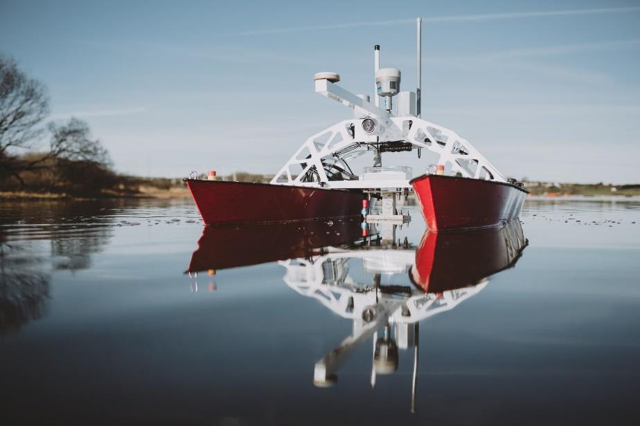
 Innovative Technologies and Methodologies to Help Solve Complex Problems in Spatial River Studies John V. Sloat Chief Technical officer WaterCube, LLC Overview Water depth, water-velocity, and water-surface
GTU. Shantilal Shah Engineering College, Bhavnagar
 GTU Shantilal Shah Engineering College, Bhavnagar 2 Around 40,000 large reservoirs worldwide used for water supply, power generation, flood control etc. About 1 % of the total storage volume is lost annually
Restoration of the Sediment Balance in the Danube River DanubeSediment. Sándor Baranya, BME
 Restoration of the Sediment Balance in the Danube River DanubeSediment Sándor Baranya, BME Sediment related problems in the Danube River Increasing discrepancy between surplus and deficit of sediment increases
Sedimentation in the Nile River
 Advanced Training Workshop on Reservoir Sedimentation Sedimentation in the Nile River Prof. Dr. Abdalla Abdelsalam Ahmed 10-16 Oct. 2007, IRTCES, Beijing, China CWR,Sudan 1 Water is essential for mankind
Limitation to qualitative stability indicators. the real world is a continuum, not a dichotomy ~ 100 % 30 % ~ 100 % ~ 40 %
 Stream Stability Assessment & BEHI Surveys Joe Rathbun MDEQ Water Resources Division rathbunj@michigan.gov 517--373 517 373--8868 Stability Stream can transport its water and sediment inputs without changing
Management Planning & Implementation of Communication Measures for Terrestrial Natura 2000 Sites in the Maltese Islands Epsilon-Adi Consortium
 Management Planning & Implementation of Communication Measures for Terrestrial Natura 2000 Sites in the Maltese Islands Epsilon-Adi Consortium Briefing Meetings, February 2013 CT3101/2011, MEPA, Malta
Sediment project proposal. EUSDR PA4 SG meeting June 9 th Dr. László KARDOSS
 Sediment project proposal EUSDR PA4 SG meeting June 9 th 2015. Dr. László KARDOSS Content Overview of the events Quick glance at the project content Steps to be made Acknowledgements Since the last PA4
Stop 1: Marmot Dam Stop 1: Marmot Dam
 Stop 1: Marmot Dam Stop 1: Marmot Dam Following the removal of Marmot Dam in 2007, the fate of the reservoir sediments has been monitored through a series of surveys and sediment transport measurements.
Shetland Islands Council
 Shetland Islands Council Response to EU Green Paper on Territorial Cohesion Shetland Islands Council is strongly in favour of a territorial dimension to cohesion policy and welcomes the Commission s consultation
Varying Bathymetric Data Collection Methods and their Impact on Impoundment Volume and Sediment Load Calculations I.A. Kiraly 1, T.
 Varying Bathymetric Data Collection Methods and their Impact on Impoundment Volume and Sediment Load Calculations I.A. Kiraly 1, T. Sullivan 2 1 Gomez and Sullivan Engineers, D.P.C., 41 Liberty Hill Road,
Reactivation of Klingnau reservoir sidearm: Numerical simulation of sediment release downstream
 River Flow 2014 Schleiss et al. (Eds) 2014 Taylor & Francis Group, London, ISBN 978-1-138-02674-2 Reactivation of Klingnau reservoir sidearm: Numerical simulation of sediment release downstream A. Amini
Submarine Debris flow Project Proposal to Force August 2018/v1.02
 Submarine Debris flow Project Proposal to Force August 2018/v1.02 Summary The main objective of the Submarine Debris Flow study is to implement the concept of debris flow in the MassFlow3DÔ code as an
Habitat Mapping in The Hauraki Gulf Marine Park. Dan Breen
 Habitat Mapping in The Hauraki Gulf Marine Park Dan Breen Outline 1. Intro Habitat mapping 2. Coastal marine habitats and marine protected areas in the New Zealand Territorial Sea: a broad scale gap analysis
Newsletter # 2. Pilot sites in Greece. December 2018
 A HarmonizEd framework to Mitigate coastal EroSion promoting ICZM protocol implementation Newsletter # 2 December 2018 View of a beach in Ammolofi ( Paggaio Municipality ) Pilot sites in Greece 1. Name
VELOCITY AND WATER DEPTH ANALYSIS ON DIFFERENT TYPES OF BLOCK RAMPS
 VELOCITY AND WATER DEPTH ANALYSIS ON DIFFERENT TYPES OF BLOCK RAMPS Markus J. Studer 1 and Anton J. Schleiss 2 1 Laboratory of Hydraulic Constructions (LCH), Ecole Polytechnique Fédérale de Lausanne (EPFL),
Diagnostic Geomorphic Methods for Understanding Future Behavior of Lake Superior Streams What Have We Learned in Two Decades?
 Diagnostic Geomorphic Methods for Understanding Future Behavior of Lake Superior Streams What Have We Learned in Two Decades? Faith Fitzpatrick USGS WI Water Science Center, Middleton, WI fafitzpa@usgs.gov
ACRONYMS AREAS COUNTRIES MARINE TERMS
 Natura 2000 ACRONYMS AREAS COUNTRIES MARINE TERMS DEFINITION A European network of protected sites under the European Habitats and Birds Directives, aiming to protect the most valuable and threatened European
SEDIMENT DATA FOR THE LOWER MEKONG
 SEDIMENT DATA FOR THE LOWER MEKONG A review of past monitoring activity and what it tells us about past and recent sediment fluxes and what lessons can be learnt for future monitoring DES WALLING DEPARTMENT
Fact sheet: Glacial rivers (all Europe)
") Fact sheet: Glacial rivers (all Europe) General description Valleyplanform Hydrology and The valley form varies from a gorge to a V-shaped valley and the single-thread channel is mainly characterized by
Fact sheet: Glacial rivers (all Europe) General description Valleyplanform Hydrology and The valley form varies from a gorge to a V-shaped valley and the single-thread channel is mainly characterized by
Tarbela Dam in Pakistan. Case study of reservoir sedimentation
 Tarbela Dam in Pakistan. HR Wallingford, Wallingford, UK Published in the proceedings of River Flow 2012, 5-7 September 2012 Abstract Reservoir sedimentation is a main concern in the Tarbela reservoir
Towards the prediction of free-forming meander formation using 3D computational fluid dynamics
 Wasserbaukolloquium 2006: Strömungssimulation im Wasserbau 31 Dresdner Wasserbauliche Mitteilungen Heft 32 Towards the prediction of free-forming meander formation using 3D computational fluid dynamics
Marine Spatial Planning: A Tool for Implementing Ecosystem-Based Management
 Marine Spatial Planning: A Tool for Implementing Ecosystem-Based Management Steven Murawski, Ph.D., Ecosystem Goal Team Lead National Oceanic and Atmospheric Administration NOAA November 16, 2009 1 To
INTEGRATED COASTAL SEDIMENT MANAGEMENT AT PHYSIOGRAPHIC UNIT SCALE, AN APPLICATION IN VERSILIA LITTORAL (TUSCANY, ITALY)
") INTEGRATED COASTAL SEDIMENT MANAGEMENT AT PHYSIOGRAPHIC UNIT SCALE, AN APPLICATION IN VERSILIA LITTORAL (TUSCANY, ITALY) Damiano Scarcella (Msc) Sergio Cappucci (PhD) Andrea Taramelli (PhD) OUTLINE Sediment
INTEGRATED COASTAL SEDIMENT MANAGEMENT AT PHYSIOGRAPHIC UNIT SCALE, AN APPLICATION IN VERSILIA LITTORAL (TUSCANY, ITALY) Damiano Scarcella (Msc) Sergio Cappucci (PhD) Andrea Taramelli (PhD) OUTLINE Sediment
EMODnet data. Flanders Marine Institute. Simon Claus. A. Giorgetti, D. Schaap, A. Novellino, A. Pititto, H.Lilis, V. Henry, T.
 EMODnet data Simon Claus A. Giorgetti, D. Schaap, A. Novellino, A. Pititto, H.Lilis, V. Henry, T. Schmitt Flanders Marine Institute EMODnet data themes Types of Data Vocabularies Data Exchange Format Metadata
Background and History
 p1 Background and History What is the Indian Ocean Climate Initiative? The Indian Ocean Climate Initiative (IOCI) is a strategic program of research and information transfer to support government decision-making.