Big Things for a Big Guy The Judaculla Rock Project. Scott Ashcraft, Pisgah N.F., NC Rock Art Project & Lorie Hansen NC Rock Art Project
|
|
|
- Jeffry Pitts
- 6 years ago
- Views:
Transcription


1 Big Things for a Big Guy The Judaculla Rock Project Scott Ashcraft, Pisgah N.F., NC Rock Art Project & Lorie Hansen NC Rock Art Project


2 Partnerships The North Carolina Rock Art Project The Parker Family


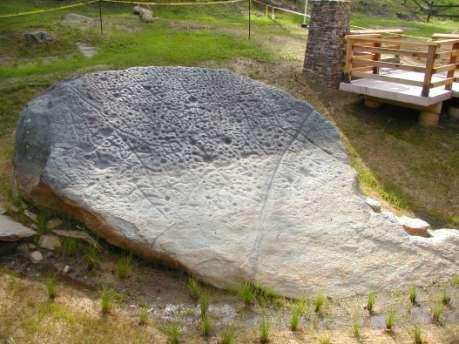
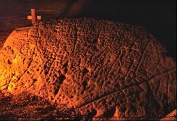
3 2008 Map of Judaculla Rock Night photo by fire light


4 Ancestral Cherokee Legacy

5 Large village site Cupule petroglyphs Petroglyph buried by mining talus Soapstone quarry Cupule petroglyphs


6 Judaculla = Tsu la kă lū means He has them slanting referring to the eyes.
7

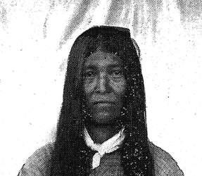
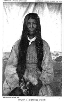
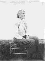
8 Cherokee Medicine Man Swimmer, 1888 Ethnologist James Mooney History, Myths, and Sacred Formulas of the Cherokees
9

10 Map- The Cherokee Country by James Mooney, 1900.

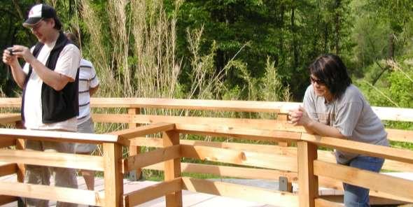
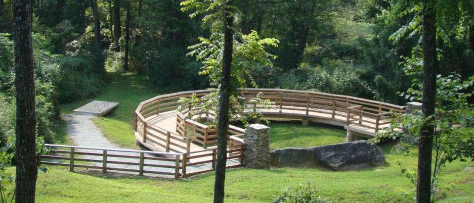
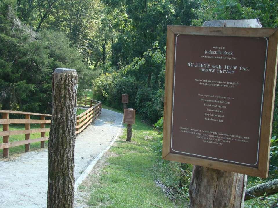
11 Judaculla Mythscape

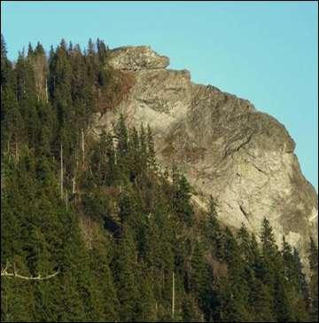
12 Judaculla Mythscape Landscape & Legend 60 Miles Kanuga Town Petroglyphs Judaculla Mountain Old Fields Bald & Judaculla Ridge Shining Rock Petroglyphs Cullowhee = Judaculla s Place Judaculla Rock Devils Courthouse Tanasee Bald Judaculla s home Pilot Mtn Looking Glass Rock


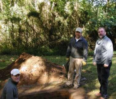
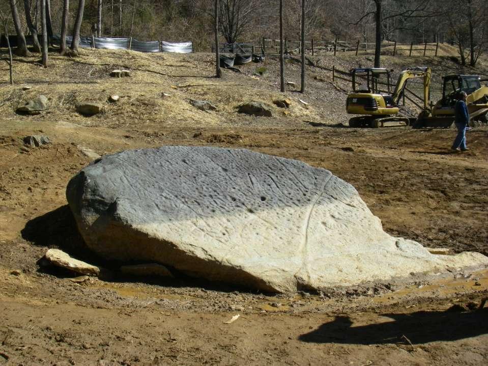
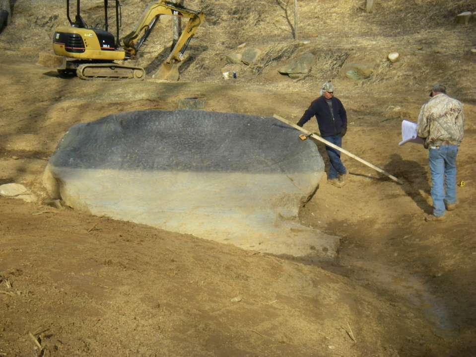
13 1920 s 1930 s 1959: Jackson County purchases 1 acre site from J.B. Parker 1960 s Roofed cinderblock building constructed


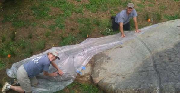
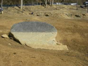
14 1980 s 2003 Judaculla Rock


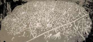
15 SOIL ENCROACHMENT ONTO JUDACULLA ROCK Year range AD AD AD years Soil encroachment annual rate cm 3.0 cm cm 1.4 cm cm 3.6 cm Total: cm average rate = 2.7 cm

16 The North Carolina Rock Art Project The North Carolina Rock Art Project Scott Ashcraft Lorie Hansen Rodney Snedeker The NC RAP has transitioned from primarily survey to facilitating protection, preservation, and interpretation of rock art sites. CURRENT PROJECTS - Ongoing survey - Paint Rock partnership with UT-Knoxville for.. - Judaculla Rock preservation & site improvements - Dupont State Park petroglyph group study - Gardner Rock preservation and archeology Website updates - Future host of the ESRARA conference
17


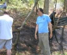
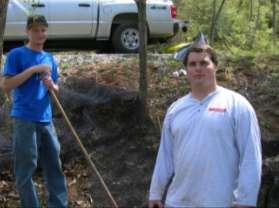

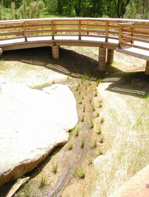
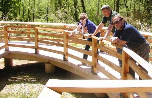
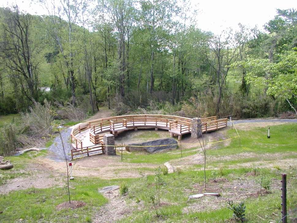
18 2007 interim work project at Judaculla Rock

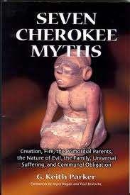
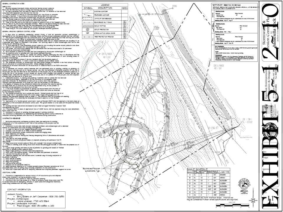
19 N.C. Rock Art Project Scott Ashcraft Rodney Snedeker Lorie Hansen Formation of the Judaculla Rock Advisory Committee Cherokee Tribal Historic Preservation Office Russell Townsend Brian Burgess Tyler Howe Jackson County Kenneth Westmoreland Emily Elders Jeff Carpenter Western NC Archaeologist - OSA Linda Hall linda.hall@ncmail.net Family Donated Judaculla Site to the County Jerry Parker judacula@verizon.net Keith Parker gkparker@infoave.net (Seven Myths of the Cherokee) Professors at WCU in Anthropology and Cherokee Studies Tom Belt tbelt@ .wcu.edu (828) Freeman Owl fowle@ .edu (Eastern Band Cherokee and teaches at WCU) Tom Hatley hatley@ .wcu.edu (Cherokee studies) Jane Brown jbrown@ .wcu.edu (Of Western Carolina University) Jane Eastman jeastman@ .wcu.edu Anne Rogers arogers@ .wcu.edu Caney Fork Community Members Curt Whitney curt_whitney@msn.com (President) Jane H Brown jbrown1861@hughes.net Tom Rodgers trodgers44@verizon.net Amy Ammons Garza v.ammons@mchsi.com Etheree Chancellor ebcmimi@hotmail.com Don Selzer dmselzer@aol.com


20 2007- Jackson County contracts with Stratum Unlimited for the development of a comprehensive Conservation Plan Jannie Loubser, Douglas Frink and Lorie Hansen remove sediment from the face of Judaculla Rock, 2007.

21 Mapping the rock

22 Stitching Together the Tracings

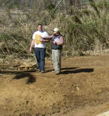
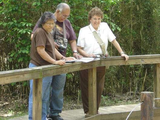
23 REDUCED RE-DRAWING OF THE JUDACULLA ROCK TRACING.
24 Map of major glyphs scaled to rock including soapstone quarry scars Quarry scars


25 JUDACULLA ROCK- COMPOSITE NIGHT-TIME PHOTOGRAPH Loubser, 2008
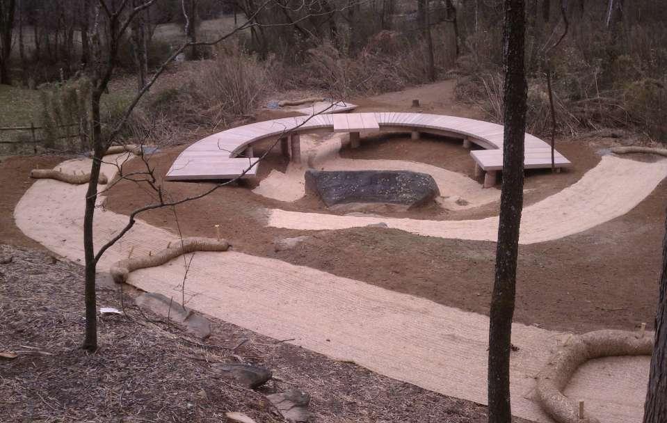
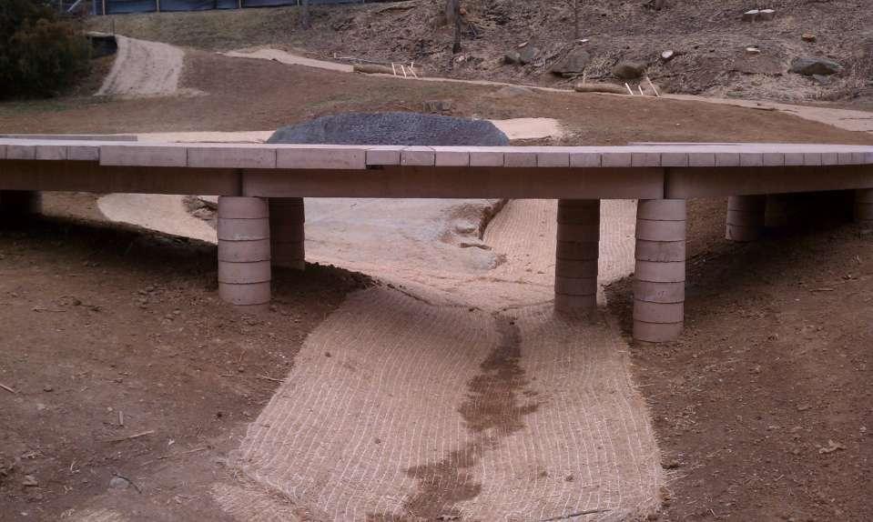
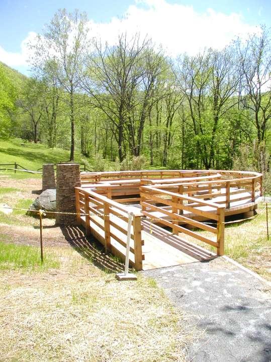
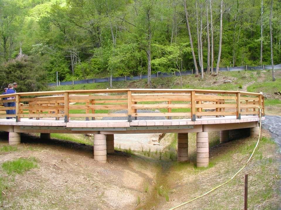
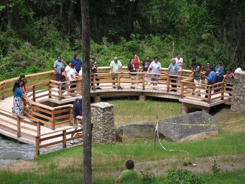
26 Dr. Loubser s recommendations for Judaculla Rock -- re-direct surface water from asphalt road to the eastern side of the asphalt road; -- install a sediment diversionary and structure to route water and soil flows away from the rock -- carefully excavate soil deposits around the rock down to the level that is apparent on the 1920s photograph (soil that covered the petroglyphs appear to have accelerated the rate of petroglyph weathering); -- construct a 70-centimeter high retaining wall along the edge of the excavated area that surrounds the rock; -- construct a curtain-drain ditch to the west, between the rock and the seep farther down slope; -- remove Black Walnut tree south of the rock and trim branches of other trees to allow direct sunlight to eliminate encroaching lichen; -- install a paved wheel-chair accessible trail on an even gradient from the road down to the wooden boardwalk; create an exit ramp for the wooden boardwalk and remove the one interpretive panel; wrap the trail around the eastern side of the boulder so that petroglyphs on this side can also be viewed and so that visitors can return to their vehicles; -- install slanting interpretive panels (line drawings) on the hand rail of the boardwalk to help visitors recognize the petroglyphs, including the Cherokee world-view of Judaculla Rock and the wider landscape;
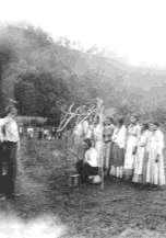
27 Eastern Band Cherokee Elders Visit Tsul' Kalu'
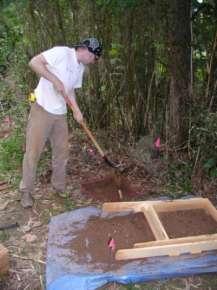
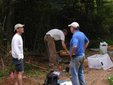
28
29

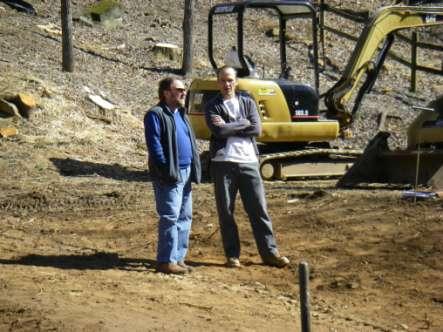
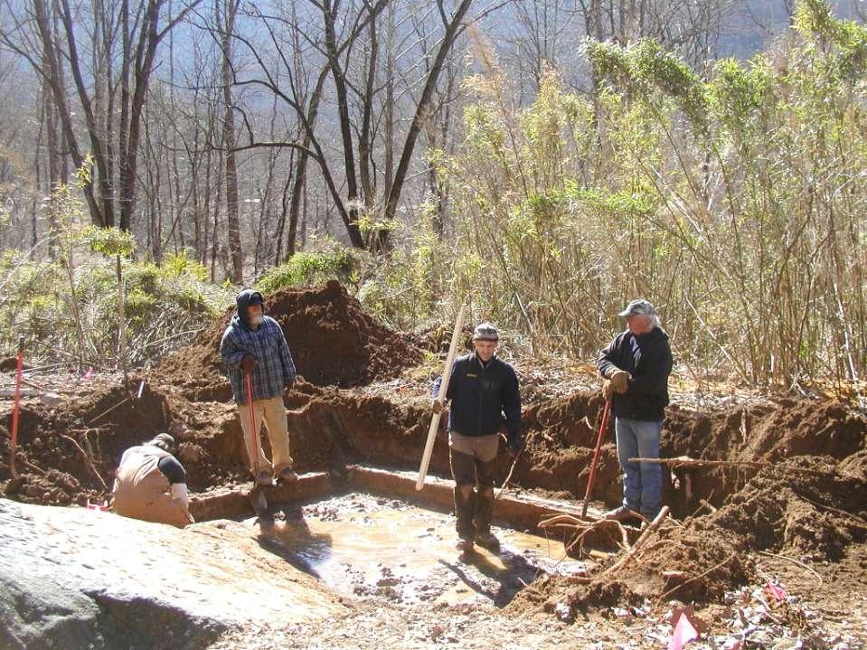
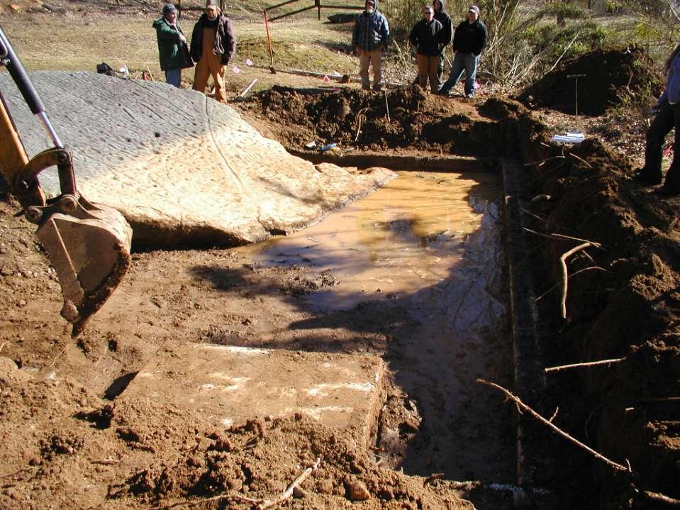
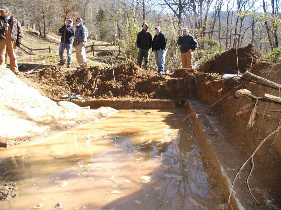
30 Advisory committee work shops

31 Protecting Respecting Celebrating


32 Shannon Swimmer Cherokee Preservation Foundation Cherokee Medicine Man Swimmer- 1888
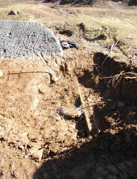
33
34

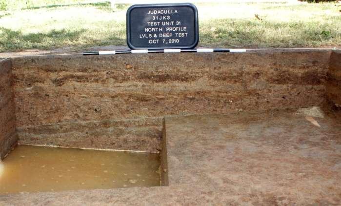
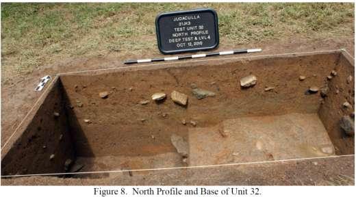
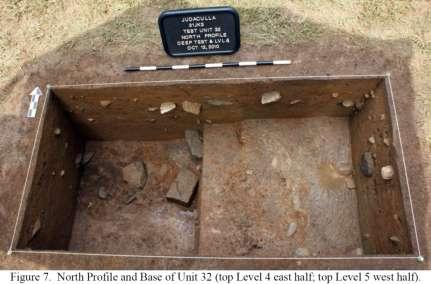
35 Phase I - Archaeology
36

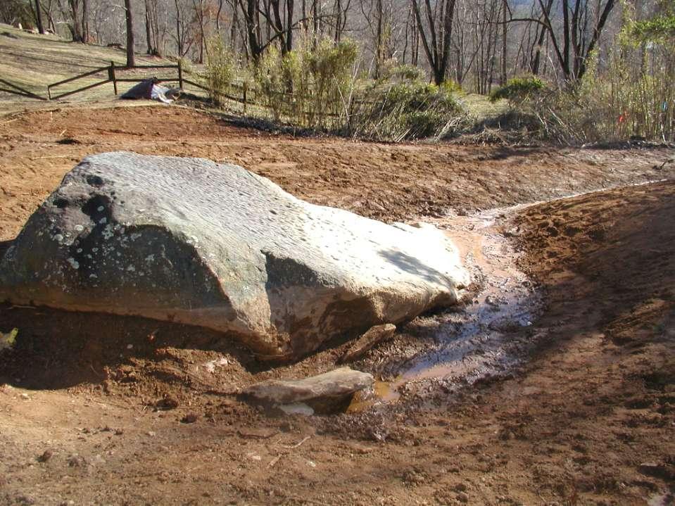
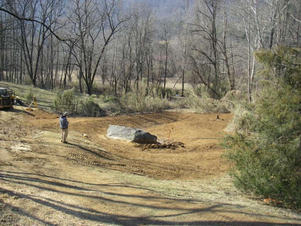
37 Unprecedented Archaeology- Thoughtful approach to ground disturbance at this unique site.


38 Estimate visitors to Judaculla Rock total over 11,000 per year
39 Partnerships The North Carolina Rock Art Project The Parker Family

40 Judaculla Rock Archaeology
41 Excavations show most of the site is long ago obliterated

42 Judaculla Rock Archaeology
43
44 Recontouring the site
45
46
47
48
49
50
51
52
53
54
55
56
57
58
59
60
61
62
63

64 Native American Boarding Schools to forcibly acculturate Indians into mainstream white society. a break with many traditions, including the Judaculla rituals


65 Eastern Band Cherokee Elders Visit Tsu la Ka lu

66 The End Thanks!

67
DRAFT
 A84536-22, A81184-3 Discovery of Human Remains On Site Lead Licensing and Environmental Assessment Archaeologist Manitoba Historic Resources Branch (HRB) RCMP STOP activities at location Step 6
Petroglyph Investigations at the Pilot Rock Site (13CK101), Cherokee County, Iowa.
, Cherokee County, Iowa.") Petroglyph Investigations at the Pilot Rock Site (13CK101), Cherokee County, Iowa. David Moyer Office of the State Archaeologist The University of Iowa Iowa City, IA 52242 david-moyer@uiowa.edu (319) 335-5702
Petroglyph Investigations at the Pilot Rock Site (13CK101), Cherokee County, Iowa. David Moyer Office of the State Archaeologist The University of Iowa Iowa City, IA 52242 david-moyer@uiowa.edu (319) 335-5702
A GEOLOGIC TRIP to the SAN ANDREAS FAULT
 A GEOLOGIC TRIP to the SAN ANDREAS FAULT San Andreas Hot Spot Loop Road Hot Spot P Parking San Andreas Fault Interpretive Trail Fault Zone Map: San Andreas Fault Zone During the 25 million years that the
Parowan Gap Nature s Perfect Observatory by V.Garth Norman
 Parowan Gap Nature s Perfect Observatory by V.Garth Norman CFI, Inc. Publication Available @ www.amazon.com Archaeological Research Consultants ARCON Inc. 2006 No part of this presentation may be reproduced
Erosion Information Paper Eagle City and Eagle Village, Alaska Current as of January 21, 2008
 U.S. Army Corps of Engineers ALASKA BASELINE EROSION ASSESSMENT Erosion Information Paper Eagle City and Eagle Village, Alaska Current as of January 21, 2008 Community Information The City of Eagle, population
,,. Mendota Mdewakanton Dakota Commun~
 ,,. Mendota Mdewakanton Dakota Commun~ 340 River Rd Phone: 651-452-4141 f\'\1p~ " email: mmdc01@comcasl.net IV ~ May 21, 2012 Robert Finley Southeast Regional Manager Minnesota Pollution Control Agency
name and locate the world s seven continents and five oceans
 Subject: Geography Activities National Curriculum Objectives One Progression of Skills Name the 7 continents and 5 oceans 3D Jigsaw task to locate continents and seas name and locate the world s seven
GM POWERTRAIN BEDFORD FACILITY BEDFORD, INDIANA
 GM POWERTRAIN BEDFORD FACILITY BEDFORD, INDIANA Welcome to the October 2007 Public Information Session October 11, 2007 Facility located on 152.5 acres and is approximately 1,000,000 square feet Approximately
AN ARCHAEOLOGICAL SURVEY FOR THE DCP MIDSTREAM THREE RIVERS PLANT TO CGP 51 PROJECT IN LIVE OAK COUNTY, TEXAS
 AN ARCHAEOLOGICAL SURVEY FOR THE DCP MIDSTREAM THREE RIVERS PLANT TO CGP 51 PROJECT IN LIVE OAK COUNTY, TEXAS By William E. Moore Brazos Valley Research Associates Contract Report Number 251 2011 AN ARCHAEOLOGICAL
Appendix I-1: Archaeological Records Search
 Appendix I-1: Archaeological Records Search South Central Coastal Information Center California State University, Fullerton Department of Anthropology MH-426 800 North State College Boulevard Fullerton,
4.11 CULTURAL RESOURCES
 4.11 CULTURAL RESOURCES 4.11 CULTURAL RESOURCES This section summarizes the cultural resources of. Information reviewed for the summary includes the General Plan, published reports on archaeological research
February 18, 2003 File: NORTH CENTRAL REGION LANDSLIDE ASSESSMENT HWY 43:16 WHITECOURT EAST HILL (NC1) 2002 ANNUAL INSPECTION REPORT
 2002 ANNUAL INSPECTION REPORT") February 18, 2003 File: 15-76-11 Alberta Transportation Room 223, Provincial Building 4709 44 Avenue Stony Plain, Alberta T7Z 1N4 Attention: Mr. Rob Lonson, P.Eng. NORTH CENTRAL REGION LANDSLIDE ASSESSMENT
February 18, 2003 File: 15-76-11 Alberta Transportation Room 223, Provincial Building 4709 44 Avenue Stony Plain, Alberta T7Z 1N4 Attention: Mr. Rob Lonson, P.Eng. NORTH CENTRAL REGION LANDSLIDE ASSESSMENT
David Gold Hiking Tours
 David Gold Hiking Tours Join us for a West Texas Active Adventure Tour February 14 21, 2017 Led by David Gold and Ulrike Porat The Big Bend area of West Texas is one of the most remote, and least visited
ACTON COMMUNITY WIDE ARCHAEOLOGICAL RECONNAISSANCE SURVEY. Town of Acton and PAL, Inc.
 ACTON COMMUNITY WIDE ARCHAEOLOGICAL RECONNAISSANCE SURVEY Town of Acton and PAL, Inc. Objectives and Scope of Work Four phase study; (1. research, 2. draft report outline, resource protection bylaw, 3.
Technical Memorandum #2 Future Conditions
 Technical Memorandum #2 Future Conditions To: Dan Farnsworth Transportation Planner Fargo-Moorhead Metro Council of Governments From: Rick Gunderson, PE Josh Hinds PE, PTOE Houston Engineering, Inc. Subject:
EROSIONAL FEATURES. reflect
 reflect Have you ever looked at the land around you and wondered what processes shaped what you see? Perhaps you see mountains, valleys, rivers, or canyons. Do you know how long these geologic features
A regular meeting of the Village of Victor Planning Board was held on Wednesday, July 26, 2017, at the Village Hall, 60 East Main Street.
 A regular meeting of the Village of Victor Planning Board was held on Wednesday, July 26, 2017, at the Village Hall, 60 East Main Street. MEMBERS PRESENT: Chairperson Meg CHaides Vice Chairperson Peter
Archaeological Survey and Evaluation at 8954 El Dorado Parkway, El Cajon, San Diego County, California
 April 16, 2013 Ms. Andrea Bitterling Helix Environmental Planning, Inc. 7578 El Cajon Blvd., Suite 200 El Cajon, California 91942 Re: Archaeological Survey and Evaluation at 8954 El Dorado Parkway, El
Status Report on Polychlorinated Biphenyls in the Western Storm Drain University of California, Richmond Field Station Richmond, California
 Status Report on Polychlorinated Biphenyls in the Western Storm Drain University of California, Richmond Field Station Richmond, California Introduction Beginning in 1999, the University of California,
Agate Fossil Beds National Monument
 University of Nebraska - Lincoln DigitalCommons@University of Nebraska - Lincoln U.S. National Park Service Publications and Papers National Park Service 2014 Follow this and additional works at: http://digitalcommons.unl.edu/natlpark
1.0 INSPECTION ANNUAL INSPECTION, JUNE 29, 2011 CARMACKS COPPER PROJECT, CARMACKS, YUKON. Dear Mr. West-Sells,
 Doc. No. 162 Rev. 0 Mr. Paul West-Sells President & Chief Operating Officer Western Copper Corporation 2060-1111 West Georgia Street Vancouver, BC V6E 4M3 ANNUAL INSPECTION, JUNE 29, 2011 CARMACKS COPPER
CHAPTER FIVE: THE LOWER MISSISSIPPI REGION AND PLAQUEMINES PARISH
 CHAPTER FIVE: THE LOWER MISSISSIPPI REGION AND PLAQUEMINES PARISH 5.1 Overview Plaquemines Parish is the area where the last portion of the Mississippi River flows out into the Gulf of Mexico (see Figures
High Impact Forces of Nature Hazards in and Around Rocky Mountain National Park
 Stop 1 High Impact Forces of Nature Hazards in and Around Rocky Mountain National Park Trip Leader Vince Matthews, Colorado Geological Survey RMAG on the Rocks July 28, 2007 Welcome to the July RMAG on
Field Trip Workbook G200 Field Studies Sec 001 (Mt St. Helens north) Fall, 2018 Professor in charge: Alex Ruzicka TA : Secana Goudy
 Fall, 2018 Professor in charge: Alex Ruzicka TA : Secana Goudy") Field Trip Workbook NAME: G200 Field Studies Sec 001 (Mt St. Helens north) Fall, 2018 Professor in charge: Alex Ruzicka TA : Secana Goudy Use this workbook to answer the following questions about the geology
Field Trip Workbook NAME: G200 Field Studies Sec 001 (Mt St. Helens north) Fall, 2018 Professor in charge: Alex Ruzicka TA : Secana Goudy Use this workbook to answer the following questions about the geology
Huron Creek Watershed 2005 Land Use Map
 Huron Creek Watershed 2005 Land Use Map Created By: Linda Kersten, 12/20/06 Created For: MTU Introduction to GIS Class (FW 5550) The Huron Creek Watershed Advisory Committee Michigan Technological University,
Follow the instructions to determine if your sample is metamorphic, sedimentary or igneous rock.
 To gather some appreciation of our world, especially our rock world, we are going to gather an assortment of rocks from our campus. You will use a rock key to classify some of the samples we collect. Procedures:
2016 SPRING MEETING April 23, 2016 Cherokee Area Bus Tour Guided by Dr. Jane Eastman, Dr. Brett Riggs, and Dr. Ben Steere
 WINTER 2016, Volume 26, Number 1 Research Laboratories of Archaeology, Campus Box 3120, University of North Carolina, Chapel Hill NC 2759-3120 http://www.rla.unc.edu/ncas 2016 SPRING MEETING April 23,
BRUNSWICK COUNTY. North Carolina State Highway Patrol Coastal Evacuation Plan 1
 North Carolina State Highway Patrol Coastal Evacuation Plan 1 Contact Information for Emergency Management Director and EOC Contact Address Telephone Number Brian Watts Building C 3325 Old Ocean Hwy. Bolivia,
Kansas Archaeology Month
 Activities for Discovering Prehistoric Trails TIME: 45 min. Kansas Archaeology Month Discovering Prehistoric Trails This lesson is divided into four sections: instructional goals, advanced preparation,
MEADOWS PRIMARY SCHOOL and NURSERY GEOGRAPHY POLICY
 MEADOWS PRIMARY SCHOOL and NURSERY GEOGRAPHY POLICY Purpose of study The teaching of Geography at Meadows is done by following the 2014 National Curriculum. The planning and teaching of the subject aims
Cranford Park CE Primary School. Subject Overview for Geography. Autumn 1 Autumn 2 Spring 1 Spring 2 Summer 1 Summer 2 Title of unit.
 Autumn 1 Autumn 2 Spring 1 Spring 2 Summer 1 Summer 2 Main Objectives /Skills Main Objectives /Skills Main Objectives /Skills Main Objectives /Skills Main Objectives /Skills Main Objectives /Skills Foundation
GIS and Predictive Modeling: Identifying North Carolina s Historic Archaeological Resources
 Environmental Services, Inc. GAI Consultants, Inc. GIS and Predictive Modeling: Identifying North Carolina s Historic Archaeological Resources Ben Resnick (GAI) and Scott Seibel (ESI) Historic Archaeological
The subject paper is being submitted for approval for publication in the annual volume entitled Geological Survey Research.
 Water Resources Division 345 Middlefield Road Menlo Park, California January 12, 1965 Memorandum To: Mr. Frank E. Clark, Chief, General Hydrology Branch Thru: Area Hydrologist PCA From: Valmore C. LaMarche
Archaeology and Geophysics at the Chillicothe Site, Ohio, USA
 info@gemsys.on.ca Archaeology and Geophysics at the Chillicothe Site, Ohio, USA In this short paper, we summarize the recent procedings of the National Parks Service Archaeology Workshop in Chillicothe,
An Introduction to Field Explorations for Foundations
 An Introduction to Field Explorations for Foundations J. Paul Guyer, P.E., R.A. Paul Guyer is a registered mechanical engineer, civil engineer, fire protection engineer and architect with over 35 years
How did North Carolina get its shape?
 How did North Carolina get its shape? How did North Carolina get its shape? The line shall: 1. Begin at the sea, 30 miles from the west side of the mouth of the Cape Fear River 2. From thence, it shall
Changes to Land 5.7B. landforms: features on the surface of Earth such as mountains, hills, dunes, oceans and rivers
 All the landforms on Earth have changed over time and continue to change. Many of the changes were caused by wind, moving water, and moving ice. Mountains have grown and shrunk. Rivers have cut away land
Pine Hill Serpentinized Peridotite,
 Maine Geologic Facts and Localities November, 2016 Pine Hill Serpentinized Peridotite, Little Deer Isle, Maine 44 o 17 6.0 N, 68 o 42 7.2 W Text and photos by Robert G. Marvinney, Department of Agriculture,
GIS and GPS Utilization in Archaeological Survey at MCB Quantico
 GIS and GPS Utilization in Archaeological Survey at MCB Quantico John H. Haynes, M.A., R.P.A. Archaeologist MCB, Quantico, NREA, NEPA Coordination Section GIS and Background Study: Setting the Context
Think about the landforms where you live. How do you think they have changed over time? How do you think they will change in the future?
 reflect All the landforms on Earth have changed over time and continue to change. Many of the changes were caused by wind, moving water, and moving ice. Mountains have grown and shrunk. Rivers have cut
Inferring Geological Environments from Cultural Artifacts Part 1: Cultural Halls at the American Museum of Natural History
 GEOL 640: Geology through Global Arts and Artifacts Inferring Geological Environments from Cultural Artifacts Part 1: Cultural Halls at the American Museum of Natural History People are reliant on their
For Sale - 56 Acre Sandstone Quarry State Route 511, Oberlin/Kipton, OH 44075
 14647 State Route 511, Oberlin/Kipton, OH 44075 56 ACRES Vermilion Rd Gifford Rd Haigh Rd 44 Summary The Kipton sandstone quarry is included in 56 acre tract owned by Terry A. Johnson, of Huron, Ohio.
Looking at Communities: Comparing Urban and Rural Neighborhoods
 Looking at Communities: Comparing Urban and Rural Neighborhoods OVERVIEW & OBJECTIVES Our urban areas have become so dominant that frequently the children we teach have no connection with and very few
Geography. Programmes of study for Key Stages 1-3
 Geography Programmes of study for Key Stages 1-3 February 2013 Contents Purpose of study 3 Aims 3 Attainment targets 3 Subject content 4 Key Stage 1 4 Key Stage 2 5 Key Stage 3 6 2 Purpose of study A high-quality
A p p l i c a t i o n D r a w i n g s : R e v i s i o n B Updated in response to submissions
 : R e v i s i o n Updated in response to submissions C o n t e n t s 1. Existing Site Plan 2. Proposed Site Plan 3. Proposed Circulation Plan 4. Proposed uildings and Driveways 5. Proposed Vegetation Strategy
Year 1 name and locate the four countries and capital cities of the United Kingdom and its surrounding seas
 Long Term Objective Organisation for Geography Please note that only statutory requirements should be included in this document; any supplementary guidance and information should be retained by Subject
COASTAL DYNAMICS VIRTUAL FIELD TRIP, NORTHEAST FLORIDA. Joann Mossa Department of Geography University of Florida
 COASTAL DYNAMICS VIRTUAL FIELD TRIP, NORTHEAST FLORIDA Joann Mossa Department of Geography University of Florida WHERE ARE WE GOING? In NE Florida (Flagler and St. Johns County, south of St. Augustine),
Vantage/Columbia Basin Field Trip
 Geology 152 Name Vantage/Columbia Basin Field Trip The primary goal of this course is to help you see the Earth from a different perspective a geological one. To accomplish this goal you will be expected
PW Parkway ES Prince William County, Virginia WSSI #
 PW Parkway ES Prince William County, Virginia WSSI #15.3 Cultural Resources Site Assessment November 15 Prepared for: Prince William County Public Schools P.O. Box 39 Manassas, Virginia 1 Prepared by:
Project (Project No. US-CA-62-2) Maintenance Inspection and Reports (Subtask 14.1) Inspection Report No.2
 Maintenance Inspection and Reports (Subtask 14.1) Inspection Report No.2") MEMORANDUM TO: FROM: Jim Well, Ducks Unlimited Mike Harvey, PhD, PG SUBJECT: M&T/ Llano Seco Fish Screen Project (Project No. US-CA-62-2) Maintenance Inspection and Reports (Subtask 14.1) Inspection Report
MEMORANDUM TO: FROM: Jim Well, Ducks Unlimited Mike Harvey, PhD, PG SUBJECT: M&T/ Llano Seco Fish Screen Project (Project No. US-CA-62-2) Maintenance Inspection and Reports (Subtask 14.1) Inspection Report
MAPS AND THEIR CLASSIFICATION
 MAPPING MAPS AND THEIR CLASSIFICATION WHAT IS A MAP? A map is representation of the Earth's surface, showing how things are related to each other by distance, direction, and size. Maps are a way of showing
Closure of Remote Historic Underground Mines in Desert Environments
 Closure of Remote Historic Underground Mines in Desert Environments James A. Cremeens Agapito Associates, Inc. Michael H. Rauschkolb U.S. Borax, Inc. 2002 SME Annual Meeting and Exhibit Geotechnical solutions
Indian Rock Art Of The Southwest (School Of American Research Southwest Indian Arts Series) By Polly Schaafsma
 By Polly Schaafsma") Indian Rock Art Of The Southwest (School Of American Research Southwest Indian Arts Series) By Polly Schaafsma INDIAN ROCK ART The Handbook of Texas Online - INDIAN ROCK ART. Indian rock art, consisting
Indian Rock Art Of The Southwest (School Of American Research Southwest Indian Arts Series) By Polly Schaafsma INDIAN ROCK ART The Handbook of Texas Online - INDIAN ROCK ART. Indian rock art, consisting
Geography Long Term Plan
 Geography Long Term Plan Year Group Children should be taught about: The topic this will be based on: Essential Learning Objectives: (Taken from Chris Quigley) Year 1 Name and locate the world s seven
!! The Rio Grande River starts at the Rocky Mountains in Colorado. This River is 1,885 miles long!
 The Southwest Region By Taylor Noble and Kaiya Leismer Land and water The southwest region covers a lot of land but the Southwest region has lowest amount of states in any other region. In the Southwest
Friends of Petrified Forest National Park
 I S S U E 2, N O V E M B E R 2 0 1 2 Friends of Petrified Forest National Park Working together we can make a difference! Revueltosaurus Quarry, June 2012. Exceptional Findings at Petrified Forest National
BISTI / DE-NA-ZIN WILDERNESS
 BISTI / DE-NA-ZIN WILDERNESS Activities: Facilities: Season / Hours: Description: Hiking and photography. No electrical hookups, water, or restrooms are available. Open year-round. The Bisti/De-Na-Zin
Gateway Trail Project
 Gateway Trail Project Debris Flow Hazard Assessment By: Juan de la Fuente April 30, 2010 Background- On April 22, 2010, the Shasta-Trinity National Forest (Mt. Shasta-McCloud Unit) requested a geologic
NOA ASSESSMENT HARRIS QUARRY MENDOCINO COUNTY, CALIFORNIA TABLE OF CONTENTS
 NOA ASSESSMENT HARRIS QUARRY MENDOCINO COUNTY, CALIFORNIA TABLE OF CONTENTS Introduction... 1 Scope of Services... 1 Project Location and Description... 1 Geologic Setting... 1 Regional Geology... 1 Site
Blue Ridge Relay Course Outline. leg distance
 Blue Ridge Relay Course Outline leg leg distance segment distance direction road markers 1 Grayson Highlands State Park Visitors Center 3.90 3.90 S Grayson Highlands State Park Office and Gate 2 S Grayson
A Geological Tour of Tumbledown Mountain, Maine
 Maine Geologic Facts and Localities April, 1998 A Geological Tour of Tumbledown Mountain, Maine 44 45 3.21 N, 70 32 50.24 W Text by Robert G. Marvinney, Department of Agriculture, Conservation & Forestry
Wonder as you Wander up the Carding Mill Valley
 Wonder as you Wander up the Carding Mill Valley Spot clues to the 600 million year old history of the Long Mynd. Consider how the Earth has evolved since the rock you are walking over first formed. Welcome
CASE STUDIES. Introduction
 Introduction The City of Winston-Salem faces the challenge of maintaining public infrastructure (e.g., water and sewer lines, storm drains, roads, culverts and bridges) while minimizing the potential impacts
cooperating sites as the three initial units of a new Southern Appalachian Biosphere Reserve, approved by UNESCO in 1988.
 -» TOWARD A U.S. MODALITY OF BIOSPHERE RESERVES: THE SOUTHERN APPALACHIAN BIOSPHERE RESERVE William s_ P. Gregg, Chief, International Affairs Office, National Biological Service, Washington, D.C. Hubert
Cripps Ranch 76+/- Acres Orchard Development Opportunity Dixon, CA. Presented By:
 Cripps Ranch 76+/- Acres Orchard Development Opportunity Dixon, CA Presented By: Cripps Ranch 76+/- Acres Orchard Development Opportunity Dixon, CA Location: This property is located at 5663 Dally Road
Geography Mile Post 1
 Mile Post 1 Use world maps, atlases and globes to identify the UK and its countries, as well as the countries, continents and oceans studied at this key stage Key Skills IPC learning Goals 1.11 Be able
Coconino County Common Snow Plow Questions/Concerns
 Coconino County Common Snow Plow Questions/Concerns I didn t know it snows so much in northern Arizona. Is this normal? According to the National Climatic Data Center, Flagstaff is the eighth snowiest
STUDENT NAME DATE ID GRADE 5 SCIENCE
 STUDENT NAME DATE ID GRADE 5 SCIENCE Administered October 2007 DIRECTIONS Read each question and choose the best answer. Be sure to mark your answers. SAMPLE A Objects That Conduct Heat Silver spoon Copper
A Phase I Archaeological Survey of Muir Knoll, University of Wisconsin-Madison, Dane County, Wisconsin
 A Phase I Archaeological Survey of Muir Knoll, University of Wisconsin-Madison, Dane County, Wisconsin Prepared For: The University of Wisconsin-Madison Prepared By: Amy L. Rosebrough Office of the State
Land and Water Summative Assessment. Name Date
 Land and Water Summative Assessment Name Date Read each question carefully and select the best answer. 1. Abby built a model to study how rain changes the land. She shaped the land into single, smooth
Erosional Features. What processes shaped this landscape?
 Have you ever looked at the land around you and wondered what processes shaped what you see? Perhaps you see mountains, valleys, rivers, or canyons. Do you know how long these geologic features have been
GET TO KNO W A NATIO NAL
 Your web browser (Safari 7) is out of date. For more security, comfort and the best experience on this site: Update your browser Ignore GET TO KNO W A NATIO NAL PARK W ITH FIEL DSCO PE Explore one of the
SITE SUMMARY REPORT Candor Dump NONCD Montgomery County
 SITE SUMMARY REPORT Candor Dump NONCD 0000433 Montgomery County Senate Bill 1492 State of North Carolina State Contract N06009S Schnabel Project No. 06210002.23 February 23, 2010 Prepared for: North Carolina
Where, on Earth, are you?
 Where, on Earth, are you? We all live on a big planet called Earth, of course. But where on Earth? And if you want to go to a different spot on Earth other than the spot you are in, how do you know which
3.11 Floodplains Existing Conditions
 Other stormwater control practices may be needed to mitigate water quality impacts. In addition to detention facilities, other practices such as vegetated basins/buffers, infiltration basins, and bioswales
CASE STUDY #9 - Brushy Fork Dam, Sugar Grove, West Virginia
 CASE STUDY #9 - Brushy Fork Dam, Sugar Grove, West Virginia Brushy Fork Dam is a flood control structure built by the Soil Conservation Service southeast of the city of Franklin in Pendleton County, West
W riters always like to ask,
 Moving to Galaxy Country article and photos by Tom Clark W riters always like to ask, "So, what would you change if you had to do it all over again?" whenever we have the chance to visit someone's homemade
CANYON THE. The Grand Canyon A Reading A Z Level K Leveled Book Word Count: 394 H K N. LEVELED BOOK K Grand
 The Grand Canyon A Reading A Z Level K Leveled Book Word Count: 394 Connections Writing and Art What would you like to do at the Grand Canyon? Why? Draw a picture and write five or more sentences about
PHOTO ESSAY: Geologic Journeys
 PHOTO ESSAY: Geologic Journeys Turnagain Arm Tidal Bore Earthcache 1 KAME & KETTLE EARTHCACHE Located at Little Campbell Lake on Kincaid Park s NE corner, the EarthCache requires a journey around the lake
MAPPING BEDROCK: Verifying Depth to Bedrock in Calumet County using Seismic Refraction
 MAPPING BEDROCK: Verifying Depth to Bedrock in Calumet County using Seismic Refraction Revised December 13, 2011 Dave Hart Wisconsin Geological and Natural History Survey INTRODUCTION Seismic refraction
Lesson 3: Maps of Space & Time
 Lesson 3: Maps of Space & Time In this exercise, you will be asked to describe a subject from three different perspectives. Answer the questions below based on what you see. Section One: Long Distance
Team Name. Name(s) SSSS Unome Geologic Mapping Test Packet p1
 SSSS Unome Geologic Mapping Test Packet p1") Scioly Summer Study Session 2018-2019 Geologic Mapping Test Packet Written by Unome Instructions 1) This test is based on the 2016 rules for Geologic Mapping. 2) This test is out of 115 points. Questions
Scioly Summer Study Session 2018-2019 Geologic Mapping Test Packet Written by Unome Instructions 1) This test is based on the 2016 rules for Geologic Mapping. 2) This test is out of 115 points. Questions
Chapter 2 - Little Tennessee River Subbasin Includes Fontana Lake and the Tuckasegee River Watershed
 Chapter 2 - Little Tennessee River Subbasin 04-04-02 Includes Fontana Lake and the Tuckasegee River Watershed 2.1 Water Quality Overview Subbasin 04-04-02 at a Glance Land and Water Land area: 1,021 mi
±2.14 AC Broad River Road Irmo, South Carolina. Site. Property Features. Lee Bussell, Jr
 Ballentine Family YMCA Pizza Hut For Sale ±2.14 AC School District 5 Office Brakes-4-Less 10737 Broad River Road Irmo, South Carolina Lee Bussell, Jr. +1 803 744 9865 lbussell@naiavant.com Property Features
3/22/2014. Earth s subsystems or cycles. Outline for next couple weeks. Weathering (breakdown of rock) Erosion
 Erosion") and Erosion Earth s subsystems or cycles Outline for next couple weeks 1. and Erosion 2. Surface water systems (rivers) 3. Groundwater systems 4. Groundwater in-class activity (grade) (breakdown of rock)
and Erosion Earth s subsystems or cycles Outline for next couple weeks 1. and Erosion 2. Surface water systems (rivers) 3. Groundwater systems 4. Groundwater in-class activity (grade) (breakdown of rock)
Quarry Database. Appendix B. Christopher R. Moore
 Appendix B Quarry Database Christopher R. Moore Two sources of information were used in compiling this database of quarry sites in the North Carolina Piedmont. First, the site files at the North Carolina
Additional Testing for Padre Dam Eastern Service Area Secondary Connection- Alternative Site Location, San Diego County, California
 Mark Niemiec Padre Dam Municipal Water District P.O. Box 719003 9300 Fanita Parkway Santee, California 92072 Re: Additional Testing for Padre Dam Eastern Service Area Secondary Connection- Alternative
CREATING A REPORT ON FIRE (April 2011)
") CREATING A REPORT ON FIRE (April 2011) The Fire Report feature on the NAFI website lets you create simple summaries of fire activity for areas of land in far northern Australia (north of 20 degrees where
CREATING A REPORT ON FIRE (April 2011) The Fire Report feature on the NAFI website lets you create simple summaries of fire activity for areas of land in far northern Australia (north of 20 degrees where
THE NEED FOR AN ADDITIONAL SPILLWAY AT THE SANFORD DAM BOILING SPRING LAKES, NC. Presentation for The Brunswick County Commissioners April 20, 2015
 THE NEED FOR AN ADDITIONAL SPILLWAY AT THE SANFORD DAM BOILING SPRING LAKES, NC Presentation for The Brunswick County Commissioners April 20, 2015 The Sanford Dam Earth Dam constructed in 1961 Drainage
Selected Archeological Terms
 Page 1 of 6 Selected Archeological Terms Links General Reference Bibliographies Glossaries Terms A b C D E F G H i j k l M N O P q R S T U V w x y z ADAPTATION: The process of change to better conform
Lesson Title: Then and Now: How Society Alters Topography and Vegetation
 Lesson Title: Then and Now: How Society Alters Topography and Vegetation Lesson Author: Rodney Collins (rwcollins@lf.k12.de.us) Lesson Description: This lesson is a comparative study in which students
Technical Report. On the. Owl Claim(s) Date: Jan. 17, Claim # Written By Lucas Handley. Claim Owner
 Date: Jan. 17, Claim # Written By Lucas Handley. Claim Owner") Technical Report On the Owl Claim(s) Date: Jan. 17, 2011 Claim # 837846 838049 838242 859407 Written By Lucas Handley Claim Owner Intro The 4 claims covered in this report cover what was mostly historically
Technical Report On the Owl Claim(s) Date: Jan. 17, 2011 Claim # 837846 838049 838242 859407 Written By Lucas Handley Claim Owner Intro The 4 claims covered in this report cover what was mostly historically
Geomorphology and Archaeology: Case Studies from Western New York
 Geomorphology and Archaeology: Case Studies from Western New York New York Archaeological Council Fall Meeting Saturday October 1, 2011 Douglas J. Perrelli Geomorphology and Archaeology: Case Studies from
AN ARCHAEOLOGICAL SURVEY FOR THE EASTHAM STATE PRISON FARM UNIT PROJECT IN HOUSTON COUNTY TEXAS
 AN ARCHAEOLOGICAL SURVEY FOR THE EASTHAM STATE PRISON FARM UNIT PROJECT IN HOUSTON COUNTY TEXAS Antiquities Permit 5693 By William E. Moore and Edward P. Baxter Brazos Valley Research Associates Contract
Stations. MUSEUM of the MOUNTAIN MAN. Presented By. 9:00AM - 5:00PM May 1 - October 31 Fremont Lake Road Pinedale, WY
 Solar Stations Presented By MUSEUM of the MOUNTAIN MAN 9:00AM - 5:00PM May 1 - October 31 Fremont Lake Road Pinedale, WY List of Activities Station #1: Plate and Coin Demonstrate how the sun and moon appear
Elizabeth Cory Sills
 Elizabeth Cory Sills Department of Social Sciences The University of Texas at Tyler 3900 University Boulevard Tyler, Texas 75799 Email:e.corysills@gmail.com Phone:214-683-5161 Education Louisiana State
Pyramids of Cochasqui, Ecuador (near Quito) In 1979, the pyramids of Cochasqui were declared a Cultural Patrimony of Mankind.
 In 1979, the pyramids of Cochasqui were declared a Cultural Patrimony of Mankind.") Pyramids of Cochasqui, Ecuador (near Quito) In 1979, the pyramids of Cochasqui were declared a Cultural Patrimony of Mankind. The pyramids of Cochasqui are considered the most important archaeological
Pyramids of Cochasqui, Ecuador (near Quito) In 1979, the pyramids of Cochasqui were declared a Cultural Patrimony of Mankind. The pyramids of Cochasqui are considered the most important archaeological
Natural Disasters. Why Are There Earthquakes? 197 words. The Power of the Earth 221 words. Big Waves! 188 words
 ARTICLE-A-DAY Natural Disasters 6 Articles Check articles you have read: Why Are There Earthquakes? 197 words The Power of the Earth 221 words Big Waves! 188 words The Volcano That Keeps Erupting 228 words
Explore. history landscapes family.
 Explore history landscapes family www.explorethepast.co.uk Contents From the team Section 1 Researching Worcestershire Section 2 Local Studies & Archaeology Reference Library Section 3 Maps and plans Accessing
Landmarks Paula Owens 5 7 years
 Landmarks Paula Owens Geography teaching resource 5 7 years This is one of a series of teaching resources for use with Digimap for Schools. For more details about this service, visit http://digimapforschools.edina.ac.uk