UTEM Electric Field Measurements
|
|
|
- Neil Osborne
- 5 years ago
- Views:
Transcription

1
 clients included Noranda, BHP, etc - mid 80 s to early 90 s industry, company focus shifted ISR/ISR processing")
2 UTEM Electric Field Measurements first measurements by Y. Lamontagne ~1975 (U of T) Ph.D. studies (U of T) by J. Macnae confirmed the method ISR evolved ~ 1986 for gold exploration (sillicification) clients included Noranda, BHP, etc - mid 80 s to early 90 s industry, company focus shifted ISR/ISR processing tested in a series of surveys: 2006 Shea Creek (AREVA) alteration in sandstone 2009 Sudbury Basin (FNX/Xstrata/Vale Inco) defining targets out into the footwall rocks 2010 Thunder Bay North - TBN (Panoramic Resources) magma conduit system, Current Lake Intrusive Complex, Thunder Bay all case histories available
3 Developing ISR Test surveys in diverse geological environments required: adjustments to the survey method employed in the field further development of the ISR processing software We were looking for a location to showcase: depth penetration less dependent on the conductivity structure the advantages of employing an inductive source The opportunity to carry out a test Sierra Gorda resulted from discussions with QuadraFNX in 2010.
4 ISR Induced Source Resistivity large ungrounded loop source electric dipole sensor time domain wideband measurements UTEM system response square wave

5

6

7

8
9 Value of ISR ISR data Interpretation sensitive to resistors and to contrast in very resistive rock useable with very resistive cover 10x tp 100x signal strength relative to H field typical repeatability <0.1% Difficulty of ISR Interpretation depolarization effect of surficial conductors need to analyze channel-to-channel/loop-to-loop variation effect of large scale and deep resistivity structure Need for data processing and inversion.
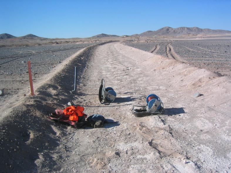
10 Sierra Gorda ISR Survey December initial phase of testing January equipment modifications February second phase of testing Based on the results of the testing phases the decision was made to carry out a full test survey with the following parameters: two 4000m survey lines ~centred over the planned pit 50m dipoles, capacitive electrodes ~2000x4000m double loops 12AWG w Master-slave Tx 20Ch a frequency of 2Hz


11 Wind-generated electrostatic noise contact electrification triboelecticity


12

13 Sierra Gorda 2011
14 Sierra Gorda 2012 Stripping and stockpiling of oxide mineralization to expose sulphide ore

15 Sierra Gorda 2012 Stripping and stockpiling of oxide mineralization to expose sulphide ore


16 Tx Loop double loop ~4000x2000m 12 AWG


17 UTEM 3 Transmitter Master-Slave pair

")
18 Capacitive Electrodes 0.9m x 1.9m (3 x6 )

19 UTEM 3 Receiver Capacitive Electrode (covered)

20 UTEM 3 Receiver 50m dipole setup

21 Line 31N 1225O

22

23

24 Line 31N
25 Line 31N

26 Line 31N

27 Line 31N

28 Line 31N

29 Line 35N
30 Resistivity imaging with ISR data combined conductivity-depth imaging and 2D resistivity inversion ECDI step Step Correct E field data normalize to the late time limit and apply lateral averaging fit these data to apparent diffusion time as a function of depth 2D resistivity inversion step incident E field with depth diffusion based on ECDI fit data with ECDI diffusion time/model smoothness constraints depth-variable modeling grid and inversion grid size major iterations (Miter) until RMS residuals no longer decrease
31 Line 31N
32 Line 31N

33 Line 31N

34 Line 31N
35 late-time normalized laterally-averaged data Channel n Channel (n-1)
36
37

38
39 Channel n Channel (n-1)
40 Where are we now A 2D resistivity inversion that can handle greater geological compexity and tolerate IP effects. working towards a 3D process currently: assemble the sections into a (more) 3D model 3D finite difference routine generates synthetic E field profiles synthetic results are compared with the Step Corrected profiles
41 Transmitter Loop 3 Lines 31N/35N

42 Transmitter Loop 3 synthetic data Line 31N

43 Transmitter Loop 3 synthetic data Line 35N

44 field data synthetic data Line 31N
45 Where are we now A 2D resistivity inversion that can handle greater geological compexity and handle IP effects. working towards a 3D process currently: assemble the sections into a (more) 3D model a 3D finite difference routine generates synthetic E field profiles synthetic results are compared with the Step Corrected profiles With the goal of putting these pieces together: inversion of field profiles to produce resistivity-depth sections assemble all resistivity-depth sections into a model 3D finite difference routine generates synthetic E field profiles major iterations (Miter) until RMS residuals no longer decrease

46 Lines 31N/35N

47 Line 19N
48 Line 23N
49 Line 27N

50 Line 31N
51 Line 35N
52 Line 39N
53 Line 43N
54 Line 47N
55 >200Ωm Line 47N

56 Line 43N
57 Line 39N

58 Line 35N
59 Line 31N
60 >300Ωm Line 31N

61 >400Ωm Line 31N

62 Line 31N
63 Acknowledgements Thanks to: KGHM International for allowing us to share the data. The management, staff and field workers involved at all levels at the Sierra Gorda site. Peter Walker
64 end of talk as presented

65

66
67
68
69
70
71

72
73 additional ISR resistivity-depth sections


74 ISR Shea Creek Athabasca Basin


75 ISR - Sudbury Falconbridge Footwall


76 ISR TBN Ni-Cu-PGM Thunder Bay North
Mapping Silicification in Gold Exploration
 Mapping Silicification in Gold Exploration with Inductive Source Resistivity James Macnae and Patrick McGowan, Lamontagne Geophysics Ltd. Lamontagne Geophysics Ltd. 115 Grant Timmins Drive Kingston, Ontario
The Cerattepe Massive Sulphide Property, Northeastern Turkey
 Integrated Exploration Case Histories Paper 139 Explor97 Master Page Explor97 Contents Previous Paper G O T O Author Index Section Contents The Cerattepe Massive Sulphide Property, Northeastern Turkey
MT Prospecting. Map Resistivity. Determine Formations. Determine Structure. Targeted Drilling
 MT Prospecting Map Resistivity Determine Formations Determine Structure Targeted Drilling Cross-sectional interpretation before and after an MT survey of a mineral exploration prospect containing volcanic
Growing Strong Industries ~ Developing New Ideas ~ Nurturing Natural Resources
 Sulfide Mining is a commonly used term to describe mining operations that mine metallic sulfide ore minerals Sulfide Mining is actually a misnomer the main objective of mining is generally not the sulfur,
COMMANDER RESOURCES LTD SOUTH VOISEY S BAY NI-CU-CO PROJECT LABRADOR
 COMMANDER RESOURCES LTD SOUTH VOISEY S BAY NI-CU-CO PROJECT LABRADOR May 2017 CORPORATE DISCLOSURE Disclaimer The information contained herein, while obtained from sources which we believe are reliable,
Introducing the Stratagem EH4. Electrical Conductivity Imaging System Hybrid-Source Magnetotellurics
 Introducing the Stratagem EH4 Electrical Conductivity Imaging System Hybrid-Source Magnetotellurics Stratagem EH4 Hybrid-Source Magnetotellurics Frequency range of 10 Hz to 90k Hz Approx. depth of investigation
Interpretation Report on Borehole TDEM Surveys
 Interpretation Report on Borehole TDEM Surveys Junior Lake Property, Armstrong, Ontario For Landore Resources Canada Inc. Alan R. King, M.Sc., P.Geo. January 25, 2016 Introduction Alan King of Geoscience
Results from the Initial Field Trials of a Borehole Gravity Meter for Mining and Geotechnical Applications
 P-174 Results from the Initial Field Trials of a Borehole Gravity Meter for Mining and Geotechnical Applications H.O. Seigel 1, C.J.M. Nind 1, A. Milanovic 1, J. MacQueen 2 Summary Scintrex is in the final
Early Exploration Plan Activity Information
 Early Exploration Plan Activity Information Activities That Require an Early Exploration Plan: Line cutting that is a width of 1.5 metres or less; Geophysical surveys on the ground requiring the use of
CHAMPION BEAR RESOURCES
 CHAMPION BEAR RESOURCES EXPLORING ADVANCED STAGE PRECIOUS METAL PROPERTIES IN ONTARIO Exploration Update January 2011 Forward Looking Statements This exploration update contains forward looking statements
MOUNT POLLEY MINING CORPORATION TECHNICAL REPORT ON MULTI-ELECTRODE RESISTIVITY AND SEISMIC REFRACTION SURVEYS MOUNT POLLEY TAILINGS DAM PROJECT
 MOUNT PLEY MINING CORPORATION TECHNICAL REPORT ON MULTI-ELECTRODE RESISTIVITY AND SEISMIC REFRACTION SURVEYS MOUNT PLEY TAILINGS DAM PROJECT LIKELY, B.C. by Claudia Krumbiegel, M.Sc. Cliff Candy, P.Geo.
CONTENTS 1. INTRODUCTION. 2. THE D.C. RESISTIVITY METHOD 2.1 Equipment 2.2 Survey Procedure 2.3 Data Reduction
 (i) CONTENTS 1. INTRODUCTION page 1 2. THE D.C. RESISTIVITY METHOD 2.1 Equipment 2.2 Survey Procedure 2.3 Data Reduction 3 3 3 3 3. GEOPHYSICAL RESULTS 3.1 General 3.2 Discussion 4 4 4 4. LIMITATIONS 5
POTASH DRAGON CHILE GEOPHYSICAL SURVEY TRANSIENT ELECTROMAGNETIC (TEM) METHOD. LLAMARA and SOLIDA PROJECTS SALAR DE LLAMARA, IQUIQUE, REGION I, CHILE
 METHOD. LLAMARA and SOLIDA PROJECTS SALAR DE LLAMARA, IQUIQUE, REGION I, CHILE") POTASH DRAGON CHILE GEOPHYSICAL SURVEY TRANSIENT ELECTROMAGNETIC (TEM) METHOD LLAMARA and SOLIDA PROJECTS SALAR DE LLAMARA, IQUIQUE, REGION I, CHILE OCTOBER 2012 CONTENT Page I INTRODUCTION 1 II FIELD
POTASH DRAGON CHILE GEOPHYSICAL SURVEY TRANSIENT ELECTROMAGNETIC (TEM) METHOD LLAMARA and SOLIDA PROJECTS SALAR DE LLAMARA, IQUIQUE, REGION I, CHILE OCTOBER 2012 CONTENT Page I INTRODUCTION 1 II FIELD
Sudbury Platinum Discovers New Ni-Cu-PGM Mineralization at its Aer-Kidd Property
 Sudbury Platinum Discovers New Ni-Cu-PGM Mineralization at its Aer-Kidd Property Sudbury, March 02, 2015 Sudbury Platinum Corporation ( SPC ) and Transition Metals Corp. (XTM TSX.V, Transition, the Company
Northern Chile, 85 Km NE of La Serena 125 km S of Relincho (Nueva Union Teck-Goldcorp)
") July 2017 Mirador lies along the southern extensions of the highly productive Paleocene Mineral Belt in northern Chile that contains numerous important copper, gold and silver mines and projects. Mirador
July 2017 Mirador lies along the southern extensions of the highly productive Paleocene Mineral Belt in northern Chile that contains numerous important copper, gold and silver mines and projects. Mirador
15. MATHEMATICAL ALGORITHMS
 15. MATHEMATICAL ALGORITHMS 15.1 STANDARD ERROR OF THE MEAN (SEM)... 2 15.2 3-POINT DECOUPLING... 3 15.3 A NOTE ON RESISTIVITY CALCULATIONS... 4 15.4 RESISTIVITY CALCULATIONS... 4 DIPOLE - DIPOLE...4 POLE
Virgin River DCIP Report
 Virgin River 1 1 University of British Columbia Geophysical Facility Applied Geophysics, 2010 Outline 1 Location Survey Specications 2 3 Correlations Snowbird Tectonic Zone Outline Location Survey Specs
Parkin Offset Properties. Sudbury, Ontario
 Parkin Offset Properties Sudbury, Ontario May 11, 2015 CAUTIONARY STATEMENT No regulatory authority has approved or disapproved the information contained in this presentation. This presentation includes
Aureus Mining New Liberty Project Geology
 Aureus Mining New Liberty Project Geology February 2014 Contents Location and Regional context Deposit geology Resources and Reserves Grade Control Underground potential Near-mine exploration potential
DECAY CHARACTERISTICS OF AIRBORNE TIME-DOMAIN ELECTROMAGNETIC DATA: WHERE TO FIND THE CONSTANT (TAU)
") DECAY CHARACTERISTICS OF AIRBORNE TIME-DOMAIN ELECTROMAGNETIC DATA: WHERE TO FIND THE CONSTANT (TAU) Tau Geophysical Consultants Magdel Combrinck Willem Botha Outline What is? Why is it useful? How is
DECAY CHARACTERISTICS OF AIRBORNE TIME-DOMAIN ELECTROMAGNETIC DATA: WHERE TO FIND THE CONSTANT (TAU) Tau Geophysical Consultants Magdel Combrinck Willem Botha Outline What is? Why is it useful? How is
The Discovery of the Phoenix: New High-Grade, Athabasca Basin Unconformity Uranium Deposits Saskatchewan, Canada
 The Discovery of the Phoenix: New High-Grade, Athabasca Basin Unconformity Uranium Deposits Saskatchewan, Canada FORWARD LOOKING STATEMENT Some disclosure included in this presentation respecting production,
Inductive source induced polarization David Marchant, Eldad Haber and Douglas W. Oldenburg, University of British Columbia
 David Marchant, Eldad Haber and Douglas W. Oldenburg, University of British Columbia Downloaded /9/3 to 37.8.7.. Redistribution subject to SEG license or copyright; see Terms of Use at http://library.seg.org/
Komatiite-hosted Ni-Cu-(PGE) deposits: understanding deposit and camp footprints
 deposits: understanding deposit and camp footprints") Komatiite-hosted Ni-Cu-(PGE) deposits: understanding deposit and camp footprints Steve Beresford newgenco Acknowledgements Co-authors Marco Fiorentini Jon Hronsky Nic Rosengren Dave Bertuch Paul Duuring
Komatiite-hosted Ni-Cu-(PGE) deposits: understanding deposit and camp footprints Steve Beresford newgenco Acknowledgements Co-authors Marco Fiorentini Jon Hronsky Nic Rosengren Dave Bertuch Paul Duuring
Figure 1: Location of principal shallow conductors at Alpala (anomalies C0-C10; 5 Ohm/m surfaces, red) and shallow zones of electrical chargeability
 and shallow zones of electrical chargeability") Figure 1: Location of principal shallow conductors at Alpala (anomalies C0-C10; 5 Ohm/m surfaces, red) and shallow zones of electrical chargeability (85 msecs, yellow-green) shown on iso-surfaces of MVI
Figure 1: Location of principal shallow conductors at Alpala (anomalies C0-C10; 5 Ohm/m surfaces, red) and shallow zones of electrical chargeability (85 msecs, yellow-green) shown on iso-surfaces of MVI
1D and 2D Inversion of the Magnetotelluric Data for Brine Bearing Structures Investigation
 1D and 2D Inversion of the Magnetotelluric Data for Brine Bearing Structures Investigation Behrooz Oskooi *, Isa Mansoori Kermanshahi * * Institute of Geophysics, University of Tehran, Tehran, Iran. boskooi@ut.ac.ir,
Applications of geophysical inversions in mineral exploration
 Applications of geophysical inversions in mineral exploration I DOUGLAS W. OLDENBURG, YAOGUO LI, and COLIN G. FARQUHARSON, University of British Columbia PETER KOWALCZYK, Placer Dome, Incorporated, Vancouver,
For personal use only
 South America s Emerging Gold Explorer ASX Release 22 November 2012 OUTSTANDING GEOPHYSICS RESULTS FROM ALUMBRE AND QUINUAL CONCESSIONS HIGHLIGHTS Independent review of the Alumbre and Quinual concessions
Sabin Zn-Cu VMS Project. Sturgeon Lake Belt, Ontario
 Sabin Zn-Cu VMS Project Sturgeon Lake Belt, Ontario June 2017 CORPORATE DISCLOSURE Disclaimer The information contained herein, while obtained from sources which we believe are reliable, is not guaranteed
Geophysics Course Introduction to DC Resistivity
 NORAD supported project in MRRD covering Capacity Building and Institutional Cooperation in the field of Hydrogeology for Faryab Province Afghanistan Geophysics Course Introduction to DC Resistivity By
STATION #1 Compaction and Cementation
 STATION #1 Compaction and Cementation STATION #2 High Temperature and Pressure STATION #3 Sediments Examples: Glacial deposits: gravel, sand, clay River and lake deposits: gravel, sand, mud Sand dunes
Quantec s ORION 3D System Application and Examples
 Quantec s ORION 3D System Application and Examples Warren W. Stanyer David Thomson Michele Tuomi Roger Sharpe*, Kevin Killin Nevada Sunrise Cerro Grande Mining Landore Resources Canada Quantec Geoscience
VTEM-ZTEM Airborne EM Survey. Results over PGM-Cu-Ni Targets. at East Bull Lake Anorthositic Complex, Massey, ON
 KEGS-PDAC SYMPOSIUM 2011 Meeting Geophysical Challenges: Difficult Environments and Hard to Detect Commodities VTEM-ZTEM Airborne EM Survey Results over PGM-Cu-Ni Targets at East Bull Lake Anorthositic
Gossan s Industrial Mineral Opportunities in Manitoba
 Gossan s Industrial Mineral Opportunities in Manitoba Presentation to: Gossan Resources Limited James Bamburak, M.Sc., P.Geo. July 2003 Manitoba Industry, Trade and Mines Industrial Mineral Opportunities
Victoria Advance Exploration Project Past, Present and What s Next
 Victoria Advance Exploration Project Past, Present and What s Next Forward Looking Statement KGHM International press releases and information on Victoria Project together with supplemental data about
Deep Exploration Technologies Coiled Tubing Drilling
 Deep Exploration Technologies Coiled Tubing Drilling Program 1 Leader: Soren Soe Drilling DEEPCORE DRILLING PLUS WORKSHOP IP and Role of Service Providers c er m IP Utilization m Co ise ial R&D Providers
CORPORATE PROFILE Airborne Geophysics for Mineral Exploration
 CORPORATE PROFILE Airborne Geophysics for Mineral Exploration Highlights Specialists in high resolution airborne geophysical surveys in mountainous terrain Precision GeoSurveys is a full-service airborne
Geophysics of Exploration for Water. Geoelectric methods III. edited by Peter Vass
 Geophysics of Exploration for Water Geoelectric methods III edited by Peter Vass The phenomenon of induced polarization was already noticed at the early stage of applying direct current electrical methods
URACAN/UEX REPORT URANIUM MINERALIZATION ON THE BLACK LAKE PROJECT; GROUND GEOPHYSICAL SURVEY UNDERWAY
 URACAN/UEX REPORT URANIUM MINERALIZATION ON THE BLACK LAKE PROJECT; GROUND GEOPHYSICAL SURVEY UNDERWAY April 2, 2014 Trading Symbols: TSX-V:URC and TSX:UEX Vancouver, Canada Uracan Resources Ltd. (TSX.V:URC)
Hydraulic Impacts of Limestone Quarries and Gravel Pits. Jeff Green Minnesota DNR-Division of Ecological & Water Resources
 Hydraulic Impacts of Limestone Quarries and Gravel Pits Jeff Green Minnesota DNR-Division of Ecological & Water Resources The Hydraulic Impacts of Limestone Quarries and Gravel Pits Study was funded by
EXTREMELY FAST IP USED TO DELINEATE BURIED LANDFILLS. Norman R. Carlson, Cris Mauldin Mayerle, and Kenneth L. Zonge
 EXTREMELY FAST IP USED TO DELINEATE BURIED LANDFILLS Norman R. Carlson, Cris Mauldin Mayerle, and Kenneth L. Zonge Zonge Engineering and Research Organization, Inc. 3322 East Fort Lowell Road Tucson, Arizona,
A review of the Jaguar Cu-Zn-Ag VMS discovery and subsequent geophysical trials
 A review of the Jaguar Cu-Zn-Ag VMS discovery and subsequent geophysical trials * N. Cantwell 1, M. Cooper 1, J. Meyers 2, N. Martin 3 and R. Sainty 3 1. Resource Potentials Pty Ltd., email: nigelc@respot.com.au,
Our Services. What We Do. How We Can Help. Contact us today: January (0)
") Listening and Understanding to Optimize our Efficiency Our Experience and Knowledge to Work for You Tailor-made Solutions to Meet your Needs Our Challenge is You Success What We Do Our Services GeoViz
Listening and Understanding to Optimize our Efficiency Our Experience and Knowledge to Work for You Tailor-made Solutions to Meet your Needs Our Challenge is You Success What We Do Our Services GeoViz
Titiribi Gold: Sleeping Giant in the Colombian Cordilleras (a Geophysical Study)
") Titiribi Gold: Sleeping Giant in the Colombian Cordilleras (a Geophysical Study) Emmett Van Reed, P.Gp. Zonge Engineering & Research Amit Tripathi, Ph.D. Terra Resources Development Technologies Jennifer
Titiribi Gold: Sleeping Giant in the Colombian Cordilleras (a Geophysical Study) Emmett Van Reed, P.Gp. Zonge Engineering & Research Amit Tripathi, Ph.D. Terra Resources Development Technologies Jennifer
Modelling IP effects in airborne time domain electromagnetics
 Modelling IP effects in airborne time domain electromagnetics Dave Marchant* Seogi Kang Mike McMillian Eldad Haber Computational Geosciences University of British Columbia Computational Geosciences University
New Generation JESSY HTS SQUID Results over the LALOR Deposit
 www.livingskygeophysics.ca New Generation JESSY HTS SQUID Results over the LALOR Deposit www.discogeo.com David Bingham, B Sc, P. Geo. Living Sky Geophysics Inc. Grant Nimeck, B Sc, P. Geo., P. Geoph.
Condor Blanco Mines Limited (Code: CDB) Company Presentation Devil s Creek Tenement E70/4529
 Company Presentation Devil s Creek Tenement E70/4529") Condor Blanco Mines Limited (Code: CDB) Company Presentation Devil s Creek Tenement E70/4529 Disclaimer This document is not a disclosure document nor does it constitute the provision of financial product
Condor Blanco Mines Limited (Code: CDB) Company Presentation Devil s Creek Tenement E70/4529 Disclaimer This document is not a disclosure document nor does it constitute the provision of financial product
SUPPLEMENTARY INFORMATION
 SUPPLEMENTARY INFORMATION Supplementary online material for Bai et al., (2). EHS3D MT data collection Broadband magnetotelluric (MT) data were recorded on profiles P, P2 and P4 in the frequency band -.5
Three High Priority Targets Identified Through Modeling of Electromagnetic Data From 2011 SkyTEM Survey
 NORTH AMERICAN NICKEL INC. 301 260 W. Esplanade North Vancouver, B.C. V7M 3G7 Tel: (604) 986-2020 Toll Free: 1-866-816-0118 Three High Priority Targets Identified Through Modeling of Electromagnetic Data
Helicopter EM (VTEM-ZTEM) Applications for Mineral Exploration
 Applications for Mineral Exploration") Technical Session: Exploratory Geophysics and Geochemistry Helicopter EM (VTEM-ZTEM) Applications for Mineral Exploration By Jean M. Legault* and Cristiano Foutoura** *Geotech Ltd., Aurora, CA **Geotech
Technical Session: Exploratory Geophysics and Geochemistry Helicopter EM (VTEM-ZTEM) Applications for Mineral Exploration By Jean M. Legault* and Cristiano Foutoura** *Geotech Ltd., Aurora, CA **Geotech
Magnetic Case Study: Raglan Mine Laura Davis May 24, 2006
 Magnetic Case Study: Raglan Mine Laura Davis May 24, 2006 Research Objectives The objective of this study was to test the tools available in EMIGMA (PetRos Eikon) for their utility in analyzing magnetic
Identified a possible new offset location where the customer is currently exploring drill options.
 GroundMetrics was hired to conduct a Full-Field Resistivity Survey for an oil and gas producer that needed to make crucial decisions to drive profitability at the location. The results saved them hundreds
A Convenient a Joint Venture Patterson Lake South
 Patterson Lake South (PLS) Property A Convenient a Joint Venture Patterson Lake South December 2012 TSX.V: AMW and FIS Garrett Ainsworth, PGeo, Alpha Minerals Inc. Saskatchewan Open House, Dec. 2012 Disclaimer
For personal use only
 UPDATE ON COCK-EYED BOB UNDERGROUND MINING INCREASING CONFIDENCE IN THE POTENTIAL FOR THREE LONG-LIFE UNDERGROUND MINES Integra Mining Limited (ASX:IGR, Integra) is pleased to report that the trial mining
Airborne EM (VTEM-ZTEM) Applications for Gold
 Applications for Gold") Airborne EM (VTEM-ZTEM) Applications for Gold with Recent examples over the Pebble cu-mo-gold Porphyry and Lalor Lake VMS cu-zn-gold deposits By Jean M. Legault *, Vlad Kaminski, Harish Kumar, Marta Orta
Airborne EM (VTEM-ZTEM) Applications for Gold with Recent examples over the Pebble cu-mo-gold Porphyry and Lalor Lake VMS cu-zn-gold deposits By Jean M. Legault *, Vlad Kaminski, Harish Kumar, Marta Orta
* **
 MT. BULGA REVISITED Bob Whiteley* and Tak Ming Leung** * rjwhiteley@optusnet.com.au ** tak-ming_leung@rta.nsw.gov.au Mt Bulga is located near Orange, New South Wales some 260 km west of Sydney. The first
Copper and Zinc Production, Disciplined Growth. S I T E V I S I T O C T O B E R % Owned Projects
 Copper and Zinc Production, Disciplined Growth. S I T E V I S I T O C T O B E R 2 0 1 6 100% Owned Projects Serbia assets Timok Magmatic Complex Rakita Joint Venture 4 exploration permits in the Bor region,
Deacon nickel-sulphide discovery, Kambalda, WA
 Deacon nickel-sulphide discovery, Kambalda, WA CET Discovery Day, Fremantle 18 February 2014 John Hicks, General Manager Exploration WWW.PANORAMICRESOURCES.COM ASX: PAN Road to discovery Introduction Feb
ASX Announcement. FLEM survey underway at Henrietta Cobalt Nickel Prospect, Tasmania ASX: AX8 HIGHLIGHTS. Market Data. Board and Management.
 FLEM survey underway at Henrietta Cobalt Nickel Prospect, Tasmania ASX Announcement Market Data ASX Code: AX8 Shares on Issue: 47,620,000 Board and Management Grant Mooney Non-Executive Chairman Andrew
GEOTECH: Airborne Geophysics and Its Possible Application in Bulgaria. Prof. Alexander Antonov, Canada
 GEOTECH: Airborne Geophysics and Its Possible Application in Bulgaria Prof. Alexander Antonov, Canada Geotech overview Geotech Ltd is a global leader in airborne geophysical survey, mapping, interpretation
CHARACTERIZATION OF SOIL PROFILE OF DHAKA CITY USING ELECTRICAL RESISTIVITY TOMOGRAPHY (ERT)
") CHARACTERIZATION OF SOIL PROFILE OF DHAKA CITY USING ELECTRICAL RESISTIVITY TOMOGRAPHY (ERT) Mehedi Ahmed ANSARY 1, B.S. Pushpendue BISWAS 2 and Abul KHAIR 3 1 Professor, Department of Civil Engineering
CHARACTERIZATION OF SOIL PROFILE OF DHAKA CITY USING ELECTRICAL RESISTIVITY TOMOGRAPHY (ERT) Mehedi Ahmed ANSARY 1, B.S. Pushpendue BISWAS 2 and Abul KHAIR 3 1 Professor, Department of Civil Engineering
RAPID GROWTH OF A MID-TIER MINER: Lessons for Future Exploration. Catharine Farrow Gord Morrison November 2012
 RAPID GROWTH OF A MID-TIER MINER: Lessons for Future Exploration Catharine Farrow Gord Morrison November 2012 OUTLINE Background Perspective Growth of a Mid-Tier Mining Company Exploration Geoscience Database
ASX Announcement. 28 January Drill results indicate large Porphyry Copper Gold System at Peenam
 ASX Announcement 28 January 2010 Drill results indicate large Porphyry Copper Gold System at Peenam Highlights: 270 metres of visible copper (gold) mineralisation in first diamond core hole at Peenam Prospect
Bryce Canyon. Bryce Zion
 Bryce Canyon Located ~50 mi NE of Zion in southern Utah On Paunsaugunt Plateau: Wetter and Colder than Zion Bounded by Sevier Fault to west and Paunsaugunt Fault to east Rocks are ~100 Ma older than at
Alligator Energy Uranium Projects. 6 September 18 NT RESOURCES WEEK Greg Hall, CEO
 Alligator Energy Uranium Projects 6 September 18 NT RESOURCES WEEK Greg Hall, CEO Disclaimer & Competent Person s Statement 2 Disclaimer This presentation contains projections and forward looking information
GROUND IP-RESISTIVITY, AND AIRBORNE SPECTREM AND HELICOPTER ZTEM SURVEY RESULTS OVER PEBBLE COPPER-MOLY-GOLD PORPHYRY DEPOSIT, ALASKA
 GROUND IP-RESISTIVITY, AND AIRBORNE SPECTREM AND HELICOPTER ZTEM SURVEY RESULTS OVER PEBBLE COPPER-MOLY-GOLD PORPHYRY DEPOSIT, ALASKA Pascal Paré Anglo-American Exploration (Canada) Ltd. Jean Legault Geotech
UBC-GIF: Capabilities for EM Modelling and Inversion of LSBB data
 The University of British Colubia Geophysical Inversion Facility slide 1 UBC-GIF: Capabilities for EM Modelling and Inversion of LSBB data Douglas W. Oldenburg Departent of Earth and Ocean Sciences June
Logistics Report on a BH UTEM 4 Survey in Elliot Lake, Ontario area for International Montoro Resources, Inc.
 Logistics Report on a BH UTEM 4 Survey in Elliot Lake, Ontario area for International Montoro Resources, Inc. Property Elliot Lake Boreholes P-15-22 June 2015 Bruce McMonnies, P.Geo. Christina Demerling,
Haoma Mining NL A.B.N
 Haoma Mining NL A.B.N 12 008 676 177 Registered Office & Head Office: 411 Collins Street, Melbourne, Vic., 3000, GPO Box 2282U, Melbourne, Vic., 3001. Telephone (03) 9629 6888, Facsimile (03) 9629 1250
Cabral cuts 36.9 g/t gold in Machichie Drilling and Announces the Discovery of a New High-grade Zone at the Cuiú Cuiú Project, Brazil
 Cabral cuts 3.4m @ 36.9 g/t gold in Machichie Drilling and Announces the Discovery of a New High-grade Zone at the Cuiú Cuiú Project, Brazil Vancouver, British Columbia February 28, 2019 Cabral Gold Inc.
Tu 23P1 06 Mapping Possible Flowpaths of Contaminants through Surface and Cross-borehole Spectral Timedomain Induced Polarization
 Tu 23P1 06 Mapping Possible Flowpaths of Contaminants through Surface and Cross-borehole Spectral Timedomain Induced Polarization T. Bording* (Aarhus University), G. Fiandaca (Aarhus University), P.K.
Anisotropic 2.5D Inversion of Towed Streamer EM Data from Three North Sea Fields Using Parallel Adaptive Finite Elements
 Anisotropic 2.5D Inversion of Towed Streamer EM Data from Three North Sea Fields Using Parallel Adaptive Finite Elements K. Key (Scripps Institution of Oceanography), Z. Du* (PGS), J. Mattsson (PGS), A.
For personal use only
 20 7 APRIL JANUARY 2017 2017 ASX ASX ANNOUNCEMENT QUEENSLAND EXPLORATION PROJECTS UPDATE Projects identified by Sasak through analysis of regional geophysics and geochemistry databases to target IOCG (Iron
ASX ANNOUNCEMENT 4 March 2019 VTEM SURVEY COMMENCED OVER LORRAINE AND ADZ PROJECT AREAS
 ASX ANNOUNCEMENT 4 March 2019 VTEM SURVEY COMMENCED OVER LORRAINE AND ADZ PROJECT AREAS The Company is pleased to announce the commencement of a detailed airborne electromagnetic geophysical survey over
A Brief Introduction to Magnetotellurics and Controlled Source Electromagnetic Methods
 A Brief Introduction to Magnetotellurics and Controlled Source Electromagnetic Methods Frank Morrison U.C. Berkeley With the help of: David Alumbaugh Erika Gasperikova Mike Hoversten Andrea Zirilli A few
For personal use only
 22 April 2013 Drilling to commence at Majada, Copper-Gold Prospect, Chile. Red Gum Resources Limited (ASX: RGX, Red Gum or the Company ) is pleased to announce that drilling of its Majada Copper-Gold Prospect,
Case Study: Ground TEM survey over the Champagne deposit, Qc.
 Case Study: Ground TEM survey over the Champagne deposit, Qc. Circé Malo Lalande, Eng. Geophysicist www.gdd.ca Survey site Localisation Champagne deposit Bellechasse Gold Belt Golden Hope Mine ltd. 2 Exploration
URANIUM EXPLORATION COMPANY
 URANIUM EXPLORATION COMPANY EXPLORATION FOR HIGH-GRADE URANIUM DEPOSITS IN SANDSTONE BASINS GETTING TO DISCOVERY QUICKER AND MORE COST EFFECTIVELY USING APPLIED RESEARCH SUCCESSFUL EXPLORATION THROUGH
CERRO BUENOS AIRES. 100% Revelo Subject to a 1% NSR payable on all metals. ~ 8,400 Ha. Available for Option & JV
 October 2017 Buenos Aires is located in the heart of the highly productive Paleocene Mineral Belt in northern Chile that contains several important gold, silver and copper mines and projects. Large outcrops
For personal use only
 ACN 097 088 689 ASX Announcement 1 EXPLORATION SUCCESS CONTINUES AT RAVENSWOOD RC drilling targeting shallow portions of Welcome breccia returns a number of significant new results including: 7m @ 7.84g/t
Geoelectricity. ieso 2010
 Geoelectricity ieso 2010 1 RESISTIVITY SURVEY AT VENETO VILLA GRITTI AT THE TOWN OF TREVISO (VENETO REGION) The survey was carried out to verify the underground presence of the fondations of a rustic building.
Geoelectrical and IP Imaging Used for Pre-investigation at a Tunnel Project. Danielsen, Berit Ensted; Arver, Henrik; Karlsson, T; Dahlin, Torleif
 Geoelectrical and IP Imaging Used for Pre-investigation at a Tunnel Project Danielsen, Berit Ensted; Arver, Henrik; Karlsson, T; Dahlin, Torleif 2008 Link to publication Citation for published version
8 2 E L. Geophysical Exploration Report of 18282EL, Wase LGA, Plateau State. BRIGO MINING COMPANY LTD.
 1 Geophysical Exploration Report of 18282EL, Wase LGA, Plateau State. BRIGO MINING COMPANY LTD. 8 2 Electromagnetic and Induced Polarization Exploration Report 8 2 E L By: Dr. Oladele Olaniyan GISL, Abuja
Transition Metals and Implats Make Platinum Discovery at Sunday Lake, Intersecting 20.2 meters grading 3.22 Combined PGM s HIGHLIGHTS
 Transition Metals and Implats Make Platinum Discovery at Sunday Lake, Intersecting 20.2 meters grading 3.22 Combined PGM s Sudbury, January 27, 2014 Transition Metals Corp. (XTM TSX.V) ( Transition, the
MINERAL RESERVES AND MINERAL RESOURCES SUMMARY TABLE MINERAL RESERVES
 SUMMARY OF MINERAL RESERVE AND MINERAL RESOURCE ESTIMATES On February 20, 2018, the Company reported consolidated Mineral Reserve and Mineral Resource estimates for its mines and development projects as
2-D Resistivity Study: The Horizontal Resolution Improvement by Introducing the Enhancing Horizontal Resolution (EHR) Technique
 Technique") Open Journal of Geology, 213, 3, 1-6 doi:1.4236/ojg.213.32b1 Published Online April 213 (http://www.scirp.org/journal/ojg) 2-D Resistivity Study: The Horizontal Resolution Improvement by Introducing the
Open Journal of Geology, 213, 3, 1-6 doi:1.4236/ojg.213.32b1 Published Online April 213 (http://www.scirp.org/journal/ojg) 2-D Resistivity Study: The Horizontal Resolution Improvement by Introducing the
Geological & Geophysical Interpretation of ZTEM EM and Magnetic Survey. Kemess Project, BC. for AuRico Metals Inc. September, 2016 Nicole Pendrigh
 Geological & Geophysical Interpretation of ZTEM EM and Magnetic Survey Kemess Project, BC for AuRico Metals Inc. September, 2016 Nicole Pendrigh SUMMARY REPORT Regional setting Located in North central
The Multiscalar Boundary Element Method E. H. Liu, Y. Lamontagne, and E. Sidaway,
 The Multiscalar Boundary Element Method E. H. Liu, Y. Lamontagne, and E. Sidaway, Abstract A new iterative boundary element formulation, the Multiscalar Boundary Element Method (MBEM), is described. It
Improved Exploration, Appraisal and Production Monitoring with Multi-Transient EM Solutions
 Improved Exploration, Appraisal and Production Monitoring with Multi-Transient EM Solutions Folke Engelmark* PGS Multi-Transient EM, Asia-Pacific, Singapore folke.engelmark@pgs.com Summary Successful as
Marine EM on Land: MT Measurements in Mono Lake. Steven Constable, UCSD/SIO Jared Peacock, USGS EMIW 2018
 Marine EM on Land: MT Measurements in Mono Lake Steven Constable, UCSD/SIO Jared Peacock, USGS EMIW 218 Mono Lake sits in the Mono Basin, where the Basin and Range meets the Sierra Nevada. The Sierra Nevada
CHAPTER 5 GEOPHYSICAL SURVEY. 5.1 Purpose of Survey
 CHAPTE 5 GEOPHYSICAL SUVEY 5.1 Purpose of Survey The objective of the Time Domain Electro- Magnetic (TDEM) survey was to define the electrical structure of the Stampriet Artesian Basin and relate this
SIXTH SCHEDULE REPUBLIC OF SOUTH SUDAN MINISTRY OF PETROLEUM, MINING THE MINING (MINERAL TITLE) REGULATIONS 2015
 REGULATIONS 2015") SIXTH SCHEDULE REPUBLIC OF SOUTH SUDAN MINISTRY OF PETROLEUM, MINING THE MINING ACT, 2012 THE MINING (MINERAL TITLE) REGULATIONS 2015 Guidelines should be prepared by the Directorate of Mineral Development
SIXTH SCHEDULE REPUBLIC OF SOUTH SUDAN MINISTRY OF PETROLEUM, MINING THE MINING ACT, 2012 THE MINING (MINERAL TITLE) REGULATIONS 2015 Guidelines should be prepared by the Directorate of Mineral Development
IRVING RESOURCES INC. 999 Canada Place, Suite 404 Vancouver, B.C., Canada V6C 3E2
 IRVING RESOURCES INC. 999 Canada Place, Suite 404 Vancouver, B.C., Canada V6C 3E2 NEWS RELEASE January 22, 2018 Irving Defines Strong Geophysical Anomalies at its Omu Gold-Silver Project, Hokkaido, Japan
CH OUTLINE OF PFS 2018 PIT CH CH CH CH CH CH CH
 E W OUTLIE OF PFS 2018 PIT STROG ZOE OPE AT DEPTH AD TO THE EAST significant intervals for that drill-hole 800mRL CH-17-232 2m @ 6.38g/t from 175m 12m @ 2.25g/t from 200m 1m @ 7.76g/t from 223m 1m @ 15g/t
MINERAL RESERVES AND MINERAL RESOURCES SUMMARY TABLE MINERAL RESERVES
 SUMMARY OF MINERAL RESERVE AND MINERAL RESOURCE ESTIMATES On February 20, 2018, the Company reported consolidated Mineral Reserve and Mineral Resource estimates for its mines and development projects as
Electrical Surveying (part A)
") Electrical Surveying (part A) Dr. Laurent Marescot Course given at the University of Fribourg (2009) Contact: laurent@tomoquest.com www.tomoquest.com 1 Introduction Electrical surveying Resistivity method
Electrical Surveying (part A) Dr. Laurent Marescot Course given at the University of Fribourg (2009) Contact: laurent@tomoquest.com www.tomoquest.com 1 Introduction Electrical surveying Resistivity method
Alligator commences drilling of TCC4 uranium prospect in Arnhem Land, NT 4 September 2018
 Alligator commences drilling of TCC4 uranium prospect in Arnhem Land, NT 4 September 2018 Highlights The TCC4 prospect represents Alligators most advanced untested undercover uranium target with a large
Geophysical Investigation of a 19th Century Archeological Site, Boston College K. Corcoran, J. Hager, M. Carnevale
 Geophysical Investigation of a 19th Century Archeological Site, Boston College K. Corcoran, J. Hager, M. Carnevale Hager GeoScience, Inc., Waltham, MA ------------------------------------------------------------------------
(BECA CLAIMS (Lat. 51 2'N; Long '~))
)") I ' ' COMINCO LTD. EXPLORATION WESTERN DISTRICT b NTS: 8 2 - ~ / 4 d GEOPHYSICAL REPORT: UTEM ELECTROMAGNETIC AND MAGNETOMETER SURVEYS ON THE,"- [BAY CLAIMS (Lat. 51 6'N; Long. 119O47'W) L (BECA CLAIMS
I ' ' COMINCO LTD. EXPLORATION WESTERN DISTRICT b NTS: 8 2 - ~ / 4 d GEOPHYSICAL REPORT: UTEM ELECTROMAGNETIC AND MAGNETOMETER SURVEYS ON THE,"- [BAY CLAIMS (Lat. 51 6'N; Long. 119O47'W) L (BECA CLAIMS
Sudbury Platinum intersects near surface Ni-Cu-Co-PGM mineralization at Aer-Kidd
 Sudbury Platinum intersects near surface Ni-Cu-Co-PGM mineralization at Aer-Kidd Sudbury, March 5, 2018 Sudbury Platinum Corporation ( SPC ) and Transition Metals Corp. (XTM TSX.V, Transition, the Company
September 16, 2010 Magnetic surveying
 September 16, 2010 Magnetic surveying After today, you will be able to Sketch anomalies over objects at any location, and explain how you derived the pattern. Explain the relation between dipoles and real