September 16, 2010 Magnetic surveying
|
|
|
- Bryan Freeman
- 5 years ago
- Views:
Transcription


1 September 16, 2010 Magnetic surveying After today, you will be able to Sketch anomalies over objects at any location, and explain how you derived the pattern. Explain the relation between dipoles and real targets. Outline the needs of a field survey. Outline necessary & some optional processing. Slide 1
 magnetic moment m = M x (volume) 4. Magnetometer measures the total field 5.")
2 Basics of Magnetics Surveying 1. Earth s magnetic field is the source: 2. Materials in the earth become magnetized (M = κh where H = B/0) (dipole moment per unit volume) 3. Magnetized material creates anomalous field (applet) magnetic moment m = M x (volume) 4. Magnetometer measures the total field 5. Anomalous field obtained by subtracting off the earth s field
3 Magnetics Earth s field Web Notes, GPG Ch.3.d.7. How is the field described anywhere? X, Y, Z Inclination, Declination, Magnitude Compass? Inclination? Declination? Earth s field strength vs anomalies. Slide 3

 Declination")
 B max = 70,000")


4 Earth s magnetic field: Strength B Inclination I Declination D Total Field Strength (nt) Declination (degrees) Inclination (degrees) B max = 70,000 nt H max = 55.7A/m B min = 20,000 nt H min = 15.9A/m


5 Magnetic field due to a dipole A dipole is the basic quantity in magnetostatics
6 Drawing the field due to burried dipoles Use the java applet on the website: Via GPG 8.c Start the applet alone here Or via: rcises/meth_3a/dipoleapp.html (there will be a link on the main EOSC 350 page)
7 Examples
8 Basics of Magnetics Surveying 1. Earth s magnetic field is the source: 2. Materials in the earth become magnetized (M = κh where H = B/0) (dipole moment per unit volume) 3. Magnetized material creates anomalous field (applet) magnetic moment m = M x (volume) 4. Magnetometer measures the total field 5. Anomalous field obtained by subtracting off the earth s field
 That is, total field anomaly B is the projection of the anomalous field onto the direction of the inducing")
9 The Anomalous field B 0 B A Measured field B = B 0 + B A Therefore components are: B AX = B X - B 0X, B AY = B Y - B 0Y, B AZ = B Z - B 0Z The total field anomaly: B = B - B 0 If B A << B 0 then B (BA Bˆ 0 ) That is, total field anomaly B is the projection of the anomalous field onto the direction of the inducing field.
10 Details on Anomalous Field See GPG d.8 Principles (anomalous fields)
 Start simple buried dipole. GPG Ch.3.d.2. Response to shallow or deep dipole targets. Response near magnetic poles near magnetic equator. Slide 11")
11 Magnetics Data What exactly is measured? GPG Ch.3.d.1. The total field magnetic anomaly. Consequently, what pattern of response can be expected for buried targets? (sketch on BB) Start simple buried dipole. GPG Ch.3.d.2. Response to shallow or deep dipole targets. Response near magnetic poles near magnetic equator. Slide 11
12 Examples
13 Homework and Readings Magnetics GPG 3.d.0 3.d.13 Use the Java Applet to investigate the field due to burried GPG 8.c nt/exercises/meth_3a/dipoleapp.html Slide 13
14 Processing Magnetic Field data Account for time variations (need a base station) Remove regional

15 Magnetics Earth s field Slide 15
16 Time Variations of the Earth s Field External sources Solar wind (micro-seconds, minutes, hours) Solar storms (hours, days, months) Man made sources Power lines (50/60 Hz plus harmonics) DC Motors, generators All electronic equipment Internal sources Fluctuations in core (days millions of years)

17 Field procedures Earth s magnetic field varies as a function of time Necessary to record the magnetic field at a fixed location to determine the Earth s field
18 Base station correction Set out another magnetometer (base station) Assume time variations at the base stations are the same as at the observation location Synchronize the times Perform a correction by subtraction
19 Anomalous field We measure the field at the Earth s surface but we are interested in the anomalous features Regional removal


20 Example of regional field removal Airborne magnetic data gathered over a 25 square km area around a mineral deposit in central British Columbia. Some geological structural information is shown as black lines. The monzonite stock in the centre of the boxed region is a magnetic body, but this is not very clear in the data before removing the regional trend.


21 Summary: Data Collection Now we know what is measured. How to make measurements? Requirements: Base station. Positioning & time tied to each measurement. Measurement while moving. Identify potential noise sources. Slide 21
22 Possible routes to extracting information Plot the data in various map displays Interpret with a dipole Interpret with simple bodies of uniform magnetization Interpret as complex bodies (inversion)

23 Aeromagnetic map construction
24 Essential airborne data preparation (processing) Levelling data maps adjustingline locations decorregation drapping What can be learned directly? Trends Contacts Geologic settings Slide 24

25 Positioning errors of flight lines (old data)

26 Essential airborne data preparation (processing) Recall Drapping De-corrugation and Levelling Decorrugation is a frequency domain procedure based on a directional cosine filter. This filter retains anomalies, from gridded data, in the flight line direction only. Source: Slide 26

27 Essential airborne data preparation (processing) Plotting Editing Drapping Source: Slide 27

28 The entire data set is available as a 200 m grid which is updated annually to reflect recent data acquisition. $45 from the Canadian government

29 Essential airborne data preparation (processing) Residual total magnetic field Reduced to pole What can be learned directly? Trends Contacts Geologic settings Slide 29


30 Processing needed before interpreting Required Temporal correction Remove regional if present. Noise suppression Optional Filtering to emphasize edges, other features. GPG Ch.3.d.6. Mt Milligan, BC. GPG Ch.6.d.1 Slide 30

31 Reduction to Pole Same object buried at different locations on the earth yields different total field anomalies. Inclination=0 Inclination=45 Inclination=90
32 Reduction to Pole Filter the data to emulate the response as if the survey was taken at the pole. (Earth s field is vertical; measure vertical component of the anomalous field) 2D Fourier Filter This simplifies interpretation. Causative body lies beneath the peak.
33 Possible routes to extracting information Plot the data in various map displays Interpret with a dipole Interpret with simple bodies of uniform magnetization Interpret as complex bodies (inversion)
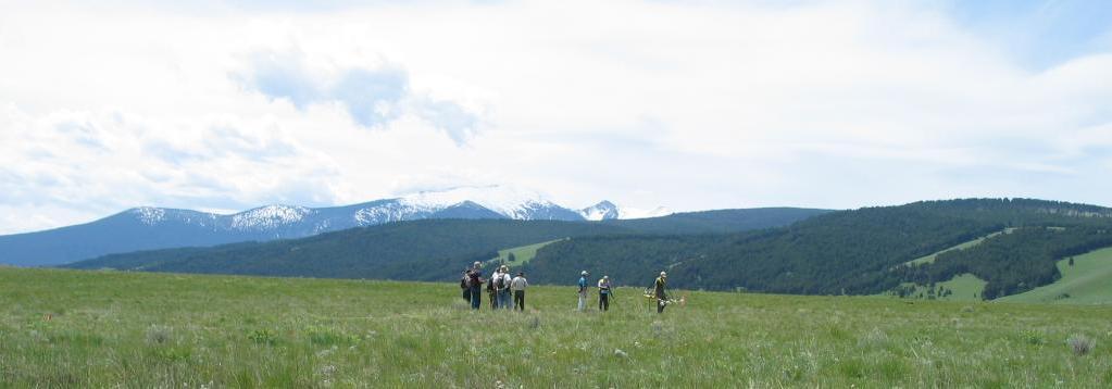
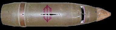
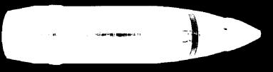
34 Environmental: How do we find UXO??


")
35 Northing (m) Environmental : Magnetic Survey 50 nt Ferrex Easting (m) -200 TM4

36 Eg of dipoles UXO data Slide 36
37 Possible routes to extracting information Plot the data in various map displays Interpret with a dipole Interpret with simple bodies of uniform magnetization Interpret as complex bodies (inversion)
38 Magnetic Charges (or Poles) (GPG d3 & d8) A magnetic charge creates a magnetic field H

39 Magnetic Charges (or Poles) In nature: magnetic poles always appear in pairs with a positive and negative pole yielding a dipole. Magnetic moment Magnetic field of dipole Magnetic field of dipole is identical to field from a loop of current
40 Beyond dipoles real targets When is a buried feature like a simple dipole? When it s diameter is much less than depth to it s centre. GPG Ch.3.d.3. Ch.3.d.4. Ch.3.d.5. Fields from some buried bodies, (cylinders, dykes) can be estimated by using charge concepts. Charge strength = M nˆ Slide 40

41 Magnetics Interpretation 2D modelling Forward modelling Line profiles might indicate 2D structure First identify the feature of interest Analyse data perpendicular to the structure Forward model in 2D Slide 41
42 Interpetation using Forward modelling: Response depends on K and size / shape. Solution is non-unique EOSC Slide 42
43 Possible routes to extracting information Plot the data in various map displays Interpret with a dipole Interpret with simple bodies of uniform magnetization Interpret as complex bodies (inversion)

44 Superposition for Magnetics Data (GPG d5) Magnetic field for one prism Magnetic field for 5 prisms

45 Earth can be complicated A complicated earth model Magnetic data for a complicated earth model. To interpret field data from a complicated earth we need to have formal inversion procedures that recognize non-uniqueness.


46 Example: Raglan aeromagnetic data Select a region of interest. Keep data set size within reason. Digitized the Earth up to 10 6 cells. Slide 46

47 Inversion: Finding an earth model that generated the data? Inversion Divide the earth into many cells of constant but unknown susceptibility Solve the large inverse problem to estimate the value of each cell Slide 47


48 Misfit: comparing predictions to measurements Once a model is estimated Calculate data caused by that model. Compare predictions to these measurements. Is comparison within errors? YES Compare NO Modify model and try again Proceed to check for acceptibility Slide 48

49 Raglan aeromagnetic data Estimate a model for the distribution of subsurface magnetic material. Model will be smooth, and close to pre-defined reference. Display result as cross sections and as isosurfaces.?? Are sills connected at depth? Inversion result supports this idea. It helped justify a 1050m drill hole. 330m of peridotite intersected at 650m 10m were ore grade. Image shows all material which has k > 0.04 SI. Slide 49
50 Summary: Magnetics interpretation 1. Qualitative: Correlate magnetic patterns to geology 2. Quantitative interpretation Determine shapes, volumes, contacts, materials 3. Direct interpretation of patterns 4. Forward modelling 1. Guess geology 2. Calculate result - Compare to data 3. Iterate. 5. Inversion: Given data, estimate possible configurations of susceptible material that could cause those data. Slide 50
51 Homework and Readings Magnetics GPG 3.d.0 3.d.13 Use the Java Applet to investigate the field due to buried GPG 8.c Quiz/Teamwork exercise Wednesday Sept 21 Slide 51
52 What s missing: Estimates of depth of burial for various objects (sphere, cylinder) EOSC Slide 52
What have we learned from the Case Histories
 What have we learned from the Case Histories Earth materials have a range of physical properties. Application of geophysics is carried out in a 7 Step process. Physical property of the target must be different
Magnetic Case Study: Raglan Mine Laura Davis May 24, 2006
 Magnetic Case Study: Raglan Mine Laura Davis May 24, 2006 Research Objectives The objective of this study was to test the tools available in EMIGMA (PetRos Eikon) for their utility in analyzing magnetic
C5 Magnetic exploration methods data analysis techniques
 C5 Magnetic exploration methods data analysis techniques C5.1 Data processing and corrections After magnetic field data have been collected a number of corrections are applied to simplify the interpretation.
Magnetics: Fundamentals and Parameter Extraction
 : Fundamentals and Parameter Extraction Stephen Billings Magnetic module outline fundamentals Sensor systems Data examples and demo Parameter extraction Concepts Real-world examples Classification Using
2c. No incident magnetic field. 2d. Earth's field causes material to become magnetized.
 Magnetic surveys Introduction This large learning resource concentrates on background about using Earth's magnetic field to learn about its subsurface. Practicalities of interpreting maps, profiles, or
EOS 350 MIDTERM OCT 4, 2013 STUDENT NAME: TEAM #:
 EOS 350 MIDTERM OCT 4, 2013 STUDENT NAME: TEAM #: Some equations which may, or may not, be useful: Distance from sensor to a dipole z ~ x ½, Distance to line of dipoles z ~ 0.75x ½ B = μh, M = κh Seismic
Magnetic field nomenclature
 Magnetic field nomenclature Declination trend angle between horizontal projection of F and true North Inclination plunge angle between horizontal and F Magnetic equator location on surface where field
MT Prospecting. Map Resistivity. Determine Formations. Determine Structure. Targeted Drilling
 MT Prospecting Map Resistivity Determine Formations Determine Structure Targeted Drilling Cross-sectional interpretation before and after an MT survey of a mineral exploration prospect containing volcanic
224 D4 Instrumentation and data collection techniques for magnetic exploration
 224 D4 Instrumentation and data collection techniques for magnetic exploration D4.1 Instrumentation D4.1.1 Flux gate magnetometer Details of operation are described in Keary and Brooks Measures the component
Final Review session 2
 Environmental and Exploration Geophysics I Final Review session 2 tom.h.wilson tom.wilson@mail.wvu.edu Department of Geology and Geography West Virginia University Morgantown, WV Reminders Turn in magnetics
Downloaded 01/09/13 to Redistribution subject to SEG license or copyright; see Terms of Use at
 Three-dimensional inversion of SQUID TEM data at Lalor Lake VMS deposit Dikun Yang*, Douglas W. Oldenburg Geophysical Inversion Facility, Earth and Ocean Sciences, University of British Columbia Summary
Geophysics foundations: Seeing underground: Introduction
 Introduction Outline This five page article was written for those involved in the earth sciences who have no background in geophysics. It is intended to explain very briefly how applied geophysics can
Enhancing exploration opportunities at Broken Hill with airborne gravity gradiometry
 Enhancing exploration opportunities at Broken Hill with airborne gravity gradiometry Richard Lane Paper presented at the NSW Department of Mineral Resources Exploration NSW Geoscience information Release
GEOL.3250 Geology for Engineers Plate Tectonics - Geomagnetism, Earthquakes, and Gravity
 Name GEOL.3250 Geology for Engineers Plate Tectonics - Geomagnetism, Earthquakes, and Gravity I. Geomagnetism The earth's magnetic field can be viewed as a simple bar magnet located near the center of
ENVI.2030L - Plate Tectonics - Geomagnetism, Earthquakes, and Gravity
 I. Geomagnetism Name ENVI.2030L - Plate Tectonics - Geomagnetism, Earthquakes, and Gravity The earth's magnetic field can be viewed as a simple bar magnet located near the center of the earth and inclined
SUMMARY METHODOLOGY. 1 + (1 η)(ıωτ) c
(ıωτ) c") On recovering induced polarization information from airborne time domain EM data Seogi Kang, Douglas W. Oldenburg, Dikun Yang, David Marchant, Geophysical Inversion Facility, University of British Columbia
On recovering induced polarization information from airborne time domain EM data Seogi Kang, Douglas W. Oldenburg, Dikun Yang, David Marchant, Geophysical Inversion Facility, University of British Columbia
AP Physics C. Magnetism - Term 4
 AP Physics C Magnetism - Term 4 Interest Packet Term Introduction: AP Physics has been specifically designed to build on physics knowledge previously acquired for a more in depth understanding of the world
Parkin Offset Properties. Sudbury, Ontario
 Parkin Offset Properties Sudbury, Ontario May 11, 2015 CAUTIONARY STATEMENT No regulatory authority has approved or disapproved the information contained in this presentation. This presentation includes
EXTREMELY FAST IP USED TO DELINEATE BURIED LANDFILLS. Norman R. Carlson, Cris Mauldin Mayerle, and Kenneth L. Zonge
 EXTREMELY FAST IP USED TO DELINEATE BURIED LANDFILLS Norman R. Carlson, Cris Mauldin Mayerle, and Kenneth L. Zonge Zonge Engineering and Research Organization, Inc. 3322 East Fort Lowell Road Tucson, Arizona,
CHAPTER FOUR GEOPHYSICAL INTERPRETATION AND DISCUSSION
 CHAPTER FOUR GEOPHYSICAL INTERPRETATION AND DISCUSSION 4.1. DATA PROCESSING AND INTERPRETATION 4.1.1. Introduction Processing of potential field data entails the application of various filters to the data
Magnetic and Gravity Methods for Geothermal Exploration
 Magnetic and Gravity Methods for Geothermal Exploration Dr. Hendra Grandis Geophysics - ITB method and survey procedure Aero- or ground magnetic (covers a large area) Schlumberger resistivity mapping and
Lecture 2. Dipole-Axis-Dependent Coordinate Systems and Near Earth's Magnetic Field
 Lecture 2. Dipole-Axis-Dependent Coordinate Systems and Near Earth's Magnetic Field 2.1. Dipole-Axis-Dependent Coordinate Systems Exercise 2.1. Please read the Appendix 3 in the following textbook Introduction
Department of Geophysics Faculty of Earth Sciences King Abdulaziz University
 Department of Geophysics Faculty of Earth Sciences King Abdulaziz University Dr. Mansour A. Al-Garni Office: room 233/Buld. 27 OR Dept. chair office/buld. 55 Introduction to Geophysics EGP 211 Time: 10-10:55
PRESENTATION TITLE. Drone Magnetic Site Surveys To Verify Wellhead Locations David M. Velozzi 9/27/18
 1 PRESENTATION TITLE Drone Magnetic Site Surveys To Verify Wellhead Locations David M. Velozzi 9/27/18 Speaker Information David M. Velozzi Geoscience Team Lead Magnetic Variation Services (MagVAR) (A
Intro to magnetic methods
 Environmental and Exploration Geophysics I Intro to magnetic methods tom.h.wilson tom.wilson@mail.wvu.edu Department of Geology and Geography West Virginia University Morgantown, WV Items on the list 6.5
Physics 1A. Lecture 1B
 Physics 1A Lecture 1B Angles: a Tricky Unit θ Angles are formally defined as a ratio of lengths; e.g. θ = Arclength/Radius [θ] = L/L = 1 This makes the angle unitless! The fundamental unit of angle is
Student Exploration: Electromagnetic Induction
 Name: Date: Student Exploration: Electromagnetic Induction Vocabulary: current, electric field, electromagnetic induction, magnetic field, magnetic flux, right-hand rule, vector, voltage, wind generator
 http://foundation.aapg.org/students/undergraduate/weeks.cfm Tim Carr - West Virginia University 3 Potential Fields Indirect Visualization Density and Magnetization Gravity and Magnetic Exploration Locate
MAGNETIC MODELING OF THE SUBSURFACE STRUCTURE OF SHIP ROCK, NEW MEXICO
 MAGNETIC MODELING OF THE SUBSURFACE STRUCTURE OF SHIP ROCK, NEW MEXICO ANDISHEH BEIKI University of Toronto Research Advisor: Dr. Charly Bank INTRODUCTION Ship Rock is a prominent volcanic neck of the
Separation of regional and residual magnetic field data
 GEOPHYSICS, VOL. 63, NO. 2 (MARCH-APRIL 1998); P 431-439,13 FIGS. Separation of regional and residual magnetic field data Yaoguo Li* and Douglas W. Oldenburg* ABSTRACT We present a method for separating
Darnley Bay Resources Preliminary Airborne Survey Results
 4 King Street West, Suite 1103 Toronto, Ontario M5H 1B6, Canada Tel:(416) 862-7885 Fax:(416) 862-7889 dbr@darnleybay.com UPDATE Trading Symbol: DBL. TSX Venture Exchange April 19, 2010 Darnley Bay Resources
GE 2400 Test #2 3/26/03. Name
 GE 2400 Test #2 3/26/03 Name 9. Fill in the blank. a. minerals have a negative magnetic susceptibility. b. Ground surveys that use gradiometer magnetometers generally measure the. c. Horizontal derivatives
INTRODUCTION TO APPLIED GEOPHYSICS
 INTRODUCTION TO APPLIED GEOPHYSICS EXPLORING THE SHALL0W SUBSURFACE H. Robert Burger Anne F. Sheehan Craig H.Jones VERSITY OF COLORADO VERSITY OF COLORADO W. W. NORTON & COMPANY NEW YORK LONDON Contents
A New Direction. Copper-Gold Deposit at Thor TSX.V:COL. August 11, May 2013
 A New Direction Copper-Gold Deposit at Thor August 11, 2016 May 2013 TSX.V:COL FORWARD LOOKING STATEMENTS This presentation includes certain forward-looking information or forward-looking statements for
1D and 2D Inversion of the Magnetotelluric Data for Brine Bearing Structures Investigation
 1D and 2D Inversion of the Magnetotelluric Data for Brine Bearing Structures Investigation Behrooz Oskooi *, Isa Mansoori Kermanshahi * * Institute of Geophysics, University of Tehran, Tehran, Iran. boskooi@ut.ac.ir,
Available online Journal of Scientific and Engineering Research, 2016, 3(2):1-7. Research Article
:1-7. Research Article") Available online www.jsaer.com, 2016, 3(2):1-7 Research Article ISSN: 2394-2630 CODEN(USA): JSERBR Assessment of the Reliability of Magnetic Method to Delineate Geologic Features in a Basement Complex:
Available online www.jsaer.com, 2016, 3(2):1-7 Research Article ISSN: 2394-2630 CODEN(USA): JSERBR Assessment of the Reliability of Magnetic Method to Delineate Geologic Features in a Basement Complex:
Saskatchewan s Mineral Resources Lesson: Exploring for Minerals in Saskatchewan: Geophysics Using Magnetics to Find a Mine
 Saskatchewan s Mineral Resources Lesson: Exploring for Minerals in Saskatchewan: Geophysics Using Magnetics to Find a Mine Overview In this activity, students use the magnetic properties of iron nails
KEMESS SOUTH MAGNETIC MODELING. CONDOR CONSULTING, INC. OCTOBER 2017
 KEMESS SOUTH MAGNETIC MODELING. CONDOR CONSULTING, INC. OCTOBER 2017 INTRODUCTION Magnetic data in the vicinity of the Kemess South Mine in the Yukon has been analyzed and modeled in order to try to explain
Titiribi Gold: Sleeping Giant in the Colombian Cordilleras (a Geophysical Study)
") Titiribi Gold: Sleeping Giant in the Colombian Cordilleras (a Geophysical Study) Emmett Van Reed, P.Gp. Zonge Engineering & Research Amit Tripathi, Ph.D. Terra Resources Development Technologies Jennifer
Titiribi Gold: Sleeping Giant in the Colombian Cordilleras (a Geophysical Study) Emmett Van Reed, P.Gp. Zonge Engineering & Research Amit Tripathi, Ph.D. Terra Resources Development Technologies Jennifer
Your web browser (Safari 7) is out of date. For more security, comfort and. the best experience on this site: Update your browser Ignore
 is out of date. For more security, comfort and. the best experience on this site: Update your browser Ignore") Your web browser (Safari 7) is out of date. For more security, comfort and Activitydevelop the best experience on this site: Update your browser Ignore Student Version Magnetic Fields Lab What is a magnetic
Your web browser (Safari 7) is out of date. For more security, comfort and Activitydevelop the best experience on this site: Update your browser Ignore Student Version Magnetic Fields Lab What is a magnetic
CULTURAL EDITING OF HRAM DATA COMPARISON OF TECHNIQUES. Canadian Journal of Exploration Geophysics, no. 1&2, vol. 34, 1998, pp.
 CULTURAL EDITING OF HRAM DATA COMPARISON OF TECHNIQUES H. H. Hassan 1, J. W. Peirce 1, W. C. Pearson 2 and M. J. Pearson 3 Canadian Journal of Exploration Geophysics, no. 1&2, vol. 34, 1998, pp. 16-22
3. Magnetic Methods / 62
 Contents Preface to the Second Edition / xv Excerpts from Preface to the FirstEdition / xvii Mathematical Conventions / xix 1. Introduction / 1 Reference / 5 2. Gravity Methods / 6 2. I. Introduction /
The Self-Compensating Magnetometer (SCM) System Test Results from a Remus 600 AUV Survey in Yellowstone Lake. Matthew Kowalczyk Feb 15, 2017
 System Test Results from a Remus 600 AUV Survey in Yellowstone Lake. Matthew Kowalczyk Feb 15, 2017") The Self-Compensating Magnetometer (SCM) System Test Results from a Remus 600 AUV Survey in Yellowstone Lake Matthew Kowalczyk Feb 15, 2017 Company History OFG was formed in 2007 to develop and deploy
The Self-Compensating Magnetometer (SCM) System Test Results from a Remus 600 AUV Survey in Yellowstone Lake Matthew Kowalczyk Feb 15, 2017 Company History OFG was formed in 2007 to develop and deploy
For personal use only
 16 May 2014 Market Announcements Platform ASX Limited Exchange Centre, 20 Bridge Street Sydney NSW 2000 ASX Code: SEG SEGUE IDENTIFIES THREE NEW GROUND EM CONDUCTORS AT PLUMRIDGE NICKEL PROJECT Segue Resources
Chapter 4 Multipole model of the Earth's magnetic field
 Chapter 4 Multipole model of the Earth's magnetic field 1 Previously A measurement of the geomagnetic field at any given point and time consists of a superposition of fields from different sources: Internal
EOSC 350: Environmental, Geotechnical and Exploration Geophysics I
 EOSC 350: Environmental, Geotechnical and Exploration Geophysics I Geophysics for geoscience students & professionals. Slide 1 Introductions Geologists? Engineers? Other EOS? Other? Professionals? Instructor:
Activity 19 Magnetic Magnitude Changes
 Activity 19 Magnetic Magnitude Changes Teacher s Guide: The THEMIS magnetometer we will be using is a professional-grade instrument capable of revealing many different types of disturbances in Earth s
Use of Geostatistically-constrained Potential Field Inversion and Downhole Drilling to Predict Distribution of Sulphide and Uranium Mineralisation
 Use of Geostatistically-constrained Potential Field Inversion and Downhole Drilling to Predict Distribution of Sulphide and Uranium Mineralisation Matthew Zengerer Talk Outline Introduction Purpose and
Horizontal gradient and band-pass filter of aeromagnetic data image the subsurface structure; Example from Esh El Mellaha Area, Gulf of Suez, Egypt.
 Horizontal gradient and band-pass filter of aeromagnetic data image the subsurface structure; Example from Esh El Mellaha Area, Gulf of Suez, Egypt. Essam Aboud 1, Serguei Goussev 2, Hassan Hassan 2, Suparno
EOSC350 Environmental, Geotechnical and Exploration Geophysics I
 EOSC350 Environmental, Geotechnical and Exploration Geophysics I Geophysics for geoscience students & professionals. Slide 1 Introductions Geologists? Engineers? Other EOS? Other? Professionals? Instructor:
GEOPHYSICAL REPORT THE CAVZ CLAIMS
 GEOPHYSICAL REPORT Magnetometer Survey on THE CAVZ CLAIMS CAVZ M.C.'s 1 to 12, 15 to 26, 29 to 40, 45 to 54 Trail Peak, Omineca M.D. 13 miles northeast of Fort Babine 550 ) 126 S.E. by G.Podolsky J.Russell
Airborne Geophysical Survey Report River Jordan Property
 Airborne Geophysical Survey Report River Jordan Property Prepared for: Inc. September 3, 2009 Precision GeoSurveys Inc. 520-355 Burrard Street, Vancouver, Canada V6C 2G8 www.precisiongeosurveys.com Table
AP Physics C. Electricity - Term 3
 AP Physics C Electricity - Term 3 Interest Packet Term Introduction: AP Physics has been specifically designed to build on physics knowledge previously acquired for a more in depth understanding of the
Towed Streamer EM data from Barents Sea, Norway
 Towed Streamer EM data from Barents Sea, Norway Anwar Bhuiyan*, Eivind Vesterås and Allan McKay, PGS Summary The measured Towed Streamer EM data from a survey in the Barents Sea, undertaken in the Norwegian
Reduction to the Pole of Magnetic Anomalies Using Analytic Signal. A.H. Ansari and K. Alamdar
 World Applied Sciences Journal 7 (4): 405-409, 2009 SSN 1818-4952 DOS Publications, 2009 Reduction to the Pole of Magnetic Anomalies Using Analytic Signal A.H. Ansari K. Alamdar Department of Mining Metallurgical
Main Menu. Douglas Oldenburg University of British Columbia Vancouver, BC, Canada
 Using ERA low frequency E-field profiling and UBC 3D frequency-domain inversion to delineate and discover a mineralized zone in Porcupine district, Ontario, Canada. Vlad Kaminski* University of British
Mine Scale Constrained Geophysical Inversion; A Case Study at the Darlot-Centenary Gold Mine
 Page 1 Mine Scale Constrained Geophysical Inversion; A Case Study at the Darlot-Centenary Gold Mine Sarah Monoury, SRK Consulting, Ben Jupp, SRK Consulting and Andrew Foley, Gold Fields This article was
Lesson 7: The Mean as a Balance Point
 Student Outcomes Students characterize the center of a distribution by its mean in the sense of a balance point. Students understand that the mean is a balance point by calculating the distances of the
Optimizing Geophysical Inversions for Archean Orogenic Gold Settings
 Geophysical Inversion and Modeling Optimizing Geophysical Inversions for Archean Orogenic Gold Settings 1. University of British Columbia Paper 103 Mitchinson, D. E. [1], Phillips, N. D. [1] ABSTRACT Geophysical
Introduction to Vectors
 Introduction to Vectors K. Behrend January 31, 008 Abstract An introduction to vectors in R and R 3. Lines and planes in R 3. Linear dependence. 1 Contents Introduction 3 1 Vectors 4 1.1 Plane vectors...............................
APPENDIX A: Magnetotelluric Data in Relation to San Pedro Mesa Structural. The San Pedro Mesa structural high (discussed in main text of paper) was
 was") Page of DR for GSA Special Paper 9, Chapter, Geophysical constraints APPENDIX A: Magnetotelluric Data in Relation to San Pedro Mesa Structural High The San Pedro Mesa structural high (discussed in main
Page of DR for GSA Special Paper 9, Chapter, Geophysical constraints APPENDIX A: Magnetotelluric Data in Relation to San Pedro Mesa Structural High The San Pedro Mesa structural high (discussed in main
Junior Uranium explorer in the Athabasca Basin. Patterson Claims
 Junior Uranium explorer in the Athabasca Basin Patterson Claims Cautionary Note Regarding Forward-Looking Statements This Presentation and the exhibits attached herein contain forward-looking statements
SEG/San Antonio 2007 Annual Meeting
 Characterization and remoal of errors due to magnetic anomalies in directional drilling Nathan Hancock * and Yaoguo Li Center for Graity, Electrical, and Magnetic studies, Department of Geophysics, Colorado
In such cases, direction may be used for the location of a point by any of the following methods:
 COMPASS SURVEYING Surveying is concerned with the relative location of points on, above or below the surface of the earth. It therefore becomes necessary to start from known points on a line. If the location
ANALYSIS OF LOCALIZED HIGH MAGNETIC SUSCEPTIBILITY ZONES AT JEFFERSON PROVING GROUND, INDIANA
 ANALYSIS OF LOCALIZED HIGH MAGNETIC SUSCEPTIBILITY ZONES AT JEFFERSON PROVING GROUND, INDIANA Ryan E. North*, Eric W. Smith, and Jose L. Llopis U. S. Army Engineer Research and Development Center Geotechnical
Achieving depth resolution with gradient array survey data through transient electromagnetic inversion
 Achieving depth resolution with gradient array survey data through transient electromagnetic inversion Downloaded /1/17 to 128.189.118.. Redistribution subject to SEG license or copyright; see Terms of
The Cerattepe Massive Sulphide Property, Northeastern Turkey
 Integrated Exploration Case Histories Paper 139 Explor97 Master Page Explor97 Contents Previous Paper G O T O Author Index Section Contents The Cerattepe Massive Sulphide Property, Northeastern Turkey
Report. On a 3D Magnetic Inversion. For. Cadillac Ventures Ltd. And. Newcastle Minerals Ltd. Pickle Lake Project. Ontario, Canada
 Report On a 3D Magnetic Inversion For Cadillac Ventures Ltd And Newcastle Minerals Ltd. Pickle Lake Project Ontario, Canada SCOTT HOGG & ASSOCIATES LTD October 2010 TABLE OF CONTENTS 1 INTRODUCTION...
Kiska Metals Corporation Project Updates
 Kiska Metals Corporation Project Updates Minerals North Conference, Mackenzie BC May 28, 2015 Kelly Franz, P.Geo Manager, Lands and Corporate Social Responsibility Cautionary Note This presentation contains
KING EDWARD POINT OBSERVATORY MAGNETIC DATA
 BRITISH GEOLOGICAL SURVEY King Edward d Point Observatory Monthly Magnetic Bulletin September 2018 18/09/KE King Edward Point (UK) Maps British Antarctic Survey KING EDWARD POINT OBSERVATORY MAGNETIC DATA
3D Geometry of the Xade Complex inferred from Gravity and Magnetic Data
 Geophysical Case Histories 3D Geometry of the Xade Complex inferred from Gravity and Magnetic Data 1. British Geological Survey, Edinburgh, United Kingdom Paper 92 Pouliquen, G. [1], Key, R. [1] ABSTRACT
Intro to magnetic methods
 Environmental and Exploration Geophysics I Intro to magnetic methods tom.h.wilson tom.wilson@mail.wvu.edu Department of Geology and Geography West Virginia University Morgantown, WV Items on the list Gravity
CORPORATE UPDATE. Feasibility Study being finalised for completion towards the end of April.
 16 March 2018 Company Announcement Officer ASX Limited 20 Bridge Street SYDNEY NSW 2000 Highlights CORPORATE UPDATE Inaugural Bowdens Reserve Statement due early April. Feasibility Study being finalised
Lecture 4. Things we might want to know about the geomagnetic field. Components of the geomagnetic field. The geomagnetic reference field
 Lecture 4 Things we might want to know about the geomagnetic field Components of the geomagnetic field The geomagnetic reference field All sorts of magnetic poles observables Things we might want to know
West Pender Street Vancouver, BC V6C 2V6 Tel: Fax: TSX-V: GBR NEWS RELEASE
 1020 800 West Pender Street Vancouver, BC V6C 2V6 Tel: 604-646-8354 Fax: 604-646-4526 TSX-V: GBR NEWS RELEASE Great Bear Drills Hinge Zone Extensions - Results Include New 42 m Wide Zone with Multiple
GEOPACIFIC REPORTS HIGH GOLD VALUES IN AUGER SOIL SAMPLES FROM THE QALAU AND TATAIYA PROSPECTS, RAKI RAKI PROJECT,
 20 June 2008 Companies Announcement Office Via Electronic Lodgement GEOPACIFIC REPORTS HIGH GOLD VALUES IN AUGER SOIL SAMPLES FROM THE QALAU AND TATAIYA PROSPECTS, RAKI RAKI PROJECT, Fiji. (Geopacific
KING EDWARD POINT OBSERVATORY MAGNETIC DATA
 BRITISH GEOLOGICAL SURVEY King Edward d Point Observatory Monthly Magnetic Bulletin October 2018 18/10/KE King Edward Point (UK) Maps British Antarctic Survey KING EDWARD POINT OBSERVATORY MAGNETIC DATA
Your work from these three exercises will be due Thursday, March 2 at class time.
 GEO231_week5_2012 GEO231, February 23, 2012 Today s class will consist of three separate parts: 1) Introduction to working with a compass 2) Continued work with spreadsheets 3) Introduction to surfer software
MEMORANDUM. Interpretation of Magnetic and Volterra-3DIP survey MC Claims
 11966 95A Avenue, Delta, BC V4C 3W2 Canada Tel +1 (604) 582-1100 www.sjgeophysics.com MEMORANDUM Date: September 13, 2017 From: To: SUBJECT: E. Trent Pezzot Bonanza Mining Corporation Interpretation of
Copper Reef to Drill Massive Sulphide Targets in Flin Flon
 12 Mitchell Road Tel: (204) 687-3500 Flin Flon, MB, R8A 1N1 CZC.CSE Fax: (204) 687-4762 copperreef.com February 28, 2019. Copper Reef to Drill Massive Sulphide Targets in Flin Flon Copper Reef Mining Corporation
Electronic Geophysical Surveys LirJted, 250 South Fell Avenue, North Burnahy 2, B. C. Telenhone:
 L GEOWG GEOPIIYSICAL SEPORT #IlO of the Gaichon Contact Group of Claims!. 1 mile NNbJ of Max&$ Lake, B.C. 50 North - 120 Vest for 4": "~ II' George Saarse Aup,,. 12 - Aug. 29, 1964 D. L. Hings, P. Eng.
EOSC 110 Reading Week Activity, February Visible Geology: Building structural geology skills by exploring 3D models online
 EOSC 110 Reading Week Activity, February 2015. Visible Geology: Building structural geology skills by exploring 3D models online Geological maps show where rocks of different ages occur on the Earth s
Interval (meters) To (meters)
 To (meters)") 200 Burrard Street, Suite 650 Tel: 604.801.5432 Vancouver, BC V6C 3L6 Fax: 604.662.8829 TSX-V: VG NEWS RELEASE Shallow RC drilling at the WAMA property returns intervals of 4m @ 30.57 g/t Au, 3m @ 19.39
200 Burrard Street, Suite 650 Tel: 604.801.5432 Vancouver, BC V6C 3L6 Fax: 604.662.8829 TSX-V: VG NEWS RELEASE Shallow RC drilling at the WAMA property returns intervals of 4m @ 30.57 g/t Au, 3m @ 19.39
C3: Magnetic anomalies produced by simple geological structures. Remember that objects can acquire both induced and remnant magnetization.
 Geophysics 3 February 009 C3: Magnetic anomalies produced by simple geological structures Remember that objects can acquire both induced and remnant magnetization. Induced magnetization will disappear
STRONG GOLD IN SOIL ANOMALY OUTLINED AT MARY HARRISON PROJECT HIGHLIGHTS
 National Stock Exchange of Australia Company Announcements Level 2, 117 Scott Street Newcastle NSW 2300 25 th January 2013 STRONG GOLD IN SOIL ANOMALY OUTLINED AT MARY HARRISON PROJECT HIGHLIGHTS 100m
For personal use only
 ASX ANNOUNCEMENT 8 June 2016 Aeromagnetic Interpretation Identifies Pinnacles Targets ASX: NXM Capital Structure Shares on Issue 70.4 million Unlisted Options 3.5 million Corporate Directory Mr Paul Boyatzis
Airborne gravity gradiometer surveying of petroleum systems under Lake Tanganyika, Tanzania
 Airborne gravity gradiometer surveying of petroleum systems under Lake Tanganyika, Tanzania D. Roberts Beach Energy P. Roy Chowdhury CGG S. J. Lowe CGG A. N. Christensen CGG Outline Introduction Geology
Hermanus Magnetic Observatory
 Hermanus Magnetic Observatory A facility of the National Research Foundation Magnetic Results 2009 Hermanus, Hartebeesthoek and Keetmanshoop observatories 1. INTRODUCTION The Hermanus Magnetic Observatory
Journal of Applied Science and Agriculture. Euler deconvolution of 3D gravity data interpretation: New approach
 AENSI Journals Journal of Applied Science and Agriculture Journal home page: www.aensiweb.com/jasa/index.html Euler deconvolution of 3D gravity data interpretation: New approach 1 Reza Toushmalani and
9/4/2018. Electric Field Models. Electric Field of a Point Charge. The Electric Field of Multiple Point Charges
 Electric Field Models One thing learned from last chapter was that sources determine the electric field. We can understand the essential physics on the basis of simplified models of the sources of electric
Electric Field Models
 Electric Field Models One thing learned from last chapter was that sources determine the electric field. We can understand the essential physics on the basis of simplified models of the sources of electric
Predictive Modelling of Ag, Au, U, and Hg Ore Deposits in West Texas Carl R. Stockmeyer. December 5, GEO 327G
 Predictive Modelling of Ag, Au, U, and Hg Ore Deposits in West Texas Carl R. Stockmeyer December 5, 2013 - GEO 327G Objectives and Motivations The goal of this project is to use ArcGIS to create models
Multi-source inversion of TEM data: with field applications to Mt. Milligan
 Multi-source inversion of TEM data: with field applications to Mt. Milligan D. Oldenburg, E. Haber, D. Yang Geophysical Inversion Facility, University of British Columbia, Vancouver, BC, Canada Summary
Foundations of Math II Unit 5: Solving Equations
 Foundations of Math II Unit 5: Solving Equations Academics High School Mathematics 5.1 Warm Up Solving Linear Equations Using Graphing, Tables, and Algebraic Properties On the graph below, graph the following
UBC-GIF: Capabilities for EM Modelling and Inversion of LSBB data
 The University of British Colubia Geophysical Inversion Facility slide 1 UBC-GIF: Capabilities for EM Modelling and Inversion of LSBB data Douglas W. Oldenburg Departent of Earth and Ocean Sciences June
704,000 OUNCE MIYABI GOLD PROJECT UPDATE
 704,000 OUNCE MIYABI GOLD PROJECT UPDATE ASX/ RELEASE 21 April 2016 ASX code RVY Board of Directors: Geoff Gilmour Managing Director Greg Cunnold Technical Director Graeme Clatworthy Non-Executive Director
Understanding Positional Astronomy Part 2 Celestial Co-ordinates Difficulty: Intermediate
 Exercise: Understanding Positional Astronomy Part 2 Celestial Co-ordinates Difficulty: Intermediate Objectives In Part 1 you learned about Celestial Sphere and how the stars appear to move across the night
Quantitative Magnetization Vector Inversion
 Quantitative Magnetization Vector Inversion I. N. MacLeod, R. G. Ellis 1. Geosoft Inc., Canada, ian.macleod@geosoft.com 2. Geosoft Inc., Canada, robert.ellis@geosoft.com BIOGRAPHY Ian MacLeod (BSc, Geology,
Strategic Phase 2 Exploration Program Launched at Island Gold High-Grade Resource Potential Identified Laterally and at Depth
 PRESS RELEASE TSX NYSE MKT: RIC Strategic Phase 2 Exploration Program Launched at Island Gold High-Grade Resource Potential Identified Laterally and at Depth Deep Drilling Intersects 18.63 g/t over 6.60
Logistics Report on a BH UTEM 4 Survey in Elliot Lake, Ontario area for International Montoro Resources, Inc.
 Logistics Report on a BH UTEM 4 Survey in Elliot Lake, Ontario area for International Montoro Resources, Inc. Property Elliot Lake Boreholes P-15-22 June 2015 Bruce McMonnies, P.Geo. Christina Demerling,