Quantifying the hazard of catastrophic rock avalanches
|
|
|
- Annabelle Brown
- 5 years ago
- Views:
Transcription

1 IRASMOS Symposium, Davos, Switzerland, May 2008 Quantifying the hazard of catastrophic rock avalanches Acknowledging John J. Clague Ken Hewitt Reginald L. Hermanns Isaac J. Larsen Alexander L. Strom Johannes T. Weidinger Oliver Korup Research Department Avalanches, Debris Flows, and Rock Falls Swiss Federal Research Institutes WSL/SLF, CH 7260 Davos, Switzerland,
2 Rock avalanches 1. Characteristics 2. Size-frequency scaling 3. Implications for hazard assessments
3 Rock avalanches 1. Characteristics 2. Size-frequency scaling 3. Implications for hazard assessments
 Higher content of H 2 0 and clay minerals (hydrothermal alteration) Higher mobility (H/L) Frequently triggered by sector")
4 Characteristics Rock avalanches Extremely rapid (~10 1 m s 1 ) flow of rock particles Volumes m 3 Frequently derived from large rock falls and rockslides Debris avalanches (= volcanic rock avalanches) Higher content of H 2 0 and clay minerals (hydrothermal alteration) Higher mobility (H/L) Frequently triggered by sector collapse
5 Characteristics Rock avalanches Dry runout of m requires very low (Coulomb) friction Rock particles are subject to dynamic fragmentation during motion Abrupt termination of runout process Debris avalanches (volcanic rock avalanches) Frequent transformation into debris flows

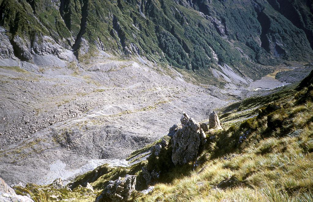
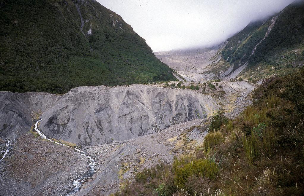
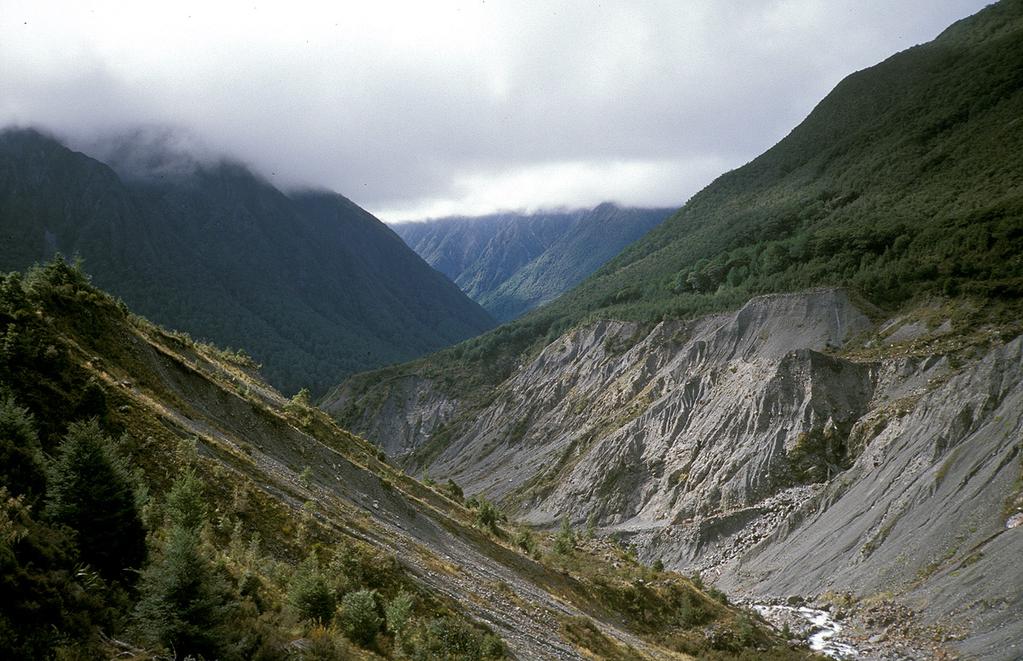
6 Characteristics Swash (run-up) Falling Mountain, New Zealand 1929 V ~5.5 x 10 7 m 3
7 Characteristics Swash height (m) v max = (2gh sw ) 0.5 v max = maximum velocty g = gravitational acceleration h sw = swash height v max = 20 m s -1 Excludes frictional heat heat and and fragmentation energy 10 empirical values of of v max max Volume (10 6 m 3 ) v max = 130 m s -1
8 Characteristics
9 Characteristics
10 Characteristics


")
11 Characteristics Fragmentation (typically very angular clasts) Preservation of lithologic bedding (negligible vertical particle mixing) Furrows, lobes, and levees
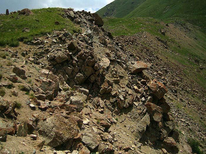
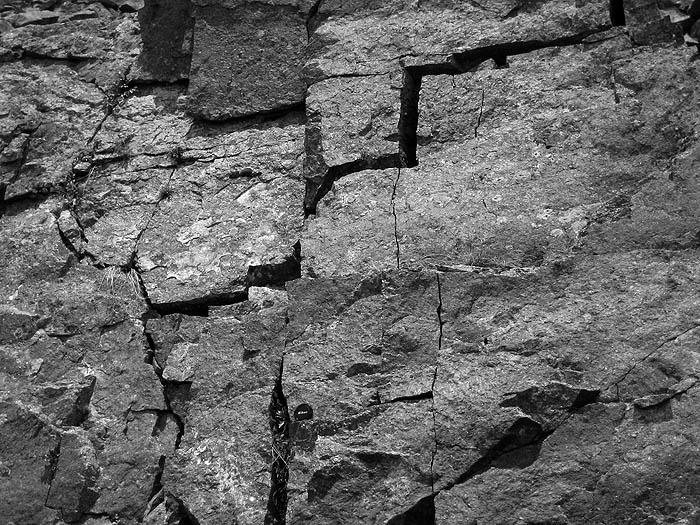
12 Characteristics Jigsaw puzzle texture
13 Causes and triggers Rock avalanches Debris avalanches Causes Triggers Rock-mass discontinuities (fault zones, joints, etc.) Slope oversteepening (e.g. glaciation, fluvial undercutting) Earthquakes Rainfall and snowmelt Anthropogenic (mining, blasting) Rock-mass discontinuities (fault zones, joints, etc.) Hydrothermal activity Slope oversteepening (e.g. expansion of magma chambers) Volcanic eruption Sector collapse Earthquakes
14 Rock avalanches 1. Characteristics 2. Size-frequency scaling 3. Implications for hazard assessments
15 Quantifying hazard Landslide hazard = probability of spatial landslide impact within a specified area per unit time (e.g. annual) Quantitative landslide hazard assessment thus requires a mathematical expression of the relationship between landslide size and frequency Empirical approach using records of landslide occurrence: Size-scaling relationships = statistical models that lump the complexity of spatio-temporal landslide occurrence into very few parameters


16 Quantifying hazard Scaling range of rock avalanches Source: m m 3 >4 orders of magnitude
17 Size-frequency scaling Most studies on size-frequency scaling focus on landslide area Largest landslide inventories contain area (volume) information on n ~10 4 (n ~10 3 ) data points (though few rock avalanches...) Most distributions have power-law interval O(2) to O(3) Landslide area Landslide volume f ( A) f ( V ) = = c c A V A V α α A V Little is known about the scaling properties of large catastrophic landslides (A >1 km 2 ) Distributions fitted to smaller landslides imply inverse power law
18 Size-frequency scaling Most popular distributions Power law Double Pareto Weibull Inverse gamma p( A ; ρ, a, s) = L 1 aγ( ρ) a AL s ρ + 1 exp a AL s A L = Landslide area ρ = 1.40 a = km 2 s = km 2 Source: Malamud et al. (2004)
19 Size-frequency scaling Estimated range of scaling exponents f ( A) = c A A α A Snow avalanches where 2.2 < α A < 2.4 (μ ±1 s.e.) f ( V ) = c V V α V where 1.6 < α V < 1.9 (μ ±1 s.e.)
20 Size-frequency scaling Size range of most landslide inventories
21 Size-frequency scaling m L = 8 m L = 2 m L = 0 Size range of most inventaries
22 Size-frequency scaling Scaling properties of volume (up to m 3 ): Catastrophic rock-slope failures (mainly rock and debris avalanches) >4 orders of magnitude p( V ) = c V V α V
23 Limitations of the method Estimates of scaling exponents depend on Sample size Bin size Regression method (OLS, GM, Max Likelihood) Lithology Landslide type Additional scatter comes from Map projection (alpine topography) Subjective mapping Use of scar, deposit, or total affected areas
 Source: www.linz.")
24 Potential pitfalls Detection of rock avalanches using remote sensing data is limited by Undersampling: dense vegetation cover may mask deposits from rock avalanches Erosional censoring: older rockavalanche deposits may have been largely eroded Depositional censoring: older rockavalanche debris may have been buried by subsequent failures at the same site (reactivation) Source:

 in")
")
25 Kokomeren, Tien Shan ~10 9 m 3 rock-avalanche debris >15 m fluvial terraces topping bedrock bedrock ~10 9 m 3 rock-avalanche debris infilled gorge bedrock Frictionite (= hyalomylonite) in thin section ~600 C for partial melting of biotite Source: Weidinger & Korup (in press) Geomorphology.
26 Rock avalanches 1. Characteristics 2. Size-frequency scaling 3. Implications for hazard assessments
27 Temporal constraints 20 th century landslides, China (Wen et al., 2004) Most landslide inventories lack lack robust temporal constraints high high likelihood of of undersampling large events (especially over over long long timescales) Holocene rock avalanches, NZ Southern Alps (Whitehouse, 1983)

28 Spatial constraints Scaling-derived hazard estimates lump all spatial information and thus do not predict where a rock avalanche of a given size will occur Topography can be used as a first-order predictor of rockavalanche occurrence, although failure often obliterates the geometric initial conditions
29 Topographic constraints A = h V V 1/ β v 1/ β V n = 72;R = / 0.09 slope = 1.05 (n = 272, R 2 = 0.50) = 0.50 Area (10 6 m 2 ) / β V = slope = / (n = 271, 2 R 2 = 0.69) n = 271;R = Volume (10 6 m 3 ) Rock avalanches Debris avalanches

30 Dynamic modelling Modified runout model used for snow avalanches and debris flows yields promising results for rock-ice and rock avalanches (i.e. the IRASMOS spectrum of extremely rapid mass movements) This model additionally considers random kinetic energy and particle collisions Test Test phase: Model sensitivity to to Initial conditions (volume and and pre-failure geometry) Topography in in runout zone Representation of of new new parameters in in deposit surface morphology

 Potential for a cascade of mainly hydrological hazards")
31 Off-site hazards Young River, New Zealand, 2007 Formation of natural dam upstream of rockavalanche dam Natural dams introduce Off-site hazards (inundation, catastrophic dam break and outburst flows) Potential for a cascade of mainly hydrological hazards Helicopter
32 Conclusions The The use use of of scaling properties to to quantify the the hazard of of catastrophic rock rock avalanches promises several prospects and and pitfalls Area-frequency scaling of rock avalanches is well constrained by the power-law tail of an inverse gamma distribution. This trend is valid over >3 orders of magnitude, although exponents (1.2 < α A < 2.0) are lower than those for smaller landslides (2.2 < α A < 2.4). This scaling relationship offers a regional-scale measure of quantifying to first order the hazard from rock avalanches, given that temporal constraints are tight enough.
33 Conclusions Existing numerical models for simulating snow avalanches and debris flows show promising results for simulating rock avalanches. The use of these models appears to be limited more by the choice of appropriate initial conditions than parameter values. Recommendations: Invest more resources to better constrain the initial conditions of large rock avalanches. Consider using a harmonized upscaling approach based on detailed case studies.
Debris flow: categories, characteristics, hazard assessment, mitigation measures. Hariklia D. SKILODIMOU, George D. BATHRELLOS
 Debris flow: categories, characteristics, hazard assessment, mitigation measures Hariklia D. SKILODIMOU, George D. BATHRELLOS Natural hazards: physical phenomena, active in geological time capable of producing
Large Volcanic Debris Avalanches; Characteristics, Distribution, and Hazards
 Lee Siebert discussion: 25 Jan 2007 Large Volcanic Debris Avalanches; Characteristics, Distribution, and Hazards UBC: 1. What are the differences between cohesive and non cohesive debris flows? (Is it
Mass Wasting: The Work of Gravity
 Chapter 15 Lecture Earth: An Introduction to Physical Geology Twelfth Edition Mass Wasting: The Work of Gravity Tarbuck and Lutgens Chapter 15 Mass Wasting The Importance of Mass Wasting Slopes are the
Unsafe Ground: Landslides and Other Mass Movements
 Unsafe Ground: Landslides and Other Mass Movements Mass Movements Downslope motion of earth materials by gravity. Mass movements are a type of natural hazard. Natural feature of the environment. Can cause
Engineering Geology ECIV 3302
 Engineering Geology ECIV 3302 Instructor : Dr. Jehad Hamad 2019-2018 Chapter (5) Weathering & Soil Chapter 5: Weathering, Soil, and Mass Wasting External processes include : (1) Weathering (2) Mass wasting
Rapid Hazard Assessment of Heavy Rainfall Triggered Landslide Dams A Review
 Rapid Hazard Assessment of Heavy Rainfall Triggered Landslide Dams A Review Focus on the developed technologies in Taiwan J. J. Dong Graduate Institute of Applied Geology, National Central University,
Dan Miller + Kelly Burnett, Kelly Christiansen, Sharon Clarke, Lee Benda. GOAL Predict Channel Characteristics in Space and Time
 Broad-Scale Models Dan Miller + Kelly Burnett, Kelly Christiansen, Sharon Clarke, Lee Benda GOAL Predict Channel Characteristics in Space and Time Assess Potential for Fish Use and Productivity Assess
OIKOS > landslide > mechanism >predisposing causes
 predisposing causes and trigger OIKOS > landslide > mechanism >predisposing causes Landslides are events that occur in space and time. As such, it is usually possible to identify both one or more landslide
GSA Data Repository
 GSA Data Repository 2015296 Marc et al. Transient changes of landslide rates after earthquakes SUPPLEMENTARY METHODS 1. Landslide mapping We used pairs of satellite images or aerial photographs to map
Mass Wasting. Requirements for Mass Wasting. Slope Stability. Geol 104: mass wasting
 Mass Wasting Movement of earth materials downslope, driven by Gravitational Forces. Landslides - general term for rock or soil movement. In U.S., on average, mass wasting causes 1 to 2 billion dollars
A probabilistic approach for landslide hazard analysis
 A probabilistic approach for landslide hazard analysis S. Lari, P. Frattimi, G.B. Crosta Engineering Geology 182 (2014) 3-14 報告者 : 符智傑 指導教授 : 李錫堤老師 報告日期 :2016/05/05 Introduction A general framework for
Volcanic Mass Flow Processes and Deposits
 Volcanic Mass Flow Processes and Deposits Smith and Lowe, 1991 Lahars=hyperconcentrated (flood) flow (HFF) and debris flow Note ideal HFF deposit has normal grading, parallel bedding, better sorting Ideal
Geomorphology for Engineers
 Geomorphology for Engineers Edited by P. G. Fookes, E. M. Lee and G. Milligan Whittles Publishing CRC PRESS Contents Foreword Preface Dedication Biographies 1. Introduction to Engineering Geomorphology
Deep-Seated Landslides and Landslide Dams Characteristics Caused by Typhoon Talas at Kii Peninsula, Japan
 Deep-Seated Landslides and Landslide Dams Characteristics Caused by Typhoon Talas at Kii Peninsula, Japan Hefryan Sukma KHARISMALATRI*,1, Hitomi KIKUCHI 1, Yoshiharu ISHIKAWA 1, Takashi GOMI 1, Katsushige
Need of Proper Development in Hilly Urban Areas to Avoid
 Need of Proper Development in Hilly Urban Areas to Avoid Landslide Hazard Dr. Arvind Phukan, P.E. Cosultant/Former Professor of Civil Engineering University of Alaska, Anchorage, USA RI District Governor
Mass Wasting. Revisit: Erosion, Transportation, and Deposition
 Mass Wasting Revisit: Erosion, Transportation, and Deposition While landslides are a normal part of erosion and surface processes, they can be very destructive to life and property! - Mass wasting: downslope
Orting Community College Proposal
 Orting Community College Proposal Cedric, Celina, Francine, Sarah, Samuel GEO CORP Located in Washington, 42 miles south of Seattle. Situated between two rivers on fertile plains. Built on lahar deposits.
A New College in Orting?
 A New College in Orting? Risk Report and Recommendation by: Safe Schools Kause Everyone Deserves (SSKED) 2017 Geographic location and physical site of Orting The city of Orting is located in Pierce county,
1. Erosion by Running Water Most powerful cause of erosion
 I. Destructive Forces Notes: Destructive force: a process in which land is destroyed or changed such as weathering and erosion. All landforms are a result of a combination of constructive and destructive
The Importance of Mass Wasting
 Mass Wasting: The Work of Gravity Earth Chapter 15 Chapter 15 Mass Wasting The Importance of Mass Wasting Slopes are the most common elements in our physical landscape Slopes may appear to be stable, but
mountain rivers fixed channel boundaries (bedrock banks and bed) high transport capacity low storage input output
 high transport capacity low storage input output") mountain rivers fixed channel boundaries (bedrock banks and bed) high transport capacity low storage input output strong interaction between streams & hillslopes Sediment Budgets for Mountain Rivers Little
mountain rivers fixed channel boundaries (bedrock banks and bed) high transport capacity low storage input output strong interaction between streams & hillslopes Sediment Budgets for Mountain Rivers Little
Natural hazards in Glenorchy Summary Report May 2010
 Natural hazards in Glenorchy Summary Report May 2010 Contents Glenorchy s hazardscape Environment setting Flood hazard Earthquakes and seismic hazards Hazards Mass movement Summary Glossary Introduction
Using Weather and Climate Information for Landslide Prevention and Mitigation
 Using Weather and Climate Information for Landslide Prevention and Mitigation Professor Roy C. Sidle Disaster Prevention Research Institute Kyoto University, Japan International Workshop on Climate and
GG101 Lecture 22: Mass Wasting. Soil, debris, sediment, and broken rock is called regolith.
 GG101 Lecture 22: Mass Wasting Mass Wasting is the movement of rock and soil down a slope due to the force of gravity. Soil, debris, sediment, and broken rock is called regolith. Mass wasting creates broad
SENSITIVITY ANALYSIS OF THE RAMMS AVALANCHE DYNAMICS MODEL IN A CANADIAN TRANSITIONAL SNOW CLIMATE
 SENSITIVITY ANALYSIS OF THE RAMMS AVALANCHE DYNAMICS MODEL IN A CANADIAN TRANSITIONAL SNOW CLIMATE Ryan Buhler 1 *, Chris Argue 1, Bruce Jamieson 2, and Alan Jones 1 1 Dynamic Avalanche Consulting Ltd.,
Interfacing with the industry needs euro geotecnica, s.a.
 Interfacing with the industry needs Avda. Corts Catalanes 5-7 2ª planta 08173 Sant Cugat del Vallès. Barcelona. Telèfon: 93 583 04 80 / Fax: 93 583 69 60 Table of contents Introduction Natural hazards
Avalanches. Avalanche s
 Avalanches Avalanche s Avalanches were first imagined as giant snowballs which increased in size from accretion of underlying snow What are avalanches? They are flows which move under the influence of
Down-stream process transition (f (q s ) = 1)
 = 1)") Down-stream process transition (f (q s ) = 1) Detachment Limited S d >> S t Transport Limited Channel Gradient (m/m) 10-1 Stochastic Variation { Detachment Limited Equilibrium Slope S d = k sd A -θ d S
Down-stream process transition (f (q s ) = 1) Detachment Limited S d >> S t Transport Limited Channel Gradient (m/m) 10-1 Stochastic Variation { Detachment Limited Equilibrium Slope S d = k sd A -θ d S
POLITECNICO DI TORINO
 POLITECNICO DI TORINO Whatever is the numerical approach to the study of rock avalanche evolution, obtained results depend on the choice of the value that is assigned to the characteristic parameters of
McGill: What is the nature of fluid flow in the clastic apron surrounding ocean islands, and what are the implications for instability?
 Dave Clague discussion: 1 Feb 2007 Landslides on Ocean Island Volcanoes UBC: What are the advantages/disadvantages of the various geophysical techniques mentioned? What vertical/horizontal resolutions
Riverbank Landslides and the Probability Analysis of Landslide Dams
 International Journal of Structural and Civil Engineering Research Vol. 5, No. 3, August 2016 Riverbank Landslides and the Probability Analysis of Landslide Dams Chien-Yuan Chen and Wei-Ting Lee Dept.
AN APPROACH TO THE CLASSIFICATION OF SLOPE MOVEMENTS
 Training/workshop on Earthquake Vulnerability and Multi-Hazard Risk Assessment: Geospatial Tools for Rehabilitation and Reconstruction Effort 13 31 March 2006, Islamabad, Pakistan AN APPROACH TO THE CLASSIFICATION
Preparing Landslide Inventory Maps using Virtual Globes
 Introduction: A landslide is the movement of a mass of rock, debris, or earth down a slope, under the influence of gravity. Landslides can be caused by different phenomena, including intense or prolonged
Surface Processes on the Earth. Rocks, Weathering, Erosion and Soil
 Surface Processes on the Earth Rocks, Weathering, Erosion and Soil ROCKS AND ROCK CYCLE Rock types Three main types of rock Igneous Metamorphic Sedimentary Igneous Form when magma or lava cools and hardens
EFFECT OF SAND MINING ACTIVITY ON THE SEDIMENT CONTROL SYSTEM (A CASE STUDY OF SOMBE-LEWARA RIVER, DONGGALA, INDONESIA)
") Civil Engineering Forum Volume XXI/1 - January 01 EFFECT OF SAND MINING ACTIVITY ON THE SEDIMENT CONTROL SYSTEM (A CASE STUDY OF SOMBE-LEWARA RIVER, DONGGALA, INDONESIA) Y. A. Bawias Agency of Public Works,
Civil Engineering Forum Volume XXI/1 - January 01 EFFECT OF SAND MINING ACTIVITY ON THE SEDIMENT CONTROL SYSTEM (A CASE STUDY OF SOMBE-LEWARA RIVER, DONGGALA, INDONESIA) Y. A. Bawias Agency of Public Works,
J. Paul Guyer, P.E., R.A.
 J. Paul Guyer, P.E., R.A. Paul Guyer is a registered mechanical engineer, civil engineer, fire protection engineer and architect with over 35 years experience in the design of buildings and related infrastructure.
Calc-alkaline Volcanic Rocks. Calc-alkali Volcanics. Fabric. Petrography. Compositional Classification. Petrography. Processes.
 Calc-alkaline Volcanic Rocks Calc-alkali Volcanics Winter Chapters 16 & 17 Petrography Processes Field relations Volcanic arcs Petrogenesis Petrography Fabric Classification Alteration Fabric Aphanitic
Volcanoes. volcanic hazards. Image courtesy of USGS.
 Volcanoes volcanic hazards Volcanic hazards Pyroclastic flows and surges Pyroclastic flows and surges PYROCLAST: all solid fragments ejected from volcanoes PYROCLASTIC FLOW: A flow of hot gas and volcanic
The Cascading Hazards from Cascadia s Earthquakes
 Tsunamis The Cascading Hazards from Cascadia s Earthquakes Earthquakes (Nisqually earthquake, Seattle, WA) Volcanoes (Mt St Helens eruption, WA) Joan Gomberg gomberg@usgs.gov Landslides (Oso landslide,
Introduction: What is Mass Wasting? (1)
") Mass Wasting Introduction: What is Mass Wasting? (1) Mass wasting is the downslope movement of regolith and masses of rock under the pull of gravity. Mass wasting is a basic part of the rock cycle. Weathering,
Mass Wasting Introduction: What is Mass Wasting? (1) Mass wasting is the downslope movement of regolith and masses of rock under the pull of gravity. Mass wasting is a basic part of the rock cycle. Weathering,
STREAM SYSTEMS and FLOODS
 STREAM SYSTEMS and FLOODS The Hydrologic Cycle Precipitation Evaporation Infiltration Runoff Transpiration Earth s Water and the Hydrologic Cycle The Hydrologic Cycle The Hydrologic Cycle Oceans not filling
Precipitation Evaporation Infiltration Earth s Water and the Hydrologic Cycle. Runoff Transpiration
 STREAM SYSTEMS and FLOODS The Hydrologic Cycle Precipitation Evaporation Infiltration Earth s Water and the Hydrologic Cycle Runoff Transpiration The Hydrologic Cycle The Hydrologic Cycle Oceans not filling
MULTI-HAZARD RISK ASSESSMENT AND DECISION MAKING
 MULTI-HAZARD RISK ASSESSMENT AND DECISION MAKING JULINDA KEÇI Epoka University Logo of the institution CONTENT: Introduction Multi Hazard Risks Multi-Hazard Risk Assessment Quantitative Assessment Event
Validation of Spatial Prediction Models for Landslide Hazard Mapping. Presenter: Huang Chih-Chieh
 Validation of Spatial Prediction Models for Landslide Hazard Mapping Presenter: Huang Chih-Chieh Reference Chung, C. J. F. and Fabbri, A. G.: 2003, Validation of spatial prediction models for landslide
Sylvain Charbonnier. PASI Workshop About 60% of Indonesians live around 16 active volcanoes on the island of Java
 Numerical modelling of pyroclastic flows: a case study from the recent activity of Merapi Volcano, Central Java, Indonesia Sylvain Charbonnier PASI Workshop 2011 Case study: Merapi Volcano! About 60% of
Rapid Geomorphic Assessments: RGA s
 Establishing Current Reference Conditions Rates and concentrations of suspended-sediment transport vary over time and space due to factors such as precipitation characteristics and discharge, geology,
Mass Wasting. Mass Wasting. Earth s s External Processes
 1 Mass Wasting Presentation Modified from Instructor Resource Center on CD-ROM, Foundations of Earth Science, 4 th Edition, Lutgens & Tarbuck Mass Wasting 2 Down-slope movement of rock, loose material
Max-stable processes and annual maximum snow depth
 Max-stable processes and annual maximum snow depth Juliette Blanchet blanchet@slf.ch 6th International Conference on Extreme Value Analysis June 23-26, 2009 Outline Motivation Max-stable process - Schlather
Introduction to Soil Mechanics
 AMRC 2011 MODULE 1 Introduction to Soil Mechanics CONTENTS Overview... 1-1 Objectives... 1-1 Procedures... 1-1 1.1 Introduction... 1-3 1.2 Erosion... 1-5 1.3 Importance of Identification of Soil Problems...
Downloaded from Downloaded from
 IV SEMESTER BACK-PAPER EXAMINATION-2004 Q. [1] [a] Describe internal structure of the earth with a neat sketch. Write down the major land forms and their characteristics on the earth surface. [8] [b] What
Rapid Mass Movement Simulation RAMMS
 R Rapid Mass Movement Simulation RAMMS Yves Bühler, Marc Christen, Perry Bartelt, SLF Christoph Graf & Brian McArdell, WSL WSL Institute for Snow and Avalanche Research SLF Switzerland: long tradition
MASS MOVEMENTS, WIND, AND GLACIERS
 Date Period Name MASS MOVEMENTS, WIND, AND GLACIERS SECTION.1 Mass Movements In your textbook, read about mass movements. Use each of the terms below just once to complete the passage. avalanche creep
Weathering, Mass Wasting and Karst
 Weathering, Mass Wasting and Karst Capable of wearing down anything that the internal processes can build. Gravity, water, wind and ice Denudation - the overall effect of disintegration, wearing away and
SLOPE PROCESSES, LANDSLIDES, AND SUBSIDENCE
 CHAPTER 9 SLOPE PROCESSES, LANDSLIDES, AND SUBSIDENCE La Conchita slide January 10, 2005 Triggered by heavy rainfall, reactivation along an older landslide surface (35,000 years ago, 6000 years ago, and
Rapid Mass Movements System RAMMS
 Rapid Mass Movements System RAMMS Yves Bühler, Marc Christen, Perry Bartelt, Christoph Graf, Werner Gerber, Brian McArdell Swiss Federal Institute for Forest, Snow and Landscape Research WSL WSL Institute
Geog 1000 Lecture 17: Chapter 10
 Geog 1000 Lecture 17: Chapter 10 Landslides and Mass Movements Link to lectures: http://scholar.ulethbridge.ca/chasmer/classes/ Today s Lecture 1. Assignment 2 Due Pick up Assignment 1 if you don t have
UGRC 144 Science and Technology in Our Lives/Geohazards
 UGRC 144 Science and Technology in Our Lives/Geohazards Session 6 Volcanic Hazards Lecturer: Dr. Patrick Asamoah Sakyi Department of Earth Science, UG Contact Information: pasakyi@ug.edu.gh College of
EAS 116 Earthquakes and Volcanoes
 EAS 116 Earthquakes and Volcanoes J. Haase Forecasting Volcanic Eruptions Assessment of Volcanic Hazard Is that volcano active? Mount Lassen: 12000 BP and 1915 Santorini, IT: 180,000 BP, 70,000 BP, 21000
Earth Science, 10e. Edward J. Tarbuck & Frederick K. Lutgens
 Earth Science, 10e Edward J. Tarbuck & Frederick K. Lutgens Weathering, Soil, and Mass Wasting Chapter 3 Earth Science, 10e Stan Hatfield and Ken Pinzke Southwestern Illinois College Earth's external processes
Unsafe Ground: Landslides and Other Mass Movements. Chapter 11. Selected landslides (causes & number of deaths) Weathering, Erosion & Mass Wasting
 Weathering, Erosion & Mass Wasting") Weathering, Erosion & Mass Wasting Chapter 11 Weathering produces all the soils, clays, sediments, and dissolved substances. Mass Wasting Erosion is the removal of sediments by natural processes e.g. wind,
Weathering, Erosion & Mass Wasting Chapter 11 Weathering produces all the soils, clays, sediments, and dissolved substances. Mass Wasting Erosion is the removal of sediments by natural processes e.g. wind,
GIS as a tool in flood management
 GIS for the United Nations and the International Community Conference Panel: GIS and Capacity - How Territorial Planning Benefits from Geospatial Information 3-5 April 2012 Geneva, Switzerland GIS as a
Mass Movements. This page last updated on 29-Oct-2015
 Page 1 of 12 EENS 1110 Tulane University Physical Geology Prof. Stephen A. Nelson Mass Movements This page last updated on 29-Oct-2015 Mass movements (also called mass-wasting) is the down-slope movement
Electrical imaging techniques for hydrological and risk assessment studies
 Séminaire IPG le 9 mars 2006 Strasbourg Institute of Geophysics ETH Hoenggerberg CH-8093 Zurich Electrical imaging techniques for hydrological and risk assessment studies Laurent Marescot laurent@aug.ig.erdw.ethz.ch
Intro to Geomorphology Key Concepts
 Intro to Geomorphology Key Concepts Geomorphology Literally means the study of earth landforms - Geo = Earth - Morph=Form - Logos= Study of Involves understanding of - Mineralogy - Structure - Tectonics
Statistical Seismic Landslide Hazard Analysis: an Example from Taiwan
 Statistical Seismic Landslide Hazard Analysis: an Example from Taiwan Chyi-Tyi Lee Graduate Institute of Applied Geology, National Central University, Taiwan Seismology Forum 27: Natural Hazards and Surface
Mass Movements, Wind, and Glaciers
 Mass Movements,, and Glaciers SECTION 8.1 Mass Movement at Earth s Surface In your textbook, read about mass movement. Use each of the terms below just once to complete the passage. avalanche creep landslide
SEDIMENTS can have different sizes and we can sort them using standard sieves. What size mesh is each sieve?
 SEDIMENTS can have different sizes and we can sort them using standard sieves What size mesh is each sieve? Streams are the most obvious sculptors of the earth, weathering and eroding the Earth and causing
Biosphere. All living things, plants, animals, (even you!) are part of the zone of the earth called the biosphere.
 are part of the zone of the earth called the biosphere.") Unit 1 Study Guide Earth s Spheres Biosphere All living things, plants, animals, (even you!) are part of the zone of the earth called the biosphere. Hydrosphere Water covers ¾ of the earth, made up mostly
Unit 1 Study Guide Earth s Spheres Biosphere All living things, plants, animals, (even you!) are part of the zone of the earth called the biosphere. Hydrosphere Water covers ¾ of the earth, made up mostly
Response on Interactive comment by Anonymous Referee #1
 Response on Interactive comment by Anonymous Referee #1 Sajid Ali First, we would like to thank you for evaluation and highlighting the deficiencies in the manuscript. It is indeed valuable addition and
OBSERVING AND MAPPING THE ROCK STREAMS AND QUARRIES IN SOME MASSIFS FROM THE ROMANIAN CARPATHIANS BY MEANS OF SATELLITE IMAGES
 VASILE LOGHIN 371 OBSERVING AND MAPPING THE ROCK STREAMS AND QUARRIES IN SOME MASSIFS FROM THE ROMANIAN CARPATHIANS BY MEANS OF SATELLITE IMAGES Key words: rock streams, quarries, satellite images, Carpathians
Prepared By: John Blair Sean Donahue Celeste Hoffman Kimberly Klinkers Megan Slater
 Prepared By: John Blair Sean Donahue Celeste Hoffman Kimberly Klinkers Megan Slater Green River Basin Location Green River Basin Stratigraphic Correlation Chart showing Study Map Units Sample of Existing
Ch. 8: Mass Movements, Wind and Glaciers
 Ch. 8: Mass Movements, Wind and Glaciers Every day the landscape around us undergoes changes. Changes that are powered by gravity alone are called mass movement or mass wasting. Mass movement includes
Chapter 11 10/30/2013. Mass Wasting. Introduction. Factors That Influence Mass Wasting. Introduction. Factors That Influence Mass Wasting
 Introduction Chapter 11 Mass wasting - The downslope movement of material resulting from the force of gravity. Mass Wasting Mass wasting results when the force of gravity acting on a slope exceeds the
Monte Rosa east face and Belvedere Glacier:
 Monte Rosa east face and Belvedere Glacier: Glacier surge, glacier lake, slope instabilities and related emergencies Christian Huggel, Luzia Fischer Glaciers in an Environmental Context: Case Studies C.
Interpretive Map Series 24
 Oregon Department of Geology and Mineral Industries Interpretive Map Series 24 Geologic Hazards, and Hazard Maps, and Future Damage Estimates for Six Counties in the Mid/Southern Willamette Valley Including
The sketch map of field investigations in Wenchuan earthquake hit region, Chengdu City.
 The sketch map of field investigations in Wenchuan earthquake hit region, Chengdu City. 1 Environmental and Geological Condition 1.1 Geomorphology BaiSha River Basin is located in Dujiangyan County, and
3/22/2014. Earth s subsystems or cycles. Outline for next couple weeks. Weathering (breakdown of rock) Erosion
 Erosion") and Erosion Earth s subsystems or cycles Outline for next couple weeks 1. and Erosion 2. Surface water systems (rivers) 3. Groundwater systems 4. Groundwater in-class activity (grade) (breakdown of rock)
and Erosion Earth s subsystems or cycles Outline for next couple weeks 1. and Erosion 2. Surface water systems (rivers) 3. Groundwater systems 4. Groundwater in-class activity (grade) (breakdown of rock)
Numerical Study of Relationship Between Landslide Geometry and Run-out Distance of Landslide Mass
 Numerical Study of Relationship Between Landslide Geometry and Run-out Distance of Landslide Mass Muneyoshi Numada Research Associate, Institute of Industrial Science, The University of Tokyo, Japan Kazuo
3.12 Geology and Topography Affected Environment
 3 Affected Environment and Environmental Consequences 3.12 Geology and Topography 3.12.1 Affected Environment 3.12.1.1 Earthquakes Sterling Highway MP 45 60 Project Draft SEIS The Kenai Peninsula is predisposed
Fukien Secondary School Monthly Vocabulary/Expression List for EMI Subjects Secondary Two. Subject: Geography
 Focus: General Specific : Section Two : Unit One 1 Landslide 2 Downslope movement 3 Rock 4 Soil 5 Gravity 6 Natural hazard 7 Rainwater 8 Friction 9 Hilly relief 10 Unstable 11 Season 12 Saturated 13 Construction
Preliminaries to Erosion: Weathering and Mass Wasting
 Preliminaries to Erosion: Weathering & Mass Wasting All things deteriorate in time. Virgil 1 Preliminaries to Erosion: Weathering and Mass Wasting Denudation The Impact of Weathering and Mass Wasting on
Examining the Terrestrial Planets (Chapter 20)
") GEOLOGY 306 Laboratory Instructor: TERRY J. BOROUGHS NAME: Examining the Terrestrial Planets (Chapter 20) For this assignment you will require: a calculator, colored pencils, a metric ruler, and your geology
GEOLOGY 306 Laboratory Instructor: TERRY J. BOROUGHS NAME: Examining the Terrestrial Planets (Chapter 20) For this assignment you will require: a calculator, colored pencils, a metric ruler, and your geology
Swiss Avalanche-Dynamics Procedures for Dense Flow Avalanches
 Swiss Avalanche-Dynamics Procedures for Dense Flow Avalanches H. Gubler 1 Swiss Avalanche-Dynamics Procedures for Dense Flow Avalanches H.Gubler AlpuG Richtstattweg2 CH-7270 Davos Platz, Switzerland Introduction
WET EXPLOSIVE ERUPTIONS. Hawaii Photograph: Dorian Weisel
 WET EXPLOSIVE ERUPTIONS Hawaii Photograph: Dorian Weisel WET EXPLOSIVE ERUPTIONS mechanisms hot magma/ hot rock + water pyroclasts + steam rapid expansion of gas fragmentation of magma + wall rock external
SUMMARY OF ACTIVITIES CARRIED OUT OFFSHORE SCIARA DEL FUOCO IN THE FRAMEWORK OF THE GNV PROJECT #15
 SUMMARY OF ACTIVITIES CARRIED OUT OFFSHORE SCIARA DEL FUOCO IN THE FRAMEWORK OF THE GNV PROJECT #15 Immediately after the tsunami event which occurred on December 30, researchers involved in the GNV Project
GEO The Åknes rock slope. Content. Dr. Vidar Kveldsvik NGI
 GEO 4180 The Åknes rock slope Dr. Vidar Kveldsvik NGI Content Background on large rock slides Triggers Stability analysis Risk mitigation (risk reduction) The Åknes rock slope 1 Background Landslides due
water erosion lithosphere Describe the process of erosion and deposition. chemical weathering Dissolving limestone is an example of.
 At one time, there was one large island off the coast of Mississippi and now it is two separate islands. What caused the island to be split into two? water erosion The crust and the top part of the upper
Debris Avalanches. Debris avalanche deposits on a volcano in Chile. All of the area in the foreground is buried by a thick debris avalanche.
 Debris Avalanches Volcanoes are not very stable structures. From time to time, they collapse producing large rock and ash avalanches that travel at high speeds down valleys. Collapse maybe caused by an
Controls on fluvial evacuation of sediment from earthquake-triggered landslides
 GSA DATA REPOSITORY 2015048 Controls on fluvial evacuation of sediment from earthquake-triggered landslides Jin Wang 1,2,3, Zhangdong Jin 1,4 *, Robert G. Hilton 2, Fei Zhang 1, Alexander L. Densmore 2,5,
Mass Movement and Surface Karst
 LAB #1 Mass Movement and Surface Karst Recommended Textbook Reading Prior to Lab: Chapter 15, Weathering and Mass Movement 15.2 Dissolving Rock: Karst 15.3 Unstable Ground: Mass Movement Goals: After completing
Section 5.1 Weathering This section describes different types of weathering in rocks.
 Section 5.1 Weathering This section describes different types of weathering in rocks. Reading Strategy Building Vocabulary As you read the section, define each vocabulary term. For more information on
Name. 4. The diagram below shows a soil profile formed in an area of granite bedrock. Four different soil horizons, A, B, C, and D, are shown.
 Name 1. In the cross section of the hill shown below, which rock units are probably most resistant to weathering? 4. The diagram below shows a soil profile formed in an area of granite bedrock. Four different
EARTH S SURFACE MOVEMENTS - introduction. Josef Stemberk, Institute of Rock Structure nad Mechanics CAS
 EARTH S SURFACE MOVEMENTS - introduction Josef Stemberk, Institute of Rock Structure nad Mechanics CAS Why is necessary to study dynamic (engineering) geology? There are known catastrophic events from
SUPPLEMENTARY INFORMATION
 In the format provided by the authors and unedited. DOI: 10.1038/NGEO3005 Rapid post-seismic landslide evacuation boosted by dynamic river width Thomas Croissant 1,*, Dimitri Lague 1, Philippe Steer 1
MEMORANDUM. REVISED Options for Landslide Regulations: Setbacks and Slope Height
 Snohomish County Council Office MS #609 3000 Rockefeller Avenue Everett, WA 98201 (425) 388-3494 MEMORANDUM DATE: May 2, 2014 TO: FROM: RE: Councilmembers Will Hall, Council Staff REVISED Options for Landslide
The Afternoon Creek rockslide near Newhalem, Washington
 Landslides (2006) 3: 175 179 DOI: 10.1007/s10346-005-0030-z Received: 17 September 2005 Accepted: 30 November 2005 Published online: 10 January 2006 Springer-Verlag 2005 A. Strouth R. L. Burk E. Eberhardt
Mountain Rivers. Gutta cavat lapidem. (Dripping water hollows out a stone) -Ovid, Epistulae Ex Ponto, Book 3, no. 10, 1. 5
 -Ovid, Epistulae Ex Ponto, Book 3, no. 10, 1. 5") Mountain Rivers Gutta cavat lapidem (Dripping water hollows out a stone) -Ovid, Epistulae Ex Ponto, Book 3, no. 10, 1. 5 Mountain Rivers Fixed channel boundaries (bedrock banks and bed) High transport
Mountain Rivers Gutta cavat lapidem (Dripping water hollows out a stone) -Ovid, Epistulae Ex Ponto, Book 3, no. 10, 1. 5 Mountain Rivers Fixed channel boundaries (bedrock banks and bed) High transport
Page 1. Name:
 Name: 1) Which property would best distinguish sediment deposited by a river from sediment deposited by a glacier? thickness of sediment layers age of fossils found in the sediment mineral composition
Pinyol, Jordi González, Marta Oller, Pere Corominas, Jordi Martínez, Pere
 Rockfall hazard mapping methodology applied to the Geological Hazard Prevention Map in Catalonia 1:25000 Pinyol, Jordi González, Marta Oller, Pere Corominas, Jordi Martínez, Pere ROCKFALL HAZARD MAPPING
Section 3. Slopes and Landscapes. What Do You See? Think About It. Investigate. Learning Outcomes
 Chapter 4 Surface Processes Section 3 Slopes and Landscapes What Do You See? Learning Outcomes In this section, you will Calculate the angle of repose for different kinds of soils and other granular materials.