APPLICATION OF GIS DATA MODELLING FOR STONE AGGREGATE POTENTIAL IN DALMATIA
|
|
|
- Alisha Reeves
- 5 years ago
- Views:
Transcription
1 APPLICATION OF GIS DATA MODELLING FOR STONE AGGREGATE POTENTIAL IN DALMATIA Željko Dedić (1) Ozren Hasan (1) Slobodan Miko (1) Boris Lukšić (1) Erli Kovačević (1) (1) Croatian Geological Survey; Sachsova 2, Zagreb 10000, Croatia 7th International Scientific Conference on Modern Management of Mine Producing, Geology and Environmental Protection - SGEM 2007
2 Scope GIS based modelling for stone aggregate potential Geology of Croatia Mineral resources of Croatia and Dalmatia Extraction sites in Dalmatia and aggregate production (study area) Method: Weights of evidence (WofE) Results: areas suitable for aggregate stone quarries in Dalmatia Future prospects of mineral aggregate extraction and land use conflicts


3 Geography Area: 58,540 sq km Population 4.8 million
4 Geology of Croatia >50% carbonate rock (limestone and dolomite mainly of the Mesozoic Adriatic Carbonate Platform) 40 % thick unconsolidated Quarternary sedimentary deposits <5% eruptive and metamorphic rocks A D R I A T I C S E A Boundary between Carbonate and Non-carbonate terrains

5 Mineral resources of Croatia Mineral commodity: crushed stone aggregate; 253 sites dimension stone aggregate; 103 sites sand and gravel; 82 sites clay; 49 sites bauxite ; 15 sites gypsum; 9 sites other non metal deposits coal in the past 626 TOTAL NUMBER OF EXPLOATION SITES IN CROATIA (378 km²)

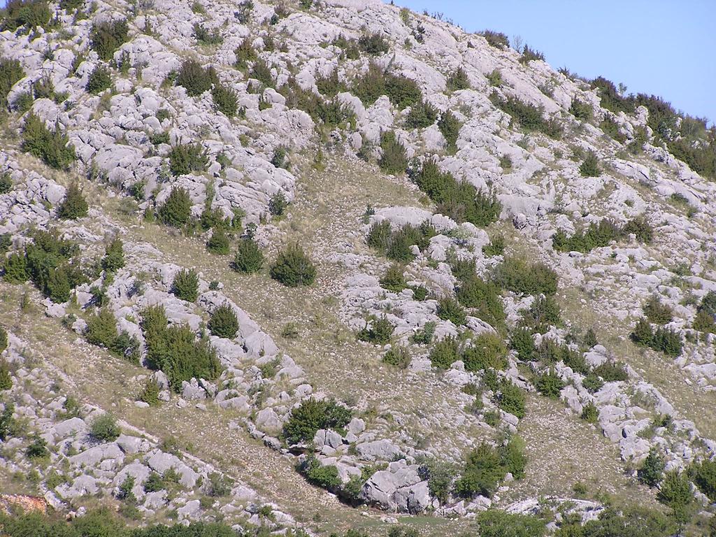
6 Quarrying in Dalmatia 68 active crushed stone aggregate quarries or 25 % in Dalmatia 82 active dimension stone aggregate quarries or 80 % in Dalmatia

7 Quarrying in Dalmatia exploitative reserves of dimension stone aggregate 13.5 mill. m³ in the study area exploitative reserves of crushed stone aggregate 350 mill. m³ in Croatia ( 25% in Dalmatia) increasing demand for aggregate in EU, as well in Croatia dimension stone aggregate crushed stone aggregate


8 Quarrying in Dalmatia Traces of old Roman quarries can be found along the coast, together with ruins of public buildings, basilicas and temples. Today export destinations include Italy, Germany, Austria, Belgium, the Netherlands, Slovenia, Bosnia - Herzegovina, Czech Republic, UK, South Korea and Australia. Limestones exclusive to the Dalmatia include Veselje, Adria Grigio, San Giorgio, Rasotica, Dracevica and Zecevo.
9 Weights of evidence (WofE) quantitative method for mineral-potential mapping by Bonham-Carter, Agterberg, and Wright (1988) response variable (training points) predictor variable (evidential theme) analyze spatial associations between variable reclassification the evidence categories define optimal prediction three evidential theme layers were used: bedrock maps with appropriate quality attributes proximity to principal highways and road lines categorical groups define by census tract population density all evidential theme layers were prepared in grid format using Arcview 9.1. and ArcSDM extension
10 Weights of evidence (WofE) predictive evidence population density (people per square km)
11 Weights of evidence (WofE) predictive evidence transportaion network distance from transportation corridors within 2 and 4 km 90% crushed stone aggregate quarries are within 2 km of principal roads the importance of proximity to transportation roads for the industry

12 Weights of evidence (WofE) bedrock lithology predictive evidence compilation of 1: scale basic geological maps of Republic of Croatia 20 maps sheets in digital format potential maps for stone aggregate in the study area
13 Results Method demonstrates a technique to define suitable areas for aggregate production using geological map, transportation network and population density spatial data for evidence


14 Future prospects To rise awareness to various mining problems and impacts on karst and to help manage better the use of mineral resources in Dalmatia based on identification of more suitable areas for stone production taking in account both environmental and marketplace restrictions and to help local environmental policy makers to correctly manage the fragile karst environment and to preserve the natural landscape.


15 Future prospects: Mineral resource potential and land use restrictions Case study: Šibensko-kninska county - Dalmatia geological potential for mineral resources
16 Future prospects: Mineral resource potential and land use restrictions Šibensko-kninska county - Dalmatia-adminstrative restrictions in context of mineral exploitation (central and local goverment agencies) road infrastructure protected areas valuable land 1 km distance from the coast tourist resorts settlements
17 Future prospects: Restricted mineral potential and spatial planning Šibensko-kninska county - Dalmatia road infrastructure protected areas valuable land 1 km distance from the coast tourist resorts settlements (500 m distance buffer) visual impacts on the landscape (viewshed) Future goals are to: Apply GIS-WofE modeling to determine most favorable areas for quarring in terms of geology, environmental protection and county master planning and derive a model procedure applicible to spatial planners for the whole territory of Croatia

18 Thank you!
Access to MRM deposits in European countries and associated territories. Case Study: Aggregates plans and their future:
 WP6 Foresight study Access to MRM deposits in European countries and associated territories Case Study: Aggregates plans and their future: a view from South East Europe (SEE) countries Minerals4EU Final
5.11 MINERAL RESOURCES
 5.11 This section of the Draft PEIR evaluates the potential impacts to mineral resources in the Plan Area from implementation of the Clovis General Plan and Development Code Update (proposed project).
EuroGeoSurveys An Introduction
 EGS -ASGMI Workshop, Madrid, 2015 EuroGeoSurveys An Introduction 40 Years Listening to the Beat of the Earth Click to edit Master title Albania style EuroGeoSurveys Austria Lithuania Luxembourg Belgium
5. Environmental Analysis
 5.9 MINERAL RESOURCES 5.9.1 Methodology The California Geological Survey Mineral Resources Project provides information about California s nonfuel mineral resources. The primary focus of the Mineral Resources
Mineral Formation & Mining
 Words Worth Knowing Pluton Pegmatite Limestone Ore Mining Mineral Formation & Mining Take notes using pages 11 and 13 in your ISN all RED words must be in notes 1 How do minerals form? Magma Plutons Magma
Module 10: Resources and Virginia Geology Topic 4 Content: Virginia Geology Notes
 Virginia is composed of a very diverse landscape that extends from the beaches and barrier islands all of the way to the highly elevated Appalachian Plateau. Geologists have discovered ancient shallow
The Favorability of Florida s Geology to Sinkhole Formation
 Florida Geological Survey The Favorability of Florida s Geology to Sinkhole Formation Clint Kromhout Alan Baker October 24, 2017 Subsidence Report Database Map of Subsidence Incident Reports taken from
New Discoveries Using Spatial Analysis in GIS
 New Discoveries Using Spatial Analysis in GIS Exploration in the Digital Age Acknowledging:, Auzex Resources, Aurora Minerals, HPD New Zealand, Garry Raines and Graeme Bonham-Carter Talking About Passion!!
5. Environmental Analysis
 5.11 This section of the Draft Environmental Impact Report (DEIR) evaluated potential impacts to mineral resources from implementation of the General Plan. 5.11.1 Environmental Setting Minerals are defined
2 Aggregates in Indiana
 2 Aggregates in Indiana Origin of Aggregates Gravel and Natural Sands Crushed Stone Slag Distribution of Aggregates Glacial Deposits Bedrock Deposits Aggregate Types Natural Aggregates Artificial Aggregates
Land Use in the context of sustainable, smart and inclusive growth
 Land Use in the context of sustainable, smart and inclusive growth François Salgé Ministry of sustainable development France facilitator EUROGI vice president AFIGéO board member 1 Introduction e-content+
5. Environmental Analysis
 5.9 MINERAL RESOURCES This section of the EIR evaluates the potential for implementation of the City of San Bernardino General Plan Update, and the Arrowhead Springs Specific Plan to impact mineral resources
Spatial Data Modelling: The Search For Gold In Otago. Presented By Matthew Hill Kenex Knowledge Systems (NZ) Kenex. Kenex
 Kenex. Kenex") Spatial Data Modelling: The Search For Gold In Otago Presented By Matthew Hill Knowledge Systems (NZ) Acknowledgements Michelle Stokes & Greg Partington - Pty Ltd (Australia) Paul Matthews, Charlene Wildman,
Spatial Data Modelling: The Search For Gold In Otago Presented By Matthew Hill Knowledge Systems (NZ) Acknowledgements Michelle Stokes & Greg Partington - Pty Ltd (Australia) Paul Matthews, Charlene Wildman,
EuroGeoSurveys & ASGMI The Geological Surveys of Europe and IberoAmerica
 EuroGeoSurveys & ASGMI The Geological Surveys of Europe and IberoAmerica Geological Surveys, what role? Legal mandate for data & information: Research Collection Management Interpretation/transformation
Tell me what the word aggregate means and at least three things aggregate is used to make.
 Lesson Plan Scout s Geology Objective: After today s lesson, you will be able to Tell me what the word aggregate means and at least three things aggregate is used to make. List the steps in the mining
Michigan s Geology and Groundwater
 Michigan s Geology and Groundwater Ralph J. Haefner Deputy Director U.S. Geological Survey Michigan-Ohio Water Science Center Lansing, Michigan Outline About the USGS Geology 101 Michigan s geology Bedrock
Improvements on 2D modelling with 3D spatial data: Tin prospectivity of Khartoum, Queensland, Australia
 Improvements on 2D modelling with 3D spatial data: Tin prospectivity of Khartoum, Queensland, Australia C. E. Payne, F. W. Cunningham, A. J. Wilkins & G. A. Partington Kenex Ltd. Outline Prospectivity
A predictive GIS methodology for mapping potential mining induced rock falls
 University of Wollongong Thesis Collections University of Wollongong Thesis Collection University of Wollongong Year 006 A predictive GIS methodology for mapping potential mining induced rock falls Hani
Hydraulic Impacts of Limestone Quarries and Gravel Pits. Jeff Green Minnesota DNR-Division of Ecological & Water Resources
 Hydraulic Impacts of Limestone Quarries and Gravel Pits Jeff Green Minnesota DNR-Division of Ecological & Water Resources The Hydraulic Impacts of Limestone Quarries and Gravel Pits Study was funded by
Geologic Resources. Geologic Resources and Society. Geologic Resources and Society
 Geologic Resources Our entire society rests upon - and is dependent upon - our water, our land, our forests, and our minerals. How we use these resources influences our health, security, economy, and well-being.
The limestone inquiry
 Sheet GB1 (General) The limestone inquiry General briefing You are going to take part in an imaginary Public Inquiry about a limestone quarry. Rock Quarry Holdings plc (RQH) have a large limestone quarry
BOSNIA AND HERZEGOVINA
 Studies to support the development of sea basin cooperation in the Mediterranean, Adriatic and Ionian, and Black Sea CONTRACT NUMBER MARE/2012/07 - REF. NO 2 REPORT 1 - ANNEX 2.2 COUNTRY FICHE - ANNEX
MINERAL POTENTIAL MAPPING A NEW SPATIAL DECISION SUPPORT TOOL FOR INDUSTRY AND PLANNERS
 MINERAL POTENTIAL MAPPING A NEW SPATIAL DECISION SUPPORT TOOL FOR INDUSTRY AND PLANNERS T J Brown British Geological Survey, Kingsley Dunham Centre, Keyworth, Nottingham NG12 5GG ABSTRACT The initial search
Spatial modelling of phosphorite deposits in the Irece Basin, Bahia, Brazil. W. Franca-Rocha 1,2, A. Misi 2
 Spatial modelling of phosphorite deposits in the Irece Basin, Bahia, Brazil W. Franca-Rocha 1,2, A. Misi 2 1 Universidade Estadual de Feira de Santana,Km 3, Br 116, Feira de Santana, 44431-460, Brazil,
Sedimentary Rocks, our most Valuable Rocks. Or, what you will probably find when you are outdoors exploring.
 Sedimentary Rocks, our most Valuable Rocks Or, what you will probably find when you are outdoors exploring. Sedimentary rocks give us evidence to earth s earlier history. We look at processes happening
Scout Name: Unit #: Date: GEOLOGY
 1) Explain what geology means. GEOLOGY Merit Badge Requirements Earth Materials 2) Make a collection of at least 10 different earth materials or geological specimens from your locality or an area of special
EU Legislation as it affects Mining
 Technical University of Košice Department of Mining & Geotechnics TAIEX WORKSHOPINFRA 22944 EU Legislation as it affects Mining Tallinn Estonia 30 th November 2 nd December 2006 EU Legislation as it affects
Geology 229 Engineering and Environmental Geology. Lecture 5. Engineering Properties of Rocks (West, Ch. 6)
") Geology 229 Engineering and Environmental Geology Lecture 5 Engineering Properties of Rocks (West, Ch. 6) Outline of this Lecture 1. Triaxial rock mechanics test Mohr circle Combination of Coulomb shear
Geology 229 Engineering and Environmental Geology Lecture 5 Engineering Properties of Rocks (West, Ch. 6) Outline of this Lecture 1. Triaxial rock mechanics test Mohr circle Combination of Coulomb shear
The use of local building materials in the Baltic States Vilnius
 The use of local building materials in the Baltic States 2012-04-12 Vilnius Mining industry is one of the most important branches of national economy, though Lithuania is not rich in natural resources.
Fossils and Geology of Litzsinger Road Ecology Center
 Fossils and Geology of Litzsinger Road Ecology Center Table of Content Key Terms 1 Key Terms 2 What you need to know Geologic Map of Missouri Geologic Time Chart More of what you need to know Digital map
Groundwater Monitoring & Aggregate Operations in the Villeneuve-Calahoo Area. William Gowdy, BSc. P.Geo
 Groundwater Monitoring & Aggregate Operations in the Villeneuve-Calahoo Area William Gowdy, BSc. P.Geo Format of Talk General Background Sand and Gravel Geology & Formation of Sand and Gravel Deposits
Unit E: Planet Earth. Topic 2: The Rock Cycle and Characteristics of Rocks
 Unit E: Planet Earth Topic 2: The Rock Cycle and Characteristics of Rocks 1 2.1 Three Classes of Rocks: Igneous, Sedimentary, and Metamorphic A. How Rocks Are Formed B. Types of Rock 1. All rocks can be
Refinement of the OECD regional typology: Economic Performance of Remote Rural Regions
 [Preliminary draft April 2010] Refinement of the OECD regional typology: Economic Performance of Remote Rural Regions by Lewis Dijkstra* and Vicente Ruiz** Abstract To account for differences among rural
Geology 1:50,000 Maps Legends
 Geology 1:50,000 s Legends MGR WGR WMGR LSGR rtificial Ground and Landslip Made Ground (Undivided) Worked Ground (Undivided) Infilled Ground Landscaped Ground (Undivided) rtificial Deposit Void rtificial
BOY SCOUTS GEOLOGY MERIT BADGE
 Requirements highlighted in yellow will be covered at the club show. Merit Badge Counselors will be on-hand. Please bring your own paperwork. Children under 12 and scouts in uniform are admitted to the
about GCC
 about GCC Bldg 234, Flat 11, Al Barakat Street, Hail Al Janaubiyah P.O Box: 94, Postal Code: 123, Al Khaudh, Sultante of Oman Fax : +968 24543188 Mobile :+968 96666445 info@gcc-oman.com www.gcc-oman.com
Content Area: Social Studies Standard: 1. History Prepared Graduates: Develop an understanding of how people view, construct, and interpret history
 Standard: 1. History Develop an understanding of how people view, construct, and interpret history 1. Organize and sequence events to understand the concepts of chronology and cause and effect in the history
KOSOVO QUARRY PLAN (KQP) REVIEW, EVALUATION AND FUTURE DEMAND FOR CONSTRUCTION RAW MATERIALS IN KOSOVO
 REVIEW, EVALUATION AND FUTURE DEMAND FOR CONSTRUCTION RAW MATERIALS IN KOSOVO") KOSOVO QUARRY PLAN (KQP) REVIEW, EVALUATION AND FUTURE DEMAND FOR CONSTRUCTION RAW MATERIALS IN KOSOVO A. Barth 1, N. Burcham 2, R. Hengstmann 2, H. Kühne 1 Abstract The Kosovo Quarry Plan contains an
KOSOVO QUARRY PLAN (KQP) REVIEW, EVALUATION AND FUTURE DEMAND FOR CONSTRUCTION RAW MATERIALS IN KOSOVO A. Barth 1, N. Burcham 2, R. Hengstmann 2, H. Kühne 1 Abstract The Kosovo Quarry Plan contains an
Landscape Analysis of Mineral Resources A View from Home Tree ( Avatar )
") NRC Workshop on Landscape Approaches and Multi-Resource Analysis for Sustainable Natural Resource Management: June 2, 2015 Landscape Analysis of Mineral Resources A View from Home Tree ( Avatar ) Murray
NRC Workshop on Landscape Approaches and Multi-Resource Analysis for Sustainable Natural Resource Management: June 2, 2015 Landscape Analysis of Mineral Resources A View from Home Tree ( Avatar ) Murray
WHAT IS A ROCK? Granite. Muscovite. Orthoclase. Quartz. Feldspar. Biotite
 Mining, Jobs October 2014 WHAT IS A ROCK? A ROCK IS DEFINED AS AN COMBINATION OF ONE OR MORE MINERALS. Granite Orthoclase Muscovite Feldspar Quartz Biotite What Makes One Rock Better than Another Rock?
Edexcel GCSE Geography A
 Edexcel GCSE Comparing the 2012 AQA GCSE specification with the new 2016 Edexcel specification This document is designed to help you compare the existing 2012 AQA GCSE specification (9030) with the new
Introduction to the Gozo & Comino Local Plan
 Introduction to the Gozo & Comino Local Plan What is a Local Plan? A Local Plan is a land use document with written text (policies and justifications) and maps; Reconciles local needs with strategic considerations;
Geology 12 FINAL EXAM PREP. Possible Written Response Exam Questions
 Geology 12 FINAL EXAM PREP Possible Written Response Exam Questions Use this study guide to prepare for the written response portion of the final exam. Name FINAL EXAM - POSSIBLE WRITTEN RESPONSE QUESTIONS
EuroGeoSurveys. Minerals, metals and mining statistics: The role of Geological Surveys in building continental-scale official data sets
 EuroGeoSurveys Minerals, metals and mining statistics: The role of Geological Surveys in building continental-scale official data sets 40 Years Listening to the Beat of the Earth 1 EuroGeoSurveys 37 Geological
In classical set theory, founded
 Fuzzy logic: Identifying areas for mineral development by Mandy Vickers and Gavin Fleming, Mintek This article looks at the application of fuzzy logic set theory in GIS to identify potential areas for
OBSERVING AND MAPPING THE ROCK STREAMS AND QUARRIES IN SOME MASSIFS FROM THE ROMANIAN CARPATHIANS BY MEANS OF SATELLITE IMAGES
 VASILE LOGHIN 371 OBSERVING AND MAPPING THE ROCK STREAMS AND QUARRIES IN SOME MASSIFS FROM THE ROMANIAN CARPATHIANS BY MEANS OF SATELLITE IMAGES Key words: rock streams, quarries, satellite images, Carpathians
THIS IS A NEW SPECIFICATION
 THIS IS A NEW SPECIFICATION ADVANCED GCE GEOLOGY Environmental Geology F794 * OCE / 12353* Candidates answer on the Question Paper OCR Supplied Materials: None Other Materials Required: Ruler (cm/mm) Thursday
Basics of GIS. by Basudeb Bhatta. Computer Aided Design Centre Department of Computer Science and Engineering Jadavpur University
 Basics of GIS by Basudeb Bhatta Computer Aided Design Centre Department of Computer Science and Engineering Jadavpur University e-governance Training Programme Conducted by National Institute of Electronics
Aggregate planning in Emilia-Romagna Region methods and data
 Aggregate planning in Emilia-Romagna Region methods and data Stakeholder consultation, SNAP-SEE project Zagreb (HR), 25 th October 2013 Christian Marasmi, Massimo Romagnoli, Anna Rita Rizzati Emilia-Romagna
Placer Potential Map. Dawson L and U se P lan. Jeffrey Bond. Yukon Geological Survey
 Placer Potential Map Dawson L and U se P lan By Jeffrey Bond Yukon Geological Survey Dawson Land Use Plan Placer Potential Map 1.0 Introduction Placer mining has been an important economic driver within
Influence of land use in small karst catchments on the chemical status of peloid sediments on the eastern Adriatic coast
 Influence of land use in small karst catchments on the chemical status of peloid sediments on the eastern Adriatic coast Slobodan Miko 1, Šparica Marko 1, Georg Koch 1, Martina Šparica Miko 1, Stanislav
Economic information for planning
 Economic information for planning Fiona McEvoy Economic Geologist and GIS Specialist Kingsley Dunham Centre Keyworth Nottingham NG12 5GG Tel 0115 936 3100 Overview Original MIST project environmentally
A d v a n c e d G e o l o g i c a l E n g i n e e r i n g ( 1 2 A ) 40S/40E/40M
 40S/40E/40M") 9 1 5 2 A d v a n c e d G e o l o g i c a l E n g i n e e r i n g ( 1 2 A ) 40S/40E/40M 9 1 5 2 A d v a n c e d G e o l o g i c a l E n g i n e e r i n g ( 1 2 A ) 4 0 S / 4 0 E / 4 0 M Course Description
9 1 5 2 A d v a n c e d G e o l o g i c a l E n g i n e e r i n g ( 1 2 A ) 40S/40E/40M 9 1 5 2 A d v a n c e d G e o l o g i c a l E n g i n e e r i n g ( 1 2 A ) 4 0 S / 4 0 E / 4 0 M Course Description
PLUTO The Transport Response to the National Planning Framework. Dr. Aoife O Grady Department of Transport, Tourism and Sport
 PLUTO 2040 The Transport Response to the National Planning Framework Dr. Aoife O Grady Department of Transport, Tourism and Sport Dublin Economics Workshop 15 th September 2018 The Story of Pluto National
GEOCHEMICAL MAPPING OF TOPSOIL IN CROATIAN KARST: PROVENANCE IMPLICATIONS AND POLLUTION SIGNATURES
 5th European Congress on Regional Geoscientific Cartography and Information Systems, Barcelona, Catalunya, 2006 GEOCHEMICAL MAPPING OF TOPSOIL IN CROATIAN KARST: PROVENANCE IMPLICATIONS AND POLLUTION SIGNATURES
Prospectivity Modelling of Granite-Related Nickel Deposits Throughout Eastern Australia
 Prospectivity Modelling of Granite-Related Nickel Deposits Throughout Eastern Australia M P Hill 1 and A McCarthy 2 ABSTRACT Spatial modelling has been used to determine potential locations of granite-related
Florida s Karst Geology
 Florida s Karst Geology Orange Creek Basin Interagency Working Group Public Workshop, November 5 th, 2015 Harley Means, P.G. Assistant State Geologist Florida Geological Survey Karst Karst a type of topography
Tuesday 6 June 2017 Afternoon
 Oxford Cambridge and RSA Tuesday 6 June 2017 Afternoon A2 GCE GEOLOGY F794/01 Environmental Geology *6783378785* Candidates answer on the Question Paper. OCR supplied materials: None Other materials required:
Geology and the Aggregate Industry: The Role of Geologists
 Geology and the Aggregate Industry: The Role of Geologists Donald G. Mikulic Illinois State Geological Survey Prairie Research Institute University of Illinois at Urbana-Champaign Outline Importance of
Follow this and additional works at: Part of the Geology Commons
 Western Michigan University ScholarWorks at WMU Michigan Geological Repository for Research and Education Geosciences 2016 Geology of Michigan William B. Harrison III Michigan Geological Repository for
Excel Geomatics. Rajesh Paul Excel Geomatics Pvt. Ltd., Noida February, 2015 India Geospatial Forum, Hyderabad
 Excel Geomatics Geo-marketing for Product Sales and Customer Services Rajesh Paul Excel Geomatics Pvt. Ltd., Noida 10-12 February, 2015 India Geospatial Forum, Hyderabad Presentation Outline About Excel
Geology Merit Badge Workbook
 Merit Badge Workbook This workbook can help you but you still need to read the merit badge pamphlet. This Workbook can help you organize your thoughts as you prepare to meet with your merit badge counselor.
MINERAL-RESOURCE POTENTIAL IN NEW MEXICO Virginia T. McLemore New Mexico Bureau of Geology and Mineral Resources, New Mexico Tech, Socorro, NM
 MINERAL-RESOURCE POTENTIAL IN NEW MEXICO 2018 Virginia T. McLemore New Mexico Bureau of Geology and Mineral Resources, New Mexico Tech, Socorro, NM Acknowledgements New Mexico Bureau of Geology and Mineral
Assistant Professor, University of Zagreb (Faculty of Mining, Geology and Petroleum Engineering)
") Proposal of Adriatic-Balkan ICL Network 1. Name of Network Adriatic-Balkan ICL Network 2. Name of Proposer Dr. Snježana Mihalić and Prof. Željko Arbanas Affiliation: position Dr. Snježana Mihalić Assistant
Proposal of Adriatic-Balkan ICL Network 1. Name of Network Adriatic-Balkan ICL Network 2. Name of Proposer Dr. Snježana Mihalić and Prof. Željko Arbanas Affiliation: position Dr. Snježana Mihalić Assistant
KEY QUESTIONS KEY IDEAS SPECIFICATION CONTENT. Extreme environments are susceptible to environmental damage from the development of tourism.
 EXAM SPECIFIATION KEY QUESTIONS KEY IDEAS SPECIFICATION CONTENT AQA GCSE GEOGRAPHY A Unit 2: Human Geography Section B What is an extreme environment? What attracts tourists to Extreme environments? Extreme
AGGREGATE RESOURCES OF ONTARIO (ARO) METADATA
 METADATA") AGGREGATE RESOURCES OF ONTARIO (ARO) METADATA GENERAL INFORMATION Official Name of the Data Set or Information Holding: Aggregate Resources of Ontario Acronyms are Used to Identify the Data Set or Information
AGGREGATE RESOURCES OF ONTARIO (ARO) METADATA GENERAL INFORMATION Official Name of the Data Set or Information Holding: Aggregate Resources of Ontario Acronyms are Used to Identify the Data Set or Information
Integrated Strategies in regional development
 Inspire policy making by territorial evidence ESPON Seminar Territories Acting for Economic Growth: Using territorial evidence to meet challenges towards 2020 Integrated Strategies in regional development
Coimisiún na Scrúduithe Stáit State Examinations Commission
 M. 24 Coimisiún na Scrúduithe Stáit State Examinations Commission LEAVING CERTIFICATE EXAMINATION 2005 GEOGRAPHY HIGHER LEVEL MONDAY, 13 JUNE, AFTERNOON 1.30 TO 4.50 Four questions to be answered, namely
Hope Brook gold mine, NL - Copper, then switched to gold
 Chapter 12 : Mining in NL Defined as the extraction of valuable minerals from Earth from an ore body, vein, or seam. A mineral is any chemical substance arranged in some crystalline structure. - must have
ESRI GIS For Mining Seminar, 10 th August, 2016, Nairobi, Kenya. Spatial DATA Solutions for Mining
 ESRI GIS For Mining Seminar, 10 th August, 2016, Nairobi, Kenya Spatial DATA Solutions for Mining Spatial Data Solutions for Mining Spatial - Data that identifies the geographic location of features &
WHO EpiData. A monthly summary of the epidemiological data on selected Vaccine preventable diseases in the European Region
 A monthly summary of the epidemiological data on selected Vaccine preventable diseases in the European Region Table : Reported measles cases for the period July 207 June 208 (data as of August 208) Population
What is a sedimentary rock?
 Sedimentary Rocks What is a sedimentary rock? Sedimentary rocks are products of mechanical and chemical weathering They account for only 5% of the top 10 miles of the outer crust, yet most of the earth
40 Years Listening to the Beat of the Earth
 EuroGeoSurveys The role of EuroGeoSurveys in Europe-Africa geoscientific cooperation 40 Years Listening to the Beat of the Earth EuroGeoSurveys 32 Albania Lithuania Austria Luxembourg Belgium The Netherlands
Bilateral Labour Agreements, 2004
 Guest Austria Canada Turkey ( 64) Canada, Czech Republic, Hungary ( 98), Belgium Italy ( 46, 54), Turkey ( 64) Bulgaria ( 99), Pol (02) Germany ( 91) Bulgaria ( 99), Mongolia ( 99), Pol ( 92), Russia (
RADON AND THE GEOGRAPHIC INFORMATION SYSTEM
 RADON AND THE GEOGRAPHIC INFORMATION SYSTEM K. A. Coleman and E. J. Scherieble Washington State Department of Health Olympia, WA ABSTRACT As Washington State's lead agency for radon issues, the Department
WHO EpiData. A monthly summary of the epidemiological data on selected Vaccine preventable diseases in the European Region
 A monthly summary of the epidemiological data on selected Vaccine preventable diseases in the European Region Table : Reported cases for the period September 207 August 208 (data as of 0 October 208) Population
4.12 Mineral Resources
 4.12.1 Setting Section 2.2, Project Location, provides general information about the Project s regional and local setting. This Section 4.12.1 provides setting information specific to mineral resources.
GIS Geographical Information Systems. GIS Management
 GIS Geographical Information Systems GIS Management Difficulties on establishing a GIS Funding GIS Determining Project Standards Data Gathering Map Development Recruiting GIS Professionals Educating Staff
SINKHOLE VULNERABILITY MAPPING: RESULTS FROM A PILOT STUDY IN NORTH CENTRAL FLORIDA
 SINKHOLE VULNERABILITY MAPPING: RESULTS FROM A PILOT STUDY IN NORTH CENTRAL FLORIDA Clint Kromhout Florida Department of Environmental Protection, Office of the Florida Geological Survey, 3000 Commonwealth
PALIN GRANIT OY. o China, Italy, Spain, Poland, Taiwan, Germany, Russia ROCKS AROUND THE WORLD.
 PALIN GRANIT OY Founded 1921, family-owned Quarrying and manufacturing blocks Quarries in SW and SE Finland Personnel 100 Annual production 40 000 m3 Export 90% o China, Italy, Spain, Poland, Taiwan, Germany,
GEO-CRADLE Project Meeting 2 Thursday, 17 th November, 2016
 GEO-CRADLE Project Meeting 2 Thursday, 17 th November, 2016 T4.3 EGS-PGI NRI Marek Graniczny (EGS PGI) Maria Przyłucka (EGS PGI) Eleftheria Poyiadji (EGS-IGME-Greece) Zbigniew Kowalski (EGS PGI) Christodoulos
Sedimentary Rocks. Rocks made of bits & pieces of other rocks.
 Sedimentary Rocks Rocks made of bits & pieces of other rocks. Sedimentary Rocks Igneous rocks are the most common rocks on Earth, but because most of them exist below the surface you might not have seen
Geological Models for Infrastructure Design:
 Geological Models for Infrastructure Design: Reducing Geotechnical Risk and Supporting Sustainability Alan Keith Turner Emeritus Professor of Geological Engineering CSM Visiting Research Associate - British
test date Name date Review: Geologic Time & Geologic Procesess-: You will record 1-38 answers on the scan sheet! These are worth 1.
 Review: Geologic Time & Geologic Procesess-: You will record 1-38 answers on the scan sheet! These are worth 1.5 points each Use your EARTH HISTORY CHART Part I. Matching All of the statements match to
FOR Sand Stone Quarry Village : Chhirraleva Tehsil : Basna District : Mahasamund
 Project Report FOR Sand Stone Quarry at Village : Chhirraleva Tehsil : Basna District : Mahasamund Contents 1. About the Firm... 1 2. Location of the Project... 1 3. Environmental Setting of Project...
Mineral activities within Rich County, Utah
 Natural Resources and Environmental Issues Volume 14 Bear Lake Basin Article 10 1-1-2007 Mineral activities within Rich County, Utah Patsy Palacios SJ & Jessie E Quinney Natural Resources Research Library,
WHO EpiData. A monthly summary of the epidemiological data on selected Vaccine preventable diseases in the WHO European Region
 A monthly summary of the epidemiological data on selected Vaccine preventable diseases in the WHO European Region Table 1: Reported cases for the period January December 2018 (data as of 01 February 2019)
Introduction to Prospecting. Session Two Geology
 Introduction to Prospecting Session Two Geology The Earth Earth is 4.6 billion years old (Ba). Bacteria & algae +3.5 Ba. Microscopic animals ~2 Ba. Animals ~600 million years (Ma) old. Mankind about 100,000
Airborne Geophysics to Map Groundwater. Bill Brown
 Airborne Geophysics to Map Groundwater Bill Brown bb@skytem.com A 6 borehole represents 1 millionth of an acre Aquifer Materials An aquifer is an underground layer of water bearing permeable rock, rock
Identification of Very Shallow Groundwater Regions in the EU to Support Monitoring
 Identification of Very Shallow Groundwater Regions in the EU to Support Monitoring Timothy Negley Paul Sweeney Lucy Fish Paul Hendley Andrew Newcombe ARCADIS Syngenta Ltd. Syngenta Ltd. Phasera Ltd. ARCADIS
For Sale - 56 Acre Sandstone Quarry State Route 511, Oberlin/Kipton, OH 44075
 14647 State Route 511, Oberlin/Kipton, OH 44075 56 ACRES Vermilion Rd Gifford Rd Haigh Rd 44 Summary The Kipton sandstone quarry is included in 56 acre tract owned by Terry A. Johnson, of Huron, Ohio.
Geological information for Europe : Towards a pan-european Geological Data Infrastructure
 Geological information for Europe : Towards a pan-european Geological Data Infrastructure Integrating geoscientific information for EU competitiveness Co-funded by the European Union European societal
2010 Oracle Corporation 1
 1 Map Views in Oracle Business Intelligence Enterprise Edition, 11g Abhinav Agarwal Jayant Sharma Consulting Product Manager, OBIEE Director, Prod. Mgmt., Oracle Spatial THE FOLLOWING
Your web browser (Safari 7) is out of date. For more security, comfort and the best experience on this site: Update your browser Ignore
 is out of date. For more security, comfort and the best experience on this site: Update your browser Ignore") Your web browser (Safari 7) is out of date. For more security, comfort and the best experience on this site: Update your browser Ignore BEDRO CK For the complete encyclopedic entry with media resources,
Your web browser (Safari 7) is out of date. For more security, comfort and the best experience on this site: Update your browser Ignore BEDRO CK For the complete encyclopedic entry with media resources,
3.8 Mineral Resources
 Bureau of Land Management/County of Kern This section discusses mineral resources relevant to the proposed Alta East Wind Project (AEWP). The study area addressed in this section includes lands that may
the Quarrying Industry Dewatering and the Quarrying Industry the Quarrying Industry
 Dewatering and the Quarrying Industry Dewatering and Dewatering and the Quarrying Industry the Quarrying Industry Les Brown Eugene P. Daly John Kelly Objectives 1) To present a summary of water management
Spatially Enabled Society
 International Seminar on Land Administration Trends and Issues in Asia and the Pacific Region Spatially Enabled Society Abbas Rajabifard Vice Chair PCGIAP-WG3 Vice-President (President Elect), GSDI Association
Study program: Geology. Semester I Required subject Code Subject ECTS. Hours per week
 Study program: Geology Semester I 2FI100112 Math 1 8 3+2+2 216 2FP100212 Physics 1 8 3+2+2 216 UGD101312 Computer Science 6 2+2+1 156 1 4 2+1+1 120 2 4 2+1+1 120 : 2FP110112 Basics geology 2FP101212 Fundamentals
Canadian Imports of Honey
 of 0409000029 - Honey, natural, in containers of a weight > 5 kg, nes (Kilogram) Argentina 236,716 663,087 2,160,216 761,990 35.27% 202.09% /0 76,819 212,038 717,834 257,569 35.88% 205.69% /0 United States
Exploring Geography. Chapter 1. Chapter 1, Section
 Chapter 1, Section World Geography Chapter 1 Exploring Geography Copyright 2003 by Pearson Education, Inc., publishing as Prentice Hall, Upper Saddle River, NJ. All rights reserved. Chapter 1, Section