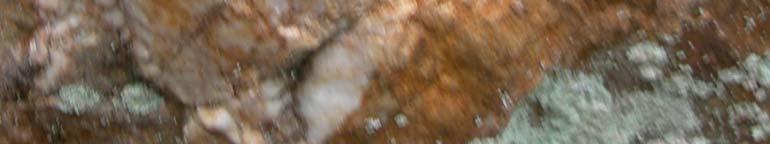
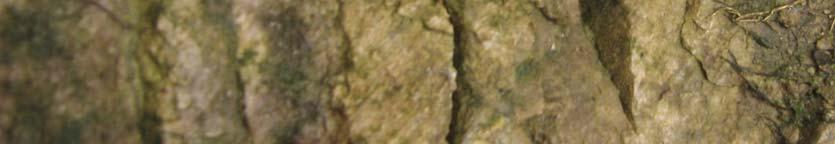
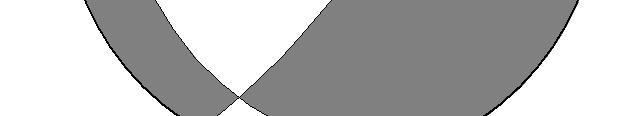
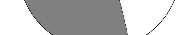
Geological sketch map of the Karkonosze granite and its metamorphic cover (after Aleksandrowski & Mazur, 2002). Study area - southern contact t zone
|
|
|
- Merryl Armstrong
- 5 years ago
- Views:
Transcription
1 Brittle faulting in the southern contact zone of the Karkonosze granite near Karpacz Krzysztof Gaidzik, Jerzy Żaba Department of Fundamental Geology Faculty of Earth Sciences University of Silesia
2 Aim - Reconstruct paleostress tensor responsible for development definite brittle faults populations in the area of Karpacz Methodolody d Field -Collect fault-slip data; -Define direction and sense of movement along fault planes; -Find out relative relations between fault populations. Labo oratory -Angelier and Hoeppener diagrams; -Classify heterogenous fault-slip data into homogenous populations; -Apply methods: right dihedra method, inverse method; -Present results on diagrams and maps.
3 Geological sketch map of the Karkonosze granite and its metamorphic cover (after Aleksandrowski & Mazur, 2002). Study area - southern contact t zone of the Karkonosze granite in the area of Karpacz: Sowia Valley, Malina Valley, Łomniczka Valley, Księża Mt., Kozi Ridge.


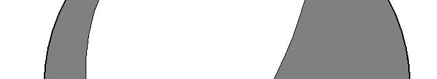
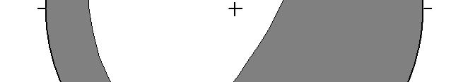
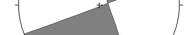
4 The right dihedra (P/T quadrant) method - principles Fault plane + N plane perpendicular to the slip lineation on the fault T=Two compressional quadrants (σ 1 ) Two tensional quadrants (σ 3 )
5 Faults from the area of Karpacz Angelier diagram Hoeppener diagram Datasets: 50 Mostly: strike-slip faults (dextral), oblique faults with dominant strike-slip component Lower hemisphere
6 Fault planes: -dominant direction (strike) NE-SW; -mostly steep and very steep dip angle (strikeslip faults). Slip lineations: -dominant dip direction SW; -mostly low and very low dip angle (strike- slip faults).

7 Fault planes with slip lineation, steps - examples Karkonosze granite Kozi Ridge Metamorphic cover Sowia Valley
8 Metamorphic cover Sowia Valley Karkonosze granite Sowia Valley
9 Karkonosze granite Sowia Valley
10 Tectonic striae on mesofaults surfaces Tectonic st triae (Dip angle) Sinistral Dextral 1 60 Normal-dextral Normal-sinistral 50 Reverse-dextral 40 Reverse-sinistral Reverse 30 Normal THorizontal 3 20 Unknown Mesofaults (Dip angle) 2 5
11 First ( normal ) population Datasets: 7 Hoeppener diagram Angelier diagram
12 First ( normal ) population Planes: -dominant NNE-SSW, NE-SW; -steep (50-70º). Slip lineations: -dominant NW; -steep (50-70º).
")


13 First ( normal ) population Normal regime The Right Dihedra method σ1 77/68 σ 2 212/16 σ 3 307/15 The Inverse method
14 Predominant (second) population Datasets: 25 Hoeppener diagram Angelier diagram
.")
15 Predominant (second) population Rose diagram Planes: -dominant NE-SW; -Steep and very steep (60-90º). Rose diagram Slip lineations: -dominant towards SW; -low and very low angles (0-20º).


16 Predominant (second) population Strike-slip regime Right Dihedra method σ 1 38/11 σ 2 256/76 σ 3 130/08 Inverse method
17 Third population Datasets: 5 Hoeppener diagram Angelier diagram
18 Third population Planes: -dominant NE-SW; -intermediate angles to steep. Slip lineations: -dominant towards SW; -intermediate angles (30-50º).


19 Third population Strike-slip regime Normal regime The Right Dihedra method σ1 192/34 σ 2 356/55 σ 3 97/08 The Inverse method
20 Fourth ( Reverse ) population Datasets: 2 Hoeppener diagram Angelier diagram
21 Fourth ( Reverse ) population Planes: -dominant W-E, NW- SE; -intermediate angles. Slip lineations: -dominant SW; -low angles (20-30º).


22 Fourth ( Reverse ) population Reverse regime σ 1 37/16 The Right Dihedra method σ 2 130/13 σ 3 259/69
23 Fifth ( strike-slip ) population Datasets: 5 Hoeppener diagram Angelier diagram
24 Fifth ( strike-slip ) population Planes: -dominant NW-SE; -very steep (80-90º). Slip lineations: -dominant SE; -low angles (10-20º).


25 Fifth ( strike-slip ) population Strike-slip regime The Right Dihedra method σ1 294/06 σ 2 69/82 σ 3 204/06 The Inverse method
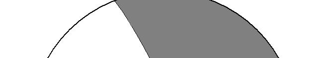
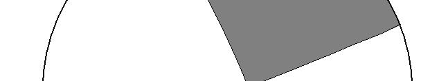
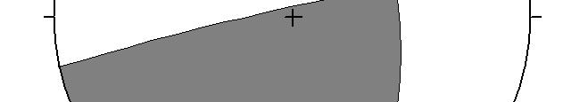
26 Compressional (white) and tensional (black) sectors for every fault from the area of Karpacz on the basis of geological sketch of the studied area. Karkonosze granite Gneiss Mica schist Lower hemisphere
27 Conclusions - Strike-slip faults are predominant; - Fault planes strike NE-SW, steep and very steep; - Slip lineations mostly towards SW, low and very low angle; - 5 homogenous fault populations; - All possible regimes (strike-slip, slip, normal gravitational, ti reverse) were involved; - Normal population is older than predominant; - Predominant population was developed in strike-slip slip regime (σ 1 towards NE-SW SW, σ 3 towards NW-SE); - Except one example σ 1 more or less towards NE-SW; - Except one example σ 3 more or less towards NW-SE.
28 σ 1 red σ 2 black σ 3 blue
29
TECTONIC AND STRUCTURAL CONTROLS ON INTRUSION- RELATED DEPOSITS IN THE NORTHERN PART OF SREDNA GORA ZONE, BULGARIA NIKOLAY PETROV & KAMELIA NEDKOVA
 TECTONIC AND STRUCTURAL CONTROLS ON INTRUSION- RELATED DEPOSITS IN THE NORTHERN PART OF SREDNA GORA ZONE, BULGARIA NIKOLAY PETROV & KAMELIA NEDKOVA INVESTIGATED AREA Praveshka Lakavica deposit Elatsite
STRAIN AND SCALING RELATIONSHIPS OF FAULTS AND VEINS AT KILVE, SOMERSET
 Read at the Annual Conference of the Ussher Society, January 1995 STRAIN AND SCALING RELATIONSHIPS OF FAULTS AND VEINS AT KILVE, SOMERSET M. O'N. BOWYER AND P. G. KELLY Bowyer, M. O'N. and Kelly, P.G.
Fault-slip analysis and paleostress reconstruction
 Fault-slip analysis and paleostress reconstruction Definitions Faults have displacements parallel to the fault, visible by naked eye. Faults bear slickenside lineations. Faults denote simple shear; pure
Chapter 15 Structures
 Chapter 15 Structures Plummer/McGeary/Carlson (c) The McGraw-Hill Companies, Inc. TECTONIC FORCES AT WORK Stress & Strain Stress Strain Compressive stress Shortening strain Tensional stress stretching
Tectonic analysis of an oceanic transform fault zone based on fault-slip data and earthquake focal mechanisms: the Húsavík Flatey Fault zone, Iceland
 Tectonophysics 344 (2002) 157 174 www.elsevier.com/locate/tecto Tectonic analysis of an oceanic transform fault zone based on fault-slip data and earthquake focal mechanisms: the Húsavík Flatey Fault zone,
KEY CHAPTER 12 TAKE-HOME QUIZ INTERNAL STRUCTURES AND PROCESSES Score Part B = / 55 PART B
 GEOLOGY 12 KEY CHAPTER 12 TAKE-HOME QUIZ INTERNAL STRUCTURES AND PROCESSES Score Part B = / 55 PART B CHAPTER 12 Isostacy and Structural Geology 1. Using the terms below, label the following diagrams and
Answers: Internal Processes and Structures (Isostasy)
") Answers: Internal Processes and Structures (Isostasy) 1. Analyse the adjustment of the crust to changes in loads associated with volcanism, mountain building, erosion, and glaciation by using the concept
Answers: Internal Processes and Structures (Isostasy) 1. Analyse the adjustment of the crust to changes in loads associated with volcanism, mountain building, erosion, and glaciation by using the concept
Seismotectonic modelling with the program GoCad; A case study: The swarm quakes in the Vogtland/ NW- Bohemian Region
 Seismotectonic modelling with the program GoCad; A case study: The swarm quakes in the Vogtland/ NW- Bohemian Region Edgar Scheidewig Turmhofstr. 10, 09599 - Freiberg Abstract The upper crust beneath the
Crustal Deformation. Earth Systems 3209
 Crustal Deformation Earth Systems 3209 Crustal Deformation pg. 415 Refers to all changes in the original form and/or size of a rock body. May also produce changes in the location and orientation of rocks.
GLY 155 Introduction to Physical Geology, W. Altermann. Press & Siever, compressive forces. Compressive forces cause folding and faulting.
 Press & Siever, 1995 compressive forces Compressive forces cause folding and faulting. faults 1 Uplift is followed by erosion, which creates new horizontal surface. lava flows Volcanic eruptions cover
Study the architecture and processes responsible for deformation of Earth s crust. Folding and Faulting
 Crustal Deformation AKA Structural geology (adapted from Brunkel, 2012) Study the architecture and processes responsible for deformation of Earth s crust. Folding and Faulting How Rocks Deform: 4 Controls
Interactive 3D Sketchupbook
 THE UNIVERSITY OF SYDNEY - SCHOOL OF GEOSCIENCES Interactive 3D Sketchupbook Patrice F. Rey CHAPTER 1 Orienting Planes and Lines 1 Interactive 1.1 Strike, dip and dip direction In a 3D space, planar surfaces
UNIVERSITY OF PRETORIA Department of Geology STRUCTURAL GEOLOGY -GLY 254 SEMESTER EXAM
 UNIVERSITY OF PRETORIA Department of Geology STRUCTURAL GEOLOGY -GLY 254 SEMESTER EXAM Copyright reserved 6 th June 2006 Time: 3 hours Internal examiner: Dr A.J. Bumby External examiner: Dr R. van der
Tectonic evolution in the Wadi Araba Segment of the Dead Sea Rift, South-West Jordan
 EGU Stephan Mueller Special Publication Series, 2, 1 19, 2002 c European Geosciences Union 2002 Tectonic evolution in the Wadi Araba Segment of the Dead Sea Rift, South-West Jordan U. Zain Eldeen 1, D.
CHAPTER 8. TUVA AND WEST-SAYAN
 169 CHAPTER 1. THEORY OF FAULTING AND EVALUATION OF TIMING OF FAULT MOVEMENTS: METHODOLOGY CHAPTER 2. NEOTECTONICS OF ALTAI-SAYAN CHAPTER 3. GEOLOGICAL AND GEODYNAMICAL SETTINGS CHAPTER 4. THE TELETSK
Structural Style and Tectonic Evolution of the Nakhon Basin, Gulf of Thailand
 Structural Style and Tectonic Evolution of the Nakhon Basin, Gulf of Thailand Piyaphong Chenrai Petroleum Geoscience Program, Department of Geology, Faculty of Science, Chulalongkorn University, Bangkok
Description of faults
 GLG310 Structural Geology Description of faults Horizontal stretch Crustal thickness Regional elevation Regional character Issues Normal Thrust/reverse Strike-slip >1 1 in one direction and < 1 in
Jonathan A. Nourse Department of Geological Sciences California State Polytechnic University Pomona, CA
 Comparison of Late Cretaceous Plutonic Rocks Across the Left-Lateral San Antonio Canyon Fault, San Gabriel Mountains Daniel E. Heaton Department of Geological Sciences San Diego State University San Diego,
Chapter 10: Deformation and Mountain Building. Fig. 10.1
 Chapter 10: Deformation and Mountain Building Fig. 10.1 OBJECTIVES Describe the processes of rock deformation and compare and contrast ductile and brittle behavior in rocks. Explain how strike and dip
NAME HOMEWORK ASSIGNMENT #3 MATERIAL COVERS CHAPTERS 8, 9, 10, 11
 NAME HOMEWORK ASSIGNMENT #3 MATERIAL OVERS HAPTERS 8, 9, 10, 11 Assignment is due the beginning of the class period on November 23, 2004. Answers for each chapter will be discussed in class, as Exam #3
PROCEEDINGS, INDONESIAN PETROLEUM ASSOCIATION Thirty-Ninth Annual Convention and Exhibition, May 2015
 IPA15-SG-089 PROCEEDINGS, INDONESIAN PETROLEUM ASSOCIATION Thirty-Ninth Annual Convention and Exhibition, May 2015 STRUCTURAL INTERPRETATION OF TECTONICALLY ASSOCIATED NORMAL AND REVERSE FAULTS OF BUKIT
Isan deformation, magmatism and extensional kinematics in the Western Fold Belt of the Mount Isa Inlier
 Isan deformation, magmatism and extensional kinematics in the Western Fold Belt of the Mount Isa Inlier Rick Gordon Department of Earth Sciences University of Queensland A thesis submitted for examination
Linking structure & mineralisation in Laverton, with specific reference to Sunrise Dam & Wallaby John Miller
 Linking structure & mineralisation in Laverton, with specific reference to Sunrise Dam & Wallaby John Miller Centre for Exploration Targeting University of Western Australia W Swager (1997) regional D
Satulinmäki Au Prospect Structural Mapping
 M19/2024/2003/1/10 Juhani Ojala Satulinmäki Au Prospect Structural Mapping V. Juhani Ojala Geological Survey of Finland 1 Table of Contents Introduction...2 Local geology...2 Structures...2 Discussion...2
GG303 Lecture 17 10/25/09 1 MOHR CIRCLE FOR TRACTIONS
 GG303 Lecture 17 10/5/09 1 MOHR CIRCLE FOR TRACTIONS I Main Topics A Stresses vs. tractions B Mohr circle for tractions II Stresses vs. tractions A Similarities between stresses and tractions 1 Same dimensions
Metamorphic Rocks. Metamorphic Rocks: Big Ideas
 Metamorphic Rocks: Big Ideas Earth scientists use the structure, sequence, and properties of rocks to reconstruct events in Earth s history Earth s systems continually react to changing influences from
Regional GIS based exploration targeting studies in data poor environments
 Regional GIS based exploration targeting studies in data poor environments A case study of gold prospectivity mapping in Nigeria Matthew Greentree, Mathieu Lacorde and Bert De Waele Acknowledgements Australian
BEYOND TRAVELTIMES AND EARTHQUAKE LOCATION What else can seismograms tell us about the nature of earthquakes on faults?
 BEYOND TRAVELTIMES AND EARTHQUAKE LOCATION What else can seismograms tell us about the nature of earthquakes on faults? What are some of the key parameters which we describe faults? GEOMETRICAL PROPERTIES
Identification of natural fractures and in situ stress at Rantau Dedap geothermal field
 IOP Conference Series: Earth and Environmental Science PAPER OPEN ACCESS Identification of natural fractures and in situ stress at Rantau Dedap geothermal field To cite this article: Andika Artyanto et
APPENDIX D FAULT SLIP DATA AND SENSE OF SHEAR DETERMINED IN FOLIATED AND MYLONITIC ROCKS FROM THE WILD ROGUE WILDERNESS, SW OREGON
 APPENDIX D FAULT SLIP DATA AND SENSE OF SHEAR DETERMINED IN FOLIATED AND MYLONITIC ROCKS FROM THE WILD ROGUE WILDERNESS, SW OREGON 581 Table D1: Fault slip data from Rogue River fault zone Outcrop Striated
Stefan M. Schmid. 84th CONVENTION 2017 Ascona, Switzerland, Monte Verità, June 17 19, 2017
 On the "root zone" of the Alpine nappes in the Ticino area (Ivrea Zone, Insubric line and gneisses of the Southern Steep Belt): Geometry and kinematics Stefan M. Schmid 84th CONVENTION 2017 Ascona, Switzerland,
MAIN DIRECTIONS OF THE FRACTURES IN THE LIMESTONE AND GRANITE QUARRIES ALONG THE SUDETIC MARGINAL FAULT NEAR VÁPENNÁ VILLAGE,
 Acta Geodyn. Geomater., Vol. 5, No. 1 (149), 49-55, 2008 MAIN DIRECTIONS OF THE FRACTURES IN THE LIMESTONE AND GRANITE QUARRIES ALONG THE SUDETIC MARGINAL FAULT NEAR VÁPENNÁ VILLAGE, NE BOHEMIAN MASSIF,
11.1 Rock Deformation
 Tarbuck Lutgens Mountain Building 11.1 Rock Deformation Factors Affecting Deformation Factors that influence the strength of a rock and how it will deform include temperature, confining pressure, rock
Crags, Cracks, and Crumples: Crustal Deformation and Mountain Building
 Crags, Cracks, and Crumples: Crustal Deformation and Mountain Building Updated by: Rick Oches, Professor of Geology & Environmental Sciences Bentley University Waltham, Massachusetts Based on slides prepared
Use a highlighter to mark the most important parts, or the parts. you want to remember in the background information.
 P a g e 1 Name A Fault Model Purpose: To explore the types of faults and how they affect the geosphere Background Information: A fault is an area of stress in the earth where broken rocks slide past each
GEOLOGY MEDIA SUITE Chapter 13
 UNDERSTANDING EARTH, SIXTH EDITION GROTZINGER JORDAN GEOLOGY MEDIA SUITE Chapter 13 Earthquakes 2010 W.H. Freeman and Company Three different types of seismic waves are recorded by seismographs Key Figure
Structural Geology Lab. The Objectives are to gain experience
 Geology 2 Structural Geology Lab The Objectives are to gain experience 1. Drawing cross sections from information given on geologic maps. 2. Recognizing folds and naming their parts on stereoscopic air
Plio-Quaternary kinematics and geometry of the Calama-Olacapato-El Toro fault zone across the Puna Plateau, Argentina
 University of Milano-Bicocca - Faculty of Mathematics, Physics and Natural Sciences and Michigan Technological University College of Engineering Federica Lanza Plio-Quaternary kinematics and geometry of
Structural Geology Lab. The Objectives are to gain experience
 Geology 2 Structural Geology Lab The Objectives are to gain experience 1. Drawing cross sections from information given on geologic maps. 2. Recognizing folds and naming their parts on stereoscopic air
Tectonic analysis of the Husavik-Flatey Fault {northern Iceland)
") TECTONICS, VOL. 19, NO. 6, PAGES 1161-1177 DECEMBER 2000 Tectonic analysis of the Husavik-Flatey Fault {northern Iceland) and mechanisms of an oceanic transform zone, the Tj/Jrnes Fracture Zone. Franqoise
TECTONICS, VOL. 19, NO. 6, PAGES 1161-1177 DECEMBER 2000 Tectonic analysis of the Husavik-Flatey Fault {northern Iceland) and mechanisms of an oceanic transform zone, the Tj/Jrnes Fracture Zone. Franqoise
Structural deformation across the southwest Mina deflection, California-Nevada: Field studies in the Huntoon Springs area.
 Structural deformation across the southwest Mina deflection, California-Nevada: Field studies in the Huntoon Springs area. Eliya R. Hogan Advisor: Jeff Lee Introduction and purpose of study: The Mina deflection
Kinematic inversion of pre-existing faults by wastewater injection-related induced seismicity: the Val d Agri oil field case study (Italy)
") Kinematic inversion of pre-existing faults by wastewater injection-related induced seismicity: the Val d Agri oil field case study (Italy) Buttinelli M., Improta L., Bagh S., Chiarabba C. 1/10 The Val
Kinematic inversion of pre-existing faults by wastewater injection-related induced seismicity: the Val d Agri oil field case study (Italy) Buttinelli M., Improta L., Bagh S., Chiarabba C. 1/10 The Val
Available online Journal of Scientific and Engineering Research, 2017, 4(4): Research Article
: Research Article") Available online www.jsaer.com, 2017, 4(4):273-282 Research Article ISSN: 2394-2630 CODEN(USA): JSERBR The Structural Geology of Eshiawa in Igarra Area, Southwestern Nigeria Adiela U.P. 1, Ofuyah W.N.
Available online www.jsaer.com, 2017, 4(4):273-282 Research Article ISSN: 2394-2630 CODEN(USA): JSERBR The Structural Geology of Eshiawa in Igarra Area, Southwestern Nigeria Adiela U.P. 1, Ofuyah W.N.
UNDERSTANDING GEOLOGIC M APS
 Name: Lab Section: work in groups, but each person turns in his/her own GEOSCIENCE 001 L AB UNDERSTANDING GEOLOGIC M APS Geologic maps are colorful and even beautiful, but they also contain an amazing
MESOSCOPIC STRUCTURES FROM THE AREA AROUND SATENGAL, LESSER GARHWAL HIMALAYA
 Journal of Scientific Research Vol. 55, 2011 : 25-34 Banaras Hindu University, Varanasi ISSN : 0447-9483 MESOSCOPIC STRUCTURES FROM THE AREA AROUND SATENGAL, LESSER GARHWAL HIMALAYA H. B. Srivastava, Lokesh
2 Geology. 2.1 Elements of Terrane Analysis. Terrane or Terrain? Potential receptors
 2 Geology Knowledge of fractured rock geology, or terrane, provides important context for investigating contaminated sites. Tectonic forces impart characteristic structures on rock formations that influence
Hints of active deformation in the southern Adriatic foreland: Holocene tectonics along the Apulia offshore (Italy)
") Hints of active deformation in the southern Adriatic foreland: Holocene tectonics along the Apulia offshore (Italy) Domenico Ridente^, Umberto Fracassi*, Daniela Di Bucci, Fabio Trincardi^ ^ & Gianluca
Hints of active deformation in the southern Adriatic foreland: Holocene tectonics along the Apulia offshore (Italy) Domenico Ridente^, Umberto Fracassi*, Daniela Di Bucci, Fabio Trincardi^ ^ & Gianluca
Structural Evolution of the Keno Hill Ag-Pb-Zn mining district, Yukon
 Structural Evolution of the Keno Hill Ag-Pb-Zn mining district, Yukon Simon D. Craggs, David R. Lentz and Joseph C. White Introduction The Keno Hill Ag-Pb-Zn mining district is located in the central Yukon,
Suusamyr, Kyrgyzstan Structural-geological Report
 Suusamyr, Kyrgyzstan Structural-geological Report by David Fossati fossatid@student.ethz.ch Contents 1 Introduction... 2 2 Field work area... 2 3 Field work methods... 5 4 Analysis methods... 7 5 Maps
GG303 Lecture 29 9/4/01 1 FABRICS
 GG303 Lecture 29 9/4/01 1 FABRICS I Main Topics A What are fabrics? B Planar fabrics C Linear fabrics D Penetrative vs. non-penetrative fabrics E Cleavage and folds F Comments on use of grain-scale observations
Brittle Deformation. Earth Structure (2 nd Edition), 2004 W.W. Norton & Co, New York Slide show by Ben van der Pluijm
, 2004 W.W. Norton & Co, New York Slide show by Ben van der Pluijm") Lecture 6 Brittle Deformation Earth Structure (2 nd Edition), 2004 W.W. Norton & Co, New York Slide show by Ben van der Pluijm WW Norton, unless noted otherwise Brittle deformation EarthStructure (2 nd
Lecture 6 Brittle Deformation Earth Structure (2 nd Edition), 2004 W.W. Norton & Co, New York Slide show by Ben van der Pluijm WW Norton, unless noted otherwise Brittle deformation EarthStructure (2 nd
Geologic Mapping Regional Tournament Trial Event
 Geologic Mapping Regional Tournament Trial Event A TEAM OF UP TO: 2 Team Name AVAILABLE TIME: 50 min Required Materials: Each team MUST have a protractor, ruler, non-programmable calculator, colored pencils,
EARTHQUAKE LOCATIONS INDICATE PLATE BOUNDARIES EARTHQUAKE MECHANISMS SHOW MOTION
 6-1 6: EARTHQUAKE FOCAL MECHANISMS AND PLATE MOTIONS Hebgen Lake, Montana 1959 Ms 7.5 1 Stein & Wysession, 2003 Owens Valley, California 1872 Mw ~7.5 EARTHQUAKE LOCATIONS INDICATE PLATE BOUNDARIES EARTHQUAKE
An Overview of Graphite Projects from Asia to Africa. Dr Mike Cunningham SRK Consulting (Australasia) Pty. Ltd.
 Pty. Ltd.") An Overview of Graphite Projects from Asia to Africa Dr Mike Cunningham SRK Consulting (Australasia) Pty. Ltd. Acknowledgements PT. Granfindo Nusantara RS Mines Pty Ltd Geological Survey and Mining Bureau
An Overview of Graphite Projects from Asia to Africa Dr Mike Cunningham SRK Consulting (Australasia) Pty. Ltd. Acknowledgements PT. Granfindo Nusantara RS Mines Pty Ltd Geological Survey and Mining Bureau
Seismicity and Seismo-tectonics of Alaska: Alaska as a Natural Laboratory for Earthcsope
 Seismicity and Seismo-tectonics of Alaska: Alaska as a Natural Laboratory for Earthcsope Roger Hansen, Natasha Ratchovski, Trilby Cox, and Douglas Christensen Geophysical Institute, University of Alaska
Chapter 3. Geology & Tectonics
 Chapter 3 Geology & Tectonics 3.1 Geology The general geological features of Indonesia are shown in Figure 3.1. The basement formation is metamorphic and it is intruded with plutonic formations. They are
Blocks Module Content Guide
 Blocks Module Content Guide This guide covers the basics of the content within the Interactive 3D Geologic Blocks Module. The content guide is intended to assist you, the teacher, in creating effective
Lecture 9 faults, folds and mountain building
 Lecture 9 faults, folds and mountain building Rock deformation Deformation = all changes in size, shape, orientation, or position of a rock mass Structural geology is the study of rock deformation Deformation
Earthquakes and Seismotectonics Chapter 5
 Earthquakes and Seismotectonics Chapter 5 What Creates Earthquakes? The term Earthquake is ambiguous: Applies to general shaking of the ground and to the source of the shaking We will talk about both,
Faults, folds and mountain building
 Faults, folds and mountain building Mountain belts Deformation Orogens (Oro = Greek all changes for mountain, in size, shape, genesis orientation, = Greek for or formation) position of a rock mass Structural
LAB 1: ORIENTATION OF LINES AND PLANES
 LAB 1: ORIENTATION OF LINES AND PLANES Read the introductory section, chapter 1, pages 1-3, of the manual by Rowland et al (2007) and make sure you understand the concepts of bearing, strike, dip, trend,
2 Structural geology of the central part of the southern coast of Gulf of Corinth
 12 2 Structural geology of the central part of the southern coast of Gulf of Corinth 2.1 Satellite Image Analysis 2.1.1 Introduction Aiming at a more reliable structural and paleo-stress analysis, in addition
Part I. PRELAB SECTION To be completed before labs starts:
 Student Name: Physical Geology 101 Laboratory #13 Structural Geology II Drawing and Analyzing Folds and Faults Grade: Introduction & Purpose: Structural geology is the study of how geologic rock units
Chapter. Mountain Building
 Chapter Mountain Building 11.1 Rock Deformation Factors Affecting Deformation Factors that influence the strength of a rock and how it will deform include temperature, confining pressure, rock type, and
NMBGMR Geologic Map Symbols
 NMBGMR Geologic Map Symbols LINES: Exposure Exposed Intermittent/Obscured Concealed Certain (or unspecified) Geologic contact, fault, or fold, exposed with high positional accuracy. Triangle shows location
lecture 8 Shear zones Kristallingeologie Summary lecture on foliations Faults and shear zones Strength of the crust
 Kristallingeologie lecture 8 Shear zones Summary lecture on foliations Rocks can contain foliations and lineations Some important foliations Primary foliation (S 0 ), Axial planar & crenulation cleavage
Deformation of Rocks. Orientation of Deformed Rocks
 Deformation of Rocks Folds and faults are geologic structures caused by deformation. Structural geology is the study of the deformation of rocks and its effects. Fig. 7.1 Orientation of Deformed Rocks
Structural analysis of the Sopron Gneiss Formation (Sopron Mts., W-Hungary)
") Structural analysis of the Sopron Gneiss Formation (Sopron Mts., W-Hungary) Zsolt BENKÓ a Éva BUGLEDITS a András RÉCSI a a Department of Physical Geography, University of West Hungary, Szombathely, Hungary
Structural analysis of the Sopron Gneiss Formation (Sopron Mts., W-Hungary) Zsolt BENKÓ a Éva BUGLEDITS a András RÉCSI a a Department of Physical Geography, University of West Hungary, Szombathely, Hungary
IESO 2012 Written TEST: Geosphere
 IESO 2012 Written TEST: Geosphere Name Nationality Write down your answer in the separate answer sheet. hoose ONLY one answer for every question. ll questions carry the same points 1. The existence of
Introduction Faults blind attitude strike dip
 Chapter 5 Faults by G.H. Girty, Department of Geological Sciences, San Diego State University Page 1 Introduction Faults are surfaces across which Earth material has lost cohesion and across which there
Exploration of Geothermal High Enthalpy Resources using Magnetotellurics an Example from Chile
 Exploration of Geothermal High Enthalpy Resources using Magnetotellurics an Example from Chile Ulrich Kalberkamp, Federal Institute for Geosciences and Natural Resources (BGR), Stilleweg 2, 30655 Hannover,
Lab 7: STRUCTURAL GEOLOGY FOLDS AND FAULTS
 Lab 7: STRUCTURAL GEOLOGY FOLDS AND FAULTS This set of labs will focus on the structures that result from deformation in earth s crust, namely folds and faults. By the end of these labs you should be able
Strike-slip tectonics in arc-continent collision; the Eastern Timor example
 Strike-slip tectonics in arc-continent collision; the Eastern Timor example RUI DIAS Escola de Ciências e Tecnologia da Universidade de Évora; Centro de Geofísica de Évora; Centro Ciência Viva de Estremoz.
of other regional earthquakes (e.g. Zoback and Zoback, 1980). I also want to find out
. I also want to find out") 4. Focal Mechanism Solutions A way to investigate source properties of the 2001 sequence is to attempt finding well-constrained focal mechanism solutions to determine if they are consistent with those
4. Focal Mechanism Solutions A way to investigate source properties of the 2001 sequence is to attempt finding well-constrained focal mechanism solutions to determine if they are consistent with those
A.M. TUESDAY, 12 May hours
 Candidate Name Centre Number 2 Candidate Number GCE AS/A level 1212/01 New AS GEOLOGY - GL2a Investigative Geology A.M. TUESDAY, 12 May 2009 1 1 2 hours For Examiner s Use Only ADDITIONAL MATERIALS In
GEOLOGY - GL4 INTERPRETING THE GEOLOGICAL RECORD
 Candidate Name Centre Number 2 Candidate Number GCE A level 1214/01 GEOLOGY - GL4 INTERPRETING THE GEOLOGICAL RECORD A.M. MONDAY, 21 June 2010 2 hours Section A 1. 2. 3. 15 15 15 1214 01 01 4. 15 Section
Northern Tanzanian Earthquakes: Fault orientations, and depth distribution
 Northern Tanzanian Earthquakes: Fault orientations, and depth distribution Stewart Rouse (NC A&T Physics) Penn State University SROP Mentors: Dr. Andy Nyblade & Dr. Rick Brazier July 27, 2005 1.0 Introduction
Composition of the earth, Geologic Time, and Plate Tectonics
 Composition of the earth, Geologic Time, and Plate Tectonics Layers of the earth Chemical vs. Mechanical Chemical : Mechanical: 1) Core: Ni and Fe 2) Mantle: Mostly Peridotite 3) Crust: Many different
Deformation: Modification of Rocks by Folding and Fracturing
 CHAPTER 7 Deformation: Modification of Rocks by Folding and Fracturing Chapter Summary A geologic map is a scientific model of rock formations that are exposed on the Earth s surface showing outcrops,
In this lab, we will study and analyze geologic maps from a few regions, including the Grand Canyon, western Wyoming, and coastal California.
 Name: Lab Section: work in groups, but each person turns in his/her own GEOSCIENCE 001 LAB UNDERSTANDING GEOLOGIC MAPS Geologic maps are colorful and even beautiful, but they also contain an amazing amount
Chapter 8 Lecture. Earth: An Introduction to Physical Geology. Twelfth Edition. Metamorphism. Rocks. Tarbuck and Lutgens Pearson Education, Inc.
 Chapter 8 Lecture Earth: An Introduction to Physical Geology Twelfth Edition Metamorphism and dmetamorphic Rocks Tarbuck and Lutgens Chapter 8 Metamorphic Rocks What Is Metamorphism? Metamorphism means
Strength variation and deformational behavior in anisotropic granitic mylonites under high-temperature and -pressure conditions An experimental study
 Strength variation and deformational behavior in anisotropic granitic mylonites under high-temperature and -pressure conditions An experimental study Gui Liu, Yongsheng Zhou, Yaolin Shi, Sheqiang Miao,
Appendix 11. Geology. of the. I60 area
 Appendix 11 Geology of the I60 area 1. Locality The locality of the I60 area is as follows; Northwestern corner; UTM_EW 530513, UTM_NS 7345741 Southwestern corner; UTM_EW 530418, UTM_NS 7301454 Northeastern
Geomorphology Final Exam Study Guide
 Geomorphology Final Exam Study Guide Geologic Structures STRUCTURAL GEOLOGY concerned with shapes, arrangement, interrelationships of bedrock units & endogenic (within) forces that cause them. Tectonic
Staple this part to part one of lab 6 and turn in. Lab 6, part two: Structural geology (analysis)
") Geology 101 Staple this part to part one of lab 6 and turn in Lab 6, part two: Structural geology (analysis) Recall that the objective of this lab is to describe the geologic structures of Cougar Mountain
Geology 101 Staple this part to part one of lab 6 and turn in Lab 6, part two: Structural geology (analysis) Recall that the objective of this lab is to describe the geologic structures of Cougar Mountain
1. classic definition = study of deformed rocks in the upper crust
 Structural Geology I. Introduction 1. classic definition = study of deformed rocks in the upper crust deformed includes translation, rotation, and strain (change of shape) All rocks are deformed in some
Lab 6: Plate tectonics, structural geology and geologic maps
 Geology 103 Name(s): Lab 6: Plate tectonics, structural geology and geologic maps Objective: To show the effects of plate tectonics on a large-scale set of rocks and to reconstruct the geological history
For personal use only
 AVZ Minerals Limited 19 September 2016 ACQUISITION OF MANONO EXTENSION LITHIUM, TIN AND TANTALUM PROJECT IN THE DEMOCRATIC REPUBLIC OF CONGO Company to acquire, subject to due diligence, the Manono Extension
Characterization of Induced Seismicity in a Petroleum Reservoir: A Case Study
 Characterization of Induced Seismicity in a Petroleum Reservoir: A Case Study Edmond Sze, M. Nafi Toksöz, and Daniel R. Burns Earth Resources Laboratory Dept. of Earth, Atmospheric and Planetary Sciences
Evidence for subduction in the ice shell of Europa
 SUPPLEMENTARY INFORMATION DOI: 10.1038/NGEO2245 Evidence for subduction in the ice shell of Europa Simon A. Kattenhorn 1*, Louise M. Prockter 2 1 Department of Geological Sciences, University of Idaho,
STRESS ORIENTATION DETERMINED FROM FAULT SLIP DATA IN HAMPEL WASH AREA, NEVADA, AND ITS RELATION TO CONTEMPORARY REGIONAL STRESS FIELD
 University of Nebraska - Lincoln DigitalCommons@University of Nebraska - Lincoln USGS Staff -- Published Research US Geological Survey March 2011 STRESS ORIENTATION DETERMINED FROM FAULT SLIP DATA IN HAMPEL
Convergent plate boundary.
 Crustal Deformation Convergent plate boundary http://my.execpc.com/~acmelasr/mountains/geogramsnf.html Plate Tectonic Settings and Magma Where plates CONVERGE, water is driven off the subducting plate,
Structural Geology of D-pit at Akara Mining, Pichit Province, North Central Thailand
 Research Article Structural Geology of D-pit at Akara Mining, Pichit Province, North Central Thailand Chalermpol Jamduong and Pitsanupong Kanjanapayont* Department of Geology, Faculty of Science, Chulalongkorn
Dynamics of Uranium Ore Formation in the Basement and Frame of the Streltsovskaya Caldera
 Dynamics of Uranium Ore Formation in the Basement and Frame of the Streltsovskaya Caldera Petrov V.A.a, Schukin S.I.b, Poluektov V.V.a, Tolstobrov V.A.b ainstitute of Geology of Ore Deposits, Petrography,
Lab 6: Earthquake Focal Mechanisms (35 points)
") Lab 6: Earthquake Focal Mechanisms (35 points) Group Exercise 1. Drawing Nodal Planes (8 pts) The outline map below labeled Figure 4.60a shows the positions of two earthquakes recorded on the Mid-Atlantic
Lab 6: Earthquake Focal Mechanisms (35 points) Group Exercise 1. Drawing Nodal Planes (8 pts) The outline map below labeled Figure 4.60a shows the positions of two earthquakes recorded on the Mid-Atlantic
Structural analysis of faults system in the West of Shahrood
 Structural analysis of faults system in the West of Shahrood F. Aarab 1, P. Omidi 2, A. Taheri 3 1) M.Sc. Structural Geology, Email: fa_aarab@yahoo.com 2) PhD. Structural Geology, Department of Earth Science,
Crustal Deformation Earth - Chapter Pearson Education, Inc.
 Crustal Deformation Earth - Chapter 10 Structural Geology Structural geologists study the architecture and processes responsible for deformation of Earth s crust. A working knowledge of rock structures
Azimuth with RH rule. Quadrant. S 180 Quadrant Azimuth. Azimuth with RH rule N 45 W. Quadrant Azimuth
 30 45 30 45 Strike and dip notation (a) N30 E, 45 SE ("Quadrant"): the bearing of the strike direction is 30 degrees east of north and the dip is 45 degrees in a southeast (SE) direction. For a given strike,
Learning goals - January 16, Describe the geometry of a fault (1) orientation of the plane (strike and dip) (2) slip vector
 orientation of the plane (strike and dip) (2) slip vector") Learning goals - January 16, 2012 You will understand how to: Describe the geometry of a fault (1) orientation of the plane (strike and dip) (2) slip vector Understand concept of slip rate and how it is
Learning goals - January 16, 2012 You will understand how to: Describe the geometry of a fault (1) orientation of the plane (strike and dip) (2) slip vector Understand concept of slip rate and how it is
lecture 8 Methods of Structural Geology This lecture Mas Rabassers de Dalt (Spain) Mas Rabassers de Dalt (Spain)
 Mas Rabassers de Dalt (Spain)") This lecture Methods of Structural Geology lecture 8 Discuss the plotting exercise on Mas Rabassers de Dalt Look at folding related to shear zones Show an example of the application of new theory: Cap
This lecture Methods of Structural Geology lecture 8 Discuss the plotting exercise on Mas Rabassers de Dalt Look at folding related to shear zones Show an example of the application of new theory: Cap