Introduction of Remote Sensing Methods for Monitoring the Under Restoration Amiantos Mine, Cyprus
|
|
|
- Lenard August Reed
- 5 years ago
- Views:
Transcription


1 Sixth International Conference on Remote Sensing and Geoinformation of Environment, March, Cyprus Introduction of Remote Sensing Methods for Monitoring the Under Restoration Amiantos Mine, Cyprus Eleftheria Poyiadji a,b Marianthi Stefouli a,b, Maria Przyłucka b,c, Stanisław Wołkowicz c, Zbigniew Kowalski c, Christodoulos Hadjigeorgiou d and Michał Woroszkiewicz c a Institute of Geology and Mineral Exploration, Sp. Loui 1, Acharnae, Greece; b Earth Observation and Geohazards Expert Group (EOEG), EuroGeoSurveys, the Geological Surveys of Europe, Brussels, Belgium; c Polish Geological Institute National Research Institute, Rakowiecka 4, Warsaw, Poland; d Geological Survey Department, Sp. Loui 1, 1 Lefkonos Street, 2064 Strovolos, Lefkosia, Cyprus; elepoyiadji@hotmail.com, kynpo@igme.gr; phone ; fax ; This project has received funding from the European Union s Horizon 2020 research and innovation programme under grant agreement No
2 Presentation Outline Who we are: EuroGeoSurveys GEO-CRADLE Overview Pilot: The Amiantos abandoned Asbestos Mine Feasibility study the methodology Results from selected remote sensing techniques Discussion
 Deputy chairs: Eleftheria Poyiadji (IGME GR): responsible for Geohazards Maria Przyłucka (PGI):")

3 EuroGeoSurveys (EGS) Geological Surveys of Europe 37 Geological Surveys Earth Observation and Geohazards Expert Group Chair: Gerardo Herrera (IGME SPAIN) Deputy chairs: Eleftheria Poyiadji (IGME GR): responsible for Geohazards Maria Przyłucka (PGI): responsible for Geohazards EO Veronika Kopackova (CZH): responsible for Raw materials EO Mission and vision: Assessment of geohazards Application of Earth Observation tools to geohazards and raw materials Members: 28 Geological Surveys and 80 scientists
 and the complete EO value chain therein, with the overarching objective of establishing a multi-regional coordination network that will: i.")
, iii.")
4 GEO-CRADLE Objectives GEO-CRADLE brings together key players fully representing the Region of Interest (Balkans, N. Africa and M. East) and the complete EO value chain therein, with the overarching objective of establishing a multi-regional coordination network that will: i. Support the effective integration of existing EO capacities (space/air-borne/in-situ monitoring networks, modelling and data exploitation skills, and past project experience), ii. Provide the interface for the engagement of the complete ecosystem of EO stakeholders (scientists, service/data providers, end-users, governmental organisations, and decision makers), iii. Promote the concrete uptake of EO services and data in response to regional needs, relevant to four thematic priorities: adaptation to climate change, improved food security, access to raw materials and energy iv. Contribute to the improved implementation of and participation in GEO, GEOSS, and Copernicus in the region. More information can be found online at


5 GEO-CRADLE - Pillars Visit:
 EGS")
 Improved")

 Access")
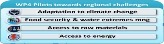
6 GEO-CRADLE Thematic Areas (Pilot areas) EGS Adaptation to Climate Change (ACC) Improved Food Security Water Extremes Management (IFS) Access to Raw Materials (ARM) Access to Energy (SENSE)
7 GEO-CRADLE Access to Raw Materials (ARM) WP4 Objective: Establishing a roadmap for long-term monitoring, mapping, and management of mineral deposits in a severely under-explored ROI. Use of existing regional capacities and skills Development of protocol for evaluating the level of impact Mapping of waste materials in abandoned mines Monitoring of ground deformation during/after mining Identification, collection, assessment and use of EO based and in-situ data Enrichment of the information content of the Regional Data Hub WP 2 & WP 3 Find examples of end-users with specific problems in the mining and post-mining areas WP 5 Identification of EO based data for the chosen example problems and enrichment of the Regional Data Hub

8 GEO-CRADLE Access to Raw Materials (ARM) Several mining and post-mining areas from Balkans, North Africa and Middle East were selected that meet the users needs according to the output of WP 2 and WP 3 and were chosen based on the short questionnaire sent to the end-users of various regions Turkey: Central Anatolian Lignite Basin Determining of orientation of coal outcrops in a selected volcano-sedimentary basin Turkey: Çelebi-Kesiköprü iron-oxide mineralization district environmental monitoring of mining activities Greece: Attica Region and Cephalonia Island Monitoring of Illegal Quarrying Cyprus: Abandoned Asbestos mine Improved environmental monitoring


9 Amiantos Mine, Cyprus Cyprus has 33 mines and 32 of them are abandoned
 Asbestos Mine It is located in the central part of Troodos Ophiolite and it is an")


10 Amiantos Mine The Problem Geographic and geological characteristics of the site (Asbestos Mine) Asbestos Mine It is located in the central part of Troodos Ophiolite and it is an outcrop of serpentine. The Asbestos Mine operated between 1904 and 1988 It is estimated that 130 million tones of rock have been excavated One (1) million tones of asbestos fibers (chrysotile) were produced Consequences adverse effects on the environment the enormous open pit the extensive waste tips pollution of the soil/water stability of the waste tips the barren nature of the tips


11 Amiantos Mine User Needs The Geological Survey Department does not have any Earth Observation data for the asbestos mine. The mine is under restoration since 1995 and it will need 15 to 20 additional years to complete the restoration. The waste dumps cover an area of about 3,2 km 2. A detailed geotechnical investigation was carried out in order to design the reprofiling of the waste dumps before the initiation of the restoration works. Based on field observations there are locations on the reprofiled berms with indications of subsidence and possibly other instabilities. It is an area that gets high rainfall during the winter.


12 Amiantos Mine, Cyprus The waste tips before restoration (from: Near the foothills of the reprofiled heap dumps is located the community of Amiantos. Due to this the stability of the waste dumps is very crucial. There are field observations for instabilities but never the site was checked for instabilities or environmental pollution using Earth Observation systems. The waste dumps contain an average content of 0,2% of Ni. In a small area within the mine the endemic plant Alyssum Cypricum was planted directly on the waste material in order to collect data for the amount of Ni that Alyssum Cypricum collects. The information that will be collected will be used for the development of a pilot project for phytoming for the recovery of Ni. Project Biodiversity Conservation in Restoration and Management of the Amiantos Asbestos Mine, in Troodos National Forest Park ( ). Department of Forests of the Ministry of Agriculture, Natural Resources & Environment of Cyprus The waste tips after restoration (from:

13 Feasibility Study - The methodology The main objectives of the Asbestos Mine pilot - feasibility study are as follow: Determination of ground stability of the former mining area, taking under special consideration the slope mass movements and vertical ground motions. Determination of ground stability of the former mining area, taking under special consideration the slope mass movements and vertical ground motions. Identification of the local pollution (if possible) related to former mining activities. The feasibility study has taken into account all available information (geological maps, geotechnical investigations, stability analysis, etc), and contains all needed exploration and monitoring works needed for a complete study of the area including ground, airborn, UAVs, satellites

14 Determination of the land use changes Results from selected remote sensing techniques NDVI Bright green colors healthy vegetation NDVI index analysis for different dates based on Sentinel-2 data. The analysis can support the monitoring of reforestation process carried out in the mine

15 Results from selected remote sensing techniques Determination of the land use changes NDWI Bright blue colors increased soil moisture / water NDWI index analysis for different dates based on Sentinel-2 data. The analysis can support the monitoring parameters related to surface waters and soil moisture

16 Determination of the land use changes Results from selected remote sensing techniques Results of classification: Green colors show vegetation Increase of fragmentation of the different land cover types can be mapped during the period of 2015 to 2017 Sentinel-2 multitemporal analysis for determination of the land use changes and monitoring progress of restoration works


17 Determination of ground stability Results from selected remote sensing techniques (top left) natural color satellite image. (top right) Corine Land cover GIS layer. (bottom) SRTM DTM. In black square the abandon asbestos mine area. PS potential visibility was analyzed on the example radar scenes from Seninel-1, ERS and Envisat satellites. The results are similar for all three satellites and reveal that Descending geometry should give more PS points. Land cover has a significant impact on the results of the processing. PS points are created in pixels with objects strongly and stable in time reflecting the radar wave. These are mainly buildings, roofs, railways, roads, bridges and other metal objects, but also outcrops of rocks.


18 Determination of ground stability Results from selected remote sensing techniques PSInSAR results Results of the test Seninel-1 processing for period 2016/07/ /07/09 Summary statistics of PS points The test processing included 30 Sentinel-1 scenes from 2016/07/ /07/09. the processing was done using SBAS algorithm in ENVI SARScape software. It resulted in acquiring PS points. Unfortunately none of the points intersects the area of the asbestos mine. High vegetation in the area prevented the software to find pixels for PS points. Processing can be improved by larger set of data (e.g scenes) or data from L-band satellite
19 Discussion The aim of the ARM pilots were to develop a methodology and to offer a feasibility study to form a basis for future funding. Only selected remote sensing techniques were elaborated, focusing on free Copernicus data. The activity on the mining area can be monitored, while a general evaluation and quantitative aspects of certain parameters can be accomplished, but there are restrictions in using Sentinel-2 data, due to its medium resolution and key features, related to inspections, cannot be recognized easily, while misinterpretations can also occur. Using Sentinel-1 data in InSAR processing has limitations, as the area in covered by vegetation and is characterised by high altitude changes. Acquisition of 3D data may also be required to be obtained using satellite or UAV airborne photogrammetric methods in order to get the third dimension of the depth of excavations and / or restoration.

20 Thank You Ευχαριστώ Manos Botrini
GEO-CRADLE Project Meeting 2 Thursday, 17 th November, 2016
 GEO-CRADLE Project Meeting 2 Thursday, 17 th November, 2016 T4.3 EGS-PGI NRI Marek Graniczny (EGS PGI) Maria Przyłucka (EGS PGI) Eleftheria Poyiadji (EGS-IGME-Greece) Zbigniew Kowalski (EGS PGI) Christodoulos
40 Years Listening to the Beat of the Earth
 EU-LA Mining & Exploration Convention Earth Observation in support of sustainable mining by the Geological Surveys of Europe Gerardo Herrera Veronika Kopačková Eleftheria Poyiadji Maria Przyłucka 40 Years
Introduction of Remote Sensing Methods for Monitoring the Under Restoration Amiantos Mine, Cyprus
 Introduction of Remote Sensing Methods for Monitoring the Under Restoration Amiantos Mine, Cyprus Eleftheria Poyiadji *a,b, Marianthi Stefouli a,b, Maria Przyłucka b,c, Stanisław Wołkowicz c, Zbigniew
OVERALL PROGRAMME. Sunday 16 October 2016:
 Sunday 16 October 2016: OVERALL PROGRAMME - Arrival in Morocco (landing either in Casablanca, with transfers to hotel to be organized by EGS, or Rabat) - Hosted dinner for the European Geological Surveys,
Copernicus for Raw Materials Workshop
 Copernicus for Raw Materials Workshop Copernicus 40 User Years Forum Listening Industry Workshop, to the Beat 5th September of the Earth 2016, Brussels About http://copernicus.eu/raw-materials-workshop
Addressing GEO-CRADLE regional challenges - Access to raw materials MINUTES
 Observation Activities in the regions of North Africa, Middle East, and Addressing GEO-CRADLE regional challenges - Access to raw materials MINUTES The GEO-CRADLE project has received funding from the
Earth Observation and GEOSS in Horizon Copernicus for Raw Material Workshop 5 th September 2016
 Earth Observation and GEOSS in Horizon 2020 Copernicus for Raw Material Workshop 5 th September 2016 Gilles OLLIER Head of Sector -Earth observation Directorate Environment Unit I.4 Climate Actions and
Call for Applications
 Call for Applications for a PanAfGeo Training «WP1 Geoscientific Mapping, part WP1E1 Remote Sensing» 20-30 November 2017, Bishoftu, Ethiopia in English 1. MAIN CONTEXT OF PANAFGEO PanAfGeo for Pan-African
Geological information for Europe : Towards a pan-european Geological Data Infrastructure
 Geological information for Europe : Towards a pan-european Geological Data Infrastructure Integrating geoscientific information for EU competitiveness Co-funded by the European Union European societal
Analysis of mining deformations based on PSInSAR technique case study of the Walbrzych coal mines (Poland)
") Analysis of mining deformations based on PSInSAR technique case study of the Walbrzych coal mines (Poland) Dr. Jan Blachowski, Dr. Wojciech Milczarek Faculty of Geoengineering, Mining and Geology, Wroclaw
Analysis of mining deformations based on PSInSAR technique case study of the Walbrzych coal mines (Poland) Dr. Jan Blachowski, Dr. Wojciech Milczarek Faculty of Geoengineering, Mining and Geology, Wroclaw
Eyal Ben-Dor Department of Geography Tel Aviv University
 Spectral Imaging of Soils: past present and future Eyal Ben-Dor Department of Geography Tel Aviv University 2nd International Conference on Airborne Research for the Environment, DLR - the German Aerospace
Evaluating Sustainability of the Georesources Observation System
 Evaluating Sustainability of the Georesources Observation System Michael Mente Federal Institute for Geosciences and Natural Resources Germany, Hannover GEOSS-CBC Meeting Athens April 27th 28th, 2009 GEOSS-CBC
Advancing Geoscientific Capability. Geological Survey of Finland
 Advancing Geoscientific Capability Geological Survey of Finland GTK in brief The Geological Survey of Finland (GTK) is one of the largest European centres of excellence in assessment, research and the
Pilot applications for Greece and Egypt related end-users
 GEO-CRADLE Project Meeting 2 16 th November, 2016 Pilot applications for Greece and Egypt related end-users Panagiotis Kosmopoulos & Hesham El-Askary National Observatory of Athens Chapman University Eratosthenes
C o p e r n i c u s a n d W I G O S
 C o p e r n i c u s a n d W I G O S Jean-Noël Thépaut & Mark Dowell 24 October 2017 GEO XIV, Washington DC, 23-28 October 2017 T h e C o p e r n i c u s P r o g r a m m e Copernicus is the European Union
GEO-VIII November Geohazard Supersites and Natural Laboratories Progress Report. Document 9
 GEO-VIII 16-17 November 2011 Geohazard Supersites and Natural Laboratories Progress Report Document 9 This document is submitted to GEO-VIII for information. Geohazard Supersites and Natural Laboratories
The role of soil spectral library for the food security issue
 The role of soil spectral library for the food security issue Eyal Ben-Dor Department of Geography Tel Aviv University The GEO-CRADLE project has received funding from the European Union s Horizon 2020
EuroGEOSS Protected Areas Pilot
 EuroGEOSS Protected Areas Pilot Max Craglia European Commission Joint Research Centre Part 1: the present MyNatura2000 Mobile app. Awareness raising & volunteered data collection. Natura2000 covers 18%
EO4SEE - THE PATHFINDER OF OPERATIONAL SATELLITE MONITORING FOR THE REGION OF THE BLACK SEA AND CENTRAL EUROPE
 EO4SEE: Pathfinder assessment for regional high volume data access, processing and information service delivery platforms - South East Region EO4SEE - THE PATHFINDER OF OPERATIONAL SATELLITE MONITORING
Towards best practices for using satellite Earth Observation in mining and extractives
 Towards best practices for using satellite Earth Observation in mining and extractives EU-Latin America Mining & Exploration Convention and Trade Show METS 2018 11 April 2018 Madrid Marriott Auditorium
Green Space Services for Local Monitoring
 Green Space Services for Local Monitoring Aratos Group V3.0 2016/08 Value added services for the society using space and satellite technologies Aratos Group 2 One of the first European downstream value
Spanish national plan for land observation: new collaborative production system in Europe
 ADVANCE UNEDITED VERSION UNITED NATIONS E/CONF.103/5/Add.1 Economic and Social Affairs 9 July 2013 Tenth United Nations Regional Cartographic Conference for the Americas New York, 19-23, August 2013 Item
Hyper-Spectral and Copernicus Evolution
 Hyper-Spectral and Copernicus Evolution Antonio Ciccolella - ESA Roma, 1 March 2017 Issue/Revision: 0.0 Reference: ESA UNCLASSIFIED Status: - For Official Use ESA UNCLASSIFIED - For Official Use Hyperspectral
EO-MINERS and Minerals 4EU
 GEO-CRADLE pre-kick-off Meeting Friday, 18 th of February, 2016 Veronika Kopačková, Czech Geological Survey EO-MINERS and Minerals 4EU IONIC Centre, 11 Lysiou Street Athens, Greece EO-MINERS (2010-2013)
Grant Agreement No. EIE/07/595/SI BEn
 Biomass energy register for sustainable site development for European regions Grant Agreement No. EIE/07/595/SI2.499697 BEn Biomass energy register for sustainable site development for European regions
Current LCLUC challenges in SCERIN: Assessing Ecosystem Function and Processes
 Summary of the SCERIN 2 meeting Current LCLUC challenges in SCERIN: Assessing Ecosystem Function and Processes Katarzyna Ostapowicz Department of GIS, Cartography and Remote Sensing, Institute of Geography
Alexia Tsouni National Observatory of Athens. Antwerp, 19/09/
 Coordinating and Integrating EO Activities in North Africa, Middle East, and Balkans. Accelerating the Development of Links with Geo/ Geoss/Copernicus and Inspire initiatives Alexia Tsouni National Observatory
Space research. Horizon Work Programme. "Countdown to Horizon 2020 Space" Earth Observation topics. Brussels, 12 December 2013
 Space research Horizon 2020 - Work Programme "Countdown to Horizon 2020 Space" Earth Observation topics Brussels, 12 December 2013 richard.gilmore@ec.europa.eu Table of contents FP/Copernicus - general
GEO-CRADLE: Fostering regional cooperation and roadmap for GEO and Copernicus implementation in N. Africa, Middle East, and the Balkans
 BEYOND, The European EO Center of Excellence in N. Africa, Middle East, Balkans (BAMENA) GEO-CRADLE: Funded under H2020 - Climate action, environment, resource efficiency and raw materials ACTIVITY: Developing
Infrastructure monitoring using SAR interferometry
 Infrastructure monitoring using SAR interferometry Hossein Nahavandchi Roghayeh Shamshiri Norwegian University of Science and Technology (NTNU), Department of Civil and Environmental Engineering Geodesy
Copernicus Today and Tomorrow GEO Week Group on Earth Observation Geneva, 16 January 2014 The Copernicus Space Infrastructure
 Copernicus Today and Tomorrow GEO Week Group on Earth Observation Geneva, 16 January 2014 The Copernicus Space Infrastructure Thomas Beer, Policy Coordinator, Copernicus Space Office, ESA-ESRIN, Frascati
Submitted to: Central Coalfields Limited Ranchi, Jharkhand. Ashoka & Piparwar OCPs, CCL
 Land Restoration / Reclamation Monitoring of more than 5 million cu. m. (Coal + OB) Capacity Open Cast Coal Mines of Central Coalfields Limited Based on Satellite Data for the Year 2013 Ashoka & Piparwar
EuroGeoSurveys An Introduction
 EGS -ASGMI Workshop, Madrid, 2015 EuroGeoSurveys An Introduction 40 Years Listening to the Beat of the Earth Click to edit Master title Albania style EuroGeoSurveys Austria Lithuania Luxembourg Belgium
Georeferencing and Satellite Image Support: Lessons learned, Challenges and Opportunities
 Georeferencing and Satellite Image Support: Lessons learned, Challenges and Opportunities Shirish Ravan shirish.ravan@unoosa.org UN-SPIDER United Nations Office for Outer Space Affairs (UNOOSA) UN-SPIDER
Mapping Water Resources and Reservoirs for Climate Resilience in Zambezi River Basin
 Mapping Water Resources and Reservoirs for Climate Resilience in Zambezi River Basin Corné van der Sande, NEO BV Senior Advisor Earth Observation Services for Monitoring Drought and Water Resources in
EU collaborations with NASA LCLUC Program & Current Priorities
 & Current Priorities ioannis Manakos, Dr. Centre for Research and Technology Hellas Information Technologies Institute Visual Analytics, Virtual & Augmented Reality Laboratory European Association of Remote
EO Information Services in support of Satellite Tools for Building Flood Defence Systems in Guyana
 EO Information Services in support of Satellite Tools for Building Flood Defence Systems in Guyana F. N. Koudogbo and A. Arnaud Altamira Information J. Leen, Eurosense World Bank HQ, Washington DC Date
Feasibility Study: GEOSCIENTIFIC KNOWLEDGE AND SKILLS OF AFRICAN GEOLOGICAL SURVEYS. WP 3 - Gap analysis of geoscientific mapping
 Feasibility Study: GEOSCIENTIFIC KNOWLEDGE AND SKILLS OF AFRICAN GEOLOGICAL SURVEYS WP 3 - Gap analysis of geoscientific mapping Acquisition of metadata to geological maps as base for the compilation of
Remote Sensing and EO activities at the University of Turku
 Remote Sensing and EO activities at the University of Turku Niina Käyhkö Associate Professor Department of Geography and Geology GEO meeting/syke May 23rd, 2018 Geospatial competence at the University
Submitted to Central Coalfields Limited BHURKUNDA OCP, CCL
 Land Restoration / Reclamation Monitoring of Open Cast Coal Mines of Central Coalfields Limited producing less than 5 m cu m. (Coal+ OB) based on Satellite Data for the Year 2013 BHURKUNDA OCP, CCL Submitted
GIS AND REMOTE SENSING FOR GEOHAZARD ASSESSMENT AND ENVIRONMENTAL IMPACT EVALUATION OF MINING ACTIVITIES AT QUY HOP, NGHE AN, VIETNAM
 GIS AND REMOTE SENSING FOR GEOHAZARD ASSESSMENT AND ENVIRONMENTAL IMPACT EVALUATION OF MINING ACTIVITIES AT QUY HOP, NGHE AN, VIETNAM QuocPhi Nguyen 1, Phuong Nguyen 1, ThiHoa Nguyen 2 and TienPhu Nguyen
GIS FOR MAZOWSZE REGION - GENERAL OUTLINE
 GIS FOR MAZOWSZE REGION - GENERAL OUTLINE S. Bialousz 1), K Mączewski 2), E. Janczar 2), K. Osinska-Skotak 1) 1) Warsaw University of Technology, Warsaw, Poland 2) Office of the Surveyor of the Mazowieckie
Introduction of the Asia-Oceania Global Earth Observation System of Systems (AOGEOSS) GEO Initiative(GI-22 )
 GEO Initiative(GI-22 )") Introduction of the Asia-Oceania Global Earth Observation System of Systems (AOGEOSS) GEO Initiative(GI-22 ) Prof. Xiang ZHOU Institute of Remote Sensing and Digital Earth, CAS 11 May 2017 Kunming, China
Introduction of the Asia-Oceania Global Earth Observation System of Systems (AOGEOSS) GEO Initiative(GI-22 ) Prof. Xiang ZHOU Institute of Remote Sensing and Digital Earth, CAS 11 May 2017 Kunming, China
Copernicus for Raw Materials: making the potential fully operational
 Raw Materials Week 2018 12 th November 2018, Le Plaza Hotel, Boulevard Adolphe Max 118-126, 1000 Brussels Copernicus for Raw Materials: making the potential fully operational 1. Nature of the meeting This
Progress Report Year 2, NAG5-6003: The Dynamics of a Semi-Arid Region in Response to Climate and Water-Use Policy
 Progress Report Year 2, NAG5-6003: The Dynamics of a Semi-Arid Region in Response to Climate and Water-Use Policy Principal Investigator: Dr. John F. Mustard Department of Geological Sciences Brown University
Terrafirma Extension Tectonic Theme. 6 th Terrafirma Workshop ESA-ESRIN, December 1st, 2010
 Terrafirma Extension Tectonic Theme 6 th Terrafirma Workshop ESA-ESRIN, December 1st, 2010 Summary - Service Prospectus Presentation - The Terrafirma Extension Tectonic Theme (TFX-TT) - Greek Task Force
sentinel-2 COLOUR VISION FOR COPERNICUS
 sentinel-2 COLOUR VISION FOR COPERNICUS SATELLITES TO SERVE By providing a set of key information services for a wide range of practical applications, Europe s Copernicus programme is providing a step
Remote sensing of forest and land cover at the AUA GIS & Remote Sensing Lab
 AUA GIS AND REMOTE SENSING LAB An initiative of the AUA Acopian Center for the Environment and the AUA College of Science and Engineering http://ace.aua.am/gis-and-remote-sensing Remote sensing of forest
Portfolio of karteco Cadastral Survey Department
 Portfolio of karteco Cadastral Survey Department 01-2016 Who we are? karteco Environmental & Energy Engineering Consultancy Founding members: Apostolos Karteris Dr. Environmental Engineer Marinos Karteris
The Safeland Project General Overview and Monitoring Technology Development
 Ber. Geol. B. A., 82, ISSN 1017 8880 Landslide Monitoring Technologies & Early Warning Systems The Safeland Project General Overview and Monitoring Technology Development The SafeLand Consortium a), N.
2013 Esri Europe, Middle East and Africa User Conference October 23-25, 2013 Munich, Germany
 2013 Esri Europe, Middle East and Africa User Conference October 23-25, 2013 Munich, Germany Environmental and Disaster Management System in the Valles Altos Region in Carabobo / NW-Venezuela Prof.Dr.habil.Barbara
Regional Centre for Mapping of Resources for Development (RCMRD), Nairobi, Kenya
, Nairobi, Kenya") Regional Centre for Mapping of Resources for Development (RCMRD), Nairobi, Kenya Introduction to GIS (2 weeks: 10 days) Intakes: 8 th January, 6 th February, 5th March, 3 rd. April 9 th, May 7 th, June
Regional Centre for Mapping of Resources for Development (RCMRD), Nairobi, Kenya Introduction to GIS (2 weeks: 10 days) Intakes: 8 th January, 6 th February, 5th March, 3 rd. April 9 th, May 7 th, June
European Space Agency
 Guidelines - Guidelines how/when to interact during the WebEx session: - Due to the number of attendees, please keep always your webcam and microphone switched-off - You can use anytime the chat to all
Cristina Ananasso Copernicus Unit DG GROW. H2020 Space: Calls on Earth Observation and Copernicus Ilan Ramon Conference 28/01/2018 Tel Aviv
 Cristina Ananasso Copernicus Unit DG GROW H2020 Space: Calls on Earth Observation and Copernicus Ilan Ramon Conference 28/01/2018 Tel Aviv OUTLINE Call Space 2018-2020 - Earth Observation and Copernicus
Airborne Multi-Spectral Minefield Survey
 Dirk-Jan de Lange, Eric den Breejen TNO Defence, Security and Safety Oude Waalsdorperweg 63 PO BOX 96864 2509 JG The Hague THE NETHERLANDS Phone +31 70 3740857 delange@fel.tno.nl ABSTRACT The availability
Regional Centre for Mapping of Resources for Development (RCMRD), Nairobi, Kenya
, Nairobi, Kenya") Regional Centre for Mapping of Resources for Development (RCMRD), Nairobi, Kenya Introduction GIS ( 2 weeks: 10 days) Intakes: 7 th Jan, 4 th Feb,4 th March, 1 st April 6 th May, 3 rd June, 1 st July,
Regional Centre for Mapping of Resources for Development (RCMRD), Nairobi, Kenya Introduction GIS ( 2 weeks: 10 days) Intakes: 7 th Jan, 4 th Feb,4 th March, 1 st April 6 th May, 3 rd June, 1 st July,
Sentinel-1 Mission Status
 Sentinel-1 Mission Status Pierre Potin, Sentinel-1 Mission Manager, ESA Luca Martino, Technical Support Engineer, ESA... and the Sentinel-1 operations team PSTG SAR Coordination Working Group 14 December
RADAR Remote Sensing Application Examples
 RADAR Remote Sensing Application Examples! All-weather capability: Microwave penetrates clouds! Construction of short-interval time series through cloud cover - crop-growth cycle! Roughness - Land cover,
Utilization of Global Map for Societal Benefit Areas
 Utilization of Global Map for Societal Benefit Areas The Fourth GEOSS AP Symposium Bali Indonesia, 11th March 2010 Shuhei Kojima Geographical Survey Institute Ministry of Land, Infrastructure, Transport
1 INTRODUCTION. 1.1 Context
 1 INTRODUCTION 1.1 Context During the last 30 years ski run construction has been one of the major human activities affecting the Alpine environment. The impact of skiing on environmental factors and processes,
Analysis of environmental-social changes in the surrounding area of KWB Turow in the historical context
 Analysis of environmental-social changes in the surrounding area of KWB Turow in the historical context Tobiasz 1, and Justyna Górniak-Zimroz 1,* 1 Wroclaw University of Science and Technology, Faculty
GEOMATICS. Shaping our world. A company of
 GEOMATICS Shaping our world A company of OUR EXPERTISE Geomatics Geomatics plays a mayor role in hydropower, land and water resources, urban development, transport & mobility, renewable energy, and infrastructure
OSS MISSION.
 GEO-CRADLE COORDINATING AND INTEGRATING STATE-OF-THE-ART EARTH OBSERVATION ACTIVITIES IN THE REGION OF NORTH OF AFRICA, MIDDLE EAST, AND BALKANS AND DEVELOPING LINKS WITH GEO RELATED INITIATIVES TOWARD
Building Institutional Capacity for Multi-Hazard Early Warning in Pacific Countries Subtitle
 Building Institutional Capacity for Multi-Hazard Early Warning in Pacific Countries Subtitle Title Keran Wang Chief, Space Applications Section ICT and Disaster Risk Reduction Division 30 March 2018 Slide
Applications of Geomatics in Surface Mining
 IOP Conference Series: Earth and Environmental Science PAPER OPEN ACCESS Applications of Geomatics in Surface Mining To cite this article: Jan Blachowski et al 2017 IOP Conf. Ser.: Earth Environ. Sci.
Use of Corona, Landsat TM, Spot 5 images to assess 40 years of land use/cover changes in Cavusbasi
 New Strategies for European Remote Sensing, Olui (ed.) 2005 Millpress, Rotterdam, ISBN 90 5966 003 X Use of Corona, Landsat TM, Spot 5 images to assess 40 years of land use/cover changes in Cavusbasi N.
Regional Centre for Mapping of Resources for Development (RCMRD), Nairobi, Kenya. Introduction GIS ( 2 weeks: 10 days)
, Nairobi, Kenya. Introduction GIS ( 2 weeks: 10 days)") Regional Centre for Mapping of Resources for Development (RCMRD), Nairobi, Kenya Introduction GIS ( 2 weeks: 10 days) Intakes: 8 th Jan, 6 th Feb,5 th March, 3 rd April 9 th, May 7 th, June 4 th, July
Regional Centre for Mapping of Resources for Development (RCMRD), Nairobi, Kenya Introduction GIS ( 2 weeks: 10 days) Intakes: 8 th Jan, 6 th Feb,5 th March, 3 rd April 9 th, May 7 th, June 4 th, July
Geoscience Australia Report on Cal/Val Activities
 Medhavy Thankappan Geoscience Australia Agency Report I Berlin May 6-8, 2015 Outline 1. Calibration / validation at Geoscience Australia Corner reflector infrastructure for SAR calibration (for information)
Geographic Information Infrastructure and Policy Framework for Sustainable Mountain Development in the Hindu Kush-Himalayas
 Geo SMART ASIA 2017 22-24 August, Kualalampur Geographic Information Infrastructure and Policy Framework for Sustainable Mountain Development in the Hindu Kush-Himalayas Basanta Shrestha, Director Strategic
Applying Hazard Maps to Urban Planning
 Applying Hazard Maps to Urban Planning September 10th, 2014 SAKAI Yuko Disaster Management Expert JICA Study Team for the Metro Cebu Roadmap Study on the Sustainable Urban Development 1 Contents 1. Outline
Time Series Analysis with SAR & Optical Satellite Data
 Time Series Analysis with SAR & Optical Satellite Data Thomas Bahr ESRI European User Conference Thursday October 2015 harris.com Motivation Changes in land surface characteristics mirror a multitude of
IAEG SDGs WG GI, , Mexico City
 IAEG SDGs WG GI, 12-14.12.2016, Mexico City UN-GGIM:Europe s perspective and activities to support better integration of geospatial information and statistics and the UN SDG monitoring Pier-Giorgio Zaccheddu,
Geohazard Supersites and Natural Laboratories
 Geohazard Supersites and Natural Laboratories FRINGE 2011, Frascati, Italy, September 19, 2011 Wolfgang Lengert, ESA Falk Amelung, University of Miami, GEO task lead Craig Dobson, NASA, CEOS task lead
Plan4all (econtentplus project)
") Plan4all (econtentplus project) Karel CHARVAT 1, Tomáš MILDORF 2 1 Help service remote sensing, Ltd., Černoleská 1600, 256 01 Benešov u Prahy, Czech Republic charvat@bnhelp.cz 2 Department of Mathematics
Plan4all (econtentplus project) Karel CHARVAT 1, Tomáš MILDORF 2 1 Help service remote sensing, Ltd., Černoleská 1600, 256 01 Benešov u Prahy, Czech Republic charvat@bnhelp.cz 2 Department of Mathematics
EuroGeoSurveys & ASGMI The Geological Surveys of Europe and IberoAmerica
 EuroGeoSurveys & ASGMI The Geological Surveys of Europe and IberoAmerica Geological Surveys, what role? Legal mandate for data & information: Research Collection Management Interpretation/transformation
The Future of Remote Sensing
 The Future of Remote Sensing BELSPO - 30 Years of Remote Sensing Research 17 September 2015, Brussels Research and Michael Berger Earth Observation Sector Directorate Climate Action and Resource Efficiency
Pilot applications for Egypt related end-users
 GEO-CRADLE Regional Workshop Thursday, 25 th May, 2017 Pilot applications for Egypt related end-users Hesham El-Askary Chapman University Panagiotis Kosmopoulos National Observatory of Athens Stelios Kazadzis
The UN-GGIM: Europe core data initiative to encourage Geographic information supporting Sustainable Development Goals Dominique Laurent, France
 INSPIRE conference Strasbourg 6 September 2017 The UN-GGIM: Europe core data initiative to encourage Geographic information supporting Sustainable Development Goals Dominique Laurent, France Introduction
IDENTIFICATION AND CHANGES OF SUBSIDENCE BASINS CAUSED BY COAL MINING ACTIVITY IN UPPER SILESIA USING SATELLITE INTERFEROMETRIC DATA
 IDENTIFICATION AND CHANGES OF SUBSIDENCE BASINS CAUSED BY COAL MINING ACTIVITY IN UPPER SILESIA USING SATELLITE INTERFEROMETRIC DATA Maria Przyłucka (1), Marek Graniczny (1), Zbigniew Kowalski (1) (1)
Dr Ozlem Adiyaman Earth Sciences and Geo-hazards Risk Reduction Section Division of Ecological and Earth Sciences ( ) NATURAL SCIENCES
 NATURAL SCIENCES") Earth Sciences and Geo-hazards Risk Reduction Section Earth observation with COPERNICUS to : protect, monitor, document, present and share our common heritage, our cultural and natural UNESCO World Heritage
Earth Sciences and Geo-hazards Risk Reduction Section Earth observation with COPERNICUS to : protect, monitor, document, present and share our common heritage, our cultural and natural UNESCO World Heritage
Regional Centre for Mapping of Resources for Development (RCMRD), Nairobi, Kenya. Introduction GIS (2 weeks: 10 days)
, Nairobi, Kenya. Introduction GIS (2 weeks: 10 days)") Regional Centre for Mapping of Resources for Development (RCMRD), Nairobi, Kenya Introduction GIS (: 10 days) Intake Dates: 9 th Jan, 6 th Feb, 6 th Mar, 3 rd April, 8 th May, 5 th June, 3 rd July, 2017
Regional Centre for Mapping of Resources for Development (RCMRD), Nairobi, Kenya Introduction GIS (: 10 days) Intake Dates: 9 th Jan, 6 th Feb, 6 th Mar, 3 rd April, 8 th May, 5 th June, 3 rd July, 2017
Questionnaire on Hazard Mapping
 Questionnaire on Hazard Mapping 1. General Questions 1.1. WHAT HAZARD MAPS HAVE BEEN DEVELOPED IN YOUR COUNTRY? The following refer to the work done by the Institute of Geology and Mineral Exploration
EXPERT ANALYSIS ON GEOGRAPHICAL SPECIFICITIES
 EXPERT ANALYSIS ON GEOGRAPHICAL SPECIFICITIES Mountains, Islands and Sparsely Populated Areas Dr. Gilda Carbone 9 Oct 2018 Objectives: to gather basic information from relevant programming documents (PAs,
Skype: konrad.turlej phone:
 Konrad Ireneusz Turlej Silvis Lab Department of Forest and Wildlife Ecology 1630 Linden Drive, WI, 53706, USA E-mail: turlej@wisc.edu Skype: konrad.turlej phone: +1-608-999-0811 Education: Since 2014 -
INCA CE: Integrating Nowcasting with crisis management and risk prevention in a transnational framework
 INCA CE: Integrating Nowcasting with crisis management and risk prevention in a transnational framework Yong Wang ZAMG, Austria This project is implemented through the CENTRAL EUROPE Programme co-financed
SPATIAL AND TEMPORAL MODELLING OF ECOSYSTEM SERVICES
 SPATIAL AND TEMPORAL MODELLING OF ECOSYSTEM SERVICES Solen Le Clec h, T.Decaëns, S. Dufour, M. Grimaldi, N. Jégou and J. Oszwald ACES Conference 2016 Jacksonville, Florida (USA). December, 5-9th : issues
EuroGeoSurveys. Minerals, metals and mining statistics: The role of Geological Surveys in building continental-scale official data sets
 EuroGeoSurveys Minerals, metals and mining statistics: The role of Geological Surveys in building continental-scale official data sets 40 Years Listening to the Beat of the Earth 1 EuroGeoSurveys 37 Geological
Diplomarbeit. zur Erlangung des akademischen Grades Diplomingenieur für Kartographie
 Falkultät Forst-, Geo- und Hydrowissenschaften, Institut für Kartographie Diplomarbeit zur Erlangung des akademischen Grades Diplomingenieur für Kartographie Combination of Remote Sensing and Socio-Economic
Sentinel-1 Mission Status
 Sentinel-1 Mission Status Pierre Potin, Sentinel-1 Mission Manager 5TH GEOGLAM RAPP Workshop 16-17 May 2017, ESRIN Sentinel-1: Copernicus radar imaging mission for ocean, land, emergency Part of the Copernicus
The Role of EO Consultants and SMEs within GMES. Geoff Smith
 The Role of EO Consultants and SMEs within GMES Geoff Smith Enable clients to deliver useful, accurate and reliable environmental information from EO. Positioned to bridge the gaps between technology development,
SYNERGY OF SATELLITE REMOTE SENSING AND SENSOR NETWORKS ON GEO GRID
 SYNERGY OF SATELLITE REMOTE SENSING AND SENSOR NETWORKS ON GEO GRID National Institute of Advanced Industrial Science and Technology, Japan Yoshio Tanaka (on behalf of AIST GEO Grid team) Contents Brief
THE FEASIBILITY AND APPLICATION OF PSI TO DETECT A RANGE OF GROUND AND STRUCTURE MOTION PHENOMENA.
 THE FEASIBILITY AND APPLICATION OF PSI TO DETECT A RANGE OF GROUND AND STRUCTURE MOTION PHENOMENA. Rachel Holley, InSAR Surveying Consultant InSAR Surveying Team Fugro NPA Satellite Mapping Introduction
EBA Engineering Consultants Ltd. Creating and Delivering Better Solutions
 EBA Engineering Consultants Ltd. Creating and Delivering Better Solutions ENHANCING THE CAPABILITY OF ECOSYSTEM MAPPING TO SUPPORT ADAPTIVE FOREST MANAGEMENT Prepared by: EBA ENGINEERING CONSULTANTS LTD.
Plenary Session 2, part 2 A European shared information system
 3 rd GMES Forum 5 6 June 2003 Athens Plenary Session 2, part 2 A European shared information system Gordon McInnes Deputy Director European Environment Agency 1 I keep six honest serving men. They taught
SDG s and the role of Earth Observation
 SDG s and the role of Earth Observation Christian Heipke IPI - Institute for Photogrammetry and GeoInformation Leibniz Universität Hannover Germany Secretary General, ISPRS 1. No Poverty 2. Zero Hunger
Progress of UN-GGIM: Europe Working Group A on Core Data
 PolicyKEN Budapest 29 November 2016 Progress of UN-GGIM: Europe Working Group A on Core Data François Chirié, Dominique Laurent, IGNF Core data context Background and purpose Aim of Work Group A to propose
Urban areas & climate change
 Urban areas & climate change Paolo Gamba University of Pavia University of Pavia The UNIPV TLC & RS Lab is a dynamic research group developing in the past years many techniques devoted to the analysis
Directorate E: Sectoral and regional statistics Unit E-4: Regional statistics and geographical information LUCAS 2018.
 EUROPEAN COMMISSION EUROSTAT Directorate E: Sectoral and regional statistics Unit E-4: Regional statistics and geographical information Doc. WG/LCU 52 LUCAS 2018 Eurostat Unit E4 Working Group for Land
National Geographic Institute (IGN)
") (IGN) National Centre of Geographic Information (CNIG) Tenth United Nations Regional Cartographic Conference of the Americas New York, 19-23 August 2013 Spanish National Land Observation Program (PNOT)
(IGN) National Centre of Geographic Information (CNIG) Tenth United Nations Regional Cartographic Conference of the Americas New York, 19-23 August 2013 Spanish National Land Observation Program (PNOT)
PROANA A USEFUL SOFTWARE FOR TERRAIN ANALYSIS AND GEOENVIRONMENTAL APPLICATIONS STUDY CASE ON THE GEODYNAMIC EVOLUTION OF ARGOLIS PENINSULA, GREECE.
 PROANA A USEFUL SOFTWARE FOR TERRAIN ANALYSIS AND GEOENVIRONMENTAL APPLICATIONS STUDY CASE ON THE GEODYNAMIC EVOLUTION OF ARGOLIS PENINSULA, GREECE. Spyridoula Vassilopoulou * Institute of Cartography