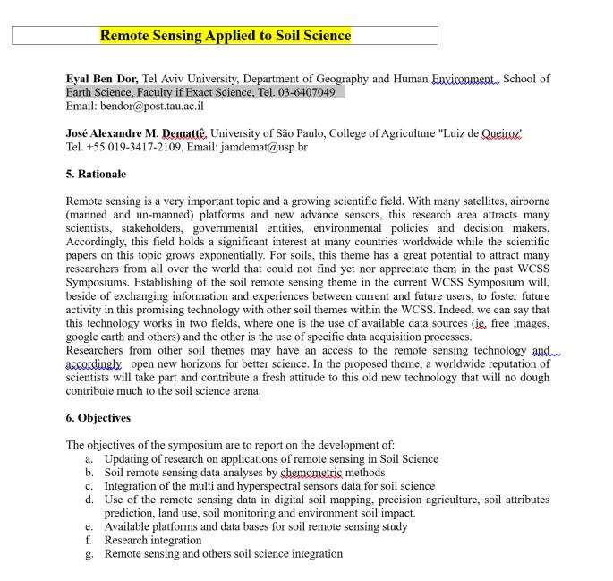
Eyal Ben-Dor Department of Geography Tel Aviv University
|
|
|
- Patience Nichols
- 5 years ago
- Views:
Transcription


1 Spectral Imaging of Soils: past present and future Eyal Ben-Dor Department of Geography Tel Aviv University 2nd International Conference on Airborne Research for the Environment, DLR - the German Aerospace Research Center, in Oberpfaffenhofen, July 2017
2 OUTLINE Definitions Soil Spectroscopy and its information Deep Learning to extract soil attributes Soil Imaging and field spectroscopy, big data issues Soil Spectral libraries and importance Soil standardization Image visualization Interests New Spectral dimensions Sensors and Platforms (airborne): big to light maned aircraft to drones (VNIR only ) Satellites program Conclusion
")

 medium for")
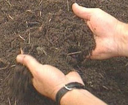
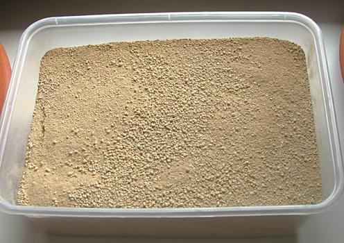
3 Definition 1 Soil The upper layer of the earth ( 0-2m) represent its loose surface material which is dug, plowed and being a medium for plants to grow. (Thompson 1957) medium for plants to grow


4 Strong Link between Point and Image Spectroscopy Image Spectroscopy Geology Vegetation Water Point Spectroscopy Soil

5 Soil Spectrum An elegant wat to simplest the complexity of the soil system Iron Oxides Clays Hygroscopic Organic Water Matter Calcite Organic Matter Wavelength (mm)
6 Quantitative spectroscopy Chemometrics

7 First article on soil spectra quantification 1965 demonstrated the power of soil spectroscopy Clayey Soil and Soil Moisture Bowers and Hanks, 1965
8 1980 First Soil Spectral Library 5 spectral types in USA Around 4000 spectra Stoner, E.R. and M.F., Baumgardner, Characteristic variations in reflectance of surface soils. Soil Science Society of American Journal 45:
9 Common method Multiple Linear Regression Analyses calibration

10 Advanced in Agronomy 2015

11 Today: Supervised Machine Learning for data mining Limited output The Unscrumbler SPSS Drawbacks Limited configuration Matlab Requires Programming knowledge No Automation for Pre-processing Tomorrow : Automated Deep Leering Aproach PARACUDA One click button No need to be expert in machine learning approach Extracting the best model Image application
 E.")
12 Software for data mining and image illustration Paracuda-II An automated data mining machine for soil chemometric analysis (point and imaging) E. Ben Dor 2015 FAST & AUTOMATICS


13 2017 and tomorrow 1. Find the code 2. Acquire the right hardware 3. Set up the environment Steps 1 to 6 are already configured, Just And see the results! 4. Import the right files 5. Installing all dependencies...packages, versions, OS etc 6. Errors.. Debugging.. Errors.. Debugging 7. Run 8. Results
14 Spectral Archive


15 Soil Spectral Library : chemistry and spectroscopy Soil Attributes Soil Spectra Files Sample Location OM Clay Lime. A1 34, % 34% 23.4% 36,654,32

16 Past : 1980 First Soil Spectral Library Around 4000 spectra
 many users 2016 2015 http://groups.google.")
")
17 Today: World Soil Spectral Libraries (no measurement protocols) many users Estimation of total number of soil spectra : 400,000 (1980 4,000)

18 Today


19 Past no protocol for spectral measurements


20 Present and future : a new standard and protocol for global soil spectral library Standardization Reducing Non Systematic Soil Internal Standard Reducing Systematic Effects
21 Tomorrow : New Standard world wide Soil Spectral Library
 Improved Food Security Water Extremes")
 (IFS) Protocol,")
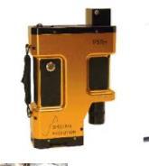
22 Thematic Areas Adaptation to Climate Change (ACC) Improved Food Security Water Extremes Management Access to Raw Materials (ARM) Access to Energy (SENSE) (IFS) Protocol, SSL
23 WP 4 TAU-i-BEC mission To establish a soil spectral library SSL for the North Africa, Middle East and Balkans To establish a basic foundation to use the SSL for EO means (from field, air and domains) To built a data base with a GEOSS sharing regulation
24 Spectral Sensors laboratory and field
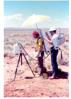
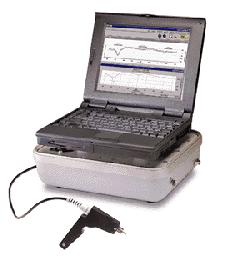

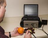
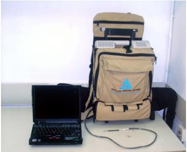
25 Field Spectrometer and Accessories Past PERS 1974 ASD 1994


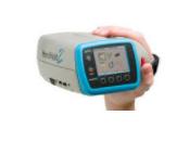
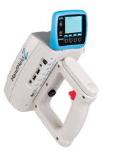
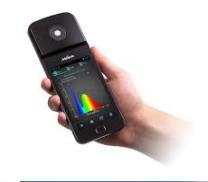
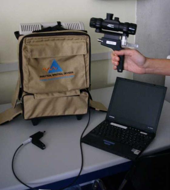
26 Today and tomorrow : Many instruments


27 Today: Field soil measurement is leaning on the sun radiation


28 Today: Close moving chamber for 27/7 option


29 Tomorrow : Close chamber compatible with all spectrometers and easy to use Soil field Probe (SoilPRO ) Laboratory quality in field measurements Bare fiber SoilPRO


30 Past: Soil spectral Profiling

31 Tomorrow: Merging profiling spectroscopy with surface data
32 Imaging Systems
 to")


33 from heavy (past) to light sensors (present and future) Petri SPECIM March 23, 2015 we have sold now way over 4000 spectrographs, of which ~110 have gone into airborne AISA systems!

34 From point and scanning (past) to snap shot systems (present and future)
35 Imaging Platforms (air borne)


36 Past: Heavy aircrafts and complicated constructions (airborne) ASD

37 Present: light aircraft and UAVs (airborne)


38 Tomorrow: Combination between airborne and satellite 20 Km 4 Weeks
39 Interest

40 Number of papers and Patents Interest How point spectroscopy driven the image spectroscopy of soils Point Spectroscopy Past & Present Future Image Spectroscopy Year
 Under Review (2) Pending Major Revisions (2) Revised Version Review (2) Pending")
41 Past: Special Issues on Soil (Field) Spectroscopy 2013 Impact Factor= As for March 27, 2015 In Total (11) Under Review (2) Pending Major Revisions (2) Revised Version Review (2) Pending Editor Decision (1) Published (3) Rejected & Archived (3)
42 Special Issues on Soil (Field) Spectroscopy Impact Factor= 2.72 As for March 27, 2015 In Total (11) Under Review (2) Pending Major Revisions (2) Revised Version Review (2) Pending Editor Decision (1) Published (3) Rejected & Archived (3)
43 the Remote Sensing Handbook (Volume I, II, III) Past Will be published by Taylor and Francis Inc. CRC Press, September 2015 Prasad T, Editor pp: Eyal Ben-Dor Tel Aviv University Jose A.M. Dematte University of Sao Paulo

44 Tomorrow
45 About 150 members visnir community Professional Groups VNIR-SWIR-TIR community 320 > 300 members

46 Tomorrow
47 Spectral Region


48 Today Tomorrow SPECTRAL REGION FOR HSR

,")
49 Du, C., & Zhou, J. (2009). Evaluation of soil fertility using infrared spectroscopy: a review. Environmental Chemistry Letters, 7(2), Mid IR for soil P (soluble and solid)
50 Space Programs

51 Space Programs


52 Hyperspectral HSR Orbital Missions Launch and Lifetime Past Present Tomorrow 2018/ /24 ESA SENTINEL 10


53 Soil monitoring from space are playing a major role in SHALOM and SENTINEL 10 missions


54 Model from SSL Tomorrow s vision
55 Conclusions Soil Hyperspectal Remote Sensing is a growing field with a growing recognition Soil Hyperspectral Remote Sensing has a great potential in many directions. The future is bright in soil spectral imaging base on the knowhow already accumulated and on the forthcoming advance technology (sensors, accessories, platforms)


56 Thank You for Your Attention
The role of soil spectral library for the food security issue
 The role of soil spectral library for the food security issue Eyal Ben-Dor Department of Geography Tel Aviv University The GEO-CRADLE project has received funding from the European Union s Horizon 2020
Optimizing Model Development and Validation Procedures of Partial Least Squares for Spectral Based Prediction of Soil Properties
 Optimizing Model Development and Validation Procedures of Partial Least Squares for Spectral Based Prediction of Soil Properties Soil Spectroscopy Extracting chemical and physical attributes from spectral
40 Years Listening to the Beat of the Earth
 EU-LA Mining & Exploration Convention Earth Observation in support of sustainable mining by the Geological Surveys of Europe Gerardo Herrera Veronika Kopačková Eleftheria Poyiadji Maria Przyłucka 40 Years
Spectroscopy Applications
 Spectroscopy Applications Soil spectroscopy as a tool for the spatial assessment of soil erosion states in agricultural semi-arid Spain Sabine Chabrillat 1, Thomas Schmid 2, Robert Milewski 1, Manuel Rodriguez
Hyper-Spectral and Copernicus Evolution
 Hyper-Spectral and Copernicus Evolution Antonio Ciccolella - ESA Roma, 1 March 2017 Issue/Revision: 0.0 Reference: ESA UNCLASSIFIED Status: - For Official Use ESA UNCLASSIFIED - For Official Use Hyperspectral
Using LST and SSE from Hyperspectral Thermal Infrared Airborne Data for Satellite Validation: Application to AisaOWL
 Using LST and SSE from Hyperspectral Thermal Infrared Airborne Data for Satellite Validation: Application to AisaOWL Mary Langsdale, Martin Wooster, Bruce Main, Daniel Fisher, Weidong Xu and Maniseng Sarrazy-Weston
Second EARSeL Workshop on Imaging Spectroscopy, Enschede, 2000
 THE ACQUISITION OF SPECTRAL REFLECTANCE MEASUREMENTS UNDER FIELD AND LABORATORY CONDITIONS AS SUPPORT FOR HYPERSPECTRAL APPLICATIONS IN PRECISION FARMING Thomas UDELHOVEN, Thomas JARMER, Patrick HOSTERT
Laboratory, field and airborne spectroscopy for monitoring organic carbon content in agricultural soils
 Laboratory, field and airborne spectroscopy for monitoring organic carbon content in agricultural soils A. Stevens, B. van Wesemael, B. Tychon, D. Rosillon, H. Bartholomeus, E. Ben Dor Département de géographie
Imaging Spectroscopy for vegetation functioning
 VTT TECHNICAL RESEARCH CENTRE OF FINLAND LTD Imaging Spectroscopy for vegetation functioning Matti Mõttus IBC-CARBON workshop Novel Earth Observation techniques for Biodiversity Monitoring and Research,
SHORT TERM SCIENTIFIC MISSION (STSM) SCIENTIFIC REPORT
 SCIENTIFIC REPORT") SHORT TERM SCIENTIFIC MISSION (STSM) SCIENTIFIC REPORT This report is submitted for approval by the STSM applicant to the STSM coordinator Action number: ES1309 STSM title: Laboratory based radiometric
SHORT TERM SCIENTIFIC MISSION (STSM) SCIENTIFIC REPORT This report is submitted for approval by the STSM applicant to the STSM coordinator Action number: ES1309 STSM title: Laboratory based radiometric
Performance of spectrometers to estimate soil properties
 Performance of spectrometers to estimate soil properties M. T. Eitelwein¹, J.. M. Demattê², R. G. Trevisan¹,.. nselmi¹, J. P. Molin¹ ¹Biosystems Engineering Department, ESLQ-USP, Piracicaba-SP, Brazil
NEW CGMS BASELINE FOR THE SPACE-BASED GOS. (Submitted by the WMO Secretariat) Summary and Purpose of Document
 Summary and Purpose of Document") WORLD METEOROLOGICAL ORGANIZATION COMMISSION FOR BASIC SYSTEMS OPEN PROGRAMME AREA GROUP ON INTEGRATED OBSERVING SYSTEMS EXPERT TEAM ON SATELLITE SYSTEMS ET-SAT-7/Inf. 2 (12.III.2012) ITEM: 8.1 SEVENTH
WORLD METEOROLOGICAL ORGANIZATION COMMISSION FOR BASIC SYSTEMS OPEN PROGRAMME AREA GROUP ON INTEGRATED OBSERVING SYSTEMS EXPERT TEAM ON SATELLITE SYSTEMS ET-SAT-7/Inf. 2 (12.III.2012) ITEM: 8.1 SEVENTH
STANDARD OPERATING PROCEDURES
 Code: METH09V01 Date: July 30, 2014 STANDARD OPERATING PROCEDURES NEAR-INFRARED DIFFUSE REFLECTANCE SPECTROSCOPY METHOD FOR ANALYSING SOILS AND PLANTS USING BRUKER MULTI PURPOSE ANALYSER SPECTROMETER Contact
IntelliCal FAQ Revised 9/27/12
 IntelliCal FAQ Revised 9/27/12 IntelliCal Intelligent spectral calibration routine from Princeton Instruments, available with 64-bit LightField data acquisition software. Q. What is IntelliCal? Figure
Process Analytical Technology Diagnosis, Optimization and Monitoring of Chemical Processes
 FRAUNHOFER INSTITUTe FoR Chemical Technology ICT Process Analytical Technology Diagnosis, Optimization and Monitoring of Chemical Processes Process Analytical Technology Diagnosis, Optimization and Monitoring
for XPS surface analysis
 Thermo Scientific Avantage XPS Software Powerful instrument operation and data processing for XPS surface analysis Avantage Software Atomic Concentration (%) 100 The premier software for surface analysis
Satellite ASTER Global Geoscience Maps
 Satellite ASTER Global Geoscience Maps Michael Abrams Jet Propulsion Laboratory, California Institute of Technology, Pasadena USA (c) 2017 California Institute of Technology. Government sponsorship acknowledged.
Copernicus for Raw Materials Workshop
 Copernicus for Raw Materials Workshop Copernicus 40 User Years Forum Listening Industry Workshop, to the Beat 5th September of the Earth 2016, Brussels About http://copernicus.eu/raw-materials-workshop
Institute of Optical Sensor Systems German Aerospace Center
 DLR.de Chart 1 Institute of Optical Sensor Systems German Aerospace Center Dr. Anko Börner Institute of Optical Sensor Systems 15th February 2017 DLR.de Chart 2 DLR Deutsches Zentrum für Luft- und Raumfahrt
The Copernicus Sentinel-5 Mission: Daily Global Data for Air Quality, Climate and Stratospheric Ozone Applications
 SENTINEL-5 The Copernicus Sentinel-5 Mission: Daily Global Data for Air Quality, Climate and Stratospheric Ozone Applications Yasjka Meijer RHEA for ESA, Noordwijk, NL 15/04/2016 Co-Authors: Jörg Langen,
Corresponding Author: Jason Wight,
 COMPARISON OF COMBUSTION, CHEMICAL, AND NEAR-INFRARED SPECTROSCOPIC METHODS TO DETERMINE SOIL ORGANIC CARBON Jason P Wight, Fred L. Allen, M. Z., Zanetti, and T. G. Rials Department of Plant Sciences,
Change Detection Over Sokolov Open Pit Mine Areas, Czech Republic, Using Multi Temporal HyMAP Data ( )
") Change Detection Over Sokolov Open Pit Mine Areas, Czech Republic, Using Multi Temporal HyMAP Data (2009 2010) S. Adar* a G. Notesco b, A. Brook b, I. Livne b, P. Rojik c, V. Kopackova d, K. Zelenkova
Change Detection Over Sokolov Open Pit Mine Areas, Czech Republic, Using Multi Temporal HyMAP Data (2009 2010) S. Adar* a G. Notesco b, A. Brook b, I. Livne b, P. Rojik c, V. Kopackova d, K. Zelenkova
Making Accurate Field Spectral Reflectance Measurements By Dr. Alexander F. H. Goetz, Co-founder ASD Inc., Boulder, Colorado, 80301, USA October 2012
 Making Accurate Field Spectral Reflectance Measurements By Dr. Alexander F. H. Goetz, Co-founder ASD Inc., Boulder, Colorado, 80301, USA October 2012 Introduction Accurate field spectral reflectance measurements
ADVANCED MINERAL MAPPING USING VISIBLE TO NEAR INFRARED, SHORTWAVE AND LONGWAVE INFRARED HIGH SPECTRAL RESOLUTION DATA
 ADVANCED MINERAL MAPPING USING VISIBLE TO NEAR INFRARED, SHORTWAVE AND LONGWAVE INFRARED HIGH SPECTRAL RESOLUTION DATA Veronika Kopačková, Lucie Koucká Overview Concept of our approach, QUANTOOLS into
Status of the Sentinel-5 Precursor Presented by C. Zehner S5p, S4, and S5 Missions Manager - ESA
 Status of the Sentinel-5 Precursor Presented by C. Zehner S5p, S4, and S5 Missions Manager - ESA European response to global needs: to manage the environment, to mitigate the effects of climate change
FIELD SPECTROMETER QUICK-START GUIDE FOR FIELD DATA COLLECTION (LAST UPDATED 23MAR2011)
") FIELD SPECTROMETER QUICK-START GUIDE FOR FIELD DATA COLLECTION (LAST UPDATED 23MAR2011) The ASD Inc FieldSpec Max spectrometer is a precision instrument designed for obtaining high spectral resolution
FIELD SPECTROMETER QUICK-START GUIDE FOR FIELD DATA COLLECTION (LAST UPDATED 23MAR2011) The ASD Inc FieldSpec Max spectrometer is a precision instrument designed for obtaining high spectral resolution
DATA COLLECTION AND ANALYSIS METHODS FOR DATA FROM FIELD EXPERIMENTS
 DATA COLLECTION AND ANALYSIS METHODS FOR DATA FROM FIELD EXPERIMENTS S. Shibusawa and C. Haché Faculty of Agriculture, Tokyo University of Agriculture and Technology, Japan Keywords: Field experiments,
MULTICHANNEL NADIR SPECTROMETER FOR THEMATICALLY ORIENTED REMOTE SENSING INVESTIGATIONS
 S E S 2 5 Scientific Conference SPACE, ECOLOGY, SAFETY with International Participation 1 13 June 25, Varna, Bulgaria MULTICHANNEL NADIR SPECTROMETER FOR THEMATICALLY ORIENTED REMOTE SENSING INVESTIGATIONS
Introduction of Remote Sensing Methods for Monitoring the Under Restoration Amiantos Mine, Cyprus
 Sixth International Conference on Remote Sensing and Geoinformation of Environment, 26-29 March, 2018 - Cyprus Introduction of Remote Sensing Methods for Monitoring the Under Restoration Amiantos Mine,
Hyperspectral Data as a Tool for Mineral Exploration
 1 Hyperspectral Data as a Tool for Mineral Exploration Nahid Kavoosi, PhD candidate of remote sensing kavoosyn@yahoo.com Nahid Kavoosi Abstract In Geology a lot of minerals and rocks have characteristic
REX Evaluation Guide. American Micro Detection Systems Inc March Lane, Suite 200 Stockton, CA 95219
 REX Evaluation Guide American Micro Detection Systems Inc. 2800 March Lane, Suite 200 Stockton, CA 95219 I. INTRODUCTION REX (Real-time Elemental X-ray Fluorescence System) is the only instrument capable
Remote sensing and Reflectance spectroscopy as useful tools for Uranium exploration
 Remote sensing and Reflectance spectroscopy as useful tools for Uranium exploration Fares Howari, PhD University of Texas at Austin Bureau of Economic Geology (BEG) and Center for International Energy
HEAVY MINERALS INVESTIGATION USING GEOSPATIAL TECHNOLOGY
 HEAVY MINERALS INVESTIGATION USING GEOSPATIAL TECHNOLOGY *Muthiah.M.S, **Colins Johnny.J, *PG student: Department of Civil Engineering, Anna University Regional Campus Tirunelveli, India **Assistant Professor:
Hyperspectral at Leonardo. Ing. Alberto Sarti, CTO Electronic, Defense and Security Sector
 Hyperspectral at Leonardo Ing. Alberto Sarti, CTO Electronic, Defense and Security Sector Leonardo Hyperspectral instruments evolution AVIONIC VIRS SIM.GA 1 SIM.GA 2 SPHYDER
Water in Food 3 rd International Workshop. Water Analysis of Food Products with at-line and on-line FT-NIR Spectroscopy. Dr.
 Water in Food 3 rd International Workshop Water Analysis of Food Products with at-line and on-line FT-NIR Spectroscopy Dr. Andreas Niemöller Lausanne 29th 30th March 2004 Bruker Group Company Technology
sentinel-2 COLOUR VISION FOR COPERNICUS
 sentinel-2 COLOUR VISION FOR COPERNICUS SATELLITES TO SERVE By providing a set of key information services for a wide range of practical applications, Europe s Copernicus programme is providing a step
XXIII CONGRESS OF ISPRS RESOLUTIONS
 XXIII CONGRESS OF ISPRS RESOLUTIONS General Resolutions Resolution 0: Thanks to the Czech Society commends: To congratulate The Czech Society, its president and the Congress Director Lena Halounová, the
CGMS Baseline In response to CGMS action/recommendation A45.01 HLPP reference: 1.1.8
 Prepared by WGIII Agenda Item: 7.1 Discussed in WGIII CGMS Baseline In response to CGMS action/recommendation A45.01 HLPP reference: 1.1.8 In CGMS-45, Working Group III agreed to hold a review of the CGMS
Cross-calibration of Geostationary Satellite Visible-channel Imagers Using the Moon as a Common Reference
 Cross-calibration of Geostationary Satellite Visible-channel Imagers Using the Moon as a Common Reference Thomas C. Stone U.S. Geological Survey, Flagstaff AZ, USA 27 30 August, 2012 Motivation The archives
Smart Sensing Embedded Spectroscopy Platform Botlek studiegroep 06-april-2017
 Smart Sensing Embedded Spectroscopy Platform Botlek studiegroep 06-april-2017 W. Karremans Personal introduction Background: Process Analysis DSM AKZO Nobel Chemicals Aspenpharma 2016: Sales Engineer Elscolab
Calibration of Ocean Colour Sensors
 Dr. A. Neumann German Aerospace Centre DLR Remote Sensing Technology Institute Marine Remote Sensing What is Calibration, why do we need it? Sensor Components Definition of Terms Calibration Standards
CGMS Baseline. Sustained contributions to the Global Observing System. Endorsed by CGMS-46 in Bengaluru, June 2018
 CGMS Baseline Sustained contributions to the Global Observing System Best Practices for Achieving User Readiness for New Meteorological Satellites Endorsed by CGMS-46 in Bengaluru, June 2018 CGMS/DOC/18/1028862,
QUALITY AND DRYING BEHAVIOUR OF ORGANIC FRUIT PRODUCTS
 Prof. Riccardo Massantini Department for Innovation in Biological, Agro food and Forest systems (DIBAF), University of Tuscia, Viterbo (Italy) massanti@unitus.it OUR RESEARCH GROUP AND COMPETENCES RICCARDO
Fri. Apr. 14, Hewson paper: Geological Map using ASTER data Sabins Ch. 10 Oil Exploration Overview. Reading:
 Fri. Apr. 14, 2018 Hewson paper: Geological Map using ASTER data Sabins Ch. 10 Oil Exploration Overview Reading: Skim Sabins Chapter 10. Oil Exploration 1 Hewson et al. Objectives 1. 2. 3. 4. 5. 6. 7.
HYPERSPECTRAL IMAGING
 1 HYPERSPECTRAL IMAGING Lecture 9 Multispectral Vs. Hyperspectral 2 The term hyperspectral usually refers to an instrument whose spectral bands are constrained to the region of solar illumination, i.e.,
History & Scope of Remote Sensing FOUNDATIONS
 History & Scope of Remote Sensing FOUNDATIONS Lecture Overview Introduction Overview of visual information Power of imagery Definition What is remote sensing? Definition standard for class History of Remote
Retrieval Algorithm Using Super channels
 Retrieval Algorithm Using Super channels Xu Liu NASA Langley Research Center, Hampton VA 23662 D. K. Zhou, A. M. Larar (NASA LaRC) W. L. Smith (HU and UW) P. Schluessel (EUMETSAT) Hank Revercomb (UW) Jonathan
Key words: Hyperspectral, imaging, object identification, urban, investigation
 URBAN SENSING BY HYPERSPECTRAL DATA Lanfen ZHENG, Qingxi TONG, Bing ZHANG, Xing LI, Jiangui LIU The Institute of Remote Sensing Applications, Chinese Academy of Sciences P. O. Box 9718, 100101, Beijing,
HY-2A Satellite User s Guide
 National Satellite Ocean Application Service 2013-5-16 Document Change Record Revision Date Changed Pages/Paragraphs Edit Description i Contents 1 Introduction to HY-2 Satellite... 1 2 HY-2 satellite data
Nanoscale IR spectroscopy of organic contaminants
 The nanoscale spectroscopy company The world leader in nanoscale IR spectroscopy Nanoscale IR spectroscopy of organic contaminants Application note nanoir uniquely and unambiguously identifies organic
M.C.PALIWAL. Department of Civil Engineering NATIONAL INSTITUTE OF TECHNICAL TEACHERS TRAINING & RESEARCH, BHOPAL (M.P.), INDIA
, INDIA") INVESTIGATIONS ON THE ACCURACY ASPECTS IN THE LAND USE/LAND COVER MAPPING USING REMOTE SENSING SATELLITE IMAGERY By M.C.PALIWAL Department of Civil Engineering NATIONAL INSTITUTE OF TECHNICAL TEACHERS
INVESTIGATIONS ON THE ACCURACY ASPECTS IN THE LAND USE/LAND COVER MAPPING USING REMOTE SENSING SATELLITE IMAGERY By M.C.PALIWAL Department of Civil Engineering NATIONAL INSTITUTE OF TECHNICAL TEACHERS
ANALYSIS OF LARGE SCALE SOIL SPECTRAL LIBRARIES
 Antoine Stevens (1), Marco Nocita (1,2), & Bas van Wesemael (1) ANALYSIS OF LARGE SCALE SOIL SPECTRAL LIBRARIES 1 Georges Lemaître Centre for Earth and Climate Research, Earth and Life Institute, UCLouvain,
Spectroscopy-supported digital soil mapping
 Spectroscopy-supported digital soil mapping Outline Introduction Project and theoretical background Field sampling Estimating and mapping soil mineralogy Conclusion & outlook The nation that destroys its
Eyes in the Sky & Data Analysis.
 Eyes in the Sky & Data Analysis How can we collect Information about Earth Climbing up Trees & Mountains Gathering Food Self Protection Understanding Surroundings By Travelling Collected Information Converted
Geoscience Australia Report on Cal/Val Activities
 Medhavy Thankappan Geoscience Australia Agency Report I Berlin May 6-8, 2015 Outline 1. Calibration / validation at Geoscience Australia Corner reflector infrastructure for SAR calibration (for information)
DYNAMIC VAPOR SORPTION ANALYZER FULLY AUTOMATED COMPACT BENCH-TOP DVS ANALYZER, FOR FAST AND ACCURATE SORPTION MEASUREMENTS.
 DYNAMIC VAPOR SORPTION ANALYZER FULLY AUTOMATED COMPACT BENCH-TOP DVS ANALYZER, FOR FAST AND ACCURATE SORPTION MEASUREMENTS. www.hidenisochema.com The IGAsorp is a fully automated compact bench-top DVS
GIS and Remote Sensing
 Spring School Land use and the vulnerability of socio-ecosystems to climate change: remote sensing and modelling techniques GIS and Remote Sensing Katerina Tzavella Project Researcher PhD candidate Technology
Advanced Geostationary Observations for the OzEWEX Community. Leon Majewski Bureau of Meteorology
 Advanced Geostationary Observations for the OzEWEX Community Leon Majewski Bureau of Meteorology Overview Geostationary satellite missions & sensors Meteorological applications Access for OzEWEX researchers
Spectroscopy in Transmission
 Spectroscopy in Transmission + Reflectance UV/VIS - NIR Absorption spectra of solids and liquids can be measured with the desktop spectrograph Lambda 9. Extinctions up to in a wavelength range from UV
Mission Objectives and Current Status of GOSAT (IBUKI) Japan Aerospace Exploration Agency Yasushi Horikawa
 Japan Aerospace Exploration Agency Yasushi Horikawa") Mission Objectives and Current Status of GOSAT (IBUKI) Japan Aerospace Exploration Agency Yasushi Horikawa 1 Background of the Launch of the GOSAT project 1997 Adoption of the Kyoto Protocol 2002 Ratification
Mission Objectives and Current Status of GOSAT (IBUKI) Japan Aerospace Exploration Agency Yasushi Horikawa 1 Background of the Launch of the GOSAT project 1997 Adoption of the Kyoto Protocol 2002 Ratification
A Regional Microsatellite Constellation with Electric Propulsion In Support of Tuscan Agriculture
 Berlin, 20 th - 24 th 2015 University of Pisa 10 th IAA Symposium on Small Satellites for Earth Observation Student Conference A Regional Microsatellite Constellation with Electric Propulsion In Support
Measurement and Instrumentation, Data Analysis. Christen and McKendry / Geography 309 Introduction to data analysis
 1 Measurement and Instrumentation, Data Analysis 2 Error in Scientific Measurement means the Inevitable Uncertainty that attends all measurements -Fritschen and Gay Uncertainties are ubiquitous and therefore
CNES Activity Report. Patrice Henry - CNES WGCV Plenary # 41 Tokyo Sept. 5-7, Working Group on Calibration and Validation
 Activity Report Patrice Henry - Tokyo Sept. 5-7, 2016 Working Group on Calibration and Validation SUMMARY Calibration Monitoring of in-flight Missions Preparation of future Missions Involvement in CEOS/WGCV
Land Cover and Asset Mapping Operational Change Detection
 Land Cover and Asset Mapping Operational Change Detection Andreas Müller DLR DFD with the support of Charly Kaufmann, Allan Nielsen, Juliane Huth ESA Oil & Gas Workshop, 13-14 September 2010 Folie 1 TWOPAC
Product Quality README file for GOME Level 1b version 5.1 dataset
 Product Quality README file for GOME Level 1b version 5.1 dataset Field Content Document Title Product Quality Readme file: GOME Level 1b version 5.1 dataset Reference ESA-EOPG-MOM-TN-13, issue 1.0, 15/06/2018
THE UTILITY OF HYPERSPECTRAL DATA ON EXPLORATION OF SANDSTONE-HOSTED URANIUM DEPOSITS *
 THE UTILITY OF HYPERSPECTRAL DATA ON EXPLORATION OF SANDSTONE-HOSTED URANIUM DEPOSITS * Jie-lin Zhang Beijing Research Institute of Uranium Geology Key Laboratory of Remote Sensing Beijing 100029, China,
Lunar Surface Material Composition Mapping
 Introduction: Lunar Surface Material Composition Mapping Japan, India, China, and the United States have recently sent spacecraft orbiters to study the lunar surface. The main focus of these missions has
Extraction of incident irradiance from LWIR hyperspectral imagery
 DRDC-RDDC-215-P14 Extraction of incident irradiance from LWIR hyperspectral imagery Pierre Lahaie, DRDC Valcartier 2459 De la Bravoure Road, Quebec, Qc, Canada ABSTRACT The atmospheric correction of thermal
Measurement & Analytics Measurement made easy. MB3600-CH70 FT-NIR polyol analyzer Pre-calibrated for OH value determination
 Measurement & Analytics Measurement made easy MB3600-CH70 FT-NIR polyol analyzer Pre-calibrated for OH value determination Adapted for polyols and polyurethanes applications The MB3600-CH70 Polyol Analyzer
Copernicus Data Driven Services for Regional & Local Government in Greece
 Workshop on Copernicus uptake by public authorities Gabriel Mavrellis CEO, Geospatial Enabling Technologies Copernicus Data Driven Services for Regional & Local Government in Greece The Company Copernicus
Advanced Spectroscopy Laboratory
 Advanced Spectroscopy Laboratory - Raman Spectroscopy - Emission Spectroscopy - Absorption Spectroscopy - Raman Microscopy - Hyperspectral Imaging Spectroscopy FERGIELAB TM Raman Spectroscopy Absorption
Current Status of the Stratospheric Ozone Layer From: UNEP Environmental Effects of Ozone Depletion and Its Interaction with Climate Change
 Goals Produce a data product that allows users to acquire time series of the distribution of UV-B radiation across the continental USA, based upon measurements from the UVMRP. Provide data in a format
Spectroscopy - is the study of the interaction between matter and radiated energy.
 Spectroscopy www.oakland.edu/?id=171 www.d.umn.edu/~mharvey/co www.spinoff.nasa.gov/spinoff201 www.aerodata-surveys.com/data_processin www.loke.as.arizona.edu/~ckulesa/camp/spectroscop www.rgbstock.com/photo/milvggk/color+model+%28
SPITZER SPACE TELESCOPE
 SPITZER SPACE TELESCOPE The Rationale for Infrared Astronomy reveal cool states of matter explore the hidden Universe provide access to many spectral features probe the early life of the cosmos WANT TO
Applications of Remote Sensing Systems. to MINERAL DEPOSIT DISCOVERY, DEVELOPMENT
 REMS 6022: Term Project Applications of Remote Sensing Systems to MINERAL DEPOSIT DISCOVERY, DEVELOPMENT and RECLAMATION Venessa Bennett OVERVIEW Remote Sensing data extensively used in all aspects of
URBAN LAND COVER AND LAND USE CLASSIFICATION USING HIGH SPATIAL RESOLUTION IMAGES AND SPATIAL METRICS
 URBAN LAND COVER AND LAND USE CLASSIFICATION USING HIGH SPATIAL RESOLUTION IMAGES AND SPATIAL METRICS Ivan Lizarazo Universidad Distrital, Department of Cadastral Engineering, Bogota, Colombia; ilizarazo@udistrital.edu.co
Soil surface illumination at micro-relief scale and soil BRDF data collected by a hyperspectral camera
 International Journal of Remote Sensing Vol. 31, Nos. 7 8, April 2010, 2151 2157 Soil surface illumination at micro-relief scale and soil BRDF data collected by a hyperspectral camera JERZY CIERNIEWSKI*,
GOSAT mission schedule
 GOSAT mission schedule 29 21 12 1 2 3 4 6 7 8 9 1 11 12 1 2 214 1 2 3 ~ Jan. 23 Launch Initial Checkout Initial function check Initial Cal. and Val. Mission life Normal observation operation Extra Operati
IR sounder small satellite for polar orbit weather measurements
 IR sounder small satellite for polar orbit weather measurements Sara Lampen, Sonny Yi, Jared Lang, Caleb Lampen, Adam Vore, David Warren, Eric Herman The Aerospace Corporation John J. Pereira National
Time Series Analysis with SAR & Optical Satellite Data
 Time Series Analysis with SAR & Optical Satellite Data Thomas Bahr ESRI European User Conference Thursday October 2015 harris.com Motivation Changes in land surface characteristics mirror a multitude of
HICO Science Mission Overview
 HICO Science Mission Overview Michael R. Corson* and Curtiss O. Davis** * Naval Research Laboratory Washington, DC corson@nrl.navy.mil ** College of Oceanic and Atmospheric Sciences Oregon State University
Thermal And Near infrared Sensor for carbon Observation (TANSO) On board the Greenhouse gases Observing SATellite (GOSAT) Research Announcement
 On board the Greenhouse gases Observing SATellite (GOSAT) Research Announcement") Thermal And Near infrared Sensor for carbon Observation (TANSO) On board the Greenhouse gases Observing SATellite (GOSAT) Research Announcement Appendix A Outlines of GOSAT and TANSO Sensor GOSAT (Greenhouse
Thermal And Near infrared Sensor for carbon Observation (TANSO) On board the Greenhouse gases Observing SATellite (GOSAT) Research Announcement Appendix A Outlines of GOSAT and TANSO Sensor GOSAT (Greenhouse
Application of near-infrared (NIR) spectroscopy to sensor based sorting of an epithermal Au-Ag ore
 spectroscopy to sensor based sorting of an epithermal Au-Ag ore") Application of near-infrared (NIR) spectroscopy to sensor based sorting of an epithermal Au-Ag ore OCM conference presentation 19-03-2015 TU Delft, Resource Engineering M.Dalm MSc. 1 Contents of the presentation
Application of near-infrared (NIR) spectroscopy to sensor based sorting of an epithermal Au-Ag ore OCM conference presentation 19-03-2015 TU Delft, Resource Engineering M.Dalm MSc. 1 Contents of the presentation
identify tile lines. The imagery used in tile lines identification should be processed in digital format.
 Question and Answers: Automated identification of tile drainage from remotely sensed data Bibi Naz, Srinivasulu Ale, Laura Bowling and Chris Johannsen Introduction: Subsurface drainage (popularly known
REVIEW MAPWORK EXAM QUESTIONS 31 JULY 2014
 REVIEW MAPWORK EXAM QUESTIONS 31 JULY 2014 Lesson Description In this lesson we: Focus on key concepts and exam questions relating to GIS. Question 1 Test Yourself The most important component of a GIS
Measuring ph with Smart Cuvettes
 1 Measuring ph with Smart Cuvettes Hardware Setup for ph Measurements ph is measured in Absorbance mode. Configure your spectroscopy components for Absorbance measurements. Sample Absorbance setups for
EO-MINERS. Contribution of Earth Observation in monitoring the environmental and societal impact of mining. The EO-MINERS project
 EO-MINERS Contribution of Earth Observation in monitoring the environmental and societal impact of mining The EO-MINERS project Geospatial World Forum Amsterdam April 25, 2012 Stéphane CHEVREL Project
Sentinel-5 Precursor: Preparing the first Copernicus Atmospheric Mission
 Sentinel-5 Precursor: Preparing the first Copernicus Atmospheric Mission Herbert Nett 1, Kevin McMullan 1, Paul Ingmann 1, Thorsten Fehr 2 (1) ESA/ESTEC, Keplerlaan 1, NL-2201 AZ Noordwijk (2) ESA/ESRIN,
Improvement of Himawari-8 observation data quality
 Improvement of Himawari-8 observation data quality 3 July 2017 Meteorological Satellite Center Japan Meteorological Agency The Japan Meteorological Agency (JMA) plans to modify its Himawari-8 ground processing
Visible-near infrared spectroscopy to assess soil contaminated with cobalt
 Available online at www.sciencedirect.com Procedia Engineering 35 (2012 ) 245 253 International Meeting of Electrical Engineering Research ENIINVIE 2012 Visible-near infrared spectroscopy to assess soil
Physics 476LW Advanced Physics Laboratory Atomic Spectroscopy
 Physics 476LW Atomic Spectroscopy 1 Introduction The description of atomic spectra and the Rutherford-Geiger-Marsden experiment were the most significant precursors of the so-called Bohr planetary model
UV Hound Series. Dependable High Quality Air Monitoring. Accurate Readings Within Seconds. Portable UVDOAS Multi-gas Analyzers. Multi-Gas Capability
 UV Hound Series Portable UVDOAS Multi-gas Analyzers Multi-Gas Capability Dependable High Quality Air Monitoring Individual VOCs PPB Sensitivity Non-Contact Optical Measurement Automated Reporting Configurable
Fundamentals of Remote Sensing
 Division of Spatial Information Science Graduate School Life and Environment Sciences University of Tsukuba Fundamentals of Remote Sensing Prof. Dr. Yuji Murayama Surantha Dassanayake 10/6/2010 1 Fundamentals
Research Article A Quantitative Assessment of Surface Urban Heat Islands Using Satellite Multitemporal Data over Abeokuta, Nigeria
 International Atmospheric Sciences Volume 2016, Article ID 3170789, 6 pages http://dx.doi.org/10.1155/2016/3170789 Research Article A Quantitative Assessment of Surface Urban Heat Islands Using Satellite
Measuring & monitoring soil carbon. Ermias Aynekulu Betemariam, Keith Shepherd, Richard Coe, Markus Walsh, Tor-G Vagen & Leigh Winowiecki
 Measuring & monitoring soil carbon Ermias Aynekulu Betemariam, Keith Shepherd, Richard Coe, Markus Walsh, Tor-G Vagen & Leigh Winowiecki September 13 2012 Issues There is a lack of coherent and rigorous
NIR Spectroscopy Identification of Persimmon Varieties Based on PCA-SVM
 NIR Spectroscopy Identification of Persimmon Varieties Based on PCA-SVM Shujuan Zhang, Dengfei Jie, and Haihong Zhang zsujuan@263.net Abstract. In order to achieve non-destructive measurement of varieties
Contribution to global Earth observation from satellites
 Contribution to global Earth observation from satellites - JAXA s Earth Observation strategy - April 16, 2008 Makoto Kajii Japan Aerospace Exploration Agency Earth Observation Summits and GEOSS 1 st EO
Extending the Deep Blue aerosol record from SeaWiFS and MODIS to NPP-VIIRS
 Extending the Deep Blue aerosol record from SeaWiFS and MODIS to NPP-VIIRS Andrew M. Sayer, N. Christina Hsu (PI), Corey Bettenhausen, Jaehwa Lee Climate & Radiation Laboratory, NASA Goddard Space Flight
PRECISION AGRICULTURE APPLICATIONS OF AN ON-THE-GO SOIL REFLECTANCE SENSOR ABSTRACT
 PRECISION AGRICULTURE APPLICATIONS OF AN ON-THE-GO SOIL REFLECTANCE SENSOR C.D. Christy, P. Drummond, E. Lund Veris Technologies Salina, Kansas ABSTRACT This work demonstrates the utility of an on-the-go
Learning Objectives. Thermal Remote Sensing. Thermal = Emitted Infrared
 November 2014 lava flow on Kilauea (USGS Volcano Observatory) (http://hvo.wr.usgs.gov) Landsat-based thermal change of Nisyros Island (volcanic) Thermal Remote Sensing Distinguishing materials on the ground