Key words: Hyperspectral, imaging, object identification, urban, investigation
|
|
|
- Aldous Weaver
- 6 years ago
- Views:
Transcription
1 URBAN SENSING BY HYPERSPECTRAL DATA Lanfen ZHENG, Qingxi TONG, Bing ZHANG, Xing LI, Jiangui LIU The Institute of Remote Sensing Applications, Chinese Academy of Sciences P. O. Box 9718, , Beijing, China ABSTRACT:- The airborne hyperspectral imaging data has operationally been used in environment, geology, agriculture and other fields. In this paper, airborne hyperspectral data in visible, SWIR, MIR and TIR spectral region acquired by the 128 band Operational Modular Imaging Spectrometer (OMIS) was attempt in urban object identification. Natural grassland/artificial grasslands, and different types of metal slabs in construction roof have been successfully differentiated, respectively. Combined with Geographic Information System(GIS) technology, a large scale urban mapping by using airborne hyperspectral data was also discussed in this paper. The results suggest that hyperspectral imaging data, especially combined with short wave infrared and thermal infrared, has broad application perspectives in artificial object identification and urban investigation. Key words: Hyperspectral, imaging, object identification, urban, investigation INTRODUCTION Recent advances in remote sensing have led the way for the development of hyperspectral sensors and the applications of the hyperspectral data. Hyperspectral remote sensing is a relatively new technology, which is currently being investigated by researchers and scientists with regard to the detection and identification of minerals, terrestrial vegetation, and man-made materials and backgrounds. The concept of hyperspectral remote sensing began in the mid-1980s and to this point has been used most widely by geologists for mineral mapping. Hyperspectral imaging sensor combines imaging and spectroscopy in a single system that often includes large data sets and requires new processing methods. Hyperspectral data sets are generally composed of about 100 to 200 or much more spectral bands with relatively narrow bandwidth (5-10 nm), whereas, multispectral data sets are usually composed of about 5 to 10 relative wider bands ( nm). With the high spectral resolution, hyperspectral remote sensing has great application potential for analyzing complex urban scenes. Because of the complexity of urban ecosystems, their spectral characteristics become more complicated. Affected by the human activities and natural power, the homogeneity of the urban surface goes worse. That makes remote sensing much difficult to classify the urban land using. Although the spectral characteristic of urban objects in visible and short infrared is not so clear, the hyperspectral data can exactly reflect the spectral features well. Hyperspectral remote sensing technology strengthens the sensors in discriminating spectral sorts, and it does good to the fine classification of urban landcover. HYPERSPECTRAL IMAGING SYSTEM?? OMIS Operative Modular Imaging Spectrometer (OMIS) was recently developed by the Shanghai Institute of Technical Physics (SITP) of Chinese Academy of Sciences. As shown in table 1, OMIS has 128 bands. There are 64bands in visible/near infrared, 40 bands in short-wave infrared,8 bands in middle infrared and 8 bands in thermal infrared. Especially, from 0.4 to 1.1µm, its spectral resolution is 10nm, while from 2.0 to2.5µm, 15nm.. OMIS has the
2 ability of acquiring the images of earth's surface in three continuous reflectance spectral regions and two emission spectral regions. The linear array detector with the optic-mechanical scanning system is adopted for OMIS. This imager is made up of five parts, which are optic-mechanical system, real-time calibration system, electronics system, real-time data recording and monitor system, GYRO stabilization plateform system and GPS orientation system. It can focus on the same pixel well in different band from visible to thermal infrared. It is proved that OMIS can be applied to the fields of geology, mineral resources, oil exploration, agriculture, forestry, marine resources, urban investigation and so on. SPECTRAL CHARACTERIZATION OF URBAN OBJECTS In this chapter, the spectral characteristics of major urban objects will be stated based on our recent researches. Hyperspectral image can perfectly reflects the spectral characteristics of the objects, [1] therefore it is the most powerful way for urban objects classification and identification. For different classes, there always are some different channels that will allow a particular class to be separated from other classes. Take vegetation for example, a unique spectral response within red to near infrared channels can be described by NDVI. On the remote sensing image, we usually obtain information of the rooftop of constructions. It is important to focus our study on the spectral feature of the rooftop, which reflected by different kinds of building materials, such as bitumen, asphalt felt, concrete, different tiles with different colors and so on. From figure 1, the reflectance of white-doped rooftop is clearly higher than the most other urban objects. With the wavelength grows up, its reflectance constants as 80% and changes very peacefully. The reflectance of hoar asbestos has the same trends with that of white-doped rooftop. On the contrary, that of bitumen tile is relatively lower. Another case should to be pointed out is that both pitch and asphalt felt that are mixed with carpolite are higher than the pure one. We got some typical spectral curves of rooftops as shown in figure 1. Different types of rooftop materials can be discriminated by their spectral features. In visual bands region, the spectral curve reflects the color feature of the tile, as yellow tile and lark tile. When it comes to infrared, the curve exposed the difference of these two tiles. The urban road is mainly classified as concrete and asphalt. In the suburb, there are a few roads paved by earth. Figure 2 describes the spectral curves of these kinds of roads? Concrete and cement roads have the highest reflectance and show an increasing trend. However, the reflectance of earth road is much lower, with 12% on 456nm and ascending very slowly to 35% on 850nm. Bituminous road has not such tendency in such spectral region. Also, there is a difference between bituminous highway and bituminous street because of the dust effect. The main reason is that the building time, the dust and maintenance conditions are difference. As shown in figure 3, from 443nm to 668nm, the reflectance of sparse grassplot and lower thin crop is higher than that of hurst, well growing crop and clipped grassplot. This has a direct relation with the proportion of bared soil. On the other hand, from 734nm to 975.6nm, the clipped grassplot has the highest reflectance while the lower thin crop has the lowest one. The differentiation between different kinds of vegetation is much more clearly in the short wave infrared bands. So this region is the best wavelength to discriminate different vegetation. Generally speaking, the reflectance of water is lower than any other objects in urban area. The average of the reflectance is about 3%, and at the infrared region about 0.75um, one of water goes to 0%. The more the suspending grain, the higher reflectance the water body. Both the size of grain and the concentration of pollutant also affect the reflectance. Usually, there is an inverse proportion between the reflectance and the purity of water.
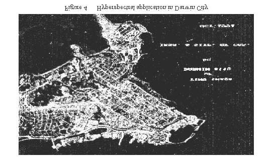
3 The shadow is important to the environment of the urban because it can reduce the absorption of solar radiation. But it also envelops some urban objects. Those objects in the shadow can also reflect the radiation from dispersion. Because the objects in the shadow are various, the effect of the round objects is complex, and the shadow is multiplex, the spectral curves of different shadow-covered objects (such as vegetation) are different. So we can get the weak information from shadow and discriminate the objects in the shadow. URBAN INVESTIGATION Urban Objects Classification and Identification With the great improvement of hyperspectral remote sensing technology, its application in urban areas has been expanded into many different fields. Urban objects classification or identification is the most important application aspect for hyperspectral data. Many materials can be identified by unique absorption feature in their reflectance spectra such as minerals and vegetation. Due to the complication of urban scene and relative disorder of artificial object in city, it is not easy to get a satisfactory classification result only depending on pixel-to-pixel spectral analysis, especially when the materials lack strong absorption features or the remote sensing data has a relative low signal/noise ratio. [2] We use hypers pectral data to detect the resource in Darwin city. In figure 4, the red areas are the places where the refrigerant gas leaks out and the power resources are chucked away. We use the infrared bands to trace the different thermal scene. As a result, we get this information to help Darwin city to rehab the constructions in which the attemperator system is not quite good. Figure 5 shows that the coal and concrete surface both are classified well. It is obviouisly that all objects have different reflectance in different wavelength. According to this unhidden trait of objects, and with the assistance of a perfect spectral library, the power of discriminating objects by hyperspectral remote sensing will be strengthened greatly. The most dramatic thing is shown in figure 6 and figure 7. In visible spectral region, two different signed grassplot in true color image of figure 6 almost have no difference. But after spectral analysis, we got distinct trait of these two areas. The comparison between their spectral curves with the spectral library shows that they are quite different. So we went to the pots to have a fieldwork and found that one is a true grassland and the other is an artificial grassland. While we focused on another place in the OMIS image shown in figure 7, we found that in visible bands the blue iron rooftop shows nothing different. But when we come to the infrared bands, an amazed thing happened: in one iron rooftop, there are three kinds of spectral curves. And after we checked the material of the rooftop, we know that the boss changed the material in economic reasons. So, the hyperspectral remote sensing has unsurpassable advantages in object identification/classification and it has great potential in urban investigation. Urban Mapping In China, because of city booming, urban mapping is becoming significant. Urban mapping is to accurately describe the figure, structure, geography and relations with circumferences of the city. With the fast urbanization, urban mapping require a shorter cycle. As government confirms the urban planning, the city-planning department
4 will publish the layouts of city in a very short period. So the data source should be refreshed in a short time. With the support of National High-Tech Plan 863 project, we have plotted the map of Zhongguancun landuse classification. As shown in figure 8, the land are classified into forty types, and in every land-using type, we had the field survey. After we got the data with pretreatment, we had it geometry and radiation corrected. With the spectral matches, we extracted different object information. Combined with GIS, we transformed the raster image into vector image, and mapped the thematic plot in the end. Urban Geographic Information Systems (UGIS) Based on hyperspectral remote sensing science and computer science, the development of GIS has provided a capacious field to urban planning departments. Technical aspects will not hobble the development of UGIS. One of the most factors that affect the UGIS is the refresh frequency of original surface data. Airborne hyperspectral remote sensing is the only way to meet the demand. Nowadays, China has stepped into the practical application stage. In urban planning management, to get timely and precise information of urban surface is pivotal step for the whole work. UGIS has the powerful function for data query, spatial analysis and synthesis management, but it should be assisted with hyperspectral remote sensing as the data source acquirer, importer and pretreater. With the development of Digital Earth, UGIS will do more in urban planning and investigation. CONCLUSION The overall idea of this study is to show that hyperspectral remote sensing applied in urban area has immense potential. At the same time, it is still a tough task in relatively speaking. Hyperspectral remote sensing will not only be widely applied in the object identification and urban mapping, but also plays a key role in UGIS (Urban Geographic Information Systems) and Digital City. ACKNOWLEDGMENTS As a research program of the Laboratory of Remote Sensing Information Sciences, Chinese Academy of Sciences, this study is funded by the National Key Project of Science and Technology in , and supported by the joint research of IRSA, China. The development of hyperspectral remote sensing system applied in urban were studied based on the results of the projects of the National High-Tech Program of China. REFERENCE Ben-Dor.E, Levin.N., and Saaroni.H., 1999, Remote Sensing of an urban environment using hyperspectral technology., Proceedings of the Thirteenth International Conference on Applied Geologic Remote Sensing,1-3 March,1999,Vancouver,BC,Canada, Vol. II:6-11. Kruse, F. A., Careen-Young, K. S., and Boardman, J. W., Mineral mapping at Cuprite, Nevada with a 63 channel imaging spectrometer, Photogram. Eng. Remote Sens, 56:83-92, 1990


5 APPENDIX

6
HYPERSPECTRAL IMAGING
 1 HYPERSPECTRAL IMAGING Lecture 9 Multispectral Vs. Hyperspectral 2 The term hyperspectral usually refers to an instrument whose spectral bands are constrained to the region of solar illumination, i.e.,
Remote Sensing and GIS Techniques for Monitoring Industrial Wastes for Baghdad City
 The 1 st Regional Conference of Eng. Sci. NUCEJ Spatial ISSUE vol.11,no.3, 2008 pp 357-365 Remote Sensing and GIS Techniques for Monitoring Industrial Wastes for Baghdad City Mohammad Ali Al-Hashimi University
GIS and Remote Sensing
 Spring School Land use and the vulnerability of socio-ecosystems to climate change: remote sensing and modelling techniques GIS and Remote Sensing Katerina Tzavella Project Researcher PhD candidate Technology
Hyperspectral Data as a Tool for Mineral Exploration
 1 Hyperspectral Data as a Tool for Mineral Exploration Nahid Kavoosi, PhD candidate of remote sensing kavoosyn@yahoo.com Nahid Kavoosi Abstract In Geology a lot of minerals and rocks have characteristic
MULTICHANNEL NADIR SPECTROMETER FOR THEMATICALLY ORIENTED REMOTE SENSING INVESTIGATIONS
 S E S 2 5 Scientific Conference SPACE, ECOLOGY, SAFETY with International Participation 1 13 June 25, Varna, Bulgaria MULTICHANNEL NADIR SPECTROMETER FOR THEMATICALLY ORIENTED REMOTE SENSING INVESTIGATIONS
PRINCIPLES OF REMOTE SENSING. Electromagnetic Energy and Spectral Signatures
 PRINCIPLES OF REMOTE SENSING Electromagnetic Energy and Spectral Signatures Remote sensing is the science and art of acquiring and analyzing information about objects or phenomena from a distance. As humans,
The role of soil spectral library for the food security issue
 The role of soil spectral library for the food security issue Eyal Ben-Dor Department of Geography Tel Aviv University The GEO-CRADLE project has received funding from the European Union s Horizon 2020
THE UTILITY OF HYPERSPECTRAL DATA ON EXPLORATION OF SANDSTONE-HOSTED URANIUM DEPOSITS *
 THE UTILITY OF HYPERSPECTRAL DATA ON EXPLORATION OF SANDSTONE-HOSTED URANIUM DEPOSITS * Jie-lin Zhang Beijing Research Institute of Uranium Geology Key Laboratory of Remote Sensing Beijing 100029, China,
Landuse and Landcover change analysis in Selaiyur village, Tambaram taluk, Chennai
 Landuse and Landcover change analysis in Selaiyur village, Tambaram taluk, Chennai K. Ilayaraja Department of Civil Engineering BIST, Bharath University Selaiyur, Chennai 73 ABSTRACT The synoptic picture
Land cover/land use mapping and cha Mongolian plateau using remote sens. Title. Author(s) Bagan, Hasi; Yamagata, Yoshiki. Citation Japan.
 Bagan, Hasi; Yamagata, Yoshiki. Citation Japan.") Title Land cover/land use mapping and cha Mongolian plateau using remote sens Author(s) Bagan, Hasi; Yamagata, Yoshiki International Symposium on "The Imp Citation Region Specific Systems". 6 Nove Japan.
Title Land cover/land use mapping and cha Mongolian plateau using remote sens Author(s) Bagan, Hasi; Yamagata, Yoshiki International Symposium on "The Imp Citation Region Specific Systems". 6 Nove Japan.
(Refer Slide Time: 3:48)
") Introduction to Remote Sensing Dr. Arun K Saraf Department of Earth Sciences Indian Institute of Technology Roorkee Lecture 01 What is Satellite based Remote Sensing Hello, hello everyone this is Arun
Introduction to Remote Sensing Dr. Arun K Saraf Department of Earth Sciences Indian Institute of Technology Roorkee Lecture 01 What is Satellite based Remote Sensing Hello, hello everyone this is Arun
History & Scope of Remote Sensing FOUNDATIONS
 History & Scope of Remote Sensing FOUNDATIONS Lecture Overview Introduction Overview of visual information Power of imagery Definition What is remote sensing? Definition standard for class History of Remote
USING HYPERSPECTRAL IMAGERY
 USING HYPERSPECTRAL IMAGERY AND LIDAR DATA TO DETECT PLANT INVASIONS 2016 ESRI CANADA SCHOLARSHIP APPLICATION CURTIS CHANCE M.SC. CANDIDATE FACULTY OF FORESTRY UNIVERSITY OF BRITISH COLUMBIA CURTIS.CHANCE@ALUMNI.UBC.CA
40 Years Listening to the Beat of the Earth
 EU-LA Mining & Exploration Convention Earth Observation in support of sustainable mining by the Geological Surveys of Europe Gerardo Herrera Veronika Kopačková Eleftheria Poyiadji Maria Przyłucka 40 Years
RESEARCH EDGE SPECTRAL REMOTE SENSING OF THE COAST. Karl Heinz Szekielda
 Research Edge Working Paper Series, no. 8 p. 1 RESEARCH EDGE SPECTRAL REMOTE SENSING OF THE COAST Karl Heinz Szekielda City University of New York Fulbright Scholar at, Nassau, The Bahamas Email: karl.szekielda@gmail.com
CORRELATION BETWEEN URBAN HEAT ISLAND EFFECT AND THE THERMAL INERTIA USING ASTER DATA IN BEIJING, CHINA
 CORRELATION BETWEEN URBAN HEAT ISLAND EFFECT AND THE THERMAL INERTIA USING ASTER DATA IN BEIJING, CHINA Yurong CHEN a, *, Mingyi DU a, Rentao DONG b a School of Geomatics and Urban Information, Beijing
AssessmentofUrbanHeatIslandUHIusingRemoteSensingandGIS
 Global Journal of HUMANSOCIAL SCIENCE: B Geography, GeoSciences, Environmental Science & Disaster Management Volume 16 Issue 2 Version 1.0 Type: Double Blind Peer Reviewed International Research Journal
Classification of High Spatial Resolution Remote Sensing Images Based on Decision Fusion
 Journal of Advances in Information Technology Vol. 8, No. 1, February 2017 Classification of High Spatial Resolution Remote Sensing Images Based on Decision Fusion Guizhou Wang Institute of Remote Sensing
ENVI Tutorial: Vegetation Analysis
 ENVI Tutorial: Vegetation Analysis Vegetation Analysis 2 Files Used in this Tutorial 2 About Vegetation Analysis in ENVI Classic 2 Opening the Input Image 3 Working with the Vegetation Index Calculator
URBAN LAND COVER AND LAND USE CLASSIFICATION USING HIGH SPATIAL RESOLUTION IMAGES AND SPATIAL METRICS
 URBAN LAND COVER AND LAND USE CLASSIFICATION USING HIGH SPATIAL RESOLUTION IMAGES AND SPATIAL METRICS Ivan Lizarazo Universidad Distrital, Department of Cadastral Engineering, Bogota, Colombia; ilizarazo@udistrital.edu.co
Joint International Mechanical, Electronic and Information Technology Conference (JIMET 2015)
") Joint International Mechanical, Electronic and Information Technology Conference (JIMET 2015) Extracting Land Cover Change Information by using Raster Image and Vector Data Synergy Processing Methods Tao
Joint International Mechanical, Electronic and Information Technology Conference (JIMET 2015) Extracting Land Cover Change Information by using Raster Image and Vector Data Synergy Processing Methods Tao
identify tile lines. The imagery used in tile lines identification should be processed in digital format.
 Question and Answers: Automated identification of tile drainage from remotely sensed data Bibi Naz, Srinivasulu Ale, Laura Bowling and Chris Johannsen Introduction: Subsurface drainage (popularly known
Estimation of Wavelet Based Spatially Enhanced Evapotranspiration Using Energy Balance Approach
 Estimation of Wavelet Based Spatially Enhanced Evapotranspiration Using Energy Balance Approach Dr.Gowri 1 Dr.Thirumalaivasan 2 1 Associate Professor, Jerusalem College of Engineering, Department of Civil
Fri. Apr. 14, Hewson paper: Geological Map using ASTER data Sabins Ch. 10 Oil Exploration Overview. Reading:
 Fri. Apr. 14, 2018 Hewson paper: Geological Map using ASTER data Sabins Ch. 10 Oil Exploration Overview Reading: Skim Sabins Chapter 10. Oil Exploration 1 Hewson et al. Objectives 1. 2. 3. 4. 5. 6. 7.
SUPPORTING INFORMATION. Ecological restoration and its effects on the
 SUPPORTING INFORMATION Ecological restoration and its effects on the regional climate: the case in the source region of the Yellow River, China Zhouyuan Li, Xuehua Liu,* Tianlin Niu, De Kejia, Qingping
Monitoring Vegetation Growth of Spectrally Landsat Satellite Imagery ETM+ 7 & TM 5 for Western Region of Iraq by Using Remote Sensing Techniques.
 Monitoring Vegetation Growth of Spectrally Landsat Satellite Imagery ETM+ 7 & TM 5 for Western Region of Iraq by Using Remote Sensing Techniques. Fouad K. Mashee, Ahmed A. Zaeen & Gheidaa S. Hadi Remote
Remote Sensing, Computers, and Land Use Planning
 Purdue University Purdue e-pubs LARS Technical Reports Laboratory for Applications of Remote Sensing 1-1-1973 Remote Sensing, Computers, and Land Use Planning Harry C. Hitchcock Follow this and additional
IMPROVING REMOTE SENSING-DERIVED LAND USE/LAND COVER CLASSIFICATION WITH THE AID OF SPATIAL INFORMATION
 IMPROVING REMOTE SENSING-DERIVED LAND USE/LAND COVER CLASSIFICATION WITH THE AID OF SPATIAL INFORMATION Yingchun Zhou1, Sunil Narumalani1, Dennis E. Jelinski2 Department of Geography, University of Nebraska,
Field Emissivity Measurements during the ReSeDA Experiment
 Field Emissivity Measurements during the ReSeDA Experiment C. Coll, V. Caselles, E. Rubio, E. Valor and F. Sospedra Department of Thermodynamics, Faculty of Physics, University of Valencia, C/ Dr. Moliner
Lesson 4b Remote Sensing and geospatial analysis to integrate observations over larger scales
 Lesson 4b Remote Sensing and geospatial analysis to integrate observations over larger scales We have discussed static sensors, human-based (participatory) sensing, and mobile sensing Remote sensing: Satellite
NASA s Airborne Visible/Infrared Imaging Spectrometer (AVIRIS) AVIRIS: PEARL HARBOR, HAWAII
 AVIRIS: PEARL HARBOR, HAWAII") AVIRIS: PEARL HARBOR, HAWAII 000412 NASA s Airborne Visible/Infrared Imaging Spectrometer (AVIRIS) LCLUC Update Robert O. Green (Tom Chrien, presenting) Jet Propulsion Laboratory Overview Objective & Approach
AVIRIS: PEARL HARBOR, HAWAII 000412 NASA s Airborne Visible/Infrared Imaging Spectrometer (AVIRIS) LCLUC Update Robert O. Green (Tom Chrien, presenting) Jet Propulsion Laboratory Overview Objective & Approach
CHARACTERIZATION OF THE LAND-COVER AND LAND-USE BY SHAPE DESCRITORS IN TWO AREAS IN PONTA GROSSA, PR, BR. S. R. Ribeiro¹*, T. M.
 CHARACTERIZATION OF THE LAND-COVER AND LAND-USE BY SHAPE DESCRITORS IN TWO AREAS IN PONTA GROSSA, PR, BR S. R. Ribeiro¹*, T. M. Hamulak 1 1 Department of Geography, State University of Ponta Grossa, Brazil
Airborne Corridor-Mapping. Planning and documentation of company infrastructure: precise, rapid, and cost effective
 Airborne Corridor-Mapping Planning and documentation of company infrastructure: precise, rapid, and cost effective Technology Airborne Laser-Scanning, digital orthophotos and thermal imaging: one flight
Sparse Representation-based Analysis of Hyperspectral Remote Sensing Data
 Sparse Representation-based Analysis of Hyperspectral Remote Sensing Data Ribana Roscher Institute of Geodesy and Geoinformation Remote Sensing Group, University of Bonn 1 Remote Sensing Image Data Remote
Vegetation Change Detection of Central part of Nepal using Landsat TM
 Vegetation Change Detection of Central part of Nepal using Landsat TM Kalpana G. Bastakoti Department of Geography, University of Calgary, kalpanagb@gmail.com Abstract This paper presents a study of detecting
1 Introduction: 2 Data Processing:
 Darren Janzen University of Northern British Columbia Student Number 230001222 Major: Forestry Minor: GIS/Remote Sensing Produced for: Geography 413 (Advanced GIS) Fall Semester Creation Date: November
A Method to Improve the Accuracy of Remote Sensing Data Classification by Exploiting the Multi-Scale Properties in the Scene
 Proceedings of the 8th International Symposium on Spatial Accuracy Assessment in Natural Resources and Environmental Sciences Shanghai, P. R. China, June 25-27, 2008, pp. 183-188 A Method to Improve the
Comparison between Land Surface Temperature Retrieval Using Classification Based Emissivity and NDVI Based Emissivity
 Comparison between Land Surface Temperature Retrieval Using Classification Based Emissivity and NDVI Based Emissivity Isabel C. Perez Hoyos NOAA Crest, City College of New York, CUNY, 160 Convent Avenue,
Abstract. TECHNOFAME- A Journal of Multidisciplinary Advance Research. Vol.2 No. 2, (2013) Received: Feb.2013; Accepted Oct.
 Received: Feb.2013; Accepted Oct.") Vol.2 No. 2, 83-87 (2013) Received: Feb.2013; Accepted Oct. 2013 Landuse Pattern Analysis Using Remote Sensing: A Case Study of Morar Block, of Gwalior District, M.P. Subhash Thakur 1 Akhilesh Singh 2
Vol.2 No. 2, 83-87 (2013) Received: Feb.2013; Accepted Oct. 2013 Landuse Pattern Analysis Using Remote Sensing: A Case Study of Morar Block, of Gwalior District, M.P. Subhash Thakur 1 Akhilesh Singh 2
Hyperspectral Atmospheric Correction
 Hyperspectral Atmospheric Correction Bo-Cai Gao June 2015 Remote Sensing Division Naval Research Laboratory, Washington, DC USA BACKGROUND The concept of imaging spectroscopy, or hyperspectral imaging,
Hyperspectral image classification using Support Vector Machine
 Journal of Physics: Conference Series OPEN ACCESS Hyperspectral image classification using Support Vector Machine To cite this article: T A Moughal 2013 J. Phys.: Conf. Ser. 439 012042 View the article
Spectral reflectance: When the solar radiation is incident upon the earth s surface, it is either
 Spectral reflectance: When the solar radiation is incident upon the earth s surface, it is either reflected by the surface, transmitted into the surface or absorbed and emitted by the surface. Remote sensing
SATELLITE REMOTE SENSING
 SATELLITE REMOTE SENSING of NATURAL RESOURCES David L. Verbyla LEWIS PUBLISHERS Boca Raton New York London Tokyo Contents CHAPTER 1. SATELLITE IMAGES 1 Raster Image Data 2 Remote Sensing Detectors 2 Analog
Spectroscopy - is the study of the interaction between matter and radiated energy.
 Spectroscopy www.oakland.edu/?id=171 www.d.umn.edu/~mharvey/co www.spinoff.nasa.gov/spinoff201 www.aerodata-surveys.com/data_processin www.loke.as.arizona.edu/~ckulesa/camp/spectroscop www.rgbstock.com/photo/milvggk/color+model+%28
LAND USE MAPPING FOR CONSTRUCTION SITES
 LAND USE MAPPING FOR CONSTRUCTION SITES STATEMENT OF THE PROBLEM Monitoring of existing construction sites within the limits of the City of Columbia is a requirement of the city government for: 1) Control
Land Surface Temperature Measurements From the Split Window Channels of the NOAA 7 Advanced Very High Resolution Radiometer John C.
 Land Surface Temperature Measurements From the Split Window Channels of the NOAA 7 Advanced Very High Resolution Radiometer John C. Price Published in the Journal of Geophysical Research, 1984 Presented
Learning Objectives. Thermal Remote Sensing. Thermal = Emitted Infrared
 November 2014 lava flow on Kilauea (USGS Volcano Observatory) (http://hvo.wr.usgs.gov) Landsat-based thermal change of Nisyros Island (volcanic) Thermal Remote Sensing Distinguishing materials on the ground
AATSR derived Land Surface Temperature from heterogeneous areas.
 AATSR derived Land Surface Temperature from heterogeneous areas. Guillem Sòria, José A. Sobrino Global Change Unit, Department of Thermodynamics, Faculty of Physics, University of Valencia, Av Dr. Moliner,
Mineral index maps of the southern Namibia using HyMap and ASTER data
 WE4.T06: Geology and Solid Earth V, Wednesday, July 27, 16:00-16:20, #1725 Mineral index maps of the southern Namibia using HyMap and ASTER data Shoko Oshigami 1*, Tatsumi Uezato 1, Yasushi Yamaguchi 1,
A GLOBAL ANALYSIS OF URBAN REFLECTANCE. Christopher SMALL
 A GLOBAL ANALYSIS OF URBAN REFLECTANCE Christopher SMALL Lamont Doherty Earth Observatory Columbia University Palisades, NY 10964 USA small@ldeo.columbia.edu ABSTRACT Spectral characterization of urban
1. Introduction. Chaithanya, V.V. 1, Binoy, B.V. 2, Vinod, T.R. 2. Publication Date: 8 April DOI: https://doi.org/ /cloud.ijarsg.
 Cloud Publications International Journal of Advanced Remote Sensing and GIS 2017, Volume 6, Issue 1, pp. 2088-2096 ISSN 2320 0243, Crossref: 10.23953/cloud.ijarsg.112 Research Article Open Access Estimation
Eyal Ben-Dor Department of Geography Tel Aviv University
 Spectral Imaging of Soils: past present and future Eyal Ben-Dor Department of Geography Tel Aviv University 2nd International Conference on Airborne Research for the Environment, DLR - the German Aerospace
Application of near-infrared (NIR) spectroscopy to sensor based sorting of an epithermal Au-Ag ore
 spectroscopy to sensor based sorting of an epithermal Au-Ag ore") Application of near-infrared (NIR) spectroscopy to sensor based sorting of an epithermal Au-Ag ore OCM conference presentation 19-03-2015 TU Delft, Resource Engineering M.Dalm MSc. 1 Contents of the presentation
Application of near-infrared (NIR) spectroscopy to sensor based sorting of an epithermal Au-Ag ore OCM conference presentation 19-03-2015 TU Delft, Resource Engineering M.Dalm MSc. 1 Contents of the presentation
Thermal Infrared (TIR) Remote Sensing: Challenges in Hot Spot Detection
 Remote Sensing: Challenges in Hot Spot Detection") Thermal Infrared (TIR) Remote Sensing: Challenges in Hot Spot Detection ASF Seminar Series Anupma Prakash Day : Tuesday Date : March 9, 2004 Time : 2.00 pm to 2.30 pm Place : GI Auditorium Geophysical
Thermal Infrared (TIR) Remote Sensing: Challenges in Hot Spot Detection ASF Seminar Series Anupma Prakash Day : Tuesday Date : March 9, 2004 Time : 2.00 pm to 2.30 pm Place : GI Auditorium Geophysical
Modeling Optical Properties of Martian Dust Using Mie Theory
 Modeling Optical Properties of Martian Dust Using Mie Theory Attila Elteto ATOC 5235: Remote Sensing of the Atmosphere and Oceans Spring, 2003 1. Introduction The Mie-Debye theory is a simple method for
Lunar Surface Material Composition Mapping
 Introduction: Lunar Surface Material Composition Mapping Japan, India, China, and the United States have recently sent spacecraft orbiters to study the lunar surface. The main focus of these missions has
Applications of GIS and Remote Sensing for Analysis of Urban Heat Island
 Chuanxin Zhu Professor Peter V. August Professor Yeqiao Wang NRS 509 December 15, 2016 Applications of GIS and Remote Sensing for Analysis of Urban Heat Island Since the last century, the global mean surface
Graduate Courses Meteorology / Atmospheric Science UNC Charlotte
 Graduate Courses Meteorology / Atmospheric Science UNC Charlotte In order to inform prospective M.S. Earth Science students as to what graduate-level courses are offered across the broad disciplines of
1. Introduction. Jai Kumar, Paras Talwar and Krishna A.P. Department of Remote Sensing, Birla Institute of Technology, Ranchi, Jharkhand, India
 Cloud Publications International Journal of Advanced Remote Sensing and GIS 2015, Volume 4, Issue 1, pp. 1026-1032, Article ID Tech-393 ISSN 2320-0243 Research Article Open Access Forest Canopy Density
Quick Response Report #126 Hurricane Floyd Flood Mapping Integrating Landsat 7 TM Satellite Imagery and DEM Data
 Quick Response Report #126 Hurricane Floyd Flood Mapping Integrating Landsat 7 TM Satellite Imagery and DEM Data Jeffrey D. Colby Yong Wang Karen Mulcahy Department of Geography East Carolina University
Making Accurate Field Spectral Reflectance Measurements By Dr. Alexander F. H. Goetz, Co-founder ASD Inc., Boulder, Colorado, 80301, USA October 2012
 Making Accurate Field Spectral Reflectance Measurements By Dr. Alexander F. H. Goetz, Co-founder ASD Inc., Boulder, Colorado, 80301, USA October 2012 Introduction Accurate field spectral reflectance measurements
Fundamentals of Remote Sensing
 Division of Spatial Information Science Graduate School Life and Environment Sciences University of Tsukuba Fundamentals of Remote Sensing Prof. Dr. Yuji Murayama Surantha Dassanayake 10/6/2010 1 Fundamentals
VISUALIZATION URBAN SPATIAL GROWTH OF DESERT CITIES FROM SATELLITE IMAGERY: A PRELIMINARY STUDY
 CO-439 VISUALIZATION URBAN SPATIAL GROWTH OF DESERT CITIES FROM SATELLITE IMAGERY: A PRELIMINARY STUDY YANG X. Florida State University, TALLAHASSEE, FLORIDA, UNITED STATES ABSTRACT Desert cities, particularly
Remote sensing of sealed surfaces and its potential for monitoring and modeling of urban dynamics
 Remote sensing of sealed surfaces and its potential for monitoring and modeling of urban dynamics Frank Canters CGIS Research Group, Department of Geography Vrije Universiteit Brussel Herhaling titel van
Urban Growth Analysis: Calculating Metrics to Quantify Urban Sprawl
 Urban Growth Analysis: Calculating Metrics to Quantify Urban Sprawl Jason Parent jason.parent@uconn.edu Academic Assistant GIS Analyst Daniel Civco Professor of Geomatics Center for Land Use Education
SPECTROMETRY AND HYPERSPECTRAL REMOTE SENSING OF URBAN ROAD INFRASTRUCTURE. Martin Herold, Margaret E. Gardner, Val Noronha and. Dar A.
 SPECTROMETRY AND HYPERSPECTRAL REMOTE SENSING OF URBAN ROAD INFRASTRUCTURE Martin Herold, Margaret E. Gardner, Val Noronha and Dar A. Roberts Introduction Detailed and accurate information about the road
DATA COLLECTION AND ANALYSIS METHODS FOR DATA FROM FIELD EXPERIMENTS
 DATA COLLECTION AND ANALYSIS METHODS FOR DATA FROM FIELD EXPERIMENTS S. Shibusawa and C. Haché Faculty of Agriculture, Tokyo University of Agriculture and Technology, Japan Keywords: Field experiments,
Drought Estimation Maps by Means of Multidate Landsat Fused Images
 Remote Sensing for Science, Education, Rainer Reuter (Editor) and Natural and Cultural Heritage EARSeL, 2010 Drought Estimation Maps by Means of Multidate Landsat Fused Images Diego RENZA, Estíbaliz MARTINEZ,
HEAVY MINERALS INVESTIGATION USING GEOSPATIAL TECHNOLOGY
 HEAVY MINERALS INVESTIGATION USING GEOSPATIAL TECHNOLOGY *Muthiah.M.S, **Colins Johnny.J, *PG student: Department of Civil Engineering, Anna University Regional Campus Tirunelveli, India **Assistant Professor:
Progress Report Year 2, NAG5-6003: The Dynamics of a Semi-Arid Region in Response to Climate and Water-Use Policy
 Progress Report Year 2, NAG5-6003: The Dynamics of a Semi-Arid Region in Response to Climate and Water-Use Policy Principal Investigator: Dr. John F. Mustard Department of Geological Sciences Brown University
GNR401 Principles of Satellite Image Processing
 Principles of Satellite Image Processing Instructor: Prof. CSRE, IIT Bombay bkmohan@csre.iitb.ac.in Slot 5 Guest Lecture PCT and Band Arithmetic November 07, 2012 9.30 AM 10.55 AM IIT Bombay Slide 1 November
UNIT I EMR AND ITS INTERACTION WITH ATMOSPHERE & EARTH MATERIAL
 Date deliverance : UNIT I EMR AND ITS INTERACTION WITH ATMOSPHERE & EARTH MATERIAL Definition remote sensing and its components Electromagnetic spectrum wavelength regions important to remote sensing Wave
EMPIRICAL ESTIMATION OF VEGETATION PARAMETERS USING MULTISENSOR DATA FUSION
 EMPIRICAL ESTIMATION OF VEGETATION PARAMETERS USING MULTISENSOR DATA FUSION Franz KURZ and Olaf HELLWICH Chair for Photogrammetry and Remote Sensing Technische Universität München, D-80290 Munich, Germany
GEOGRAPHY. Parts/Units Topics Marks. Part A Fundamentals of Human Geography 35. Map Work 5. Part B India: People and Economy 35
 GEOGRAPHY Course Structure Parts/Units Topics Marks Part A Fundamentals of Human Geography 35 Unit 1 Unit 2 Unit 3 Unit 4 Unit 5 Human Geography People Human Activities Transport, Communication & Trade
SAIL thermique, a model to simulate land surface emissivity (LSE) spectra
 spectra") SAIL thermique, a model to simulate land surface emissivity (LSE) spectra Albert Olioso, INRA, UMR EMMAH (INRA UAPV), Avignon, France Frédéric Jacob, Audrey Lesaignoux IRD, UMR LISAH, Montpellier, France
SAIL thermique, a model to simulate land surface emissivity (LSE) spectra Albert Olioso, INRA, UMR EMMAH (INRA UAPV), Avignon, France Frédéric Jacob, Audrey Lesaignoux IRD, UMR LISAH, Montpellier, France
Geospatial technology for land cover analysis
 Home Articles Application Environment & Climate Conservation & monitoring Published in : Middle East & Africa Geospatial Digest November 2013 Lemenkova Polina Charles University in Prague, Faculty of Science,
IMPACT OF URBAN EVOLUTION ON LAND-USE CHANGE OF SARGODHA CITY, PAKISTAN
 Impact of Urban Evolution on Land-Use Change of Sargodha City in Pakistan J. Sc. & Tech. Univ. Peshawar, 2015, 39 (2), 29-36. IMPACT OF URBAN EVOLUTION ON LAND-USE CHANGE OF SARGODHA CITY, PAKISTAN SAJJAD
Urban Tree Canopy Assessment Purcellville, Virginia
 GLOBAL ECOSYSTEM CENTER www.systemecology.org Urban Tree Canopy Assessment Purcellville, Virginia Table of Contents 1. Project Background 2. Project Goal 3. Assessment Procedure 4. Economic Benefits 5.
LAB 3: SPECTROSCOPY. GEOL104: Exploring the Planets
 LAB 3: SPECTROSCOPY OBJECTIVES: I. Review the basics of spectroscopy, including how to identify different materials on the basis of spectra. II. Develop an understanding of general spectroscopic features
Change Detection Methods Using Band Ratio and Raster to Vector Transform
 Change Detection Methods Using Band Ratio and Raster to Vector Transform Gheidaa Sabeeh Al-Hassany Remote sensing Unit, College of Science, University of Baghdad, Baghdad, Iraq Gheida2009@yahoo.com Abstract
Illumination, Radiometry, and a (Very Brief) Introduction to the Physics of Remote Sensing!
 Introduction to the Physics of Remote Sensing!") Illumination, Radiometry, and a (Very Brief) Introduction to the Physics of Remote Sensing! Course Philosophy" Rendering! Computer graphics! Estimation! Computer vision! Robot vision" Remote sensing! lhm
Illumination, Radiometry, and a (Very Brief) Introduction to the Physics of Remote Sensing! Course Philosophy" Rendering! Computer graphics! Estimation! Computer vision! Robot vision" Remote sensing! lhm
Land Use/Cover Change Detection Using Feature Database Based on Vector-Image Data Conflation
 Proceedings of the 8th International Symposium on Spatial Accuracy Assessment in Natural Resources and Environmental Sciences Shanghai, P. R. China, June 25-27, 2008, pp. 255-262 Land Use/Cover Change
Analysis of the Tourism Locations of Chinese Provinces and Autonomous Regions: An Analysis Based on Cities
 Chinese Journal of Urban and Environmental Studies Vol. 2, No. 1 (2014) 1450004 (9 pages) World Scientific Publishing Company DOI: 10.1142/S2345748114500043 Analysis of the Tourism Locations of Chinese
1 University of Portland Portland OR
 Effect Of -To-Reflectance Transformation And Atmosphere Removal On Maximum ikelihood Classification Accuracy Of High-Dimensional Remote Sensing Data Joseph P. Hoffbeck and David A. andgrebe 2 University
Progress in Field Spectroscopy
 Progress in Field Spectroscopy Ted Milton School of Geography University of Southampton NASA JPL Reflectomobile 1976... 1976... Progress in Instrument Design Challenges in Instrument Design SNR in SWIR
RADAR BACKSCATTER AND COHERENCE INFORMATION SUPPORTING HIGH QUALITY URBAN MAPPING
 RADAR BACKSCATTER AND COHERENCE INFORMATION SUPPORTING HIGH QUALITY URBAN MAPPING Peter Fischer (1), Zbigniew Perski ( 2), Stefan Wannemacher (1) (1)University of Applied Sciences Trier, Informatics Department,
CALIBRATION INFRASTRUCTURE AND TYPICAL APPLICATIONS OF CHINA LAND OBSERVATION SATELLITES. Li Liu. Executive summary (corresponding to ca ½ a page)
") Prepared by CNSA Agenda Item: WG.3 CALIBRATION INFRASTRUCTURE AND TYPICAL APPLICATIONS OF CHINA LAND OBSERVATION SATELLITES Li Liu Executive summary (corresponding to ca ½ a page) This report introduces
Prepared by CNSA Agenda Item: WG.3 CALIBRATION INFRASTRUCTURE AND TYPICAL APPLICATIONS OF CHINA LAND OBSERVATION SATELLITES Li Liu Executive summary (corresponding to ca ½ a page) This report introduces
Directed Reading. Section: Types of Maps
 Skills Worksheet Directed Reading Section: Types of Maps 1. What are some of the characteristics of an area shown on maps used by Earth scientists? a. types of animals, types of plants, types of minerals
Remote sensing and Reflectance spectroscopy as useful tools for Uranium exploration
 Remote sensing and Reflectance spectroscopy as useful tools for Uranium exploration Fares Howari, PhD University of Texas at Austin Bureau of Economic Geology (BEG) and Center for International Energy
Determination of the NDSI index and cloud mask algorithm (The Case Study: Sepidan Region, Iran)
") 2012 International Conference on Future Environment and Energy IPCBEE vol.28(2012) (2012)IACSIT Press, Singapoore Determination of the NDSI index and cloud mask algorithm (The Case Study: Sepidan Region,
2012 International Conference on Future Environment and Energy IPCBEE vol.28(2012) (2012)IACSIT Press, Singapoore Determination of the NDSI index and cloud mask algorithm (The Case Study: Sepidan Region,
Seek of Specific Soils in Puerto Rico using IKONOS
 Geological Aplication of Remote Sensing Copyright 2004 Department of Geology University of Puerto Rico, Mayagüez Seek of Specific Soils in Puerto Rico using IKONOS D. HERNÁNDEZ University of Puerto Rico
Multiresolution Analysis of Urban Reflectance
 Multiresolution Analysis of Urban Reflectance Christopher Small Lamont Doherty Earth Observatory Columbia University Palisades, NY 10964 USA small@ldeo.columbia.edu Reprinted from: IEEE/ISPRS joint Workshop
Orbital Identification of Carbonate-Bearing Rocks on Mars
 www.sciencemag.org/cgi/content/full/322/5909/1828/dc1 Supporting Online Material for Orbital Identification of Carbonate-Bearing Rocks on Mars Bethany L. Ehlmann, John F. Mustard, Scott L. Murchie, Francois
Signal to Noise Comparison of IS-Instruments Ltd High Throughput OEM Spectrometer and a Czerny Turner Instrument. July 2013
 Signal to Noise Comparison of IS-Instruments Ltd High Throughput OEM Spectrometer and a Czerny Turner Instrument July 2013 EXECUTIVE SUMMARY IS-Instrument s new range of High Étendue Spectrometers (HES)
The Road to Data in Baltimore
 Creating a parcel level database from high resolution imagery By Austin Troy and Weiqi Zhou University of Vermont, Rubenstein School of Natural Resources State and local planning agencies are increasingly
9/12/2011. Training Course Remote Sensing - Basic Theory & Image Processing Methods September 2011
 Training Course Remote Sensing - Basic Theory & Image Processing Methods 19 23 September 2011 Introduction to Remote Sensing Michiel Damen (September 2011) damen@itc.nl 1 Overview Electro Magnetic (EM)
GAS CAMERA MOBILE IMAGING SYSTEM FOR VISUALISING METHANE PLUMES AT DISTANCES BETWEEN 0 M AND 100 M AND MORE
 23rd World Gas Conference, Amsterdam 2006 GAS CAMERA MOBILE IMAGING SYSTEM FOR VISUALISING METHANE PLUMES AT DISTANCES BETWEEN 0 M AND 100 M AND MORE Main Author Peter Schwengler, E.ON Ruhrgas AG, Pipelines
OBJECT BASED IMAGE ANALYSIS FOR URBAN MAPPING AND CITY PLANNING IN BELGIUM. P. Lemenkova
 Fig. 3 The fragment of 3D view of Tambov spatial model References 1. Nemtinov,V.A. Information technology in development of spatial-temporal models of the cultural heritage objects: monograph / V.A. Nemtinov,
An Algorithm for Retrieving Land Surface Temperatures Using VIIRS Data in Combination with Multi-Sensors
 Sensors 2014, 14, 21385-21408; doi:10.3390/s141121385 Article OPEN ACCESS sensors ISSN 1424-8220 www.mdpi.com/journal/sensors An Algorithm for Retrieving Land Surface Temperatures Using VIIRS Data in Combination
UNIVERSITY OF TECHNOLOGY, SYDNEY
 THllS PAPER MUST NOT BE REMOVED TO BE RETURNED AT THE END OF THE EXAMINA'TION UNIVERSITY OF TECHNOLOGY, SYDNEY NAME: STUDENT NUMBER: COURSE: AUTUMN SEMESTER EXAMINATION 2007 Subject Number: 91 120 GIs