Q = Flow of water in the River (cubic metres per second) y o = depth (metres) and is a function of. y o Q
|
|
|
- Bethanie Gardner
- 5 years ago
- Views:
Transcription
1 Peace River Ice and Joint Task Force September 2008 Martin Jasek
2 River Ice Processes
3 Open Water Hydraulics Q = Flow of water in the River (cubic metres per second) y o = depth (metres) and is a function of channel shape and river bed roughness y o Q
4 Ice Covered Hydraulics Thin Ice Cover y o (ice) = 1.3y o y o y o (ice) Q
5 Ice Covered Hydraulics Thicker Ice Cover H = y o (ice) t t 0.92t y o (ice) H Q
6 Consolidated Ice Cover Thickness dt dx τ t = A gs + B C t Width
7
8 Water Level Increases when Stationary Ice is Present in River Elevatio on (metres) Freeze-up Break-up d) m Bennett Dam res per second Flow from (cubic metr Dec 1-Jan 21-Jan 10-Feb 1-Mar 21-Mar 10-Apr 30-Apr 0
9 Frazil Ice Evolution:


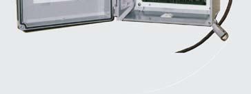


10 Instrument Shack Instrument Cabinet Ice Ice Anchor line Electronics Cable SWIP S Transducer Concrete Pad 10m max SWIPS = Shallow Water Ice Profiling Sonar


11 Water Temperature ( o C) Water ae Temperature peaue Freezing Point Jan 00:00 10-Jan 00:00 11-Jan 00:00 12-Jan 00:00 13-Jan 00:00 14-Jan 00:00
12
13 Ice Front Progression Causes stage-up to progress upstream a function of air temperature, discharge, river velocity, slope
14 Juxtaposed dice cover
15 Consolidated ice cover
16 Ice Cover Formation & Progression Open Water
17 Ice Cover Formation & Progression -Colder - Less Water Flow - Smaller ice discharge River Slope -Not so Cold -More water flow - Larger ice discharge
18 Frazil Deposition and Transport Surface Ice Production Suspended Frazil Frazil Deposition Frazil Transport
19 Backwater Curve Q Q
20 Channel Storage during an ice front advance Q in Q out < Q in Q out
21 Channel Storage Release during an ice front recession Q in Q out > Q in Q out
22 Water Levels fluctuations due to dynamic ice processes (CRISSP 1D modeling)
23 Thermal Ice Thickness Provides extra internal strength to the ice cover Growth a function of air temperature ice porosity snow cover Thermal Ice Thickness
24 Thermal Ice Thickness (l (slow advance)
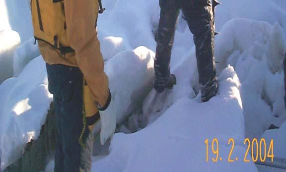
25 Thermal Ice Thickness (fast advance)
26 Secondary Consolidations
27 2004 Consolidation
28 Consolidation Event Ice Front advanced at a rate = 15 to 40 km/day Temperature increased from about -40 to C 75 km of ice collapsed to 40 km
29 Historical, Locations of Interest Distance from Bennett t Dam (km) Town of Peace River Dunvegan Nov 1-Dec 1-Jan 31-Jan 2-Mar 1-Apr 2-May 1-Jun
30 Channel Storage Release during an ice front recession Q in Q out > Q in Q out
31 Storage Release during Secondary Consolidations Measured stage ter level 2.50 Calculated stage, RLAM 5000 Stage above pre-con nsoldiation wa (m m) Calculated discharge, RLAM Dischar rge (m 3 /s) Time (hours)


32 Surface Ice Features at Toe of Consolidation
33 Surface Ice Features at Toe of Consolidation
34 Surface Ice Features at Toe


35 Measurements (contd.) Thermal ice thickness Total ice thickness
36 Ice Thickness Measurements and Mapping of the Toe of the Consolidation Pre-Consolidation Thermal Ice = 0.22 m Rubble Ice ~ 10 m
37 Section A-A Elevation (m) 350 Thermal ice that appears intact but may be bent or 348 cracked Thermal ice that has been reduced to rubble by the consolidation Distance dow nstream (m) Elevation (m) Typical Ice Elevation Section B-B Water Level Bottom of Ice Interpolated Bottom of Ice Bed Jun 16-17, Distance dow nstream (m)
38 Ice Thickness Measurements and Mapping of the Toe of the Consolidation
39 and Mapping of the Toe of the Consolidation
40 Bathymetry, Ice Thickness, Flow Surge stopped by grounding first in shallows along right bank Maximum downstream extent occurred in thalweg along left bank 0.22 m of thermal ice
41 2005 Consolidation compared with 2003 and 2004 Comparison of Freezeup Levels Open Water Dec 25, : High Water Marks High Water Marks High Water Marks tion (m) Elevat Shaftesbury Cros ssing TPR Distance from Bennett Dam (km )


42 Break-up Thermal Break-up Dynamic Break-up
43 Break-up Thermal or Dynamic? Time Res sistive F orces Dow wnstream Force es
44 Break-up Thermal or Dynamic? Time Res sistive F orces Dow wnstream Force es
45 Break-up Thermal or Dynamic? Thermal Time Res sistive F orces Dow wnstream Force es
46 Break-up Thermal or Dynamic? Time Dynamic Thermal Res sistive F orces Dow wnstream Force es
47 Break-up Ice Jam Flooding Peace River 1997
48 Peace River Ice Models 2002 TRICEP RICE DynaRICE RICEN PRICE CRISSP 1D CRISSP 2D 2008 Glacier BC Hydro
49 CRISSP 1D
50 CRISSP 2D
51 Hour 1:00: Y X
52 Hour 1:00: Bed Elev Y X
53 2D - Computer Modeling Peace River Go to animations
54 Joint Task Force
55 Peace River Hydro Power Operations during the Winter Coordinated through the Joint Task Force BC Hydro, Alberta Environment, Ministry of Environment BC Government Balance Hydro Power Production and Ice Jam Flood Risk Manage both break-up and freeze-up JTF formed after severe 1973 and 1974 after severe break-ups
56 Peace River Secondary Consolidation 1982 I 1982 i ll d In 1982, ice cover collapsed in this reach and produced high water levels at the Town of Peace River (TPR). Linked to discharge increase after holidays
57 1982 Consolidation Event (Freeze-up) Water Surface Elevation at To own of Peace Riv ver (m) m 3 /s Water Level Discharge at Peace Canyon Dam Dicharge Shifted and inflows added TPR nitial Freeze-up at I Secondary Consolid dation Discharge (m 3 /s) Dec 26-Dec 31-Dec 05-Jan 10-Jan
58 Control Flow Current Criteria 1) Control flow is implemented 2 days prior to the ice front reaching a point 16 km downstream of Town 2) Control flow is lifted 10 to 14 days after the ice front arrival at Dunvegan or about 0.4 m of thermal ice at Dunvegan
59 Control Flow Trial Criteria 1) Control flow is implemented 2 days prior to the ice front reaching a point 16 km downstream of Town 2) Control flow is lifted when there is about 0.4 m of thermal ice for at least a 10 km stretch between Dunvegan and McLeod Cairn
60 Trial Criteria More Scientific (thickness rather than ice front location) Initiated by the Glacier Project Based on extensive studies of secondary consolidations It was found under current flow control practices that secondary consolidations were arrested by 0.25 m of thermal ice or less 0.4 m provides a Factor of Safety of years of successful trials
61 Peace River dyke and levels Peace River at the Town of Peace River Lower West Peace River m Basements subject to seepage flooding m 315 m 312 m
62 Freeze-up 1) Target Elevation at TPR is m allows 5 m freeboard for secondary consolidations If above m the JTF will closely monitor If above m JTF will recommend some action to try to get water level back below m 2) Control Flow at TPR is set (1600 m 3 /s) PCN flow 1400 to 1500 m 3 /s Inflows typically 100 to 200 m3/s between Peace Canyon and the Town 3) West Peace Subdivision basement flooding Elevation >315.5 m (1 to 2 weeks)
63 JTF Procedures during break-up
64 JTF Break up Procedures In the 2-3 weeks prior to breakup if the benchmark elevation of m is exceeded the JTF will continue close monitoring i of : river levels discharges tributary inflow JTF will investigate/implement measures to JTF will investigate/implement measures to lower pre-breakup levels to below m
65 JTF Break up Procedures (continued) if Smoky River Basin snow pack is above normal and there is a high probability of the Smoky River breaking up into the Peace River or TPR Flow > 2000 m 3 /s 3 days forecast of flow at TPR are conducted If forecast is greater than 3200 m 3 /s The Peace Canyon Flows are reduced d in order to maintain TPR Flow less than 3200 m 3 /s
66 Peace River Ice Management (example ) 2004) Elevatio on (metres) dyke elevation Freeze-up m alarm m target control flow Break-up m Smokey river break-up target d) m Bennett Dam res per second Flow from (cubic metr Dec 1-Jan 21-Jan 10-Feb 1-Mar 21-Mar 10-Apr 30-Apr 0
67 Dunvegan Project and Peace River Ice Regime
68 Two Ice Fronts with Dunvegan Project Peace River Observed Ice Front Pre - Dunvegan 600 Post DNV Upstream Post DNV Downstream Distance fro om Bennett Dam (k km) TPR Dunvegan 100 Taylor 0 01-Nov 01-Dec 01-Jan 31-Jan 02-Mar 01-Apr 02-May
69 Pre Dunvegan (fast advance)
70 Post Dunvegan (l (slow advance)
71 Ratio of Surface Ice to Suspended Ice
72 Frazil Deposition and Transport Surface Ice Production Suspended Frazil Frazil Deposition Frazil Transport
20th IAHR International Symposium on Ice Lahti, Finland, June 14 to 18, 2010
 2th IAHR International Symposium on Ice Lahti, Finland, June 14 to 18, 21 Acoustic detection of ice and water velocities on the Peace River during the 29 Winter tin Jasek BC Hydro, Burnaby, BC, martin.jasek@bchydro.com
River ice-jam modelling in MESH. Karl-Erich Lindenschmidt Prabin Rokaya, Luis Morales-Marín, Howard Wheater
 River ice-jam modelling in MESH Karl-Erich Lindenschmidt Prabin Rokaya, Luis Morales-Marín, Howard Wheater Outlook: MESH/RIVICE coupling for Peace River Lindenschmidt et al. (215) Ice jam flood hazard
EFFECTS OF ICE ON THE HYDRAULICS OF INNER MONGOLIA REACH OF THE YELLOW RIVER
 Ice in the Environment: Proceedings of the 16th IAHR International Symposium on Ice Dunedin, New Zealand, 2nd 6th December 2002 International Association of Hydraulic Engineering and Research EFFECTS OF
Observations of Anchor Ice Formation and Rafting of Sediments
 CGU HS Committee on River Ice Processes and the Environment 18 th Workshop on the Hydraulics of Ice Covered Rivers Quebec City, QC, Canada, August 18-20, 2015 Observations of Anchor Ice Formation and Rafting
Integrating Weather Forecasts into Folsom Reservoir Operations
 Integrating Weather Forecasts into Folsom Reservoir Operations California Extreme Precipitation Symposium September 6, 2016 Brad Moore, PE US Army Corps of Engineers Biography Brad Moore is a Lead Civil
Folsom Dam Water Control Manual Update Joint Federal Project, Folsom Dam
 Folsom Dam Water Control Manual Update Joint Federal Project, Folsom Dam Public Workshop May 28, 2015 Library Galleria 828 I Street, Sacramento, CA US Army Corps of Engineers BUILDING STRONG WELCOME &
2011 Flood: Technical Review of Lake Manitoba, Lake St. Martin and Assiniboine River Water Levels Summary
 2011 Flood: Technical Review of Lake Manitoba, Lake St. Martin and Assiniboine River Water Levels Summary October 2013 Introduction Manitoba experienced unprecedented flooding in 2011. While flooding was
Folsom Dam Water Control Manual Update Joint Federal Project, Folsom Dam
 Folsom Dam Water Control Manual Update Joint Federal Project, Folsom Dam Public Workshop May 25, 2016 Sacramento Library Galleria 828 I Street, Sacramento, CA US Army Corps of Engineers BUILDING STRONG
Presented by Larry Rundquist Alaska-Pacific River Forecast Center Anchorage, Alaska April 14, 2009
 Presented by Larry Rundquist Alaska-Pacific River Forecast Center Anchorage, Alaska April 14, 2009 Presentation Outline Who we are Breakup characteristics Climate and weather influences 2009 breakup outlook
Modelling probabilities of ice jam flooding from artificial breakup of the Athabasca River ice cover at Fort McMurray
 CGU HS Committee on River Ice Processes and the Environment 19 th Workshop on the Hydraulics of Ice Covered Rivers Whitehorse, Yukon, Canada, July 9-12, 2017. Modelling probabilities of ice jam flooding
Freeze-up Jam Observations on the Dauphin River
 CGU HS Committee on River Ice Processes and the Environment 19 th Workshop on the Hydraulics of Ice Covered Rivers Whitehorse, Yukon, Canada, July 9-12, 2017. Freeze-up Jam Observations on the Dauphin
Two-dimensional modeling of river ice cover formation during freeze-up
 CGU HS Committee on River Ice Processes and the Environment 18 th Workshop on the Hydraulics of Ice Covered Rivers Quebec City, QC, Canada, August 18-20, 2015 Two-dimensional modeling of river ice cover
List of Tables. Jacques Whitford 2006 PROJECT ABC50541 October i
 4.6 Surface Water Hydrology and Groundwater...4-72 4.6.1 Boundaries...4-72 4.6.1.1 Spatial Boundaries...4-72 4.6.1.2 Regional Spatial Boundary...4-72 4.6.1.3 Local Spatial Boundary...4-74 4.6.1.4 Temporal
Instrument for Detecting Freeze-up, Mid-Winter and Break-up Ice Processes in Rivers
 CGU HS Committee on River Ice Processes and the Environment 13th Workshop on the Hydraulics of Ice Covered Rivers Hanover, NH, September15-16, 200 Instrument for Detecting Freeze-up, Mid-Winter and Break-up
PRELIMINARY DRAFT FOR DISCUSSION PURPOSES
 Memorandum To: David Thompson From: John Haapala CC: Dan McDonald Bob Montgomery Date: February 24, 2003 File #: 1003551 Re: Lake Wenatchee Historic Water Levels, Operation Model, and Flood Operation This
Technical Review of Pak Beng Hydropower Project (1) Hydrology & Hydraulics and (2) Sediment Transport & River Morphology
 Hydrology & Hydraulics and (2) Sediment Transport & River Morphology") Technical Review of Pak Beng Hydropower Project (1) Hydrology & Hydraulics and (2) Sediment Transport & River Morphology The 2 nd Regional Stakeholder Forum The Pak Beng Hydropower Project 5 th May 2017
Technical Review of Pak Beng Hydropower Project (1) Hydrology & Hydraulics and (2) Sediment Transport & River Morphology The 2 nd Regional Stakeholder Forum The Pak Beng Hydropower Project 5 th May 2017
Numerical Hydraulics
 ETH Zurich, Fall 2017 Numerical Hydraulics Assignment 2 Numerical solution of shallow water wave propagation (www.surfertoday.com) 1 Introduction 1.1 Equations Understanding the propagation of shallow
Opanuku Stream Benchmark Validation 1. Introduction. 2. The Opanuku Stream Model
 Opanuku Stream Benchmark Validation 1. Introduction The model accuracy benchmark published by the Flood Risk Management Committee of the IAHR in http://members.iahr.org/imis/communitymanagement/communitylayouts/flood_risk_manageme
Modelling the Impacts of Dam Rehabilitation on River Ice Jam: A Case Study on the Matane River, QC, Canada
 CGU HS Committee on River Ice Processes and the Environment 19 th Workshop on the Hydraulics of Ice Covered Rivers Whitehorse, Yukon, Canada, July 9-12, 2017. Modelling the Impacts of Dam Rehabilitation
FLOOD REPORT FOR MANITOBA. April 11, :00 am
 FLOOD REPORT FOR MANITOBA April 11, 2017 9:00 am Overland flooding and tributary flows are subsiding across much of southern Manitoba. Flows on northern rivers are ice covered and are responding to runoff.
3.0 TECHNICAL FEASIBILITY
 3.0 TECHNICAL FEASIBILITY 3.1 INTRODUCTION To enable seasonal storage and release of water from Lake Wenatchee, an impoundment structure would need to be constructed on the lake outlet channel. The structure
Ice Phenomena on the Lower Vistula
 Geophysica (2011), 47(1 2), 57 67 Ice Phenomena on the Lower Vistula Wojciech Majewski Institute of Meteorology and Water Management, 61 Podleśna str. 01-673 Warsaw, Poland (Received: June 2010; Accepted:
FORECAST-BASED OPERATIONS AT FOLSOM DAM AND LAKE
 FORECAST-BASED OPERATIONS AT FOLSOM DAM AND LAKE 255 237 237 237 217 217 217 200 200 200 0 163 131 Bridging the Gap163Conference 255 0 132 255 0 163 122 The Dana on Mission Bay San Diego, CA January 28,
How to predict the sedimentological impacts of reservoir operations?
 ICSE 212 How to predict the sedimentological impacts of reservoir operations? E. Valette EDF CIH eric.valette@edf.fr M. Jodeau EDF R&D LNHE magali.jodeau@edf.fr Presentation of the numerical code Courlis
Modelling flood levels associated with ice consolidation events triggered by upstream ice jam release waves in the Hay River Delta, NWT
 Modelling flood levels associated with ice consolidation events triggered by upstream ice jam release waves in the Hay River Delta, NWT by Michael De Coste A thesis submitted in partial fulfillment of
Hydrologic Forecast Centre. Manitoba Infrastructure. Winnipeg, Manitoba FEBRUARY FLOOD OUTLOOK REPORT FOR MANITOBA.
 Page 1 of 20 Hydrologic Forecast Centre Manitoba Infrastructure Winnipeg, Manitoba FEBRUARY FLOOD OUTLOOK REPORT FOR MANITOBA February 28, 2019 Overview The February Outlook Report prepared by the Hydrologic
River Ice Modelling. Hydraulic Modelling of Mackenzie River at Ft. Province, NWT, Canada
 River Ice Modelling Hydraulic Modelling of Mackenzie River at Ft. Province, NWT, Canada Submitted to F.E. Hicks, PhD, PEng, FCSCE Professor, Dept. of Civil and Environmental Engineering University of Alberta
Proposal to limit Namakan Lake to 1970 Upper Rule Curve for remainder of summer
 July 7, 214 Subject: Proposal to limit Namakan Lake to 197 Upper Rule Curve for remainder of summer Background: Flooding in 214 has resulted in the highest water levels on Namakan Lake since 1968, and
Hydrologic Forecast Centre Manitoba Infrastructure, Winnipeg, Manitoba. MARCH OUTLOOK REPORT FOR MANITOBA March 23, 2018
 Page 1 of 21 Hydrologic Forecast Centre Manitoba Infrastructure, Winnipeg, Manitoba MARCH OUTLOOK REPORT FOR MANITOBA March 23, 2018 Overview The March Outlook Report prepared by the Hydrologic Forecast
Tarbela Dam in Pakistan. Case study of reservoir sedimentation
 Tarbela Dam in Pakistan. HR Wallingford, Wallingford, UK Published in the proceedings of River Flow 2012, 5-7 September 2012 Abstract Reservoir sedimentation is a main concern in the Tarbela reservoir
NRC Workshop Probabilistic Flood Hazard Assessment (PFHA) Jan 29-31, Mel Schaefer Ph.D. P.E. MGS Engineering Consultants, Inc.
 Jan 29-31, Mel Schaefer Ph.D. P.E. MGS Engineering Consultants, Inc.") Stochastic Event Flood Model (SEFM) Stochastic Modeling of Extreme Floods A Hydrological Tool for Analysis of Extreme Floods Mel Schaefer Ph.D. P.E. MGS Engineering Consultants, Inc. Olympia, WA NRC Workshop
Stochastic Event Flood Model (SEFM) Stochastic Modeling of Extreme Floods A Hydrological Tool for Analysis of Extreme Floods Mel Schaefer Ph.D. P.E. MGS Engineering Consultants, Inc. Olympia, WA NRC Workshop
Modeling of peak inflow dates for a snowmelt dominated basin Evan Heisman. CVEN 6833: Advanced Data Analysis Fall 2012 Prof. Balaji Rajagopalan
 Modeling of peak inflow dates for a snowmelt dominated basin Evan Heisman CVEN 6833: Advanced Data Analysis Fall 2012 Prof. Balaji Rajagopalan The Dworshak reservoir, a project operated by the Army Corps
2015 Fall Conditions Report
 2015 Fall Conditions Report Prepared by: Hydrologic Forecast Centre Date: December 21 st, 2015 Table of Contents Table of Figures... ii EXECUTIVE SUMMARY... 1 BACKGROUND... 2 SUMMER AND FALL PRECIPITATION...
ANALYSIS ON THE ICE CONDITIONS CHANGES IN INNER MONGOLIA REACH OF YELLOW RIVER
 Ice in the Environment: Proceedings of the 16th IAHR International Symposium on Ice Dunedin, New Zealand, 2nd 6th December 2002 International Association of Hydraulic Engineering and Research ANALYSIS
ES 105 Surface Processes I. Hydrologic cycle A. Distribution % in oceans 2. >3% surface water a. +99% surface water in glaciers b.
 ES 105 Surface Processes I. Hydrologic cycle A. Distribution 1. +97% in oceans 2. >3% surface water a. +99% surface water in glaciers b. >1/3% liquid, fresh water in streams and lakes~1/10,000 of water
Hydrologic Forecast Centre Manitoba Infrastructure, Winnipeg, Manitoba. FEBRUARY OUTLOOK REPORT FOR MANITOBA February 23, 2018
 Page 1 of 17 Hydrologic Forecast Centre Manitoba Infrastructure, Winnipeg, Manitoba FEBRUARY OUTLOOK REPORT FOR MANITOBA February 23, 2018 Overview The February Outlook Report prepared by the Hydrologic
Monitoring the ice cover evolution of a medium size river from RADARSAT-1 : preliminary results
 Monitoring the ice cover evolution of a medium size river from RADARSAT-1 : preliminary results Y. Gauthier, T. B.M.J. Ouarda, M. Bernier and A. El Battay INRS-Eau, 2800 Einstein, C.P. 7500, Ste-Foy (Qc)
Isabelle Thériault Hydro-Québec 855 Sainte-Catherine Est Montréal (Québec) Canada, H2X 3P4
 Canada, H2X 3P4") Validation of the Mike-Ice model simulating river flows in presence of ice and forecast of changes to the ice regime of the Romaine river due to hydroelectric project Abstract Isabelle Thériault Hydro-Québec
Validation of the Mike-Ice model simulating river flows in presence of ice and forecast of changes to the ice regime of the Romaine river due to hydroelectric project Abstract Isabelle Thériault Hydro-Québec
Updated Hydrotechnical Information for the Mackenzie River Bridge at Fort Providence
 File Number 02-519 for the Mackenzie River Bridge at Fort Providence Prepared for: JIVKO Engineering 210, 4812-87 St. Edmonton, Alberta Canada T6E 4T3 Phone: 780.496.7671 Fax: 780.463.7185 EXECUTIVE SUMMARY
Frazil Monitoring by Multi-frequency Shallow Water Ice Profiling Sonar (SWIPS): Present Status
: Present Status") 2th IAHR International Symposium on Ice Lahti, Finland, June 14 to 18, 21 Frazil Monitoring by Multi-frequency Shallow Water Ice Profiling Sonar (SWIPS): Present Status John R. Marko ASL Environmental
2th IAHR International Symposium on Ice Lahti, Finland, June 14 to 18, 21 Frazil Monitoring by Multi-frequency Shallow Water Ice Profiling Sonar (SWIPS): Present Status John R. Marko ASL Environmental
Colorado Ice Jams and CRREL s Ice Jam Database CRREL Ice Engineering Group
 Colorado Ice Jams and CRREL s Ice Jam Database CRREL Ice Engineering Group Presented by, Carrie Vuyovich, Ph.D., P.E. Research Hydraulic Engineer ERDC Cold Regions Research and Engineering Laboratory,
Numerical modeling of sediment flushing from Lewis and Clark Lake
 University of Nebraska - Lincoln DigitalCommons@University of Nebraska - Lincoln US Army Research U.S. Department of Defense 2013 Numerical modeling of sediment flushing from Lewis and Clark Lake Jungkyu
Do you think sediment transport is a concern?
 STREAM RESTORATION FRAMEWORK AND SEDIMENT TRANSPORT BASICS Pete Klingeman 1 What is Your Restoration Project Like? k? Do you think sediment transport is a concern? East Fork Lewis River, WA Tidal creek,
2017 January Conditions Report Manitoba Hydrologic Forecasting and Coordination Branch Manitoba Infrastructure
 2017 January Conditions Report Manitoba Hydrologic Forecasting and Coordination Branch Manitoba Infrastructure 1/30/2017 Page 1 of 22 Hydrologic Forecast Centre Manitoba Infrastructure and Transportation
HYDROLOGY AND HYDRAULICS MUSKEG RIVER BRIDGE
 PUBLIC WORKS CANADA HYDROLOGY AND HYDRAULICS MUSKEG RIVER BRIDGE KILOMETRE 207.9, LIARD HIGKWAY December 1978 I I f I I I I # Bolter Parish Trimble Ltd. ONLIULTINO Public Works, Canada, 9925-109 Street,
Sediment transport and river bed evolution
 1 Chapter 1 Sediment transport and river bed evolution 1.1 What is the sediment transport? What is the river bed evolution? System of the interaction between flow and river beds Rivers transport a variety
GAMINGRE 8/1/ of 7
 FYE 09/30/92 JULY 92 0.00 254,550.00 0.00 0 0 0 0 0 0 0 0 0 254,550.00 0.00 0.00 0.00 0.00 254,550.00 AUG 10,616,710.31 5,299.95 845,656.83 84,565.68 61,084.86 23,480.82 339,734.73 135,893.89 67,946.95
Folsom Dam Water Control Manual Update
 Folsom Dam Water Control Manual Update Public Workshop April 3, 2014 Location: Sterling Hotel Ballroom 1300 H Street, Sacramento US Army Corps of Engineers BUILDING STRONG WELCOME & INTRODUCTIONS 2 BUILDING
Open Channel Flow Part 2. Ch 10 Young, notes, handouts
 Open Channel Flow Part 2 Ch 10 Young, notes, handouts Uniform Channel Flow Many situations have a good approximation d(v,y,q)/dx=0 Uniform flow Look at extended Bernoulli equation Friction slope exactly
IP3 Workshop #3, November 2008, Whitehorse, Yukon
 River and Lake Ice: Quantification, Extremes and Historical i Trends; Advances under IPY cryosphere/hydrology & ArcticNet Terry Prowse Katrina Bennett Rheannon Brooks Laurent de Rham Holly Goulding Simon
Ice Observations on the Churchill River using Satellite Imagery
 CGU HS Committee on River Ice Processes and the Environment 15 th Workshop on River Ice St. John s, Newfoundland and Labrador, June 15-17, 2009 Ice Observations on the Churchill River using Satellite Imagery
Degradation Concerns related to Bridge Structures in Alberta
 Degradation Concerns related to Bridge Structures in Alberta Introduction There has been recent discussion regarding the identification and assessment of stream degradation in terms of how it relates to
Missouri River Basin Water Management Monthly Update
 Missouri River Basin Water Management Monthly Update Participating Agencies 255 255 255 237 237 237 0 0 0 217 217 217 163 163 163 200 200 200 131 132 122 239 65 53 80 119 27 National Oceanic and Atmospheric
Applying HEC-RAS to simulate river ice jams: snags and practical hints
 CGU HS Committee on River Ice Processes and the Environment 17 th Workshop on River Ice Edmonton, Alberta, July 21-24, 2013 Applying HEC-RAS to simulate river ice jams: snags and practical hints Spyros
 http://water.usgs.gov/waterwatch/ Stream Flow Measurement: Velocity-Area method Stream discharge = Q = U * A Q = volumetric flow rate in [L 3 T -1 ] U= average stream velocity [L 2 T -1 ] A = cross sectional
SCOPE OF PRESENTATION STREAM DYNAMICS, CHANNEL RESTORATION PLANS, & SEDIMENT TRANSPORT ANALYSES IN RELATION TO RESTORATION PLANS
 DESIGN METHODS B: SEDIMENT TRANSPORT PROCESSES FOR STREAM RESTORATION DESIGN PETER KLINGEMAN OREGON STATE UNIVERSITY CIVIL ENGINEERING DEPT., CORVALLIS 2 ND ANNUAL NORTHWEST STREAM RESTORATION DESIGN SYMPOSIUM
River Current Resource Assessment and Characterization Considering Ice Conditions
 River Current Resource Assessment and Characterization Considering Ice Conditions 1 Gilles Boesch, Eng, M.Eng Marie-Hélène Briand, Eng, PhD Vadim Belotserkovsky International Conference on Ocean Energy,
Missouri River Basin Water Management Monthly Update
 Missouri River Basin Water Management Monthly Update Participating Agencies 255 255 255 237 237 237 0 0 0 217 217 217 163 163 163 200 200 200 131 132 122 239 65 53 80 119 27 National Oceanic and Atmospheric
Souris River Basin Spring Runoff Outlook As of March 15, 2018
 Souris River Basin Spring Runoff Outlook As of March 15, 2018 Prepared by: Flow Forecasting & Operations Planning Water Security Agency Basin Conditions Summer rainfall in 2017 in the Saskatchewan portion
Preliminary development of a geospatial model to estimate a river channel s predisposition to ice jams
 CGU HS Committee on River Ice Processes and the Environment 16 th Workshop on River Ice Winnipeg, Manitoba, September 18 22, 2011 Preliminary development of a geospatial model to estimate a river channel
Interactions between water, ice and sediment during spring breakup at the mouth of the Mackenzie River, Northwest Territories
 Interactions between water, ice and sediment during spring breakup at the mouth of the Mackenzie River, Northwest Territories Steven M. Solomon 1, Donald L. Forbes 1, Maxime Belanger 2, Dustin Whalen 1,
1 INTRODUCTION 1.1 General
 #701 475 Howe Street Vancouver, British Columbia V6C 2B3 August 1, 2014 Robin McCall Wolverine Mine Environmental Superintendent Dear Mr. McCall: 1 INTRODUCTION 1.1 General This letter report presents
May Creek Canyon LWD Stream Restoration Project. Helicopter Placement of LWD in an Urban Stream. By Kathryn Neal, P.E.
 Helicopter Placement of LWD in an Urban Stream By Kathryn Neal, P.E. May Creek Canyon LWD Stream Restoration Project By Kathryn Neal, P.E. Project proponents: King County City of Renton City of Newcastle
Illinois State Water Survey Division
 Illinois State Water Survey Division SURFACE WATER SECTION SWS Miscellaneous Publication 108 SEDIMENT YIELD AND ACCUMULATION IN THE LOWER CACHE RIVER by Misganaw Demissie Champaign, Illinois June 1989
Ice-Related Floods and Flood Delineation along Streams and Small Rivers
 CGU HS Committee on River Ice Processes and the Environment 19 th Workshop on the Hydraulics of Ice Covered Rivers Whitehorse, YK, Canada, July 10 th -12 th, 2017 Ice-Related Floods and Flood Delineation
Missouri River Basin Water Management Monthly Update
 Missouri River Basin Water Management Monthly Update Participating Agencies 255 255 255 237 237 237 0 0 0 217 217 217 163 163 163 200 200 200 131 132 122 239 65 53 80 119 27 National Oceanic and Atmospheric
Flooding Caused by Freezeup on Ship Creek, AK
 CGU HS Committee on River Ice Processes and the Environment 19 th Workshop on the Hydraulics of Ice Covered Rivers Whitehorse, Yukon, Canada, July 9-12, 2017. Flooding Caused by Freezeup on Ship Creek,
A Report on a Statistical Model to Forecast Seasonal Inflows to Cowichan Lake
 A Report on a Statistical Model to Forecast Seasonal Inflows to Cowichan Lake Prepared by: Allan Chapman, MSc, PGeo Hydrologist, Chapman Geoscience Ltd., and Former Head, BC River Forecast Centre Victoria
Attabad landslide crisis in Hunza, Pakistan lessons for the management of valley blocking landslides. Dave Petley
 Attabad landslide crisis in Hunza, Pakistan lessons for the management of valley blocking landslides Dave Petley Durham University, United Kingdom Thanks to: D. Karim, S. Wali, N. Ali, N. Nasab & K. Shaban
STREAM SYSTEMS and FLOODS
 STREAM SYSTEMS and FLOODS The Hydrologic Cycle Precipitation Evaporation Infiltration Runoff Transpiration Earth s Water and the Hydrologic Cycle The Hydrologic Cycle The Hydrologic Cycle Oceans not filling
Precipitation Evaporation Infiltration Earth s Water and the Hydrologic Cycle. Runoff Transpiration
 STREAM SYSTEMS and FLOODS The Hydrologic Cycle Precipitation Evaporation Infiltration Earth s Water and the Hydrologic Cycle Runoff Transpiration The Hydrologic Cycle The Hydrologic Cycle Oceans not filling
January 22, Coronado National Forest 300 West Congress Street Tucson, AZ Jim Upchurch, Forest Supervisor. Dear Mr.
 January 22, 2015 Coronado National Forest 300 West Congress Street Tucson, AZ 85701 Attn: Jim Upchurch, Forest Supervisor Dear Mr. Upchurch: In your letter dated January 16, 2015, you requested that Hudbay
CASE STUDY NATHPA JHAKRI, INDIA
 SEDIMENT MANAGEMENT CASE STUDY NATHPA JHAKRI, INDIA Key project features Name: Nathpa Jhakri Country: India Category: reduce sediment production (watershed management); upstream sediment trapping; bypass
Karamea floodplain investigation
 Karamea floodplain investigation NIWA Client Report: CHC2010-107 October 2010 NIWA Project: ELF 10234/1 Karamea floodplain investigation Graeme Smart Jo Bind NIWA contact/corresponding author Graeme Smart
Advanced Hydraulics Prof. Dr. Suresh A Kartha Department of Civil Engineering Indian Institute of Technology, Guwahati
 Advanced Hydraulics Prof. Dr. Suresh A Kartha Department of Civil Engineering Indian Institute of Technology, Guwahati Module - 2 Uniform Flows Lecture - 6 Design of Channels for Uniform Flow (Refer Slide
HEC-RAS Reservoir Transport Simulation of Three Reservoirs in the Lower Susquehanna River Basin. Mike Langland and Ed Koerkle
 HEC-RAS Reservoir Transport Simulation of Three Reservoirs in the Lower Susquehanna River Basin Mike Langland and Ed Koerkle Topics Background / Project Objectives Data Selection - Sediment and Geometric
RESERVOIR DRAWDOWN RATES/RESERVOIR DRAWDOWN TEST Iron Gate, Copco (I & II), and JC Boyle Dams
, and JC Boyle Dams") TECHNICAL MEMORANDUM No. 1 TO: Michael Bowen California Coastal Conservancy Geotechnical & Earthquake Engineering Consultants CC: Eric Ginney Philip Williams & Associates PREPARED BY: Paul Grant SUBJECT:
TECHNICAL MEMORANDUM No. 1 TO: Michael Bowen California Coastal Conservancy Geotechnical & Earthquake Engineering Consultants CC: Eric Ginney Philip Williams & Associates PREPARED BY: Paul Grant SUBJECT:
MARMOT CREEK BASIN: MANAGING FORESTS FOR WATER
 MARMOT CREEK BASIN: MANAGING FORESTS FOR WATER CABIN AND TWIN CREEK EXPERIMENTS 1962-1987 MARMOT CREEK SUBBASINS Subbasin Drainage Treatment Area (ha) (completion date) Cabin Creek 212 (50%)* Commercial
July, International SWAT Conference & Workshops
 July, 212 212 International SWAT Conference & Workshops Hydrological Modelling of Kosi and Gandak Basins using SWAT Model S. Dutta, Pritam Biswas, Sangita Devi, Suresh A Karth and Bimlesh kumar, Ganga
Flood Inundation Mapping under different climate change scenarios in the upper Indus River Basin, Pakistan
 Flood Inundation Mapping under different climate change scenarios in the upper Indus River Basin, Pakistan Sohaib Baig (doctoral student) 16 November 2017 Disaster Prevention Research Institute 1 Kyoto
Running Water Earth - Chapter 16 Stan Hatfield Southwestern Illinois College
 Running Water Earth - Chapter 16 Stan Hatfield Southwestern Illinois College Hydrologic Cycle The hydrologic cycle is a summary of the circulation of Earth s water supply. Processes involved in the hydrologic
Evapo-transpiration Losses Produced by Irrigation in the Snake River Basin, Idaho
 Nov 7, 2007 DRAFT Evapo-transpiration Losses Produced by Irrigation in the Snake River Basin, Idaho Wendell Tangborn and Birbal Rana HyMet Inc. Vashon Island, WA Abstract An estimated 8 MAF (million acre-feet)
VOLUME IV. Feasibility Study for the Madian Hydropower Project HYDRO - METEOROLOGICAL DATA BASE. Headrace Tunnel. Bahrain. Part 1 of 3.
 for the Weir Bahrain Headrace Tunnel Madian Powerhouse Madain Town VOLUME IV HYDRO - METEOROLOGICAL DATA BASE Part 1 of 3 Weir Axis 7166P02 February 2009 Table of Contents VOLUME I: EXECUTIVE SUMMARY VOLUME
CFD Modeling for Structure Designs in Environmental Impacts Mitigation
 CFD Modeling for Structure Designs in Environmental Impacts Mitigation June 05 Navid Nekouee, Hugo Rodriguez and Steven Davie Environmental Impact Mitigation Design Savannah Harbor Expansion Project (SHEP)
Multi-decadal records of PCBs and PCDD/F in Rhône River sediment cores
 Multi-decadal records of PCBs and PCDD/F in Rhône River sediment cores Brice Mourier, M. Desmet, B. J. Mahler, P. C. Van Metre, S. Sauvé, G. Roux, Y. Perrodin, M. Babut brice.mourier@unilim.fr l SedNet
Unconventional Wisdom and the Effects of Dams on Downstream Coarse Sediment Supply. Byron Amerson, Jay Stallman, John Wooster, and Derek Booth
 Unconventional Wisdom and the Effects of Dams on Downstream Coarse Sediment Supply 3 February 2009 Byron Amerson, Jay Stallman, John Wooster, and Derek Booth Sultan River, WA OBJECTIVE Consider the landscape
REDWOOD VALLEY SUBAREA
 Independent Science Review Panel Conceptual Model of Watershed Hydrology, Surface Water and Groundwater Interactions and Stream Ecology for the Russian River Watershed Appendices A-1 APPENDIX A A-2 REDWOOD
Sediment Transport under Ice Conditions
 13 Sediment Transport under Ice Conditions Faye Hirshfield and Jueyi Sui University of Northern British Columbia Canada 1. Introduction Every winter, a vast majority of rivers in cold regions undergo freeze
Badger Flood Situation Report. Robert Picco Amir Ali Khan Ken Rollings. Department of Environment Water Resources Management Division
 Badger Flood 2003 Situation Report Robert Picco Amir Ali Khan Ken Rollings Department of Environment Water Resources Management Division Table of Contents 1. Background... 1 2. Antecedent Conditions...
CASE STUDY BINGA, PHILIPPINES
 SEDIMENT MANAGEMENT CASE STUDY BINGA, PHILIPPINES Key project features Name: Binga Country: Philippines Category: modify operating rule (focus or redistribute sediment); adaptive strategies Reservoir volume
Development and application of demonstration MIKE 21C morphological model for a bend in Mekong River
 Development and application of demonstration MIKE 21C morphological model for a bend in Mekong River September 2015 0 Table of Contents 1. Introduction... 2 2. Data collection... 3 2.1 Additional data...
Effects of the slope toe evolution on the behaviour of a slow-moving large landslide
 Effects of the slope toe evolution on the behaviour of a slow-moving large landslide A. Ferrari, A. Ledesma, J. Corominas MOUNTAIN RISKS - Topic Meeting WB1 Dynamic spatial modelling of landslide hazards
Impacts of Climate Warming on River Ice Break-up and Snowmelt Freshet Processes on the Porcupine River in Northern Yukon
 CGU HS Committee on River Ice Processes and the Environment 19 th Workshop on the Hydraulics of Ice Covered Rivers Whitehorse, Yukon, Canada, July 9-12, 2017. Impacts of Climate Warming on River Ice Break-up
A Review of the 2007 Water Year in Colorado
 A Review of the 2007 Water Year in Colorado Nolan Doesken Colorado Climate Center, CSU Mike Gillespie Snow Survey Division, USDA, NRCS Presented at the 28 th Annual AGU Hydrology Days, March 26, 2008,
CHANGES IN RIVER BED AROUND THE FUKAWA CONTRACTION AREA BY FLOODS AND CHANNEL IMPROVEMENT WORKS IN THE LOWER TONE RIVER
 The 1 th Int. Conf. on Hydroscience and Engineering (ICHE-212), Nov. 4 Nov. 7, Orlando, USA 1 CHANGES IN RIVER BED AROUND THE FUKAWA CONTRACTION AREA BY FLOODS AND CHANNEL IMPROVEMENT WORKS IN THE LOWER
AN OVERVIEW OF KONAR DAM ON NEED OF REHABILITATION
 AN OVERVIEW OF KONAR DAM ON NEED OF REHABILITATION Dipankar Chaudhuri, SE (Civil) A. K. Dubey, SE (Civil) and S. B. Pandey, DCE (Civil) DAMODAR VALLEY CORPORATION OVER VIEW Problems Cracks Potential Conclusion
Attachment B to Technical Memorandum No.2. Operations Plan of Ross Valley Detention Basins
 Attachment B to Technical Memorandum No.2 Operations Plan of Ross Valley Detention Basins Operations Plan of Ross Valley Detention Basins Stetson Engineers Inc. January 26, 2011 1.0 Introduction Achieving
Hydrologic Forecast Centre Manitoba Infrastructure and Transportation Winnipeg, Manitoba. FIRST SPRING FLOOD OUTLOOK FOR MANITOBA February 27, 2015
 Hydrologic Forecast Centre Manitoba Infrastructure and Transportation Winnipeg, Manitoba FIRST SPRING FLOOD OUTLOOK FOR MANITOBA February 27, 2015 Overview The Hydrologic Forecast Centre of Manitoba Infrastructure
A distributed runoff model for flood prediction in ungauged basins
 Predictions in Ungauged Basins: PUB Kick-off (Proceedings of the PUB Kick-off meeting held in Brasilia, 2 22 November 22). IAHS Publ. 39, 27. 267 A distributed runoff model for flood prediction in ungauged
CASE STUDY BINGA, PHILIPPINES
 SEDIMENT MANAGEMENT CASE STUDY BINGA, PHILIPPINES Key project features Name: Binga Country: Philippines Category: modify operating rule (focus or redistribute sediment); adaptive strategies Binga hydropower