Beyond GIS: The Promise of Spatial Humanities
|
|
|
- Griffin Robinson
- 5 years ago
- Views:
Transcription
1 2007 Beyond GIS: The Promise of Spatial David J. Bodenhamer The Polis Center Indiana University Purdue University, Indianapolis Virtual Center for Spatial Purdue University November 7, 2014
2 2007 An Epistemological Shift We know not through our intellect but through our experience. Maurice Merleau-Ponty, Phenomenology of Perception (1945) Post-Modernism subjective, experiential contingency, ambiguity fluidity, simultaneity multiplicity, diversity emphasis on agency skeptical, especially of experts
3 2007 New Framework for Learning Unstructured interactions Volunteered information Blurred disciplinary boundaries Does not privilege expert Networked participant-collaborators Open to experiential knowledge
4 2007 Current Perspectives What perspectives engage humanists? Multiple realities Interdependency Intercultural and trans-cultural Multi-scalar and inter-scalar Hybridity and complexity
5 2007 Spatial Turn and GIS Increased attention to space and spatiality, beginning in 1960s New technologies support the spatial turn, with GIS the primary tool-kit Critique of GIS Emergence of GIScience
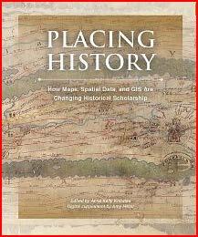
6 2007 (Re)Discovery of the Power of Maps Relationships that jump out when presented in a spatial format such as a map tend to clog a narrative, choking its arteries, until even if the narrative does not expire the reader, overwhelmed by detail, is ready to die of tedium and confusion. Richard White, Placing History (2008)
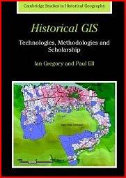
7 2007 Historical GIS (Spatial 1.0) Spatial turn in humanities in 1980s/1990s Emphasis on integration, visualization, and spatial analysis through GIS-facilitated tools and methods Strategic datasets (various national HGIS projects) International collaborations New genres of scholarship in history, archaeology, cultural studies, etc. (e.g., Historical GIS)

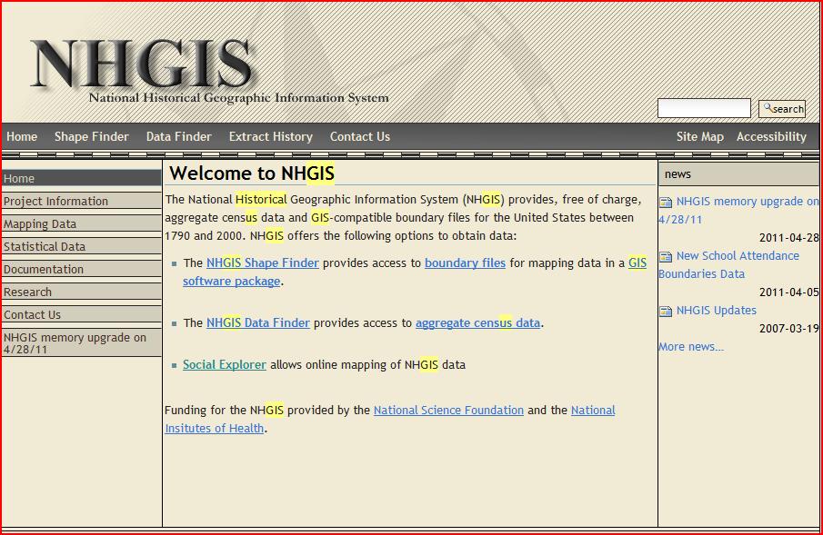

8 2007 National Historical GIS

9 2007 Geo-rectified Historical Maps

10 Spatial Taipei 2007 ECAI
11 2007 Projects and Publications Projects with HGIS components Salem Witchcraft Trials, e-williamsburg, etc. Major HGIS projects Stanford Spatial History Project, Digital Atlas of American Religion, Irish Famine, Aurora Project (Dynamic Atlas of US History), Holocaust Project, Literary Atlas of Europe Major publications and conferences in HGIS and spatial humanities

12 2007 Salem Witch Trials: Accusations

13 2007 Spatial History Project

14 2007 Literary Atlas of Europe
15 2007 Critiques Mostly mapping/spatial primitives Requires technical expertise Incompatible with much humanities data About space, not place Where is time? Contributions to scholarship debated Scanty uptake by humanists
16 2007 Barriers Systems Data Culture Literacy Spatial/Geographic Visual
17 2007 An Epistemological Clash? GIS and (re)discovery of the map: vision of rigorously measurable, infinitely sharable information across temporal and spatial scales Where does GIS fit with post-modernism s emphasis on indeterminacy, ambiguity, fluidity, particularity, and other non-standard characteristics? Can GIS fit the needs of historians and other humanists?
18 2007 Pareto GIS Pareto principle (80/20): 80% of the effects come from 20% of the causes We often do not need the full analytical functionality of ArcGIS to accomplish what humanists need
19 2007 Virtual Center for Spatial Formed in 2008 as a collaboration among three research universities: Florida State University, West Virginia University, and Indiana University-Purdue University, Indianapolis Goal: Move beyond GIS and toward the spatial humanities, a post-modern and post-structural approach that bends technology to the needs of humanists; blends GIScience with the humanities to understand the reciprocal influence of space and place on culture and society.
20 2007 Re-booting Moving beyond GIS Making geo-spatial tools open to humanities data Embracing multimodal approach Using VREs and immersive environments Creating collaborative spaces Developing a new epistemology (nonlinear, fluid, reflexive)
21 2007 Emergent Realities [M]aps will be more than the sum of their parts: they will possess emerging qualities, which were not visible at the lower level.not that the map is itself an explanation, of course: but at least, if offers a model of the narrative universe which rearranges its components in a non-trivial way, and may bring some hidden patterns to the surface. Franco Moretti, Graphs, Maps, Trees (2005)
22 2007 Spatial 2.0 Spatial humanities is an explicit recognition of the reciprocal influence of geographic and constructed space on culture and society. Fuses traditional focus on nuance, voice, experience, text, and image with the systematic approaches of spatial science, computer modeling and virtual reality. Links time, space, and culture dynamically.
23 2007 Spatial and Web 2.0 Space as the meeting ground; an integrated perspective on place Web 2.0 as the toolkit; does not privilege a spatial technology or quantitative data Open, participatory framework for experts and non-experts
24 2007 New Approaches Neogeography Participatory GIS Volunteered Geographic Information (VGI) Virtual globes, APIs, mash-ups, and social networking Gazetteers Semantic searching Text mining

25 2007 Vision of Britain.com

26 2007 Lakes District Project: Mash-up GIS

27 2007 Visible Past: A Participatory GIS

28 2007 Virtual Globes


29 2007 Augmented Reality Synthesis of real and digital space e.g., Architip Wearable technology, e.g., Google Glass

30 2007 Spatial VR
31 2007 Virtual Reality VR is an experiential medium, not a peripheral It evokes emotion The experience is social It is open to everyone


32 2007 New Scholarship

33 2007 New Forms of Scholarship

34 2007 New Spatio-Temporal Visualizations

35 2007 New Geo-Literary Visualizations

36 2007 Space-Time Networks

37 Spatial Taipei 2007 ESDA

38 2007 Sound Maps
39 2007 Spatial Today What has emerged are new and exciting forms of convergence, focused on geocultural spaces (or place). Also, new types of scholarship and new collaborations, while retaining the best of HGIS/Spatial 1.0.
40 2007 Opportunities for Spatial Life paths and spatial narratives Spatio-temporal networks Spatial imaginaire Virtual reality/immersion Gaming and simulations Practice theory Deep mapping/deep contingency
41 2007 Deep Mapping Goal: Reveal the complex and contingent context of events within and across time and space Deep maps (platform, process, and product): Links time and space (chronotope) Operates across multiple scales (time and space) Embodies multiple agents, multiple perspectives Recognizes alternate schemes/emergent realities Fosters dynamic context (movement, linkage) Evokes emotional and experiential (visual and immersive; an affective geography)
42 2007 Design Requirements Deep maps are: Flexible, inviting exploration User-centric, supporting differing views Path-traceable, supporting narration Open, admitting new material Immersive, evoking experience

43 2007 Conceptual Schema
 GRID+Web 2.0/3.")
44 2007 Technical Schema New collaboratories that allow Retrieval Contextualization Hypothesis building Fleible narration Integration into knowledge networks Virtual Research Laboratories(VRL) GRID+Web 2.0/3.0+Spatial Technologies

45 2007 Frameworks: WordPress

46 2007 Frameworks: HGIS


47 2007 Frameworks:Space-time cubes spatial, temporal, & contextual what/where/when total perspective

48 2007 Frameworks: Virtual Resource Environments

49 2007 Frameworks: Immersive Gaming

50 2007 DPLA Observatory


51 2007 Driving through Time: Digital Bue Ridge Parkway

52 2007 Temporal Ubiquity

53 2007 Virtual Place-Making
")
54 2007 Imaginative and Historical Cityscapes (Literary Edinburgh)

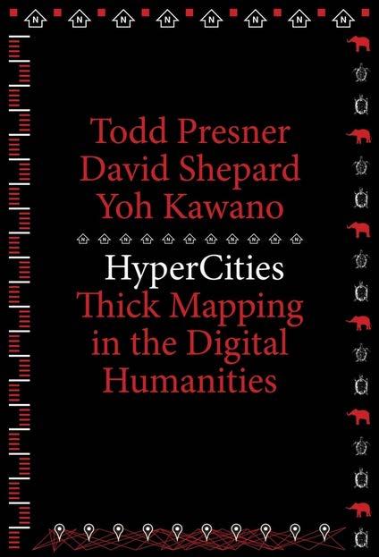
55 2007 HyperCities.com
56 2007 Spatial Narratives Time geography Text mapping Geospatial semantic web But how to: Capture experiential/metaphorical space? Enable deep contingency? Integrate structure, process, event? Space, time, place? Understand the situatedness of the narrator(s) Represent the narrative(s)? Make the argument?
57 2007 New Vision New collaboratories that allow Retrieval Contextualization Hypothesis building Flexible narration Integration into knowledge networks Virtual Research Laboratories(VRL) GRID+Web 2.0/3.0+Spatial Technologies
58 2007 Future of Spatial A unique post-modern scholarship with real and conceptual space as an integrating and animating framework: Visual and experiential Multiple perspectives Complex environments Emergent realities, deep contingencies Spatial narratives, spatial arguments

59 2007
Re-imagining Religion: The Spatial Humanities as a Framework for New Scholarship
 2010 Re-imagining Religion: The Spatial Humanities as a Framework for New Scholarship David J. Bodenhamer The Polis Center at IUPUI Virtual Center for Spatial Humanities New Technologies and Interdisciplinary
HISTORY 1XX/ DH 1XX. Introduction to Geospatial Humanities. Instructor: Zephyr Frank, Associate Professor, History Department Office: Building
 HISTORY 1XX/ DH 1XX Introduction to Geospatial Humanities Instructor: Zephyr Frank, Associate Professor, History Department Office: Building 200-332 Course Description This course introduces undergraduate
Dynamic Maps and Historical Context
 Dynamic Maps and Historical Context Jeanette Zerneke International Joint GIS-IDEAS and PNC/ECAI Conference December 2008 Dynamic Maps Roles and Functions of Dynamic Maps in Cultural Collections and Atlases
GIS Visualization: A Library s Pursuit Towards Creative and Innovative Research
 GIS Visualization: A Library s Pursuit Towards Creative and Innovative Research Justin B. Sorensen J. Willard Marriott Library University of Utah justin.sorensen@utah.edu Abstract As emerging technologies
Visualizing Uncertainty: How to Use the Fuzzy Data of 550 Medieval Texts?
 Visualizing Uncertainty: How to Use the Fuzzy Data of 550 Medieval Texts? Stefan Jänicke, Institut für Informatik, Universität Leipzig David Joseph Wrisley, Department of English, American University of
ESSENTIAL CONCEPTS AND SKILL SETS OF THE IOWA CORE CURRICULUM
 ESSENTIAL CONCEPTS AND SKILL SETS OF THE IOWA CORE CURRICULUM SOCIAL STUDIES PROVIDED BY THE IOWA DEPARTMENT OF EDUCATION INTRODUCTION Social studies is the integrated study of the social sciences and
Cartographic and Geospatial Futures
 Cartographic and Geospatial Futures 1. Web Cartography, WebGIS, & Virtual Globes--New Roles for Maps, GIS, and GIS professionals 2. Map Mashups, the Neo Neo-geography Movement, & Crowd-sourcing Geospatial
Enriching the GIScience Research Agenda: Fusing Augmented Reality (AR) and Location Based Social Networks (LBSN)
 and Location Based Social Networks (LBSN)") Enriching the GIScience Research Agenda: Fusing Augmented Reality (AR) and Location Based Social Networks (LBSN) Chengbi Liu and Sven Fuhrmann Department of Geography and Geoinformation Science George
Enriching the GIScience Research Agenda: Fusing Augmented Reality (AR) and Location Based Social Networks (LBSN) Chengbi Liu and Sven Fuhrmann Department of Geography and Geoinformation Science George
DANIEL WILSON AND BEN CONKLIN. Integrating AI with Foundation Intelligence for Actionable Intelligence
 DANIEL WILSON AND BEN CONKLIN Integrating AI with Foundation Intelligence for Actionable Intelligence INTEGRATING AI WITH FOUNDATION INTELLIGENCE FOR ACTIONABLE INTELLIGENCE in an arms race for artificial
2013 AND 2025 THE FUTURE OF GIS
 THE FUTURE OF GIS 2013 AND 2025 What is the state of geospatial computing today? What are the issues today? Unresolved problems What will geospatial computing be like in 2025? What issues will be of concern
Maps as Research Tools Within a Virtual Research Environment.
 Maps as Research Tools Within a Virtual Research Environment. Sebastian Specht, Christian Hanewinkel Leibniz-Institute for Regional Geography Leipzig, Germany Abstract. The Tambora.org Virtual Research
Dublin City Schools Social Studies Graded Course of Study Grade 5 K-12 Social Studies Vision
 K-12 Social Studies Vision The Dublin City Schools K-12 Social Studies Education will provide many learning opportunities that will help students to: develop thinking as educated citizens who seek to understand
GRADE 5 SOCIAL STUDIES SOCIAL STUDIES APPLICATION. SOCIAL STUDIES STANDARDS for Grade 5
 GRADE 5 SOCIAL STUDIES The Archdiocese of Cincinnati has established the following Social Studies standards based on the most current teachings which are aligned to Ohio New Learning Social Studies Standards.
Geospatial Services in Special Libraries: A Needs Assessment Perspective
 Purdue University Purdue e-pubs Libraries Faculty and Staff Scholarship and Research Purdue Libraries 5-17-2013 Geospatial Services in Special Libraries: A Needs Assessment Perspective Ilana R. Barnes
A General Framework for Conflation
 A General Framework for Conflation Benjamin Adams, Linna Li, Martin Raubal, Michael F. Goodchild University of California, Santa Barbara, CA, USA Email: badams@cs.ucsb.edu, linna@geog.ucsb.edu, raubal@geog.ucsb.edu,
Canadian Historical GIS Partnership Development: Taking Steps for Historical Mapping in Canada
 Canadian Historical GIS Partnership Development: Taking Steps for Historical Mapping in Canada Byron Moldofsky Manager, GIS and Cartography Office Department of Geography and Planning University of Toronto
GRADE 6 SOCIAL STUDIES SOCIAL STUDIES APPLICATION. SOCIAL STUDIES STANDARDS for Grade 6
 GRADE 6 SOCIAL STUDIES The Archdiocese of Cincinnati has established the following Social Studies standards based on the most current teachings which are aligned to Ohio New Learning Social Studies Standards.
XXIII CONGRESS OF ISPRS RESOLUTIONS
 XXIII CONGRESS OF ISPRS RESOLUTIONS General Resolutions Resolution 0: Thanks to the Czech Society commends: To congratulate The Czech Society, its president and the Congress Director Lena Halounová, the
Changing Communities: Regions of the United States. Social Studies Fairfield Public Schools
 4 Changing Communities: Regions of the United States Social Studies Fairfield Public Schools 4 Grade 4-Communities Across The United States (9/08/2015) DRAFT Description: In Grade 4, students engage in
Conceptual study of Web-based PPGIS for Designing Built Environment: Identifying Housing Location Preferences in Littleborough
 Conceptual study of Web-based PPGIS for Designing Built Environment: Identifying Housing Location Preferences in Littleborough Shrabanti Hira *1, S M Labib 1 1 SEED, University of Manchester March 31,
Literary Geographies, Past and Future. Sheila Hones. The University of Tokyo
 1 THINKING SPACE Thinking Space is a series of short position papers on key terms and concepts for literary geography. Cumulatively, these accessible and wide-ranging pieces will explore the scope, parameters,
correlated to the West Virginia Specific Criteria for Content and Skills Grade Seven: World Geography CC2
 correlated to the West Virginia Specific Criteria for Content and Skills Grade Seven: World Geography CC2 6/2003 2003 Introduction to McDougal Littell World Cultures and Geography: Western Hemisphere and
A GIS helps you answer questions and solve problems by looking at your data in a way that is quickly understood and easily shared.
 WHAT IS GIS? A geographic information system (GIS) integrates hardware, software, and data for capturing, managing, analyzing, and displaying all forms of geographically referenced information. GIS allows
GREEN INFRASTRUCTURE, PARTICIPATORY MODELING, & DELIBERATIVE DEMOCRACY
 GREEN INFRASTRUCTURE, PARTICIPATORY MODELING, & DELIBERATIVE DEMOCRACY Katharine Travaline, Alex Waldman, & Franco Montalto, PhD September 27, 2011 Philadelphia Low Impact Development Symposium Introduction
Curriculum and Assessment in Geography at KS3
 Curriculum and Assessment in Geography at KS3 Curriculum Statement: Geography The world as we know it is not given and it can and it will change. - Lambert et al. Powerful Knowledge in Geography Geography
A Geographer s role in a Google Maps World. Jeremy Bartley ESRI
 A Geographer s role in a Google Maps World Jeremy Bartley ESRI 1 It is a good time to be a Geographer. 2 Microsoft, Google, Yahoo, and others are pushing geographic awareness to the general public Providing
Crowdsourcing, Citizen Science & INSPIRE
 Crowdsourcing, Citizen Science & INSPIRE Muki Haklay & Claire Ellul Extreme Citizen Science (ExCiteS) research group, UCL @mhaklay / @UCL_ExCiteS Outline Three eras of environmental information: By experts,
Lesson 16: Technology Trends and Research
 http://www.esri.com/library/whitepapers/pdfs/integrated-geoenabled-soa.pdf GEOG DL582 : GIS Data Management Lesson 16: Technology Trends and Research Overview Learning Objective Questions: 1. Why is integration
Geography. Programme of study for key stage 3 and attainment target (This is an extract from The National Curriculum 2007)
") Geography Programme of study for key stage 3 and attainment target (This is an extract from The National Curriculum 2007) Crown copyright 2007 Qualifications and Curriculum Authority 2007 Curriculum aims
Geography Programme of study for key stage 3 and attainment target (This is an extract from The National Curriculum 2007) Crown copyright 2007 Qualifications and Curriculum Authority 2007 Curriculum aims
correlated to the West Virginia Specific Criteria for Content and Skills Grade Seven: World Geography CC2
 correlated to the West Virginia Specific Criteria for Content and Skills Grade Seven: World Geography CC2 6/2003 2003 Introduction to McDougal Littell World Cultures and Geography: Eastern Hemisphere World
Manual of Digital Earth
 V8.0 March 27, 2018 International Society for Digital Earth Manual of Digital Earth (Tentative Title) OUTLINE Foreword Chapter 1 Understanding Digital Earth 1.1 Origins and Precursors of Digital Earth
Implementing the Sustainable Development Goals: The Role of Geospatial Technology and Innovation
 Fifth High Level Forum on UN Global Geospatial Information Management Implementing the Sustainable Development Goals: The Role of Geospatial Technology and Innovation 28-30 November 2017 Sheraton Maria
TRAITS to put you on the map
 TRAITS to put you on the map Know what s where See the big picture Connect the dots Get it right Use where to say WOW Look around Spread the word Make it yours Finding your way Location is associated with
Pathways. Pathways through the Geography Major
 Pathways through the Major majors may structure their course selections around a sub-field of. Pathways are suggestions for classes in, in related disciplines, and skills training. Each pathway includes
Geographic Information Systems and Science: Today and Tomorrow. Michael F. Goodchild University of California Santa Barbara
 Geographic Information Systems and Science: Today and Tomorrow Michael F. Goodchild University of California Santa Barbara Geospatial technologies Positioning on the Earth s surface GPS, RFID Acquisition
Social Studies I. Scope and Sequence. Quarter 1
 Quarter 1 Unit 1.1, Global Interactions (10 days) HP 2: History is a chronicle of human activities, diverse people, and the societies they form. (9-12) 3 Students show understanding of change over time
Master Syllabus Department of Geography GEOG 121: Geography of the Cultural Environment Course Description
 Master Syllabus Department of Geography GEOG 121: Geography of the Cultural Environment Course Description Geography of the Cultural Environment utilizes qualitative methods to investigate relationships
Animating Maps: Visual Analytics meets Geoweb 2.0
 Animating Maps: Visual Analytics meets Geoweb 2.0 Piyush Yadav 1, Shailesh Deshpande 1, Raja Sengupta 2 1 Tata Research Development and Design Centre, Pune (India) Email: {piyush.yadav1, shailesh.deshpande}@tcs.com
GISLab (UK) School of Computing and Mathematical Sciences Liverpool John Moores University, UK. Dr. Michael Francis. Keynote Presentation
 School of Computing and Mathematical Sciences Liverpool John Moores University, UK. Dr. Michael Francis. Keynote Presentation") GISLab (UK) School of Computing and Mathematical Sciences Liverpool John Moores University, UK Dr. Michael Francis Keynote Presentation Dr. Michael Francis North-West GIS Research Laboratory, LJMU, Liverpool,
GISLab (UK) School of Computing and Mathematical Sciences Liverpool John Moores University, UK Dr. Michael Francis Keynote Presentation Dr. Michael Francis North-West GIS Research Laboratory, LJMU, Liverpool,
The Importance of Spatial Literacy
 The Importance of Spatial Literacy Dr. Michael Phoenix GIS Education Consultant Taiwan, 2009 What is Spatial Literacy? Spatial Literacy is the ability to be able to include the spatial dimension in our
A Correlation of. Eastern Hemisphere. Ohio s Learning Standards Social Studies: K-12 Grade 6
 A Correlation of Eastern Hemisphere To Grade 6 to,, Grade 6 Introduction This document demonstrates how, Eastern Hemisphere, Ohio Edition, meets : K-12 Social Studies for Grade 6. Correlation page references
Enhancing Spatial Thinking in High-School Education: An Evaluation of Geography Textbooks in Taiwan
 Enhancing Thinking in High-School Education: An Evaluation of Geography Textbooks in Taiwan Jinn-Guey Lay 1, Chih-Ying Wu 2, Chia-Jung Wu 3, Chung-An Wang 4 1 National Taiwan University, No. 1, Sec. 4,
Course Syllabus. Geospatial Data & Spatial Digital Technologies: Assessing Land Use/Land Cover Change in the Ecuadorian Amazon.
 Course Syllabus Geospatial Data & Spatial Digital Technologies: Assessing Land Use/Land Cover Change in the Ecuadorian Amazon Co- Instructors Dr. Carlos F. Mena, Universidad San Francisco de Quito, Ecuador
A Framework for Implementing Volunteered Geographic Information Systems
 A Framework for Implementing Volunteered Geographic Information Systems Claus Rinner, Victoria Fast Department of Geography, Ryerson University, Toronto, ON; crinner@ryerson.ca Abstract In an effort to
Key Points Sharing fosters participation and collaboration Metadata has a big role in sharing Sharing is not always easy
 Sharing Resources Geoff Mortson esri, Inc. SDI Solutions Team Key Points Sharing fosters participation and collaboration Metadata has a big role in sharing Sharing is not always easy Data Sharing is Good
Pleiades: Beyond the Barrington Atlas. Richard Talbert, principal investigator Sean Gillies, chief engineer
 Pleiades: Beyond the Barrington Atlas Richard Talbert, principal investigator Sean Gillies, chief engineer Pleiades Project, Ancient World Mapping Center University of North Carolina at Chapel Hill, U.S.A.
Information System as a Tool for Marine Spatial Planning The SmartSea Vision and a Prototype
 Information System as a Tool for Marine Spatial Planning The SmartSea Vision and a Prototype Ari Jolma Marine Research Centre Finnish Environment Institute May 10, 2017 ISESS 2017, Zadar, Croatia Contents
Reducing Consumer Uncertainty
 Spatial Analytics Reducing Consumer Uncertainty Eliciting User and Producer Views on Geospatial Data Quality Introduction Cooperative Research Centre for Spatial Information (CRCSI) in Australia Communicate
Career and College Readiness in Terms of Next Generation Science Standards (NGSS)
") Career and College Readiness in Terms of Next Generation Science Standards (NGSS) Michigan An NGSS Lead State Partner Next Generation Science Standards for Today s Students and Tomorrow s Workforce Building
Career and College Readiness in Terms of Next Generation Science Standards (NGSS) Michigan An NGSS Lead State Partner Next Generation Science Standards for Today s Students and Tomorrow s Workforce Building
Economic and Social Council
 United Nations Economic and Social Council Distr.: General 2 July 2012 E/C.20/2012/10/Add.1 Original: English Committee of Experts on Global Geospatial Information Management Second session New York, 13-15
Tools to Assess Local Health Needs. Richard Leadbeater, Esri NACo 2011 Healthy Counties Forum December 1, 2011
 Tools to Assess Local Health Needs Richard Leadbeater, Esri NACo 2011 Healthy Counties Forum December 1, 2011 Richard Leadbeater currently holds the position of Industry Solutions Manager with Esri. He
Geographic Information Systems A GIS Primer for Public Health. Capacity Building Workshop October 19, 2009
 Geographic Information Systems A for Public Health Capacity Building Workshop October 19, 2009 Agenda Welcome (:10) OAHPP GIS Workshop Series (:10) GIS: A Four Letter Word (:10) The Fundamentals (:30)
Geographic Analysis of Linguistically Encoded Movement Patterns A Contextualized Perspective
 Geographic Analysis of Linguistically Encoded Movement Patterns A Contextualized Perspective Alexander Klippel 1, Alan MacEachren 1, Prasenjit Mitra 2, Ian Turton 1, Xiao Zhang 2, Anuj Jaiswal 2, Kean
Nature s Art Village
 Nature s Art Village Educational Field Trip Programs Guide To: College, Career & Civic Life C3 Framework For Social Studies State Standards Grades 3 through 5 All That Glitters Children journey back in
INTEGRATING GEOSPATIAL PERSPECTIVES IN THE ANTHROPOLOGY CURRICULUM AT THE UNIVERSITY OF NEW MEXICO (UNM)
") INTEGRATING GEOSPATIAL PERSPECTIVES IN THE ANTHROPOLOGY CURRICULUM AT THE UNIVERSITY OF NEW MEXICO (UNM) VERONICA ARIAS HEATHER RICHARDS JUDITH VAN DER ELST DEPARTMENT OF ANTHROPOLOGY MARCH 2005 INTEGRATING
INTEGRATING GEOSPATIAL PERSPECTIVES IN THE ANTHROPOLOGY CURRICULUM AT THE UNIVERSITY OF NEW MEXICO (UNM) VERONICA ARIAS HEATHER RICHARDS JUDITH VAN DER ELST DEPARTMENT OF ANTHROPOLOGY MARCH 2005 INTEGRATING
Think Global, Map Local! Introducing the. Open Green Map
 Think Global, Map Local! Introducing the Open Green Map Green Map System: Promoting inclusive participation in sustainable community development since 1995 Engaging over 550 communities in 54 countries,
GIS Institute Center for Geographic Analysis
 GIS Institute Center for Geographic Analysis Welcome Intensive training in the application of GIS to research Collection, management, analysis, and communication of spatial data Topics include: data collection,
GIS and Community Health. GIS and Community Health. Institutional Context and Interests in GIS Development. GIS and Community Health
 GIS and Community Health GIS and Community Health Some critiques of GIS emphasize the potentially harmful social consequences of the diffusion of GIS technology, including reinforcing the power of state
NGSS Example Bundles. Page 1 of 13
 High School Modified Domains Model Course III Life Sciences Bundle 4: Life Diversifies Over Time This is the fourth bundle of the High School Domains Model Course III Life Sciences. Each bundle has connections
Reimaging GIS: Geographic Information Society. Clint Brown Linda Beale Mark Harrower Esri
 Reimaging GIS: Geographic Information Society Clint Brown Linda Beale Mark Harrower Esri 8 billion = Number of basemap requests per month on AGOL 14,000 = Unique requests per second 12,000 = New Items
Spatially Enabled Society
 International Seminar on Land Administration Trends and Issues in Asia and the Pacific Region Spatially Enabled Society Abbas Rajabifard Vice Chair PCGIAP-WG3 Vice-President (President Elect), GSDI Association
Beyond control: agricultural heritage and the Anthropocene
 Beyond control: agricultural heritage and the Anthropocene Daniel Niles Research Institute for Humanity and Nature Kyoto Japan RIHN/UC Berkeley International Workshop Food, Agriculture and Human Impacts
ARCHAVE : A Virtual Reality Interface for Archaeological 3D GIS. Master s Thesis Proposal by Daniel Acevedo Feliz
 ARCHAVE : A Virtual Reality Interface for Archaeological 3D GIS Master s Thesis Proposal by Daniel Acevedo Feliz Brown University February 4, 2000 Presentation Outline 1.- Motivation and definitions. Motivation
SOCIAL SCIENCES. WORLD GEOGRAPHY LH Grade(s): 9 Pre-Req: N/A
: 9 Pre-Req: N/A") SOCIAL SCIENCES WORLD GEOGRAPHY 21033000 Grade(s): 9 The World Cultural Geography course consists of the following content area strands: American History, World History, Geography, Humanities, Civics and
SOCIAL SCIENCES WORLD GEOGRAPHY 21033000 Grade(s): 9 The World Cultural Geography course consists of the following content area strands: American History, World History, Geography, Humanities, Civics and
Overcoming Complexities on the Interface of Infrastructure and Land Use
 Date 22-11-2013 1 Overcoming Complexities on the Interface of Infrastructure and Land Use Towards design preconditions for integrated regional development Niels Heeres & Jos Arts University of Groningen,
Geography: Place & Liveability
 Geography: Place & Liveability Learning Area(s) Geography Year(s) 6, 7 Description AC Geography : Year 6 A diverse and connected world takes a global view of geography and focuses particularly on the concepts
Groveport Madison Local School District Sixth Grade Social Studies Content Standards Planning Sheets
 Standard: Citizenship Rights and Responsibilities A. Show the relationship between civic participation and attainment of civic and public goals. 1. Explain how opportunities for citizens to participate
WS/FCS Unit Planning Organizer
 WS/FCS Unit Planning Organizer Subject(s) Social Studies Conceptual Lenses Grade/Course 3rd Place Unit of Study Five Themes of Geography Location Unit Title Pacing Geo Explorers 20-22 days Human environment
The Evolution of NWI Mapping and How It Has Changed Since Inception
 The Evolution of NWI Mapping and How It Has Changed Since Inception Some Basic NWI Facts: Established in 1974 Goal to create database on characteristics and extent of U.S. wetlands Maps & Statistics In
ArcGIS Platform For NSOs
 ArcGIS Platform For NSOs Applying GIS and Spatial Thinking to Official Statistics Esri UC 2014 Demo Theater Applying GIS at the NSO Generic Statistical Business Process Model (GSBPM) 1 Specify Needs 2
The Case for Space in the Social Sciences
 The Case for Space in the Social Sciences Don Janelle Center for Spatially Integrated Social Science University of California, Santa Barbara Roundtable on Geographical Voices and Geographical Analysis
The Medium Has a New Message: Media and Critical Geography
 The Medium Has a New Message: Media and Critical Geography Jim Craine 1 Department of Geography, California State University Northridge, 18111 Nordhoff, Northridge, CA 91330-8249 USA Email: jwc53531@csun.edu
GEOGRAPHY 350/550 Final Exam Fall 2005 NAME:
 1) A GIS data model using an array of cells to store spatial data is termed: a) Topology b) Vector c) Object d) Raster 2) Metadata a) Usually includes map projection, scale, data types and origin, resolution
DATA SCIENCE SIMPLIFIED USING ARCGIS API FOR PYTHON
 DATA SCIENCE SIMPLIFIED USING ARCGIS API FOR PYTHON LEAD CONSULTANT, INFOSYS LIMITED SEZ Survey No. 41 (pt) 50 (pt), Singapore Township PO, Ghatkesar Mandal, Hyderabad, Telengana 500088 Word Limit of the
GIS at UCAR. The evolution of NCAR s GIS Initiative. Olga Wilhelmi ESIG-NCAR Unidata Workshop 24 June, 2003
 GIS at UCAR The evolution of NCAR s GIS Initiative Olga Wilhelmi ESIG-NCAR Unidata Workshop 24 June, 2003 Why GIS? z z z z More questions about various climatological, meteorological, hydrological and
MIDDLE TENNESSEE STATE UNIVERSITY Global Studies / Cultural Geography Major Matrix Page 1 of 7
 Page 1 of 7 I. Social Studies Core GS 4990 (3) Senior Seminar in Global Studies SSC 1. Demonstrate critical thinking in the social sciences by GEOG 2000 (1/3) Introduction to Regional Geography posing
THE PAST AND PRESENT STATE OF DIGITAL HISTORY
 THE PAST AND PRESENT STATE OF DIGITAL HISTORY Dara Folan Ollscoil na héireann,gaillimh/ NUI Galway FINDING NEW WAYS TO ANALYZE THE PAST ADDING LAYERS OF UNDERSTANDING DEFINING DIGITAL HUMANITIES Lou Burnard
From User Requirements Analysis to Conceptual Design of a Mobile Augmented Reality Tool to be used in an Urban Geography Fieldwork Setting
 From User Requirements Analysis to Conceptual Design of a Mobile Augmented Reality Tool to be used in an Urban Geography Fieldwork Setting Xiaoling Wang, Corné P.J.M. van Elzakker, Menno-Jan Kraak 2016
30 YEARS SINCE Z_GIS FOUNDING: PROVIDING SOLUTIONS FOR SOCIETY AND BUSINESS
 30 YEARS SINCE Z_GIS FOUNDING: PROVIDING SOLUTIONS FOR SOCIETY AND BUSINESS Michael F Goodchild Emeritus Professor of Geography University of California, Santa Barbara Keynote GIScience Symposium, Salzburg,
Planning in a Geospatially Enabled Society. Michael F. Goodchild University of California Santa Barbara
 Planning in a Geospatially Enabled Society Michael F. Goodchild University of California Santa Barbara What is a geospatially enabled society? Knowing the locations of all points of interest and their
The GapVis project and automated textual geoparsing
 The GapVis project and automated textual geoparsing Google Ancient Places team, Edinburgh Language Technology Group GeoBib Conference, Giessen, 4th-5th May 2015 1 1 Google Ancient Places and GapVis The
A Correlation of. Ohio s Learning Standards in Social Studies. Grade 5
 A Correlation of 2019 To in Social Studies Grade 5 Introduction The all new myworld Interactive Social Studies encourages students to explore their world, expand their thinking, and engage their college,
Smart Cities and Urban Governance. The urbanapi Project: Bologna Case Study David C. Ludlow, Maria Paola Mauri, Chiara Caranti
 1 ABSTRACT Smart Cities and Urban Governance. The urbanapi Project: Bologna Case Study David C. Ludlow, Maria Paola Mauri, Chiara Caranti (David C. Ludlow, UWE University of the West of England, Bristol-
Cultural Geographies Old and New
 Cultural Geographies Old and New GG270 Winter 2013 Dr Margaret Walton-Roberts COURSE OBJECTIVES Survey the development of cultural geography from early environmental approaches, to more recent examinations
Introduction to ArcGIS Maps for Office. Greg Ponto Scott Ball
 Introduction to ArcGIS Maps for Office Greg Ponto Scott Ball Agenda What is Maps for Office? Platform overview What are Apps for the Office? ArcGIS Maps for Office features - Visualization - Geoenrichment
Content Area: Social Studies Standard: 1. History Prepared Graduates: Develop an understanding of how people view, construct, and interpret history
 Standard: 1. History Develop an understanding of how people view, construct, and interpret history 1. Organize and sequence events to understand the concepts of chronology and cause and effect in the history
Enabling Geospatial Killer Apps Interfaces, Visualizations and APIs Imaging the World
 International Open Government Data Conference Enabling Geospatial Killer Apps Interfaces, Visualizations and APIs Imaging the World Jim Barrett, Data.gov Geospatial Architect Pat Cummens, Government Strategist,
REGIONAL SDI DEVELOPMENT
 REGIONAL SDI DEVELOPMENT Abbas Rajabifard 1 and Ian P. Williamson 2 1 Deputy Director and Senior Research Fellow Email: abbas.r@unimelb.edu.au 2 Director, Professor of Surveying and Land Information, Email:
Towards Geographic Information Observatories
 Towards Geographic Information Observatories Krzysztof Janowicz 1, Benjamin Adams 2, Grant McKenzie 1, and Tomi Kauppinen 3,4 1 University of California, Santa Barbara, USA 2 The University of Auckland,
CyberGIS: What Still Needs to Be Done? Michael F. Goodchild University of California Santa Barbara
 CyberGIS: What Still Needs to Be Done? Michael F. Goodchild University of California Santa Barbara Progress to date Interoperable location referencing coordinate transformations geocoding addresses point-of-interest
Joanne N. Halls, PhD Dept. of Geography & Geology David Kirk Information Technology Services
 Joanne N. Halls, PhD Dept. of Geography & Geology David Kirk Information Technology Services Geographic Information Systems manage and analyze data to solve spatial problems. Real World Abstraction Analysis
LANGUAGE ARTS STANDARDS
 LANGUAGE ARTS STANDARDS STANDARD 1: READING Students learn and effectively apply a variety of reading strategies for comprehending, interpreting and evaluating a wide range of texts including fiction,
Investigation, Conceptualization and Abstraction in Geographic Information Science: Some Methodological Parallels with Human Geography
 Investigation, Conceptualization and Abstraction in Geographic Information Science: Some Methodological Parallels with Human Geography Gregory Elmes Department of Geology and Geography West Virginia University
Modeling forest insect infestation: GIS and agentbased
 Modeling forest insect infestation: GIS and agentbased approaches Taylor Anderson and Suzana Dragićević 2014 Esri Canada s Annual User Conference October 7 th, Toronto, Canada Presentation Overview Emerald
You are Building Your Organization s Geographic Knowledge
 You are Building Your Organization s Geographic Knowledge And Increasingly Making it Available Sharing Data Publishing Maps and Geo-Apps Developing Collaborative Approaches Citizens Knowledge Workers Analysts
Journal of e-media Studies Volume 3, Issue 1, 2013 Dartmouth College
 Journal of e-media Studies Volume 3, Issue 1, 2013 Dartmouth College Review of Old Maps Online Alyssa McLeod Labeled Google for old maps by its creators, the Jisc-funded Old Maps Online is an interface
Multi-cultural Aspects of Spatial Knowledge
 Multi-cultural Aspects of Spatial Knowledge Andrew U. Frank Geoinformation TU Vienna frank@geoinfo.tuwien.ac.at www.geoinfo.tuwien.ac.at Andrew Frank 1 Overview 1. What is culture? 2. Cultural influences
Development and application of a spray- can tool for fuzzy geographical analysis.
 Development and application of a spray- can tool for fuzzy geographical analysis. J. J. Huck 1, J. D. Whyatt 2, S. Yielding 2, H. Stanford 2, P. Coulton 3 1 School of Computing and Communications, Lancaster
SOCIAL STUDIES Grade 6 Standard: History
 Standard: History Chronology A. Interpret relationships between events shown on multipletier 1. Construct a multiple-tier time line from a list of events time lines. and interpret the relationships between
A spatial literacy initiative for undergraduate education at UCSB
 A spatial literacy initiative for undergraduate education at UCSB Mike Goodchild & Don Janelle Department of Geography / spatial@ucsb University of California, Santa Barbara ThinkSpatial Brown bag forum