The Changing Landscape of Land Administration
|
|
|
- Stewart Craig
- 5 years ago
- Views:
Transcription

1 The Changing Landscape of Land Administration B r e n t J o n e s P E, PLS E s r i
2

3 World s Largest Media Company No Journalists No Content Producers No Photographers

4 World s Largest Hospitality Company No Rooms No Receptionists No Free Breakfast
5 World s Largest Database - Blockchain No Operating System No Infrastructure No Database Admin

6 World s Largest Currency No Vault No Tellers No Drive-up Window
7 World s Largest Transportation Company No Cars No Manufacturing No Repair Facilities


8 Industrial Revolutions First ~ Second ~ Third ~ Forth ~ ?
9 *aas


10

11

12

13 willrobotstakemyjob.com/

14
15 ?
16 Land Administration Tenure Value Land Use Land Development Land Market Cadastre Valuation Permitting Planning Land Market Registration Taxation Land Consolidation Acquisition Trading Titling Expropriation Surveying Addressing Land Applications Land Services Land Information Data
17 Artificial Intelligence Video game behavioral AI Natural Language Processing Computer Vision Theano IBM Watson Machine Learning CNTK Deep Learning Keras TensorFlow scikit-learn Robotics


18 It s applied everywhere.. Autonomous Cars Sentiment Analysis Chatbots War Robots Advanced Video Analytics Crime Prediction Predictive Maintenance Advanced Feature Extraction Cancer Detection Facial Recognition Personalized Marketing Advanced Feature Extraction Stock Market Prediction


19 Machine Learning Cloud ML On-premise ML Enhanced Products New Products

20 The Machine Learning Race Top Active Companies & Categories

21 GIS Machine Learning Tools Classification Clustering GIS Prediction

22 Prediction Using the known to estimate the unknown Use Case: Accurately predict impacts of climate change on local temperature using global climate model data In ArcGIS: Empirical Bayesian Kriging, Areal Interpolation, EBK Regression Prediction, Ordinary Least Squares Regression and Exploratory Regression, Geographically Weighted Regression
, where are traffic zones that can be used")

23 Clustering The grouping of observations based on similarities of values or locations Use Case: Given the nearly 50,000 reports of traffic between 5pm and 6pm in Los Angeles (from Traffic Alerts by Waze), where are traffic zones that can be used to elicit feedback from current drivers in the area? In ArcGIS: Spatially Constrained Multivariate Clustering, Multivariate Clustering, Density-based Clustering, Image Segmentation, Hot Spot Analysis, Cluster and Outlier Analysis, Space Time Pattern Mining
24 Classification The process of deciding to which category an object should be assigned based on a training dataset Use Case: Classify impervious surfaces to help effectively prepare for storm and flood events based on the latest high-resolution imagery In ArcGIS: Maximum Likelihood Classification, Random Trees, Support Vector Machine


25 Integration with External Frameworks GIS

26 Advanced Object Detection from Imagery Discover Deep Hidden Insights from Imagery Data

27 Smart Road Snapping

28 Road Detection from Satellite Imagery

29 Real-Time Activity Detection Using Deep Learning with ArcGIS API for Python and Operations Dashboard


30 Automated Mapping with Lidar Courtesy: Esri Canada
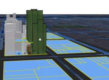
31 Combining Capabilities Courtesy: Esri Canada

32 Vertical and Horizontal Equity

33 High Resolution Land Cover Using Deep Learning to achieve 1-meter resolution land cover at scale

34 Manually created a high-resolution land cover map for precision conservation of the Chesapeake watershed 100k mi 2 Area of watershed to map 2TB File size of imagery to classify 18 months Time to create map By the time the land cover map was completed in December 2016, it was already out of date, and an update would be time-intensive and costly.


35 Land Classification Model Labeled Training Images Chesapeake Conservancy Dataset Convolutional Network Architecture 23 layer U-Net Working Platform: GeoAI Virtual Machine Dataset: 120k mi 2 of imagery at 1-meter resolution, split in half geographically into train and test sets Test Images Land Classification Model Land Cover Map Algorithm Results 91% Average land classification accuracy 16x Faster than Chesapeake Conservancy s previous methods

36 High Resolution Land Classification Using CNTK Convolutional Neural Networks - Microsoft Cognitive Toolkit (

37 ETA Prediction Using Deep Learning with Network Analyst to Predict ETA from Downtown San Francisco to different areas under 25 Minutes


38 Nigeria - Polio


39 3D Cadastre
40 So what do we do now? How do we stay relevant?
41 Brent s Seven Rules for Success


42 1. Think Big and Spatial

43 2. Use Your Tools

44 3. Stay Current

45 4. Create New Services
46 5. Be Free or Affordable

47 6. Move Quickly & Evolve It is not the strongest of the species that survives, nor the most intelligent that survives. It is the one that is most adaptable to change.
48 7. Get Started Now
49 GIS Brent Jones, PE, PLS
50
DANIEL WILSON AND BEN CONKLIN. Integrating AI with Foundation Intelligence for Actionable Intelligence
 DANIEL WILSON AND BEN CONKLIN Integrating AI with Foundation Intelligence for Actionable Intelligence INTEGRATING AI WITH FOUNDATION INTELLIGENCE FOR ACTIONABLE INTELLIGENCE in an arms race for artificial
Advancing Machine Learning and AI with Geography and GIS. Robert Kircher
 Advancing Machine Learning and AI with Geography and GIS Robert Kircher rkircher@esri.com Welcome & Thanks GIS is expected to do more, faster. see where find where predict where locate, connect WHERE route
Smart Land Administration. Brent A. Jones, PE, PLS
 Smart Land Administration Brent A. Jones, PE, PLS bjones@esri.com What is Smart? Required Important Modern Open Secure Authoritative Sustainable Cost Effective Reliable Scalable Contributory Usable Timely
The Pace of Change Is Accelerating Creating Many Challenges
 VISION The Pace of Change Is Accelerating Creating Many Challenges Evidence Threatening Our Natural World and Our Future as Humans Social Conflict Mass Migration Ocean Acidification Food Population Urbanization
Spatial Analysis with ArcGIS Pro STUDENT EDITION
 Spatial Analysis with ArcGIS Pro STUDENT EDITION Copyright 2018 Esri All rights reserved. Course version 2.0. Version release date November 2018. Printed in the United States of America. The information
Welcome. C o n n e c t i n g
 Welcome C o n n e c t i n g YOU D i s c i p l i n e s Why is This Meeting......So Important Now? OUR WORLD Is Increasingly Challenged The Evidence Is Clear We Need Better Understanding and More Collaboration
Machine Learning to Automatically Detect Human Development from Satellite Imagery
 Technical Disclosure Commons Defensive Publications Series April 24, 2017 Machine Learning to Automatically Detect Human Development from Satellite Imagery Matthew Manolides Follow this and additional
Calculating Land Values by Using Advanced Statistical Approaches in Pendik
 Presented at the FIG Congress 2018, May 6-11, 2018 in Istanbul, Turkey Calculating Land Values by Using Advanced Statistical Approaches in Pendik Prof. Dr. Arif Cagdas AYDINOGLU Ress. Asst. Rabia BOVKIR
ArcGIS Pro: Analysis and Geoprocessing. Nicholas M. Giner Esri Christopher Gabris Blue Raster
 ArcGIS Pro: Analysis and Geoprocessing Nicholas M. Giner Esri Christopher Gabris Blue Raster Agenda What is Analysis and Geoprocessing? Analysis in ArcGIS Pro - 2D (Spatial xy) - 3D (Elevation - z) - 4D
Risk Assessment of Pedestrian Accident Area Using Spatial Analysis and Deep Learning
 Risk Assessment of Pedestrian Accident Area Using Spatial Analysis and Deep Learning Ilyoung Hong*, Hanseung Choi, Songpyo Hong Department of GIS Engineering, Namseoul University, Republic of Korea. *
ArcGIS Online Routing and Network Analysis. Deelesh Mandloi Matt Crowder
 ArcGIS Online Routing and Network Analysis Deelesh Mandloi Matt Crowder Introductions Who are we? - Members of the Network Analyst development team Who are you? - Network Analyst users? - ArcGIS Online
A Service Architecture for Processing Big Earth Data in the Cloud with Geospatial Analytics and Machine Learning
 A Service Architecture for Processing Big Earth Data in the Cloud with Geospatial Analytics and Machine Learning WOLFGANG GLATZ & THOMAS BAHR 1 Abstract: The Geospatial Services Framework (GSF) brings
Introduction to Spatial Big Data Analytics. Zhe Jiang Office: SEC 3435
 Introduction to Spatial Big Data Analytics Zhe Jiang zjiang@cs.ua.edu Office: SEC 3435 1 What is Big Data? Examples Internet data (images from the web) Earth observation data (nasa.gov) wikimedia.org www.me.mtu.edu
Spatial Analysis with Web GIS. Rachel Weeden
 Spatial Analysis with Web GIS Rachel Weeden Agenda Subhead goes here Introducing ArcGIS Online Spatial Analysis Workflows Scenarios Other Options Resources ArcGIS is a Platform Making mapping and analytics
DATA SCIENCE SIMPLIFIED USING ARCGIS API FOR PYTHON
 DATA SCIENCE SIMPLIFIED USING ARCGIS API FOR PYTHON LEAD CONSULTANT, INFOSYS LIMITED SEZ Survey No. 41 (pt) 50 (pt), Singapore Township PO, Ghatkesar Mandal, Hyderabad, Telengana 500088 Word Limit of the
You are Building Your Organization s Geographic Knowledge
 You are Building Your Organization s Geographic Knowledge And Increasingly Making it Available Sharing Data Publishing Maps and Geo-Apps Developing Collaborative Approaches Citizens Knowledge Workers Analysts
for Effective Land Administration
 Role of Geospatial Technology in Land Information System(LIS) for Effective Land Administration Dr. Deb Jyoti Pal Sections Role of GIS in Land Records Proposed Work Flow Case Studies Role of GIS Creating
Esri and GIS Education
 Esri and GIS Education Organizations Esri Users 1,200 National Government Agencies 11,500 States & Regional Agencies 30,800 Cities & Local Governments 32,000 Businesses 8,500 Utilities 12,600 NGOs 11,000
ArcGIS is Advancing. Both Contributing and Integrating many new Innovations. IoT. Smart Mapping. Smart Devices Advanced Analytics
 ArcGIS is Advancing IoT Smart Devices Advanced Analytics Smart Mapping Real-Time Faster Computing Web Services Crowdsourcing Sensor Networks Both Contributing and Integrating many new Innovations ArcGIS
Towards Fully-automated Driving
 Towards Fully-automated Driving Challenges and Potential Solutions Dr. Gijs Dubbelman Mobile Perception Systems EE-SPS/VCA Mobile Perception Systems 6 PhDs, postdoc, project manager, software engineer,
Enhance Security, Safety and Efficiency With Geospatial Visualization
 Areas within 10 minutes of an exit are emphasized on this map, to give an indication of how accessible neighborhoods are by highway. The colors represent 1, 3, 5 and 10 minute increments from the exits.
Geo-Enabling Digital India. 15 th Esri India User Conference GIS and Smart Cities
 15 th Esri India User Conference 2014 GIS and Smart Cities 15 th Esri India User Conference 2014 GIS and Smart Cities Agendra Kumar President, Esri India Our World Is Facing Serious Challenges Our World
Esri WebGIS Highlights of What s New, and the Road Ahead
 West Virginia GIS Conference WVU, Morgantown, WV Esri WebGIS Highlights of What s New, and the Road Ahead Mark Scott, Solutions Engineer, Esri Local Government Team May 5 th, 2016 West Virginia GIS Conference
Course Structure. Psychology 452 Week 12: Deep Learning. Chapter 8 Discussion. Part I: Deep Learning: What and Why? Rufus. Rufus Processed By Fetch
 Psychology 452 Week 12: Deep Learning What Is Deep Learning? Preliminary Ideas (that we already know!) The Restricted Boltzmann Machine (RBM) Many Layers of RBMs Pros and Cons of Deep Learning Course Structure
Portal for ArcGIS: An Introduction
 Portal for ArcGIS: An Introduction Derek Law Esri Product Management Esri UC 2014 Technical Workshop Agenda Web GIS pattern Product overview Installation and deployment Security and groups Configuration
MANAGING TRANSPORTATION & LAND USE INTERACTIONS (PL-58)
") MANAGING TRANSPORTATION & LAND USE INTERACTIONS (PL-58) COURSE OUTLINE DAY ONE 1:30 2:00 p.m. MODULE 1: History and Context Understand history and foundation for transportation and land use planning today
MANAGING TRANSPORTATION & LAND USE INTERACTIONS (PL-58) COURSE OUTLINE DAY ONE 1:30 2:00 p.m. MODULE 1: History and Context Understand history and foundation for transportation and land use planning today
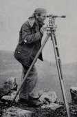
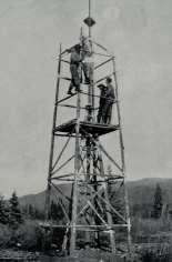
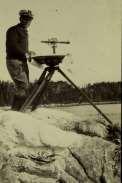
A Broad View of Geospatial Technology & Systems
 A Broad View of Geospatial Technology & Systems Pete Large Vice President, Trimble On the shoulders of giants 1 Since their time, our ability to generate geospatial information has grown exponentially
ArcGIS Enterprise: What s New. Philip Heede Shannon Kalisky Melanie Summers Sam Williamson
 ArcGIS Enterprise: What s New Philip Heede Shannon Kalisky Melanie Summers Sam Williamson ArcGIS Enterprise is the new name for ArcGIS for Server What is ArcGIS Enterprise ArcGIS Enterprise is powerful
ESRI Survey Summit August Clint Brown Director of ESRI Software Products
 ESRI Survey Summit August 2006 Clint Brown Director of ESRI Software Products Cadastral Fabric How does Cadastral fit with Survey? Surveyors process raw field observations Survey measurements define high-order
Globally Estimating the Population Characteristics of Small Geographic Areas. Tom Fitzwater
 Globally Estimating the Population Characteristics of Small Geographic Areas Tom Fitzwater U.S. Census Bureau Population Division What we know 2 Where do people live? Difficult to measure and quantify.
Geo Business Gis In The Digital Organization
 We have made it easy for you to find a PDF Ebooks without any digging. And by having access to our ebooks online or by storing it on your computer, you have convenient answers with geo business gis in
AN INTRODUCTION TO NEURAL NETWORKS. Scott Kuindersma November 12, 2009
 AN INTRODUCTION TO NEURAL NETWORKS Scott Kuindersma November 12, 2009 SUPERVISED LEARNING We are given some training data: We must learn a function If y is discrete, we call it classification If it is
About Nnergix +2, More than 2,5 GW forecasted. Forecasting in 5 countries. 4 predictive technologies. More than power facilities
 About Nnergix +2,5 5 4 +20.000 More than 2,5 GW forecasted Forecasting in 5 countries 4 predictive technologies More than 20.000 power facilities Nnergix s Timeline 2012 First Solar Photovoltaic energy
Introduction to Portal for ArcGIS
 Introduction to Portal for ArcGIS Derek Law Product Management March 10 th, 2015 Esri Developer Summit 2015 Agenda Web GIS pattern Product overview Installation and deployment Security and groups Configuration
DATA MINING WITH DIFFERENT TYPES OF X-RAY DATA
 DATA MINING WITH DIFFERENT TYPES OF X-RAY DATA 315 C. K. Lowe-Ma, A. E. Chen, D. Scholl Physical & Environmental Sciences, Research and Advanced Engineering Ford Motor Company, Dearborn, Michigan, USA
Presented at the FIG Working Week 2017, May 29 - June 2, 2017 in Helsinki, Finland SURV. ISAAC OLORUNFEMI ADEDURIN MAY 2017
 Presented at the FIG Working Week 2017, May 29 - June 2, 2017 in Helsinki, Finland BY SURV. ISAAC OLORUNFEMI ADEDURIN 08023139029 MAY 2017 GEOGRAPHICAL COMPONENT DATABANK SECURITY DATABANK COMPONENT:
Spatial Data Science. Soumya K Ghosh
 Workshop on Data Science and Machine Learning (DSML 17) ISI Kolkata, March 28-31, 2017 Spatial Data Science Soumya K Ghosh Professor Department of Computer Science and Engineering Indian Institute of Technology,
ENV208/ENV508 Applied GIS. Week 1: What is GIS?
 ENV208/ENV508 Applied GIS Week 1: What is GIS? 1 WHAT IS GIS? A GIS integrates hardware, software, and data for capturing, managing, analyzing, and displaying all forms of geographically referenced information.
Spatial Pattern Analysis: Mapping Trends and Clusters
 2013 Esri International User Conference July 8 12, 2013 San Diego, California Technical Workshop Spatial Pattern Analysis: Mapping Trends and Clusters Lauren Rosenshein Bennett Brett Rose Presentation
GIS and Governing Anchorage. GIS Critical for Efficient, Transparent Government How is GIS Program Doing Where can GIS Program Take us
 GIS and Governing Anchorage GIS Critical for Efficient, Transparent Government How is GIS Program Doing Where can GIS Program Take us Municipality of Anchorage Office of Economic And Community Development
Mitosis Detection in Breast Cancer Histology Images with Multi Column Deep Neural Networks
 Mitosis Detection in Breast Cancer Histology Images with Multi Column Deep Neural Networks IDSIA, Lugano, Switzerland dan.ciresan@gmail.com Dan C. Cireşan and Alessandro Giusti DNN for Visual Pattern Recognition
Incorporating ArcGIS Pro in your Curriculum
 AAG, Boston 2017 April 5, 2017 Incorporating ArcGIS Pro in your Curriculum Geri Miller Agenda Concerns Acknowledged Learning curve ArcGIS Pro does not have all the tools (perception) Licensing and offline
Open spatial data infrastructure
 Open spatial data infrastructure a backbone for digital government Thorben Hansen Geomatikkdagene 2018 Stavanger 13.-15. mars Spatial Data Infrastructure definition the technology, policies, standards,
GeoAnalytics A key component for insurance industry disruption
 GeoAnalytics A key component for insurance industry disruption Geo Risk Insurance Seminar London, 13th of March 2018 Image: used under license from Shutterstock.com Source: Earthstar Geographics, Esri,
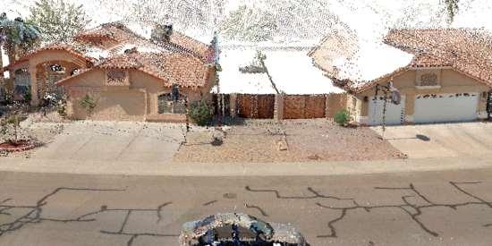
Innovation in mapping and photogrammetry at the Survey of Israel
 16, October, 2017 Innovation in mapping and photogrammetry at the Survey of Israel Yaron Felus and Ronen Regev Contents Why HD mapping? Government requirements Mapping regulations o Quality requirements
Web GIS Administration: Tips and Tricks
 EdUC 2017 July 8 th, 2017 Web GIS Administration: Tips and Tricks Geri Miller Agenda Concerns Acknowledged User Management Content Management Monitoring Licensing and logins Sophistication of IT support
Introduction to Portal for ArcGIS. Hao LEE November 12, 2015
 Introduction to Portal for ArcGIS Hao LEE November 12, 2015 Agenda Web GIS pattern Product overview Installation and deployment Security and groups Configuration options Portal for ArcGIS + ArcGIS for
Maryland State Geographic Information Committee
 MD IMAP 3.0 Next generation of MD imap platform running on Esri s ArcGIS Enterprise Promoting authoritative data sharing among State agencies via Portal for ArcGIS Centralization of GIS infrastructure
Changes in Esri GIS, practical ways to be ready for the future
 Changes in Esri GIS, practical ways to be ready for the future John Sharrard, Esri April 16, 2015 The only thing that is constant is change. Heraclitus, ca. 500 B.C. My story (of experiencing change) Changes
UPDATING THE MINNESOTA NATIONAL WETLAND INVENTORY
 UPDATING THE MINNESOTA NATIONAL WETLAND INVENTORY An Integrated Approach Using Object-Oriented Image Analysis, Human Air-Photo Interpretation and Machine Learning AARON SMITH EQUINOX ANALYTICS INC. FUNDING
Land Cover Classification Mapping & its uses for Planning
 Land Cover Classification Mapping & its uses for Planning What is Land Cover Classification Mapping? Examples of an actual product Why use Land Cover Classification Mapping for planning? Possible uses
Spatial Data, Spatial Analysis and Spatial Data Science
 Spatial Data, Spatial Analysis and Spatial Data Science Luc Anselin http://spatial.uchicago.edu 1 spatial thinking in the social sciences spatial analysis spatial data science spatial data types and research
Short-term traffic volume prediction using neural networks
 Short-term traffic volume prediction using neural networks Nassim Sohaee Hiranya Garbha Kumar Aswin Sreeram Abstract There are many modeling techniques that can predict the behavior of complex systems,
DP Project Development Pvt. Ltd.
 Dear Sir/Madam, Greetings!!! Thanks for contacting DP Project Development for your training requirement. DP Project Development is leading professional training provider in GIS technologies and GIS application
AUTOMATED DATA PROCESSING FOR MARITIME AND FLOODS APPLICATIONS
 YOUR HUB FOR GEOSPATIAL APPLICATIONS AUTOMATED DATA PROCESSING FOR MARITIME AND FLOODS APPLICATIONS Angelucci Maria, Daffina Filippo, Grandoni Domenico, Quattrociocchi Dino Automated Data Processing (Smart
A Vision for ArcGIS Applying Geography Everywhere
 A Vision for ArcGIS Applying Geography Everywhere WELCOME PURPOSE A Network of GIS Professionals Are Awakening the World to the Power of Web GIS You Your WORK Making a Difference Your Work Open Maps and
Working with ArcGIS Online
 Esri International User Conference San Diego, CA Technical Workshops July 12, 2011 Working with ArcGIS Online Bern Szukalski, Deane Kensok Topics for this Session ArcGIS Online Overview ArcGIS Online Content
MSC HPC Infrastructure Update. Alain St-Denis Canadian Meteorological Centre Meteorological Service of Canada
 MSC HPC Infrastructure Update Alain St-Denis Canadian Meteorological Centre Meteorological Service of Canada Outline HPC Infrastructure Overview Supercomputer Configuration Scientific Direction 2 IT Infrastructure
KING GEORGE COUNTY DEPARTMENT OF COMMUNITY DEVELOPMENT
 GIS REPORT 2016 KING GEORGE COUNTY DEPARTMENT OF COMMUNITY DEVELOPMENT Background The GIS (Geographic Information System) coordinator was hired in 2001 to develop a GIS for King George County. Prior to
ArcGIS. for Server. Understanding our World
 ArcGIS for Server Understanding our World ArcGIS for Server Create, Distribute, and Manage GIS Services You can use ArcGIS for Server to create services from your mapping and geographic information system
WeatherCloud Hyper-Local Global Forecasting All rights reserved. Fathym, Inc.
 WeatherCloud Hyper-Local Global Forecasting based on current forecast techniques EVOLVING FORECASTING TECHNOLOGY 1) The WeatherCloud backend forecast system allows for routing around hazardous weather
Portal for ArcGIS: An Introduction. Catherine Hynes and Derek Law
 Portal for ArcGIS: An Introduction Catherine Hynes and Derek Law Agenda Web GIS pattern Product overview Installation and deployment Configuration options Security options and groups Portal for ArcGIS
Quantum Artificial Intelligence and Machine Learning: The Path to Enterprise Deployments. Randall Correll. +1 (703) Palo Alto, CA
 Palo Alto, CA") Quantum Artificial Intelligence and Machine : The Path to Enterprise Deployments Randall Correll randall.correll@qcware.com +1 (703) 867-2395 Palo Alto, CA 1 Bundled software and services Professional
Quantum Artificial Intelligence and Machine : The Path to Enterprise Deployments Randall Correll randall.correll@qcware.com +1 (703) 867-2395 Palo Alto, CA 1 Bundled software and services Professional
An Industry Perspective. Bryn Fosburgh Vice President Trimble
 An Industry Perspective Bryn Fosburgh Vice President Trimble Who are we? Professionals & Consultants Geospatial Professionals working at or with: AEC Consultants Transportation Departments Construction
Leveraging Geospatial Technology for Cadastral Surveys
 Matthew Delano, LS Geospatial World Forum January 2017 Leveraging Geospatial Technology for Cadastral Surveys Fit-for-Purpose Simple to start Can improve over time whenever necessary Meet the needs of
SPATIAL ANALYSIS. Transformation. Cartogram Central. 14 & 15. Query, Measurement, Transformation, Descriptive Summary, Design, and Inference
 14 & 15. Query, Measurement, Transformation, Descriptive Summary, Design, and Inference Geographic Information Systems and Science SECOND EDITION Paul A. Longley, Michael F. Goodchild, David J. Maguire,
Forecasting demand in the National Electricity Market. October 2017
 Forecasting demand in the National Electricity Market October 2017 Agenda Trends in the National Electricity Market A review of AEMO s forecasting methods Long short-term memory (LSTM) neural networks
Esri Overview for Mentor Protégé Program:
 Agenda Passionate About Helping You Succeed Esri Overview for Mentor Protégé Program: Northrop Grumman CSSS Jeff Dawley 3 September 2010 Esri Overview ArcGIS as a System ArcGIS 10 - Map Production - Mobile
Introduction to ArcGIS Maps for Office. Greg Ponto Scott Ball
 Introduction to ArcGIS Maps for Office Greg Ponto Scott Ball Agenda What is Maps for Office? Platform overview What are Apps for the Office? ArcGIS Maps for Office features - Visualization - Geoenrichment
Demystifying ArcGIS Online. Karen Lizcano Esri
 Demystifying ArcGIS Online Karen Lizcano Esri An Integrated Web GIS Platform Desktop Web Device Powered by Services Managed via Portal Access from any Device Portal Server Online Content and Services ArcGIS
Implications for the Sharing Economy
 Locational Big Data and Analytics: Implications for the Sharing Economy AMCIS 2017 SIGGIS Workshop Brian N. Hilton, Ph.D. Associate Professor Director, Advanced GIS Lab Center for Information Systems and
ArcGIS GeoAnalytics Server: An Introduction. Sarah Ambrose and Ravi Narayanan
 ArcGIS GeoAnalytics Server: An Introduction Sarah Ambrose and Ravi Narayanan Overview Introduction Demos Analysis Concepts using GeoAnalytics Server GeoAnalytics Data Sources GeoAnalytics Server Administration
@SoyGema GEMA PARREÑO PIQUERAS
 @SoyGema GEMA PARREÑO PIQUERAS WHAT IS AN ARTIFICIAL NEURON? WHAT IS AN ARTIFICIAL NEURON? Image Recognition Classification using Softmax Regressions and Convolutional Neural Networks Languaje Understanding
GEOMATICS. Shaping our world. A company of
 GEOMATICS Shaping our world A company of OUR EXPERTISE Geomatics Geomatics plays a mayor role in hydropower, land and water resources, urban development, transport & mobility, renewable energy, and infrastructure
A Little History of Machine Learning
 機器學習現在 過去 未來 A Little History of Machine Learning Chia-Ping Chen National Sun Yat-sen University @NPTU, December 2016 Outline ubiquitous machine intelligence challenge and reaction AI brief deep learning
Esri User Conference 2018 Video Topics
 Esri User Conference 2018 Video Topics 3D GIS 3D Across ArcGIS 3D Analysis Tools in ArcGIS Pro 3D Cartographic Techniques: An Introduction 3D Data: Lidar Point Clouds and 3D Mesh 3D Feature and Sub-Surface
Introduction to Neural Networks
 CUONG TUAN NGUYEN SEIJI HOTTA MASAKI NAKAGAWA Tokyo University of Agriculture and Technology Copyright by Nguyen, Hotta and Nakagawa 1 Pattern classification Which category of an input? Example: Character
Spatial Data Analysis with ArcGIS Desktop: From Basic to Advance
 Spatial Data Analysis with ArcGIS Desktop: From Basic to Advance 1. Course overview Modern environmental, energy as well as resource modeling and planning require huge amount of geographically located
Geography for the 2020 Round of Census
 Boundaries Key Census Data EA Id Population Male Female EA Id Area EA Id Num HH Avg HH size Geography for the 2020 Round of Census Linda Peters, Esri lpeters@esri.com Integration of Statistical and Geospatial
Introduction to Geographic Information Systems (GIS): Environmental Science Focus
: Environmental Science Focus") Introduction to Geographic Information Systems (GIS): Environmental Science Focus September 9, 2013 We will begin at 9:10 AM. Login info: Username:!cnrguest Password: gocal_bears Instructor: Domain: CAMPUS
Introduction to Geographic Information Systems (GIS): Environmental Science Focus September 9, 2013 We will begin at 9:10 AM. Login info: Username:!cnrguest Password: gocal_bears Instructor: Domain: CAMPUS
ArcGIS Enterprise: What s New. Philip Heede Shannon Kalisky Melanie Summers Shreyas Shinde
 ArcGIS Enterprise: What s New Philip Heede Shannon Kalisky Melanie Summers Shreyas Shinde ArcGIS Enterprise is the new name for ArcGIS for Server ArcGIS Enterprise Software Components ArcGIS Server Portal
CONTEMPORARY ANALYTICAL ECOSYSTEM PATRICK HALL, SAS INSTITUTE
 CONTEMPORARY ANALYTICAL ECOSYSTEM PATRICK HALL, SAS INSTITUTE Copyright 2013, SAS Institute Inc. All rights reserved. Agenda (Optional) History Lesson 2015 Buzzwords Machine Learning for X Citizen Data
June 19 Huntsville, Alabama 1
 June 19 Huntsville, Alabama 1 Real-Time Geospatial Data: The Fusion of PI and ArcGIS Enabling Smarter Facilities Management OSIsoft and Esri Mapping and Location Analytics Platform Supporting Your Use
Implementing ArcGis 10 infrastructure to resolve mining problems
 Implementing ArcGis 10 infrastructure to resolve mining problems ESRI UC 2013, San Diego, 8-12 July, 2013 A R T U R O M O R A L E S L A D R O N D E G U E V A R A, E L T E N I E N T E M I N E, C O D E L
Overview of ArcGIS Enterprise August 24, Dan Haag ESRI
 Overview of ArcGIS Enterprise August 24, 2017 Dan Haag ESRI Sharing to a portal ArcGIS 10.3 portal Central destination for all of your geospatial assets in Web GIS - ArcGIS Online organization and/or Portal
Arcgis Enterprise Performance And Scalability Best Practices
 Arcgis Enterprise Performance And Scalability Best Practices We have made it easy for you to find a PDF Ebooks without any digging. And by having access to our ebooks online or by storing it on your computer,
Neural networks and optimization
 Neural networks and optimization Nicolas Le Roux INRIA 8 Nov 2011 Nicolas Le Roux (INRIA) Neural networks and optimization 8 Nov 2011 1 / 80 1 Introduction 2 Linear classifier 3 Convolutional neural networks
ArcGIS Platform For NSOs
 ArcGIS Platform For NSOs Applying GIS and Spatial Thinking to Official Statistics Esri UC 2014 Demo Theater Applying GIS at the NSO Generic Statistical Business Process Model (GSBPM) 1 Specify Needs 2
IMPERIAL COUNTY PLANNING AND DEVELOPMENT
 IMPERIAL COUNTY PLANNING AND DEVELOPMENT GEODATABASE USER MANUAL FOR COUNTY BUSINESS DEVELOPMENT GIS June 2010 Prepared for: Prepared by: County of Imperial Planning and Development 801 Main Street El
FIRE DEPARMENT SANTA CLARA COUNTY
 DEFINITION FIRE DEPARMENT SANTA CLARA COUNTY GEOGRAPHIC INFORMATION SYSTEM (GIS) ANALYST Under the direction of the Information Technology Officer, the GIS Analyst provides geo-spatial strategic planning,
Leveraging Web GIS: An Introduction to the ArcGIS portal
 Leveraging Web GIS: An Introduction to the ArcGIS portal Derek Law Product Management DLaw@esri.com Agenda Web GIS pattern Product overview Installation and deployment Configuration options Security options
GIS = Geographic Information Systems;
 What is GIS GIS = Geographic Information Systems; What Information are we talking about? Information about anything that has a place (e.g. locations of features, address of people) on Earth s surface,
Transit Time Shed Analyzing Accessibility to Employment and Services
 Transit Time Shed Analyzing Accessibility to Employment and Services presented by Ammar Naji, Liz Thompson and Abdulnaser Arafat Shimberg Center for Housing Studies at the University of Florida www.shimberg.ufl.edu
Molinas. June 15, 2018
 ITT8 SAMBa Presentation June 15, 2018 ling Data The data we have include: Approx 30,000 questionnaire responses each with 234 questions during 1998-2017 A data set of 60 questions asked to 500,000 households
From statistics to data science. BAE 815 (Fall 2017) Dr. Zifei Liu
 Dr. Zifei Liu") From statistics to data science BAE 815 (Fall 2017) Dr. Zifei Liu Zifeiliu@ksu.edu Why? How? What? How much? How many? Individual facts (quantities, characters, or symbols) The Data-Information-Knowledge-Wisdom
From statistics to data science BAE 815 (Fall 2017) Dr. Zifei Liu Zifeiliu@ksu.edu Why? How? What? How much? How many? Individual facts (quantities, characters, or symbols) The Data-Information-Knowledge-Wisdom
GIS for Crime Analysis. Building Better Analysis Capabilities with the ArcGIS Platform
 GIS for Crime Analysis Building Better Analysis Capabilities with the ArcGIS Platform Crime Analysis The Current State One of the foundations of criminological theory is that three things are needed for
Understanding Travel Time to Airports in New York City Sierra Gentry Dominik Schunack
 Understanding Travel Time to Airports in New York City Sierra Gentry Dominik Schunack 1 Introduction Even with the rising competition of rideshare services, many in New York City still utilize taxis for
An Implementation of Mobile Sensing for Large-Scale Urban Monitoring
 An Implementation of Mobile Sensing for Large-Scale Urban Monitoring Teerayut Horanont 1, Ryosuke Shibasaki 1,2 1 Department of Civil Engineering, University of Tokyo, Meguro, Tokyo 153-8505, JAPAN Email:
The University of Arizona Enterprise GIS. CFTA 2016 Facilities Geospatial Technologies Showcase
 The University of Arizona Enterprise GIS CFTA 2016 Facilities Geospatial Technologies Showcase Main Campus: Tucson, Arizona Founded: 1885 Number of Buildings: 227 GSF: 9.4 million Acres: 393 Total Students:
Mapping Coastal Change Using LiDAR and Multispectral Imagery
 Mapping Coastal Change Using LiDAR and Multispectral Imagery Contributor: Patrick Collins, Technical Solutions Engineer Presented by TABLE OF CONTENTS Introduction... 1 Coastal Change... 1 Mapping Coastal