CWC Water Plan
|
|
|
- Kathleen Dawson
- 5 years ago
- Views:
Transcription
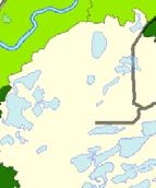
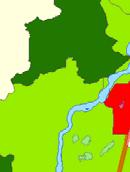
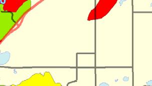
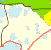
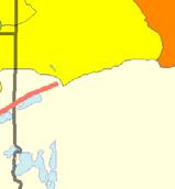
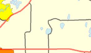
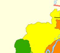
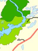
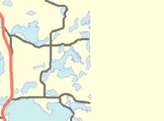
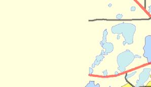
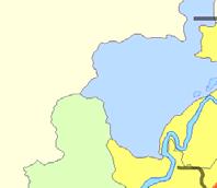
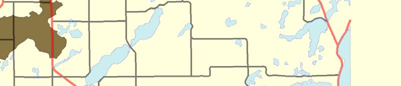
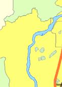
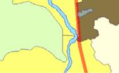
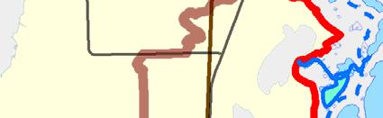
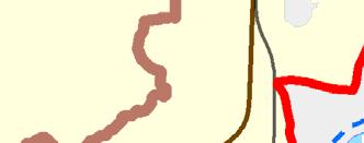
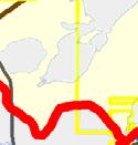
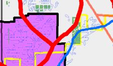
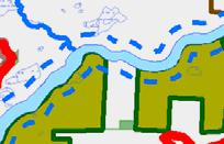
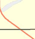
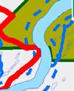
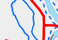
1 CWC Water Plan IMPLEMENTATION: MISSISSIPPI RIVER The begins as a trickle flowing out of Lake Itasca in northern Minnesota. From there the river flows 2,348 miles until it pours into the Gulf of Meico below New Orleans. The Mississippi River drains 33 states and its watershed covers one-half of the United States. It fosters cities and commerce, transports people and goods, provides habitat for fish, plants, and wildlife, and enriches human life with natural and recreational opportunities. North America's longest river percolates out of a mied hardwood and conifer forest as it begins its descent to the Gulf of Meico. It is a humble stream fed by underground springs, the moist climate and countless lakes, marshes, bogs. The at its source bears little resemblance to the mighty river it becomes. It is nonetheless the defining feature of northern Minnesota. The is protected from its headwaters at Lake Itasca in Clearwater County, to the southern boundary of Morrison County, near Little Falls by the Mississippi Headwaters Board (MHB). Formed in 1980 as an alternative to designation of the river into the National Wild and Scenic River System, the Mississippi Headwaters Board (MHB) is a joint powers board of Clearwater, Beltrami, Cass, Hubbard, Itasca, Aitkin, Crow Wing and Morrison Counties that is mandated by Minnesota Statutes 103F to enhance and protect the natural, cultural, historic, scientific and recreational values of the headwaters region. MHB achieves its goal of river protection through cooperative land use planning in the eight counties, in conjunction with the Chippewa National Forest and the Leech Lake Indian Reservation. The MHB also promotes water quality monitoring, education and stewardship activities among its partners along the corridor. The MHB is currently coordinating a water planning effort along the entire 400+ mile corridor to prioritize conservation implementation projects by minor watershed (DNR Level 8 Catchment). By analyzing the available GIS and water quality information, the MHB and the member counties can coordinate funding strategies for targeted, effective implementation of conservation practices that take advantage of future Clean Water Land and Legacy funding opportunities as well as providing greater coordination among the counties. The DNR Level 8 Catchment was the level chosen because it is a slightly more focused watershed unit than the DNR Level 7 watershed. Conservation priorities were again summarized by catchment along the corridor for the level of eisting protection and land use disturbance and were also prioritized by various implementation focuses and summarized by catchment. The vigilance, protection, and enhance risk classification were again applied and mapped. Figures highlight the implementation priorities by catchment along the river in Crow Wing County. Figures are more detailed maps of these catchments. Water quality and DNR survey data for the is included as Appendi 5 of this report. 79
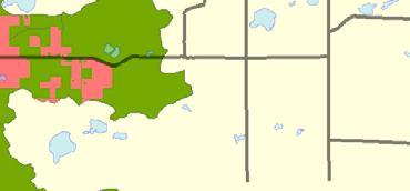
2 CWC Water Plan Map: Figure #: Risk Classification 50 % Protected (by catchment) 51 Land Use Disturbance 52 Watershed Protection Categories o % Public Land 53 o % 54 o % Wetlands 55 o Easements 56 (by catchment) o 57 o 58 o Growth & 59 o Private Forest Management 60 o Drinking Water Protection 61 o Wild Rice 62 o Shallow 63 o Unique & Native Plant Communities 64 o Bald Eagle Areas 65 o Bird Habitat 66 o Mussel Habitat 67 Other considerations o Surficial Geology 68 Catchment Maps & Data o Catchment Map 1 69 o Catchment Map 2 70 o Catchment Map 3 71 o Individual Catchment Summaries 72 80


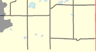
3 City of Brainerd Figure 50: Risk Classification Land Services Environmental Services Risk Classification (by catchment) Vigilance Protection Enhance / Protection Enhance


4 Pine River Crow Wing River - Brainerd City of Brainerd Rum River - Sartell Figure 51: % Protected Environmental Services Services Protected = Public Land,, Rivers, Wetlands (private) & Easements Protected (by catchment) Major Watersheds 80+ % % % % 0-20 %


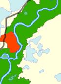


5 Figure 52: Land Use Disturbance Environmental Services Services Disturbed = Developed, Cultivated, Pasture, & Grassland 0-8 % 8-15 % % % % % % 40+ %


6 City of Brainerd Figure 53: % Public Ownership Environmental Land Services Services Public Ownership (by catchment) 50+ % % % 5-10 % 0-5 %


7 City of Brainerd Figure 54: % Environmental Services Services Lake Area (by catchment) 50+ % % % 5-10 % 0-5 %


8 City of Brainerd Figure 55: % Wetlands Environmental Services Services Wetland Area (by catchment) 50+ % % % 5-10 % 0-5 %


9 City of Brainerd Figure 56: Easements Easements Environmental Services Services Includes: ACUB, RIM, MLT, STATE OF MN Catchments with Easements Other catchments


10 City of Brainerd Figure 57: Implementation Priority = AIS Environmental Services Services Catchments with AIS Other catchments


11 City of Brainerd Figure 58: Implementation Priority = Environmental Services Services Catchments with Agriculture Other catchments


12 City of Brainerd Figure 59: Implementation Priority = Growth & Environmental Services Services Populated and Developing Areas Other catchments


13 City of Brainerd Figure 60: Implementation Priority = Private Forest Management Environmental Services Services Catchments with > 25% Private Forest Lands Other catchments


14 City of Brainerd Figure 61: Implementation Priority = Drinking Water Protection Environmental Services Services Wellhead and Source Water Protection Areas Other catchments
15 City of Brainerd Figure 62: Implementation Priority = Wild Rice Environmental Services Services Catchments with Wild Rice Other Catchments


16 City of Brainerd Figure 63: Implementation Priority = Shallow Environmental Services Services Shallow, Wildlife Other catchments


17 City of Brainerd Figure 64: Implementation Priority = Unique & Native Plant Communities Environmental Services Services Unique Plant Species Other catchments


18 City of Brainerd Figure 65: Implementation Priority = Bald Eagle Areas Environmental Services Services Bald Eagle Areas Other catchments


19 City of Brainerd Figure 66: Implementation Priority = Bird Habitat Environmental Services Services Bird Habitat Areas Other catchments


20 City of Brainerd Figure 67: Implementation Priority = Mussel Habitat Environmental Services Services Unique and Native Mussel Areas Other catchments


21 City of Brainerd Figure 68: Surficial Geology Environmental Services Services Primary Surficial Features Alluvium Ice Contact Lacustrine Outwash Peat Supraglacial Drift Comple Till Plain Undifferentiated
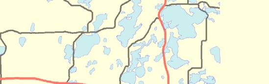
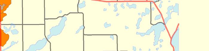
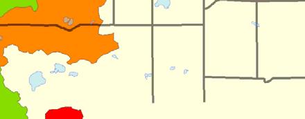
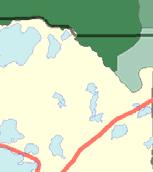
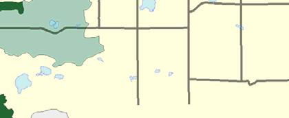
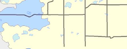
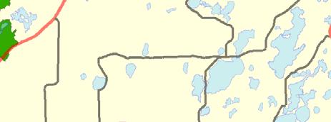
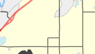
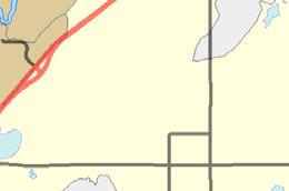
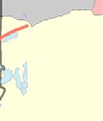
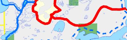
22 STATE HWY 6 CO RD 11 SECOND ASSESSMENT X CO RD 105 CO RD MISSION Unnamed Stream PERRY LAKE CO RD 11 Unnamed Stream Pine River Fool ( P) Deadman's ( P) Deadman's Creek CO RD 109 Unnamed ( W) X X Stanley ( P) &V Judicial Ditch 1 CO RD Aitkin CO RD 19 Unnamed ( W) Island ( P) Unnamed Stream Indian Jack ( P) Rabbit Lake Ditch 11 CO RD 32 Cedar Creek WOLFORD Milford ( P) CO RD 31 CO RD CENTER Mission Creek City of Trommald Half Moon ( P) Cuyuna Country State Recreation Area Figure 69: Catchment Map 1 Environmental Services ã ÊÚ #S #0 %U &V City of Cuyuna Public Waterworks Feedlots (by primary animal) Water Use: Air Conditioning BIRDS Water Use: Industrial Processing BOVINES Irrigation: Crop HORSES Irrigation: Non Crop PIGS Water Use: Special Categories X Active Gravel Pits Areas Drinking Water Source Protection Areas State Park Boundaries State Recreation Area Boundaries Scientific and Natural Areas Wildlife Management Areas Water Access Sites Wild Rice Streams County Ditches Wetlands (from NWI) CO RD 32 STATE HWY 210 Unnamed ( P) Conservation Easements Public Lands Cities / Townships U.S. Highways Paul Bunyan State Trail!P!. : Outlet - Major Watershed Outlet - Catchment Catchments (DNR Level 8) Major Watersheds Miles

")


")


")
 Unnamed")

")


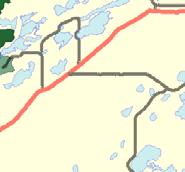
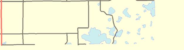
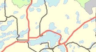
23 CO RD 119 CO RD 3 CO RD 23 CO RD 59 City of Breezy Point Pine River Fool ( P) Deadman's ( P) PELICAN MISSION CO RD 109 Unnamed ( W) PERRY LAKE X X CO RD 11 Stanley ( P) Indian Jack ( P) Unnamed ( W) Island ( P) CO RD 118 CO RD 116 WOLFORD Milford ( P) Mission Creek CO RD 13 CO RD 4 LAKE EDWARD CO RD 19 CENTER Half Moon ( P) City of Trommald CO RD 34 CO RD 30 City of Cuyuna STATE HWY 6 Unnamed ( P) Cuyuna Country State Recreation Area City of Crosby City of Ironton CO RD 33 CO RD 28 CO RD 127 Unnamed ( P) Campbell ( P) Ditch 7 Sorenson ( P) Unnamed ( P) CO RD 128 Little Rabbit ( P) City of Riverton Horseshoe ( W) Cuyuna Country State Recreation Area IRONDALE STATE HWY 210 CO RD 12 Green ( P) Pickerel ( W) Paul Bunyan State Trail Little Menomin ( W) Ditch 5 X Horseshoe ( W) Sand Creek Unnamed ( P) CO RD 147 CO RD 102 FIRST ASSESSMENT &V&V&V CSAH 5 CO RD 20 %U %U STATE HWY 371 ã ã CO RD 49 CO RD 45 CO RD 3 #S #S City of Brainerd Rice ( P) ÊÚÊÚ HWY 25 S Little Buffalo Creek Unnamed ( P) Whitley's Creek Unnamed ( P) STATE HWY 210 STATE HWY 25 CO RD 144 CO RD 25 OAK LAWN STATE HWY 18 NOKAY LAKE CO RD 159 CO RD 8 CO RD 8 CO RD 8 Figure 70: Catchment Map 2 Environmental Services ã ÊÚ #S #0 %U &V Miles Public Waterworks Water Use: Air Conditioning Water Use: Industrial Processing Irrigation: Crop Irrigation: Non Crop Water Use: Special Categories Areas Drinking Water Source Protection Areas : Feedlots (by primary animal) X BIRDS BOVINES HORSES PIGS Active Gravel Pits State Park Boundaries State Recreation Area Boundaries Scientific and Natural Areas Wildlife Management Areas Water Access Sites Wild Rice Streams County Ditches Wetlands (from NWI)!P!. Conservation Easements Public Lands Cities / Townships U.S. Highways Paul Bunyan State Trail Outlet - Major Watershed Outlet - Catchment Catchments (DNR Level 8) Major Watersheds


 Bass")
 Hardy")


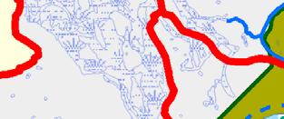


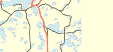
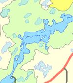
24 CO RD 21 CO RD 122 CO RD 45 CO RD 130 Cass Crow Wing State Park Crow Wing River Island ( P) Bass ( P) Unnamed ( W) Hardy ( P) City of Bater CO RD 170 #0 Unnamed Stream CO RD 77 STATE HWY 210 %U BYPASS 371 FIRST ASSESSMENT STATE HWY BYPASS 371 CO RD 49 ÊÚ ã CO RD 48 BUSINESS 371 CO RD 48 &V&V&V Buffalo ( W) CSAH 5 CO RD 20 CO RD 153 Unnamed Stream %U %U ã ã #S #S City of Brainerd STATE HWY 371 CO RD Buffalo Creek Rice ( P) CO RD 3 ÊÚÊÚ HWY 25 S Little Buffalo Creek Whitley's Creek CO RD 117 Ditch 6 LONG LAKE STATE HWY 210 STATE HWY 18 CO RD 9 STATE HWY 25 OAK LAWN CO RD 148 Morrison Crow Wing State Park CO RD 27 #0 CROW WING CO RD 44 Camp Ripley Brook Ditch #0 # #0 STATE HWY 371 CO RD 121 Unnamed ( W) Unnamed ( W) Unnamed ( W) #0 #0 FORT RIPLEY Unnamed Stream X Unnamed Stream #0 Twin ( W) Nokasippi River #0 CO RD 131 ST MATHIAS CO RD 2 CO RD 2 DAGGETT BROOK X City of Fort Ripley CO RD Figure 71: Catchment Map 3 Environmental Services ã ÊÚ #S #0 %U &V Miles Public Waterworks Water Use: Air Conditioning Water Use: Industrial Processing Irrigation: Crop Irrigation: Non Crop Water Use: Special Categories Areas Drinking Water Source Protection Areas : Feedlots (by primary animal) X BIRDS BOVINES HORSES PIGS Active Gravel Pits State Park Boundaries State Recreation Area Boundaries Scientific and Natural Areas Wildlife Management Areas Water Access Sites Wild Rice Streams County Ditches Wetlands (from NWI)!P!. Conservation Easements Public Lands Cities / Townships U.S. Highways Paul Bunyan State Trail Outlet - Major Watershed Outlet - Catchment Catchments (DNR Level 8) Major Watersheds
25 Catchment # Area (sq. miles) 7 Population Population Change 2000 to Surficial Geology Peat Topography Level % Slope (avg.) 2 % Forested (private) 11 % Disturbed Land Cover 24 % Developed 2 # of Animal Units 361 % Public Land 50 % Easements 0 % 0 % 0 % Wetlands (private) 16 % Protected 66 Risk Classification Protection Catchment # Area (sq. miles) 10 Population Population Change 2000 to Surficial Geology Undifferentiated Topography Level % Slope (avg.) 3 % Forested (private) 23 % Disturbed Land Cover 21 % Developed 3 # of Animal Units 631 % Public Land 16 % Easements 0 % 0 % 2 % Wetlands (private) 24 % Protected 43 Risk Classification Protection (eisting and potential) Wild Rice Shallow /Wildlife (eisting and potential) Wild Rice Shallow /Wildlife
26 Catchment # Area (sq. miles) 8 Population Population Change 2000 to Surficial Geology Undifferentiated Topography Level % Slope (avg.) 2 % Forested (private) 11 % Disturbed Land Cover 42 % Developed 5 % Public Land 7 % Easements 0 % 0 % 0 % Wetlands (private) 34 % Protected 40 Risk Classification Protection Catchment # Area (sq. miles) 15 Population Population Change 2000 to Surficial Geology Outwash Topography Level % Slope (avg.) 14 % Forested (private) 15 % Disturbed Land Cover 27 % Developed 5 # of Animal Units 708 % Public Land 59 % Easements 9 % 2 % 4 % Wetlands (private) 3 % Protected 76 Risk Classification Protection (eisting and potential) Wild Rice Shallow /Wildlife (eisting and potential) Wild Rice Shallow /Wildlife
27 Catchment # Area (sq. miles) 9 Population Population Change 2000 to Surficial Geology Supraglacial Drift Comple Topography Steep % Slope (avg.) 14 % Forested (private) 0 % Disturbed Land Cover 26 % Developed 4 % Public Land 100 % Easements 0 % 2 % 0 % Wetlands (private) 0 % Protected 100 Risk Classification Vigilance (eisting and potential) Wild Rice Shallow /Wildlife Catchment # Area (sq. miles) 18 Population Population Change 2000 to Surficial Geology Outwash Topography Level % Slope (avg.) 9 % Forested (private) 6 % Disturbed Land Cover 54 % Developed 9 % Public Land 60 % Easements 1 % 0 % 5 % Wetlands (private) 0 % Protected 66 Risk Classification Vigilance (eisting and potential) Wild Rice Shallow /Wildlife
28 Catchment # Area (sq. miles) 17 Population Population Change 2000 to Surficial Geology Outwash Topography Level % Slope (avg.) 11 % Forested (private) 21 % Disturbed Land Cover 37 % Developed 22 % Public Land 13 % Easements 0 % 0 % 5 % Wetlands (private) 6 % Protected 25 Risk Classification Enhance (eisting and potential) Wild Rice Shallow /Wildlife Catchment # Area (sq. miles) 19 Population Population Change 2000 to Surficial Geology Supraglacial Drift Comple Topography Steep % Slope (avg.) 13 % Forested (private) 29 % Disturbed Land Cover 19 % Developed 11 % Public Land 23 % Easements 0 % 8 % 14 % Wetlands (private) 9 % Protected 54 Risk Classification Protection (eisting and potential) Wild Rice Shallow /Wildlife
29 Catchment # Area (sq. miles) 7 Population Population Change 2000 to Surficial Geology Outwash Topography Steep % Slope (avg.) 13 % Forested (private) 35 % Disturbed Land Cover 8 % Developed 1 % Public Land 55 % Easements 2 % 3 % 4 % Wetlands (private) 6 % Protected 70 Risk Classification Vigilance (eisting and potential) Wild Rice Shallow /Wildlife Catchment # Area (sq. miles) 5 Population Population Change 2000 to Surficial Geology Outwash Topography Rolling to Undulating % Slope (avg.) 13 % Forested (private) 52 % Disturbed Land Cover 4 % Developed 1 % Public Land 21 % Easements 0 % 1 % 8 % Wetlands (private) 8 % Protected 38 Risk Classification Protection (eisting and potential) Wild Rice Shallow /Wildlife
30 Catchment # Area (sq. miles) 25 Population Population Change 2000 to Surficial Geology Supraglacial Drift Comple Topography Steep % Slope (avg.) 8 % Forested (private) 28 % Disturbed Land Cover 14 % Developed 3 # of Animal Units 880 % Public Land 41 % Easements 0 % 1 % 2 % Wetlands (private) 18 % Protected 63 Risk Classification Protection Catchment # Area (sq. miles) 2 Population Population Change 2000 to Surficial Geology Supraglacial Drift Comple Topography Steep % Slope (avg.) 16 % Forested (private) 43 % Disturbed Land Cover 2 % Developed 2 % Public Land 100 % Easements 0 % 16 % 0 % Wetlands (private) 12 % Protected 100 Risk Classification Vigilance (eisting and potential) Wild Rice Shallow /Wildlife (eisting and potential) Wild Rice Shallow /Wildlife
31 Catchment # Area (sq. miles) 2 Population Population Change 2000 to Surficial Geology Undifferentiated Topography Level % Slope (avg.) 3 % Forested (private) 27 % Disturbed Land Cover 29 % Developed 4 % Public Land 39 % Easements 0 % 0 % 0 % Wetlands (private) 16 % Protected 55 Risk Classification Protection (eisting and potential) Wild Rice Shallow /Wildlife Catchment # Area (sq. miles) 0 Population Population Change 2000 to Surficial Geology Outwash Topography Rolling to Undulating % Slope (avg.) 13 % Forested (private) 2 % Disturbed Land Cover 3 % Developed 0 % Public Land 96 % Easements 0 % 0 % 0 % Wetlands (private) 0 % Protected 96 Risk Classification Vigilance (eisting and potential) Wild Rice Shallow /Wildlife
32 Catchment # Area (sq. miles) 7 Population Population Change 2000 to Surficial Geology Topography % Slope (avg.) 6 % Forested (private) 26 % Disturbed Land Cover 53 % Developed 24 % Public Land 10 % Easements 0 % 0 % 0 % Wetlands (private) 10 % Protected 21 Risk Classification Enhance Catchment # Area (sq. miles) 12 Population Population Change 2000 to Surficial Geology Till Plain Topography Gently Rolling % Slope (avg.) 6 % Forested (private) 29 % Disturbed Land Cover 36 % Developed 3 # of Animal Units 40 % Public Land 6 % Easements 0 % 0 % 0 % Wetlands (private) 18 % Protected 25 Risk Classification Enhance (eisting and potential) Wild Rice Shallow /Wildlife (eisting and potential) Wild Rice Shallow /Wildlife
33 Catchment # Area (sq. miles) 1 Population Population Change 2000 to Surficial Geology Outwash Topography Level % Slope (avg.) 3 % Forested (private) 25 % Disturbed Land Cover 61 % Developed 8 % Public Land 0 % Easements 3 % 1 % 0 % Wetlands (private) 8 % Protected 12 Risk Classification Enhance (eisting and potential) Wild Rice Shallow /Wildlife Catchment # Area (sq. miles) 10 Population Population Change 2000 to Surficial Geology Till Plain Topography Gently Rolling % Slope (avg.) 10 % Forested (private) 39 % Disturbed Land Cover 39 % Developed 4 # of Animal Units 156 % Public Land 8 % Easements 21 % 2 % 0 % Wetlands (private) 7 % Protected 38 Risk Classification Enhance / Protection (eisting and potential) Wild Rice Shallow /Wildlife
34 Catchment # Area (sq. miles) 5 Population Population Change 2000 to Surficial Geology Lacustrine Topography Level % Slope (avg.) 6 % Forested (private) 14 % Disturbed Land Cover 62 % Developed 50 % Public Land 8 % Easements 5 % 0 % 0 % Wetlands (private) 6 % Protected 18 Risk Classification Enhance (eisting and potential) Wild Rice Shallow /Wildlife Catchment # Area (sq. miles) 1 Population Population Change 2000 to Surficial Geology Outwash Topography Steep % Slope (avg.) 6 % Forested (private) 27 % Disturbed Land Cover 37 % Developed 2 % Public Land 12 % Easements 0 % 0 % 0 % Wetlands (private) 19 % Protected 31 Risk Classification Enhance / Protection (eisting and potential) Wild Rice Shallow /Wildlife
35 Catchment # Area (sq. miles) 6 Population Population Change 2000 to Surficial Geology Supraglacial Drift Comple Topography Steep % Slope (avg.) 8 % Forested (private) 0 % Disturbed Land Cover 21 % Developed 2 % Public Land 100 % Easements 0 % 0 % 0 % Wetlands (private) 0 % Protected 100 Risk Classification Vigilance (eisting and potential) Wild Rice Shallow /Wildlife Catchment # Area (sq. miles) 5 Population Population Change 2000 to Surficial Geology Alluvium Topography Level % Slope (avg.) 2 % Forested (private) 19 % Disturbed Land Cover 48 % Developed 4 # of Animal Units 165 % Public Land 1 % Easements 0 % 0 % 4 % Wetlands (private) 10 % Protected 15 Risk Classification Enhance (eisting and potential) Wild Rice Shallow /Wildlife
36 Catchment # Area (sq. miles) 4 Population Population Change 2000 to Surficial Geology Outwash Topography Level % Slope (avg.) 6 % Forested (private) 3 % Disturbed Land Cover 41 % Developed 5 % Public Land 64 % Easements 0 % 0 % 7 % Wetlands (private) 0 % Protected 72 Risk Classification Protection (eisting and potential) Wild Rice Shallow /Wildlife Catchment # Area (sq. miles) 7 Population Population Change 2000 to Surficial Geology Supraglacial Drift Comple Topography Steep % Slope (avg.) 12 % Forested (private) 33 % Disturbed Land Cover 6 % Developed 1 % Public Land 41 % Easements 6 % 0 % 0 % Wetlands (private) 15 % Protected 61 Risk Classification Vigilance (eisting and potential) Wild Rice Shallow /Wildlife
37 Catchment # Area (sq. miles) 1 Population Population Change 2000 to Surficial Geology Topography % Slope (avg.) 6 % Forested (private) 18 % Disturbed Land Cover 1 % Developed 0 % Public Land 35 % Easements 0 % 42 % 0 % Wetlands (private) 5 % Protected 83 Risk Classification Vigilance Catchment # Area (sq. miles) 7 Population Population Change 2000 to Surficial Geology Lacustrine Topography Steep % Slope (avg.) 10 % Forested (private) 31 % Disturbed Land Cover 21 % Developed 3 % Public Land 26 % Easements 4 % 6 % 0 % Wetlands (private) 5 % Protected 41 Risk Classification Protection (eisting and potential) Wild Rice Shallow /Wildlife (eisting and potential) Wild Rice Shallow /Wildlife
Page G Crow Wing County Multi-Hazard Mitigation Plan, 2017
 Table G - 10. s Identified by the () (From Crow Wing County Master Chart) 1 5 All- Hazards All- Hazards Work to ensure that all Crow Wing County residents are aware of and sign-up for the County s Emergency
Puakea, Hawaiÿi. Puakea, Hawaiÿi WATERSHED FEATURES
 Puakea, Hawaiÿi DAR Watershed Code: 85046 Puakea, Hawaiÿi WATERSHED FEATURES Puakea watershed occurs on the island of Hawaiÿi. The Hawaiian meaning of the name is white blossom. The area of the watershed
Ecological Land Cover Classification For a Natural Resources Inventory in the Kansas City Region, USA
 Ecological Land Cover Classification For a Natural Resources Inventory in the Kansas City Region, USA by Applied Ecological Services, Inc. In cooperation with the Mid-America Regional Council 600 Broadway,
Keanahalululu Gulch, Hawaiÿi
 DAR Watershed Code: 85021 WATERSHED FEATURES Keanahalululu Gulch watershed occurs on the island of Hawaiÿi. The Hawaiian meaning of the name is unknown. The area of the watershed is 4.1 square mi (10.6
Timeframe. Crow Wing County, Baxter, Brainerd, Breezy Point, Crosby, Crosslake, Cuyuna, Deerwood, Emily, Fifty
 Table G - 13. s Identified for by the () (From Crow Wing County Master Chart) 1 5 9 All- Hazards All- Hazards Winter Work to ensure that all Crow Wing County residents are aware of and sign-up for the
Changes in Texas Ecoregions
 Comment On Lesson Changes in Texas Ecoregions The state of Texas can be divided into 10 distinct areas based on unique combinations of vegetation, topography, landforms, wildlife, soil, rock, climate,
Environmental. Plan Update. By Jodie Pavlica
 E i t l and d Environmental Recreational Analysis Snake Salt Basin Plan Update By Jodie Pavlica i for f oday s d Presentation P t ti opics 1. 2. 3. 4. 5. 6. Recreational and Environmental Uses in the Last
ADMINISTRATION DEPARTMENT Land Management Information Center. An Inventory of Its Records
 MINNESOTA HISTORICAL SOCIETY Minnesota State Archives ADMINISTRATION DEPARTMENT Land Management Information Center An Inventory of Its Records OVERVIEW OF THE RECORDS Agency: Series Title: Land Management
April 9, Phosphate Mining and Reclamation Overview
 April 9, 2012 Phosphate Mining and Reclamation Overview Business & Mission Mosaic produces the majority of the phosphate used by American farmers Employs approximately 7,000 people worldwide, 3,000 in
Description DESCRIPTION
 DESCRIPTION The location of the Upper James Watershed is located in northeastern South Dakota as well as southeastern North Dakota. It includes the following counties located in North Dakota Barnes, Dickey,
EAGLES NEST AND PIASA ISLANDS
 EAGLES NEST AND PIASA ISLANDS HABITAT REHABILITATION AND ENHANCEMENT PROJECT MADISON AND JERSEY COUNTIES, ILLINOIS ENVIRONMENTAL MANAGEMENT PROGRAM ST. LOUIS DISTRICT FACT SHEET I. LOCATION The proposed
APPENDIX PHASE 1 GREEN INFRASTRUCTURE FRAMEWORK
 APPENDIX PHASE 1 GREEN INFRASTRUCTURE FRAMEWORK KANSAS MISSOURI CONTENTS A DATA WISHLIST 4 B PRECEDENTS 7 C WORKSHOP MATERIALS 13 D ANALYSIS PROCESS 124 E ATLAS & PLAYBOOK DETAILS 156 F POLICY ANALYSIS
A Comprehensive Inventory of the Number of Modified Stream Channels in the State of Minnesota. Data, Information and Knowledge Management.
 A Comprehensive Inventory of the Number of Modified Stream Channels in the State of Minnesota Data, Information and Knowledge Management Glenn Skuta Environmental Analysis and Outcomes Division Minnesota
Evaluating Wildlife Habitats
 Lesson C5 4 Evaluating Wildlife Habitats Unit C. Animal Wildlife Management Problem Area 5. Game Animals Management Lesson 4. Evaluating Wildlife Habitats New Mexico Content Standard: Pathway Strand: Natural
The Niagara Escarpment extends from western New York, through the GTA all the way up to Manitoulin Island and into Michigan and Wisconsin.
 is southern Ontario s most prominent topographic feature, extending more than 500 kilometres from western New York, through Niagara Falls and the western part of the Greater Toronto Area (GTA), and north
Cannon River Watershed 2017 Zonation Update Clarification
 Project Name Cannon River One Watershed, One Plan Date 8-10-2017 To / Contact info Policy Committee Planning Work Group From / Contact info Regarding Meghan Funke, PhD Cannon River Watershed 2017 Zonation
3.11 Floodplains Existing Conditions
 Other stormwater control practices may be needed to mitigate water quality impacts. In addition to detention facilities, other practices such as vegetated basins/buffers, infiltration basins, and bioswales
Social Studies (4) Social Science
 Social Science") Scope And Sequence Timeframe Unit Instructional Topics 8 Day(s) Course Overview Students will learn about the regions of the United States with emphasis on local and state history, geography, government,
Scope And Sequence Timeframe Unit Instructional Topics 8 Day(s) Course Overview Students will learn about the regions of the United States with emphasis on local and state history, geography, government,
Chapter 3 - White Oak River Subbasin Includes Bogue Sound and the Newport River
 Chapter 3 - White Oak River Subbasin 03-05-03 Includes Bogue Sound and the Newport River 3.1 Water Quality Overview Subbasin 03-05-03 at a Glance Land and Water Area (sq. mi.) Total area: 228 Land area:
Analysis of Tides and Storm Surge from Observational Records in the Delaware Inland Bays
 Analysis of Tides and Storm Surge from Observational Records in the Delaware Inland Bays John Callahan Delaware Geological Survey Coastal GeoTools Conference March 30 April 2, 2015 Charleston, SC Outline
RANGE AND ANIMAL SCIENCES AND RESOURCES MANAGEMENT - Vol. II - Catchment Management A Framework for Managing Rangelands - Hugh Milner
 CATCHMENT MANAGEMENT A FRAMEWORK FOR MANAGING RANGELANDS Hugh Milner International Water Management Consultant, Australia Keywords: Rangeland management; catchments and watersheds; catchment management
Maggie Payne Jim Turenne
 Maggie Payne Jim Turenne USDA-NRCS 60 Quaker Lane, Suite 46 Warwick, RI. 02886 401-822-8832 maggie.payne@ri.usda.gov U.S. Department of Agriculture 1935: Soil Conservation Service (SCS) Natural Resources
Wailupe, Oÿahu. Wailupe, Oÿahu WATERSHED FEATURES
 DAR Watershed Code: 33005 WATERSHED FEATURES Wailupe watershed occurs on the island of Oÿahu. The Hawaiian meaning of the name is kite water. The area of the watershed is 3.4 square mi (8.8 square km),
The Macalester Geography Crow River Watershed Project
 The Macalester Geography Crow River Watershed Project A Collaborative Project Between: Advanced d GIS Cities of the 21 st Century Urban Geography Field Seminar Talk Overview Introduction to the Project
Chris Lenhart, John Nieber, Ann Lewandowski, Jason Ulrich TOOLS AND STRATEGIES FOR REDUCING CHANNEL EROSION IN MINNESOTA
 Chris Lenhart, John Nieber, Ann Lewandowski, Jason Ulrich TOOLS AND STRATEGIES FOR REDUCING CHANNEL EROSION IN MINNESOTA Background and approach Channel loading major source of sediment in much of MN River
Overview of Methods. Terrestrial areas that are most important for conservation Conservation
 Overview of Methods The goal of the Western Lake Erie Coastal Conservation Vision project (WLECCV) is to define where we should be working locally to optimally achieve regional conservation impact. The
QUANTIFYING CORRELATION IN THREE-DIMENSIONAL GEOLOGIC MAPPING OF GLACIAL DRIFT
 QUANTIFYING CORRELATION IN THREE-DIMENSIONAL GEOLOGIC MAPPING OF GLACIAL DRIFT John J. Quinn 1 and Howard D Moores 2 1 Argonne National Laboratory, Argonne, IL, USA quinnj@anl.gov 2 Department of Geosciences,
2 Georgia: Its Heritage and Its Promise
 TERMS region, erosion, fault, elevation, Fall Line, aquifer, marsh, climate, weather, precipitation, drought, tornado, hurricane, wetland, estuary, barrier island, swamp PLACES Appalachian Mountains, Appalachian
GIS Data and Technology to Support Transportation & MPO Decision-Making & Planning. using an Eco-Logical* Approach within the Kansas City Region
 GIS Data and Technology to Support Transportation & MPO Decision-Making & Planning using an Eco-Logical* Approach within the Kansas City Region Authors (in alphabetical order): Tom Gerend, Tom Jacobs,
Influence of the Major Drainages to the Mississippi River and Implications for System Level Management
 Influence of the Major Drainages to the Mississippi River and Implications for System Level Management Brian M. Vosburg Geologist Louisiana Coastal Protection and Restoration Authority brian.vosburg@la.gov
Appendix 1. River/Stream Classification for the NTPE
 Appendix Page Appendix. River/Stream Classification for the NTPE A.. Aquatic Classification Framework One of the goals of the ecoregional planning process is to develop a strategy to protect ecosystems
3.3 CLIMATE, GEOLOGY, TOPOGRAPHY, AND SOILS CLIMATE GEOLOGY TOPOGRAPHY
 3.3 CLIMATE, GEOLOGY, TOPOGRAPHY, AND SOILS This section describes the climate, geology, topography, and soil resource characteristics of the Yolo Bypass Wildlife Area (Wildlife Area). Agricultural soil
How & Where does infiltration work? Summary of Geologic History Constraints/benefits for different geologic units
 June 26, 2007: Low Impact Development 1 Associated Earth Sciences, Inc. Associated Earth Sciences, Inc. Presented by: Matthew A. Miller, PE April 24, 2012 How & Where does infiltration work? Summary of
Ecoregions Glossary. 7.8B: Changes To Texas Land Earth and Space
 Ecoregions Glossary Ecoregions The term ecoregions was developed by combining the terms ecology and region. Ecology is the study of the interrelationship of organisms and their environments. The term,
Welcome to Arkansas History Chapter 1- The Natural State
 Welcome to Arkansas History Chapter 1- The Natural State Geology The study of how the earth was formed and how it has changed over time. Geologist scientist who study the earth and it s features Pangaea
Crow River Plaza - Retail Development South Diamond Lake Rd. Rogers, MN FOR LEASE 1,024 SF Retail Space. Lease Rate: $16.
 FEATURES: - Available in Rogers, MN Lease Rate: $16.00 / psf NNN - Excellent location with freeway signage on I-94! - Near large retailers such as Target, Kohls, & Applebees. Taxes $3.65 / psf Cam $3.20
Maps of the Rush Creek Watershed
 Maps of the Watershed Yuba River Watershed South Yuba River Watershed Watershed 1 Monitoring Sites 5 Land Cover 8 Parcel Density 2 Topology & Hydrology 6 Land Use 9 Road Density 3 Public Ownership 7 Parcels
Changes in Texas Ecoregions Copy the questions and answers
 Changes in Texas Ecoregions Copy the questions and answers 1. What are some kinds of damage that hurricanes cause? Roads and bridges might be washed away. Trees and power lines can be knocked down. Area
Construction of a Geographic Information System for Wildlife Refuge Planning: Seney National Wildlife Refuge 1
 Construction of a Geographic Information System for Wildlife Refuge Planning: Seney National Wildlife Refuge 1 by Brian D. Mueller, Thomas E. Burk, Paul V. Bolstad and John H. Schomaker 2 October, 2003
Crow River Plaza - Retail Development South Diamond Lake Rd. Rogers, MN FOR LEASE 2,066 SF Retail Space. Lease Rate: $16.
 FEATURES: - 2,066 SF End Cap Retail Space Available in Rogers, MN - Excellent location with freeway signage on I-94! - Near large retailers such as Target, Kohls, & Applebees. - Convenient location off
Wailua, Maui WATERSHED FEATURES
 Wailua, Maui DAR Watershed Code: 65007 Wailua, Maui WATERSHED FEATURES Wailua watershed occurs on the island of Maui. The Hawaiian meaning of the name is two waters. The area of the watershed is 1.9 square
Use of benthic invertebrate biological indicators in evaluating sediment deposition impairment on the Middle Truckee River, California
 Use of benthic invertebrate biological indicators in evaluating sediment deposition impairment on the Middle Truckee River, California David B. Herbst Sierra Nevada Aquatic Research Laboratory University
APPENDIX D QUESTIONS/ACTIVITIES FOR TEACHERS AND STUDENTS
 APPENDIX D QUESTIONS/ACTIVITIES FOR TEACHERS AND STUDENTS The questions below are intended for teachers as they educate K-12 Geography students using the Japanese American relocation centers as their focal
STUDY GUIDE FOR CONTENT MASTERY. Surface Water Movement
 Surface Water SECTION 9.1 Surface Water Movement In your textbook, read about surface water and the way in which it moves sediment. Complete each statement. 1. An excessive amount of water flowing downslope
Improvement of the National Hydrography Dataset for Parts of the Lower Colorado Region and Additional Areas of Importance to the DLCC
 Improvement of the National Hydrography Dataset for Parts of the Lower Colorado Region and Additional Areas of Importance to the DLCC Carlos Reyes-Andrade California State University, Northridge September
Information Paper. Kansas City District. Missouri River Fish and Wildlife Mitigation Project Jim and Olivia Hare Wildlife Area, MO
 City District Information Paper River Fish and Wildlife Mitigation Project Jim and Olivia Hare Wildlife Area, MO Riverine habitat created in 2004/2005 by modifying existing river structures along the banks,
World rivers investigation
 World rivers investigation Grades 3-5 This activity was designed as a companion for the music video What Does A River Want To Do?. Background What Does A River Want To Do? is a song about the countless
Jim Turenne. Soils on Social Media
 Jim Turenne USDA-NRCS 60 Quaker Lane, Suite 46 Warwick, RI. 02886 401-822-8832 Jim.turenne@ri.usda.gov Soils on Social Media www.twitter.com/soilsne www.fb.com/soilsne www.nesoil.com U.S. Department of
Regional Sediment Management
 Regional Sediment Management Linda S. Lillycrop Program Manager Coastal Engineer US Army Engineer Research and Development Center Coastal and Hydraulics Laboratory Q AVG Coastal Resilience: The Environmental,
Information for File # ERH
 Information for File #2014-00931-ERH Applicant: Minnesota Department of Transportation, Scott Morgan Corps Contact: Eric Hanson Address: 180 5th Street East, Suite 700 St. Paul, MN 55101 E-Mail: eric.r.hanson@usace.army.mil
Implementing a Project with 319 Funds: The Spring Brook Meander Project. Leslie A. Berns
 Implementing a Project with 319 Funds: The Spring Brook Meander Project Leslie A. Berns "...to acquire... and hold lands... for the purpose of protecting and preserving the flora, fauna and scenic beauties...
Name period date assigned date due date returned. Texas Ecoregions
 Name period date assigned date due date returned Directions: Go to the following website: https://www-k6.thinkcentral.com/epc/start.do Use the log in that is taped to the top of your laptop. If you are
Learning Objectives: I can identify and interpret river flows and directions.
 Learning Objectives: I can identify and interpret river flows and directions. Bellringer Review: Check for Understanding Questions: 1 2 What Are The Key Parts Of A River s Anatomy? In your data notebooks
Geologic Mapping in Northeastern Illinois. What do we know about. Donald A. Keefer, Director Geologic Mapping and Hydrogeology Center
 Geologic Mapping in Northeastern Illinois & What do we know about Lake County s Geology? Donald A. Keefer, Director Geologic Mapping and Hydrogeology Center Societal Benefits of Mapping Water Supply Delineation,
Alamito Waters Ranch 80 acres, Presidio County, Texas James King, Agent Office Cell
 Alamito Waters Ranch 80 acres, Presidio County, Texas James King, Agent Office 432-426-2024 Cell 432-386-2821 James@KingLandWater.com King Land & Water LLC P.O. Box 109, 600 State Street, Fort Davis, TX
3.2.2 Ecological units of the Des Quinze lake proposed biodiversity reserve
 3.2.2 Ecological units of the proposed biodiversity reserve An intact forest mass The proposed biodiversity reserve (see appendix 3) protects terrestrial environments almost exclusively. Proximity of Des
MAPS AND THEIR CLASSIFICATION
 MAPPING MAPS AND THEIR CLASSIFICATION WHAT IS A MAP? A map is representation of the Earth's surface, showing how things are related to each other by distance, direction, and size. Maps are a way of showing
One Hilltop, Three Major Watersheds!
 One Hilltop, Three Major Watersheds! Adapted from: An original Creek Connections activity. Creek Connections, Box E, Allegheny College, Meadville, Pennsylvania, 16335 Watersheds of PA/ Topo Map Review
Alamito Creek Preserve Ranches for Sale Marfa, Presidio County, Texas
 Alamito Creek Preserve Ranches for Sale Marfa, Presidio County, Texas James King, Agent Office 432 426.2024 Cell 432 386.2821 James@KingLandWater.com Alamito Creek Preserve Various size Ranch Properties,
Great California Delta Trail Blueprint for Contra Costa and Solano Counties GIS AND MAPPING MEMORANDUM JULY 2010
 Great California Delta Trail Blueprint for Contra Costa and Solano Counties GIS AND MAPPING MEMORANDUM JULY 2010 {DRAFT} July 2010 Introduction Geographic Information Systems (GIS) are computer-based
Chapter 2 Roanoke River Subbasin Including: Dan and Mayo Rivers, Pawpaw and Jacobs Creek
 Chapter 2 Roanoke River Subbasin 03-02-02 Including: Dan and Mayo Rivers, Pawpaw and Jacobs Creek 2.1 Subbasin Overview Subbasin 03-02-02 at a Glance Land and Water Area Total area: 231 mi 2 Land area:
Huron Creek Watershed 2005 Land Use Map
 Huron Creek Watershed 2005 Land Use Map Created By: Linda Kersten, 12/20/06 Created For: MTU Introduction to GIS Class (FW 5550) The Huron Creek Watershed Advisory Committee Michigan Technological University,
Chapter 3. Description of the Study Area. Karl Taboga, James Stafford and Paul Taucher 3-19
 Chapter 3 Description of the Study Area Karl Taboga, James Stafford and Paul Taucher 3-19 T his study examines groundwater resources that underlie the Bear River drainage basin in Wyoming as well as areas
ROAD SEDIMENT ASSESSMENT & MODELING: KOOTENAI-FISHER TMDL PLANNING AREA ROAD GIS LAYERS & SUMMARY STATISTICS
 ROAD SEDIMENT ASSESSMENT & MODELING: KOOTENAI-FISHER TMDL PLANNING AREA ROAD GIS LAYERS & SUMMARY STATISTICS Prepared by: ATKINS Water Resources Group 820 North Montana Avenue Helena, MT 59601 November
Climate Change and Climate Trends in Our Own Backyard
 Climate Change and Climate Trends in Our Own Backyard Dr. Mark Seeley Department of Soil, Water, and Climate University of Minnesota St Paul, MN 55108 For IATP: Rural Climate Dialogue Grand Rapids, MN
Most people used to live like this
 Urbanization Most people used to live like this Increasingly people live like this. For the first time in history, there are now more urban residents than rural residents. Land Cover & Land Use Land cover
An introduction to thee Urban Oases Site Selection Tool:
 An introduction to thee Urban Oases Site Selection Tool: Created by Audubon Connecticut with assistance from a GIS Consultant/Research Assistant at the Harvard Forest Essential input provided by the New
Geomorphology Of The Chilliwack River Watershed Landform Mapping At North Cascades National Park Service Complex, Washington By National Park Service
 Geomorphology Of The Chilliwack River Watershed Landform Mapping At North Cascades National Park Service Complex, Washington By National Park Service READ ONLINE Snowshed contributions to the Nooksack
Water Year Data Summary, Lake Levels. Introduction
 Lake Levels Introduction The Lake Hydrology Program exists to support the DNR Waters director and staff by collecting and providing data on lake levels and other lake characteristics that are needed to
EROSION HAZARD OF MINNESOTA'S LAKE SUPERIOR SHORELINE. Carol A. Johnston Principal Investigator
 EROSION HAZARD OF MINNESOTA'S LAKE SUPERIOR SHORELINE Carol A. Johnston Principal Investigator Maps prepared by: James Salés, John Bonde, Tim Aunan, and Richard Raby Minnesota Sea Grant Research Bulletin
Diagnostic Geomorphic Methods for Understanding Future Behavior of Lake Superior Streams What Have We Learned in Two Decades?
 Diagnostic Geomorphic Methods for Understanding Future Behavior of Lake Superior Streams What Have We Learned in Two Decades? Faith Fitzpatrick USGS WI Water Science Center, Middleton, WI fafitzpa@usgs.gov
PLANNING BOARD An Inventory of Its Water Basin Maps and Graphs
 MINNESOTA HISTORICAL SOCIETY Minnesota State Archives PLANNING BOARD An Inventory of Its Water Basin Maps and Graphs OVERVIEW OF THE RECORDS Agency: Minnesota State Planning Board. Series Title: Dates:
Ms. A. Mormando's Class *
 8 th Grade Science Essential Standard: 8.E.1.1 Explain the structure of the hydrosphere including: Water distribution on Earth; Local river basin and water availability Stream - A stream is a body of water
GOAL 7 AREAS SUBJECT TO NATURAL DISASTERS AND HAZARDS. To protect life and property from natural disasters and hazards.
 GOAL 7 AREAS SUBJECT TO NATURAL DISASTERS AND HAZARDS A. GOALS: To protect life and property from natural disasters and hazards. B. POLICIES: 1. Floodplains shall be maintained as natural drainage-ways.
The Refugia Concept: Using Watershed Analysis to Prioritize Salmonid Habitat for Conservation and Restoration
 The Refugia Concept: Using Watershed Analysis to Prioritize Salmonid Habitat for Conservation and Restoration Christopher May Battelle & UW Cumulative Impacts of Urbanization Landscape Alterations Loss
United States Department of the Interior NATIONAL PARK SERVICE Northeast Region
 United States Department of the Interior NATIONAL PARK SERVICE Northeast Region June 17, 2017 REQUEST FOR STATEMENTS OF INTEREST and QUALIFICATIONS Project Title: ASSESSMENT OF NATURAL RESOURCE CONDITION
UPDATING THE MINNESOTA NATIONAL WETLAND INVENTORY
 UPDATING THE MINNESOTA NATIONAL WETLAND INVENTORY An Integrated Approach Using Object-Oriented Image Analysis, Human Air-Photo Interpretation and Machine Learning AARON SMITH EQUINOX ANALYTICS INC. FUNDING
Vancouver Island and Coast
 Places in B.C. This handout package provides students with a brief overview of one of seven regions in B.C. These descriptions will help students audit the different types of energy (see the Energy Primers)
COLUSA BASIN WATERSHED ASSESSMENT. Final. Prepared by: H. T. Harvey & Associates. In Collaboration With:
 COLUSA BASIN WATERSHED ASSESSMENT Prepared by: In Collaboration With: G. Mathias Kondolf Geomorph Blankinship & Associates Prepared for: Colusa County Resource Conservation District 100 Sunrise Boulevard,
Climate Change and Climate Trends in Our Own Backyard
 Climate Change and Climate Trends in Our Own Backyard Dr. Mark Seeley Department of Soil, Water, and Climate University of Minnesota St Paul, MN 55108 For IATP: Winona Rural Climate Dialogue Citizen Jury
Native species (Forbes and Graminoids) Less than 5% woody plant species. Inclusions of vernal pools. High plant diversity
 Less than 5% woody plant species. Inclusions of vernal pools. High plant diversity") WILLAMETTE VALLEY WET-PRAIRIE RESTORATION MODEL WHAT IS A WILLAMETTE VALLEY WET-PRAIRIE Hot Spot s Native species (Forbes and Graminoids) Rare plant species Less than 5% woody plant species Often dominated
WILLAMETTE VALLEY WET-PRAIRIE RESTORATION MODEL WHAT IS A WILLAMETTE VALLEY WET-PRAIRIE Hot Spot s Native species (Forbes and Graminoids) Rare plant species Less than 5% woody plant species Often dominated
MVP WMS, George Schorr
 APPROVED JURISDICTIONAL DETERMINATION FORM U.S. Army Corps of Engineers This form should be completed by following the instructions provided in Section IV of the JD Form Instructional Guidebook. SECTION
Keaÿahala, Oÿahu. Keaÿahala, Oÿahu WATERSHED FEATURES
 DAR Watershed Code: 32009 WATERSHED FEATURES Keaÿahala watershed occurs on the island of Oÿahu. The Hawaiian meaning of the name is the pandanas root. The area of the watershed is 1.6 square mi (4.2 square
GUIDED READING CHAPTER 1: THE LAY OF THE LAND (Page 1)
") CHAPTER 1: THE LAY OF THE LAND (Page 1) Section 1 The Tidewater Region Directions: Use the information from pages 6-11 to complete the following statements. 1. In the southern part of the coast, the Tidewater
CHAPTER 1: THE LAY OF THE LAND (Page 1) Section 1 The Tidewater Region Directions: Use the information from pages 6-11 to complete the following statements. 1. In the southern part of the coast, the Tidewater
Land Cover Classification Mapping & its uses for Planning
 Land Cover Classification Mapping & its uses for Planning What is Land Cover Classification Mapping? Examples of an actual product Why use Land Cover Classification Mapping for planning? Possible uses
Appendix F4.11 Geologic Unit Summaries, Hazard Areas, and Boring Locations
 Appendix F4.11 Geologic Unit Summaries, Hazard Areas, and Boring Locations Appendix F4.11 Geologic Unit Summaries and Hazard Areas TABLE F4.11-1 Summary of Geologic Units and their Engineering Properties
How Do Human Impacts and Geomorphological Responses Vary with Spatial Scale in the Streams and Rivers of the Illinois Basin?
 How Do Human Impacts and Geomorphological Responses Vary with Spatial Scale in the Streams and Rivers of the Illinois Basin? Bruce Rhoads Department of Geography University of Illinois at Urbana-Champaign
Appendix D ORV Assessment for Clarion River
 Introduction The following ORV assessment criteria were utilized in making WSR eligibility determinations for the 2007 ANF LRMP. These criteria will also be used to assess resource values for the Clarion
Earth Wind & Fire. Game Changing Restoration Options in the Texas Chenier Plain
 Earth Wind & Fire Game Changing Restoration Options in the Texas Chenier Plain EARTH: The Chenier Plain is a 5 million acre coastal region in Southwest Louisiana and Southeast Texas providing landscape
Assessing state-wide biodiversity in the Florida Gap analysis project
 University of Nebraska - Lincoln DigitalCommons@University of Nebraska - Lincoln Nebraska Cooperative Fish & Wildlife Research Unit -- Staff Publications Nebraska Cooperative Fish & Wildlife Research Unit
APPROVED JURISDICTIONAL DETERMINATION FORM U.S. Army Corps of Engineers
 APPROVED JURISDICTIONAL DETERMINATION FORM U.S. Army Corps of Engineers This form should be completed by following the instructions provided in Section IV of the JD Form Instructional Guidebook. SECTION
Natural Shoreline Landscapes on Michigan Inland Lakes
 Natural Shoreline Landscapes on Michigan Inland Lakes Excerpts from Chapters 2 and 3 Photo Photo by Jane by Jane Herbert Herbert Did you know? Twenty-four species of amphibians, 25 species of reptiles,
ACTON COMMUNITY WIDE ARCHAEOLOGICAL RECONNAISSANCE SURVEY. Town of Acton and PAL, Inc.
 ACTON COMMUNITY WIDE ARCHAEOLOGICAL RECONNAISSANCE SURVEY Town of Acton and PAL, Inc. Objectives and Scope of Work Four phase study; (1. research, 2. draft report outline, resource protection bylaw, 3.
4th Grade U.S. Regional Geography
 4th Grade U.S. Regional Geography Multiple Choice Identify the choice that best completes the statement or answers the question. What does the term mainland mean in the sentence above? A the continent
Wisconsin River Floodplain Project: Overview and Plot Metadata
 Wisconsin River Floodplain Project: Overview and Plot Metadata CLASS I. DATA SET DESCRIPTORS Data set identity: Plot-level variable information for Wisconsin River Floodplain Project. Relevant for following
Southwest LRT Habitat Analysis. May 2016 Southwest LRT Project Technical Report
 Southwest LRT Habitat Analysis Southwest LRT Project Technical Report This page intentionally blank. Executive Summary This technical report describes the habitat analysis that was performed to support
Internet GIS Sites. 2 OakMapper webgis Application
 Internet GIS Sites # Name URL Description 1 City of Sugar Land http://www.sugarlandtx.gov/index.htm It is a city in Texas with 65,000 Residents. The City of Sugar Land, Texas, provides ArcIMS-based maps
Groundwater Investigation SOUTHGATE GRAVEL PIT Part of Lot 15, Concession 15 (formerly Township of Proton), Township of Southgate.
, Township of Southgate.") Groundwater Investigation SOUTHGATE GRAVEL PIT Part of Lot 15, Concession 15 (formerly Township of Proton), Township of Southgate County of Grey October, 2014 Prepared for: Drysdale Aggregate Consulting
Groundwater Investigation SOUTHGATE GRAVEL PIT Part of Lot 15, Concession 15 (formerly Township of Proton), Township of Southgate County of Grey October, 2014 Prepared for: Drysdale Aggregate Consulting
ESRI NONPROFIT/CONSERVATION GRANTS PROGRAM STATUS REPORT JANUARY 2010
 ESRI NONPROFIT/CONSERVATION GRANTS PROGRAM STATUS REPORT JANUARY 2010 Grantee ESRI Client Number 150983 FARMINGTON RIVER WATERSHED ASSOCIATION 749 Hopmeadow Street, Simsbury, Connecticut 06070 Contact:
ADDITIONAL PHASE IA ARCHAEOLOGICAL SURVEY FOR THE UMORE PARK SAND AND GRAVEL MINING ENVIRONMENTAL REVIEW SERVICES, DAKOTA COUNTY, MINNESOTA
 ADDITIONAL PHASE IA ARCHAEOLOGICAL SURVEY FOR THE UMORE PARK SAND AND GRAVEL MINING ENVIRONMENTAL REVIEW SERVICES, DAKOTA COUNTY, MINNESOTA ADDENDUM I Submitted to: Short Elliot Hendrickson, Inc. Submitted