Using Web Maps to Measure the Development of Global Scale Cognitive Maps
|
|
|
- Peregrine Flynn
- 5 years ago
- Views:
Transcription
1 Using Web Maps to Measure the Development of Global Scale Cognitive Maps Thomas J. Pingel Department of Geography Northern Illinois University Illinois Geographic Information Systems Association (ILGISA) Annual Conference Lisle, IL October, 2016 Research supported by the E. Willard and Ruby S. NCGE Miller Geography Education Research Grant
2 Outline Objectives and justification for study A quick introduction to anchor-point theory The study Construction of the interface and database Data collection and processing Preliminary results Future work 2
3 Objectives 1. As a world regional geography instructor, I want to help students develop better, more complete global scale cognitive maps. 2. As a cognitive scientist, I want to better understand how these large-extent, geographic scale cognitive maps are constructed. 3. As a Geographic Information Scientist, I want to apply (2) to (1). 3


4 Research Questions 1. How can we use web maps to help track how students are assembling a cognitive map of the world? 2. Are the data consistent with the anchor-point theory of cognitive map development? 4

5 Place learning is the anatomy of geography. First level of an online, place-learning game by Sheppard Software. ( 5


6 World Map Quiz is a nice study aid for Android. 6
7 good to excellent (%) Sketch Map Analysis (1) Saarinen and MacCabe (1995) collected 3,568 sketch maps from university students at 75 sites in 52 countries. These were examined for quality, and ranked 1 (poor) to 5 (excellent) according to the inclusion of continents and countries. Sketch maps correlate very well with other, more inclusive metrics of geographic literacy Country and Continent Place Name Knowledge by Continent (from Saarinen and MacCabe, 1995) 7
8 Sketch Map Analysis (2) In a study of sketch maps, Pinheiro (1998) found geopolitical power (measured by GDP, etc.) to be a significant predictor of inclusion. But proximity, % coastline, and cultural factors also played a role. Sketch maps at right from Pinheiro (1998), drawn by Brazilian students. 8

9 Graphical representation of the anchor-point theory of spatial cognition. Figure from Golledge,
10 Recreation and visualization with Gephi network analysis and visualization software. 10
11 Anchor points rate highly on measures of network centrality. Betweenness centrality measures how often a node appears on shortest paths between nodes in the network. Closeness centrality measures the average distance from a given starting node to all other nodes in the network. BC CC Anchor Points Other
 Recognizing the sight or name of a spatial cue Knowing where it is (spatial location) Frequency of interaction.")
12 Identifying anchor points Multidimensional measures of familiarity (Couclelis et al. 1987; Gale et al. 1990) Recognizing the sight or name of a spatial cue Knowing where it is (spatial location) Frequency of interaction. On a local level, interaction might be supported by travel log or GPS track analysis. Space-time visualization from Kraak (2003) 12
13 Student Map Assessment Students are asked to place labels of countries on a map with only political boundaries drawn. Not multiple choice or matching Because most web maps use a Mercator projection, the Mercator projection was used to ensure visual matching. Quizzes overlap with previous material 13

14 Quizzes


15 Many fine online map study aids are available, but I wanted more control over the way in which the data was assimilated. 15

 as a guide.")
16 I first constructed a simple flash-card style interface using Google Fusion tables for this purpose. I used anchor point theory (Golledge 1984, Couclelis et al. 1987) as a guide. First, students filled in a global skeleton before we moved on to more traditional regional quizzes. 16

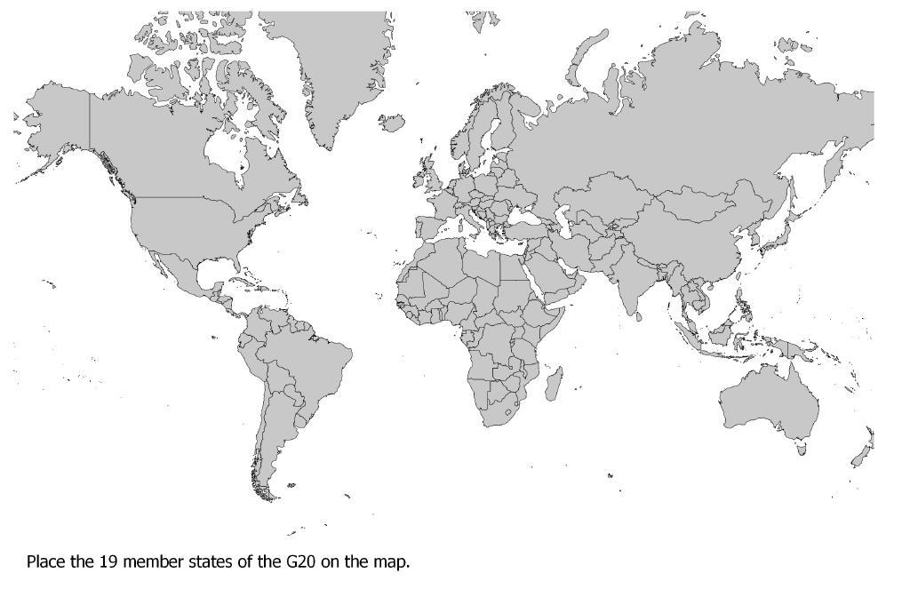
17 I use the G-20 countries as a starting point. Other countries may be more familiar for other reasons but these provide a reasonably common frame of reference. 17
18 United States (USA) Mexico (MEX) Canada (CAN) Australia (AUS) Brazil (BRA) China (CHN) Russia (RUS) Italy (ITL) India (IND) Japan (JPN) South Africa (ZAF) Argentina (ARG) United Kingdom (GBR) France (FRA) Germany (DEU) Saudi Arabia (SAU) South Korea (KOR) Turkey (TUR) Indonesia (IDN) Pretask knowledge assessment indicated that some countries are known nearly perfectly (USA, MEX, CAN) while others are much less well known (KOR, TUR, IDN) Pretest Knowledge (%, n = 48)
19 19
20 20

21 21

22 As an aside, the horror stories you hear about students not being able to place the United States on the map did not hold true for my class, and knowledge of Canada, US, Mexico is near 100%. Still, a few global scale cognitive maps contain very large errors. 22
23 In order to measure interactions, the interface was coded in a custom JavaScript / Leaflet based map. 23

24 24
 Peters projection, an equal-area projection often advocated as a preferred alternative to the Mercator")
25 Despite concerns, Battersby and Montello (2009) found scant evidence for a Mercator Effect in the mental maps of students. A rendering of the (Gall) Peters projection, an equal-area projection often advocated as a preferred alternative to the Mercator projection. 25
26 Randomly generated IDs were used to track users, and clicks and timestamps were recorded to a PHP database. 26

27 Participants Data collected in the wild 200 students enrolled in World Regional Geography Demographic data was not collected Relatively typical undergraduate sample 499 unique IDs Use of multiple devices was common 27

28 Sample data as a CSV file 28
29 Processing User name combined with timestamp to assign a unique session identifier 15 minute break between clicks Clicks not on quiz were removed from the session 2% of clicks Repeat clicks were removed e.g., Afghanistan -> Afghanistan 4.8% of clicks Final dataset 4 quizzes 1,638 unique sessions 75,536 clicks 29
 formed a link, or edge. The more it was clicked, the stronger the connection between two countries. http://www.npr.")
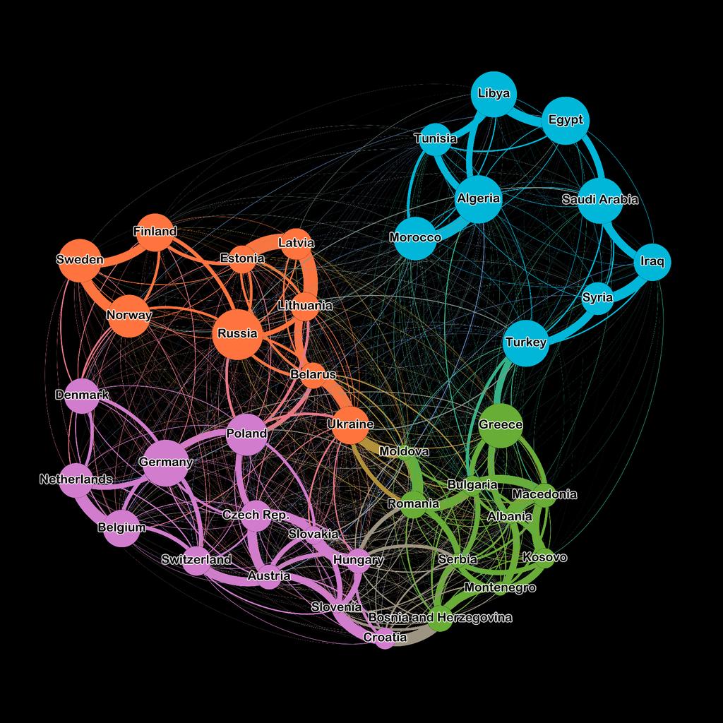
30 Network visualization and statistics are a powerful tool towards understanding multidimensional datasets of many kinds. In my dataset, each click (country to country) formed a link, or edge. The more it was clicked, the stronger the connection between two countries. 30

31 The Risk board game network, sized according to PageRank, the metric of node importance famously used by Google to rank web pages. 31
32 Median session length was 28 clicks. (M = 46.1; SD = 57.7) 32

33 Spatial distribution of pretest knowledge and clicks on Quiz 1. 33
34 Clicking was negatively correlated with pretest knowledge. r =

35 Undirected graph representation of aggregate Quiz 1 data. Diameter of nodes is proportional to accuracy. Edge thickness is proportional to number of clicks. Position is determined by force directed layout algorithm. Groups are determined by modularity community detection algorithm. 35

36 Everything is related to everything else, but near things are more related than distant things. Spatial knowledge, measured in this way is regionalized. But is it hierarchical? 36
37 Quiz 3 37

38 Quiz 4* *Bahrain, Cypress, Kuwait, Malta, Palestine, Qatar removed Aggregate correlation between clicks and accuracy, r =

39 Most measures of centrality and node importance are negatively correlated with accuracy. 39
40 Conclusions Web map derived click-paths represent the development of global scale cognitive maps Network visualization tools aid in their interpretation Unlike physical anchor-points, network anchor-points are negatively related to both interaction (clicks) and network centrality. Strictly hierarchical models fail to capture the rich connections between nodes 40
41 Future Work What other network measures could be derived to better capture anchor-points? Anchor nodes can be visualized, but current network indices are insufficient. Need to explore local-global interaction measures. Individual analysis of cognitive map development Aggregate analysis likely washes out interesting and important individual differences Formal experiments out of the classroom Ability to assess performance gains Release the dataset The rich data needs more attention than I can give it Eventually, development of Automated Tutor Best ways to present, regionalize, and reinforce material Support for individual differences / strategies 41
Unit of Study: Physical Geography & Settlement Patterns; Culture & Civilizations; and The Spread of Ideas
 6 th Grade Social Studies 1 st Nine Weeks TEKS Unit of Study: Physical Geography & Settlement Patterns; Culture & Civilizations; and The Spread of Ideas 6.1) History. The student understands that historical
21st Century Global Learning
 21st Century Global Learning A focus for 7th grade is on the ever-increasing global interactions in society. This focus includes a study of various societies and regions from every continent. We have already
Unit Two: Development & Globalization
 Unit Objectives Unit Two: Development & Globalization Students gain an understanding of the definitions of and differences in less economically developed countries and more economically developed countries
Global Data Catalog initiative Christophe Charpentier ArcGIS Content Product Manager
 Global Data Catalog initiative Christophe Charpentier ArcGIS Content Product Manager ccharpentier@esri.com We are in a global economy Global Economy Business and Operations are now global Strategic need
World Geography A. Course Overview. Course Goals. General Skills. Syllabus
 Syllabus World Geography A Course Overview Geography is the study of where things are in the world. It is important to know why people settled where they did: sometimes this is for weather-related reasons,
Exploring geographic knowledge through mapping
 Prairie Perspectives 89 Exploring geographic knowledge through mapping Scott Bell, University of Saskatchewan Abstract: Knowledge about the world is expressed in many ways. Sketch mapping has been a dominant
Asia. JigsawGeo. Free Printable Maps for Geography Education. Try our geography games for the ipod Touch or iphone.
 Free Printable Maps for Geography Education Map with region names shown Map without names, for coloring or quizzes Map with coordinate system, for location practice Answer key for coordinate system quiz
International Student Enrollment Fall 2018 By CIP Code, Country of Citizenship, and Education Level Harpur College of Arts and Sciences
 International Student Enrollment Fall 2018 By CIP Code, Country of Citizenship, and Education Level Harpur College of Arts and Sciences CIP Code Description Citizenship Graduate Undergrad Total 00.0000
1 st Six Weeks # of Days. Unit # and Title Unit 1 Geography Overview
 1 st Six Weeks # of Days Unit # and Title Unit 1 Geography Overview Orange Grove ISD Instructional Planning Information and Process Standards The Process Standards Must Be Included in Each Unit # of Class
Study Guide Unit 6 Economics and Development
 Name Period Study Guide Unit 6 Economics and Development When you are asked to sketch maps, please put a key so that you can remember what the colors mean! Chapter 9: Development How does the author introduce
Temporal Evolution of the ScientificCollaboration Network in Europe
 Temporal Evolution of the ScientificCollaboration Network in Europe Jori Jämsä 23.3.2015 Instructor: Ph.D Raj Kumar Pan Supervisor: Prof. Harri Ehtamo This work can be saved and published in Aalto University
Texas Essential Knowledge and Skills (TEKS) Science Grade: 6 - Adopted: 2010
 Science Grade: 6 - Adopted: 2010") Main Criteria: Texas Essential Knowledge and Skills (TEKS) Secondary Criteria: Subjects: Science, Social Studies Grade: 6 Correlation Options: Show Correlated Texas Essential Knowledge and Skills (TEKS)
Main Criteria: Texas Essential Knowledge and Skills (TEKS) Secondary Criteria: Subjects: Science, Social Studies Grade: 6 Correlation Options: Show Correlated Texas Essential Knowledge and Skills (TEKS)
Amarillo ISD Grade 6 Standards
 Amarillo Independent School District follows the Texas Essential Knowledge and Skills (TEKS). All of AISD curriculum and documents and resources are aligned to the TEKS. The State of Texas State Board
A Correlation of. Eastern Hemisphere. Ohio s Learning Standards Social Studies: K-12 Grade 6
 A Correlation of Eastern Hemisphere To Grade 6 to,, Grade 6 Introduction This document demonstrates how, Eastern Hemisphere, Ohio Edition, meets : K-12 Social Studies for Grade 6. Correlation page references
Growth: Facts and Theories
 Notes on Growth: Facts and Theories Intermediate Macroeconomics Spring 2006 Guido Menzio University of Pennsylvania Growth In the last part of the course we are going to study economic growth, i.e. the
Year 34 B2 Geography - Continents and Oceans 2018 Key Skills to be covered: Taken from Level 3 Taken from Level 4
 Key Skills to be covered: Taken from Level 3 Taken from Level 4 Geographical Enquiry: I ask, Which PHYSICAL features does this place have? I ask, Which HUMAN features does this place have? I give reasons
Curriculum Catalog
 2017-2018 Curriculum Catalog - for use with AP courses 2017 Glynlyon, Inc. - for use with AP courses Table of Contents HUMAN GEOGRAPHY COURSE OVERVIEW... 1 UNIT 1: GEOGRAPHY NATIVE AND PERSPECTIVE... 1
Online Appendix of the paper " How does sovereign bond market integration relate to fundamentals and CDS spreads?"
 Online Appendix of the paper " How does sovereign bond market integration relate to fundamentals and CDS spreads?" Appendix A.1 - Summary statistics for sovereign bond returns Appendix A.2 - Correlations
From User Requirements Analysis to Conceptual Design of a Mobile Augmented Reality Tool to be used in an Urban Geography Fieldwork Setting
 From User Requirements Analysis to Conceptual Design of a Mobile Augmented Reality Tool to be used in an Urban Geography Fieldwork Setting Xiaoling Wang, Corné P.J.M. van Elzakker, Menno-Jan Kraak 2016
2017 Source of Foreign Income Earned By Fund
 2017 Source of Foreign Income Earned By Fund Putnam Emerging Markets Equity Fund EIN: 26-2670607 FYE: 08/31/2017 Statement Pursuant to 1.853-4: The fund is hereby electing to apply code section 853 for
National Geographic Geography Bee Study Guide
 We have made it easy for you to find a PDF Ebooks without any digging. And by having access to our ebooks online or by storing it on your computer, you have convenient answers with national geographic
PIRLS 2016 INTERNATIONAL RESULTS IN READING
 Exhibit 2.3: Low International Benchmark (400) Exhibit 2.3 presents the description of fourth grade students achievement at the Low International Benchmark primarily based on results from the PIRLS Literacy
ia PU BLi s g C o M Pa K T Wa i n CD-1576
 M h M y CD-1576 o M Pa g C n ar ia PU BLi s in K T Wa i n ed National Geography Standards National Geography Standards Teachers leading discussions while completing units and activities is a prerequisite
Chapter 9.D Services Trade Data
 Chapter 9.D Services Trade Data Arjan Lejour, Nico van Leeuwen and Robert A. McDougall 9.D.1 Introduction This paper has two aims. First of all, it presents CPB s contribution of bilateral services trade
TIGER: Tracking Indexes for the Global Economic Recovery By Eswar Prasad, Karim Foda, and Ethan Wu
 TIGER: Tracking Indexes for the Global Economic Recovery By Eswar Prasad, Karim Foda, and Ethan Wu Technical Appendix Methodology In our analysis, we employ a statistical procedure called Principal Component
GEOG 100E Introduction to Geography (5 credits)
") Bellevue College GEOG 100E Introduction to Geography (5 credits) Fall, 2010 5:30 7:40 pm T, Th Room D273 Instructor: Charles Chip Dodd Phone: 425 564-2499 E-mail: cdodd@shoreline.edu Office Hours: 4:30
Bellevue College GEOG 100E Introduction to Geography (5 credits) Fall, 2010 5:30 7:40 pm T, Th Room D273 Instructor: Charles Chip Dodd Phone: 425 564-2499 E-mail: cdodd@shoreline.edu Office Hours: 4:30
TIGER: Tracking Indexes for the Global Economic Recovery By Eswar Prasad and Karim Foda
 TIGER: Tracking Indexes for the Global Economic Recovery By Eswar Prasad and Karim Foda Technical Appendix Methodology In our analysis, we employ a statistical procedure called Principal Compon Analysis
Chapter 9: Looking Beyond Poverty: The Development Continuum
 Chapter 9: Looking Beyond Poverty: The Development Continuum Using measures such as Gross Domestic Product (GDP), Gross National Income (GNI), and more recently the Human Development Index (HDI), various
State and National Standard Correlations NGS, NCGIA, ESRI, MCHE
 GEOGRAPHIC INFORMATION SYSTEMS (GIS) COURSE DESCRIPTION SS000044 (1 st or 2 nd Sem.) GEOGRAPHIC INFORMATION SYSTEMS (11, 12) ½ Unit Prerequisite: None This course is an introduction to Geographic Information
Latitude & Longitude. Worksheets & activities to teach latitude & longitude. Includes notes, activities, review & all answer keys. 11 pages!
 Latitude & Longitude Worksheets & activities to teach latitude & longitude. Includes notes, activities, review & all answer keys. 11 pages! Lines of Latitude & Longitude Name: Lines of latitude and longitude
HISTORY 1XX/ DH 1XX. Introduction to Geospatial Humanities. Instructor: Zephyr Frank, Associate Professor, History Department Office: Building
 HISTORY 1XX/ DH 1XX Introduction to Geospatial Humanities Instructor: Zephyr Frank, Associate Professor, History Department Office: Building 200-332 Course Description This course introduces undergraduate
relationships between physical environments an society
 Lesson Plans Geography Grade 9 Mrs. Newgard Monday, December 7 o Objective: Find out what has affected the modern development of the Arabian Peninsula. Go over Arabian Peninsula map together Notes 18.4
World Geography. Teacher s Guide
 World Geography Teacher s Guide WALCH PUBLISHING Table of Contents To the Teacher.......................................................... vi Classroom Management.................................................
protein interaction analysis bulletin 6300
 protein interaction analysis bulletin 6300 Guide to SPR Data Analysis on the ProteOn XPR36 System Ruben Luo, Bio-Rad Laboratories, Inc., 2000 Alfred Nobel Drive, Hercules, CA 94547 Kinetic Analysis To
Do Policy-Related Shocks Affect Real Exchange Rates? An Empirical Analysis Using Sign Restrictions and a Penalty-Function Approach
 ISSN 1440-771X Australia Department of Econometrics and Business Statistics http://www.buseco.monash.edu.au/depts/ebs/pubs/wpapers/ Do Policy-Related Shocks Affect Real Exchange Rates? An Empirical Analysis
A Street Named for a King
 A Street Named for a King Dr. Jerry Mitchell University of South Carolina OVERVIEW This lesson adapts the work of Dr. Derek Alderman, a geographer who has used the Martin Luther King, Jr. street-naming
Nebraska s Place in the World
 Geographic Educators of Nebraska Advocating geographic education for all Nebraskans Nebraska s Place in the World Students will use lines of latitude and longitude to locate cities within the state and
Lecture 1 Introduction to GIS. Dr. Zhang Spring, 2017
 Lecture 1 Introduction to GIS Dr. Zhang Spring, 2017 Topics of the course Using and making maps Navigating GIS Map design Working with spatial data Geoprocessing Spatial data infrastructure Digitizing
ˆ GDP t = GDP t SCAN t (1) t stat : (3.71) (5.53) (3.27) AdjustedR 2 : 0.652
 t stat : (3.71) (5.53) (3.27) AdjustedR 2 : 0.652") We study the relationship between SCAN index and GDP growth for some major countries. The SCAN data is taken as of Oct. The SCAN is of monthly frequency so we first compute its three-month average as quarterly
We study the relationship between SCAN index and GDP growth for some major countries. The SCAN data is taken as of Oct. The SCAN is of monthly frequency so we first compute its three-month average as quarterly
GFS Geography Medium Term Plan Year 8 AUTUMN
 Context: Unit of work that focusing on the continent of Africa. Students will identify the range of variations in climate, culture, population, changing economies and levels of development. This unit will
Grade 6 Social Studies
 Unit Title: Africa : Movement Location Place Human Region : Subject/Course: 6 th Grade Social Studies Essential Questions: peoples, cultures and ideas of the world? How is a location identified using map
A. Cuñat 1 R. Zymek 2
 1 2 1 University of Vienna and CESifo, alejandro.cunat@univie.ac.at 2 University of Edinburgh and CESifo, robert.zymek@ed.ac.uk and Outline accounting: quantitative assessment of the contribution of measurable
From Your Home to NEPAL
 From Your Home to NEPAL Grade Levels: K-12 Overview Geography has a great impact on education and sustainability. This activity invites students to explore Nepal in comparison to their home country so
Lecture 2. Introduction to ESRI s ArcGIS Desktop and ArcMap
 Lecture 2 Introduction to ESRI s ArcGIS Desktop and ArcMap Outline ESRI What is ArcGIS? ArcGIS Desktop ArcMap Overview Views Layers Attribute Tables Help! Scale Tips and Tricks ESRI Environmental Systems
PERFORMANCE. 1 Scheduled and successfully completed observing time
 PERFORMANCE INDICATORS The ATNF assesses its performance through key performance indicators, based on those used generally by CSIRO but adapted to be appropriate for a National Facility. Unless otherwise
Kindle World Regions In Global Context: Peoples, Places, And Environments
 Kindle World Regions In Global Context: Peoples, Places, And Environments For courses in world regional geography. Conceptual Exploration of World Regions and the Myriad Issues Critical to Geography Today
BASIC TECHNOLOGY Pre K starts and shuts down computer, monitor, and printer E E D D P P P P P P P P P P
 BASIC TECHNOLOGY Pre K 1 2 3 4 5 6 7 8 9 10 11 12 starts and shuts down computer, monitor, and printer P P P P P P practices responsible use and care of technology devices P P P P P P opens and quits an
Alleghany County Schools Curriculum Guide GRADE/COURSE: World Geography
 GRADE/COURSE: World 2013-14 GRADING PERIOD: 1 st Six Weeks Time Frame Unit/SOLs SOL # Strand Resource Assessment 8 days* The student will use maps, globes, satellite images, photographs, or diagrams to
Critical Thinking. about. GeoGRAPHY. United States, Canada, and Greenland. Jayne Freeman
 Critical Thinking about GeoGRAPHY United States, Canada, and Greenland Jayne Freeman WALCH EDUCATION Contents Introduction............................................................... v National Geography
Geographical knowledge and understanding scope and sequence: Foundation to Year 10
 Geographical knowledge and understanding scope and sequence: Foundation to Year 10 Foundation Year 1 Year 2 Year 3 Year 4 Year 5 Year 6 Year level focus People live in places Places have distinctive features
Critical Thinking. about GEOGRAPHY. The Middle East. Jayne Freeman
 Critical Thinking about GEOGRAPHY The Middle East Jayne Freeman WALCH EDUCATION The classroom teacher may reproduce materials in this book for classroom use only. The reproduction of any part for an entire
Central Valley School District Social Studies Curriculum Map Grade 7. August - September
 August - September Geographical/Historical Skills Identify and analyze timelines. Construct and use cause and effect charts. Differentiate between fact and opinion. Use of word webs, flip charts, outlines
International and regional network status
 WORLD METEOROLOGICAL ORGANIZATION JOINT MEETING OF CBS EXPERT TEAM ON SURFACE-BASED REMOTELY- SENSED OBSERVATIONS (Second Session) AND CIMO EXPERT TEAM ON OPERATIONAL REMOTE SENSING (First Session) CBS/ET-SBRSO-2
2,152,283. Japan 6,350,859 32,301 6,383,160 58,239, ,790 58,464,425 6,091, ,091,085 52,565, ,420 52,768,905
 Almond Industry Position Report APRIL 2018 2017-2018 Crop Year Salable Forecast Million Lbs. 2017-2018 08/01-04/30 Kernel Wt. 2016-2017 08/01-04/30 Kernel Wt. % Change 1. Carryin August 1, 2017 398.7 398,677,112
Search for the Gulf of Carpentaria in the remap search bar:
 This tutorial is aimed at getting you started with making maps in Remap (). In this tutorial we are going to develop a simple classification of mangroves in northern Australia. Before getting started with
DOWNLOAD OR READ : WORLD STUDIES GEOGRAPHY ASIA OCEANIA AFRICA GEOGRAPHY HISTORY CULTURETHE HISTORY OF ALEXANDER PDF EBOOK EPUB MOBI
 DOWNLOAD OR READ : WORLD STUDIES GEOGRAPHY ASIA OCEANIA AFRICA GEOGRAPHY HISTORY CULTURETHE HISTORY OF ALEXANDER PDF EBOOK EPUB MOBI Page 1 Page 2 alexander world studies geography asia pdf alexander Social
Value added trade: A tale of two concepts
 Value added trade: Robert Stehrer The Vienna Institute for International Economic Studies (wiiw) Version: 2012-12-09 December 10-11, 2012 - CompNet workshop ECB Frankfurt, Germany. Overview Two concepts
Evaluating Physical, Chemical, and Biological Impacts from the Savannah Harbor Expansion Project Cooperative Agreement Number W912HZ
 Evaluating Physical, Chemical, and Biological Impacts from the Savannah Harbor Expansion Project Cooperative Agreement Number W912HZ-13-2-0013 Annual Report FY 2018 Submitted by Sergio Bernardes and Marguerite
Animating Maps: Visual Analytics meets Geoweb 2.0
 Animating Maps: Visual Analytics meets Geoweb 2.0 Piyush Yadav 1, Shailesh Deshpande 1, Raja Sengupta 2 1 Tata Research Development and Design Centre, Pune (India) Email: {piyush.yadav1, shailesh.deshpande}@tcs.com
Forecast Million Lbs. % Change 1. Carryin August 1, ,677, ,001, % 45.0
 Almond Industry Position Report DECEMBER 2017 2017-2018 Crop Year Salable Forecast Million Lbs. 2017-2018 08/01-12/31 Kernel Wt. 2016-2017 08/01-12/31 Kernel Wt. % Change 1. Carryin August 1, 2017 398.7
Koenji. Using ARCGIS Online to explore a place
 Koenji Using ARCGIS Online to explore a place ArcGIS Online is a GIS program that can be opened at http://www.arcgis.com/home/ You can click on Sign-up now or Make a map to get started. It is free to use
READY TO SCRAP: HOW MANY VESSELS AT DEMOLITION VALUE?
 READY TO SCRAP: HOW MANY VESSELS AT DEMOLITION VALUE? August 206 VesselsValue Global number of vessels at demolition value At scrap value 7,27 6 Above scrap value,8 84 Number of vessels at demolition value
How Well Are Recessions and Recoveries Forecast? Prakash Loungani, Herman Stekler and Natalia Tamirisa
 How Well Are Recessions and Recoveries Forecast? Prakash Loungani, Herman Stekler and Natalia Tamirisa 1 Outline Focus of the study Data Dispersion and forecast errors during turning points Testing efficiency
Unit 5 Geography Challenge Answers
 Unit 5 Challenge Answers Free PDF ebook Download: Unit 5 Challenge Answers Download or Read Online ebook unit 5 geography challenge answers in PDF Format From The Best User Guide Database o complete each
International Student Achievement in Mathematics
 Chapter 1 International Student Achievement in Mathematics Chapter 1 contains the TIMSS 2007 achievement results for fourth and eighth grade students in mathematics for each of the participating countries
Location. Look over the indicators of location on your handout. What things about Baltimore s location make it unique from other places?
 Objective We will review the 5 Themes of Geography to explain why each place on earth is unique. We will apply the concepts related to the 5 Themes of Geography to Baltimore Tuesday, September 7, 2010
World Atlas With Latitude And Longitude And Cities
 World Atlas With Latitude And Longitude And Cities Free Download WORLD ATLAS WITH LATITUDE AND LONGITUDE AND CITIES LATITUDE AND LONGITUDE FINDER - WORLD ATLAS Wed, 27 Dec 2017 14:35:00 GMT enter any address,
Sample. Contents SECTION 1: PLACE NAMES 6 SECTION 2: CONNECTING TO PLACES 21 SECTION 3: SPACES: NEAR AND FAR 53
 Contents Teachers' Notes 4 National Curriculum Links 5 SECTION 1: PLACE NAMES 6 Teachers' Notes 7-8 Activities Names Of Places 9 Place Names Are Important 1 10 Place Names Are Important 2 11 The Meanings
Many Ways to Name a Place
 Your web browser (Safari 7) is out of date. For more security, comfort and Activityapply the best experience on this site: Update your browser Ignore Many Ways to Name a Place What are the names for the
Environmental Cognition and Perception I
 Environmental Cognition and Perception I Review: Spatial Interaction and Spatial Behavior II - Individual travel behavior - Activity space - Mental maps How we perceive the environment Maps in the head
DOWNLOAD OR READ : WORLD GEOGRAPHY READING AND VOCABULARY STUDY GUIDE 2007 PDF EBOOK EPUB MOBI
 DOWNLOAD OR READ : WORLD GEOGRAPHY READING AND VOCABULARY STUDY GUIDE 2007 PDF EBOOK EPUB MOBI Page 1 Page 2 world geography reading and vocabulary study guide 2007 world geography reading and pdf world
Canadian Imports of Honey
 of 0409000029 - Honey, natural, in containers of a weight > 5 kg, nes (Kilogram) Argentina 236,716 663,087 2,160,216 761,990 35.27% 202.09% /0 76,819 212,038 717,834 257,569 35.88% 205.69% /0 United States
IR-4: Classroom Grid Region 4 Education Service Center Geography by Design, Volume 1
 IR-4: Classroom Grid 2013 Region 4 Education Service Center Geography by Design, Volume 1 IR-5: Latitude/Longitude Coordinates Location Latitude Longitude 35 N 139 E 11 N 104 E 1 N 103 E 18 N 72 E 59 N
Quick Guide QUICK GUIDE. Activity 1: Determine the Reaction Rate in the Presence or Absence of an Enzyme
 Activity 1: Determine the Reaction Rate in the Presence or Absence of an 1. Find your 15 ml conical tubes labeled Stop Solution, 1.5 mm Substrate, and Buffer. Write your initials on each tube. 2. Label
Your web browser (Safari 7) is out of date. For more security, comfort and. the best experience on this site: Update your browser Ignore
 is out of date. For more security, comfort and. the best experience on this site: Update your browser Ignore") Your web browser (Safari 7) is out of date. For more security, comfort and Activityengage the best experience on this site: Update your browser Ignore Introduction to GIS What is a geographic information
Your web browser (Safari 7) is out of date. For more security, comfort and Activityengage the best experience on this site: Update your browser Ignore Introduction to GIS What is a geographic information
Parametric Emerging Markets Fund
 Attribution Analysis May 2018 Parametric Emerging Markets Fund EAEMX EIEMX eatonvance.com/eaemx eatonvance.com/eiemx Fund Performance % Average Annual Returns (as of 05/31/2018) 1 Month Q1 YTD 1 Year 3
locate the world s countries, using maps to focus on Europe (including the location of
 Year 3 and 4 Geography study- Autumn 2 2017 National curriculum: Locational knowledge locate the world s countries, using maps to focus on Europe (including the location of Russia) and North and South
Prentice Hall. World Explorer: People, Places, Cultures Grade 7. Oklahoma Priority Academic Student Skills (PASS) for Grade 7 World Geography
 for Grade 7 World Geography") Prentice Hall World Explorer: People, Places, Cultures 2007 Grade 7 C O R R E L A T E D T O for Grade 7 1. Locate, gather, analyze, and apply information from primary and secondary sources. WORLD GEOGRAPHY
Prentice Hall World Explorer: People, Places, Cultures 2007 Grade 7 C O R R E L A T E D T O for Grade 7 1. Locate, gather, analyze, and apply information from primary and secondary sources. WORLD GEOGRAPHY
How to display data badly
 How to display data badly Karl W Broman Biostatistics & Medical Informatics University of Wisconsin Madison kbroman.org github.com/kbroman @kwbroman Using Microsoft Excel to obscure your data and annoy
Global Studies A and B Mr. Lord
 1. ARRIVE ON TIME. Global Studies A and B Mr. Lord michael.lord@orecity.k12.or.us Global Studies A and B Classroom Rules and Grading Expectations 2. BE PREPARED BOTH MENTALLY AND PHYSICALLY FOR CLASS.
Exploring Climate Influences
 Exploring Climate Influences Purpose Students are able to identify the influence of latitude, elevation, proximity to water and physical features on their local climate by analyzing 30 years of monthly
DEKDIV: A Linked-Data-Driven Web Portal for Learning Analytics Data Enrichment, Interactive Visualization, and Knowledge Discovery
 DEKDIV: A Linked-Data-Driven Web Portal for Learning Analytics Data Enrichment, Interactive Visualization, and Knowledge Discovery Yingjie Hu, Grant McKenzie, Jiue-An Yang, Song Gao, Amin Abdalla, and
This image cannot currently be displayed. Course Catalog. World Geography Glynlyon, Inc.
 This image cannot currently be displayed. Course Catalog World Geography 2016 Glynlyon, Inc. Table of Contents COURSE OVERVIEW... 1 UNIT 1: INTRODUCTION TO GEOGRAPHY... 1 UNIT 2: HUMAN GEOGRAPHY... 1 UNIT
Simulation of Gross Domestic Product in International Trade Networks: Linear Gravity Transportation Model
 Simulation of Gross Domestic Product in International Trade Networks: Linear Gravity Transportation Model Tsuyoshi Deguchi, Hideki Takayasu, and Misako Takayasu Abstract In this study, we introduce a model
D ESK A TLAS.COM MAPS N YSTROM NYSTROM. Name
 MAPS A TLAS.COM Exploring NystromDeskAtlas.com The resources in NystromDeskAtlas.com will help you learn more about our world. The site s maps, graphs, photos, and links offer a wealth of information about
Understanding 1D Motion
 Understanding 1D Motion OBJECTIVE Analyze the motion of a student walking across the room. Predict, sketch, and test position vs. time kinematics graphs. Predict, sketch, and test velocity vs. time kinematics
Risky world. What is risk? Is our local area a risky place? To understand what is meant by risky places
 Lesson 1: Is our local area a risky place? Place - geographical imaginations, physical and human characteristics of real places. Space spatial patterns and distributionsd Scale making links between scales
Hard and Fuzzy c-medoids for Asymmetric Networks
 16th World Congress of the International Fuzzy Systems Association (IFSA) 9th Conference of the European Society for Fuzzy Logic and Technology (EUSFLAT) Hard and Fuzzy c-medoids for Asymmetric Networks
East Asia Tariff Concession: A CGE analysis
 East Asia Tariff Concession: A CGE analysis 19 June 2015 Kenichi Kawasaki, RIETI Badri Narayanan, Purdue University Houssein Guimbard, CEPII Arata Kuno, Kyorin University 29 October 2011 Overview East
Cognitive Engineering for Geographic Information Science
 Cognitive Engineering for Geographic Information Science Martin Raubal Department of Geography, UCSB raubal@geog.ucsb.edu 21 Jan 2009 ThinkSpatial, UCSB 1 GIScience Motivation systematic study of all aspects
Premier Vision. May 2017
 Premier Vision May 2017 Contents Tax Free Trends Summary 03 Tax Free Sales Trends 05 Feature: South Korean Tourists Increasingly Venturing into Europe 07 Tax Free Sales by Destination and Source 08 Top
AP Human Geography Summer Assignment
 P Human Geography Summer ssignment P Human Geography is not a traditional geography class. Instead of learning about the locations of physical and political features, this course focuses on the interactions
Map Skills Scavenger Hunt
 Map Skills Scavenger Hunt Introduction to: Continents Cardinal Directions Relative Location Equator and Prime Meridian Hemispheres Reading a Political Map Reading a Physical Map Idea: This product includes
Essential Maths Skills. for AS/A-level. Geography. Helen Harris. Series Editor Heather Davis Educational Consultant with Cornwall Learning
 Essential Maths Skills for AS/A-level Geography Helen Harris Series Editor Heather Davis Educational Consultant with Cornwall Learning Contents Introduction... 5 1 Understanding data Nominal, ordinal and
A COMPREHENSIVE WORLDWIDE WEB-BASED WEATHER RADAR DATABASE
 A COMPREHENSIVE WORLDWIDE WEB-BASED WEATHER RADAR DATABASE Oguzhan SİRECİ 1, Paul JOE 2, Serkan EMINOGLU 3, Kamuran AKYILDIZ 4 1 Turkish State Meteorological Service(TSMS), Kecioren, Ankara Turkey,osireci@gmail.com
Laboratory Exercise Possible Zara Locations in Utah
 Brigham Young University BYU ScholarsArchive Engineering Applications of GIS - Laboratory Exercises Civil and Environmental Engineering 2017 Laboratory Exercise Possible Zara Locations in Utah Garlick
KNES Primary School Year 1 Geography Course Outline: Term 1, 2 and 3
 KNES Primary School Year 1 Geography Course Outline: 2017-2018 Term 1, 2 and 3 Overview. Term 1, 2 and 3 Brief overview of topics to be covered during the year Resources to be used-textbooks, other sources
Cartographic Adaptations of the GAIA Visualization Method for Spatial Decision Support
 International MCDA Workshop on PROMETHEE: Research and Case Studies Cartographic Adaptations of the GAIA Visualization Method for Spatial Decision Support Karim LIDOUH January 22, 2014 Context Spatial
Welcome to NR502 GIS Applications in Natural Resources. You can take this course for 1 or 2 credits. There is also an option for 3 credits.
 Welcome to NR502 GIS Applications in Natural Resources. You can take this course for 1 or 2 credits. There is also an option for 3 credits. The 1st credit consists of a series of readings, demonstration,
Curriculum Catalog
 2017-2018 Curriculum Catalog 2017 Glynlyon, Inc. Table of Contents WORLD GEOGRAPHY COURSE OVERVIEW...1 UNIT 1: INTRODUCTION TO GEOGRAPHY... 1 UNIT 2: HUMAN GEOGRAPHY... 1 UNIT 3: NORTH AMERICA... 2 UNIT