GlobalSoilMap.net. a new digital soil map of the world. Alfred Hartemink (on behalf of the global consortium) ISRIC World Soil Information Wageningen
|
|
|
- Owen White
- 6 years ago
- Views:
Transcription

1 GlobalSoilMap.net a new digital soil map of the world Alfred Hartemink (on behalf of the global consortium) ISRIC World Soil Information Wageningen


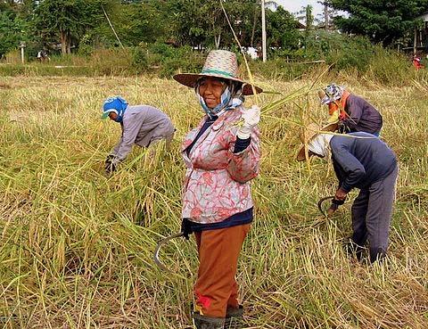
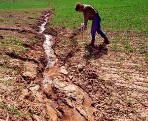

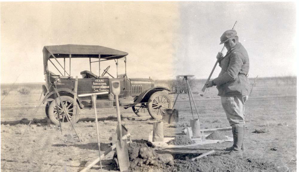
2 The use of soil information
3 GlobalSoilMap.net A digital soil map of the world


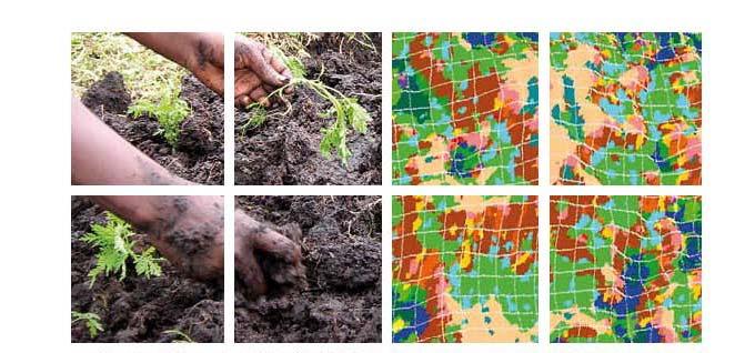
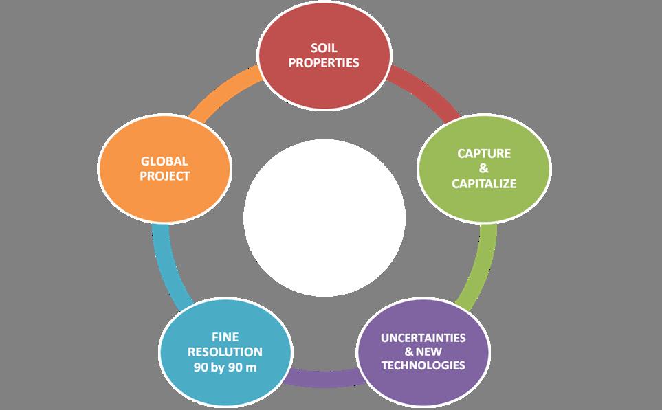
4 Aspect 1 Capture and Capitalise Soil maps Soil samples Reports, literature Soil data and information
5
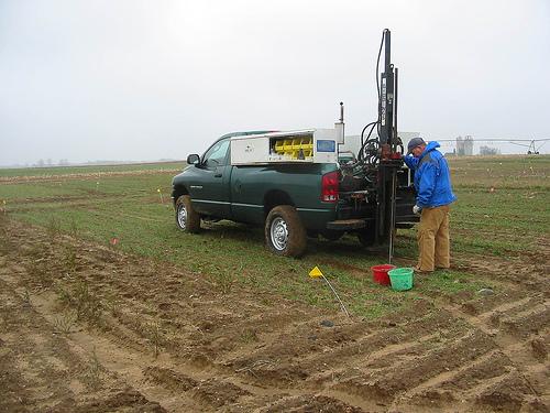
6 Aspect 2 Soil properties (not yet classes) Key properties 0 5 cm 5 15 cm cm cm cm cm Effective depth 1. Organic Carbon (g/kg) 2. Sand (%), Silt (%), Clay (%) & coarse fragments (%) 3. ph 4. Depth to bedrock or restricting layer (m) From these attributes, the following two properties will be predicted using pedo transfer functions: 5. Bulk Density (kg/m3) 6. Available Water Capacity (given in mm/m) Optional: 7. ECEC (Cations plus exchangeable acidity mol/kg) 8. EC (Electrical conductivity ds/m)


7 Aspect 3 Showing Uncertainties AWC (mm) > 19 Standard errors > 4.00


8 0 5cm 30 60cm cm Upper prediction limit DSM prediction Lower prediction limit Variability of OC at selected across the Edgeroi study area.


9 Aspect 4 Fine resolution grid 90 by 90 m From the polygon to the grid


10 Aspect 4 Fine resolution grid 90 by 90 m 0 5 cm 5 15 cm cm cm cm cm Effective depth
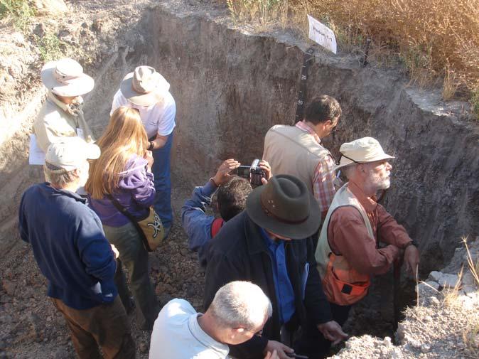
11 Initially a legacy based approach Which soil data are available? Assign quality of soil data and coverage in the covariate space Detailed soil maps Soil Point data Detailed soil maps Almost no data with legends with legends and Soil Point data scorpan Full Cover? kriging Full Cover? Homosoil Yes No Yes No Soil maps: -Spatially weighted mean -Spatial disaggregation Soil data: - scorpan kriging Extrapolation from reference areas: -Soil maps -Soil point data Time -Spatially weighted mean -Spatial disaggregation Extrapolation from reference areas Spatially weighted mean


 Sand Clay Bulk density Organic")
12 Predictions Soil observations or maps with legends scorpan layers Existing Soil maps Climate Landcover DEM Lithology S p = f (s,c,o,r,p,a,n) + e f Linear regression, Regression trees, Random forests, Neural networks, Expert system Etc.. Krige residuals (e) Sand Clay Bulk density Organic C CEC ph Inferred property e.g., AWC
13 The spline Modal profile Fit masspreserving spline Fitted Spline Estimate averages for spline at standardised depth ranges Spline averages at specified depth ranges

14 layer Soil C prediction 0 5 cm 5 15 cm cm cm cm cm


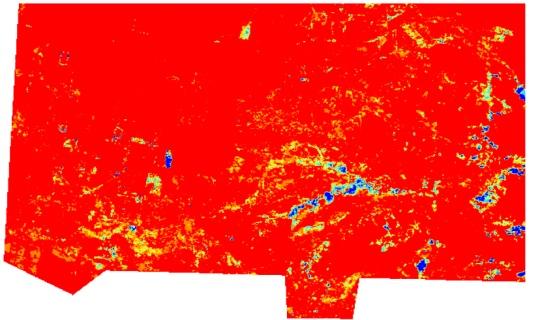
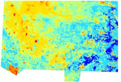
15 Reconstruct splines at every pixel Carbon (%) 0-5cm High : 6.5 Low : 0.8
16 11 task groups 1.Specifications 2. Soil profile and map legacy data 3. Covariates 4. New Prediction Method Development 5. Application & Documentation of Existing Methods 6. Soil Information Model 7. Cyber Infrastructure 8. End user Engagement 9. Uncertainty and Accuracy 10. Operational production mapping 11. Global stratification (pedoecophysiographic)


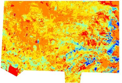
17 Aspect 5 It s s a global project North America Latin America/ Caribbean Eurasia Jordan North Africa/West Asia Africa South Asia East Asia Oceania
18 Start up in December 2006


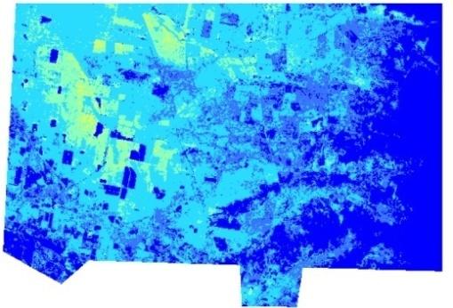
19 The African launch th th Jan 2009


20 The Global launch 17 th Feb 2009 "Let there be no mistake about the significance of this wonderful project" Kofi Annan "Soil mapping is one of the pillars to the challenge of sustainable development" Jeffrey Sachs
21


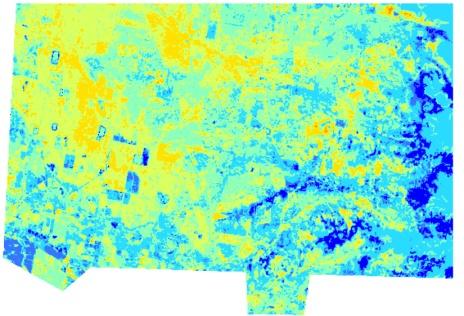
22

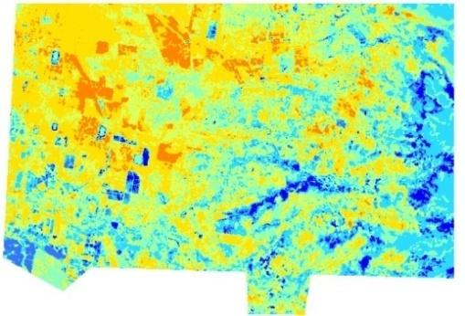
23 Large differences USA Sub Sahara Africa 9.1 million km million km 2 35,000 soil profiles 4,057 soil profiles That s s currently available!


24 Progress Scientific Publications

25 Activities in the node East Asia

26 Activities in the node East Asia Proof of concept studies with voluntary source. 90m resolution maps are being tested in the pilot areas >0.05mm <0.001mm <0.01mm
 using spatially weighted mean")
27 Activities in the node North America Hired two post docs Will produce soil property information. Training workshops Work closely with Canada and Mexico Produced 30 m resolution soil carbon map (1 m depth) using spatially weighted mean calculations from SSURGO and STASGO Information


28 Activities in the node L America Launch at Seventeenth Latin American Congress of Soil Science Node established Identify country coordinators Technical meetings planned for March Translation some standards texts in Spanish Plan training and capacity building

29 Activities in the node L America


30 Activities in the node Oceania Good connections Australia Indonesia New Zealand Neil McKenzie, Mike Grundy, Peter Wilson, David Jacquier, Budi Minasny, Brendan Malone and John Gallant met in Canberra to discuss scientific issues, including proof of concept areas, and developing the Oceania node. Meetings in New Zealand, and Indonesia with follow ups in Australia are planned. There will be data from Australia forthcoming for proof of concept studies Indonesian Soil Science Society Conference November 2009 in Yogyakarta
 Agreed specifications: 90 m, the spline (six depth layers) and uncertainty.")
31 Activities in the node Oceania From R. Viscarra Rossell (CSIRO) From B. Malone et al. (Geoderma, 2009) Agreed specifications: 90 m, the spline (six depth layers) and uncertainty. Figured out how to convert ASRIS coverage to a 90 m raster with depth data and uncertainty. Increased complexity the way forward, not multi resolution,
32 Some conclusions Importance of soils and soil information is recognised in big global issues (climate change, food production, environmental degradation, biodiversity, water scarcity, land disputes and war) Increasingly recognised: soils are not the problem but part of the solution
33 Some conclusions Increased demand for soil information by other scientific disciplines, policy and society Demand for raster based soil properties with uncertainties Coincides with a quantum leap in technology to produce accurate soil information in a timely manner Enormous opportunities for soil science, and also for a new generation to get engaged
34 Thank you for your attention Alfred Hartemink (on behalf of the global consortium) ISRIC World Soil Information Wageningen
WEALTH FROM WATER PILOT PROGRAM
 WEALTH FROM WATER PILOT PROGRAM The Wealth from Water Pilot Program is part of Tasmania s Innovation Strategy (Innovation in Primary Production) A two-year, $2.15 million pilot program that commenced in
Versioning of GlobalSoilMap.net raster property maps for the North American Node
 Digital Soil Assessments and Beyond Minasny, Malone & McBratney (eds) 2012 Taylor & Francis Group, London, ISBN 978-0-415-62155-7 Versioning of GlobalSoilMap.net raster property maps for the North American
Development of Global Map for GEOSS SBAs US-09-03a
 Development of Global Map for GEOSS SBAs US-09-03a UIC User Engagement Session 2 November, 2010 Yoshikazu FUKUSHIMA Secretariat General of International Steering Committee for Global Mapping Geospatial
ACLEP-Tasmanian Digital Soil Mapping Project (a component of the Wealth from Water Land Suitability Project)
") 2011 ACLEP-Tasmanian Digital Soil Mapping Project (a component of the Wealth from Water Land Suitability Project) Darren Kidd & Raphael Viscarra Rossel Darren Kidd 1, Raphael Viscarra Rossel 3, Chris Grose
2011 ACLEP-Tasmanian Digital Soil Mapping Project (a component of the Wealth from Water Land Suitability Project) Darren Kidd & Raphael Viscarra Rossel Darren Kidd 1, Raphael Viscarra Rossel 3, Chris Grose
Table A1. Data sources
 Section I. Data sources Data sources are given in Table A1. Table A1. Data sources No Dataset Full name Website 1 ESDB European Soil Database http://eusoils.jrc.ec.europa.eu/es db_archive/esdb/index.htm
GLOBAL SYMPOSIUM ON SOIL ORGANIC CARBON, Rome, Italy, March 2017
 GLOBAL SYMPOSIUM ON SOIL ORGANIC CARBON, Rome, Italy, 21-23 March 2017 GlobalSoilMap for Soil Organic Carbon Mapping and as a Basis for Global Modeling Dominique Arrouays 1*, Budiman Minasny 2, Alex. B.
National Remote Sensing Center of China. Space Technology for Sustainable Development in China Status, Achievements and Futures.
 National Remote Sensing Center of China Space Technology for Sustainable Development in China Status, Achievements and Futures Jing Li National Remote Sensing Center of China Ministry of Science and Technology,
Sneak Preview of the Saskatchewan Soil Information System (SKSIS)
") Sneak Preview of the Saskatchewan Soil Information System (SKSIS) Angela Bedard-Haughn 1, Ken Van Rees 1, Murray Bentham 1, Paul Krug 1 Kent Walters 1,3, Brandon Heung 2, Tom Jamsrandorj 3 Ralph Deters
Sneak Preview of the Saskatchewan Soil Information System (SKSIS) Angela Bedard-Haughn 1, Ken Van Rees 1, Murray Bentham 1, Paul Krug 1 Kent Walters 1,3, Brandon Heung 2, Tom Jamsrandorj 3 Ralph Deters
Anjana Dewanji, Anindita Chatterjee & Achyut Kumar Banerjee. Agricultural & Ecological Research Unit Indian Statistical Institute Kolkata, India
 Anjana Dewanji, Anindita Chatterjee & Achyut Kumar Banerjee Agricultural & Ecological Research Unit Indian Statistical Institute Kolkata, India World wide distribution Distribution in India Present scenario
Developing a global, peoplebased definition of cities and settlements
 Developing a global, peoplebased definition of cities and settlements By Lewis Dijkstra, Lewis.Dijkstra@ec.europa.eu Head of the Economic Analysis Sector DG for Regional and Urban Policy, Regional & Urban
The Soil Atlas of the Northern Circumpolar Region
 Conference Soil, Climate Change and Biodiversity Where do we stand? Brussels, Thursday 23rd and Friday 24th September 2010 1 The Soil Atlas of the Northern Circumpolar Region Luca Montanarella European
NCAVES - Global initiative and national pilots
 NCAVES - Global initiative and national pilots Kavita Sharma UN Environment Pretoria, March 2018 Outline 1. Global initiative > Introduction > Objectives and deliverables >Activities in 2017 and 2018 2.
Biodiversity and Ecosystem services Thinking globally, acting locally
 Biodiversity and Ecosystem services Thinking globally, acting locally Anne-Gaelle Ausseil - Manaaki Whenua Landcare Research Geoff Hicks National Commission for UNESCO 1 8 / 1 0 / 2 0 1 8 M A N A A K I
Proposed AKS for 6 th Grade Social Studies
 Proposed AKS for 6 th Grade Social Studies A. Map and Globe Skills 1. use cardinal directions 2. use intermediate directions 3. use a letter/number grid system to determine location 4. compare and contrast
RiskCity Training package on the Application of GIS for multi- hazard risk assessment in an urban environment.
 RiskCity Training package on the Application of GIS for multi- hazard risk assessment in an urban environment. Cees van Westen (Westen@itc.nl) & Nanette C. Kingma (Kingma@itc.nl) ITC: Training & Research
ANALYSIS OF LARGE SCALE SOIL SPECTRAL LIBRARIES
 Antoine Stevens (1), Marco Nocita (1,2), & Bas van Wesemael (1) ANALYSIS OF LARGE SCALE SOIL SPECTRAL LIBRARIES 1 Georges Lemaître Centre for Earth and Climate Research, Earth and Life Institute, UCLouvain,
Weather Climate Science to Service Partnership South Africa
 PROJECTS UNDERWAY Title of the Weather Climate Science to Service Partnership South Africa Together, building on an existing strong partnership, South African Weather Service and the Met Office will build
Using Equal Area Quadratic. Weighted Averages of Soil Chemical Parameters. Jeremy Tamargo Syracuse University March 8, 2011
 Using Equal Area Quadratic Splines to Compute Depth Weighted Averages of Soil Chemical Parameters Jeremy Tamargo Syracuse University March 8, 2011 Outline Introduction Historical Perspective Equal Area
Recommendations for the Advancement of Digital Soil Assessment in Australia
 Recommendations for the Advancement of Digital Soil Assessment in Australia Incorporating the report on the 4 th Global Digital Soil Mapping Workshop Rome 2010 Prepared by the state, territory and federal
GLOBAL SYMPOSIUM ON SOIL ORGANIC CARBON, Rome, Italy, March 2017
 GLOBAL SYMPOSIUM ON SOIL ORGANIC CARBON, Rome, Italy, 21-23 March 2017 Strength and weaknesses of a bottom up approach in estimating soil organic carbon: an experience in the varied Italian scenery I.
World Bank Group GEF Program
 World Bank Group GEF Program Global Environment Facility: -Transport World Bank GEF Coordination Team Content How does GEF work? World Bank s role in the GEF partnership The GEF transport activities What
Verifor information note December Recent international trade patterns in timber products for the Verifor case study countries
 Verifor information note December 2007 Recent international trade patterns in timber products for the Verifor case study countries Neil Bird Introduction A major driver behind the development of national
Economic and Social Council
 United Nations E/CN.3/2019/31 Economic and Social Council Distr.: General 19 December 2018 Original: English Statistical Commission Fiftieth session 5-8 March 2019 Item 4(i) of the provisional agenda*
Using Equal Area Quadratic Splines to Compute Depth Weighted Averages of Soil Chemical Parameters
 Syracuse University SURFACE Civil and Environmental Engineering College of Engineering and Computer Science March 2011 Using Equal Area Quadratic Splines to Compute Depth Weighted Averages of Soil Chemical
National assessment on member s readiness to produce indicators
 Inter-Agency and Expert Group on the Sustainable Development Goal Indicators WORKING GROUP ON GEOSPATIAL INFORMATION Fifth expert meeting 5 and 8 December 2018 8 th Meeting of IAEG-SDGs 5 8 November 2018,
Overview and Recent Developments
 SoLIM: An Effort Moving DSM into the Digital Era Overview and Recent Developments A-Xing Zhu 1,2 1 Department of Geography University of Wisconsin-Madison azhu@wisc.edu 2 Institute of Geographical Sciences
The role of soil spectral library for the food security issue
 The role of soil spectral library for the food security issue Eyal Ben-Dor Department of Geography Tel Aviv University The GEO-CRADLE project has received funding from the European Union s Horizon 2020
Global SoilMappingin a Changing World
 Global SoilMappingin a Changing World Sabine Grunwald Acknowledgements: GIS-Pedometrics Team, UF Soil Story My soil story. Your soil story Digital Soil Mapping in a Changing World Global climate change,
Creation of high resolution soil parameter data by use of artificial neural network technologies (advangeo )
") Creation of high resolution soil parameter data by use of artificial neural network technologies (advangeo ) A. Knobloch 1, F. Schmidt 1, M.K. Zeidler 1, A. Barth 1 1 Beak Consultants GmbH, Freiberg /
Creation of high resolution soil parameter data by use of artificial neural network technologies (advangeo ) A. Knobloch 1, F. Schmidt 1, M.K. Zeidler 1, A. Barth 1 1 Beak Consultants GmbH, Freiberg /
Soil Chemistry. Dr. Shalamar Armstrong Dr. Rob Rhykerd Department of Agriculture
 Soil Chemistry Dr. Shalamar Armstrong sdarmst@ilstu.edu Dr. Rob Rhykerd rrhyker@ilstu.edu Importance of soil Feeding the world World Population & Growth Other Asia Africa India China Latin America Europe
Bengt Kjellson Chair of the Executive Committee UN-GGIM: Europe. 2 nd Joint UN-GGIM: Europe ESS Meeting 11 th March 2016, Luxembourg
 Bengt Kjellson Chair of the Executive Committee UN-GGIM: Europe 2 nd Joint UN-GGIM: Europe ESS Meeting 11 th March 2016, Luxembourg A global geospatial mandate At its 47th plenary in July 2011, ECOSOC,
INTRODUCTION. In March 1998, the tender for project CT.98.EP.04 was awarded to the Department of Medicines Management, Keele University, UK.
 INTRODUCTION In many areas of Europe patterns of drug use are changing. The mechanisms of diffusion are diverse: introduction of new practices by new users, tourism and migration, cross-border contact,
THE GLOBAL INDICATOR FRAMEWORK: NEW AND INNOVATIVE METHODS FOR DISAGGREGATIN BY GEOLOCATION
 Parallel Session: Measuring and Monitoring the SDGs: THE GLOBAL INDICATOR FRAMEWORK: NEW AND INNOVATIVE METHODS FOR DISAGGREGATIN BY GEOLOCATION from global to regional to national panorama 8 th Meeting
Directorate E: Sectoral and regional statistics Unit E-4: Regional statistics and geographical information LUCAS 2018.
 EUROPEAN COMMISSION EUROSTAT Directorate E: Sectoral and regional statistics Unit E-4: Regional statistics and geographical information Doc. WG/LCU 52 LUCAS 2018 Eurostat Unit E4 Working Group for Land
UN-GGIM: An Overview Stefan Schweinfest, Director (UNSD) Bangkok, 27 March 2015
 Bangkok, 27 March 2015") UN-GGIM: An Overview Stefan Schweinfest, Director (UNSD) Bangkok, 27 March 2015 ggim.un.org UN-GGIM: A global initiative Formal inter-governmental UN Committee of Experts to: Discuss, enhance and coordinate
UN-GGIM: An Overview Stefan Schweinfest, Director (UNSD) Bangkok, 27 March 2015 ggim.un.org UN-GGIM: A global initiative Formal inter-governmental UN Committee of Experts to: Discuss, enhance and coordinate
Major Opportunities in Spatial Data Infrastructure Communities
 Major Opportunities in Spatial Data Infrastructure Communities Bas Kok President GSDI June 17 th 2008 FIG Working Week: Integrating Generations 14-19 June 2008 Stockholm, Sweden http://www.gsdi.org 1 GSDI
Global Challenges - Partnering with Service Providers. World Meteorological Organization. J. Lengoasa WMO Deputy Secretary-General
 WMO World Meteorological Organization Working together in weather, climate and water Global Challenges - Partnering with Service Providers J. Lengoasa WMO Deputy Secretary-General jlengoasa@wmo.int http://www.wmo.int/pages/gfcs/gfcs_en.html
Introduction of the Asia-Oceania Global Earth Observation System of Systems (AOGEOSS) GEO Initiative(GI-22 )
 GEO Initiative(GI-22 )") Introduction of the Asia-Oceania Global Earth Observation System of Systems (AOGEOSS) GEO Initiative(GI-22 ) Prof. Xiang ZHOU Institute of Remote Sensing and Digital Earth, CAS 11 May 2017 Kunming, China
Introduction of the Asia-Oceania Global Earth Observation System of Systems (AOGEOSS) GEO Initiative(GI-22 ) Prof. Xiang ZHOU Institute of Remote Sensing and Digital Earth, CAS 11 May 2017 Kunming, China
The Role of Data & Information Infrastructures in Supporting Climate Change Adaptation in Latin America & the Caribbean
 The Role of Data & Information Infrastructures in Supporting Climate Change Adaptation in Latin America & the Caribbean Emil A. Cherrington Senior Scientist Water Center for the Humid Tropics of Latin
Pan American Institute of Geography and History. 12th MACHC 5-9 December 2011
 Pan American Institute of Geography and History 12th MACHC 5-9 December 2011 1 PAIGH Mission and Objectives To encourage, coordinate, and publicize cartographical, geographical, geophysical and historical
Data Integration Model for Air Quality: A Hierarchical Approach to the Global Estimation of Exposures to Ambient Air Pollution
 Data Integration Model for Air Quality: A Hierarchical Approach to the Global Estimation of Exposures to Ambient Air Pollution Matthew Thomas 9 th January 07 / 0 OUTLINE Introduction Previous methods for
Earth Observations as a Tool To Achieve Sustainable Development Goals
 The image part with relationship ID rid3 was not found in the file. 16/10/2017 Earth Observations as a Tool To Achieve Sustainable Development Goals LI Jing, China GEO On behalf of the Group on Earth Observations
Geospatial workflows and potential applications to the Sustainable Development Goals of countries in West Asia
 Geospatial workflows and potential applications to the Sustainable Development Goals of countries in West Asia Ameer Abdulla, PhD Senior Advisor, European Topic Center for Spatial Analysis, Spain Associate
Crowdsourcing approach for large scale mapping of built-up land
 Crowdsourcing approach for large scale mapping of built-up land Kavinda Gunasekara Kavinda@ait.asia Geoinformatics Center Asian Institute of Technology, Thailand. Regional expert workshop on land accounting
The International Society for Photogrammetry and Remote Sensing Study on the Status of Mapping on the World
 Joint ISPRS Project with the United Nations Committee of Experts on Geospatial Information Management UN GGIM Secretariat, New York The International Society for Photogrammetry and Remote Sensing Study
March 2007 The Survey Department of Sri Lanka
 Contribution of Survey Department of Sri Lanka for Mitigation of Disasters in Sri Lanka K.A.U.N.Kasthuri Deputy Surveyor General (Information Technology) March 2007 The Survey Department of Sri Lanka 1
What is PRECIS and what can it do?
 PRECIS: Facilitating capacity building and technology transfer to enable climate change mitigation and adaptation activities worldwide Joseph Intsiful, UNFCCC NWP Meeting, Mexico City 4-7 March 2008 Content:
Spectroscopy-supported digital soil mapping
 Spectroscopy-supported digital soil mapping Outline Introduction Project and theoretical background Field sampling Estimating and mapping soil mineralogy Conclusion & outlook The nation that destroys its
Alleghany County Schools Curriculum Guide GRADE/COURSE: World Geography
 GRADE/COURSE: World 2013-14 GRADING PERIOD: 1 st Six Weeks Time Frame Unit/SOLs SOL # Strand Resource Assessment 8 days* The student will use maps, globes, satellite images, photographs, or diagrams to
Mineral Resources Reporting and Valuation in Latin America: The CRIRSCO Standard
 Mineral Resources Reporting and Valuation in Latin America: The CRIRSCO Standard Edmundo TULCANAZA Committee for Mineral Reserves International Reporting Standards METS 2018 April 2018 Latin América AGENDA
PREDICTION OF SOIL ORGANIC CARBON CONTENT BY SPECTROSCOPY AT EUROPEAN SCALE USING A LOCAL PARTIAL LEAST SQUARE REGRESSION APPROACH
 Proceedings of the 13 th International Conference on Environmental Science and Technology Athens, Greece, 5-7 September 2013 PREDICTION OF SOIL ORGANIC CARBON CONTENT BY SPECTROSCOPY AT EUROPEAN SCALE
Development of Geospatial Information in Indonesia: Progress & Challenge
 Development of Geospatial Information in Indonesia: Progress & Challenge Dr. Nurwadjedi Sarbini Deputy of Thematic Geospatial Information Geospatial Information Agency (BIG) Geosmart Asia, September 29
Training on national land cover classification systems. Toward the integration of forest and other land use mapping activities.
 Training on national land cover classification systems Toward the integration of forest and other land use mapping activities. Guiana Shield 9 to 13 March 2015, Paramaribo, Suriname Background Sustainable
Relationships in soil distribution from digital soil modelling and mapping over eastern Australia under past, present and future conditions
 Relationships in soil distribution from digital soil modelling and mapping over eastern Australia under past, present and future conditions A thesis submitted in fulfilment of the requirements for the
Important Developments in International Coke Markets
 Important Developments in International Coke Markets Andrew Jones Resource-Net South Africa China Coke Market Congress Xuzhou, Jiangsu September 2018 Introduction to Presentation Resource-Net produces
European Initiatives on Drought: Research Projects and Networks
 European Initiatives on Drought: Research Projects and Networks Kerstin Stahl Department of Geosciences University of Oslo Oslo, Norway Outline Drought in Europe: events and issues Previous research on
Space Application in Support of Land Management for SDG Implementation
 Space Application in Support of Land Management for SDG Implementation Regional Expert Workshop on Land Accounting for SDG Monitoring and Reporting 26 September 2017 Space Application Section Information
Exploring the uncertainty of soil water holding capacity information
 Exploring the uncertainty of soil water holding capacity information Linda Lilburne*, Stephen McNeill, Tom Cuthill, Pierre Roudier Landcare Research, Lincoln, New Zealand *Corresponding author: lilburnel@landcareresearch.co.nz
Monday Tuesday Wednesday Thursday Friday
 Monday Tuesday Wednesday Thursday Friday Aug-7 Aug-8 Aug-9 Aug-10 Aug-11 Based off the World Cultures and Geography Textbook Teacher Inservice Teacher Inservice Teacher Inservice Teacher Inservice Aug
Geographical knowledge and understanding scope and sequence: Foundation to Year 10
 Geographical knowledge and understanding scope and sequence: Foundation to Year 10 Foundation Year 1 Year 2 Year 3 Year 4 Year 5 Year 6 Year level focus People live in places Places have distinctive features
Digital Soil Mapping
 Digital Soil Mapping Getting Operational An introductory course of practical exercises for Digital Soil Mapping February 2011 Prepared by: Brendan Malone Preface Digital Soil Mapping (DSM) has matured
The Integration of Land and Marine Spatial Data Set As Part of Indonesian Spatial Data Infrastructure Development
 UNITED NATIONS E/CONF.97/6/IP. 46 ECONOMIC AND SOCIAL COUNCIL Seventeenth United Nations Regional Cartographic Conference for Asia and the Pacific Bangkok, 18-22 September 2006 Item 7 of the provisional
The World Bank Ecuador - Sustainable Family Farming Modernization Project (P151963)
") Public Disclosure Authorized LATIN AMERICA AND CARIBBEAN Ecuador Agriculture Global Practice IBRD/IDA Investment Project Financing FY 2016 Seq No: 5 ARCHIVED on 17-Nov-2017 ISR30151 Implementing Agencies:
Public Disclosure Authorized LATIN AMERICA AND CARIBBEAN Ecuador Agriculture Global Practice IBRD/IDA Investment Project Financing FY 2016 Seq No: 5 ARCHIVED on 17-Nov-2017 ISR30151 Implementing Agencies:
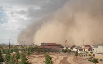
Dust storm variability over EGYPT By Fathy M ELashmawy Egyptian Meteorological Authority
 WMO WORKSHOP ON CLIMATE MONITORING INCLUDING THE IMPLEMENTATION OF CLIMATE WATCH SYSTEMS FOR ARAB COUNTRIES IN WEST ASIA, AMMAN, JORDAN, 27-29 MAY 2013 Dust storm variability over EGYPT By Fathy M ELashmawy
2015 Record breaking temperature anomalies
 2015 Record breaking temperature anomalies June 2015 global temperature was the highest in 136 (since 1880) years reaching an average of 0.88 C above the 20 th century average. This is an increase of 0.12
Public Disclosure Copy
 Public Disclosure Authorized LATIN AMERICA AND CARIBBEAN Brazil Transport & Digital Development Global Practice IBRD/IDA Investment Project Financing FY 2010 Seq No: 16 ARCHIVED on 01-Jun-2018 ISR31660
ACKNOWLEDGEMENTS. Contributions from: Prof. Larry Hildebrand. Dr. David Obura CORDIO - Kenya
 ACKNOWLEDGEMENTS Contributions from: Prof. Larry Hildebrand World Maritime University, Malmo, Sweden Dr. David Obura CORDIO - Kenya Ms. Sibongile Manzana-Saruchera GIZ MARISMA Project, Benguela Current
The International Society for Photogrammetry and Remote Sensing Study on the Status of Mapping on the World
 Joint ISPRS Project with the United Nations Committee of Experts on Geospatial Information Management UN-GGIM Secretariat, New York The International Society for Photogrammetry and Remote Sensing Study
Do Policy-Related Shocks Affect Real Exchange Rates? An Empirical Analysis Using Sign Restrictions and a Penalty-Function Approach
 ISSN 1440-771X Australia Department of Econometrics and Business Statistics http://www.buseco.monash.edu.au/depts/ebs/pubs/wpapers/ Do Policy-Related Shocks Affect Real Exchange Rates? An Empirical Analysis
PROPOSED MST RESEARCH PROGRAM
 UNWTO Statistics and Tourism Satellite Account Programme COMMITTEE ON STATISTICS AND THE TOURISM SATELLITE ACCOUNT Seventeenth meeting UNWTO Headquarters, Madrid, Spain 24-25 January 2017 PROPOSED MST
Transactions on Information and Communications Technologies vol 18, 1998 WIT Press, ISSN
 STREAM, spatial tools for river basins, environment and analysis of management options Menno Schepel Resource Analysis, Zuiderstraat 110, 2611 SJDelft, the Netherlands; e-mail: menno.schepel@resource.nl
Unit 2 Study Guide: The World in Spatial Terms
 Name Date Hour Unit 2 Study Guide: The World in Spatial Terms TEST is WEDNESDAY, DECEMBER 19 TH This study guide contains all the concepts that will be on your test. Vocabulary words and concepts will
From a North American to a Global Drought Monitor Richard R. Heim Jr.
 From a North American to a Global Drought Monitor Richard R. Heim Jr. NOAA/NESDIS/ Asheville, North Carolina, USA GEO-DRI Drought Monitoring Workshop Winnipeg, Manitoba, Canada 10-11 May 2010 NADM History
Pilot area description Tissoe
 Pilot area description Tissoe October 2014 Mette V. Odgaard, department of Agroecology, Aarhus University Camilla Vestergaard, Knowledge Center for Agriculture P/S (eds.) 1 Content 1. General pilot area
Creating Low-Cost Soil Maps for Tropical Agriculture using Gaussian Processes
 Creating Low-Cost Soil Maps for Tropical Agriculture using Gaussian Processes Juan Pablo Gonzalez, Simon Cook, Thomas Oberthur, Andrew Jarvis, J. Andrew Bagnell and M. Bernardine Dias Robotics Institute
UN GGIM and National SDI Strategy
 MSDI Open Forum on 26 th January 2016 Contributing to the successful delivery of MSDI UN GGIM and National SDI Strategy Hiroshi Murakami Deputy Administrator Geospatial Information Authority of Japan Geospatial
Economic and Social Council
 United Nations Economic and Social Council Distr.: General 18 July 2016 Original: English Committee of Experts on Global Geospatial Information Management Sixth session New York, 3-5 August 2016 Item 2
Urban Expansion. Urban Expansion: a global phenomenon with local causes? Stephen Sheppard Williams College
 Urban Expansion: a global phenomenon with local causes? Stephen Sheppard Williams College Presentation for World Bank, April 30, 2007 Presentations and papers available at http://www.williams.edu/economics/urbangrowth/homepage.htm
SEACLID/CORDEX Southeast Asia: A Regional Initiative to Provide Regional Climate Change Information and Capacity Building
 SEACLID/CORDEX Southeast Asia: A Regional Initiative to Provide Regional Climate Change Information and Capacity Building Liew Ju Neng SEACLID/CORDEX Southeast Asia School of Environment and Natural Sciences
The importance of satellite data and products for RA1 in the WWRP strategy. Estelle de Coning World Weather Research Division
 The importance of satellite data and products for RA1 in the WWRP strategy Estelle de Coning World Weather Research Division Kofi Annan former UN Secretary-General (21 July 2016) "The poor need alerts
Pillar 5 and its implementation in Europe
 Pillar 5 and its implementation in Europe Chair: Rainer Baritz Asia: Hakki Erdogan, Kazumichi Fujii and Yusuke Takata Europe: Marco Nocita, Bernd Bussian and Niels Batjes, North America: Jon Hempel South
Improving rural statistics. Defining rural territories and key indicators of rural development
 Improving rural statistics Defining rural territories and key indicators of rural development Improving rural statistics Improving Rural Statistics In 2016, the Global Strategy to improve Agricultural
Geographic Information Systems (GIS) and inland fishery management
 and inland fishery management") THEMATIC REPORT Geographic Information Systems (GIS) and inland fishery management Stratified inland fisheries monitoring using GIS Gertjan DE GRAAF Nefisco, Amsterdam, the Netherlands Felix MARTTIN and
THEMATIC REPORT Geographic Information Systems (GIS) and inland fishery management Stratified inland fisheries monitoring using GIS Gertjan DE GRAAF Nefisco, Amsterdam, the Netherlands Felix MARTTIN and
The Four World Zones Become Connected
 The Four World Zones Become Connected By Cynthia Stokes Brown, Big History Project, adapted by Newsela staff on 07.30.16 Word Count 812 TOP: Asia from space. Photo: Corbis. MIDDLE: Bering Land Bridge National
Advantages of Regional and Global Data Exchange. Gavin Hayes U.S. Geological Survey, National Earthquake Information Center
 Advantages of Regional and Global Data Exchange Gavin Hayes U.S. Geological Survey, National Earthquake Information Center USGS NEIC Global Earthquake Response Area of responsibility => Global BUT - domestically,
World Status of National Spatial Data Clearinghouses
 World Status of National Spatial Data Clearinghouses Joep Crompvoets and Arnold Bregt Abstract: In December 2001, a survey of the World Wide Web was carried out to assess systematically the state-of-the-art
Regional mechanisms for satellite data access and exchange: RA III/IV
 WORLD METEOROLOGICAL ORGANIZATION COMMISSION FOR BASIC SYSTEMS OPEN PROGRAMME AREA GROUP ON INTEGRATED OBSERVING SYSTEMS EXPERT TEAM ON SATELLITE UTILIZATION AND PRODUCTS ET-SUP-8/Doc. 5.1.3 (25.III.2014)
NR402 GIS Applications in Natural Resources
 NR402 GIS Applications in Natural Resources Lesson 1 Introduction to GIS Eva Strand, University of Idaho Map of the Pacific Northwest from http://www.or.blm.gov/gis/ Welcome to NR402 GIS Applications in
Bunker Related Charges and Currency Adjustment Factor Application from / to Asia and Oceania
 Bunker Related Charges and Currency Adjustment Factor Application from / to Asia and Oceania November 30, 2017 Dear Customer, Please be informed about the Bunker Charge (BUC), Bunker Adjustment Factor
What is OneGeology in 2015?
 What is OneGeology in 2015? 25th May 2015 Marko Komac OneGeology Managing Director Presentation Outline Background quick OneGeology history Consortium The vehicle to achieve the goal Current status Where
Sharthi Laldaparsad Statistics South Africa, Policy Research & Analysis. Sub-regional workshop on integration of administrative data,
 Sub-regional workshop on integration of administrative data, big data and geospatial information for the compilation of SDG indicators and International Workshop on Global Fundamental Geospatial Data Themes
INDONESIA S S UPDATE: GEOSPATIAL INFORMATION FOR SUSTAINABLE DEVELOPMENT RELATED TO INA SDI Dr. Asep Karsidi, M.Sc
 INDONESIA S S UPDATE: GEOSPATIAL INFORMATION FOR SUSTAINABLE DEVELOPMENT RELATED TO INA SDI Dr. Asep Karsidi, M.Sc GEOSPATIAL INFORMATION AGENCY 08 August, 2012 OUTLINE 1. Transformation Bakosurtanal into
8 th Arctic Regional Hydrographic Commission Meeting September 2018, Longyearbyen, Svalbard Norway
 8 th Arctic Regional Hydrographic Commission Meeting 11-13 September 2018, Longyearbyen, Svalbard Norway Status Report of the Arctic Regional Marine Spatial Data Infrastructures Working Group (ARMSDIWG)
The Efforts of Building GIS Infrastructure in a Newly Independent State: The case of Timor Leste *
 UNITED NATIONS E/CONF.100/IP.12 ECONOMIC AND SOCIAL COUNCIL Eighteenth United Nations Regional Cartographic Conference for Asia and the Pacific Bangkok, 26-29 October 2009 Item 7(b) of the provisional
Comparison of Methods for Deriving a Digital Elevation Model from Contours and Modelling of the Associated Uncertainty
 Comparison of Methods for Deriving a Digital Elevation Model from Contours and Modelling of the Associated Uncertainty Anicet Sindayihebura 1, Marc Van Meirvenne 1 and Stanislas Nsabimana 2 1 Department
Interactive comment on A review on the global soil datasets for earth system modeling by Yongjiu Dai et al.
 SOIL Discuss., https://doi.org/10.5194/soil-2018-32-ac1, 2018 Author(s) 2018. This work is distributed under the Creative Commons Attribution 4.0 License. Interactive comment on A review on the global
Utilization of Global Map for Societal Benefit Areas
 Utilization of Global Map for Societal Benefit Areas The Fourth GEOSS AP Symposium Bali Indonesia, 11th March 2010 Shuhei Kojima Geographical Survey Institute Ministry of Land, Infrastructure, Transport
Harmonization of methods and measurements (GSP Pillar 5) Rainer Baritz
 Rainer Baritz") Harmonization of methods and measurements (GSP Pillar 5) Rainer Baritz ESP, Rome, 17-18 March 2015 1 Pillar 5 writing team: Compiled after expert registration through GSP web site; 2 experts dropped out;
Harmonization of methods and measurements (GSP Pillar 5) Rainer Baritz ESP, Rome, 17-18 March 2015 1 Pillar 5 writing team: Compiled after expert registration through GSP web site; 2 experts dropped out;
NASA s Activities in Europe
 NASA s Activities in Europe Presented by Dr. Bill Barry NASA European Representative November 10, 2009 at the 2009 International Workshop on Environment and Alternative Energy 2 Current Activities The
Geospatial activities during the 47 th UN Statistical Commission
 Geospatial activities during the 47 th UN Statistical Commission A Summary Rolando Ocampo Alcántar April 2016 47 th Session of the United Nations Statistical Commission Side Events Friday Seminar on Emerging