The Soil Atlas of the Northern Circumpolar Region
|
|
|
- Hope Neal
- 5 years ago
- Views:
Transcription


1 Conference Soil, Climate Change and Biodiversity Where do we stand? Brussels, Thursday 23rd and Friday 24th September The Soil Atlas of the Northern Circumpolar Region Luca Montanarella European Commission Joint Research Centre Institute for Environment and Sustainability Land Management and Natural Hazards Unit
 Luca Montanarella, Soil Action Leader, JRC Vladimir Stolbovoy, Institute of Geography, Russian")
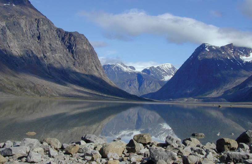
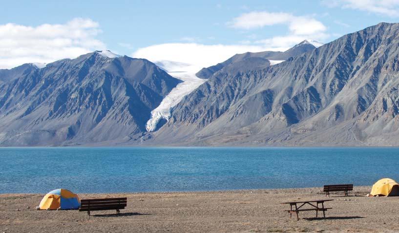
2 Editorial Board of the Atlas Conference Soil, Climate Change and Biodiversity Where do we stand? Brussels, Thursday 23rd and Friday 24th September Arwyn Jones, Soil Action, JRC (Lead Editor) Luca Montanarella, Soil Action Leader, JRC Vladimir Stolbovoy, Institute of Geography, Russian Academy of Sciences Prof. Gabriele Broll, University of Osnabrück (D) Charles Tarnocai, Agriculture and Agri-Food Canada Otto Spaargaren, ISRIC World Soils Data (NL) Prof. Chien-Lu Ping, University of Alaska Fairbanks (USA) Over 24 scientists contributed significant articles to the atlas with a further 50 providing additional graphical materials and photographs. Baffin Island Gabrielle Broll
 is a global scientific programme that focuses on the Arctic")
 and the World Meteorological Organization (WMO).")

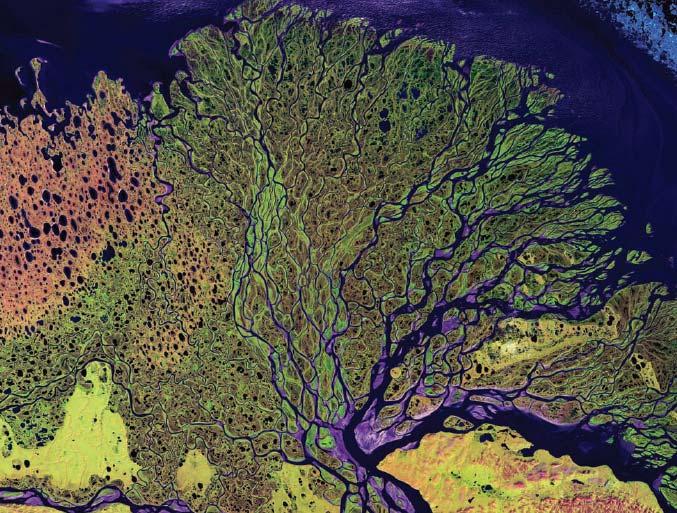
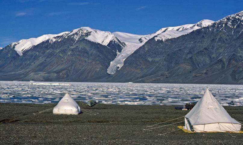
3 Conference Soil, Climate Change and Biodiversity Where do we stand? Brussels, Thursday 23rd and Friday 24th September The International Polar Year (IPY) is a global scientific programme that focuses on the Arctic and the Antarctic from March 2007 to March The 4 th International Polar Year is led by the International Council for Science (ICSU) and the World Meteorological Organization (WMO). Importantly, the IPY aims to educate the public whilst training the next generation of polar engineers and scientists. Therefore, over 50 projects deal with education and outreach. Within this goal, EU initiative to produce a Atlas of Northern Circumpolar Soil. The Atlas strengthens the theme of soil within IPY Registered as Activity 1210 under IPY Expression of Intent and attached to the IPY Collaborative Science dpa Programme 373 on Carbon Pools in Permafrost Regions (CAPP). Greenland shoreline Christian Morel

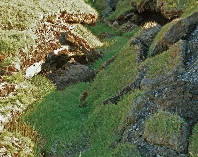
4 Why soils? Conference Soil, Climate Change and Biodiversity Where do we stand? Brussels, Thursday 23rd and Friday 24th September The importance of soil and the multitude of environmental services that depend on soil properties are not widely understood by society at large. 2 Soil scientists are becoming increasingly aware of the necessity to raise awareness and educate the general public, policy makers and other scientists of the importance and global significance of soil. 3 This is particularly true of soil in northern latitudes where the impacts of global climate change would be dramatic on both a local and global perspective. Canadian Peatlands Government of Northwest Territories
5 What is the aim of atlas? Conference Soil, Climate Change and Biodiversity Where do we stand? Brussels, Thursday 23rd and Friday 24th September Publication to raise awareness of the significance of soils in the Northern Circumpolar Region (> 50 o North). Supporting the EU Thematic Strategy for Soil Protection and related initiatives. To educate and inform. Send a message from soil scientists to policy makers on the global importance of soils in northern latitudes. Baffin Island Gabrielle Broll

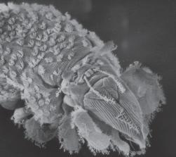
6 Audience and Targets Conference Soil, Climate Change and Biodiversity Where do we stand? Brussels, Thursday 23rd and Friday 24th September High quality reference work on the soils of the northern circumpolar region for the general public Informative, easy to read, graphically stimulating Lead to better understanding and appreciation of the role of soils in our lives Life in northern soils! Charles Tarnocai

")

7 The Atlas The Atlas A3 book of 144 pages (Portrait) Opens to A2 spreads (Landscape) 7


8 Inviting layout Conference Soil, Climate Change and Biodiversity Where do we stand? Brussels, Thursday 23rd and Friday 24th September
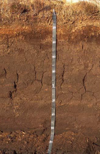
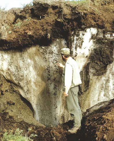
9 Visually Stimulating Visually Stimulating Photos: Tarnocai, USGS, Micheli, Russel 9


10 Explain cold soils in a clear manner Explain cold soils in a clear manner 10


11 Deliver message through graphics Deliver message through graphics 11

 Soil Geographical Database of Eurasia (ESBN/JRC) Digital")
 Dominant Soil Type assigned to each")

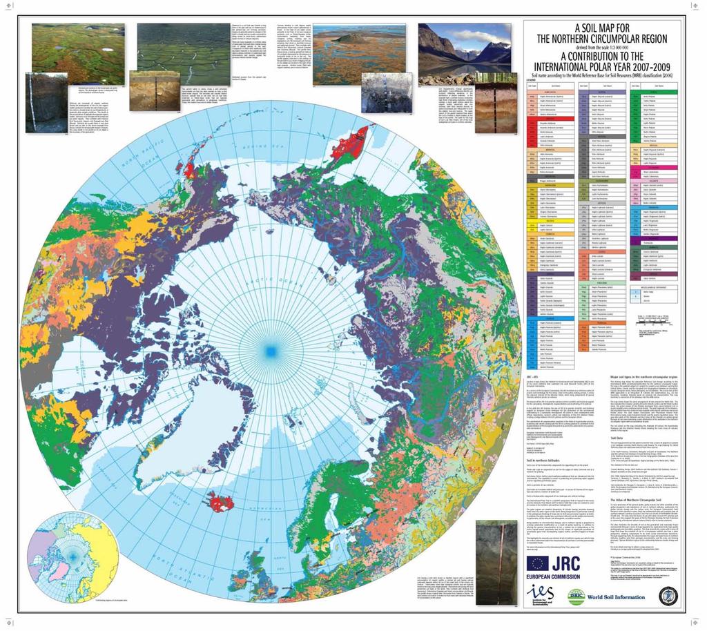
12 An Atlas Needs Maps! Nearly 200 A4 pages of text Heart of the atlas based on digital soil datasets: Northern and Mid-Latitude Soil Database (Cryosol WG) Soil Geographical Database of Eurasia (ESBN/JRC) Digital Soil Map of the World (FAO) Northern Circumpolar Soil Carbon Database 2007 (Tarnocai) Dominant Soil Type assigned to each polygon. Novel conversion of soil nomenclature to international classification/correlation scheme (WRB 2006) Different classification systems, different standards, different databases 12
13 13


14 29 Regional Soil Maps 29 Regional Soil Maps 14

15 Link between texts and maps Link between texts and maps 15


16 Northern soils in a global context Northern soils in a global context 16
17 Northernsoil soilininaalocal localcontext context Northern Northern soil in a global context 17
18 Conclusions The atlas: raises public awareness of the importance, fragility and beauty of soil in the northern circumpolar region. illustrates the enormous variety and complexity of permafrostaffected and seasonally-frozen soils in the northern circumpolar region (accounting for approximately 15% of the global soil cover). describes the sensitivity of soil to the effects of climate change and human activities. makes the case for a sustainable approach to land management to ensure a minimal level of soil degradation. calls for continued research to improve our understanding of the complex interactions between permafrost-affected soils and climate change. 18
19 How can you obtain a copy? How can you obtain a copy? Purchase via Office of Official Publications Luxembourg Limited copies via the JRC arwyn.jones@jrc.ec.europa.eu Today! 19


20 JRC Editorial Plan for the Soil Atlas Series: The way forward! 2005 Soil Atlas of Europe 2010 Soil Atlas of the Northern Circumpolar Region 2010 Atlas of Soil Biodiversity 2011 Soil Atlas of Africa 2013 Soil Atlas of Latin America In discussion: Soil Atlas of Antarctica Soil Atlas of North America Soil Atlas of Asia 20


21 Thank you for your attention. 21
Compact guides GISCO. Geographic information system of the Commission
 Compact guides GISCO Geographic information system of the Commission What is GISCO? GISCO, the Geographic Information System of the COmmission, is a permanent service of Eurostat that fulfils the requirements
CONFERENCE STATEMENT
 CONFERENCE STATEMENT We, the elected representatives from Canada, Denmark/Greenland, Finland, Iceland, Norway, Russia, Sweden and the United States of America; In collaboration with the indigenous peoples
Alleghany County Schools Curriculum Guide GRADE/COURSE: World Geography
 GRADE/COURSE: World 2013-14 GRADING PERIOD: 1 st Six Weeks Time Frame Unit/SOLs SOL # Strand Resource Assessment 8 days* The student will use maps, globes, satellite images, photographs, or diagrams to
Geological information for Europe : Towards a pan-european Geological Data Infrastructure
 Geological information for Europe : Towards a pan-european Geological Data Infrastructure Integrating geoscientific information for EU competitiveness Co-funded by the European Union European societal
MEADOWS PRIMARY SCHOOL and NURSERY GEOGRAPHY POLICY
 MEADOWS PRIMARY SCHOOL and NURSERY GEOGRAPHY POLICY Purpose of study The teaching of Geography at Meadows is done by following the 2014 National Curriculum. The planning and teaching of the subject aims
Meteorological Cooperation in the Arctic. Perspectives from Finland
 Meteorological Cooperation in the Arctic Perspectives from Finland Improving public safety, better data coverage, enhancing arctic climate science VAWS Webinar Series Fairbanks, Alaska May 10th 2017 Finland
GEOGRAPHY POLICY STATEMENT. The study of geography helps our pupils to make sense of the world around them.
 GEOGRAPHY POLICY STATEMENT We believe that the study of geography is concerned with people, place, space and the environment and explores the relationships between the earth and its peoples. The study
Geography. Programmes of study for Key Stages 1-3
 Geography Programmes of study for Key Stages 1-3 February 2013 Contents Purpose of study 3 Aims 3 Attainment targets 3 Subject content 4 Key Stage 1 4 Key Stage 2 5 Key Stage 3 6 2 Purpose of study A high-quality
EuroGEOSS Protected Areas Pilot
 EuroGEOSS Protected Areas Pilot Max Craglia European Commission Joint Research Centre Part 1: the present MyNatura2000 Mobile app. Awareness raising & volunteered data collection. Natura2000 covers 18%
LUCAS Technical reference document U1 LUCAS Survey data user guide. (Land Use / Cover Area Frame Survey)
") Regional statistics and Geographic Information Author: E4.LUCAS (ESTAT) TechnicalDocuments 2015 LUCAS 2015 (Land Use / Cover Area Frame Survey) Technical reference document U1 LUCAS Survey data user guide
Regional statistics and Geographic Information Author: E4.LUCAS (ESTAT) TechnicalDocuments 2015 LUCAS 2015 (Land Use / Cover Area Frame Survey) Technical reference document U1 LUCAS Survey data user guide
Pikes Lane Primary School. Geography Statement of Practice
 Pikes Lane Primary School Geography Statement of Practice Subject Leader: Mrs Cawley Subject Link Governor: Mr Scholar & Mrs Azad Last Updated: September 2016 Review Date: September 2017 Aims and objectives
St. James C of E Primary School
 St. James C of E Primary School Geography Policy St. James C of E Primary School Geography Policy Written by: Lisa Harford Written: April 2016 Reviewed: April 2018 1. Introduction Geography is concerned
HOLY CROSS CATHOLIC PRIMARY SCHOOL
 HOLY CROSS CATHOLIC PRIMARY SCHOOL Geography Policy Date Implemented Jan 17 Review Date Jan 22 Mission Statement Holy Cross Primary School is a Catholic School. We seek to provide a broad, balanced Christian
Geography Policy. Introduction
 Geography Policy Introduction Geography at St. Aloysius Federation School teaches an understanding of places and environments and aims to inspire a curiosity and fascination about the world and its people.
Tuition, Medical and Behaviour Support Service
 Tuition, Medical and Behaviour Support Service Curriculum Policy - Primary Geography Reviewed: October 2018 Next Review: October 2019 Responsibility: Andrea Snow AIMS AND PRINCIPLES The national curriculum
Northern Circumpolar Soil. S u p p o r t i n g t h e I n t e r n a t i o n a l P o l a r Y e a r
 Northern Circumpolar Soil S u p p o r t i n g t h e I n t e r n a t i o n a l P o l a r Y e a r 2 0 0 7-2 0 0 8 Soil in northern latitudes (GB) Soil is one of the fundamental components for supporting
LUCAS: current product and its evolutions
 LUCAS: current product and its evolutions Workshop Land Use and Land Cover products: challenges and opportunities Brussels 15 Nov 2017 Eurostat E4: estat-dl-lucas@ec.europa.eu Contents 1) The context 2)
Interregional Cooperation in the Apennines
 INTERNATIONAL WORKSHOP THE ALPS AND THE ARDENNES: SHARING EXPERIENCES AMONG TRANSBOUNDARY MOUNTAIN AREAS Interregional Cooperation in the Apennines Massimo Sargolini, professor at the University of Camerino,
The importance of international university and project cooperation in science
 The importance of international university and project cooperation in science The Role of Science in Arctic Social and Business Development Arctic Frontiers Science January 25, 2017 Dr. Marina Kalinina
Northern circumpolar soil database and derived soil maps in different classification systems
 Symposium no. 21 Paper no. 838 Presentation: oral Northern circumpolar soil database and derived soil maps in different classification systems GORYACHKIN Sergey (1), STOLBOVOI Vladimir (2), TARNOCAI Charles
World Meterological Organization Polar Space Task Group
 World Meterological Organization Polar Space Task Group Jerry L. Mullins Coordinator, USGS Antarctic, Arctic and Canadian Programs Reston, VA, USA 30 September 2011 1. USGS Landsat Program 11/06 7/07 4/08
COUNCIL OF THE EUROPEAN UNION. Brussels, 2 May /14 CULT 68
 COUNCIL OF THE EUROPEAN UNION Brussels, 2 May 2014 9129/14 CULT 68 NOTE from: General Secretariat of the Council to: Permanent Representatives Committee (Part 1) / Council No. prev. doc.: 8892/14 CULT
St John s Catholic Primary School. Geography Policy. Mission Statement
 St John s Catholic Primary School Geography Policy Mission Statement We at St John s strive for excellence in education by providing a safe, secure and caring family environment where individuals are valued
Geography Policy 2014
 Geography Policy 2014 DEFINITION Geography education should inspire in pupils a curiosity and fascination about the world and its people that will remain with them for the rest of their lives. Teaching
Areas Beyond National Jurisdiction (ABNJ) 2016 Regional Leaders Program. March 22 to April 1, 2016 United Nations, New York
 2016 Regional Leaders Program. March 22 to April 1, 2016 United Nations, New York") Areas Beyond National Jurisdiction (ABNJ) 2016 Regional Leaders Program March 22 to April 1, 2016 United Nations, New York Welcome and Introductions Biliana Cicin-Sain President, Global Ocean Forum Vladimir
Areas Beyond National Jurisdiction (ABNJ) 2016 Regional Leaders Program March 22 to April 1, 2016 United Nations, New York Welcome and Introductions Biliana Cicin-Sain President, Global Ocean Forum Vladimir
CONFERENCE STATEMENT
 Final draft CONFERENCE STATEMENT We, the elected representatives of Canada, Denmark/Greenland, the European Parliament, Finland, Iceland, Norway, Russia, Sweden and the United States of America; In collaboration
Enabling Access to Arctic Location Based Information - the Arctic SDI
 Enabling Access to Arctic Location Based Information - the Arctic SDI Jani Kylmäaho Head of Arctic SDI Geoportal WG National Land Survey of Finland SAO Chair, WG Chairs and Executive Secretaries meeting
Geography Long Term Plan 2018
 Geography Long Term Plan 2018 Geography Co-ordinator: Megan Frost A high-quality geography education should inspire in pupils a curiosity and fascination about the world and its people that will remain
Geography Route Planner
 Geography Route Planner Introduction to Route Planners Route Planners outline the Key Stages 1-3 curriculum to be taught within each campus of the Bury St Edmunds Trust. Each Route Planner has been designed
IRENA Indicator Fact Sheet IRENA indicator 29 Soil quality
 Indicator Definition Topsoil (0-30cm) organic carbon content Input Indicator links: IRENA 24 - Land cover change Output Indicator Links: IRENA 23 - Soil erosion Key message Soil quality cannot be measured
2018/1 The integration of statistical and geospatial information. The Regional Committee of UN-GGIM: Americas:
 The following are the conclusions and recommendations of the Regional Committee of the United Nations on Global Geospatial Information Management for the Americas, during its Fifth Session, Thursday 8
Bringing Earth Science to Life
 Bringing Earth Science to Life Earth History Geomorphology Surface Processes Soils Rocks Minerals Tectonics Using Natural Resources Careers www.edgeo.org In partnership with: Students investigate the
The Arctic Ocean. Grade Level: This lesson is appropriate for students in Grades K-5. Time Required: Two class periods for this lesson
 The Arctic Ocean Lesson Overview: This lesson will introduce students to the Eastern Arctic Region and the benefits of the Arctic Ocean to the people who live in the Far North. This lesson can be modified
Intro Translations and Publications. Reports on Activities. Upcoming Activities. Introduction
 WRB N 8 August 2009 Intro Translations and Publications Reports on Activities Upcoming Activities Introduction This newsletter wants to inform all interested people about recent activities of the WRB Working
Geographical knowledge and understanding scope and sequence: Foundation to Year 10
 Geographical knowledge and understanding scope and sequence: Foundation to Year 10 Foundation Year 1 Year 2 Year 3 Year 4 Year 5 Year 6 Year level focus People live in places Places have distinctive features
Pool Canvas. Add. Creation Settings. Chapter 1--Objectives and Tools of World Regional Geography. Description Instructions.
 1 of 6 TEST BANK > CONTROL PANEL > POOL MANAGER > POOL CANVAS Pool Canvas Add, modify, and remove questions. Select a question type from the Add Question drop-down list and click Go to add questions. Use
Economic and Social Council
 United Nations Economic and Social Council Distr.: General 2 July 2012 E/C.20/2012/10/Add.1 Original: English Committee of Experts on Global Geospatial Information Management Second session New York, 13-15
Glaciology Exchange (Glacio-Ex) Norwegian/Canadian/US Partnership Program
 Norwegian/Canadian/US Partnership Program") Glaciology Exchange (Glacio-Ex) Norwegian/Canadian/US Partnership Program Luke Copland University of Ottawa, Canada Jon Ove Hagen University of Oslo, Norway Kronebreeen, Svalbard. Photo: Monica Sund The
Glaciology Exchange (Glacio-Ex) Norwegian/Canadian/US Partnership Program Luke Copland University of Ottawa, Canada Jon Ove Hagen University of Oslo, Norway Kronebreeen, Svalbard. Photo: Monica Sund The
GEOGRAPHY POLICY. Date: March Signed: Review: March 2019
 GEOGRAPHY POLICY Date: March 2018 Signed: Review: March 2019 Aims At Hayton C of E Primary School we believe that Geography is an essential part of the curriculum and teachers ensure that the children
Carpathians Unite mechanism of consultation and cooperation for implementation of the Carpathian Convention
 Carpathians Unite mechanism of consultation and cooperation for implementation of the Carpathian Convention Zbigniew Niewiadomski, UNEP/GRID-Warsaw Centre First Joint Meeting of the Carpathian Convention
Geography involves the study of places: their locations, their characteristics, and how humans use and move around them.
 Physical Geography Looking at the Earth Geography involves the study of places: their locations, their characteristics, and how humans use and move around them. NEXT Physical Geography Looking at the Earth
EXPLORING COMMON SOLUTIONS IN ARCTIC METEOROLOGY FINLAND S CHAIRMANSHIP OF THE ARCTIC COUNCIL
 EXPLORING COMMON SOLUTIONS IN ARCTIC METEOROLOGY FINLAND S CHAIRMANSHIP OF THE ARCTIC COUNCIL 2017 2019 GENERAL OBJECTIVES Finland chairs the Arctic Council in 2017-2019. One of the chairmanship priorities
Korean Arctic Research 2015 update
 FARO Annual Meeting, ASSW 2016 Fairbanks, Alaska, 12 March 2016 Korean Arctic Research 2015 update International Cooperation Department Korea Polar Research Institute Outline KOPRI and Korean Arctic research;
name and locate the world s seven continents and five oceans
 Subject: Geography Activities National Curriculum Objectives One Progression of Skills Name the 7 continents and 5 oceans 3D Jigsaw task to locate continents and seas name and locate the world s seven
Launch of the ESPON 2013 Programme. European observation network on territorial development and cohesion
 Launch of the ESPON 2013 Programme European observation network on territorial development and cohesion Framework conditions for the ESPON 2013 Programme Policy development in use of territorial evidence
Edgebrook Geography Bee Workshop
 Edgebrook Geography Bee Workshop January 12, 2015 1/13/2015 1 Image from https://www.google.com/search?q=world+map 1/13/2015 2 Two Bees Grade 4-8: National Geographic Society (NGS) Geography Bee School
Economic and Social Council
 United Nations Economic and Social Council Distr.: General 18 July 2016 Original: English Committee of Experts on Global Geospatial Information Management Sixth session New York, 3-5 August 2016 Item 2
Bengt Kjellson Chair of the Executive Committee UN-GGIM: Europe. 2 nd Joint UN-GGIM: Europe ESS Meeting 11 th March 2016, Luxembourg
 Bengt Kjellson Chair of the Executive Committee UN-GGIM: Europe 2 nd Joint UN-GGIM: Europe ESS Meeting 11 th March 2016, Luxembourg A global geospatial mandate At its 47th plenary in July 2011, ECOSOC,
Group on Earth Observations (GEO) Cold Regions Work Plan Item WA-01-C3
 Cold Regions Work Plan Item WA-01-C3") EC Panel of Experts on Polar Observations, Research and Services Group on Earth Observations (GEO) Cold Regions Work Plan Item WA-01-C3 Barbara J. Ryan Secretariat Director Lanzhou, China 13 March 2013
EC Panel of Experts on Polar Observations, Research and Services Group on Earth Observations (GEO) Cold Regions Work Plan Item WA-01-C3 Barbara J. Ryan Secretariat Director Lanzhou, China 13 March 2013
Range of Opportunities
 Geograhy Curriculum Cropwell Bishop Primary School Range of Opportunities Year 1 Year 2 Year 3 Year 4 Year 5 Year 6 All Key Stage 1 Key Stage 2 Investigate the countries and capitals of the United Kingdom.
The EU Arctic Cluster
 The EU Arctic Cluster Implementing the European Arctic Policy and fostering international cooperation Photo: Steffen Olsen www.eu-arcticcluster.eu Integrated European Union Policy for the Arctic 3 priority
Drought Bulletin for the Greater Horn of Africa: Situation in June 2011
 Drought Bulletin for the Greater Horn of Africa: Situation in June 2011 Preliminary Analysis of data from the African Drought Observatory (ADO) SUMMARY The analyses of different meteorological and remote
Climate Change: How it impacts Canadians and what we can do to slow it down.
 Climate Change: How it impacts Canadians and what we can do to slow it down. Lesson Overview This lesson takes stock of how climate change has already affected Canadians in geographic, economic, and cultural
Territorial Cooperation within the Northern Periphery and the Arctic
 Territorial Cooperation within the Northern Periphery and the Arctic 12 March 2013 / By Silvia Curbelo Betancort North charr project, Landösjön lake, Sweden. Source: North Periphery Programme Today we
JRC MARS Bulletin global outlook 2017 Crop monitoring European neighbourhood
 MARS Bulletin global outlook 2015-06 7r JRC MARS Bulletin global outlook 2017 Crop monitoring European neighbourhood Russia April 2017 Positive start to the season after winter dormancy The sowing campaign
Spatially Enabled Society
 International Seminar on Land Administration Trends and Issues in Asia and the Pacific Region Spatially Enabled Society Abbas Rajabifard Vice Chair PCGIAP-WG3 Vice-President (President Elect), GSDI Association
Report on the establishment of UN GGIM: Europe Item 14. 4th session of the Committee of Experts on UN-GGIM
 Report on the establishment of UN GGIM: Europe Item 14 1 Why regional European committees of UN GGIM? In the ECOSOC resolution 2011/24 on the UN GGIM: Emphasizes the importance of promoting national, regional
Republic of Korea in Czech atlases and geography textbooks. Jan Ptacek, Kartografie Praha
 Republic of Korea in Czech atlases and geography textbooks Jan Ptacek, Kartografie Praha Schools in the Czech republic Primary schools 9 years (age 6 15) Geography from the age of 11, only one year of
Geography Policy. for Hertsmere Jewish Primary School
 Geography Policy for Hertsmere Jewish Primary School Reviewed by: L Rubin Reviewed on: September 2017 Date of Next Review: September 2018 Policy Review This policy will be reviewed in full by the Governing
WORLD GEOGRAPHY GRADE 10
 Parent / Student Course Information SOCIAL STUDIES WORLD GEOGRAPHY GRADE 10 Counselors are available to assist parents and students with course selections and career planning. Parents may arrange to meet
GEOGRAPHY CURRICULUM OVERVIEW
 GEOGRAPHY CURRICULUM OVERVIEW Geographical knowledge Progression Statement Autumn Spring Summer Year 1 UK and Local Area: Physical Themes: Name, locate and identify characteristics of the 4 countries and
SAON II 9-11 April 2008 Edmonton, Alberta (to be confirmed)
") SAON II A Preview SAON II 9-11 April 2008 Edmonton, Alberta (to be confirmed) How many participants (300?) Opportunities for side meetings at SAON II Format of breakout and plenary sessions Organization
SAON II A Preview SAON II 9-11 April 2008 Edmonton, Alberta (to be confirmed) How many participants (300?) Opportunities for side meetings at SAON II Format of breakout and plenary sessions Organization
DEVELOPMENT FOR THE PEOPLE OF THE NORTH. Results achieved during
 DEVELOPMENT FOR THE PEOPLE OF THE NORTH Results achieved during Learn more about the work and the activities of the Arctic Council by visiting the Council s website and connecting on social media: www.arctic-council.org
CURRICULUM COURSE OUTLINE
 CURRICULUM COURSE OUTLINE Course Name(s): World Area Studies Grade(s): 9-11 Department: Social Studies Course Length: 1 Semester Pre-requisite: None Textbook/Key Resource: No Primary Textbook Course Description:
European Topic Centre on Land Urban and Soil Systems. Green Infrastructure at EEA
 Green Infrastructure at EEA A SPATIAL APPROACH TO MAPPING GI Stefan Kleeschulte, ETC ULS GI and territorial cohesion 2011 first EEA report on Green Infrastructure Underlining the need to develop tools
New National Curriculum Geography Skills Planning KS1
 New National Curriculum Geography Skills Planning KS1 Enquiry Question Objective-essential knowledge skills or understanding Locational Knowledge Standards /Success Criteria Lesson progression over half
ESPON 2020 Cooperation Programme. Anneloes van Noordt MC-member Belgium
 ESPON 2020 Cooperation Programme Anneloes van Noordt MC-member Belgium Anneloes.vannoordt@vlaanderen.be Outline ESPON 2020 Cooperation Programme Applied Research Targeted Analysis Database & Tools Outreach
8 th Arctic Regional Hydrographic Commission Meeting September 2018, Longyearbyen, Svalbard Norway
 8 th Arctic Regional Hydrographic Commission Meeting 11-13 September 2018, Longyearbyen, Svalbard Norway Status Report of the Arctic Regional Marine Spatial Data Infrastructures Working Group (ARMSDIWG)
Climate Outlook for March August 2018
 The APEC CLIMATE CENTER Climate Outlook for March August 2018 BUSAN, 26 February 2018 The synthesis of the latest model forecasts for March to August 2018 (MAMJJA) from the APEC Climate Center (APCC),
The Arctic SDI - A circumpolar initiative -
 Arctic The Arctic - A circumpolar initiative - ULI, Uppsala October 4, 2011 www. arctic-sdi.org Owe Palmér Martin Skedsmo Project Management Group Lantmäteriet Norwegian Mapping Authority October 2011
Geography Progression
 Geography Progression This document aims to track expectations for History within George Grenville Academy. What the National Curriculum says: KS1: Locational Knowledge: Name and locate the world s 7 continents
Crop Monitoring in Europe WINTER CEREAL HARDENING IS PROGRESSING WELL. MARS BULLETIN Vol.20 No.12 (2012)
") ONLINE VERSION JRC68576 EUR 24736 EN ISSN 1831-9424 ISSN 1831-9793 Crop Monitoring in Europe MARS BULLETIN Vol.20 No.12 (2012) Issued: 17 December 2012 WINTER CEREAL HARDENING IS PROGRESSING WELL The last
ONLINE VERSION JRC68576 EUR 24736 EN ISSN 1831-9424 ISSN 1831-9793 Crop Monitoring in Europe MARS BULLETIN Vol.20 No.12 (2012) Issued: 17 December 2012 WINTER CEREAL HARDENING IS PROGRESSING WELL The last
Work Package 7: Improving and harmonizing biodiversity monitoring workshop report
 Work Package 7: Improving and harmonizing biodiversity monitoring workshop report International Network for Terrestrial Research and Monitoring in the Arctic (INTERACT) Aarhus University, Copenhagen, Denmark
St Joseph s R.C. Primary School. Policy for Geography
 St Joseph s R.C. Primary School Policy for Geography 2016-2017 This policy is written with consideration to our school commitment to the Rights of the Child and our achievement of becoming a Rights Respecting
GGY 301: Research Methods
 GGY 301: Research Methods Course No GGY 301 Course Title Research Methods Core/Optional Core for Special Degree :This course provides students with a basic knowledge and understanding of the research methodology
6. What is the absolute location (latitude and longitude) and relative location of your home town or the town in which you attend school?
 and relative location of your home town or the town in which you attend school?") Social Studies 10 Chapter 1 Worksheet Directions: Be sure to complete reading the chapter before you attempt these questions. Be aware that the Chapter Test will cover everything you read in the chapter,
Social Studies 10 Chapter 1 Worksheet Directions: Be sure to complete reading the chapter before you attempt these questions. Be aware that the Chapter Test will cover everything you read in the chapter,
Study on Data Integration and Sharing Standard and Specification System for Earth System Science
 Study on Data Integration and Sharing Standard and Specification System for Earth System Science Juanle Wang and Jiulin Sun Information Sharing Center for Earth System Science Institute of Geographic Sciences
Curriculum map GEOGRAPHY
 Curriculum map Learning outcomes (LOs): Having completed a major in Geography, a student will be able to: 1. Demonstrate an understanding of the major biophysical and social patterns in the world, and
JRC MARS Bulletin Crop monitoring in Europe January 2019
 Online version Issued: 21 January 2019 r JRC MARS Bulletin Vol. 27 No 1 JRC MARS Bulletin Crop monitoring in Europe January 2019 Continued mild winter Improved hardening of winter cereals in central and
Geography Mile Post 1
 Mile Post 1 Use world maps, atlases and globes to identify the UK and its countries, as well as the countries, continents and oceans studied at this key stage Key Skills IPC learning Goals 1.11 Be able
Factors that Shape Places Stage 3 Geography
 Factors that Shape Places Stage 3 Geography Summary This unit is written for Stage 3 "Factors that shape places". It is a Geographical Inquiry, enabling students to work through the 3 stages of inquiry;
GlobalSoilMap.net. a new digital soil map of the world. Alfred Hartemink (on behalf of the global consortium) ISRIC World Soil Information Wageningen
 ISRIC World Soil Information Wageningen") GlobalSoilMap.net a new digital soil map of the world Alfred Hartemink (on behalf of the global consortium) ISRIC World Soil Information Wageningen The use of soil information GlobalSoilMap.net A digital
GlobalSoilMap.net a new digital soil map of the world Alfred Hartemink (on behalf of the global consortium) ISRIC World Soil Information Wageningen The use of soil information GlobalSoilMap.net A digital
Activity 1 Eyewitnesses to Change
 Activity 1 Eyewitnesses to Change Forces of Change >> Arctic >> Activity 1 >> Page 1 EYEWITNESSES TO CHANGE NATIVE PEOPLES OBSERVE CLIMATE CHANGES IN THE ARCTIC Living With Change Sachs Harbour, Canada
A Correlation of. Ohio s Learning Standards in Social Studies. Grade 5
 A Correlation of 2019 To in Social Studies Grade 5 Introduction The all new myworld Interactive Social Studies encourages students to explore their world, expand their thinking, and engage their college,
Open Data meets Big Data
 Open Data meets Big Data Max Craglia, Sven Schade, Anders Friis European Commission Joint Research Centre www.jrc.ec.europa.eu Serving society Stimulating innovation Supporting legislation JRC is Technical
Year 1 name and locate the four countries and capital cities of the United Kingdom and its surrounding seas
 Long Term Objective Organisation for Geography Please note that only statutory requirements should be included in this document; any supplementary guidance and information should be retained by Subject
Research Programme Polar, Marine and Coastal Systems. Current and future Arctic research priorities of Germany Nicole Biebow, AWI
 Research Programme Polar, Marine and Coastal Systems Current and future Arctic research priorities of Germany Nicole Biebow, AWI Arctic Science and Technology (S&T) Collaboration and Engagement Workshop,
ESBN. Working Group on INSPIRE
 ESBN Working Group on INSPIRE by Marc Van Liedekerke, Endre Dobos and Paul Smits behalf of the WG members WG participants Marc Van Liedekerke Panos Panagos Borut Vrščaj Ivana Kovacikova Erik Obersteiner
16540/14 EE/cm 1 DG E 1A
 Council of the European Union Brussels, 5 December 2014 (OR. en) 16540/14 ENV 965 CULT 139 NOTE From: To: Subject: General Secretariat of the Council Delegations Charter of Rome on Natural and Cultural
Land Use and Land cover statistics (LUCAS)
") EUROPEAN COMMISSION EUROSTAT Directorate E: Sectoral and regional statistics Doc. ENV/DIMESA/7.1/2012 Original in EN Agenda point 7.1 Land Use and Land cover statistics (LUCAS) DIMESA Directors' Meeting
EUROPEAN COMMISSION EUROSTAT Directorate E: Sectoral and regional statistics Doc. ENV/DIMESA/7.1/2012 Original in EN Agenda point 7.1 Land Use and Land cover statistics (LUCAS) DIMESA Directors' Meeting
IAEG SDGs WG GI, , Mexico City
 IAEG SDGs WG GI, 12-14.12.2016, Mexico City UN-GGIM:Europe s perspective and activities to support better integration of geospatial information and statistics and the UN SDG monitoring Pier-Giorgio Zaccheddu,
Cartography and Children Commission: Proposals for the next 4 years
 International Cartographic Association Cartography and Children Commission: Proposals for the next 4 years José Jesús Reyes Nuñez Eötvös Loránd University Dept. of Cartography and Geoinformatics Budapest,
ARICE Arctic Research Icebreaker Consortium for Europe A strategy for meeting the needs for marine research in the Arctic
 ARICE Arctic Research Icebreaker Consortium for Europe ARICE Arctic Research Icebreaker Consortium for Europe A strategy for meeting the needs for marine research in the Arctic 20 partners from Europe,
JRC MARS Bulletin Crop monitoring in Europe. January 2017 Minor frost damages so far. Improved hardening of winter cereals in central Europe
 MARS Bulletin Vol. 25 No 1 23 January 2017 1 JRC MARS Bulletin Vol. 25 No 1 Period covered: 1 December 2016-16 January 2017 Issued: 23 January 2017 JRC MARS Bulletin Crop monitoring in Europe January 2017
a national geological survey perspective François ROBIDA BRGM (French Geological Survey)
") a national geological survey perspective François ROBIDA BRGM (French Geological Survey) Pre-Conference Seminar on Socio-Economic Value of Geospatial for National and Regional Development 21 August 2017,
a national geological survey perspective François ROBIDA BRGM (French Geological Survey) Pre-Conference Seminar on Socio-Economic Value of Geospatial for National and Regional Development 21 August 2017,
World Geography Chapter 3
 World Geography Chapter 3 Section 1 A. Introduction a. Weather b. Climate c. Both weather and climate are influenced by i. direct sunlight. ii. iii. iv. the features of the earth s surface. B. The Greenhouse
FINDINGS OF THE ARCTIC METEOROLOGY SUMMIT
 FINDINGS OF THE ARCTIC METEOROLOGY SUMMIT 2018 WWW.FMI.FI CHAIR S SUMMARY: 1 2 3 We need to be curious to explore the known unknowns. Meteorology is an elemental part of international collaboration in
Spatially enabling e-government through geo-services
 Spatially enabling e-government through geo-services Mauro Salvemini EUROGI PRESIDENT Professor at Sapienza Università di Roma (IT) 1 About the presentation Few information about Eurogi ; Some essential
Poland, European Territory, ESPON Programme Warsaw, 2 July 2007 STRATEGY OF THE ESPON 2013 PROGRAMME
 Poland, European Territory, ESPON Programme 2007-2013 Warsaw, 2 July 2007 STRATEGY OF THE ESPON 2013 PROGRAMME Territory matters Regional diversity as asset Territorial potentials increasing in importance
ST AMBROSE CATHOLIC PRIMARY SCHOOL Geography Policy
 ST AMBROSE CATHOLIC PRIMARY SCHOOL Geography Policy 2017-2018 Our school policy is developed in accordance with the National Curriculum for Geography and Foundation Stage Curriculum for Understanding of