Creation of high resolution soil parameter data by use of artificial neural network technologies (advangeo )
|
|
|
- Susanna Cobb
- 6 years ago
- Views:
Transcription

1 Creation of high resolution soil parameter data by use of artificial neural network technologies (advangeo ) A. Knobloch 1, F. Schmidt 1, M.K. Zeidler 1, A. Barth 1 1 Beak Consultants GmbH, Freiberg / Deutschland, postmaster@beak.de Folie 1


2 Available Data and Knowledge Training Data: Aerial Images, Field Observations Data: DEM, soil map, land use, yield map Knowledge: Natural Processes Folie 2


3 Traditional Approach Traditional prediction methods are based mainly on the expert s knowledge / experience supported by modern information technology Data Analysis and Interpretation Folie 3


4 Modern Approach Using Artificial Intelligence The artificial neuronal network replaces the experts empirical data analysis Pre-ProcessingProcessing Validation Folie 4
5 Definition: Artificial Neural Network Model: Neuron Cell Functionality as a biological neural system Consists of artificial neuron cells Simulation of biological processes of neurons by use of suitable mathematical operations In most cases layer-like lik configuration of the neurons The Neuron Cell as a Processor Connection between the neurons by weights w Enforce or reduce the level of the input information Are directed, can be trained Input signals Re-computed to a single input information: the propagation function Output signals Activation function computes the output status of a neuron (often used: Sigmoid function) Folie 5
6 Principle Setup of Artificial Neural Networks Network Topology: MLP (Multi Layer Perceptron) Set-up of neurons in layers Direction and degree of connections Amount of hidden layers and neurons Folie 6


7 Training of Artificial Neural Networks Learning Algorithm: Back-Propagation Repeated input of training data Modification of weights w Reduces error between expected and actual output of the network MSE - Curve Folie 7
8 Advantages / Disadvantages of Artificial Neural Networks Advantages: learnable: learning from examples generalization: able to solve similar problems that have not been trained yet universal: prediction, classification, pattern recognition able to analyze complex, non-linear relationships fault-tolerant against noisy data (e.g. face recognition) quickness Additional characteristics: choice of topology and training algorithm black box system: evaluation of weight of parameters Folie 8


9 Software: advangeo Easy Access to Methods of Artificial i Intelligence for Spatial Prediction Documentation of Working Steps Capture and Management of Metadata for Geodata Tools for Data Pre-Processing, Post-Processing and Cartographic Presentation Integration into Standard ESRI ArcGIS-Software Data- and Model Explorer Application Metadata Spatial Data GIS Extension Referenced Data Sources Folie 9


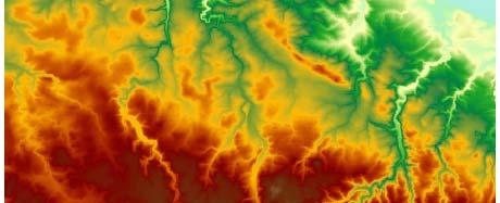
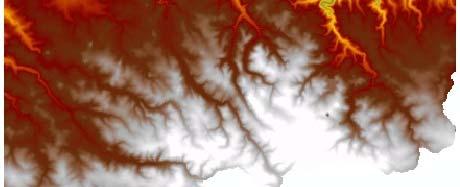
10 Case Study 1: Extensive Soil Erosion Input Data: Derivate of the Digital Elevation Model Slope DEM Saxony 5m RESAMPLED Slope [ ] Log Flow Accumulation Folie 10


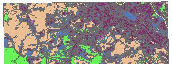
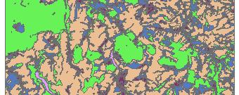
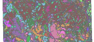
11 Case Study 1: Extensive Soil Erosion Input Data: Soil Map Fine Soil (Clay, Silt, Sand), Skeleton Soil Soil Map Fine Soil (Clay, Silt, Sand), Skeleton Soil Folie 11
 Forest, arable land, pastures,")
 Single raster for each land use")
12 Case Study 1: Extensive Soil Erosion Input Data: Land use (ATKIS, Biotope Type Mapping) Forest, arable land, pastures, wetland, etc. Land use (ATKIS, Biotope Types) Single raster for each land use class (Forest, arable land, pastures, wetland., etc.) Folie 12


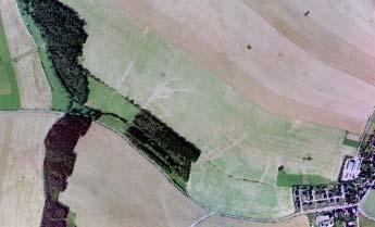
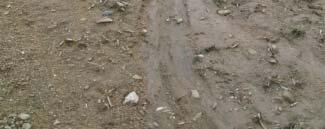
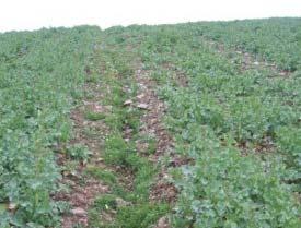
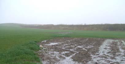
13 Case Study 1: Extensive Soil Erosion Training Data: Based on Aerial Images Mapping of Erosion Areas Aerial Images intense rainfall/flood 2002 Mapped Erosion Areas Folie 13


14 Case Study 1: Extensive Soil Erosion Input Data / Layers Training Data Weights Hidden Layers Output Layer Weights Result: Probability Validation Known Erosion Areas Folie 14


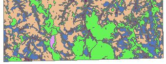
15 Case Study 1: Extensive Soil Erosion Input Data: Slope, Silt, Clay, Sand, Landuse, Flow Accumulation + Horizontal curvature Re-Modeled Erosion Areas: Training Areas ca. 80 % of known erosion areas with p>75% Test Area: ca. 90 % of known erosion areas with p>75% Probability: Folie 15
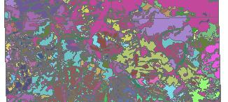
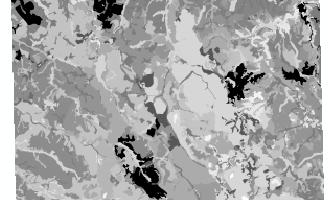
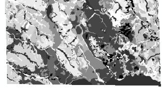
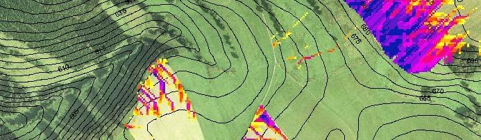
16 Case Study 1: Extensive Soil Erosion Folie 16


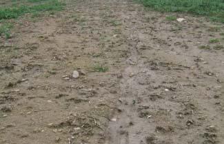
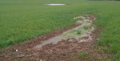
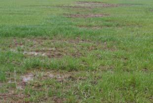
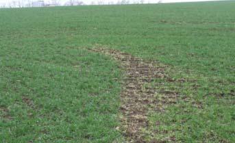
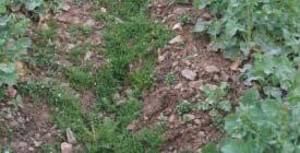
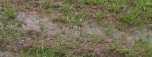
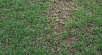
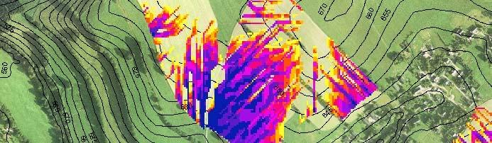
17 Case Study 1: Extensive Soil Erosion Validation of Prediction Results in the Field Folie 17


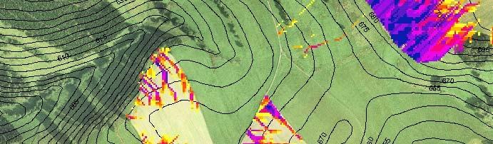
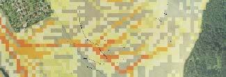
18 Case Study 1: Extensive Soil Erosion Optimization of Protection Measures Alteration of Input Data: DEM Folie 18


19 Case Study 2: Soil Creeping Input Data Elevation Model and its Derivates Geology: Lithology, Foliation Landuse Soil Types Training Data Known Areas with Sliding / Creeping Folie 19


20 Case Study 2: Soil Creeping A B Landslides Dip of the Foliation to N B A Folie 20


21 Case Study 3: Erosion Gullies Input Data Elevation Model and its Derivates Geology: Lithology, Foliation Landuse Soil Types Training Data Known Areas with Gullies Folie 21


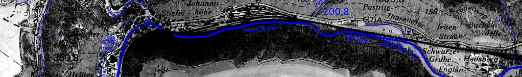
22 Case Study 4: Spread of Forest Pests Input Data: Elevation Model and its Derivates, Soil Map, Forest Inventory Data Training Data: Qualitative/ Quantitative Infection Data Investigation Area: Forests in Eastern Erzgebirge, Tharandter Wald Folie 22


23 Case Study 4: Spread of Forest Pests Average Result from a Total of 15 Different Models with Different Input Data Training Data: Infection Data 2008 Coded d as: Infected = 1 Rest= 0 No Endangerment Low Endangerment Medium Endangerment High Endangerment Very High Endangerment Folie 23


24 Case Study 4: Spread of Forest Pests Average Result from a Total of 15 Different Models with Different Input Data Training Data: Infection Data 2008 Coded d as: Infection Rate Infection Rate (m³/infection Area) Folie 24


 feu1 feu6 TK")
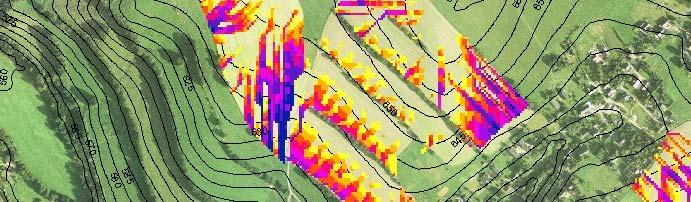
25 Case Study 5: Regionalization of Soil Parameters: Humidity Level Input Data: Elevation Model and its Derivates Soil Map Climate Data Landuse Training Data: Sounding Rods / Auger (1252 Points) feu1 feu6 TK 5046, 5047, 5146, 5147 Folie 25


26 Case Study 5: Regionalization of Soil Parameters: Humidity Level Additional Input Data: Climate Data Evaporation, Rainfall, Relative Humidity Evaporation [mm] Rainfall [mm] Relative Humidity [%] Folie 26


27 Case Study 5: Regionalization of Soil Parameters: Humidity Level Training Data: 1252 Sounding Rods / Auger with Humidity Level feu1 feu6 Folie 27
28 Case Study 5: Regionalization of Soil Parameters: Humidity Level Folie 28
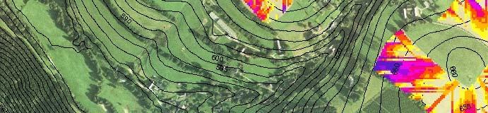
29 Case Study 5: Regionalization of Soil Parameters: Humidity Level Humidity Level Influence of Exposition (here: N-Hillside) and Climate (Rainfall Distribution) Folie 29
30 Case Study 5: Regionalization of Soil Parameters: Humidity Level Humidity Level Visible Gradient of Humidity Level within Biotope Types (here: Grassland) Folie 30


 h0 h7")
31 Case Study 6: Regionalization of Soil Parameters: Humus Level Input Data: Elevation Model and its Derivates Soil Map Climate Data Landuse Training Data: Sounding Rods / Auger (1725 Points) h0 h7 TK 5046, 5047, 5146, 5147 Folie 31
32 Case Study 6: Regionalization of Soil Parameters: Humus Level Humus Level Folie 32

![Parameters: TOC [%] Input](/docs-images/73/68686898/images/33-1.jpg "Data Elevation Model and")

 TOC [%] TK")
33 Case Study 7: Regionalization of Soil Parameters: TOC [%] Input Data Elevation Model and its Derivates Soil Map Landuse Training Data: Exploratory Soil Excavation (38 Points) TOC [%] TK 5046, 5047, 5146, 5147 Folie 33
34 Case Study 7: Regionalization of Soil Parameters: TOC [%] Folie 34
35 Case Study 7: Regionalization of Soil Parameters: TOC [%] 6 5 Berech Com hneter puted TOC [%] Gegebener TOC [%] Known TOC Folie 35


 VISION: Raster Soil map")

36 Outlook: Vision of a Rasterised Soilmap Humus Humidity TOC Fine Soil (Clay, Silt, Sand) Fine Skeleton Soil Coarse Skeleton Soil CURRENT: Vector Soil map with defined polygon boundaries with the same parameters inside id a polygon (without gradient) VISION: Raster Soil map with separate raster layers for each parameter and gradient inside the original polygon Folie 36


37 Outlook: Application of Artificial Neural Networks in Precision Farming Input Data: Various soil data Water balance data DEM and derivations Phenomena mapped from aerial images ECa maps Yield maps Possible Results Enhanced raster soil maps Prediction of pests All other spatial phenomena that are based on various controlling (spatial) factors Folie 37
38 Summary: Application of Artificial Neural Netwroks Various applications are possible, e.g.: Regionalization of soil parameters, Time series analysis, "Raster soil map, Analysis of influencing factors We are looking forward to your comments, knowledge sharing and collaboration! Folie 38
Geo-hazard Potential Mapping Using GIS and Artificial Intelligence
 Geo-hazard Potential Mapping Using GIS and Artificial Intelligence Theoretical Background and Uses Case from Namibia Andreas Knobloch 1, Dr Andreas Barth 1, Ellen Dickmayer 1, Israel Hasheela 2, Andreas
Introduction to Natural Computation. Lecture 9. Multilayer Perceptrons and Backpropagation. Peter Lewis
 Introduction to Natural Computation Lecture 9 Multilayer Perceptrons and Backpropagation Peter Lewis 1 / 25 Overview of the Lecture Why multilayer perceptrons? Some applications of multilayer perceptrons.
Response on Interactive comment by Anonymous Referee #1
 Response on Interactive comment by Anonymous Referee #1 Sajid Ali First, we would like to thank you for evaluation and highlighting the deficiencies in the manuscript. It is indeed valuable addition and
ECE521 Lectures 9 Fully Connected Neural Networks
 ECE521 Lectures 9 Fully Connected Neural Networks Outline Multi-class classification Learning multi-layer neural networks 2 Measuring distance in probability space We learnt that the squared L2 distance
What Do Neural Networks Do? MLP Lecture 3 Multi-layer networks 1
 What Do Neural Networks Do? MLP Lecture 3 Multi-layer networks 1 Multi-layer networks Steve Renals Machine Learning Practical MLP Lecture 3 7 October 2015 MLP Lecture 3 Multi-layer networks 2 What Do Single
WERENSKIOLD GLACIER (SW SPITSBERGEN) MORPHOMETRIC CHARACTERISTICS
 MORPHOMETRIC CHARACTERISTICS") WERENSKIOLD GLACIER (SW SPITSBERGEN) MORPHOMETRIC CHARACTERISTICS Abstract Małgorzata Wieczorek Instytut Geografii I Rozwoju Regionalnego Uniwersytet Wrocławski pl. Uniwersytecki 1 50-137 Wrocław POLAND
WERENSKIOLD GLACIER (SW SPITSBERGEN) MORPHOMETRIC CHARACTERISTICS Abstract Małgorzata Wieczorek Instytut Geografii I Rozwoju Regionalnego Uniwersytet Wrocławski pl. Uniwersytecki 1 50-137 Wrocław POLAND
ABSTRACT The first chapter Chapter two Chapter three Chapter four
 ABSTRACT The researches regarding this doctoral dissertation have been focused on the use of modern techniques and technologies of topography for the inventory and record keeping of land reclamation. The
Neural Networks. Chapter 18, Section 7. TB Artificial Intelligence. Slides from AIMA 1/ 21
 Neural Networks Chapter 8, Section 7 TB Artificial Intelligence Slides from AIMA http://aima.cs.berkeley.edu / 2 Outline Brains Neural networks Perceptrons Multilayer perceptrons Applications of neural
COMMON GIS TECHNIQUES FOR VECTOR AND RASTER DATA PROCESSING. Ophelia Wang, Department of Geography and the Environment, University of Texas
 COMMON GIS TECHNIQUES FOR VECTOR AND RASTER DATA PROCESSING Ophelia Wang, Department of Geography and the Environment, University of Texas PART I: BASIC VECTOR TOOLS CLIP A FEATURE BASED ON THE EXTENT
2013 Esri Europe, Middle East and Africa User Conference October 23-25, 2013 Munich, Germany
 2013 Esri Europe, Middle East and Africa User Conference October 23-25, 2013 Munich, Germany Environmental and Disaster Management System in the Valles Altos Region in Carabobo / NW-Venezuela Prof.Dr.habil.Barbara
GEOMATICS. Shaping our world. A company of
 GEOMATICS Shaping our world A company of OUR EXPERTISE Geomatics Geomatics plays a mayor role in hydropower, land and water resources, urban development, transport & mobility, renewable energy, and infrastructure
GEOGRAPHIC INFORMATION SYSTEMS (GIS)
") AN INTRODUCTION TO GEOGRAPHIC INFORMATION SYSTEMS (GIS) Joana Magos Brehm 1, Ali Shehadeh 2 1 Botanical Garden, National Museum of Natural History, University of Lisbon (Portugal) 2 Genetic Resources Unit,
AN INTRODUCTION TO GEOGRAPHIC INFORMATION SYSTEMS (GIS) Joana Magos Brehm 1, Ali Shehadeh 2 1 Botanical Garden, National Museum of Natural History, University of Lisbon (Portugal) 2 Genetic Resources Unit,
Deep Learning Architecture for Univariate Time Series Forecasting
 CS229,Technical Report, 2014 Deep Learning Architecture for Univariate Time Series Forecasting Dmitry Vengertsev 1 Abstract This paper studies the problem of applying machine learning with deep architecture
CS:4420 Artificial Intelligence
 CS:4420 Artificial Intelligence Spring 2018 Neural Networks Cesare Tinelli The University of Iowa Copyright 2004 18, Cesare Tinelli and Stuart Russell a a These notes were originally developed by Stuart
Artificial Neural Network
 Artificial Neural Network Contents 2 What is ANN? Biological Neuron Structure of Neuron Types of Neuron Models of Neuron Analogy with human NN Perceptron OCR Multilayer Neural Network Back propagation
Artificial neural networks
 Artificial neural networks Chapter 8, Section 7 Artificial Intelligence, spring 203, Peter Ljunglöf; based on AIMA Slides c Stuart Russel and Peter Norvig, 2004 Chapter 8, Section 7 Outline Brains Neural
EPL442: Computational
 EPL442: Computational Learning Systems Lab 2 Vassilis Vassiliades Department of Computer Science University of Cyprus Outline Artificial Neuron Feedforward Neural Network Back-propagation Algorithm Notes
PROANA A USEFUL SOFTWARE FOR TERRAIN ANALYSIS AND GEOENVIRONMENTAL APPLICATIONS STUDY CASE ON THE GEODYNAMIC EVOLUTION OF ARGOLIS PENINSULA, GREECE.
 PROANA A USEFUL SOFTWARE FOR TERRAIN ANALYSIS AND GEOENVIRONMENTAL APPLICATIONS STUDY CASE ON THE GEODYNAMIC EVOLUTION OF ARGOLIS PENINSULA, GREECE. Spyridoula Vassilopoulou * Institute of Cartography
Wetland Mapping. Wetland Mapping in the United States. State Wetland Losses 53% in Lower US. Matthew J. Gray University of Tennessee
 Wetland Mapping Caribbean Matthew J. Gray University of Tennessee Wetland Mapping in the United States Shaw and Fredine (1956) National Wetlands Inventory U.S. Fish and Wildlife Service is the principle
Floodplain modeling. Ovidius University of Constanta (P4) Romania & Technological Educational Institute of Serres, Greece
 Romania & Technological Educational Institute of Serres, Greece") Floodplain modeling Ovidius University of Constanta (P4) Romania & Technological Educational Institute of Serres, Greece Scientific Staff: Dr Carmen Maftei, Professor, Civil Engineering Dept. Dr Konstantinos
Floodplain modeling Ovidius University of Constanta (P4) Romania & Technological Educational Institute of Serres, Greece Scientific Staff: Dr Carmen Maftei, Professor, Civil Engineering Dept. Dr Konstantinos
Deep Neural Networks (1) Hidden layers; Back-propagation
 Hidden layers; Back-propagation") Deep Neural Networs (1) Hidden layers; Bac-propagation Steve Renals Machine Learning Practical MLP Lecture 3 4 October 2017 / 9 October 2017 MLP Lecture 3 Deep Neural Networs (1) 1 Recap: Softmax single
Deep Neural Networs (1) Hidden layers; Bac-propagation Steve Renals Machine Learning Practical MLP Lecture 3 4 October 2017 / 9 October 2017 MLP Lecture 3 Deep Neural Networs (1) 1 Recap: Softmax single
Eyes in the Sky & Data Analysis.
 Eyes in the Sky & Data Analysis How can we collect Information about Earth Climbing up Trees & Mountains Gathering Food Self Protection Understanding Surroundings By Travelling Collected Information Converted
ARTIFICIAL NEURAL NETWORKS گروه مطالعاتي 17 بهار 92
 ARTIFICIAL NEURAL NETWORKS گروه مطالعاتي 17 بهار 92 BIOLOGICAL INSPIRATIONS Some numbers The human brain contains about 10 billion nerve cells (neurons) Each neuron is connected to the others through 10000
Multilayer Perceptrons and Backpropagation
 Multilayer Perceptrons and Backpropagation Informatics 1 CG: Lecture 7 Chris Lucas School of Informatics University of Edinburgh January 31, 2017 (Slides adapted from Mirella Lapata s.) 1 / 33 Reading:
Introduction to GIS I
 Introduction to GIS Introduction How to answer geographical questions such as follows: What is the population of a particular city? What are the characteristics of the soils in a particular land parcel?
An Introduction to Geographic Information System
 An Introduction to Geographic Information System PROF. Dr. Yuji MURAYAMA Khun Kyaw Aung Hein 1 July 21,2010 GIS: A Formal Definition A system for capturing, storing, checking, Integrating, manipulating,
Raster Spatial Analysis Specific Theory
 RSATheory.doc 1 Raster Spatial Analysis Specific Theory... 1 Spatial resampling... 1 Mosaic... 3 Reclassification... 4 Slicing... 4 Zonal Operations... 5 References... 5 Raster Spatial Analysis Specific
Neural Networks biological neuron artificial neuron 1
 Neural Networks biological neuron artificial neuron 1 A two-layer neural network Output layer (activation represents classification) Weighted connections Hidden layer ( internal representation ) Input
ARTIFICIAL NEURAL NETWORK PART I HANIEH BORHANAZAD
 ARTIFICIAL NEURAL NETWORK PART I HANIEH BORHANAZAD WHAT IS A NEURAL NETWORK? The simplest definition of a neural network, more properly referred to as an 'artificial' neural network (ANN), is provided
Geo-spatial Analysis for Prediction of River Floods
 Geo-spatial Analysis for Prediction of River Floods Abstract. Due to the serious climate change, severe weather conditions constantly change the environment s phenomena. Floods turned out to be one of
Workshops funded by the Minnesota Environment and Natural Resources Trust Fund
 Workshops funded by the Minnesota Environment and Natural Resources Trust Fund Conservation Applications of LiDAR Data Workshops funded by: Minnesota Environment and Natural Resources Trust Fund Presented
MAPPING POTENTIAL LAND DEGRADATION IN BHUTAN
 MAPPING POTENTIAL LAND DEGRADATION IN BHUTAN Moe Myint, Geoinformatics Consultant Rue du Midi-8, CH-1196, Gland, Switzerland moemyint@bluewin.ch Pema Thinley, GIS Analyst Renewable Natural Resources Research
LAND CHANGE MODELER SOFTWARE FOR ARCGIS
 LAND CHANGE MODELER SOFTWARE FOR ARCGIS The Land Change Modeler is revolutionary land cover change analysis and prediction software which also incorporates tools that allow you to analyze, measure and
Neural Networks and the Back-propagation Algorithm
 Neural Networks and the Back-propagation Algorithm Francisco S. Melo In these notes, we provide a brief overview of the main concepts concerning neural networks and the back-propagation algorithm. We closely
Geo 327G Semester Project. Landslide Suitability Assessment of Olympic National Park, WA. Fall Shane Lewis
 Geo 327G Semester Project Landslide Suitability Assessment of Olympic National Park, WA Fall 2011 Shane Lewis 1 I. Problem Landslides cause millions of dollars of damage nationally every year, and are
Data Mining Part 5. Prediction
 Data Mining Part 5. Prediction 5.5. Spring 2010 Instructor: Dr. Masoud Yaghini Outline How the Brain Works Artificial Neural Networks Simple Computing Elements Feed-Forward Networks Perceptrons (Single-layer,
Biosphere. All living things, plants, animals, (even you!) are part of the zone of the earth called the biosphere.
 are part of the zone of the earth called the biosphere.") Unit 1 Study Guide Earth s Spheres Biosphere All living things, plants, animals, (even you!) are part of the zone of the earth called the biosphere. Hydrosphere Water covers ¾ of the earth, made up mostly
Unit 1 Study Guide Earth s Spheres Biosphere All living things, plants, animals, (even you!) are part of the zone of the earth called the biosphere. Hydrosphere Water covers ¾ of the earth, made up mostly
Existing NWS Flash Flood Guidance
 Introduction The Flash Flood Potential Index (FFPI) incorporates physiographic characteristics of an individual drainage basin to determine its hydrologic response. In flash flood situations, the hydrologic
CSE 352 (AI) LECTURE NOTES Professor Anita Wasilewska. NEURAL NETWORKS Learning
 LECTURE NOTES Professor Anita Wasilewska. NEURAL NETWORKS Learning") CSE 352 (AI) LECTURE NOTES Professor Anita Wasilewska NEURAL NETWORKS Learning Neural Networks Classifier Short Presentation INPUT: classification data, i.e. it contains an classification (class) attribute.
CSE 352 (AI) LECTURE NOTES Professor Anita Wasilewska NEURAL NETWORKS Learning Neural Networks Classifier Short Presentation INPUT: classification data, i.e. it contains an classification (class) attribute.
Lab 5: 16 th April Exercises on Neural Networks
 Lab 5: 16 th April 01 Exercises on Neural Networks 1. What are the values of weights w 0, w 1, and w for the perceptron whose decision surface is illustrated in the figure? Assume the surface crosses the
Popular Mechanics, 1954
 Introduction to GIS Popular Mechanics, 1954 1986 $2,599 1 MB of RAM 2017, $750, 128 GB memory, 2 GB of RAM Computing power has increased exponentially over the past 30 years, Allowing the existence of
22c145-Fall 01: Neural Networks. Neural Networks. Readings: Chapter 19 of Russell & Norvig. Cesare Tinelli 1
 Neural Networks Readings: Chapter 19 of Russell & Norvig. Cesare Tinelli 1 Brains as Computational Devices Brains advantages with respect to digital computers: Massively parallel Fault-tolerant Reliable
Welcome to NR502 GIS Applications in Natural Resources. You can take this course for 1 or 2 credits. There is also an option for 3 credits.
 Welcome to NR502 GIS Applications in Natural Resources. You can take this course for 1 or 2 credits. There is also an option for 3 credits. The 1st credit consists of a series of readings, demonstration,
GIS Application in Landslide Hazard Analysis An Example from the Shihmen Reservoir Catchment Area in Northern Taiwan
 GIS Application in Landslide Hazard Analysis An Example from the Shihmen Reservoir Catchment Area in Northern Taiwan Chyi-Tyi Lee Institute of Applied Geology, National Central University, No.300, Jungda
Delineation of high landslide risk areas as a result of land cover, slope, and geology in San Mateo County, California
 Delineation of high landslide risk areas as a result of land cover, slope, and geology in San Mateo County, California Introduction Problem Overview This project attempts to delineate the high-risk areas
GIS Viewshed Analysis to Identify Zones of Potential Visual Impact on Protected Landscapes
 GIS Viewshed Analysis to Identify Zones of Potential Visual Impact on Protected Landscapes Background Natural England is consulted by local planning authorities on increasing numbers of development proposals,
Aldo Ferrero, Francesco Vidotto, Fernando De Palo. RUNOFF team
 TOPPS ACADEMY 15-1818 th June 2015 Grugliasco (TO) Aldo Ferrero, Francesco Vidotto, Fernando De Palo RUNOFF team DIAGNOSIS what data do we need? collection of territorial data (soils, elevation, slope,
Summary Description Municipality of Anchorage. Anchorage Coastal Resource Atlas Project
 Summary Description Municipality of Anchorage Anchorage Coastal Resource Atlas Project By: Thede Tobish, MOA Planner; and Charlie Barnwell, MOA GIS Manager Introduction Local governments often struggle
INTRODUCTION TO ARCGIS 10
 Department of Irrigation, Drainage and Landscape Engineering, Faculty of Civil Engineering, CTU Prague Institute of Hydraulics and Rural Water Management BOKU Vienna INTRODUCTION TO ARCGIS 10 MAIN WINDOW
Neural networks. Chapter 19, Sections 1 5 1
 Neural networks Chapter 19, Sections 1 5 Chapter 19, Sections 1 5 1 Outline Brains Neural networks Perceptrons Multilayer perceptrons Applications of neural networks Chapter 19, Sections 1 5 2 Brains 10
Geog 469 GIS Workshop. Data Analysis
 Geog 469 GIS Workshop Data Analysis Outline 1. What kinds of need-to-know questions can be addressed using GIS data analysis? 2. What is a typology of GIS operations? 3. What kinds of operations are useful
EO Information Services. Assessing Vulnerability in the metropolitan area of Rio de Janeiro (Floods & Landslides) Project
 Project") EO Information Services in support of Assessing Vulnerability in the metropolitan area of Rio de Janeiro (Floods & Landslides) Project Ricardo Armas, Critical Software SA Haris Kontoes, ISARS NOA World
EO Information Services in support of Assessing Vulnerability in the metropolitan area of Rio de Janeiro (Floods & Landslides) Project Ricardo Armas, Critical Software SA Haris Kontoes, ISARS NOA World
Development of Webbased. Tool for Tennessee
 Development of Webbased Farm Mapping Tool for Tennessee Southern Region Water Quality Conference, Oct. 24 2005 Forbes Walker and Alan Jolly Biosystems Engineering and SOIL SCIENCE Nutrient Management Planning
Watershed Modeling With DEMs
 Watershed Modeling With DEMs Lesson 6 6-1 Objectives Use DEMs for watershed delineation. Explain the relationship between DEMs and feature objects. Use WMS to compute geometric basin data from a delineated
ANUELA. Nature Conservation Management for Sustainable Agriculture.
 ANUELA Nature Conservation Management for Sustainable Agriculture Content Seite 2 Background: Why MANUELA? 3 Structure of the system (Modules, Desktop view, Techn. details) 4 Presentation of modules 8
Deep Neural Networks (1) Hidden layers; Back-propagation
 Hidden layers; Back-propagation") Deep Neural Networs (1) Hidden layers; Bac-propagation Steve Renals Machine Learning Practical MLP Lecture 3 2 October 2018 http://www.inf.ed.ac.u/teaching/courses/mlp/ MLP Lecture 3 / 2 October 2018 Deep
Deep Neural Networs (1) Hidden layers; Bac-propagation Steve Renals Machine Learning Practical MLP Lecture 3 2 October 2018 http://www.inf.ed.ac.u/teaching/courses/mlp/ MLP Lecture 3 / 2 October 2018 Deep
Projecting a Gully on Wilson Ranch Meadow, Eldorado National Forest By David Russell and Angelina Lasko Humboldt State University
 Projecting a Gully on Wilson Ranch Meadow, Eldorado National Forest By David Russell and Angelina Lasko Humboldt State University Introduction The purpose of this project is to create a digital elevation
Management of Geological Information for Mining Sector Development and Investment Attraction Examples from Uganda and Tanzania
 Mineral Wealth Conference 2016 Kampala / Uganda Management of Geological Information for Mining Sector Development and Investment Attraction Examples from Uganda and Tanzania Andreas Barth 1, Andreas Knobloch
Relative soil vulnerability and patterns of erosion during the muddy floods of on the South Downs, Sussex, UK
 Relative soil vulnerability and patterns of erosion during the muddy floods of 2000-2001 on the South Downs, Sussex, UK Hazel Faulkner, Jose Luis Ruiz & John Boardman South Downs East Sussex Due to a long
CSE446: Neural Networks Spring Many slides are adapted from Carlos Guestrin and Luke Zettlemoyer
 CSE446: Neural Networks Spring 2017 Many slides are adapted from Carlos Guestrin and Luke Zettlemoyer Human Neurons Switching time ~ 0.001 second Number of neurons 10 10 Connections per neuron 10 4-5 Scene
Landslide Susceptibility Mapping Using Logistic Regression in Garut District, West Java, Indonesia
 Landslide Susceptibility Mapping Using Logistic Regression in Garut District, West Java, Indonesia N. Lakmal Deshapriya 1, Udhi Catur Nugroho 2, Sesa Wiguna 3, Manzul Hazarika 1, Lal Samarakoon 1 1 Geoinformatics
GIS and Remote Sensing
 Spring School Land use and the vulnerability of socio-ecosystems to climate change: remote sensing and modelling techniques GIS and Remote Sensing Katerina Tzavella Project Researcher PhD candidate Technology
Introduction-Overview. Why use a GIS? What can a GIS do? Spatial (coordinate) data model Relational (tabular) data model
 data model Relational (tabular) data model") Introduction-Overview Why use a GIS? What can a GIS do? How does a GIS work? GIS definitions Spatial (coordinate) data model Relational (tabular) data model intro_gis.ppt 1 Why use a GIS? An extension
Introduction-Overview Why use a GIS? What can a GIS do? How does a GIS work? GIS definitions Spatial (coordinate) data model Relational (tabular) data model intro_gis.ppt 1 Why use a GIS? An extension
COMP 551 Applied Machine Learning Lecture 14: Neural Networks
 COMP 551 Applied Machine Learning Lecture 14: Neural Networks Instructor: Ryan Lowe (ryan.lowe@mail.mcgill.ca) Slides mostly by: Class web page: www.cs.mcgill.ca/~hvanho2/comp551 Unless otherwise noted,
Artificial Intelligence (AI) Common AI Methods. Training. Signals to Perceptrons. Artificial Neural Networks (ANN) Artificial Intelligence
 Common AI Methods. Training. Signals to Perceptrons. Artificial Neural Networks (ANN) Artificial Intelligence") Artificial Intelligence (AI) Artificial Intelligence AI is an attempt to reproduce intelligent reasoning using machines * * H. M. Cartwright, Applications of Artificial Intelligence in Chemistry, 1993,
Artificial Intelligence (AI) Artificial Intelligence AI is an attempt to reproduce intelligent reasoning using machines * * H. M. Cartwright, Applications of Artificial Intelligence in Chemistry, 1993,
Application and Challenges of Artificial Intelligence in Exploration
 Application and Challenges of Artificial Intelligence in Exploration XPLOR 2017 John McGaughey 2017 Mira Geoscience Ltd. Artificial Intelligence Artificial Intelligence is colossally hyped these days,
Lecture 4: Perceptrons and Multilayer Perceptrons
 Lecture 4: Perceptrons and Multilayer Perceptrons Cognitive Systems II - Machine Learning SS 2005 Part I: Basic Approaches of Concept Learning Perceptrons, Artificial Neuronal Networks Lecture 4: Perceptrons
Gully erosion and associated risks in the Tutova basin Moldavian Plateau
 Landform Analysis, Vol. 17: 193 197 (2011) Gully erosion and associated risks in the Tutova basin Moldavian Plateau University Alexandru Ioan Cuza of Iasi, Department of Geography, Romania, e-mail: catiul@yahoo.com
Machine Learning. Neural Networks. (slides from Domingos, Pardo, others)
") Machine Learning Neural Networks (slides from Domingos, Pardo, others) For this week, Reading Chapter 4: Neural Networks (Mitchell, 1997) See Canvas For subsequent weeks: Scaling Learning Algorithms toward
Machine Learning Neural Networks (slides from Domingos, Pardo, others) For this week, Reading Chapter 4: Neural Networks (Mitchell, 1997) See Canvas For subsequent weeks: Scaling Learning Algorithms toward
Unconsolidated Undrained Shear Strength Of Remoulded Clays By Anns Technique
 Unconsolidated Undrained Shear Strength Of Remoulded Clays By Anns Technique Jain Rajeev Associate Professor S.A.T.I. VIDISHA (M.P.) India Sharma Pramod Associate Professor S.A.T.I. VIDISHA (M.P.) India
Engineering Part IIB: Module 4F10 Statistical Pattern Processing Lecture 6: Multi-Layer Perceptrons I
 Engineering Part IIB: Module 4F10 Statistical Pattern Processing Lecture 6: Multi-Layer Perceptrons I Phil Woodland: pcw@eng.cam.ac.uk Michaelmas 2012 Engineering Part IIB: Module 4F10 Introduction In
Estimation of Reference Evapotranspiration by Artificial Neural Network
 Estimation of Reference Evapotranspiration by Artificial Neural Network A. D. Bhagat 1, P. G. Popale 2 PhD Scholar, Department of Irrigation and Drainage Engineering, Dr. ASCAE&T, Mahatma Phule Krishi
Understanding Earth Fifth Edition
 Understanding Earth Fifth Edition Grotzinger Jordan Press Siever Chapter 16: WEATHERING, EROSION, AND MASS WASTING Interface Between Climate and Tectonics Lecturer: H Mohammadzadeh Assistant professors,
GlobalSoilMap.net. a new digital soil map of the world. Alfred Hartemink (on behalf of the global consortium) ISRIC World Soil Information Wageningen
 ISRIC World Soil Information Wageningen") GlobalSoilMap.net a new digital soil map of the world Alfred Hartemink (on behalf of the global consortium) ISRIC World Soil Information Wageningen The use of soil information GlobalSoilMap.net A digital
GlobalSoilMap.net a new digital soil map of the world Alfred Hartemink (on behalf of the global consortium) ISRIC World Soil Information Wageningen The use of soil information GlobalSoilMap.net A digital
Practical reliability approach to urban slope stability
 University of Wollongong Research Online Faculty of Engineering - Papers (Archive) Faculty of Engineering and Information Sciences 2011 Practical reliability approach to urban slope stability R. Chowdhury
Unit 8: Introduction to neural networks. Perceptrons
 Unit 8: Introduction to neural networks. Perceptrons D. Balbontín Noval F. J. Martín Mateos J. L. Ruiz Reina A. Riscos Núñez Departamento de Ciencias de la Computación e Inteligencia Artificial Universidad
Neural Networks, Computation Graphs. CMSC 470 Marine Carpuat
 Neural Networks, Computation Graphs CMSC 470 Marine Carpuat Binary Classification with a Multi-layer Perceptron φ A = 1 φ site = 1 φ located = 1 φ Maizuru = 1 φ, = 2 φ in = 1 φ Kyoto = 1 φ priest = 0 φ
Applying Hazard Maps to Urban Planning
 Applying Hazard Maps to Urban Planning September 10th, 2014 SAKAI Yuko Disaster Management Expert JICA Study Team for the Metro Cebu Roadmap Study on the Sustainable Urban Development 1 Contents 1. Outline
Neural Networks Lecturer: J. Matas Authors: J. Matas, B. Flach, O. Drbohlav
 Neural Networks 30.11.2015 Lecturer: J. Matas Authors: J. Matas, B. Flach, O. Drbohlav 1 Talk Outline Perceptron Combining neurons to a network Neural network, processing input to an output Learning Cost
C) D) 3. Which graph best represents the relationship between soil particle size and the rate at which water infiltrates permeable soil?
 D) 3. Which graph best represents the relationship between soil particle size and the rate at which water infiltrates permeable soil?") 1. Which earth material covering the surface of a landfill would permit the least amount of rainwater to infiltrate the surface? A) silt B) clay C) sand D) pebbles 2. Which graph best represents the relationship
1. Which earth material covering the surface of a landfill would permit the least amount of rainwater to infiltrate the surface? A) silt B) clay C) sand D) pebbles 2. Which graph best represents the relationship
Artificial Neural Networks" and Nonparametric Methods" CMPSCI 383 Nov 17, 2011!
 Artificial Neural Networks" and Nonparametric Methods" CMPSCI 383 Nov 17, 2011! 1 Todayʼs lecture" How the brain works (!)! Artificial neural networks! Perceptrons! Multilayer feed-forward networks! Error
EFFECT OF ANCILLARY DATA ON THE PERFORMANCE OF LAND COVER CLASSIFICATION USING A NEURAL NETWORK MODEL. Duong Dang KHOI.
 EFFECT OF ANCILLARY DATA ON THE PERFORMANCE OF LAND COVER CLASSIFICATION USING A NEURAL NETWORK MODEL Duong Dang KHOI 1 10 Feb, 2011 Presentation contents 1. Introduction 2. Methods 3. Results 4. Discussion
Potential and Accuracy of Digital Landscape Analysis based on high resolution remote sensing data
 'Spatial Information for Sustainable Management of Urban Areas' Mainz, 2-4 February 2009, Germany Potential and Accuracy of Digital Landscape Analysis based on high resolution remote sensing data Dr. Matthias
Neural Networks and Ensemble Methods for Classification
 Neural Networks and Ensemble Methods for Classification NEURAL NETWORKS 2 Neural Networks A neural network is a set of connected input/output units (neurons) where each connection has a weight associated
Introduction to Neural Networks
 CUONG TUAN NGUYEN SEIJI HOTTA MASAKI NAKAGAWA Tokyo University of Agriculture and Technology Copyright by Nguyen, Hotta and Nakagawa 1 Pattern classification Which category of an input? Example: Character
Neural networks. Chapter 20, Section 5 1
 Neural networks Chapter 20, Section 5 Chapter 20, Section 5 Outline Brains Neural networks Perceptrons Multilayer perceptrons Applications of neural networks Chapter 20, Section 5 2 Brains 0 neurons of
a system for input, storage, manipulation, and output of geographic information. GIS combines software with hardware,
 Introduction to GIS Dr. Pranjit Kr. Sarma Assistant Professor Department of Geography Mangaldi College Mobile: +91 94357 04398 What is a GIS a system for input, storage, manipulation, and output of geographic
Pierce Cedar Creek Institute GIS Development Final Report. Grand Valley State University
 Pierce Cedar Creek Institute GIS Development Final Report Grand Valley State University Major Goals of Project The two primary goals of the project were to provide Matt VanPortfliet, GVSU student, the
Remote Sensing and GIS Applications for Hilly Watersheds SUBASHISA DUTTA DEPARTMENT OF CIVIL ENGINEERING IIT GUWAHATI
 Remote Sensing and GIS Applications for Hilly Watersheds SUBASHISA DUTTA DEPARTMENT OF CIVIL ENGINEERING IIT GUWAHATI Deciding Alternative Land Use Options in a Watershed Using GIS Source: Anita Prakash
Chapter 11 10/30/2013. Mass Wasting. Introduction. Factors That Influence Mass Wasting. Introduction. Factors That Influence Mass Wasting
 Introduction Chapter 11 Mass wasting - The downslope movement of material resulting from the force of gravity. Mass Wasting Mass wasting results when the force of gravity acting on a slope exceeds the
Spatial Concepts: Data Models 2
 Spatial Concepts: Data Models 2 2009/2010 CGI GIRS 2/31 Data modeling in 4 steps 1. Geographical perception Continuous phenomenon Discrete phenomena Virtual boundaries Tangible boundaries altitude, EM
Unit III. A Survey of Neural Network Model
 Unit III A Survey of Neural Network Model 1 Single Layer Perceptron Perceptron the first adaptive network architecture was invented by Frank Rosenblatt in 1957. It can be used for the classification of
The Soils and Land Capability for Agriculture. Land North of Aberdeen, Aberdeenshire
 The Soils and Land Capability for Agriculture Of Land North of Aberdeen, Aberdeenshire Report prepared for Peter Radmall Associates May 2012 Reading Agricultural Consultants Ltd Beechwood Court, Long Toll,
) (d o f. For the previous layer in a neural network (just the rightmost layer if a single neuron), the required update equation is: 2.
 (d o f. For the previous layer in a neural network (just the rightmost layer if a single neuron), the required update equation is: 2.") 1 Massachusetts Institute of Technology Department of Electrical Engineering and Computer Science 6.034 Artificial Intelligence, Fall 2011 Recitation 8, November 3 Corrected Version & (most) solutions
1 Massachusetts Institute of Technology Department of Electrical Engineering and Computer Science 6.034 Artificial Intelligence, Fall 2011 Recitation 8, November 3 Corrected Version & (most) solutions
Overview of the Czech national datasets for new database
 Overview of the Czech national datasets for new database J.Kozák, V. Penížek, T. Zádorová R. Vašát, A. Rubešová Czech University of Life Sciences Prague Soil information resources Soil geodatabase 1:1M
Mechanical Weathering
 Weathering is the disintegration and decomposition of material at or near the surface. Erosion is the incorporation and transportation of material by a mobile agent, usually water, wind, or ice. Geologists
Neural Networks Introduction
 Neural Networks Introduction H.A Talebi Farzaneh Abdollahi Department of Electrical Engineering Amirkabir University of Technology Winter 2011 H. A. Talebi, Farzaneh Abdollahi Neural Networks 1/22 Biological
Landslide Susceptibility, Hazard, and Risk Assessment. Twin Hosea W. K. Advisor: Prof. C.T. Lee
 Landslide Susceptibility, Hazard, and Risk Assessment Twin Hosea W. K. Advisor: Prof. C.T. Lee Date: 2018/05/24 1 OUTLINE INTRODUCTION LANDSLIDE HAZARD ASSESSTMENT LOGISTIC REGRESSION IN LSA STUDY CASE
The Evolution of NWI Mapping and How It Has Changed Since Inception
 The Evolution of NWI Mapping and How It Has Changed Since Inception Some Basic NWI Facts: Established in 1974 Goal to create database on characteristics and extent of U.S. wetlands Maps & Statistics In
Assessment of the Incidence of Landslides Using Numerical Information
 PAPER Assessment of the Incidence of Landslides Using Numerical Information Atsushi HASEGAWA Takehiro OHTA, Dr. Sci. Assistant Senior Researcher, Senior Researcher, Laboratory Head, Geology Laboratory,