Geo-Sciences and International Studies
|
|
|
- Victor Dawson
- 5 years ago
- Views:
Transcription
1 Geo-Sciences and International Studies September 01, 2011 PRESENTATION BY Ambrish Dhaka Associate Professor CSCSEASWPS School of International Studies Jawaharlal Nehru University New Delhi
2 Geography Place, People and Regions The social imprints are visible in terms of physical characteristics of the location that makes it distinctly visible marking spatial social differentiation. Patrick Geddes worked out the concept of locational uniqueness of the place and its socio-economic ecology as distinctly visible. People refer to economic, social and cultural organization of space. It can be said that urban spaces viewed on an imagery are regions representing place, work and folk. 2
3 Organization of Space The Area/Region in such a backdrop is the physical organization of space that is host to a community with physical and socio-political structures. The community is linked with the physical world in terms of economic activity. The identification of such area have a history of delimitation and nomenclaturepays, narods, nation-state, lebensraum and others. The functional and formal delimitation is one of the problem of Area Studies. 3
4 Cognitive Area Organization of Space An area is usually taken as a source of information and its elements are used by cartographic sciences to produce knowledge. Maps have been thematically drawn for delimiting the cultural regions, the networks and also symbolize the various socio-cultural attributes on maps. The question of representation is revisited with new scientific and technological developments, viz., RS-GIS that has effectively reduced the time-lag and made location almost synonymous to temporal attribute of action. 4
5 The Information There is regular census, sampling of population to know the organization of an area as economic space. The social indicators are also recorded to spatially differentiate the cultural areas. The processes both progressive and regressive are also recorded through media information. Despite all this one really sees that field visit of an area is qualitatively different experience than what is derived through the host of information. 5
6 What is Remote Sensing? Remote sensing- obtaining information about objects or areas by using electromagnetic radiation (light) without being in direct contact with the object or area. The human eyes register the solar light reflected by these objects and your brains interpret the colours, the grey tones and intensity variations. The human eye however is limited to a small part of the total electromagnetic spectrum i.e. approximately 400 to 700 nm. In remote sensing various kinds of tools and devices are used to make electromagnetic radiation outside this range visible to the human eye, especially the near infrared, middle infrared, thermal infrared and microwaves. Next, these data are translated into useful information. --STEVEN M. DE JONG & FREEK D. VAN DER MEER 6

7 Image A tool of Representation 7

8 Image A tool of Representation 8

9 Image A tool of Representation 9

10 Image A tool of Representation 10
11 What is GIS? Art of Decision Making- GIS acronym for Geographic Information Systems use cartographic methods to create a communication system of information that is selectively needed for processing a hierarchy of information. Places, people connect to each other. They form networks. There is a hierarchy of networks. They create virtual spaces and time-bound spatial planes. The representation of these thematic planes cannot be viewed by any spectrum of light. It can only be symbolized with qualitative denomination given to a symbol. GIS is a communication of these virtual maps through computers and map representations. 11

12 Communication of Representation 12

13 Communication of Representation 13
14 Some Applications of GIS in Area Studies 14

15 Prevention of Terrorism Client: National Memorial Institute for the Prevention of Terrorism Summary: In 1999, Integral GIS received a call from a loosely connected group of people associated with the National Memorial Institute for the Prevention of Terrorism. They were developing a forensic analysis program examining the Oklahoma City Bombing. Results: Integral GIS created a suite of applications called the Oklahoma City Bombing Injury Study (OBIS). 15
16 Representing Maps 16

17 Representing Maps 17

18 Cities and borders Central Asia Police stations, tax offices, the prosecutor's office and the customs terminal were set ablaze in the town of Korasuv, on the border of Uzbekistan and Kyrgyzstan, the Russian news agency Itar- Tass reported. About 5,000 people fled there Saturday from Andijon, 30 miles to the west, it said. Hundreds more fled to at least one other border-crossing site. (MAY 15, 2005) UZBEK-KHYRGYZ BORDER 18

19 Cities and conflict Central Asia 19

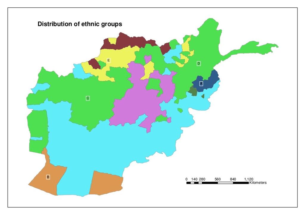
20 Tracing Opium cultivation in Afghanistan 20

21 Sri Lanka IDP shelters Feb 6 March 21

22 Buffering the range - Pakistan HAFT I M-II GHAURI 80KM 300KM 1,900KM 22

23 Nuclear sites - Pakistan 23

24 Drones Theatre Concept of War 24

25 Drones Theatre Concept of War 25

26 Soldier System Theatre Concept of War About 15,000 Soviet Afghantsy died during the decade long Afghan War and only 1600 US soldiers have during the same period. 26
27 Power and Information Technology Time and Space are key to power relations. The technological pursuits focus to jacket in more and more time and space into smaller dimensions. The role of technology can only be appreciated by developing research methods using them. Modern day international politics and the power relations are having these as sub-stratum governing all super-structure visible forms be they norms or values. 27
28 Power and Information Technology Under modern technological conditions, international conflict, even if short, as in the six-day Arab-Israeli War of June 1967, costs many lives and threatens escalation to nuclear war which might decimate the human race. It deserves to study to understand the causes and conditions of its initiations and escalation, and the means and procedures which might control and terminate particular conflict situations. The world needs both a pure science and an applied science of conflict. Prof. Quincy Wright in The Social Sciences and International Conflict. 28
29 Thanks! 29
DEPARTMENT OF GEOGRAPHY B.A. PROGRAMME COURSE DESCRIPTION
 DEPARTMENT OF GEOGRAPHY B.A. PROGRAMME COURSE DESCRIPTION (3 Cr. Hrs) (2340100) Geography of Jordan (University Requirement) This Course pursues the following objectives: - The study the physical geographical
Mutah university faculty of Social Sciences The Study plan of the department of Geography 2006/2007
 Mutah university faculty of Social Sciences The Study plan of the department of Geography 2006/2007 Requirements university compulsory 22 Credit hours Course No Credit hours Prerequisite Requirements Faculty
INSTITUTE OF TOWN PLANNERS, INDIA TOWN PLANNING EXAMINATION BOARD ASSOCIATESHIP EXAMINATION
 SUBJECT: C.1.1. Planning Theory Maximum Marks: 20 1. What is Rational Planning Model? Discuss its main features. 2. Discuss the salient features of Advocacy Planning Theory. 3. Discuss David Harvey s contribution
Overview of Technical Advisory Missions
 Expert Group Meeting (EGM) on Georeferenced Information Systems for Disaster Risk Management (Geo-DRM) and sustaining the Community of Practice (COP) 23-25 April 2014 Bangkok Overview of Technical Advisory
Belfairs Academy GEOGRAPHY Fundamentals Map
 YEAR 12 Fundamentals Unit 1 Contemporary Urban Places Urbanisation Urbanisation and its importance in human affairs. Global patterns of urbanisation since 1945. Urbanisation, suburbanisation, counter-urbanisation,
Human Geography: Places and Regions in Global Context Sixth Edition. Political Geographies. Chapter 9 Lecture
 Chapter 9 Lecture Human Geography: Places and Regions in Global Context Sixth Edition Political Geographies Wendy A. Mitteager State University of New York, Oneonta Key Concepts Geopolitics Territories
AP Human Geography Chapter 1: Thinking Geographically Key Issue 1: How do Geographers describe where things are?
 AP Human Geography Chapter 1: Thinking Geographically Key Issue 1: How do Geographers describe where things are? Studying Human Geography Physical Geography Physical geography deals with Earth s natural
APPENDIX B UNDERGRADUATE CATALOG
 APPENDIX B UNDERGRADUATE CATALOG 75 76 Geography-Undergraduate Catalog Richard A. Marston, Head Professors Goodin, J. Harrington, L. Harrington, Marston, Nellis, Paul, and White; Associate Professors Blake,
Chapter 02 Maps. Multiple Choice Questions
 Chapter 02 Maps Multiple Choice Questions 1. Every projection has some degree of distortion because A. a curved surface cannot be represented on a flat surface without distortion. B. parallels and meridians
Lesson Quizzes (Individual assessments for each lesson) Social Studies Alive! Our Community and Beyond Lesson 1-6
 Social Studies Alive! Our Community and Beyond Lesson 1-6") 7.1 Basic Geographic Literacy 7.1.3.A-Identigy how basic geographic tools are used to organize and interpret information about people, places and environment. 7.3 Human Characteristics of Places and Regions
7.1 Basic Geographic Literacy 7.1.3.A-Identigy how basic geographic tools are used to organize and interpret information about people, places and environment. 7.3 Human Characteristics of Places and Regions
SPACE Workshop NSF NCGIA CSISS UCGIS SDSU. Aldstadt, Getis, Jankowski, Rey, Weeks SDSU F. Goodchild, M. Goodchild, Janelle, Rebich UCSB
 SPACE Workshop NSF NCGIA CSISS UCGIS SDSU Aldstadt, Getis, Jankowski, Rey, Weeks SDSU F. Goodchild, M. Goodchild, Janelle, Rebich UCSB August 2-8, 2004 San Diego State University Some Examples of Spatial
Alleghany County Schools Curriculum Guide GRADE/COURSE: World Geography
 GRADE/COURSE: World 2013-14 GRADING PERIOD: 1 st Six Weeks Time Frame Unit/SOLs SOL # Strand Resource Assessment 8 days* The student will use maps, globes, satellite images, photographs, or diagrams to
9/7/ Studying Geography: Introduction to Mapping. Cartographic Terms. Cartographic Terms. Geographers Tools. Geographers Needs.
 Geographers Tools Studying Geography: Introduction to Mapping Prof. Anthony Grande Hunter College Geography Lecture design, content and presentation AFG0918. Individual images and illustrations may be
Urbanisation Dynamics in West Africa AFRICAPOLIS I, 2015 UPDATE
 Public Disclosure Authorized Public Disclosure Authorized Urbanisation Dynamics in West Africa 1950 2010 AFRICAPOLIS I, 2015 UPDATE uy François Moriconi-Ebrard, Dominique Harre, Philipp Heinrigs Washington
Wayne E. Sirmon GEO 301 World Regional Geography
 Wayne E. Sirmon GEO 301 Geography 301 Geography 301 MAP: A graphic representation of a portion of the earth s surface dawn to scale, as seen from above. Types of Maps Climate maps give general information
Better Topographic Map Production Using ArcGIS. A Comprehensive Solution for Mapping Organizations
 Better Topographic Map Production Using ArcGIS A Comprehensive Solution for Mapping Organizations The World Is Always Changing As a member of a national mapping organization, you know this is true. You
Combining Geospatial and Statistical Data for Analysis & Dissemination
 Combining Geospatial and Statistical Data for Analysis & Dissemination (with Special Reference to Qatar Census 2010) Presentation by Mansoor Al Malki, Director of IT Department Qatar Statistics Authority
SUBJECT: YEAR: Half Term:
 Geography 9 1 Introduction to Population and population distribution begin to explain the pattern of population distribution. describe and explain the pattern of population distribution at a range of scales.
COURSES OUTSIDE THE JOURNALISM SCHOOL
 COURSES OUTSIDE THE JOURNALISM SCHOOL Students are not limited to the science courses on this list and may select classes from additional specialties. In accordance with University policy, 400-level courses
Systems (GIS) - with a focus on.
 - with a focus on.") Introduction to Geographic Information Systems (GIS) - with a focus on localizing the MDGs Carmelle J. Terborgh, Ph.D. ESRI www.esri.com Flying Blind Jul 24th 2003 The Economist We Live in Two Worlds Natural
Introduction to Geographic Information Systems (GIS) - with a focus on localizing the MDGs Carmelle J. Terborgh, Ph.D. ESRI www.esri.com Flying Blind Jul 24th 2003 The Economist We Live in Two Worlds Natural
Geography Faculty: S. Tsutsui, Departmental Chair; G. Berlin, J. Byrkit, A. Lew, H. Salisbury, S. Swarts, G. Van Often.
 Geography 295 ANT 685 Graduate Research (1-6). ANT 697 Independent Study (1-3). ANT 698 Graduate Seminar (1-3). ANT 699 Thesis (1-6). Advisement Coordinators: L. McFarlane, M. Sanera. For faculty listing,
AP HUG REVIEW WELCOME TO 2 ND SEMESTER! Annette Parkhurst, M.Ed. January, 2015
 AP HUG REVIEW WELCOME TO 2 ND SEMESTER! Annette Parkhurst, M.Ed. January, 2015 Movement Globalization Latitude & Elevation Levels of Economic Activities CONNECTIONS Human Geography Human is the geography
Dr Ozlem Adiyaman Earth Sciences and Geo-hazards Risk Reduction Section Division of Ecological and Earth Sciences ( ) NATURAL SCIENCES
 NATURAL SCIENCES") Earth Sciences and Geo-hazards Risk Reduction Section Earth observation with COPERNICUS to : protect, monitor, document, present and share our common heritage, our cultural and natural UNESCO World Heritage
Earth Sciences and Geo-hazards Risk Reduction Section Earth observation with COPERNICUS to : protect, monitor, document, present and share our common heritage, our cultural and natural UNESCO World Heritage
Switching to AQA from Edexcel: Draft Geography AS and A-level (teaching from September 2016)
") Switching to AQA from Edexcel: Draft Geography AS and A-level (teaching from September 2016) If you are thinking of switching from OCR to AQA (from September 2016), this resource is an easy reference guide.
Switching to AQA from Edexcel: Draft Geography AS and A-level (teaching from September 2016) If you are thinking of switching from OCR to AQA (from September 2016), this resource is an easy reference guide.
Declaration Population and culture
 Declaration Population and culture The ministers of the parties to the Alpine Convention regard the socio-economic and socio-cultural aspects mentioned in Article 2, Paragraph 2, Item a., as being central
Peoples, Places and Cultures in Africa, Asia and the Southwest Pacific
 GRADE 7 Peoples, Places and Cultures in Africa, Asia and the Southwest Pacific Course 0470-07 Students in seventh grade explore the history, geography, government, economic systems, current issues, and
POTENTIAL COURSES FOR CEP STUDENTS AND THEIR AREAS OF INTERST
 POTENTIAL COURSES FOR CEP STUDENTS AND THEIR AREAS OF INTERST C ENV 110 Food & Environment CHSTU 320 Food Sovereignty in Mexico and the United States ANTH 361 Anthropology of Food ANTH 488 Agroecology
GEOGRAPHY (GE) Courses of Instruction
 Courses of Instruction") GEOGRAPHY (GE) GE 102. (3) World Regional Geography. The geographic method of inquiry is used to examine, describe, explain, and analyze the human and physical environments of the major regions of the
GEOGRAPHY (GE) GE 102. (3) World Regional Geography. The geographic method of inquiry is used to examine, describe, explain, and analyze the human and physical environments of the major regions of the
4 Studying Geography:
 4 Studying Geography: Introduction to Mapping Prof. Anthony Grande Hunter College Geography Lecture design, content and presentation AFG0119 Individual images and illustrations may be subject to prior
Central Asia on the New Silk Road: infrastructure, geography and society
 Central Asia on the New Silk Road: infrastructure, geography and society View from London Troy Sternberg School of Geography University of Oxford Host nation context Geography Society people, livelihoods,
Social Studies 3 Vocabulary Cards. century. History 1. period of 100 years
 century History 1 period of 100 years chronological History 1 in order of time decade History 1 period of 10 years timeline History 1 list of important events in the order in which they happened year History
WORLD GEOGRAPHY GRADE 10
 Parent / Student Course Information SOCIAL STUDIES WORLD GEOGRAPHY GRADE 10 Counselors are available to assist parents and students with course selections and career planning. Parents may arrange to meet
UNITED NATIONS E/CONF.96/CRP. 5
 UNITED NATIONS E/CONF.96/CRP. 5 ECONOMIC AND SOCIAL COUNCIL Eighth United Nations Regional Cartographic Conference for the Americas New York, 27 June -1 July 2005 Item 5 of the provisional agenda* COUNTRY
An Optimization Research of Urban Image Construction and System Structure Characteristics based on CIS
 An Optimization Research of Urban Image Construction and System Structure Characteristics based on CIS Wang Tingting Department of Art and Design, Hefei University, Hefei 230000, China Abstract In the
INTRODUCTION TO HUMAN GEOGRAPHY. Chapter 1
 INTRODUCTION TO HUMAN GEOGRAPHY Chapter 1 What Is Human Geography? The study of How people make places How we organize space and society How we interact with each other in places and across space How we
GIS Geographical Information Systems. GIS Management
 GIS Geographical Information Systems GIS Management Difficulties on establishing a GIS Funding GIS Determining Project Standards Data Gathering Map Development Recruiting GIS Professionals Educating Staff
Geography Can Be Cool. Seriously
 Geography Can Be Cool Seriously Why does geography matter? Geography: the study of looking at every aspect of the Earth s systems, such as human economies, societies, cultures, plants, animals, & climate.
0 questions at random and keep in order
 Page 1 of 5 This chapter has 36 questions. Scroll down to see and select individual questions or narrow the list using the checkboxes below. 0 questions at random and keep in order s - (20) - (11) / Questions
DIGITAL CARTOGRAPHY AND ARCHAEOLOGY
 DIGITAL CARTOGRAPHY AND ARCHAEOLOGY A CARTOGRAPHICAL JOURNEY TO THE LAND OF MYTH AND HISTORY AS IT PRESENTED IN THE RE-EXCIBITION OF THE ARCHAEOLOGICAL MUSEUM OF TEGEA Accepted for publication in the proceedings
Course Introduction II
 CULTURE GEOG 247 Cultural Geography Course Introduction II Prof. Anthony Grande Hunter College-CUNY AFG 2015 Culture is the essence of human geography because it influences all aspects of life on earth.
ADVANCED PLACEMENT HUMAN GEOGRAPHY
 ADVANCED PLACEMENT HUMAN GEOGRAPHY Unit One Geography: Its Nature and Perspectives Session 3 INTERPRETATION OF PLACES AND PATTERNS PLACE: THE GEOGRAPHIC TERM Place is deceptively complex. Place describes
Chapter 1: Basic Concepts
 Chapter 1: Basic Concepts The Cultural Landscape: An Introduction to Human Geography Defining Geography Word coined by Eratosthenes Geo = Earth Graphia = writing Geography thus means earth writing Contemporary
The Case for Space in the Social Sciences
 The Case for Space in the Social Sciences Don Janelle Center for Spatially Integrated Social Science University of California, Santa Barbara Roundtable on Geographical Voices and Geographical Analysis
What on Earth is Geography? Using the Five Themes of Geography to Study the Continent of Asia.
 What on Earth is Geography? Using the Five Themes of Geography to Study the Continent of Asia. Name Date Essential questions: 1. How can we study the geography of our Earth? a. What are the five themes
DROUGHT ASSESSMENT USING SATELLITE DERIVED METEOROLOGICAL PARAMETERS AND NDVI IN POTOHAR REGION
 DROUGHT ASSESSMENT USING SATELLITE DERIVED METEOROLOGICAL PARAMETERS AND NDVI IN POTOHAR REGION Researcher: Saad-ul-Haque Supervisor: Dr. Badar Ghauri Department of RS & GISc Institute of Space Technology
Chapter 1: This is Geography. Unit 1
 Chapter 1: This is Geography Unit 1 Why Is Geography a Science? Defining geography: Word coined by Eratosthenes Geo = Earth Graphia = writing Geography thus means earth writing Why Is Geography a Science?
Yrd. Doç. Dr. Saygın ABDİKAN Öğretim Yılı Güz Dönemi
 Yabancı Dil III (YDL285) Introduction to Geomatics Yrd. Doç. Dr. Saygın ABDİKAN 2017-2018 Öğretim Yılı Güz Dönemi 1 géomatique Geo (Earth) + informatics Geodesy + Geoinformatics Geomatics: The mathematics
SPATIO-TEMPORAL ANALYSIS OF URBAN POPULATION GROWTH AND DISTRIBUTION IN AURANGABAD CITY
 International Journal of Research in Social Sciences Vol. 8 Issue 3, March 2018, ISSN: 2249-2496 Impact Factor: 7.081 Journal Homepage: Double-Blind Peer Reviewed Refereed Open Access International Journal
DEPARTMENT OF GLOBAL STUDIES AND GEOGRAPHY COURSES OFFERED - FALL 18 SEMESTER GEOGRAPHY
 DEPARTMENT OF GLOBAL STUDIES AND GEOGRAPHY What Should You Take First? COURSES OFFERED - FALL 18 SEMESTER GEOGRAPHY Besides our Senior Seminars (and Geog 160), our classes can be taken at any time, whether
A spatial literacy initiative for undergraduate education at UCSB
 A spatial literacy initiative for undergraduate education at UCSB Mike Goodchild & Don Janelle Department of Geography / spatial@ucsb University of California, Santa Barbara ThinkSpatial Brown bag forum
Southwest and Central Asia
 Southwest and Central Asia Preview Making a Mental Map of the Region Look at the outline map of Central and Southwest Asia on the next page. Add a compass rose to the map, showing where north, south, east,
GIS in Planning, Engineering and Environmental Applications
 GIS in Planning, Engineering and Environmental Applications Herman Ng & Eric Yau November 24, 2010 GIS for Planning Herman Ng How GIS can be made useful to Planning? GIS for Planning Herman Ng Planning
Cultural Geography. Chapter 1
 Cultural Geography Chapter 1 What is Geography? The study of the interaction of all physical and human phenomenon at individual places, and how interactions among places form patterns and organize space.
Chapter 1: Basic Concepts
 Chapter 1: Basic Concepts The Cultural Landscape: An Introduction to Human Geography Defining Geography Word coined by Eratosthenes Geo = Earth Graphia = writing Geography thus means earth writing Contemporary
Geography (GEOG) Courses
 Courses") Geography (GEOG) 1 Geography (GEOG) Courses GEOG 100. Introduction to Human Geography. 4 (GE=D4) Introduction to the global patterns and dynamics of such human activities as population growth and movements,
Geography (GEOG) 1 Geography (GEOG) Courses GEOG 100. Introduction to Human Geography. 4 (GE=D4) Introduction to the global patterns and dynamics of such human activities as population growth and movements,
Global Studies A and B Mr. Lord
 1. ARRIVE ON TIME. Global Studies A and B Mr. Lord michael.lord@orecity.k12.or.us Global Studies A and B Classroom Rules and Grading Expectations 2. BE PREPARED BOTH MENTALLY AND PHYSICALLY FOR CLASS.
Boundaries and Borders
 Political Geography Origins: Antecedent Boundaries and Borders Existed in prehistoric times Usually align with physical boundaries Pyrenees between France/Spain Cultural linguistic borders between Germanic
Fourth Grade Social Studies Crosswalk
 Fourth Grade Social Studies Crosswalk This crosswalk document compares the 2010 K-12 Social Studies Essential Standards and the 2006 North Carolina Social Studies Standard Course of Study (SCOS) and provides
Dr. Emily A. Fogarty, Coordinator History, Politics and Geography Dept School of Arts & Sciences
 Geography Dr. Emily A. Fogarty, Coordinator History, Politics and Geography Dept. Emily.Fogarty@farmingdale.edu 631-420-2739 School of Arts & Sciences The History, Politics and Geography Department offers
Spatio-temporal changes in literacy of Nandurbar district of Maharashtra, India
 2015; 1(10): 602-606 ISS Print: 2394-7500 ISS Online: 2394-5869 Impact Factor: 5.2 IJAR 2015; 1(10): 602-606 www.allresearchjournal.com Received: 23-07-2015 Accepted: 24-08-2015 RC Ahire Geography, Late
Geography involves the study of places: their locations, their characteristics, and how humans use and move around them.
 Physical Geography Looking at the Earth Geography involves the study of places: their locations, their characteristics, and how humans use and move around them. NEXT Physical Geography Looking at the Earth
International Development
 International Development Office: The Payson Center for International Development and Technology Transfer, 300 Hébert Hall Phone: 504-865-5240 Fax: 504-865-5241 Website: www.payson.tulane.edu/ Program
Mapping and GIS TIME Tra T ining ining - SE S P E, P NEUH AUS US N, GERM ANY
 Mapping and GIS Maps and Humanitarian assistance Geographic coordinate system A geographic coordinate system is a coordinate system that enables every location on the Earth to be specified by a set of
Central Valley School District Social Studies Curriculum Map Grade 7. August - September
 August - September Geographical/Historical Skills Identify and analyze timelines. Construct and use cause and effect charts. Differentiate between fact and opinion. Use of word webs, flip charts, outlines
Grade Level Expectations for the Sunshine State Standards
 for the Sunshine State Standards FLORIDA DEPARTMENT OF EDUCATION http://www.myfloridaeducation.com/ The sixth grade student: Time, Continuity, and Change [History] understands that historical events are
Application Issues in GIS: the UCL Centre for Advanced Spatial Analysis. Paul Longley UCL
 Application Issues in GIS: the UCL Centre for Advanced Spatial Analysis Paul Longley UCL GIS: inclusive, shared understanding Geodemographics as a focus of interest Profiling public goods and services
Geographic Information Systems (GIS) in Environmental Studies ENVS Winter 2003 Session III
 in Environmental Studies ENVS Winter 2003 Session III") Geographic Information Systems (GIS) in Environmental Studies ENVS 6189 3.0 Winter 2003 Session III John Sorrell York University sorrell@yorku.ca Session Purpose: To discuss the various concepts of space,
Geographic Information Systems (GIS) in Environmental Studies ENVS 6189 3.0 Winter 2003 Session III John Sorrell York University sorrell@yorku.ca Session Purpose: To discuss the various concepts of space,
Planning in a Geospatially Enabled Society. Michael F. Goodchild University of California Santa Barbara
 Planning in a Geospatially Enabled Society Michael F. Goodchild University of California Santa Barbara What is a geospatially enabled society? Knowing the locations of all points of interest and their
Geospatial Technologies for Resources Planning & Management
 Geospatial Technologies for Resources Planning & Management Lal Samarakoon, PhD Director, Geoinformatics Center Asian Institute of Technology, Thailand Content Geoinformatics for SDG Information Integration
Diverse Places 3 days
 AS Level Geography Edexcel Diverse Places 3 days Deliver two days of fieldwork within a dynamic human environment and cover the recommended themes in depth. Fieldwork in these locations provides a contrast
Exploring Digital Welfare data using GeoTools and Grids
 Exploring Digital Welfare data using GeoTools and Grids Hodkinson, S.N., Turner, A.G.D. School of Geography, University of Leeds June 20, 2014 Summary As part of the Digital Welfare project [1] a Java
Geography (GEOG) Introduction to Geography Global Change and Natural Disasters and Environmental Change
 Introduction to Geography Global Change and Natural Disasters and Environmental Change") Geography (GEOG) Head of Department: Professor Jeffrey P. Osleeb Department Office: Room 422, Philip E. Austin Building For major requirements, see the College of Liberal Arts and Sciences section of this
Geography (GEOG) Head of Department: Professor Jeffrey P. Osleeb Department Office: Room 422, Philip E. Austin Building For major requirements, see the College of Liberal Arts and Sciences section of this
relationships between physical environments an society
 Lesson Plans Geography Grade 9 Mrs. Newgard Monday, December 7 o Objective: Find out what has affected the modern development of the Arabian Peninsula. Go over Arabian Peninsula map together Notes 18.4
Index. B Bertin, 230 Bible, 329, 330 Biblical mapping, 328, 330, 331, 340 Blue Marble, 12 Body systems, 105
 Index A Abstraction, 227, 299 301, 349, 353 356, 365, 370 Academic planning, 45 Actor-network theory (ANT) Africa, 3, 6, 8, 86, 90, 153, 159, 161, 162, 164, 186, 190, 270, 291, 309, 378 America, 3, 9,
Terrain Analysis through Maps.
 Terrain Analysis through Maps Need for Maps Theodolite Every Inch on Earth is Measured Maps are Prepared based on these Measurements Classification of Maps Function Scale Physical (Natural Features)
INFS 321 Information Sources
 INFS 321 Information Sources Session 7 Geographical Sources Lecturer: Prof. Perpetua S. Dadzie, DIS Contact Information: pdadzie@ug.edu.gh College of Education School of Continuing and Distance Education
Asia. JigsawGeo. Free Printable Maps for Geography Education. Try our geography games for the ipod Touch or iphone.
 Free Printable Maps for Geography Education Map with region names shown Map without names, for coloring or quizzes Map with coordinate system, for location practice Answer key for coordinate system quiz
MIDDLE TENNESSEE STATE UNIVERSITY Global Studies / Cultural Geography Major Matrix Page 1 of 7
 Page 1 of 7 I. Social Studies Core GS 4990 (3) Senior Seminar in Global Studies SSC 1. Demonstrate critical thinking in the social sciences by GEOG 2000 (1/3) Introduction to Regional Geography posing
Software for Landuse Management: Modelling with GIS
 O. R. SODEINDE, Nigeria Key words: ABSTRACT Land use management has been a very important issue in the planning and maintenance of environmental and economic development of a geographic area. Therefore,
Economic and Political Geography of South Asia
 Economic and Political Geography of South Asia IS 529 N MA Course, 2017 Ambrish Dhaka What is South Asia A sub-continent A region with perennial history of invasions A land with longest traditions in social
MIGRATION BETWEEN EASTERN PARTNERS (BELARUS, GEORGIA, UKRAINE, MOLDOVA) AND THE VISEGRAD COUNTRIES
 AND THE VISEGRAD COUNTRIES") MIGRATION BETWEEN EASTERN PARTNERS (BELARUS, GEORGIA, UKRAINE, MOLDOVA) AND THE VISEGRAD COUNTRIES E.A. ANTIPOVA DOCTOR OF GEOGRAPHICAL SCIENCES, FULL PROFESSOR antipovaekaterina@gmail.com L. V. FAKEYEVA
MIGRATION BETWEEN EASTERN PARTNERS (BELARUS, GEORGIA, UKRAINE, MOLDOVA) AND THE VISEGRAD COUNTRIES E.A. ANTIPOVA DOCTOR OF GEOGRAPHICAL SCIENCES, FULL PROFESSOR antipovaekaterina@gmail.com L. V. FAKEYEVA
Unit 1: Introduction: Thinking Geographically, Basic Concepts
 Unit 1: Introduction: Thinking Geographically, Basic Concepts 38:180 Human Geography What does it mean to think like a geographer? Memorizing places? Countries, capital cities, rivers, etc School Geography
CLICK HERE TO KNOW MORE
 CLICK HERE TO KNOW MORE GENERALIZATION OF TOPOGRAPHIC DATABASE FOR SERVING GEOSPATIAL DATA FOR MILITARY AND SOCIO-ECONOMIC TASKS IN VIETNAM Speaker: Lieutenant Colonel, Nguyen Dinh Minh GENERAL STAFF -
The National Spatial Strategy
 Purpose of this Consultation Paper This paper seeks the views of a wide range of bodies, interests and members of the public on the issues which the National Spatial Strategy should address. These views
AP Human Geography. Basic Concepts
 AP Human Geography Basic Concepts An in-depth Social Science Many people have misconceptions about geography and think of the discipline as simply an exercise in memorizing place names. Where we find Geography?
GGY 301: Research Methods
 GGY 301: Research Methods Course No GGY 301 Course Title Research Methods Core/Optional Core for Special Degree :This course provides students with a basic knowledge and understanding of the research methodology
The Use of Geographical Information Systems. in Historic and Cultural Places. Case Study: Town of Side. Omur ESEN
 The Use of Geographical Information Systems in Historic and Cultural Places Case Study: Town of Side Omur ESEN Selcuk University, Office of Construction and Infrastructure Dept. Konya,TURKEY omuresen@hotmail.com
A Review of Concept of Peri-urban Area & Its Identification
 A Review of Concept of Peri-urban Area & Its Identification Ar. Manita Saxena Research Scholar Department of Architecture and Planning M.A.N.I.T, Bhopal Dr. Supriya Vyas Assistant Professor, Department
Content Area: Social Studies Standard: 1. History Prepared Graduates: Develop an understanding of how people view, construct, and interpret history
 Standard: 1. History Develop an understanding of how people view, construct, and interpret history 1. Organize and sequence events to understand the concepts of chronology and cause and effect in the history
GEOMATICS. Shaping our world. A company of
 GEOMATICS Shaping our world A company of OUR EXPERTISE Geomatics Geomatics plays a mayor role in hydropower, land and water resources, urban development, transport & mobility, renewable energy, and infrastructure
Set-up of subnational statistical systems Statistical Development Strategy for the State of Jalisco México, 2016
 Set-up of subnational statistical systems Statistical Development Strategy for the State of Jalisco México, 2016 Statistical and Geographical Information Institute of Jalisco (IIEG) 2013. Merger of three
Diffusion of GIS in Public Policy Doctoral Program
 Diffusion of GIS in Public Policy Doctoral Program By Fulbert Namwamba PhD Southern University This presentation demonstrate how GIS was introduced in the Public Policy Doctoral Program at Southern University,
Site Suitability Analysis for Local Airport Using Geographic Information System
 Cloud Publications International Journal of Advanced Remote Sensing and GIS 2018, Volume 7, Issue 1, pp. 2719-2727 ISSN 2320 0243, Crossref: 10.23953/cloud.ijarsg.368 Research Article Site Suitability
GEOGRAPHY (GEG) Geography (GEG) 1
 Geography (GEG) 1") Geography (GEG) 1 GEOGRAPHY (GEG) GEG 101. Digital Earth. 3 Credit Hours. Explores various geospatial technologies and the societal implications of our digital world with particular emphasis locational
Geography (GEG) 1 GEOGRAPHY (GEG) GEG 101. Digital Earth. 3 Credit Hours. Explores various geospatial technologies and the societal implications of our digital world with particular emphasis locational
Warmup. geography compass rose culture longitude
 Warmup geography compass rose culture longitude ecosystem latitude 1. study of the special physical and human characteristics of a place or region 2. learned system of shared beliefs, traits, and values
Understanding China Census Data with GIS By Shuming Bao and Susan Haynie China Data Center, University of Michigan
 Understanding China Census Data with GIS By Shuming Bao and Susan Haynie China Data Center, University of Michigan The Census data for China provides comprehensive demographic and business information
Norwich City Schools Social Studies 6
 Social Studies 6 Topic: Maps and Globes and Graphs and Time Transferable Concepts: change 3: Geography Geography Geographers use maps, globes, and graphs to study the Earth and everything on it. Types
Item Specifications Summary 7 th grade World Geography Assessment
 Item Specifications Summary 7 th grade World Geography Assessment 2013-14 Structure: 65 multiple choice questions (15 field test items) Minimum of 6 questions per standard At least 75% of objectives have
GE 331: Political Geography Spring Office Hours: Tuesday, Thursday 11-12:30; Wednesday 1-2 Phone:
 GE 331: Political Geography Spring 2007 Instructor: Professor Bill Anderson Office: CAS 439f Office Hours: Tuesday, Thursday 11-12:30; Wednesday 1-2 Phone: 358-0208 email: bander@bu.edu Lectures: Tuesday,
INDONESIA S S UPDATE: GEOSPATIAL INFORMATION FOR SUSTAINABLE DEVELOPMENT RELATED TO INA SDI Dr. Asep Karsidi, M.Sc
 INDONESIA S S UPDATE: GEOSPATIAL INFORMATION FOR SUSTAINABLE DEVELOPMENT RELATED TO INA SDI Dr. Asep Karsidi, M.Sc GEOSPATIAL INFORMATION AGENCY 08 August, 2012 OUTLINE 1. Transformation Bakosurtanal into