Data Sonification for Users with Visual Impairment: A Case Study with Geo-referenced Data. Haixia Zhao, Catherine Plaisant, Ben Shneiderman
|
|
|
- Mary Welch
- 5 years ago
- Views:
Transcription
1 Data Sonification for Users with Visual Impairment: A Case Study with Geo-referenced Data Haixia Zhao, Catherine Plaisant, Ben Shneiderman University of Maryland Jonathan Lazar Towson University

2 Data Sonification for Users with Visual Impairment: A Case Study with Geo-referenced Data Haixia Zhao, Catherine Plaisant, Ben Shneiderman University of Maryland Jonathan Lazar Towson University
3 Data Sonification for Users with Visual Impairment: A Case Study with Geo-referenced Data Haixia Zhao, Catherine Plaisant, Ben Shneiderman University of Maryland Jonathan Lazar Towson University Improve access to government statistics -
4
5
6
7

8 Treemap - Stock market, clustered by industry

9 (here started typing: c )
10 How to make an interactive map such as this accessible?
11 Related work Sonification of tables, menus, desktops Maps for navigation in real world (e.g. how do I get to the bus) OUR FOCUS: maps as visualization of abstract data
12 State of the art of citizen web access to statistical info on map
13 State of the art of citizen web access to statistical info on map

14 Text version generated automatically Usable with screen readers

15 Traditionally, tactile approaches to maps Learning maps with a printed tactile Braille atlas

16 Tactile approaches to maps Braille mouse gives Braille feedback for different regions

17 Tactile approaches to maps Embossed map attached to touchscreen (
18 but All require custom input devices or special printed tactile materials i.e. not really providing access for all Instead, we use what users have:

19
20 Visualization Sonification Use of non-speech audio to represent data Still use speech output Note: other direction is text summarization

21 Closest related project: Use of Real world sounds BATS project at UNC Uses open library of spatial sounds as icons
22 Mono audio Stereo audio Spatial audio Left - Right Up - Down Front back Distance Sonification Sounds generated using high performance dual processors or by saving very large files of sound libraries
23 Iterative Process First prototype Pilot study (9 users) Second prototype Controlled experiment (48 users) of 4 design variations Third Prototype: isonic [Presented here] Continuous feedback <- design partners


24
25 VIDEO
26 Evaluation 7 participants (no residual vision) Computer users (familiar with excel) Have use of statistics in their work Most had college education Volunteers, paid for their time Average of 6 hours of observation and interviews, over 2 separate days

27 7 participants, 42 hours
28 Sample Tasks T1: Name counties with 5 lowest values T4: For which factors does County X do better than County Y? Not really geospacial T6: Find all 3 counties that border Frederick. Which one has the highest housing vacancy? T7: Among 2 given variables which one increases from east to west? Geospacial
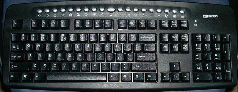
29 Procedure 1/3: Training 1 st Day: Training isonic self paced tutorial (1h 50 min. average) US map, 2003 census data 8 variables 67% of tasks performed without help

30 Procedure 1/3: Testing 2 nd Day Testing with Maryland and its 24 counties Each task with Excel alone, then with isonic 12 variables NO retraining
31 Procedure 2/2: Testing When no geographical information needed Similar success rate (86%) isonic preferred over Excel (7.9 over 7.0 on a 10 pt scale; 10=easiest) When geospatial information needed isonic: 95% success Excel: 67% for 2 users with good knowledge of Maryland 20% for 5 others (who guessed or gave up)
32 Procedure 2/2: Testing When no geographical information needed Similar success rate (86%) isonic preferred over Excel (7.9 over 7.0 on a 10 pt scale; 10=easiest) When geospatial information needed isonic: - Sound/Pitch 95% success helpful Excel: - Sorting easier 67% for 2 users with good knowledge of Maryland - Isolating regions helpful 20% for 5 others (who guessed or gave up) - Different information levels helpful
33 Procedure 2/2: Testing When no geographical information needed Similar success rate (86%) isonic preferred over Excel (7.9 over 7.0 on a 10 pt scale; 10=easiest) When geospatial information needed isonic: 95% success Excel: 67% for 2 users with good knowledge of Maryland 20% for 5 others (who guessed or gave up)
34 Procedure 2/2: Testing - Map easy to use and helpful - Switching between table and map When no geographical information needed Similar success - Pitch rate (86%) helpful to compare isonic preferred - More over Excel than one way to find answers (7.9 over 7.0 on a 10 pt scale; 10=easiest) When geospatial information needed isonic: 95% success Excel: 67% for 2 users with good knowledge of Maryland 20% for 5 others (who guessed or gave up)
35 Procedure 2/2: Testing - Map easy to use and helpful - Switching between table and map When no geographical information needed Similar success - Pitch rate (86%) helpful to compare isonic preferred - More over Excel than one way to find answers (7.9 over 7.0 on a 10 pt scale; 10=easiest) When geospatial information needed isonic: 95% success Excel: 67% for 2 users with good knowledge of Maryland 20% for 5 others (who guessed or gave up)
36 Procedure 1/2: Testing Users did find steps on their own When no geographical information needed Exception: correlation (i.e. sorting one Similar success column, rate (86%) then listening to other column isonic preferred with over inf. Excel level 1 = only pitch) (7.9 over 7.0 on a 10 pt scale; 10=easiest) When geospatial information needed isonic: 95% success Excel: 67% for 2 users with good knowledge of Maryland 20% for 5 others (who guessed or gave up)
37 VIDEO AGAIN?
38

39 Suggestions Provide the data (can be loaded in excel) Consider sonification (hard but effective) Improve table viewers Coordinate map and table Navigate with numerical keypad Synchronize visual and sound à cooperation Use/Expand our toolkit Java webstart Source code, tutorials and extra utilities available for DOWNLOAD

40 Not just maps!


41 and FYI: HCIL Symposium May 28-29, 2009 (200+ attendees) Universal Usability Jonathan Lazar (Ed.) Designing the User Interface (5 th Edition) Shneiderman and Plaisant Visit Pearson Education Booth
42 Stereo Sounds: high pitch = high value Sweep for overview Num Keypad for partial overview Table and Map
43 Stereo Sounds: high pitch = high value Sweep for overview Num Keypad for partial overview


44 Stereo Sounds: high pitch = high value Sweep for overview Num Keypad for partial overview and many more excellent ideas
45 Procedure 3/3 Free exploration Post test: Free exploration of Idaho (but didn t know) with 44 counties with both isonic, and asked to report on things of interest Semi-structured interview
Brian D. George. GIMS Specialist Ohio Coastal Atlas Project Coordinator and Cartographer. Impacts and Outcomes of Mature Coastal Web Atlases
 Ohio Coastal Atlas Project Brian D. George GIMS Specialist Ohio Coastal Atlas Project Coordinator and Cartographer Ohio Department of Natural Resources Office of Coastal Management Sandusky, OH Impacts
This tutorial is intended to familiarize you with the Geomatica Toolbar and describe the basics of viewing data using Geomatica Focus.
 PCI GEOMATICS GEOMATICA QUICKSTART 1. Introduction This tutorial is intended to familiarize you with the Geomatica Toolbar and describe the basics of viewing data using Geomatica Focus. All data used in
Google Maps and Beyond
 Google Maps and Beyond Aaron Paul First American Title apaul@firstam.com 2015 APRA Symposium Association of Professional Reserve Analysts May 2 nd, 2015 Google Maps and Beyond - Overview Business case
Environmental Systems Research Institute
 Introduction to ArcGIS ESRI Environmental Systems Research Institute Redlands, California 2 ESRI GIS Development Arc/Info (coverage model) Versions 1-7 from 1980 1999 Arc Macro Language (AML) ArcView (shapefile
Bloomsburg University Weather Viewer Quick Start Guide. Software Version 1.2 Date 4/7/2014
 Bloomsburg University Weather Viewer Quick Start Guide Software Version 1.2 Date 4/7/2014 Program Background / Objectives: The Bloomsburg Weather Viewer is a weather visualization program that is designed
BASIC TECHNOLOGY Pre K starts and shuts down computer, monitor, and printer E E D D P P P P P P P P P P
 BASIC TECHNOLOGY Pre K 1 2 3 4 5 6 7 8 9 10 11 12 starts and shuts down computer, monitor, and printer P P P P P P practices responsible use and care of technology devices P P P P P P opens and quits an
Gis 10 Training Manual
 Gis 10 Training Manual If you are searched for a ebook Gis 10 training manual in pdf format, then you have come on to right website. We presented full variation of this ebook in PDF, doc, epub, DjVu, txt
The econ Planning Suite: CPD Maps and the Con Plan in IDIS for Consortia Grantees Session 1
 The econ Planning Suite: CPD Maps and the Con Plan in IDIS for Consortia Grantees Session 1 1 Training Objectives Use CPD Maps to analyze, assess, and compare levels of need in your community Use IDIS
SRJC Applied Technology 54A Introduction to GIS
 SRJC Applied Technology 54A Introduction to GIS Overview Lecture of Geographic Information Systems Fall 2004 Santa Rosa Junior College Presented By: Tim Pudoff, GIS Coordinator, County of Sonoma, Information
Introduction to Google Drive Objectives:
 Introduction to Google Drive Objectives: Learn how to access your Google Drive account Learn to create new documents using Google Drive Upload files to store on Google Drive Share files and folders with
Search for the Gulf of Carpentaria in the remap search bar:
 This tutorial is aimed at getting you started with making maps in Remap (). In this tutorial we are going to develop a simple classification of mangroves in northern Australia. Before getting started with
GEOGRAPHIC INFORMATION SYSTEMS Session 8
 GEOGRAPHIC INFORMATION SYSTEMS Session 8 Introduction Geography underpins all activities associated with a census Census geography is essential to plan and manage fieldwork as well as to report results
Incorporating ArcGIS Pro in your Curriculum
 AAG, Boston 2017 April 5, 2017 Incorporating ArcGIS Pro in your Curriculum Geri Miller Agenda Concerns Acknowledged Learning curve ArcGIS Pro does not have all the tools (perception) Licensing and offline
Using the Stock Hydrology Tools in ArcGIS
 Using the Stock Hydrology Tools in ArcGIS This lab exercise contains a homework assignment, detailed at the bottom, which is due Wednesday, October 6th. Several hydrology tools are part of the basic ArcGIS
The Changing Face of Geospatial Technology
 The Changing Face of Geospatial Technology Vincent A. DiNoto, Jr. Director of GeoTech Center Vince.dinoto@kctcs.edu Based upon work supported by the National Science Foundation under Grant DUE ATE 1304591.
Working with Census 2000 Data from MassGIS
 Tufts University GIS Tutorial Working with Census 2000 Data from MassGIS Revised September 26, 2007 Overview In this tutorial, you will use pre-processed census data from Massachusetts to create maps of
Projection and Reprojection
 Using Quantum GIS Tutorial ID: IGET_GIS_002 This tutorial has been developed by BVIEER as part of the IGET web portal intended to provide easy access to geospatial education. This tutorial is released
Investigating Weather and Climate with Google Earth Teacher Guide
 Google Earth Weather and Climate Teacher Guide In this activity, students will use Google Earth to explore global temperature changes. They will: 1. Use Google Earth to determine how the temperature of
TEACHER NOTES MATH NSPIRED
 Math Objectives Students will understand how various data transformations can be used to achieve a linear relationship and, consequently, how to use the methods of linear regression to obtain a line of
LAB 2 - ONE DIMENSIONAL MOTION
 Name Date Partners L02-1 LAB 2 - ONE DIMENSIONAL MOTION OBJECTIVES Slow and steady wins the race. Aesop s fable: The Hare and the Tortoise To learn how to use a motion detector and gain more familiarity
Instructions for using the Point Mass Ballistics Solver 2.0 Computer Program
 Instructions for using the Point Mass Ballistics Solver 2.0 Computer Program Overview This ballistics program was designed to be an educational tool, as well as a functional and accurate program for generating
NR402 GIS Applications in Natural Resources
 NR402 GIS Applications in Natural Resources Lesson 1 Introduction to GIS Eva Strand, University of Idaho Map of the Pacific Northwest from http://www.or.blm.gov/gis/ Welcome to NR402 GIS Applications in
Geographic Communication with Solid Terrain Models
 2013 Esri Europe, Middle East and Africa User Conference October 23-25, 2013 Munich, Germany Geographic Communication with Solid Terrain Models Carlos Coucelo, Pedro Duarte, Rita Crespo CCCGeomática, Portugal
BOUNDARY MAP USER GUIDE
 BOUNDARY MAP USER GUIDE Get Exploring. Boundaries. The Northern Ontario Boundary Map provides users with the ability to explore the many community, administrative and service provider boundaries in the
Learning ArcGIS Geodatabase By Hussein Nasser
 Learning ArcGIS Geodatabase By Hussein Nasser If searching for a ebook Learning ArcGIS Geodatabase by Hussein Nasser in pdf format, then you've come to correct site. We presented the complete option of
GIS for the Beginner on a Budget
 GIS for the Beginner on a Budget Andre C. Bally, RLA, GIS Coordinator, Harris County Public Infrastructure Department Engineering Division This presentation, GIS for Beginners on a Budget. will briefly
Your web browser (Safari 7) is out of date. For more security, comfort and the best experience on this site: Update your browser Ignore
 is out of date. For more security, comfort and the best experience on this site: Update your browser Ignore") Your web browser (Safari 7) is out of date. For more security, comfort and the best experience on this site: Update your browser Ignore U NLO CKING THE EDUCATIO NAL PO TENTIAL O F CITIZEN SCIENCE Essays
Your web browser (Safari 7) is out of date. For more security, comfort and the best experience on this site: Update your browser Ignore U NLO CKING THE EDUCATIO NAL PO TENTIAL O F CITIZEN SCIENCE Essays
Map image from the Atlas of Oregon (2nd. Ed.), Copyright 2001 University of Oregon Press
, Copyright 2001 University of Oregon Press") Map Layout and Cartographic Design with ArcGIS Desktop Matthew Baker ESRI Educational Services Redlands, CA Education UC 2008 1 Seminar overview General map design principles Working with map elements
Map Layout and Cartographic Design with ArcGIS Desktop Matthew Baker ESRI Educational Services Redlands, CA Education UC 2008 1 Seminar overview General map design principles Working with map elements
GIS Software. Evolution of GIS Software
 GIS Software The geoprocessing engines of GIS Major functions Collect, store, mange, query, analyze and present Key terms Program collections of instructions to manipulate data Package integrated collection
SANTA CLARA COUNTY THEMATIC ATLAS
 1 SANTA CLARA COUNTY THEMATIC ATLAS Project Overview Douglas Schenk, GIS Analyst Sampa Patra, GIS Analyst Making the Thematic Atlas 2 Brought to you by the County of Santa Clara Public Health Department,
Geo-enabling a Transactional Real Estate Management System A case study from the Minnesota Dept. of Transportation
 Geo-enabling a Transactional Real Estate Management System A case study from the Minnesota Dept. of Transportation Michael Terner Executive Vice President Co-author and Project Manager Andy Buck Overview
SONIFICATION OF GEO-REFERENDED DATA FOR AUDITORY INFORMATION SEEKING: DESIGN PRINCIPLE AND PILOT STUDY
 SONIFICATION OF GEO-REFERENDED DATA FOR AUDITORY INFORMATION SEEKING: DESIGN PRINCIPLE AND PILOT STUDY Haixia Zhao 1, Catherine Plaisant, Ben Shneiderman 1 Department of Computer Science 1 & Human Computer
file://q:\report1\greenatlasfinalreportindex.html
 Page 1 of 8 Quick Links WATER MANAGEMENT INTERNSHIP USDA HIS GRANT FUNDED FINAL PROJECT REPORT SUBMITTED BY MELISSA QUINTANA 11/07/07-03/24/08 Summary Provided is an assessment of my accomplishments for
Last updated: Copyright
 Last updated: 2012-08-20 Copyright 2004-2012 plabel (v2.4) User s Manual by Bioinformatics Group, Institute of Computing Technology, Chinese Academy of Sciences Tel: 86-10-62601016 Email: zhangkun01@ict.ac.cn,
WHAT'S NEW IN HSC CHEMISTRY 6.0
 What's New in HSC 6.0 6-1 WHAT'S NEW IN HSC CHEMISTRY 6.0 Fig. 1. HSC Chemistry 6.0 Main Menu. The old HSC Chemistry 5.1 software is made for the simulation and modeling of single chemical reactions and
Linear Referencing in Boulder County, CO. Getting Started
 Linear Referencing in Boulder County, CO Getting Started 1 Authors Janie Pierre GIS Technician, Boulder County Road centerline and storm sewer geodatabases & maps John Mosher GIS Specialist, Boulder County
Learning ArcGIS: Introduction to ArcCatalog 10.1
 Learning ArcGIS: Introduction to ArcCatalog 10.1 Estimated Time: 1 Hour Information systems help us to manage what we know by making it easier to organize, access, manipulate, and apply knowledge to the
ARCGIS TRAINING AT KU GIS LABS: INTRODUCTION TO GIS: EXPLORING ARCCATALOG AND ARCGIS TOOLS
 PHASE 1_3 rd SESSION ARCGIS TRAINING AT KU GIS LABS: INTRODUCTION TO GIS: EXPLORING ARCCATALOG AND ARCGIS TOOLS 3 rd SESSION REPORT: 25 TH -27 TH JUNE 2014 SCHOOL OF ENVIRONMENTAL STUDIES COMPUTER LAB
Lab 1 Uniform Motion - Graphing and Analyzing Motion
 Lab 1 Uniform Motion - Graphing and Analyzing Motion Objectives: < To observe the distance-time relation for motion at constant velocity. < To make a straight line fit to the distance-time data. < To interpret
How to Make or Plot a Graph or Chart in Excel
 This is a complete video tutorial on How to Make or Plot a Graph or Chart in Excel. To make complex chart like Gantt Chart, you have know the basic principles of making a chart. Though I have used Excel
DISCRETE RANDOM VARIABLES EXCEL LAB #3
 DISCRETE RANDOM VARIABLES EXCEL LAB #3 ECON/BUSN 180: Quantitative Methods for Economics and Business Department of Economics and Business Lake Forest College Lake Forest, IL 60045 Copyright, 2011 Overview
Quality Measures Green Light Report Online Management Tool. Self Guided Tutorial
 Quality Measures Green Light Report Online Management Tool Self Guided Tutorial 1 Tutorial Contents Overview Access the QM Green Light Report Review the QM Green Light Report Tips for Success Contact PointRight
USEPA's Comprehensive Geospatial Information Sharing Framework
 USEPA's Comprehensive Geospatial Information Sharing Framework An Overview ESRI Federal User Conference February 22, 2008 Agenda Background What is EPA s Geospatial Information Sharing Framework? Why was
Introduction to ArcGIS Server - Creating and Using GIS Services. Mark Ho Instructor Washington, DC
 Introduction to ArcGIS Server - Creating and Using GIS Services Mark Ho Instructor Washington, DC Technical Workshop Road Map Product overview Building server applications GIS services Developer Help resources
Geo-identification and pedestrian navigation with geo-mobile applications: how do users proceed?
 TU Vienna presentation 17 th July 2008 Geo-identification and pedestrian navigation with geo-mobile applications: how do users proceed? Ioannis Delikostidis Corné van Elzakker INTERNATIONAL INSTITUTE FOR
Basic Training Battlemind to Home Symposium. Sept
 Basic Training Battlemind to Home Symposium Sept 2017 1 What is Measuring Communities? A social indicators project which allows users to obtain military-specific information about communities strengths
Planning Softproviding Meat User Documentation
 Great ideas are always simple Softproviding simply makes them happen. Planning Softproviding Meat User Documentation Version: 1.00 Date: 24 August 2017 Release: v5.50 Softproviding AG Riehenring 175 CH-4058
User Guide. Affirmatively Furthering Fair Housing Data and Mapping Tool. U.S. Department of Housing and Urban Development
 User Guide Affirmatively Furthering Fair Housing Data and Mapping Tool U.S. Department of Housing and Urban Development December, 2015 1 Table of Contents 1. Getting Started... 5 1.1 Software Version...
Many Ways to Name a Place
 Your web browser (Safari 7) is out of date. For more security, comfort and Activityapply the best experience on this site: Update your browser Ignore Many Ways to Name a Place What are the names for the
Cartographic and Geospatial Futures
 Cartographic and Geospatial Futures 1. Web Cartography, WebGIS, & Virtual Globes--New Roles for Maps, GIS, and GIS professionals 2. Map Mashups, the Neo Neo-geography Movement, & Crowd-sourcing Geospatial
The Church Demographic Specialists
 The Church Demographic Specialists Easy-to-Use Features Map-driven, Web-based Software An Integrated Suite of Information and Query Tools Providing An Insightful Window into the Communities You Serve Key
UNDER REVIEW. Abstract
 UNDER REVIEW Getting To Know ArcGIS Desktop By: Ormsby, Napoleon, Burke, Groessl, and Bowden, (2010). Format: (Softcover, 592 pp. ISBN: 9781589482609) Publisher: Redlands, California: ESRI Press Abstract
E-LEARNING FOUNDATIONS INTENSIVE. e-learning Project Management
 E-LEARNING FOUNDATIONS INTENSIVE e-learning Project Management INTRODUCTION Harry Mellon, VP/COO USN Over 26 Years Training Development Experience Instructional Design Development Project Management WHAT
Counter-trafficking Integrated Display System (CIDS): A GIS-Based Command & Control Environment for Coalition Nations
: A GIS-Based Command & Control Environment for Coalition Nations") 9 th International Command and Control Research and Technology Symposium Counter-trafficking Integrated Display System (CIDS): A GIS-Based Command & Control Environment for Coalition Nations Elizabeth
9 th International Command and Control Research and Technology Symposium Counter-trafficking Integrated Display System (CIDS): A GIS-Based Command & Control Environment for Coalition Nations Elizabeth
Chart Group indicator
 Chart Group indicator 1. Overview... 2 2. Using the... 3 2.1 Adding the indicator to a chart... 3 2.2 Choosing whether to link the timeframe or the symbol... 3 2.3 Assigning charts to groups... 3 2.3.1
GIS Tutorial: Workbook For ArcView 9.0 By Wilpen Gorr, Kristen Kurland READ ONLINE
 GIS Tutorial: Workbook For ArcView 9.0 By Wilpen Gorr, Kristen Kurland READ ONLINE 8/20/2016 Watch video Get Now http://edigibooks.xyz/?book=1589481275download GIS Tutorial: Workbook for ArcView 9.0 Popular
Using ArcGIS Server to Bring Geospatial Analysis
 Using ArcGIS Server to Bring Geospatial Analysis and Mapping to non-gis Analysts ESRI Health User Conference September 22, 2009 Jim Laramie, Altarum Institute Sam Wang, Altarum Institute Agenda Agenda
Among various open-source GIS programs, QGIS can be the best suitable option which can be used across partners for reasons outlined below.
 Comparison of Geographic Information Systems (GIS) software As of January 2018, WHO has reached an agreement with ESRI (an international supplier of GIS software) for an unlimited use of ArcGIS Desktop
From User Requirements Analysis to Conceptual Design of a Mobile Augmented Reality Tool to be used in an Urban Geography Fieldwork Setting
 From User Requirements Analysis to Conceptual Design of a Mobile Augmented Reality Tool to be used in an Urban Geography Fieldwork Setting Xiaoling Wang, Corné P.J.M. van Elzakker, Menno-Jan Kraak 2016
GIS Visualization: A Library s Pursuit Towards Creative and Innovative Research
 GIS Visualization: A Library s Pursuit Towards Creative and Innovative Research Justin B. Sorensen J. Willard Marriott Library University of Utah justin.sorensen@utah.edu Abstract As emerging technologies
Task 1: Start ArcMap and add the county boundary data from your downloaded dataset to the data frame.
 Exercise 6 Coordinate Systems and Map Projections The following steps describe the general process that you will follow to complete the exercise. Specific steps will be provided later in the step-by-step
These modules are covered with a brief information and practical in ArcGIS Software and open source software also like QGIS, ILWIS.
 Online GIS Training and training modules covered are: 1. ArcGIS, Analysis, Fundamentals and Implementation 2. ArcGIS Web Data Sharing 3. ArcGIS for Desktop 4. ArcGIS for Server These modules are covered
SCHOOL OF ENGINEERING AND TECHNOLOGY COMPUTER LAB
 PHASE 1_6 TH SESSION ARCGIS TRAINING AT KU GIS LABS: INTRODUCTION TO GIS: EXPLORING ARCCATALOG AND ARCGIS TOOLS 6 TH SESSION REPORT: 3 RD -5 TH SEPTEMBER 2014 SCHOOL OF ENGINEERING AND TECHNOLOGY COMPUTER
SoilView: Development of a Custom GIS Application for Publishing Soil Surveys
 SoilView: Development of a Custom GIS Application for Publishing Soil Surveys Allan Johnson and Mike Wigginton Abstract Currently, digital soils information can be obtained from many sources. Numerous
Career Exploration: Science, Technology, Engineering, and Math (STEM)
") Career Exploration: Science, Technology, Engineering, and Math (STEM) What is the Career Exploration Lab? Six (6) 3D Printers Large wall mounted touchscreen monitor Accessible design software Located in
Career Exploration: Science, Technology, Engineering, and Math (STEM) What is the Career Exploration Lab? Six (6) 3D Printers Large wall mounted touchscreen monitor Accessible design software Located in
Data Structures & Database Queries in GIS
 Data Structures & Database Queries in GIS Objective In this lab we will show you how to use ArcGIS for analysis of digital elevation models (DEM s), in relationship to Rocky Mountain bighorn sheep (Ovis
The next generation in weather radar software.
 The next generation in weather radar software. PUBLISHED BY Vaisala Oyj Phone (int.): +358 9 8949 1 P.O. Box 26 Fax: +358 9 8949 2227 FI-00421 Helsinki Finland Try IRIS Focus at iris.vaisala.com. Vaisala
Search for the Dubai in the remap search bar:
 This tutorial is aimed at developing maps for two time periods with in Remap (). In this tutorial we are going to develop a classification water and non-water in Dubai for the year 2000 and the year 2016.
Astronomy 101 Lab: Stellarium Tutorial
 Name: Astronomy 101 Lab: Stellarium Tutorial Please install the Stellarium software on your computer using the instructions in the procedure. If you own a laptop, please bring it to class. You will submit
ARGUS.net IS THREE SOLUTIONS IN ONE
 OVERVIEW H i g h l y c o n f i g u r a b l e s o f t w a r e a c c o m m o d a t e s a w i d e r a n g e o f c o l l e c t i o n s T h r e e s o l u t i o n s c o v e r P o r t a l s, C o l l e c t i o
M E R C E R W I N WA L K T H R O U G H
 H E A L T H W E A L T H C A R E E R WA L K T H R O U G H C L I E N T S O L U T I O N S T E A M T A B L E O F C O N T E N T 1. Login to the Tool 2 2. Published reports... 7 3. Select Results Criteria...
Introducing the. a partnership of
 Introducing the a partnership of Background Need for online atlas identified by managers and researchers to make coastal data available Shoreline data Ocean and coastal resources Sea-level rise potential
Finding Common Ground Through GIS
 Finding Common Ground Through GIS Matthew Stone, MPH Special Unit for Technical Assistance Chronic Disease and Injury Control California Department of Public Health ESRI Health GIS Conference Scottsdale,
Where do I live? Geography teaching resource. Paula Owens. Primary. Locating own home address
 Where do I live? Locating own home address Paula Owens Geography teaching resource Primary Digimap for Schools Geography Resources Where do I live Level Context Location Primary Locating own home address
INSTITUTIONAL CARTOGRAPHY VISUALIZER OF THE NATIONAL GEOGRAPHICAL INSTITUTE OF SPAIN
 INSTITUTIONAL CARTOGRAPHY VISUALIZER OF THE NATIONAL GEOGRAPHICAL INSTITUTE OF SPAIN Alfredo del Campo García, Manuel Carbajo Ruiz National Atlas of Spain Department (adelcampo@mfom.es, mcarbajo@mfom.es)
ArcGIS Earth an Intro
 ArcGIS Earth an Intro Chris Andrews Product Manager, 3D and ArcGIS Earth Brian Sims 3D Content Lead 3D across the Esri product family ArcGIS Pro 3D Analyst CityEngine ArcGIS for Server ArcGIS Online ArcGIS
SuperCELL Data Programmer and ACTiSys IR Programmer User s Guide
 SuperCELL Data Programmer and ACTiSys IR Programmer User s Guide This page is intentionally left blank. SuperCELL Data Programmer and ACTiSys IR Programmer User s Guide The ACTiSys IR Programmer and SuperCELL
Welcome to NR502 GIS Applications in Natural Resources. You can take this course for 1 or 2 credits. There is also an option for 3 credits.
 Welcome to NR502 GIS Applications in Natural Resources. You can take this course for 1 or 2 credits. There is also an option for 3 credits. The 1st credit consists of a series of readings, demonstration,
Interactive Statistics Visualisation based on Geovisual Analytics
 Interactive Statistics Visualisation based on Geovisual Analytics Prof. Mikael Jern NCVA LiU and NComVA AB May 2010 - Spin-off company to focus on Interactive Statistics Visualization and Storytelling
Geography for the 2020 Round of Census
 Boundaries Key Census Data EA Id Population Male Female EA Id Area EA Id Num HH Avg HH size Geography for the 2020 Round of Census Linda Peters, Esri lpeters@esri.com Integration of Statistical and Geospatial
Your web browser (Safari 7) is out of date. For more security, comfort and. the best experience on this site: Update your browser Ignore
 is out of date. For more security, comfort and. the best experience on this site: Update your browser Ignore") Your web browser (Safari 7) is out of date. For more security, comfort and Activitydevelop the best experience on this site: Update your browser Ignore Places in the Park Why do we use symbols? Overview
Your web browser (Safari 7) is out of date. For more security, comfort and Activitydevelop the best experience on this site: Update your browser Ignore Places in the Park Why do we use symbols? Overview
Overview of Geospatial Open Source Software which is Robust, Feature Rich and Standards Compliant
 Overview of Geospatial Open Source Software which is Robust, Feature Rich and Standards Compliant Cameron SHORTER, Australia Key words: Open Source Geospatial Foundation, OSGeo, Open Standards, Open Geospatial
ESRI GUIDE TO GIS ANALYSIS
 page 1 / 5 page 2 / 5 esri guide to gis pdf ESRI Shapefile Technical Description J-7855 March 1998 2 SDE, ARC/INFO, PC ARC/INFO, Data Automation Kit (DAK ), and ArcCAD software provide shape-to-coverage
PHASE 1_7 TH SESSION ARCGIS TRAINING AT KU GIS LABS: INTRODUCTION TO GIS: EXPLORING ARCCATALOG AND ARCGIS TOOLS
 PHASE 1_7 TH SESSION ARCGIS TRAINING AT KU GIS LABS: INTRODUCTION TO GIS: EXPLORING ARCCATALOG AND ARCGIS TOOLS 7 TH SESSION REPORT: 10 TH - 12 TH SEPTEMBER 2014 SCHOOL OF ENGINEERING AND TECHNOLOGY COMPUTER
ARCGIS TRAINING AT KU GIS LABS: INTRODUCTION TO GIS: EXPLORING ARCCATALOG AND ARCGIS TOOLS
 PHASE 1_4 th SESSION ARCGIS TRAINING AT KU GIS LABS: INTRODUCTION TO GIS: EXPLORING ARCCATALOG AND ARCGIS TOOLS 4 th SESSION REPORT: 30 TH JUNE - 2 ND JULY SCHOOL OF ENVIRONMENTAL STUDIES COMPUTER LAB
Spatial Asset Management
 Spatial Asset Management What can Maximo do for you? Jeremy Myers www.cohesivesolutions.com Today s Topics What is Maximo Spatial High Level Architecture Using Spatial Configuration Capabilities Use Case
Introduction to ArcGIS Server Development
 Introduction to ArcGIS Server Development Kevin Deege,, Rob Burke, Kelly Hutchins, and Sathya Prasad ESRI Developer Summit 2008 1 Schedule Introduction to ArcGIS Server Rob and Kevin Questions Break 2:15
7th FIG Regional Conference Spatial Data Serving People: Land Governance and the Environment - Building the Capacity
 7th FIG Regional Conference Spatial Data Serving People: Land Governance and the Environment - Building the Capacity Hanoi, Vietnam, 19-22 October 2009 ------------------ TS 3A - SDI in Support of Urban
Arcmap Manual Esri 10 READ ONLINE
 Arcmap Manual Esri 10 READ ONLINE Esri Store: Browsing ArcPad 10.2.2 - ArcPad is mobile field mapping and data collection software designed for GIS professionals. It includes advanced GIS and GPS capabilities
Conceptual study of Web-based PPGIS for Designing Built Environment: Identifying Housing Location Preferences in Littleborough
 Conceptual study of Web-based PPGIS for Designing Built Environment: Identifying Housing Location Preferences in Littleborough Shrabanti Hira *1, S M Labib 1 1 SEED, University of Manchester March 31,
Spatial Data Availability Energizes Florida s Citizens
 NASCIO 2016 Recognition Awards Nomination Spatial Data Availability Energizes Florida s Citizens State of Florida Agency for State Technology & Department of Environmental Protection Category: ICT Innovations
Utilizing Data from American FactFinder with TIGER/Line Shapefiles in ArcGIS
 Utilizing Data from American FactFinder with TIGER/Line Shapefiles in ArcGIS Web Adams, GISP Data Dissemination Specialist U.S. Census Bureau New York Regional Office 1 What We Do Decennial Census Every
Arcmap Manual Esri 10 READ ONLINE
 Arcmap Manual Esri 10 READ ONLINE If searching for a book Arcmap manual esri 10 in pdf form, then you have come on to the loyal site. We present the utter release of this book in PDF, doc, DjVu, epub,
CPSC 695. Future of GIS. Marina L. Gavrilova
 CPSC 695 Future of GIS Marina L. Gavrilova The future of GIS Overview What is GIS now How GIS was viewed before Current trends and developments Future directions of research What is GIS? Internet's definition
How to Create a Substance Answer Set
 How to Create a Substance Answer Set Select among five search techniques to find substances Since substances can be described by multiple names or other characteristics, SciFinder gives you the flexibility
Building Inflation Tables and CER Libraries
 Building Inflation Tables and CER Libraries January 2007 Presented by James K. Johnson Tecolote Research, Inc. Copyright Tecolote Research, Inc. September 2006 Abstract Building Inflation Tables and CER
Assignment #0 Using Stellarium
 Name: Class: Date: Assignment #0 Using Stellarium The purpose of this exercise is to familiarize yourself with the Stellarium program and its many capabilities and features. Stellarium is a visually beautiful
Search for the Dubai in the remap search bar:
 This tutorial is aimed at developing maps for two time periods with in Remap (). In this tutorial we are going to develop a classification water and non-water in Dubai for the year 2000 and the year 2016.
Chapter 1. GIS Fundamentals
 1. GIS Overview Chapter 1. GIS Fundamentals GIS refers to three integrated parts. Geographic: Of the real world; the spatial realities, the geography. Information: Data and information; their meaning and
Introduction to Google Mapping Tools
 Introduction to Google Mapping Tools Google s Mapping Tools Explore geographic data. Organize your own geographic data. Visualize complex data. Share your data with the world. Tell your story and educate