A Sense of Where We Are:
|
|
|
- Edward Richard
- 5 years ago
- Views:
Transcription
1 A Sense of Where We Are: Geographic Information Science and Systems IDT Roundtable K State Union 212 Mar 25, :00 a.m. to 12:30 p.m. Presented by: Eric Bernard, LARCP, Chair GIScience Commons Rick Chubb, GIScience Commons Shiva Mohandass, GIScience Commons
2 where are we?


3 Who is this? How did he know where he was, or how to get where he wanted dt to go? Source:
4 Source: Thanks to Waldseemüller, Columbus, Vespucci, Ptolemy and many others Note: Martin Waldseemüller generated this map "A drawing ofthe whole earth following the tradition ofptolemy and the travels of Amerigo Vespucci and others and is the first map to call our continent the Americas. See it at the Library of Congress. since 1507 we are in America


5 How did Powell, Lewis and Clark know where they were or where they were going? John Wesley Powell Source: Lewis and Clark Source:
6 How did those who first came to this landscape of the Flint Hills know where they were going? Source: Conservation Design Forum Jim Patchett
7 we ve got an app for that
8 next apps TED 2010 Augmented Reality

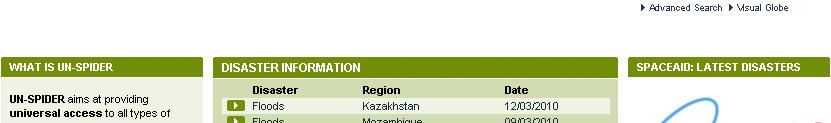


9 spider.org/ spider.org/haiti
10 Demo of Google Earth: Haiti Demo of ESRI GeoViewer Population Estimation


11 Weather, Rivers and Streams
12 what is required to get the where, when, and potential damage of a flood?
13 GIScience deals with The science and tools used to acquire, store, analyze, and output data in two or three (four) dimensions, referenced to the earth by some type of real world coordinate system (e.g., a map projection). Source: USGS Source: ESRI, Inc.


14 GIScience deals with Source: ESRI, Inc.


15 GIScience deals with GeoVisualization= Metaphors of Reality Source:


16 GIScience deals with Source: SPOT, Inc.


17 GIScience deals with Sources:
18 GIScience deals with
19


20 GIScience deals with Models Map2Map Flood Inundation Model Inputs: LiDAR data Nexrad Doppler Rainfall Stream Gauge data Hydro Data Model


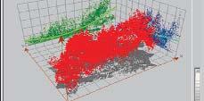
21 GIScience deals with LiDAR: Light Detection Dt ti and Ranging Channel Profiles Kansas River Manhattan, KS NED 30m NED 10 m LiDAR 3D River Stream Channel and Floodplain


22 GIScience deals with the the Census County Population


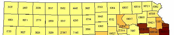

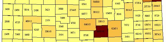
23 GIScience deals with the the Census GeoVisualization Population Percentage of KS 1900 Population 1900 Population 2000 Population Percentage of KS 2004 Population 2004
24 GIScience deals with Business Web based spatial analysis tools for Socioeconomic and demographic data Business location data Consumer spending data Reporting tools Tables Charts & graphs Map production tools
25 Business Analyst Example Compare two potential locations for a franchise restaurant 1200 Moro St. (Aggieville) 3001 Anderson Ave. (Village Plaza) Criteria for the area within a 5 minute drive: Total population > 25,000 Average household income > $40,000 Age class yrs > 33% of total
26 BAO Startup
27 Select a Location
28 Define Analysis Area
29 Select Second Location
30 Define Second Analysis Area
31 Create Report
32 Comparison Report Setup
33 Comparison Report Table
34 Comparison Report Graph

35 Village Plaza Location Our Results Population > 25,000? 33,521 Income > $40,000? $55,223 Age > 33%? 29.6% Aggieville Location Population > 25,000? 27,899 Income > $40,000? $41,436 Age > 33%? 36.5%
36 2009 & 2014 Projected Demographics Age 50+ Profile Age by Income Profile Age by Sex by Race Profile Age by Sex Profile Demographic and Income Comparison Profile Demographic and Income Profile Detailed Age Profile Detailed Income Profile Disposable Income Profile Executive Summary Graphic Profile Housing Profile Market Profile Net Worth Profile Quarterly Demographic Profile 2009 Market Potential Automotive Aftermarket Expenditures Financial Expenditures House and Home Expenditures Household Budget Expenditures Medical Expenditures Recreation Expenditures RtilG Retail Goods and Services Expenditures Business Data 2009 Tapestry Market Segmentation Traffic Counts
37 How to Get BAO Visit thek StateGIScience Commons Visit the K State GIScience Commons (
38 K State GIScience Commons
39 GIS Software from ESRI

40 BAO Registration Form
41 BAO Login
42 BAO Startup


43 National Resources tl


44 National Resources


45 Kansas Resources


46 Local GIS Resources
47 Local GIS Resources


48 K State GIScience Commons Community Access 48


49 GIS and GIScience Resources Data Sources and Standards s g/ coming soon K-State GeoPortal
50 Federal Geographic Data Committee National Spatial Data Infrastructure Federal Geographic Data Committee Meta Data data.html Data Clearinghouse learinghouse.html Data Standards dards.htmld Framework mework.html Stakeholders akeholders.html Publications and Special Reports blications.html GIS/Base Data: Software Vendor Sites State by State: Kansas Missouri Nebraska gis.html Imagery: g
51 Learning: GIScience K State K State s GIScience Certificate Program state.edu/geography/academics/gis.html ESRI Virtual Campus Courses GIScience Commons Assistance state.edu tt or gisci@ksu.edu i@k Research Assistance GIS and Spatial Analysis Lab GISSAL Lab in Geography state.edu/geography/research/gissal.html Internet Mapping Assistance state.edu See K State GIScience Commons Web Mapping Examples at: soils Additional Info gisci@ksu.edu or ebernard@ksu.edu
Demographic Data in ArcGIS. Harry J. Moore IV
 Demographic Data in ArcGIS Harry J. Moore IV Outline What is demographic data? Esri Demographic data - Real world examples with GIS - Redistricting - Emergency Preparedness - Economic Development Next
Techniques for Science Teachers: Using GIS in Science Classrooms.
 Techniques for Science Teachers: Using GIS in Science Classrooms. After ESRI, 2008 GIS A Geographic Information System A collection of computer hardware, software, and geographic data used together for
GIS for the Beginner on a Budget
 GIS for the Beginner on a Budget Andre C. Bally, RLA, GIS Coordinator, Harris County Public Infrastructure Department Engineering Division This presentation, GIS for Beginners on a Budget. will briefly
GIS Lecture 5: Spatial Data
 GIS Lecture 5: Spatial Data GIS 1 Outline Vector Data Formats Raster Data Formats Map Projections Coordinate Systems US Census geographic files US Census data files GIS Data Sources GIS 2 Vector Data Formats
Introducing GIS analysis
 1 Introducing GIS analysis GIS analysis lets you see patterns and relationships in your geographic data. The results of your analysis will give you insight into a place, help you focus your actions, or
Are You Maximizing The Value Of All Your Data?
 Are You Maximizing The Value Of All Your Data? Using The SAS Bridge for ESRI With ArcGIS Business Analyst In A Retail Market Analysis SAS and ESRI: Bringing GIS Mapping and SAS Data Together Presented
Applications: Introduction Task 1: Introduction to ArcCatalog Task 2: Introduction to ArcMap Challenge Question References
 CHAPTER 1 INTRODUCTION 1.1 GIS? 1.1.1 Components of a GIS 1.1.2 A Brief History of GIS 1.1.3 GIS Software Products Box 1.1 A List of GIS Software Producers and Their Main Products 1.2 GIS Applications
Robert s Village. The Shops at Aubert Avenue Saint Louis, Missouri 63113
 The Shops at Robert s Village 1330 Aubert Avenue Saint Louis, Missouri 63113 Jeff Eisenberg P: (314) 721-5611 C: (314) 640-8510 jeff@jeisenberg.com www.jeisenberg.com FOR LEASE Roberts Village Shopping
GIS = Geographic Information Systems;
 What is GIS GIS = Geographic Information Systems; What Information are we talking about? Information about anything that has a place (e.g. locations of features, address of people) on Earth s surface,
Working with ArcGIS Online
 Esri International User Conference San Diego, CA Technical Workshops July 12, 2011 Working with ArcGIS Online Bern Szukalski, Deane Kensok Topics for this Session ArcGIS Online Overview ArcGIS Online Content
GIS Resources for Local Governments
 ISSUE PAPER SERIES GIS Resources for Local Governments February 2018 NEW YORK STATE TUG HILL COMMISSION DULLES STATE OFFICE BUILDING 317 WASHINGTON STREET WATERTOWN, NY 13601 (315) 785-2380 WWW.TUGHILL.ORG
Introduction to Geographic Information Systems
 Introduction to Geographic Information Systems What is GIS? GIScience, Geography and Cartography GIS Maps Why is it important? What is Driving GIS? Applications of GIS Case Studies Components of a GIS
Advanced Algorithms for Geographic Information Systems CPSC 695
 Advanced Algorithms for Geographic Information Systems CPSC 695 Think about Geography What is Geography The 3 W s of Geography What is where Why is it there Why do I care Data - Data - Data We all got
An Internet-Based Integrated Resource Management System (IRMS)
") An Internet-Based Integrated Resource Management System (IRMS) Third Quarter Report, Year II 4/1/2000 6/30/2000 Prepared for Missouri Department of Natural Resources Missouri Department of Conservation
An Internet-Based Integrated Resource Management System (IRMS) Third Quarter Report, Year II 4/1/2000 6/30/2000 Prepared for Missouri Department of Natural Resources Missouri Department of Conservation
How GIS can be used for improvement of literacy and CE programmes
 How GIS can be used for improvement of literacy and CE programmes Training Workshop for Myanmar Literacy Resource Center (MLRC) ( Yangon, Myanmar, 11 20 October 2000 ) Presented by U THEIN HTUT GEOCOMP
Information. Information Technology. Geographic. Services (GIS) 119 W Indiana Ave Deland, FL 32720
 119 W Indiana Ave Deland, FL 32720") Information Technology Geographic Information Services (GIS) 119 W Indiana Ave Deland, FL 32720 A GIS consists of 5 primary components: Hardware Software People Data Methods or Business Processes --- Hardware
Information Technology Geographic Information Services (GIS) 119 W Indiana Ave Deland, FL 32720 A GIS consists of 5 primary components: Hardware Software People Data Methods or Business Processes --- Hardware
GIS CONCEPTS Part I. GIS ON THE WEB Part II
 Week 2 GIS CONCEPTS Part I GIS ON THE WEB Part II topics of the week part I GIS functions and GIS data Spatial relationships Organizing convention for spatial data Store Information by thematic layers
GIS Spatial Statistics for Public Opinion Survey Response Rates
 GIS Spatial Statistics for Public Opinion Survey Response Rates July 22, 2015 Timothy Michalowski Senior Statistical GIS Analyst Abt SRBI - New York, NY t.michalowski@srbi.com www.srbi.com Introduction
The Journal of Database Marketing, Vol. 6, No. 3, 1999, pp Retail Trade Area Analysis: Concepts and New Approaches
 Retail Trade Area Analysis: Concepts and New Approaches By Donald B. Segal Spatial Insights, Inc. 4938 Hampden Lane, PMB 338 Bethesda, MD 20814 Abstract: The process of estimating or measuring store trade
DOWNLOAD OR READ : WEB GIS PRINCIPLES AND APPLICATIONS PDF EBOOK EPUB MOBI
 DOWNLOAD OR READ : WEB GIS PRINCIPLES AND APPLICATIONS PDF EBOOK EPUB MOBI Page 1 Page 2 web gis principles and applications web gis principles and pdf web gis principles and applications Course Tutors
Rural Louisiana. A quarterly publication of the Louisiana Tech Rural Development Center
 Rural Louisiana A quarterly publication of the Louisiana Tech Rural Development Center Volume 4, No. 1, Fall 2009 Editor: Aaron K. Lusby Director, Asst. Professor Newsletter design: Stephanie Tidwell Student
Geospatial Technologies
 An Overview of Prepared by: John McGee Jennifer McKee With support from: NSF DUE-0903270 in partnership with: Geospatial Technician Education Through Virginia s Community Colleges (GTEVCC) What is Geospatial?
An Introduction to China and US Map Library. Shuming Bao Spatial Data Center & China Data Center University of Michigan
 An Introduction to China and US Map Library Shuming Bao Spatial Data Center & China Data Center University of Michigan Current Spatial Data Services http://chinadataonline.org China Geo-Explorer http://chinageoexplorer.org
Massachusetts Institute of Technology Department of Urban Studies and Planning
 Massachusetts Institute of Technology Department of Urban Studies and Planning 11.204: Planning, Communications & Digital Media Fall 2002 Lecture 6: Tools for Transforming Data to Action Lorlene Hoyt October
Missouri Spatial Data Information Service (MSDIS) Mark Duewell MSDIS Program Manager/ GIS Specialist Sr.
 Mark Duewell MSDIS Program Manager/ GIS Specialist Sr.") Missouri Spatial Data Information Service (MSDIS) Mark Duewell MSDIS Program Manager/ GIS Specialist Sr. duewellm@missouri.edu Missouri Spatial Data Information Service (MSDIS) http://msdis.missouri.edu/
Missouri Spatial Data Information Service (MSDIS) Mark Duewell MSDIS Program Manager/ GIS Specialist Sr. duewellm@missouri.edu Missouri Spatial Data Information Service (MSDIS) http://msdis.missouri.edu/
A Comprehensive Inventory of the Number of Modified Stream Channels in the State of Minnesota. Data, Information and Knowledge Management.
 A Comprehensive Inventory of the Number of Modified Stream Channels in the State of Minnesota Data, Information and Knowledge Management Glenn Skuta Environmental Analysis and Outcomes Division Minnesota
GEOG 508 GEOGRAPHIC INFORMATION SYSTEMS I KANSAS STATE UNIVERSITY DEPARTMENT OF GEOGRAPHY FALL SEMESTER, 2002
 GEOG 508 GEOGRAPHIC INFORMATION SYSTEMS I KANSAS STATE UNIVERSITY DEPARTMENT OF GEOGRAPHY FALL SEMESTER, 2002 Course Reference #: 13210 Meeting Time: TU 2:05pm - 3:20 pm Meeting Place: Ackert 221 Remote
Map your way to deeper insights
 Map your way to deeper insights Target, forecast and plan by geographic region Highlights Apply your data to pre-installed map templates and customize to meet your needs. Select from included map files
11/7/2018. Q: What is this? What is in this area of the country?
 Update on Upcoming Learning Opportunities: GEOG Courses Related to Cities and the Economy Murray Rice Spring 2019: GEOG 4230 (Location Intelligence: Business GIS) Focus on GIS applications in business
DEVELOPING DECISION SUPPORT TOOLS FOR THE IMPLEMENTATION OF BICYCLE AND PEDESTRIAN SAFETY STRATEGIES
 DEVELOPING DECISION SUPPORT TOOLS FOR THE IMPLEMENTATION OF BICYCLE AND PEDESTRIAN SAFETY STRATEGIES Deo Chimba, PhD., P.E., PTOE Associate Professor Civil Engineering Department Tennessee State University
SRJC Applied Technology 54A Introduction to GIS
 SRJC Applied Technology 54A Introduction to GIS Overview Lecture of Geographic Information Systems Fall 2004 Santa Rosa Junior College Presented By: Tim Pudoff, GIS Coordinator, County of Sonoma, Information
NEW YORK DEPARTMENT OF SANITATION. Spatial Analysis of Complaints
 NEW YORK DEPARTMENT OF SANITATION Spatial Analysis of Complaints Spatial Information Design Lab Columbia University Graduate School of Architecture, Planning and Preservation November 2007 Title New York
HORIZON 2030: Land Use & Transportation November 2005
 PROJECTS Land Use An important component of the Horizon transportation planning process involved reviewing the area s comprehensive land use plans to ensure consistency between them and the longrange transportation
KENTUCKY HAZARD MITIGATION PLAN RISK ASSESSMENT
 KENTUCKY HAZARD MITIGATION PLAN RISK ASSESSMENT Presentation Outline Development of the 2013 State Hazard Mitigation Plan Risk Assessment Determining risk assessment scale Census Data Aggregation Levels
GIS in Weather and Society
 GIS in Weather and Society Olga Wilhelmi Institute for the Study of Society and Environment National Center for Atmospheric Research WAS*IS November 8, 2005 Boulder, Colorado Presentation Outline GIS basic
3/21/2019. Q: What is this? What is in this area of the country? Q: So what is this? GEOG 3100 Next Week
 Tuesday: Thursday: GEOG 3100 Next Week Discussion of The South region (in this room) GIS Computer Lab Time (ENV Building, Room 340 more on this in class on Tuesday next week) Ahead of this lab time, please
Esri s Living Atlas of the World Community Maps
 Esri s Living Atlas of the World Community Maps Seth Sarakaitis Wednesday May 7, 2014 ArcGIS Living Atlas Concept Living Atlas Content Tour Contributing to the Living Atlas (Community Maps) Seth Sarakaitis
MISSOURI LiDAR Stakeholders Meeting
 MISSOURI LiDAR Stakeholders Meeting East-West Gateway June 18, 2010 Tim Haithcoat Missouri GIO Enhanced Elevation Data What s different about it? Business requirements are changing.fast New data collection
ArcGIS Online Analytics. Mike Flanagan
 ArcGIS Online Analytics Mike Flanagan MFlanagan@esri.com Agenda Introduction to ArcGIS Online Spatial Analysis ArcGIS Online Spatial Analysis Workflow Demos and Examples Wrap-up Q&A ArcGIS A complete web
ENV208/ENV508 Applied GIS. Week 1: What is GIS?
 ENV208/ENV508 Applied GIS Week 1: What is GIS? 1 WHAT IS GIS? A GIS integrates hardware, software, and data for capturing, managing, analyzing, and displaying all forms of geographically referenced information.
Preparing Spatial Data
 13 CHAPTER 2 Preparing Spatial Data Assessing Your Spatial Data Needs 13 Assessing Your Attribute Data 13 Determining Your Spatial Data Requirements 14 Locating a Source of Spatial Data 14 Performing Common
Geo Business Gis In The Digital Organization
 We have made it easy for you to find a PDF Ebooks without any digging. And by having access to our ebooks online or by storing it on your computer, you have convenient answers with geo business gis in
Sea Level Rise and Hurricane Florence storm surge research methodology
 Sea Level Rise and Hurricane Florence storm surge research methodology Hurricane Florence storm surge analysis was conducted using a variety of input sources. In order to determine the maximum storm surge
3D Elevation Program, Lidar in Missouri. West Central Regional Advanced LiDAR Workshop Ray Fox
 3D Elevation Program, Lidar in Missouri West Central Regional Advanced LiDAR Workshop Ray Fox National Enhanced Elevation Assessment (Dewberry, 2011) Sponsored by the National Digital Elevation Program
Your web browser (Safari 7) is out of date. For more security, comfort and. the best experience on this site: Update your browser Ignore
 is out of date. For more security, comfort and. the best experience on this site: Update your browser Ignore") Your web browser (Safari 7) is out of date. For more security, comfort and Activityengage the best experience on this site: Update your browser Ignore Introduction to GIS What is a geographic information
Your web browser (Safari 7) is out of date. For more security, comfort and Activityengage the best experience on this site: Update your browser Ignore Introduction to GIS What is a geographic information
GIScience: Current Technology. Michael F. Goodchild University of California Santa Barbara
 GIScience: Current Technology Michael F. Goodchild University of California Santa Barbara What is a GIS? A class of software designed to handle geographic information and perform virtually any conceivable
What is new at ArcGIS 10.2? David Parry
 What is new at ArcGIS 10.2? David Parry What s new http://www.esri.com/software/ arcgis/arcgis10/features http://resources.arcgis.com/en/help/main/10.2/# /What_s_new_in_ArcGIS_10_2/016w0000005s 000000/
Flood Inundation Mapping
 KU GIS Day 2009 November 18, 2009 Flood Inundation Mapping Wendy L. Pearson NOAA s National Weather Service Central Region Headquarters Kansas City, Missouri Flood Inundation Mapping Objectives: Overview
A Case Study of Regional Dynamics of China 中国区域动态案例研究
 A Case Study of Regional Dynamics of China 中国区域动态案例研究 Shuming Bao Spatial Data Center & China Data Center University of Michigan 1:00 PM - 2:00 PM, Tue, Feb 6, 2018 EST USA A Case Study of Regional Dynamics
Lab Assistant: Kathy Tang Office: SSC 2208 Phone: ext
 The University of Western Ontario Department of Geography GEOGRAPHY 9110B: Introduction to Geographic Information Systems Lecture: Thursday 11:30 1:30pm, SSC #1004 Lab: Thursday 2:30 4:30pm, SSC #1316A
Google Maps and Beyond
 Google Maps and Beyond Aaron Paul First American Title apaul@firstam.com 2015 APRA Symposium Association of Professional Reserve Analysts May 2 nd, 2015 Google Maps and Beyond - Overview Business case
The Attractive Side of Corpus Christi: A Study of the City s Downtown Economic Growth
 The Attractive Side of Corpus Christi: A Study of the City s Downtown Economic Growth GISC PROJECT DR. LUCY HUANG SPRING 2012 DIONNE BRYANT Introduction Background As a GIS Intern working with the City
2007 / 2008 GeoNOVA Secretariat Annual Report
 2007 / 2008 GeoNOVA Secretariat Annual Report Prepared for: Assistant Deputy Minister and Deputy Minister of Service Nova Scotia and Municipal Relations BACKGROUND This report reflects GeoNOVA s ongoing
Neighborhood Locations and Amenities
 University of Maryland School of Architecture, Planning and Preservation Fall, 2014 Neighborhood Locations and Amenities Authors: Cole Greene Jacob Johnson Maha Tariq Under the Supervision of: Dr. Chao
What is GIS? G: Geographic, Geospatial, Geo
 GEOG 488/588: GIS I Introduction Instructor: Geoffrey Duh TA: David Graves What is GIS? G: Geographic, Geospatial, Geo Alternatives: Spatial Information Systems, Land Information Systems Geography diverse
Gov 2.0. Encourage citizen engagement, deliver transparency, and foster collaboration with ArcGIS.
 Gov 2.0 Encourage citizen engagement, deliver transparency, and foster collaboration with ArcGIS. F E D E R A L GIS A Platform for Open Government Upon taking office, President Barack Obama issued an open
Spatial Variation in Local Road Pedestrian and Bicycle Crashes
 2015 Esri International User Conference July 20 24, 2015 San Diego, California Spatial Variation in Local Road Pedestrian and Bicycle Crashes Musinguzi, Abram, Graduate Research Assistant Chimba,Deo, PhD.,
Medical GIS: New Uses of Mapping Technology in Public Health. Peter Hayward, PhD Department of Geography SUNY College at Oneonta
 Medical GIS: New Uses of Mapping Technology in Public Health Peter Hayward, PhD Department of Geography SUNY College at Oneonta Invited research seminar presentation at Bassett Healthcare. Cooperstown,
Spatial Organization of Data and Data Extraction from Maptitude
 Spatial Organization of Data and Data Extraction from Maptitude N. P. Taliceo Geospatial Information Sciences The University of Texas at Dallas UT Dallas GIS Workshop Richardson, TX March 30 31, 2018 1/
GED 554 IT & GIS. Lecture 6 Exercise 5. May 10, 2013
 GED 554 IT & GIS Lecture 6 Exercise 5 May 10, 2013 Free GIS data sources ******************* Mapping numerical data & Symbolization ******************* Exercise: Making maps for presentation GIS DATA SOFTWARE
CENSUS MAPPING WITH GIS IN NAMIBIA. BY Mrs. Ottilie Mwazi Central Bureau of Statistics Tel: October 2007
 CENSUS MAPPING WITH GIS IN NAMIBIA BY Mrs. Ottilie Mwazi Central Bureau of Statistics E-mail: omwazi@npc.gov.na Tel: + 264 61 283 4060 October 2007 Content of Presentation HISTORICAL BACKGROUND OF CENSUS
Combining Geospatial and Statistical Data for Analysis & Dissemination
 Combining Geospatial and Statistical Data for Analysis & Dissemination (with Special Reference to Qatar Census 2010) Presentation by Mansoor Al Malki, Director of IT Department Qatar Statistics Authority
Applications of a GIS Floodplain Mapping Model valley identification, connectivity indexing, and emergency management.
 Applications of a GIS Floodplain Mapping Model valley identification, connectivity indexing, and emergency management. Jude H. Kastens, Debra S. Baker, Donald G. Huggins, and Kevin E. Dobbs University
BROOKINGS May
 Appendix 1. Technical Methodology This study combines detailed data on transit systems, demographics, and employment to determine the accessibility of jobs via transit within and across the country s 100
Arkansas-Red Basin River Forecast Center Operations. RRVA Conference Durant, OK 8/22/2013 Jeff McMurphy Sr. Hydrologist - ABRFC
 Arkansas-Red Basin River Forecast Center Operations RRVA Conference Durant, OK 8/22/2013 Jeff McMurphy Sr. Hydrologist - ABRFC NWS River Forecast Centers NWS Weather Forecast Offices Operations Staffing
Maryland State Geographic Information Committee
 MD IMAP 3.0 Next generation of MD imap platform running on Esri s ArcGIS Enterprise Promoting authoritative data sharing among State agencies via Portal for ArcGIS Centralization of GIS infrastructure
Understanding China Census Data with GIS By Shuming Bao and Susan Haynie China Data Center, University of Michigan
 Understanding China Census Data with GIS By Shuming Bao and Susan Haynie China Data Center, University of Michigan The Census data for China provides comprehensive demographic and business information
Give 4 advantages of using ICT in the collection of data. Give. Give 4 disadvantages in the use of ICT in the collection of data
 Give 4 advantages of using ICT in the collection of data can use a handheld GPS to get accurate location information which can be used to show data linked to specific locations within a GIS can collect
APPENDIX PHASE 1 GREEN INFRASTRUCTURE FRAMEWORK
 APPENDIX PHASE 1 GREEN INFRASTRUCTURE FRAMEWORK KANSAS MISSOURI CONTENTS A DATA WISHLIST 4 B PRECEDENTS 7 C WORKSHOP MATERIALS 13 D ANALYSIS PROCESS 124 E ATLAS & PLAYBOOK DETAILS 156 F POLICY ANALYSIS
GIS and Forest Engineering Applications FE 357 Lecture: 2 hours Lab: 2 hours 3 credits
 GIS and Forest Engineering Applications FE 357 Lecture: 2 hours Lab: 2 hours 3 credits Instructor: Michael Wing Assistant Professor Forest Engineering Department Oregon State University Peavy Hall 275
COURSE INTRODUCTION & COURSE OVERVIEW
 week 1 COURSE INTRODUCTION & COURSE OVERVIEW topics of the week Instructor introduction Students introductions Course logistics Course objectives Definition of GIS The story of GIS introductions Who am
Climate Risk Visualization for Adaptation Planning and Emergency Response
 Climate Risk Visualization for Adaptation Planning and Emergency Response NCR Flood Fact Finding Workshop Ricardo Saavedra ricardo@vizonomy.com Social Media, Mobile, and Big Data St. Peter s Basilica,
Introduction to Geographic Information Science. Updates/News. Last Lecture 1/23/2017. Geography 4103 / Spatial Data Representations
 Geography 4103 / 5103 Introduction to Geographic Information Science Spatial Data Representations Updates/News Waitlisted students First graded lab this week: skills learning Instructional labs vs. independence
WOODRUFF ROAD CORRIDOR ORIGIN-DESTINATION ANALYSIS
 2018 WOODRUFF ROAD CORRIDOR ORIGIN-DESTINATION ANALYSIS Introduction Woodruff Road is the main road to and through the commercial area in Greenville, South Carolina. Businesses along the corridor have
CAS GE 365 Introduction to Geographical Information Systems. The Applications of GIS are endless
 Spring 2007 CAS GE 365 Introduction to Geographical Information Systems Boston University Department of Geography and Environment The Applications of GIS are endless images from www.esri.com CAS GE 365
Spatial Analysis in Decision Making: A European Perspective. Andrew Coote TASSIC Forum Wednesday 24 th October 2018
 Spatial Analysis in Decision Making: A European Perspective Andrew Coote TASSIC Forum Wednesday 24 th October 2018 1 Agenda Set Context Examples of Real Impacts Thoughts on Future Challenges 2 Hype Blockchain
Orien Ori t en a t tion a Webi W nar: ebi CPD Maps 2
 Orientation Webinar: CPD Maps 2 Agenda 1. Background - econ Planning Suite 2. Expanded Planning Data 3. CPD Maps Overview 4. Demonstration Guide Me Wizard Map Selection Identify Tool Printing and Saving
4. GIS Implementation of the TxDOT Hydrology Extensions
 4. GIS Implementation of the TxDOT Hydrology Extensions A Geographic Information System (GIS) is a computer-assisted system for the capture, storage, retrieval, analysis and display of spatial data. It
Data Visualization and Evaluation
 Data Visualization and Evaluation Juan Paulo Ramírez, Ph.D. University of Nebraska 5th Annual Environmental Evaluators Networking Forum June 2010 Purpose and Objectives Purpose Introduce to program evaluators
Long Island Breast Cancer Study and the GIS-H (Health)
") Long Island Breast Cancer Study and the GIS-H (Health) Edward J. Trapido, Sc.D. Associate Director Epidemiology and Genetics Research Program, DCCPS/NCI COMPREHENSIVE APPROACHES TO CANCER CONTROL September,
Long Island Breast Cancer Study and the GIS-H (Health) Edward J. Trapido, Sc.D. Associate Director Epidemiology and Genetics Research Program, DCCPS/NCI COMPREHENSIVE APPROACHES TO CANCER CONTROL September,
Developing Built Environment Indicators for Urban Oregon. Dan Rubado, MPH EPHT Epidemiologist Oregon Public Health Division
 Developing Built Environment Indicators for Urban Oregon Dan Rubado, MPH EPHT Epidemiologist Oregon Public Health Division What is the built environment? The built environment encompasses spaces and places
Excel Geomatics. Rajesh Paul Excel Geomatics Pvt. Ltd., Noida February, 2015 India Geospatial Forum, Hyderabad
 Excel Geomatics Geo-marketing for Product Sales and Customer Services Rajesh Paul Excel Geomatics Pvt. Ltd., Noida 10-12 February, 2015 India Geospatial Forum, Hyderabad Presentation Outline About Excel
Louisiana Transportation Engineering Conference. Monday, February 12, 2007
 Louisiana Transportation Engineering Conference Monday, February 12, 2007 Agenda Project Background Goal of EIS Why Use GIS? What is GIS? How used on this Project Other site selection tools I-69 Corridor
Mission Geography and Missouri Show-Me Standards Connecting Mission Geography to State Standards
 Module 1: Volcanoes local hazard, global issue Mission Geography and Missouri Show-Me Standards Connecting Mission Geography to State Standards Grades 5-8 Inv Geography for Life State Standard(s) Connection
Crime Analysis. GIS Solutions for Intelligence-Led Policing
 Crime Analysis GIS Solutions for Intelligence-Led Policing Applying GIS Technology to Crime Analysis Know Your Community Analyze Your Crime Use Your Advantage GIS aids crime analysis by Identifying and
Hennepin GIS. Tree Planting Priority Areas - Analysis Methodology. GIS Services April 2018 GOAL:
 Hennepin GIS GIS Services April 2018 Tree Planting Priority Areas - Analysis Methodology GOAL: To create a GIS data layer that will aid Hennepin County Environment & Energy staff in determining where to
The Use of Geographic Information Systems (GIS) by Local Governments. Giving municipal decision-makers the power to make better decisions
 by Local Governments. Giving municipal decision-makers the power to make better decisions") The Use of Geographic Information Systems (GIS) by Local Governments Giving municipal decision-makers the power to make better decisions Case Study: Examples of GIS Usage by Local Governments in North
The Use of Geographic Information Systems (GIS) by Local Governments Giving municipal decision-makers the power to make better decisions Case Study: Examples of GIS Usage by Local Governments in North
June 19 Huntsville, Alabama 1
 June 19 Huntsville, Alabama 1 Real-Time Geospatial Data: The Fusion of PI and ArcGIS Enabling Smarter Facilities Management OSIsoft and Esri Mapping and Location Analytics Platform Supporting Your Use
World Geography A. Course Overview. Course Goals. General Skills. Syllabus
 Syllabus World Geography A Course Overview Geography is the study of where things are in the world. It is important to know why people settled where they did: sometimes this is for weather-related reasons,
Social Studies Grade 2 - Building a Society
 Social Studies Grade 2 - Building a Society Description The second grade curriculum provides students with a broad view of the political units around them, specifically their town, state, and country.
Using Geographical Information System Techniques for Finding Appropriate Location for opening up a new retail site
 Using Geographical Information System Techniques for Finding Appropriate Location for opening up a new retail site Harpreet Rai Assistant Professor Department of computer applications SASIIT&R, Mohali
Economic consequences of floods: impacts in urban areas
 Economic consequences of floods: impacts in urban areas SWITCH Paris Conference Paris, 24 th 26 th January 2011 Economic consequences of floods: impacts in urban areas Institutions: Authors Vanessa Cançado
USING LANDSAT IN A GIS WORLD
 USING LANDSAT IN A GIS WORLD RACHEL MK HEADLEY; PHD, PMP STEM LIAISON, ACADEMIC AFFAIRS BLACK HILLS STATE UNIVERSITY This material is based upon work supported by the National Science Foundation under
An online data and consulting resource of THE UNIVERSITY OF TOLEDO THE JACK FORD URBAN AFFAIRS CENTER
 An online data and consulting resource of THE JACK FORD URBAN AFFAIRS CENTER THE CENTER FOR GEOGRAPHIC INFORMATION SCIENCE AND APPLIED GEOGRAPHICS DEPARTMENT OF GEOGRAPHY AND PLANNING THE UNIVERSITY OF
Lesson Graphic Organizer
 Lesson Graphic Organizer Maps Aerial Photos and Satellite Images Globes Global Positioning System (GPS) Graphs Charts Diagrams Global Information Systems (GIS) Michigan Citizenship Collaborative Curriculum
Geoarchiving Kentucky State Government Data. Glen McAninch Kentucky Department for Libraries and Archives
 Geoarchiving Kentucky State Government Data Glen McAninch (glen.mcaninch@ky.gov) Kentucky Department for Libraries and Archives KY GIS Day University of Kentucky November 17 th, 2011 GeoMAPP Project Overview
GIS DISASTER MAPPING TO UPDATE WARNING SYSTEMS
 POSTER SESSIONS 309 GIS DISASTER MAPPING TO UPDATE WARNING SYSTEMS UTEJ. DYMON DEPT. OF GEOGRAPHY KENT STATE UNIVERSITY KENT, OHIO 44242-0001, USA DYMON@HUMBOLDT.KENT.EDU FAX (216) 672-4304 ABSTRACT The
A.C.R.E and. C3S Data Rescue Capacity Building Workshops. December 4-8, 2017 Auckland, New Zealand. Session 3: Rescue of Large Format and Analog Data
 A.C.R.E and C3S Data Rescue Capacity Building Workshops December 4-8, 2017 Auckland, New Zealand Dr. Rick Crouthamel, D.Sc. Executive Director Session 3: Rescue of Large Format and Analog Data 4 December
STATE GEOGRAPHIC INFORMATION DATABASE
 STATE GEOGRAPHIC INFORMATION DATABASE Data Information and Knowledge Management STATE GEOGRAPHIC INFORMATION DATABASE EXECUTIVE SUMMARY Utah has developed one of the most comprehensive statewide GIS resources
California Reality and Nova Scotia Dreaming. Michael F. Goodchild University of California Santa Barbara
 California Reality and Nova Scotia Dreaming Michael F. Goodchild University of California Santa Barbara 1 The geospatial world Remote sensing Geographic information systems Automated cartography Global