PRELIMINARY INFORMATION BOOKLET. Texas TOTAL OF 45,538± ACRES INCLUDING COLORADO, NEBRASKA & ILLINOIS
|
|
|
- Gladys Taylor
- 5 years ago
- Views:
Transcription


1 OWNERS WILL ENTERTAIN NON-CONTINGENT OFFERS ON PORTFOLIO, BY COUNTY, UNTIL OCTOBER 13. PRELIMINARY INFORMATION BOOKLET Texas TOTAL OF 45,538± ACRES INCLUDING COLORADO, NEBRASKA & ILLINOIS
2 DISCLAIMER: This information booklet includes information obtained or derived from third-party sources. Although believed to be accurate and from reliable sources, such information is subject to verification and is not intended as a substitute for a prospective buyer s independent review and investigation of the property. Prospective buyers are responsible for completing their own due diligence. THIS PROPERTY IS OFFERED AS IS, WHERE IS. NO WARRANTY OR REPRESENTATION, STATED OR IMPLIED, IS MADE CONCERNING THE PROPERTY. Without limiting the foregoing, Owner, Auction Company and Cooperating Broker, and their respective agents and representatives, assume no liability for (and disclaim any and all promises, representations and warranties with respect to) the information and reports contained herein. Seller: Wilder Farms, et al. Auction Company: Schrader Real Estate and Auction Company, Inc SchraderAuction.com Texas Auctioneer: Rex D. Schrader II, #17409 IN COOPERATION WITH TEXAS: Paul A. Lynn & Associates, LLC, Texas Real Estate Broker # At Auction with Reserve & 2% Buyer s Premium
3 Information About Brokerage Services Texas law requires all real estate license holders to give the following informaɵon about brokerage services to prospecɵve buyers, tenants, sellers and landlords TYPES OF REAL ESTATE LICENSE HOLDERS:. A BROKER is responsible for all brokerage acɵviɵes, including acts performed by sales agents sponsored by the broker. A SALES AGENT must be sponsored by a broker and works with clients on behalf of the broker. A BROKER S MINIMUM DUTIES REQUIRED BY LAW (A client is the person or party that the broker represents): Put the interests of the client above all others, including the broker s own interests; Inform the client of any material informaɵon about the property or transacɵon received by the broker; Answer the client s quesɵons and present any offer to or counter-offer from the client; and Treat all parɵes to a real estate transacɵon honestly and fairly. A LICENSE HOLDER CAN REPRESENT A PARTY IN A REAL ESTATE TRANSACTION: AS AGENT FOR OWNER (SELLER/LANDLORD): The broker becomes the property owner's agent through an agreement with the owner, usually in a wriʃen lisɵng to sell or property management agreement. An owner's agent must perform the broker s minimum duɵes above and must inform the owner of any material informaɵon about the property or transacɵon known by the agent, including informaɵon disclosed to the agent or subagent by the buyer or buyer s agent. AS AGENT FOR BUYER/TENANT: The broker becomes the buyer/tenant's agent by agreeing to represent the buyer, usually through a wriʃen representaɵon agreement. A buyer's agent must perform the broker s minimum duɵes above and must inform the buyer of any material informaɵon about the property or transacɵon known by the agent, including informaɵon disclosed to the agent by the seller or seller s agent. AS AGENT FOR BOTH - INTERMEDIARY: To act as an intermediary between the parɵes the broker must first obtain the wriʃen agreement of each party to the transacɵon. The wriʃen agreement must state who will pay the broker and, in conspicuous bold or underlined print, set forth the broker's obligaɵons as an intermediary. A broker who acts as an intermediary: Must treat all parɵes to the transacɵon imparɵally and fairly; May, with the parɵes' wriʃen consent, appoint a different license holder associated with the broker to each party (owner and buyer) to communicate with, provide opinions and advice to, and carry out the instrucɵons of each party to the transacɵon. Must not, unless specifically authorized in wriɵng to do so by the party, disclose: ᴑ that the owner will accept a price less than the wriʃen asking price; ᴑ ᴑ that the buyer/tenant will pay a price greater than the price submiʃed in a wriʃen offer; and any confidenɵal informaɵon or any other informaɵon that a party specifically instructs the broker in wriɵng not to disclose, unless required to do so by law. AS SUBAGENT: A license holder acts as a subagent when aiding a buyer in a transacɵon without an agreement to represent the buyer. A subagent can assist the buyer but does not represent the buyer and must place the interests of the owner first. TO AVOID DISPUTES, ALL AGREEMENTS BETWEEN YOU AND A BROKER SHOULD BE IN WRITING AND CLEARLY ESTABLISH: The broker s duɵes and responsibiliɵes to you, and your obligaɵons under the representaɵon agreement. Who will pay the broker for services provided to you, when payment will be made and how the payment will be calculated. LICENSE HOLDER CONTACT INFORMATION: This noɵce is being provided for informaɵon purposes. It does not create an obligaɵon for you to use the broker s services. Please acknowledge receipt of this noɵce below and retain a copy for your records. Paul A. Lynn & Assoc., LLC palccim@gmail.com Licensed Broker /Broker Firm Name or Primary Assumed Business Name License No. Phone Paul A. Lynn, CCIM palccim@gmail.com Designated Broker of Firm License No. Phone Licensed Supervisor of Sales Agent/ Associate License No. Phone Sales Agent/Associate s Name License No. Phone Regulated by the Texas Real Estate Commission Buyer/Tenant/Seller/Landlord Initials Date InformaƟon available at IABS 1-0

4


5 BOOKLET INDEX LOCATION MAP & GAZATEER MAP AERIAL MAP FLOW TESTS SOIL INFORMATION MAPS FSA INFORMATION COUNTY TAX INFORMATION CRP CONTRACTS IMPROVEMENTS SUMMARY PHOTOS


6
7 MAPS

8 LOCATION MAP

9 GAZETEER MAP

10 AERIAL MAP

11 FLOW TEST - MAY 2015 HA-0945 OW Logan OS Logan HA-7041 nm nm HA-0653 XW HA , 44, H&TC HA-1938 HA , 44, H&TC HA-1789 HA-4725 County Road G HA , 44, H&TC HA-1905 HA-0266 nm HA-5092 HA-2088 HA , 44, H&TC HA , 44, H&TC , 44, H&TC HA-3009 HA-3010 XW HA-2346 M Whitney M Whitney NICK FARMS County Road 47 HA-0655 HA , 44, H&TC HA HA-0656 HA-1605 HA-1202 HA-0825 HA-2467 HA-0857 HA-0858 HA-0859 HA-0981 nm H&TC, BLK , 44, H&TC HA-5093 County Road 49 * HA-0370 HA-0339 HA-0982 * HA , 44, H&TC HA-1653 HA-1018 HA-2429 HA-0937 ^ HA , 44, H&TC 338, 44, H&TC 339, 44, H&TC HA-2026 HA-0936 HA-5094 Source: Esri, DigitalGlobe, GeoEye, i-cubed, Earthstar Geographics, CNES/Airbus DS, USDA, USGS, AEX, Getmapping, Aerogrid, IGN, IGP, swisstopo, and the GIS User Community
12 FLOW TEST - MARCH 2015 RNA AG SERVICES, LLC Flow Test Results Farm Name: Kasper DATE TEST PERFORMED: Section Block Survey NPWD Number Latitude Longitude Current GPM RPM Notes H&TC MO H&TC MO H&TC MO H&TC MO H&TC MO H&TC MO H&TC HA H&TC HA OFF Motor gone H&TC HA H&TC HA UNUSED H&TC HA SUB H&TC HA UNUSED H&TC HA This well is actually sitting just south of the section line. Therefore it should be in Section H&TC HA H&TC HA H&TC HA H&TC HA H&TC HA Breaking suction H&TC HA Meter reads gpm. Meter is installed right other than not being grounded H&TC HA SUB H&TC HA H&TC HA H&TC HA OFF H&TC HA SUB H&TC HA SUB H&TC HA H&TC HA H&TC HA SUB Lots of turbulance jumps from 18 gpm to gpm H&TC HA SUB H&TC HA SUB H&TC HA H&TC HA SUB Lots of air H&TC HA Tested by another person H&TC HA SUB Lots of air H&TC HA SUB H&TC HA Electric Meter reads gpm. Meter is installed right other than not being grounded H&TC HA SUB Lots of air H&TC HA H&TC HA Meter reads 1041 gpm H&TC HA SUB H&TC HA SUB H&TC HA SUB H&TC HA SUB H&TC HA SUB Lots of air H&TC HA Tested by another person H&TC HA SUB Well Classied as Unused H&TC HA Tested by another person H&TC HA SUB H&TC HA H&TC HA SUB H&TC HA H&TC HA H&TC HA H&TC HA SUB H&TC HA UNUSED H&TC HA UNUSED
13 FLOW TEST - MARCH 2015 County Road 47 HA-0369 BLK A-3 HA-2594 HA-0451 HA-1233 HA-1232 BLK A-3 1, BLK HA-0728 A-3 MO-0718 MO-1237 HA , 1, J Poitevent 2, 1, J Poitevent 12, Q, H&GN HA , Q, H&GN HA-0733 JH Lewis HA-3725 HA-0371 MO-2384 HA-0647 HA-2350 HA-2576 J Potevent, BLK 1 HA-0482 HA-1726 H&GN, BLK Q * HA-5740 * HA-0721 HA-2555 J Davis J Davis HA-0737 HA-1452 HA , 1, J Poitevent 1, 1, J Poitevent 1, Q, H&GN 2, Q, H&GN HA-0591 * HA-0648 HA-0425 HA-0650 HA HA-5336 HA-0649!( HA-1762 HA-0344 * R McKinney HA-1801 HA HA-0434 MO , 44, H&TC 422, 44, H&TC Tract 2!( 424, 44, H&TC 425, 44, H&TC 426, 44, H&TC 423, 44, H&TC HA-3018HA-0417 * HA-1250 HA-1816 HA-0796 HA-0433 HA-1690MO-1042 MO-1534 * * * HA-1788 HA-1512 HA-2468 HA-1219 HA-1977 HA-1477 MO-2008 MO-1864 HA-0654 HA-0652 HA-0275 HA-1892 MO , 44, H&TC 419, 44, H&TC HA-1271 Tract 1 417, 44, H&TC * 416, 44, H&TC 415, 44, H&TC 418, 44, H&TC HA-1903 HA-4724 OW OS Logan HA-4725 HA-1938 HA-1789 County Road GHA HA-0381 HA-0292 MO-0573 MO-0574!( HA-7037 * MO-2446* * HA-0241 HA-1905 HA y Road E County Road!( HA-7940 HA-0564 HA HA-1594 HA-1853 HA-0724 MO-1115 * MO , 44, H&TC!( 384, 44, H&TC 379, 44, H&TC 381, 44, H&TC 382, 44, H&TC 383, 44, H&TC 2-09 HA-3010!( * MO-0658 HA-0655 HA-0656 Tract 3 HA-0857 HA-0858 HA-0370 HA-0340 HA-0480 HA-0917 HA-2070 MO-1941 MO-5615 * * HA-1653 HA-0565 HA-0723 HA-0889 MO-2013 HA-1605 * HA-0944 MO-1417 HA-0935 * 4-12 HA-0942 * HA-5093 HA , 44,!( HA-1202 H&TC * 377, 44, H&TC 376, 44, H&TC 375, 44, H&TC 374, 44, H&TC Tract 7!( HA-1018 HA-0943 Tract 4 MO , 44, H&TC HA-0930 MO-2087 M Whitney Tract 5 HA-0825 HA-2467 HA-2429 HA-0937 HA-0941 MO-0752 MO-1190 Tract 6 * * AG #17 HA-0936 HA-0939 MO-1390 H&TC, BLK 44 HA-2026 HA Tract , 44, H&TC!(!( 339, 44, H&TC!( 342, 44, H&TC 340, 44, H&TC 341, 44, H&TC 337, 44, H&TC HA-0938 *!( MO HA-0940 HA-0830!(!( HA-3017 HA-0305 HA-0829 MO !( HA-0884 HA-0885Tract 8 Tract 9 HA-0828 AG # !(!( 336, 44, H&TC 335, 44, H&TC 334, 44, H&TC 333, 44, H&TC 332, 44, H&TC 331, 44, H&TC HA-2302 HA-4003 HA-0888 WF Williams HA HA-0826!( HA-0886 HA-0887 * AW Hill HA-0819 HA-0827 HA-2301 HA-2300 HA , 44, H&TC 296, 44, H&TC 8-08 HA-0318!(!( 298, 44, H&TC 299, 44, H&TC 300, 44, H&TC 297, 44, H&TC HA-4966 HA HA-6140 HA-1222 HA-0824 HA-0368 HA-0823!( HA-0500 HA-2238 HA-1007 MO-0758 Road L HA-1506 * MO-4726 HA-3030 HA , 44, H&TC HA-4965 HA-1017 MO-4915 AG #8 HA , HA , H&TC 292, 44, H&TC 291, 44, H&TC 290, 44, H&TC 289, 44, H&TC County Road 49 HA-1585 HA-0749 HA-1005 HA-0277 HA-0442 County Road 50 County Line Countyline County Line County Line MO-4884 MO-1119

14
15 SOIL INFORMATION

16 SOIL MAP


17 SOIL MAP Soils Map State: County: Location: Township: Acres: Date: 8/10/2016 Texas Hartley 35 57' 10.39, ' Channing Soils data provided by USDA and NRCS. Arc ived Soils ndin Area Sym ol 205, Soil Area Version 10 Area Sym ol 341, Soil Area Version 15 Code S A GrA SuA DuA SuA S A DmA Soil Description S erm clay loam, 0 to 1 percent slopes Gruver loam, 0 to 1 percent slopes Sunray loam, 0 to 1 percent slopes Dumas loam, 0 to 1 percent slopes Sunray loam, 0 to 1 percent slopes S erm silty clay loam, 0 to 1 percent slopes Dumas loam, 0 to 1 percent slopes Acres Percent of field Non Irr Class e end Non Irr Class Irr Class Alfalfa ay Irri ated Corn Irri ated Corn sila e Irri ated Grain sor um Grain sor um Irri ated e ume ay Irri ated Sor um sila e Irri ated Soy eans Irri ated eat eat Irri ated % IIIe IIs % IIIe IIe % IIe IIe % IIIe IIe % IIe IIe % IIIe IIs % IIIe IIe
18 SOIL MAP Area Sym ol 341, Soil Area Version 15 Code Soil Description Acres Percent of field Non Irr Class e end Non Irr Class Irr Class Alfalfa ay Irri ated Corn Irri ated Corn sila e Irri ated Grain sor um Grain sor um Irri ated e ume ay Irri ated Sor um sila e Irri ated Soy eans Irri ated SuB S A Sunray S erm clay loam, % 2.0% IIIeIIe IIe IIs to 3 percent slopes Ne Ness clay, % Vw Vw to 1 percent slopes, frequently ponded CoB Conlen loam, % IVe IIIe to 3 percent slopes DuB Dumas loam, % IIIe IIIe to 3 percent slopes PeB Perico fine % IIIe IIIe sandy loam, 1 to 3 percent slopes GrB Gruver loam, % IIIe IIIe to 3 percent slopes HaA Gruver clay % IIIe IIe loam, 0 to 1 percent slopes DfA Dallam fine % IIIe IIe sandy loam, 0 to 1 percent slopes CaA Capps clay % IIIe IIe loam, 0 to 1 percent slopes SpC Spurlock fine % IVe IVe sandy loam, 3 to 5 percent slopes DfB Dallam fine sandy loam, 1 to 3 percent slopes % IIIe IIIe Weighted Average 15* * eat eat Irri ated Area Symbol: TX205, Soil Area Version: 10 Area Symbol: TX341, Soil Area Version: 15 Soils data provided by USDA and NRCS.
19 FSA INFORMATION
20 FSA AERIALS
21 FSA AERIALS

22 FSA AERIALS

23 FSA AERIALS

24 FSA AERIALS

25 FSA AERIALS
26 FSA AERIALS

27 FSA AERIALS
28 FSA AERIALS

29 FSA AERIALS
30 FSA AERIALS
31 FSA AERIALS
32 FSA AERIALS

33 FSA AERIALS

34 FSA AERIALS

35 FSA AERIALS

36 FSA AERIALS
37 FSA 156EZ Hartley County & Moore County, Texas TEXAS HARTLEY Form: FSA-156EZ See Page 2 for non-discriminatory Statements. United States Department of Agriculture Farm Service Agency Abbreviated 156 Farm Record FARM : Prepared : Crop Year : 2082 Aug 26, Operator Name : NORTHTEX FARMS Farms Associated with Operator : , CRP Contract Number(s) : 10016A, 10017A Farm Land Data Farmland Cropland DCP Cropland WBP WRP CRP GRP Sugarcane Farm Status Number Of Tracts 1, , , Active 2 State Conservation Other Conservation Effective DCP Cropland Double Cropped MPL Acre Election EWP DCP Ag. Related Activity , No Crop Election Choice ARC Individual ARC County Price Loss Coverage None CORN WHEAT DCP Crop Data Crop Name Base Acres CCC-505 CRP Reduction Acres CTAP Yield PLC Yield HIP Wheat Corn TOTAL NOTES Tract Number : Description : BIA Unit Range Number : HEL Status : Wetland Status : WL Violations : Owners : Other Producers : 505 H&TC 44: 378, 380 HEL field on tract.conservation system being actively applied Tract does not contain a wetland None WILDER CORP OF DELAWARE CORNELIUS P BANMAN Tract Land Data Farm Land Cropland DCP Cropland WBP WRP CRP GRP Sugarcane 1, , , State Conservation Other Conservation Effective DCP Cropland Double Cropped MPL EWP DCP Ag. Related Activity , DCP Crop Data Crop Name Base Acres CCC-505 CRP Reduction Acres CTAP Yield PLC Yield Wheat Corn TOTAL NOTES Page: 1 of 2
38 FSA 156EZ Hartley County & Moore County, Texas TEXAS HARTLEY Form: FSA-156EZ United States Department of Agriculture Farm Service Agency Abbreviated 156 Farm Record FARM : Prepared : Crop Year : 2082 Aug 26, Tract Number : Description : BIA Unit Range Number : HEL Status : Wetland Status : WL Violations : Owners : Other Producers : 540 H&TC 44: W/2 381 HEL field on tract.conservation system being actively applied Tract does not contain a wetland None WILDER CORP OF DELAWARE CORNELIUS P BANMAN Tract Land Data Farm Land Cropland DCP Cropland WBP WRP CRP GRP Sugarcane State Conservation Other Conservation Effective DCP Cropland Double Cropped MPL EWP DCP Ag. Related Activity DCP Crop Data Crop Name Base Acres CCC-505 CRP Reduction Acres CTAP Yield PLC Yield Wheat Corn TOTAL NOTES The U.S. Department of Agriculture (USDA) prohibits discrimination against its customers, employees, and applicants for employment on the basis of race, color, national origin, age, disability, sex, gender identity, religion, reprisal, and where applicable, political beliefs, marital status, familial or parental status, sexual orientation, or all or part of an individual's income is derived from any public assistance program, or protected genetic information in employment or in any program or activity conducted or funded by the Department. (Not all prohibited bases will apply to all programs and/or employment activities.) Persons with disabilities, who wish to file a program complaint, write to the address below or if you require alternative means of communication for program information (e.g., Braille, large print, audiotape, etc.) please contact USDA's TARGET Center at (202) (voice and TDD). Individuals who are deaf, hard of hearing, or have speech disabilities and wish to file either an EEO or program complaint, please contact USDA through the Federal Relay Service at (800) or (800) (in Spanish). If you wish to file a Civil Rights program complaint of discrimination, complete the USDA Program Discrimination Complaint Form, found online at or at any USDA office, or call (866) to request the form. You may also write a letter containing all of the information requested in the form. Send your completed complaint form or letter by mail to U.S. Department of Agriculture, Director, Office of Adjudication, 1400 Independence Avenue, S.W., Washington, D.C , by fax (202) or at program.intake@usda.gov. USDA is an equal opportunity provider and employer. Page: 2 of 2
39 FSA 156EZ Hartley County & Moore County, Texas TEXAS HARTLEY Form: FSA-156EZ See Page 10 for non-discriminatory Statements. United States Department of Agriculture Farm Service Agency Abbreviated 156 Farm Record FARM : Prepared : Crop Year : 2177 Aug 26, Operator Name : Farms Associated with Operator : CRP Contract Number(s) : LOCKHART LAND & CATTLE , , , , , , None Farm Land Data Farmland Cropland DCP Cropland WBP WRP CRP GRP Sugarcane Farm Status Number Of Tracts 10, , , Active 15 State Conservation Other Conservation Effective DCP Cropland Double Cropped MPL Acre Election EWP DCP Ag. Related Activity , No Crop Election Choice ARC Individual ARC County Price Loss Coverage None WHEAT, OATS, CORN, SORGH, SNFLR, BARLY None DCP Crop Data Crop Name Base Acres CCC-505 CRP Reduction Acres CTAP Yield PLC Yield HIP Wheat Oats Corn Grain Sorghum Sunflowers Barley TOTAL NOTES Tract Number : Description : BIA Unit Range Number : HEL Status : Wetland Status : WL Violations : Owners : Other Producers : 541 H&TC 44: E/2 381, 382 HEL field on tract.conservation system being actively applied Tract does not contain a wetland None WILDER FARMS INC None Tract Land Data Farm Land Cropland DCP Cropland WBP WRP CRP GRP Sugarcane State Conservation Other Conservation Effective DCP Cropland Double Cropped MPL EWP DCP Ag. Related Activity DCP Crop Data Crop Name Base Acres CCC-505 CRP Reduction Acres CTAP Yield PLC Yield Wheat Corn Grain Sorghum Page: 1 of 10
40 FSA 156EZ Hartley County & Moore County, Texas TEXAS HARTLEY Form: FSA-156EZ United States Department of Agriculture Farm Service Agency Abbreviated 156 Farm Record FARM : Prepared : Crop Year : 2177 Aug 26, Tract 541 Continued... Sunflowers TOTAL NOTES Tract Number : Description : BIA Unit Range Number : HEL Status : Wetland Status : WL Violations : Owners : Other Producers : 579 H&TC 44: 373 HEL field on tract.conservation system being actively applied Tract does not contain a wetland None WILDER FARMS INC None Tract Land Data Farm Land Cropland DCP Cropland WBP WRP CRP GRP Sugarcane State Conservation Other Conservation Effective DCP Cropland Double Cropped MPL EWP DCP Ag. Related Activity DCP Crop Data Crop Name Base Acres CCC-505 CRP Reduction Acres CTAP Yield PLC Yield Wheat Corn TOTAL NOTES Tract Number : Description : BIA Unit Range Number : HEL Status : Wetland Status : WL Violations : Owners : Other Producers : 4801 H&TC 44: 377 HEL field on tract.conservation system being actively applied Tract does not contain a wetland None WILDER FARMS INC None Tract Land Data Farm Land Cropland DCP Cropland WBP WRP CRP GRP Sugarcane State Conservation Other Conservation Effective DCP Cropland Double Cropped MPL EWP DCP Ag. Related Activity DCP Crop Data Page: 2 of 10
41 FSA 156EZ Hartley County & Moore County, Texas TEXAS HARTLEY Form: FSA-156EZ United States Department of Agriculture Farm Service Agency Abbreviated 156 Farm Record FARM : Prepared : Crop Year : 2177 Aug 26, Tract 4801 Continued... Crop Name Base Acres CCC-505 CRP Reduction Acres CTAP Yield PLC Yield Wheat Corn Grain Sorghum Sunflowers TOTAL NOTES Tract Number : Description : BIA Unit Range Number : HEL Status : Wetland Status : WL Violations : Owners : Other Producers : 4806 H&TC 44: 339 HEL field on tract.conservation system being actively applied Tract does not contain a wetland None WILDER FARMS INC None Tract Land Data Farm Land Cropland DCP Cropland WBP WRP CRP GRP Sugarcane State Conservation Other Conservation Effective DCP Cropland Double Cropped MPL EWP DCP Ag. Related Activity DCP Crop Data Crop Name Base Acres CCC-505 CRP Reduction Acres CTAP Yield PLC Yield Wheat Corn Grain Sorghum Barley TOTAL NOTES Tract Number : Description : BIA Unit Range Number : HEL Status : Wetland Status : WL Violations : Owners : Other Producers : 4811 H&TC 44: 340 HEL field on tract.conservation system being actively applied Tract does not contain a wetland None WILDER FARMS INC None Page: 3 of 10
42 FSA 156EZ Hartley County & Moore County, Texas TEXAS HARTLEY Form: FSA-156EZ United States Department of Agriculture Farm Service Agency Abbreviated 156 Farm Record FARM : Prepared : Crop Year : 2177 Aug 26, Tract Land Data Tract 4811 Continued... Farm Land Cropland DCP Cropland WBP WRP CRP GRP Sugarcane State Conservation Other Conservation Effective DCP Cropland Double Cropped MPL EWP DCP Ag. Related Activity DCP Crop Data Crop Name Base Acres CCC-505 CRP Reduction Acres CTAP Yield PLC Yield Wheat Corn Grain Sorghum TOTAL NOTES Tract Number : Description : BIA Unit Range Number : HEL Status : Wetland Status : WL Violations : Owners : Other Producers : 4961 H&TC 44: 341 HEL field on tract.conservation system being actively applied Tract does not contain a wetland None WILDER FARMS INC None Tract Land Data Farm Land Cropland DCP Cropland WBP WRP CRP GRP Sugarcane State Conservation Other Conservation Effective DCP Cropland Double Cropped MPL EWP DCP Ag. Related Activity DCP Crop Data Crop Name Base Acres CCC-505 CRP Reduction Acres CTAP Yield PLC Yield Wheat Corn Grain Sorghum TOTAL NOTES Page: 4 of 10
43 FSA 156EZ Hartley County & Moore County, Texas TEXAS HARTLEY Form: FSA-156EZ United States Department of Agriculture Farm Service Agency Abbreviated 156 Farm Record FARM : Prepared : Crop Year : 2177 Aug 26, Tract Number : Description : BIA Unit Range Number : HEL Status : Wetland Status : WL Violations : Owners : Other Producers : 5290 H&TC 44: 333 HEL field on tract.conservation system being actively applied Tract does not contain a wetland None WILDER FARMS INC None Tract Land Data Farm Land Cropland DCP Cropland WBP WRP CRP GRP Sugarcane State Conservation Other Conservation Effective DCP Cropland Double Cropped MPL EWP DCP Ag. Related Activity DCP Crop Data Crop Name Base Acres CCC-505 CRP Reduction Acres CTAP Yield PLC Yield Wheat Oats Corn Grain Sorghum TOTAL NOTES Tract Number : Description : BIA Unit Range Number : HEL Status : Wetland Status : WL Violations : Owners : Other Producers : 5291 H&TC 44: 334 HEL field on tract.conservation system being actively applied Tract does not contain a wetland None WILDER FARMS INC None Tract Land Data Farm Land Cropland DCP Cropland WBP WRP CRP GRP Sugarcane State Conservation Other Conservation Effective DCP Cropland Double Cropped MPL EWP DCP Ag. Related Activity DCP Crop Data Crop Name Base Acres CCC-505 CRP Reduction Acres CTAP Yield PLC Yield Corn Grain Sorghum TOTAL Page: 5 of 10
44 FSA 156EZ Hartley County & Moore County, Texas TEXAS HARTLEY Form: FSA-156EZ United States Department of Agriculture Farm Service Agency Abbreviated 156 Farm Record FARM : Prepared : Crop Year : 2177 Aug 26, Tract 5291 Continued... NOTES Tract Number : Description : BIA Unit Range Number : HEL Status : Wetland Status : WL Violations : Owners : Other Producers : 5342 H&TC 44: 376 HEL field on tract.conservation system being actively applied Tract does not contain a wetland None WILDER FARMS INC None Tract Land Data Farm Land Cropland DCP Cropland WBP WRP CRP GRP Sugarcane State Conservation Other Conservation Effective DCP Cropland Double Cropped MPL EWP DCP Ag. Related Activity DCP Crop Data Crop Name Base Acres CCC-505 CRP Reduction Acres CTAP Yield PLC Yield Wheat TOTAL NOTES Tract Number : Description : BIA Unit Range Number : HEL Status : Wetland Status : WL Violations : Owners : Other Producers : 5343 H&TC 44: 374 HEL field on tract.conservation system being actively applied Tract does not contain a wetland None WILDER FARMS INC None Tract Land Data Farm Land Cropland DCP Cropland WBP WRP CRP GRP Sugarcane State Conservation Other Conservation Effective DCP Cropland Double Cropped MPL EWP DCP Ag. Related Activity DCP Crop Data Crop Name Base Acres CCC-505 CRP Reduction Acres CTAP Yield PLC Yield Wheat Oats Page: 6 of 10
45 FSA 156EZ Hartley County & Moore County, Texas TEXAS HARTLEY Form: FSA-156EZ United States Department of Agriculture Farm Service Agency Abbreviated 156 Farm Record FARM : Prepared : Crop Year : 2177 Aug 26, Tract 5343 Continued... Corn Grain Sorghum TOTAL NOTES Tract Number : Description : BIA Unit Range Number : HEL Status : Wetland Status : WL Violations : Owners : Other Producers : 5344 H&TC 44: 375 HEL field on tract.conservation system being actively applied Tract does not contain a wetland None WILDER FARMS INC None Tract Land Data Farm Land Cropland DCP Cropland WBP WRP CRP GRP Sugarcane State Conservation Other Conservation Effective DCP Cropland Double Cropped MPL EWP DCP Ag. Related Activity DCP Crop Data Crop Name Base Acres CCC-505 CRP Reduction Acres CTAP Yield PLC Yield Wheat Corn Grain Sorghum Barley TOTAL NOTES Tract Number : Description : BIA Unit Range Number : HEL Status : Wetland Status : WL Violations : Owners : Other Producers : 5928 H&TC 44: 423 NHEL: No agricultural commodity planted on undetermined fields Tract does not contain a wetland None WILDER FARMS INC None Tract Land Data Farm Land Cropland DCP Cropland WBP WRP CRP GRP Sugarcane Page: 7 of 10
46 FSA 156EZ Hartley County & Moore County, Texas TEXAS HARTLEY Form: FSA-156EZ United States Department of Agriculture Farm Service Agency Abbreviated 156 Farm Record FARM : Prepared : Crop Year : 2177 Aug 26, Tract 5928 Continued... Other State Conservation Effective DCP Cropland Double Cropped MPL EWP DCP Ag. Related Activity Conservation DCP Crop Data Crop Name Base Acres CCC-505 CRP Reduction Acres CTAP Yield PLC Yield Wheat Corn Grain Sorghum TOTAL NOTES Tract Number : Description : BIA Unit Range Number : HEL Status : Wetland Status : WL Violations : Owners : Other Producers : 5950 H&TC 44: 418 HEL field on tract.conservation system being actively applied Tract does not contain a wetland None WILDER FARMS INC None Tract Land Data Farm Land Cropland DCP Cropland WBP WRP CRP GRP Sugarcane State Conservation Other Conservation Effective DCP Cropland Double Cropped MPL EWP DCP Ag. Related Activity DCP Crop Data Crop Name Base Acres CCC-505 CRP Reduction Acres CTAP Yield PLC Yield Wheat Corn TOTAL NOTES Tract Number : Description : BIA Unit Range Number : HEL Status : Wetland Status : WL Violations : Owners : Other Producers : 5951 H&TC 44: 337, 338 HEL field on tract.conservation system being actively applied Tract contains a wetland or farmed wetland None WILDER FARMS INC None Page: 8 of 10
47 FSA 156EZ Hartley County & Moore County, Texas TEXAS HARTLEY Form: FSA-156EZ United States Department of Agriculture Farm Service Agency Abbreviated 156 Farm Record FARM : Prepared : Crop Year : 2177 Aug 26, Tract 5951 Continued... Tract Land Data Farm Land Cropland DCP Cropland WBP WRP CRP GRP Sugarcane 1, , , State Conservation Other Conservation Effective DCP Cropland Double Cropped MPL EWP DCP Ag. Related Activity , DCP Crop Data Crop Name Base Acres CCC-505 CRP Reduction Acres CTAP Yield PLC Yield Wheat Oats Corn Grain Sorghum Sunflowers TOTAL NOTES Tract Number : Description : BIA Unit Range Number : HEL Status : Wetland Status : WL Violations : Owners : Other Producers : 5952 H&TC 44: 335 HEL field on tract.conservation system being actively applied Tract contains a wetland or farmed wetland None WILDER FARMS INC None Tract Land Data Farm Land Cropland DCP Cropland WBP WRP CRP GRP Sugarcane State Conservation Other Conservation Effective DCP Cropland Double Cropped MPL EWP DCP Ag. Related Activity DCP Crop Data Crop Name Base Acres CCC-505 CRP Reduction Acres CTAP Yield PLC Yield Wheat Corn Grain Sorghum TOTAL NOTES Page: 9 of 10
48 FSA 156EZ Hartley County & Moore County, Texas TEXAS HARTLEY Form: FSA-156EZ United States Department of Agriculture Farm Service Agency Abbreviated 156 Farm Record FARM : Prepared : Crop Year : 2177 Aug 26, The U.S. Department of Agriculture (USDA) prohibits discrimination against its customers, employees, and applicants for employment on the basis of race, color, national origin, age, disability, sex, gender identity, religion, reprisal, and where applicable, political beliefs, marital status, familial or parental status, sexual orientation, or all or part of an individual's income is derived from any public assistance program, or protected genetic information in employment or in any program or activity conducted or funded by the Department. (Not all prohibited bases will apply to all programs and/or employment activities.) Persons with disabilities, who wish to file a program complaint, write to the address below or if you require alternative means of communication for program information (e.g., Braille, large print, audiotape, etc.) please contact USDA's TARGET Center at (202) (voice and TDD). Individuals who are deaf, hard of hearing, or have speech disabilities and wish to file either an EEO or program complaint, please contact USDA through the Federal Relay Service at (800) or (800) (in Spanish). If you wish to file a Civil Rights program complaint of discrimination, complete the USDA Program Discrimination Complaint Form, found online at or at any USDA office, or call (866) to request the form. You may also write a letter containing all of the information requested in the form. Send your completed complaint form or letter by mail to U.S. Department of Agriculture, Director, Office of Adjudication, 1400 Independence Avenue, S.W., Washington, D.C , by fax (202) or at program.intake@usda.gov. USDA is an equal opportunity provider and employer. Page: 10 of 10
49 COUNTY TAX INFORMATION
50 COUNTY TAX INFORMATION Hartley County, TX
51 COUNTY TAX INFORMATION Hartley County, TX
52 COUNTY TAX INFORMATION Hartley County, TX
53 COUNTY TAX INFORMATION Hartley County, TX
54 COUNTY TAX INFORMATION Hartley County, TX
55 COUNTY TAX INFORMATION Hartley County, TX
56 COUNTY TAX INFORMATION Hartley County, TX
57 COUNTY TAX INFORMATION Hartley County, TX
58 COUNTY TAX INFORMATION Hartley County, TX
59 COUNTY TAX INFORMATION Hartley County, TX
60 COUNTY TAX INFORMATION Hartley County, TX
61 COUNTY TAX INFORMATION Hartley County, TX
62 COUNTY TAX INFORMATION Hartley County, TX
63 COUNTY TAX INFORMATION Hartley County, TX
64 COUNTY TAX INFORMATION Hartley County, TX
65 COUNTY TAX INFORMATION Hartley County, TX
66 COUNTY TAX INFORMATION Hartley County, TX
67 COUNTY TAX INFORMATION Hartley County, TX
68 COUNTY TAX INFORMATION Hartley County, TX
69 COUNTY TAX INFORMATION Hartley County, TX
70 COUNTY TAX INFORMATION Hartley County, TX
71 COUNTY TAX INFORMATION Hartley County, TX
72 COUNTY TAX INFORMATION Hartley County, TX
73 COUNTY TAX INFORMATION Hartley County, TX
74 COUNTY TAX INFORMATION Hartley County, TX
75 COUNTY TAX INFORMATION Hartley County, TX
76 COUNTY TAX INFORMATION Hartley County, TX
77 COUNTY TAX INFORMATION Hartley County, TX
78 COUNTY TAX INFORMATION Hartley County, TX
79 COUNTY TAX INFORMATION Hartley County, TX
80 COUNTY TAX INFORMATION Hartley County, TX
81 COUNTY TAX INFORMATION Hartley County, TX
82 COUNTY TAX INFORMATION Hartley County, TX
83 COUNTY TAX INFORMATION Hartley County, TX
84 COUNTY TAX INFORMATION Hartley County, TX
85 COUNTY TAX INFORMATION Hartley County, TX
86 COUNTY TAX INFORMATION Hartley County, TX
87 COUNTY TAX INFORMATION Hartley County, TX
88 COUNTY TAX INFORMATION Hartley County, TX
89 COUNTY TAX INFORMATION Hartley County, TX
90 COUNTY TAX INFORMATION Hartley County, TX
91 COUNTY TAX INFORMATION Hartley County, TX
92 COUNTY TAX INFORMATION Hartley County, TX
93 COUNTY TAX INFORMATION Hartley County, TX

94 COUNTY TAX INFORMATION Moore County, TX
95 COUNTY TAX INFORMATION Moore County, TX

96 COUNTY TAX INFORMATION Moore County, TX

97 COUNTY TAX INFORMATION Moore County, TX

98 COUNTY TAX INFORMATION Moore County, TX

99 COUNTY TAX INFORMATION Moore County, TX
100 COUNTY TAX INFORMATION Moore County, TX

101 COUNTY TAX INFORMATION Moore County, TX

102 COUNTY TAX INFORMATION Moore County, TX

103 COUNTY TAX INFORMATION Moore County, TX

104 COUNTY TAX INFORMATION Moore County, TX
105 COUNTY TAX INFORMATION Moore County, TX
106 COUNTY TAX INFORMATION Moore County, TX

107 COUNTY TAX INFORMATION Moore County, TX

108 COUNTY TAX INFORMATION Moore County, TX
109 CRP CONTRACTS

110 CRP CONTRACTS
111 CRP CONTRACTS

112 CRP CONTRACTS
113 CRP CONTRACTS
114
115 IMPROVEMENTS SUMMARY
 older steel grain")
116 IMPROVEMENTS SUMMARY There are (31) irrigated circles, and an older headquarters location including shop, apartment and (6) older steel grain bins.


 1997 18-Tower Reinke, (2) 1997 8-Tower Reinke, 1985 8-Tower T-L SECTION: 335, S/2 338 IMPROVEMENTS/IRRIGATION/DESCRIPTION: 1980 10-Tower Reinke")
 1983 Valley Pivots, (1) 1983 Zimmatic Pivot, (1) 2002 Reinke Pivot SECTION: W/2 381")
117 IMPROVEMENTS SUMMARY SECTION: 418 IMPROVEMENTS/IRRIGATION/DESCRIPTION: Tower Valley SECTION: 423 IMPROVEMENTS/IRRIGATION/DESCRIPTION: Tower Valley SECTION: 382, E/2 381 IMPROVEMENTS/IRRIGATION/DESCRIPTION: Tower Zimmatic, Tower Zimmatic, Tower Zimmatic SECTION: 377, N/2 338 IMPROVEMENTS/IRRIGATION/DESCRIPTION: Tower Reinke, Tower Valmont, Tower Valmont SECTION: 376, 375, 339 IMPROVEMENTS/IRRIGATION/DESCRIPTION: Tower Reinke, Tower T-L SECTION: 374, 341 IMPROVEMENTS/IRRIGATION/DESCRIPTION: Tower Reinke, Tower Reinke SECTION: 373 IMPROVEMENTS/IRRIGATION/DESCRIPTION: Tower Reinke SECTION: 340, 333, 334 IMPROVEMENTS/IRRIGATION/DESCRIPTION: Tower Reinke, (2) Tower Reinke, (2) Tower Reinke, Tower T-L SECTION: 335, S/2 338 IMPROVEMENTS/IRRIGATION/DESCRIPTION: Tower Reinke SECTION: 337 IMPROVEMENTS/IRRIGATION/DESCRIPTION: Tower Zimmatic SECTION: 338 IMPROVEMENTS/IRRIGATION/DESCRIPTION: (3) 1985 Valley Pivots (1) 2000 Valley Pivot SECTION: 380 IMPROVEMENTS/IRRIGATION/DESCRIPTION: (2) 1983 Valley Pivots, (1) 1983 Zimmatic Pivot, (1) 2002 Reinke Pivot SECTION: W/2 381 IMPROVEMENTS/IRRIGATION/DESCRIPTION: (2) 1982 Zimmatic Pivots
118
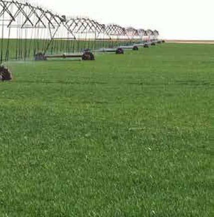
119 PHOTOS

120 PHOTOS

121 PHOTOS

122 SchraderAuction.com Texas Auctioneer: Rex D. Schrader II, #17409 IN COOPERATION WITH TEXAS: Paul A. Lynn & Associates, LLC, Texas Real Estate Broker #
Abbreviated 156 Farm Record
 MISSOURI HOWARD Form: FSA-156EZ See Page 3 for non-discriminatory Statements. United States Department of Agriculture Farm Service Agency Abbreviated 156 Farm Record FARM : Prepared : Crop Year : 4825
CRP HEL CRP Ortho Imagery. Tract Cropland Total: acres
 United States Department of Agriculture Madison County, Iowa 17 4.09 23 1.26 6 10.74 14 2.89 12 1.7 1 18.02 230TH LN T 347 3 34 4.65 13 2.81 2 11.4 ELMWOOD AVE 16 3 6.49 18 6.5 1.59 21 2.35 8.76 24 11
MATHEWS FARM TUNICA MISSISSIPPI 1130 ACRES (+/ ) TUNICA AND DESOTO COUNTY FOR SALE. List Price $6,100,000.
 TUNICA AND DESOTO COUNTY FOR SALE. List Price $6,100,000.") MATHEWS FARM TUNICA MISSISSIPPI 1130 ACRES (+/ ) TUNICA AND DESOTO COUNTY FOR SALE List Price $6,100,000. FARM ACREAGE BREAKDOWN: Map Acres FSA Crop Acres Shop, bins, turn rows, and ditches Tract 1 Main
MATHEWS FARM TUNICA MISSISSIPPI 1130 ACRES (+/ ) TUNICA AND DESOTO COUNTY FOR SALE List Price $6,100,000. FARM ACREAGE BREAKDOWN: Map Acres FSA Crop Acres Shop, bins, turn rows, and ditches Tract 1 Main
Near Sledge, Mississippi. Please call to arrange a private viewing
 $3,958,000.00 $1,685,000 ($4,010/Acre) ($3,539/Acre) Precision Leveled Cropland 936.7 Total Acres - 598.39 Cropland Acres - 32.54 CRP Acres - 252.7 Timberland Acres (5) Irrigation Wells CRP Income: $6,500
160 Acres of Tillable Land, Alfalfa, Pasture, Building Site, and Rec Area in Sun Prairie Township! Thursday, November 1, 2018 at NOON
 160+/- Acres of McCook County land 160 Acres of Tillable Land, Alfalfa, Pasture, Building Site, and Rec Area in Sun Prairie Township! Thursday, November 1, 2018 at NOON Located from Salem, SD on US HWY
Total Acres: Tillable Acres: Irrigated Acres: All Improvements will be managed by Farmers National Company / CHS.
 GROUP P Parcel # Acres Twp County FSA Farm FSA Tract Tillable Acres Irrigated Acres 14-040-011-022-00 105.00 Lagrange Cass 7797 7858 262.12 72.50 14-040-011-022-10 5.00 Lagrange Cass 7797 7858 w 040-011-022-00
YELLOW MEDICINE COUNTY FARMS FOR SALE
 YELLOW MEDICINE COUNTY FARMS FOR SALE Owners Rhea Trusts 790+ acres of high quality cropland in western Yellow Medicine County, MN. The land has been owned by the Rhea family for many years. The land includes
105 (+/-) acres Jefferson County, Arkansas
 acres Jefferson County, Arkansas") offered for sale THE PB 105 A recreational and agricultural investment opportunity. 105 (+/-) acres Jefferson County, Arkansas offered by Licensed in Arkansas, Louisiana, Mississippi, Tennessee and Texas
offered for sale THE PB 105 A recreational and agricultural investment opportunity. 105 (+/-) acres Jefferson County, Arkansas offered by Licensed in Arkansas, Louisiana, Mississippi, Tennessee and Texas
BROWN COUNTY FARMLAND AUCTION
 BROWN COUNTY FARMLAND AUCTION CROP - PASTURE - HUNTING - INVESTMENT 62 Acres +/- TUESDAY, NOVEMBER, 1 :30am Auction Location: The DEC (Dakota Event Center) - Lamont St. - Aberdeen, SD 5401 Mercier & Ravina
What is a published soil survey?
 What is a published soil survey? A soil survey is a detailed report on the soils of an area. The soil survey has maps with soil boundaries and photos, descriptions, and tables of soil properties and features.
Management and Use of LiDAR-derived Information. Elizabeth Cook, GIS Specialist
 Management and Use of LiDAR-derived Information Elizabeth Cook, GIS Specialist Advanced LiDAR Workshop March 15, 2012 50-100 gb/county Now What? Project Deliverables LAS mass point files, classification
Crop Progress. Corn Mature Selected States [These 18 States planted 92% of the 2017 corn acreage]
![Crop Progress. Corn Mature Selected States [These 18 States planted 92% of the 2017 corn acreage]](/thumbs/89/98128758.jpg "Crop Progress. Corn Mature Selected States [These 18 States planted 92% of the 2017 corn acreage]") Crop Progress ISSN: 00 Released October, 0, by the National Agricultural Statistics Service (NASS), Agricultural Statistics Board, United s Department of Agriculture (USDA). Corn Mature Selected s [These
Crop Progress ISSN: 00 Released October, 0, by the National Agricultural Statistics Service (NASS), Agricultural Statistics Board, United s Department of Agriculture (USDA). Corn Mature Selected s [These
² 2015 Program Year. Farm Tract McLeod County, Minnesota 1:4, NHEL NHEL
 United States Department of Agriculture McLeod County, Minnesota Farm 5125 #* 2 3.65 NHEL Tract 2762 1 33.19 NHEL ² 2015 Program Year Map Created November 06, 2014 Common Land Unit Cropland Non-cropland
A DISCOUNT MINI STORAGE
 A DISCOUNT MINI STORAGE 3735 Mangum Rd, Houston, TX 77092 High Density Mini Storage in Near NW Houston and close to newly proposed renovated US290 Highway Renovated Living Quarters, Gated Customer Access,
Custom Soil Resource Report for Clackamas County Area, Oregon
 United States Department of Agriculture Natural Resources Conservation Service A product of the National Cooperative Soil Survey, a joint effort of the United States Department of Agriculture and other
Custom Soil Resource Report for Valley County, Montana
 United States Department of Agriculture Natural Resources Conservation Service A product of the National Cooperative Soil Survey, a joint effort of the United States Department of Agriculture and other
Custom Soil Resource Report for Clackamas County Area, Oregon
 United States Department of Agriculture Natural Resources Conservation Service A product of the National Cooperative Soil Survey, a joint effort of the United States Department of Agriculture and other
Custom Soil Resource Report for Multnomah County Area, Oregon
 United States Department of Agriculture Natural Resources Conservation Service A product of the National Cooperative Soil Survey, a joint effort of the United States Department of Agriculture and other
Carrick Road $798,000
 1955-2020 Carrick Road 165.76± acres Fayette/Scott Counties $798,000 Offered Exclusively By: Zach Davis Principal Broker +1.859.576.8195 www.kirkfarms.com zach@kirkfarms.com Measuring an appx. 165+/- acres,
Soils of Hawai i Dr. Greg Bruland NREM 461
 Soils of Hawai i Dr. Greg Bruland NREM 461 Figure modified from Gavenda et al. 1998 Island Age = million years (mya) Map modified from Gavenda et al. 1998 Island Age = mya 9 of 11 soil orders present Map
Cripps Ranch 76+/- Acres Orchard Development Opportunity Dixon, CA. Presented By:
 Cripps Ranch 76+/- Acres Orchard Development Opportunity Dixon, CA Presented By: Cripps Ranch 76+/- Acres Orchard Development Opportunity Dixon, CA Location: This property is located at 5663 Dally Road
Airtanker. Drop Guides
 United States Department of Agriculture Forest Service Technology & Development Program Airtanker 57-2852-MTDC September 2 51/57 Drop Guides Ground Pattern Performance of the Snow Air Tractor with Constant
TRACT 7: ±252 Acres Irrigated Farmland Grassland
 TRACT 7: ±252 Acres Irrigated Farmland Grassland 1880 FM 2013, Friona, Texas 79035 ±252 acres of irrigated farmland and grassland. This farmland is currently being leased and farmed. The lease agreement
Custom Soil Resource Report for Clark County, Washington
 United States Department of Agriculture Natural Resources Conservation Service A product of the National Cooperative Soil Survey, a joint effort of the United States Department of Agriculture and other
The Wildland Fire Chemical
 United States Department of Agriculture Forest Service Technology & Development Program Airtanker 157-284-MTDC January 21 51/57 Drop Guides Ground Pattern Performance of the National Guard Black Hawk Helicopter
Crop Enterprise Budget Dry Beans, Powell Area
 Crop Enterprise Budget Dry Beans, Powell Area John P. Hewlett, Farm/Ranch Management Extension Specialist Jay Jenkins, Extension Educator Paul A. Burgener, Former Graduate Assistant Jim J. Jacobs, Professor,
MILLS COUNTY, IOWA FARMLAND FOR SALE PRICE REDUCED
 MILLS COUNTY, IOWA FARMLAND FOR SALE PRICE REDUCED Owners: Riverdale Farm Corp. Acres: 302.59 Legal Description: Location: Description: See Attached From I-29/Highway 370 exit, 1 ¾ Miles west on Highway
Input Costs Trends for Arkansas Field Crops, AG -1291
 Input Costs Trends for Arkansas Field Crops, 2007-2013 AG -1291 Input Costs Trends for Arkansas Field Crops, 2007-2013 October 2013 AG-1291 Archie Flanders Department of Agricultural Economics and Agribusiness
For Sale at $437,500.00
 We are pleased to present Carlson Farm 72.43 ± Acres Garden City Township, Blue Earth County For Sale at $437,500.00 Listing Agent: Darrell Hylen, ALC Office: 507-345-LAND (5263) Toll Free: 800-730-LAND
Producing Chandler Walnut Orchard
 AG-LAND Investment Brokers 275 Sale Lane Red Bluff, CA 96080 530-529-4400 Fax 530-527-5042 Producing Chandler Walnut Orchard West Sacramento Avenue - Chico, CA AG-LAND INVESTMENT BROKERS 275 Sale Lane
Custom Soil Resource Report for Bell County, Texas
 United States Department of Agriculture Natural Resources Conservation Service A product of the National Cooperative Soil Survey, a joint effort of the United States Department of Agriculture and other
CALIFORNIA AGRICULTURAL PR OPERTIES, IN C. GALE RANCH
 CALIFORNIA AGRICULTURAL PR OPERTIES, IN C. GALE RANCH LOCATION: The Ranch is located 6 Yi miles west of the City of Davis on the northwest corner of County Roads 29A and 92E in Yolo County. SIZE: 368.64
Town of Enfield, CT Geographic Information Systems
 Geographic Information Systems Geographic Information System Data Distribution Policy Purpose The purpose of this policy is to (1) protect the Town of Enfield, Connecticut ( Town ) against the misuse or
APPROVED JURISDICTIONAL DETERMINATION FORM U.S. Army Corps of Engineers
 APPROVED JURISDICTIONAL DETERMINATION FORM U.S. Army Corps of Engineers This form should be completed by following the instructions provided in Section IV of the JD Form Instructional Guidebook. SECTION
McHenry County Property Search Sources of Information
 Disclaimer: The information in this system may contain inaccuracies or typographical errors. The information in this system is a digital representation of information derived from original documents; as
McHenry County Property Search Sources of Information
 Disclaimer: The information in this system may contain inaccuracies or typographical errors. The information in this system is a digital representation of information derived from original documents; as
The New York City Soil Survey
 The New York City Soil Survey Olga Vargas, USDA-NRCS Soil Scientist May 2018 New York City Soil Survey Program Since 1995 A partnership was established between: NRCS NYC-SWCD Cornell University To address
Seed Cotton Program Workshop
 Seed Cotton Program Workshop USDA FSA, LFBF, LSU AgCenter, Mississippi State University Extension Service Thursday, August 16, 2018 Oak Grove, LA Seed Cotton Program Workshop Program Overview and Farm
Commentary on Factors Affecting Transverse Vibration Using an Idealized Theoretical Equation
 United States Department of Agriculture Forest Service Forest Products Laboratory Research Note FPL RN 076 Commentary on Factors Affecting Transverse Vibration Using an Idealized Theoretical Equation Joseph
GIS APPLICATIONS IN SOIL SURVEY UPDATES
 GIS APPLICATIONS IN SOIL SURVEY UPDATES ABSTRACT Recent computer hardware and GIS software developments provide new methods that can be used to update existing digital soil surveys. Multi-perspective visualization
O\.OLSSON \ ASSOC I ATES
 O\.OLSSON \ ASSOC I ATES NRCS Soils Report Larry D. Knox Juniper Hills Private Landing Strip ) OAProject No. 012-1776 760 Horizon Drive, Suite 1021 Grand Junction, CO 815061 TEL 970.263.7800 I FAX 970.263.7456
Custom Soil Resource Report for Polk County, Oregon
 United States Department of Agriculture Natural Resources Conservation Service A product of the National Cooperative Soil Survey, a joint effort of the United States Department of Agriculture and other
E-Community Check Request Checklist
 E-Community Check Request Checklist The E-Community must complete the following information on each business approved for a loan or grant in order for the Kansas Center of Entrepreneurship (KCFE) to disburse
U. S. Postal Service
 U. S. Postal Service Equal Employment Opportunity Data Posted Pursuant to Title III of the Notification and Federal Employee Antidiscrimination and Retaliation Act of 2002 (No FEAR Act), Public Law 107-174
Custom Soil Resource Report for Clackamas County Area, Oregon
 United States Department of Agriculture Natural Resources Conservation Service A product of the National Cooperative Soil Survey, a joint effort of the United States Department of Agriculture and other
Custom Soil Resource Report for Coryell County, Texas
 United States Department of Agriculture Natural Resources Conservation Service A product of the National Cooperative Soil Survey, a joint effort of the United States Department of Agriculture and other
Equal Employment Opportunity Data Posted Pursuant to the No FEAR Act
 Page 1 of 7 U. S. Postal Service Equal Employment Opportunity Data Posted Pursuant to Title III of the Notification and Federal Employee Antidiscrimination and Retaliation Act of 2002 (No FEAR Act), Public
Western Area U. S. Postal Service
 Western Area U. S. Postal Service Equal Employment Opportunity Data Posted Pursuant to Title III of the Notification and Federal Employee Antidiscrimination and Retaliation Act of 2002 (No FEAR Act), Public
Eastern Area U. S. Postal Service
 Eastern Area U. S. Postal Service Equal Employment Opportunity Data Posted Pursuant to Title III of the Notification and Federal Employee Antidiscrimination and Retaliation Act of 2002 (No FEAR Act), Public
Great Lakes Area U. S. Postal Service
 Great Lakes Area U. S. Postal Service Equal Employment Opportunity Data Posted Pursuant to Title III of the Notification and Federal Employee Antidiscrimination and Retaliation Act of 2002 (No FEAR Act),
Northeast Area U. S. Postal Service
 Northeast Area U. S. Postal Service Equal Employment Opportunity Data Posted Pursuant to Title III of the Notification and Federal Employee Antidiscrimination and Retaliation Act of 2002 (No FEAR Act),
CALIFORNIA AGRICULTURAL PR OPERTIES, IN C. BOWLSBEY 320 LIBERTY ISLAND ROAD BUYER: RASSMUSSEN TRUST
 CALIFORNIA AGRICULTURAL PR OPERTIES, IN C. BOWLSBEY 320 LIBERTY ISLAND ROAD SELLER: BOWLSBEY TRUST BUYER: RASSMUSSEN TRUST LOCATION: The Bowlsbey 320 is located ten (10) miles southeast of the City of
Equal Employment Opportunity Data Posted Pursuant to the No FEAR Act
 Page 1 of 7 Eastern Area U. S. Postal Service Equal Employment Opportunity Data Posted Pursuant to Title III of the Notification and Federal Employee Antidiscrimination and Retaliation Act of 2002 (No
Equal Employment Opportunity Data Posted Pursuant to the No Fear Act: Army (and below)
") Equal Employment Opportunity Data Posted Pursuant to the No Fear Act: Army (and below) For 4th Quarter 2013 for period ending September, 2013 **This report is based on the Complaint Against hierarchy.**
Equal Employment Opportunity Data Posted Pursuant to the No Fear Act: Army (and below) For 4th Quarter 2013 for period ending September, 2013 **This report is based on the Complaint Against hierarchy.**
Capital Metro Area U. S. Postal Service
 Capital Metro Area U. S. Postal Service Equal Employment Opportunity Data Posted Pursuant to Title III of the Notification and Federal Employee Antidiscrimination and Retaliation Act of 2002 (No FEAR Act),
Fall River Valley Irrigated Farmland
 AG-LAND Investment Brokers 275 Sale Lane Red Bluff, CA 96080 530-529-4400 Fax 530-527-5042 Fall River Valley Irrigated Farmland Tehama McArthur, County, California 2015 well, 16 inch casing, 150 HP, 2,000
Custom Soil Resource Report for Hansford County, Texas
 United States Department of Agriculture Natural Resources Conservation Service A product of the National Cooperative Soil Survey, a joint effort of the United States Department of Agriculture and other
Custom Soil Resource Report for St. Lucie County, Florida
 United States Department of Agriculture Natural Resources Conservation Service A product of the National Cooperative Soil Survey, a joint effort of the United States Department of Agriculture and other
Aerial Map. map center: 43 24' 27.29, ' ft 1886ft 3773ft. 9-99N-72W Gregory County South Dakota
 Aerial Map map center: 43 24' 27.29, -99 21' 57.12 0ft 1886ft 3773ft 9-99N-72W Gregory County South Dakota 1/23/2019 338 Ave 339 Ave 340 Ave 341 Ave 342 Ave 343 Ave 344 Ave LANDING CREEK TOWNSHIP T 99
Custom Soil Resource Report for Southampton County, Virginia
 United States Department of Agriculture Natural Resources Conservation Service A product of the National Cooperative Soil Survey, a joint effort of the United States Department of Agriculture and other
Custom Soil Resource Report for Santa Fe Area, New Mexico, Santa Fe County and Part of Rio Arriba County; and Santa Fe County Area, New Mexico
 United States Department of Agriculture Natural Resources Conservation Service A product of the National Cooperative Soil Survey, a joint effort of the United States Department of Agriculture and other
Acknowledgment of Aramco Asia. Supplier Code of Conduct
 Acknowledgment of Aramco Asia Supplier Code of Conduct (Applicable to Vendors, Manufacturers, and Contractors) Aramco Asia is committed to the highest ethical and legal standards in the conduct of its
Sacramento River Farmland Anderson, California
 AG-LAND INVESTMENT BROKERS 275 Sale Lane / P. O. Box 896 Red Bluff, CA 96080 530.529.4400 office / 530.527.5042 fax Sacramento River Farmland Anderson, California Property: 45 +/- acres of farmland with
Capital Metro Area U. S. Postal Service
 Capital Metro Area U. S. Postal Service Equal Employment Opportunity Data Posted Pursuant to Title III of the Notification and Federal Employee Antidiscrimination and Retaliation Act of 2002 (No FEAR Act),
Pacific Area U. S. Postal Service
 Pacific Area U. S. Postal Service Equal Employment Opportunity Data Posted Pursuant to Title III of the Notification and Federal Employee Antidiscrimination and Retaliation Act of 2002 (No FEAR Act), Public
For Sale on Bids. Open House By Appointment
 For Sale on Bids Written Bid Deadline: Friday, September 7, by 12:00 P.M. Noon 52+/- Acres & Storage Facility Grand Forks, ND Property Location: Conveniently located off Interstate 29 and North Washington
North Dakota Lignite Energy Industry's Contribution to the State Economy for 2002 and Projected for 2003
 AAE 03002 March 2003 North Dakota Lignite Energy Industry's Contribution to the State Economy for 2002 and Projected for 2003 Randal C. Coon and F. Larry Leistritz * This report provides estimates of the
2004 Report on Roadside Vegetation Management Equipment & Technology. Project 2156: Section 9
 2004 Report on Roadside Vegetation Management Equipment & Technology Project 2156: Section 9 By Craig Evans Extension Associate Doug Montgomery Extension Associate and Dr. Dennis Martin Extension Turfgrass
Custom Soil Resource Report for Polk County, Oregon
 United States Department of Agriculture Natural Resources Conservation Service A product of the National Cooperative Soil Survey, a joint effort of the United States Department of Agriculture and other
Digital Mapping License Agreement
 City of Des Moines, Iowa GIS Division, Information Technology Department Digital Mapping License Agreement PURPOSE AND NATURE OF THE AGREEMENT This Digital Mapping License Agreement ("Agreement") is executed
Esri Image & Mapping Forum 9 July 2017 Geiger-Mode for Conservation Planning & Design by USDA NRCS NGCE
 Esri Image & Mapping Forum 9 July 2017 Geiger-Mode for Conservation Planning & Design by USDA NRCS NGCE For over 75 years, the Natural Resources Conservation Service has been a pioneer in conservation,
 United States Department of Agriculture Natural Resources Conservation Service A product of the National Cooperative Soil Survey, a joint effort of the United States Department of Agriculture and other
Chapter 10 MOVING WITH CONTINUED ASSISTANCE AND PORTABILITY
 INTRODUCTION Chapter 10 MOVING WITH CONTINUED ASSISTANCE AND PORTABILITY Freedom of housing choice is a hallmark of the housing choice voucher (HCV) program. In general, HUD regulations impose few restrictions
Lakeland Court MHP Norton Rd Lakeland, FL 33809
 23-space/units - 2 Block Homes - 2 Duplexes 75% Occupied - Annual Leases - Long Term Tenants City Water - Septic Possible 3 additional spaces can be added Seller may consider offering Seller Financing
POSITION DESCRIPTION. Position Title: Geographic Information Systems (GIS) Coordinator Department: Engineering
 Coordinator Department: Engineering") POSITION DESCRIPTION Position Title: Geographic Information Systems (GIS) Coordinator Department: Engineering Reports To: Engineering Supervisor FLSA Status: Exempt Date: April 2018 PRIMARY OBJECTIVE OF
POSITION DESCRIPTION Position Title: Geographic Information Systems (GIS) Coordinator Department: Engineering Reports To: Engineering Supervisor FLSA Status: Exempt Date: April 2018 PRIMARY OBJECTIVE OF
Chittenden Road Prune Orchard Corning, California
 AG-LAND INVESTMENT BROKERS 275 Sale Lane / P. O. Box 896 Red Bluff, CA 96080 530.529.4400 office / 530.527.5042 fax Chittenden Road Prune Orchard Corning, California Property: 40.00 acres planted to producing
Custom Soil Resource Report for Potter County, Texas
 United States Department of Agriculture Natural Resources Conservation Service A product of the National Cooperative Soil Survey, a joint effort of the United States Department of Agriculture and other
Name of Applicant Mailing Address address Telephone Number
 District Court, Water Division, Colorado Court Address: CONCERNING THE APPLICATION FOR WATER RIGHTS OF Applicant: In the River or its Tributaries In COUNTY Attorney or Party Without Attorney (Name and
Custom Soil Resource Report for Clackamas County Area, Oregon, and Marion County Area, Oregon
 United States Department of Agriculture Natural Resources Conservation Service A product of the National Cooperative Soil Survey, a joint effort of the United States Department of Agriculture and other
Custom Soil Resource Report for Stevens County, Washington
 United States Department of Agriculture Natural Resources Conservation Service A product of the National Cooperative Soil Survey, a joint effort of the United States Department of Agriculture and other
Custom Soil Resource Report for Marion County Area, Oregon
 United States Department of Agriculture Natural Resources Conservation Service A product of the National Cooperative Soil Survey, a joint effort of the United States Department of Agriculture and other
Custom Soil Resource Report for Hamilton County, Texas
 United States Department of Agriculture Natural Resources Conservation Service A product of the National Cooperative Soil Survey, a joint effort of the United States Department of Agriculture and other
Equal Employment Opportunity Data Posted Pursuant to the No Fear Act: Army (and below)
") Equal Employment Opportunity Data Posted Pursuant to the No Fear Act: Army (and below) For 4th Quarter 2016 for period ending September, 2016 **This report is based on the Complaint Against hierarchy.**
Equal Employment Opportunity Data Posted Pursuant to the No Fear Act: Army (and below) For 4th Quarter 2016 for period ending September, 2016 **This report is based on the Complaint Against hierarchy.**
Background and Assumptions
 2013 Costs and Returns Estimate Southwest Idaho: Treasure valley Commercial Dry Beans Kathleen Painter Background and Assumptions Southwestern Idaho The University of Idaho s costs and returns estimates
Custom Soil Resource Report for San Juan Area, Puerto Rico
 United States Department of Agriculture Natural Resources Conservation Service A product of the National Cooperative Soil Survey, a joint effort of the United States Department of Agriculture and other
Equal Employment Opportunity Data Posted Pursuant to the No Fear Act: Army (and below)
") Content Body Navigation Links Connect Portal MicroPact icomplaints System Session will expire in 30 minutes Thu Jan 31 06:51:39 GMT 2019 Report Filter/Options Exit NoFear Module Equal Employment Opportunity
Content Body Navigation Links Connect Portal MicroPact icomplaints System Session will expire in 30 minutes Thu Jan 31 06:51:39 GMT 2019 Report Filter/Options Exit NoFear Module Equal Employment Opportunity
Custom Soil Resource Report for Clackamas County Area, Oregon
 United States Department of Agriculture Natural Resources Conservation Service A product of the National Cooperative Soil Survey, a joint effort of the United States Department of Agriculture and other
Background and Assumptions
 2017 Costs and Returns Estimate Southcentral Idaho: Magic Valley Alfalfa Hay Establishment with Oats Ben Eborn Magic Valley Background and Assumptions The University of Idaho s costs and returns estimates
Custom Soil Resource Report for Livingston Parish, Louisiana
 United States Department of Agriculture Natural Resources Conservation Service A product of the National Cooperative Soil Survey, a joint effort of the United States Department of Agriculture and other
2.a.. Physical Factors General Map
 2.a.. Physical Factors General Map General Map: Provide map showing proposed site location within the State and County, depicting road(s) accessing the site. i. Provide information depicting the location
Denis White NSI Technical Services Corporation 200 SW 35th St. Corvallis, Oregon 97333
 POLYGON OVERLAY TO SUPPORT POINT SAMPLE MAPPING: THE NATIONAL RESOURCES INVENTORY Denis White NSI Technical Services Corporation 200 SW 35th St. Corvallis, Oregon 97333 Margaret Maizel ' American Farmland
APPLICATION FOR CONDITIONAL ABSOLUTE WATER STORAGE RIGHT
 District Court, Water Division, Colorado Court Address: CONCERNING THE APPLICATION FOR WATER RIGHTS OF Applicant: In the River or its Tributaries In COUNTY Attorney or Party Without Attorney (Name and
MAIN CIVIL WORKS CONTRACT SCHEDULE 3 ROLES AND REPRESENTATIVES TABLE OF CONTENTS
 MAIN CIVIL WORKS CONTRACT SCHEDULE 3 ROLES AND REPRESENTATIVES TABLE OF CONTENTS 1 INTERPRETATION... 1 1.1 Definitions... 1 2 HYDRO S REPRESENTATIVE... 1 2.1 Appointment of Hydro s Representative... 1
GIS SERVICE CENTER MAP ORDER FORM
 Steven V. Stenger County Executive Pam Reitz Director of Administration GIS SERVICE CENTER MAP ORDER FORM 1. Print this form. 2. Fill out the form calculate and include the total cost of your order. 3.
Background & Assumptions
 EBB2 SWWW 15 2015 Costs and Returns Estimate.. Southwestern Idaho: Treasure Valley Soft White Winter Wheat Ben Eborn Southwestern Idaho Background & Assumptions The University of Idaho s costs and returns
Custom Soil Resource Report for Wasco County, Oregon, Northern Part
 United States Department of Agriculture Natural Resources Conservation Service A product of the National Cooperative Soil Survey, a joint effort of the United States Department of Agriculture and other
Chapter 10 MOVING WITH CONTINUED ASSISTANCE AND PORTABILITY
 INTRODUCTION Chapter 10 MOVING WITH CONTINUED ASSISTANCE AND PORTABILITY Freedom of housing choice is a hallmark of the housing choice voucher (HCV) program. In general, HUD regulations impose few restrictions
North Dakota Lignite Energy Industry s Contribution to the State Economy
 Agricultural Economics Miscellaneous Report No. 186 May 2000 North Dakota Lignite Energy Industry s Contribution to the State Economy Randal C. Coon, and F. Larry Leistritz* Department of Agricultural
VIKING INSPECTION PROPERTY 4921 U.S. Hwy. 85, Williston, ND 58801
 SALE PRICE: $799,000 LOT SIZE: +/-2.49 Acres BUILDING SIZE: +/-3,800 SF DRIVE-IN DOORS 2 CEILING HEIGHT: 16' YEAR BUILT: 2007 ZONING: Commercial PROPERTY OVERVIEW Highly visible, hard-to-find small shop/office/apartment
Custom Soil Resource Report for Coryell County, Texas
 United States Department of Agriculture Natural Resources Conservation Service A product of the National Cooperative Soil Survey, a joint effort of the United States Department of Agriculture and other