REPORT BY THE HYDROGRAPHIC AND GEODETIC SERVICE OF THE REPUBLIC OF CUBA. 18 th MESO AMERICAN AND CARIBBEAN SEA HYDROGRAPHIC COMMISSION MEETING
|
|
|
- Everett O’Connor’
- 5 years ago
- Views:
Transcription

1 REPORT BY THE HYDROGRAPHIC AND GEODETIC SERVICE OF THE REPUBLIC OF CUBA 18 th MESO AMERICAN AND CARIBBEAN SEA HYDROGRAPHIC COMMISSION MEETING

2 1. STRUCTURE OF THE HYDROGRAPHIC AND GEODETIC SERVICE OF THE REPUBLIC OF CUBA (HGSC) ONHG HYDROGRAPHIC AND GEODETIC NATIONAL OFFICE Fulfills the functions of representing the Cuban State and executing the State policies GEOCUBA BUSINESS GROUP Conducts productive activities and marketing
3 2. HYDROGRAPHIC SURVEYS NEW HYDROGRAPHIC SURVEYS WITH CARTOGRAPHIC PURPOSES EQUIPMENT ORDER OF PRECISION (S44) REGION OR PLACE NEW BATYMETRIC DATA FOR NAUTICAL CHARTS Single beam echosounders I y II Tract of coastal sailing from Punta Maisí to Cabo Cruz 11534, 11536, Swath Echo Sounders (EM- 2040C) Special and I Bahía del Mariel Bahía de Nuevitas Bahía de Puerto Padre Puerto de Casasa 11824, , 11859,

4 2. HYROGRAPHIC SURVEYS CURRENT CHALLENGES WE DON'T HAVE THE APPROPRIATE TECHNOLOGY FOR THE HYDROGRAPHIC SURVEYS IN SHALLOW AND DANGEROUS WATERS.
5 3. ELECTRONIC NAVIGATIONAL CHART Current Status of the ENC Production STATUS USAGE BAND TITLES IC ENC IN PRODUCTION DISTRIBUTION VALIDATION TOTAL

6 3. NATIONAL PAPER CHARTS New Charts No. Range of Scale 1: Paper Chart Quantity BSB Quantity 1 Smaller than Larger than Total 4 4
7 3. NATIONAL PAPER CHARTS New Editions No. Range of Scale 1: Paper Chart Quantity BSB Quantity 1 Smaller than Larger than Total 25 25
8 3. NATIONAL PAPER CHARTS Currents Cartographic Coverage No. Range of Scale 1: Paper Chart Quantity Quantity BSB 1 Smaller than Larger than Total

9 3. INT CHARTS INT Charts (4)


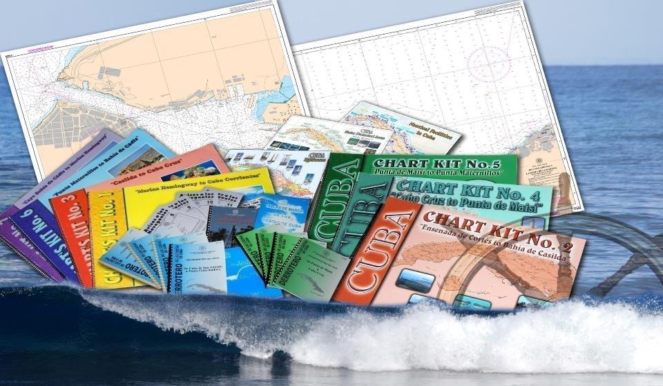
10 3. OTHER CHARTS STATUS OF THE YACHTING CHARTS: 8 Albums

11 3. NAUTICAL CHARTS AND PUBLICATIONS CURRENT CHALLENGES WE DON'T HAVE: SOFTWARE FOR ENC VALIDATION. UPDATED CARIS LICENSES. ACCESS TO HIGH RESOLUTION SATELLITE IMAGES.
12 4. NAUTICAL PUBLICATIONS STATUS -NOTICE TO MARINERS (Monthly). -ANNUAL SUMMARY NOTICE TO MARINERS. -LIGHTS LIST OF CUBA. -SAILING DIRECTION (9 fascicles). -TIDE TABLES OF CUBA. -NAUTICAL ALMANAC. -SYMBOLS, ABBREVIATIONS AND TERMS USED ON CHARTS (INT1). -CHARTS AND NAUTICAL PUBLICATIONS CATALOGUE.
 AND ANNUAL SUMMARY IS AVAILABLE ON THE WEBSITE www.iderc.")
.")
13 5. MARITIME SAFETY INFORMATION (MSI) CURRENT STATUS NOTICE TO MARINERS (MONTHLY) AND ANNUAL SUMMARY IS AVAILABLE ON THE WEBSITE CURRENT CHALLENGES WE DON'T HAVE INFRASTRUCTURE FOR: NAVIGATIONAL INFORMATION BROADCAST (S-53). GMDSS IMPLEMENTATION (IMO Publication GMDSS Handbook).
14 6. C-55 BASIC DATA No. Description Data Updating 1 Nation / Maritime Zone. Cuba Cuba 2 Code ISO of the Nation / Maritime Zone. 3 ID. Region NC NC 4 Nation or Maritime Zone N N 5 EEZ (km 2 x 1000) Length of Coastline 2500 km 2500 km 8 Last Updating December 2016 December IHO Membership S S CU CU
, Busan, ROK, 05 June 30")
15 7. CAPACITY BUILDING TRAINING RECEIVED Phase 3 of Category B" Marine Geospatial Information Programme, sponsored by the Republic of Korea, (KHOA), Busan, ROK, 05 June 30 July 2017.
16 7. CAPACITY BUILDING TRAINING NEEDED HYDROGRAPHY NAUTICAL CARTOGRAPHY ENC VALIDATION MARITIME BOUNDARIES MARINE SPATIAL DATA INFRASTRUCTURE
17 8. OCEANOGRAPHIC ACTIVITIES MAIN INSTITUTIONS ONHG AND GEOCUBA (HGSC). INSTITUTE OF OCEANOLOGY (MINISTRY OF SCIENCE AND TECHNOLOGY). MARINE RESEARCH CENTER OF THE HAVANA UNIVERSITY. MAIN ACTIVITIES OCEANOGRAPHIC DATA COLLECTION AND MEANSUREMENTS IN SPECIFIC AREAS. GENERATION OF NUMERICAL MODELS (SMS, SISCOM, ROMS). MODELING OF TRAJECTORY FORECAST.
18 9. CONCLUSIONS 1. The Republic of Cuba has an area of hydrographic responsibility of km 2, the 92,5% are surveyed and the 49,5% requires resurveys to modern standars of IHO. 2. The series of nautical charts produced and printed by the Republic of Cuba cover the jurisdictional waters of its responsibility and comply with the IHO international standards for Paper Charts, Raster (BSB), Vectorial Chart (S-57) and INT Charts.
19 THANK YOU
National Report Suriname 2014
 MARITIEME AUTHORITY SURINAME National Report Suriname 2014 15th MEETING OF THE MESO AMERICAN AND CARIBBEAN SEA HYDROGRAPHIC COMMISSION (MACHC) 10 13 December 2013 Manzanillo, Mexico 1. Hydrographic Office
14 th NIOHC, Myanmar National Report MYANMAR NAVAL HYDROGRAPHIC CENTRE (MNHC) NATIONAL REPORT HYDROGRAPHIC DEPARTMENT, ROYAL THAI NAVY-HDRTN
 NATIONAL REPORT HYDROGRAPHIC DEPARTMENT, ROYAL THAI NAVY-HDRTN") 14 th NIOHC, Myanmar National Report MYANMAR NAVAL HYDROGRAPHIC CENTRE (MNHC) NATIONAL REPORT 14 th NORTH INDIAN OCEAN HYDROGRAPHIC COMMISSION CONFERENCE HYDROGRAPHIC DEPARTMENT, ROYAL THAI NAVY-HDRTN
14 th NIOHC, Myanmar National Report MYANMAR NAVAL HYDROGRAPHIC CENTRE (MNHC) NATIONAL REPORT 14 th NORTH INDIAN OCEAN HYDROGRAPHIC COMMISSION CONFERENCE HYDROGRAPHIC DEPARTMENT, ROYAL THAI NAVY-HDRTN
PORTUGAL NATIONAL REPORT
 PORTUGAL NATIONAL REPORT 14 TH MEETING OF THE EASTERN ATLANTIC HYDROGRAPHIC COMMISSION Cadiz, Spain 18 th 20 th October 2016 INSTITUTO HIDROGRÁFICO Miguel Arenga IHPT Head of the Hydrography Division 2016-10-18
THAILAND NATIONAL REPORT
 NIOHC14 TH National Report THAILAND NATIONAL REPORT 14 th NORTH INDIAN OCEAN HYDROGRAPHIC COMMISSION (NIOHC) CONFERENCE Bangkok, Thailand 26 th 28 th February 2014 1 CONTENTS 1. Hydrographic Office / Service...
PORTUGAL NATIONAL REPORT
 PORTUGAL NATIONAL REPORT 13 TH SOUTHERN AFRICA AND ISLANDS HYDROGRAPHIC COMMISSION MEETING Cape Town, South Africa 29 th 31 st August 2016 INSTITUTO HIDROGRÁFICO Miguel Arenga IHPT Head of the Hydrography
THAILAND NATIONAL REPORT
 NIOHC18 TH National Report THAILAND NATIONAL REPORT 18 th NORTH INDIAN OCEAN HYDROGRAPHIC COMMISSION (NIOHC) CONFERENCE Goa, India 9 th 12 th April 2018-1 - CONTENTS 1. Hydrographic Office / Service 3
PAKISTAN NATIONAL REPORT
 PAKISTAN NATIONAL REPORT 16 th MEETING NORTH INDIAN OCEAN HYDROGRAPHIC COMMISSION (NIOHC) CHITTAGONG, BANGLADESH 14-16 MARCH 2016 BY PAKISTAN NAVY HYDROGRAPHIC DEPARTMENT HYDROGRAPHIC DEPARTMENT OF PAKISTAN
R E P U B L I C O F C Y P R U S. NATIONAL REPORT OF CYPRUS TO THE 19 th MEDITERRANEAN AND BLACK SEAS HYDROGRAPHIC COMMISSION (MBSHC)
") R E P U B L I C O F C Y P R U S NATIONAL REPORT OF CYPRUS TO THE 19 th MEDITERRANEAN AND BLACK SEAS HYDROGRAPHIC COMMISSION (MBSHC) BATUMI MEETING 30 JUNE TO 02 JULY 2015 NATIONAL REPORT OF CYPRUS TO THE
R E P U B L I C O F C Y P R U S NATIONAL REPORT OF CYPRUS TO THE 19 th MEDITERRANEAN AND BLACK SEAS HYDROGRAPHIC COMMISSION (MBSHC) BATUMI MEETING 30 JUNE TO 02 JULY 2015 NATIONAL REPORT OF CYPRUS TO THE
PAKISTAN NATIONAL REPORT. 12 th MEETING NORTH INDIAN OCEAN HYDROGRAPHIC COMMISSION (NIOHC) Colombo, Sri Lanka March 2012
 Colombo, Sri Lanka March 2012") PAKISTAN NATIONAL REPORT 12 th MEETING NORTH INDIAN OCEAN HYDROGRAPHIC COMMISSION (NIOHC) Colombo, Sri Lanka 20-23 March 2012 BY PAKISTAN NAVY HYDROGRAPHIC DEPARTMENT HYDROGRAPHIC DEPARTMENT OF PAKISTAN
PAKISTAN NATIONAL REPORT 12 th MEETING NORTH INDIAN OCEAN HYDROGRAPHIC COMMISSION (NIOHC) Colombo, Sri Lanka 20-23 March 2012 BY PAKISTAN NAVY HYDROGRAPHIC DEPARTMENT HYDROGRAPHIC DEPARTMENT OF PAKISTAN
NATIONAL REPORT OF ESTONIA
 BSHC 21 th Conference 27-29 Sept 2016 Klaipeda, Lithuania NATIONAL REPORT OF ESTONIA Executive summary This report summarizes the activities of the Estonian Maritime Administration in the field of hydrography
INTERNATIONAL HYDROGRAPHIC ORGANIZATION MESO AMERICAN & CARIBBEAN SEA HYDROGRAPHIC COMMISSION
 INTERNATIONAL HYDROGRAPHIC ORGANIZATION MESO AMERICAN & CARIBBEAN SEA HYDROGRAPHIC COMMISSION CAPACITY BUILDING PLAN Programme document for the period 2010-2012 1. INTRODUCTION 1.1. Rationale It is estimated
Maritime Standards. Rafael Ponce Tom De Puyt
 Maritime Standards Rafael Ponce Tom De Puyt Content The International Hydrographic Organization - Overview - Existing Support - Committees and Working Groups - Technology - Runtime - MCS Next Generation
PAKISTAN NATIONAL REPORT. 3 rd ROPME Sea Area Hydrographic Commission (RSAHC) Meeting 8 and 9 June Monaco PAKISTAN NAVY HYDROGRAPHIC DEPARTMENT
 Meeting 8 and 9 June Monaco PAKISTAN NAVY HYDROGRAPHIC DEPARTMENT") PAKISTAN NATIONAL REPORT 3 rd ROPME Sea Area Hydrographic Commission (RSAHC) Meeting 8 and 9 June 2009 Monaco PAKISTAN NAVY HYDROGRAPHIC DEPARTMENT HYDROGRAPHIC DEPARTMENT OF PAKISTAN (NATIONAL REPORT
PAKISTAN NATIONAL REPORT 3 rd ROPME Sea Area Hydrographic Commission (RSAHC) Meeting 8 and 9 June 2009 Monaco PAKISTAN NAVY HYDROGRAPHIC DEPARTMENT HYDROGRAPHIC DEPARTMENT OF PAKISTAN (NATIONAL REPORT
PAKISTAN NAVY HYDROGRAPHIC DEPARTMENT
 PAKISTAN NATIONAL REPORT 5th MEETING ROPME SEA ARAE HYDROGRAPHIC COMMISSION (RASHC) Riyadh, Saudi Arabia 04-06 March 2013 PAKISTAN NAVY HYDROGRAPHIC DEPARTMENT HYDROGRAPHIC DEPARTMENT OF PAKISTAN (NATIONAL
IHO Input to the Report of the UN Secretary General on Oceans and Law of the Sea Executive Summary General
 IHO Input to the Report of the UN Secretary General on Oceans and Law of the Sea The following notes provide information on activities of the International Hydrographic Organization that are relevant to
R E P U B L I C O F C Y P R U S NATIONAL REPORT OF CYPRUS TO THE MEDITERRANEAN AND BLACK SEAS HYDROGRAPHIC COMMISSION (MBSHC)
") R E P U B L I C O F C Y P R U S NATIONAL REPORT OF CYPRUS TO THE MEDITERRANEAN AND BLACK SEAS HYDROGRAPHIC COMMISSION (MBSHC) ISTANBUL MEETING 25-27 SEPTEMBER 2013 NATIONAL REPORT OF CYPRUS TO THE MEDITERRANEAN
R E P U B L I C O F C Y P R U S NATIONAL REPORT OF CYPRUS TO THE MEDITERRANEAN AND BLACK SEAS HYDROGRAPHIC COMMISSION (MBSHC) ISTANBUL MEETING 25-27 SEPTEMBER 2013 NATIONAL REPORT OF CYPRUS TO THE MEDITERRANEAN
ISRAEL NATIONAL REPORT 2015
 State of Israel Ministry of Construction Survey of Israel Geodesy, Cadastre, Hydrography, Mapping and GIS ISRAEL NATIONAL REPORT 2015 to the 19 th MEDITERRANEAN AND BLACK SEA HYDROGRAPHIC COMMISSION (MBSHC)
THAILAND NATIONAL REPORT
 NIOHC19 TH National Report THAILAND NATIONAL REPORT 19 th MEETING OF THE NORTH INDIAN OCEAN HYDROGRAPHIC COMMISSION (NIOHC19) MUSCAT, OMAN 25 th 28 th March 2019-1 - CONTENTS 1. Hydrographic Office / Service
NATIONAL REPORT OF POLAND
 NATIONAL REPORT OF Executive summary This report summarizes activities of the Hydrographic Office/Service in the field of hydrography since the previous Baltic Sea Hydrographic Commission 18th Conference
Pan American Institute of Geography and History. 12th MACHC 5-9 December 2011
 Pan American Institute of Geography and History 12th MACHC 5-9 December 2011 1 PAIGH Mission and Objectives To encourage, coordinate, and publicize cartographical, geographical, geophysical and historical
HYDROGRAPHIC SECTION QATAR NATIONAL REPORT TO THE 6 TH ROPME SEA AREA HYDROGRAPHIC COMMISSION MEETING
 HYDROGRAPHIC SECTION QATAR NATIONAL REPORT TO THE 6 TH ROPME SEA AREA HYDROGRAPHIC COMMISSION MEETING ABU DHABI, UNITED ARAB EMIRATES 9 11 FEBRUARY 2015 Page left intentionally blank 1. Hydrographic Section
Arctic Regional Hydrographic Commission (ARHC) Portsmouth, New Hampshire, United States, January 29-30, Hydrographic National Report of Denmark
 Portsmouth, New Hampshire, United States, January 29-30, Hydrographic National Report of Denmark") ARHC4-2.2 Arctic Regional Hydrographic Commission (ARHC) Portsmouth, New Hampshire, United States, January 29-30, 2014 Hydrographic National Report of Denmark January 2014 1. Hydrographic Office January
ARHC4-2.2 Arctic Regional Hydrographic Commission (ARHC) Portsmouth, New Hampshire, United States, January 29-30, 2014 Hydrographic National Report of Denmark January 2014 1. Hydrographic Office January
GEOMATICA 2004 Geospatial Technology: Trends and Opportunities La Habana, Cuba, May, 2004
 IHB File No. S1/3008 CIRCULAR LETTER 29/2004 23 April 2004 GEOMATICA 2004 Geospatial Technology: Trends and Opportunities La Habana, Cuba, 10-14 May, 2004 Reference: IHB Circular Letter 74/2003, dated
Options in Capacity Building. Underpinning the Blue Economy. Slide 1/78. Derrick R. Peyton. 14 th MACHC Meeting. IIC Technologies. December 9-13, 2013
 Options in Capacity Building Underpinning the Blue Economy Derrick R. Peyton IIC Technologies 14 th MACHC Meeting December 9-13, 2013 Slide 1/78 Overview Blue Economy Defined Challenges (SDI, MSDI, Standards)
STATUS QUO REPORT ON ENC ACTIVITIES
 NETWORK OF DANUBE WATERWAY ADMINISTRATIONS South-East European Transnational Cooperation Programme STATUS QUO REPORT ON ENC ACTIVITIES UA - ONMA Document ID: Activity: 5.2 Author / Project Partner: Date:
National Report of Finland
 of Executive Summary This Report highlights the main activities and achievements of the Finnish Hydrographic Office since BSHC 22 nd Conference in September 2017. - The amount of Hydrographic surveys has
Hydrographic National Report of Denmark
 18th Conference Agenda item B.2 Tallinn, Estonia National report 16-18 September 2013 Denmark Hydrographic National Report of Denmark Marts 2013 1. Hydrographic Office January 1, 2013 Kort & Matrikelstyrelsen
Baltic Sea Hydrographic Commission 22nd meeting
 Agenda item B3.1 Baltic Sea Hydrographic Commission 22nd meeting Rostock, Germany, 19 21 September 2017 National Report of Denmark August 2017 Executive summary This report gives a summary of the main
STATUS QUO REPORT ON ENC ACTIVITIES
 NETWORK OF DANUBE WATERWAY ADMINISTRATIONS South-East European Transnational Cooperation Programme STATUS QUO REPORT ON ENC ACTIVITIES UA - SHS Document ID: Activity: 5.2 Author / Project Partner: Date:
National Report of Finland
 National Report of 1. Finnish Hydrographic Office The Finnish Hydrographic Office (FHO) is responsible for nautical charting over the Finnish sea area and the most important inland water bodies. This covers
IHO Perspective on a Marine Spatial Data Infrastructure
 IHO Perspective on a Marine Spatial Data Infrastructure Anthony Pharaoh (International Hydrographic Bureau) Definitions of Hydrography on the Web: The study of the surface waters of the Earth. www.geographic.org/glossary.html
NATIONAL REPORT OF THE HYDROGRAPHIC DEPARTMENT, ROYAL THAI NAVY
 NATIONAL REPORT OF THE HYDROGRAPHIC DEPARTMENT, ROYAL THAI NAVY to 11 th NORTH INDIAN OCEAN HYDROGRAPHIC COMMISSION MEETING NEW DELHI, INDIA 1-2 MARCH 2011 1. Hydrographic Office / Service Established
ENC and SDI: Convergence Issues. Tatiana DELGADO Fernández GEOCUBA, Hydrographic and Geodetic Service of Cuba
 ENC and SDI: Convergence Issues Tatiana DELGADO Fernández GEOCUBA, Hydrographic and Geodetic Service of Cuba tatiana@geocuba.co.cu Michel HUET International Hydrographic Bureau, Monaco mhuet@ihb.mc ABSTRACT
STUDY ON STANDARDIZATION OF HYDROGRAPHIC SURVEYING AND CHARTING
 STUDY ON STANDARDIZATION OF HYDROGRAPHIC Li, S., Wu, D., Yin, X. and Cui, Y. The department of Hydrography and Cartography, Dalian Naval Academy, 667, Jiefang Road, Dalian, Liaoning, 116018,P.R.China.
The STATE HYDROGRAPHIC SERVICE OF GEORGIA
 The STATE HYDROGRAPHIC SERVICE OF GEORGIA NATIONAL REPORT OF GEORGIA TO 11th MEETING OF THE WORKING GROUP ON THE SAFETY OF NAVIGATION IN THE BLACK AND AZOV SEAS (BASWG11) The STATE HYDROGRAPHIC SERVICE
NATIONAL REPORT OF UKRAINE TO 16 th CONFERENCE OF THE MEDITERRANEAN AND BLACK SEAS HYDROGRAPHIC COMMISSION (MBSHC)
") NATIONAL REPORT OF UKRAINE TO 16 th CONFERENCE OF THE MEDITERRANEAN AND BLACK SEAS HYDROGRAPHIC COMMISSION (MBSHC) 1. Hydrographic Service a) State Hydrographic Service of Ukraine (SHS) is the national
NATIONAL REPORT OF UKRAINE TO 16 th CONFERENCE OF THE MEDITERRANEAN AND BLACK SEAS HYDROGRAPHIC COMMISSION (MBSHC) 1. Hydrographic Service a) State Hydrographic Service of Ukraine (SHS) is the national
CANADIAN HYDROGRAPHIC SERVICE
 CANADIAN HYDROGRAPHIC SERVICE Surveying and Charting Canada s Waters Since 1883 Ilulisat Maritime Workshop 2017 The Importance and Need for Hydrography Denis Hains, Hydrographer General of Canada & Director
NATIONAL HYDROGRAPHIC OFFICE
 NATIONAL HYDROGRAPHIC OFFICE OF SRI LANKA NATIONAL REPORT TO THE 18 TH NORTH INDIAN OCEAN HYDROGRAPHIC COMMISSION GOA, INDIA (9-12 APRIL 2018) CONTENTS 1. Introduction 03 2. Surveys 03 3. New Charts and
INTERNATIONAL HYDROGRAPHIC BUREAU 4b, quai Antoine 1er BP 445 MC MONACO CEDEX PRINCIPAUTE DE MONACO
 IHO Input to Part I of the Report of the UN Secretary General on Oceans and Law of the Sea This contribution is provided in response to letter LOS/SGR/2015 dated 10 December 2014 as the input from the
Hydrographic National Report of Denmark
 Hydrographic National Report of Denmark April 2008 1. Hydrographic Office The present report outlines and summaries the activities carried out in 2007 by The Danish Maritime Safety Administration, and
NATIONAL REPORT TO THE 6 TH SOUTHERN AFRICAN AND ISLANDS HYDROGRAPHIC COMMISSION MEETING TO BE HELD IN PREPARED BY B. N. OWIN0
 REPUBLIC OF KENYA NATIONAL REPORT TO THE 6 TH SOUTHERN AFRICAN AND ISLANDS HYDROGRAPHIC COMMISSION MEETING TO BE HELD IN MANGOCHI, MALAWI, 27th 28 th AUGUST, 2007. PREPARED BY B. N. OWIN0 SENIOR ASSISTANT
23 rd BSHC Meeting Agenda item B August 2018 National Report of Sweden Aalborg, DENMARK
 23 rd BSHC Meeting Agenda item B 3.9 27 29 August 2018 National Report of Sweden Aalborg, DENMARK NATIONAL REPORT OF SWEDEN Executive summary This report gives a summary of the main activities within the
Requirement for Hydrographic Surveying and Nautical Charting for Small Island Developing States within the South West Pacific Region
 Requirement for Hydrographic Surveying and Nautical Charting for Small Island Developing States within the South West Pacific Region John Maschke September 2013 Overview Welcome Introduction Current Situation
IHO HYDROGRAPHIC COMMISION ON ANTARCTICA (HCA) 9 th Meeting, Simon's Town, Cape Town, South Africa, October 2009
 9 th Meeting, Simon's Town, Cape Town, South Africa, October 2009") HCA9-07.4Ac IHO HYDROGRAPHIC COMMISION ON ANTARCTICA (HCA) 9 th Meeting, Simon's Town, Cape Town, South Africa, 12-14 October 2009 National Report - JAPAN Hydrographic and Oceanographic Department of Japan
HCA9-07.4Ac IHO HYDROGRAPHIC COMMISION ON ANTARCTICA (HCA) 9 th Meeting, Simon's Town, Cape Town, South Africa, 12-14 October 2009 National Report - JAPAN Hydrographic and Oceanographic Department of Japan
NATIONAL REPORT TO THE 7 TH SOUTHERN AFRICAN AND ISLANDS HYDROGRAPHIC COMMISSION
 THE UNITED REPUBLIC OF TANZANIA SAIHC7-5.3M NATIONAL REPORT TO THE 7 TH SOUTHERN AFRICAN AND ISLANDS HYDROGRAPHIC COMMISSION TO BE HELD IN LA REUNION, 14 TH 17 TH SEPTEMBER, 2009 PREPARED BY IGNATIOUS
Routeing. Voyage preparation, -planning and -implementation
 Routeing Voyage preparation, -planning and -implementation Routeing possibilities Weather routeing By own information By external party Climatologic Routeing By charts and books Weather Routeing Basis
IHO STAKEHOLDERS FORUM. Hydrographic data and its role in MSDI. Thursday 27 September Jens Peter Hartmann KMS
 IHO STAKEHOLDERS FORUM Hydrographic data and its role in MSDI Thursday 27 September Jens Peter Hartmann KMS Agenda Traditional approach to hydrographic data Expectations within the marine / maritime field
S-100 the geospatial standard for Hydrographic Data
 International Hydrographic Organisation S-100 the geospatial standard for Hydrographic Data John G Pepper Head of GI Strategy & Policy United Kingdom Hydrographic Office www.iho.org About the IHO The IHO
Meeting July 2018 Agenda Item 7.1. Tsunami Service Provider Messages for the Maritime Community. Submitted by IOC Secretariat SUMMARY
 WWNWS WWNWS10/7/1 Meeting 10 19 July 2018 Agenda Item 7.1 Tsunami Service Provider Messages for the Maritime Community Submitted by IOC Secretariat SUMMARY Executive Summary: This document provides details
SAIHC 13 th Meeting Cape Town August 2016
 SAIHC 13 th Meeting Cape Town 30-31 August 2016 SAIHC National Report NORWAY NATIONAL REPORT NORWAY Executive Summary This report gives the summary of the activities and events that have taken place within
Efficiencies in Data Acquisition and Transformation
 Efficiencies in Data Acquisition and Transformation Andrew LEYZACK Canada Key words: Hydrography, IHO S-57, Nautical Chart SUMMARY For many hydrographic offices, the introduction of electronic nautical
SAIHC 10 th Meeting Lisbon September 2013
 SAIHC 10 th Meeting Lisbon 17-18 September 2013 National Report NORWAY NATIONAL REPORT NORWAY Executive Summery This report gives the summary of the activities and events that has taken place within the
COUNTRY REPORT ON CARTOGRAPHIC ACTIVITIES IN SINGAPORE ( ) Submitted by Singapore **
 Submitted by Singapore **") UNITED NATIONS E/CONF.97/5/CRP. 9 ECONOMIC AND SOCIAL COUNCIL Seventeenth United Nations Regional Cartographic Conference for Asia and the Pacific Bangkok, 18-22 September 2006 Item 6 (b) of the provisional
UNITED NATIONS E/CONF.97/5/CRP. 9 ECONOMIC AND SOCIAL COUNCIL Seventeenth United Nations Regional Cartographic Conference for Asia and the Pacific Bangkok, 18-22 September 2006 Item 6 (b) of the provisional
PARTICIPATION IN THE WMO VOLUNTARY OBSERVING SHIPS (VOS) SCHEME
 SCHEME") INTERNATIONAL MARITIME ORGANIZATION 4 ALBERT EMBANKMENT LONDON SE1 7SR Telephone: 020 7735 7611 Fax: 020 7587 3210 IMO E Ref. T2-OSS/1.4 MSC.1/Circ.1293 10 December 2008 PARTICIPATION IN THE WMO VOLUNTARY
INTERNATIONAL MARITIME ORGANIZATION 4 ALBERT EMBANKMENT LONDON SE1 7SR Telephone: 020 7735 7611 Fax: 020 7587 3210 IMO E Ref. T2-OSS/1.4 MSC.1/Circ.1293 10 December 2008 PARTICIPATION IN THE WMO VOLUNTARY
The role of the Italian Navy Hydrographic Institute in the Arctic activities
 The role of the Italian Navy Hydrographic Institute in the Arctic activities Luigi Sinapi Director of the Italian Hydrographic Institute Early Arctic hydrographic surveys ICE ICE Arctic hydrographic monitoring
Seabed knowledge In support of UN SDGs
 Seabed knowledge In support of UN SDGs Evert Flier Fiskerifaglig forum 2. november 2017 Hydrography & small scale fishing Hydrography in Transition Serving the Maritime Community Hydrography in Transition
U.S. National Report
 U.S. National Report U.S.-Canada Regional Hydrographic Commission Meeting RDML Gerd F. Glang, National Hydrographer, Director Office Coast Survey RDML Timothy Gallaudet, Hydrographer of the Navy John E.
63 rd NHC Meeting Agenda item B April 2019 National Report of Sweden Helsinki, FINLAND
 63 rd NHC Meeting Agenda item B 6 9 11 April 2019 National Report of Sweden Helsinki, FINLAND NATIONAL REPORT OF SWEDEN Executive summary This report gives a summary of the main activities within the Swedish
Current Hydrographic Projects at BSH
 7 th Workshop Seabed Acoustics, Rostock, November 19/20, 2015 P01-1 Current Hydrographic Projects at BSH Thomas Dehling Federal Maritime and Hydrographic Agency (BSH) Germany Contact Address Website BSH
SUMMARY. Executive Summary: NAVAREA VIII provides the paper of MSI Self Assessment for CPRNW 10
 CPRNW Meeting 10 Agenda Item 3.2.1 CPRNW10/3/2/VIII MSI Self Assessment - NAVAREA VIII Submitted by INDIA SUMMARY Executive Summary: NAVAREA VIII provides the paper of MSI Self Assessment for CPRNW 10
Sea Level Monitoring and the GLOSS Programme
 Sea Level Monitoring and the GLOSS Programme Philip L. Woodworth Permanent Service for Mean Sea Level Proudman Oceanographic Laboratory, UK Port Meteorological Officers Meeting, IMO, 25 July 2003 www.pol.ac.uk
IHO MSDI Forum 30 January 2013 The IHO perspective - Is there a new role for national HO and IHO?
 International Hydrographic Organization IHO MSDI Forum 30 January 2013 The IHO perspective - Is there a new role for national HO and IHO? Michel Huet IHB XVIIIth IHC, Monaco, Apr. 2012 The main aim for
INTEGRATION OF HYDROGRAPHIC AND TOPOGRAPHIC DATA FOR COASTAL GIS SOLUTIONS
 Integration of data for coastal GIS INTEGRATION OF HYDROGRAPHIC AND TOPOGRAPHIC DATA FOR COASTAL GIS SOLUTIONS Igor KARNIČNIK (Geodetic Institute of Slovenia, Jamova 2, Ljubljana, Slovenia; igor.karnicnik@geod-is.si)
Briefing on the work of GEBCO (GENERAL BATHYMETRIC CHART OF THE OCEANS)
") Briefing on the work of GEBCO (GENERAL BATHYMETRIC CHART OF THE OCEANS) 7th ROPME Sea Area Hydrographic Commission Meeting, Muscat, Oman 20-22 February 2017 What is GEBCO? The General Bathymetric Chart
Briefing on the work of GEBCO (GENERAL BATHYMETRIC CHART OF THE OCEANS) 7th ROPME Sea Area Hydrographic Commission Meeting, Muscat, Oman 20-22 February 2017 What is GEBCO? The General Bathymetric Chart
Coast Survey Providing Improved Access to Maritime Navigation Products and Services
 Coast Survey Providing Improved Access to Maritime Navigation Products and Services Kurt A. Nelson, Branch Chief CGTP Leland Snyder, Branch Chief FADS Office of Coast Survey Agenda Current Coast Survey
ANNEX 23 RESOLUTION MSC.231(82) ADOPTION OF AMENDMENTS TO THE EXISTING MANDATORY SHIP REPORTING SYSTEM IN THE GULF OF FINLAND
 ADOPTION OF AMENDMENTS TO THE EXISTING MANDATORY SHIP REPORTING SYSTEM IN THE GULF OF FINLAND") RESOLUTION MSC.231(82) (adopted on 5 December 2006) ADOPTION OF AMENDMENTS TO THE EXISTING MANDATORY SHIP REPORTING SYSTEM IN THE GULF OF FINLAND THE MARITIME SAFETY COMMITTEE, RECALLING Article 28(b)
RESOLUTION MSC.231(82) (adopted on 5 December 2006) ADOPTION OF AMENDMENTS TO THE EXISTING MANDATORY SHIP REPORTING SYSTEM IN THE GULF OF FINLAND THE MARITIME SAFETY COMMITTEE, RECALLING Article 28(b)
Coral Reef Electronic Chart Initiative: Protecting Corals, Saving Ships
 Proceedings: US Hydrographic Conference 2005, 29-31 March 2005, San Diego, CA Coral Reef Electronic Chart Initiative: Protecting Corals, Saving Ships Dr. Lee Alexander Center for Coastal and Ocean Mapping
Critical issues relating to the integration of land and marine geospatial information
 Committee of Experts on Background document 1 Global Geospatial Information Management Available in English only Third session Cambridge, United Kingdom of Great Britain and Northern Ireland 24-26 July
NATIONAL REPORT OF HYDROGRAPHIC SERVICE OF THE RUSSIAN FEDERATION NAVY
 2nd Meeting Arctic Regional Hydrographic Commission Copenhagen Denmark September 28-29, 2011 ARHC2-02B National report Russian Federation NATIONAL REPORT OF HYDROGRAPHIC SERVICE OF THE RUSSIAN FEDERATION
TECHNICAL REPORT ISO/TR Geographic information Functional standards. Information géographique Normes fonctionnelles. First edition
 TECHNICAL REPORT ISO/TR 19120 First edition 2001-07-01 Geographic information Functional standards Information géographique Normes fonctionnelles Reference number ISO 2001 Provläsningsexemplar / Preview
The Danish Maritime Spatial Data Infrastructure (MSDI) Geodata of the Sea
 Geodata of the Sea") MSDI/MSP The Danish Maritime Spatial Data Infrastructure (MSDI) Geodata of the Sea Components of an infrastructure: DATA - metadata, datasets FUNCTIONALITY - spatial data services, web services and other
MSDI/MSP The Danish Maritime Spatial Data Infrastructure (MSDI) Geodata of the Sea Components of an infrastructure: DATA - metadata, datasets FUNCTIONALITY - spatial data services, web services and other
Open Geospatial Consortium activities in the Maritime domain
 Open Geospatial Consortium activities in the Maritime domain Scott Simmons Executive Director, Standards Program General Maritime efforts participants Alliance partners IHO ISO / TC 211 Members Danish
Baltic Marine Environment Protection Commission
 Baltic Marine Environment Protection Commission Maritime Group Klaipeda, Lithuania, 23-25 November 2015 MARITIME 15-2015 Document title FAMOS Finalising Surveys for the Baltic Motorways of the Sea Code
Charts and Chart Work with Poole Sailing
 with Poole Sailing Nautical charts are a mine of information but they need to be up to date. Corrections to charts are published by the Hydrographic Office monthly as Notices to Mariners both in print
12/11/2013& egm502 seafloor mapping
 egm502 seafloor mapping lecture 13 multi-beam echo-sounders The majority of the current charts of the ocean floors have been produced from single beam echo-sounder data. Even though these data have been
The IHPT Marine Spatial Data infrastructure and its contribution to the INSPIRE Directive
 The IHPT Marine Spatial Data infrastructure and its contribution to the INSPIRE Directive INSPIRE - GWF 2015 - Coastal & Marine session Lisbon Congress Center, Portugal - Thursday, 28 May 2015 Summary
This page intentionally left blank
 Version 3.0.1 October 2011 This page intentionally left blank Copyright Notice Copyright International Hydrographic Organization 2011 This work is copyright. Apart from any use permitted in accordance
Spatial Statistical Information Services in KOSTAT
 Distr. GENERAL WP.30 12 April 2010 ENGLISH ONLY UNITED NATIONS ECONOMIC COMMISSION FOR EUROPE (UNECE) CONFERENCE OF EUROPEAN STATISTICIANS EUROPEAN COMMISSION STATISTICAL OFFICE OF THE EUROPEAN UNION (EUROSTAT)
Global Geospatial Information Management in Tunisia Situation and Future prospects
 Republic of Tunisia Ministry of National Defense National Mapping and Remote Sensing Center (NMRC) Global Geospatial Information Management in Tunisia Situation and Future prospects Qatar, February 2013
INTERNATIONAL HYDROGRAPHIC ORGANIZATION NATIONAL REPORT FROM REPUBLIC OF FIJI ISLANDS TO THE SWPHC15
 SWPHC15-07B INTERNATIONAL HYDROGRAPHIC ORGANIZATION NATIONAL REPORT FROM REPUBLIC OF FIJI ISLANDS TO THE SWPHC15 Reference: IHO Resolution 2/1997 as amended Executive summary 1. Hydrographic Office / Service:
Marine Geospatial Software: Generating Economic Benefits from Hydrographic Data and Calculation of Maritime Boundaries
 Marine Geospatial Software: Generating Economic Benefits from Hydrographic Data and Calculation of Serge LEVESQUE and Alexis CARDENAS, Canada Key words: marine geospatial data, hydrography, economic benefits,
CHARTING A DYNAMIC SEAFLOOR:
 CHARTING A DYNAMIC SEAFLOOR: how an excellent survey becomes a poor data set, and what to tell the mariner INTRODUCTION Hydrographic offices that chart a seafloor with dynamic behaviour are faced with
COMNAP REPORT TO HCA OCT 09
 HCA9-06.2A COMNAP REPORT TO HCA-9 12-14 OCT 09 About COMNAP Pupose : To develop and promote best practice in managing the support of scientific research in Antarctica How Serving as a forum to develop
Committee of Experts on Background document 1. Critical issues relating to the integration of land and marine geospatial information
 Committee of Experts on Background document 1 Global Geospatial Information Management Available in English only Third session Cambridge, United Kingdom of Great Britain and Northern Ireland 24-26 July
This page intentionally left blank
 Version 3.0.6 December 2016 1 This page intentionally left blank 2 Copyright Notice Copyright International Hydrographic Organization 2016 This work is copyright. Apart from any use permitted in accordance
VOYAGE (PASSAGE) PLANNING
 PLANNING") VOYAGE (PASSAGE) PLANNING Introduction O Passage planning or voyage planning is a procedure of developing a complete description of a vessel's voyage from start to finish. O Production of a passage plan
VOYAGE (PASSAGE) PLANNING Introduction O Passage planning or voyage planning is a procedure of developing a complete description of a vessel's voyage from start to finish. O Production of a passage plan
FRENCH NATIONAL REPORT TO THE 13 TH MEETING OF THE HYDROGRAPHIC COMMISSION OF ANTARCTICA
 SERVICE HYDROGRAPHIQUE ET OCEANOGRAPHIQUE DE LA MARINE DIRECTION DES MISSIONS INSTITUTIONNELLES ET DES RELATIONS INTERNATIONALES Dossier suivi par IPETA Eric Langlois Head of the external relations division
Inspire Conference Istanbul, 2012 Ralf Lindgren. Inspire Conference Istanbul, 2012 Ralf Lindgren
 Background A Baltic Sea Bathymetry Database Concept and Hans Öiås Swedish Maritime Administration Hydrographic Office A national directive: The Swedish Maritime Administration shall, in cooperation with
CLICK HERE TO KNOW MORE
 CLICK HERE TO KNOW MORE GENERALIZATION OF TOPOGRAPHIC DATABASE FOR SERVING GEOSPATIAL DATA FOR MILITARY AND SOCIO-ECONOMIC TASKS IN VIETNAM Speaker: Lieutenant Colonel, Nguyen Dinh Minh GENERAL STAFF -
1 Introduction / Background
 HSSC3-03C rev1 3 rd IHO-HSSC Meeting IHB, Monaco, 8-10 November 2011 Report to HSSC-3 by the Correspondence Group on Definition and Length of Coastline Submitted by: France Executive Summary: This paper
Marine SDI supporting MyGDI
 IHO MSDI Demonstration Workshop and Open Forum Marine SDI supporting MyGDI Kamaruddin Yusoff National Hydrographic Centre 26 Jan 2016 EAHC Capacity Building Programme - MSDI and Database Management Bangkok,
4 th IHO-HSSC Meeting IHB, Taunton, September Report to HSSC-4 by the Correspondence Group on Definition and Length of Coastline
 HSSC4-03C rev1 4 th IHO-HSSC Meeting IHB, Taunton, 25-28 September 2012 Report to HSSC-4 by the Correspondence Group on Definition and Length of Coastline Submitted by: France Executive Summary: This paper
COMPUTER ASSISTED CARTOGRAPHY AT THE HYDROGRAPHIC AND OCEANOGRAPHIC SERVICE OF THE CHILEAN NAVY
 International Hydrographie Review, Monaco, LXX(2), September 1993 COMPUTER ASSISTED CARTOGRAPHY AT THE HYDROGRAPHIC AND OCEANOGRAPHIC SERVICE OF THE CHILEAN NAVY by Captain Hugo M. GORZIGL1A 1 1. INTRODUCTION
9 th Meeting of the IHO Inter-Regional Coordination Committee (IRCC9) Paramaribo, Suriname, June 2017
 Paramaribo, Suriname, June 2017") IRCC9-07H2 9 th Meeting of the IHO Inter-Regional Coordination Committee (IRCC9) Paramaribo, Suriname, 12-14 June 2017 Draft New Edition 1.0.0 of the IHO Publication S-8B Standards of Competence for Category
IRCC9-07H2 9 th Meeting of the IHO Inter-Regional Coordination Committee (IRCC9) Paramaribo, Suriname, 12-14 June 2017 Draft New Edition 1.0.0 of the IHO Publication S-8B Standards of Competence for Category
DELINEATION OF COASTLINE AND MARINE SDI IN CROATIA
 CO-090 DELINEATION OF COASTLINE AND MARINE SDI IN CROATIA LEDER N.(1), DUPLANČIĆ LEDER T.(2) (1) Hydrographic Institute of the Republic of Croatia, SPLIT, CROATIA ; (2) Faculty of Civil Engineering and
"Outcomes of the storm surge and waves workshop in Dominican Republic and the questionnaire"
 "Outcomes of the storm surge and waves workshop in Dominican Republic and the questionnaire" Strengthening Regional Cooperation to Support Forecasting with Multi Hazard Approach in RA IV Ritz Carlton Grand
State of Israel Ministry of Housing and Construction Survey of Israel. The Hydrological project case
 State of Israel Ministry of Housing and Construction Survey of Israel The Hydrological project case Survey of Israel Content Introduction To the Survey of Israel The operation assumptions The main responsibilities
Country Fiche Latvia Updated October 2016
 Country Fiche Latvia Updated October 2016 1. General information Marine area under Latvian jurisdiction includes inland sea waters, Territorial sea (12 nautical miles from the baseline) and exclusive economic
13 th EUMETSAT User Forum in Africa
 13 th EUMETSAT User Forum in Africa GMES & Africa implementation in Western Africa Dogbeda M.Y. Azumah Regional Marine Centre University of Ghana Pictures zone UG GMES Presentation Layout UG G Project
Hydrography at MSc and Category A level: a European perspective. Victor Abbott & Nicolas Seube
 Hydrography at MSc and Category A level: a European perspective Victor Abbott & Nicolas Seube La Manche A map of our localities... Plymouth University of Plymouth RNHMS Training School Plymouth Martine