KUMAUN DIVISION PWD ENGINEERS MEET-2013 FOR GIS DEVELOPMENT. J.S.Rawat
|
|
|
- Shavonne Harmon
- 5 years ago
- Views:
Transcription
1 A REPORT Uttarakhand Leading Towards g-governance via GI Science KUMAUN DIVISION PWD ENGINEERS MEET-2013 FOR GIS DEVELOPMENT J.S.Rawat


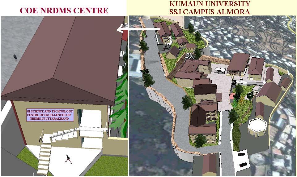
2 KUMAUN DIVISION PWD ENGINEERS MEET-2013 FOR GIS DEVELOPMENT A WORKSHOP Sponsored by The Uttarakhand State Council of Science & Technology, Govt. of Uttarakhand, Dehradun & The NRDMS Division, Department of Science & Technology, Govt. of India, New Delhi UCOST, Govt. of Uttarakhand DST, Govt. of India Organized by Centre of Excellence for NRDMS in Uttarakhand Department in Geography, Kumaun University, SSJ Campus Almora (Uttarakhand) & Kumaun Division, PWD Almora February 2013

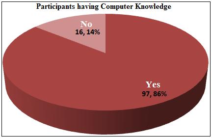
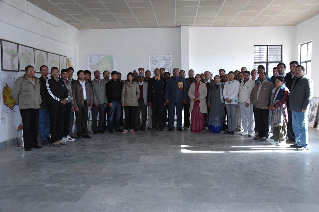
3 KUMAUN DIVISION PWD ENGINEERS MEET-2013 FOR GIS DEVELOPMENT Summary To sensitize the Public Work Department (PWD) Engineers about the latest hi-tech technologies of GIS and its applications in road engineering works specifically in road planning, road development, road management and road monitoring; workout plan for capacity building of PWD Engineers in application of GIS Technology; and to develop a strategy and work mechanism for development of GIS infrastructure for the Kumaun Division of Uttarakhand State as per need of the PWD -a Workshop of the Kumaun Division PWD Engineers for GIS Development was jointly organized by the Centre of Excellence for Nature Resources Data Management System in Uttarakhand (COE NRDMS), Department of Geography, Kumaun University, S.S.J. Campus Almora and the PWD of Kumaun Division was organized on 11 th February 2013 at the COE NRDMS. Apart from 100 PWD Engineers of the Kumaun Division, District Administrators and Scientist of COE NRDMS also participated in the workshop. The Workshop was organized in three different sessions. In the first session, the workshop was inaugurated by the Prof. Rakesh Bhatnagar, Vice Chancellor, Kumaun University as the Chief Guest. Prof. H.S. Dhami, Pro-Vice Chancellor, Kumaun University and Mr. Akshat Gupta graced the occasion as the special guests, and Mr. Lokesh Sharma, Chief Engineer, Kumaun Division, PWD Almora Chair the Inaugural Session. In this session, participants were motivated towards applications of GIS technologies and briefed about the objectives of the workshop. In the second session, a demonstration of Almora GeoPortal for Governance was given by COE NRDMS. In the third session deliberations and discussions were done regarding digital information needs for road engineering works while in the fourth session, a road map and mechanism for development and updating of GIS infrastructure of the Kumaun Division of the Uttarakhand state was workout. It was unanimously decided that GIS Cells shall be established at each district headquarter of the Kumaun Division of PWD for development and updating of GIS infrastructure, and for management of these GIS Cells a steering committee, viz., Kumaun Division Coordination Committee (KDCC) under the Chairmanship of the Chief Engineer, Kumaun Division, PWD shall be constituted. A brief account of these sessions is presented in the following paragraphs.

4
5 Inaugural Session Addressing to the Engineers through his inaugural speech as the Chief Guest of the workshop, Prof. Rakesh Bhatnagar, Vice Chancellor, Kumaun University Nainital said that in the modern age technology is changing very fast, therefore, for efficient and proper planning, administration and management, and to achieve goal of development, use of updated technology is essential. Due to lack of use of the updated technology we waste our energy, therefore, our development growth rate is very low, Prof. Bhatnagar further added. Highlighting the importance of GIS technology in road engineering works, Prof. Bhatanagar said that using this latest technology road development works can be done scientifically in a better way. In this respect, this workshop is very important and timely initiation of the Kumaun University to update the engineers with applications of GIS in road development, Prof. Bhatanagar further added. Regarding development of GIS infrastructure for the Uttrakhand State, Prof. Bhatnagar did appreciate the works of the NRDMS Centre of the Kumaun University and said that this training workshop for engineers should not be the end, it should be beginning of GIS applications in road engineering works, Prof. Bhatnagar suggested. For application of GIS in road engineering, Prof. Bhatnagar stressed on the need of hands on training for capacity building of Engineers for this purpose he suggested that University and PWD both should jointly develop Collaborative Laboratories for GIS Development. Wishing for the success of the workshop, Prof. Bhatnagar said that for capacity building and for developing Collaborative Laboratory for GIS development for road engineering, the Kumaun University shall provide all technical supports as and when required. Prof. H.S.Dhami, Pro-Vice Chancellor, Kumaun University said that GIS is a spatial technology which application is very challenging for all of us. Highlighting the significance of GIS, Prof. Dhami said that its application would be very useful in road development specifically in hilly and urban areas. Advocating the GIS as a quick decision support system, he demonstrated that how the road planning can be done through computer using desired parameters, i.e., slope, aspect, topography etc., by clicking few mouse buttons. Mr. Akshat Gupta, District Magistrate Almora describing the need of Geo-Stamped, (i.e., GIS/RS/GPS enabled spatial) data in district planning informed that since June 2011, it has become mandatory to prepare development plan/s in digital form through GIS technologies. Due to lack of digital based plan, numbers of road plans of the district were pending but due to the technical support of the NRDMS Centre in Geo-stamping, now the development proposals are getting through very rapidly, Mr. Gupta further informed. By coordinating all the departments, the GIS infrastructure of the NRDMS Centre can be used for planning and administration, Mr. Gupta suggested. For this purpose we have allotted two rooms at the Vikash Bhawan to develop a GIS Cell for preparing digital data base of different departments, and for implementation and monitoring of different development projects such as ATMA etc., Mr. Gupta further informed. Mr. Lokesh Sharma, Chief Engineer, Kumaun Division, PWD Almora said in his presenditial address that the Kumaun University through its NRDMS Centre has developed hi-tech facilities of GIS technologies which is very useful for road engineering works. For new road proposals now it is necessary to prepare road proposal in digital form, for this purpose our engineers have to go to Dehradun for making digital maps but now this hi-tech GIS facility has created by the NRDMS Centre of Kumaun University by which lot of time as well as money is being saved, Mr. Sharma informed. Highlighting the significance of this workshop, Mr. Sharma said that this workshop shall be proved as a milestone in applications of GIS in road engineering works. Regarding the importance of documentation in road engineering works, Mr. Sharma said that our department is about 150 years old which was well documented and well maintained even small incidences of road landslides and lake inlets were well documented but now there is no proper system of such documentation. Highlighting the importance of the hi-tech GIS technologies in regular and systematic documentation, Mr. Sharma

6 hoped that now with the help of GIS, scientific documentation of road planning, development, management and monitoring would be possible. Mr. Sharma also gave necessary instructions to the engineers to do needful to convert all their road maps and office records in digital form with the technical support of the NRDMS Centre of the Kumaun University. He also extended his heartly thanks to the NRDMS Centre of Kumaun University for extending the technical supports for preparing digital road plan as and when required, and to Mr. Lalit Mohan, Principal Chief Engineer, Government of Uttarakhand for his inspiration to organized this workshop. Technical Session First PRESENTATION ON THE ALMORA GEOPORTAL With the help of the financial and technical support of the Department of Science and Technology, Government of India (DST GOI) and technical support of the Department of Computer Science, IIT Mumbai and School of Information Technology, IIT Khargpur, the COE NRDMS in Uttarakhand, Department of Geography, Kumaun University started work of development GeoPortal for one of the districts of Uttarakhand, viz., district Almora since GeoPortal provides single window service for accessing data/information with digital map of a targeted region/area/place by clicking few mouse battens in the computer. For developing Almora GeoPortal, how the GIS infrastructure of district Almora was developed as per the needs of different government departments? How the digital maps of different departments are stored layer wise systematically in the computer through GIS technology? and How the digital maps of different departments are accessed from the computer as and when required? In this session, Prof. J.S.Rawat, Director, COE NRDMS demonstrated the answer of these questions in detailed through LCD presentation on the Almora GeoPortal. Presenting a detailed account of GIS infrastructure developed for district Almora, Prof. Rawat demonstrated applications of Police GIS, Watershed GIS, Road GIS, Village GIS, Household GIS, Election GIS, Municipal GIS and GIS of Education, Health and Urban Centers, and GIS for post
7 disaster management operations. The Almora GeoPortal is a web-based GeoPortal which is tagged with India GeoPortal established at the NSDI, DST GOI, New Delhi which shall be tagged soon with the Uttarakhand State Council of Science and Technology (UCOST), Dehradun for the use of State and District level planners/administrators of the Uttarakhand State, Prof. Rawat informed. Thus, demonstrating that how different line departments can access information with digital map through a single window by clicking two/three mouse buttons in computer, Prof. Rawat suggested that to develop GIS for districts of the Kumaun Division as per needs of engineers for planning and administration, a GIS Cell (having minimum two computers and one GIS Analyst) at PWD headquarter of each district should be established and for management and monitoring of GIS Cells, Kumaun Division Coordination Committee (KDCC) should be constituted. For capacity building in GIS applications in administration and planning in the district, technical support in terms of on-job training to the engineers as and when required, shall be given by our Centre, Prof. Rawat informed. Technical Session Second INFORMATION NEED ASSESSMENT Mr. K.C. Arya, Assistant Engineer, PWD, Haldwani said that on the road map, location of culverts and bridges with their span and location of roads accident prone sites should be marked. Mr. Arya suggested that for road planning, information of rock types and rock structure including rock dip/strength, and soil types map would be very useful. Spatial distribution map of orchards and agricultural belts shall helpful in proposing new roads, Mr. Arya further suggested. Information of railway lines alongwith overbridges/flyovers should also be integrated on road map, Mr. Arya, added. Mr. G.Chandra, Additional Assistant Engineer, PWD, Nainital informed that during the course of road planning, specific care has to be taken regarding the safety of drinking water sources in rural as well as urban areas and our department has to ensured that due to the road construction there will be no negative impact on the discharge of concerned spring/s or naula/s, Mr Chaudhary suggested that a digital map showing spatial distribution of all the drinking water sources shall be useful in road planning. Mr. Mohan Chandra Palaria, Assistant Engineer, PWD, Bhowali said that classified road distribution map should be prepared which should also depict distribution of proposed and under construction roads. Highlighting significance of village population data for new road construction, Mr. Palariya suggested that the classified road map should be integrated with village location with their latest population data. Mr. V.N. Pandey, Executive Engineer, PWD, Nainital said that the information of geologically weak zones specially major fractures and active fault zones would be helpful for road planning as well road development. Mr. Pandey suggested that for road construction, raw material such as stones, silt and gravel is required and digital information of such raw material sites shall help in road construction cost estimation and road development. The notified road side control act of different roads with their width should be attached, this will help in quick examination of road encroachment, Mr. Pandey further suggested. Mr. Sanjay Pandey, Executive Engineer, PMGSY, PWD, Kathgodam, explained the importance of rivers and streams discharge data in designing structure of bridges and culverts and suggested that these data should be available for designing of bridges and culverts. Highlighted the significance of traffic flow data in developing road upgradation plan, Mr Pandey underlined the need of road traffic flow data of different roads. Mr. L.D. Mathela, Executive Engineer, PWD, Haldawani described about importance of soil strength map superficially of CBR values in road planning. Mr. Mathela informed that besides the PWD, many other departments and agencies such as Forest Department, Mandi Parishad and Ganna Parishad, etc., also develop roads, but their information on map is not available. Department wise road information map shall help to the PWD for planning new roads, Mr. Mathela suggested. Mr. Deepak Pandey, Computer Operator, PWD, Pithoragarh and Mr. Abash Kumar Singh said that with each road and bridge/culvert, their year of construction and name of the staff, i.e., name of engineer, junior engineer and contractor etc., should be integrate with map. Mr. S.P Sinha, Executive Engineer, PWD, Ranikhet and Mr. Anil Pangty, Executive Engineer, PWD, Rudraprag highlighted the significance of information related with swamps and marshy land specifically in
8 tarai region and suggested that information of such lands and water table depth should be available by which alignment of roads could be done accordingly. They also stressed on the need for soil type maps showing their strength and standardized CBR values specifically for in the plain areas. Mr. Tula Ram Tamta, Assistant Engineer, P.M.G.S.Y, PWD, Almora said that along with kachha and pacca roads, information of seasonal roads should also be marked on the map. Mr. A.B. Kandpal, Executive Engineer, PWD, Nainital said that for updating of road network, a GIS Software is required, therefore, department should made arrangement of a GIS Software and should also make arrangements of short and long term training programmes for capacity building in handling the GIS software. Mr. R.S. Upadhayay, Assistant Engineer, PWD Bhowali, suggested to do road planning though mobile GPS while Mr. Ajay Prakash, Assistant Engineer, PWD Pithoragarh, suggested that for preparing new road proposals, a digital geological map would be very helpful. Mr. Sunil Kumar, Executive Engineer, Almora said that today through this workshop we have learn number of new things regarding the application of hi-tech GIS technologies in road engineering works. Now we understand that how the real world can be viewed through computer using remote sensing and GIS techniques, Mr. Kumar further said. In view of the importance of GIS in road engineering works, Mr. Kumar suggested that use of this technology in road planning and development should be mandatory. Mr. P.K.Arya, Superintending Engineer, expressing his views regarding the significance and importance of the workshop in this modern age said that this workshop is eye opening and very much informative for the engineers. Highlighting the significance of GIS technology in road planning Mr Arya said that through this technology now there will lot of facilities in developing new road proposals and development works related to road engineering. Mr. Purohit, Superintending Engineer did appreciate the work of the NRDMS Centre regarding development of GIS infrastructure in the Uttarakhand State and said that with help of GIS, the required information for road engineering work shall be available quickly through computer. We should use this technology in our road engineering works, Mr. Purohit suggested. Technical Session Third DISCUSSION AND RECOMMONDATIONS In this session the participants made deliberations and discussions regarding development of GIS infrastructure for the Kumaun Division of the Uttarakhand State. After deliberation and discussions, the following recommendations emerged by consensus: 1.0 The under mentioned digital spatial and non-spatial database is required for the engineers of the Public Works Department for road planning, development, management and monitoring: 1.1 Spatial distribution of roads as per PWD road classification criteria with their attribute data such as their names, length, year of construction and names of engineer/contractors by whom the road was constructed. 1.2 Department wise spatial distribution of roads such as Forest Road, Mandi Parishad Roads and Ganna Parishad Roads etc., and quality wise information such as kuchha/puckka roads and seasonal roads etc. 1.3 Location of all culverts/bridges with their details such as their span, year of construction, names of engineer, junior engineer/contractor by whom these were designed/constructed. 1.4 Geological map showing distribution of rocks and structural lines such as thrusts/faults/fractures and rock dip direction /amount. 1.5 Soil type and soil strength maps with standardize CBR values. 1.6 Spatial distribution of swamps/marshy land and depth of groundwater table specifically of the tarai region. 1.7 Spatial distribution of geomorphological and geological hazard zones. 1.8 Digital Elevation Model (DEM) at different resolution (i.e., 10m, 50m.100m). 1.9 Digital slope, aspect and 3D maps Landuse/land cover map depicting spatial distribution of reserved forest, van panchyats, civil soyam land, agricultural land and barren land Spatial distribution of forest compartments, forest beats, tree species, tree density, tree width and height maps Spatial distribution of drinking water sources, non-perennial and perennial streams/rivers with their beds and associated sand bars Spatial distribution of villages with their total Population and SC/ST population.
9 1.14 Road traffic census data for road upgradation Road buffer maps integrated with village location map at different distances, i.e., 3km, 6km, 9km etc., for new preparing road planning Spatial distribution of PWD Rest Houses, Inspection Banglows, and Division, District and Zonal Headquarters with their attribute data Details of notified road side control act of different roads with their width and date of notification for quick examination of road encroachment. 2.0 The Department of Forest, Government of Uttarakhand should provide digital forest data showing compartment and beat boundaries with forest species and tree density information in soft form ( i.e., in.shp files) to the PWD. 3.0 For preparing accurate road maps, fine resolution satellite data, viz., QUICKBIRD are very useful which have been already procured by the State Government through DMMC Dehradun. That QUICKBIRD data should be made available to the PWD engineers for efficient, accurate and quick road engineering works. 4.0 To develop digital database for road engineering, a GIS cell at each PWD district headquarter should be established. The Cell shall function under the direct control of the Chief Engineer of the Kumaun Division and the Executive Engineer of the concerned District shall be the Nodal Officer for GIS Development in the district. 5.0 For development of GIS infrastructure as per needs of the PWD, the State Government should provide a GIS software, a GIS Analyst (EQ-Master in GIS) and two Computers to each district GIS Cell. 6.0 The objectives of the GIS Cell should be i) to develop GIS infrastructure for the district as per the needs of the department; ii) to make applications of GIS in planning, project implementation, monitoring,development, management and in administrative works; iii) to update district GIS at monthly, bi-annually and annual basis through the concerned divisions of the district; and iv) to make constant efforts for capacity building of the district in GIS development. 7.0 For smooth functioning of the GIS Cells and for monitoring progress of GIS Cell activities in region, a Kumaun Zone Coordination Committee (KDCC) should be constituted. The structure and objectives of KDCC should be as follow : Structure of KDCC Chairman : Chief Engineer, Kumaun Division, PWD Almora. Director Members : Director, COE NRDMS in Uttarakhand, Kumaun University. : Nodal Officers of all the GIS Cells/NRDMS Division, DST New Delhi/UCOST, Dehradun, ATI Nainital Objective of KDCC i) To work for GIS development as per needs of the PWD. ii) To review the progress of the GIS Cells and to make necessary arrangements of resources for its development. 8.0 To review the progress of the GIS Cells, the KZCC meeting should be held bi-annually. 9.0 To develop Uttarakhand GeoPortal, GIS Development Working Group-IV is formed. All the participants of this workshop shall be member of this GIS Development Working Group IV. At the end of the workshop, the organizer of the workshop Prof.J.S.Rawat extended vote of thanks to all the participants and media persons.
10
11 Annexure-I KUMAUN DIVISION PWD ENGINEERS MEET-2013 FOR GIS DEVELOPMENT Date-11 th February 2013 LIST OF PARTICIPANTS 1. Prof. Rakesh Bhatnagar, Vice Chancellor, Kumaun University, Nainital. 2. Mr. Lokesh Sharma, Chief Engineer, Kumaun Division, PWD Almora. 3. Prof. H.S. Dhami, Pro-Vice Chancellor, Kumaun University, Nainital. 4. Mr. Akshat Gupta, IAS, District Magistrate Almora. 5. Prof. J.S. Rawat, Director, COE NRDMS in Uttarakhand, Department of Geography, Kumaun University, SSJ Campus Almora. 6. Mr. G.C. Arya, Superintending Engineer, P.W.D. Pithoragarh, 7. Mr.P.K. Arya, Superintending Engineer, P.W.D IIIrd Cirde Nainital, (m). ( ). 8. Mr. R. C. Purohit, Superintending Engineer, P.W.D., Superintendent Engineer Almora, (m), 9. Dr. Geeta Rawat, Research Scientist, COE for NRDMS in Uttarakhand, Department of Geography, Kumaun University, SSJ Campus Almora. 10. Mr.Vinod Rawat, Research Scientist, COE for NRDMS in Uttarakhand, Department of Geography, Kumaun University, SSJ Campus Almora. 11. Mr. Manish Kumar, Assistant Professor, GI Science, COE for NRDMS in Uttarakhand, Kumaun University, SSJ Campus Almora. 12. Miss Anjali Sharma, Assistant Professor, GI Science, COE for NRDMS in Uttarakhand, Kumaun University, SSJ Campus Almora. 13. Mr. Nanneet Gahlot, GIS Aalyst, COE NRDMS in Uttarakhand, Department of Geography, Kumaun University, SSJ Campus Almora. 14. Mr.Vijay Narayan Pandey, Executive Engineer, P.W.D., Bhowali, Nainital, (m), ( ). 15. Mr. Suneel Kumar Garg, Executive Engineer, P.W.D. Construction Division, Ramnagar, Mr. Bishan Lal, Executive Engineer, P.W.D., Temporary Division P.W.D, Berinag, (m), (Fax). 17. Mr. Girish Chandra Vishwakarma, Executive Engineer, P.W.D, Construction Division, Kasipur, (m), 18. Mr. Yogesh Lal Shail, Executive Engineer, P.W.D, Construction Division. Khateema, (m), ( ). 19. Mr. A.B. Kandpal, Executive Engineer, P.W.D, Construction Division, Nainital, (m), ( ). 20. Mr.Chandra Shekhar Joshi, Executive Engineer, P.W.D, Construction Division. Askot, (m), 21. Mr. Vinod Kumar, Executive Engineer, P.M.G.S.Y., Didihat, (m), ( ), Mr. Mool Chand Gupta, Executive Engineer, P.W.D., PMGSY Almora, ( ), Mr. Harish Pangti, Executive Engineer, P.W.D, Provincial Division, Ranikhet, (m), 24. Mr. Sanjay Kumar Pandey, Executive Engineer, P.M.G.S.Y, P.W.D, Kathgodam, (m), 25. Mr. L.D. Mathela, Executive Engineer, Construction Division. P.W.D, Haldwani, (m), Mr. S.P. Sinha, Executive Engineer, P.W.D, Construction Division, Ranikhet, (m), ( ). 27. Mr. A. C. Pathak, Executive Engineer, P.M.G.S.Y, P.W.D., Irrigation Division, Almora, (m). 28. Mr. Mohan Chandra Palaria, Assistant Engineer, P.W.D, Temporary Division Bhowali, (m), 29. Mr. Hemraj, Assistant Engineer, Construction Division. P.W.D, Lohaghat, (m). 30. Mr. Anil Pangty, Executive Engineer, P.W.D Constriction Division,Frinees Enclave, Near Railway Station, Rudrapur, (m), 31. Mr. B.C. Pant, Executive Engineer, P.W.D Provincial Division, Champawat, (m), (Fax). 32. Mr.Suresh Chandra Arya,Excu. Engineer,Construction Division PWD,Almora, Mr. Rajendra Prasad Upadhyay, Assistant Engineer, Temporary Division P.W.D Bhowali, (m). 34. Mr. Amit Bharatiya, Assistant Engineer, P.M.G.S.Y, RES, Didihat, Pithoragarh, (m), ( ). 35. Mr. J.C. Pantola, Assistant Engineer, P.W.D, Construction Division, Kasipur, (m), Mr. Udai Ram, Assistant Engineer, P.W.D, Provincial Division P.W.D, Pithoragarh, (m), 37. Mr. K. C. Arya, Assistant Engineer, P.W.D, National Highway P.W.D, Haldwani, (m), (Fax). 38. Mr. Bhuwan Chandra, Assistant Engineer, P.W.D, Construction Division, Ranikhet, (m), Mr. Ajay Prakash, Assistant Engineer, P.W.D, Irrigation Division, Pithoragarh, (m), (Fax). 40. Mr. Dinesh Mohan Gupta, Astt. Engineer, P.W.D, Provincial Division, Pithoragarh, , (Fax). 41. Tula Ram, Assistant Engineer, P.W.D, P.M.G.S.Y Division Almora, , (m), ( ) (Fax). 42. Mr. J. S. Kanyal, Assistant Engineer, P.W.D, Construction Division, Almora, (m), (Fax). 43. Mr. Sunil Kumar, Assistant Engineer, P.W.D, P.M.G.S.Y, Champawat, (m). 44. Mr. B.C. Bhandari, Assistant Engineer, P.W.D, Construction Division, Nainital, (m). 45. Mr. Harish Chandra Mainoli, Assistant Engineer, P.W.D Construction Division, Khatima, (M). 46. Mr. N.S. Majila, Assistant Engineer, P.W.D Construction Division, Kapkot, (m), (Fax). 47. Mr. Lalit Kumar, Assistant Engineer (Civil), P.M.G.S.Y, P.W.D, Irrigation Division, Pithoragarh, (m), 48. Mr. Binod Kumar Sinha, Assistant Engineer, P.W.D Provincial Division, Nainital, (m), 49. Mr. Vinod Kumar, Assistant Engineer, Provincial Division P.W.D, Bageshwar, (m), (Fax). 50. Mr. Narendra Kumar Pant, Assistant Engineer, Provincial Division P.W.D, Ranikhet, (m), (Fax). 51. Mr. Devendra Singh Bora, Assistant Engineer, Provincial Division P.W.D, Pithoragarh, (m), (Fax). 52. Mr. Prem Prakesh, Assistant Engineer, National History Division P.W.D, Almora, (m), Mr. Rajendra Lal Sah, Additional Assistant Engineer, P.W.D. Berinag, Pithoragarh, (m), (Fax). 54. Mr. Mohmmad Tahsin, Additional Assistant Engineer,Provincial Division P.W.D, Nainital, (m), 55. Mr. Amit Rusia, Additional Assistant Engineer, P.W.D, Provincial Division P.W.D, Nainital, (m), 56. Mr. Girish Chandra, Additional Assistant Engineer, P.W.D, Temporary Division P.W.D, Bhowali, Nainital, (m). 57. Mr. Vinod Kumar, Additional Assistant Engineer, Construction Division P.W.D, Almora,
12 58. Mr. vishwamohan Giri, Additional Assistant Engineer, P.W.D, Construction Division P.W.D, Almora, (m). 59. Mr. Dan Singh, Additional Assistant Engineer, P.W.D, Temporary Division P.W.D, Berinag, (m). 60. Mr. Dinesh Chandra Joshi, Additional Assistant Engineer, P.W.D, Temporary Division P.W.D, Berinag, Pithoragarh, Mr. Dinesh Giriraj, Additional Assistant Engineer, Provincial Division P.W.D, Pithoragarh, (m), 62. Mr. Girdhar Ram Tamta, AA Engineer, Construction Division P.W.D, Salt, Almora, (m), ( ). 63. Mr. Shankar Singh, Additional Assistant Engineer, P.W.D, Didihat, Pithoragarh, (m), 64. Mr. Nafees Ahmad, Additional Assistant Engineer,Construction Division P.W.D, Ranikhet, 65. Mr. N C Tamta, Additional Assistant Engineer, Construction Division P.W.D, Salt, Almora, (m),nctamta@gmail.com. 66. Mr. Yashpal Ram, Additional Assistant Engineer, Provincial Division, P.W.D, Ranikhet, ,yashpalarya2012@yahoo.com Mr.Prakash Chandra Nariyal, Junior Engineer, Construction Division P.W.D, Askot, Pithoragarh, , prakashnariyal@gmail.com 68. Mr. Kuldeep Kumar, Additional Assistant Engineer,Construction Division. P.W.D, Ramnagar, , kuldeep64@yahoo.co.in Mr. Anil Kanaujiya, Additional Assistant Engineer, Construction Division P.W.D, Haldwani, (m), anilkaunjiya@gmail.com. 70. Mr. Hem Chandra, Additional Assistant Engineer, P.W.D, Construction Division, (m). 71. Mr. Alok Kumar, Additional Assistant Engineer, P.W.D, Khatima, (m). 72. Mr. Anupum Rai, Adl. Asstt. Engineer, P.W.D Provisional Division, Champawat, ,eechampawat@rediffmail.com, Mr. S. M. Upadhyay, Additional Assistant Engineer, P.W.D Irrigation Division, Pithoragarch, (m), sumu7868@gmail.com. 74. Mr. Himanshu Bhatt, Additional Assistant Engineer, Provincial Division, P.W.D Almora, (m). 75. Mr. Jabir Ali, Junior Engineer, Champawat, P.W.D Provincial Division Champawat, (m), jabir420@gmail.com. 76. Mr. Prakash Arya, Junior Engineer,P.M.G.S.Y Division, P.W.D Almora, (m), popspart3@gmail.com( ), Mr. Subhash Arya, Junior Engineer, P.W.D, Colony Pilibhit Road Khatima, (m), subhashkumar@gmail.com ( ). 78. Mr. Avinesh Kumar Rawat, Junior Engineer, Irrigation Division P.M.G.S.Y, P.W.D, Champawat, (m), avinesh81redifmail.com. 79. Mr. Pawan Kumar Telia, Junior Engineer, Irrigation Division, P.M.G.S.Y, P.W.D, Pithoragarh, (m), pawantelia@gmail.com. 80. Mrs. Bhawna Pant, Junior Engineer, Provincial Division, P.W.D Almora, (m), jsh-bhwn@gmail.com. ( ). 81. Miss Shefali Panday, Junior Assistant, P.W.D Jamuna Quarter Bhowali (Nainital), (m), pwdbhowalintl@yahoo.com Mr. Chandan Chaudhary, Computer Operator, Construction Division P.W.D, Salt, Almora, (m), pwdsalt@rediffmail.com. 83. Mr. Lalit Prasad, Computer Operator, Construction Division P.W.D, Lohaghat, Champawat, (m). 84. Mr. Ravindra Singh Bisht, Computer Operator,Construction Division P.W.D, Almora, ,eecdalmorapwd@rediffmail.com Mr. Jeewan Lal, Computer Operator, P.W.D, Berinag, Pithoragarh, eepwdberinag@rediffmail.com ( ), (Fax). 86. Mr. Deepak Pandey, Computer Operator,Executive Engineer, P.W.D, Askot, Pithoragarh, , gaya.guro@gmail.com Mr. Sunil Singh, Computer Operator, P.W.D, Provincial Division, Pithoragarh, (m), pdpwdppth@rediffmail.com, Mr. Vimohan Dutt, Computer Operator,Construction Division P.W.D, Kashipur, US Nagar, (m), eepwdksp@gmail.com, Mr. Narendra Singh Phartiyal, Computer Operator,Provincial Division P.W.D, Ranikhet, , phartiyalnaran@yahoo.com ( ). 90. Mr. Mahendra Singh Panu, Computer Operator, P.W.D, Didihat, (m), mahendrapanu@gmail.com ( ). 91. Mr. Rajendra Uperti, Computer Operator, P.W.D, Construction Division P.W.D, Nainital, rajendrauperti50@gmail.com ( ). 92. Mr. Pramod Kumar Joshi, Computer Operator, P.M.G.S.Y Near Jal Nigam Colony, Almora, (m), pmgsy.alm@gmail.com. 93. Mr. Mukesh Chandra Gaushwami, Computer Operator, P.W.D, Kapkote, eepwdkapkot@gmail.com ( ). 94. Mr. Deep, Computer Operator, Construction Division P.W.D, Ramnagar, , eecdrmr@rediffmail.com, Mr. Prakash Singh Kharayat, Computer operator,provincial Division P.W.D, Champawat, , kharayat.para@gmail.com ( ). 96. Mr. Kailash Chandra Arya, Computer Operator, construction Division P.W.D, Ranikhet, , kailashcarya@gmail.com Miss Meena Pandey, Computer Operator, Construction Division P.W.D, Rudrapur, ,meena.pandey89@gmail.com, Mr. Sumit Joshi, District Disaster Management Officer, DDMC, Collectorate Premises, Almora, sumitnsummit@gmail.com. 99. Mr. Abdul Rizwan, Junior Clerk, S.D.M Office, Tehsil Ranikhet, (m), abdulrizwan5055@yahoo.in ( ), (Fax) Mr. Rami Ram, Amen, P.W.D, Construction Division P.W.D, Lohaghat, Champawat, (m) Mr. Mahesh Chandra Akola, Amen, P.W.D, Construction Division P.W.D, Ranikhet, (m), cdpwd@gmail.com ( ) Mr. Tarun Kanojia, Apprentice Trainee, P.W.D, Construction Division Almora, ,tannukanojiya15@gmail.com, (Fax) Mr. Durgesh Pant, Computer operator, Construction Division, Haldwani, , ee_hdkal@rediffmail.com. ( ) Mr. Sunil Datt, Computer operator, P.W.D Khatima, near Chauhan Petrol Pump, (m), msunildatt@gmail.com., Mr. Chandan Singh Dafooty, Computer operator, P.W.D Bageshwar, (m), pdpwdbgr@yahoo.in. ( ) Mrs. Nirmala Nainwal, Junior Research Fellow, COE NRDMS, Department of Geography, KumauN University, SSJ Campus Almora Mr. Vivek Viswas, Junior Research Fellow, COE NRDMS, Department of Geography, KumauN University, SSJ Campus Almora Mr. Uma Shankar Negi, GIS Assistant, COE NRDMS in Uttarakhand, Department of Geography, KumauN University, SSJ Campus Almora Mr. Naresh Pant, GIS Assistant, COE NRDMS in Uttarakhand, Dept. of Geography, Kumaun University, SSJ Campus Almora Miss Neha, GIS Analyst, COE NRDMS in Uttarakhand, Department of Geography, KumauN University, SSJ Campus Almora MR. M.L.Kanojia, Office Superintendent, COE NRDMS, Department of Geography, KumauN University, SSJ Campus Almora Mr. Manoj Bisht, COE NRDMS in Uttarakhand, Department of Geography, KumauN University, SSJ Campus Almora.


13 Media View

14 Pre Workshop Media View For more details about the workshop contact to Prof. J.S.Rawat, Director, COE NRDMS in Uttarakhand, Department of Geography, Kumaun University SSJ Campus Almora , Uttarakhand for Details about COE NRDMS in Uttarakhand, visit
GIS OVERVIEW OF DISTRICT ALMORA IN UTTARANCHAL, INDIA
 GIS OVERVIEW OF DISTRICT ALMORA IN UTTARANCHAL, INDIA J.S.Rawat, S. Naithani,G. Rawat, C.M.S. Adhikari and V.S.Rawat NRDMS Centre, Department of Geography, Kumaun University Campus Almora-263611 Uttaranchal
CSIR-Central Building Research Institute, Roorkee (UK)
") CSIR-Central Building Research Institute, Roorkee (UK) Introduction: Training programme on Control Measures for Landslides held during July 18-22, 2016 Landslides problem in hilly terrains are one of the
CSIR-Central Building Research Institute, Roorkee (UK) Introduction: Training programme on Control Measures for Landslides held during July 18-22, 2016 Landslides problem in hilly terrains are one of the
Integrated Geodatabase Model for effective planning of District -Hamirpur
 Integrated Geodatabase Model for effective planning of District -Hamirpur Developed by District Administration,Hamirpur in collaboration with Centre for Geoinformatics Research and Training, CSK HPAU,Palampur
DEVELOPMENT OF STANDARD BASED UTTARAKHAND STATE GEOPORTAL FOR DECENTRALISED GOVERNANCE
 DEVELOPMENT OF STANDARD BASED UTTARAKHAND STATE GEOPORTAL FOR DECENTRALISED GOVERNANCE SSDI (STATE SPATIAL DATA INFRASTRUCTURE) GOVERNMENT OF UTTARAKHAND STATE SPATIAL DATA INFRASTRUCTURE (SSDI), GOVERNMENT
GEOGRAPHIC INFORMATION SYSTEMS Session 8
 GEOGRAPHIC INFORMATION SYSTEMS Session 8 Introduction Geography underpins all activities associated with a census Census geography is essential to plan and manage fieldwork as well as to report results
Quantifying Land Use/Cover Dynamics of Nainital Town (India) Using Remote Sensing and GIS Techniques
 Using Remote Sensing and GIS Techniques") Quantifying Land Use/Cover Dynamics of Nainital Town (India) Using Remote Sensing and GIS Techniques Jiwan Rawat 1*, Vivekananda Biswas 1 and Manish Kumar 1 1 Centre of Excellence for NRDMS in Uttarakhand,
Quantifying Land Use/Cover Dynamics of Nainital Town (India) Using Remote Sensing and GIS Techniques Jiwan Rawat 1*, Vivekananda Biswas 1 and Manish Kumar 1 1 Centre of Excellence for NRDMS in Uttarakhand,
Progress Report. Flood Hazard Mapping in Thailand
 Progress Report Flood Hazard Mapping in Thailand Prepared By: Mr. PAITOON NAKTAE Chief of Safety Standard sub-beuro Disaster Prevention beuro Department of Disaster Prevention and Mitigation THAILAND E-mail:
Georeferencing and Satellite Image Support: Lessons learned, Challenges and Opportunities
 Georeferencing and Satellite Image Support: Lessons learned, Challenges and Opportunities Shirish Ravan shirish.ravan@unoosa.org UN-SPIDER United Nations Office for Outer Space Affairs (UNOOSA) UN-SPIDER
Non-Glacial Watersheds of Uttarakhand
 Impact of Climate Change in the Non- Glacial Fed Himalayan River System: A Case Study From the Kosi River in District Almora, Uttarakhand State (India) J.S.Rawat Director Centre of Excellence for Natural
GIS Geographical Information Systems. GIS Management
 GIS Geographical Information Systems GIS Management Difficulties on establishing a GIS Funding GIS Determining Project Standards Data Gathering Map Development Recruiting GIS Professionals Educating Staff
CENSUS MAPPING WITH GIS IN NAMIBIA. BY Mrs. Ottilie Mwazi Central Bureau of Statistics Tel: October 2007
 CENSUS MAPPING WITH GIS IN NAMIBIA BY Mrs. Ottilie Mwazi Central Bureau of Statistics E-mail: omwazi@npc.gov.na Tel: + 264 61 283 4060 October 2007 Content of Presentation HISTORICAL BACKGROUND OF CENSUS
Module - 3 GIS MAPPING, MIS AND GIS UNDER RAY
 Module - 3 1 GIS MAPPING, MIS AND GIS MIS INTEGRATION UNDER RAY Role of GIS & MIS under RAY Under the scheme, two step implementation strategy has been adopted i.e. preparation of SFCPoAs on whole city
VENUS INTERNATIONAL COLLEGE OF TECHNOLOGY
 VENUS INTERNATIONAL COLLEGE OF TECHNOLOGY DEPARTMENT OF E&C ENGINEERING A REPORT ON INDUSTRIAL VISIT AT BISAG, GANDHINAGAR PROFILE: BISAG provides specialized services and solutions in implementing mapbased
Introduction to GIS. Dr. M.S. Ganesh Prasad
 Introduction to GIS Dr. M.S. Ganesh Prasad Department of Civil Engineering The National Institute of Engineering, MYSORE ganeshprasad.nie@gmail.com 9449153758 Geographic Information System (GIS) Information
Statewide Topographic Mapping Program
 Statewide Topographic Mapping Program February 28, 2018 www.dotd.la.gov Outline Purpose of the Statewide Topographic Mapping Program History Breakdown of R.S. 48:36 - Topographic Mapping Statewide Topographic
Capacity Building Programme
 Capacity Building Programme 14-17 August 2012 Space Technology for improving Hazard Mapping in Sri Lanka An event organised as a follow up of the UN-SPIDER Technical Advisory Mission to Sri Lanka - 17-21
Presented to Sub-regional workshop on integration of administrative data, big data and geospatial information for the compilation of SDG indicators
 Presented to Sub-regional workshop on integration of administrative data, big data and geospatial information for the compilation of SDG indicators 23-25 April,2018 Addis Ababa, Ethiopia By: Deogratius
Educational Qualification No ( No of Positions) 01. Geographic
 01. Geographic") ICZMP, State Project Management Unit-Orissa Plot # 108,Unit VII, Suryanagar,Bhubaneswar 751 003 ICZMP invites applications from eligible candidates for filling up of posts as mentioned below under the
ICZMP, State Project Management Unit-Orissa Plot # 108,Unit VII, Suryanagar,Bhubaneswar 751 003 ICZMP invites applications from eligible candidates for filling up of posts as mentioned below under the
Relief Camp Tool Using GIS
 Relief Camp Tool Using GIS MAYANK SINGH SAKLA 1, JANKI ADHVARYU 2 1 M.TECH GEOMATICS STUDENT, CEPT UNIVERSITY 2 M.TECH GEOMATICS STUDENT, CEPT UNIVERSITY K L CAMPUS UNIVERSITY AREA NAVARANG PURA AHMEDABAD
What s Happening in My Watershed?
 What s Happening in My Watershed? How Implementing a GIS system to Utilize Spatial Data and Digital Collection Techniques can help Solve Watershed Issues. Mindi J. Parsell City of Tulsa Stormwater Quality
Combining Geospatial and Statistical Data for Analysis & Dissemination
 Combining Geospatial and Statistical Data for Analysis & Dissemination (with Special Reference to Qatar Census 2010) Presentation by Mansoor Al Malki, Director of IT Department Qatar Statistics Authority
THE ROLE OF GEOSPATIAL TECHNOLOGY IN SOCIAL AMENITIES FOR RURAL DEVELOPMENT
 THE ROLE OF GEOSPATIAL TECHNOLOGY IN SOCIAL AMENITIES FOR RURAL DEVELOPMENT ANAND P. PANDIT, P.G. Department of Geography, New Arts Commerce and Science College, Ahmednagar. (MS) INDIA MADHUKAR R. KARALE
An Internet-Based Integrated Resource Management System (IRMS)
") An Internet-Based Integrated Resource Management System (IRMS) Third Quarter Report, Year II 4/1/2000 6/30/2000 Prepared for Missouri Department of Natural Resources Missouri Department of Conservation
An Internet-Based Integrated Resource Management System (IRMS) Third Quarter Report, Year II 4/1/2000 6/30/2000 Prepared for Missouri Department of Natural Resources Missouri Department of Conservation
Preparation of Database for Urban Development
 Preparation of Database for Urban Development By PunyaP OLI, 1. Chairman, ERMC (P) Ltd., Kathmandu, Nepal. Email: punyaoli@ermcnepal.com 2. Coordinator, Himalayan College of Geomatic Engineering and Land
D.B.S. (P.G.) COLLEGE, DEHRADUN
 COLLEGE, DEHRADUN") : General Open Candidates 3 4 5 6 7 8 9 0 3 4 5 6 7 8 9 0 R8074 DEEKSHA RAWAT RAJPAL SINGH RAWAT F GEN 9.00 0 9.00 R805 medha aggarwal manish kumar F GEN 9.00 0 9.00 R80680 MUSKAAN NEGI BHAGWAT SINGH NEGI
: General Open Candidates 3 4 5 6 7 8 9 0 3 4 5 6 7 8 9 0 R8074 DEEKSHA RAWAT RAJPAL SINGH RAWAT F GEN 9.00 0 9.00 R805 medha aggarwal manish kumar F GEN 9.00 0 9.00 R80680 MUSKAAN NEGI BHAGWAT SINGH NEGI
C U R R I C U L U M V I T A E
 C U R R I C U L U M V I T A E Tariq Siddique Assistant Professor Department of Geology Aligarh Muslim University Aligarh, Uttar Pradesh, India : +918755994820 E-mail:- tariqsiddiqueiitr@gmail.com tariq.gl@amu.ac.in
Fish Pond. Old Secretariate. Shaheed Smarak
 Fish Pond Old Secretariate Shaheed Smarak HOW SATELLITE SCANS EARTH. Rajbhawan area viewed by IKONOS 1 meter sensor Very high resolution (40 cm) Orbi-Image data Higher the resolution better the geometric
UNITED NATIONS E/CONF.96/CRP. 5
 UNITED NATIONS E/CONF.96/CRP. 5 ECONOMIC AND SOCIAL COUNCIL Eighth United Nations Regional Cartographic Conference for the Americas New York, 27 June -1 July 2005 Item 5 of the provisional agenda* COUNTRY
ROAD INFORMATION SYSTEM FOR MAINTENANCE MANAGEMENT OF ROAD INFRASTRUCTURE PROJECTS
 ROAD INFORMATION SYSTEM FOR MAINTENANCE MANAGEMENT OF ROAD INFRASTRUCTURE PROJECTS Need for GIS Voluminous/ Manual Data Vs Digital Need for GIS CE - C&B (North) KPWD Secretary Office CE - C&B (South) Dispersed
PRE MONSOON TROPICAL CYCLONE ALERT (LAILA)
") PRE MONSOON TROPICAL CYCLONE ALERT (LAILA) (Updated as on 19 th May, 2010, 10.00 AM) A pre-monsoon Tropical Cyclone alert has been issued for all the coastal districts of Orissa by the Special Relief Commissioner
PRE MONSOON TROPICAL CYCLONE ALERT (LAILA) (Updated as on 19 th May, 2010, 10.00 AM) A pre-monsoon Tropical Cyclone alert has been issued for all the coastal districts of Orissa by the Special Relief Commissioner
INTRODUCTION TO GEOGRAPHIC INFORMATION SYSTEM By Reshma H. Patil
 INTRODUCTION TO GEOGRAPHIC INFORMATION SYSTEM By Reshma H. Patil ABSTRACT:- The geographical information system (GIS) is Computer system for capturing, storing, querying analyzing, and displaying geospatial
Geo-hazard Potential Mapping Using GIS and Artificial Intelligence
 Geo-hazard Potential Mapping Using GIS and Artificial Intelligence Theoretical Background and Uses Case from Namibia Andreas Knobloch 1, Dr Andreas Barth 1, Ellen Dickmayer 1, Israel Hasheela 2, Andreas
International Journal of Modern Trends in Engineering and Research e-issn No.: , Date: April, 2016
 International Journal of Modern Trends in Engineering and Research www.ijmter.com e-issn No.:2349-9745, Date: 28-30 April, 2016 Landslide Hazard Management Maps for Settlements in Yelwandi River Basin,
FACULTY PROFILE PROFORMA Title (Ms/Mr/Dr/Prof)
") FACULTY PROFILE PROFORMA Title (Ms/Mr/Dr/Prof) Dr. First Name Manish Last Name Kumar Photograph Designation Assistant Professor (Ad Hoc) Department Geography Department of Geography Kalindi College Address
FACULTY PROFILE PROFORMA Title (Ms/Mr/Dr/Prof) Dr. First Name Manish Last Name Kumar Photograph Designation Assistant Professor (Ad Hoc) Department Geography Department of Geography Kalindi College Address
Land Administration and Cadastre
 Geomatics play a major role in hydropower, land and water resources and other infrastructure projects. Lahmeyer International s (LI) worldwide projects require a wide range of approaches to the integration
ENV208/ENV508 Applied GIS. Week 1: What is GIS?
 ENV208/ENV508 Applied GIS Week 1: What is GIS? 1 WHAT IS GIS? A GIS integrates hardware, software, and data for capturing, managing, analyzing, and displaying all forms of geographically referenced information.
2018 NASCIO Award Submission Category: Cross-Boundary Collaboration and Partnerships. Project Title: Tennessee Wildfires: A Coordinated GIS Response
 2018 NASCIO Award Submission Category: Cross-Boundary Collaboration and Partnerships Project Title: Tennessee Wildfires: A Coordinated GIS Response Sevier County, Tennessee State of Tennessee, Emergency
Mapping Water Resources and Reservoirs for Climate Resilience in Zambezi River Basin
 Mapping Water Resources and Reservoirs for Climate Resilience in Zambezi River Basin Corné van der Sande, NEO BV Senior Advisor Earth Observation Services for Monitoring Drought and Water Resources in
INTERNATIONAL JOURNAL OF PURE AND APPLIED RESEARCH IN ENGINEERING AND TECHNOLOGY
 INTERNATIONAL JOURNAL OF PURE AND APPLIED RESEARCH IN ENGINEERING AND TECHNOLOGY A PATH FOR HORIZING YOUR INNOVATIVE WORK SPECIAL ISSUE FOR NATIONAL LEVEL CONFERENCE "SUSTAINABLE TECHNOLOGIES IN CIVIL
Yaneev Golombek, GISP. Merrick/McLaughlin. ESRI International User. July 9, Engineering Architecture Design-Build Surveying GeoSpatial Solutions
 Yaneev Golombek, GISP GIS July Presentation 9, 2013 for Merrick/McLaughlin Conference Water ESRI International User July 9, 2013 Engineering Architecture Design-Build Surveying GeoSpatial Solutions Purpose
a system for input, storage, manipulation, and output of geographic information. GIS combines software with hardware,
 Introduction to GIS Dr. Pranjit Kr. Sarma Assistant Professor Department of Geography Mangaldi College Mobile: +91 94357 04398 What is a GIS a system for input, storage, manipulation, and output of geographic
BOWIE SENIORS COMPUTER CLUB
 BOWIE SENIORS COMPUTER CLUB Meeting Minutes for May 5, 2016 Through the efforts of Program Chairman Dan Lee, we had Patrick T. Callahan, GIS Manager of the Prince George's County Office of Information
Abstract: About the Author:
 REMOTE SENSING AND GIS IN LAND USE PLANNING Sathees kumar P 1, Nisha Radhakrishnan 2 1 1 Ph.D Research Scholar, Department of Civil Engineering, National Institute of Technology, Tiruchirappalli- 620015,
Utilization and Provision of Geographical Name Information on the Basic Map of Japan*
 UNITED NATIONS WORKING PAPER GROUP OF EXPERTS NO. 1/9 ON GEOGRAPHICAL NAMES Twenty-eight session 28 April 2 May 2014 Item 9 of the Provisional Agenda Activities relating to the Working Group on Toponymic
Crowdsourcing approach for large scale mapping of built-up land
 Crowdsourcing approach for large scale mapping of built-up land Kavinda Gunasekara Kavinda@ait.asia Geoinformatics Center Asian Institute of Technology, Thailand. Regional expert workshop on land accounting
October 08-11, Co-Organizer Dr. S D Samantaray Professor & Head,
 A Journey towards Systems system Biology biology :: Biocomputing of of Hi-throughput Omics omics Data data October 08-11, 2018 Coordinator Dr. Anil Kumar Gaur Professor & Head Department of Molecular Biology
RESOLUTION NO
 RESOLUTION NO. 09-2017 Adopting Job Descriptions for Engineering and GIS Manager and GIS Analyst and Amending the Pay Resolution to Accommodate Said Positions and Amending the Staffing Chart to Accommodate
e-pathai GIS (Electronic Project, Administration, Traffic, Highway Assets and Information management system) in Tamil Nadu Highways
 in Tamil Nadu Highways") e-pathai GIS (Electronic Project, Administration, Traffic, Highway Assets and Information management system) in Tamil Nadu Highways Er.G.Kumar¹, Er.R.Sendel Raj², Er.P.Eshwarmoorthy³, Dr.P.Rajakumar 4
e-pathai GIS (Electronic Project, Administration, Traffic, Highway Assets and Information management system) in Tamil Nadu Highways Er.G.Kumar¹, Er.R.Sendel Raj², Er.P.Eshwarmoorthy³, Dr.P.Rajakumar 4
John Laznik 273 Delaplane Ave Newark, DE (302)
") Office Address: John Laznik 273 Delaplane Ave Newark, DE 19711 (302) 831-0479 Center for Applied Demography and Survey Research College of Human Services, Education and Public Policy University of Delaware
Office Address: John Laznik 273 Delaplane Ave Newark, DE 19711 (302) 831-0479 Center for Applied Demography and Survey Research College of Human Services, Education and Public Policy University of Delaware
A BRIEF NOTE ON USE OF GIS IN PREPARATION OF WORKING PLANS IN MAHARASHTRA STATE
 1 A BRIEF NOTE ON USE OF GIS IN PREPARATION OF WORKING PLANS IN MAHARASHTRA STATE GIS was introduced in the Forest Department in Maharashtra state under the World Bank Project in the year 1995, when a
Key Elements of the Geographical Information System of Mexico *
 UNITED NATIONS E/CONF.99/IP.1 ECONOMIC AND SOCIAL COUNCIL Ninth United Nations Regional Cartographic Conference for the Americas New York, 10-14 August 2009 Item 7(a) of the provisional agenda Strategy,
Applying Hazard Maps to Urban Planning
 Applying Hazard Maps to Urban Planning September 10th, 2014 SAKAI Yuko Disaster Management Expert JICA Study Team for the Metro Cebu Roadmap Study on the Sustainable Urban Development 1 Contents 1. Outline
Economic and Social Council
 United Nations Economic and Social Council Distr.: General 23 May 2012 Original: English E/CONF.101/100 Tenth United Nations Conference on the Standardization of Geographical Names New York, 31 July 9
DOWNLOAD OR READ : GIS BASED FLOOD LOSS ESTIMATION MODELING IN JAPAN PDF EBOOK EPUB MOBI
 DOWNLOAD OR READ : GIS BASED FLOOD LOSS ESTIMATION MODELING IN JAPAN PDF EBOOK EPUB MOBI Page 1 Page 2 gis based flood loss estimation modeling in japan gis based flood loss pdf gis based flood loss estimation
PROJECTS ACCOMPLISHED A number of projects have been accomplished by the Department which are listed here as under:
 PROJECTS ACCOMPLISHED A number of projects have been accomplished by the Department which are listed here as under: S.No Project 1 Water Quality Mapping of Dal and Wular Lakes Phase-I & Phase-II 2 Snow-Melt
KERALA STATE LAND USE BOARD TECHNICAL SUPPORT ORGANISATION
 KERALA STATE LAND USE BOARD TECHNICAL SUPPORT ORGANISATION Kerala State Land Use Board was established in 1975 under Department of Planning and Economic Affairs, Government of Kerala and is functioning
STEREO ANALYST FOR ERDAS IMAGINE Stereo Feature Collection for the GIS Professional
 STEREO ANALYST FOR ERDAS IMAGINE Stereo Feature Collection for the GIS Professional STEREO ANALYST FOR ERDAS IMAGINE Has Your GIS Gone Flat? Hexagon Geospatial takes three-dimensional geographic imaging
Excel Geomatics. Rajesh Paul Excel Geomatics Pvt. Ltd., Noida February, 2015 India Geospatial Forum, Hyderabad
 Excel Geomatics Geo-marketing for Product Sales and Customer Services Rajesh Paul Excel Geomatics Pvt. Ltd., Noida 10-12 February, 2015 India Geospatial Forum, Hyderabad Presentation Outline About Excel
Developing a Community Geographical Information System (GIS) in Rural India
 in Rural India") Developing a Community Geographical Information System (GIS) in Rural India Before rushing off and describing the unique challenges of developing a small scale GIS system India I better first describe
Developing a Community Geographical Information System (GIS) in Rural India Before rushing off and describing the unique challenges of developing a small scale GIS system India I better first describe
Estelar. Puran Ch. Joshi. Supervisor. Dr. Ravindra K. Pande. Professor of Geography
 Landslide Hazard Zonation and Management Study in Malpa Area of Pithoragarh District Using Remote Sensing and Geographical Information System (GIS) Techniques The Thesis Submitted to the Kumaun University
Land Use/Land Cover Change Study of District Dehradun, Uttarakhand using Remote Sensing and GIS Technologies
 Cloud Publications International Journal of Advanced Remote Sensing and GIS 2017, Volume 6, Issue 1, pp. 2223-2233 ISSN 2320 0243, Crossref: 10.23953/cloud.ijarsg.281 Research Article Land Use/Land Cover
Manitoba s Elevation (LiDAR) & Imagery Datasets. Acquisition Plans & Opportunities for Collaboration
 & Imagery Datasets. Acquisition Plans & Opportunities for Collaboration") Manitoba s Elevation (LiDAR) & Imagery Datasets Acquisition Plans & Opportunities for Collaboration Manitoba Planning Conference May 2017 Presentation Outline Manitoba s Elevation (LiDAR) and Imagery Datasets
Manitoba s Elevation (LiDAR) & Imagery Datasets Acquisition Plans & Opportunities for Collaboration Manitoba Planning Conference May 2017 Presentation Outline Manitoba s Elevation (LiDAR) and Imagery Datasets
Introduction to Field Data Collection
 Introduction to Field Data Collection Dr. Yuji Murayama (Professor) Dr. Ko Ko Lwin (JSPS Postdoctoral Researcher) Division of Spatial Information Science Graduate School of Life and Environmental Sciences
Dr. K. Prabakaran Assistant Professor
 Dr. K. Prabakaran Assistant Professor Contact Address : Department of Geology Alagappa University Karaikudi 630 003 Tamil Nadu, INDIA Employee Number : 53408 Date of Birth : 10-05-1982 Contact Phone (Office)
FORM XVII [SEE RULE 78(I)(A)(i)] REGISTER OF WAGES
![FORM XVII [SEE RULE 78(I)(A)(i)] REGISTER OF WAGES](/thumbs/80/81915133.jpg "FORM XVII [SEE RULE 78(I)(A)(i)] REGISTER OF WAGES") SNO EMPLOYEE ID EMPLOYEE NAME A/c No Bank Name PF NO ESI NO Days BASIC H.R.A CONV ALL/OTH ER GROSS BASIC H.R.A CONV ALL/OT HER GROSS P.F ESI TOTAL 1 13140067 Sukhvir Yadav 071601504936 ICICI Bank DSSHD09411550000006276
SNO EMPLOYEE ID EMPLOYEE NAME A/c No Bank Name PF NO ESI NO Days BASIC H.R.A CONV ALL/OTH ER GROSS BASIC H.R.A CONV ALL/OT HER GROSS P.F ESI TOTAL 1 13140067 Sukhvir Yadav 071601504936 ICICI Bank DSSHD09411550000006276
Excel Geomatics: Offering Excellence with Unique Consultancy & Services
 Excel Geomatics: Offering Excellence with Unique Consultancy & Services Providing consultancy and value Added Services using Remote Sensing, Photogrammetry and LiDAR in areas such as Agriculture, Forestry,
CHAPTER 22 GEOGRAPHIC INFORMATION SYSTEMS
 CHAPTER 22 GEOGRAPHIC INFORMATION SYSTEMS PURPOSE: This chapter establishes the administration and use of to improve the quality and accessibility of Department s spatial information and support graphical
VILLAGE INFORMATION SYSTEM (V.I.S) FOR WATERSHED MANAGEMENT IN THE NORTH AHMADNAGAR DISTRICT, MAHARASHTRA
 FOR WATERSHED MANAGEMENT IN THE NORTH AHMADNAGAR DISTRICT, MAHARASHTRA") VILLAGE INFORMATION SYSTEM (V.I.S) FOR WATERSHED MANAGEMENT IN THE NORTH AHMADNAGAR DISTRICT, MAHARASHTRA Abstract: The drought prone zone in the Western Maharashtra is not in position to achieve the agricultural
VILLAGE INFORMATION SYSTEM (V.I.S) FOR WATERSHED MANAGEMENT IN THE NORTH AHMADNAGAR DISTRICT, MAHARASHTRA Abstract: The drought prone zone in the Western Maharashtra is not in position to achieve the agricultural
An Investigation into Land Use and Land Cover Change through Object Based Classification (A Case Study of South Haldwani, Uttarakhand, India)
") International Journal of Humanities and Social Science Invention (IJHSSI) ISSN (Online): 2319 7722, ISSN (Print): 2319 7714 Volume 7 Issue 03 Ver. II March. 2018 PP.50-58 An Investigation into Land Use
International Journal of Humanities and Social Science Invention (IJHSSI) ISSN (Online): 2319 7722, ISSN (Print): 2319 7714 Volume 7 Issue 03 Ver. II March. 2018 PP.50-58 An Investigation into Land Use
Using GIS to Brief New York City Public Officials after September 11
 Using GIS to Brief New York City Public Officials after September 11 Presented by Zvia Segal Naphtali, Ph.D. and Leonard M. Naphtali, Ph.D. Presented at the ESRI International Health GIS Conference, May
FOREST RESEARCH INSTITUTE, DEHRADUN
 PROJECT REPORT DRAINAGE AND REPLENISHMENT STUDY OF MINED AREA OF GANGA SHYAMPUR RIVER HARIDWAR Submitted to UTTARAKHAND FOREST DEVELOPMENT CORPORATION (UFDC) 73, Nehru Road, Deharadun Prepared&Submitted
Hydrological parameters Controls Vulnerable Zones in Calicut Nilambur Gudalur Ghat section, Gudalur, The Nilgiris, Tamil Nadu.
 International Journal of ChemTech Research CODEN (USA): IJCRGG ISSN: 0974-4290 Vol.9, No.03 pp 248-253, 2016 Hydrological parameters Controls Vulnerable Zones in Calicut Nilambur Gudalur Ghat section,
Data Collection. Lecture Notes in Transportation Systems Engineering. Prof. Tom V. Mathew. 1 Overview 1
 Data Collection Lecture Notes in Transportation Systems Engineering Prof. Tom V. Mathew Contents 1 Overview 1 2 Survey design 2 2.1 Information needed................................. 2 2.2 Study area.....................................
COMMUNITY SERVICE AREA
 INSTITUTE FOR TRIBAL ENVIRONMENTAL PROFESSIONALS Tribal Waste and Response Assistance Program (TWRAP) Developing and Implementing a Tribal Integrated Solid Waste Management Plan April 12-14, 2016 Palm
D.B.S. (P.G.) COLLEGE, DEHRADUN
 COLLEGE, DEHRADUN") : General Open Candidates :00 pm 5 6 7 8 9 0 5 6 7 8 9 0 R7009 YASHIKA KUKRETI RAKESH KUMAR KUKRETI F GEN 7.60 0 7.60 R700 DIKSHA JAIRAM SINGH F GEN 7.0 0 7.0 R7057 HIMANSHU ANTHWAL PRAMOD KUMAR M GEN
: General Open Candidates :00 pm 5 6 7 8 9 0 5 6 7 8 9 0 R7009 YASHIKA KUKRETI RAKESH KUMAR KUKRETI F GEN 7.60 0 7.60 R700 DIKSHA JAIRAM SINGH F GEN 7.0 0 7.0 R7057 HIMANSHU ANTHWAL PRAMOD KUMAR M GEN
Digitization in a Census
 Topics Connectivity of Geographic Data Sketch Maps Data Organization and Geodatabases Managing a Digitization Project Quality and Control Topology Metadata 1 Topics (continued) Interactive Selection Snapping
Applications of GIS in Electrical Power System
 Applications of GIS in Electrical Power System Abdulrahman M. AL-Sakkaf 201102310 CRP 514 May 2013 Dr. Baqer M. AL-Ramadan Abstract GIS has been widely used in various areas and disciplines. This paper
Roadmap to Stability
 Landslide Policy Committee for Aizawl City February 2014 Technical Support by: Aizawl is in earthquake hazard zone V and highly prone to natural, man-made and earthquake induced landslides. In order to
GIS = Geographic Information Systems;
 What is GIS GIS = Geographic Information Systems; What Information are we talking about? Information about anything that has a place (e.g. locations of features, address of people) on Earth s surface,
GOAL 7 AREAS SUBJECT TO NATURAL DISASTERS AND HAZARDS. To protect life and property from natural disasters and hazards.
 GOAL 7 AREAS SUBJECT TO NATURAL DISASTERS AND HAZARDS A. GOALS: To protect life and property from natural disasters and hazards. B. POLICIES: 1. Floodplains shall be maintained as natural drainage-ways.
Remote Sensing and GIS Applications for Hilly Watersheds SUBASHISA DUTTA DEPARTMENT OF CIVIL ENGINEERING IIT GUWAHATI
 Remote Sensing and GIS Applications for Hilly Watersheds SUBASHISA DUTTA DEPARTMENT OF CIVIL ENGINEERING IIT GUWAHATI Deciding Alternative Land Use Options in a Watershed Using GIS Source: Anita Prakash
Use of Geospatial data for disaster managements
 Use of Geospatial data for disaster managements Source: http://alertsystemsgroup.com Instructor : Professor Dr. Yuji Murayama Teaching Assistant : Manjula Ranagalage What is GIS? A powerful set of tools
Snow and Ice Control POLICY NO. P-01/2015. CITY OF AIRDRIE Snow and Ice Control Policy
 Page 1 CITY OF AIRDRIE Snow and Ice Control Effective Date: Approved By: Approved On: March 17, 2015 City Council March 16, 2015 Revision Date: Resolution #: ------ PURPOSE: The City of Airdrie is responsible
INTERNATIONAL JOURNAL OF ENVIRONMENTAL SCIENCES Volume 5, No 1, Copyright by the authors - Licensee IPA- Under Creative Commons license 3.
 INTERNATIONAL JOURNAL OF ENVIRONMENTAL SCIENCES Volume 5, No 1, 2014 Copyright by the authors - Licensee IPA- Under Creative Commons license 3.0 Research article ISSN 0976 4402 Manual and automated delineation
GOVERNMENT OF NEPAL MINISTRY OF IRRIGATION GROUND WATER RESOURCES DEVELOPMENT BOARD BABARMAHAL, KATHMANDU, NEPAL
 GOVERNMENT OF NEPAL MINISTRY OF IRRIGATION GROUND WATER RESOURCES DEVELOPMENT BOARD BABARMAHAL, KATHMANDU, NEPAL GIS Based Updating of Groundwater Level Siraha District Final Report Submitted to Ground
Development of Karnataka State Geoportal
 Development of Karnataka State Geoportal H Hemanth Kumar KSCST, Bangalore 12. hemanth.h.kumar@gmail.com hemanth@kscst.iisc.ernet.in 1 DEVELOPMENT OF KARNATAKA STATE SPATIAL DATA INFRASTRUCTURE (KSSDI)
Request for Empanelment
 Request for Empanelment (Empanelment is method/procedure/way to seek technical & financial or financial quotation from eligible firm/organization/academic institute to short list eligible contender for
M.Sc. (Applied Geology) from Aligarh Muslim University, Aligarh, U.P. India, with First division (72%) in the year 2008.
 from Aligarh Muslim University, Aligarh, U.P. India, with First division (72%) in the year 2008.") CURRICULUM VITAE SAYEMA JAMAL OBJECTIVE To work in a self esteemed highly motivated, co-operative and competitive atmosphere that includes innovative ideas and a spirit of team work for my overall professional
CURRICULUM VITAE SAYEMA JAMAL OBJECTIVE To work in a self esteemed highly motivated, co-operative and competitive atmosphere that includes innovative ideas and a spirit of team work for my overall professional
Economic and Social Council
 United Nation E/C.20/2012/4/Add.1 Economic and Social Council Distr.: General 2 July 2012 Original: English Committee of Experts on Global Geospatial Information Management Second session New York, 13-15
ADMINISTRATIVE PROCEDURES
 PROCEDURES NO: A-AD-109-14 ADMINISTRATIVE PROCEDURES SUBJECT: A. Communications For the purpose of communicating the policies, regulations, administrative procedures, and parental expectations of Transportation
Presented at the FIG Congress 2018, May 6-11, 2018 in Istanbul, Turkey
 Presented at the FIG Congress 2018, May 6-11, 2018 in Istanbul, Turkey INVESTIGATION OF THE SPATIAL ADDRESS RECORDING SYSTEM (SARS) PROJECT PROCESS TO BE BASE THE URBAN INFORMATION SYSTEM 1 FANİSE USLU,
GEOVEKST A Norwegian Program for Cost Sharing in Production, Updating and Administration of Geographic Data
 GEOVEKST A Norwegian Program for Cost Sharing in Production, Updating and Administration of Dr. Anne Kirsten S. HØSTMARK, Norway Key words: Mapping in large scale, formal co-operation, cost sharing, standarised
DIPLOMA IN DISASTER MANAGEMENT. (Non-Semester) (With effect from the academic year )
 (With effect from the academic year )") DIPLOMA IN DISASTER MANAGEMENT (Non-Semester) (With effect from the academic year 2013-14) Eligibility for the Course Candidate should have passed the Higher Secondary Examination conducted by the Board
DIPLOMA IN DISASTER MANAGEMENT (Non-Semester) (With effect from the academic year 2013-14) Eligibility for the Course Candidate should have passed the Higher Secondary Examination conducted by the Board
The Use of Geographic Information Systems (GIS) by Local Governments. Giving municipal decision-makers the power to make better decisions
 by Local Governments. Giving municipal decision-makers the power to make better decisions") The Use of Geographic Information Systems (GIS) by Local Governments Giving municipal decision-makers the power to make better decisions Case Study: Examples of GIS Usage by Local Governments in North
The Use of Geographic Information Systems (GIS) by Local Governments Giving municipal decision-makers the power to make better decisions Case Study: Examples of GIS Usage by Local Governments in North
GIS for the Beginner on a Budget
 GIS for the Beginner on a Budget Andre C. Bally, RLA, GIS Coordinator, Harris County Public Infrastructure Department Engineering Division This presentation, GIS for Beginners on a Budget. will briefly
International Journal of Computing and Business Research (IJCBR) ISSN (Online) : APPLICATION OF GIS IN HEALTHCARE MANAGEMENT
 ISSN (Online) : APPLICATION OF GIS IN HEALTHCARE MANAGEMENT") International Journal of Computing and Business Research (IJCBR) ISSN (Online) : 2229-6166 Volume 3 Issue 2 May 2012 APPLICATION OF GIS IN HEALTHCARE MANAGEMENT Dr. Ram Shukla, Faculty (Operations Area),
International Journal of Computing and Business Research (IJCBR) ISSN (Online) : 2229-6166 Volume 3 Issue 2 May 2012 APPLICATION OF GIS IN HEALTHCARE MANAGEMENT Dr. Ram Shukla, Faculty (Operations Area),
FLOODPLAIN MAPPING OF RIVER KRISHNANA USING HEC-RAS MODEL AT TWO STREACHES NAMELY KUDACHI AND UGAR VILLAGES OF BELAGAVI DISTRICT, KARNATAKA
 FLOODPLAIN MAPPING OF RIVER KRISHNANA USING HEC-RAS MODEL AT TWO STREACHES NAMELY KUDACHI AND UGAR VILLAGES OF BELAGAVI DISTRICT, KARNATAKA Sandhyarekha 1, A. V. Shivapur 2 1M.tech Student, Dept. of and
Site Suitability Analysis for Urban Development: A Review
 Site Suitability Analysis for Urban Development: A Review Santanu Kumar Misra Associate Professor (Dept. of CSE) Sikkim Manipal Institute of Technology Majitar, Sikkim misra_santanu@rediffmail.com Shrijana
Status and Challenges on Geo-DRM Information Systems in Tonga
 Name: Mafua- i-vai utukakau Maka Status and Challenges on Geo-DRM Information Systems in Tonga 1 Roles and Relationships Land and Geographic Information Systems (LGIS) Unit: Establish updated high-resolution
Country Report Nepal Geospatial Data Sharing Initiatives of Survey Department Supporting Disaster Management
 Third JPTM Step 2 for Sentinel Asia 6-8 July, 2010 Manila, The Philippines Country Report Nepal Geospatial Data Sharing Initiatives of Survey Department Supporting Disaster Management Durgendra M Kayastha