Linking role-playing games, GIS and MAS to accompany governing processes in land use management: The SelfCormas experiment in the Senegal river valley
|
|
|
- Philomena Arnold
- 5 years ago
- Views:
Transcription
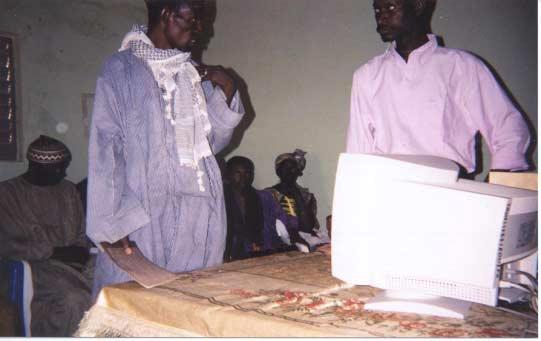
1 Linking role-playing games, GIS and MAS to accompany governing processes in land use management: The SelfCormas experiment in the Senegal river valley P. d Aquino, C. Le Page, F. Bousquet CIRAD, Montpellier, France
2 I. Theoretical grounds 1.Complexity of LUCC presents uncertainty and implies a multiplicity of legitimate perspectives. 2. Scientific knowledge is only one of the legitimate perspectives taken account to handle complexity. 3. Due to this complexity, decision-making process is imperfect : incremental, iterative and continuous. 4. How can we help actors to govern themselves instead of propose pretentious technical solutions? -> The Accompanying Approach
3 The Accompanying Approach Not produce definitive decisions but improve making-decision process. Putting all supports at principals' disposal: to take into account their own perceptions to provide external knowledge on request, into their own framework To be directly controllable by them Scientific information summoned up progressively by principals.
4 II. Help stakeholders to conceive theirs LUCC models: the SelfCormas experiment (2 500 km² and people) For "Taking into account the stakeholders' perceptions 1/GIS self-design. a/ Stakeholders give spatial information they consider themselves important
5 Stake hold. Annual Cycle of «needs», according to participants Bree der Pas ture water Agric. Crop water Fisher Fish water Parc Vegt. water Hunt. Bird water Légend : watering zone until about November : watering zone until about February : watering zone until about May : culture : water
6 1/GIS self-design. b/ Stakeholders identify lacks of information and control some data collects
7 For "Putting external knowledge straight at stakeholders' disposal. providing data directly from a complex GIS, but through their own framework. learning-by-doing to analyze maps (correct, valid, debate)


8

9 Towards Map Self-Designing
10 2/The use of GIS: Self-Designed Simulations stakeholders identify space and time stakeholders identify usages -> role-playing game : the own perception of participants, with their own simplification choices
11 3/From playing model to computer model: MAS self-design -> GIS x RpG x CORMAS


12


13

14
15 Towards "tools directly handled by stakeholders. A self-incremental modeling process, supplied by an accurate information system (GIS). More insights in the results of the simulations. Better to take into account distance between model and reality
16 II. CORMAS, a flexible platform for accompanying Elementary spatial entity (ESE), in regular grids or irregular tessellation Compound Spatial Entity (CSE) collection of ESE sharing same properties Spatial point of view" (PoV), simple method implemented combining values of some ESE attributes
17 II. CORMAS, a flexible platform for accompanying PoV defined from biophysical and appropriation features of ESE. All PoV showed in a same simulation ESE or location Shifting/creating/destructing spatial features with a simple click static (raster or vector) and dynamic (ArcView) links GIS/MAS
18 CORMAS Organization Object Entity Msg SpatialEntity Agent ObjectLocated... AgentLocated AgentCommLocated Spatial Entity AgentComm Group Elementary SE (L 0 ) Cell Compound SE SpatialEntitySet Topological CSE (L 1 ) SpatialEntitySetConnex non-topological CSE Partition Aggregate CSEnT single-value (L 2 ) Category CSEnT pluri-values (L 3 ) Landscape

19 CORMAS Screen
20 Some Spatial Representations in CORMAS Crops Dynamics Animals Movements and Territories Aggregates Dynamics (village/crops/pasture/forest)
21 CORMAS: Dealing Spatial Points of View Herb Shrub Tree Rock Two Points of View on this Spatial Environment
22 III. Conclusions and perspectives producing an environment enabling stakeholders to design their model practical use in real conditions GIS provides data on request and MAS supports local perceptions a collective learning-by-doing process combining role-playing games, GIS and MAS towards two directions: technologic improvements for a better selfuse investigations for a self-interconnecting between scales of collective decision
Least-Cost Transportation Corridor Analysis Using Raster Data.
 Least-Cost Transportation Corridor Analysis Using Raster Data What is GeoMedia Grid: Key Grid Concepts Vector Model Vector based systems show data by means of a series of points, lines, and polygons. Each
Geographical Information Systems
 Geographical Information Systems Geographical Information Systems (GIS) is a relatively new technology that is now prominent in the ecological sciences. This tool allows users to map geographic features
Linking local multimedia models in a spatially-distributed system
 Linking local multimedia models in a spatially-distributed system I. Miller, S. Knopf & R. Kossik The GoldSim Technology Group, USA Abstract The development of spatially-distributed multimedia models has
TP4D. Fostering territorial perspective for development. Towards a wider alliance
 Fostering territorial perspective for development Towards a wider alliance FOR several years, territorial approaches to development have been spreading within international organizations and among development
USING GIS CARTOGRAPHIC MODELING TO ANALYSIS SPATIAL DISTRIBUTION OF LANDSLIDE SENSITIVE AREAS IN YANGMINGSHAN NATIONAL PARK, TAIWAN
 CO-145 USING GIS CARTOGRAPHIC MODELING TO ANALYSIS SPATIAL DISTRIBUTION OF LANDSLIDE SENSITIVE AREAS IN YANGMINGSHAN NATIONAL PARK, TAIWAN DING Y.C. Chinese Culture University., TAIPEI, TAIWAN, PROVINCE
Spatial Process VS. Non-spatial Process. Landscape Process
 Spatial Process VS. Non-spatial Process A process is non-spatial if it is NOT a function of spatial pattern = A process is spatial if it is a function of spatial pattern Landscape Process If there is no
Table of Contents. General Introduction... Part 1. Introduction... 3
 Table of Contents General Introduction... xi PART 1. THE STRUCTURE OF THE GEOGRAPHIC SPACE... 1 Part 1. Introduction... 3 Chapter 1. Structure and System Concepts... 5 1.1. The notion of structure... 5
What is GIS? Introduction to data. Introduction to data modeling
 What is GIS? Introduction to data Introduction to data modeling 2 A GIS is similar, layering mapped information in a computer to help us view our world as a system A Geographic Information System is a
Geographical knowledge and understanding scope and sequence: Foundation to Year 10
 Geographical knowledge and understanding scope and sequence: Foundation to Year 10 Foundation Year 1 Year 2 Year 3 Year 4 Year 5 Year 6 Year level focus People live in places Places have distinctive features
M. Saraiva* 1 and J. Barros 1. * Keywords: Agent-Based Models, Urban Flows, Accessibility, Centrality.
 The AXS Model: an agent-based simulation model for urban flows M. Saraiva* 1 and J. Barros 1 1 Department of Geography, Birkbeck, University of London, 32 Tavistock Square, London, WC1H 9EZ *Email: m.saraiva@mail.bbk.ac.uk
Supplementary material: Methodological annex
 1 Supplementary material: Methodological annex Correcting the spatial representation bias: the grid sample approach Our land-use time series used non-ideal data sources, which differed in spatial and thematic
Re-imagining Religion: The Spatial Humanities as a Framework for New Scholarship
 2010 Re-imagining Religion: The Spatial Humanities as a Framework for New Scholarship David J. Bodenhamer The Polis Center at IUPUI Virtual Center for Spatial Humanities New Technologies and Interdisciplinary
Brief Glimpse of Agent-Based Modeling
 Brief Glimpse of Agent-Based Modeling Nathaniel Osgood Using Modeling to Prepare for Changing Healthcare Need January 9, 2014 Agent-Based Models Agent-based model characteristics One or more populations
![)UDQFR54XHQWLQ(DQG'tD]'HOJDGR&](/thumbs/95/125846872.jpg ")UDQFR54XHQWLQ(DQG'tD]'HOJDGR&") &21&(37,21$1',03/(0(17$7,212)$1+
&21&(37,21$1',03/(0(17$7,212)$1+ STUDY GUIDE. Exploring Geography. Chapter 1, Section 1. Terms to Know DRAWING FROM EXPERIENCE ORGANIZING YOUR THOUGHTS
 For use with textbook pages 19 22. Exploring Geography Terms to Know location A specific place on the earth (page 20) absolute location The exact spot at which a place is found on the globe (page 20) hemisphere
Geography for Life. Course Overview
 Geography for Life Description In Geography for Life students will explore the world around them. Using the six essential elements established by the National Geographic Society students will be able to
Lecture 1: Geospatial Data Models
 Lecture 1: GEOG413/613 Dr. Anthony Jjumba Introduction Course Outline Journal Article Review Projects (and short presentations) Final Exam (April 3) Participation in class discussions Geog413/Geog613 A
GIS in Water Resources Midterm Exam Fall 2008 There are 4 questions on this exam. Please do all 4.
 Page 1 of 8 Name: GIS in Water Resources Midterm Exam Fall 2008 There are 4 questions on this exam. Please do all 4. 1. Basic Concepts [20 points] Find the letter with the best answer for each term: 1.
Can You do Maths in a Crowd? Chris Budd
 Can You do Maths in a Crowd? Chris Budd Human beings are social animals We usually have to make decisions in the context of interactions with many other individuals Examples Crowds in a sports stadium
Geographic Communication with Solid Terrain Models
 2013 Esri Europe, Middle East and Africa User Conference October 23-25, 2013 Munich, Germany Geographic Communication with Solid Terrain Models Carlos Coucelo, Pedro Duarte, Rita Crespo CCCGeomática, Portugal
A Framework of Participatory Geo-Spatial Information System for Micro Level Planning A Case Study in Aquaculture
 A Framework of Participatory Geo-Spatial Information System for Micro Level Planning A Case Study in Aquaculture G.P. Reddy, M.N. Reddy, B.S. Sontakki and K.V. Kumar* I INTRODUCTION Ind. Jn. of Agri.Econ.
Outline. Geographic Information Analysis & Spatial Data. Spatial Analysis is a Key Term. Lecture #1
 Geographic Information Analysis & Spatial Data Lecture #1 Outline Introduction Spatial Data Types: Objects vs. Fields Scale of Attribute Measures GIS and Spatial Analysis Spatial Analysis is a Key Term
The Blacktown Fishing Bat
 Factors That Shape Places The Blacktown Fishing Bat As urban Sydney sprawls in all directions, the Blacktown Local Government Area is changing dramatically. This Geographical Inquiry will focus on the
Protected areas: model landscapes for sustainable development
 International workshop: Protected areas as tools for regional development Saint-Pierre-de-Chartreuse, France 13 October, 2011 Ingo Mose ZENARiO Center for Sustainable Spatial Development Carl von Ossietzky
SPATIAL AND TEMPORAL MODELLING OF ECOSYSTEM SERVICES
 SPATIAL AND TEMPORAL MODELLING OF ECOSYSTEM SERVICES Solen Le Clec h, T.Decaëns, S. Dufour, M. Grimaldi, N. Jégou and J. Oszwald ACES Conference 2016 Jacksonville, Florida (USA). December, 5-9th : issues
PERCEPTION and Focus on Maps. Focus on Maps 8/29/2014. English and Dutch Maps from the 1600s and 1680 British Maps of N. Am.
 PERCEPTION English and Dutch Maps from the 600s The Nature of New York Dutch67 Prof. Anthony Grande English 67 Copyright 04 AFG 676 and 680 British Maps of N. Am. 70 and 776 4 Focus on Maps Maps are geographers
The map document opens, and you see a physical map of the world with the Saudi Arabian Peninsula outlined in red.
 Module 5, Lesson 2 A line in the sand The ever-changing map of the world reflects the forces of conflict and cooperation among nations and peoples of the world. In this activity, you will explore one of
Geostatistics and Spatial Scales
 Geostatistics and Spatial Scales Semivariance & semi-variograms Scale dependence & independence Ranges of spatial scales Variable dependent Fractal dimension GIS implications Spatial Modeling Spatial Analysis
Research on Object-Oriented Geographical Data Model in GIS
 Research on Object-Oriented Geographical Data Model in GIS Wang Qingshan, Wang Jiayao, Zhou Haiyan, Li Bin Institute of Information Engineering University 66 Longhai Road, ZhengZhou 450052, P.R.China Abstract
GIS: Definition, Software. IAI Summer Institute 19 July 2000
 GIS: Definition, Software IAI Summer Institute 19 July 2000 What is a GIS? Geographic Information System Definitions DeMers (1997): Tools that allow for the processing of spatial data into information,
Kansas Archaeology Month
 Activities for Discovering Prehistoric Trails TIME: 45 min. Kansas Archaeology Month Discovering Prehistoric Trails This lesson is divided into four sections: instructional goals, advanced preparation,
A Living Planet. Chapter PHYSICAL GEOGRAPHY. What you will learn in this chapter. Summary of the chapter
 QUIT Main Ideas What you will learn in this chapter Summary Summary of the chapter Test your geographic knowledge by playing the. Main Ideas Section 1: The Earth Inside and Out The earth is the only habitable
Factors That Shape Places Sackville North
 Factors That Shape Places Sackville North As urban Sydney sprawls in all directions, the North West is changing dramatically. This Geographical Inquiry will focus on the connections between people and
Gina Hunt Chesapeake Bay Program Fish Habitat Coordinator
 Gina Hunt Chesapeake Bay Program Fish Habitat Coordinator Regional Fish Habitat Assessment User Needs A guiding principal for the assessment framework is that it should support planning and management
Chisoni Mumba. Presentation made at the Zambia Science Conference 2017-Reseachers Symposium, th November 2017, AVANI, Livingstone, Zambia
 Application of system dynamics and participatory spatial group model building in animal health: A case study of East Coast Fever interventions in Lundazi and Monze districts of Zambia Chisoni Mumba Presentation
Give 4 advantages of using ICT in the collection of data. Give. Give 4 disadvantages in the use of ICT in the collection of data
 Give 4 advantages of using ICT in the collection of data can use a handheld GPS to get accurate location information which can be used to show data linked to specific locations within a GIS can collect
RESEARCH ON SPATIAL DATA MINING BASED ON UNCERTAINTY IN GOVERNMENT GIS
 Abstract RESEARCH ON SPATIAL DATA MINING BASED ON UNCERTAINTY IN GOVERNMENT GIS Bin Li 1,2, Jiping Liu 1, Lihong Shi 1 1 Chinese Academy of Surveying and Mapping 16 beitaiping Road, Beijing 10039, China
Fig 1. Steps in the EcoValue Project
 Assessing the Social and Economic Value of Ecosystem Services in the Northern Forest Region: A Geographic Information System (GIS) Approach to Landscape Valuation Principal Investigator(s): Dr. Matthew
Overcoming Complexities on the Interface of Infrastructure and Land Use
 Date 22-11-2013 1 Overcoming Complexities on the Interface of Infrastructure and Land Use Towards design preconditions for integrated regional development Niels Heeres & Jos Arts University of Groningen,
Introduction to GIS. Phil Guertin School of Natural Resources and the Environment GeoSpatial Technologies
 Introduction to GIS Phil Guertin School of Natural Resources and the Environment dguertin@cals.arizona.edu Mapping GeoSpatial Technologies Traditional Survey Global Positioning Systems (GPS) Remote Sensing
The French SIGMA-Cassini Research Group The Agenda for
 Page 1 of 9 The French SIGMA-Cassini Research Group The Agenda for 2005-2008 M. Mainguenaud C. Weber michel.mainguenaud@insa-rouen.fr christiane.weber@lorraine.u-strasbg.fr http://www.sigma-cassini.org
Nigeria What is a Region? George Kuhter South Tama County Middle School, Toledo, IA
 Instructional Sequence/Procedure (Req.): 1. Review or introduce the idea of region. The most important idea to stress is that a region is a place or places that have similar physical or human characteristics.
Transactions on Information and Communications Technologies vol 18, 1998 WIT Press, ISSN
 STREAM, spatial tools for river basins, environment and analysis of management options Menno Schepel Resource Analysis, Zuiderstraat 110, 2611 SJDelft, the Netherlands; e-mail: menno.schepel@resource.nl
A SYSTEM VIEW TO URBAN PLANNING: AN INTRODUCTION
 A SYSTEM VIEW TO URBAN PLANNING: AN INTRODUCTION Research Seminar Urban Systems Prof. Leandro Madrazo School of Architecture La Salle November 2015 SYSTEM THEORY DEFINITIONS OF SYSTEM A system can be defined
Nepal College of Travel & Tourism Management
 BTTM/Semester-5/ Ethical, legal and regulatory aspects of Travel and Tourism-A 1. Law is not a static thing. It changes with the changes in the society. What are primary and secondary sources of law? Define
Canada s Experience with Chemicals Assessment and Management and its Application to Nanomaterials
 Canada s Experience with Chemicals Assessment and Management and its Application to Nanomaterials European Chemicals Agency (ECHA) Topical Scientific Workshop: Regulatory Challenges in Risk Assessment
Factors That Shape Places. Sackville North
 Factors That Shape Places Sackville North Stage 3 Geography As urban Sydney sprawls in all directions, the North West is changing dramatically. This Geographical Inquiry will focus on the connections between
software, just as word processors or databases are. GIS was originally developed and cartographic capabilities have been augmented by analysis tools.
 1. INTRODUCTION 1.1Background A GIS is a Geographic Information System, a software package for creating, viewing, and analyzing geographic information or spatial data. GIS is a class of software, just
Hierarchies of sustainability in a catchment
 Sustainable Development and Planning IV, Vol. 2 635 Hierarchies of sustainability in a catchment N. Dunstan School of Science and Technology, University of New England, Australia Abstract This paper investigates
OBEUS. (Object-Based Environment for Urban Simulation) Shareware Version. Itzhak Benenson 1,2, Slava Birfur 1, Vlad Kharbash 1
 Shareware Version. Itzhak Benenson 1,2, Slava Birfur 1, Vlad Kharbash 1") OBEUS (Object-Based Environment for Urban Simulation) Shareware Version Yaffo model is based on partition of the area into Voronoi polygons, which correspond to real-world houses; neighborhood relationship
OBEUS (Object-Based Environment for Urban Simulation) Shareware Version Yaffo model is based on partition of the area into Voronoi polygons, which correspond to real-world houses; neighborhood relationship
LAND USE PLANNING (LUP) TOOLS A bottom-up tool
 TOOLS A bottom-up tool") LAND USE PLANNING (LUP) TOOLS A bottom-up tool PARTICIPATORY 3D MAPPING IN THE UPPER SURINAME RIVER BASIN A tool for an inclusive land use planning and decision making in Suriname. Sara O.I. Ramirez Gomez
LAND USE PLANNING (LUP) TOOLS A bottom-up tool PARTICIPATORY 3D MAPPING IN THE UPPER SURINAME RIVER BASIN A tool for an inclusive land use planning and decision making in Suriname. Sara O.I. Ramirez Gomez
Prepared by: Precious Annie Lopez & Nolwenn Boucher
 Recognizing the ancestral land and biodiversity conservation efforts of indigenous people in Quinchao municipality using GIS- and participatory 3Dmapping tool Prepared by: Precious Annie Lopez & Nolwenn
The Contested Cultural Landscape of a Lebanese Border Town: MARJA AYOUN
 The Contested Cultural Landscape of a Lebanese Border Town: MARJA AYOUN IBD 2013 FNAS MAY 2013 Dr. Christine Mady, City & Regional Planning NDU -FAAD In this Presentation A PLANNING PERSPECTIVE INTRODUCING
Use of Government Land Office Surveys in Tribal GIS Land Management. Dustin Holt GIS Technician Choctaw Nation of Oklahoma
 Use of Government Land Office Surveys in Tribal GIS Land Management Dustin Holt GIS Technician Choctaw Nation of Oklahoma Ardmore Quadrangle - 1949 Different versions of the same map were printed in 1901,
Mystery Images from Space Educator s Guide
 Mystery Images from Space Educator s Guide Summary: Students learn and reinforce core concepts in Earth science and achieve learning goals in other fields as well by exploring photographs taken by astronauts.
Situation. The XPS project. PSO publication pattern. Problem. Aims. Areas
 Situation The XPS project we are looking at a paradigm in its youth, full of potential and fertile with new ideas and new perspectives Researchers in many countries are experimenting with particle swarms
Course Introduction II
 CULTURE GEOG 247 Cultural Geography Course Introduction II Prof. Anthony Grande Hunter College-CUNY AFG 2015 Culture is the essence of human geography because it influences all aspects of life on earth.
Project Primary Contact: Gregg Servheen, Idaho Department of Fish and Game, PO Box 25 Boise, ID ,
 Project Title: Idaho Montana Divide Project Objective: Pilot the conceptualization and coordination of a transboundary Decision Support System(DSS) for fish, wildlife, and habitats along the Idaho Montana
GIS Data Structure: Raster vs. Vector RS & GIS XXIII
 Subject Paper No and Title Module No and Title Module Tag Geology Remote Sensing and GIS GIS Data Structure: Raster vs. Vector RS & GIS XXIII Principal Investigator Co-Principal Investigator Co-Principal
Mixed methods in land change research: towards integration
 ransactions of the Institute of British Geographers Boundary Crossings Mixed methods in land change research: towards integration So-Min Cheong*, Daniel G Brown**, Kasper Kok and David Lopez-Carrà *Department
Utilization of Global Map for Societal Benefit Areas
 Utilization of Global Map for Societal Benefit Areas The Fourth GEOSS AP Symposium Bali Indonesia, 11th March 2010 Shuhei Kojima Geographical Survey Institute Ministry of Land, Infrastructure, Transport
T he O utlet: Almirante
 T he O utlet: Almirante For me, the sea is life. This understanding also holds true with our rivers. Each are alive, and carry life with them as they reach the sea. Our rivers, are born up high in the
Types of spatial data. The Nature of Geographic Data. Types of spatial data. Spatial Autocorrelation. Continuous spatial data: geostatistics
 The Nature of Geographic Data Types of spatial data Continuous spatial data: geostatistics Samples may be taken at intervals, but the spatial process is continuous e.g. soil quality Discrete data Irregular:
Geographers Perspectives on the World
 What is Geography? Geography is not just about city and country names Geography is not just about population and growth Geography is not just about rivers and mountains Geography is a broad field that
5 THEMES OF GEOGRAPHY ACTIVITIES/BOOKLET
 5 THEMES OF GEOGRAPHY ACTIVITIES/BOOKLET Choose two activites from each theme to complete LOCATION: 1) Using latitude and longitude lines on a world map, locate and note the following: the highest mountain
GIS Workshop Data Collection Techniques
 GIS Workshop Data Collection Techniques NOFNEC Conference 2016 Presented by: Matawa First Nations Management Jennifer Duncan and Charlene Wagenaar, Geomatics Technicians, Four Rivers Department QA #: FRG
Critical Thinking. about. GeoGRAPHY. United States, Canada, and Greenland. Jayne Freeman
 Critical Thinking about GeoGRAPHY United States, Canada, and Greenland Jayne Freeman WALCH EDUCATION Contents Introduction............................................................... v National Geography
A diffusion model to predict spatial and temporal population dynamics of Rift valley fever vectors in Northern Senegal
 A diffusion model to predict spatial and temporal population dynamics of Rift valley fever vectors in Northern Senegal Soti V., Tran A., Fontenille D, Lancelot R, Chevalier V., Thiongane Y., Degenne P.,
Animating Maps: Visual Analytics meets Geoweb 2.0
 Animating Maps: Visual Analytics meets Geoweb 2.0 Piyush Yadav 1, Shailesh Deshpande 1, Raja Sengupta 2 1 Tata Research Development and Design Centre, Pune (India) Email: {piyush.yadav1, shailesh.deshpande}@tcs.com
Multifunctional theory in agricultural land use planning case study
 Multifunctional theory in agricultural land use planning case study Introduction István Ferencsik (PhD) VÁTI Research Department, iferencsik@vati.hu By the end of 20 th century demands and expectations
SOLIDWORKS Simulation Time Based Thermal Stress
 SOLIDWORKS Simulation Time Based Thermal Stress Overview Given that SOLIDWORKS Simulation is capable of running a transient thermal analysis on models it leads to the question of whether the transient
Lecture 9: Reference Maps & Aerial Photography
 Lecture 9: Reference Maps & Aerial Photography I. Overview of Reference and Topographic Maps There are two basic types of maps? Reference Maps - General purpose maps & Thematic Maps - maps made for a specific
Land Use in the context of sustainable, smart and inclusive growth
 Land Use in the context of sustainable, smart and inclusive growth François Salgé Ministry of sustainable development France facilitator EUROGI vice president AFIGéO board member 1 Introduction e-content+
Development of an Integrated Modelling Framework for the Assessment of River Management Policies
 Development of an Integrated Modelling Framework for the Assessment of River Management Policies 1,2 Rowan, T. S. C., 1 H. R. Maier, 2 J. Connor, and 1 G. C. Dandy 1 Centre for Applied Modelling in Water
Geography Teach Yourself Series Topic 4: Global Distribution of Land Cover
 Geography Teach Yourself Series Topic 4: Global Distribution of Land Cover A: Level 14, 474 Flinders Street Melbourne VIC 3000 T: 1300 134 518 W: tssm.com.au E: info@tssm.com.au TSSM 2016 Page 1 of 7 Contents
Specialist Meeting on Spatial Concepts in GIS and Design Santa Barbara, California. Geo-Spatial Design
 Specialist Meeting on Spatial Concepts in GIS and Design Santa Barbara, California Geo-Spatial Design Creativity is the synapse between two normally disassociated matrices of thought. Arthur Koestler William
VOCABULARY SCAVENGER HUNT Five Themes of Geography
 SECTION: VOCABULARY SCAVENGER HUNT Five Themes of Geography Directions: Skim The Five Themes of Geography and define the following words. Geography: Absolute Location: Relative Location: Hemisphere: Equator:
Complexity and agent-based modelling in urban research
 Working Paper nr. 17 Complexity and agent-based modelling in urban research Christian Fertner is PhD student at the Centre of Forest, Landscape and Planning, University of Copenhagen since March 2008.
Representation of Geographic Data
 GIS 5210 Week 2 The Nature of Spatial Variation Three principles of the nature of spatial variation: proximity effects are key to understanding spatial variation issues of geographic scale and level of
An Internet-Based Integrated Resource Management System (IRMS)
") An Internet-Based Integrated Resource Management System (IRMS) Third Quarter Report, Year II 4/1/2000 6/30/2000 Prepared for Missouri Department of Natural Resources Missouri Department of Conservation
An Internet-Based Integrated Resource Management System (IRMS) Third Quarter Report, Year II 4/1/2000 6/30/2000 Prepared for Missouri Department of Natural Resources Missouri Department of Conservation
Land accounting in Québec: Pilot project for a sub-provincial area
 Land accounting in Québec: Pilot project for a sub-provincial area Stéphanie Uhde 8th meeting of the London Group on Environmental Accounting Ottawa, 2 October, 2012 Province of Québec Area: 1 667 441
Sec$on 1: Geography and Early China. How does China s geography affect the culture?
 Sec$on 1: Geography and Early China How does China s geography affect the culture? Con$nents of the World Label the continents. Where is China located? Where is China located? In your groups, begin filling
Mississippi Valley Archaeology Center 1725 State Street La Crosse, Wisconsin Phone: Web site:
 Mississippi Valley Archaeology Center 1725 State Street La Crosse, Wisconsin 54601 Phone: 608-785-6473 Web site: http://www.uwlax.edu/mvac/ The following lessons were created by Richard Neves, a teacher
Cognitive semantics and cognitive theories of representation: Session 6: Conceptual spaces
 Cognitive semantics and cognitive theories of representation: Session 6: Conceptual spaces Martin Takáč Centre for cognitive science DAI FMFI Comenius University in Bratislava Príprava štúdia matematiky
Moreton Bay and Key Geographic Concepts Worksheet
 Moreton Bay and Key Geographic Concepts Worksheet The Australian Curriculum: Geography draws on seven key geographic concepts: place scale space environment change interconnection sustainability They are
GEOGRAPHY. Grade 10. Syllabus (To be implemented from 2007) National Institute of Education Maharagama Sri Lanka
 National Institute of Education Maharagama Sri Lanka") GEOGRAPHY Grade 10 Syllabus (To be implemented from 2007) National Institute of Education Maharagama Sri Lanka Definition and Objective Geography is the study of nature - society interrelationships and
GEOGRAPHY Grade 10 Syllabus (To be implemented from 2007) National Institute of Education Maharagama Sri Lanka Definition and Objective Geography is the study of nature - society interrelationships and
Table of Contents. Foreword... xiii Michael F. GOODCHILD Introduction... xix Stéphane ROCHE and Claude CARON
 Table of Contents Foreword... xiii Michael F. GOODCHILD Introduction... xix Stéphane ROCHE and Claude CARON PART 1. ISSUES AND PROSPECTS OF GIS RELATIONSHIPS, ORGANIZATIONS AND SOCIETY... 1 Chapter 1.
Natura 2000 and spatial planning. Executive summary
 Natura 2000 and spatial planning Executive summary DISCLAIMER The information and views set out in this study are those of the author(s) and do not necessarily reflect the official opinion of the Commission.
SAON. Finnish Perspectives
 SAON Finnish Perspectives Challenges and opportunities Kari Laine THULE institute University of Oulu Finnish Perspectives: Challenges and opportunities Northern Long-Term Socio-Ecological Research Platform
SPIMA Spatial dynamics and strategic planning in metropolitan areas
 Targeted Analysis SPIMA Spatial dynamics and strategic planning in metropolitan areas Executive Summary Conference version 1 February 2018 0 1. Background To address the challenges of metropolitan development
Geospatial Data Visualization
 Geospatial Data Visualization CS 7450 - Information Visualization October 19, 2016 John Stasko Guest speaker: Alex Godwin Learning Objectives Process of encoding Geospatial Visualization Common Geospatial
HARMO-DATA Project Cross border spatial data harmonization using INSPIRE model
 HARMO-DATA Project Cross border spatial data harmonization using INSPIRE model Blaž Barborič, Raffaela Cefalo, Alessandra Chiarandini, Silvano Dezorzi, Tomaž Petek, Martin Puhar, Mauro Zanardo, Tatiana
Modeling Disease Transmission in Long-tailed Macaques on Bali
 Modeling Disease Transmission in Long-tailed Macaques on Bali Kelly Lane Gerhard Niederwieser Ryan Kennedy University of Notre Dame Macaque Background Coexisted in temples across the island for at least
Participants. Participatory Mapping. Village : Date : Page : / No. Name Job Gender. Entered by. Interviewer. Author. Checked by
 Participatory Mapping Author Interviewer Entered by Checked by Original or Copy O C File name Checked by Has been written on back? Y N Has been copied? Village Participants No. Name Job Gender 1 2 3 4
Turning landscape rambles into integrative, interdisciplinary, intergenerational field experiences
 Turning landscape rambles into integrative, interdisciplinary, intergenerational field experiences Tim Lutz LeeAnn Srogi Earth & Space Sciences West Chester University The major problems of the world are
Citizen Science and Arctic Observing: Using the Internet and Simple Technologies to Improve Understanding of Arctic Ecosystem Change
 Citizen Science and Arctic Observing: Using the Internet and Simple Technologies to Improve Understanding of Arctic Ecosystem Change Maribeth S. Murray 1, Phillip A. Loring 2, Howard Ferren 3 and Rebekka
CS : Spatial Data Modeling and Analysis. Geovisualization
 CS260-002: Spatial Data Modeling and Analysis Geovisualization Visual Perception Learning Styles & Personality Types: Visual, Auditory, Kinesthetic Cholera cases in the London epidemic of 1854 Cholera
MR. GOFF S WORLD HISTORY UNIT ONE: GEOGRAPHY 5 THEMES OF GEOGRAPHY
 MR. GOFF S WORLD HISTORY UNIT ONE: GEOGRAPHY 5 THEMES OF GEOGRAPHY BYOD BRING YOUR OWN DEVICE IN SMALL GROUPS (3-4), USE YOUR ELECTRONIC DEVICE(S) AND DEFINE THE FOLLOWING VOCAB. WORDS 1. GEOGRAPHY 2.
a. Hunting and gathering SE/TE: 17, 19, 21, 22, 23, 25, 30 b. Tool making SE/TE: 17, 18, 19, 22, 23 c. Use of fire SE/TE: 17, 23, 30
 Ohio Academic Content Standards, Social Studies, Benchmarks and Indicators (Grade 6) Grade Six History Students use materials drawn from the diversity of human experience to analyze and interpret significant
Grade 4 Benchmarks. Benchmark Concepts Skills Essential Question(s)
") **Be aware of the use of and & or in the benchmark language related to Canada and Mexico; sometimes students may look at the US and one of our neighboring countries and other times students need to study
**Be aware of the use of and & or in the benchmark language related to Canada and Mexico; sometimes students may look at the US and one of our neighboring countries and other times students need to study