Migration Modelling using Global Population Projections
|
|
|
- Brook Cox
- 5 years ago
- Views:
Transcription


1 Migration Modelling using Global Population Projections Bryan Jones CUNY Institute for Demographic Research Workshop on Data and Methods for Modelling Migration Associated with Climate Change 5 December 2016
2 Outline 1) Project overview a. Proposed tasks and test countries 2) Existing SSP-based spatial population scenarios 3) Proposed new scenarios a. SSP/RCP combinations and time horizon b. Modified spatial population downscaling model c. Data d. Calibration e. Outcomes f. Strengths and limitations
3 Project Overview Task 1. Investigation of the statistical relationship between climate impacts (e.g. ISI-MIP) / climate variables and population distribution from 1970 to 2010 for a subset of representative countries: Task 3. Comparison of the projected populations by RCP/SSP with and without climate impacts to identify hotspots of population change. Task 4. Work with country specialists to contextualize the hotspots mapping results with data from micro- and meso-level research on the drivers of migration in 4-5 target countries. Vietnam and greater Mekong Bangladesh Ethiopia Kenya Morocco Mexico
4 Task 2: Projections of population distribution using the baseline Shared Socioeconomic Pathway (SSP) based population projections but adding climate impacts at subnational scale.

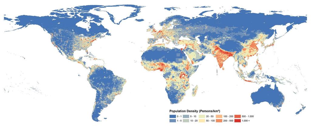
5 NCAR/CUNY Spatial Population Downscaling Model Research Goal: To develop an improved methodology for constructing large-scale, plausible future spatial population scenarios which may be calibrated to reflect alternative regional patterns of development for use in the scenario-based assessment of global change. Characteristics Gravity-based downscaling model Captures observed geographic patterns Calibration Flexible framework Data Resolution (temporal & spatial) SSP-based spatial population scenarios 232 countries/territories Urban, rural, and total populations 10-year time steps, 1/8 th degree NO CLIMATE ASSUMPTIONS


6 Projected Global Population Change 14 SSP1 SSP2 SSP3 SSP4 SSP5 SSP1 - Urban SSP2 - Urban SSP3 - Urban SSP4 - Urban SSP5 - Urban 12 SSP 1 SSP 3 SSP 2 SSP 4 SSP 5 Population (Billions) 10 Concentration 8 6 Population Developed Nations Dispersion SSP 1 SSP 3 SSP 4 SSP 2 SSP 5 Concentration 4 Developing Nations Dispersion Year Urbanization
7 SSP 1: Sustainability
8 SSP 2: Middle of the Road
9 SSP 3: Regional Rivalry

10 SSP 4: Inequality
11 SSP 5: Fossil-Fueled Development
12 New Spatial Population Scenarios Scenarios under consideration: Low emissions: SSP1/RCP2.6 Middle-of-the-road: SSP2/RCP4.5 High emissions: SSP5/RCP8.5 Other combinations to span full range of population outcomes (e.g. SSP3/RCPx) Time horizon: 2030, in 5-year intervals possible. Spatial resolution: Data driven; 1/8 to 1


13 NCAR-CUNY Spatial Population Downscaling Model v i = Al i i m j= 1 P α j e βd ij Assumptions: Spatial choice informed by accessibility Projected U.S. Urban and Rural Population Population agglomeration is a proxy for the socio-economic characteristics of attractive places Environmental/sectoral change will impact relative attractiveness Population Potential Surface Population Distribution New Population Distribution
 are estimated from historical data for both urban and rural distributions. A consists of one or many spatial layers (i.e. singleindicator/indices) that impact the relative attractiveness of place.")
14 The Modified NCAR-CUNY Population Potential Model v i Local Characteristics = Al i Spatial Mask i m j= 1 Population Parameter P α j Population e Distance Parameter β d ij Distance Potential is calculated for each cell over a window of 100km. Parameters (α and β) are estimated from historical data for both urban and rural distributions. A consists of one or many spatial layers (i.e. singleindicator/indices) that impact the relative attractiveness of place.


 National/Regional Population Projection Socio-Economic")
15 Modified NCAR/CUNY Spatial Population Downscaling Model Base-Year Distribution Urban Parameters Rural Parameters Historic Population Change Elevation Slope Calculate Urban Potential Calculate Rural Potential Spatial Mask Surface Water Protected Status Climate Impacts Allocate Projected Urban Population Change Allocate Projected Rural Population Change Local Characteristics Sectoral Impacts (ISI-MIP) Demographic Data New Population Distribution Final Population Distribution t(100) National/Regional Population Projection Socio-Economic Data (GDP) Geographic Data
16 Additional Data We have found that patterns of spatial population change can be correlated to certain demographic, socio-economic, and geographic variables over different regions, including: Demographic Age specific fertility and mortality Median age % elderly (65+) Geographic Physical amenities index Ecozone Socio-Economic Income Sectoral employment Unemployment rate Poverty rate Educational attainment Social amenities index Here we add sectoral impact (ISI-MIP) and climate indicators to the analysis to isolate their impact on historic patterns of spatial population change.
17 Calibration The parameters α and β are estimated from historic data by minimizing the error term in: obs i,2000 obs T,2000 P P = mod i,2000 mod T,2000 P P + ε i ( α, β ) (α, β) For each cell i there will be an error in projected population: A(i)
18 Calibration We hypothesize that these errors can be explained by local environmental (and other) characteristics, which are used to estimate the A parameter. (α, β) A(i) For each cell i we calculate the value of A necessary to eliminate ε. We call this value the observed A.
19 Calibration We then estimate the relationship between observed A and cell-specific climate and sectoral impact indicators, as well as other know drivers, by fitting a spatially autoregressive model: = β + A X µ i, t i, t i, t µ = + ρ ε, Wu i t i, t i, t where X is the set of explanatory variables, u the random effect component, ρ is the spatial autocorrelation coefficient and W is a spatial weight matrix. From this procedure we estimate a set of cell specific A values.
20 Proposed Outcomes GWR analysis examining the relationship between past climate stressors and change in spatial population distribution, controlling for other known drivers such as GDP, across sub-national regions in the proposed countries. Spatially explicit population projections for 2-3 scenarios for developing world regions inclusive of climate change impacts. Test countries acting as markers for larger regions. Hotspot analysis comparison to existing SSP-based projections to identify significant differences (potential net senders/receivers) Statistical assessment of the impact of climate change on spatial population outcomes, including uncertainty across scenarios. More detailed analysis, incorporating country or sub-national findings from household-level research on migration dynamics, that contextualizes the results of the migration modeling exercise for test countries.
21 Limitations Does not directly project migration or displacement Cannot produce estimates of total number of internal migrants Household decisions not considered Time invariance Identifies potential migration hotspots Subnational regions/areas that are large net senders or receivers Broad trends/aggregate change useful at global scale. Can estimate impact of climate change using counterfactuals Strengths
22 Questions, Discussion.. (Due to time constraints testing and validation not included here)
23 Extra Slides


24 Historical Validation: Prediction Error Divisional Redistribution Scenario Sour e: Jones and O Neill, 2013

25 SSP-based Spatial Population Projections Parameters reflect spatial patterns implied by SSP storylines Representative parameters applied to groups of countries 1/8 resolution, : 10-year intervals
Constructing Global-Scale Spatial Population Scenarios. Bryan Jones, CGD-IAM, NCAR Boulder, CO August 19, 2013
 Constructing Global-Scale Spatial Population Scenarios Bryan Jones, CGD-IAM, NCAR Boulder, CO August 19, 2013 NCAR Community Demographic Model (CDM) Urbanization Projection (National) Household Projection
Progress in Modeling Spatial Population Scenarios. Bryan Jones CGD-IAM, NCAR NCAR IAM Group Annual Meeting, July 19, 2012
 Progress in Modeling Spatial Population Scenarios Bryan Jones CGD-IAM, NCAR NCAR IAM Group Annual Meeting, July 19, 2012 Agenda 1. Introduction a. Importance b. Research goals 2. Methodology a. Current
Supplementary Information Jones and O Neill, Spatially explicit global population scenarios consistent with the Shared Socioeconomic Pathways
 S1 Supplementary Information Jones and O Neill, Spatially explicit global population scenarios consistent with the Shared Socioeconomic Pathways Outline This supplementary information contains additional
AS Population Change Question spotting
 AS Change Question spotting Changing rate of growth How the rate of growth has changed over the last 100 years Explain the reasons for these changes Describe global or national distribution. Study the
Responding to Natural Hazards: The Effects of Disaster on Residential Location Decisions and Health Outcomes
 Responding to Natural Hazards: The Effects of Disaster on Residential Location Decisions and Health Outcomes James Price Department of Economics University of New Mexico April 6 th, 2012 1 Introduction
Applying Earth System Forecasts For Climate Change To Inform Conservation Planning Of The East African Great Lakes
 Applying Earth System Forecasts For Climate Change To Inform Conservation Planning Of The East African Great Lakes S. Asefi, D. Lawrence, P. Lawrence, A. Seimon, S. Talbot 1- University Of Virginia Department
Assessing Social Vulnerability to Biophysical Hazards. Dr. Jasmine Waddell
 Assessing Social Vulnerability to Biophysical Hazards Dr. Jasmine Waddell About the Project Built on a need to understand: The pre-disposition of the populations in the SE to adverse impacts from disaster
BUILDING SOUND AND COMPARABLE METRICS FOR SDGS: THE CONTRIBUTION OF THE OECD DATA AND TOOLS FOR CITIES AND REGIONS
 BUILDING SOUND AND COMPARABLE METRICS FOR SDGS: THE CONTRIBUTION OF THE OECD DATA AND TOOLS FOR CITIES AND REGIONS STATISTICAL CAPACITY BUILDING FOR MONITORING OF SUSTAINABLE DEVELOPMENT GOALS Lukas Kleine-Rueschkamp
Future population exposure to US heat extremes
 Outline SUPPLEMENTARY INFORMATION DOI: 10.1038/NCLIMATE2631 Future population exposure to US heat extremes Jones, O Neill, McDaniel, McGinnis, Mearns & Tebaldi This Supplementary Information contains additional
The Cost of Transportation : Spatial Analysis of US Fuel Prices
 The Cost of Transportation : Spatial Analysis of US Fuel Prices J. Raimbault 1,2, A. Bergeaud 3 juste.raimbault@polytechnique.edu 1 UMR CNRS 8504 Géographie-cités 2 UMR-T IFSTTAR 9403 LVMT 3 Paris School
1Department of Demography and Organization Studies, University of Texas at San Antonio, One UTSA Circle, San Antonio, TX
 Well, it depends on where you're born: A practical application of geographically weighted regression to the study of infant mortality in the U.S. P. Johnelle Sparks and Corey S. Sparks 1 Introduction Infant
MIGRATION, URBANIZATION, AND DEVELOPMENT -COURSE DESCRIPTION- (Revised: August 16, 1993)
") Geog./Econ;.: 4293/5293 Migration, Urbanization, and Development Fall 1993 - MWF 9:00-9:50 Guggenheim 2 Mr. A. Rogers and Mr. C. Becker MIGRATION, URBANIZATION, AND DEVELOPMENT -COURSE DESCRIPTION- (Revised:
Geog./Econ;.: 4293/5293 Migration, Urbanization, and Development Fall 1993 - MWF 9:00-9:50 Guggenheim 2 Mr. A. Rogers and Mr. C. Becker MIGRATION, URBANIZATION, AND DEVELOPMENT -COURSE DESCRIPTION- (Revised:
Population and Employment Forecast
 Population and Employment Forecast How Do We Get the Numbers? Thurston Regional Planning Council Technical Brief Updated July 2012 We plan for forecast growth in Population and Employment, but where do
Disaster Management & Recovery Framework: The Surveyors Response
 Disaster Management & Recovery Framework: The Surveyors Response Greg Scott Inter-Regional Advisor Global Geospatial Information Management United Nations Statistics Division Department of Economic and
Urban development in Finland part of a dynamic or declining Europe?
 Urban development in Finland part of a dynamic or declining Europe? Emma Terämä Finnish environment institute (SYKE) URMI 2.2.2017 Tampere 1 Maija Mattinen Emma Terämä Ville Helminen Urban Europe vs. Finland
Temperature ( C) Map 1. Annual Average Temperatures Are Projected to Increase Dramatically by 2050
 Map 1. Annual Average Temperatures Are Projected to Increase Dramatically by 2050") CO UNT RY S NA P SHO T Sri Lanka s Hotspots The Impact of Temperature and Precipitation Changes on Living Standards Climate change is already a pressing issue for Sri Lanka. Temperatures have risen considerably
CO UNT RY S NA P SHO T Sri Lanka s Hotspots The Impact of Temperature and Precipitation Changes on Living Standards Climate change is already a pressing issue for Sri Lanka. Temperatures have risen considerably
What s new (or not so new) in Population and Poverty Data Initiatives
 in Population and Poverty Data Initiatives") What s new (or not so new) in Population and Poverty Data Initiatives Deborah Balk Global Spatial Data and Information User Workshop 21 September 2004 Evolution in global collection of population and poverty
What s new (or not so new) in Population and Poverty Data Initiatives Deborah Balk Global Spatial Data and Information User Workshop 21 September 2004 Evolution in global collection of population and poverty
TOWARDS STRATEGIC SPATIAL PLANNING IN JAMAICA: THE NATIONAL SPATIAL PLAN
 TOWARDS STRATEGIC SPATIAL PLANNING IN JAMAICA: THE NATIONAL SPATIAL PLAN JIEP 5th Biennial Conference on the Environment: Balancing National Development and Environmental Protection June 6, 2011 Jamaica
AP HUG REVIEW WELCOME TO 2 ND SEMESTER! Annette Parkhurst, M.Ed. January, 2015
 AP HUG REVIEW WELCOME TO 2 ND SEMESTER! Annette Parkhurst, M.Ed. January, 2015 Movement Globalization Latitude & Elevation Levels of Economic Activities CONNECTIONS Human Geography Human is the geography
Measuring Disaster Risk for Urban areas in Asia-Pacific
 Measuring Disaster Risk for Urban areas in Asia-Pacific Acknowledgement: Trevor Clifford, Intl Consultant 1 SDG 11 Make cities and human settlements inclusive, safe, resilient and sustainable 11.1: By
Temperature ( C) Map 1. Annual Average Temperatures Are Projected to Increase Dramatically by 2050
 Map 1. Annual Average Temperatures Are Projected to Increase Dramatically by 2050") CO UNT RY S NA P SHO T India s Hotspots The Impact of Temperature and Precipitation Changes on Living Standards Climate change is already a pressing issue for India. Temperatures have risen considerably
CO UNT RY S NA P SHO T India s Hotspots The Impact of Temperature and Precipitation Changes on Living Standards Climate change is already a pressing issue for India. Temperatures have risen considerably
Simulating urban growth in South Asia: A SLEUTH application
 Simulating urban growth in South Asia: A SLEUTH application Gargi Chaudhuri* 1 1 1725 State St., 2022 Cowley Hall, Department of Geography and Earth Science, University of Wisconsin-La Crosse *Email: gchaudhuri@uwlax.edu
GIS in Locating and Explaining Conflict Hotspots in Nepal
 GIS in Locating and Explaining Conflict Hotspots in Nepal Lila Kumar Khatiwada Notre Dame Initiative for Global Development 1 Outline Brief background Use of GIS in conflict study Data source Findings
Spatial Modeling of Agricultural Land-Use Change at Global Scale
 NCAR IAM Group Annual Meeting, 19 Aug 013 Spatial Modeling of Agricultural Land-Use Change at Global Scale Prasanth Meiyappan PhD Candidate University of Illinois at Urbana-Champaign With contributions
Links between socio-economic and ethnic segregation at different spatial scales: a comparison between The Netherlands and Belgium
 Links between socio-economic and ethnic segregation at different spatial scales: a comparison between The Netherlands and Belgium Bart Sleutjes₁ & Rafael Costa₂ ₁ Netherlands Interdisciplinary Demographic
The challenge of globalization for Finland and its regions: The new economic geography perspective
 The challenge of globalization for Finland and its regions: The new economic geography perspective Prepared within the framework of study Finland in the Global Economy, Prime Minister s Office, Helsinki
Key Indicators for Territorial Cohesion and Spatial Planning in Preparing Territorial Development Strategies
 ESPON Evidence in a North European Context Challenges and Opportunities for Territorial Development and Cohesion in a North European Macro Region, 10-11 April, 2014, Vilnius, Lithuania Key Indicators for
The Tyndall Cities Integrated Assessment Framework
 The Tyndall Cities Integrated Assessment Framework Alistair Ford 1, Stuart Barr 1, Richard Dawson 1, Jim Hall 2, Michael Batty 3 1 School of Civil Engineering & Geosciences and Centre for Earth Systems
Low Density Areas : Places of Opportunity. Enrique Garcilazo, OECD Directorate for Public Governance and Territorial Development
 Low Density Areas : Places of Opportunity Enrique Garcilazo, OECD Directorate for Public Governance and Territorial Development Open Days, Brussels, 11 th October, 2016 Outline 1. Performance low density
Topic 4: Changing cities
 Topic 4: Changing cities Overview of urban patterns and processes 4.1 Urbanisation is a global process a. Contrasting trends in urbanisation over the last 50 years in different parts of the world (developed,
Urban Climate Resilience
 Urban Climate Resilience in Southeast Asia Partnership Project Introduction Planning for climate change is a daunting challenge for governments in the Mekong Region. Limited capacity at the municipal level,
Multidimensional Poverty in Colombia: Identifying Regional Disparities using GIS and Population Census Data (2005)
") Multidimensional Poverty in Colombia: Identifying Regional Disparities using GIS and Population Census Data (2005) Laura Estrada Sandra Liliana Moreno December 2013 Aguascalientes, Mexico Content 1. Spatial
Multidimensional Poverty in Colombia: Identifying Regional Disparities using GIS and Population Census Data (2005) Laura Estrada Sandra Liliana Moreno December 2013 Aguascalientes, Mexico Content 1. Spatial
Key Indicators for Territorial Cohesion & Spatial Planning Stakeholder Workshop - Project Update. 13 th December 2012 San Sebastián, Basque Country
 Key Indicators for Territorial Cohesion & Spatial Planning Stakeholder Workshop - Project Update 13 th December 2012 San Sebastián, Basque Country Key Aims Explore the use of territorial data in developing
Modeling Smart Growth in the Southeast Using Smart-SLEUTH. November 20, 2014 SOUTH ATLANTIC LCC WEB FORUM Monica A. Dorning
 Modeling Smart Growth in the Southeast Using Smart-SLEUTH November 20, 2014 SOUTH ATLANTIC LCC WEB FORUM Monica A. Dorning (Sub)Urbanization in the Southeast November 20, 2014 SOUTH ATLANTIC LCC WEB FORUM
SPATIAL ANALYSIS OF POPULATION DATA BASED ON GEOGRAPHIC INFORMATION SYSTEM
 SPATIAL ANALYSIS OF POPULATION DATA BASED ON GEOGRAPHIC INFORMATION SYSTEM Liu, D. Chinese Academy of Surveying and Mapping, 16 Beitaiping Road, Beijing 100039, China. E-mail: liudq@casm.ac.cn ABSTRACT
Applying Health Outcome Data to Improve Health Equity
 Applying Health Outcome Data to Improve Health Equity Devon Williford, MPH, Health GIS Specialist Lorraine Dixon-Jones, Policy Analyst CDPHE Health Equity and Environmental Justice Collaborative Mile High
Poverty statistics in Mongolia
 HIGH-LEVEL SEMINAR ON HARMONISATION OF POVERTY STATISTICS IN CIS COUNTRIES SOCHI (RUSSIAN FEDERATION) Poverty statistics in Mongolia Oyunchimeg Dandar Director Population and Social Statistics Department,
Structural change in a multi-sector model of the climate and the economy
 Structural change in a multi-sector model of the climate and the economy Gustav Engström The Beijer Institute of Environmental Economics Stockholm, December 2012 G. Engström (Beijer) Stockholm, December
The Council Study: Social assessment approach and methodology
 Preliminary draft for internal discussion The Council Study: Social assessment approach and methodology Vientiane, September 24 2015 Social /economic assessment team Basin Development Plan (BDP) Programme
Regional variation in the educational gradient of fertility. The case of Belgium
 Regional variation in the educational gradient of fertility. The case of Belgium Education and reproduction in low-fertility settings (EDUREP), Vienna, 2 4 December 215 Jonas Wood*, Sebastian Klüsener**,
ACCESSIBILITY TO SERVICES IN REGIONS AND CITIES: MEASURES AND POLICIES NOTE FOR THE WPTI WORKSHOP, 18 JUNE 2013
 ACCESSIBILITY TO SERVICES IN REGIONS AND CITIES: MEASURES AND POLICIES NOTE FOR THE WPTI WORKSHOP, 18 JUNE 2013 1. Significant differences in the access to basic and advanced services, such as transport,
Impact Evaluation of Rural Road Projects. Dominique van de Walle World Bank
 Impact Evaluation of Rural Road Projects Dominique van de Walle World Bank Introduction General consensus that roads are good for development & living standards A sizeable share of development aid and
Lecture 2 Differences and Commonalities among Developing Countries
 Lecture 2 Differences and Commonalities among Developing Countries Lecture Outline I-Defining the developing world: Indicators of development A-GDP per capita: nominal, real, PPP B-Human Development Index
Globally Estimating the Population Characteristics of Small Geographic Areas. Tom Fitzwater
 Globally Estimating the Population Characteristics of Small Geographic Areas Tom Fitzwater U.S. Census Bureau Population Division What we know 2 Where do people live? Difficult to measure and quantify.
Structural Change, Demographic Transition and Fertility Di erence
 Structural Change, Demographic Transition and Fertility Di erence T. Terry Cheung February 14, 2017 T. Terry Cheung () Structural Change and Fertility February 14, 2017 1 / 35 Question Question: The force
Presentation by Thangavel Palanivel Senior Strategic Advisor and Chief Economist UNDP Regional Bureau for Asia-Pacific
 Presentation by Thangavel Palanivel Senior Strategic Advisor and Chief Economist UNDP Regional Bureau for Asia-Pacific The High-Level Euro-Asia Regional Meeting on Improving Cooperation on Transit, Trade
Productivity Differences Within and Between Countries
 Productivity Differences Within and Between Countries Melissa Dell MIT OECD Lagging Regions Meeting, June 2010 Dell (MIT) Productivity Differences OECD Lagging Regions 1 / 21 Motivation Introduction and
A Spatial Multiple Discrete-Continuous Model
 A Spatial Multiple Discrete-Continuous Model Chandra R. Bhat 1,2 and Sebastian Astroza 1,3 1: The University of Texas at Austin 2: The Hong Kong Polytechnic University 3: Universidad de Concepción Outline
Enquiry question: How does the world s climate system function, why does it change and how can this be hazardous for people?
 Content Topic 1: Hazardous Earth Enquiry question: How does the world s climate system function, why does it change and how can this be hazardous for people? 1.1 The atmosphere operates as a global system
Stability, Ability and Equity
 Stability, Ability and Equity Mobility and Protection in the Urban Context Arup Banerji Senior Director and Head of Global Practice, Social Protection and Labor The World Bank Group 1 ECONOMIC MOBILITY
Vulnerability and Adaptation to Climate Change
 Vulnerability and Adaptation to Climate Change Prof. Dr. Christoph Görg Department of Social Sciences, University of Kasssel Head of Department Environmental Politics, UFZ Leipzig 1 Introduction: Climate
Urbanization and Sustainable Development of Cities: A Ready Engine to Promote Economic Growth and Cooperation
 Urbanization and Sustainable Development of Cities: A Ready Engine to Promote Economic Growth and Cooperation Wan Portia Hamzah Institute of Strategic and International Studies (ISIS) Malaysia 10 September
National SDG Data Hubs: Statistical integration and geographic disaggregation (Philippines)
") National SDG Data Hubs: Statistical integration and geographic disaggregation (Philippines) 5 th High Level Forum on United Nations Global Geospatial Information Management Implementing the Sustainable
National SDG Data Hubs: Statistical integration and geographic disaggregation (Philippines) 5 th High Level Forum on United Nations Global Geospatial Information Management Implementing the Sustainable
APPLICATION OF DEFINITION AND METHODS IN MEXICO
 APPLICATION OF DEFINITION AND METHODS IN MEXICO WIEGO 20th. ANNIVERSARY RESEARCH CONFERENCE Cambridge Mass. November 10-12 2017 Rodrigo Negrete Lilia Guadalupe Luna Why informality matters so much in Mexico
Climate Change Hotspots Mapping and Migration as Adaptation
 Climate Change Hotspots Mapping and Migration as Adaptation Alex de Sherbinin, PhD Center for International Earth Science Information Network (CIESIN) The Earth Institute at Columbia University NASA Socioeconomic
Global Atmospheric Circulation. Past climate change and natural causes. Global climate change and human activity
 GCSE Geography Edexcel B Revision Checklist Paper 1. Global Geographical Issues Topic 1. Hazardous Earth Key Idea I know/ understand The world s climate system Global Atmospheric Circulation Past climate
Spatial Modeling of Land Use and Land Cover Change
 Spatial Modeling of Land Use and Land Cover Change Daniel G. Brown Environmental Spatial Analysis Lab School of Natural Resources and Environment University of Michigan Synthesis Products Modeling Chapter
Integration for Informed Decision Making
 Geospatial and Statistics Policy Intervention: Integration for Informed Decision Making Greg Scott Global Geospatial Information Management United Nations Statistics Division Department of Economic and
Land Use/Cover Changes & Modeling Urban Expansion of Nairobi City
 Land Use/Cover Changes & Modeling Urban Expansion of Nairobi City Overview Introduction Objectives Land use/cover changes Modeling with Cellular Automata Conclusions Introduction Urban land use/cover types
INTELLIGENT CITIES AND A NEW ECONOMIC STORY CASES FOR HOUSING DUNCAN MACLENNAN UNIVERSITIES OF GLASGOW AND ST ANDREWS
 INTELLIGENT CITIES AND A NEW ECONOMIC STORY CASES FOR HOUSING DUNCAN MACLENNAN UNIVERSITIES OF GLASGOW AND ST ANDREWS THREE POLICY PARADOXES 16-11-08 1. GROWING FISCAL IMBALANCE 1. All orders of government
Population Research Center (PRC) Oregon Population Forecast Program
 Oregon Population Forecast Program") Population Research Center (PRC) Oregon Population Forecast Program 2013 Oregon League of Cities Conference Risa S. Proehl Jason R. Jurjevich, Ph.D. Population Research Center (PRC) Population Research
Population Research Center (PRC) Oregon Population Forecast Program 2013 Oregon League of Cities Conference Risa S. Proehl Jason R. Jurjevich, Ph.D. Population Research Center (PRC) Population Research
Application of Geographic Information Systems for Government School Sites Selection
 Rs. 3000,00 Application of Geographic Information Systems for Government School Sites Selection by K. D. Nethsiri Jayaweera M.Sc. Library - USJP 1111111111111111 210975 2014 210873 Application of Geographic
More on Roy Model of Self-Selection
 V. J. Hotz Rev. May 26, 2007 More on Roy Model of Self-Selection Results drawn on Heckman and Sedlacek JPE, 1985 and Heckman and Honoré, Econometrica, 1986. Two-sector model in which: Agents are income
Social Vulnerability Index. Susan L. Cutter Department of Geography, University of South Carolina
 Social Vulnerability Index Susan L. Cutter Department of Geography, University of South Carolina scutter@sc.edu Great Lakes and St. Lawrence Cities Initiative Webinar December 3, 2014 Vulnerability The
Spatial Economics Ph.D. candidate E: JJan Rouwendal Associate Professor E:
 M k van D Mark Duijn ij Spatial Economics Ph.D. candidate E: m.van.duijn@vu.nl JJan Rouwendal R d l Spatial Economics Associate Professor E: j.rouwendal@vu.nl Jobs are the main amenity of cities but certainly
Challenges around European cities
 Future Orientation for CIties (FOCI) Moritz Lennert IGEAT-ULB with ETC-LUSI, EUROREG, Géographie-Cités, IGUL, INRETS-LVMT, NTUA, TERSYN ESPON Seminar Malmö, 2 3 December2009 2/25 Challenges around European
Disaggregation according to geographic location the need and the challenges
 International Seminar On United Nations Global Geospatial Information Management Disaggregation according to geographic location the need and the challenges 6 th 7 th November 2018 Tribe Hotel, Nairobi,
Unit Two: Development & Globalization
 Unit Objectives Unit Two: Development & Globalization Students gain an understanding of the definitions of and differences in less economically developed countries and more economically developed countries
Geospatial Analysis of Job-Housing Mismatch Using ArcGIS and Python
 Geospatial Analysis of Job-Housing Mismatch Using ArcGIS and Python 2016 ESRI User Conference June 29, 2016 San Diego, CA Jung Seo, Frank Wen, Simon Choi and Tom Vo, Research & Analysis Southern California
Lecture 9: Location Effects, Economic Geography and Regional Policy
 Lecture 9: Location Effects, Economic Geography and Regional Policy G. Di Bartolomeo Index, EU-25 = 100 < 30 30-50 50-75 75-100 100-125 >= 125 Canarias (E) Guadeloupe Martinique RÈunion (F) (F) (F) Guyane
Downloaded from
 GIST OF THE LESSON: General patternsof population distribution in the world, density of population, factors influencing the distribution of population, population growth, trends in population growth, doubling
Economic Development and the Spatial Allocation of Labor: Evidence From Indonesia. Gharad Bryan (LSE) Melanie Morten (Stanford) May 19, 2015
 Melanie Morten (Stanford) May 19, 2015") Economic Development and the Spatial Allocation of Labor: Evidence From Indonesia Gharad Bryan (LSE) Melanie Morten (Stanford) May 19, 2015 Gains from Spatial Reallocation of Labor? Remove observables
Economic Development and the Spatial Allocation of Labor: Evidence From Indonesia Gharad Bryan (LSE) Melanie Morten (Stanford) May 19, 2015 Gains from Spatial Reallocation of Labor? Remove observables
APPENDIX V VALLEYWIDE REPORT
 APPENDIX V VALLEYWIDE REPORT Page Intentionally Left Blank 1.2 San Joaquin Valley Profile Geography The San Joaquin Valley is the southern portion of the Great Central Valley of California (Exhibit 1-1).
The Geography of Development: Evaluating Migration Restrictions and Coastal Flooding
 The Geography of Development: Evaluating Migration Restrictions and Coastal Flooding Klaus Desmet SMU Dávid Krisztián Nagy Princeton University Esteban Rossi-Hansberg Princeton University World Bank, February
arxiv:physics/ v1 [physics.soc-ph] 27 Oct 2005
![arxiv:physics/ v1 [physics.soc-ph] 27 Oct 2005](/thumbs/73/68818890.jpg "arxiv:physics/ v1 [physics.soc-ph] 27 Oct 2005") A Harris-Todaro Agent-Based Model to Rural-Urban Migration Aquino L. Espíndola Instituto de Física, Universidade Federal Fluminense 24.21-34, Niterói, RJ, Brazil aquino@if.uff.br arxiv:physics/51248v1
A Harris-Todaro Agent-Based Model to Rural-Urban Migration Aquino L. Espíndola Instituto de Física, Universidade Federal Fluminense 24.21-34, Niterói, RJ, Brazil aquino@if.uff.br arxiv:physics/51248v1
Climate and Health Vulnerability & Adaptation Assessment Profile Manaus - Brazil
 Climate and Health Vulnerability & Adaptation Assessment Profile Manaus - Brazil Christovam Barcellos (ICICT/Fiocruz) Diego Xavier Silva (ICICT/Fiocruz) Rita Bacuri (CPqLMD/Fiocruz) Assessment Objectives
November 29, World Urban Forum 6. Prosperity of Cities: Balancing Ecology, Economy and Equity. Concept Note
 November 29, 2010 World Urban Forum 6 Prosperity of Cities: Balancing Ecology, Economy and Equity Concept Note 1 CONTENT Thematic Continuity Conceptualizing the Theme The 6 Domains of Prosperity The WUF
Maggie M. Kovach. Department of Geography University of North Carolina at Chapel Hill
 Maggie M. Kovach Department of Geography University of North Carolina at Chapel Hill Rationale What is heat-related illness? Why is it important? Who is at risk for heat-related illness and death? Urban
Measuring Poverty. Introduction
 Measuring Poverty Introduction To measure something, we need to provide answers to the following basic questions: 1. What are we going to measure? Poverty? So, what is poverty? 2. Who wants to measure
The Spatial Perspective
 Department of Geography University of California at Santa Barbara GEOGRAPHY 5 MIDTERM REVIEW SHEET The Spatial Perspective - Review all of chapter 1 carefully except for Box 1.B (but do review Box 1.A
Jun Tu. Department of Geography and Anthropology Kennesaw State University
 Examining Spatially Varying Relationships between Preterm Births and Ambient Air Pollution in Georgia using Geographically Weighted Logistic Regression Jun Tu Department of Geography and Anthropology Kennesaw
A Numerical Simulation Analysis of (Hukou) Labour Mobility Restrictions in China
 Labour Mobility Restrictions in China") A Numerical Simulation Analysis of (Hukou) Labour Mobility Restrictions in China John Whalley Department of Economics, The University of Western Ontario and Shunming Zhang Department of Finance, School
A Numerical Simulation Analysis of (Hukou) Labour Mobility Restrictions in China John Whalley Department of Economics, The University of Western Ontario and Shunming Zhang Department of Finance, School
AAG CENTER FOR GLOBAL GEOGRAPHY EDUCATION Internationalizing the Teaching and Learning of Geography
 Using the CGGE Materials in Advanced Placement Human Geography Classes About the CGGE: The AAG Center for Global Geography Education (CGGE) is a collection of online modules for undergraduate courses in
Millennium Ecosystem Assessment
 Millennium Ecosystem Assessment Global Data Challenges from an MA perspective Global Spatial Data and Information User Workshop 21-23 September 2004! What is the MA?! How and what kinds of data does it
Spatial profile of three South African cities
 Spatial Outcomes Workshop South African Reserve Bank Conference Centre Pretoria September 29-30, 2009 Spatial profile of three South African cities by Alain Bertaud September 29 Email: duatreb@msn.com
transportation research in policy making for addressing mobility problems, infrastructure and functionality issues in urban areas. This study explored
 ABSTRACT: Demand supply system are the three core clusters of transportation research in policy making for addressing mobility problems, infrastructure and functionality issues in urban areas. This study
Geospatial Technologies for Resources Planning & Management
 Geospatial Technologies for Resources Planning & Management Lal Samarakoon, PhD Director, Geoinformatics Center Asian Institute of Technology, Thailand Content Geoinformatics for SDG Information Integration
UNIVERSITY OF NAIROBI COLLEGE OF HUMANITIES AND SOCIAL SCIENCES FACULTY OF ARTS & SCHOOL OF PHYSICAL SCIENCES
 UNIVERSITY OF NAIROBI COLLEGE OF HUMANITIES AND SOCIAL SCIENCES FACULTY OF ARTS & SCHOOL OF PHYSICAL SCIENCES Department of Geography and Environmental Studies TEACHING MODULE CGP/SGP 321: ECONOMIC GEOGRAPHY
Explaining Regional Differences in Environmental Inequality
 Explaining Regional Differences in Environmental Inequality A Multi-Level Assessment of German Cities Tobias Rüttenauer Department of Social Sciences TU Kaiserslautern November 22, 2017 Analytische Soziologie
Finding Poverty in Satellite Images
 Finding Poverty in Satellite Images Neal Jean Stanford University Department of Electrical Engineering nealjean@stanford.edu Rachel Luo Stanford University Department of Electrical Engineering rsluo@stanford.edu
Urban Process and Future Development of Colombo Metropolitan Area, Sri Lanka: An Application of Geospatial Techniques
 Urban Process and Future Development of Colombo Metropolitan Area, Sri Lanka: An Application of Geospatial Techniques January 2017 Suwandaralalage Indika Shyamantha SUBASINGHE Urban Process and Future
Trade, Inequality and Costly Redistribution
 Trade, Inequality and Costly Redistribution Pol Antràs Alonso de Gortari Oleg Itskhoki Harvard Harvard Princeton ILO Symposium September 2015 1 / 30 Introduction International trade raises real income
National Spatial Development Perspective (NSDP) Policy Coordination and Advisory Service
 Policy Coordination and Advisory Service") National Spatial Development Perspective (NSDP) Policy Coordination and Advisory Service 1 BACKGROUND The advances made in the First Decade by far supersede the weaknesses. Yet, if all indicators were
National Spatial Development Perspective (NSDP) Policy Coordination and Advisory Service 1 BACKGROUND The advances made in the First Decade by far supersede the weaknesses. Yet, if all indicators were
TERRITORIAL COHESION MEASUREMENT AT THE REGIONAL SCALE. A METHODOLOGICAL PROPOSAL AND APPLICATION IN ANDALUSIA
 Boletín Territorial de la Asociación cohesion measurement de Geógrafos at Españoles the regional N.º scale. 68-2015, A methodological págs. 455-459 proposal and application in Andalusia I.S.S.N.: 0212-9426
This report details analyses and methodologies used to examine and visualize the spatial and nonspatial
 Analysis Summary: Acute Myocardial Infarction and Social Determinants of Health Acute Myocardial Infarction Study Summary March 2014 Project Summary :: Purpose This report details analyses and methodologies
Task A4, Appendix A: Maryland Land Use and Impact Assessment Model
 Task A4, Appendix A: Maryland Land Use and Impact Assessment Model The LEAM Model During the last two decades, spatial analysis tools, geographic information systems (GIS), and remote-sensing (RS) technologies
The Church Demographic Specialists
 The Church Demographic Specialists Easy-to-Use Features Map-driven, Web-based Software An Integrated Suite of Information and Query Tools Providing An Insightful Window into the Communities You Serve Key
Aalborg Universitet. Land-use modelling by cellular automata Hansen, Henning Sten. Published in: NORDGI : Nordic Geographic Information
 Aalborg Universitet Land-use modelling by cellular automata Hansen, Henning Sten Published in: NORDGI : Nordic Geographic Information Publication date: 2006 Document Version Publisher's PDF, also known
CONSTRUCTING THE POVERTY AND OPPORTUNITIES/PUBLIC SERVICES MAPS INFORMATION MANAGEMENT. Background: Brazil Without Extreme Poverty Plan
 INFORMATION MANAGEMENT CONSTRUCTING THE POVERTY AND OPPORTUNITIES/PUBLIC SERVICES MAPS Background: Brazil Without Extreme Poverty Plan The Brazil Without Extreme Poverty Plan (BSM), designed to overcome
Domestic trade impacts of the expansion of the National Expressway Network in China
 Domestic trade impacts of the expansion of the National Expressway Network in China Chris Bennett, Piet Buys, Wenling Chen, Uwe Deichmann and Aurelio Menendez World Bank EASTE & DECRG Draft June 26, 2007