Evolution or Devolution of Cartographic Education?
|
|
|
- Byron Ellis
- 5 years ago
- Views:
Transcription
1 Evolution or Devolution of Cartographic Education? Transformations in Teaching Cartographic Concepts and Techniques Aileen Buckley Cartographic Researcher, ESRI, Inc.
2 Terminology
3 UCGIS* Body of Knowledge CV Cartography and visualization This Knowledge Area addresses the complex issues involved in effective visual thinking and communication of geospatial data and of the results of geospatial analysis. This Knowledge Area reflects much of the domain of cartography and visualization, although some components can be found in others. * University Consortium for Geographic Information Science
4 UCGIS* Body of Knowledge CV Cartography and visualization This Knowledge Area addresses the complex issues involved in effective visual thinking and communication of geospatial data and of the results of geospatial analysis. This Knowledge Area reflects much of the domain of cartography and visualization, although some components can be found in others. * University Consortium for Geographic Information Science
5 CV1 History and trends CV1-1 History of cartography CV1-2 Technological transformations CV2 Data considerations CV2-1 Source materials for mapping CV2-1 Data abstraction: classification, selection and generalization CV2-3 Projections as a map design issue CV3 Principals of map design CV3-1 Map design fundamentals CV3-2 Basic concepts of symbolization CV3-3 Color CV3-3 Typography CV4 Graphic representation techniques CV4-1 Basic thematic mapping methods CV4-2 Multivariate maps CV4-3 Dynamic and interactive mapping CV4-4 Representing terrain CV4-5 Web mapping and visualizations CV4-6 Virtual and immersive environments CV4-7 Spatialization CV4-8 Visualization of temporal geographic data CV4-9 Visualization of uncertainty CV5 Map production CV5-1 Computational issues in cartography and visualization CV 5-2 Map production CV 5-2 Map reproduction CV6 Map use and evaluation CV6-1 The power of maps CV6-2 Map reading CV6-3 Map interpretation CV6-4 Map analysis CV6-5 Evaluation and testing CV6-6 Impact of uncertainty
6 CV1 History and trends CV1-1 History of cartography CV1-2 Technological transformations CV2 Data considerations CV2-1 Source materials for mapping CV2-1 Data abstraction: classification, selection and generalization CV2-3 Projections as a map design issue CV3 Principals of map design CV3-1 Map design fundamentals CV3-2 Basic concepts of symbolization CV3-3 Color CV3-3 Typography CV4 Graphic representation techniques CV4-1 Basic thematic mapping methods CV4-2 Multivariate maps CV4-3 Dynamic and interactive mapping CV4-4 Representing terrain CV4-5 Web mapping and visualizations CV4-6 Virtual and immersive environments CV4-7 Spatialization CV4-8 Visualization of temporal geographic data CV4-9 Visualization of uncertainty CV5 Map production CV5-1 Computational issues in cartography and visualization CV 5-2 Map production CV 5-2 Map reproduction CV6 Map use and evaluation CV6-1 The power of maps CV6-2 Map reading CV6-3 Map interpretation CV6-4 Map analysis CV6-5 Evaluation and testing CV6-6 Impact of uncertainty Key Making maps
7 CV1 History and trends CV1-1 History of cartography CV1-2 Technological transformations CV2 Data considerations CV2-1 Source materials for mapping CV2-1 Data abstraction: classification, selection and generalization CV2-3 Projections as a map design issue CV3 Principals of map design CV3-1 Map design fundamentals CV3-2 Basic concepts of symbolization CV3-3 Color CV3-3 Typography CV4 Graphic representation techniques CV4-1 Basic thematic mapping methods CV4-2 Multivariate maps CV4-3 Dynamic and interactive mapping CV4-4 Representing terrain CV4-5 Web mapping and visualizations CV4-6 Virtual and immersive environments CV4-7 Spatialization CV4-8 Visualization of temporal geographic data CV4-9 Visualization of uncertainty CV5 Map production CV5-1 Computational issues in cartography and visualization CV 5-2 Map production CV 5-2 Map reproduction CV6 Map use and evaluation CV6-1 The power of maps CV6-2 Map reading CV6-3 Map interpretation CV6-4 Map analysis CV6-5 Evaluation and testing CV6-6 Impact of uncertainty Key Making maps Making special types of map
8 CV1 History and trends CV1-1 History of cartography CV1-2 Technological transformations CV2 Data considerations CV2-1 Source materials for mapping CV2-1 Data abstraction: classification, selection and generalization CV2-3 Projections as a map design issue CV3 Principals of map design CV3-1 Map design fundamentals CV3-2 Basic concepts of symbolization CV3-3 Color CV3-3 Typography CV4 Graphic representation techniques CV4-1 Basic thematic mapping methods CV4-2 Multivariate maps CV4-3 Dynamic and interactive mapping CV4-4 Representing terrain CV4-5 Web mapping and visualizations CV4-6 Virtual and immersive environments CV4-7 Spatialization CV4-8 Visualization of temporal geographic data CV4-9 Visualization of uncertainty CV5 Map production CV5-1 Computational issues in cartography and visualization CV 5-2 Map production CV 5-2 Map reproduction CV6 Map use and evaluation CV6-1 The power of maps CV6-2 Map reading CV6-3 Map interpretation CV6-4 Map analysis CV6-5 Evaluation and testing CV6-6 Impact of uncertainty Key Making maps Making special types of map Using maps
9 Evolution of cartography education Does it reflect this current content? What was the earlier content? How can we examine the evolution? My approach
10 Course Evolution Waldo Tobler Professor Emeritus of Geography at University of California, Santa Barbara BA 1956, U British Columbia & U Washington, Seattle MA 1958, U Washington, Seattle, Cartography PhD 1961, U Washington, Seattle Phillip Muehrcke Professor Emeritus of Geography at University of Wisconsin, Madison BA 1964, Northern Michigan University, Geography MA , University of Michigan, Geography PhD , University of Michigan, Geography Jon Kimerling Professor of Geography at Oregon State University, Corvallis BA 1972, University of Washington, Geography MA 1973, University of Wisconsin, Geography & Cartography PhD 1976, University of Wisconsin, Geography & Cartography Aileen Buckley former Assistant Professor at University of Oregon in Eugene; adjunct Associate Professor at University of Redlands BA 1982, Valparaiso University, Geography MA 1992, Indiana University & Michigan State University, Geography & Cartography/GIS PhD 1997, Oregon State University, Geography & Geographic Techniques (GIS/Cart/RS)
11 Cartography classes over the years
12 Cartography classes over the years Arthur Robinson The Look of Maps
13 Cartography classes over the years Waldo Tobler BA 1956 PhD MA Arthur Robinson The Look of Maps
14 Cartography classes over the years Waldo Tobler BA 1956 PhD 1961 Phil Muehrcke MA MA Arthur Robinson The Look of Maps BA PhD
15 Cartography classes over the years Waldo Tobler BA 1956 PhD 1961 Phil Muehrcke MA 1966 Jon Kimerling BA 1972 PhD MA Arthur Robinson The Look of Maps BA PhD MA
16 Cartography classes over the years Waldo Tobler BA 1956 PhD 1961 Phil Muehrcke MA 1966 Jon Kimerling BA 1972 PhD 1976 BA 1982 Aileen Buckley MA MA Arthur Robinson The Look of Maps BA PhD MA PhD
17 Waldo s cartography classes Undergraduate degree (U WA) One year of cartography (Ross MacKay UBC) Cartography class (John Sherman U WA) Master s degree (U WA) 2-3 cartography classes (John Sherman) Map Reproduction (Bill Heath) Cartography (TA) Department Cartographer Doctoral degree (U WA) Seminars
18 Phil s cartography classes Undergraduate degree (NMU) Basic Cartography (Pat Farrell) Master s degree (U MI) Introduction to Photo Processing and Dark Room Methods (Waldo Tobler) Photo Interpretation (can t remember) introduction to Map Projections (Waldo Tobler) Doctoral degree (U MI/U Sydney) Seminars
19 Jon s cartography classes Undergraduate degree (U WA) Map Interpretation Cartography Map Intelligence Map Production Computer Cartography (through Urban Studies) Map Projections (through Civil Engineering) Master s degree (U WI) History of Cartography Map Design Seminars Doctoral degree (U WI) Seminars Remote sensing classes
20 Aileen s cartography classes Undergraduate degree (Valpo U) Introduction to Cartography Master s degree (IU/MSU) Introduction to Cartography (TA) Advanced Cartography Map Production Computer Cartography Seminars GIS classes Doctoral degree (OSU) Introduction to Cartography (TA) Air Photo and Image Interpretation Seminars GIS/remote sensing classes
21 Current cartography classes U WA Maps and GIS Principles of Cartography Map Sources and Errors Analytical Cartography
22 Current cartography classes U WI Map Reading and Interpretation Introduction to Cartography Problems in Cartography Graphic Design in Cartography Cartographic Methods in Research Introduction to Computer Cartography Map Transformations and Coordinate Systems Animated and Web-based Mapping
23 Current cartography classes OSU Map and Image Interpretation Cartography Computer-assisted Cartography Multimedia Cartography
24 Evolution of cartography education New content
25 Evolution of cartography education New content New ways to teach cartographic concepts and techniques
26 Evolution of cartography education New content New ways to teach cartographic concepts and techniques Web sites tools for map makers FAQs users asking questions; experts providing answers Blog Web log ; blog owners posting content Forum user community exchange Webcast live, one hour, digitally recorded Instructor-led course presented by an instructor, face to face, 2-5 days Virtual classroom live, conference call, 3 days, ½ day classes Online Web course Web delivery of standard course content, on your own Podcast 10 minutes, focused, audio
27 Evolution of cartography education New content New ways to teach cartographic concepts and techniques Examples Web sites tools for map makers FAQs users asking questions; experts providing answers Blog Web log ; blog owners posting content Forum user community exchange Webcast live, one hour, digitally recorded Instructor-led course presented by an instructor, face to face, 2-5 days Virtual classroom live, conference call, 3 days, ½ day classes Online Web course Web delivery of standard course content, on your own Podcast 10 minutes, focused, audio

28 FAQs users asking questions; experts providing answers Blog Web log ; blog owners posting content

29 FAQs users asking questions; experts providing answers Blog Web log ; blog owners posting content Forum user community exchange Webcast live, one hour, digitally recorded Instructor-led course presented by an instructor, face to face, 2-5 days Virtual classroom live, conference call, 3 days, ½ day classes Online Web course Web delivery of standard course content, on your own Podcast 10 minutes, focused, audio
30 EVOLUTION of cartography education New content New ways to teach cartographic concepts and techniques
31 DEVOLUTION of cartography education New content New ways to teach cartographic concepts and techniques New teachers/ new audience
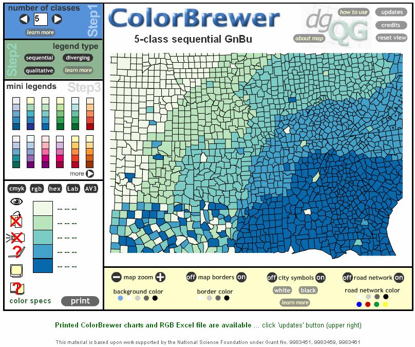
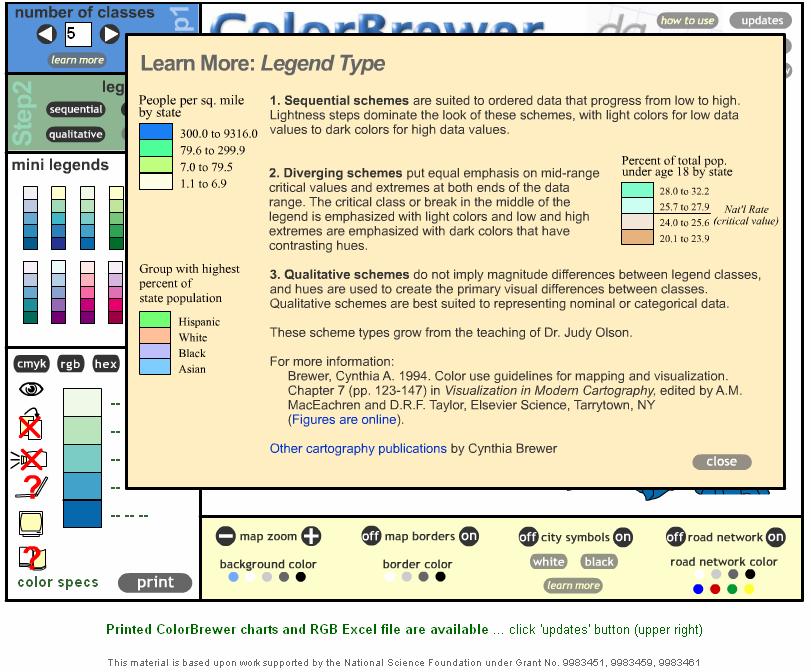
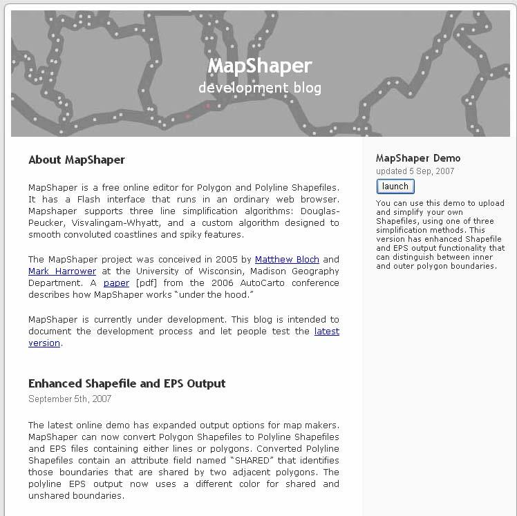
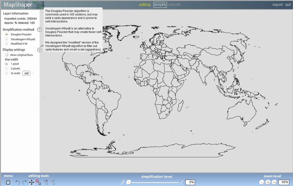
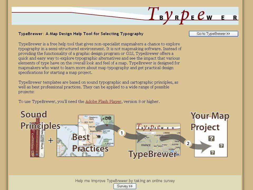
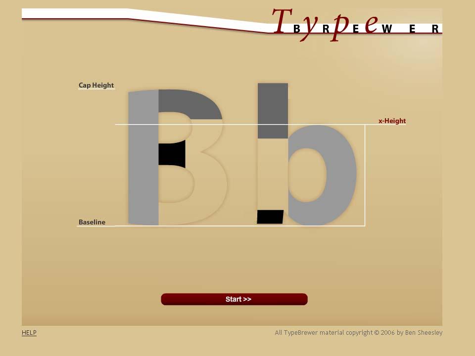
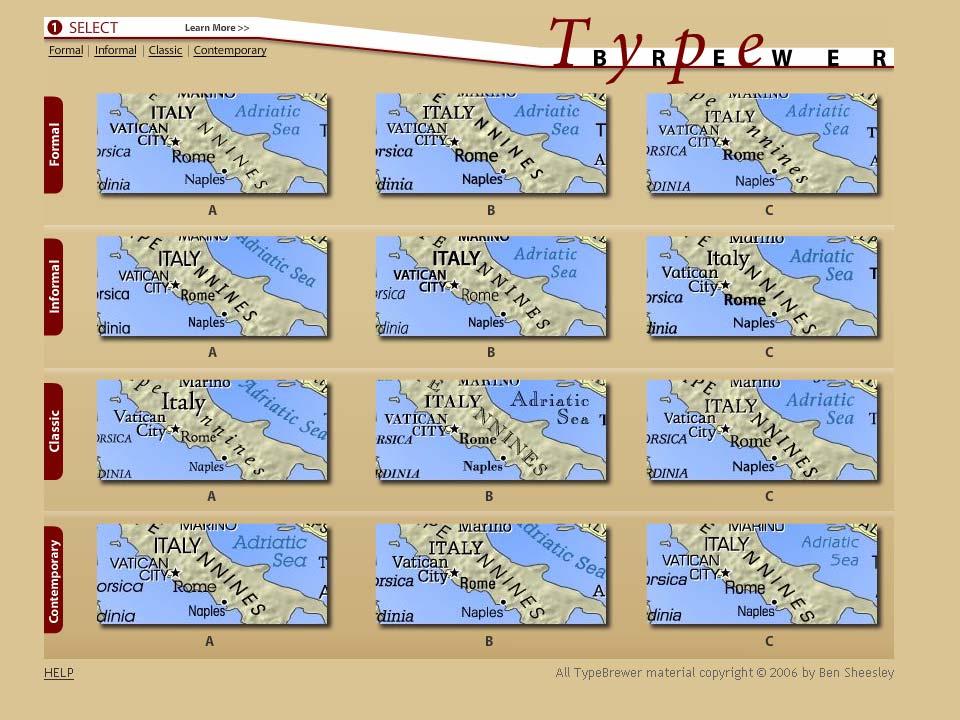
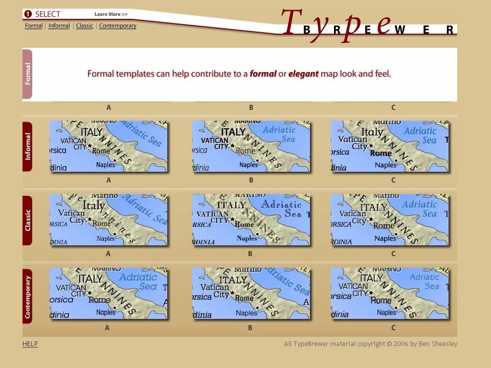
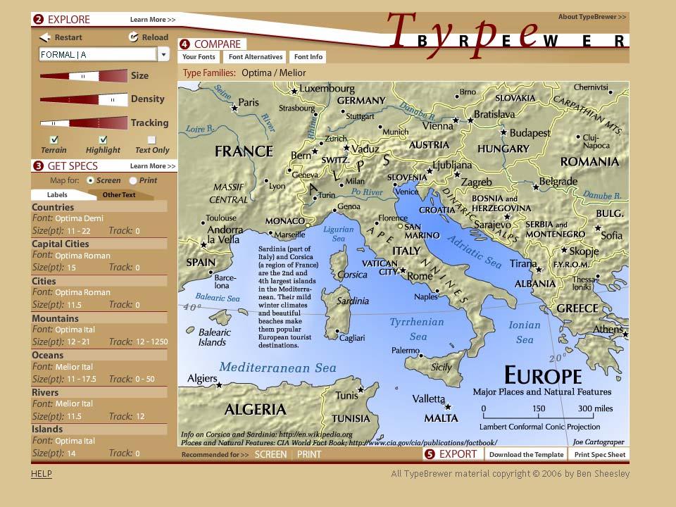
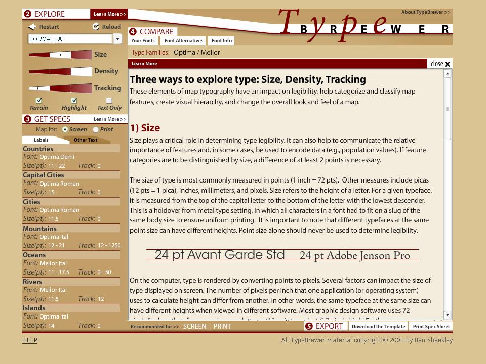
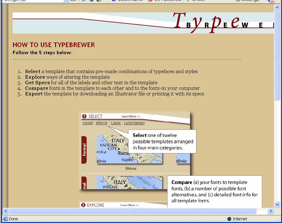
32 Web sites Tools for map makers ColorBrewer.org MapShaper.org TypeBrewer.org Forum CartoTalk.com Hybrid? MappingCenter.esri.com
33 Web sites Tools for map makers ColorBrewer.org (Cindy Brewer) MapShaper.org (Mark Harrower) TypeBrewer.org (Ben Sheesley) Forum CartoTalk.com Hybrid? MappingCenter.esri.com
34
35
36
37
38
39
40
41
42
43
44
45
46
47
48
49
50 Help
51 CV1 History and trends CV1-1 History of cartography CV1-2 Technological transformations CV2 Data considerations CV2-1 Source materials for mapping CV2-1 Data abstraction: classification, selection and generalization CV2-3 Projections as a map design issue CV3 Principals of map design CV3-1 Map design fundamentals CV3-2 Basic concepts of symbolization CV3-3 Color CV3-3 Typography CV4 Graphic representation techniques CV4-1 Basic thematic mapping methods CV4-2 Multivariate maps CV4-3 Dynamic and interactive mapping CV4-4 Representing terrain CV4-5 Web mapping and visualizations CV4-6 Virtual and immersive environments CV4-7 Spatialization CV4-8 Visualization of temporal geographic data CV4-9 Visualization of uncertainty CV5 Map production CV5-1 Computational issues in cartography and visualization CV 5-2 Map production CV 5-2 Map reproduction CV6 Map use and evaluation CV6-1 The power of maps CV6-2 Map reading CV6-3 Map interpretation CV6-4 Map analysis CV6-5 Evaluation and testing CV6-6 Impact of uncertainty Key Making maps
52 Web sites Tools for map makers colorbrewer.org mapshaper.org typebrewer.org Forum - user community exchange cartotalk.com Hybrid? MappingCenter.esri.com

53 Who is the community?
54 Web sites Tools for map makers colorbrewer.org mapshaper.org typebrewer.org Forum - user community exchange cartotalk.com Hybrid? MappingCenter.esri.com

55 Who is the audience?
56
57
58
59

60 Work week Xmas Weekend
61 ESRI UC Map Gallery Participant Survey Have you received formal cartographic or map production education? Percent Yes No
62 ESRI UC Map Gallery Participant Survey If so, what level of this education have you received? Percent Technical Institute Community College Undergraduate Graduate Post-graduate Workplace training Professional training ESRI training Other
63 CV1 History and trends CV1-1 History of cartography CV1-2 Technological transformations CV2 Data considerations CV2-1 Source materials for mapping CV2-1 Data abstraction: classification, selection and generalization CV2-3 Projections as a map design issue CV3 Principals of map design CV3-1 Map design fundamentals CV3-2 Basic concepts of symbolization CV3-3 Color CV3-3 Typography CV4 Graphic representation techniques CV4-1 Basic thematic mapping methods CV4-2 Multivariate maps CV4-3 Dynamic and interactive mapping CV4-4 Representing terrain CV4-5 Web mapping and visualizations CV4-6 Virtual and immersive environments CV4-7 Spatialization CV4-8 Visualization of temporal geographic data CV4-9 Visualization of uncertainty CV5 Map production CV5-1 Computational issues in cartography and visualization CV 5-2 Map production CV 5-2 Map reproduction CV6 Map use and evaluation CV6-1 The power of maps CV6-2 Map reading CV6-3 Map interpretation CV6-4 Map analysis CV6-5 Evaluation and testing CV6-6 Impact of uncertainty Key Making maps Making special types of map Using maps
64 Future Additions to Mapping Center The Cartographer s Eye Map critique Teaching Materials Relief Representation Basic Cartographic Design

:")
65 The Cartographer s Eye a la Imhof* * Imhof, Eduard Positioning Names on Maps. American Cartographer 2(2):


66 The Cartographer s Eye This place looks an island with a lot of rivers. What do the arrows mean? What do their colors mean? I can t see what s happening in Florida.
67 Teaching Materials Useful to teach a one-day workshop (university or anywhere) or to teach yourself Lecture PowerPoints with bottom notes Labs Data sets, styles, expressions, statements,.mxds, step-by-step instructions, whatever is needed
68 Terrain Representation Morning The Basics Data DEM Manipulation Hillshading Layer Tinting Afternoon - Advanced Topics Advanced DEM Manipulation Advanced Hillshading Techniques Modifications to Layer Tinting Bump Mapping Vegetation Illuminated Contours Printing and Output Final Project Related readings Imhof Relief Presentation, with attention to selected sections Tom Patterson selected readings Jeff Nighbert Bump mapping Kennelly and Kimerling Tanaka s illuminated contours David Barnes Swiss Hillshade David Mark MDOW hillshade

69 Basic Cartographic Design After Andrew Mundi s Graphic Design
70 Evolution or Devolution of Cartographic Education? Transformations in Teaching Cartographic Concepts and Techniques
71 Evolution AND Devolution of Cartographic Education Continuing to Transform How We Teach Cartographic Concepts and Techniques
72 Evolution AND Devolution of Cartographic Education Continuing to Transform How We Teach Cartographic Concepts and Techniques Evolution of cartography classes Devolution of cartography education Methods, teachers, audience
73 Evolution AND Devolution of Cartographic Education MappingCenter.esri.com Aileen Buckley Cartographic Researcher, ESRI, Inc.
74
WHAT YOU WILL LEARN TODAY
 WHAT YOU WILL LEARN TODAY Overview of the new QGIS Academy Curriculum Background on curriculum development Curriculum alignment with national standards Description of the five GIS courses Details of the
WHAT YOU WILL LEARN TODAY
 WHAT YOU WILL LEARN TODAY Overview of the new GeoAcademy Curriculum Background on curriculum development Curriculum alignment with national standards Description of the five GIS courses Details of the
Spatial Analysis and Modeling (GIST 4302/5302) Guofeng Cao Department of Geosciences Texas Tech University
 Guofeng Cao Department of Geosciences Texas Tech University") Spatial Analysis and Modeling (GIST 4302/5302) Guofeng Cao Department of Geosciences Texas Tech University TTU Graduate Certificate Geographic Information Science and Technology (GIST) 3 Core Courses and
Spatial Analysis and Modeling (GIST 4302/5302) Guofeng Cao Department of Geosciences Texas Tech University TTU Graduate Certificate Geographic Information Science and Technology (GIST) 3 Core Courses and
GTECH 380/722 Analytical and Computer Cartography Hunter College, CUNY Department of Geography
 GTECH 380/722 Analytical and Computer Cartography Hunter College, CUNY Department of Geography Fall 2014 Mondays 5:35PM to 9:15PM Instructor: Doug Williamson, PhD Email: Douglas.Williamson@hunter.cuny.edu
An Information Model for Maps: Towards Cartographic Production from GIS Databases
 An Information Model for s: Towards Cartographic Production from GIS Databases Aileen Buckley, Ph.D. and Charlie Frye Senior Cartographic Researchers, ESRI Barbara Buttenfield, Ph.D. Professor, University
GIS Applications on Environmental Education in Taiwan
 GIS Applications on Environmental Education in Taiwan Track: Education Authors: Yu-Chen Lai, Mei-Ling Yeh, Tien-Yin Chou Abstract GIS is a perfect vehicle to deliver environmental knowledge and spatial
Map image from the Atlas of Oregon (2nd. Ed.), Copyright 2001 University of Oregon Press
, Copyright 2001 University of Oregon Press") Map Layout and Cartographic Design with ArcGIS Desktop Matthew Baker ESRI Educational Services Redlands, CA Education UC 2008 1 Seminar overview General map design principles Working with map elements
Map Layout and Cartographic Design with ArcGIS Desktop Matthew Baker ESRI Educational Services Redlands, CA Education UC 2008 1 Seminar overview General map design principles Working with map elements
GTECH 380/722 Analytical and Computer Cartography Hunter College, CUNY Department of Geography
 GTECH 380/722 Analytical and Computer Cartography Hunter College, CUNY Department of Geography Spring 2010 Wednesdays 5:35PM to 9:15PM Instructor: Doug Williamson, PhD Email: Douglas.Williamson@hunter.cuny.edu
Watershed Sciences 4930 & 6920 GEOGRAPHIC INFORMATION SYSTEMS
 PURPOSE OF TODAY S LECTURE: Watershed Sciences 4930 & 6920 GEOGRAPHIC INFORMATION SYSTEMS WEEK ONE Lecture 1 Introduction to Course & Review of Maps Joe Wheaton Introduction to Course & Review of Maps
Dr. Stephen J. Walsh Department of Geography, UNC-CH Fall, 2007 Monday 3:30-6:00 pm Saunders Hall Room 220. Introduction
 Geographic Information Systems Geography 491 Dr. Stephen J. Walsh Department of Geography, UNC-CH Fall, 2007 Monday 3:30-6:00 pm Saunders Hall Room 220 Introduction Organizations that have a planning,
Emerging Issues in Geographic Information Science (GEP680): Projections, Scale, Accuracy, and Interpolation Lehman College, Spring 2017
: Projections, Scale, Accuracy, and Interpolation Lehman College, Spring 2017") Emerging Issues in Geographic Information Science (GEP680): Projections, Scale, Accuracy, and Interpolation Lehman College, Spring 2017 Instructor: Gary Ostroff, P.E., Adjunct Lecturer E-mail: Gary.Ostroff@lehman.cuny.edu;
Emerging Issues in Geographic Information Science (GEP680): Projections, Scale, Accuracy, and Interpolation Lehman College, Spring 2017 Instructor: Gary Ostroff, P.E., Adjunct Lecturer E-mail: Gary.Ostroff@lehman.cuny.edu;
Welcome to GST 101: Introduction to Geospatial Technology. This course will introduce you to Geographic Information Systems (GIS), cartography,
, cartography,") Welcome to GST 101: Introduction to Geospatial Technology. This course will introduce you to Geographic Information Systems (GIS), cartography, remote sensing, and spatial analysis through a series of
Welcome to GST 101: Introduction to Geospatial Technology. This course will introduce you to Geographic Information Systems (GIS), cartography, remote sensing, and spatial analysis through a series of
Geography 128 Winter Quarter Lecture 5: What is Analytical Cartography?
 Geography 128 Winter Quarter 2017 Lecture 5: What is Analytical Cartography? What is Cartography? Cartography - the science, technology and art of making maps. Matthew Hampton, 2007, A Mosaic of Space,
Snowden Cartography 1 GEOG 315:001 Cartography Thursdays 4:00 6:30PM F375 Fall 2010 Dr. Snowden Course Description
 Snowden Cartography 1 www.drksnowden.com GEOG 315:001 Cartography Thursdays 4:00 6:30PM F375 Fall 2010 Dr. Snowden Course Description Principles and theory of basic map design, layout, and communication.
Aileen Buckley, Ph.D. and Charlie Frye
 An Information Model for Maps: Towards Production from GIS Databases Aileen Buckley, Ph.D. and Charlie Frye Researchers, ESRI GIS vs. cart GIS Outline of the presentation Introduction Differences between
Basic principles of cartographic design. Makram Murad-al-shaikh M.S. Cartography Esri education delivery team
 Basic principles of cartographic design Makram Murad-al-shaikh M.S. Cartography Esri education delivery team Cartographic concepts Cartography defined The communication channel - Why maps fail Objectives
https://sites.google.com/a/pdx.edu/gis-2-applications/home
 Page 1 of 5 GIS 2: APPLICATIONS Search this site GEOG 492/592: GIS 2 Syllabus Academic Guidelines Rubrics Presentation Rubric Project Poster Project Proposal Syllabus (PDF) Sitemap GEOG 492/592: GIS 2
GIST 4302/5302: Spatial Analysis and Modeling Lecture 1: Overview
 GIST 4302/5302: Spatial Analysis and Modeling Lecture 1: Overview Guofeng Cao www.myweb.ttu.edu/gucao Department of Geosciences Texas Tech University guofeng.cao@ttu.edu Fall 2017 Texas Tech GIS Graduate
MASTER OF APPLIED GEOGRAPHY (M.A.GEO.) MAJOR IN GEOGRAPHIC INFORMATION SCIENCE
 MAJOR IN GEOGRAPHIC INFORMATION SCIENCE") Master of Applied Geography (M.A.Geo.) Major in Geographic Information Science 1 MASTER OF APPLIED GEOGRAPHY (M.A.GEO.) MAJOR IN GEOGRAPHIC INFORMATION SCIENCE Major Program The Master of Applied Geography
Master of Applied Geography (M.A.Geo.) Major in Geographic Information Science 1 MASTER OF APPLIED GEOGRAPHY (M.A.GEO.) MAJOR IN GEOGRAPHIC INFORMATION SCIENCE Major Program The Master of Applied Geography
MASTER OF APPLIED GEOGRAPHY (M.A.GEO.) MAJOR IN GEOGRAPHY RESOURCE AND ENVIRONMENTAL STUDIES
 MAJOR IN GEOGRAPHY RESOURCE AND ENVIRONMENTAL STUDIES") Master of Applied Geography (M.A.Geo.) Major in Geography Resource and Environmental Studies 1 MASTER OF APPLIED GEOGRAPHY (M.A.GEO.) MAJOR IN GEOGRAPHY RESOURCE AND ENVIRONMENTAL STUDIES Major Program
Master of Applied Geography (M.A.Geo.) Major in Geography Resource and Environmental Studies 1 MASTER OF APPLIED GEOGRAPHY (M.A.GEO.) MAJOR IN GEOGRAPHY RESOURCE AND ENVIRONMENTAL STUDIES Major Program
GTECH 380/722 Analytical and Computer Cartography Hunter College, CUNY Department of Geography
 GTECH 380/722 Analytical and Computer Cartography Hunter College, CUNY Department of Geography Fall 2011 Mondays 5:35PM to 9:15PM Instructor: Doug Williamson, PhD Email: Douglas.Williamson@hunter.cuny.edu
Leilei Duan. Spatial Science Institute University of Southern California Los Angeles, CA 90089
 Leilei Duan Spatial Science Institute University of Southern California Los Angeles, CA 90089 Email: leileidu@usc.edu Web resume: https://goo.gl/btwwip Phone: +1 352 213 3511 EDUCATION Post-doc Teaching
Introduction to Coastal GIS
 Held on Tues, 1/8/13 through Thurs, 1/10/13 Location: Roger Williams University, Bristol, RI Audience: The intended audiences for this course are federal and state personnel, municipal staff and officials,
Cartographic Workshop
 http://lazarus.elte.hu/cet/ Cartographic Workshop One of the roles of the ICA, Commission on Education and Training is to provide member nations with cartographic workshop experiences that enhance the
Cambridge Systematics, Inc., New York, NY, Associate, Cambridge Systematics, Inc., New York, NY, Senior Professional,
 Xia Jin, Ph.D., AICP Assistant Professor, Transportation Engineering Department of Civil and Environmental Engineering, EC 3603, Florida International University 10555 W Flagler St., Miami, FL 33174. Phone:
SRJC Applied Technology 54A Introduction to GIS
 SRJC Applied Technology 54A Introduction to GIS Overview Lecture of Geographic Information Systems Fall 2004 Santa Rosa Junior College Presented By: Tim Pudoff, GIS Coordinator, County of Sonoma, Information
GIS Institute Center for Geographic Analysis
 GIS Institute Center for Geographic Analysis Welcome Intensive training in the application of GIS to research Collection, management, analysis, and communication of spatial data Topics include: data collection,
GeoHealth Applications Platform ESRI Health GIS Conference 2013
 GeoHealth Applications Platform ESRI Health GIS Conference 2013 Authors Thomas A. Horan, Ph.D. Professor, CISAT Director April Moreno Health GeoInformatics Ph.D. Student Brian N. Hilton, Ph.D. Clinical
3D MAPS SCALE, ACCURACY, LEVEL OF DETAIL
 26 th International Cartographic Conference August 25 30, 2013 Dresden, Germany 3D MAPS SCALE, ACCURACY, LEVEL OF DETAIL Prof. Dr. Temenoujka BANDROVA Eng. Stefan BONCHEV University of Architecture, Civil
Esri s Living Atlas of the World Community Maps
 Esri s Living Atlas of the World Community Maps Seth Sarakaitis Wednesday May 7, 2014 ArcGIS Living Atlas Concept Living Atlas Content Tour Contributing to the Living Atlas (Community Maps) Seth Sarakaitis
The Natural Earth II world map projection
 INTERNATIONAL JOURNAL OF CARTOGRAPHY, 2015 VOL. 1, NO. 2, 123 133 http://dx.doi.org/10.1080/23729333.2015.1093312 The Natural Earth II world map projection Bojan Šavrič a,b, Tom Patterson c and Bernhard
Open Source Software Education in Texas
 Open Source Software Education in Texas PHILLIP DAVIS / RICHARD SMITH GEOACADEMY The Challenge for Open Source Adoption OPEN SOURCE Less the 5% of US colleges and universities offer training in Free and
Designing GIS Databases to Support Mapping and Map Production Charlie Frye, ESRI Redlands Aileen Buckley, ESRI Redlands
 Designing GIS Databases to Support Mapping and Map Production Charlie Frye, ESRI Redlands Aileen Buckley, ESRI Redlands 1 Designing GIS Databases to Support Mapping and Map Production Charlie Frye, ESRI
GEOG 508 GEOGRAPHIC INFORMATION SYSTEMS I KANSAS STATE UNIVERSITY DEPARTMENT OF GEOGRAPHY FALL SEMESTER, 2002
 GEOG 508 GEOGRAPHIC INFORMATION SYSTEMS I KANSAS STATE UNIVERSITY DEPARTMENT OF GEOGRAPHY FALL SEMESTER, 2002 Course Reference #: 13210 Meeting Time: TU 2:05pm - 3:20 pm Meeting Place: Ackert 221 Remote
Introduction to Coastal GIS
 Introduction to Coastal GIS Event was held on Tues, 1/8/13 - Thurs, 1/10/13 Time: 9:00 am to 5:00 pm Location: Roger Williams University, Bristol, RI Audience: The intended audiences for this course are
CSISS Resources for Research and Teaching
 CSISS Resources for Research and Teaching Donald G. Janelle Center for Spatially Integrated Social Science University of California, Santa Barbara Montreal 26 July 2003 Workshop on Spatial Analysis for
GIS Visualization: A Library s Pursuit Towards Creative and Innovative Research
 GIS Visualization: A Library s Pursuit Towards Creative and Innovative Research Justin B. Sorensen J. Willard Marriott Library University of Utah justin.sorensen@utah.edu Abstract As emerging technologies
IMPROVING GIS AND CARTOGRAPHY TOPIC INTEGRATION AND ASSIMILATION
 IMPROVING GIS AND CARTOGRAPHY TOPIC INTEGRATION AND ASSIMILATION Environmental Systems Research Institute Educational User Conference By Curtis B. Edson United States Military Academy, West Point Department
GED 554 IT & GIS. Lecture 6 Exercise 5. May 10, 2013
 GED 554 IT & GIS Lecture 6 Exercise 5 May 10, 2013 Free GIS data sources ******************* Mapping numerical data & Symbolization ******************* Exercise: Making maps for presentation GIS DATA SOFTWARE
Dr. Jennifer L. Smith
 Dr. Jennifer L. Smith Assistant Professor Geography & Regional Planning Indiana University of Pennsylvania Humanities and Social Sciences Building Room 413-E 981 Grant Street Phone: (724)-357-5990 Indiana,
ENV208/ENV508 Applied GIS. Week 2: Making maps, data visualisation, and GIS output
 ENV208/ENV508 Applied GIS Week 2: Making maps, data visualisation, and GIS output Overview GIS Output Map Making Types of Maps Key Elements GIS Output Formats Table Graph Statistics Maps Map Making Maps
Introduction to GIS (GEOG 401) Spring 2014, 3 credit hours
 Spring 2014, 3 credit hours") Introduction to GIS (GEOG 401) Spring 2014, 3 credit hours Instructors: Guangxing Wang, Ph.D. Email: gxwang@siu.edu Phone: (618) 453-6017 Office: 4442 Faner Hall Office hours: M& W&F 9:00am-11:00am or
Introduction to GIS (GEOG 401) Spring 2014, 3 credit hours Instructors: Guangxing Wang, Ph.D. Email: gxwang@siu.edu Phone: (618) 453-6017 Office: 4442 Faner Hall Office hours: M& W&F 9:00am-11:00am or
Overview. GIS Data Output Methods
 Overview GIS Output Formats ENV208/ENV508 Applied GIS Week 2: Making maps, data visualisation, and GIS output GIS Output Map Making Types of Maps Key Elements Table Graph Statistics Maps Map Making Maps
A spatial literacy initiative for undergraduate education at UCSB
 A spatial literacy initiative for undergraduate education at UCSB Mike Goodchild & Don Janelle Department of Geography / spatial@ucsb University of California, Santa Barbara ThinkSpatial Brown bag forum
Ladder versus star: Comparing two approaches for generalizing hydrologic flowline data across multiple scales. Kevin Ross
 Ladder versus star: Comparing two approaches for generalizing hydrologic flowline data across multiple scales Kevin Ross kevin.ross@psu.edu Paper for Seminar in Cartography: Multiscale Hydrography GEOG
Sample assessment task. Task details. Content description. Year level 7
 Sample assessment task Year level 7 Learning area Subject Title of task Task details Description of task Type of assessment Purpose of assessment Assessment strategy Evidence to be collected Suggested
Geospatial Intelligence
 Geospatial Intelligence Geospatial analysis has existed as long as humans have made and studied maps but its importance to the intelligence community has skyrocketed in the past several years, with Unmanned
Geography (GEOG) Courses
 Courses") Geography (GEOG) 1 Geography (GEOG) Courses GEOG 100. Introduction to Human Geography. 4 (GE=D4) Introduction to the global patterns and dynamics of such human activities as population growth and movements,
Geography (GEOG) 1 Geography (GEOG) Courses GEOG 100. Introduction to Human Geography. 4 (GE=D4) Introduction to the global patterns and dynamics of such human activities as population growth and movements,
DATA APPLIANCE FOR ARCGIS
 DATA APPLIANCE FOR ARCGIS Data Appliance for ArcGIS Provides Access to Multi-Scale Basemaps Down to Medium Scale Levels Worldwide And Large Scale for Most of the World The Data Appliance includes Several
GIS = Geographic Information Systems;
 What is GIS GIS = Geographic Information Systems; What Information are we talking about? Information about anything that has a place (e.g. locations of features, address of people) on Earth s surface,
2.1.9 Expansion of Instructional GIS Lab Page 1 of 6. Fiscal Year 2002 Years Following Fiscal Year 2002 $61, $23,625.00
 2.1.9 Expansion of Instructional GIS Lab Page 1 of 6 Proposal for the Use of the FY2002 Technology Fee Submitting Organization: Anthropology and Geography Contact Person: Zhi-Yong Yin Email: gegzyy@panther.gsu.edu
GEOGRAPHY MA, ASSESSMENT REPORT AY
 GEOGRAPHY MA, ASSESSMENT REPORT AY2012-2013 Programs: Geography MA Options Department: GSHAA Assessment Instruments and Student Outcomes This is an assessment report on three MA options in Geography in
GEOG 105 THE DIGITAL EARTH Spring 2017
 GEOG 105 THE DIGITAL EARTH Spring 2017 Instructor: Dr. Julie Cidell E-mail: jcidell@illinois.edu Office: CAB 251 (244-4665) Office hours: W 1:30-3:30 or by appt. TA: Donald Planey TA E-mail: planey1@illinois.edu
GIS and Forest Engineering Applications FE 357 Lecture: 2 hours Lab: 2 hours 3 credits
 GIS and Forest Engineering Applications FE 357 Lecture: 2 hours Lab: 2 hours 3 credits Instructor: Michael Wing Assistant Professor Forest Engineering Department Oregon State University Peavy Hall 275
Teaching GIS Technology at UW-Superior. Volume 9, Number 8: May 23, 2003
 Teaching GIS Technology at UW-Superior Volume 9, Number 8: May 23, 2003 William Bajjali University of Wisconsin, department of Biology and Earth Science, Superior, WI 54880 Abstract As educators, it is
CARTOGRAPHY in a Web World
 CARTOGRAPHY in a Web World SENSE Research Cluster XIII meeting: Concepts and tools for spatial data visualization BAREND KÖBBEN kobben@itc.nl b.j.kobben@utwente.nl Agenda Short introduction to ITC and
COMMISSION ON ACCREDITATION 2017 ANNUAL REPORT ONLINE
 COMMISSION ON ACCREDITATION 2017 ANNUAL REPORT ONLINE SUMMARY DATA: DOCTORAL PROGRAMS ^Table titles are hyperlinks to the tables within this document INTRODUCTION The Annual Report was created in 1998
Cartographic and Geospatial Futures
 Cartographic and Geospatial Futures 1. Web Cartography, WebGIS, & Virtual Globes--New Roles for Maps, GIS, and GIS professionals 2. Map Mashups, the Neo Neo-geography Movement, & Crowd-sourcing Geospatial
CURRICULUM DESIGN FOR A UNIVERSITY GRADUATE COURSE ON ADVANCED TOPICS IN GIS FOR NATURAL RESOURCES MANAGEMENT
 CURRICULUM DESIGN FOR A UNIVERSITY GRADUATE COURSE ON ADVANCED TOPICS IN GIS FOR NATURAL RESOURCES MANAGEMENT Yousif Ali Hussin Department of Natural Resources, International Institute for Geoinformation
Workshop and Session Descriptions
 MONDAY, SEPTEMBER 14 Workshops (Full-day) Workshop and Session Descriptions 1. Bridging the surveyed gap: How land surveying data works with GIS GIS professionals use a myriad of data to construct their
Mastering Map Scale: Formalizing Guidelines for Multi-Scale Map Design
 Mastering Map Scale: Formalizing Guidelines for Multi-Scale Map Design Cynthia A. Brewer Pennsylvania State University Barbara P. Buttenfield University of Colorado Boulder a.k.a. Cindy and babs Collaborators
Data Visualization (CSE 578) About this Course. Learning Outcomes. Projects
 About this Course. Learning Outcomes. Projects") (CSE 578) Note: Below outline is subject to modifications and updates. About this Course Visual representations generated by statistical models help us to make sense of large, complex datasets through
(CSE 578) Note: Below outline is subject to modifications and updates. About this Course Visual representations generated by statistical models help us to make sense of large, complex datasets through
Cartography: Modeling GIS data for Mapmaking. Aileen Buckley, Ph.D. Senior Cartographic Researcher, ESRI. Barbara Buttenfield, Ph.D.
 Slide 1 Cartography: Modeling GIS data for Mapmaking Aileen Buckley, Ph.D. Senior Cartographic Researcher, ESRI Barbara Buttenfield, Ph.D. Professor, University of Colorado-Boulder Thank you coming to
Advancing Green Chemistry Practices in Business
 Green Chemistry and Commerce Council: 6 th Annual GC3 Innovators Roundtable Advancing Green Chemistry Practices in Business Barbara Peterson, Ph.D. Marty Mulvihill, Ph.D. Program Director Executive Director,
Elizabeth Cory Sills
 Elizabeth Cory Sills Department of Social Sciences The University of Texas at Tyler 3900 University Boulevard Tyler, Texas 75799 Email:e.corysills@gmail.com Phone:214-683-5161 Education Louisiana State
Techniques for Science Teachers: Using GIS in Science Classrooms.
 Techniques for Science Teachers: Using GIS in Science Classrooms. After ESRI, 2008 GIS A Geographic Information System A collection of computer hardware, software, and geographic data used together for
Practical applications of GPS surveying
 Practical applications of GPS surveying WHO WILL TEACH THE COURSE? Kurt L. Feigl, Ph.D., Associate Professor, Department of Geology and Geophysics feigl@geology.wisc.edu CAPSULE STATEMENT OF COURSE CONTENT
Joanne N. Halls, PhD Dept. of Geography & Geology David Kirk Information Technology Services
 Joanne N. Halls, PhD Dept. of Geography & Geology David Kirk Information Technology Services Geographic Information Systems manage and analyze data to solve spatial problems. Real World Abstraction Analysis
Geographic Systems and Analysis
 Geographic Systems and Analysis New York University Robert F. Wagner Graduate School of Public Service Instructor Stephanie Rosoff Contact: stephanie.rosoff@nyu.edu Office hours: Mondays by appointment
COURSE CONTENT for Computer Science & Engineering [CSE]
![COURSE CONTENT for Computer Science & Engineering [CSE]](/thumbs/92/110586049.jpg "COURSE CONTENT for Computer Science & Engineering [CSE]") COURSE CONTENT for Computer Science & Engineering [CSE] 1st Semester 1 HU 101 English Language & Communication 2 1 0 3 3 2 PH 101 Engineering Physics 3 1 0 4 4 3 M 101 Mathematics 3 1 0 4 4 4 ME 101 Mechanical
COURSE CONTENT for Computer Science & Engineering [CSE] 1st Semester 1 HU 101 English Language & Communication 2 1 0 3 3 2 PH 101 Engineering Physics 3 1 0 4 4 3 M 101 Mathematics 3 1 0 4 4 4 ME 101 Mechanical
APC Part I Workshop. Mapping and Cartography. 14 November 2014
 APC Part I Workshop Mapping and Cartography 14 November 2014 Cartography Cartography is the discipline dealing with the conception, production, dissemination and study of maps in all forms (ICA) A holistic
CARTOGRAPHY in a Web World
 CARTOGRAPHY in a Web World Nationale GI Minor BAREND KÖBBEN b.j.kobben@utwente.nl Agenda Short introduction to ITC and me Cartography: communicating spatial data Changing GIS & Cartography technology:
SPACE Workshop Santa Barbara, California July 2007
 SPACE Workshop Santa Barbara, California 15 20 July 2007 Modeling a Center for Spatially Integrated Social Science Critical Themes in Social Science + Tools and Concepts for Spatial Thinking + Infrastructure
What is GIS? G: Geographic, Geospatial, Geo
 GEOG 488/588: GIS I Introduction Instructor: Geoffrey Duh TA: David Graves What is GIS? G: Geographic, Geospatial, Geo Alternatives: Spatial Information Systems, Land Information Systems Geography diverse
LEHMAN COLLEGE OF THE CITY UNIVERSITY OF NEW YORK. 1. Type of Change: Change in Degree Requirements
 Alpha Number: Hegis Code 1214 Program Code: 30600 1. Type of Change: Change in Degree Requirements 2. From: [The curriculum consists of 45 graduate credits and includes core courses, an area of specialization,
TEXAS STATE VITA. A. Name: Niem Tu HUYNH Title: Assistant Professor
 TEXAS STATE VITA I. Academic/Professional Background A. Name: Niem Tu HUYNH Title: Assistant Professor B. Educational Background Degree Year University Major Thesis/Dissertation Ph.d 2009 Wilfrid Laurier
revisiting soil cartography aileen buckley,, cartographic researcher, ESRI redlands for NACIS 2008, missoula, mt
 revisiting soil cartography aileen buckley,, cartographic researcher, ESRI redlands for NACIS 2008, missoula, mt topics why soil maps? soil themes data web map services future work NACIS missoula, mt
a system for input, storage, manipulation, and output of geographic information. GIS combines software with hardware,
 Introduction to GIS Dr. Pranjit Kr. Sarma Assistant Professor Department of Geography Mangaldi College Mobile: +91 94357 04398 What is a GIS a system for input, storage, manipulation, and output of geographic
Please note: This presentation was used as speaker s notes for the 2008 Petroleum User Group Conference on Feb. 27, 2008 in Houston, TX.
 Please note: This presentation was used as speaker s notes for the 2008 Petroleum User Group Conference on Feb. 27, 2008 in Houston, TX. This material is not intended as course material nor reference material,
An Evaluation of Web-based Geovisualizations for Different Levels of Abstraction and Realism What do users predict?
 An Evaluation of Web-based Geovisualizations for Different Levels of Abstraction and Realism What do users predict? Alíz Boér*, Arzu Çöltekin *, Keith C. Clarke** * University of Zurich, Department of
GEOGRAPHY. Undergraduate Program Information. Degrees for the Department. Graduate Program Information. Minors for the Department.
 Geography 1 GEOGRAPHY Undergraduate Program Information The Geography Program emphasizes the interaction of humans with the environment, and the program prepares students for professional positions in
Medical GIS: New Uses of Mapping Technology in Public Health. Peter Hayward, PhD Department of Geography SUNY College at Oneonta
 Medical GIS: New Uses of Mapping Technology in Public Health Peter Hayward, PhD Department of Geography SUNY College at Oneonta Invited research seminar presentation at Bassett Healthcare. Cooperstown,
Introduction. Maps in Science and Society Professor Keith C. Clarke TA Marcela Suarez Winter 2018
 Introduction Maps in Science and Society Professor Keith C. Clarke TA Marcela Suarez Winter 2018 History of the Class First taught at UCSB by Waldo Tobler, using materials from George Kish at Michigan
Your web browser (Safari 7) is out of date. For more security, comfort and the best experience on this site: Update your browser Ignore
 is out of date. For more security, comfort and the best experience on this site: Update your browser Ignore") Your web browser (Safari 7) is out of date. For more security, comfort and the best experience on this site: Update your browser Ignore Activityapply MEASU RING DISTANCES O N A MAP How can you use a map
Your web browser (Safari 7) is out of date. For more security, comfort and the best experience on this site: Update your browser Ignore Activityapply MEASU RING DISTANCES O N A MAP How can you use a map
geographic patterns and processes are captured and represented using computer technologies
 Proposed Certificate in Geographic Information Science Department of Geographical and Sustainability Sciences Submitted: November 9, 2016 Geographic information systems (GIS) capture the complex spatial
Reimaging GIS: Geographic Information Society. Clint Brown Linda Beale Mark Harrower Esri
 Reimaging GIS: Geographic Information Society Clint Brown Linda Beale Mark Harrower Esri 8 billion = Number of basemap requests per month on AGOL 14,000 = Unique requests per second 12,000 = New Items
Development and operation of GIS exercise materials for undergraduate students
 Development and operation of GIS exercise materials for undergraduate students Since around 2000, GIS researchers in Japan have collaborated to provide materials for GIS lecture classes for university
Course Syllabus. Geospatial Data & Spatial Digital Technologies: Assessing Land Use/Land Cover Change in the Ecuadorian Amazon.
 Course Syllabus Geospatial Data & Spatial Digital Technologies: Assessing Land Use/Land Cover Change in the Ecuadorian Amazon Co- Instructors Dr. Carlos F. Mena, Universidad San Francisco de Quito, Ecuador
Your web browser (Safari 7) is out of date. For more security, comfort and. the best experience on this site: Update your browser Ignore
 is out of date. For more security, comfort and. the best experience on this site: Update your browser Ignore") Your web browser (Safari 7) is out of date. For more security, comfort and Activityengage the best experience on this site: Update your browser Ignore Introduction to GIS What is a geographic information
Your web browser (Safari 7) is out of date. For more security, comfort and Activityengage the best experience on this site: Update your browser Ignore Introduction to GIS What is a geographic information
SOUTH DAKOTA BOARD OF REGENTS. Academic and Student Affairs ******************************************************************************
 SOUTH DAKOTA BOARD OF REGENTS Academic and Student Affairs AGENDA ITEM: 7 C (4) DATE: June 28-30, 2016 ****************************************************************************** SUBJECT: New Minor:
GIS Certification: How will it be used to improve education?
 GIS Certification: How will it be used to improve education? Deidre Sullivan OSTO Workshop November 11, 2008 1 What is GIS? Geographic Information Systems It is a science, a tool, and a software It assists
An Alternate Career Choice for the Geography Major: Map, GIS, or Geographic Information Librarianship
 An Alternate Career Choice for the Geography Major: Map, GIS, or Geographic Information Librarianship Katherine H. Weimer Texas A&M University Libraries SWAAG 2007 - Bryan, Texas Overview of today s talk
Spatial Data Discovery and Support in a Library Setting
 Spatial Data Discovery and Support in a Library Setting Marcel Fortin Map and Data Library University of Toronto Expert Meeting on Spatial Discovery Santa Barbara June 2015 Spatial Communities - U of Toronto
GIS Education in Finnish Upper Secondary Schools
 GIS Education in Finnish Upper Secondary Schools Simo Tolvanen, MA Geography and Biology lecturer Kauhajoki Upper Secondary School Finland simo.tolvanen@kauhajoki.fi Photo: Simo Tolvanen Finland in Brief
Geography. Faculty. InfoGraphics Lab. The University of Oregon 1
 The University of Oregon Geography Daniel Gavin, Department Head 5-36-555 5-36-067 fax 07 Condon Hall 5 University of Oregon Eugene, Oregon 9703-5 uogeog@uoregon.edu Students who major in geography develop
HGP 470 GIS and Advanced Cartography for Social Science
 HGP 470 GIS and Advanced Cartography for Social Science Winter 2014 Instructor: Office: Tory 3-115 Telephone: 780-248-5758 E-mail: vukicevi@ualberta.ca Office hours: By appointment LECTURES AND LABS Lectures/Labs:
A Spatial Analytical Methods-first Approach to Teaching Core Concepts
 Thomas Hervey 4.24.18 A Spatial Analytical Methods-first Approach to Teaching Core Concepts Introduction Teaching geospatial technologies is notoriously difficult regardless of the learning audience. Even
1. Omit Human and Physical Geography electives (6 credits) 2. Add GEOG 677:Internet GIS (3 credits) 3. Add 3 credits to GEOG 797: Final Project
 2. Add GEOG 677:Internet GIS (3 credits) 3. Add 3 credits to GEOG 797: Final Project") The Department of Geography and the Office of Professional Studies propose to modify the Master of Professional Studies in Geospatial Information Sciences (GIS) as follows: 1. Omit Human and Physical Geography
The Department of Geography and the Office of Professional Studies propose to modify the Master of Professional Studies in Geospatial Information Sciences (GIS) as follows: 1. Omit Human and Physical Geography
GIS Applications in Criminology Crim 6332/GISc 6331 Summer 2017 Syllabus
 GIS Applications in Criminology Crim 6332/GISc 6331 Summer 2017 Syllabus Course Information Time: Online, Full Summer Session Class Location: Online Professor Contact Information Dr. Andrew P. Wheeler
Different Models of the Curriculum for the Higher Education of Surveying & Mapping in China
 Different Models of the Curriculum for the Higher Education of Surveying & Mapping in China NING Jinsheng, LIU Yanfang, LIU Yaolin, China P. R. Key words: curriculum, common foundation, distinguished feature