Spatial Data Discovery and Support in a Library Setting
|
|
|
- Annabel Gilbert
- 6 years ago
- Views:
Transcription
1 Spatial Data Discovery and Support in a Library Setting Marcel Fortin Map and Data Library University of Toronto Expert Meeting on Spatial Discovery Santa Barbara June 2015


2 Spatial Communities - U of Toronto
3
4
5
6
7
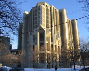

8 Spatial Communities - U of Toronto - Map and Data Library
9 Geospatial support in libraries - U of T - (data)
10 Data acquisitions (purchase, license, store, etc.) Geospatial support in libraries - U of T - (data)
11 Geospatial support in libraries - U of T - (data) Data acquisitions (purchase, license, store, etc.) Data management
12 Geospatial support in libraries - U of T - (data) Data acquisitions (purchase, license, store, etc.) Data management Data dissemination
13 Geospatial support in libraries - U of T (support)
14 Geospatial support in libraries - U of T (support) Instruction & teaching (workshops / credit courses)
15 Geospatial support in libraries - U of T (support) Instruction & teaching (workshops / credit courses) Literacy skills
16 Geospatial support in libraries - U of T (support) Instruction & teaching (workshops / credit courses) Literacy skills Software / technology support
17 Geospatial support in libraries - U of T (support) Instruction & teaching (workshops / credit courses) Literacy skills Software / technology support Reference / Research Consultations
18 GIS Consultations breakdown
19 increasing number of questions increasing level of difficulty GIS Consultations breakdown
20 increasing number of questions GIS Consultations breakdown finding/acquiring data data use data licensing software installation software licensing data access increasing level of difficulty
21 increasing number of questions GIS Consultations breakdown data creation data analysis advanced GIS advanced cartography geoprocessing GIS basics mapping transformations finding/acquiring data data use data licensing software installation software licensing data access increasing level of difficulty
22 increasing number of questions GIS Consultations breakdown geostatistics satellite imagery interpretation advanced analysis data creation data analysis advanced GIS advanced cartography geoprocessing GIS basics mapping transformations finding/acquiring data data use data licensing software installation software licensing data access increasing level of difficulty
23 increasing number of questions GIS Consultations breakdown geostatistics satellite imagery interpretation advanced analysis data creation data analysis advanced GIS advanced cartography geoprocessing GIS basics mapping transformations finding/acquiring data data use data licensing software installation software licensing data access increasing level of difficulty
24 increasing number of questions GIS Consultations breakdown geostatistics satellite imagery interpretation advanced analysis data creation data analysis advanced GIS advanced cartography geoprocessing GIS basics mapping transformations finding/acquiring data data use data licensing software installation software licensing data access increasing level of difficulty
25 Challenges - demand 9000 Map and GIS Reference
26 Challenges - demand 9000 Map and GIS Reference

27 Challenges - increased demand

28 A new data culture?
29 The ability to gather and reproduce data has far outstripped our ability to present it. Arthur Robinson, 1966
30 Increase in geospatial collection size: datasets 1600 Datasets
31 1600 Increase in geospatial collection size: datasets Datasets 1,600 1,
32 Increase in geospatial collection size: GB 5000 Size of Collection (GBs)
33 Increase in geospatial collection size: GB Size of Collection (GBs) 4, ,
34 Data Management/Dissemination
35 Data Management/Dissemination X
36
37

38 Shared Data Discovery

39 geo.scholarsportal.info
40
41
42
43
44
45
46
47
48 30000 U of T vector layers only (approximate) Scholars Portal raster & vector layers ,000 16, ,
49
50 Research Data Management...[T]he general preservation problem for geospatial data will simply compound over time with increasing quantities of data being produced by collection systems such as satellites and sensor networks. Historical geospatial data is of great value in understanding and modelling climate and land use change, for example, and hence future users and archivists are likely to want to use and curate increasing quantities of increasingly older geospatial data. Technology Watch Report, 2009
51 THE LIBRARY AND ARCHIVES OF CANADA ACT (2004)
52 THE LIBRARY AND ARCHIVES OF CANADA ACT (2004) LAC can acquire government and ministerial cartographic material considered of historical or archival value
53 THE LIBRARY AND ARCHIVES OF CANADA ACT (2004) LAC can acquire government and ministerial cartographic material considered of historical or archival value Section 12: no government or ministerial geospatial data or maps shall be destroyed or disposed of without the consent of the Librarian or Archivist
54 THE LIBRARY AND ARCHIVES OF CANADA ACT (2004) LAC can acquire government and ministerial cartographic material considered of historical or archival value Section 12: no government or ministerial geospatial data or maps shall be destroyed or disposed of without the consent of the Librarian or Archivist LAC has responsibility to work with institutions to identify information that should be transferred to the LAC
55
56
57
58

59
60

61

62
63
64
65
66
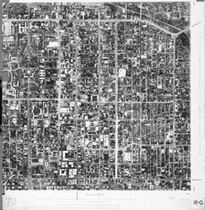
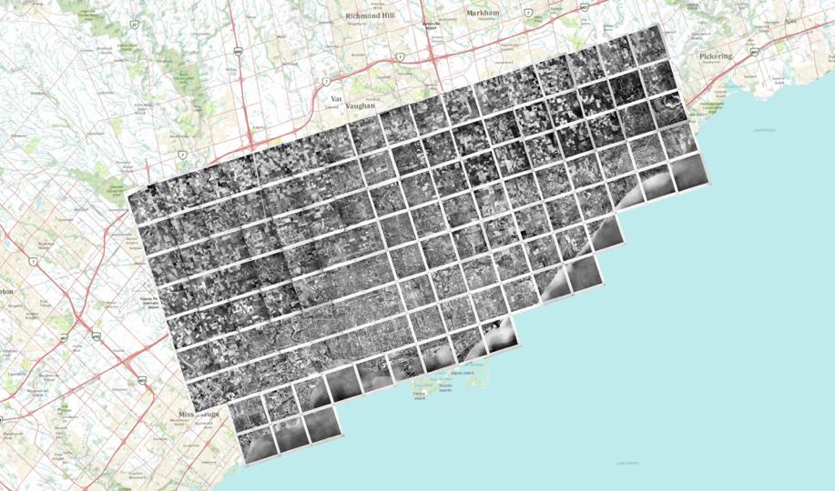
67
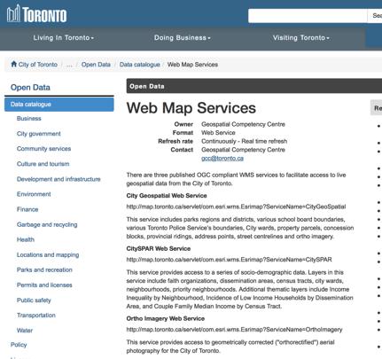
68
69

70
71
72
73

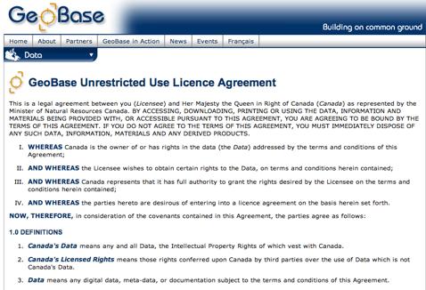
74 data we thought we d never see

75 Map Services

76 Data mashups are great, but...
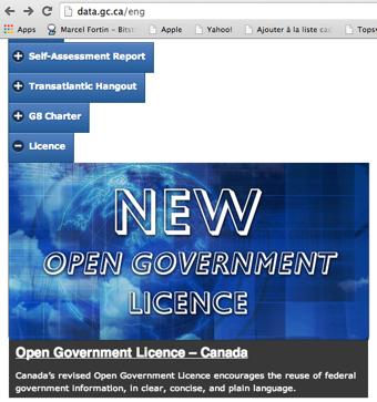
77
78

79 Open Data - Issues - WMS
80 $$$?
81 Licensing & Copyright Challenges Difficult and confusing terms that can t be followed If you are accepting on behalf of your employer or another entity, you represent that you have full authority to bind your employer or such other entity to the Terms of Use. terms.htm#licence
82 If you distribute or provide access to these datasets to any other person, whether in original or modified form, you agree to include a copy of, or this Uniform Resource Locator (URL) for, these Terms of Use and to ensure any such person agrees to, and is bound by, them Image courtesy of
83 Fear If, as a result of your breach of these Terms of Use, the City gets sued you agree to protect the City and reimburse the City for everything which you cause the City to suffer. you agree to defend, indemnify and hold harmless the City and all of its officers, employees, representatives and agents from any and all liabilities incurred in connection with any claim arising from any breach by you of these Terms of Use, including reasonable legal fees and costs. You agree to cooperate fully in the defence of any such claim.
84 data.gc.ca - license confusion "You shall not use the data made available through the GC [Government of Canada] Open Data Portal in any way which, in the opinion of Canada, may bring disrepute to or prejudice the reputation of Canada."

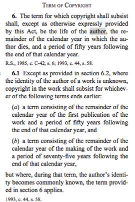
85 Which License?
86
87
88

89 Copyright Issues

90 Maps, under copyright, remain the same
91


92 FIPs and 90 years


93 Shifts in use - Spatial History / HGIS / GeoHumanities

94 Data Creation
95
96

97
98
99 Changes - Library/Faculty relations
100 HGIS Partnership/Network - Two year funding to develop a community/partnership/network of HGIS/Spatial History researchers Applicant Marcel Fortin, University of Toronto Co-applicants Léon Robichaud is Director of the History Department,University of Sherbrooke Donald Lafreniere is Assistant Professor of Historical Geography and GIS at Michigan Technological University John Lutz is an Associate Professor of History at the University of Victoria Collaborators Colleen Beard is Head of the Map, Data and GIS Library, Brock University Geoff Cunfer is an environmental historian of agriculture and Associate Professor in the Department of History at the University of Saskatchewan Jim Clifford is an Assistant Professor of environmental history in the Department of History at the University of Saskatchewan Josh MacFadyen Assistant Professor, Arizona State University Jennifer Bonnell is an L.R. Wilson Fellow in Canadian History at McMaster University Larry Laliberté is a GIS Librarian at the University of Alberta Ken Sylvester is Research Associate Professor, Inter-university Consortium for Political and Social Research, University of Michigan Glenn Brauen is Lecturer in Geographic Information Science, Department of Human Geography, University of Toronto Scarborough Marc St.-Hilaire Marc St-Hilaire is professor of human geography at Laval University Robert Sweeny is a Professor in the Department of History, Memorial University of Newfoundland. Project Manager Byron Moldofsky, University of Toronto
101 HGIS Partnership/Network - Goals White papers Visualization methods Survey of Canadian HGIS Datasets Existing and Emerging Technologies Standards for Data and Research Data Management and Preservation HGIS Education Build a pilot version of an open, accessible Historical GIS Data Portal Build a pilot accessible interactive mapping application for HGIS
102 New Challenges to come?
103 Spatial History / Digital Humanities New Challenges to come?
104 Spatial History / Digital Humanities Web mapping support New Challenges to come?
105 Spatial History / Digital Humanities Web mapping support Technology changes New Challenges to come?
106 Spatial History / Digital Humanities Web mapping support Technology changes 3D GIS New Challenges to come?
107 Spatial History / Digital Humanities Web mapping support Technology changes 3D GIS Open New Challenges to come?
108 Spatial History / Digital Humanities Web mapping support Technology changes 3D GIS Open Open Source New Challenges to come?
109 Spatial History / Digital Humanities Web mapping support Technology changes 3D GIS Open Open Source Open Data New Challenges to come?
110 Spatial History / Digital Humanities Web mapping support Technology changes 3D GIS Open Open Source Open Data Open Access New Challenges to come?
111 Spatial History / Digital Humanities Web mapping support Technology changes 3D GIS Open Open Source Open Data Open Access New Challenges to come? ESRI Licensing complications (more products, different licensing, authentication)
112 Spatial History / Digital Humanities Web mapping support Technology changes 3D GIS Open Open Source Open Data Open Access New Challenges to come? ESRI Licensing complications (more products, different licensing, authentication) Internationalization
Canadian Historical GIS Partnership Development: Taking Steps for Historical Mapping in Canada
 Canadian Historical GIS Partnership Development: Taking Steps for Historical Mapping in Canada Byron Moldofsky Manager, GIS and Cartography Office Department of Geography and Planning University of Toronto
GIS at UCAR. The evolution of NCAR s GIS Initiative. Olga Wilhelmi ESIG-NCAR Unidata Workshop 24 June, 2003
 GIS at UCAR The evolution of NCAR s GIS Initiative Olga Wilhelmi ESIG-NCAR Unidata Workshop 24 June, 2003 Why GIS? z z z z More questions about various climatological, meteorological, hydrological and
Keeping Maps Safe and Accessible: Digitization and Preservation at the Library of Congress
 Keeping Maps Safe and Accessible: Digitization and Preservation at the Library of Congress September 27, 2017 p.1 Agenda Jacqueline Nolan, Cartographer Colleen Cahill, Digital Conversion Coordinator Geography
Boreal Wetland probability - metadata
 Boreal Wetland probability - metadata WetlandProbability_OS.tif Wetland_OS.tif ABMI Geospatial Centre December, 2017 1 Contents 1. Overview... 3 1.1 Summary... 3 1.2 Description... 3 1.3 Credits... 3 1.4
Technical Drafting, Geographic Information Systems and Computer- Based Cartography
 Technical Drafting, Geographic Information Systems and Computer- Based Cartography Project-Specific and Regional Resource Mapping Services Geographic Information Systems - Spatial Analysis Terrestrial
An Alternate Career Choice for the Geography Major: Map, GIS, or Geographic Information Librarianship
 An Alternate Career Choice for the Geography Major: Map, GIS, or Geographic Information Librarianship Katherine H. Weimer Texas A&M University Libraries SWAAG 2007 - Bryan, Texas Overview of today s talk
GIS Visualization: A Library s Pursuit Towards Creative and Innovative Research
 GIS Visualization: A Library s Pursuit Towards Creative and Innovative Research Justin B. Sorensen J. Willard Marriott Library University of Utah justin.sorensen@utah.edu Abstract As emerging technologies
Boreal Fen probability - metadata
 Boreal Fen probability - metadata FenProbabilityOS.tif FenOS.tif ABMI Geospatial Centre February, 2017 Photo credit Emily Upham-Mills and Bayne Lab 1 Contents 1. Overview... 3 1.1 Summary... 3 1.2 Description...
CSISS Resources for Research and Teaching
 CSISS Resources for Research and Teaching Donald G. Janelle Center for Spatially Integrated Social Science University of California, Santa Barbara Montreal 26 July 2003 Workshop on Spatial Analysis for
GIS ADMINISTRATOR / WEB DEVELOPER EVANSVILLE-VANDERBURGH COUNTY AREA PLAN COMMISSION
 GIS ADMINISTRATOR / WEB DEVELOPER EVANSVILLE-VANDERBURGH COUNTY AREA PLAN COMMISSION SALARY RANGE INITIATION $43,277 SIX MONTHS $45,367 POSITION GRADE PAT VI The Evansville-Vanderburgh County Area Plan
Digital Mapping License Agreement
 City of Des Moines, Iowa GIS Division, Information Technology Department Digital Mapping License Agreement PURPOSE AND NATURE OF THE AGREEMENT This Digital Mapping License Agreement ("Agreement") is executed
Kentucky Collaborates in GeoMAPP Project: The Advantages and Challenges of Archiving in a State with a Centralized GIS
 Kentucky Collaborates in GeoMAPP Project: The Advantages and Challenges of Archiving in a State with a Centralized GIS Geospatial Multistate Archive and Preservation Partnership By Glen McAninch Best Practices
Are You on the Map for Geospatial Data Applications and Hosting?
 Are You on the Map for Geospatial Data Applications and Hosting? May 20, 2011 an East View update on happenings benefiting print, raster and vector geospatial data Rodney Buhrsmith, Chief Marketing Officer,
INTEGRATING GEOSPATIAL PERSPECTIVES IN THE ANTHROPOLOGY CURRICULUM AT THE UNIVERSITY OF NEW MEXICO (UNM)
") INTEGRATING GEOSPATIAL PERSPECTIVES IN THE ANTHROPOLOGY CURRICULUM AT THE UNIVERSITY OF NEW MEXICO (UNM) VERONICA ARIAS HEATHER RICHARDS JUDITH VAN DER ELST DEPARTMENT OF ANTHROPOLOGY MARCH 2005 INTEGRATING
INTEGRATING GEOSPATIAL PERSPECTIVES IN THE ANTHROPOLOGY CURRICULUM AT THE UNIVERSITY OF NEW MEXICO (UNM) VERONICA ARIAS HEATHER RICHARDS JUDITH VAN DER ELST DEPARTMENT OF ANTHROPOLOGY MARCH 2005 INTEGRATING
Department Of Geography. MSc Applied GIS.
 Department Of Geography. MSc Applied GIS. This is a really exciting time to be in GIS, with new tools and new software allowing the application of GIS techniques to an ever-increasing range of fields.
Data Aggregation with InfraWorks and ArcGIS for Visualization, Analysis, and Planning
 Data Aggregation with InfraWorks and ArcGIS for Visualization, Analysis, and Planning Stephen Brockwell President, Brockwell IT Consulting, Inc. Join the conversation #AU2017 KEYWORD Class Summary Silos
Information Needs & Information Seeking in Internet Era: A Case Study of Geographers in Maharashtra
 International Journal of Research in Library Science ISSN: 2455-104X Indexed in: IIJIF, ijindex, SJIF,ISI Volume 2,Issue 1 (January-June) 2016,99-108 Received: 7 May 2016 ; Accepted: 12 May 2016 ; Published:
Welcome to GST 101: Introduction to Geospatial Technology. This course will introduce you to Geographic Information Systems (GIS), cartography,
, cartography,") Welcome to GST 101: Introduction to Geospatial Technology. This course will introduce you to Geographic Information Systems (GIS), cartography, remote sensing, and spatial analysis through a series of
Welcome to GST 101: Introduction to Geospatial Technology. This course will introduce you to Geographic Information Systems (GIS), cartography, remote sensing, and spatial analysis through a series of
GEOGRAPHIC INFORMATION SYSTEMS SPECIALIST 3 DEFINITION:
 Hunterdon County Department of Planning and Land Use Vacancy: Geographic Information Systems Specialist 3 Full Time: 40 Hours per Week Compensation: $42,000.00 per year GEOGRAPHIC INFORMATION SYSTEMS SPECIALIST
State GIS Officer/GIS Data
 State GIS Officer/GIS Data This Act creates the position of state Geographic Information Systems (GIS) officer. The Act: requires the state GIS officer to adopt or veto the GIS data standards and a statewide
GIS Building Communities beyond National Borders (Building Successful Spatial Data Infrastructures) Nick Land, ESRI Europe
 Nick Land, ESRI Europe") GIS Building Communities beyond National Borders (Building Successful Spatial Data Infrastructures) Nick Land, ESRI Europe UK worst flooding in the last 60 years 350,000 households without drinking water
GIS Building Communities beyond National Borders (Building Successful Spatial Data Infrastructures) Nick Land, ESRI Europe UK worst flooding in the last 60 years 350,000 households without drinking water
GEOGRAPHY (GE) Courses of Instruction
 Courses of Instruction") GEOGRAPHY (GE) GE 102. (3) World Regional Geography. The geographic method of inquiry is used to examine, describe, explain, and analyze the human and physical environments of the major regions of the
GEOGRAPHY (GE) GE 102. (3) World Regional Geography. The geographic method of inquiry is used to examine, describe, explain, and analyze the human and physical environments of the major regions of the
Cartographic and Geospatial Futures
 Cartographic and Geospatial Futures 1. Web Cartography, WebGIS, & Virtual Globes--New Roles for Maps, GIS, and GIS professionals 2. Map Mashups, the Neo Neo-geography Movement, & Crowd-sourcing Geospatial
Boreal Surface water inventory - metadata
 Boreal Surface water inventory - metadata BorealSurfaceWaterInventory.gdb ABMI Geospatial Centre December, 2017 1 Contents 1. Overview... 3 1.1. Summary... 3 1.2 Description... 3 1.3 Credits... 3 1.4 Citation...
Finding Common Ground Through GIS
 Finding Common Ground Through GIS Matthew Stone, MPH Special Unit for Technical Assistance Chronic Disease and Injury Control California Department of Public Health ESRI Health GIS Conference Scottsdale,
Esri and GIS Education
 Esri and GIS Education Organizations Esri Users 1,200 National Government Agencies 11,500 States & Regional Agencies 30,800 Cities & Local Governments 32,000 Businesses 8,500 Utilities 12,600 NGOs 11,000
2015 Copyright Board of Studies, Teaching and Educational Standards NSW for and on behalf of the Crown in right of the State of New South Wales.
 2015 Copyright Board of Studies, Teaching and Educational Standards NSW for and on behalf of the Crown in right of the State of New South Wales. This document contains Material prepared by the Board of
1. Omit Human and Physical Geography electives (6 credits) 2. Add GEOG 677:Internet GIS (3 credits) 3. Add 3 credits to GEOG 797: Final Project
 2. Add GEOG 677:Internet GIS (3 credits) 3. Add 3 credits to GEOG 797: Final Project") The Department of Geography and the Office of Professional Studies propose to modify the Master of Professional Studies in Geospatial Information Sciences (GIS) as follows: 1. Omit Human and Physical Geography
The Department of Geography and the Office of Professional Studies propose to modify the Master of Professional Studies in Geospatial Information Sciences (GIS) as follows: 1. Omit Human and Physical Geography
Spatial Analysis Unit Carolina Population Center
 Spatial Analysis Unit Carolina Population Center scan code to link to website: www.cpc.unc.edu/aboutcpc/services/research/spatial Carolina Population Center University Square East 123 West Franklin Street
STATE GEOGRAPHIC INFORMATION DATABASE
 STATE GEOGRAPHIC INFORMATION DATABASE Data Information and Knowledge Management STATE GEOGRAPHIC INFORMATION DATABASE EXECUTIVE SUMMARY Utah has developed one of the most comprehensive statewide GIS resources
COURSE INTRODUCTION & COURSE OVERVIEW
 week 1 COURSE INTRODUCTION & COURSE OVERVIEW topics of the week Instructor introduction Students introductions Course logistics Course objectives Definition of GIS The story of GIS introductions Who am
The Canadian Ceoscience Knowledge Network. - A Collaborative Effort for Unified Access to Ceoscience Data
 The Canadian Ceoscience Knowledge Network - A Collaborative Effort for Unified Access to Ceoscience Data The Canadian Geoscience Knowledge Network A Collaborative Effort for Unified Access to Geoscience
geographic patterns and processes are captured and represented using computer technologies
 Proposed Certificate in Geographic Information Science Department of Geographical and Sustainability Sciences Submitted: November 9, 2016 Geographic information systems (GIS) capture the complex spatial
Geospatial Services in Special Libraries: A Needs Assessment Perspective
 Purdue University Purdue e-pubs Libraries Faculty and Staff Scholarship and Research Purdue Libraries 5-17-2013 Geospatial Services in Special Libraries: A Needs Assessment Perspective Ilana R. Barnes
Geography (GEOG) Introduction to Geography Global Change and Natural Disasters and Environmental Change
 Introduction to Geography Global Change and Natural Disasters and Environmental Change") Geography (GEOG) Head of Department: Professor Jeffrey P. Osleeb Department Office: Room 422, Philip E. Austin Building For major requirements, see the College of Liberal Arts and Sciences section of this
Geography (GEOG) Head of Department: Professor Jeffrey P. Osleeb Department Office: Room 422, Philip E. Austin Building For major requirements, see the College of Liberal Arts and Sciences section of this
WHAT YOU WILL LEARN TODAY
 WHAT YOU WILL LEARN TODAY Overview of the new QGIS Academy Curriculum Background on curriculum development Curriculum alignment with national standards Description of the five GIS courses Details of the
GED 554 IT & GIS. Lecture 6 Exercise 5. May 10, 2013
 GED 554 IT & GIS Lecture 6 Exercise 5 May 10, 2013 Free GIS data sources ******************* Mapping numerical data & Symbolization ******************* Exercise: Making maps for presentation GIS DATA SOFTWARE
GEOMATICS. Shaping our world. A company of
 GEOMATICS Shaping our world A company of OUR EXPERTISE Geomatics Geomatics plays a mayor role in hydropower, land and water resources, urban development, transport & mobility, renewable energy, and infrastructure
To: Ross Martin, Lisa Stapleton From: Brad Lind Subject: Joint Funding Agreement with USGS for 2012 Imagery Date: March 14, 2012.
 To: Ross Martin, Lisa Stapleton From: Brad Lind Subject: Joint Funding Agreement with USGS for 2012 Imagery Date: March 14, 2012 Attached are two copies of the Joint Funding Agreement (JFA) between SanGIS
SOUTH DAKOTA BOARD OF REGENTS. Academic and Student Affairs ******************************************************************************
 SOUTH DAKOTA BOARD OF REGENTS Academic and Student Affairs AGENDA ITEM: 7 C (4) DATE: June 28-30, 2016 ****************************************************************************** SUBJECT: New Minor:
Town of Enfield, CT Geographic Information Systems
 Geographic Information Systems Geographic Information System Data Distribution Policy Purpose The purpose of this policy is to (1) protect the Town of Enfield, Connecticut ( Town ) against the misuse or
Techniques for Science Teachers: Using GIS in Science Classrooms.
 Techniques for Science Teachers: Using GIS in Science Classrooms. After ESRI, 2008 GIS A Geographic Information System A collection of computer hardware, software, and geographic data used together for
EuroSDR (European Spatial Data Research)
") EuroSDR (European Spatial Data Research) ROLLING RESEARCH PLAN 2015-2018 EuroSDR Secretariat Public Governance Institute KU Leuven Parkstraat 45 bus 3609 3000 Leuven Belgium Tel.: +32 16 32 31 80 Fax:
EuroSDR (European Spatial Data Research) ROLLING RESEARCH PLAN 2015-2018 EuroSDR Secretariat Public Governance Institute KU Leuven Parkstraat 45 bus 3609 3000 Leuven Belgium Tel.: +32 16 32 31 80 Fax:
WHAT YOU WILL LEARN TODAY
 WHAT YOU WILL LEARN TODAY Overview of the new GeoAcademy Curriculum Background on curriculum development Curriculum alignment with national standards Description of the five GIS courses Details of the
June 19 Huntsville, Alabama 1
 June 19 Huntsville, Alabama 1 Real-Time Geospatial Data: The Fusion of PI and ArcGIS Enabling Smarter Facilities Management OSIsoft and Esri Mapping and Location Analytics Platform Supporting Your Use
Increasing GI awareness in local authorities in Poland experiences from the INSPIRE Academy training programme
 Increasing GI awareness in local authorities in Poland experiences from the INSPIRE Academy training programme http://www.akademiainspire.pl Maria Andrzejewska, Monika Rusztecka UNEP/GRID-Warsaw Centre,
CARTOGRAPHIC INFORMATION MANAGEMENT IN COLOMBIA REACH A LEVEL OF PERFECTION
 CARTOGRAPHIC INFORMATION MANAGEMENT IN COLOMBIA REACH A LEVEL OF PERFECTION Jaime Alberto Duarte Castro 1 Carrera 30 No. 48 51 Bogotá - Colombia, jduarte@igac.gov.co Claudia Inés Sepúlveda Fajardo 2 Carrera
Geography & Technology. Geography of Canada
 Geography & Technology Geography of Canada www.craigmarlatt.com/school Geography & Technology 1. Geographic Informationn Systems 2. Global Positioning System 3. Aerial Photographs 4. Satellite Imagery
ArcGIS Enterprise: Administration Workflows STUDENT EDITION
 ArcGIS Enterprise: Administration Workflows STUDENT EDITION Copyright 2019 Esri All rights reserved. Course version 1.1. Version release date April 2019. Printed in the United States of America. The information
Institute of Statistical and Geographical Information of Jalisco State Subnational Statistical and Geographical System India.
 Institute of Statistical and Geographical Information of Jalisco State Subnational Statistical and Geographical System India. January 2017 Subnational Statistical and Geographical System National Statistical
Joanne N. Halls, PhD Dept. of Geography & Geology David Kirk Information Technology Services
 Joanne N. Halls, PhD Dept. of Geography & Geology David Kirk Information Technology Services Geographic Information Systems manage and analyze data to solve spatial problems. Real World Abstraction Analysis
USGIF Essential Body of Knowledge Competency Areas
 GEOINT Job/Practice Analysis USGIF, in consultation with psychometric consultants and the GEOINT community, executed a job/practice analysis to identify common competencies within the GEOINT profession.
Cartographic Workshop
 http://lazarus.elte.hu/cet/ Cartographic Workshop One of the roles of the ICA, Commission on Education and Training is to provide member nations with cartographic workshop experiences that enhance the
Strategic considerations for geospatial collection development from Greek Academic Libraries in an open access era: GIS users point of view
 Ifigenia Vardakosta1,2 Sarantos Kapidakis1 1Laboratory on Digital Libraries and Electronic Publishing Department of Archive, Library and Museum Sciences, Faculty of Information Science and Informatics
Megan Durden, North Carolina State Archives Butch Lazorchak, Library of Congress Mark Myers, Kentucky State Archives Best Practices Exchange, Helena,
 GIS are from Mars, Archivists are from Venus: Linking State Government Geospatial Professionals and their Cultural l Heritage Counterparts Megan Durden, North Carolina State Archives Butch Lazorchak, Library
Rural GIS Applications Geospatial Technology Awareness
 Rural GIS Applications Geospatial Technology Awareness Mike Rudibaugh, Ph.D. Co-PI NSF GeoTech Center Geography/GIS Instructor Lake Land College mrudibau@lakeland.cc.il.us 217-234-5244 What is the GeoTech
GIScience: Current Technology. Michael F. Goodchild University of California Santa Barbara
 GIScience: Current Technology Michael F. Goodchild University of California Santa Barbara What is a GIS? A class of software designed to handle geographic information and perform virtually any conceivable
Safe to Save? Archive Options for Geodatabases. Jeff Essic North Carolina State University Libraries
 Safe to Save? Archive Options for Geodatabases Jeff Essic North Carolina State University Libraries 2011 ESRI International Users Conference July 13, 2011 GeoMAPP Geospatial Multistate Archive and Preservation
Advanced Landcover Prediction and Habitat Assessment (ALPHA) 1.0 metadata
 1.0 metadata") 1 Advanced Landcover Prediction and Habitat Assessment (ALPHA) 1.0 metadata ALPHA_OS_10.tif ABMI Geospatial Centre March, 2018 2 Contents 1. Overview... 3 1.1 Summary... 3 1.2 Description... 3 1.3 Credits...
1 Advanced Landcover Prediction and Habitat Assessment (ALPHA) 1.0 metadata ALPHA_OS_10.tif ABMI Geospatial Centre March, 2018 2 Contents 1. Overview... 3 1.1 Summary... 3 1.2 Description... 3 1.3 Credits...
UTAH S STATEWIDE GEOGRAPHIC INFORMATION DATABASE
 UTAH S STATEWIDE GEOGRAPHIC INFORMATION DATABASE Data Information and Knowledge Management NASCIO Awards 2009 STATE GEOGRAPHIC INFORMATION DATABASE B. EXECUTIVE SUMMARY Utah has developed one of the most
33 par&cipants 16 countries 5 sessions 16 presenta&ons
 33 par&cipants 16 countries 5 sessions 16 presenta&ons Collection development, facts, figures and trends DUTCH EXPERIENCES rich tradition of institutional map collecting, dating back already to the 16th
Resources for Spatial Thinking and Analysis
 Resources for Spatial Thinking and Analysis Donald G. Janelle Center for Spatially Integrated Social Science University of California, Santa Barbara New Orleans, 21 November 2002 Workshop on Spatial Analysis
What are the five components of a GIS? A typically GIS consists of five elements: - Hardware, Software, Data, People and Procedures (Work Flows)
") LECTURE 1 - INTRODUCTION TO GIS Section I - GIS versus GPS What is a geographic information system (GIS)? GIS can be defined as a computerized application that combines an interactive map with a database
LECTURE 1 - INTRODUCTION TO GIS Section I - GIS versus GPS What is a geographic information system (GIS)? GIS can be defined as a computerized application that combines an interactive map with a database
Lecture 11. Data Standards and Quality & New Developments in GIS
 Lecture 11 Data Standards and Quality & New Developments in GIS Lecture 11: Outline I. Data Standards and Quality 1. Types of Spatial Data Standards 2. Data Accuracy II. New Developments/The Future of
GIS FOR MAZOWSZE REGION - GENERAL OUTLINE
 GIS FOR MAZOWSZE REGION - GENERAL OUTLINE S. Bialousz 1), K Mączewski 2), E. Janczar 2), K. Osinska-Skotak 1) 1) Warsaw University of Technology, Warsaw, Poland 2) Office of the Surveyor of the Mazowieckie
ArcGIS. for Server. Understanding our World
 ArcGIS for Server Understanding our World ArcGIS for Server Create, Distribute, and Manage GIS Services You can use ArcGIS for Server to create services from your mapping and geographic information system
Creating A-16 Compliant National Data Theme for Cultural Resources
 Creating A-16 Compliant National Data Theme for Cultural Resources Cultural Resource GIS Facility National Park Service John J. Knoerl Deidre McCarthy Paper 169 Abstract OMB Circular A-16 defines a set
Towards a better adoption of ISO/TC 211 standards: Courses on international standards in geomatics
 Towards a better adoption of ISO/TC 211 standards: Courses on international standards in geomatics Dr. Thierry Badard Centre for Research in Geomatics (CRG) University Laval, Québec, Canada Thierry.Badard@scg.ulaval.ca
Exploring Digital Welfare data using GeoTools and Grids
 Exploring Digital Welfare data using GeoTools and Grids Hodkinson, S.N., Turner, A.G.D. School of Geography, University of Leeds June 20, 2014 Summary As part of the Digital Welfare project [1] a Java
SHAWN J. MUELLER 2003
 SHAWN J. MUELLER 2003 2238 7 th Ave. N.W. Calgary, AB T2N 0Z6 Canada Telephone: 403.220.0635 Email: sjmuelle@ucalgary.ca Citizenship: Canadian Languages: English (mother tongue), German (read, write, speak)
GEOGRAPHY (GEOG) Geography (GEOG) 1. GEOG 11. Laboratory in Physical Geography. 1 Unit Prerequisite(s): GEOG 1; may be taken concurrently.
 Geography (GEOG) 1. GEOG 11. Laboratory in Physical Geography. 1 Unit Prerequisite(s): GEOG 1; may be taken concurrently.") Geography (GEOG) 1 GEOGRAPHY (GEOG) GEOG 1. Physical Geography: The Distribution of Natural Phenomena. 3 Units General Education Area/Graduation Requirement: Physical Science (B1), Summer Introductory
Geography (GEOG) 1 GEOGRAPHY (GEOG) GEOG 1. Physical Geography: The Distribution of Natural Phenomena. 3 Units General Education Area/Graduation Requirement: Physical Science (B1), Summer Introductory
Integrating Official Statistics and Geospatial Information NBS Experience
 Integrating Official Statistics and Geospatial Information NBS Experience Presented by Eng. Reda AL Sabbagh Director of IT Dept. Prepared by Eng. Adham Makky GIS Specialist Topics to be covered: Background
ArcGIS for Desktop. ArcGIS for Desktop is the primary authoring tool for the ArcGIS platform.
 ArcGIS for Desktop ArcGIS for Desktop ArcGIS for Desktop is the primary authoring tool for the ArcGIS platform. Beyond showing your data as points on a map, ArcGIS for Desktop gives you the power to manage
From the Venice Lagoon Atlas towards a collaborative federated system
 From the Venice Lagoon Atlas towards a collaborative federated system City of Venice Alessandro Mulazzani CORILA Consortium for Coordination of Research Activities Concerning the Venice Lagoon System ISMAR-CNR
GIS Boot Camp for Education June th, 2011 Day 1. Instructor: Sabah Jabbouri Phone: (253) x 4854 Office: TC 136
 x 4854 Office: TC 136") GIS Boot Camp for Education June 27-30 th, 2011 Day 1 Instructor: Sabah Jabbouri Phone: (253) 833-9111 x 4854 Office: TC 136 Email: sjabbouri@greenriver.edu http://www.instruction.greenriver.edu/gis/ Summer
GIS Boot Camp for Education June 27-30 th, 2011 Day 1 Instructor: Sabah Jabbouri Phone: (253) 833-9111 x 4854 Office: TC 136 Email: sjabbouri@greenriver.edu http://www.instruction.greenriver.edu/gis/ Summer
The Research Agenda of the Wisconsin Coastal Atlas
 The Research Agenda of the Wisconsin Coastal Atlas David Hart GIS Specialist University of Wisconsin Sea Grant Institute International Coastal Atlas Network Workshop 4 Trieste, Italy Tuesday, November
Agenda. Status of GI activities. NGII Framework. SDI from the national policy perspective
 Towards a National Geographic Information Infrastructure: Overcoming Impediments to the Development of SDI in Nepal R.R. Chhatkuli Email: chhatkuli@ngiip.gov.np & D.M. Kayastha Email: chhatkuli@ngiip.gov.np
JOB DESCRIPTION. Research Associate - Urban Economy and Employment
 JOB DESCRIPTION Research Associate - Urban Economy and Employment 2 Research Associate Urban Economy and Employment About Us The Indian Institute for Human Settlements (IIHS) is a national education institution
ASSESSMENT. Industry Solutions Harness the Power of GIS for Property Assessment
 ASSESSMENT Industry Solutions Harness the Power of GIS for Property Assessment Esri Canada has thousands of customers worldwide who are using the transforming power of GIS technology to collect, maintain,
I. Collection purpose and description of the users. II. Selection, Evaluation and Prioritization
 COLLECTION DEVELOPMENT POLICY FOR THE NATIONAL GEOSPATIAL DIGITAL ARCHIVE: Node, Map and Imagery Laboratory (MIL), Davidson Library, University of California, Santa Barbara May 2007 I. Collection purpose
CAS GE 365 Introduction to Geographical Information Systems. The Applications of GIS are endless
 Spring 2007 CAS GE 365 Introduction to Geographical Information Systems Boston University Department of Geography and Environment The Applications of GIS are endless images from www.esri.com CAS GE 365
Economic and Social Council
 United Nations Economic and Social Council Distr.: General 2 July 2012 E/C.20/2012/10/Add.1 Original: English Committee of Experts on Global Geospatial Information Management Second session New York, 13-15
University of Lusaka
 University of Lusaka BSPH 315 Health Mapping & GIS Topic: Background of GIS Content: 1. Aim of the course 2. What do you know about GIS? 3. Difference between geographic data and geographic information
Global Geospatial Information Management Country Report Finland. Submitted by Director General Jarmo Ratia, National Land Survey
 Global Geospatial Information Management Country Report Finland Submitted by Director General Jarmo Ratia, National Land Survey Global Geospatial Information Management Country Report Finland Background
Archaeology & Digital Humanities
 WAYNE STATE UNIVERSITY Archaeology & Digital Humanities The D.I.R.T. on Big Data STRENGTHENING THE BIG DATA & ANALYTICS ECOSYSTEM WAYNE STATE UNIVERSITY Krysta Ryzewski Associate Professor of Anthropology
OC Enterprise GIS. Kevin Hills, PLS Cameron Smith, GISP. OC Survey
 OC Enterprise GIS Kevin Hills, PLS Cameron Smith, GISP OC Survey Discussion Points Background & Organizational Structure of OCPW Past practices prior to Enterprise Wide GIS License (ELA) Participating
THE TRANSFORMATION OF LIBRARY CARTOGRAPHIC COLLECTIONS TO GIS CENTERS AND ONLINE DATA REPOSITORIES
 THE TRANSFORMATION OF LIBRARY CARTOGRAPHIC COLLECTIONS TO GIS CENTERS AND ONLINE DATA REPOSITORIES Eva Dodsworth Geospatial Data Services Librarian University of Waterloo BA, MLIS 200 University Ave West,
Rural Louisiana. A quarterly publication of the Louisiana Tech Rural Development Center
 Rural Louisiana A quarterly publication of the Louisiana Tech Rural Development Center Volume 4, No. 1, Fall 2009 Editor: Aaron K. Lusby Director, Asst. Professor Newsletter design: Stephanie Tidwell Student
Statewide Topographic Mapping Program
 Statewide Topographic Mapping Program February 28, 2018 www.dotd.la.gov Outline Purpose of the Statewide Topographic Mapping Program History Breakdown of R.S. 48:36 - Topographic Mapping Statewide Topographic
NR402 GIS Applications in Natural Resources
 NR402 GIS Applications in Natural Resources Lesson 1 Introduction to GIS Eva Strand, University of Idaho Map of the Pacific Northwest from http://www.or.blm.gov/gis/ Welcome to NR402 GIS Applications in
Strategic Plan for the Geospatial Teaching, Research, and Outreach in CNR. The CNR Geospatial Steering Committee, March 31, 2008
 Strategic Plan for the Geospatial Teaching, Research, and Outreach in CNR The CNR Geospatial Steering Committee, March 31, 2008 Current Mission for the Geospatial Learning Center Established in 1995, the
Lecture 12. Data Standards and Quality & New Developments in GIS
 Lecture 12 Data Standards and Quality & New Developments in GIS Lecture 12: Outline I. Data Standards and Quality 1. Types of Spatial Data Standards 2. Data Accuracy 3. III. Documenting Spatial Data Accuracy
Understanding China Census Data with GIS By Shuming Bao and Susan Haynie China Data Center, University of Michigan
 Understanding China Census Data with GIS By Shuming Bao and Susan Haynie China Data Center, University of Michigan The Census data for China provides comprehensive demographic and business information
Exploring GIS Potential for Northwestern Ontario Land Information Ontario
 Exploring GIS Potential for Northwestern Ontario Land Information Ontario May 13, 2015 The LIO Vision LIO Vision: That all geographic information about Ontario is fully integrated and accessible LIO Goal:
A Geographer s role in a Google Maps World. Jeremy Bartley ESRI
 A Geographer s role in a Google Maps World Jeremy Bartley ESRI 1 It is a good time to be a Geographer. 2 Microsoft, Google, Yahoo, and others are pushing geographic awareness to the general public Providing
PaikkaOppi - a Virtual Learning Environment on Geographic Information for Upper Secondary School
 PaikkaOppi - a Virtual Learning Environment on Geographic Information for Upper Secondary School Jaakko Kähkönen*, Lassi Lehto*, Juha Riihelä** * Finnish Geodetic Institute, PO Box 15, FI-02431 Masala,
GIS = Geographic Information Systems;
 What is GIS GIS = Geographic Information Systems; What Information are we talking about? Information about anything that has a place (e.g. locations of features, address of people) on Earth s surface,
Adding value to Copernicus services with member states reference data
 www.eurogeographics.org Adding value to Copernicus services with member states reference data Neil Sutherland neil.sutherland@os.uk GIS in the EU 10 November 2016 Copyright 2016 EuroGeographics 61 member
Base Maps: Creating, Using & Participating
 Base Maps: Creating, Using & Participating Michael Fashoway & Erin Geraghty Montana Base Map Service Center 2010 MAGIP Technical Session October 28, 2010 What is a Base Map? Using a Base Map Creating a
FIRE DEPARMENT SANTA CLARA COUNTY
 DEFINITION FIRE DEPARMENT SANTA CLARA COUNTY GEOGRAPHIC INFORMATION SYSTEM (GIS) ANALYST Under the direction of the Information Technology Officer, the GIS Analyst provides geo-spatial strategic planning,