Tim Loesch Minnesota Department of Natural Resources
|
|
|
- Erik Daniels
- 5 years ago
- Views:
Transcription


1 Tim Loesch Minnesota Department of Natural Resources
2 Agenda Status of State Project Where to get data What types of data are available How to download and retrieve information What to do after you download the data Examples of LiDAR Use

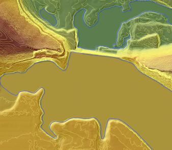
3 Remote sensing technology similar to radar, but uses laser light instead of radio waves Combined with GPS information a point cloud, a collection of X,Y,Z points (millions per square mile!) Precision and number of points depends on collect specifications Scanners can be ground-based, airborne, or spaceborne


4 LiDAR Data in Minnesota Available for large areas 52,000 square miles in the Public Domain High quality High degree of consistency

5
6 Acquisition Initiatives Red River Valley International Water Institute Minnesota High Resolution Elevation Mapping Project Several County Collects Blue Earth, Chisago, Crow Wing, McLeod, Pine, Rice, Stearns, Wright Carver, Dakota, Goodhue, Ramsey, Scott Older data, proprietary Re-acquired as part of MN HREM

7 DESIGNING A RING DIKE LiDAR was used in the Wild Rice Watershed (Red River Valley) to accurately locate, size and align the structure, to estimate ring dike material quantities and total costs, and to meet permitting/mitigation requirements.

8 DESIGNING A RING DIKE The result during the 2009 spring floods
9 Minnesota Elevation Mapping Project Started with the USGS LiDAR Base Specifications V13 Draft Published February 22, 2010 Specifies minimum specifications for Federal and Federally funded LiDAR projects Collection Data Processing and Handling Hydro-Flattening Requirements Deliverables 2/21/2012
10 Data Deliverables All data are delivered in tiles based on 1/16 th of a USGS 1:24,000 scale quadrangle Roughly 3.25 square miles DNR_QQQ_ID Tile name field A good balance between file size and area Average LAS file size = 291 mb Average GDB file size = 5.6 mb 2/21/2012

11 Tile scheme 16 tiles per 24K quadrangle Data must fill tile no partials 2/21/2012
12 File Geodatabase Contents Contour_Data Feature Dataset Contours 2 contours (3D Polylines) Terrain_Data Feature Dataset Bare_Earth_Points bare earth points from LAS files (3D Multipoint) Hydro_Breaklines Edge of water breaklines (3d Polygons) DEM01 one meter DEM Buildings Building outlines generated from LAS
, classified Bare Earth")

13 Products from the state collects include: LAS (Open standard format), classified Bare Earth points Rough building footprints Hydro Breaklines 1-meter DEM 2 contours 3-meter DEM hillshades

14 Hydro Breaklines

15 Building footprints Not required by state collect contract to be perfect Gives relative proximity and quantity Sometimes tall vegetation in flat areas is erroneously depicted as building

16 In ArcCatalog


17 LAS Files One per tile Full Point Cloud All returns all points Classifications 1 - Processed but unclassified 2 - Bare earth ground 4 Vegetation 6 - Buildings 7 - Noise (low or high) 8 Mass Points 9 - Water 10 Breakline Proximity 14 Bridge Decks All Points Bare Earth Ground Vegetation Buildings Mass Points Water 2/21/2012
18 What about existing data? Projected to UTM Zone 15 Vertical Units converted to meters Re-Tiled to 1/16 tile Reproject 3d shapefiles Scale 3D shapefile from feet to meters Recreate DEMs, Contours Published on ftp site
19 County Data Bundles Data have been assembled into county based bundles Mosaic all tiles that touch county Ease of use for county and other staff Assists with QA/QC Additional derived products ArcGIS 9.3 File Geodatabases
20 County Bundle File Geodatabase Contents ELEVATION_DATA.GDB Buildings Building polygons Contours Two foot contours DEM01 One meter DEM Mosaic DEM01HS Hillshade of DEM01 DEM03 Three meter DEM (rescaled DEM01) DEM03HS Hillshade of DEM03 DEM03Slope_degree Slope of DEM03 in degrees DEM03Slope_percent Slope of DEM03 in percent Hydro_Breaklines Edge of water breaklines qaqc table of tiles and statistics for data Tile_index index of tiles for county Validation_points survey shots used for QA/QC
21 In ArcCatalog
22 Data dissemination is a challenge Data volume is high 26,000 square miles = 1 tb of data Variety of data representations Contours, DEMs, LAS, etc Plethora of software formats CAD, GIS, Graphics Projections.? Lots of questions
23 County Area (sq miles) Mosaic LAS Geodatabase Total Douglas gb 56gb 21.5gb Faribault gb 76.5gb 16.5gb Jackson gb 75.8gb 18.2gb LeSueur gb 55.6gb 10gb Martin gb 91.5gb 17.3gb Nobles gb 71.3gb 20gb Pope gb 70gb Rock gb 51.5gb 12.5gb Waseca gb 41.5gb 7.91gb 52.68

24 LiDAR allowed staff to quickly assess the entire project area and select preliminary sites. On-site surveying determined which sites were optimum. Once selected, staff compared cut-andfill estimates using the computer model and on-site surveying (the figures were remarkably similar, within 3-7 percent).
25 Where to get Data DNR ftp access Server name - lidar.dnr.state.mn.us Pros Data is available Data is highly structured and consistent Can download vast quantities of data Cons Not entirely intuitive Must use ftp Client Must learn storage structures Not entirely fast
26 FTP Site contents \data all LiDAR related data found here \documentation documentation and instructions for site navigation \examples small lidar example datasets \tools tools for using LiDAR and Elevation data \training training materials \readme_first.rtf site documentation in text format \watchme_first.swf site documentation in video format
27
28 Mosaiced Data Packets are found at: \data\county\<county_name> Elevation_data.gdb Tiled Data Packets are found at: \data\raw\<county_name> Geodatabase Folder LAZ Folder
29 Accessing LAS Data LAS files are stored as compressed LAZ files LAS -> LAZ Lossless Compression averages 90% This is a BIG deal Uses LASTOOLS LASZIP.EXE Command Line tool Compression and Uncompression
30 LASTOOLS An easy to use, lightweight and efficient set of tools for processing LiDAR data in LAS format Not a free set of tools but some parts ARE free License information can be found at: d/license.txt LASZIP compression software IS Free as is LAS2LAS
31 Scenario YOU are a technician who has to obtain LAS data for a Project Project is in LeSueur County at the intersection of State Highways 99 and 112 Convert data to ASCII X,Y,Z format for input into CAD How do I get there?
32 Using an FTP Client 1) Log into lidar.dnr.state.mn.us 1) Anonymous username and password 2) Change folders to: 1) \data\raw\county\leseuer 3) Download and View TILE_INDEX_MAP.PDF 4) Identify Tiles to Download 5) Change folders to 1) \data\raw\county\leseuer\laz 2) Find and download tiles of interest 3) Unzip to LAS Format


33 Need Tile

34 Download LAZ via FTP

35 Unzip using LASZIP tool
36 LASTOOL Capabilities LAS2TXT to convert LAS files to X,Y,Z ASCII format LAS2LAS to re-project data Clip Data to circles, squares and rectangles Filter data based on Classifications Class 2 (bare earth) is often too much information Class 8 (Mass Point) is a subset of Class 2 Can find tips for LASTOOLS at: \tools\lastools\las_file_processing_using LASTOOLS.pdf
37 Export to CAD as ASCII x,y,z file
38 Other CAD Options AutoCAD Civil3D can now read LAS files Classes 2, 8 make up bare earth Some users prefer to use Raster data to build surfaces Don t use Contours!

39
40 Geodatabases if you are working with ArcGIS Once you ve found the Tiles you need Download from the county GEODATABASE folder gdb Ready to use in ArcGIS
41 If you want County Mosaic Data Go to the county folder of interest \data\county\lesueur Download entire folder ELEVATION_DATA.GDB Validation Report Ready to use in ArcGIS
42 Future Plans Simplify downloads using browser based front Provide options for: Project data Output formats (CAD, GIS) Output representations (contours, TIN, DEM, Points) Subset data (clipping and filtering) Expect availability in 2012 More Web Services Check out:
43 Future Plans Web and Smartphone LiDAR Viewer DEM, Contours, Terrain, Slope, Air Photos, Base maps User Defined Profile and Point Elevations PDF output
44 A great example. International Water Institute LiDAR Portal Pros Visual access via browser Intuitive interface that is easy to use Select and download Six representations instructions for downloading


45
46 Training Opportunities Conservation Applications of LiDAR University of MN, DNR, BWSR Funded by LCCMR Nominal fee <$40 Six Class Series Basics of Using LiDAR Data Terrain Analysis Hydrologic Applications Engineering Applications Forestry and Ecological Applications Wetland Mapping
47 Training Opportunities Or search on Conservation Applications of LiDAR Locations Winona March 27, 28, 29 East Grand Forks April 10, 11, 12, 13 Morris July 25, 26; August 8 Cloquet April 26, 27 Minneapolis, May 15 More sessions are being planned

48
LiDAR User Data Needs Survey Results
 LiDAR User Data Needs Survey Results June 2012 Introduction The Minnesota Geospatial Information Office (MnGeo) is working with the Minnesota Department of Natural Resources (DNR) to develop a data distribution
Management and Use of LiDAR-derived Information. Elizabeth Cook, GIS Specialist
 Management and Use of LiDAR-derived Information Elizabeth Cook, GIS Specialist Advanced LiDAR Workshop March 15, 2012 50-100 gb/county Now What? Project Deliverables LAS mass point files, classification
These modules are covered with a brief information and practical in ArcGIS Software and open source software also like QGIS, ILWIS.
 Online GIS Training and training modules covered are: 1. ArcGIS, Analysis, Fundamentals and Implementation 2. ArcGIS Web Data Sharing 3. ArcGIS for Desktop 4. ArcGIS for Server These modules are covered
Delineation of Watersheds
 Delineation of Watersheds Adirondack Park, New York by Introduction Problem Watershed boundaries are increasingly being used in land and water management, separating the direction of water flow such that
Data Aggregation with InfraWorks and ArcGIS for Visualization, Analysis, and Planning
 Data Aggregation with InfraWorks and ArcGIS for Visualization, Analysis, and Planning Stephen Brockwell President, Brockwell IT Consulting, Inc. Join the conversation #AU2017 KEYWORD Class Summary Silos
If this is your first experience with LiDAR data you might want to check out the MGISAC s whitepaper on LiDAR here:
 IMPORTANT NOTE! If the LiDAR data products you re looking are not in the maps.wustl.edu / mo_lidar_data directory then it is either not available for public access yet - is in the pipeline to be posted
Trail Flow: Analysis of Drainage Patterns Affecting a Mountain Bike Trail
 Andy Belcher BAE 590 Professor Huffman 12.9.11 Location Trail Flow: Analysis of Drainage Patterns Affecting a Mountain Bike Trail The location of the project area rests in the Cary area of Wake County,
LiDAR Quality Assessment Report
 LiDAR Quality Assessment Report The USGS National Geospatial Technical Operations Center, Data Operations Branch is responsible for conducting reviews of all Light Detection and Ranging (LiDAR) pointcloud
Using the Stock Hydrology Tools in ArcGIS
 Using the Stock Hydrology Tools in ArcGIS This lab exercise contains a homework assignment, detailed at the bottom, which is due Wednesday, October 6th. Several hydrology tools are part of the basic ArcGIS
ArcGIS Pro: Essential Workflows STUDENT EDITION
 ArcGIS Pro: Essential Workflows STUDENT EDITION Copyright 2018 Esri All rights reserved. Course version 6.0. Version release date August 2018. Printed in the United States of America. The information contained
To: Ross Martin, Lisa Stapleton From: Brad Lind Subject: Joint Funding Agreement with USGS for 2012 Imagery Date: March 14, 2012.
 To: Ross Martin, Lisa Stapleton From: Brad Lind Subject: Joint Funding Agreement with USGS for 2012 Imagery Date: March 14, 2012 Attached are two copies of the Joint Funding Agreement (JFA) between SanGIS
Data Structures & Database Queries in GIS
 Data Structures & Database Queries in GIS Objective In this lab we will show you how to use ArcGIS for analysis of digital elevation models (DEM s), in relationship to Rocky Mountain bighorn sheep (Ovis
GIS-T 2010 Building a Successful Geospatial Data Sharing Framework: A Ohio DOT Success Story
 GIS-T 2010 Building a Successful Geospatial Data Sharing Framework: A Ohio DOT Success Story ODOT District 2 GIS John Puente District 1 GIS Coordinator\ Planning Administrator 2 Interoperability 3 District
Pictometry GIS and Integration Solutions. Presented by Peter White, GISP GIS Product Manager, Pictometry International Corp.
 Pictometry GIS and Integration Solutions Presented by Peter White, GISP GIS Product Manager, Pictometry International Corp. 1. Pictometry Web Integration Solutions 2. Advanced LiDAR Sensor and Solutions
Office of Geographic Information Systems
 Winter 2007 Department Spotlight SWCD GIS by Dave Holmen, Dakota County Soil and Water Conservation District The Dakota County Soil and Water Conservation District (SWCD) has collaborated with the Dakota
The Geodatabase Working with Spatial Analyst. Calculating Elevation and Slope Values for Forested Roads, Streams, and Stands.
 GIS LAB 7 The Geodatabase Working with Spatial Analyst. Calculating Elevation and Slope Values for Forested Roads, Streams, and Stands. This lab will ask you to work with the Spatial Analyst extension.
ISU GIS CENTER S ARCSDE USER'S GUIDE AND DATA CATALOG
 ISU GIS CENTER S ARCSDE USER'S GUIDE AND DATA CATALOG 2 TABLE OF CONTENTS 1) INTRODUCTION TO ARCSDE............. 3 2) CONNECTING TO ARCSDE.............. 5 3) ARCSDE LAYERS...................... 9 4) LAYER
Geodatabase An Overview
 Federal GIS Conference February 9 10, 2015 Washington, DC Geodatabase An Overview Ralph Denkenberger - esri Session Path The Geodatabase - What is it? - Why use it? - What types are there? Inside the Geodatabase
Background Information Methods Pre- Processing in ArcMap Processing in Fusion Analysis
 DETECTING RIPARIAN VEGETATION CHANGE USING LIDAR WILLIAM SERCOMBE ALEX THOMAS GEOG 593 PRESENTATION OVERVIEW Background Information Research Question Study Area Methods Pre- Processing in ArcMap Processing
Remote Sensing / GIS Conference. The Louisiana Proposed Elevation for the Nation Business Plan Components
 Remote Sensing / GIS Conference 08 April 2008 The Louisiana Proposed Elevation for the Nation Business Plan Components David Gisclair, Louisiana Oil Spill Coordinators Office, Office of the Governor david.gisclair@la.gov
Exercise 2: Working with Vector Data in ArcGIS 9.3
 Exercise 2: Working with Vector Data in ArcGIS 9.3 There are several tools in ArcGIS 9.3 used for GIS operations on vector data. In this exercise we will use: Analysis Tools in ArcToolbox Overlay Analysis
GRAPEVINE LAKE MODELING & WATERSHED CHARACTERISTICS
 GRAPEVINE LAKE MODELING & WATERSHED CHARACTERISTICS Photo Credit: Lake Grapevine Boat Ramps Nash Mock GIS in Water Resources Fall 2016 Table of Contents Figures and Tables... 2 Introduction... 3 Objectives...
Esri UC2013. Technical Workshop.
 Esri International User Conference San Diego, California Technical Workshops July 9, 2013 CAD: Introduction to using CAD Data in ArcGIS Jeff Reinhart & Phil Sanchez Agenda Overview of ArcGIS CAD Support
Measuring earthquake-generated surface offsets from high-resolution digital topography
 Measuring earthquake-generated surface offsets from high-resolution digital topography July 19, 2011 David E. Haddad david.e.haddad@asu.edu Active Tectonics, Quantitative Structural Geology, and Geomorphology
Object Based Imagery Exploration with. Outline
 Object Based Imagery Exploration with Dan Craver Portland State University June 11, 2007 Outline Overview Getting Started Processing and Derivatives Object-oriented classification Literature review Demo
Louisiana Transportation Engineering Conference. Monday, February 12, 2007
 Louisiana Transportation Engineering Conference Monday, February 12, 2007 Agenda Project Background Goal of EIS Why Use GIS? What is GIS? How used on this Project Other site selection tools I-69 Corridor
Outcrop suitability analysis of blueschists within the Dry Lakes region of the Condrey Mountain Window, North-central Klamaths, Northern California
 Outcrop suitability analysis of blueschists within the Dry Lakes region of the Condrey Mountain Window, North-central Klamaths, Northern California (1) Introduction: This project proposes to assess the
Using ArcGIS for Hydrology and Watershed Analysis:
 Using ArcGIS 10.2.2 for Hydrology and Watershed Analysis: A guide for running hydrologic analysis using elevation and a suite of ArcGIS tools Anna Nakae Feb. 10, 2015 Introduction Hydrology and watershed
The File Geodatabase API. Craig Gillgrass Lance Shipman
 The File Geodatabase API Craig Gillgrass Lance Shipman Schedule Cell phones and pagers Please complete the session survey we take your feedback very seriously! Overview File Geodatabase API - Introduction
2013 Indiana GIS Conference. Mini-Workshop. (9:00 am 10:30 am)
") Indiana GIS LiDAR Applications 2013 Indiana GIS Conference Mini-Workshop May 7, 2013 (9:00 am 10:30 am) Topics Workshop Overview 1. Indiana Statewide Ortho-LiDAR Program Overview and Status (Phil Worrall)
Indiana GIS LiDAR Applications 2013 Indiana GIS Conference Mini-Workshop May 7, 2013 (9:00 am 10:30 am) Topics Workshop Overview 1. Indiana Statewide Ortho-LiDAR Program Overview and Status (Phil Worrall)
Introduction to Geographic Information Systems (GIS): Environmental Science Focus
: Environmental Science Focus") Introduction to Geographic Information Systems (GIS): Environmental Science Focus September 9, 2013 We will begin at 9:10 AM. Login info: Username:!cnrguest Password: gocal_bears Instructor: Domain: CAMPUS
Introduction to Geographic Information Systems (GIS): Environmental Science Focus September 9, 2013 We will begin at 9:10 AM. Login info: Username:!cnrguest Password: gocal_bears Instructor: Domain: CAMPUS
GIS APPLICATIONS IN SOIL SURVEY UPDATES
 GIS APPLICATIONS IN SOIL SURVEY UPDATES ABSTRACT Recent computer hardware and GIS software developments provide new methods that can be used to update existing digital soil surveys. Multi-perspective visualization
Geoprocessing Tools at ArcGIS 9.2 Desktop
 Geoprocessing Tools at ArcGIS 9.2 Desktop Analysis Tools Analysis Tools \ Extract Clip Analysis Tools \ Extract Select Analysis Tools \ Extract Split Analysis Tools \ Extract Table Select Analysis Tools
Workshops funded by the Minnesota Environment and Natural Resources Trust Fund
 Workshops funded by the Minnesota Environment and Natural Resources Trust Fund Conservation Applications of LiDAR Data Workshops funded by: Minnesota Environment and Natural Resources Trust Fund Presented
Handling Raster Data for Hydrologic Applications
 Handling Raster Data for Hydrologic Applications Prepared by Venkatesh Merwade Lyles School of Civil Engineering, Purdue University vmerwade@purdue.edu January 2018 Objective The objective of this exercise
Alaska, USA. Sam Robbins
 Using ArcGIS to determine erosion susceptibility within Denali National Park, Alaska, USA Sam Robbins Introduction Denali National Park is six million acres of wild land with only one road and one road
Introduction. Elevation Data Strategy. Status and Next Steps
 1 2 Introduction Elevation Data Strategy Status and Next Steps 3 Canada is the 2nd largest country in the world - 9.9 million sq km Surrounded by 3 oceans with 202 000 km of coastline Population over 35
WORKING WITH DMTI DIGITAL ELEVATION MODELS (DEM)
") WORKING WITH DMTI DIGITAL ELEVATION MODELS (DEM) Contents (Ctrl-Click to jump to a specific page) Manipulating the DEM Step 1: Finding the DEM Tiles You Need... 2 Step 2: Importing the DEM Tiles into ArcMap...
WORKING WITH DMTI DIGITAL ELEVATION MODELS (DEM) Contents (Ctrl-Click to jump to a specific page) Manipulating the DEM Step 1: Finding the DEM Tiles You Need... 2 Step 2: Importing the DEM Tiles into ArcMap...
GeoWEPP Tutorial Appendix
 GeoWEPP Tutorial Appendix Chris S. Renschler University at Buffalo - The State University of New York Department of Geography, 116 Wilkeson Quad Buffalo, New York 14261, USA Prepared for use at the WEPP/GeoWEPP
Geodatabase An Introduction
 Federal GIS Conference 2014 February 10 11, 2014 Washington DC Geodatabase An Introduction Ralph Denkenberger esri Session Path The Geodatabase - What is it? - Why use it? - What types are there? Inside
Lecture 6 - Raster Data Model & GIS File Organization
 Lecture 6 - Raster Data Model & GIS File Organization I. Overview of Raster Data Model Raster data models define objects in a fixed manner see Figure 1. Each grid cell has fixed size (resolution). The
MISSOURI LiDAR Stakeholders Meeting
 MISSOURI LiDAR Stakeholders Meeting East-West Gateway June 18, 2010 Tim Haithcoat Missouri GIO Enhanced Elevation Data What s different about it? Business requirements are changing.fast New data collection
Geo 327G Semester Project. Landslide Suitability Assessment of Olympic National Park, WA. Fall Shane Lewis
 Geo 327G Semester Project Landslide Suitability Assessment of Olympic National Park, WA Fall 2011 Shane Lewis 1 I. Problem Landslides cause millions of dollars of damage nationally every year, and are
Hydrologic Engineering Applications of Geographic Information Systems
 Hydrologic Engineering Applications of Geographic Information Systems Davis, California Objectives: The participant will acquire practical knowledge and skills in the application of GIS technologies for
Floodplain Mapping & Flood Warning Applications in North Carolina
 Floodplain Mapping & Flood Warning Applications in North Carolina Marc Stanard, IT Project Manager Ken Ashe, Assistant Director David Herlong, Flood Warning Program Manager NC Crime Control & Public Safety
Technical Drafting, Geographic Information Systems and Computer- Based Cartography
 Technical Drafting, Geographic Information Systems and Computer- Based Cartography Project-Specific and Regional Resource Mapping Services Geographic Information Systems - Spatial Analysis Terrestrial
Andrew Dolch October 2013 Revision 1.0
 LP360 Andrew Dolch Revision 1.0 l GeoCue has had a long association with the Pennsylvania State University (Penn State) where the John A. Dutton e-education program in the department of Geography uses
In this exercise we will learn how to use the analysis tools in ArcGIS with vector and raster data to further examine potential building sites.
 GIS Level 2 In the Introduction to GIS workshop we filtered data and visually examined it to determine where to potentially build a new mixed use facility. In order to get a low interest loan, the building
EnvSci 360 Computer and Analytical Cartography
 EnvSci 360 Computer and Analytical Cartography Lecture 7 Mapping Images, Surfaces, and 3-D Data Brief Overview of Imagery What is Imagery? A spatial data model that defines space as an array of equally
Steve Pye LA /22/16 Final Report: Determining regional locations of reference sites based on slope and soil type. Client: Sonoma Land Trust
 Steve Pye LA 221 04/22/16 Final Report: Determining regional locations of reference sites based on slope and soil type. Client: Sonoma Land Trust Deliverables: Results and working model that determine
IMPERIAL COUNTY PLANNING AND DEVELOPMENT
 IMPERIAL COUNTY PLANNING AND DEVELOPMENT GEODATABASE USER MANUAL FOR COUNTY BUSINESS DEVELOPMENT GIS June 2010 Prepared for: Prepared by: County of Imperial Planning and Development 801 Main Street El
Lauren Jacob May 6, Tectonics of the Northern Menderes Massif: The Simav Detachment and its relationship to three granite plutons
 Lauren Jacob May 6, 2010 Tectonics of the Northern Menderes Massif: The Simav Detachment and its relationship to three granite plutons I. Introduction: Purpose: While reading through the literature regarding
A Temporal Hydrologic Database for Rapidly Changing Landscapes
 A Temporal Hydrologic Database for Rapidly Changing Landscapes Using Mt. St. Helens in Washington as a Pilot Site Adam Mosbrucker Geog 575 BACKGROUND: Client / User U.S. Geological Survey Cascades Volcano
Flood Hazard Zone Modeling for Regulation Development
 Flood Hazard Zone Modeling for Regulation Development By Greg Lang and Jared Erickson Pierce County GIS June 2003 Abstract The desire to blend current digital information with government permitting procedures,
SIE 509 Principles of GIS Exercise 5 An Introduction to Spatial Analysis
 SIE 509 Principles of GIS Exercise 5 An Introduction to Spatial Analysis Due: Oct. 31, 2017 Total Points: 50 Introduction: The Governor of Maine is asking communities to look at regionalization for major
Working with Elevation Data Using Mosaic Datasets & Image Services. Peter Becker
 Working with Elevation Data Using Mosaic Datasets & Image Services Peter Becker OUTLINE Uses or Elevation data Requirements ArcGIS 10 capabilities - Mosaic Datasets - ArcGIS Server Best Practices Worklow
Spatial Analysis with Web GIS. Rachel Weeden
 Spatial Analysis with Web GIS Rachel Weeden Agenda Subhead goes here Introducing ArcGIS Online Spatial Analysis Workflows Scenarios Other Options Resources ArcGIS is a Platform Making mapping and analytics
LiDAR APPLICATIONS REMS6090. Assignment 2 HYDROLOGICAL APPLICATIONS of LiDAR DATA Due Date April 8, Venessa Bennett W
 LiDAR APPLICATIONS REMS6090 Assignment 2 HYDROLOGICAL APPLICATIONS of LiDAR DATA Due Date April 8, 2015 Venessa Bennett W0279429 1.0 Introduction High accuracy Digital Elevation Models (DEM) derived from
ARCGIS TRAINING AT KU GIS LABS: INTRODUCTION TO GIS: EXPLORING ARCCATALOG AND ARCGIS TOOLS
 PHASE 1_3 rd SESSION ARCGIS TRAINING AT KU GIS LABS: INTRODUCTION TO GIS: EXPLORING ARCCATALOG AND ARCGIS TOOLS 3 rd SESSION REPORT: 25 TH -27 TH JUNE 2014 SCHOOL OF ENVIRONMENTAL STUDIES COMPUTER LAB
Acknowledgments xiii Preface xv. GIS Tutorial 1 Introducing GIS and health applications 1. What is GIS? 2
 Acknowledgments xiii Preface xv GIS Tutorial 1 Introducing GIS and health applications 1 What is GIS? 2 Spatial data 2 Digital map infrastructure 4 Unique capabilities of GIS 5 Installing ArcView and the
Building a Hydrologic Base Map Prepared by David R. Maidment Waterways Centre for Freshwater Research University of Canterbury
 Building a Hydrologic Base Map Prepared by David R. Maidment Waterways Centre for Freshwater Research University of Canterbury 14 March 2018 Goals of the Exercise This exercise shows how to develop a hydrologic
Key Processes
 Data Manipulation and Extraction Key Processes Key Processes Re-Projecting Data Selecting by Attributes Exporting Data Hillshade Reclassification Conversion of Raster to Vector Re-Projecting Data Purpose
Spatial Data Analysis with ArcGIS Desktop: From Basic to Advance
 Spatial Data Analysis with ArcGIS Desktop: From Basic to Advance 1. Course overview Modern environmental, energy as well as resource modeling and planning require huge amount of geographically located
Session Objectives. Learn how to: Bring georeferenced aerial imagery into Civil 3D. Connect to and import GIS data using various tools and techniques.
 GIS into Civil 3D Data 70th Annual Wisconsin Society of Land Surveyors' Institute January 24, 2019 1 Learn how to: Session Objectives Bring georeferenced aerial imagery into Civil 3D. Connect to and import
Final Project: Geodatabase of Mule Mountains Area, southeastern Arizona
 R. Aisner 11/24/09 GEO 386G Final Project: Geodatabase of Mule Mountains Area, southeastern Arizona Project goal: Develop a geodatabase with vector and raster data for future data organization and analysis.
Introduction. Project Summary In 2014 multiple local Otsego county agencies, Otsego County Soil and Water
 Introduction Project Summary In 2014 multiple local Otsego county agencies, Otsego County Soil and Water Conservation District (SWCD), the Otsego County Planning Department (OPD), and the Otsego County
GIS Boot Camp for Education June th, 2011 Day 1. Instructor: Sabah Jabbouri Phone: (253) x 4854 Office: TC 136
 x 4854 Office: TC 136") GIS Boot Camp for Education June 27-30 th, 2011 Day 1 Instructor: Sabah Jabbouri Phone: (253) 833-9111 x 4854 Office: TC 136 Email: sjabbouri@greenriver.edu http://www.instruction.greenriver.edu/gis/ Summer
GIS Boot Camp for Education June 27-30 th, 2011 Day 1 Instructor: Sabah Jabbouri Phone: (253) 833-9111 x 4854 Office: TC 136 Email: sjabbouri@greenriver.edu http://www.instruction.greenriver.edu/gis/ Summer
Out with the Old, In with the New: Implementing the Results of the Iowa Rapid Floodplain Modeling Project
 Out with the Old, In with the New: Implementing the Results of the Iowa Rapid Floodplain Modeling Project Traci Tylski, E.I., CFM Hydraulics Engineer USACE - Omaha District Traci.M.Tylski@USACE.army.mil
Introduction INTRODUCTION TO GIS GIS - GIS GIS 1/12/2015. New York Association of Professional Land Surveyors January 22, 2015
 New York Association of Professional Land Surveyors January 22, 2015 INTRODUCTION TO GIS Introduction GIS - GIS GIS 1 2 What is a GIS Geographic of or relating to geography the study of the physical features
ArcGIS Data Reviewer: Quality Assessment for Elevation Raster Datasets. Roslyn Dunn
 ArcGIS Data Reviewer: Quality Assessment for Elevation Raster Datasets Roslyn Dunn What is ArcGIS Data Reviewer? Data Quality Management for ArcGIS Provides - Rule-based validation - Interactive tools
The Looming Threat of Rising Sea Levels to the Florida Keys
 The Looming Threat of Rising Sea Levels to the Florida Keys 1. Introduction Sea levels are rising, and possibly faster than we thought before. In a recent report in 2017 by the National Oceanic and Atmospheric
Display data in a map-like format so that geographic patterns and interrelationships are visible
 Vilmaliz Rodríguez Guzmán M.S. Student, Department of Geology University of Puerto Rico at Mayagüez Remote Sensing and Geographic Information Systems (GIS) Reference: James B. Campbell. Introduction to
Pan-Arctic Digital Elevation Map (Pan-Arctic DEM)
") Memorandum to CAFF Board 07/28/2017 BACKGROUND: Pan-Arctic Digital Elevation Map (Pan-Arctic DEM) ArcticDEM is a National Geospatial-Intelligence Agency (NGA)-National Science Foundation (NSF) publicprivate
Memorandum to CAFF Board 07/28/2017 BACKGROUND: Pan-Arctic Digital Elevation Map (Pan-Arctic DEM) ArcticDEM is a National Geospatial-Intelligence Agency (NGA)-National Science Foundation (NSF) publicprivate
Working with Elevation Services. Cody Benkelman
 Working with Elevation Services Cody Benkelman Outline ArcGIS Online World Elevation & 3D Elevation Cache for Pro What is included? - Data and Tools How can I use it? - Modes of use - Client Applications
4. GIS Implementation of the TxDOT Hydrology Extensions
 4. GIS Implementation of the TxDOT Hydrology Extensions A Geographic Information System (GIS) is a computer-assisted system for the capture, storage, retrieval, analysis and display of spatial data. It
Raster Data Model. Examples of raster data Remotely sensed imagery (BV, DN) DEM (elevation) DRG (color) Raster Database
 DEM (elevation) DRG (color) Raster Database") Raster Data Model Why use a raster data model? Raster data representations Cell value Measurement, average, majority, significance Cell-based vs. point-based Raster data components Cells, Pixels, Grid
Raster Data Model Why use a raster data model? Raster data representations Cell value Measurement, average, majority, significance Cell-based vs. point-based Raster data components Cells, Pixels, Grid
How to Create Stream Networks using DEM and TauDEM
 How to Create Stream Networks using DEM and TauDEM Take note: These procedures do not describe all steps. Knowledge of ArcGIS, DEMs, and TauDEM is required. TauDEM software ( http://hydrology.neng.usu.edu/taudem/
Keeping Maps Safe and Accessible: Digitization and Preservation at the Library of Congress
 Keeping Maps Safe and Accessible: Digitization and Preservation at the Library of Congress September 27, 2017 p.1 Agenda Jacqueline Nolan, Cartographer Colleen Cahill, Digital Conversion Coordinator Geography
DEMs Downloading and projecting and using Digital Elevation Models (DEM)
") DEMs Downloading and projecting and using Digital Elevation Models (DEM) Introduction In this exercise, you will work with Digital Elevation Models (DEM). You will download a DEM in geographic coordinates
DEMs Downloading and projecting and using Digital Elevation Models (DEM) Introduction In this exercise, you will work with Digital Elevation Models (DEM). You will download a DEM in geographic coordinates
Indiana GIS Local Resolution NHD Applications. Indiana State GIS Conference
 Indiana GIS Local Resolution NHD Applications Indiana State GIS Conference May 7, 2013 Agenda Topics I. Indiana s National Hydrography y Data II. Accessing NHD Data III. Demonstrations Using Local NHD
ArcGIS Enterprise: What s New. Philip Heede Shannon Kalisky Melanie Summers Shreyas Shinde
 ArcGIS Enterprise: What s New Philip Heede Shannon Kalisky Melanie Summers Shreyas Shinde ArcGIS Enterprise is the new name for ArcGIS for Server ArcGIS Enterprise Software Components ArcGIS Server Portal
Exercise 3: GIS data on the World Wide Web
 Exercise 3: GIS data on the World Wide Web These web sites are a few examples of sites that are serving free GIS data. Many other sites exist. Search in Google or other search engine to find GIS data for
Watershed Analysis of the Blue Ridge Mountains in Northwestern Virginia
 Watershed Analysis of the Blue Ridge Mountains in Northwestern Virginia Mason Fredericks December 6, 2018 Purpose The Blue Ridge Mountain range is one of the most popular mountain ranges in the United
WHAT MAKES A GOOD GIS LAB EXERCISE? Robert N. Martin
 WHAT MAKES A GOOD GIS LAB EXERCISE? Robert N. Martin ABSTRACT Having taught GIS for over fifteen years in a lecture/laboratory format, I have developed a series of laboratory exercise that provide a good
Introduction to Geographic Information Systems
 Introduction to Geographic Information Systems Lynn_Carlson@brown.edu 401-863-9917 The Environmental And Remote TecHnologies Lab MacMillan Hall, Room 105 http://www.brown.edu/research/earthlab/ Outline
Watershed Modeling Orange County Hydrology Using GIS Data
 v. 10.0 WMS 10.0 Tutorial Watershed Modeling Orange County Hydrology Using GIS Data Learn how to delineate sub-basins and compute soil losses for Orange County (California) hydrologic modeling Objectives
Tracy Fuller U. S. Geological Survey. February 24, 2016
 U. S. Geological Survey Arctic Elevation Data Involvement Statewide Alaska IfSAR Radar Collection Program Pan-Arctic Digital Elevation Map International Coordination Tracy Fuller U. S. Geological Survey
Exercise 2: Working with Vector Data in ArcGIS 9.3
 Exercise 2: Working with Vector Data in ArcGIS 9.3 There are several tools in ArcGIS 9.3 used for GIS operations on vector data. In this exercise we will use: Analysis Tools in ArcToolbox Overlay Analysis
Features and Benefits
 Autodesk LandXplorer Features and Benefits Use the Autodesk LandXplorer software family to help improve decision making, lower costs, view and share changes, and avoid the expense of creating physical
Digital Elevation Models (DEM)
") Digital Elevation Models (DEM) Digital representation of the terrain surface enable 2.5 / 3D views Rule #1: they are models, not reality Rule #2: they always include some errors (subject to scale and data
Digital Elevation Models (DEM) Digital representation of the terrain surface enable 2.5 / 3D views Rule #1: they are models, not reality Rule #2: they always include some errors (subject to scale and data
Regional GIS and GIS Alternatives. Carl Zimmerman, PhD Senior GIS Manager
 Regional GIS and GIS Alternatives Carl Zimmerman, PhD Senior GIS Manager Data Availability Imagery now available for entire region. 3 and 4-band imagery Data Availability Imagery now available for entire
Leon Creek Watershed October 17-18, 1998 Rainfall Analysis Examination of USGS Gauge Helotes Creek at Helotes, Texas
 Leon Creek Watershed October 17-18, 1998 Rainfall Analysis Examination of USGS Gauge 8181400 Helotes Creek at Helotes, Texas Terrance Jackson MSCE Candidate University of Texas San Antonio Abstract The
Applied Cartography and Introduction to GIS GEOG 2017 EL. Lecture-2 Chapters 3 and 4
 Applied Cartography and Introduction to GIS GEOG 2017 EL Lecture-2 Chapters 3 and 4 Vector Data Modeling To prepare spatial data for computer processing: Use x,y coordinates to represent spatial features
Mapping Utilities with Mobile GIS Applications
 Mapping Utilities with Mobile GIS Applications Kristy M. Capobianco Reynolds, Smith and Hills, Inc. GIS Analyst Kristy.Capobianco@rsandh.com (904) 256-2251 2007 ESRI Southeast User Group Conference May
Geography 38/42:376 GIS II. Topic 1: Spatial Data Representation and an Introduction to Geodatabases. The Nature of Geographic Data
 Geography 38/42:376 GIS II Topic 1: Spatial Data Representation and an Introduction to Geodatabases Chapters 3 & 4: Chang (Chapter 4: DeMers) The Nature of Geographic Data Features or phenomena occur as
Watershed Application of WEPP and Geospatial Interfaces. Dennis C. Flanagan
 Watershed Application of WEPP and Geospatial Interfaces Dennis C. Flanagan Research Agricultural Engineer USDA-Agricultural Research Service Adjunct Professor Purdue Univ., Dept. of Agric. & Biol. Eng.
Imagery and the Location-enabled Platform in State and Local Government
 Imagery and the Location-enabled Platform in State and Local Government Fred Limp, Director, CAST Jim Farley, Vice President, Leica Geosystems Oracle Spatial Users Group Denver, March 10, 2005 TM TM Discussion
Base Level Engineering FEMA Region 6
 Base Level Engineering Over the past five years, has been evaluating its investment approach and data preparation work flow to establish an efficient and effective change in operation, generating an approach
Introduction to the 176A labs and ArcGIS
 Introduction to the 176A labs and ArcGIS Acknowledgement: Slides by David Maidment, U Texas-Austin and Francisco Olivera (TAMU) Purpose of the labs Hands-on experience with one software pakage Introduction
Bentley Map Advancing GIS for the World s Infrastructure
 Bentley Map Advancing GIS for the World s Infrastructure Presentation Overview Why would you need Bentley Map? What is Bentley Map? Where is Bentley Map Used? Why would you need Bentley Map? Because your