Thomas Koellner 1, Adrienne Grét-Regamey 1, Miguel Marchamalo 2, and Raffaele Vignola 3. ETH Zurich, Switzerland. Polytecnica Madrid, Spain
|
|
|
- Annabella Barber
- 5 years ago
- Views:
Transcription

1 Thomas Koellner 1, Adrienne Grét-Regamey 1, Miguel Marchamalo 2, and Raffaele Vignola 3 1 ETH Zurich, Switzerland 2 Polytecnica Madrid, Spain 3 CATIE, Costa Rica
2
3 Our concept of human-environment systems Environmental System Socio-economic System Climate Policy Ecosystems & biodiversity Land use and land cover Decision making of actors Markets Ecosystem goods & services Micro/Meso Level (local to regional) Macro Level (national to global)
4 Our concept of human-environment systems Climate Underlying drivers Policy Ecosystems & biodiversity Land use and land cover Decision making of actors Markets Ecosystem goods & services DYNAMICS OF LAND-USE AND LAND-COVER CHANGE IN TROPICAL REGIONS (Lambin 2003) Proximate drivers
5 The problem Modeling ecosystem services in Human-Environment Systems for decision support under uncertainty and incomplete information.
6 Model types for Human-Environment System System dynamics Voinov, A., Costanza, R., Wainger, L., Boumans, R.M.J., Ferdinando, V., Maxwell, T. and Voinov, H., Patuxent landscape model: integrated ecological economic modeling of a watershed. Environmental Modelling & Software 14: Geostatistical Analysis Coxhead, I., Rola, A. and Kim, K., How Do National Markets and Price Policies Affect Land Use at the Forest Margin? Evidence from the Philippines. Land Economics 77: Agent-based modeling Mathews, R., The People and Landscape Model (PALM): Towards full integration of human decision-making and biophysical simulation models. Ecological Modelling 194: Markov Chain Balzter, H., Markov chain models for vegetation dynamics. Ecological Modelling 126: Bayesian Networks Gret-Regamey, A., Bebi, P., Ian D. Bishop, I.D. and Willy Schmid, W., in press. Linking GIS-based models to value ecosystem services in an Alpine region. Journal of Environmental Management.
7 Case study Switzerland Practical Problem: Spatial planning in Davos must take ecosystem services into account (avalanche protection, habitat protection, scenic beauty, carbon sequestration) Decision Problem: Where in the valley of Davos is settlement expansion ecologically and economically feasible? Solution: Assessing direct economic benefit and ecosystem services values with spatial Bayesian Networks Tuesday, December 09, 2008 Departement/Institut/Gruppe


8 VALUE OF ES INTO SPATIAL PLANNING Laret Wolfgang Davos-Dorf Davos-Platz Frauenkirch Glaris 10 km


9 LINKING BAYESIAN NETWORK TO A GIS Value of ES into planning for settlement expansion ArcGIS X1 Bayesian Network D1 X2 X3 X4 X5 Visual Studio.NET / Hugin X6 X7 U1 Institut für Raum- und Landschaftsentwicklung (IRL)
10 BAYESIAN NETWORK FOR ES VALUATION
11 BAYESIAN NETWORK FOR ES VALUATION Habitat
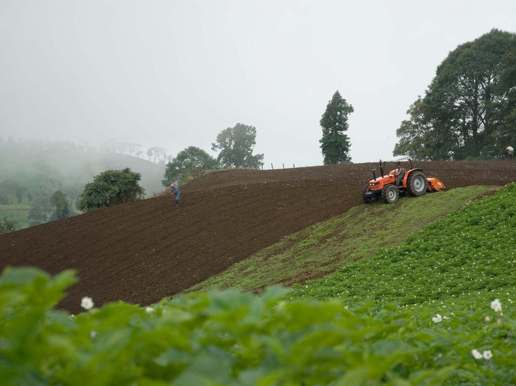
12 BAYESIAN NETWORK FOR ES VALUATION Habitat Avalanche protection
13 BAYESIAN NETWORK FOR ES VALUATION Habitat Avalanche protection Scenic beauty
14 BAYESIAN NETWORK FOR ES VALUATION Habitat Avalanche protection Scenic beauty CO2 sequestration
15 Economic benefits provided by vacation rentals CHF


16 Economic benefits provided by vacation rentals

17 Direct economic benefits minus ecosystem services value < 0 CHF CHF >0 CHF
18 ES benefits from 1997 to 2045 without and with BN Scenic Beauty Habitat Carbon sequestration Avalanche protection Total ES Without Bayesian Network ,941-14,112,408-14,772,253 With Bayesian Network - 13, ,182-9,408,272-9,546,634 1 Values are in CHF. No discount rates are applied Literature: Grêt-Regamey et al. (2008) Valuing for Sustainable Landscape Planning in Alpine Regions. Mountain Research and Development 28:
19 Case study Costa Rica Practical problem: Upstream farmers produce sediments and downstream hydropower producers have economic damage Decision problem: Design of payments for ecosystem services for improved soil erosion regulation Solution: Linking erosion model with farmers decision model in spatial Bayesian Networks


20 Erosion regulation by natural ecosystems Reduced erosion regulation service Production of sediments in the Birris Watershed upstream Costs of additional sediments downstream in the Angostura Dam Cost of dredging the dam in $ per year Reduced lifetime of dam
21 Erosion model RUSLE model (Revised Universal Soil Loss Equation) (Wischmeier y Smith, 1978; Renard et al. 1997) SE = R, K, LS, CP SE: Soil erosion (ton/ha/yr) R: Precipitation erosivity [MJ mm / (ha hr año)] K: Soil erodability [ton ha hr / (ha MJ mm)] LS: Length of slope (adimensional) C: Soil cover (adimensional) P: Soil management practices (adimensional)

22 Factor CP Accounts for vegetation cover comparing actual vs natural vegetation cover effect, and conservation practices Typically used in modelling effect of conservation options Expresses average value of soil cover over the year Existing data for C in Costa Rica have been used combined with data collected by the project (Lianes, 2007)


23 Payment for ecosystem services in high risk areas Pixel Management unit 51,67 t/ha/año

24
25 Factors influencing the land-use decision Knowledge and belief system Signals from climate, policy and markets Subjective Norms Cost-benefit expectations (Attitude) Financial benefits and costs Non-financial benefit and costs Perceived behavioral control (+/-) Environmental constraints Legal constraints Technical constraints Financial constraints Based on * Ajzen 1991 Theory of Planned Behavior * Von Neumann and Morgenstern 1944 Expected Utility Theory
26 Bayesian model + process models Ecosystem part Socio-economic part Policy part Bayesian Model (A) Climate (B) Market (D) Land Use Decision Making (C) Policy design Erosion Model (USLE) (F) Ecosystem (E) Land Use and Cover (G) Ecosystem Services
 Policy design Erosion Model (USLE) (F) Ecosystem (E) Land Use and Cover (G) Ecosystem")
27 Bayesian model + process models Ecosystem part Socio-economic part Policy part Bayesian Model (A) Climate (B) Market (D) Land Use Decision Making Work in Progress (C) Policy design Erosion Model (USLE) (F) Ecosystem (E) Land Use and Cover (G) Ecosystem Services
28 Conclusion - Modeling with Bayesian Networks BN Disadvantage 1. No continuous functions -> proxy by discontinuous ones 2. No feedback loops -> output of BN for time step 1 is input for BN for time step 2 Advantage 1. Uncertainties: Probability distribution for all variables in the model; calculation of joint probabilities 2. Incomplete information: Input data from expert assessment, survey data, data from process models, remote sensed data etc. 3. Design of cost-effective models: Assessment of costs and benefits of additional information as input into the model
Assessment and valuation of Ecosystem Services for decision-makers
 Assessment and valuation of Ecosystem Services for decision-makers An introduction to the ARIES approach Ferdinando Villa *, Ken Bagstad Gary Johnson, Marta Ceroni *Basque Center for Climate Change, Bilbao,
Global Land Project: major scientific questions for coupled modelling
 Global Land Project: major scientific questions for coupled modelling Richard Aspinall Macaulay Land Use Research Institute and GLP Nodal Office on Integration and Modelling Aberdeen, Scotland NATO Advanced
Application of GIS and Remote Sensing in Ecosystem Services Studies
 NRS509 Tingting Liu Application of GIS and Remote Sensing in Ecosystem Services Studies What is Ecosystem Services? Nowadays, more and more people are paying attention to ecosystem services as people are
SPATIAL AND TEMPORAL MODELLING OF ECOSYSTEM SERVICES
 SPATIAL AND TEMPORAL MODELLING OF ECOSYSTEM SERVICES Solen Le Clec h, T.Decaëns, S. Dufour, M. Grimaldi, N. Jégou and J. Oszwald ACES Conference 2016 Jacksonville, Florida (USA). December, 5-9th : issues
Fig 1. Steps in the EcoValue Project
 Assessing the Social and Economic Value of Ecosystem Services in the Northern Forest Region: A Geographic Information System (GIS) Approach to Landscape Valuation Principal Investigator(s): Dr. Matthew
Update ecosystem services analysis in SEEA Experimental Ecosystem Accounting
 Update ecosystem services analysis in SEEA Experimental Ecosystem Accounting Prof. Dr Lars Hein, Wageningen University With materials produced by or in collaboration with CBS, Statistics the Netherlands
Measuring Uncertainty in Spatial Data via Bayesian Melding
 Measuring Uncertainty in Spatial Data via Bayesian Melding Matt Falk Queensland University of Technology (QUT) m.falk@qut.edu.au Joint work with Robert Denham (NRW) and Kerrie Mengersen (QUT) Data Driven
Framework for the Basin-Wide Socio-Economic Analysis of Four Proposed Sediment Diversions. August 4, 2015
 Framework for the Basin-Wide Socio-Economic Analysis of Four Proposed Sediment Diversions August 4, 2015 Proposed Sediment Diversions Mid-Breton Mid-Barataria Lower Barataria Lower Breton Overview of Presentation
Physical Geography: Patterns, Processes, and Interactions, Grade 11, University/College Expectations
 Geographic Foundations: Space and Systems SSV.01 explain major theories of the origin and internal structure of the earth; Page 1 SSV.02 demonstrate an understanding of the principal features of the earth
TEEB: The Economics of Ecosystems and Biodiversity Overview of Process, Content and Approach
 TEEB: The Economics of Ecosystems and Biodiversity Overview of Process, Content and Approach Heidi Wittmer TEEBAgriFood writers workshop Paris, 9-10 May 2016 TEEB s genesis Potsdam Initiative Biological
ROSS ECOSYSTEM VALUATION FRAMEWORK. TECHNICAL WORK SESSION June 12 th, 2013 FRAMEWORK DEVELOPMENT TO SUPPORT DECISION MAKING
 ECOSYSTEM VALUATION FRAMEWORK ROSS TECHNICAL WORK SESSION June 12 th, 2013 FRAMEWORK DEVELOPMENT TO SUPPORT DECISION MAKING CENTRAL PUGET SOUND REGIONAL OPEN SPACE SYSTEM (ROSS) Understand how landscape
ANUELA. Nature Conservation Management for Sustainable Agriculture.
 ANUELA Nature Conservation Management for Sustainable Agriculture Content Seite 2 Background: Why MANUELA? 3 Structure of the system (Modules, Desktop view, Techn. details) 4 Presentation of modules 8
CLIMATE RESILIENT ALTITUDINAL GRADIENTS (CRAGs)
") CLIMATE RESILIENT ALTITUDINAL GRADIENTS (CRAGs) BUILDING CLIMATE CHANGE RESILIENCE IN THE KIVU- RUSIZI WATERSHEDS Great Lake Conference Entebbe 2017 Chris Magero WHAT ARE CRAGs? Climate-Resilient Altitudinal
CLIMATE RESILIENT ALTITUDINAL GRADIENTS (CRAGs) BUILDING CLIMATE CHANGE RESILIENCE IN THE KIVU- RUSIZI WATERSHEDS Great Lake Conference Entebbe 2017 Chris Magero WHAT ARE CRAGs? Climate-Resilient Altitudinal
Combining Three Modelling and Visualization Tools for Collaborative Planning of Urban Transformation
 152 Combining Three Modelling and Visualization Tools for Collaborative Planning of Urban Transformation Ulrike WISSEN HAYEK 1, Noemi NEUENSCHWANDER 1, Timo VON WIRTH 2, Antje KUNZE 3, Jan HALATSCH 3,
Mapping of ecosystems and their services in the EU and its Member States
 Mapping of ecosystems and their services in the EU and its Member States Leon C. Braat, Alterra, Wageningen, The Netherlands MESEU Brussels, July 1, 2015 MESEU FINAL REPORT OCTOBER 2015 The Objective :
Looking at the big picture to plan land treatments
 Looking at the big picture to plan land treatments Eva Strand Department of Rangeland Ecology and Management University of Idaho evas@uidaho.edu, http://www.cnr.uidaho.edu/range Why land treatment planning?
COMMON CONCEPTUAL AND OPERATIONAL FRAMEWORKS FOR RESEARCH AND SUSTAINABLE MANAGEMENT OF NESTED SOCIO-ECOLOGICAL SYSTEMS ACROSS LARGE WATERSHEDS
 COMMON CONCEPTUAL AND OPERATIONAL FRAMEWORKS FOR RESEARCH AND SUSTAINABLE MANAGEMENT OF NESTED SOCIO-ECOLOGICAL SYSTEMS ACROSS LARGE WATERSHEDS Angheluta VADINEANU 1 & Nusret KARAKAYA 2 1 Department of
Review Using the Geographical Information System and Remote Sensing Techniques for Soil Erosion Assessment
 Polish J. of Environ. Stud. Vol. 19, No. 5 (2010), 881-886 Review Using the Geographical Information System and Remote Sensing Techniques for Soil Erosion Assessment Nuket Benzer* Landscape Architecture
SPLAN-Natura Towards an integrated spatial planning approach for Natura th January, 2017 Brussels. Commissioned by DG Environment
 SPLAN-Natura 2000 Towards an integrated spatial planning approach for Natura 2000 Commissioned by DG Environment 17 th January, 2017 Brussels V. Simeonova (Ph.D.) Drivers towards integrating Biodiversity
Subject Name: SOIL AND WATER CONSERVATION ENGINEERING 3(2+1) COURSE OUTLINE
 COURSE OUTLINE") Subject Name: SOIL AND WATER CONSERVATION ENGINEERING 3(2+1) COURSE OUTLINE (Name of Course Developer: Prof. Ashok Mishra, AgFE Department, IIT Kharagpur, Kharagpur 721 302) Module 1: Introduction and
Subject Name: SOIL AND WATER CONSERVATION ENGINEERING 3(2+1) COURSE OUTLINE (Name of Course Developer: Prof. Ashok Mishra, AgFE Department, IIT Kharagpur, Kharagpur 721 302) Module 1: Introduction and
Organizing Inter- and Transdisciplinary Research in TERRECO TERRECO Seminar, Winter term 2009/10
 Organizing Inter- and Transdisciplinary Research in TERRECO TERRECO Seminar, Winter term 2009/10 Prof. Dr. Thomas Köllner Professorship of Ecological Services (PES), University of Bayreuth Goals 1. Learn
Assessing Investment in Future Landsat Instruments for Ecosystem Management: The Example of Forest Carbon Sequestration
 Assessing Investment in Future Landsat Instruments for Ecosystem Management: The Example of Forest Carbon Sequestration Molly K. Macauley Jhih-Shyang Shih ACES 2010 7 December 2010 macauley@rff.org;shih@rff.org
Term Knowledge Using and applying Grade Criteria Autumn 1 Assessment window October Natural hazards pose major risks to people and property.
 Assessment Schedule Year 9 2015/6 Term Knowledge Using and applying Grade Criteria Autumn 1 Assessment window October 2015 3.1.1.2 Tectonic Natural hazards pose major risks to people and property. Definition
16540/14 EE/cm 1 DG E 1A
 Council of the European Union Brussels, 5 December 2014 (OR. en) 16540/14 ENV 965 CULT 139 NOTE From: To: Subject: General Secretariat of the Council Delegations Charter of Rome on Natural and Cultural
National Land Use Policy and National Integrated Planning Framework for Land Resource Development
 Title National Land Use Policy and National Integrated Planning Framework for Land Resource Development Duration: 32 Weeks Objective: Adoption of appropriate land use planning approaches to: Maintain the
AN ASSESSMENT OF THE IMPACT OF RETENTION PONDS
 AN ASSESSMENT OF THE IMPACT OF RETENTION PONDS FOR SEDIMENT TRAPPING IN THE ADA CREEK AND LONGWOOD COVE USING REMOTELY SENSED DATA AND GIS ANALYSIS Sudhanshu Sekhar Panda Associate Professor, GIS/Env.
Mapping and Assessment of Ecosystems and their Services
 Mapping and Assessment of Ecosystems and their Services ALTER-Net Conference 2013: Science underpinning the EU 2020 Biodiversity Strategy. April 2013 Gent Joachim MAES 1 This presentation is based on the
New Frameworks for Urban Sustainability Assessments: Linking Complexity, Information and Policy
 New Frameworks for Urban Sustainability Assessments: Linking Complexity, Information and Policy Moira L. Zellner 1, Thomas L. Theis 2 1 University of Illinois at Chicago, Urban Planning and Policy Program
Data sources and classification for ecosystem accounting g
 Data sources and classification for ecosystem accounting Ken Bagstad 23 February 2015 Wealth Accounting and the Valuation of Ecosystem Services www.wavespartnership.org Data sources and classification
Graduate Courses Meteorology / Atmospheric Science UNC Charlotte
 Graduate Courses Meteorology / Atmospheric Science UNC Charlotte In order to inform prospective M.S. Earth Science students as to what graduate-level courses are offered across the broad disciplines of
From individual perceptions and statistical data to instruments for land resource management
 From individual s and statistical data to instruments for land Land Ulrike Tappeiner, Innsbruck / Bolzano Status quo versus Stefan Marzelli, München Instruments Status quo versus The two sides of the same
Millennium Ecosystem Assessment
 Millennium Ecosystem Assessment Global Data Challenges from an MA perspective Global Spatial Data and Information User Workshop 21-23 September 2004! What is the MA?! How and what kinds of data does it
Hydrologic Analysis for Ecosystem Restoration
 Hydrologic Analysis for Ecosystem Restoration Davis, California Objectives: To provide participants with: 1) an understanding of the issues in restoration studies; 2) an overview of Corps policies and
Rainforests and Deserts: Distribution, Uses, and Human Influences. Teacher s Masters California Education and the Environment Initiative
 E Teacher s Masters California Education and the Environment Initiative Earth Science Standard E.5.e. Rainforests and Deserts: Distribution, Uses, and Human Influences California Education and the Environment
ilampt - Framework and Tool for Supporting Participatory Adaptive Management Quang Bao Le
 ilampt - Framework and Tool for Supporting Participatory Adaptive Management Quang Bao Le Scientific model as Decision Support System (DSS) SOCIETAL FACTORS TECHNICAL SUPPORT SYSTEM DATA EMPIRICAL STUDIES
Spatial units (Levels 0 and 1)
") Spatial units (Levels 0 and 1) Project: Advancing the SEEA Experimental Ecosystem Accounting Overview: Spatial units 1. Learning objectives 2. Level 1: Presentation & group exercise Spatial units (10m
Spatial units (Levels 0 and 1) Project: Advancing the SEEA Experimental Ecosystem Accounting Overview: Spatial units 1. Learning objectives 2. Level 1: Presentation & group exercise Spatial units (10m
06/04/2015. Overview: Spatial units. Advancing the SEEA Experimental Ecosystem Accounting Spatial units (Level 1)
") Advancing the SEEA Experimental Ecosystem Accounting Spatial units (Level 1) Advancing the SEEA-EEA Project Overview: Spatial units 1. Learning objectives 2. Level 1: Presentation & group exercise Spatial
Advancing the SEEA Experimental Ecosystem Accounting Spatial units (Level 1) Advancing the SEEA-EEA Project Overview: Spatial units 1. Learning objectives 2. Level 1: Presentation & group exercise Spatial
ENV208/ENV508 Applied GIS. Week 1: What is GIS?
 ENV208/ENV508 Applied GIS Week 1: What is GIS? 1 WHAT IS GIS? A GIS integrates hardware, software, and data for capturing, managing, analyzing, and displaying all forms of geographically referenced information.
Presented at the FIG Working Week 2017, May 29 - June 2, 2017 in Helsinki, Finland. Denny LUMBAN RAJA Adang SAPUTRA Johannes ANHORN
 Presented at the FIG Working Week 2017, May 29 - June 2, 2017 in Helsinki, Finland Denny LUMBAN RAJA Adang SAPUTRA Johannes ANHORN MAIN RESULTS Most of the surroundings of Cipongkor is dominated by very
Policy-oriented ES-research in Belgium: progress and prospects
 Policy-oriented ES-research in Belgium: progress and prospects Vilm 12.10.2011 Sander Jacobs 1, Wouter Van Reeth², Jan Staes 1 & Patrick Meire 1 1 University of Antwerp, ecosystem management research group
Developing urban ecosystem accounts for Great Britain. Emily Connors Head of Natural Capital Accounting Office for National Statistics (UK)
") Developing urban ecosystem accounts for Great Britain Emily Connors Head of Natural Capital Accounting Office for National Statistics (UK) UN 2014 UN 2014 ONS 2017 UK motivation 54% 82% 5,900 Of the world
Developing urban ecosystem accounts for Great Britain Emily Connors Head of Natural Capital Accounting Office for National Statistics (UK) UN 2014 UN 2014 ONS 2017 UK motivation 54% 82% 5,900 Of the world
GIS model & modeling
 GIS model & modeling Model : a simplified representation of a phenomenon or a system. GIS modeling : the use of GIS in the process of building models with spatial data. Basic requirement in modeling :
ESTIMATING THE SOCIAL & ENVIRONMENTAL EFFECTS OF ADVENTURE TOURISM AND RECREATION ON CROWN LAND IN BRITISH COLUMBIA
 ESTIMATING THE SOCIAL & ENVIRONMENTAL EFFECTS OF ADVENTURE TOURISM AND RECREATION ON CROWN LAND IN BRITISH COLUMBIA Wolfgang Haider School of Resource and Environmental Mgt. Simon Fraser University Burnaby,
Land Accounts - The Canadian Experience
 Land Accounts - The Canadian Experience Development of a Geospatial database to measure the effect of human activity on the environment Who is doing Land Accounts Statistics Canada (national) Component
Possibilities for applying ES assessment results in spatial planning in Latvia
 Possibilities for applying ES assessment results in spatial planning in Latvia Inga Hoņavko LIFE EcosystemServices project manager LIFE Viva Grass seminar, Sigulda, 17.05.2018 Projekts LIFE EcosystemServices,
1 INTRODUCTION. 1.1 Context
 1 INTRODUCTION 1.1 Context During the last 30 years ski run construction has been one of the major human activities affecting the Alpine environment. The impact of skiing on environmental factors and processes,
Stewards Pooi Kei College TEACHING SCHEDULE ( ) Form: S4 Subject : Geography No. of periods per cycle: 9 Teacher: Mr. Eric Chau Year/Month
 Form: S4 Subject : Geography No. of periods per cycle: 9 Teacher: Mr. Eric Chau Year/Month") Form: S4 Subject : Geography No. of periods per cycle: 9 Teacher: Mr. Eric Chau Year/Month 2009 September October November Topics / Subjects to be covered skills (if any) Remarks Cycle 1 What is tropical
Form: S4 Subject : Geography No. of periods per cycle: 9 Teacher: Mr. Eric Chau Year/Month 2009 September October November Topics / Subjects to be covered skills (if any) Remarks Cycle 1 What is tropical
LAND CHANGE MODELER SOFTWARE FOR ARCGIS
 LAND CHANGE MODELER SOFTWARE FOR ARCGIS The Land Change Modeler is revolutionary land cover change analysis and prediction software which also incorporates tools that allow you to analyze, measure and
EcoServ-GIS. Ecosystem Services Mapping: A Wildlife Trust GIS Toolkit to map ecosystem services at a county scale
 EcoServ-GIS Ecosystem Services Mapping: A Wildlife Trust GIS Toolkit to map ecosystem services at a county scale Dr Jonathan Winn Living Landscape Coordinator Durham Wildlife Trust Dr Chloe Bellamy Ecosystem
EXPERT ANALYSIS ON GEOGRAPHICAL SPECIFICITIES
 EXPERT ANALYSIS ON GEOGRAPHICAL SPECIFICITIES Mountains, Islands and Sparsely Populated Areas Dr. Gilda Carbone 9 Oct 2018 Objectives: to gather basic information from relevant programming documents (PAs,
Biophysical Modelling & GIS
 Biophysical Modelling & GIS Regional Training Workshop on the SEEA Experimental Ecosystem Accounting for Countries of Latin America and the Caribbean 21-23 November 2018, Rio de Janeiro, Brazil Contents
Using object oriented technique to extract jujube based on landsat8 OLI image in Jialuhe Basin
 Journal of Image Processing Theory and Applications (2016) 1: 16-20 Clausius Scientific Press, Canada Using object oriented technique to extract jujube based on landsat8 OLI image in Jialuhe Basin Guotao
Mapping Ecosystem Services: Current Trends
 Mapping Ecosystem Services: Current Trends Ignacio Palomo, Berta Martín-López, Carlos Montes Social Ecological Systems Laboratory Department of Ecology Universidad Autónoma de Madrid ACES 2008: A Conference
Soil Erosion Calculation using Remote Sensing and GIS in Río Grande de Arecibo Watershed, Puerto Rico
 Soil Erosion Calculation using Remote Sensing and GIS in Río Grande de Arecibo Watershed, Puerto Rico Alejandra M. Rojas González Department of Civil Engineering University of Puerto Rico at Mayaguez.
Stream Geomorphology. Leslie A. Morrissey UVM July 25, 2012
 Stream Geomorphology Leslie A. Morrissey UVM July 25, 2012 What Functions do Healthy Streams Provide? Flood mitigation Water supply Water quality Sediment storage and transport Habitat Recreation Transportation
This table connects the content provided by Education Perfect to the NSW Syllabus.
 Education Perfect Geography provides teachers with a wide range of quality, engaging and innovative content to drive positive student learning outcomes. Designed by teachers and written by our in-house
Tropical Montane Cloud Forests: Importance and Challenges in a Changing Environment
 Tropical Montane Cloud Forests: Importance and Challenges in a Changing Environment Daniel E. Comarazamy and Jorge E. González The NOAA-CREST Center & Department of Mechanical Engineering, City College
Biodiversity Blueprint Overview
 Biodiversity Blueprint Overview Climate Variability Climate projections for the Glenelg Hopkins Regions suggest that the weather will be hotter and drier in the coming years which will impact on land use,
Habitat Mapping using Remote Sensing for Green Infrastructure Planning in Anguilla
 Habitat Mapping using Remote Sensing for Green Infrastructure Planning in Anguilla Dr Katie Medcalf Cenv MIEEM www.envsys.co.uk Context Introduction to Anguilla Habitat mapping using Earth Observation
1/20/2013. Introduction to Environmental Geology, 5e. Case History: Island of Hispaniola. Earth History. Earth s Place in Space
 Introduction to Environmental Geology, 5e Edward A. Keller Chapter 1 Philosophy and Fundamental Concepts Intro to Geology: summary haiku Here's geology. It's the study of the Earth - complete entity. Lecture
Ecological Land Cover Classification For a Natural Resources Inventory in the Kansas City Region, USA
 Ecological Land Cover Classification For a Natural Resources Inventory in the Kansas City Region, USA by Applied Ecological Services, Inc. In cooperation with the Mid-America Regional Council 600 Broadway,
Note on Definition of Socio-Ecological Landscape Unit, SELU Classification and its Policy Application
 Note on Definition of Socio-Ecological Landscape Unit, SELU Classification and its Policy Application Alessandra Alfieri, Daniel Clarke and Ivo Havinga, United Nations Statistics Division and Jean Louis
Spatial Units (Level 1)
") Spatial Units (Level 1) Project: Advancing the SEEA Experimental Ecosystem Accounting Overview: Spatial Units 1. Learning objectives 2. Review of Level 0 (5m) 3. Level 1 (Compilers): Presentation & group
Spatial Units (Level 1) Project: Advancing the SEEA Experimental Ecosystem Accounting Overview: Spatial Units 1. Learning objectives 2. Review of Level 0 (5m) 3. Level 1 (Compilers): Presentation & group
DEVELOPMENT AND APPLICATION OF HIGH- RESOLUTION GIS-BASED ATLAS TO ENHANCE WATERSHED MANAGEMENT IN THE PHILIPPINES
 DEVELOPMENT AND APPLICATION OF HIGH- RESOLUTION GIS-BASED ATLAS TO ENHANCE WATERSHED MANAGEMENT IN THE PHILIPPINES Nathaniel C. Bantayan Institute of Renewable Natural Resources College of Forestry and
Land Cover Classification Mapping & its uses for Planning
 Land Cover Classification Mapping & its uses for Planning What is Land Cover Classification Mapping? Examples of an actual product Why use Land Cover Classification Mapping for planning? Possible uses
2018 Geography Mock Examination
 2018 Geography Mock Examination Your Geography mock examination will test your understanding of Paper 1 (Living with the physical environment) and Section B (Fieldwork) from Paper 2. Attached are the necessary
Modelling the influence of land use and land cover change on ecosystem services
 Modelling the influence of land use and land cover change on ecosystem services Peter Verburg Institute for Environmental Studies VU University Amsterdam With contributions of: Derek van Berkel, Wieteke
Minnesota K-12 Academic Standards in Social Studies. Grade 4: Geography of North America
 Minnesota K-12 Academic s in Social Studies Grade 4: Geography of North America 4 Describe how people take 1. Democratic government action to influence a depends on informed and decision on a specific
Eagle Creek Post Fire Erosion Hazard Analysis Using the WEPP Model. John Rogers & Lauren McKinney
 Eagle Creek Post Fire Erosion Hazard Analysis Using the WEPP Model John Rogers & Lauren McKinney Columbia River Gorge at Risk: Using LiDAR and GIS-based predictive modeling for regional-scale erosion susceptibility
World Geography TEKS 2nd Nine Weeks. Unit of Study Regional Studies; U.S. and Canada Regional Studies; Latin America; and Europe
 World Geography TEKS 2nd Nine Weeks Unit of Study Regional Studies; U.S. and Canada Regional Studies; Latin America; and Europe 1) History. The student understands how geography and processes of spatial
Land Use in the context of sustainable, smart and inclusive growth
 Land Use in the context of sustainable, smart and inclusive growth François Salgé Ministry of sustainable development France facilitator EUROGI vice president AFIGéO board member 1 Introduction e-content+
Environmental Modelling & Software
 Environmental Modelling & Software 75 (2016) 439e458 Contents lists available at ScienceDirect Environmental Modelling & Software journal homepage: www.elsevier.com/locate/envsoft A backcasting approach
Building the Climate Change Resilience in the Lake Kivu and Rusizi River Catchments: CRAGs II project
 Building the Climate Change Resilience in the Lake Kivu and Rusizi River Catchments: CRAGs II project Project countries: Rwanda and Burundi Project Area: Sebeya and Ruhwa River Systems (Rwanda), Muhira
Regional Plan 4: Integrating Ecosystem Services Mapping into Regional Land Use Planning
 Rural-Urban Outlooks: Unlocking Synergies (ROBUST) ROBUST receives funding from the European Union s Horizon 2020 research and innovation programme under grant agreement No 727988.* October 2018 Natural
Exploring the provision of ecosystem services through rural landscape management: a development of conceptual framework
 Exploring the provision of ecosystem services through rural landscape management: a development of conceptual framework Rovai M., Bartolini F., Fastelli L., Brunori G. Department of Agriculture, Food and
GEOGRAPHY ADVANCED LEVEL
 GEOGRAPHY ADVANCED LEVEL The syllabus is based on the belief that geography makes a valuable contribution to education. This partly derives from the nature of the questions which geographers raise and
EcoServ-GIS. EcoServ GIS Stage I. Why EcoServ GIS? 17/12/2012
 EcoServ-GIS Ecosystem Services Mapping: A Wildlife Trust GIS Toolkit to map ecosystem services at a county scale Dr Jonathan Winn Living Landscape Coordinator Durham Wildlife Trust Dr Chloe Bellamy Ecosystem
ENVS S102 Earth and Environment (Cross-listed as GEOG 102) ENVS S110 Introduction to ArcGIS (Cross-listed as GEOG 110)
 ENVS S110 Introduction to ArcGIS (Cross-listed as GEOG 110)") ENVS S102 Earth and Environment (Cross-listed as GEOG 102) 1. Describe the fundamental workings of the atmospheric, hydrospheric, lithospheric, and oceanic systems of Earth 2. Explain the interactions
ENVS S102 Earth and Environment (Cross-listed as GEOG 102) 1. Describe the fundamental workings of the atmospheric, hydrospheric, lithospheric, and oceanic systems of Earth 2. Explain the interactions
Sustainable development of the Greek islands
 Sustainable development of the Greek islands Coccossis H. in Camarda D. (ed.), Grassini L. (ed.). Interdependency between agriculture and urbanization: Conflicts on sustainable use of soil and water Bari
Discussion paper on spatial units
 Discussion paper on spatial units for the Forum of Experts in SEEA Experimental Ecosystem Accounting 2018 Version: 8 June 2018 Prepared by: SEEA EEA Revision Working Group 1 on spatial units (led by Sjoerd
Data Collection and GIS Applications
 Data Collection and GIS Applications Governor s s Conference on the Management of the Illinois River System Jeff Jack of all Trades Boeckler, IDNR Introduction Collecting available GIS data sets Creating
Biodiversität und Fernerkundung im Skalierungskontext des BrahmaTWinn-Projektes
 Biodiversität und Fernerkundung im Skalierungskontext des BrahmaTWinn-Projektes Norbert Exler - Iris Wagner - Georg Janauer 6th EU Framework Programme Priority: Global Change and Ecosystems Contract: No.
Coastal Barrier Island Network (CBIN): Management strategies for the future
: Management strategies for the future") Coastal Barrier Island Network (CBIN): Management strategies for the future Heather Joesting*, Amy Williams**, Rusty Feagin**, and William K. Smith* *Department of Biology, Wake Forest University, Winston
Coastal Barrier Island Network (CBIN): Management strategies for the future Heather Joesting*, Amy Williams**, Rusty Feagin**, and William K. Smith* *Department of Biology, Wake Forest University, Winston
SOCIO-ECOLOGICAL RESILIENCE OF THE AGRICULTURE LEGISLATION
 SOCIO-ECOLOGICAL RESILIENCE OF THE AGRICULTURE LEGISLATION INITIAL REMARKS PhD project: early stages Analysis of the agriculture legislation in the light of socio-ecological resilience theory Multi-level
1. Introduction. 2. Study area. Arun Babu Elangovan 1+ and Ravichandran Seetharaman 2
 2011 International Conference on Environmental and Computer Science IPCBEE vol.19(2011) (2011) IACSIT Press, Singapore Estimating Rainfall Erosivity of the Revised Universal Soil Loss Equation from daily
Natural Resource Management. Northern Tasmania. Strategy. Appendix 2
 Natural Resource Management Strategy Northern Tasmania 2015 2020 Appendix 2 Appendix 2 Appendix 2. Carbon Planting Spatial Prioritisation In support of this Strategy s development and implementation, work
Urban Spatial Scenario Design Modelling (USSDM) in Dar es Salaam: Background Information
 in Dar es Salaam: Background Information") Urban Spatial Scenario Design Modelling (USSDM) in Dar es Salaam: Background Information Modelling urban settlement dynamics in Dar es Salaam Revision: 2 (July 2013) Prepared by: Katja Buchta TUM team
Urban Spatial Scenario Design Modelling (USSDM) in Dar es Salaam: Background Information Modelling urban settlement dynamics in Dar es Salaam Revision: 2 (July 2013) Prepared by: Katja Buchta TUM team
Establishment of the Hellenic Ecosystem Services Partnership (HESP) research group: Drafting the national agenda for the implementation of the
 research group: Drafting the national agenda for the implementation of the") Establishment of the Hellenic Ecosystem Services Partnership (HESP) research group: Drafting the national agenda for the implementation of the ES concept in Greece Establishment of the Hellenic Ecosystem
Establishment of the Hellenic Ecosystem Services Partnership (HESP) research group: Drafting the national agenda for the implementation of the ES concept in Greece Establishment of the Hellenic Ecosystem
Belfairs Academy GEOGRAPHY Fundamentals Map
 YEAR 12 Fundamentals Unit 1 Contemporary Urban Places Urbanisation Urbanisation and its importance in human affairs. Global patterns of urbanisation since 1945. Urbanisation, suburbanisation, counter-urbanisation,
The Role of Wilderness in Climate Change Adaptation
 The Role of Wilderness in Climate Change Adaptation A Case Study of the Northern Rockies Greg Aplet, Bo Wilmer Goal: Sustaining Ecosystem Services Sustaining the full suite of benefits we receive from
Climate Change Scenario Planning: A Tool for Managing Resources in an Era of Uncertainty
 Climate Change Scenario Planning: A Tool for Managing Resources in an Era of Uncertainty Leigh Welling Climate Change Coordinator National Park Service Natural Resource Stewardship & Science Mount Rainier
GIS as a tool in flood management
 GIS for the United Nations and the International Community Conference Panel: GIS and Capacity - How Territorial Planning Benefits from Geospatial Information 3-5 April 2012 Geneva, Switzerland GIS as a
Urban Tree Canopy Assessment Purcellville, Virginia
 GLOBAL ECOSYSTEM CENTER www.systemecology.org Urban Tree Canopy Assessment Purcellville, Virginia Table of Contents 1. Project Background 2. Project Goal 3. Assessment Procedure 4. Economic Benefits 5.
Potential Impacts of Climate Change on Soil Erosion Vulnerability Across the Conterminous U.S.
 Potential Impacts of Climate Change on Soil Erosion Vulnerability Across the Conterminous U.S. Catalina Segura 1, Ge Sun 2, Steve McNulty 2, and Yang Zhang 1 1 2 1 Soil Erosion Natural process by which
Catastrophic Events Impact on Ecosystems
 Catastrophic Events Impact on Ecosystems Hurricanes Hurricanes An intense, rotating oceanic weather system with sustained winds of at least 74 mph and a welldefined eye Conditions for formation: Warm water
Critical success factors for revegetation of heavily polluted sites.
 Critical success factors for revegetation of heavily polluted sites. A cost-benefit analysis tool. Jan Japenga, Paul Römkens, Luc Bonten Soil Science Centre ALTERRA Green World Research, Wageningen University
ABSTRACT The first chapter Chapter two Chapter three Chapter four
 ABSTRACT The researches regarding this doctoral dissertation have been focused on the use of modern techniques and technologies of topography for the inventory and record keeping of land reclamation. The
EAGLES NEST AND PIASA ISLANDS
 EAGLES NEST AND PIASA ISLANDS HABITAT REHABILITATION AND ENHANCEMENT PROJECT MADISON AND JERSEY COUNTIES, ILLINOIS ENVIRONMENTAL MANAGEMENT PROGRAM ST. LOUIS DISTRICT FACT SHEET I. LOCATION The proposed
Rationale for measuring and monitoring forestrelated indicators for the "Caminos de Liderazgo
 Photo: Daniel Villafranca Rationale for measuring and monitoring forestrelated indicators for the "Caminos de Liderazgo Program", Osa Region, Costa Rica Lucia Morales Barquero April 2014 This document
COMMON GIS TECHNIQUES FOR VECTOR AND RASTER DATA PROCESSING. Ophelia Wang, Department of Geography and the Environment, University of Texas
 COMMON GIS TECHNIQUES FOR VECTOR AND RASTER DATA PROCESSING Ophelia Wang, Department of Geography and the Environment, University of Texas PART I: BASIC VECTOR TOOLS CLIP A FEATURE BASED ON THE EXTENT