Natural Area Mapping and Inventory of Alley Pond Park 1987 Survey
|
|
|
- Spencer Knight
- 5 years ago
- Views:
Transcription
1 Natural Area Mapping and Inventory of Alley Pond Park 1987 Survey Prepared by the Natural Resources Group Michael R. Bloomberg, Mayor Adrian Benepe, Commissioner
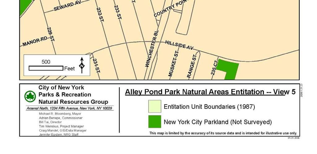
2 Alley Pond Park Natural Area Mapping & Inventory Surveyed December acres Introduction City of New York Parks & Recreation (DPR) manages one of the most extensive and varied park systems of any city in the world. These 29,000 acres of city park property occupy about 15 percent of New York City s total area. In addition to flagship parks such as Central Park and Prospect Park, the city s parklands include over 11,000 acres of natural areas. Until the 1980 s, the Parks Department was primarily concerned with developed landscapes and recreation facilities rather than natural areas. In the absence of a comprehensive management policy, these areas succumbed to invasive species, pollution and erosion. In 1984, Parks established the Natural Resources Group (NRG) with a mandate to acquire, restore and manage natural areas in New York City. The wetlands, forests, meadows, and shorelines under NRG s jurisdiction provide valuable habitat for hundreds of species, from rare wildflowers to endangered birds of prey. In addition to the goals mentioned above, NRG serves as a clearinghouse for technical research to aid in the protection and restoration of the city's natural resources. This inventory of Alley Pond Park was conducted in 1987 as part of NRG s commitment to improving the natural areas of New York City parks. Alley Pond Park, the second largest park in Queens, is located approximately one mile from the Nassau County border. The north end of the park is an estuary, where freshwater draining off the land flows into the saltwater of Little Neck Bay. This area hosts wetlands and meadows. The forested upland area in the south end of the park exhibits the knob and kettle topography typical of glaciated landscapes. Many of the kettles are now filled with ponds. In addition, the hills are dotted with glacial erratics. These are large boulders that were transported by the moving ice, then left stranded as the ice sheets melted. Much of Alley Pond Park s marshland was filled throughout the twentieth century to make way for active recreational uses and highways. The remaining natural areas were susceptible to problems such as invasion by Phragmites, the common reed. This species is less beneficial to the ecosystem than native salt marsh cordgrass. Since the 1960 s, citizens have successfully prompted action to restore and preserve the Alley wetlands. Alley Pond Environmental Center (APEC) was founded in 1972 to promote environmental education in public schools. To facilitate the protection, management and restoration of Alley Pond Park, NRG completed an inventory of the area using entitation, a process of identifying and describing ecologically distinct plant communities. Using aerial photographs and field reconnaissance, Parks staff delineated distinct ecological entities, known as entitation units, based on cover type, understory structure, species composition, and topography. Evidence of historical use, current use, environmental disturbance, and additional notes were also recorded for each unit. Entitation of Alley Pond Park resulted in a map and database that can be used to locate valuable and threatened areas. They also serve as a baseline for measuring change over time. Entitation Entitation is a type of plant community inventory well suited to the patchy environments often found in urban areas. Originally designed for European landscapes, the system was revised by NRG in 1985 for use in urban parkland. NRG has used entitation widely and successfully to facilitate acquisition and restoration decisions. Put simply, entitation is a process of breaking up a park into manageable parts called entities or entitation units. Entitation units are defined using a weighted list of criteria. The first level of distinction is 2
3 based on cover type (e.g. closed forest, vineland, scrub), followed by canopy species composition, understory type (e.g. herbs, vines, shrubs), and understory species composition. Additional factors, such as topography and soil condition (e.g. wet, moist, dry) are also taken into account. To prepare for fieldwork, mapping technicians examine aerial photographs and delineate areas of similar cover. The mapping staff use the aerial information to create a strategy for covering land area. In the field, boundaries are identified as described above. For each unit, staff record the data listed above, as well as current uses, environmental disturbances, historical indicators, community stability, and comments. In December 1987, in Alley Pond Park, workers identified 364 discrete vegetation units. Some of these units include multiple, non-contiguous sections. Of approximately 686 park acres entitated, 214 were classified as forest or woodland, 12 as scrub, 77 as herbaceous community, 29 as vineland, 7 as intertidal, 5 as aquatic plant, 1 as wetland, and 19 as desert. 3


4 4


5 5


6 6


7 7


8 8


9 9
10 Unit: 1 Acreage: Woodland Red oak >30' Picnic Compaction Deciduous Black oak >30' Campfire Fire Hemicryptophytes London planetree >30' Yes Foot traffic Undulating Cool season grass <5' Maintained, manicured woodland throughout Alley Pond Park. Over 50 year old trees. Mower compacts soil; few wildflowers make it to flowering before being cut. Edges allowed to grow wildflowers; grass 10" high in some spots here. Other trees in area: flowering dogwood, American beech, sweetgum, sycamore maple, Sassafras, pin oak, silver maple, black locust, and others. Herbaceous species include CSG, path rush, mugwort, lamb's quarters, goldenrod, white wood aster, moss etc. A lot of tulip tree, white oak, and hickory spp. in southeastern section. Unit: 2 Acreage: 1.10 Herbaceous Mugwort <5' & 5-30' Yes Road Dumping Cool season grass <5' Vehicle Compaction Hemicryptophytes Foot traffic Auto Level Herbaceous border along park's edges. In the part that is mowed CSG is dominant. Cars pull off the side of the road here fairly often and there are spots where the soil is compacted. Access blocked in spots by berms, which are either in this unit or adjacent ones. Herbaceous species include dogbane, dandelion, everlasting pea, goldenrod, poor-man's-pepper, clover, and curly dock. Lianas spreading from adjacent areas. 10
11 Unit: 3 Acreage: 3.57 Vineland Bittersweet All Yes Road Foot traffic Dumping Deciduous Poison ivy All Full-crown Vehicle Dirt berms Lianas Black cherry All Slope Sassafras <5' & 5-30' Pin oak >30' & 5-30' Flowering dogwood 5-30' Vineland of bittersweet, poison ivy, wild grape, Japanese honeysuckle, and Virginia creeper that stretches along parks' border at 53rd Ave. Multitude of tree species-- dogwood and hawthorn plantings that have been invaded by Norway maple, black cherry, and Sassafras. Species composition is very mixed and is changing. MC: because of access problems, dumping, and liana growth (yet good wildlife area). Small pocket of black locust, plus gray birch, red oak, pin oak, sycamore maple, crab apple, white ash. Unit: 4 Acreage: 1.86 Woodland Pin oak All Foot traffic Erosion Deciduous Black oak <5' & >30' Vehicle Compaction Phanerophytes Black cherry <5' & 5-30' Picnic Trash Slope Cool season grass <5' Mugwort <5' Yes An area surrendered by the Parks Dept. Once was a lawn area but hasn t been mowed that often, and the result is the encroachment from the woods. Pioneering species like black cherry and grey birch. Other species: mimosa, white ash, crab apple, deadly nightshade, plenty of aster and poison ivy, path rush, hawkweed, Queen Anne s lace, Rubus, common plantain, wild chicory, smartweed, Virginia creeper, bittersweet, butter-and-eggs, knapweed, Indian hemp, goldenrod, flowering dogwood, and catbrier. 11
12 Unit: 5 Acreage: Herbaceous Cool season grass <5' Sports Compaction Plantain spp. <5' Foot traffic Hemicryptophytes Picnic Level Areas of managed ballfilelds. Well maintained. Scattered trees. Unit: 6 Acreage: 0.14 Herbaceous Cool season grass <5' Foot traffic Knapweed <5' Hemicryptophytes Poison ivy <5' Level Small herb. unit that separates the half of unit 4 which is adj. to paved pathway from the half that borders 53rd Ave. MC: Knapweed is abundant herb and is a good food source for butterflies; also, poison ivy is invading the field. Other species include: mugwort, rose, and dogbane. 12
13 Unit: 7 Acreage: 0.76 Closed forest Pin oak >30' Foot traffic Deciduous Flowering dogwood 5'-30' Phanerophytes Sycamore maple >30' Yes Level Privet sp. 5'-30' Yes Moist Black cherry 5'-30' Bittersweet 5-30'&<5 A closed forest unit adjacent to ballfields and the corner of Springfield Boulevard and 76th Street. One dead tree on the ground. Other species: mugwort, Virginia creeper, black haw, hawthorn, goldenrod, Aster, wineberry, curly dock, burdock, and white snakeroot. Very rich area for mushrooms of the Amanita and Boletus genera. Unit: 8 Acreage: 0.70 Closed forest Pin oak >30' Hedgerow Vehicle Grass dump Deciduous Ornamental shrubs 5'-30' Road Foot traffic Trash Phanerophytes Dumping Level A planted double strip of pin oaks with a hedgerow of CSG along the road is mowed occasionally. Other species: common plantain, lamb's quarters, Norway maple, arrowwood, poison ivy, wood sorrel, black locust, mountain ash, black cherry, mugwort, deadly nightshade, flowering dogwood, wineberry, Asiatic dayflower, crab apple, and smartweed. 13
14 Unit: 9 Acreage: 4.83 Desert Vehicle Trash Foot traffic Level Various parking lots of various shapes and sizes in various locations. Various hemicryptophytes present, such as mugwort, common plantain, CSG, as well as occasional tree rows. Unit: 10 Acreage: 0.58 Closed forest Red maple >30' Foot traffic Dumping Deciduous Black cherry All Vehicle Trash Phanerophytes Norway maple All Yes Level Moist A moist area with abundant red maple. Other trees include: swamp white oak, pin oak, black oak, Sassafras, dogwood, and American hornbeam. The area is bordered by a road where dumping of branches, leaves and lawn clippings occurs frequently. Dirt berms were created to prevent dumping. Other species: rose, hawthorn, poison ivy, Virginia creeper, bittersweet, Aster, mugwort, Rubus, pokeweed, lamb's quarters, smartweed, arrowwood, wineberry, and ornamental shrubs. 14
15 Unit: 11 Acreage: 0.54 Vineland Bittersweet <5' & 5-30' Yes Picnic site Foot traffic Deciduous Black cherry All Lianas Gray birch <5' & 5-30' Slope Poison ivy <5' & 5-30' Vineland adjacent to manicured parkland, picnic area, unit 1. Lianas very thick, only sparse in a few areas. A lot of birds present. Area was probably an old picnic spot - evidence of old sites (metal poles, brackets, stone slabs, etc.) Small part of unit near 76th Avenue; black oak regeneration occurring here. Other species include mulberry, goldenrod, Virginia creeper, black birch, wood sorrel, wineberry, mugwort, pokeweed, Sassafras, etc. MC: good wildlife habitat. Unit: 12 Acreage: 0.49 Closed forest Gray birch <5' & 5-30' Picnic site Foot traffic Erosion Deciduous Black cherry <5' & 5-30' Hemicryptophytes Slope Nice area, predominantly grey birch with a carpet of CSG. Surrounding units contain many lianas that may encroach upon this unit, therefore a management concern. Many birds utilize area. Possible former picnic site. Both black cherry and grey birch regenerating; grey birch in clonal patches. Other species--goldenrod, black oak, pin oak, Sassafras, Japanese yew, Japanese honeysuckle, moss, wineberry, mulberry, bay berry, poison ivy, mugwort, etc. 15
16 Unit: 13 Acreage: 0.33 Closed forest Black cherry All Road Compaction Deciduous Gray birch 5'-30' Picnic site Lianas Bittersweet All Yes Slope Norway maple All Yes MC: the area is evolving into a vineland and will eventually shade out and kill the trees. Grey birch is on its way out as the bittersweet is becoming dominant in the unit. There is some black cherry regeneration, but more Norway maple regeneration. There is Virginia knotweed, Aster, rose, burdock, true and false Solomon's seal, path rush, enchanter's nightshade, Sassafras, American beech, and mapleleaf Viburnum. Unit: 14 Acreage: 0.20 Closed forest Sassafras All Road Foot traffic Erosion Deciduous Black cherry All Picnic site Vehicle Phanerophytes Mugwort <5' Yes Campfire Slope Management concern due to the severe erosion taking place on the slopes of the unit. Other trees in the unit include: pin oak, black oak, black birch, red maple, Norway maple, white poplar, grey birch, Virginia creeper, enchanter's nightshade, rough avens, goldenrod, Rubus, false Solomon's seal, rose, wild grape and a lot of leaf litter. Additional management concern because lianas are threatening in and around the unit. 16
17 Unit: 15 Acreage: 1.20 Closed forest Gray birch <5' & 5-30' Road Foot traffic Deciduous Bittersweet <5' & 5-30' Yes Lianas Black cherry <5' & 5-30' Slope Wild grape All Poison ivy <5' & 5-30' Red oak All Emergent vineland encompassing a gray birch-black cherry closed forest. Above lianas engulfing many of the trees. Although there is a small amount of red oak, it is regenerating nicely in one spot. MC: because of liana control. Unit is a haven for birds. Other species are deadly nightshade, black birch, mapleleaf viburnum, Rubus, catbrier, Virginia creeper, bayberry, hickory regeneration, rose, Sassafras, mugwort, and swamp white oak. Unit: 16 Acreage: 1.08 Closed forest Black berry All Full-crown Foot traffic Compaction Deciduous Sassafras All Vehicle Trash Phanerophytes Gray birch All Campfire Vandalism Slope Pin oak >30' Black oak <5' & >30' Bittersweet All Yes This unit has plenty of black cherry and Sassafras regeneration occurring. Numerous patches of bittersweet, wineberry, wild grape, rose, and mugwort. Full crown tree plantings of pin oaks near unit 1. The area is used often by picnickers who barbecue and litter. Other species: CSG, false Solomon s seal, Aster, Rubus, catbrier, rough avens, poison ivy, enchanter's nightshade, Virginia creeper, pokeweed, and goldenrod. MC: control the lianas. 17
18 Unit: 17 Acreage: 1.12 Closed forest Gray birch 5'-30' Cribbing Foot traffic Erosion Deciduous Red oak >30' & 5-30' Road Vehicle Trash Phanerophytes Sassafras All Dumping Slope Black cherry All Black birch All The species composition is changing here because the grey birch (pioneering species) is now being shaded out. Species such as red oak are moving in and regenerating. Unit is a management concern because there is serious erosion problems on the steep slopes. Other species: hawthorn (regenerating), American beech, goldenrod, Aster, poison ivy, Virginia creeper, Japanese honeysuckle, mugwort, CSG, rose, moss, butter--and--eggs, bayberry, and bittersweet. Unit: 18 Acreage: 0.33 Vineland Poison ivy <5' & 5-30' Foot traffic Fire Deciduous Bittersweet <5' & 5-30' Yes Campfire Compaction Lianas Virginia creeper <5' Trash Depression Black cherry All Ailanthus All Yes Sassafras All Small, shallow depression that has recently burned. There has been a recent resurgence of growth. MC: because lianas will grow into canopy that was open by the fire. Vines may grow into adjacent areas too. Other species: red oak, wild grape, jewelweed, Rubus, pokeweed, wineberry, Virginia knotweed, etc. 18
19 Unit: 19 Acreage: 0.47 Closed forest Gray birch 5'-30' Road Deciduous Sassafras All Phanerophytes Black cherry All Slope Red oak All Flowering dogwood <5' & 5-30' Poison ivy <5 & 5-30 A unit dominated by grey birch that has a paved path along one of its borders. The grass is cut along the pathway often. The grey birch is dying back, while the red oak and Sassafras are regenerating and becoming more dominant. The unit slopes towards a depression. Parts of the forest floor is covered with poison ivy. Other species are: hickory spp, pin oak, wild grape, flowering dogwood, rose, CSG, goldenrod, Virginia creeper, Aster, mapleleaf viburnum, false Solomon s seal, mugwort, Japanese Honeysuckle, Rubus, and American beech. Unit: 20 Acreage: 0.06 Vineland Bittersweet All Yes Foot traffic Erosion Deciduous Norway maple <5' & 5-30' Yes Vehicle Trash Red oak <5' & 5-30' MC: it is the border of the park and there is the issue of aesthetics and the problem of dumping. Also, the vineland itself is a management problem. The trees are covered by bittersweet, which will eventually kill them. Other species: black cherry, sycamore maple, CSG, Rubus, mugwort, and poison ivy. 19
20 Unit: 21 Acreage: 0.05 Vineland Bittersweet All Yes Road Foot traffic Deciduous Wild grape <5' & 5-30' Vehicle Lianas Sassafras All Level Virginia creeper All Poison ivy <5' & 5-30' A small pocket of lianas growing on both roads. Vines dominate the vegetation and are choking the trees. At entitation time, a female cardinal was making a nest here. MC: Lianas control. Other species: rose, Rubus, wineberry, smartweed, red oak, black locust regeneration, white poplar, mugwort, Japanese honeysuckle, grey birch, Aster, CSG, Virginia knotweed, rough avens, etc. Unit: 22 Acreage: 0.22 Closed forest Black locust >30' & 5-30' Yes Cribbing Erosion Deciduous Norway maple 5'-30' Yes Road Phanerophytes Black cherry All Slope Rose <5' Yes Dense growth closed forest bordering 73rd Avenue. Understory is sparse and consists of Norway maple saplings and swamp white oak saplings. Ground cover includes some rose and some black cherry (<5'), but is mostly leaf litter. Unit observed after heavy rain; evidence of soil erosion, gully at east end of unit. Other species are Pachysandra, swamp white oak, bittersweet, Japanese honeysuckle, Aster, grey birch, pin oak, Virginia creeper, black birch, red oak, and true Solomon s seal. 20
21 Unit: 23 Acreage: 0.34 Closed forest American beech All Foot traffic Erosion Deciduous Sassafras All Vehicle Phanerophytes Norway maple <5' & 5-30' Yes Picnic Slope Flowering dogwood <5' & 5-30' Red oak All Sweet cherry >30' &5-30" Sloping closed forest leading into a moist, depressed area. Unit is a mixture of the above mentioned species. Also some huge black and red oaks present. There is some dogwood, cherry, and oak regeneration; it is difficult to tell if it is sweet/black cherry regenerating. MC because of erosion problems. Other species include: wild grape, poison ivy, Japanese honeysuckle, Norway maple, Aster, basswood, black birch, wineberry, and rose. Unit: 24 Acreage: 0.35 Closed forest Gray birch <5' & 5-30' Road Foot traffic Wood dump Deciduous Sassafras All Old roadbed Vehicle Phanerophytes Flowering dogwood <5' & 5-30' Level Black cherry All The forest floor is covered by Aster, Virginia creeper, and some poison ivy. The grey birch are dying back and there is plenty of grey birch decomposition. Old grassy path on edge of unit. Other species are: true and false Solomon s seal, mapleleaf viburnum, wild grape, black oak, arrowwood, Japanese honeysuckle, Rubus, wineberry, Virginia knotweed, path rush, and black birch. 21
22 Unit: 25 Acreage: 3.02 Closed forest Black birch >30' & 5-30' Picnic site Foot traffic Erosion Deciduous Black oak All Campfire Compaction Chamaephytes Red oak All Leaf dump Slope Norway maple All Yes Mapleleaf viburnum <5' & 5-30' Rubus <5' & 5-30' MC: most of the unit has steep slopes that have erosion problems. The unit is large and varies depending on slope, soil composition, and erosion. At the bottom, in the kettle depression, is a large patch of wineberry, Rubus, rose, and poison ivy. The trees are large and provide a lot of shade, except in a few spots. Other species: Aster, bittersweet, flowering dogwood, Virginia creeper, mulberry, enchanter's nightshade, pokeweed, smartweed, Virginia knotweed, elderberry, basswood, Sassafras, tulip tree, etc. Unit: 26 Acreage: 2.79 Closed forest Black birch All Road Foot traffic Compaction Deciduous Black oak >30' Picnic site Picnic Dumping Lianas Black cherry All Vehicle Level Red maple >30' Moist Closed forest of birch-oak-cherry with some wet site species such as red maple. Majority of oaks and birch over 50'. Very little regeneration. Ground cover is a mix of chamaephytes, hemicryptophytes, and lianas. Lianas may be strangling any regeneration attempts. Portion of unit borders 76th Avenue; much of understory is open. Other species: spicebush, enchanter's nightshade, Aster, wineberry, goldenrod, Virginia creeper, wild grape, Virginia knotweed, rose, Japanese honeysuckle, bittersweet, Sassafras, grey birch, Norway maple, mulberry, etc. 22
23 Unit: 27 Acreage: 0.19 Closed forest Black cherry All Road Foot traffic Leaf dump Deciduous Black oak All Full-crown Trash Lianas Slope Unit borders 76th Avenue. Possibly a berm was created here because the slope towards the street is steep. Problems with dumping (mostly lawn clippings, etc.) some plantings (garden), and erosion. Oaks were probably planted. MC: because of above mentioned problems, and park's border should be protected and enhanced. Other trees are Norway maple, Sassafras and grey birch. Other species include: poison ivy, mugwort, rose and Asiatic dayflower. Unit: 28 Acreage: 0.62 Closed forest Black oak >30' & 5-30' Road Foot traffic Compaction Deciduous Black birch All Rock wall Vehicle Erosion Phanerophytes Flowering dogwood <5' & 5-30' Dumping Knoll Black cherry <5' & 5-30' Sassafras <5' & 5-30' Mapleleaf viburnum <5' This unit has many large black oaks but no signs of regeneration present. Regenerating species include grey birch, black birch, and some black locust and bitternut hickory regeneration. Unit borders the corner of 76th Street and Cloverdale Boulevard. It has many footpaths, including a paved one. Other species are: mapleleaf viburnum, catbrier, bittersweet, Aster, path rush, goldenrod, Rubus, CSG, mugwort, Virginia creeper, Virginia knotweed, rough avens, enchanter's nightshade, wineberry and spicebush. 23
24 Unit: 29 Acreage: 0.40 Closed forest Black locust All Yes Foot traffic Leaf dump Deciduous Ailanthus All Yes Vehicle Phanerophytes Mugwort <5' Yes Level Wild grape <5' & 5-30' Rose <5' Yes Poison ivy <5' This unit is the disturbed transition zone between the natural forest and the occasionally mowed strip along Cloverdale Blvd. Occasional incline towards the park pathway. The rose and poison ivy are evident only near the more natural, undisturbed area. Other species are: sweetgum, black cherry, Sassafras, silver maple, flowering dogwood, black birch, oak spp. (5-30'), mapleleaf viburnum, Japanese honeysuckle, great ragweed and dogbane. Unit: 30 Acreage: 0.20 Closed forest Black birch 5'-30' Foot traffic Erosion Deciduous Black cherry All Vehicle Compaction Lianas Virginia creeper <5' & 5-30' Slope Poison ivy <5' A sloping unit comprised of black birch with some black cherry. The ground cover is Virginia creeper, poison ivy, Aster, and mugwort. The unit is thin and long, and borders the path. Other species include Ailanthus, wild grape, honeysuckle spp., Norway maple, goldenrod, red oak, Virginia knotweed. There is also some oak regeneration. 24
25 Unit: 31 Acreage: 0.29 Closed forest Black cherry All Foot traffic Erosion Deciduous Red oak All Leaf dump Phanerophytes Black birch All Slope Gray birch <5' & 5-30' Flowering dogwood <5' & 5-30' Sweetgum <5' & 5-30' Small closed forest with a fairly even mixture of the above species. Many phanerophytes; poison ivy and Aster dominate the ground cover. Unit may be an ecotone of surrounding areas. Oak not as large as is usual in park. Some trees becoming engulfed by lianas (not as much as in rest of park). Unit near Cloverdale Boulevard. Other species are: Ailanthus, Norway maple, wild grape, bittersweet, rose, goldenrod, mugwort, honeysuckle spp., maple leaf viburnum, and Sassafras. Unit: 32 Acreage: 0.57 Closed forest White oak >30' Vehicle Compaction Deciduous Black birch >30' & 5-30' Phanerophytes Black cherry All Slope Hickory spp. >30' Black locust <5' & >30' Yes Sweetgum All A transitional unit of distinctive species that make up several surrounding units. The black locust and Sassafras are regenerating very well, while there is little, if any, oak regeneration. One side of this unit slopes toward the Vanderbilt Motor Parkway, but no erosion (at least not serious) is taking place. Other species: spicebush, bittersweet, red maple, Virginia creeper, Aster, poison ivy, Virginia knotweed, Sassafras (with plenty of regeneration), Rubus, catbrier, black cherry (<5'), Rose, flowering dogwood, etc. 25
26 Unit: 33 Acreage: 1.12 Desert Road Foot traffic Vehicle Dirt bikes Level Old Vanderbilt Motor Parkway. Unit: 34 Acreage: 1.56 Closed forest Red oak All Foot traffic Compaction Deciduous Hickory spp. >30' & 5-30' Vehicle Trash Phanerophytes Sassafras All Tree house Slope Flowering dogwood <5' & 5-30' Moist Spicebush <5' & 5-30' Rose <5' Yes MC: moist unit, high species diversity. Pockets of lianas and shrubs. Lianas are dense, large, and in certain areas they are killing some of the trees. There are many house cats in the unit. The area varies from large oak trees to young trees and dense stands of spicebush. Other species: Japanese honeysuckle, Trillium sp., Virginia creeper, devil's walking stick, black cherry, elderberry, sweetgum, Jack-in-the-pulpit, ferns, Aster, poison ivy, Virginia Knotweed, enchanter's nightshade, red maple, wild grape, catbrier, etc. 26
27 Unit: 35 Acreage: 0.21 Closed forest Black birch >30' & 5-30' Road Banks Foot traffic Erosion Deciduous Black cherry <5' & 5-30' Dirt bikes Phanerophytes Spicebush <5' & 5-30' Vehicle Slope Red maple <5' & 5-30' There is severe erosion and a lot of the soil has been washed out onto the Vanderbilt Motor parkway. MC: erosion problem; trees will probably fall soon, due to root exposure. Soil is barely covering 1/3 of the surface, while the remainder is vegetation leaf litter. Other species: Virginia knotweed, bittersweet, poison ivy, Rubus, wineberry, sweet cherry, Aster, tulip tree, flowering dogwood, red oak, hickory spp, enchanter's nightshade, true and false Solomon s seal. Some erosion control efforts have been made (cribbing and berm). Unit: 36 Acreage: 0.22 Closed forest Black locust All Yes Road Foot traffic Erosion Deciduous Ailanthus All Yes Lamppost Vehicle Trash Rose <5' Yes Compaction Slope MC: because of erosion on slopes and the trash scattered along the unit. This unit is the border of the park and runs along Kingsbury Avenue towards the Grand Central Parkway. There are pockets of Jack-in-the-pulpit along the slope. Other species: Asiatic dayflower, mugwort, Virginia creeper, great ragweed, Norway maple, Sassafras, sweetgum, black birch, flowering dogwood, bittersweet, poison ivy, Japanese honeysuckle, black cherry, hickory spp., red maple, and meadow rue. 27
28 Unit: 37 Acreage: 0.27 Scrub Spicebush <5' & 5-30' Deciduous Wild grape <5' & 5-30' Chamaephytes Jewelweed <5' Depression Moist Small depression with very tall spicebush that cover two sides of Vanderbilt Motor Parkway. Wild grape is beginning to choke out the spicebush by forming a blanket across the top of it. Part of unit is on the slope. Other species: mulberry, Rubus, Norway maple, red oak, black oak, hickory spp., Virginia knotweed, mugwort, and Viburnum spp. MC: wet site species propagation. Unit: 38 Acreage: 0.10 Vineland Wild grape All Road Trash Deciduous Bittersweet All Yes Dumping Lianas Rose <5' & 5-30' Yes Level Bindweed <5' & 5-30' Pokeweed <5' Mugwort <5' &5-30' Yes Two patches of lianas growing alongside Kingsbury Avenue. There has been a lot of growth here in two years as indicated by the aerial photos. MC: lianas are encompassing black cherry, Ailanthus, red maple, and Sassafras. Dumping and trash by roadside. Other species: deadly nightshade, Rubus, Asiatic dayflower, red oak, Virginia creeper, sycamore maple, Norway maple, etc. 28
29 Unit: 39 Acreage: 0.04 Vineland Virginia creeper <5' Road Foot traffic Erosion Deciduous Bittersweet <5' & 5-30' Yes Lianas Jewelweed <5' Slope Porcelain berry <5' Vineland which extends from Vanderbilt Motor Parkway to the underpass. Very little erosion, mostly within underpass on unit's edges. CSG lines this border. Other lianas are wild grape and poison ivy. There is also Rubus, Virginia knotweed, red oak, and avens. Jewelweed is growing alongside the Parkway where water drains into; it is also growing below the underpass where water collects. Unit: 40 Acreage: 0.06 Closed forest Black birch All Road Foot traffic Leaf dump Deciduous Red oak All Vehicle Erosion Phanerophytes Red maple All Dirt bikes Trash Slope Sweetgum <5' & >30' Flowering dogwood <5' & 5-30' American beech All Closed forest of birch/oak that extends along Vanderbilt Motor Parkway and crosses the road at a point. Patches of catbrier in unit. Other trees include: mulberry, Sassafras and black cherry. MC: Trees are not regenerating well - may be erosion/ compaction problems. Beech has clonal regeneration. One Eastern hemlock present that isn't doing too well. Other species: mugwort, mapleleaf viburnum, hickory spp., Asiatic dayflower, spicebush, poison ivy, arrowwood, Aster, Virginia knotweed, rose, bittersweet, etc. 29
30 Unit: 41 Acreage: 0.30 Herbaceous Mugwort <5' Yes Road Foot traffic Smooth sumac <5' & 5-30' Vehicle Chamaephytes Black cherry <5' & 5-30' Slope Mulberry <5' & 5-30' Poison ivy <5' Goldenrod <5' Unit 41 is bisected by the Vanderbilt Motor Parkway and is underneath the Grand Central Parkway. It slopes towards the Motor Parkway and then downhill towards units 42 & 49. The smooth sumac is increasing at a fast rate. Some black locust, sycamore maple, black cherry, mulberry, and crab apple are also invading the unit. Other spp.: Rubus, Ailanthus, pin oak, CSG, wineberry, Queen Anne's lace, evening primrose, chicory, great ragweed, smartweed, common milkweed, daisy fleabane, common mullein, mountain mint, cow vetch, etc. Unit: 42 Acreage: 1.66 Closed forest Red oak All Guard rails Foot traffic Deciduous Hickory spp. All Phanerophytes Norway maple <5' & 5-30' Yes Level Flowering dogwood <5' & 5-30' Vegetation along the border of the Vanderbilt Motor Parkway is representative of units 43 and 48 with the jewelweed and rose present. In the unit itself, there is a pathway that has been "landscaped" to an extent -i.e., rocks lining the trail and planted pachysandra. MC because of the oak-hickory forest and the regeneration taking place here, especially the invasive Norway maple. Lianas are invading along the Motor Parkway and the Grand Central Parkway entrance ramp. Other species are catbrier, Virginia knotweed, rough avens, poison ivy, Aster, etc. 30
31 Unit: 43 Acreage: 3.69 Closed forest Black locust >30' & 5-30' Yes Road Foot traffic Compaction Deciduous Black cherry 5'-30' Vehicle Dumping Phanerophytes Norway maple All Yes Level Ailanthus All Yes Poison ivy All Rose <5' Yes Closed forest border of park along Union Turnpike. Overstory primarily black locust and black cherry with a significant amount of Norway maple; the latter is regenerating the most. Virginia knotweed, jewelweed and lianas compose ground cover. MC: moist site and/ or dense ground cover in spots may be preventing regeneration of locust and cherry. Mugwort, goldenrod, Ailanthus (<5), poison ivy and Japanese honeysuckle growing near road. Other species: wineberry, box elder, wild lettuce, jewelweed, CSG, Virginia creeper, silver maple, etc. Unit: 44 Acreage: 0.42 Closed forest Norway maple All Yes Road Foot traffic Erosion Deciduous Black locust All Yes Vehicle Phanerophytes Ailanthus <5' & 5-30' Yes Slope Unit surrounds end of Vanderbilt Motor Parkway at Winchester Avenue. Slopes lead in all directions downward from Motor Parkway. Other trees include: American elm, black cherry, sycamore maple, mulberry and sweet cherry. Regeneration: a lot of Norway maple, some Ailanthus, no locust. Other species-- rose, poison ivy, bittersweet, purple flowering raspberry, mugwort, Virginia creeper, and jewelweed. 31
32 Unit: 45 Acreage: 0.18 Desert Deciduous Phanerophytes Level Foot traffic Vehicle Sports Community Board 13 - Recreation Resource Center. Managed lawn and ornamental shrubs, plus some trees surround the building located on Winchester Boulevard. Species include: Austrian pine, Scotch pine, Japanese barberry, Japanese yew, crab apple, deadly nightshade, pin oak, flowering dogwood, cool season grass and other ornamental shrubs. Unit: 46 Acreage: 6.61 Desert Hemicryptophytes Level Sports Paved (or other material) recreational areas in park such as handball courts, playgrounds, tennis courts, etc. Hemicryptophytes grow ground borders and/or in cracks. Occasionally London planetrees are included. Also there may be lianas growing on fences. 32
33 Unit: 47 Acreage: 0.48 Woodland Black locust <5' & >30' Yes Road Foot traffic Erosion Deciduous Rose <5' & 5-30' Yes Fence Lianas Virginia creeper All Depression Wild grape All Moist Box Elder <5' & 5-30' Jewelweed <5' &5-30' Emergent vineland. Pocket of lianas growing on black locust in a small depression divided by Vanderbilt Motor Parkway. Most likely, a culvert runs under Parkway here to allow drainage from tennis courts. A lot of wet indicator species - jewelweed, box elder, Trillium. Many eroded "paths" leading to area. Other side of road mostly jewelweed, rose, Japanese honeysuckle, and wild grape. MC: nice wildlife habitat and possible propagation of wet spp. here. Other species: wineberry, black cherry, Ailanthus, garlic mustard, Norway maple, poison ivy, etc. Unit: 48 Acreage: 1.89 Closed forest Black locust All Yes Road Foot traffic Erosion Deciduous Black cherry >30' & 5-30' Culvert Vehicle Trash Chamaephytes Rose <5' & 5-30' Yes Slope Box Elder All Moist Sycamore maple All Yes Poison ivy All Wet indicator species present, manage for this vegetation and the problems of erosion resulting from drainage of nearby fields and courts. This unit (on both sides of the road) is infested with rats; however, there are plenty of bird species and many rabbits. Erosion and flooding problems due to the many (10+) culverts draining into the area. Jewelweed and box elder around because of Excess water. Other species: Asiatic dayflower, Trillium spp., Virginia Knotweed, poison ivy, smartweed, Japanese. honeysuckle, wild grape, white ash, red maple, CSG, mugwort, etc. 33
34 Unit: 49 Acreage: 0.68 Closed forest Red oak All Road posts Foot traffic Dumping Deciduous Sassafras <5' & 5-30' Trash Lianas Black locust All Yes Level Rose <5' & 5-30' Yes Bittersweet <5' & 5-30' Yes Wild grape <5' &5-30' Small, trashed-out area near Grand central Parkway and adjacent to Vanderbilt Motor Parkway. Ground cover predominately rose and lianas. MC: because emergent vineland; oaks are regenerating, but not as well as they could. Parts of unit may collect water since some wet indicator species are present, such as spicebush and jewelweed. Old road/fence may have run through unit. Other species: hawthorn, white snakeroot, false Solomon's seal, poison ivy, Japanese honeysuckle, Virginia creeper, Aster, Ailanthus, etc. Unit: 50 Acreage: 0.57 Herbaceous Mugwort <5' & 5-30' Yes Fence Foot traffic Trash Cool season grass <5' Road Hemicryptophytes Slope A steep slope on the north side of the grand Central Parkway access road. Patches of mugwort among scattered wildflowers. Drainage pipe from road leads into pond. Two footpaths through unit. Other species: wild lettuce, common mullein, goldenrod, butter-and-eggs, Queen Anne's lace, a small patch of Rubus, common plantain, bittersweet, sweetgum, and some oak seedlings.. 34
35 Unit: 51 Acreage: 0.40 Closed forest Red oak >30' & 5-30' Full-crown Foot traffic Erosion Deciduous Flowering dogwood 5'-30' Bikes Compaction Hemicryptophytes Vehicle Trash Slope Moist MC: closed forest of red oak, which experiences a great deal of erosion and compaction from foot/bike traffic. Unit slopes toward Little Alley Pond. Some type of cribbing had been put in that is useless now and root exposure is rampant! Some patches of vegetation, but undergrowth is practically non-existent. Unit sees a lot of usage. Three big black oaks and some black birch present. Other species include: path rush, moss, American beech, bittersweet, poison ivy, sweetgum, spicebush, Aster, goldenrod, and mapleleaf viburnum. Unit: 52 Acreage: 3.43 Woodland Red oak >30' & 5-30' Road Compaction Deciduous Black oak >30' Picnic site Fire Chamaephytes Leaf dump Undulating Woodland of oaks that was a former picnic site; some picnicking still in spots. Fire evident; Rubus heavy in spots with other chamaephytes. Some fallen trees; some with basal fire scars. Large area. Ground cover primarily Rubus, wineberry, bittersweet, wild grape, Aster and path rush. Borderline lianas/chamaephytes (5'), but they are hindering regeneration. Other species: black cherry, Sassafras, mulberry, devil's walking stick, Virginia knotweed, garlic mustard, rough avens, goldenrod, mugwort, dogbane, pokeweed, catalpa (<5'), etc. 35
36 Unit: 53 Acreage: 0.36 Closed forest Red oak All Road Foot traffic Erosion Deciduous Black birch All Bikes Compaction Hemicryptophytes Flowering dogwood <5' & 5-30' Slope Small closed forest of very few trees, most of which are over 30'. Area is severely eroded due to natural actions and foot/bike traffic. Little/no groundcover except near base of trees and at unit edge. A built-up embankment, which slopes toward both a paved path and the Vanderbilt Motor Parkway. Root exposure evident. Other species include: serviceberry, black cherry, mapleleaf viburnum, CSG, Aster, poison ivy, Virginia creeper, black oak, hickory spp., black locust. Unit: 54 Acreage: 0.84 Closed forest Red oak >30' Kettle Foot traffic Erosion Deciduous American beech >30' Compaction Lianas Black oak All Slope Wild grape <5' & 5-30' Black birch All Flowering dogwood <5 &5-30' Plenty of regeneration taking place on the kettle slopes except where erosion and foot traffic are heavy. The regenerating species include tulip tree, Sassafras, sweetgum, flowering dogwood, black birch, and black cherry. The understory is covered in most parts with wild grape and some Rubus. Other species: spicebush, mapleleaf viburnum, Asiatic dayflower, ferns, bittersweet, CSG, Virginia creeper, Virginia knotweed, poison ivy, and black locust. Some erosion control efforts have been made using hay and asphalt. 36
37 Unit: 55 Acreage: 1.54 Closed forest Red oak All Water fntn. Foot traffic Deciduous American beech All Access Erosion Phanerophytes Black oak >30' & 5-30' Campfire Compaction Undulating Black birch <5' & 5-30' Flowering dogwood <5' & 5-30' Mapleleaf viburnum <5 & 5-30' The Northern red oak dominates unit 55 with remaining species not nearly as numerous. American beech may be regenerating, but it really, appears to be clonal. Sunlight reaches the forest floor; there are a few pockets of open space. Other trees include: hickory spp, Sassafras, white oak, sweetgum, black cherry, American hornbeam, tulip tree, mulberry. Other species: Aster, goldenrod, Virginia knotweed, spicebush, wineberry, Rubus, wild grape, bittersweet, Norway maple, Virginia creeper, honeysuckle sp., highbush blueberry, serviceberry, etc. Unit: 56 Acreage: 0.08 Herbaceous Cool season grass <5' Kettle Foot traffic Compaction Pokeweed <5' Picnic Erosion Hemicryptophytes Asiatic dayflower <5' Yes Campfire Depression Moist Old kettle hole which no longer holds water. Not as many wet sites here as some other areas. This unit may end up like unit 67 because of abundant organic matter and little vegetation. Some erosion, soil compaction problems. May be picnicking here since the depressions seem to be a favorite spot. Other species include: smartweed, jewelweed, and deadly nightshade. 37
38 Unit: 57 Acreage: 0.23 Closed forest Black oak >30' & 5-30' Old path Foot traffic Erosion Deciduous Red oak >30' Drnge ditch Vehicle Vandalism Phanerophytes American beech <5' & >30' Slope Black birch <5' & >30' Black cherry All Flowering dogwood <5 &5-30' A small unit that has two paths and a set of stairs in it. It overlooks the pond and has a large American elm snag. A few large trees in the unit with a lot of young trees and saplings coming in. The American beech doesn't seem to be regenerating, but there are many suckers sprouting from the roots. Other species: hickory spp., Sassafras, sweetgum, mulberry, wild grape, Virginia creeper, poison ivy, bittersweet, Aster, Rubus, CSG, mapleleaf viburnum, a good deal of young grey birch, catbrier, spicebush, and Viburnum sp. Unit: 58 Acreage: 0.10 Vineland Wild grape 5-30'&<5' Road Deciduous Jewelweed <5' Exotic Lianas Virginia creeper <5' Slope Bittersweet <5' Yes Moist Mugwort <5' Yes Small vineland strip, which gently slopes from paved pathways to Little Alley Pond. Wild grape growing over everything. Site is moist; jewelweed present. Hornet/wasp nest noted. A lot of bird activity here. Ornamental shrubs planted; may have been old picnic site in part of unit. Other species are ornamental shrubs, common ragweed, poison ivy, one sassafras tree, hawthorn, black cherry, rose, etc. MC because blocks view of pond, yet good for wildlife. 38
39 Unit: 59 Acreage: 2.17 Herbaceous Mugwort <5' Yes Foot traffic Pokeweed 5-30'&5' Hemicryptophytes Sweetgum >30' Level Fringed loosestrife <5' As evidenced by the aerial photo and the watermarks on trees, this unit was once part of Little Alley Pond. An unusually wet season had caused this area to flood; now it is a meadow with scattered trees. It is a wonderful spot for pheasant. Other species: goldenrod, Queen Anne's lace, evening primrose, lettuce spp., curly dock, cattails, mulberry (5'-30'), tulip tree (<5'), white vervain, cinquefoil, smartweed, burdock, Phragmites, and thistle. Unit: 60 Acreage: 0.39 Herbaceous Grass spp. <5' Foot traffic Trash Polygonum spp. <5' Bike/ ATV Hemicryptophytes Path rush <5' Picnic Slope Cabomba spp. <5' Yes Sandy area surrounding pond, which primarily contains grass and Polygonum spp. Some areas of unit are moist to the touch, and contain withered Cabomba flowers that were covered by water. MC: zonation caused by seasonal fluctuation of water level provides a good example of vegetation establishment in former lakes and ponds. Other species: goldenrod, cool season grasses, mugwort. 39
40 Unit: 61 Acreage: 0.60 Aquatic plant Cabomba sp. <5' Yes Dumping Unk. Grass <5' Trash Hydrophytes Depression Surface water A pond subject to dramatic fluctuations in water level. Cabomba spp. grows on 35% of the water surface and some grows on recently wet perimeter of pond. Border around pond is sandy, containing grass spp., clover, and Polygonum spp. MC: Pond is habitat for frogs and toads. Much dumping of logs, woody debris, and trash in pond. Seasonal variation in water level is evident from zonation of surrounding vegetation cover. Unit: 62 Acreage: 0.63 Closed forest Oak, red All Foot traffic Erosion Deciduous Black birch All Phanerophytes American beech All Slope Oak, black >30' A slope area along the eastern shore of Little Alley Pond with tall red oaks, black birch, and other trees that create a high upper canopy with an open understory. A few fallen, dead trees on the ground. Ground cover is ferns, CSG, mosses and regenerating trees. Soil creep with some gulleying evident on slope. Other species: Aster, pin oak, Sassafras, black cherry, grey birch, flowering dogwood, thistle, mapleleaf viburnum, pokeweed, Virginia creeper, evening primrose, goldenrod, hickory spp., etc. MC because of soil erosion. 40
41 Unit: 63 Acreage: 2.47 Closed forest Oak, red >30' Old path Foot traffic Dumping Deciduous Oak, black >30' Lianas Tulip tree All Undulating Bittersweet 5-30'&<5' Yes Black cherry 5-30'&<5' Virginia creeper <5' Closed forest of tall red oaks with scattered black oaks, tulip trees, and black cherries. Not much oak regeneration. Unit is an emergent vineland--lianas reaching into canopy. Large patches of Aster, Virginia creeper. Heavy leaf litter; some dumped prunings; several deadfalls. MC. Vine problems. Other species: Ailanthus, sweetgum, black tupelo, Rubus, wild grape, poison ivy, mint spp., pin oak, Jack-in-the-pulpit, Virginia knotweed, Sassafras, hickory spp., flowering dogwood, white ash. Unit: 64 Acreage: 1.65 Closed forest Oak, red All Picnic site Foot traffic Wdcp dump Deciduous Oak, black >30'&<5' Compaction Phanerophytes Hickory spp. >30' Undulating Black birch All American beech >30'&<5' Bittersweet >5-30'&<5' Yes Another closed forest with old benches much like unit 35, but more regeneration here. One large snag in unit. A lot of tulip tree saplings, but only one seedling tulip tree. A lot of wineberry, Rubus, Aster, and goldenrod, which a meadow-like condition under the trees. Other species: mint spp., devil s walking stick, flowering dogwood, red maple, Sassafras, Virginia creeper, wild grape, cool season grasses, etc. 41
42 Unit: 65 Acreage: 0.28 Woodland Oak, black >30' Foot traffic Erosion Deciduous Hickory spp. >30' Lianas Bittersweet 5-30'&<5' Yes Level Emergent vineland much like adjacent unit 35. There has been some regeneration here, which has become encompassed by vines. Many lianas growing into the taller trees. Unit borders the paved road. Other species are: burdock, Virginia knotweed, Rubus, wineberry, devil's walking stick, mulberry, poison ivy, black cherry, tulip tree, and grey birch. Unit: 66 Acreage: 1.29 Woodland Oak, red >30' Foot traffic Deciduous Oak, white >30' Lianas Oak, black >30' Depression Ailanthus 5'-30'&<5' Yes Moist Bittersweet 5'-30'&<5' Yes Wild grape All Unit with oak overstory of a few trees, which slopes down into a depressed area. A lot of regeneration of Ailanthus and devil's walking stick. Unit is becoming engulfed by lianas, which dominate the ground cover. Although part of unit does not have as many trees regenerating, the whole area will probably experience the same invasion of Ailanthus and devil's walking stick. A lot of the soil is moist, as indicated by such species as pokeweed and ferns. Other species include: mulberry, Rubus, wineberry, flowering dogwood, tulip tree, Sassafras, etc. 42
43 Unit: 67 Acreage: 0.92 Closed forest Oak, red >30' Sewer Campfire Erosion Deciduous Black birch >30'&5-30' Water Fntn. Foot traffic Compaction Chamaephytes American Beech >30'&<5' Vehicle access Trash Depression Oak, black >30' Flowering dogwood 5-30' Spicebush 5-30' &<5 Old kettle hole formation that has since dried up. Four red maple, under 15' (which appear to be dying), and spicebush present, but not really a wet site. Slope eroded, but not as bad as other areas in park. Vehicles and dirt bikes have been seen riding down slopes. Campfire rings present. Most of trees are along slope leading into depression; canopy open in middle of unit. MC: a lot of leaf litter-is it preventing regeneration? Other species: mapleleaf viburnum, wineberry, black cherry, Virginia knotweed, CSG, serviceberry, Norway maple, etc. Unit: 68 Acreage: 0.32 Closed forest Oak, black All Road Foot traffic Erosion Deciduous Oak, white All Full-crown tree Vehicle access Trash Chamaephytes Red maple >30'&5-30' Slope Sweetgum All Moist Spicebush 5'-30&<5 Flowering dogwood` 5-30'&<5' MC only because of the erosion near the steps and pathway. The understory is dominated by spicebush and there is also quite a bit of flowering dogwood. The stump of a former full crown tree supports a lot of mushroom growth. There is some regeneration of black cherry, American beech and tulip trees. Other species include: wild grape, Asiatic dayflower, goldenrod, pokeweed, deadly nightshade, wineberry, Virginia knotweed, mapleleaf viburnum, bittersweet, Rubus, Virginia creeper, Aster, American beech, tulip tree, black cherry and black birch. 43
44 Unit: 69 Acreage: 0.24 Closed forest Red oak >30' Road Foot traffic Dumping Deciduous Black oak >30' Full-crown tree Vehicle access Chamaephytes Hickory spp. >30' Undulating Flowering dogwood <5' & 5-30' Black birch <5' & 5-30' Mapleleaf viburnum <5' Small unit with older oak and hickory, and younger dogwood, birch, Ailanthus and devil's walking stick. A lot of wineberry and bittersweet, the latter beginning to grow on trees. Other species are: tulip tree (<5'), Aster, Virginia Knotweed, enchanter's nightshade, goldenrod, etc. Unit: 70 Acreage: 0.36 Closed forest American beech All Road Foot traffic Compaction Deciduous Flowering dogwood 5-30'&<5' Vehicle access Phanerophytes Mapleleaf viburnum <5' Undulating Small unit of American beech with clonal regeneration. Area adjacent to unit 87. Two large black oaks, some hickory, black birch (<5'), and tulip tree (<5'), present also. Dogwood and viburnum not as prolific, but enough to be noted. Lots of leaf litter. MC: one area where it is being dumped into depression and Aster on ground. 44
45 Unit: 71 Acreage: 0.73 Closed forest Hickory spp. >30' Foot traffic Deciduous Oak, red >30' Vehicle access Lianas Oak, white >30' Undulating Tulip tree All Flowering dogwood 5-30'&<5' Bittersweet 5-30'&<5' Yes Closed forest in a small valley leading to depression unit 72. Ground cover is leaf litter and lianas. Quite a bit of mapleleaf viburnum near unit's edge (87,69,70). Bittersweet taking over in spots. Other species: sweet cherry, two large black oaks, black birch, black black cherry, Ailanthus, wineberry, spicebush, Virginia creeper, Aster, Virginia knotweed, false Solomon s seal, pokeweed, and Sassafras. Unit: 72 Acreage: 0.12 Vineland Bittersweet <5' & 5-30' Yes Campfire Trash Deciduous Pokeweed <5' & 5-30' Foot traffic Fire Lianas Spicebush <5' & 5-30' Depression Rubus <5' Moist Deadly nightshade <5' This depression is a potential wetland as indicated by the species spicebush and pokeweed. However, bittersweet is choking and outcompeting the spicebush. Soil conditions are moist. MC: because of the lianas and the people who have barbecues and campfires in the depressions. Other species: Virginia creeper, smartweed, sweetgum, wineberry, black cherry, sweet cherry, tulip tree (5'), and Sassafras. 45
46 Unit: 73 Acreage: 0.54 Closed forest Red oak <5' & >30' Stairs Foot traffic Erosion Deciduous Black birch All Phanerophytes American beech All Slope White oak >30' Flowering dogwood <5' & 5-30' Severe erosion problems in this steeply sloped, closed forest. Unsuccessful attempts were made to control it with cribbing. Ground cover primarily bare soil and leaf litter. Much of the clonal beech regeneration is dying/dead. Shrubs planted along stair include: highbush blueberry, rose; also some maplewood viburnum here. MC: because of erosion problem, which adds to siltation of Muskrat Pond. Other species are: catbrier, Aster, goldenrod, CSG, Rubus, bittersweet, Virginia knotweed, red maple, poison ivy, black cherry, etc. Unit: 74 Acreage: 0.37 Woodland Red oak >30' Foot traffic Erosion Deciduous White oak >30' Compaction Hemicryptophytes Mugwort <5' Yes Slope Aster <5' Moist Small openings upslope from Muskrat Pond near woodland center. Overstory much like unit 1. Some erosion on the slope; grassy paths through unit. Other species: hickory spp., tulip tree (<5'), black birch (<5'), bittersweet, flowering dogwood, goldenrod, path rush, and wineberry. 46
Natural Area Mapping and Inventory of University Woods 2007 Survey
 Natural Area Mapping and Inventory of University Woods 2007 Survey Prepared by the Natural Resources Group Michael R. Bloomberg, Mayor Adrian Benepe, Commissioner Bill Tai, Director January 8, 2008 University
Natural Area Mapping and Inventory of Mosholu Parkway 2011 Survey
 Natural Area Mapping and Inventory of Mosholu Parkway 2011 Survey Prepared by: City of New York Parks & Recreation Forestry, Horticulture, and Natural Resources Michael R. Bloomberg, Mayor Veronica M.
Natural Area Mapping and Inventory of North Brother Island 1989 Survey
 Natural Area Mapping and Inventory of North Brother Island 1989 Survey Prepared by the Natural Resources Group Michael R. Bloomberg, Mayor Adrian Benepe, Commissioner North Brother Island Natural Area
Natural Area Mapping and Inventory of Ferry Point Park 2011 Survey
 Natural Area Mapping and Inventory of Ferry Point Park 2011 Survey Prepared by: City of New York Parks & Recreation Forestry, Horticulture, and Natural Resources Michael R. Bloomberg, Mayor Adrian Benepe,
Natural Area Mapping and Inventory of Kissena Park November 1986 Survey
 Natural Area Mapping and Inventory of Kissena Park November 1986 Survey Prepared by the Natural Resources Group Michael R. Bloomberg, Mayor Adrian Benepe, Commissioner Kissena Park Natural Area Mapping
Natural Area Mapping and Inventory of Henry Hudson Park 2007 Survey
 Natural Area Mapping and Inventory of Henry Hudson Park 2007 Survey Prepared by the Natural Resources Group Michael R. Bloomberg, Mayor Adrian Benepe, Commissioner Bill Tai, Director January 8, 2008 Henry
Natural Area Mapping and Inventory of Spuyten Duyvil Shorefront Park 2007 Survey
 Natural Area Mapping and Inventory of Spuyten Duyvil Shorefront Park 2007 Survey Prepared by the Natural Resources Group Michael R. Bloomberg, Mayor Adrian Benepe, Commissioner Bill Tai, Director January
Natural Area Mapping and Inventory of Seton Falls Park September 2007 Survey
 Natural Area Mapping and Inventory of Seton Falls Park September 2007 Survey Prepared by the Natural Resources Group Michael R. Bloomberg, Mayor Adrian Benepe, Commissioner Bill Tai, Director January 8,
Natural Area Mapping and Inventory of Pelham Bay Park Volume II Surveyed 2007
 Natural Area Mapping and Inventory of Pelham Bay Park Volume II Surveyed 2007 Prepared by the Natural Resources Group Michael R. Bloomberg, Mayor Adrian Benepe, Commissioner Bill Tai, Director January
Natural Area Mapping and Inventory of Arbutus Creek 1989 Survey
 Natural Area Mapping and Inventory of Arbutus Creek 1989 Survey Prepared by the Natural Resources Group Michael R. Bloomberg, Mayor Adrian Benepe, Commissioner Arbutus Creek Natural Area Mapping & Inventory
Long Pond Park Entitation Unit Descriptions, Surveyed New York City, Parks & Recreation, Natural Resources Group Page 1
 Page 1 Long Pond Park Natural Area Mapping & Inventory Surveyed 2014 116 acres Introduction City of New York Parks & Recreation (DPR) manages one of the most extensive and varied park systems of any city
Natural Area Mapping and Inventory of High Rock Park 2008 Survey
 Natural Area Mapping and Inventory of High Rock Park 2008 Survey Prepared by the Natural Resources Group & Greenbelt Administration Michael R. Bloomberg, Mayor Adrian Benepe, Commissioner Thomas A. Paulo,
Conference House Park Entitation Unit Descriptions, Surveyed 2012
 City of New York, Parks & Recreation, Natural Resources Group Page 1 Conference House Park Natural Area Mapping & Inventory Surveyed 2012 286.382 acres Introduction The City of New York Parks & Recreation
Natural Area Mapping and Inventory of Blood Root Valley Survey
 Natural Area Mapping and Inventory of Blood Root Valley 2011 2012 Survey Prepared by the Greenbelt Natural Resources Team Michael R. Bloomberg, Mayor Veronica M. White, Commissioner Adena L. Long, Staten
Natural Area Mapping and Inventory of Highbridge Park Final Report
 Natural Area Mapping and Inventory of Highbridge Park Final Report Natural Area Mapping and Inventory of Highbridge Park: Final Report for Environmental Protection Funds from the Hudson River Estuary Grant
Shoreline Protection by Native Vegetation
 Shoreline Protection by Native Vegetation Native Vegetation listed in this presentation protect both the shoreline and the water beyond. Various mixtures of these native species provide a filter that interrupts
Module 2. Classification. The Classification of Plants. We will discuss a few ways of classifying plants: Big vs. Small. Grass vs.
 Module 2 The Classification of Plants Classification We will discuss a few ways of classifying plants: Big vs. Small Grass vs. Tree Native vs. Introduced Invasive (Noxious) vs. Non-Invasive Trees vs. Shrubs
Southwest LRT Habitat Analysis. May 2016 Southwest LRT Project Technical Report
 Southwest LRT Habitat Analysis Southwest LRT Project Technical Report This page intentionally blank. Executive Summary This technical report describes the habitat analysis that was performed to support
Invasive Species in Your Backyard
 Invasive Species in Your Backyard Grand Traverse Regional Land Conservancy, Benzie Conservation District, Sleeping Bear Dunes National Lakeshore, Leelanau Conservancy, The Nature Conservancy, Saving Birds
How does erosion happen?
 How does erosion happen? By National Geographic, adapted by Newsela staff on 10.03.17 Word Count 682 Level 830L These rock formations, in Bryce Canyon National Park, Utah, are called hoodoos. Although
Florida Friendly Landscapes?
 Florida Friendly Landscapes? Backyards as Habitats Ecology Concepts Ecosystem interacting network of living and non-living components Community association of different species living and interacting in
Elevation (ft) Slope ( ) County CONDITION CATEGORY. Parameter Natural Condition Slightly impacted Moderately Impacted Heavily Impacted
 Slope ( ) County CONDITION CATEGORY. Parameter Natural Condition Slightly impacted Moderately Impacted Heavily Impacted") Version: 8/25/14 Meadow Name Date : / / MM DD YYYY GPS Location:. N. W GPS Datum (e.g., WGS 84, NAD 27) Elevation (ft) Slope ( ) County Watershed (HUC8) Landowner USGS Quad Name Observers: 7.5 or 15 (circle
Version: 8/25/14 Meadow Name Date : / / MM DD YYYY GPS Location:. N. W GPS Datum (e.g., WGS 84, NAD 27) Elevation (ft) Slope ( ) County Watershed (HUC8) Landowner USGS Quad Name Observers: 7.5 or 15 (circle
Stamp Area. Biology - Note Packet #55. Major Climate Change ( ) What are some causes of major changes (or disruptions) in an ecosystem?
 What are some causes of major changes (or disruptions) in an ecosystem?") Name: Mr. LaFranca s - Period Date: Aim: How do ecosystems change over time? Do Now: In I Am Legend, Will Smith s character is the last man in an abandoned NYC. Why do you think grass is overtaking (growing
Name: Mr. LaFranca s - Period Date: Aim: How do ecosystems change over time? Do Now: In I Am Legend, Will Smith s character is the last man in an abandoned NYC. Why do you think grass is overtaking (growing
ECOLOGICAL IMPACTS OF INVASIVE SPECIES. on Native Species and Ecosystems
 ECOLOGICAL IMPACTS OF INVASIVE SPECIES I. Competition on Native Species and Ecosystems II. Consumption (invasive species eat native species) III. Other deadly impacts on individuals and populations IV.
Hickory Hills Park: Invasive Species Management Plan Prepared by Colton Johnson, Animal Ecology, Iowa State University.
 Hickory Hills Park: Invasive Species Management Plan Prepared by Colton Johnson, Animal Ecology, Iowa State University Summer 2011 Above: Hickory Hills Park Left: Garlic Mustard Right: Autumn Olive 1 Record
Changes to Land 5.7B. landforms: features on the surface of Earth such as mountains, hills, dunes, oceans and rivers
 All the landforms on Earth have changed over time and continue to change. Many of the changes were caused by wind, moving water, and moving ice. Mountains have grown and shrunk. Rivers have cut away land
Ecological Succession
 Ecological Succession Primary succession will ALWAYS be on areas where there is NO SOIL a) bare rock from a retreating glacier, b) newly cooled lava; c) abandoned lot with an impervious surface (parking
Think about the landforms where you live. How do you think they have changed over time? How do you think they will change in the future?
 reflect All the landforms on Earth have changed over time and continue to change. Many of the changes were caused by wind, moving water, and moving ice. Mountains have grown and shrunk. Rivers have cut
Environmental Management 123 West Indiana Ave., Room 202 DeLand, FL (386) Environmental Management Outdoor Education
 Environmental Management Outdoor Education") Environmental Management 123 West Indiana Ave., Room 202 DeLand, FL 32720 (386) 736-5927 Environmental Management Outdoor Education 2015-2016 Environmental Management Education Offerings Botany Botany,
Environmental Management 123 West Indiana Ave., Room 202 DeLand, FL 32720 (386) 736-5927 Environmental Management Outdoor Education 2015-2016 Environmental Management Education Offerings Botany Botany,
Evaluating Wildlife Habitats
 Lesson C5 4 Evaluating Wildlife Habitats Unit C. Animal Wildlife Management Problem Area 5. Game Animals Management Lesson 4. Evaluating Wildlife Habitats New Mexico Content Standard: Pathway Strand: Natural
Changes in Texas Ecoregions
 Comment On Lesson Changes in Texas Ecoregions The state of Texas can be divided into 10 distinct areas based on unique combinations of vegetation, topography, landforms, wildlife, soil, rock, climate,
VILLAGE OF MAMARONECK
 VILLAGE OF MAMARONECK STREET TREE INVENTORY Inventory Conducted October 2013 Funding provided by USDA Forest Service Prepared by Hudson Valley Specialized Weekday Arborist Team (SWAT) SWAT Coordinator,
DETAILED DESCRIPTION OF STREAM CONDITIONS AND HABITAT TYPES IN REACH 4, REACH 5 AND REACH 6.
 DETAILED DESCRIPTION OF STREAM CONDITIONS AND HABITAT TYPES IN REACH 4, REACH 5 AND REACH 6. The Eklutna River was divided into study reaches (figure 1) prior to this site visit. Prominent geologic or
Organism Species Population Community Ecosystem
 Name: Date: Period: Ecosystems and Their Interactions S8.B.3.1 Getting the idea The environment is everything that surrounds an organism. Organisms cooperate and compete with each other to get everything
Adjacent Sewage Treatment Plant
 Allan S. Motter NJDEP/BEERA 609-984-4532 allan.motter@dep.state.nj.us Long Branch, Monmouth County, NJ 17 Acre Site Operated Approximately 1870-1961 Surrounding Land Use light industrial, i commercial,
Appendix E: Cowardin Classification Coding System
 Appendix E: Cowardin Classification Coding System The following summarizes the Cowardin classification coding system and the letters and numbers used to define the USFWS NWI wetland types and subtypes:
Chapter 7 Case study. Sand dune coastal environment: Studland Bay
 Sand dune coastal environment: Studland Bay Sand dunes are common features of low-lying stretches of coastline in the UK and elsewhere in the world. They form in places where there is a plentiful supply
Abiotic Dominant Dominant Factors Plants Animals
 TERRESTRIAL BIOMES Abiotic Dominant Dominant Factors Plants Animals Tropical Rain Forest Hot & wet year round Ferns Woody vines Broad leaved evergreen trees Sloths Jaguars Monkeys Toucans Tropical Dry
Exploring Plants and their Homes Post-Visit Activity
 Exploring Plants and their Homes Post-Visit Activity Overview This lesson will review and summarize the observations that students made during their visit to the Garden. This opportunity for students to
Purple Loosestrife Project Biocontrol Sites:
 Purple Loosestrife Project Biocontrol Sites: Interim results of a cooperative project between Michigan State University and Michigan Sea Grant Extension Photos, Maps and Layout by Jason K. Potter 2002
A Gallery of Important Insect Pollinators
 A Gallery of Important Insect Pollinators Bees Beetles Flies Wasps Butterflies Moths Who Are the Pollinators and What Do They Need to be Effective? Bees Attracted to bright white, yellow, orange, blue
Biomes. Biomes Are Life Zones
 Biomes Biomes Are Life Zones Biomes They Include All Plants Animals Other Organisms The Physical Environment In A Particular Area Biomes A Biome Is Characterized By Its Plant Life Biomes These Types Are
Squamish River Estuary
 Squamish River Estuary The Wildlife Management Area (WMA) was divided into the following sub-divisions (Fig 1) 1. Squamish River East Bank 2. Crescent Slough 3. Central Delta 4. Dredge Spoils 5. Uplands
Environmental Science: Biomes Test
 Name: Date: Pd. VERSION 1 Environmental Science: Biomes Test 1. Eland are large herbivores with loose skin under the throat and neck. This patch of skin aids in lowering the body temperature when temperatures
Name Hour. Section 4-1 The Role of Climate (pages 87-89) What Is Climate? (page 87) 1. How is weather different from climate?
 What Is Climate? (page 87) 1. How is weather different from climate?") Name Hour Section 4-1 The Role of Climate (pages 87-89) What Is Climate? (page 87) 1. How is weather different from climate? 2. What factors cause climate? The Greenhouse Effect (page 87) 3. Circle the
Name Hour Section 4-1 The Role of Climate (pages 87-89) What Is Climate? (page 87) 1. How is weather different from climate? 2. What factors cause climate? The Greenhouse Effect (page 87) 3. Circle the
remain on the trees all year long) Example: Beaverlodge, Alberta, Canada
 Example: Beaverlodge, Alberta, Canada") Coniferous Forest Temperature: -40 C to 20 C, average summer temperature is 10 C Precipitation: 300 to 900 millimeters of rain per year Vegetation: Coniferous-evergreen trees (trees that produce cones
Coniferous Forest Temperature: -40 C to 20 C, average summer temperature is 10 C Precipitation: 300 to 900 millimeters of rain per year Vegetation: Coniferous-evergreen trees (trees that produce cones
What is a Tree? Tree Biology 2012
 What is a Tree? Tree Biology 2012 Tree History Question What is the connection between this tree and the celestial body shown here? What is a Tree? Random House College Dictionary Definition: (1) a perennial
Field Content Description
 ECO_FOREST Field Names: ESS1, ESS2, ESS3, ESS4, ESS5, ESS6 Ms Mh M A Po Ew O Bw By Ad Ap Bd Iw Cp Cb Bn Be Hi Lh W Cw Sh Q Sw Sb S L B Ce Pw Pr Pj Ps He H Mx C Forest Species Red maple/manitoba maple/silver
Riparian Plants Along the Three Rivers of Pittsburgh
 Riparian Plants Along the Three Rivers of Pittsburgh Cephalanthus occidental is (buttonbush) I 3 Rivers-2nd Nature STUDIO for Creative Inquiry CArnegie Mellon University Pittsburgh, PA 2001 ".:1 = The
APPENDIX A REACH DECRIPTIONS. Quantico Creek Watershed Assessment April 2011
 APPENDIX A REACH DECRIPTIONS Basin 615, South Fork of Quantico Creek - Project Reach Descriptions Reach Name: 615-A Coordinates (NAD 83, Virginia State Plane North): 11796510.57, 6893938.95 to 11801555.79,
3.3 TXT + WKBK answers.docx Page 1 of 5
 3.3TXT+WKBKanswers.docx Page1of5 TEXTBOOK SECTION3.3ASSESSMENT,p.147 CheckYourUnderstandingAnswers CheckingConcepts 1.(a)Sampleanswer:Anexampleofanative speciesiswhitebarkpineintherocky MountainsorGarryoakinVancouver
Natural Shoreline Landscapes on Michigan Inland Lakes
 Natural Shoreline Landscapes on Michigan Inland Lakes Excerpts from Chapters 2 and 3 Photo Photo by Jane by Jane Herbert Herbert Did you know? Twenty-four species of amphibians, 25 species of reptiles,
exposed has to the this soil lowest water salinity. However in the fall, following a lot of Underground
 How deep it collects from Background information for Data Analysis for Mass Audubon s Salt Marsh Science Project* We are measuring salinity at different depths to see what conditions Phragmites, and other
Creating Pollinator Friendly Gardens and Landscapes. Sandra L. Mason University of Illinois Extension Educator Horticulture
 Creating Pollinator Friendly Gardens and Landscapes Sandra L. Mason University of Illinois Extension Educator Horticulture Pollinator Landscapes Wild Landscapes We All Need the Same Things Food, water,
Biomes Section 2. Chapter 6: Biomes Section 2: Forest Biomes DAY ONE
 Chapter 6: Biomes Section 2: Forest Biomes DAY ONE Of all the biomes in the world, forest biomes are the most widespread and the most diverse. The large trees of forests need a lot of water, so forests
CHAPTER 6 & 7 VOCABULARY
 CHAPTER 6 & 7 VOCABULARY 1. Biome 2. Climate 3. Latitude 4. Altitude 5. Emergent layer 6. Epiphyte 7. Understory 8. Permafrost 9. Wetland 10.Plankton 11.Nekton 12.Benthos 13.Littoral zone 14.Benthic zone
3.7 VISUAL RESOURCES Environmental Setting
 2 3 4 5 6 7 8 9 0 2 3 4 5 6 7 8 9 20 2 22 23 24 25 26 27 28 29 30 3 32 33 34 35 36 37 38 39 40 4 3.7 VISUAL RESOURCES This section assesses the effects of the treatment techniques on views from public
Global Biogeography. Natural Vegetation. Structure and Life-Forms of Plants. Terrestrial Ecosystems-The Biomes
 Global Biogeography Natural Vegetation Structure and Life-Forms of Plants Terrestrial Ecosystems-The Biomes Natural Vegetation natural vegetation is the plant cover that develops with little or no human
Gymnosperms. Section 22-4
 Gymnosperms Section 22-4 Seeds can be found everywhere! Gymnosperms - bear their seeds directly in the surfaces of cones conifers such as pines and spruces cycads which are palmlike plants ginkgoes gnetophytes
Review of Riparian Function Riparian Management Riparian Monitoring
 Review of Riparian Function Riparian Management Riparian Monitoring Water Shed Water Catchment Water catching creek Water shedding creek Properly functioning riparian area Properly Functioning Riparian
STRATUM Sample Survey of Street Trees. For City of Richmond, Urban Forestry Division
 STRATUM Sample Survey of Street Trees For City of Richmond, Urban Forestry Division Submitted by: Peter Girardi, Vice President Certified Arborist #MA-0657AT, International Society of Arboriculture Truetimber
INVASIVE PLANTS: NOXIOUS ALIEN INVADERS Q & A
 INVASIVE PLANTS: NOXIOUS ALIEN INVADERS Q & A (Compiled by Roslyn Moorhead and Anita Caveney) The purpose of this article is to inform people, especially Londoners, about invasive plant species, and encourage
Second Annual Monitoring Report Tidal Wetland Restoration 159 Long Neck Point Road, Darien, CT NAE
 1) Project Overview Second Annual Monitoring Report Tidal Wetland Restoration 159 Long Neck Point Road, Darien, CT NAE-2007-1130 December 13, 2013 This is the second year of a five year monitoring program
Environmental Science
 Environmental Science A Study of Interrelationships Cui Jiansheng Hebei University of Science and Technology CH06 Kinds of Ecosystems and Communities Chapter Objectives After reading this chapter, you
Ecology. Ecology terminology Biomes Succession Energy flow in ecosystems Loss of energy in a food chain
 Ecology Ecology terminology Biomes Succession Energy flow in ecosystems Loss of energy in a food chain Terminology Ecology- the study of the interactions of living organisms with one another and with their
4thscience_lifescience (4thscience_lifescience) 4. Which of the following would probably cause the MOST harm to a pond or stream?
 4. Which of the following would probably cause the MOST harm to a pond or stream?") Name: Date: 1. Whitetail deer live on the Cumberland Island National Seashore. What would make the deer population on the island smaller? A. people moving away from the island B. planting new trees in
Name: Date: 1. Whitetail deer live on the Cumberland Island National Seashore. What would make the deer population on the island smaller? A. people moving away from the island B. planting new trees in
TEST NAME: Biome Test 10/7 TEST ID: GRADE:05 - Fifth Grade SUBJECT:Life and Physical Sciences TEST CATEGORY: My Classroom
 TEST NAME: Biome Test 10/7 TEST ID:1239163 GRADE:05 - Fifth Grade SUBJECT:Life and Physical Sciences TEST CATEGORY: My Classroom Biome Test 10/7 Page 1 of 8 10/07/16, Biome Test 10/7 Student: Class: Date:
Landscape Design Series 2. Authored by Larry A. Sagers Horticulture Specialist Utah Sate University
 Landscape Design Series 2 Authored by Larry A. Sagers Horticulture Specialist Utah Sate University The image cannot be displayed. Your computer may not have enough memory to open the image, or the image
Global Patterns Gaston, K.J Nature 405. Benefit Diversity. Threats to Biodiversity
 Biodiversity Definitions the variability among living organisms from all sources, including, 'inter alia', terrestrial, marine, and other aquatic ecosystems, and the ecological complexes of which they
TRADITIONAL AND FIRE- RELATED SILVICULTURAL TECHNIQUES TO REGENERATE OAK RESULTS FROM NC SITE OF THE REGIONAL OAK STUDY
 TRADITIONAL AND FIRE- RELATED SILVICULTURAL TECHNIQUES TO REGENERATE OAK RESULTS FROM NC SITE OF THE REGIONAL OAK STUDY BACKGROUND Difficulty in regenerating oak has been identified by many resource practitioners
Manual of. Plant Formation Entitation
 Manual of Plant Formation Entitation Natural Resources Group New York City Department of Parks & Recreation 1986 Revised 1988 Digitized 2004 Contents Maps, Figures, Appendices, and Tables 3 List of Contributors
Shoreline and Climate Change Adaptation Alternatives for The Letter Parcel, Bolinas Lagoon
 Shoreline and Climate Change Adaptation Alternatives for The Letter Parcel, Bolinas Lagoon Scenic shoreline vista of Bolinas Lagoon and ridges, from Letter Parcel, March 2016 Peter Baye, Coastal Ecologist
Beekeeping in Urban Areas. Where to put your bees!
 Beekeeping in Urban Areas Where to put your bees! Check the laws in your area Go online Regulations such as distance from property lines Neighbors signatures Considerations Neighbors Pools Fences Dogs
> True/False Indicate whether the statement is true or false.
 Class: Date: Biology Chapter 3 Test: Communities, Bionics, and Ecosystems > True/False Indicate whether the statement is true or false. 1. The main abiotic distinction between temperate grassland and tropical
The Earth s Ecosystems
 CHAPTER 17 DIRECTED READING WORKSHEET The Earth s Ecosystems As you read Chapter 17, which begins on page 414 of your textbook, answer the following questions. Would You Believe...? (p. 414) 1. How does
Table 9. FAI accession log
 Table 9. FAI-02045 accession log UA Accession # FS # Depth (cm BS) Artifact Type n= Material Color UA2010-187-0001 1 5-10 utilized flake 1 basalt black UA2010-187-0002 2 5-10 flake 1 chert black UA2010-187-0003
Exploring Invasive Plant Species: A Case Study Using Japanese Barberry and Garlic Mustard. Melanie Goral, BSc MSc (PhD Candidate) April 2013
 April 2013") Exploring Invasive Plant Species: A Case Study Using Japanese Barberry and Garlic Mustard Melanie Goral, BSc MSc (PhD Candidate) April 2013 Overview 1. PhD Project & Objectives 2. Invasive Plant Species
Exploring Invasive Plant Species: A Case Study Using Japanese Barberry and Garlic Mustard Melanie Goral, BSc MSc (PhD Candidate) April 2013 Overview 1. PhD Project & Objectives 2. Invasive Plant Species
Willow Pond Introduction
 Name: Willow Pond Introduction Pond Ecosystems An ecosystem is made up of both biotic (living) and abiotic (non-living) components. Biotic elements include plants, animals, fungi, and microorganisms. Some
Name Hour. Chapter 4 Review
 Name Hour Chapter 4 Review 1. The average, year-after-year conditions of temperature and precipitation within a particular region are its weather. climate. greenhouse effect. d. biotic factors. 2. The
Animals: Habitats & Adaptations
 Animals: Habitats & Adaptations 3.2.1 Illustrate the life cycles of seed plants and various animals and summarize how they grow and are adapted to conditions within their habitats. 3.2.2 Explain how physical
Section A: Multiple choice (30 Marks)
") Grade 7 Science Unit 1 SAMPLE TEST Section A: Multiple choice (30 Marks) 1. Which term defines a group of interacting living and non-living things? A. community B. ecosystem C. habitat D. niche 2. Which
Grade 7 Science Unit 1 SAMPLE TEST Section A: Multiple choice (30 Marks) 1. Which term defines a group of interacting living and non-living things? A. community B. ecosystem C. habitat D. niche 2. Which
Burren National Park. Nature Trail
 Burren National Park Nature Trail DO NOT KNOCK WALLS KEEP DOGS ON LEAD DO NOT MOVE ROCKS DO NOT PARK ON ROAD VERGES DO NOT SCARE ANIMALS TAKE LITTER HOME DO NOT PICK PLANTS TAKE RAIN GEAR AND BOOTS WITH
APPENDIX B. NMFWRI Field Inventory Summary for Three L Canyon, pre-treatment (2008 and 2009) and post-treatment (2013)
 and post-treatment (2013)") SACRAMENTO MOUNTAINS WATERSHED STUDY APPENDIX B NMFWRI Field Inventory Summary for Three L Canyon, pre-treatment (2008 and 2009) and post-treatment (2013) These documents describe efforts and results from
SACRAMENTO MOUNTAINS WATERSHED STUDY APPENDIX B NMFWRI Field Inventory Summary for Three L Canyon, pre-treatment (2008 and 2009) and post-treatment (2013) These documents describe efforts and results from
B - Requires a sheltered position. Prefers a moist soil.
 BROWN BROTHERS COMPANY Trees and Plants Attractive to Birds (From 1925 Brown Bros. Co. catalogue with notations added concerning invasive caveats for natural areas or in the garden) A -Very hardy. B -
Huron Creek Watershed 2005 Land Use Map
 Huron Creek Watershed 2005 Land Use Map Created By: Linda Kersten, 12/20/06 Created For: MTU Introduction to GIS Class (FW 5550) The Huron Creek Watershed Advisory Committee Michigan Technological University,
Instream Erosion Control General
 Instream Erosion Control General EROSION CONTROL TECHNIQUES Revegetation Temperate Climates Short-Term Non Vegetation Wet Tropics Long-Term Weed Control [1] Semi-Arid Zones Permanent [1] Weed control attributes
Chapter 52 An Introduction to Ecology and the Biosphere
 Chapter 52 An Introduction to Ecology and the Biosphere Ecology The study of the interactions between organisms and their environment. Ecology Integrates all areas of biological research and informs environmental
Battle Tactics from Camp Ripley, The War on Invasive Species
 Battle Tactics from Camp Ripley, The War on Invasive Species Kayla Malone maka0811@stcloudstate.edu Camp Ripley, MN Camp Ripley is a 53,000-acre regional training facility for our military, federal, state,
Can you see the difference between wind pollinated and insect pollinated flowers?
 Can you see the difference between wind pollinated and insect pollinated flowers? Age of Students: 10 14 years Duration: 1 hour Summary Institute: National Botanic Garden of Belgium. Lesson developed by:
U.S. Fish & Wildlife Service. Attracting Pollinators to Your Garden
 U.S. Fish & Wildlife Service Attracting Pollinators to Your Garden Why are Pollinators Important? Pollinators are nearly as important as sunlight, soil and water to the reproductive success of over 75%
Natural Shoreline Landscapes on Michigan Inland Lakes
 Natural Shoreline Landscapes on Michigan Inland Lakes Excerpts from Chapters 2 and 3 Photo Photo by Jane by Jane Herbert Herbert Session topics Characteristics of natural and altered shorelines Lakes,
What Is Climate? (page 87) The Greenhouse Effect (page 87) Section 4-1 The Role of Climate (pages 87-89) Chapter 4 Ecosystems and Communities
 The Greenhouse Effect (page 87) Section 4-1 The Role of Climate (pages 87-89) Chapter 4 Ecosystems and Communities") Chapter 4 Ecosystems and Communities Section 4-1 The Role of Climate (pages 87-89) This section explains how the greenhouse effect maintains the biosphere's temperature range. It also describes Earth's
Chapter 4 Ecosystems and Communities Section 4-1 The Role of Climate (pages 87-89) This section explains how the greenhouse effect maintains the biosphere's temperature range. It also describes Earth's
Wonders of the Rainforest Resource Book
 E-BOOK CODE: REAU5021 Special School Photocopy Master Edition Wonders of the Rainforest Resource Book IMSI by Jane Bourke Wonders of the Rainforest Contents Contents... 3 Learning About Rainforests...
Prepared by Henry Mann, Nature Enthusiast/Naturalist for the Pasadena Ski and Nature Park
 Prepared by Henry Mann, Nature Enthusiast/Naturalist for the Pasadena Ski and Nature Park Numerous wildflowers bloom along the PSNP ski trails from spring to autumn, each in their own season. Some are
How does the physical environment influence communities and ecosystems? Hoodoos in Cappadocia, Turkey
 Biomes of the World How does the physical environment influence communities and ecosystems? Hoodoos in Cappadocia, Turkey ecosystems are shaped by: abiotic factors climate/weather space Rainfall Soil air
Organism Interactions in Ecosystems
 Organism Interactions in Ecosystems Have you ever grown a plant or taken care of a pet? If so, you know they have certain needs such as water or warmth. Plants need sunlight to grow. Animals need food
Earth processes are dynamic actions that occur both on
 29 Weathering, Erosion, and Deposition R EA D I N G Earth processes are dynamic actions that occur both on the earth s surface and inside the earth. Any process that breaks down earth material, such as
NOSE HILL PARK LINEAR BIRD TRANSECTS 2006
 NOSE HILL PARK LINEAR BIRD TRANSECTS 2006 Prepared by: Sweetgrass Consultants Ltd. Calgary, AB For: CITY OF CALGARY PARKS January 2007 Sweetgrass Consultants Ltd. 15112 Deer Run Dr. S.E. Calgary, AB T2J
BIOMES. Copyright Cmassengale
 BIOMES Biogeography - study of where organisms live Continental drift - slow motion of continents Dispersal of organisms Movement of organisms from 1 place to another Dispersal is usually caused by wind,
All species evolve characteristics, features or behaviours that allow them to survive in a certain habitat (or environment)
") What is adaptation? All species evolve characteristics, features or behaviours that allow them to survive in a certain habitat (or environment) o Animals and plants living in different habitats need different
What is adaptation? All species evolve characteristics, features or behaviours that allow them to survive in a certain habitat (or environment) o Animals and plants living in different habitats need different