Energy and Mass Balance Snow Model. Department of Civil and Environmental Engineering University of Washington
|
|
|
- Clemence Johnson
- 5 years ago
- Views:
Transcription


1 SnowSTAR2002 STAR2002 TransectReconstruction ti Ui Using a Multilayered Energy and Mass Balance Snow Model Xiaogang Shi and Dennis P. Lettenmaier Department of Civil and Environmental Engineering University of Washington UW-UBC symposium / September 26, 2008
2 Contents Motivation and Research Questions SnowSTAR2002 Snow Model and Microwave Emission Model Precipitation Rescaling and Evaluation Results and Discussion i
3 Motivation Changes in Snow Cover Extent VIC simulation ( ) (Adam et al. 2004) Snow cover extent (duration and depth) is decreasing in the Arctic. Current ground snow observations in the Arctic: 1) sparse observation network 2) unable to capture the spatial variability of snow over large areas. Retrieval of SWE is complicated by the dependence of microwave emission signal on snow microphysical properties, in particular, snow temperature, density, and grain size. The measured snow profiles along the SnowSTAR2002 transect can provide a unique opportunity to improve our understanding di for this important source of error in SWE retrieval algorithm.
4 Research Questions 1) Does the snow model have the ability to recover observed microphysical structures of snowpack in the study domain? 2) What s the sensitivity of microwave emission model to difference in simulated and observed snowpack microphysical properties? What s the magnitude of error for brightness temperatures?
5 Experimental Design SnowSTAR2002 Snow Model Interpolated ERA-40 reanalysis data on the observation sites Precipitation Rescaling Microwave Emission Model Simulated Brightness Temperatures (Snow Model V.S. SnowSTAR2002)
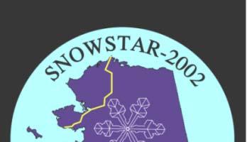

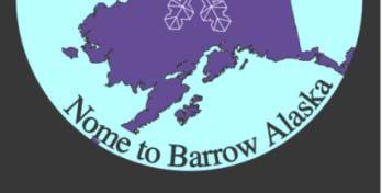


6 SnowSTAR2002STAR2002 Route Length: about 1200 kilometers Period: March 24 - April 26, 2002 Data: SWE and profiles of snow properties
7 Snow Model SNTHERM (Jordan 1991) Physically-based y 1-D snow model. Accounts for the snowpack mass and energy balance in multiple layers. S n... s 1 s 0 Simulates profiles of snow microphysical properties, such as snow density, grain size, and temperature. Initial conditions of snow and soil: the run starts from the date without snowfall. Schematic diagram of SNTHERM model

8 Microwave Emission Model MEMLS (Mätzler et al. 1999) 1. Calculates brightness temperature from a multi-layer snow medium. 2. The absorption coefficient is derived from snow density, frequency and temperature. 3. The scattering coefficient depends on the correlation length, density, and frequency. 4 Inputs include snow depth 4. Inputs include snow depth, temperature, density, ground temperature and correlation length for each layer.
9 Cumulative precipitation comparison between the ERA-40 and observed data at Indian Pass Precipitation (mm) Cumulative /9/ /9/2001 2/9/2002 4/9/2002 6/9/2002 Date OBS_P ERA40
10 Rescaling ERA-40 precipitation Data 1 For the day of a SnowSTAR2002 observation, we defined a ratio R* of the observed SWE SWE* to the accumulated ERA 40 precipitation P* up to the measurement date: R* = SWE*/P* 2. This ratio R* was applied to rescale ERA 40 precipitation on all days starting with the beginning of the winter season so as to produce a rescaled ERA 40 precipitation time series. 3. We assume that all winter precipitation either adds to SWE or is sublimated (i.e., we assume that the effect of winter melt is negligible), therefore SWE on the measurement date is given by: SWE = P S 4. The rescaled precipitation at any time is given by: P =ΔSWE (1 + S/SWE) where S is the sublimation rate. ΔSWE is the successive difference of SWE over the time step (e.g., g, daily). Adjusting the ratio of the sublimation to snow water equivalent ( S/SWE) allows solution for the rescaled precipitation from ERA 40, and in particular, we force the predicted SWE to match on the observation date.
11 Evaluation of therescaling method Indian Pass (61.07N,149.49W) April 1, 2002 Relative RMSE: 8.9% Munson Ridge (64.85N,146.21W) April 15, 2002 Relative RMSE: 9.8%


12 SNTHERM V.S. SnowSTAR The comparison of snowpack profiles at 4 sample stations evenly distributed on the transect. 2. The mean absolute error (MAE) between model simulation and field measurements along the SnowSTAR2002 transect.
13 Elevation Snow Depth
14 Comparison of snowpack temperature profiles
15 Comparison of snowpack density profiles
16 Comparison of snow grain size profiles
:76 Maximum:20")

17 Maximum:700 Minmum:82 Mean (MAE):76 Maximum:20 Minmum:0.1 Mean (MAE):1.2 High:-0.5 Low:-23.3 Mean (MAE):1.8
18 SNTHERM/MEMLS V.S. SnowSTAR2002/MEMLS Comparison of modeled brightness temperatures RMSE = 1.5K RMSE = 8.7K RMSE = 5.9K RMSE = 6.2K
19 Conclusions 1. SNTHERM has the ability to recover observed snow microphysical structures along the SnowSTAR2002 transect. In particular, it does quite well for profile simulations of snow temperature, less well for snow density and snow grain size. 2. Comparison of simulated brightness temperatures showed quite good agreement between SNTHERM/MEMLS and SnowSTAR2002/MEMLS. The error is generally lower than the effects of mixed land cover types over large satellite footprints. These results are encouraging and imply that model simulation of snow microphysical profiles is a viable strategy for retrieval of SWE from passive microwave remote sensing data. Reference: Shi, X., M. Sturm, G. E. Liston, R. E. Jordan, and D. P. Lettenmaier, 2008: SnowSTAR2002 transect reconstruction using a multilayered energy and mass balance snow mode l, J. of Hydrometeorology (in review).
SEA ICE MICROWAVE EMISSION MODELLING APPLICATIONS
 SEA ICE MICROWAVE EMISSION MODELLING APPLICATIONS R. T. Tonboe, S. Andersen, R. S. Gill Danish Meteorological Institute, Lyngbyvej 100, DK-2100 Copenhagen Ø, Denmark Tel.:+45 39 15 73 49, e-mail: rtt@dmi.dk
THE ROLE OF MICROSTRUCTURE IN FORWARD MODELING AND DATA ASSIMILATION SCHEMES: A CASE STUDY IN THE KERN RIVER, SIERRA NEVADA, USA
 MICHAEL DURAND (DURAND.8@OSU.EDU), DONGYUE LI, STEVE MARGULIS Photo: Danielle Perrot THE ROLE OF MICROSTRUCTURE IN FORWARD MODELING AND DATA ASSIMILATION SCHEMES: A CASE STUDY IN THE KERN RIVER, SIERRA
Snow on sea ice retrieval using microwave radiometer data. Rasmus Tonboe and Lise Kilic Danish Meteorological Institute Observatoire de Paris
 Snow on sea ice retrieval using microwave radiometer data Rasmus Tonboe and Lise Kilic Danish Meteorological Institute Observatoire de Paris We know something about snow The temperature gradient within
Remote Sensing of SWE in Canada
 Remote Sensing of SWE in Canada Anne Walker Climate Research Division, Environment Canada Polar Snowfall Hydrology Mission Workshop, June 26-28, 2007 Satellite Remote Sensing Snow Cover Optical -- Snow
Evaluation of sub-kilometric numerical simulations of C-band radar backscatter over the french Alps against Sentinel-1 observations
 Evaluation of sub-kilometric numerical simulations of C-band radar backscatter over the french Alps against Sentinel-1 observations Gaëlle Veyssière, Fatima Karbou, Samuel Morin, Matthieu Lafaysse Monterey,
Using MODIS imagery to validate the spatial representation of snow cover extent obtained from SWAT in a data-scarce Chilean Andean watershed
 Using MODIS imagery to validate the spatial representation of snow cover extent obtained from SWAT in a data-scarce Chilean Andean watershed Alejandra Stehr 1, Oscar Link 2, Mauricio Aguayo 1 1 Centro
Souris River Basin Spring Runoff Outlook As of March 15, 2018
 Souris River Basin Spring Runoff Outlook As of March 15, 2018 Prepared by: Flow Forecasting & Operations Planning Water Security Agency Basin Conditions Summer rainfall in 2017 in the Saskatchewan portion
How complex should a snow model be?
 How complex should a snow model be? Xu Liang 1 and Seongeun Jeong 2 1 Department of Civil and Environmental Engineering University of Pittsburgh 2 Department of Civil and Environmental Engineering University
Towards the use of SAR observations from Sentinel-1 to study snowpack properties in Alpine regions
 Towards the use of SAR observations from Sentinel-1 to study snowpack properties in Alpine regions Gaëlle Veyssière, Fatima Karbou, Samuel Morin et Vincent Vionnet CNRM-GAME /Centre d Etude de la Neige
Winter Precipitation, Sublimation, and Snow-Depth in the Pan-Arctic: Critical Processes and a Half Century of Change
 Winter Precipitation, Sublimation, and Snow-Depth in the Pan-Arctic: Critical Processes and a Half Century of Change PI s: Glen E. Liston, Colorado State University Larry J. Mahrt, Oregon State University
Observing Snow: Conventional Measurements, Satellite and Airborne Remote Sensing. Chris Derksen Climate Research Division, ECCC
 Observing Snow: Conventional Measurements, Satellite and Airborne Remote Sensing Chris Derksen Climate Research Division, ECCC Outline Three Snow Lectures: 1. Why you should care about snow 2. How we measure
Land Data Assimilation at NCEP NLDAS Project Overview, ECMWF HEPEX 2004
 Dag.Lohmann@noaa.gov, Land Data Assimilation at NCEP NLDAS Project Overview, ECMWF HEPEX 2004 Land Data Assimilation at NCEP: Strategic Lessons Learned from the North American Land Data Assimilation System
Validation of satellite derived snow cover data records with surface networks and m ulti-dataset inter-comparisons
 Validation of satellite derived snow cover data records with surface networks and m ulti-dataset inter-comparisons Chris Derksen Climate Research Division Environment Canada Thanks to our data providers:
Studying snow cover in European Russia with the use of remote sensing methods
 40 Remote Sensing and GIS for Hydrology and Water Resources (IAHS Publ. 368, 2015) (Proceedings RSHS14 and ICGRHWE14, Guangzhou, China, August 2014). Studying snow cover in European Russia with the use
SIMULATION OF SPACEBORNE MICROWAVE RADIOMETER MEASUREMENTS OF SNOW COVER FROM IN-SITU DATA AND EMISSION MODELS
 SIMULATION OF SPACEBORNE MICROWAVE RADIOMETER MEASUREMENTS OF SNOW COVER FROM IN-SITU DATA AND EMISSION MODELS Anna Kontu 1 and Jouni Pulliainen 1 1. Finnish Meteorological Institute, Arctic Research,
NOAA Snow Map Climate Data Record Generated at Rutgers
 NOAA Snow Map Climate Data Record Generated at Rutgers David A. Robinson Rutgers University Piscataway, NJ Snow Watch 2013 Downsview, Ontario January 29, 2013 December 2012 snow extent departures Motivation
Helsinki Testbed - a contribution to NASA's Global Precipitation Measurement (GPM) mission
 mission") Helsinki Testbed - a contribution to NASA's Global Precipitation Measurement (GPM) mission Ubicasting workshop, September 10, 2008 Jarkko Koskinen, Jarmo Koistinen, Jouni Pulliainen, Elena Saltikoff, David
Helsinki Testbed - a contribution to NASA's Global Precipitation Measurement (GPM) mission Ubicasting workshop, September 10, 2008 Jarkko Koskinen, Jarmo Koistinen, Jouni Pulliainen, Elena Saltikoff, David
Canadian Prairie Snow Cover Variability
 Canadian Prairie Snow Cover Variability Chris Derksen, Ross Brown, Murray MacKay, Anne Walker Climate Research Division Environment Canada Ongoing Activities: Snow Cover Variability and Links to Atmospheric
COMPARISON OF GROUND-BASED OBSERVATIONS OF SNOW SLABS WITH EMISSION MODELS
 MICROSNOW2 Columbia, MD, 13-15 July 2015 COMPARISON OF GROUND-BASED OBSERVATIONS OF SNOW SLABS WITH EMISSION MODELS William Maslanka Mel Sandells, Robert Gurney (University of Reading) Juha Lemmetyinen,
Snow Data Assimilation
 Snow Data Assimilation Andrew G. Slater 1 and Martyn P. Clark 2 1 National Snow & Ice Data Centre (NSIDC), University of Colorado 2 National Institute of Water and Atmospheric Research (NIWA), New Zealand
P1.34 MULTISEASONALVALIDATION OF GOES-BASED INSOLATION ESTIMATES. Jason A. Otkin*, Martha C. Anderson*, and John R. Mecikalski #
 P1.34 MULTISEASONALVALIDATION OF GOES-BASED INSOLATION ESTIMATES Jason A. Otkin*, Martha C. Anderson*, and John R. Mecikalski # *Cooperative Institute for Meteorological Satellite Studies, University of
School on Modelling Tools and Capacity Building in Climate and Public Health April Remote Sensing
 2453-5 School on Modelling Tools and Capacity Building in Climate and Public Health 15-26 April 2013 Remote Sensing CECCATO Pietro International Research Institute for Climate and Society, IRI The Earth
Jennifer Jacobs, Bryan Carignan, and Carrie Vuyovich. Environmental Research Group University of New Hampshire
 Jennifer Jacobs, Bryan Carignan, and Carrie Vuyovich Environmental Research Group University of New Hampshire New Hampshire Water Conference March 21, 2014 Funding Provided By: NASA 1 Precipitation is
Multi- Sensor Ground- based Microwave Snow Experiment at Altay, CHINA
 Multi- Sensor Ground- based Microwave Snow Experiment at Altay, CHINA Jiancheng Shi 1, Chuan Xiong 1, Jinmei Pan 1, Tao Che 2, Tianjie Zhao 1, Haokui Xu 1, Lu Hu 1, Xiang Ji 1, Shunli Chang 3, Suhong Liu
Discritnination of a wet snow cover using passive tnicrowa ve satellite data
 Annals of Glaciology 17 1993 International Glaciological Society Discritnination of a wet snow cover using passive tnicrowa ve satellite data A. E. WALKER AND B. E. GOODISON Canadian Climate Centre, 4905
MODIS True Color Terra image from from NASA WorldView (worldview.earthdata.nasa.gov)
") Estimating the snowpack with remote sensing MODIS True Color Terra image from 2016-09-07 from NASA WorldView (worldview.earthdata.nasa.gov) Edward (Ned) Bair, Ph.D. Earth Research Institute, University
Estimating the snowpack with remote sensing MODIS True Color Terra image from 2016-09-07 from NASA WorldView (worldview.earthdata.nasa.gov) Edward (Ned) Bair, Ph.D. Earth Research Institute, University
Climate Models and Snow: Projections and Predictions, Decades to Days
 Climate Models and Snow: Projections and Predictions, Decades to Days Outline Three Snow Lectures: 1. Why you should care about snow 2. How we measure snow 3. Snow and climate modeling The observational
Souris River Basin Spring Runoff Outlook As of March 1, 2019
 Souris River Basin Spring Runoff Outlook As of March 1, 2019 Prepared by: Flow Forecasting & Operations Planning Water Security Agency Basin Conditions Summer rainfall in 2018 over the Saskatchewan portion
Assessment of Snow Cover Vulnerability over the Qinghai-Tibetan Plateau
 ADVANCES IN CLIMATE CHANGE RESEARCH 2(2): 93 100, 2011 www.climatechange.cn DOI: 10.3724/SP.J.1248.2011.00093 ARTICLE Assessment of Snow Cover Vulnerability over the Qinghai-Tibetan Plateau Lijuan Ma 1,
Snowcover accumulation and soil temperature at sites in the western Canadian Arctic
 Snowcover accumulation and soil temperature at sites in the western Canadian Arctic Philip Marsh 1, C. Cuell 1, S. Endrizzi 1, M. Sturm 2, M. Russell 1, C. Onclin 1, and J. Pomeroy 3 1. National Hydrology
Preliminary Runoff Outlook February 2018
 Preliminary Runoff Outlook February 2018 Prepared by: Flow Forecasting & Operations Planning Water Security Agency General Overview The Water Security Agency (WSA) is preparing for 2018 spring runoff including
Water information system advances American River basin. Roger Bales, Martha Conklin, Steve Glaser, Bob Rice & collaborators UC: SNRI & CITRIS
 Water information system advances American River basin Roger Bales, Martha Conklin, Steve Glaser, Bob Rice & collaborators UC: SNRI & CITRIS Opportunities Unprecedented level of information from low-cost
Prediction of Snow Water Equivalent in the Snake River Basin
 Hobbs et al. Seasonal Forecasting 1 Jon Hobbs Steve Guimond Nate Snook Meteorology 455 Seasonal Forecasting Prediction of Snow Water Equivalent in the Snake River Basin Abstract Mountainous regions of
Moisture transport to Syowa Station and Dome Fuji Station, Antarctica
 Session 5: Science Using Ground-Based and Satellite Measurements Moisture transport to Syowa Station and Dome Fuji Station, Antarctica Kazue Suzuki, Takashi Yamanouchi, Naohiko Hirasawa and Hideaki Motoyama
Real Time Snow Water Equivalent (SWE) Simulation March 29, 2015 Sierra Nevada Mountains, California
 Simulation March 29, 2015 Sierra Nevada Mountains, California") Real Time Snow Water Equivalent (SWE) Simulation March 29, 2015 Sierra Nevada Mountains, California Introduction We have developed a real-time SWE estimation scheme based on historical SWE reconstructions
Real Time Snow Water Equivalent (SWE) Simulation March 29, 2015 Sierra Nevada Mountains, California Introduction We have developed a real-time SWE estimation scheme based on historical SWE reconstructions
The Importance of Snowmelt Runoff Modeling for Sustainable Development and Disaster Prevention
 The Importance of Snowmelt Runoff Modeling for Sustainable Development and Disaster Prevention Muzafar Malikov Space Research Centre Academy of Sciences Republic of Uzbekistan Water H 2 O Gas - Water Vapor
Passive Microwave Physics & Basics. Edward Kim NASA/GSFC
 Passive Microwave Physics & Basics Edward Kim NASA/GSFC ed.kim@nasa.gov NASA Snow Remote Sensing Workshop, Boulder CO, Aug 14 16, 2013 1 Contents How does passive microwave sensing of snow work? What are
Real Time Snow Water Equivalent (SWE) Simulation February 5, 2014 Sierra Nevada Mountains, California
 Simulation February 5, 2014 Sierra Nevada Mountains, California") Real Time Snow Water Equivalent (SWE) Simulation February 5, 2014 Sierra Nevada Mountains, California Introduction We have developed a real-time SWE estimation scheme based on historical SWE reconstructions
Real Time Snow Water Equivalent (SWE) Simulation February 5, 2014 Sierra Nevada Mountains, California Introduction We have developed a real-time SWE estimation scheme based on historical SWE reconstructions
SMOSIce L-Band Radiometry for Sea Ice Applications
 Institute of Environmental Physics University of Bremen SMOSIce L-Band Radiometry for Sea Ice Applications Georg Heygster 1), Christian Haas 2), Lars Kaleschke 3), Helge Rebhan 5), Detlef Stammer 3), Rasmus
Retrieving Snowfall Rate with Satellite Passive Microwave Measurements
 Retrieving Snowfall Rate with Satellite Passive Microwave Measurements Huan Meng 1, Ralph Ferraro 1, Banghua Yan 1, Cezar Kongoli 2, Nai-Yu Wang 2, Jun Dong 2, Limin Zhao 1 1 NOAA/NESDIS, USA 2 Earth System
Validation of passive microwave snow algorithms
 Remote Sensing and Hydrology 2000 (Proceedings of a symposium held at Santa Fe, New Mexico, USA, April 2000). IAHS Publ. no. 267, 2001. 87 Validation of passive microwave snow algorithms RICHARD L. ARMSTRONG
ESA GlobSnow - project overview
 ESA GlobSnow - project overview GCW 1 st Implementation meeting Geneve, 23 Nov. 2011 K. Luojus & J. Pulliainen (FMI) + R. Solberg (NR) Finnish Meteorological Institute 1.12.2011 1 ESA GlobSnow ESA-GlobSnow
ASSESSMENT OF NORTHERN HEMISPHERE SWE DATASETS IN THE ESA SNOWPEX INITIATIVE
 ASSESSMENT OF NORTHERN HEMISPHERE SWE DATASETS IN THE ESA SNOWPEX INITIATIVE Kari Luojus 1), Jouni Pulliainen 1), Matias Takala 1), Juha Lemmetyinen 1), Chris Derksen 2), Lawrence Mudryk 2), Michael Kern
Jessica Lundquist 1, Paul Neiman 3, Brooks Martner 2,3, Allen White 2,3, Dan Gottas 2,3, Marty Ralph 3
 PRELIMINARY STUDY RESULTS Rain versus Snow in the Sierra Nevada, CA: Comparing free-air observations of melting level with surface measurements Jessica Lundquist 1, Paul Neiman 3, Brooks Martner 2,3, Allen
2 nd Asia CryoNet Workshop Current methods of measurement of the cryosphere in Asia consistency and issues
 2 nd Asia CryoNet Workshop Current methods of measurement of the cryosphere in Asia consistency and issues Dongqi Zhang, Cunde Xiao, Vladimir Aizen and Wolfgang Schöner Feb.5, 2016, Salekhard, Russia 1.
Remote sensing with FAAM to evaluate model performance
 Remote sensing with FAAM to evaluate model performance YOPP-UK Workshop Chawn Harlow, Exeter 10 November 2015 Contents This presentation covers the following areas Introduce myself Focus of radiation research
An investigation of sampling efficiency using historical data. Patrick Didier Advisor: Justine Blanford
 An investigation of sampling efficiency using historical data Patrick Didier Advisor: Justine Blanford Overview Introduction to Airborne Snow Survey program Goals of the Capstone Project Methods and Expected
Annual September Arctic Sea ice extent
 Annual September Arctic Sea ice extent 1979-2012 Annual September Arctic Sea ice extent 1979-2012 Notes: The month of September has the minimum sea ice cover each year. Passive microwave instruments on
ASimultaneousRadiometricand Gravimetric Framework
 Towards Multisensor Snow Assimilation: ASimultaneousRadiometricand Gravimetric Framework Assistant Professor, University of Maryland Department of Civil and Environmental Engineering September 8 th, 2014
Incorporating Effects of Forest Litter in a Snow Process Model
 57th EASTERN SNOW CONFERENCE Syracuse, New York, USA, 2000 Incorporating Effects of Forest Litter in a Snow Process Model ABSTRACT J. P. H A R D Y, 1 R. MELLOH, 1 P. ROBINSON, 1 AND R. JORDAN 1 N e t s
A Prototype Precipitation Retrieval Algorithm Over Land for SSMIS and ATMS
 A Prototype Precipitation Retrieval Algorithm Over Land for SSMIS and ATMS Yalei You 1, Nai-Yu Wang 2, Ralph Ferraro 2 1 CICS-MD/ESSIC/UMD 2 STAR/NESDIS/NOAA Background Our group provided the level-2 rainfall
Analysis and Estimation of Snowpack Properties Using CLPX Data. (NESDIS), Camp Springs, MD
, Camp Springs, MD") Analysis and Estimation of Snowpack Properties Using CLPX Data Amir E Azar *, Dugwon Seo, Al Powell, Reza Khanbilvardi, NOAA-CREST, City University of New York, New York, NY NOAA/ National Environmental
Analysis and Estimation of Snowpack Properties Using CLPX Data Amir E Azar *, Dugwon Seo, Al Powell, Reza Khanbilvardi, NOAA-CREST, City University of New York, New York, NY NOAA/ National Environmental
Estimation of snow surface temperature for NW Himalayan regions using passive microwave satellite data
 Indian Journal of Radio & Space Physics Vol 42, February 2013, pp 27-33 Estimation of snow surface temperature for NW Himalayan regions using passive microwave satellite data K K Singh 1,$,*, V D Mishra
Bill Kappel. Doug Hultstrand. Applied Weather Associates
 Cool-Season PMP/PMF Meteorological Time Series for Snow Melt Calculations Bill Kappel Senior Meteorologist/Vice President Doug Hultstrand Hydrometeorologist Applied Weather Associates www.appliedweatherassociates.com
Durham Research Online
 Durham Research Online Deposited in DRO: 19 May 215 Version of attached le: Accepted Version Peer-review status of attached le: Peer-reviewed Citation for published item: Hancock, S. and Baxter, R. and
Bugs in JRA-55 snow depth analysis
 14 December 2015 Climate Prediction Division, Japan Meteorological Agency Bugs in JRA-55 snow depth analysis Bugs were recently found in the snow depth analysis (i.e., the snow depth data generation process)
Snow and glacier change modelling in the French Alps
 International Network for Alpine Research Catchment Hydrology Inaugural Workshop Barrier Lake Field Station, Kananaskis Country, Alberta, Canada 22-24 October 2015 Snow and glacier change modelling in
NIDIS Intermountain West Drought Early Warning System April 16, 2019
 NIDIS Intermountain West Drought Early Warning System April 16, 2019 Precipitation The images above use daily precipitation statistics from NWS COOP, CoCoRaHS, and CoAgMet stations. From top to bottom,
Soil frost from microwave data. Kimmo Rautiainen, Jouni Pulliainen, Juha Lemmetyinen, Jaakko Ikonen, Mika Aurela
 Soil frost from microwave data Kimmo Rautiainen, Jouni Pulliainen, Juha Lemmetyinen, Jaakko Ikonen, Mika Aurela Why landscape freeze/thaw? Latitudinal variation in mean correlations (r) between annual
SNOW AND GLACIER HYDROLOGY
 SNOW AND GLACIER HYDROLOGY by PRATAP SINGH National Institute of Hydrology, Roorkee, India and VIJAY P. SINGH Department of Civil and Environmental Engineering, Louisiana State University, Baton Rouge,
September 2018 Weather Summary West Central Research and Outreach Center Morris, MN
 September 2018 Weather Summary The mean temperature for September was 60.6 F, which is 1.5 F above the average of 59.1 F (1886-2017). The high temperature for the month was 94 F on September 16 th. The
138 ANALYSIS OF FREEZING RAIN PATTERNS IN THE SOUTH CENTRAL UNITED STATES: Jessica Blunden* STG, Inc., Asheville, North Carolina
 138 ANALYSIS OF FREEZING RAIN PATTERNS IN THE SOUTH CENTRAL UNITED STATES: 1979 2009 Jessica Blunden* STG, Inc., Asheville, North Carolina Derek S. Arndt NOAA National Climatic Data Center, Asheville,
Terrestrial Snow Cover: Properties, Trends, and Feedbacks. Chris Derksen Climate Research Division, ECCC
 Terrestrial Snow Cover: Properties, Trends, and Feedbacks Chris Derksen Climate Research Division, ECCC Outline Three Snow Lectures: 1. Why you should care about snow: Snow and the cryosphere Classes of
Assessment of Snowpack-Influencing climate Change in the Colorado Rockies and Oregon Cascades using a Simple Winter Precipitation Index
 Assessment of Snowpack-Influencing climate Change in the Colorado Rockies and Oregon Cascades using a Simple Winter Precipitation Index Has recent climate change benefited mountain snowpack? Mark Losleben,
Regional offline land surface simulations over eastern Canada using CLASS. Diana Verseghy Climate Research Division Environment Canada
 Regional offline land surface simulations over eastern Canada using CLASS Diana Verseghy Climate Research Division Environment Canada The Canadian Land Surface Scheme (CLASS) Originally developed for the
IEEE TRANSACTIONS ON GEOSCIENCE AND REMOTE SENSING 1
 IEEE TRANSACTIONS ON GEOSCIENCE AND REMOTE SENSING 1 Observing System Simulation of Snow Microwave Emissions Over Data Sparse Regions Part I: Single Layer Physics Do Hyuk Kang and Ana P. Barros, Senior
Surface & subsurface processes in mountain environments
 Surface & subsurface processes in mountain environments evapotranspiration snowmelt precipitation infiltration Roger Bales Martha Conklin Robert Rice Fengjing Liu Peter Kirchner runoff sublimation ground
Description of Snow Depth Retrieval Algorithm for ADEOS II AMSR
 1. Introduction Description of Snow Depth Retrieval Algorithm for ADEOS II AMSR Dr. Alfred Chang and Dr. Richard Kelly NASA/GSFC The development of a snow depth retrieval algorithm for ADEOS II AMSR has
Operational MRCC Tools Useful and Usable by the National Weather Service
 Operational MRCC Tools Useful and Usable by the National Weather Service Vegetation Impact Program (VIP): Frost / Freeze Project Beth Hall Accumulated Winter Season Severity Index (AWSSI) Steve Hilberg
Quenching the Valley s thirst: The connection between Sierra Nevada snowpack & regional water supply
 Quenching the Valley s thirst: The connection between Sierra Nevada snowpack & regional water supply Roger Bales, UC Merced Snow conditions Snow & climate change Research directions Sierra Nevada snow
The indicator can be used for awareness raising, evaluation of occurred droughts, forecasting future drought risks and management purposes.
 INDICATOR FACT SHEET SSPI: Standardized SnowPack Index Indicator definition The availability of water in rivers, lakes and ground is mainly related to precipitation. However, in the cold climate when precipitation
November 2018 Weather Summary West Central Research and Outreach Center Morris, MN
 November 2018 Weather Summary Lower than normal temperatures occurred for the second month. The mean temperature for November was 22.7 F, which is 7.2 F below the average of 29.9 F (1886-2017). This November
Evaluation of snow cover and snow depth on the Qinghai Tibetan Plateau derived from passive microwave remote sensing
 https://doi.org/10.5194/tc-11-1933-2017 Author(s) 2017. This work is distributed under the Creative Commons Attribution 3.0 License. Evaluation of snow cover and snow depth on the Qinghai Tibetan Plateau
CLIMATE CHANGE AND REGIONAL HYDROLOGY ACROSS THE NORTHEAST US: Evidence of Changes, Model Projections, and Remote Sensing Approaches
 CLIMATE CHANGE AND REGIONAL HYDROLOGY ACROSS THE NORTHEAST US: Evidence of Changes, Model Projections, and Remote Sensing Approaches Michael A. Rawlins Dept of Geosciences University of Massachusetts OUTLINE
A comparison of modeled, remotely sensed, and measured snow water equivalent in the northern Great Plains
 WATER RESOURCES RESEARCH, VOL. 39, NO. 8, 1209, doi:10.1029/2002wr001782, 2003 A comparison of modeled, remotely sensed, and measured snow water equivalent in the northern Great Plains Thomas L. Mote and
Recent evolution of the snow surface in East Antarctica
 Nicolas Champollion International Space Science Institute (ISSI) Recent evolution of the snow surface in East Antarctica Teaching Unit (UE) SCI 121 Nicolas CHAMPOLLION nchampollion@gmail.com The 10 April
The DMRT-ML model: numerical simulations of the microwave emission of snowpacks based on the Dense Media Radiative Transfer theory
 The DMRT-ML model: numerical simulations of the microwave emission of snowpacks based on the Dense Media Radiative Transfer theory Ludovic Brucker 1,2, Ghislain Picard 3 Alexandre Roy 4, Florent Dupont
Multifaceted Geocomputation to Support Ecological Modelling in Yellowstone
 Multifaceted Geocomputation to Support Ecological Modelling in Yellowstone D. L. McGinnis 1, C. Anderson 2, M. W. Williams 3, D. A. Bennett 4 1 Montana State University-Billings, 1500 University Avenue,
The Documentation of Extreme Hydrometeorlogical Events: Two Case Studies in Utah, Water Year 2005
 The Documentation of Extreme Hydrometeorlogical Events: Two Case Studies in Utah, Water Year 2005 Tim Bardsley1*, Mark Losleben2, Randy Julander1 1. USDA, NRCS, Snow Survey Program, Salt Lake City, Utah.
Assimilation of land surface satellite data for Numerical Weather Prediction at ECMWF
 4 th workshop on Remote Sensing and Modelling of Surface properties Saint Martin d Hères, 14-16 March 2016 Assimilation of land surface satellite data for Numerical Weather Prediction at ECMWF P. de Rosnay,
Effects of forest cover and environmental variables on snow accumulation and melt
 Effects of forest cover and environmental variables on snow accumulation and melt Mariana Dobre, William J. Elliot, Joan Q. Wu, Timothy E. Link, Ina S. Miller Abstract The goal of this study was to assess
Global SWE Mapping by Combining Passive and Active Microwave Data: The GlobSnow Approach and CoReH 2 O
 Global SWE Mapping by Combining Passive and Active Microwave Data: The GlobSnow Approach and CoReH 2 O April 28, 2010 J. Pulliainen, J. Lemmetyinen, A. Kontu, M. Takala, K. Luojus, K. Rautiainen, A.N.
Assimilating remotely sensed snow observations into a macroscale hydrology model
 Advances in Water Resources 29 (2006) 872 886 www.elsevier.com/locate/advwatres Assimilating remotely sensed snow observations into a macroscale hydrology model Konstantinos M. Andreadis *, Dennis P. Lettenmaier
NIDIS Intermountain West Drought Early Warning System January 15, 2019
 NIDIS Drought and Water Assessment NIDIS Intermountain West Drought Early Warning System January 15, 2019 Precipitation The images above use daily precipitation statistics from NWS COOP, CoCoRaHS, and
NIDIS Intermountain West Drought Early Warning System April 18, 2017
 1 of 11 4/18/2017 3:42 PM Precipitation NIDIS Intermountain West Drought Early Warning System April 18, 2017 The images above use daily precipitation statistics from NWS COOP, CoCoRaHS, and CoAgMet stations.
The University of Texas at Austin, Jackson School of Geosciences, Austin, Texas 2. The National Center for Atmospheric Research, Boulder, Colorado 3
 Assimilation of MODIS Snow Cover and GRACE Terrestrial Water Storage Data through DART/CLM4 Yong-Fei Zhang 1, Zong-Liang Yang 1, Tim J. Hoar 2, Hua Su 1, Jeffrey L. Anderson 2, Ally M. Toure 3,4, and Matthew
Implementation of the NCEP operational GLDAS for the CFS land initialization
 Implementation of the NCEP operational GLDAS for the CFS land initialization Jesse Meng, Mickael Ek, Rongqian Yang NOAA/NCEP/EMC July 2012 1 Improving the Global Land Surface Climatology via improved Global
Figure 2. April 8, 2011 spatial SWE shown for the Weber, UT watershed.
 Real-Time Snow Water Equivalent (SWE) Simulation April 8, 2011 Intermountain West Noah Molotch, Dominik Schneider and Leanne Lestak University of Colorado, Institute of Arctic and Alpine Research Noah.Molotch@colorado.edu,
NIDIS Intermountain West Regional Drought Early Warning System February 7, 2017
 NIDIS Drought and Water Assessment NIDIS Intermountain West Regional Drought Early Warning System February 7, 2017 Precipitation The images above use daily precipitation statistics from NWS COOP, CoCoRaHS,
Land surface data assimilation for Numerical Weather Prediction
 Sixth WMO Symposium on Data Assimilation, University of Maryland, 7-11 October 2013 Land surface data assimilation for Numerical Weather Prediction P. de Rosnay, J. Muñoz Sabater, C. Albergel, G. Balsamo,
Real Time (RT) Snow Water Equivalent (SWE) Simulation May 11, 2014 Sierra Nevada Mountains, California
 Snow Water Equivalent (SWE) Simulation May 11, 2014 Sierra Nevada Mountains, California") Real Time (RT) Snow Water Equivalent (SWE) Simulation May 11, 2014 Sierra Nevada Mountains, California Abstract On May 11 th, percent of average SWE values for this date have shown an increase (see note
Real Time (RT) Snow Water Equivalent (SWE) Simulation May 11, 2014 Sierra Nevada Mountains, California Abstract On May 11 th, percent of average SWE values for this date have shown an increase (see note
GIS based Estimation of snow depth in mountainous Himalayan region: A case study
 GIS based Estimation of snow depth in mountainous Himalayan region: A case study Chander Shekhar *1, S K Dewali *, Snehmani * * Snow and Avalanche Study Establishment, Chandigarh, India 160036, India 1
Storm and Runoff Calculation Standard Review Snowmelt and Climate Change
 Storm and Runoff Calculation Standard Review Snowmelt and Climate Change Presented by Don Moss, M.Eng., P.Eng. and Jim Hartman, P.Eng. Greenland International Consulting Ltd. Map from Google Maps TOBM
IPWG s Potential Role in a Snow Hydrology Mission
 IPWG s Potential Role in a Snow Hydrology Mission Chris Kidd The University of Birmingham Birmingham, United Kingdom International Precipitation Working Group Ralph Ferraro NOAA/NESDIS College Park, MD
Presentation of met.no s experience and expertise related to high resolution reanalysis
 Presentation of met.no s experience and expertise related to high resolution reanalysis Oyvind Saetra, Ole Einar Tveito, Harald Schyberg and Lars Anders Breivik Norwegian Meteorological Institute Daily
RETRIEVAL OF SOIL MOISTURE OVER SOUTH AMERICA DERIVED FROM MICROWAVE OBSERVATIONS
 2nd Workshop on Remote Sensing and Modeling of Surface Properties 9-11 June 2009, Toulouse, France Météo France Centre International de Conférences RETRIEVAL OF SOIL MOISTURE OVER SOUTH AMERICA DERIVED
Snowcover interaction with climate, topography & vegetation in mountain catchments
 Snowcover interaction with climate, topography & vegetation in mountain catchments DANNY MARKS Northwest Watershed Research Center USDA-Agricultural Agricultural Research Service Boise, Idaho USA RCEW
ELEVATION ANGULAR DEPENDENCE OF WIDEBAND AUTOCORRELATION RADIOMETRIC (WIBAR) REMOTE SENSING OF DRY SNOWPACK AND LAKE ICEPACK
 REMOTE SENSING OF DRY SNOWPACK AND LAKE ICEPACK") ELEVATION ANGULAR DEPENDENCE OF WIDEBAND AUTOCORRELATION RADIOMETRIC (WIBAR) REMOTE SENSING OF DRY SNOWPACK AND LAKE ICEPACK Seyedmohammad Mousavi 1, Roger De Roo 2, Kamal Sarabandi 1, and Anthony W. England
ELEVATION ANGULAR DEPENDENCE OF WIDEBAND AUTOCORRELATION RADIOMETRIC (WIBAR) REMOTE SENSING OF DRY SNOWPACK AND LAKE ICEPACK Seyedmohammad Mousavi 1, Roger De Roo 2, Kamal Sarabandi 1, and Anthony W. England
Enabling Climate Information Services for Europe
 Enabling Climate Information Services for Europe Report DELIVERABLE 6.5 Report on past and future stream flow estimates coupled to dam flow evaluation and hydropower production potential Activity: Activity
A Microwave Snow Emissivity Model
 A Microwave Snow Emissivity Model Fuzhong Weng Joint Center for Satellite Data Assimilation NOAA/NESDIS/Office of Research and Applications, Camp Springs, Maryland and Banghua Yan Decision Systems Technologies