Overview of The CALIPSO Mission
|
|
|
- Justina Carpenter
- 6 years ago
- Views:
Transcription

1 Overview of The CALIPSO Mission Dave Winker NASA-LaRC LaRC,, PI Jacques Pelon IPSL/CNRS, co-pi

2 Research Themes Improved understanding of the Earth s climate system is a primary goal of the Scientific Community
3 Science Objectives Primary Observationally-based estimates of direct and indirect aerosol radiative forcing Allow improved characterization of surface longwave radiative fluxes and atmospheric heating rates Improved model parameterizations of cloud-climate feedbacks Secondary Complementary measurements to validate and improve EOS Aqua data retrievals Data to improve the representation of aerosols in chemical models Monitoring long-range transport of pollutants Polar stratospheric cloud climatology for chemistry applications
4 MISSION REQUIREMENT The science objectives will be achieved by flying the lidar, the Imaging Infrared Radiometer (IIR) and a wide field camera (WFC) in formation with AQUA for a threeyear mission life. CALIPSO Co-manifested with CloudSat and Parasol

5 Synergies with the A-train The atrain polarization, multi-angle τ, P(θ) Aerosols and cirrus aerosol profiles, cloud tops Cirrus, D e thick clouds cirrus drizzle CERES: TOA fluxes MODIS: cloud r e, τ AMSR: LWP O 2 A- band OMI absorbing aerosol


6 Aerosol Radiative Forcing 1) Direct forcing Scattering and absorption of solar and terrestrial radiation by aerosols 2) Indirect forcing Effects of aerosols on the optical properties and lifetime of clouds


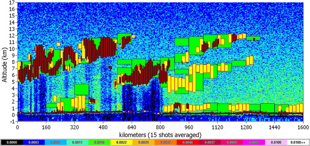
7 One Big Uncertainty: The Effects of Multilayer Clouds 20 LITE data, Western Africa, September1994 Thin Cirrus Ice clouds Altitude, km 10 Aerosols Mixed-phase clouds 0 LITE was able to penetrate cirrus to OD ~ 5-80% of profiles penetrated to top of boundary layer - expect similar from CALIPSO, with some averaging 20 o N, 3 o E 17 o N, 6 o E
")
 Aura OMI (aerosol absorption) Vertical distribution of aerosols and clouds Imaging IR radiometer Wide-field camera Aerosol / cloud")
8 Mission Concept PARASOL CloudSat CALIPSO Aqua Orbit: 705 km, 98 inclination, in formation with Aqua, CloudSat and Parasol Launch beginning of 2005 Aura Mission duration: 3 years Three co-aligned instruments: 3-channel lidar 532 nm 532 nm 1064 nm Complementary Instruments CloudSat radar (cloud profiles) Aqua CERES (top-of-the-atmosphere radiation) Aqua AIRS / AMSU-A / HSB (atmospheric state) Aqua MODIS (aerosol / cloud properties) PARASOL (aerosol / cloud properties) Aura OMI (aerosol absorption) Vertical distribution of aerosols and clouds Imaging IR radiometer Wide-field camera Aerosol / cloud properties
 Wavelength Spectral bandwidth IFOV / Swath 645 nm 50")
9 Instrument Characteristics Star Tracker X-Band Antenna Lidar Laser Nd: YAG, 2x110 mj Wavelength 532 nm, 1064 nm Repetition rate Hz Receiver telescope 1.0 m diameter Polarization 532 and Footprint/FOV 100 m / 130 µrad Vertical resolution m Horizontal resolution 333 m Wide Field Camera (WFC) Wavelength Spectral bandwidth IFOV / Swath 645 nm 50 nm 125 m / 60 km Laser/Transmitter Imaging Infrared Radiometer Wide-Field Camera Imaging Infrared Radiometer (IIR) Wavelength 8.7, 10.6, and 12.0 µm Spectral resolution µm IFOV / Swath 1 km / 64 km
10 Imaging Infrared Radiometer Warm Blackbody Cold Deep Space NedT 1 sigma value (83% of pixels) 8.65 µm µm K 0.20 K 0.27 K K 0.09 K 0.14 K 0.11 K 100 Filter transmissions for B1,B2 & B3 80 Global Cycle (40.92 s) Filter Wheel Transmission (%) BB DS DS DS DS Total 8,184 8,184 8,184 8,184 8,184 40,92 20 Earth Wavelength (µm) Filter B1 Filter B2 Filter B3 Detector normalized response Objective+mirror
11 Layer Detection: minimum backscatter 25 Assumptions: z = 60 m sfc albedo = 5% solar zenith = 0 o Altitude (km) km Sv Ci 1 km Cirrus single-shot day night 5 LITE aerosol Stratus 0 1E-4 1E Backscatter Cross-section (532 nm, /km/sr)

")
12 CALIPSO Detection Performance Simulation 1540 km LITE, Shuttle (260 km) Nighttime CALIPSO, Polar Orbit (705 km) Daytime

13 Layer Detection Simulation
14 Satellite covers a fixed grid every 16 days 16-day repeat cycle produces a grid spaced by 172 km at the equator
 S.")
15 L3 nighttime LITE data : 1 week 5 x10 First Class : Red Low Level Green Middle Level Blue High Level Black Clear Sky White No data Second Class : 1 Low Level 2 Middle Level 3 High Level 4 Clear Sky * Flag ( Shot Nb < 100) S. Berthier, IPSL
16 Correlative Measurement Strategy Quid Pro Quo (QPQ) measurements (g/b) coordinate with established programs well-calibrated and characterized instrumentation spatial matching requirements dictate the usefulness of the sites Field campaigns (g/b, a/c) (validation and science) provide comprehensive measurement suites required to fully understand the retrieval performance provide spatially and temporally matched data in any location the number of independent samples obtained is usually limited coordinated with other NASA and international activities Other satellites climatological data sets large number of comparisons coverage over regions without suitable ground sites uniqueness of CALIPSO measurement suite
17 Data Level Data Products Production Schedule 1b Calibrated lidar profiles Calibrated IIR radiances Uncalibrated WFC radiances Meteorological profiles Lidar aerosol & cloud browse images Starts after a 90-day onorbit checkout phase (L+135 days). Thereafter, data produced on 2-day lag following receipt of all required ancillary data (e.g., meteorological profiles). 2a Lidar backscatter profiles Aerosol layer height/thickness Cloud height/thickness 2b Aerosol extinction, optical depth Cloud extinction, optical depth Cloud ice/water phase Ice particle size Cloud emissivity Preliminary release after 90-day on-orbit checkout phase (L+135 days). Data produced on 3-day lag thereafter. Archived after 18 month validation period Archived after 18 month validation period

18 Science Team R. Schwiesow, Ball Aero. M. Platt, CSU G. Stephens, CSU S. Ackerman, U.WI A. Heidinger, NOAA R. Hoff, UMBC Y. Kaufman, NASA/GSFC J. Pelon, Co-PI, IPSL P. Flamant, IPSL H. LeTreut, IPSL G. Megie, CNRS F. Breon, Atomic Energy Commission D. Tanré, Univ. of Lille J. Reagan, U.AZ J. Coakley, OSU B. Charlson, U.WA D. Winker, PI, NASA/LaRC T. Charlock, NASA/LaRC C. Hostetler, NASA/LaRC L. Poole, NASA/LaRC C. Trepte, NASA/LaRC B. Wielicki, NASA/LaRC M. P. McCormick, Co-PI, HU N. Loeb, HU A. Omar, HU
CALIPSO: Global aerosol and cloud observations from lidar and passive instruments
 CALIPSO: Global aerosol and cloud observations from lidar and passive instruments L. R. Poole* a, D. M. Winker** a, J. R. Pelon #b, M. P. McCormick ##c a NASA Langley Research Center; b Universite Pierre
Global observations from CALIPSO
 Global observations from CALIPSO Dave Winker, Chip Trepte, and the CALIPSO team NRL, Monterey, 27-29 April 2010 Mission Overview Features: Two-wavelength backscatter lidar First spaceborne polarization
Influence of Clouds and Aerosols on the Earth s Radiation Budget Using Clouds and the Earth s Radiant Energy System (CERES) Measurements
 Measurements") Influence of Clouds and Aerosols on the Earth s Radiation Budget Using Clouds and the Earth s Radiant Energy System (CERES) Measurements Norman G. Loeb Hampton University/NASA Langley Research Center Bruce
Influence of Clouds and Aerosols on the Earth s Radiation Budget Using Clouds and the Earth s Radiant Energy System (CERES) Measurements Norman G. Loeb Hampton University/NASA Langley Research Center Bruce
History of Aerosol Remote Sensing. Mark Smithgall Maria Zatko 597K Spring 2009
 History of Aerosol Remote Sensing Mark Smithgall Maria Zatko 597K Spring 2009 Aerosol Sources Anthropogenic Biological decomposition from fertilizer and sewage treatment (ex. ammonium) Combustion of fossil
On the Satellite Determination of Multilayered Multiphase Cloud Properties. Science Systems and Applications, Inc., Hampton, Virginia 2
 JP1.10 On the Satellite Determination of Multilayered Multiphase Cloud Properties Fu-Lung Chang 1 *, Patrick Minnis 2, Sunny Sun-Mack 1, Louis Nguyen 1, Yan Chen 2 1 Science Systems and Applications, Inc.,
Global Cloud Climatologies from satellite-based InfraRed Sounders (TOVS, AIRS, IASI) +
 +") Global Cloud Climatologies from satellite-based InfraRed Sounders (TOVS, AIRS, IASI) + AIRS-CALIPSO-CloudSat Synergy Claudia Stubenrauch * until 2010 S. Cros*, A. Guignard, N. Lamquin*, R. Armante, A.
Global Cloud Climatologies from satellite-based InfraRed Sounders (TOVS, AIRS, IASI) + AIRS-CALIPSO-CloudSat Synergy Claudia Stubenrauch * until 2010 S. Cros*, A. Guignard, N. Lamquin*, R. Armante, A.
The EarthCARE mission: An active view on aerosols, clouds and radiation
 The EarthCARE mission: An active view on aerosols, clouds and radiation T. Wehr, P. Ingmann, T. Fehr Heraklion, Crete, Greece 08/06/2015 EarthCARE is ESA s sixths Earth Explorer Mission and will be implemented
An Observational Study of the Relationship between Cloud, Aerosol and Meteorology in Marine Stratus Regions
 An Observational Study of the Relationship between Cloud, Aerosol and Meteorology in Marine Stratus Regions Norman G. Loeb NASA Langley Research Center Hampton, VA Oct 18 th, 2006, AeroCom Meeting (Virginia
Atmospheric Lidar The Atmospheric Lidar (ATLID) is a high-spectral resolution lidar and will be the first of its type to be flown in space.
 is a high-spectral resolution lidar and will be the first of its type to be flown in space.") www.esa.int EarthCARE mission instruments ESA s EarthCARE satellite payload comprises four instruments: the Atmospheric Lidar, the Cloud Profiling Radar, the Multi-Spectral Imager and the Broad-Band Radiometer.
www.esa.int EarthCARE mission instruments ESA s EarthCARE satellite payload comprises four instruments: the Atmospheric Lidar, the Cloud Profiling Radar, the Multi-Spectral Imager and the Broad-Band Radiometer.
Improving the CALIPSO VFM product with Aqua MODIS measurements
 University of Nebraska - Lincoln DigitalCommons@University of Nebraska - Lincoln NASA Publications National Aeronautics and Space Administration 2010 Improving the CALIPSO VFM product with Aqua MODIS measurements
Overview of FIRST instrument & exploration of capabilities
 Overview of FIRST instrument & exploration of capabilities JPL Weekly CLARREO Meeting September 04, 2007 Daniel Feldman, Caltech Presentation Outline Motivation for studying the far infrared FIRST instrument
Launched on May 4, K. Hokusai
 CITES-2009 CITES-2009 CONFERENCE CONFERENCE KRASNOYARSK, KRASNOYARSK, Russia Russia OBSERVING THE EARTH FROM SPACE AS AN INTEGRATED SYSTEM: THE USA/F* A-TRAIN CONCEPT G. BEGNI, D. RENAUT (CNES CNES), D.
Lecture 14. Principles of active remote sensing: Lidars. Lidar sensing of gases, aerosols, and clouds.
 Lecture 14. Principles of active remote sensing: Lidars. Lidar sensing of gases, aerosols, and clouds. 1. Optical interactions of relevance to lasers. 2. General principles of lidars. 3. Lidar equation.
Chapter 4 Nadir looking UV measurement. Part-I: Theory and algorithm
 Chapter 4 Nadir looking UV measurement. Part-I: Theory and algorithm -Aerosol and tropospheric ozone retrieval method using continuous UV spectra- Atmospheric composition measurements from satellites are
Changes in Earth s Albedo Measured by satellite
 Changes in Earth s Albedo Measured by satellite Bruce A. Wielicki, Takmeng Wong, Norman Loeb, Patrick Minnis, Kory Priestley, Robert Kandel Presented by Yunsoo Choi Earth s albedo Earth s albedo The climate
The EarthCARE mission: An active view on aerosols, clouds and radiation
 The EarthCARE mission: An active view on aerosols, clouds and radiation T. Wehr, T. Fehr, P. Ingmann, J. v. Bismarck ESRIN, Frascati, Italy 20/10/2015 EARTH Clouds, Aerosols and Radiation Explorer EarthCARE
Future NASA Atmospheric Missions: Adding to the A-Train Calipso OCO NPP CloudSat Glory
 Future NASA Atmospheric Missions: Adding to the A-Train James Gleason NASA Goddard Space Flight Center, Mail Code 613.3, Greenbelt, MD 20771, United States Abstract Following on the successful launch of
Title: The Impact of Convection on the Transport and Redistribution of Dust Aerosols
 Authors: Kathryn Sauter, Tristan L'Ecuyer Title: The Impact of Convection on the Transport and Redistribution of Dust Aerosols Type of Presentation: Oral Short Abstract: The distribution of mineral dust
Steve Ackerman, R. Holz, R Frey, S. Platnick, A. Heidinger, and a bunch of others.
 Steve Ackerman, R. Holz, R Frey, S. Platnick, A. Heidinger, and a bunch of others. Outline Using CALIOP to Validate MODIS Cloud Detection, Cloud Height Assignment, Optical Properties Clouds and Surface
Satellite observation of atmospheric dust
 Satellite observation of atmospheric dust Taichu Y. Tanaka Meteorological Research Institute, Japan Meteorological Agency 11 April 2017, SDS WAS: Dust observation and modeling @WMO, Geneva Dust observations
Ground-based Validation of spaceborne lidar measurements
 Ground-based Validation of spaceborne lidar measurements Ground-based Validation of spaceborne lidar measurements to make something officially acceptable or approved, to prove that something is correct
Clouds, Haze, and Climate Change
 Clouds, Haze, and Climate Change Jim Coakley College of Oceanic and Atmospheric Sciences Earth s Energy Budget and Global Temperature Incident Sunlight 340 Wm -2 Reflected Sunlight 100 Wm -2 Emitted Terrestrial
Determination of atmospheric temperature, far- infrared hyperspectral measurements
 Determination of atmospheric temperature, water vapor, and heating rates from mid- and far- infrared hyperspectral measurements AGU Fall Meeting, Wednesday, December 12, 2007 GC34A 02 D.R. Feldman (Caltech);
Remote sensing of ice clouds
 Remote sensing of ice clouds Carlos Jimenez LERMA, Observatoire de Paris, France GDR microondes, Paris, 09/09/2008 Outline : ice clouds and the climate system : VIS-NIR, IR, mm/sub-mm, active 3. Observing
A new perspective on aerosol direct radiative effects in South Atlantic and Southern Africa
 A new perspective on aerosol direct radiative effects in South Atlantic and Southern Africa Ian Chang and Sundar A. Christopher Department of Atmospheric Science University of Alabama in Huntsville, U.S.A.
Meteorological Satellite Image Interpretations, Part III. Acknowledgement: Dr. S. Kidder at Colorado State Univ.
 Meteorological Satellite Image Interpretations, Part III Acknowledgement: Dr. S. Kidder at Colorado State Univ. Dates EAS417 Topics Jan 30 Introduction & Matlab tutorial Feb 1 Satellite orbits & navigation
Status and performance of the CALIOP lidar
 Status and performance of the CALIOP lidar David M. Winker* a, William Hunt b, and Chris Hostetler a a NASA Langley Research Center, MS/435, Hampton, Virginia 23681, USA *b Wyle Laboratories, Hampton,
CALIPSO On-Orbit - Lidar
 CALIPSO On-Orbit - Lidar Cloud - Aerosol Lidar and Infrared Pathfinder Satellite Observations Lidar Data Curtain Carl Weimer 3/21/07 Outline Why CALIPSO? Some Early Science Results Selected Engineering
Interannual variability of top-ofatmosphere. CERES instruments
 Interannual variability of top-ofatmosphere albedo observed by CERES instruments Seiji Kato NASA Langley Research Center Hampton, VA SORCE Science team meeting, Sedona, Arizona, Sep. 13-16, 2011 TOA irradiance
Lecture 4b: Meteorological Satellites and Instruments. Acknowledgement: Dr. S. Kidder at Colorado State Univ.
 Lecture 4b: Meteorological Satellites and Instruments Acknowledgement: Dr. S. Kidder at Colorado State Univ. US Geostationary satellites - GOES (Geostationary Operational Environmental Satellites) US
Variability in Global Top-of-Atmosphere Shortwave Radiation Between 2000 And 2005
 Variability in Global Top-of-Atmosphere Shortwave Radiation Between 2000 And 2005 Norman G. Loeb NASA Langley Research Center Hampton, VA Collaborators: B.A. Wielicki, F.G. Rose, D.R. Doelling February
Aerosol and cloud related products by ESA s Aeolus mission
 Aerosol and cloud related products by ESA s Aeolus mission Stefano Casadio 1, Anne Grete Straume 2, Christophe Caspar 2 1 IDEAS/SERCO, 2 ESA Anne.Straume@esa.int, Stefano.Casadio@esa.int, Christope.Caspar@esa.int
An Overview of the Radiation Budget in the Lower Atmosphere
 An Overview of the Radiation Budget in the Lower Atmosphere atmospheric extinction irradiance at surface P. Pilewskie 300 University of Colorado Laboratory for Atmospheric and Space Physics Department
What are Aerosols? Suspension of very small solid particles or liquid droplets Radii typically in the range of 10nm to
 What are Aerosols? Suspension of very small solid particles or liquid droplets Radii typically in the range of 10nm to 10µm Concentrations decrease exponentially with height N(z) = N(0)exp(-z/H) Long-lived
Satellite analysis of aerosol indirect effect on stratocumulus clouds over South-East Atlantic
 1/23 Remote sensing of atmospheric aerosol, clouds and aerosol-cloud interactions. Bremen, 16-19 December 2013 Satellite analysis of aerosol indirect effect on stratocumulus clouds over South-East Atlantic
Multi-instrumental study of aerosol optical properties over the city of Sao Paulo: Lidar, sunphotometer and CALIPSO satellite
 Multi-instrumental study of aerosol optical properties over the city of Sao Paulo: Lidar, sunphotometer and CALIPSO satellite Fábio Juliano da Silva Lopes (*), Eduardo Landulfo Instituto de Pesquisas Energéticas
CALIPSO measurements of clouds, aerosols, ocean surface mean square slopes, and phytoplankton backscatter
 CALIPSO measurements of clouds, aerosols, ocean surface mean square slopes, and phytoplankton backscatter Yongxiang Hu, Chris Hostetler, Kuanman Xu,, and CALIPSO team NASA Langley Research Center Alain
NIR Solar Reference Spectrum Algorithm for the Orbiting Carbon Observatory (OCO)
") NIR Solar Reference Spectrum Algorithm for the Orbiting Carbon Observatory (OCO) Hartmut Bösch and Geoffrey Toon Jet Propulsion Laboratory, California Institute of Technology OCO Mission Global, space-based
NIR Solar Reference Spectrum Algorithm for the Orbiting Carbon Observatory (OCO) Hartmut Bösch and Geoffrey Toon Jet Propulsion Laboratory, California Institute of Technology OCO Mission Global, space-based
2.0 EFFORTS TO MONITOR GLOBAL CLIMATE CHANGE
 2.0 EFFORTS TO MONITOR GLOBAL CLIMATE CHANGE 2.1 The Earth radiation budget Averaged over the entire Earth and over the span of a year, the sun delivers approximately 340 W/m 2 of shortwave radiation.
On Surface fluxes and Clouds/Precipitation in the Tropical Eastern Atlantic
 On Surface fluxes and Clouds/Precipitation in the Tropical Eastern Atlantic Chris Fairall, NOAA/ESRL Paquita Zuidema, RSMAS/U Miami with contributions from Peter Minnett & Erica Key AMMA Team Meeting Leeds,
Cloud Microphysical and Radiative Properties Derived from MODIS, VIRS, AVHRR, and GMS Data Over the Tropical Western Pacific
 Cloud Microphysical and Radiative Properties Derived from MODIS, VIRS, AVHRR, and GMS Data Over the Tropical Western Pacific G. D. Nowicki, M. L. Nordeen, P. W. Heck, D. R. Doelling, and M. M. Khaiyer
History of Earth Radiation Budget Measurements With results from a recent assessment
 History of Earth Radiation Budget Measurements With results from a recent assessment Ehrhard Raschke and Stefan Kinne Institute of Meteorology, University Hamburg MPI Meteorology, Hamburg, Germany Centenary
CATS GSFC TEAM Matt McGill, John Yorks, Stan Scott, Stephen Palm, Dennis Hlavka, William Hart, Ed Nowottnick, Patrick Selmer, Andrew Kupchock
 The Cloud-Aerosol Transport System (CATS) CATS GSFC TEAM Matt McGill, John Yorks, Stan Scott, Stephen Palm, Dennis Hlavka, William Hart, Ed Nowottnick, Patrick Selmer, Andrew Kupchock CATS LaRC Team Chip
Projects in the Remote Sensing of Aerosols with focus on Air Quality
 Projects in the Remote Sensing of Aerosols with focus on Air Quality Faculty Leads Barry Gross (Satellite Remote Sensing), Fred Moshary (Lidar) Direct Supervision Post-Doc Yonghua Wu (Lidar) PhD Student
Interpretation of Polar-orbiting Satellite Observations. Atmospheric Instrumentation
 Interpretation of Polar-orbiting Satellite Observations Outline Polar-Orbiting Observations: Review of Polar-Orbiting Satellite Systems Overview of Currently Active Satellites / Sensors Overview of Sensor
Global Moderate Resolution Imaging Spectroradiometer (MODIS) cloud detection and height evaluation using CALIOP
 cloud detection and height evaluation using CALIOP") JOURNAL OF GEOPHYSICAL RESEARCH, VOL. 113,, doi:10.1029/2008jd009837, 2008 Global Moderate Resolution Imaging Spectroradiometer (MODIS) cloud detection and height evaluation using CALIOP R. E. Holz, 1
JOURNAL OF GEOPHYSICAL RESEARCH, VOL. 113,, doi:10.1029/2008jd009837, 2008 Global Moderate Resolution Imaging Spectroradiometer (MODIS) cloud detection and height evaluation using CALIOP R. E. Holz, 1
Surface Radiation Budget from ARM Satellite Retrievals
 Surface Radiation Budget from ARM Satellite Retrievals P. Minnis, D. P. Kratz, and T. P. charlock Atmospheric Sciences National Aeronautics and Space Administration Langley Research Center Hampton, Virginia
Lecture 3: Atmospheric Radiative Transfer and Climate
 Lecture 3: Atmospheric Radiative Transfer and Climate Solar and infrared radiation selective absorption and emission Selective absorption and emission Cloud and radiation Radiative-convective equilibrium
The Probabilistic Risk Assessment of the CloudSat Profiling Radar
 The Probabilistic Risk Assessment of the CloudSat Profiling Radar Todd Paulos, Alejo Engineering, Simi Valley, CA John Klohoker,,, Pasadena, CA May 2008 What is CloudSat? Launched on April 28, 2006 with
Satellite-based estimate of global aerosol-cloud radiative forcing by marine warm clouds
 SUPPLEMENTARY INFORMATION DOI: 10.1038/NGEO2214 Satellite-based estimate of global aerosol-cloud radiative forcing by marine warm clouds Y.-C. Chen, M. W. Christensen, G. L. Stephens, and J. H. Seinfeld
On the Limitations of Satellite Passive Measurements for Climate Process Studies
 On the Limitations of Satellite Passive Measurements for Climate Process Studies Steve Cooper 1, Jay Mace 1, Tristan L Ecuyer 2, Matthew Lebsock 3 1 University of Utah, Atmospheric Sciences 2 University
The Orbiting Carbon Observatory (OCO)
") GEMS 2006 Assembly The Orbiting Carbon Observatory (OCO) http://oco.jpl.nasa.gov David Crisp, OCO PI (JPL/Caltech) February 2006 1 of 13, OCO Dec 2005 Page 1 The Orbiting Carbon Observatory (OCO) OCO will
GEMS 2006 Assembly The Orbiting Carbon Observatory (OCO) http://oco.jpl.nasa.gov David Crisp, OCO PI (JPL/Caltech) February 2006 1 of 13, OCO Dec 2005 Page 1 The Orbiting Carbon Observatory (OCO) OCO will
Final Report: NASA Award Number, NNX07AR95G, entitled, COMPARISON OF A - TRAIN CLOUD RETRIEVALS AND MULTI-INSTRUMENT ALGORITHM STUDIES.
 Final Report: NASA Award Number, NNX07AR95G, entitled, COMPARISON OF A - TRAIN CLOUD RETRIEVALS AND MULTI-INSTRUMENT ALGORITHM STUDIES. For the period of August 15, 2007 August 14, 2010 Principal Investigator:
Lectures 7 and 8: 14, 16 Oct Sea Surface Temperature
 Lectures 7 and 8: 14, 16 Oct 2008 Sea Surface Temperature References: Martin, S., 2004, An Introduction to Ocean Remote Sensing, Cambridge University Press, 454 pp. Chapter 7. Robinson, I. S., 2004, Measuring
Large-Scale Cloud Properties and Radiative Fluxes over Darwin during Tropical Warm Pool International Cloud Experiment
 Large-Scale Cloud Properties and Radiative Fluxes over Darwin during Tropical Warm Pool International Cloud Experiment P. Minnis, L. Nguyen, and W.L. Smith, Jr. National Aeronautics and Space Administration/Langley
Radiation balance of the Earth. 6. Earth radiation balance under present day conditions. Top of Atmosphere (TOA) Radiation balance
 Radiation balance") Radiation balance of the Earth Top of Atmosphere (TOA) radiation balance 6. Earth radiation balance under present day conditions Atmospheric radiation balance: Difference between TOA and surface radiation
Radiation balance of the Earth Top of Atmosphere (TOA) radiation balance 6. Earth radiation balance under present day conditions Atmospheric radiation balance: Difference between TOA and surface radiation
CALIPSO Lessons Learned: Retrieval aspects, CAL/VAL, and Scientific Applications
 CALIPSO Lessons Learned: Retrieval aspects, CAL/VAL, and Scientific Applications Aeolus Workshop, Frascati, 10-13 Feb 2015 First light: 7 June 2006 Three co-aligned instruments: CALIOP: polarization lidar
REMOTE SENSING KEY!!
 REMOTE SENSING KEY!! This is a really ugly cover page I m sorry. Name Key. Score / 100 Directions: You have 50 minutes to take this test. You may use a cheatsheet (2 pages), a non-graphing calculator,
GCOM-W1 now on the A-Train
 GCOM-W1 now on the A-Train GCOM-W1 Global Change Observation Mission-Water Taikan Oki, K. Imaoka, and M. Kachi JAXA/EORC (& IIS/The University of Tokyo) Mini-Workshop on A-Train Science, March 8 th, 2013
Developments in CALIOP Aerosol Products. Dave Winker
 Developments in CALIOP Aerosol Products Dave Winker NASA Langley Research Center Hampton, VA Winker - 1 Outline Level 3 aerosol product (beta-version) Version 4 Level 1 product A few CALIOP assimilation
PUBLICATIONS. Journal of Geophysical Research: Atmospheres
 PUBLICATIONS Journal of Geophysical Research: Atmospheres RESEARCH ARTICLE Key Points: The CERES-MODIS retrieved cloud microphysical properties agree well with ARM retrievals under both snow-free and snow
Radiation and the atmosphere
 Radiation and the atmosphere Of great importance is the difference between how the atmosphere transmits, absorbs, and scatters solar and terrestrial radiation streams. The most important statement that
Cloud property retrievals for climate monitoring:
 X-1 ROEBELING ET AL.: SEVIRI & AVHRR CLOUD PROPERTY RETRIEVALS Cloud property retrievals for climate monitoring: implications of differences between SEVIRI on METEOSAT-8 and AVHRR on NOAA-17 R.A. Roebeling,
Remote Sensing How we know what we know A Brief Tour
 Remote Sensing How we know what we know A Brief Tour Dr. Erik Richard Dr. Jerald Harder LASP Richard 1 Remote Sensing The measurement of physical variables (usually light or sound) from outside of a medium
3D data in climatology
 GIS Laboratory, Institute of Geography and Spatial Management, Jagiellonian University 1 3D applications There are at least three distinct fields of Earth sciences, were 3D data play an important (or fundamental)
Lidar and radiosonde measurement campaign for the validation of ENVISAT atmospheric products
 Lidar and radiosonde measurement campaign for the validation of ENVISAT atmospheric products V. Cuomo, G. Pappalardo, A. Amodeo, C. Cornacchia, L. Mona, M. Pandolfi IMAA-CNR Istituto di Metodologie per
Assessing the Radiative Impact of Clouds of Low Optical Depth
 Assessing the Radiative Impact of Clouds of Low Optical Depth W. O'Hirok and P. Ricchiazzi Institute for Computational Earth System Science University of California Santa Barbara, California C. Gautier
Radiation Fluxes During ZCAREX-99: Measurements and Calculations
 Radiation Fluxes During ZCAREX-99: Measurements and Calculations G. S. Golitsyn, P. P. Anikin, E. M. Feigelson, I. A. Gorchakova, I. I. Mokhov, E. V. Romashova, M. A. Sviridenkov, and T. A. Tarasova Oboukhov
CLAVR-x is the Clouds from AVHRR Extended Processing System. Responsible for AVHRR cloud products and other products at various times.
 CLAVR-x in CSPP Andrew Heidinger, NOAA/NESDIS/STAR, Madison WI Nick Bearson, SSEC, Madison, WI Denis Botambekov, CIMSS, Madison, WI Andi Walther, CIMSS, Madison, WI William Straka III, CIMSS, Madison,
Spectrum of Radiation. Importance of Radiation Transfer. Radiation Intensity and Wavelength. Lecture 3: Atmospheric Radiative Transfer and Climate
 Lecture 3: Atmospheric Radiative Transfer and Climate Radiation Intensity and Wavelength frequency Planck s constant Solar and infrared radiation selective absorption and emission Selective absorption
Course outline, objectives, workload, projects, expectations
 Course outline, objectives, workload, projects, expectations Introductions Remote Sensing Overview Elements of a remote sensing observing system 1. platform (satellite, surface, etc) 2. experimental design
Cloud properties & bulk microphysical properties of semi-transparent cirrus from AIRS & IASI
 Cloud properties & bulk microphysical properties of semi-transparent cirrus from AIRS & Claudia Stubenrauch A. Feofilov, R. Armante, A. Guignard* ABC(t) ARA team Laboratoire de Météorologie Dynamique /
1.0 BACKGROUND 1.1 Surface Radiation
 1.0 BACKGROUND 1.1 Surface Radiation Meteorologists have utilized recent advances in computer speeds and atmospheric models to create increasingly accurate models of the environment. The computational
McIDAS Activities Within The NASA Langley Research Center Clouds And Radiation Group
 McIDAS Activities Within The NASA Langley Research Center Clouds And Radiation Group Kristopher Bedka Science Systems and Applications Inc @ NASA LaRC In Collaboration With (in alphabetical order) J. K.
9.4. The newly released 5-year Terra-based monthly CERES radiative flux and cloud product. David R. Doelling, D. F. Keyes AS&M, Inc.
 9.4 The newly released 5-year Terra-based monthly CERES radiative flux and cloud product David R. Doelling, D. F. Keyes AS&M, Inc., Hampton, VA D. F. Young, B. A. Wielicki, T. Wong NASA Langley Research
Journal of the Meteorological Society of Japan, Vol. 75, No. 1, pp , Day-to-Night Cloudiness Change of Cloud Types Inferred from
 Journal of the Meteorological Society of Japan, Vol. 75, No. 1, pp. 59-66, 1997 59 Day-to-Night Cloudiness Change of Cloud Types Inferred from Split Window Measurements aboard NOAA Polar-Orbiting Satellites
Satellite remote sensing of aerosols & clouds: An introduction
 Satellite remote sensing of aerosols & clouds: An introduction Jun Wang & Kelly Chance April 27, 2006 junwang@fas.harvard.edu Outline Principals in retrieval of aerosols Principals in retrieval of water
McIDAS support of Suomi-NPP /JPSS and GOES-R L2
 McIDAS support of Suomi-NPP /JPSS and GOES-R L2 William Straka III 1 Tommy Jasmin 1, Bob Carp 1 1 Cooperative Institute for Meteorological Satellite Studies, Space Science and Engineering Center, University
A 6-year global cloud climatology from the Atmospheric InfraRed Sounder AIRS and a statistical analysis in synergy with CALIPSO and CloudSat
 Atmos. Chem. Phys., 10, 7197 7214, 2010 doi:10.5194/acp-10-7197-2010 Author(s) 2010. CC Attribution 3.0 License. Atmospheric Chemistry and Physics A 6-year global cloud climatology from the Atmospheric
Study of the Influence of Thin Cirrus Clouds on Satellite Radiances Using Raman Lidar and GOES Data
 Study of the Influence of Thin Cirrus Clouds on Satellite Radiances Using Raman Lidar and GOES Data D. N. Whiteman, D. O C. Starr, and G. Schwemmer National Aeronautics and Space Administration Goddard
CASE/ARIEL & FINESSE Briefing
 CASE/ARIEL & FINESSE Briefing Presentation to NRC Committee for Exoplanet Science Strategy including material from the ARIEL consortium Mark Swain - JPL 19 April 2019 2018 California Institute of Technology.
Radiation in the atmosphere
 Radiation in the atmosphere Flux and intensity Blackbody radiation in a nutshell Solar constant Interaction of radiation with matter Absorption of solar radiation Scattering Radiative transfer Irradiance
Aerosol measurements from Space. Gerrit de Leeuw FMI & Uni of Helsinki, Finland & TNO, Utrecht, Netherlands
 Aerosol measurements from Space Gerrit de Leeuw FMI & Uni of Helsinki, Finland & TNO, Utrecht, Netherlands ACCENT AT-2 Follow-up meeting Mainz, 22 June 2009 ACCENT AT-2 Outcomes The Remote Sensing of Tropospheric
Status of VIIRS Reflective Solar Bands On-orbit Calibration and Performance
 EOS Status of VIIRS Reflective Solar Bands On-orbit Calibration and Performance X. Xiong 1, J. Fulbright 2, N. Lei 2, J. Sun 2, Z. Wang 2, and J. McIntire 2 1. NASA/GSFC, Greenbelt, MD 20771, USA 2. Sigma
Methane Sensing Flight of Scanning HIS over Hutchinson, KS, 31 March 2001
 Methane Sensing Flight of Scanning HIS over Hutchinson, KS, 31 March 2001 Hank Revercomb, Chris Moeller, Bob Knuteson, Dave Tobin, Ben Howell University of Wisconsin, Space Science and Engineering Center
A Suite of Retrieval Algorithms for Cirrus Cloud Microphysical Properties Applied To Lidar, Radar, and Radiometer Data Prepared for the A-Train
 P1R.15 A Suite of Retrieval Algorithms for Cirrus Cloud Microphysical Properties Applied To Lidar, Radar, and Radiometer Data Prepared for the A-Train Yuying Zhang * and Gerald G. Mace Department of Meteorology,
REVISION OF THE STATEMENT OF GUIDANCE FOR GLOBAL NUMERICAL WEATHER PREDICTION. (Submitted by Dr. J. Eyre)
") WORLD METEOROLOGICAL ORGANIZATION Distr.: RESTRICTED CBS/OPAG-IOS (ODRRGOS-5)/Doc.5, Add.5 (11.VI.2002) COMMISSION FOR BASIC SYSTEMS OPEN PROGRAMME AREA GROUP ON INTEGRATED OBSERVING SYSTEMS ITEM: 4 EXPERT
WORLD METEOROLOGICAL ORGANIZATION Distr.: RESTRICTED CBS/OPAG-IOS (ODRRGOS-5)/Doc.5, Add.5 (11.VI.2002) COMMISSION FOR BASIC SYSTEMS OPEN PROGRAMME AREA GROUP ON INTEGRATED OBSERVING SYSTEMS ITEM: 4 EXPERT
The Climatology of Clouds using surface observations. S.G. Warren and C.J. Hahn Encyclopedia of Atmospheric Sciences.
 The Climatology of Clouds using surface observations S.G. Warren and C.J. Hahn Encyclopedia of Atmospheric Sciences Gill-Ran Jeong Cloud Climatology The time-averaged geographical distribution of cloud
A 6-year global cloud climatology from the Atmospheric InfraRed Sounder AIRS and a statistical analysis in synergy with CALIPSO and CloudSat
 A 6-year global cloud climatology from the Atmospheric InfraRed Sounder AIRS and a statistical analysis in synergy with CALIPSO and CloudSat C. J. Stubenrauch, S. Cros, A. Guignard, N. Lamquin To cite
Atmospheric Measurements from Space
 Atmospheric Measurements from Space MPI Mainz Germany Thomas Wagner Satellite Group MPI Mainz Part 1: Basics Break Part 2: Applications Part 1: Basics of satellite remote sensing Why atmospheric satellite
FUNDAMENTALS OF REMOTE SENSING FOR RISKS ASSESSMENT. 1. Introduction
 FUNDAMENTALS OF REMOTE SENSING FOR RISKS ASSESSMENT FRANÇOIS BECKER International Space University and University Louis Pasteur, Strasbourg, France; E-mail: becker@isu.isunet.edu Abstract. Remote sensing
The MODIS Cloud Data Record
 The MODIS Cloud Data Record Brent C. Maddux 1,2 Steve Platnick 3, Steven A. Ackerman 1 Paul Menzel 1, Kathy Strabala 1, Richard Frey 1, 1 Cooperative Institute for Meteorological Satellite Studies, 2 Department
Clouds, Precipitation and their Remote Sensing
 Clouds, Precipitation and their Remote Sensing Prof. Susanne Crewell AG Integrated Remote Sensing Institute for Geophysics and Meteorology University of Cologne Susanne Crewell, Kompaktkurs, Jülich 24.
OSI SAF SST Products and Services
 OSI SAF SST Products and Services Pierre Le Borgne Météo-France/DP/CMS (With G. Legendre, A. Marsouin, S. Péré, S. Philippe, H. Roquet) 2 Outline Satellite IR radiometric measurements From Brightness Temperatures
Study Participants: T.E. Sarris, E.R. Talaat, A. Papayannis, P. Dietrich, M. Daly, X. Chu, J. Penson, A. Vouldis, V. Antakis, G.
 GLEME: GLOBAL LIDAR EXPLORATION OF THE MESOSPHERE Project Technical Officer: E. Armandillo Study Participants: T.E. Sarris, E.R. Talaat, A. Papayannis, P. Dietrich, M. Daly, X. Chu, J. Penson, A. Vouldis,
Extending the Deep Blue aerosol record from SeaWiFS and MODIS to NPP-VIIRS
 Extending the Deep Blue aerosol record from SeaWiFS and MODIS to NPP-VIIRS Andrew M. Sayer, N. Christina Hsu (PI), Corey Bettenhausen, Jaehwa Lee Climate & Radiation Laboratory, NASA Goddard Space Flight
VERIFICATION OF MERIS LEVEL 2 PRODUCTS: CLOUD TOP PRESSURE AND CLOUD OPTICAL THICKNESS
 VERIFICATION OF MERIS LEVEL 2 PRODUCTS: CLOUD TOP PRESSURE AND CLOUD OPTICAL THICKNESS Rene Preusker, Peter Albert and Juergen Fischer 17th December 2002 Freie Universitaet Berlin Institut fuer Weltraumwissenschaften
Climatologies of ultra-low clouds over the southern West African monsoon region
 Climatologies of ultra-low clouds over the southern West African monsoon region Andreas H. Fink 1, R. Schuster 1, R. van der Linden 1, J. M. Schrage 2, C. K. Akpanya 2, and C. Yorke 3 1 Institute of Geophysics
Intercomparison of column aerosol optical depths from CALIPSO and MODIS-Aqua
 Atmos. Meas. Tech., 4, 131 141, 2011 doi:10.5194/amt-4-131-2011 Author(s) 2011. CC Attribution 3.0 License. Atmospheric Measurement Techniques Intercomparison of column aerosol optical depths from CALIPSO
Principles of active remote sensing: Lidars and lidar sensing of aerosols, gases and clouds.
 Lecture 14 Principles of active remote sensing: Lidars and lidar sensing of aerosols, gases and clouds. Objectives: 1. Optical interactions of relevance to lasers. 2. General principles of lidars. 3. Lidar