Marl Prairie vegetation response to 20th century land use and its implications for management in the Everglades
|
|
|
- Bonnie Lang
- 5 years ago
- Views:
Transcription

1 Marl Prairie vegetation response to 20th century land use and its implications for management in the Everglades C. Bernhardt, D. Willard, B. Landacre US Geological Survey Reston, VA USA U.S. Department of the Interior U.S. Geological Survey

2 Marl Prairie Ecosystem History Heterogeous Surface sediment Down core sediment Timing of marl accumulation Past vegetation responses 20 th century impact on vegetation Increase in fires with drying in 20 th century?


3 Controls on Vegetation Distribution in the Everglades Historic /Pre-drainage Water Management Present (Lodge, 2005) (Lodge, 2005)
 Calcareous soil")


4 What is a Marl Prairie? Short hydroperiod (3-7 months) Calcareous soil High plant diversity (>100 species) Dominated by grasses and sedges ~1,900km 2 /6,000km 2 of current Everglades Neighboring Communities Wet Prairie Fresh Water Marsh Sawgrass Marsh Big Cypress Slough Cypress Strand

5 The Cape Sable Seaside Sparrow (CSSS) CSSS listed as T&E in 1967 due to limited distribution and threats to its habitat by landuse changes Nesting bird, occupies marl prairies with short hydroperiods and sparse vegetation

6 Cape Sable Seaside Sparrow Distribution: Early vs. Late 20 th Century - Stimson (1956)
7 Objectives Recent research indicates that sustained changes in hydroperiod played significant roles in structuring tree islands and the ridge and slough landscape. These changes resulted both from natural climate fluctuations and anthropogenic alteration of Everglades hydrology. Examine the long-term history of marl prairie habitats of the Everglades which provide critical refuges for rare and endemic species, including the endangered Cape Sable Seaside Sparrow (CSSS). This research is intended to document the longevity and stability of the marl prairie habitat using paleoecological proxies for vegetation and hydrology. Strategies to stabilize and maintain habitats are an important component of Everglades restoration planning.

8 Methodology Collection of surface samples for calibration dataset
9 Methodology Collection of cores in historic CSSS habitat


10 Methodology Current CSS habitat
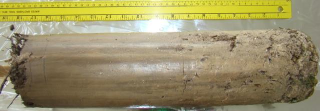


11 Methodology Collection of sediment cores YD
 Carbon-14 dating and Lead-210")
12 Methodology Core/sediment description (sediment type, color) Carbon-14 dating and Lead-210 dating


13 Methodology Analysis of downcore pollen assemblages and calibration with modern analogs

14 Surface sediment type varies considerably within CSSS subpopulations Variability of Surface Sediments within Modern CSSS Subpopulations


15 Variability of downcore sediment profiles within Modern CSSS Subpopulations all marl marl over peat organic rich marl peat over marl
16 Percent Abundance of Pollen of Major Plant Taxa, Core , CSSS Population A, Big Cypress National Preserve

17 Percent Abundance of Pollen of Major Plant Taxa, Core , CSSS Population B, Everglades National Park

18 Percent Abundance of Pollen of Major Plant Taxa, Core a, CSSS Population D, Everglades National Park

19 Many cores the same pattern
20 Marl Prairie Fire History Microscopic charcoal results Charcoal μm 2 /grains Population F Population D Population B Population D Population E Population C
21 Conclusions Surface sediments vary between and within modern CSSS populations Timing of marl accumulation varies -Some sites it was initiated during the 20 th century and corresponds to shifts to modern pollen assemblages. -Other sites marl was initiated well before onset of water management practices, ranging from 300 to nearly 3000 cal yrbp. Down core sediment types heterogeneous (marl, marl over peat, peat, peat over marl) 20 th century water management had an effect on all pollen assemblages examined -Toward modern conditions At some sites, significant changes in pollen assemblages occurred during the last few millennia probably tied to climate fluctuations Microscopic charcoal increases after the 20 th century, however some sites record similar increases in the past
22 Climate Change and Management Considerations The marl prairie landscape is not homogeneous -different sediment types and marl accumulation timing Varying hydrologic conditions at varying times through the late Holocene and 20 th century initiated marl accumulation This study demonstrates that plant communities within the current marl prairie habitat have fluctuated during the last few millennia in response to both natural hydrologic variability and anthropogenic modification of the ecosystem -but modern landscape est. in 20 th century? However, 20 th century water management may have had the greatest impacts -must keep this in mind when managing current system
23 Characterize spatial variability of surface sediments within each CSSS subpopulation Characterize temporal variability of sediment types at multiple sites within CSSS subpopulations Document temporal and spatial variability in vegetation and hydrology throughout current CSSS habitats using pollen and seed assemblages and stable isotopes Characterize temporal/spatial variability of sediment, vegetation, and hydrology in historic CSSS subpopulations Identify timing of vegetation and substrate changes during last few decades to millennia throughout CSSS habitat
24
25 - Stimson (1956) Historic Cape Sable Seaside Sparrow Distribution: : Spartina marshes on Cape Sable : Spartina marshes inland of mangroves Post-1940: marshes inland of mangroves and initial expansion into Big Cypress
Long-Term Patterns of Coastal Response to Changing Land Use and Climate: Examples from the Atlantic and Gulf Coastal Plains
 Long-Term Patterns of Coastal Response to Changing Land Use and Climate: Examples from the Atlantic and Gulf Coastal Plains Debra Willard, Christopher Bernhardt, and Miriam Jones U.S. Geological Survey,
Ecosystem History of Florida Bay and the Southern Estuaries Five Year Update. G. Lynn Wingard (USGS)
") Ecosystem History of Florida Bay and the Southern Estuaries Five Year Update G. Lynn Wingard (USGS) Progress since 2003 Florida Bay Science Conference Expansion of Ecosystem History Research into surrounding
Ecosystem History of Florida Bay and the Southern Estuaries Five Year Update G. Lynn Wingard (USGS) Progress since 2003 Florida Bay Science Conference Expansion of Ecosystem History Research into surrounding
Ecological Patterns and Processes in Ghost Tree Islands of the Everglades
 Ecological Patterns and Processes in Ghost Tree Islands of the Everglades Sharon M. L. Ewe 1, Binhe Gu 2, Jennifer Vega 1 and Kristin Vaughan 1 1 Ecology and Environment Inc., 12300 South Shore Blvd, Wellington,
Ground Water Control of Tree Island Origin, Genesis and Destruction. By John F. Meeder and Peter W. Harlem SERC,FIU
 Ground Water Control of Tree Island Origin, Genesis and Destruction By John F. Meeder and Peter W. Harlem SERC,FIU Functional Definition Our functional definition of a Tree Island is; an isolated scrub
Landscape-scale trends and. Islands in the Everglades. Sharon M. L. Ewe, Binhe Gu, Jennifer Vega, Kristin Vaughan, Sumanjit Aich
 Landscape-scale trends and patterns of Ghost Tree Islands in the Everglades Sharon M. L. Ewe, Binhe Gu, Jennifer Vega, Kristin Vaughan, Sumanjit Aich What is a Ghost island? Ghost island is a tree island
9 th INTECOL Orlando, Florida June 7, 2012
 Restoration of the Everglades Saline Wetlands and Florida Bay: Responses Driven from Land and Sea David Rudnick 1, Colin Saunders 2, Carlos Coronado 2, Fred Sklar 2 Erik Stabenau 1, Vic Engel 1, Rene Price
7.3 Paleoenvironmental History of Jamaica Bay Marshes, New York
 7.3 Paleoenvironmental History of Jamaica Bay Marshes, New York Dorothy Peteet and Louisa Lieberman 7.3.1 INTRODUCTION Jamaica Bay Wildlife Refuge, a U.S. National Park, is internationally and nationally
Mosaic: Predictions from Alternative
 Flow and Pattern in the Ridge Slough Mosaic: Predictions from Alternative Mechanisms of Landform Development Matt Cohen, Danielle Watts, Todd Osborne University of Florida Jim Heffernan Florida International
CHAPTER 6 & 7 VOCABULARY
 CHAPTER 6 & 7 VOCABULARY 1. Biome 2. Climate 3. Latitude 4. Altitude 5. Emergent layer 6. Epiphyte 7. Understory 8. Permafrost 9. Wetland 10.Plankton 11.Nekton 12.Benthos 13.Littoral zone 14.Benthic zone
What is the future of Amazon
 What is the future of Amazon forests under climate change? -Increase in temperatures of ~3C -20% reduction in precipitation over 21 st cent. Two kinds of philosophy in predicting Amazon future Similar
The Role of the Mangrove Ecotone Region in Regulating Nutrient Cycling and Wetland Productivity in South Florida
 The Role of the Mangrove Ecotone Region in Regulating Nutrient Cycling and Wetland Productivity in South Florida Victor H. Rivera-Monroy, Stephen E. Davis III, Robert R. Twilley, Daniel L. Childers, Marc
Mangrove Restoration and Migration in a Changing Climate: Climatic Drivers and Shifting Ecotones
 Mangrove Restoration and Migration in a Changing Climate: Climatic Drivers and Shifting Ecotones Michael J. Osland & Richard H. Day U.S. Geological Survey, National Wetlands Research Center U.S. Department
Records of climate and vegetation change over time in an area are found from many
 Laser Diffraction Particle Size Analysis of Little Lake, Oregon By: Rebecca A Puta, Advisor J Elmo Rawling III Paleolimnology is the study of ancient lake sediments and the significant paleoenvironmental
Changes in Texas Ecoregions
 Comment On Lesson Changes in Texas Ecoregions The state of Texas can be divided into 10 distinct areas based on unique combinations of vegetation, topography, landforms, wildlife, soil, rock, climate,
South Florida climate over the last 5,000 years
 South Florida climate over the last 5, years inferences from paleoecological studies Colin Saunders South Florida Water Management District Climate Change Workshop, October 3, 29 Roadmap Paleo-climate
 Prehistory and the Present: Paleoenvironments in the Northern Congo Basin Christopher A. Kiahtipes Washington State University, Department of Anthropology Abstract: The Congo Basin contains a stunning
BIOS 230 Landscape Ecology. Lecture #32
 BIOS 230 Landscape Ecology Lecture #32 What is a Landscape? One definition: A large area, based on intuitive human scales and traditional geographical studies 10s of hectares to 100s of kilometers 2 (1
Elkhorn Slough Marsh Stratigraphy
 Elkhorn Slough Marsh Stratigraphy Prehistoric marsh extent & recent sediment accretion Elizabeth Burke Watson, Ph.D. U.S. Environmental Protection Agency Narragansett, RI Paleoecology: Reconstruction of
ATLSS SESI MODEL: Long-Legged and Short-Legged Wading Birds: Foraging Indices
 ATLSS SESI MODEL: Long-Legged and Short-Legged Wading Birds: Foraging Indices Louis J. Gross, University of Tennessee ATLSS.org Provides a relative estimate of quality of pixels as sites for nesting colonies
APPENDIX D: WATER CONSERVATION AREA NO. 3, EVERGLADES NATIONAL PARK AND EVERGLADES NATIONAL PARK-SOUTH DADE CONVEYANCE SYSTEM OPERATIONAL GUIDANCE
 APPENDIX D: WATER CONSERVATION AREA NO. 3, EVERGLADES NATIONAL PARK AND EVERGLADES NATIONAL PARK-SOUTH DADE CONVEYANCE SYSTEM OPERATIONAL GUIDANCE DRAFT CSSS Operational Guidance for Water Conservation
DPM Science Team. S. Baisden S. Wilcox N. Garratt D. Crawford T. Kinsey D. George. F. Sklar C. Saunders S. Newman C. Coronado C. Zweig S.
 DPM Science Team F. Sklar C. Saunders S. Newman C. Coronado C. Zweig S. Hagerthey L. Larsen A. Hurst J. Harvey B. Rosen M. Dickman J. Choi J. Lewis E. Tate-Boldt M. Manna E. Cline C. Hansen M. Blaha F.
Integrated Ecological Modeling and Decision Analysis within the Everglades Landscape
 Integrated Ecological Modeling and Decision Analysis within the Everglades Landscape GEER 2008 H. Carl Fitz Soil & Water Science Dept., Ft. Lauderdale Research & Education Center Greg Kiker Dept. of Agricultural
Impacts of past climate and sea level change on Everglades wetlands: placing a century of anthropogenic change into a late-holocene context
 Climatic Change (2011) 107:59 80 DOI 10.1007/s10584-011-0078-9 Impacts of past climate and sea level change on Everglades wetlands: placing a century of anthropogenic change into a late-holocene context
Nutrient and Sediment Cycling and Retention in Urban Floodplain Wetlands
 Nutrient and Sediment Cycling and Retention in Urban Floodplain Wetlands Greg Noe, Cliff Hupp, Nancy Rybicki, Ed Schenk, and Jackie Batson National Research Program, Reston VA U.S. Department of the Interior
Climate Change. Unit 3
 Climate Change Unit 3 Aims Is global warming a recent short term phenomenon or should it be seen as part of long term climate change? What evidence is there of long-, medium-, and short- term climate change?
Late Quaternary changes in the terrestrial biosphere: causes and consequences
 Late Quaternary changes in the terrestrial biosphere: causes and consequences Mats Rundgren Department of Geology Quaternary Sciences Lund University NGEN03 2014 The global carbon cycle CO 2 Ocean Marshak,
4.2 Tidal Wetlands. Phragmites Australis
 4.2 Tidal Wetlands Few topics elicit such strong emotions in Guilford as the current state of salt marshes. These marshes, more broadly known as tidal wetlands, are undergoing a transformation as sea level
A Small Migrating Herd. Mapping Wildlife Distribution 1. Mapping Wildlife Distribution 2. Conservation & Reserve Management
 A Basic Introduction to Wildlife Mapping & Modeling ~~~~~~~~~~ Rev. Ronald J. Wasowski, C.S.C. Associate Professor of Environmental Science University of Portland Portland, Oregon 8 December 2015 Introduction
Stamp Area. Biology - Note Packet #55. Major Climate Change ( ) What are some causes of major changes (or disruptions) in an ecosystem?
 What are some causes of major changes (or disruptions) in an ecosystem?") Name: Mr. LaFranca s - Period Date: Aim: How do ecosystems change over time? Do Now: In I Am Legend, Will Smith s character is the last man in an abandoned NYC. Why do you think grass is overtaking (growing
Name: Mr. LaFranca s - Period Date: Aim: How do ecosystems change over time? Do Now: In I Am Legend, Will Smith s character is the last man in an abandoned NYC. Why do you think grass is overtaking (growing
Should (R)SET-MH data be used to forecast the effects of sea level rise on wetland resilience and carbon sequestration?
SET-MH data be used to forecast the effects of sea level rise on wetland resilience and carbon sequestration?") Should (R)SET-MH data be used to forecast the effects of sea level rise on wetland resilience and carbon sequestration? Randall W. Parkinson, Ph.D., P.G. Institute for Water and Environment Florida International
Should (R)SET-MH data be used to forecast the effects of sea level rise on wetland resilience and carbon sequestration? Randall W. Parkinson, Ph.D., P.G. Institute for Water and Environment Florida International
Application of Paleoecologic Methods to Coastal Resource Management: An Example from Biscayne National Park
 Application of Paleoecologic Methods to Coastal Resource Management: An Example from Biscayne National Park G. Lynn Wingard Introduction THE NATION S COASTAL ECOSYSTEMS HAVE CHANGED PROFOUNDLY during the
Global Biogeography. Natural Vegetation. Structure and Life-Forms of Plants. Terrestrial Ecosystems-The Biomes
 Global Biogeography Natural Vegetation Structure and Life-Forms of Plants Terrestrial Ecosystems-The Biomes Natural Vegetation natural vegetation is the plant cover that develops with little or no human
SIF_7.1_v2. Indicator. Measurement. What should the measurement tell us?
 Indicator 7 Area of natural and semi-natural habitat Measurement 7.1 Area of natural and semi-natural habitat What should the measurement tell us? Natural habitats are considered the land and water areas
How Do Human Impacts and Geomorphological Responses Vary with Spatial Scale in the Streams and Rivers of the Illinois Basin?
 How Do Human Impacts and Geomorphological Responses Vary with Spatial Scale in the Streams and Rivers of the Illinois Basin? Bruce Rhoads Department of Geography University of Illinois at Urbana-Champaign
WHAT IS BIOLOGICAL DIVERSITY?
 WHAT IS BIOLOGICAL DIVERSITY? Biological diversity or biodiversity is the variety of life - the wealth of life forms found on earth. 9 WHAT IS BIOLOGICAL DIVERSITY? Wilcox s (1984) definition: Biological
PLANT COMMUNITY COMPOSITION OF THE BUCKTOWN CREATED MARSH:
 PLANT COMMUNITY COMPOSITION OF THE BUCKTOWN CREATED MARSH: A PRELIMINARY ASSESSMENT Prepared for: John Lopez, Director Coastal Sustainability Program Lake Pontchartrain Basin Foundation Prepared by: Mark
Understanding landscape metrics. The link between pattern and process.
 Understanding landscape metrics The link between pattern and process. Roadmap Introduction Methodological considerations Spatial autocorrelation Stationarity Processes Abiotic Biotic Anthropogenic Disturbances
Bay of the Living Dead: Preservational Bias and Historical Ecology of Holocene Mollusks in the Chesapeake Bay
 Bay of the Living Dead: Preservational Bias and Historical Ecology of Holocene Mollusks in the Chesapeake Bay Rowan Lockwood Department of Geology The College of William & Mary I. Introduction II. III.
Annual September Arctic Sea ice extent
 Annual September Arctic Sea ice extent 1979-2012 Annual September Arctic Sea ice extent 1979-2012 Notes: The month of September has the minimum sea ice cover each year. Passive microwave instruments on
Earth s Major Terrerstrial Biomes. *Wetlands (found all over Earth)
") Biomes Biome: the major types of terrestrial ecosystems determined primarily by climate 2 main factors: Depends on ; proximity to ocean; and air and ocean circulation patterns Similar traits of plants
Biomes Biome: the major types of terrestrial ecosystems determined primarily by climate 2 main factors: Depends on ; proximity to ocean; and air and ocean circulation patterns Similar traits of plants
Landscape Planning and Habitat Metrics
 Landscape Planning and Habitat Metrics Frank W. Davis National Center for Ecological Analysis and Synthesis UC Santa Barbara (Tools for Landscape Biodiversity Planning) Jimmy Kagan Institute for Natural
Concept of Scale in Landscape Ecology. Puzzling findings Scale defined Scale vs levels of organization Hierarchy theory Implications for management
 Concept of Scale in Landscape Ecology Topics Puzzling findings Scale defined Scale vs levels of organization Hierarchy theory Implications for management Puzzling Findings Question: how important is competition
Copyright is owned by the Author of the thesis. Permission is given for a copy to be downloaded by an individual for the purpose of research and
 Copyright is owned by the Author of the thesis. Permission is given for a copy to be downloaded by an individual for the purpose of research and private study only. The thesis may not be reproduced elsewhere
Nitrogen and phosphorus dynamics in restored riverine floodplains in intensively managed watersheds
 Nitrogen and phosphorus dynamics in restored riverine floodplains in intensively managed watersheds Sara McMillan 1, Alex Johnson 1, Celena Alford 1, Greg Noe 2, Venkatesh Merwade 1, Sayan Dey, 1 Siddharth
Moreton Bay and Key Geographic Concepts Worksheet
 Moreton Bay and Key Geographic Concepts Worksheet The Australian Curriculum: Geography draws on seven key geographic concepts: place scale space environment change interconnection sustainability They are
Continue 59 Invasive. Yes. Place on invasive plant list, no further investigation needed. STOP. No. Continue on to question 2.
 Ohio Plant Assessment Protocol Posted Date: 7/2/ Step II Outcome: Directions: Place an "" in the Score column next to the selected answer to each of the four questions.. Is this plant known to occur in
Connectivity Between the Mangrove Ecotone Region and Florida Bay: Current Understanding in Carbon and Nutrient Fluxes
 Connectivity Between the Mangrove Ecotone Region and Florida Bay: Current Understanding in Carbon and Nutrient Fluxes Victor H. Rivera-Monroy, Stephen E. Davis III, Robert R. Twilley, Daniel L. Childers,
Trouble in Paradise: Paleoecology and extinction of island birds
 Trouble in Paradise: Paleoecology and extinction of island birds Alison G. Boyer Dept. Ecology and Evolutionary Biology University of Tennessee & Climate Change Science Institute Oak Ridge National Laboratory
Origins of the First Californians
 Setting the Stage for the Peopling of the Americas Origins of the First Californians John R. Johnson Anthropology 131CA Mal ta Peopling of Siberia was episodic between 35,000 and 15,000 years ago. Middle
U.S. Department of the Interior U.S. Geological Survey. Krista Karstensen Mark Drummond
 USGS Land-Cover Trends: A focus on contemporary land-use and land-cover change within the LCCs U.S. Department of the Interior U.S. Geological Survey Krista Karstensen Mark Drummond The Challenge Land
Lake-Level Variability and Water Availability in the Great Lakes
 National Water Availability and Use Program Lake-Level Variability and Water Availability in the Great Lakes Circular 1311 U.S. Department of the Interior U.S. Geological Survey Front-cover photo: Drowned-river-mouth
Influence of the Major Drainages to the Mississippi River and Implications for System Level Management
 Influence of the Major Drainages to the Mississippi River and Implications for System Level Management Brian M. Vosburg Geologist Louisiana Coastal Protection and Restoration Authority brian.vosburg@la.gov
AUTOMATED ONLINE ECOLOGICAL MODELING AND EVALUATION FOR EVERGLADES MANAGEMENT AND RESTORATION
 AUTOMATED ONLINE ECOLOGICAL MODELING AND EVALUATION FOR EVERGLADES MANAGEMENT AND RESTORATION Leonard Pearlstine 1 Suresh Goldconda 2 Kevin Suir 3 Alicia LoGalbo 1 Craig Conzelmann 3 Janice Parsons 1 1
RHOSYDD LLANPUMSAINT SITE OF SPECIAL SCIENTIFIC INTEREST
 RHOSYDD LLANPUMSAINT SITE OF SPECIAL SCIENTIFIC INTEREST Sam Bosanquet 2008 YOUR SPECIAL SITE AND ITS FUTURE Your Special Site and its Future is part of our commitment to improve the way we work with Site
Using core samples from lakes to understand past ecological changes and the impacts of land use: manoomin project
 Using core samples from lakes to understand past ecological changes and the impacts of land use: manoomin project Amy Myrbo LacCore/Limnological Research Center University of Minnesota, Minneapolis Lakes
Through their research, geographers gather a great deal of data about Canada.
 Ecozones What is an Ecozone? Through their research, geographers gather a great deal of data about Canada. To make sense of this information, they often organize and group areas with similar features.
Bob Van Dolah. Marine Resources Research Institute South Carolina Department of Natural Resources
 Bob Van Dolah Marine Resources Research Institute South Carolina Department of Natural Resources Shoreline Change Will Occur! On our front beaches where it is not easy to retreat Shoreline Change Will
3. LANDSCAPE FRAGMENTATION AS THE MAIN THREAT TO THE INTEGRITY OF THE OPERATION OF THE LANDSCAPE
 Landscape fragmentation as the main threat to the integrity of the operation of the landscape 3 3. LANDSCAPE FRAGMENTATION AS THE MAIN THREAT TO THE INTEGRITY OF THE OPERATION OF THE LANDSCAPE The loss
Sediment Distribution and Characteristics
 Sediment Distribution and Characteristics Sediments at the bottom of ponds are a source or sink for nutrients in relation to the water column, contribute to turbidity during storm events, serve as the
Development of the Global Environment
 Development of the Global Environment G302: Spring 2004 A course focused on exploration of changes in the Earth system through geological history Simon C. Brassell Geological Sciences simon@indiana.edu
exposed has to the this soil lowest water salinity. However in the fall, following a lot of Underground
 How deep it collects from Background information for Data Analysis for Mass Audubon s Salt Marsh Science Project* We are measuring salinity at different depths to see what conditions Phragmites, and other
Chapter 14: The Changing Climate
 Chapter 14: The Changing Climate Detecting Climate Change Natural Causes of Climate Change Anthropogenic Causes of Climate Change Possible Consequences of Global Warming Climate Change? -Paleo studies
Most natural ecosystems are in a state of equilibrium. This means that their biotic and abiotic features remain relatively constant over time.
 Most natural ecosystems are in a state of equilibrium. This means that their biotic and abiotic features remain relatively constant over time. The major biomes, for example, usually maintain a characteristic
WERP: How an Obsolete Levee and an Abandoned Jetport Hold the Key to a Rain-Driven Swamp
 WERP: How an Obsolete Levee and an Abandoned Jetport Hold the Key to a Rain-Driven Swamp WERP: How an Obsolete Levee and an Abandoned Jetport Hold the Key to a Rain-Driven Swamp WERP: How an Obsolete Levee
Multi-scale Modeling of Ecological Systems: Systems Biology in Application to Natural Resource Management
 Multi-scale Modeling of Ecological Systems: Systems Biology in Application to Natural Resource Management Louis J. Gross The Institute for Environmental Modeling Departments of Ecology and Evolutionary
Ecological Succession
 Ecological Succession Most natural ecosystems are in a state of equilibrium. This means that their biotic and abiotic features remain relatively constant over time. The major biomes, for example, usually
VEGETATION EVA BOEHRINGER
 VEGETATION EVA BOEHRINGER April 2, 2014 WUP CONSULTATIVE COMMITTEE WUP Consultative Committee (WUP CC) recognized that riparian and wetland vegetation in the reservoir drawdown zone is valuable for fish,
Research Background: Researcher Sam Bond taking Sediment Elevation Table (SET) measurements in the marsh. A view of salt marsh hay growing in a marsh
 measurements in the marsh. A view of salt marsh hay growing in a marsh") Name Keeping up with the sea level Featured scientist: Anne Giblin from the Marine Biological Laboratory and the Plum Island Ecosystems Long-Term Ecological Research site Research Background: Salt marshes
Name Keeping up with the sea level Featured scientist: Anne Giblin from the Marine Biological Laboratory and the Plum Island Ecosystems Long-Term Ecological Research site Research Background: Salt marshes
Water Management and Hydrology of Northeast Shark River Slough from 1940 to 2015
 Water Management and Hydrology of Northeast Shark River Slough from 1940 to 2015 Greater Everglades Ecosystem Restoration Conference April 2015 Kevin Kotun, Hydrologist Physical Resources Branch South
3/3/2013. The hydro cycle water returns from the sea. All "toilet to tap." Introduction to Environmental Geology, 5e
 Introduction to Environmental Geology, 5e Running Water: summary in haiku form Edward A. Keller Chapter 9 Rivers and Flooding Lecture Presentation prepared by X. Mara Chen, Salisbury University The hydro
The following statements will be changed into TRUE/FALSE Questions. STUDY! (Hi-light important info)
") BIOME STUDY GUIDE!!!! ~There will be a map on your Biome Exam! ~ You will also need to know and understand the zones of the marine and freshwater biomes. ~FYI- I will collect your Biome Suitcases on WEDNESDAY
BIOME STUDY GUIDE!!!! ~There will be a map on your Biome Exam! ~ You will also need to know and understand the zones of the marine and freshwater biomes. ~FYI- I will collect your Biome Suitcases on WEDNESDAY
Adaptive Radiation (Lexile 990L)
") daptation daptive Radiation (Lexile 990L) 1 The Hawaiian Islands are the picture of a tropical paradise. There are beaches, mountains, rainforests, grasslands, and deserts to explore, often on a single
daptation daptive Radiation (Lexile 990L) 1 The Hawaiian Islands are the picture of a tropical paradise. There are beaches, mountains, rainforests, grasslands, and deserts to explore, often on a single
Permafrost-influenced Geomorphic Processes
 Section 4 Permafrost-influenced Geomorphic Processes Geomorphic processes vary greatly among ecoregions in northern Alaska, extending from the Beaufort Sea coast to the Brooks Range (Figure 4.1). Regional
Eco-hydromorphic Characterization of the Louisiana Coastal Region Using Multiple Remotely Sensed Data Sources and Analyses
 National Wetlands Research Center Eco-hydromorphic Characterization of the Louisiana Coastal Region Using Multiple Remotely Sensed Data Sources and Analyses 1Holly Beck, 2 Brady Couvillion, 1 Nadine Trahan
Bright blue marble floating in space. Biomes & Ecology
 Bright blue marble floating in space Biomes & Ecology Chapter 50 Spheres of life Molecules Cells (Tissues Organ Organ systems) Organisms Populations Community all the organisms of all the species that
Quantifying effects of oil on coastal dune vegetation. Thomas Miller and Elise Gornish Biological Science, Florida State University
 Quantifying effects of oil on coastal dune vegetation Thomas Miller and Elise Gornish Biological Science, Florida State University Natural History of Barrier Islands in the Northern Gulf Make up ~70% of
Natural Resource Condition Assessments. Everglades National Park and Big Cypress National Preserve 2015
 Natural Resource Condition Assessments Everglades National Park and Big Cypress National Preserve 2015 Greater Everglades Ecosystem Restoration Conference- 4/23/2015 The Information Pyramid. Data and information
Response of the Everglades ridge and slough landscape to climate variability and 20th-century water management
 Ecological Applications, 19(7), 2009, pp. 1723 1738 Ó 2009 by the Ecological Society of America Response of the Everglades ridge and slough landscape to climate variability and 20th-century water management
LANDSCAPE CHANGE IN THE SOUTHWEST: Historical changes in selected ecosystems of the southwestern United States
 LANDSCAPE CHANGE IN THE SOUTHWEST: Historical changes in selected ecosystems of the southwestern United States Robert H. Webb U.S. Geological Survey 520 N. Park Avenue Tucson, AZ 85719 rhwebb@usgs.gov
Analysis of the USGS Coastal Gradient Real-time Gaging Network
 Analysis of the USGS Coastal Gradient Real-time Gaging Network Paul Conrads, USGS, SC Water Science Center Kenneth Odom, USGS, CO Water Science Center Greater Everglades Ecosystem Restoration Conference
Chapter 8. Biogeographic Processes. Upon completion of this chapter the student will be able to:
 Chapter 8 Biogeographic Processes Chapter Objectives Upon completion of this chapter the student will be able to: 1. Define the terms ecosystem, habitat, ecological niche, and community. 2. Outline how
PALEO- CLIMATE MODULE
 PALEO- CLIMATE MODULE Table of Content Vocabulary... 99 Background Information... 101 Question Set 1... 102 Activity 2... 104 Question Set 2... 107 107 Vocabulary Analog analysis: A method for analyzing
Tropical Rainforests in the Pleistocene
 Tropical Rainforests in the Pleistocene tropics stable during Pleistocene? 1 C temperature drop based on 1976 CLIMAP study of warm vs. cold loving forams (vs. 10 C in North Atlantic) Paleothermometers
Tropical Rainforests in the Pleistocene
 Tropical Rainforests in the Pleistocene tropics stable during Pleistocene? 1 C temperature drop based on 1976 CLIMAP study of warm vs. cold loving forams (vs. 10 C in North Atlantic) Pollen analysis of
Spheres of Life. Ecology. Chapter 52. Impact of Ecology as a Science. Ecology. Biotic Factors Competitors Predators / Parasites Food sources
 "Look again at that dot... That's here. That's home. That's us. On it everyone you love, everyone you know, everyone you ever heard of, every human being who ever was, lived out their lives. Ecology Chapter
Ecosystems and Communities
 Ecosystems and Communities Chapter 4 Section Outline Section 4-1 4 1 The Role of Climate A. What Is Climate? 1. Weather is day to day at a particular time and place 2. Climate is year-to-year averages
Nikki Sacha. NRS 509 Restoration Ecology
 Nikki Sacha NRS 509 Restoration Ecology There were several ways that GIS was incorporated into restoration ecology that was repeated in the eight articles that I reviewed. The first was that it served
Reading the landscape: temporal and spatial changes in a patterned peatland
 Wetlands Ecol Manage (211) 19:475 493 DOI 1.17/s11273-11-9229-z ORIGINAL PAPER Reading the landscape: temporal and spatial changes in a patterned peatland M. K. Nungesser Received: 29 June 29 / Accepted:
Characterization of Southern Florida Marsh Vegetation Using a Landscape Scale Random Sample: R-EMAP Phase III Vegetation Sampling.
 Characterization of Southern Florida Marsh Vegetation Using a Landscape Scale Random Sample: R-EMAP Phase III Vegetation Sampling. Jennifer H. Richards 1 Tom Philippi 1 P. Kalla 2 and D. Scheidt 3 1 Dept.
Using Grassland Vegetation Inventory Data
 Adam Moltzahn Eastern Short-Horned Lizard Using Grassland Vegetation Inventory Data The GVI represents the Government of Alberta s comprehensive biophysical, anthropogenic and land-use inventory of the
Factors influencing nutrient and sediment retention by riverine wetlands in the Chesapeake watershed Greg Noe, Cliff Hupp, Ed Schenk, Nancy Rybicki
 Factors influencing nutrient and sediment retention by riverine wetlands in the Chesapeake watershed Greg Noe, Cliff Hupp, Ed Schenk, Nancy Rybicki National Research Program, Reston VA U.S. Department
Types of Wetlands. Tidal Systems
 Types of Wetlands Tidal Systems 1 COASTAL WETLAND ECOSYSTEMS Tidal Salt Marshes Tidal Freshwater Marshes Mangrove Wetlands 2 Tidal Estuarine Wetland 3 Definition and Formation of Estuaries Estuary: : partially
The Long-Term History of Oak Woodlands in California Scott Mensing University of Nevada, Reno
 The Long-Term History of Oak Woodlands in California Scott Mensing University of Nevada, Reno Miocene ~20 5 MYA Ancestors of modern oaks present in western U.S. Pliocene ~5 2 MYA By end, oaks restricted
Subtidal permanently flooded with tidal water. Irregularly exposed surface exposed by tides less often than daily
 Types of Wetlands Tidal Systems COASTAL WETLAND ECOSYSTEMS Tidal Salt Marshes Tidal Freshwater Marshes Mangrove Wetlands Tidal Estuarine Wetland 1 Definition and Formation of Estuaries u Estuary : partially
11 major glaciations occurred during the Pleistocene. As glaciers advanced and receded the sea level globally decreased and rose accordingly.
 11 major glaciations occurred during the Pleistocene. As glaciers advanced and receded the sea level globally decreased and rose accordingly. This rising of sea levels caused plants and animals to move
Biology. Slide 1 of 39. End Show. Copyright Pearson Prentice Hall
 Biology 1 of 39 4-2 What Shapes an Ecosystem? 2 of 39 Biotic and Abiotic Factors Biotic and Abiotic Factors Ecosystems are influenced by a combination of biological and physical factors. Biotic biological
Chapter 7 Part III: Biomes
 Chapter 7 Part III: Biomes Biomes Biome: the major types of terrestrial ecosystems determined primarily by climate 2 main factors: Temperature and precipitation Depends on latitude or altitude; proximity
Karr J.R. and D.R. Dudley Ecological perspective on water quality goals. Environmental Manager 5:55-68.
 Ecological Integrity Assessment: An Approach for Assessing Ecosystem Condition to Guide Conservation and Management Ecological Integrity " the ability of an ecosystem to support and maintain i a balanced
Zoogeographic Regions. Reflective of the general distribution of energy and richness of food chemistry
 Terrestrial Flora & Fauna Part II In short, the animal and vegetable lines, diverging widely above, join below in a loop. 1 Asa Gray Zoogeographic Regions Reflective of the general distribution of energy
Introduction. Ecology is the scientific study of the interactions between organisms and their environment.
 Introduction Ecology is the scientific study of the interactions between organisms and their environment. 1. The interactions between organisms and their environments determine the distribution and abundance