Water Management and Hydrology of Northeast Shark River Slough from 1940 to 2015
|
|
|
- Cornelius Sparks
- 5 years ago
- Views:
Transcription

1 Water Management and Hydrology of Northeast Shark River Slough from 1940 to 2015 Greater Everglades Ecosystem Restoration Conference April 2015 Kevin Kotun, Hydrologist Physical Resources Branch South Florida Natural Resources Center Everglades National Park
2
3

4
5
6
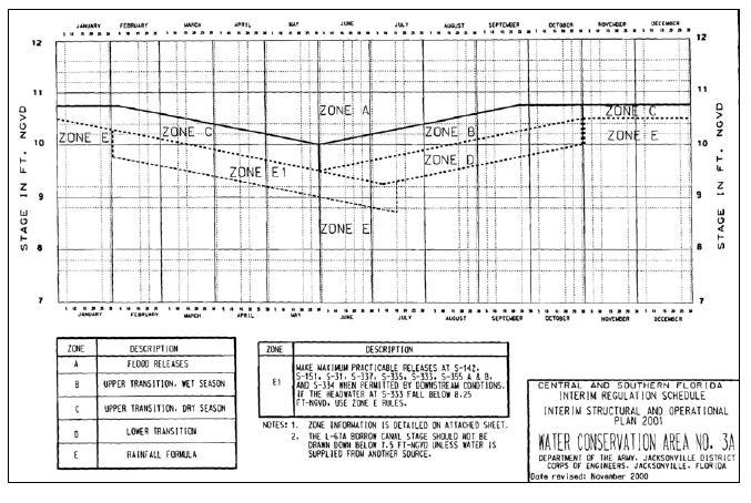
7 Structurally: Over-drained by early canal work - But Still Rain Driven System Until Eastern Protective Levee 1962 Water Conservation Areas Impounded 1983 Outlet from WCA3A to NESS 2003 Lower 4 Miles of L67 removed and filled 2013 One-Mile Bridge Opened Operationally Discharge from WCA3A governed by the Regulation Schedule No Discharge to NESRS Regulation Schedule for WCA3A complimented by the Minimum Delivery Schedule No Discharge to NESRS Experimental Program Regulation Schedule for WCA3 complimented by the Rainfall Plan Flow to NESRS Constrained by max canal stage of 7.5 ft-ngvd and max stage of 6.8 ft ngvd at G Interim Operational Plan. For NESRS basically the same as the Experimental Program with WCA3A excess routed into South Dade Stage constraint of 7.5 maintained Everglades Restoration Transition Plan. Lower Regulation Schedule for WCA3A. Stage constraint of 7.5 maintained
8
9
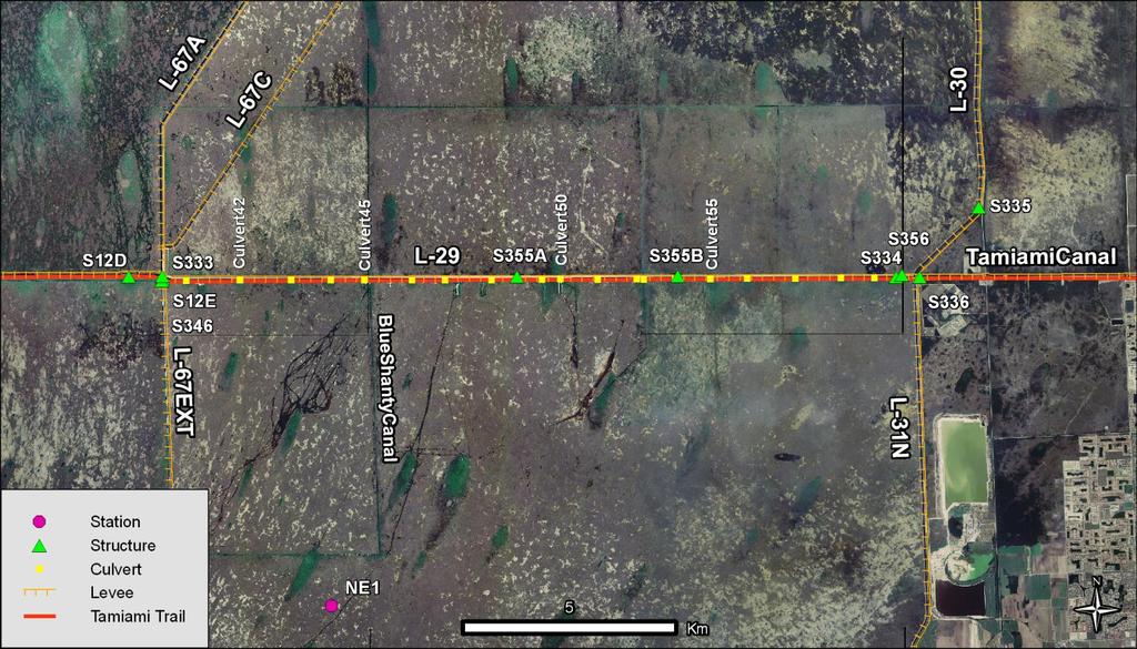
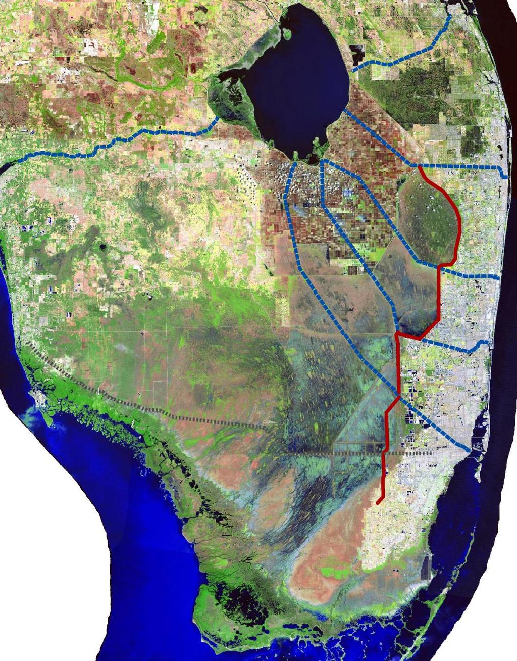
10
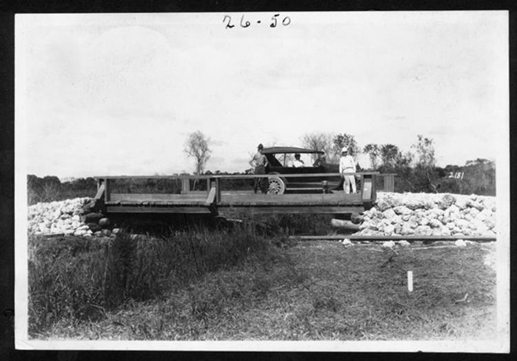
11 1914
12
13 1966
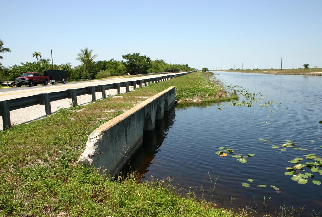
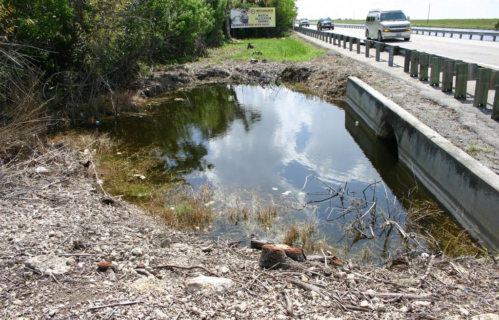
14 The focus is on flow How flow has varied with regional rainfall. This is indicative of upstream water management. And how flow has varied with the water level in the L29 Canal. This analysis is from synoptic measurements (semi-monthly since 1940) and are indicative of physical conditions of the landscape downstream We will also look at how flow has varied spatially through the culverts, and get a glimpse of the effects of the bridge with the 2 years of data available
15
16
17 Conservation Areas Impounded S333 Connects WCA3A to NESRS Eastern Protective Levee
18
19 Since 1983,, flow into L29 stops when the canal stage reaches 7.5 ft ngvd Or the marsh gauge, G3273 reaches 6.8 ft
20 Gravity Driven Flow is Controlled by Topography We have pumps to fill up the Conservation Areas, but we rely on gravity to move the water out
21
22
23
24 In southern Miami-Dade county the aquifer is so permeable that the C&SF had to route water more westerly than in Palm Beach and Broward
25
26
27
28 L-31N South Florida Natural Resources Center L-29 S333 L-67A L-67C L-67EXT L-67EXT S334S336 NE3 S335 C-4 L-30N Average Annual NESS Water Budget (1000 acre-ft) NE4 G211 C-1W S338 Inflows 203 Seepage Loss 222 P33 C-102 L-31N
29
30
31
32
33
34
35
36
37
38
39
40 Stage (ft NGVD) Stage (ft NGVD) South Florida Natural Resources Center NE3 Stage 2001 (Hydroperiod = 192 days) /1/01 2/1/01 3/1/01 4/1/01 5/1/01 6/1/01 7/1/01 8/1/01 9/1/01 10/1/01 11/1/01 12/1/01 Date NE3 Stage 2002 (Hydroperiod = 330 days) /1/02 2/1/02 3/1/02 4/1/02 5/1/02 6/1/02 7/1/02 8/1/02 9/1/02 10/1/02 11/1/02 12/1/02 Date
41 Stage (ft NGVD) Stage (ft NGVD) South Florida Natural Resources Center NE4 Stage 2001 (Hydroperiod = 310 days) /1/01 2/1/01 3/1/01 4/1/01 5/1/01 6/1/01 7/1/01 8/1/01 9/1/01 10/1/01 11/1/01 12/1/01 Date 8.0 NE4 Stage 2002 (Hydroperiod = 365 days) /1/02 2/1/02 3/1/02 4/1/02 5/1/02 6/1/02 7/1/02 8/1/02 9/1/02 10/1/02 11/1/02 12/1/02 Date

42 Over 3 feet of soil loss in Northeast Shark River Slough due to dry conditions caused by seepage losses and cutting off of inflows 3 ft soil loss since 1946
43 What s Next for NESRS? Near Term (Over the Next 5 years): Modified Water Deliveries Project Incremental Field Test is scheduled To begin next month. Increment 1 will maintain the 7.5 foot ngvd canal limit but remove the 6.8 foot ngvd Marsh gauge constraint at G3273 Increment 2 and 3 will raise the canal stage limit to 8.0 and then 8.5 feet ngvd.

44 Long Term (20-25 Years) Central Everglades Plan

45 Thank you.
APPENDIX D: WATER CONSERVATION AREA NO. 3, EVERGLADES NATIONAL PARK AND EVERGLADES NATIONAL PARK-SOUTH DADE CONVEYANCE SYSTEM OPERATIONAL GUIDANCE
 APPENDIX D: WATER CONSERVATION AREA NO. 3, EVERGLADES NATIONAL PARK AND EVERGLADES NATIONAL PARK-SOUTH DADE CONVEYANCE SYSTEM OPERATIONAL GUIDANCE DRAFT CSSS Operational Guidance for Water Conservation
L-31N Seepage Management Field Test
 Miami-Dade Limestone Products Association 13292 N.W. 118 th Avenue Miami, FL 33178 L-31N Seepage Management Field Test The Performance of a Partially Penetrating Seepage Barrier along the L-31N Canal July
Shallow Karst Aquifer System of the Lake Belt Study Area, Miami-Dade County, Florida, USA EXTENDED ABSTRACT
 Second International Conference on Saltwater Intrusion and Coastal Aquifers Monitoring, Modeling, and Management. Merida, Mexico, March 30 April 2, 2003 Shallow Karst Aquifer System of the Lake Belt Study
Everglades National Park
 National Park Service U.S. Department of the Interior Water Budget, Climate Variability, and Predicting Salinity for Eastern Florida Bay Erik Stabenau and Kevin Kotun National Park Service Erik_Stabenau@nps.gov
Rainfall Estimation at S-44 Site
 Technical Note EMA # 389 Rainfall Estimation at S-44 Site (January 2 "d, 3 rd, and 1 7 th, 1999 Events) March 1999 by Alaa Ali & Wossenu Abtew Hydro Information Systems and Assessment Department Environmental
Flow estimations through spillways under submerged tidal conditions
 Computational Methods and Experimental Measurements XIII 137 Flow estimations through spillways under submerged tidal conditions P. D. Scarlatos 1, M. Ansar 2 & Z. Chen 2 1 Department of Civil Engineering
LOCATED IN INDIAN RIVER COUNTY PREPARED FOR S.J.R.W.M.D. AND F.W.C.D. DECEMBER, 2003 Updated 2007 Updated May 2014 PREPARED BY
 FELLSMERE WATER CONTROL DISTRICT EAST MASTER DRAINAGE PLAN AND STORMWATER HYDROLOGIC ANALYSIS OF THE GRAVITY DRAINAGE SYSTEM LOCATED BETWEEN THE EAST BOUNDARY, LATERAL U, THE MAIN CANAL, AND DITCH 24 LOCATED
Project Delivery Team Meeting. December 14, Trusted Partners Delivering Value Today for a Better Tomorrow
 LOXAHATCHEE RIVER WATERSHED RESTORATION PROJECT Project Delivery Team Meeting December 14, 2016 One of the Last Old Growth Cypress Floodplains in the SE Florida Federally designated as a National Wild
WERP: How an Obsolete Levee and an Abandoned Jetport Hold the Key to a Rain-Driven Swamp
 WERP: How an Obsolete Levee and an Abandoned Jetport Hold the Key to a Rain-Driven Swamp WERP: How an Obsolete Levee and an Abandoned Jetport Hold the Key to a Rain-Driven Swamp WERP: How an Obsolete Levee
3.0 TECHNICAL FEASIBILITY
 3.0 TECHNICAL FEASIBILITY 3.1 INTRODUCTION To enable seasonal storage and release of water from Lake Wenatchee, an impoundment structure would need to be constructed on the lake outlet channel. The structure
Water Budget Analysis for Stormwater Treatment Area 2
 Technical Publication SFWMD-103 Water Budget Analysis for Stormwater Treatment Area 2 (Water Year 2007; May 1, 2006-April 30, 2007) June 2008 R. Scott Huebner Water Quality Assessment Division Environmental
Illinois State Water Survey Division
 Illinois State Water Survey Division SURFACE WATER SECTION SWS Miscellaneous Publication 108 SEDIMENT YIELD AND ACCUMULATION IN THE LOWER CACHE RIVER by Misganaw Demissie Champaign, Illinois June 1989
PRELIMINARY DRAFT FOR DISCUSSION PURPOSES
 Memorandum To: David Thompson From: John Haapala CC: Dan McDonald Bob Montgomery Date: February 24, 2003 File #: 1003551 Re: Lake Wenatchee Historic Water Levels, Operation Model, and Flood Operation This
Integrated Ecological Modeling and Decision Analysis within the Everglades Landscape
 Integrated Ecological Modeling and Decision Analysis within the Everglades Landscape GEER 2008 H. Carl Fitz Soil & Water Science Dept., Ft. Lauderdale Research & Education Center Greg Kiker Dept. of Agricultural
Estuarine Response in Northeastern Florida Bay to Major Hurricanes in 2005
 Estuarine Response in Northeastern Florida Bay to Major s in 25 By Jeff Woods and Mark Zucker s and tropical storms are critical components of the south Florida hydrologic cycle. These storms cause dramatic
RAINFALL AVERAGES AND SELECTED EXTREMES FOR CENTRAL AND SOUTH FLORIDA. Thomas K. MacVicar
 TECHNICAL PUBLICATION #83-2 March 1983 RAINFALL AVERAGES AND SELECTED EXTREMES FOR CENTRAL AND SOUTH FLORIDA by Thomas K. MacVicar "This public document was promulgated at an annual cost of $136.74, or
Natural Disasters. in Florida. Severe Thunderstorms
 Natural Disasters in Florida SC.6.E.7.7 Investigate how natural disasters have affected human life in Florida. Severe Thunderstorms While the typical afternoon thunderstorm in Florida may not appear to
HISTORY OF CONSTRUCTION FOR EXISTING CCR SURFACE IMPOUNDMENT PLANT GASTON ASH POND 40 CFR (c)(1)(i) (xii)
(1)(i) (xii)") HISTORY OF CONSTRUCTION FOR EXISTING CCR SURFACE IMPOUNDMENT PLANT GASTON ASH POND 40 CFR 257.73(c)(1)(i) (xii) (i) Site Name and Ownership Information: Site Name: E.C. Gaston Steam Plant Site Location:
HISTORY OF CONSTRUCTION FOR EXISTING CCR SURFACE IMPOUNDMENT PLANT GASTON ASH POND 40 CFR 257.73(c)(1)(i) (xii) (i) Site Name and Ownership Information: Site Name: E.C. Gaston Steam Plant Site Location:
ARTICLE 5 (PART 2) DETENTION VOLUME EXAMPLE PROBLEMS
 DETENTION VOLUME EXAMPLE PROBLEMS") ARTICLE 5 (PART 2) DETENTION VOLUME EXAMPLE PROBLEMS Example 5.7 Simple (Detention Nomograph) Example 5.8 Offsite and Unrestricted Areas (HEC-HMS) Example 5.9 Ponds in Series w/ Tailwater (HEC-HMS) Example
ARTICLE 5 (PART 2) DETENTION VOLUME EXAMPLE PROBLEMS Example 5.7 Simple (Detention Nomograph) Example 5.8 Offsite and Unrestricted Areas (HEC-HMS) Example 5.9 Ponds in Series w/ Tailwater (HEC-HMS) Example
Hydrologic budget of the ORW mitigation wetland, 2002
 Billabong Hydrology 2002 81 Hydrologic budget of the ORW mitigation wetland, 2002 Li Zhang and William J. Mitsch School of Natural Resources, The Ohio State University Introduction Understanding the hydrologic
INFLOW DESIGN FLOOD CONTROL SYSTEM PLAN 40 C.F.R. PART PLANT YATES ASH POND 2 (AP-2) GEORGIA POWER COMPANY
 GEORGIA POWER COMPANY") INFLOW DESIGN FLOOD CONTROL SYSTEM PLAN 40 C.F.R. PART 257.82 PLANT YATES ASH POND 2 (AP-2) GEORGIA POWER COMPANY EPA s Disposal of Coal Combustion Residuals from Electric Utilities Final Rule (40 C.F.R.
INFLOW DESIGN FLOOD CONTROL SYSTEM PLAN 40 C.F.R. PART 257.82 PLANT YATES ASH POND 2 (AP-2) GEORGIA POWER COMPANY EPA s Disposal of Coal Combustion Residuals from Electric Utilities Final Rule (40 C.F.R.
The Great USA Flood of 1993
 Destructive Water: Water-Caused Natural Disasters, their Abatement and Control (Proceedings of the Conference held at Anaheim, California, June 1996). IAHS Publ. no, 239, 1997. 13 The Great USA Flood of
E XTREME D ROUGHT An oppressive, long-term
 E XTREME D ROUGHT 2006-2008 An oppressive, long-term drought lasting from late March of 2006 until late August of 2008 impacted the entire state of Florida, with costly consequences in residential water
Physical Processes: What have we learned about Florida Bay in the past five years, and how is that useful to CERP planning and SFER management?
 Physical Processes: What have we learned about Florida Bay in the past five years, and how is that useful to CERP planning and SFER management? Peter B. Ortner, UM/RSMAS/CIMAS Modeling Progress Statistical
STRUCTURAL STABILITY ASSESSMENT
 STRUCTURAL STABILITY ASSESSMENT CFR 257.73(d) Bottom Ash Pond Complex Cardinal Plant Brilliant, Ohio October, 2016 Prepared for: Cardinal Operating Company Cardinal Plant Brilliant, Ohio Prepared by: Geotechnical
UPPER COSUMNES RIVER FLOOD MAPPING
 UPPER COSUMNES RIVER FLOOD MAPPING DRAFT BASIC DATA NARRATIVE FLOOD INSURANCE STUDY SACRAMENTO COUTY, CALIFORNIA Community No. 060262 November 2008 Prepared By: CIVIL ENGINEERING SOLUTIONS, INC. 1325 Howe
Screening analysis of Climate Scenarios. Jayantha Obeysekera, Jenifer Barnes, Moysey Ostrovsky Hydrologic & Environmental Systems Modeling
 Screening analysis of Climate Scenarios Jayantha Obeysekera, Jenifer Barnes, Moysey Ostrovsky Hydrologic & Environmental Systems Modeling Predicting Ecological Change in the Florida Everglades in a Future
THE NEED FOR AN ADDITIONAL SPILLWAY AT THE SANFORD DAM BOILING SPRING LAKES, NC. Presentation for The Brunswick County Commissioners April 20, 2015
 THE NEED FOR AN ADDITIONAL SPILLWAY AT THE SANFORD DAM BOILING SPRING LAKES, NC Presentation for The Brunswick County Commissioners April 20, 2015 The Sanford Dam Earth Dam constructed in 1961 Drainage
Technical Paper ERA #431
 Technical Paper ERA #431 (for presentation at the World Environmental & Water Resources Congress 2006 ASCE Conference in Omaha, Nebraska, May 21 to 25, 2006) Hydrologic Impact of the 2004 Hurricane Season
Attachment B to Technical Memorandum No.2. Operations Plan of Ross Valley Detention Basins
 Attachment B to Technical Memorandum No.2 Operations Plan of Ross Valley Detention Basins Operations Plan of Ross Valley Detention Basins Stetson Engineers Inc. January 26, 2011 1.0 Introduction Achieving
Ground Water Control of Tree Island Origin, Genesis and Destruction. By John F. Meeder and Peter W. Harlem SERC,FIU
 Ground Water Control of Tree Island Origin, Genesis and Destruction By John F. Meeder and Peter W. Harlem SERC,FIU Functional Definition Our functional definition of a Tree Island is; an isolated scrub
Adam Munson, Environmental Scientist III Resource Conservation and Development Department Southwest Florida Water Management District
 April 27, 2004 MEMORANDUM TO: FROM: File Adam Munson, Environmental Scientist III Resource Conservation and Development Department Southwest Florida Water Management District SUBJECT: Proposed minimum
UK Flooding Feb 2003
 UK Flooding 2000 06 Feb 2003 Britain has taken a battering from floods in the last 5 years, with major events in 1998 and 2000, significant floods in 2001 and minor events in each of the other years. So
Hydrogeology and Simulated Effects of Future Water Use and Drought in the North Fork Red River Alluvial Aquifer: Progress Report
 Hydrogeology and Simulated Effects of Future Water Use and Drought in the North Fork Red River Alluvial Aquifer: Progress Report Developed in partnership with the Oklahoma Water Resources Board S. Jerrod
Estimating Sewage System Flows
 9 Estimating Sewage System Flows DWSD Wholesale Sewer Rates 201 In this module, you will learn the sources of dry and wet weather flows and how these flows are estimated. Three different tools are used
Water-budget Analysis for Stormwater Treatment Area 5
 Technical Publication ERA # 447 Water-budget Analysis for Stormwater Treatment Area 5 (Water Year 2006; May 1, 2005 to April 30, 2006) May 2007 R. Scott Huebner Water Quality Assessment Division Environmental
9 th INTECOL Orlando, Florida June 7, 2012
 Restoration of the Everglades Saline Wetlands and Florida Bay: Responses Driven from Land and Sea David Rudnick 1, Colin Saunders 2, Carlos Coronado 2, Fred Sklar 2 Erik Stabenau 1, Vic Engel 1, Rene Price
Ecological Patterns and Processes in Ghost Tree Islands of the Everglades
 Ecological Patterns and Processes in Ghost Tree Islands of the Everglades Sharon M. L. Ewe 1, Binhe Gu 2, Jennifer Vega 1 and Kristin Vaughan 1 1 Ecology and Environment Inc., 12300 South Shore Blvd, Wellington,
Assessment of Lake Forest Lake Sediment Trapping Efficiency and Capacity. Marlon R. Cook Groundwater Assessment Program Geological Survey of Alabama
 Assessment of Lake Forest Lake Sediment Trapping Efficiency and Capacity Marlon R. Cook Groundwater Assessment Program Geological Survey of Alabama Impacts of the Lake at Lake Forest on the connectivity
NWS FORM E-5 U.S. DEPARTMENT OF COMMERCE I HYDRO SERVICE AREA NOAA, NATIONAL WEATHER SERVICE I Indianapolis, IN MONTHLY REPORT
 NWS FORM E-5 U.S. DEPARTMENT OF COMMERCE I HYDRO SERVICE AREA NOAA, NATIONAL WEATHER SERVICE I Indianapolis, IN. 1-------------------- MONTHLY REPORT OF RIVER AND FLOOD CONDITIONSI REPORT FOR I November
Frank Marshall CLF. Lynn Wingard, USGS Patrick Pitts, USFWS. Evelyn Gaiser, FIU Ania Wachnicka, FIU
 Pre-drainage Everglades Hydrology and Florida Bay Salinity Based on Paleoecology and Statistical Models Florida Bay and Adjacent Marine Systems Science Conference 2008 Frank Marshall CLF Lynn Wingard,
CR AAO Bridge. Dead River Flood & Natural Channel Design. Mitch Koetje Water Resources Division UP District
 CR AAO Bridge Dead River Flood & Natural Channel Design Mitch Koetje Water Resources Division UP District Old County Road AAO Bridge Map courtesy of Marquette County Silver Lake Basin McClure Basin
US Army Corps of Engineers BUILDING STRONG
 Greater New Orleans Hurricane and Storm Damage Risk Reduction System Robert Rowlette Senior Senior Program Manager Task Force Hope U.S. Army Corps of Engineers April 19, 2012 US Army Corps of Engineers
Lower Tuolumne River Accretion (La Grange to Modesto) Estimated daily flows ( ) for the Operations Model Don Pedro Project Relicensing
 Estimated daily flows ( ) for the Operations Model Don Pedro Project Relicensing") Lower Tuolumne River Accretion (La Grange to Modesto) Estimated daily flows (1970-2010) for the Operations Model Don Pedro Project Relicensing 1.0 Objective Using available data, develop a daily time series
Lower Tuolumne River Accretion (La Grange to Modesto) Estimated daily flows (1970-2010) for the Operations Model Don Pedro Project Relicensing 1.0 Objective Using available data, develop a daily time series
CCR Rule Annual Inspection Report (cont.) 2
 2") The inspection findings consisted of maintenance items and items that were not observed to be signs or potential signs of significant structural weakness. No deficiencies or disrupting conditions that
The inspection findings consisted of maintenance items and items that were not observed to be signs or potential signs of significant structural weakness. No deficiencies or disrupting conditions that
STREUVER FIDELCO CAPPELLI, LLC YONKERS DOWNTOWN DEVELOPMENT PHASE 1. DRAFT ENVIRONMENTAL IMPACT STATEMENT For: PALISADES POINT
 STREUVER FIDELCO CAPPELLI, LLC YONKERS DOWNTOWN DEVELOPMENT PHASE 1 DRAFT ENVIRONMENTAL IMPACT STATEMENT For: PALISADES POINT Prepared by: PAULUS, SOKOLOWSKI & SARTOR STORMWATER MANAGEMENT 1. Methodology
Rainfall Observations in the Loxahatchee River Watershed
 Rainfall Observations in the Loxahatchee River Watershed Richard C. Dent Loxahatchee River District September 1997 Introduction Rain is a common occurrence in south Florida, yet its presence or absence
Controlling Processes That Change Land
 1 Name Date Controlling Processes That Change Land People try to control some of the processes that change land. To do this, people apply technology- the use of science to solve problems in everyday life.
Chapter 5 CALIBRATION AND VERIFICATION
 Chapter 5 CALIBRATION AND VERIFICATION This chapter contains the calibration procedure and data used for the LSC existing conditions model. The goal of the calibration effort was to develop a hydraulic
Earth Wind & Fire. Game Changing Restoration Options in the Texas Chenier Plain
 Earth Wind & Fire Game Changing Restoration Options in the Texas Chenier Plain EARTH: The Chenier Plain is a 5 million acre coastal region in Southwest Louisiana and Southeast Texas providing landscape
Use of SWAT to Scale Sediment Delivery from Field to Watershed in an Agricultural Landscape with Depressions
 Use of SWAT to Scale Sediment Delivery from Field to Watershed in an Agricultural Landscape with Depressions James E. Almendinger St. Croix Watershed Research Station, Science Museum of Minnesota Marylee
Everglades National Park
 National Park Service U.S. Department of the Interior Climate Variability and the Coastal Physical Environment (Florida Bay) Presented by: Erik Stabenau - National Park Service Contributions from: Christina
TECHNICAL PUBLICATION ERA # 422 RATING DEVELOPMENT FOR FLOW THROUGH CULVERTS UNDER SR9336 IN THE EVERGLADES NATIONAL PARK I: CONCEPTS AND METHODS
 TEHNIAL PUBLIATION ERA # 422 RATING DEVELOPMENT FOR FLOW THROUGH ULVERTS UNDER SR9336 IN THE EVERGLADES NATIONAL PARK I: ONEPTS AND METHODS BY Qinglong Wu Muluneh Imru April 2005 South Florida Water Management
APPENDIX 3B OCCURRENCE OF SIGNIFICANT RIVER ALLUVIUM AQUIFERS IN THE PLATEAU REGION
 Plateau Region Water Plan January 2011 APPENDIX 3B OCCURRENCE OF SIGNIFICANT RIVER ALLUVIUM AQUIFERS IN THE PLATEAU REGION Occurrence of Significant River Alluvium Aquifers in the Plateau Region Prepared
Napa County Comprehensive Groundwater Monitoring Program 2015 Annual Report and CASGEM Update
 Napa County Comprehensive Groundwater Monitoring Program 2015 Annual Report and CASGEM Update April 21, 2016 Watershed Information & Conservation Council By Vicki Kretsinger Grabert Overview Evolving groundwater
Flow impacts on P and OM Cycling in the Ridge and Slough:
 Flow impacts on P and OM Cycling in the Ridge and Slough: Lessons from landscape budgets in the Decomp Physical Model and Shark Slough, ENP Colin Saunders South Florida Water Management District Greater
President s Day Weekend Storm Community Meeting and Workshop April 17, 2017
 President s Day Weekend Storm Community Meeting and Workshop April 17, 2017 Meeting outline 1. Progress update on the City of San Jose s recovery efforts 2. Water district presentation on: Weather situation
Why Geomorphology for Fish Passage
 Channel Morphology - Stream Crossing Interactions An Overview Michael Love Michael Love & Associates mlove@h2odesigns.com (707) 476-8938 Why Geomorphology for Fish Passage 1. Understand the Scale of the
Platte River Flow and Sediment Transport Between North Platte and Grand Island, Nebraska ( )
") Platte River Flow and Sediment Transport Between North Platte and Grand Island, Nebraska (1895-1999) U.S. Department of the Interior Bureau of Reclamation TECHNICAL SERVICE CENTER Denver, Colorado October
Platte River Flow and Sediment Transport Between North Platte and Grand Island, Nebraska (1895-1999) U.S. Department of the Interior Bureau of Reclamation TECHNICAL SERVICE CENTER Denver, Colorado October
AlL^Ol^^ A DISSERTATION PRESENTED TO THE GRADUATE SCHOOL OF THE UNIVERSITY OF FLORIDA IN PARTIAL FULFILLMENT OF THE REQUIREMENTS FOR THE DEGREE OF
 AlL^Ol^^ SPATTAL AND TEMPORAL DYNAMICS IN THE EVERGLADES ECOSYSTEM WITH IMPLICATIONS FOR WATER DEUVERIES TO EVERGLADES NATIONAL PARK By LANCE H. GUNDERSON A DISSERTATION PRESENTED TO THE GRADUATE SCHOOL
REDWOOD VALLEY SUBAREA
 Independent Science Review Panel Conceptual Model of Watershed Hydrology, Surface Water and Groundwater Interactions and Stream Ecology for the Russian River Watershed Appendices A-1 APPENDIX A A-2 REDWOOD
Betsy Stevenson and Allison Mohrs (Skagit County Planning and Development Services) Jenny Baker, The Nature Conservancy
 Jenny Baker, The Nature Conservancy") TC Fisher Slough Final Design and Permitting Subject: Well Review Memorandum To: From: Betsy Stevenson and Allison Mohrs (Skagit County Planning and Development Services) Jenny Baker, The ature Conservancy
TC Fisher Slough Final Design and Permitting Subject: Well Review Memorandum To: From: Betsy Stevenson and Allison Mohrs (Skagit County Planning and Development Services) Jenny Baker, The ature Conservancy
Background and Purpose of Meeting. River Towers Meeting. Flood Risk Management Study Alternatives Overview
 1 and Purpose of Meeting River Towers Meeting Flood Risk Management Study Alternatives Overview September 23, 2014 There is no "proposed" flood risk management solution for this area at this time Fairfax
Mosaic: Predictions from Alternative
 Flow and Pattern in the Ridge Slough Mosaic: Predictions from Alternative Mechanisms of Landform Development Matt Cohen, Danielle Watts, Todd Osborne University of Florida Jim Heffernan Florida International
9. PROBABLE MAXIMUM PRECIPITATION AND PROBABLE MAXIMUM FLOOD
 9. PROBABLE MAXIMUM PRECIPITATION AND PROBABLE MAXIMUM FLOOD 9.1. Introduction Due to the size of Watana Dam and the economic importance of the Project to the Railbelt, the Probable Maximum Flood (PMF)
FORECAST-BASED OPERATIONS AT FOLSOM DAM AND LAKE
 FORECAST-BASED OPERATIONS AT FOLSOM DAM AND LAKE 255 237 237 237 217 217 217 200 200 200 0 163 131 Bridging the Gap163Conference 255 0 132 255 0 163 122 The Dana on Mission Bay San Diego, CA January 28,
Seagrass Transplantation & Environmental & Marine Consulting Services, Inc. Drew Campbell, Vice President & Lead Scientst.
 Indian River Lagoon Symposium Seagrass Transplantation & Project Considerations Environmental & Marine Consulting Services, Inc. Drew Campbell, Vice President & Lead Scientst March 26 th, 2013 Regulatory
Colorado River Management under Uncertainty
 Colorado River Management under Uncertainty Terry Fulp Deputy Regional Director Lower Colorado Region WRRC Annual Meeting June 24, 2008 Colorado River Management under Uncertainty Overview of Colorado
Appendix B - Alabama-Coosa-Tallapoosa (ACT) Basin
 Basin") Appendix B - Alabama-Coosa-Tallapoosa (ACT) Basin 1 ACT BASIN 1.1 DESCRIPTION OF BASIN The headwater streams of the Alabama-Coosa-Tallapoosa (ACT) System rise in the Blue Ridge Mountains of Georgia and
Appendix B - Alabama-Coosa-Tallapoosa (ACT) Basin 1 ACT BASIN 1.1 DESCRIPTION OF BASIN The headwater streams of the Alabama-Coosa-Tallapoosa (ACT) System rise in the Blue Ridge Mountains of Georgia and
National Weather Service Flood Forecast Needs: Improved Rainfall Estimates
 National Weather Service Flood Forecast Needs: Improved Rainfall Estimates Weather Forecast Offices Cleveland and Northern Indiana Ohio River Forecast Center Presenter: Sarah Jamison, Service Hydrologist
Hydraulic and Sediment Transport Modeling Strategy
 Appendix B Hydraulic and Sediment Transport Modeling Strategy May 2014 Technical Memorandum Channel Capacity Report January 2015 San Joaquin River Restoration Program Hydraulic and Sediment Transport Modeling
Connectivity Between the Mangrove Ecotone Region and Florida Bay: Current Understanding in Carbon and Nutrient Fluxes
 Connectivity Between the Mangrove Ecotone Region and Florida Bay: Current Understanding in Carbon and Nutrient Fluxes Victor H. Rivera-Monroy, Stephen E. Davis III, Robert R. Twilley, Daniel L. Childers,
Folsom Dam Water Control Manual Update
 Folsom Dam Water Control Manual Update Public Workshop April 3, 2014 Location: Sterling Hotel Ballroom 1300 H Street, Sacramento US Army Corps of Engineers BUILDING STRONG WELCOME & INTRODUCTIONS 2 BUILDING
Hydrologic Forecast Centre Manitoba Infrastructure, Winnipeg, Manitoba. FEBRUARY OUTLOOK REPORT FOR MANITOBA February 23, 2018
 Page 1 of 17 Hydrologic Forecast Centre Manitoba Infrastructure, Winnipeg, Manitoba FEBRUARY OUTLOOK REPORT FOR MANITOBA February 23, 2018 Overview The February Outlook Report prepared by the Hydrologic
STREAM RESTORATION AWRA Summer Specialty Conference, GIS and Water Resources IX
 STREAM RESTORATION 2016 AWRA Summer Specialty Conference, GIS and Water Resources IX Innovative Use of 2D Hydraulic Modeling in Stream Restoration Design Presented by: Li Gao, PE and Robert Scrafford,
Analysis of the USGS Coastal Gradient Real-time Gaging Network
 Analysis of the USGS Coastal Gradient Real-time Gaging Network Paul Conrads, USGS, SC Water Science Center Kenneth Odom, USGS, CO Water Science Center Greater Everglades Ecosystem Restoration Conference
Bureau of Economic and Business Research May 29, Measuring Population Density for Counties in Florida
 Bureau of Economic and Business Research May 29, 2015 Measuring Population Density for Counties in Florida By: Stefan Rayer, PhD; Ying Wang, PhD https://www.bebr.ufl.edu/content/measuring-population-density-counties-florida
PENNSYLVANIA DEPARTMENT OF TRANSPORTATION ENGINEERING DISTRICT 3-0
 PENNSYLVANIA DEPARTMENT OF TRANSPORTATION ENGINEERING DISTRICT 3-0 LYCOMING COUNTY S.R.15, SECTION C41 FINAL HYDROLOGIC AND HYDRAULIC REPORT STEAM VALLEY RUN STREAM RELOCATION DATE: June, 2006 REVISED:
Analysis of Hydraulic Impacts on the Schuylkill River
 Analysis of Hydraulic Impacts on the Schuylkill River Manayunk Sewer Basin Construction Project and the Venice Island Recreation Center Reconstruction Project Venice Island, Manayunk, Philadelphia, PA
FLOOD REPORT FOR MANITOBA. June 28, A Gale wind warning is in effect for Lake Manitoba and Lake Winnipeg
 FLOOD REPORT FOR MANITOBA June 28, 2014 A Gale wind warning is in effect for Lake Manitoba and Lake Winnipeg Flood Warning*: Flood Watch*: High Water Advisory*: - Assiniboine River, from Shellmouth Dam
Stage Discharge Tabulation for Only Orifice Flow
 Stage Discharge Tabulation for Only Orifice Flow DEPTH STAGE DISCHARGE (meters) (feet) (meters) (feet) (m 3 /s) (ft 3 /s) 0 0.20 0.40 0.60 0.80 1.00 1.20 1.40 1.60 1.80 2.00 0.7 1.3 2.0 2.6 3.3 3.9 4.6
12 SWAT USER S MANUAL, VERSION 98.1
 12 SWAT USER S MANUAL, VERSION 98.1 CANOPY STORAGE. Canopy storage is the water intercepted by vegetative surfaces (the canopy) where it is held and made available for evaporation. When using the curve
InSAR-based hydrology of the Everglades, South Florida
 InSAR-based hydrology of the Everglades, South Florida Shimon Wdowinski (1), Falk Amelung (1), Fernando Miralles-Wilhelm (2), Tim Dixon (1), and Richard Carande (3) (1) Division of Marine Geology and Geophysics,
ATLANTIC INTRACOASTAL WATERWAY NORFOLK DISTRICT. Joel F. Scussel, Operations Support Section Dismal Swamp Canal July 27, 2017
 ATLANTIC INTRACOASTAL WATERWAY 1 255 255 255 237 237 237 0 0 0 217 217 217 163 163 163 200 200 200 131 132 122 239 65 53 80 119 27 NORFOLK DISTRICT 110 135 120 252 174.59 112 92 56 62 102 130 102 56 48
Appendix C. Apalachicola-Chattahoochee-Flint (ACF) Basin Detailed Analysis
 Basin Detailed Analysis") Appendix C Apalachicola-Chattahoochee-Flint (ACF) Basin Detailed Analysis Appendix C - Apalachicola-Chattahoochee-Flint Basin Detailed Analysis 1 ACF BASIN 1.1 DESCRIPTION OF BASIN Streams of the Apalachicola-Chattahoochee-Flint
Appendix C Apalachicola-Chattahoochee-Flint (ACF) Basin Detailed Analysis Appendix C - Apalachicola-Chattahoochee-Flint Basin Detailed Analysis 1 ACF BASIN 1.1 DESCRIPTION OF BASIN Streams of the Apalachicola-Chattahoochee-Flint
Low Low Water in Puget Sound vs. Mean Sea Level. What do the flood event gauge readings at Sedro Woolley really mean?
 Low Low Water in Puget Sound vs. Mean Sea Level What do the flood event gauge readings at Sedro Woolley really mean? When you make the adjustment of 8.93 feet to the published values and then subtract
Wisconsin s Hydrogeology: an overview
 2012 Soil and Water Conservation Society Conference Stevens Point, WI Feb 9, 2012 Wisconsin s Hydrogeology: an overview Ken Bradbury Wisconsin Geological and Natural History Survey University of Wisconsin-Extension
Highland Lake Bathymetric Survey
 Highland Lake Bathymetric Survey Final Report, Prepared For: The Town of Highland Lake 612 Lakeshore Drive Oneonta, AL 35121 Prepared By: Tetra Tech 2110 Powers Ferry Road SE Suite 202 Atlanta, GA 30339
Factors influencing nutrient and sediment retention by riverine wetlands in the Chesapeake watershed Greg Noe, Cliff Hupp, Ed Schenk, Nancy Rybicki
 Factors influencing nutrient and sediment retention by riverine wetlands in the Chesapeake watershed Greg Noe, Cliff Hupp, Ed Schenk, Nancy Rybicki National Research Program, Reston VA U.S. Department
Enhancing and Combining Complex Numerical Models of Coastal Southern Florida
 Enhancing and Combining Complex Numerical Models of Coastal Southern Florida Eric Swain, Melinda Lohmann, and Jeremy Decker U.S. Geological Survey Florida Bay and Adjacent Marine Systems Science Conference,
Appendix E Guidance for Shallow Flooding Analyses and Mapping
 Appendix E Guidance for Shallow Flooding Analyses and Mapping E.1 Introduction Different types of shallow flooding commonly occur throughout the United States. Types of flows that result in shallow flooding
CASE STUDIES. Introduction
 Introduction The City of Winston-Salem faces the challenge of maintaining public infrastructure (e.g., water and sewer lines, storm drains, roads, culverts and bridges) while minimizing the potential impacts
LOMR SUBMITTAL LOWER NEHALEM RIVER TILLAMOOK COUNTY, OREGON
 LOMR SUBMITTAL LOWER NEHALEM RIVER TILLAMOOK COUNTY, OREGON Prepared for: TILLAMOOK COUNTY DEPARTMENT OF COMMUNITY DEVELOPMENT 1510-B THIRD STREET TILLAMOOK, OR 97141 Prepared by: 10300 SW GREENBURG ROAD,
The Saltwater Intrusion Problem: Concepts, Challenges, Modeling, Experiments and Case Studies
 The Saltwater Intrusion Problem: Concepts, Challenges, Modeling, Experiments and Case Studies Manfred Koch Department of Geohydraulics and Engineering Hydrology, University of Kassel, Germany Email: kochm@uni-kassel.de
2012 Rainfall, Runoff, Water Level & Temperature Beebe Lake Wright County, MN (# )
") www.fixmylake.com 18029 83 rd Avenue North Maple Grove, MN 55311 mail@freshwatersci.com (651) 336-8696 2012 Rainfall, Runoff, Water Level & Temperature Beebe Lake Wright County, MN (#86-0023) Prepared
www.fixmylake.com 18029 83 rd Avenue North Maple Grove, MN 55311 mail@freshwatersci.com (651) 336-8696 2012 Rainfall, Runoff, Water Level & Temperature Beebe Lake Wright County, MN (#86-0023) Prepared
EQ: Discuss main geographic landforms of the U.S. & Canada and examine varied landforms in relation to their lifestyles.
 EQ: Discuss main geographic landforms of the U.S. & Canada and examine varied landforms in relation to their lifestyles. Places & Terms for Discussion Appalachian Mountains Great Plains Canadian Shield
FHWA - HIGHWAY HYDROLOGY
 The unit peak discharge is computed with Equation 5.6 by interpolating c 0, c, and c Table 5.5 using a type II distribution. The peak discharge is also calculated as follows. from Variable SI Unit U Unit.5444
Summary of Hydraulic and Sediment-transport. Analysis of Residual Sediment: Alternatives for the San Clemente Dam Removal/Retrofit Project,
 Appendix N SUMMARY OF HYDRAULIC AND SEDIMENT-TRANSPORT ANALYSIS OF RESIDUAL SEDIMENT: ALTERNATIVES FOR THE SAN CLEMENTE DAM REMOVAL/RETROFIT PROJECT, CALIFORNIA the San Clemente Dam Removal/Retrofit Project,
Study 16.5 Probable Maximum Flood (PMF)
") Initial Study Report Meeting Study 16.5 Probable Maximum Flood (PMF) October 22, 2014 Prepared by 10/22/2014 1 Study 16.5 Objectives Develop a site-specific PMP to be used for the derivation of the PMF
Initial Study Report Meeting Study 16.5 Probable Maximum Flood (PMF) October 22, 2014 Prepared by 10/22/2014 1 Study 16.5 Objectives Develop a site-specific PMP to be used for the derivation of the PMF
Optimal Artificial Neural Network Modeling of Sedimentation yield and Runoff in high flow season of Indus River at Besham Qila for Terbela Dam
 Optimal Artificial Neural Network Modeling of Sedimentation yield and Runoff in high flow season of Indus River at Besham Qila for Terbela Dam Akif Rahim 1, Amina Akif 2 1 Ph.D Scholar in Center of integrated