Knowledge and data gaps on the Rio Grande Rise, South Atlantic Ocean benthic and pelagic ecosystems
|
|
|
- Elfrieda Sanders
- 5 years ago
- Views:
Transcription
 1-3 June 2015, Horta, Azores, Portugal Knowledge and data gaps on the Rio Grande Rise, South Atlantic Ocean benthic and pelagic ecosystems Angel")
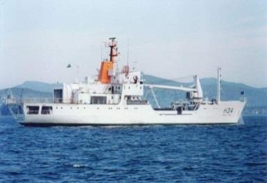
1 Workshop Towards the development of a strategic Environmental Management Plan for deep seabed mineral exploration and exploitation in the Atlantic basin (SEMPIA) 1-3 June 2015, Horta, Azores, Portugal Knowledge and data gaps on the Rio Grande Rise, South Atlantic Ocean benthic and pelagic ecosystems Angel Perez

2 Origin Ma - On-ridge intense basaltic volcanism Atlantic expansion - Separation fron Walvis Ridge - Thermal subsidence, Eocene (30-50 ma) - RGR underwent alkaline vulcanism - Formation of seamounts and guyots - uplifted bove the sea level Erosion - shallow watter sedimentation - subsidence

 5km above ocean basin plateau 600 m deep On plateau:")
3 Geomorphology ERGR WRGR km 2 Complex topography: Western Eastern components Western Large Elyptic Bulge (1.5 the area of Portugal!) 5km above ocean basin plateau 600 m deep On plateau: NW SE troughs: grabben over plateau
4 Questions Surface Productivity Topography x Current flow Nutrient enrichment? Plankton trapping? Biodiversity Fauna Diversity - Abundance Connectivity Drivers Depth Habitats Topography Heterogeneity? Energy sources?


5 Studies in the RGR

6 Benthic & Benthopelagic Fauna Rock Cnidaria Porifera Echinodermata Mollusca Polychaeta Crustacea Bryozoa Sipuncula Ascidiacea Pisces Brachiopoda Percentual de ocorrência nos lances Al Ch Pockmarks Width ~30km Sediment


7 Grabben Bottom 1200m Grabben Wall m Summit - Crust m Summit Carbonate Rock 600m Summit Sediment 1000m
 350355 330 335340345 315 320325 0 5 10 15 20 25 30")
 Sarostegia oculata 60 295 300305310 65 290 70 285 75")

8 Perez et al. (submitted) Hajdu et al. (submitted) Sarostegia oculata Regular plane of growth (n=85, r = 0.97) Regular current direction (313⁰)


 ~7 Families Dive 1338 Dive 1339 Projasus parkery Malacocephalus")
9 Megafauna: Fish & Crustacean (video analysis) Gadiformes Anguilliformes Lophiiformes Albuliformes Beryciformes Aristeidae Argentiniformes Redfish Order2 Zeiformes Dendrobranchiata1 Redfish Order1 Palinuridae Squaliformes Geryonidae Scorpaeniformes Polychelidae Ophidiiformes Stomiiformes Nematocarcinidae Dendrobranchiata 2 Lithodidae Unid Fish Dendrobranchiata NI Decapoda NI Exploration: ~5500 m - ~9.5 hours 466 fish (30 morphotypes) 13 Orders/~16 Families 26 Decapoda (7 morphotypes) ~7 Families Dive 1338 Dive 1339 Projasus parkery Malacocephalus okamurai Synaphobranchus sp. Chaunax sp.
10 Number of Morphotypes More habitats Fish and crustacean community composition vary significantly among habitats (ANOSIM p = 0.001) Less habitats 40 60% species turnover between adjacent habitats Two diving sites differed in abundance (<0.001) Number of records/ 80 m observation 0 0:00 1:00 2:00 3:00 4:00 Observation Time (h) Records with Susp. Feeders Records on habitats with high sediments coverage Current effect? 0 GB SCR SCA SSD SCT Dive Dive GB GW SCR SCA All SSD SCT All

 320 325330335340345350355 285 290 295 300 305310315 280 275 270 265 260 255 250")
11 Megafauna: Hypothesis RGR sectors exposed to intense/ regular current regime many suspension feeders concentrate OM (Sponges) - increased fauna abundance RGR sectors where current regime is less intense/regular more sediments less suspension feeders less fish/crustacean abundance Fish react to current regime in different ways Cabeça Cauda Current direction (as derived from sponge growth plane) Cabeça Cauda


12 Depth (m) Pelagic Ecosystem 0 clorofila-a (ug/l) ZOOPLÂNKTON Mg/l


13 Top Predators Brazilian longliners concentrateon slope waters aiming at Swordfish Long Distance operations on SE RGR - targetting at large concentrations of blue shark Food concentration does not seem to be the driver of those concentrations life cycle? B Fraction of Data A Fraction of Data Kg/1000 hooks Slpe Waters RGR RGR Slpe Waters Xyphias gladius Prionace glauca Kg/1000 hooks
 Series of Oceanographic Cruises planned to build Environmenl Baselines Ecological Questions will be addressed in a specific sampling")
14 Final Remarks Understanding biological community structure in RGR is becoming critical as Brazil has applied for exploration of Cobalt-rich Ferromanganese Crusts 2015 onwards Plan of Work First Phase (5 years) Series of Oceanographic Cruises planned to build Environmenl Baselines Ecological Questions will be addressed in a specific sampling program
Major Factors influencing Seamount Niches
 2018 May 27-30, Quindao, China International Workshop of the REMP for the Cobalt-Rich Ferromanganese Crust in the Triangle Area in the northwest Pacific Ocean Major Factors influencing Seamount Niches
Workshop background and objectives
 Cobalt crusts and the diversity and distribution patterns of seamount faunas Workshop background and objectives Tony Koslow March 2006 CSIRO Marine and Atmospheric Research Perth, Australia www.csiro.au
Deep-sea nodule and crust ecosystems: benthic assemblages of manganese nodules and cobalt-rich crusts Malcolm Clark
 Deep-sea nodule and crust ecosystems: benthic assemblages of manganese nodules and cobalt-rich crusts Malcolm Clark National Institute of Water & Atmospheric Research, New Zealand SPC-EU EDF10 Deep Sea
Chapter 7 Benthic deep-sea carbonates: reefs and seeps
 Chapter 7 Benthic deep-sea carbonates: reefs and seeps Carbonates are formed across most latitudes and they are not restricted to shallow water but are also found in all but the deepest abyssal and hadal
Marine ecosystem mapping at the Prince Edward Islands
 Marine ecosystem mapping at the Prince Edward Islands Biodiversity Planning Forum NBA special session June 2018 R Adams, C von der Meden, A Dayaram, K Sink, A Lombard, A Bosman, M Dopolo, F Fourie, L Harris,
Earth / Environmental Science. Ch. 14 THE OCEAN FLOOR
 Earth / Environmental Science Ch. 14 THE OCEAN FLOOR The Blue Planet Nearly 70% of the Earth s surface is covered by the global ocean It was not until the 1800s that the ocean became an important focus
Physiography Ocean Provinces p. 1 Dimensions p. 1 Physiographic Provinces p. 2 Continental Margin Province p. 2 Deep-Ocean Basin Province p.
 Physiography Ocean Provinces p. 1 Dimensions p. 1 Physiographic Provinces p. 2 Continental Margin Province p. 2 Deep-Ocean Basin Province p. 2 Mid-Ocean Ridge Province p. 3 Benthic and Pelagic Provinces
Seafloor Morphology. Techniques of Investigation. Bathymetry and Sediment Studies
 Seafloor Morphology I f we select a grid for the surface of the earth (i.e. 5 km 2 ) and assign it an average elevation in relation to sea level, we can construct a graph of elevation versus area of the
A Planned Course Statement for. Oceanography. Course # 410 Grade(s) 9, 10, 11, 12. Length of Period (mins.) 40 Total Clock Hours: 60
 9, 10, 11, 12. Length of Period (mins.) 40 Total Clock Hours: 60") East Penn School District Secondary Curriculum A Planned Course Statement for Oceanography Course # 410 Grade(s) 9, 10, 11, 12 Department: Science ength of Period (mins.) 40 Total Clock Hours: 60 Periods
East Penn School District Secondary Curriculum A Planned Course Statement for Oceanography Course # 410 Grade(s) 9, 10, 11, 12 Department: Science ength of Period (mins.) 40 Total Clock Hours: 60 Periods
Earth s Continents and Seafloors. GEOL100 Physical Geology Ray Rector - Instructor
 Earth s Continents and Seafloors GEOL100 Physical Geology Ray Rector - Instructor OCEAN BASINS and CONTINENTAL PLATFORMS Key Concepts I. Earth s rocky surface covered by of two types of crust Dense, thin,
Deep sea floor By. The structures and features of ocean basin are summarized in Fig. 1. Ocean basin
 Deep sea floor By Sufia Zaman 1, Tanmay Ray Chaudhuri 2, Prosenjit Pramanick 2 and Abhijit Mitra 1 1 Department of Marine Science, University of Calcutta, 35, B. C. Road, Kolkata-700 019, India. 2 Department
Ocean Floor. Continental Margins. Divided into 3 major regions. Continental Margins. Ocean Basins. Mid-Ocean Ridges. Include:
 Ocean Floor Divided into 3 major regions Continental Margins Ocean Basins Mid-Ocean Ridges Continental Margins Include: Continental Shelves Continental Slopes Continental Rise 1 Continental Shelves Part
Characteristics of the Deep- Sea environment II. Malcolm Clark
 Characteristics of the Deep- Sea environment II Malcolm Clark 4 th Regional Training Workshop, Environmental Perspectives of Deep Sea Mineral Activities, Nadi, Fiji. December 2013 Bathyal and Abyssal regions-the
Marine biodiversity - PBBT102
 Marine biodiversity - PBBT102 UNIT 1 (2 marks) 1. Define marine biodiversity? 2. How biodiversity is measured? 3. Why many species go extinct every day? 4. What is biodiversity hotspot? 5. What are endemic
Submersible investigation of unconfirmed western Miami Terrace habitat
 Submersible investigation of unconfirmed western Miami Terrace habitat Prepared By: Brian K. Walker, Ph.D. Nova Southeastern University Oceanographic Center 6/08/2015 On June 5, 2015 Nova Southeastern
Map shows 3 main features of ocean floor
 Map shows 3 main features of ocean floor 2017 Pearson Education, Inc. Chapter 3 Marine Provinces 2017 Pearson Education, Inc. 1 Chapter 3 Overview The study of bathymetry determines ocean depths and ocean
SW Florida Escarpment Mapping Area
 Overview NOAA s Okeanos Explorer (EX) Program plans to conduct systematic mapping and telepresence-enabled ROV explorations in the Gulf of Mexico during Spring 2014. In 2011, the EX conducted mapping operations
Oceanography, An Invitation to Marine Science 9e Tom Garrison. Ocean Basins Cengage Learning. All Rights Reserved.
 Oceanography, An Invitation to Marine Science 9e Tom Garrison 4 Ocean Basins Key Concepts Tectonic forces shape the seabed The ocean floor is divided into continental margins and deep ocean basins The
Unit 4 - Water. Earth s Interior. Earth s Interior. Continental Drift. Continental Drift. Continental Drift. Crust. Mantle. Core.
 Unit 4 - Water How did the oceans form? What special adaptations do saltwater organisms have? Where does our water come from? How do humans affect the Earth s water? Crust Rigid outer shell of Earth Oceanic
Marine Life. and Ecology. 2. From phytoplanktons to invertebates
 Marine Life and Ecology 2. From phytoplanktons to invertebates Virtually all primary productivity on land comes from large seaweeds such as these do exist, but they need shallow water where Sunlight is
Bathymetry Measures the vertical distance from the ocean surface to mountains, valleys, plains, and other sea floor features
 1 2 3 4 5 6 7 8 9 10 11 CHAPTER 3 Marine Provinces Chapter Overview The study of bathymetry determines ocean depths and ocean floor topography. Echo sounding and satellites are efficient bathymetric tools.
Development of EIA protocol for deep-sea ecosystems and seabed mining
 Development of EIA protocol for deep-sea ecosystems and seabed mining Hiroyuki Yamamoto, Ryota Nakajima, Takehisa Yamakita, Dhugal Lindsay, Tomohiko Fukushima Environmental Impact Assessment Research Group,
Lecture 18 Paleoceanography 2
 Lecture 18 Paleoceanography 2 May 26, 2010 Trend and Events Climatic evolution in Tertiary Overall drop of sea level General cooling (Figure 9-11) High latitude (deep-water) feature Two major step Middle
MULTIPLE CHOICE. Choose the one alternative that best completes the statement or answers the question.
 Geology 300, Physical Geology Spring 2019 Quiz Chapter 18, Seafloor Name MULTIPLE CHOICE. Choose the one alternative that best completes the statement or answers the question. 1) Abyssal fans are made
Arctic Ocean Biology. from the surface to the deep sea
 Arctic Ocean Biology from the surface to the deep sea Christina Bienhold Helmholtz Max Planck Research Group for Deep Sea Ecology and Technology cbienhol@mpi-bremen.de ACCESS Summerschool, Bremen, Germany
The Ocean Floor Earth Science, 13e Chapter 13
 The Ocean Floor Earth Science, 13e Chapter 13 Stanley C. Hatfield Southwestern Illinois College The vast world ocean Earth is often referred to as the blue planet Seventy-one percent of Earth s surface
ARE YOU READY TO THINK? Look at the first slide THINK PAIR SHARE!
 ARE YOU READY TO THINK? Look at the first slide THINK PAIR SHARE! WHAT PROMINENT FEATURE CAN YOU IDENTIFY IN THIS PICTURE? What do you think the different colors represent? Who might find such a picture
Chapter Overview. Bathymetry. Measuring Bathymetry. Measuring Bathymetry
 CHAPTER 3 Marine Provinces Chapter Overview The study of bathymetry determines ocean depths and ocean floor topography. Echo sounding and satellites are efficient bathymetric tools. Most ocean floor features
Earth s Seafloors. Ocean Basins and Continental Margins. Introductory Oceanography Ray Rector - Instructor
 Earth s Seafloors Ocean Basins and Continental Margins Introductory Oceanography Ray Rector - Instructor OCEAN BASINS and CONTINENTAL PLATFORMS Key Concepts I. Earth s rocky surface covered by of two types
14.2 Ocean Floor Features Mapping the Ocean Floor
 14.2 Ocean Floor Features Mapping the Ocean Floor The ocean floor regions are the continental margins, the ocean basin floor, and the mid-ocean ridge. 14.2 Ocean Floor Features Continental Margins A continental
BIOLOGICAL OCEANOGRAPHY
 BIOLOGICAL OCEANOGRAPHY AN INTRODUCTION 0 ^ J ty - y\ 2 S CAROL M. LALLI and TIMOTHY R. PARSONS University of British Columbia, Vancouver, Canada PERGAMON PRESS OXFORD NEW YORK SEOUL TOKYO ABOUT THIS VOLUME
Lecture Marine Provinces
 Lecture Marine Provinces Measuring bathymetry Ocean depths and topography of ocean floor Sounding Rope/wire with heavy weight Known as lead lining Echo sounding Reflection of sound signals 1925 German
Chapter 02 The Sea Floor
 Chapter 02 The Sea Floor Multiple Choice Questions 1. One of the following is not one of the world's major ocean basins: A. Atlantic Ocean B. Arctic Ocean C. Indian Ocean D. Antarctic Ocean E. Pacific
PART II. Physical Landscape Chapters 2 5
 PART II Physical Landscape Chapters 2 5 Prof. Anthony Grande 2016 Lecture design, content and presentation AFG 0616. Individual images and illustrations may be subject to prior copyright. R E M I N D E
OCN 201 Mantle plumes and hot spots
 OCN 201 Mantle plumes and hot spots Question Long-term (>50 million years) changes in sea level are caused by: A. Changes in the volume of water in the ocean B. Changes in the volume of the ocean basins
Carbon pathways in the South Atlantic
 Carbon pathways in the South Atlantic Olga T. Sato, Ph.D. Paulo Polito, Ph.D. olga.sato@usp.br - polito@usp.br Oceanographic Institute University of São Paulo Olga Sato and Paulo Polito (IOUSP) Carbon
Marine biologists have identified over 250,000 marine species. This number is constantly increasing as new organisms are discovered.
 A wide variety of organisms inhabit the marine environment. These organisms range in size from microscopic bacteria and algae to the largest organisms alive today blue whales, which are as long as three
What Lives in the Open Ocean and Where Do They Live?
 Open Ocean 2 Concepts What are some of the organisms in the ocean? How do the physical (abiotic) properties of the ocean define what organisms live there? Standards Addressed HCPS 5.1, 5.2, & 5.3 Duration
Marine Science and Oceanography
 Marine Science and Oceanography Marine geology- study of the ocean floor Physical oceanography- study of waves, currents, and tides Marine biology study of nature and distribution of marine organisms Chemical
Non-living Resources of the OCS. Harald Brekke NPD
 Non-living Resources of the OCS Harald Brekke NPD The Continental Shelf and the Area http://www.grida.no/publications/shelf-last-zone/ Outer Continental Shelf Example http://www.grida.no/publications/shelf-last-zone/
SEDIMENTARY BASINS BASIN TYPES ACCORDING TO TECTONIC. by Prof. Dr. Abbas Mansour
 SEDIMENTARY BASINS BASIN TYPES ACCORDING TO TECTONIC by Prof. Dr. Abbas Mansour B. Convergent plate margins 10. STABLE CONTINENTAL INTERIOR BASIN E.g. Lake Eyre Basin Intracratonic (= within stable continental
Unit 8 Test Review -- Oceanography
 Unit 8 Test Review -- Oceanography Multiple Choice Identify the choice that best completes the statement or answers the question. D 1. A large body of saline water that may be surrounded by land is a(n)
"New challenges for the Azorean deep-sea ecosystems"- Potential mining impacts- Case study during MIDAS project
 "New challenges for the Azorean deep-sea ecosystems"- Potential mining impacts- Case study during MIDAS project MIN-GUIDE Policy Laboratory - Innovations and Supporting Policies for Mineral Exploration
Relationship between gas-bearing (?) sediments and biogenic mounds in the Kalloni Gulf, Lesvos Island, Greece
 sediments and biogenic mounds in the Kalloni Gulf, Lesvos Island, Greece") 6 th Workshop Seabed Acoustics, Rostock, November 14/15, 2013 P13-1 Relationship between gas-bearing (?) sediments and biogenic mounds in the Kalloni Gulf, Lesvos Island, Greece Alexandros Chronis, Dr.
6 th Workshop Seabed Acoustics, Rostock, November 14/15, 2013 P13-1 Relationship between gas-bearing (?) sediments and biogenic mounds in the Kalloni Gulf, Lesvos Island, Greece Alexandros Chronis, Dr.
Continental Drift & Seafloor Spreading
 Continental Drift & Seafloor Spreading Question: Continental Drift is an accepted theory in science A. True B. False Question: Plate Tectonics and Continental drift are not the same concept A. True B.
Actual bathymetry (with vertical exaggeration) Geometry of the ocean 1/17/2018. Patterns and observations? Patterns and observations?
 Geometry of the ocean 1/17/2018. Patterns and observations? Patterns and observations?") Patterns and observations? Patterns and observations? Observations? Patterns? Observations? Patterns? Geometry of the ocean Actual bathymetry (with vertical exaggeration) Continental Continental Basin
Patterns and observations? Patterns and observations? Observations? Patterns? Observations? Patterns? Geometry of the ocean Actual bathymetry (with vertical exaggeration) Continental Continental Basin
East Pacific Rise. Hydrothermal vent ecology - Larval supply, colonization, and community development. Biogeography of hydrothermal vent fauna
 149 sites visually confirmed as active hydrothermal vents Hydrothermal vent ecology - Larval supply, colonization, and community development Presented by: Stace Beaulieu InterRidge Coordinator and Research
Question: What is the primary reason for the great abundance of fish along the Peruvian coast?
 Buzzer Question # 1 Question Type: toss-up Question Format: Multiple Choice Category: Biology What is the primary reason for the great abundance of fish along the Peruvian coast? Answer W: upwelling Answer
Seas. A sea is a part of an ocean that is nearly surrounded by water. The Mediterranean, Arctic and Black Sea are really part of the Atlantic Ocean.
 Exploring the Ocean Since ancient times people have studied the ocean such as waters and ocean floor It provides food and services, and serves as a route for trade and travel The World s Oceans 71% of
MAR110 LECTURE #6 West Coast Earthquakes & Hot Spots
 17 September 2007 Lecture 6 West Coast Earthquakes & Hot Spots 1 MAR110 LECTURE #6 West Coast Earthquakes & Hot Spots Figure 6.1 Plate Formation & Subduction Destruction The formation of the ocean crust
Ocean Scavenger Hunt. Materials: pencil study notes timer. Directions:
 Ocean Scavenger Hunt Materials: pencil study notes timer Directions: 1. Each student receives a copy of the scavenger hunt, placed upside down on their desk. 2. Explain to students that they will scavenge
Using seascapes to help predict Australia s benthic marine habitat diversity in the development of a national system of marine protected areas
 Using seascapes to help predict Australia s benthic marine habitat diversity in the development of a national system of marine protected areas A.D. Heap 1, T. Whiteway 1, V. Lucieer 2, S. Nichol 1 1. Geoscience
Welcome to GEO 101 Introduction to Geology
 Welcome to GEO 101 Introduction to Geology so what is Geology? not just rocks! Geology is... study of Earth and planetary bodies processes responsible for formation processes that modify all areas of geology
Divergent Boundaries: Origin and Evolution of the Ocean Floor
 1 2 3 4 5 6 7 8 9 10 11 12 Divergent Boundaries: Origin and Evolution of the Ocean Floor Earth, 12 th Edition, Chapter 13 Chapter 13 Divergent Boundaries From 1872 to 1876, the HMS Challenger expedition
Oceans. PPt. by, Robin D. Seamon
 Oceans PPt. by, Robin D. Seamon Ocean Notes Salt water/ salinity 360 million square miles 3.5 billion years old 100,000 + species 28 degrees to 86 degrees F 7 miles down in some places Mineral composition:
Unit 6: The Sea Floor
 Unit 6: The Sea Floor Turn to Page 62 in Introduction to the World s Oceans Study the bathymetric chart What features do you see? How do the Atlantic and Pacific Oceans differ? What do you think accounts
Impacts of Deep Sea Mining. Phil Weaver Seascape Consultants Romsey, UK
 Impacts of Deep Sea Mining Phil Weaver Seascape Consultants Romsey, UK phil.weaver@seascapeconsultants.co.uk MIN_GUIDE annual mee?ng, Brussels, 13-14 December, 2017 Three types of Deep Sea Mineral Mn-Nodules
7. Deep Sea Reducing Habitats. Deep-Sea Reducing Habitats
 7. Deep Sea Reducing Habitats History of Deep Sea Exploration Discovery of hydrothermal vents Hydrothermal Vents Living in reducing environments Chemosynthesis Life history strategies Other Reducing Habitats
Picture: Nigel Keeley. SustainAqua. Sustainable aquaculture in the North identifying thresholds, indicators and tools for future growth
 Picture: Nigel Keeley SustainAqua Sustainable aquaculture in the North identifying thresholds, indicators and tools for future growth 4 årigt forskningsråds prosjekt Norway International Raymond Bannister
Managing Impacts of Deep-seA resource exploitation - the MIDAS project. Phil Weaver Seascape Consultants Romsey, UK
 Managing Impacts of Deep-seA resource exploitation - the MIDAS project Phil Weaver Seascape Consultants Romsey, UK Seas at Risk workshop, Brussels 5 th November 2014 Total number of ISA Contractors Number
A Synthesis of Results from the Norwegian ESSAS (N-ESSAS) Project
 Project") A Synthesis of Results from the Norwegian ESSAS (N-ESSAS) Project Ken Drinkwater Institute of Marine Research Bergen, Norway ken.drinkwater@imr.no ESSAS has several formally recognized national research
A Synthesis of Results from the Norwegian ESSAS (N-ESSAS) Project Ken Drinkwater Institute of Marine Research Bergen, Norway ken.drinkwater@imr.no ESSAS has several formally recognized national research
Two of the main currents in the Arctic region are the North Atlantic Current (in red) and the Transport Current (in blue).
 and the Transport Current (in blue).") Have you ever enjoyed playing in the snow or making snowmen in the wintertime? The winter season is our coldest season. However, some of the coldest days we have here in Indiana have the same temperature
Have you ever enjoyed playing in the snow or making snowmen in the wintertime? The winter season is our coldest season. However, some of the coldest days we have here in Indiana have the same temperature
The environmental effects of seabed mining: aspects of the New Zealand experience
 The environmental effects of seabed mining: aspects of the New Zealand experience Malcolm Clark, Ashley Rowden, Geoffroy Lamarche, Alison MacDiarmid NIWA, Wellington, New Zealand 36 th Annual Conference
Foundations of Earth Science, 6e Lutgens, Tarbuck, & Tasa
 Foundations of Earth Science, 6e Lutgens, Tarbuck, & Tasa Oceans: The Last Frontier Foundations, 6e - Chapter 9 Stan Hatfield Southwestern Illinois College The vast world ocean Earth is often referred
Plate Tectonics 3. Where Does All the Extra Crust Go?
 Plate Tectonics 3 Where Does All the Extra Crust Go? Unless otherwise noted the artwork and photographs in this slide show are original and by Burt Carter. Permission is granted to use them for non-commercial,
Identifying and characterizing biodiversity hotspots in the BCLME: its relevance in the light of climate change
 Identifying and characterizing biodiversity hotspots in the BCLME: its relevance in the light of climate change Kirkman SP 1, Yemane D 2, Kathena J 3, Mafwila S 4, Nsiangango S 5, Samaai T 1, Singh L 2
"The Relationship Between Seagrass Cover and Species- richness of Invertebrates"
 "The Relationship Between Seagrass Cover and Species- richness of Invertebrates" SCIE 2204: Marine Systems The Cottesloe Marine Ecosystem Research Project 2014 By Baronie Shaw, K., Bortoloso, T., Cargill,
Unit 1: Water Systems on Earth Chapter 2
 Unit 1: Water Systems on Earth Chapter 2 Create a mind map with the driving question, Why are Oceans Important? Remember: Why are oceans so important? Why are oceans so important? Primary water source
Peregrino Environmental Monitoring of Calcareous Algae PEMCA
 Peregrino Environmental Monitoring of Calcareous Algae PEMCA Agenda Presentation Introduction and Background Carachteristics Objectives Partners Results and Discussion Conclusions Contributions from the
Benthic Deep Ocean Zone. By: Amanda, Alyssa, Mason, and Skai
 Benthic Deep Ocean Zone By: Amanda, Alyssa, Mason, and Skai The Benthic Zone The darkest, deepest, and best part of the ocean Benthic Zone Basic Info The Benthic Zone is located at the bottom of the ocean,
Offshore Video Survey and Oceanographic Analysis: Georges Bank to the Chesapeake project
 Non-Technical Synopsis of the Offshore Video Survey and Oceanographic Analysis: Georges Bank to the Chesapeake project Executive Summary Dave Bethoney Kristin Kleisner Mark Anderson Changsheng Chen Bradley
Gulf and Caribbean Research
 Gulf and Caribbean Research Volume 19 Issue 1 January 27 Abundance and Ecological Distribution of the "Sete-Barbas" Shrimp Xiphopenaeus kroyeri (Heller, 1862) (Decapoda: Penaeoidea) in Three Bays of the
Antarctic Undersea Foodweb
 Details Completion Time: 2-3 hours Permission: Download, Share, and Remix Antarctic Undersea Foodweb Overview Using photos from a variety of websites, including the PolarTREC and SCINI websites, students
The International Indian Ocean Expedition. Mika ODIDO IOC Sub Commission for Africa and the Adjacent Island States
 The International Indian Ocean Expedition Mika ODIDO IOC Sub Commission for Africa and the Adjacent Island States INDIAN OCEAN Facts and Figures 3rd largest ocean (after Pacific and Atlantic) Extent from
200 Meters Down Topic: Ocean Zones (5 th 8 th grade)
") 200 Meters Down Topic: Ocean Zones (5 th 8 th grade) by Lodge 200 Meters Down Have you people heard about the plankton? Just tiny algae and it s floating, right What about the nekton like jellyfish? They
200 Meters Down Topic: Ocean Zones (5 th 8 th grade) by Lodge 200 Meters Down Have you people heard about the plankton? Just tiny algae and it s floating, right What about the nekton like jellyfish? They
Ocean Sciences 101 The Marine Environment Midterm #1
 Part 1. Multiple Choice Questions. Choose the one best answer from the list, and write the correct letter legibly in the blank to the left of the question. 2 points each. 1. Many of the unique properties
Chapter 8. Sponges Phylum Porifera Basic characteristics: simple asymmetric sessile
 Chapter 8 Key Concepts Sponges are asymmetric, sessile animals that filter food from the water circulating through their bodies. Sponges provide habitats for other animals. Cnidarians and ctenophores exhibit
Skeletal grains. Pores. Matrix <20 m) Cement. Non-skeletal grains. 1 cm
 Cement. Non-skeletal grains. 1 cm") Components of a Carbonate rock Skeletal grains Pores Matrix
Components of a Carbonate rock Skeletal grains Pores Matrix
Class Webpage. Forms of Diversity. biol170/biol170syl.htm
 Class Webpage http://userwww.sfsu.edu/~efc/classes/ biol170/biol170syl.htm What is an animal? While there are exceptions, five criteria distinguish animals from other life forms. (1)Animals are multicellular,
8. Climate changes Short-term regional variations
 8. Climate changes 8.1. Short-term regional variations By short-term climate changes, we refer here to changes occurring over years to decades. Over this timescale, climate is influenced by interactions
Sedimentary Basins. Gerhard Einsele. Springer-Verlag Berlin Heidelberg New York London Paris Tokyo Hong Kong Barcelona Budapest
 Gerhard Einsele Sedimentary Basins Evolution, Facies, and Sediment Budget With 269 Figures Springer-Verlag Berlin Heidelberg New York London Paris Tokyo Hong Kong Barcelona Budapest Contents Part I Types
Earthquakes. Earthquakes are caused by a sudden release of energy
 Earthquakes Earthquakes are caused by a sudden release of energy The amount of energy released determines the magnitude of the earthquake Seismic waves carry the energy away from its origin Fig. 18.1 Origin
Identifying Sensitive Marine Areas: A tour of the legal and scientific criteria
 Identifying Sensitive Marine Areas: A tour of the legal and scientific criteria CIL High Seas Governance: Gaps and Challenges Panel 1 on Sensitive Marine Areas 24-25 April 2017, Singapore Youna Lyons,
READING QUESTIONS: Chapter 11, Plate Tectonics GEOL 131 Fall pts
 READING QUESTIONS: Chapter 11, Plate Tectonics GEOL 131 Fall 2018 61 pts NAME DUE: Tuesday, November 20 Continental Drift: An Idea Before Its Time (p. 317-321) 1. Fill in the blanks in this sentence from
USU 1360 TECTONICS / PROCESSES
 USU 1360 TECTONICS / PROCESSES Observe the world map and each enlargement Pacific Northwest Tibet South America Japan 03.00.a1 South Atlantic Arabian Peninsula Observe features near the Pacific Northwest
Plate Tectonics. entirely rock both and rock
 Plate Tectonics I. Tectonics A. Tectonic Forces are forces generated from within Earth causing rock to become. B. 1. The study of the origin and arrangement of Earth surface including mountain belts, continents,
OCEANOGRAPHY CURRICULUM. Unit 1: Introduction to Oceanography
 Chariho Regional School District - Science Curriculum September, 2016 OCEANOGRAPHY CURRICULUM Unit 1: Introduction to Oceanography OVERVIEW Summary In this unit students will be introduced to the field
PRINCIPLE OF OCEANOGRAPHY PBBT101 UNIT-1 INTRODUCTION OF OCEANIC ENVIRONMENT. PART-A (2 Marks)
") PRINCIPLE OF OCEANOGRAPHY PBBT101 UNIT-1 INTRODUCTION OF OCEANIC ENVIRONMENT 1. Define marine ecosystem. 2. What is geography? 3. Give two Oceanic zones 4. What is sea? 5. Define oceanography? 6. Enlist
PRINCIPLE OF OCEANOGRAPHY PBBT101 UNIT-1 INTRODUCTION OF OCEANIC ENVIRONMENT 1. Define marine ecosystem. 2. What is geography? 3. Give two Oceanic zones 4. What is sea? 5. Define oceanography? 6. Enlist
Cobalt-rich ferromanganese crusts: global evaluation and exploration in the Atlantic Ocean and Southwest Indian Ocean
 Cobalt-rich ferromanganese crusts: global evaluation and exploration in the Atlantic Ocean and Southwest Indian Ocean Prof. Dr. Georgy Cherkashov, VNIIOkeangeologia, University St. Petersburg, Russia,
Bell Ringer. water cycle? gaseous water (water vapor)? How do you know? 1. What are the five components of the
? How do you know? 1. What are the five components of the") Bell Ringer 1. What are the five components of the water cycle? 2. Are clouds composed of liquid water or gaseous water (water vapor)? How do you know? 3. How are glaciers formed? Salt Water - Oceans Characteristics
Bell Ringer 1. What are the five components of the water cycle? 2. Are clouds composed of liquid water or gaseous water (water vapor)? How do you know? 3. How are glaciers formed? Salt Water - Oceans Characteristics
Is sustainable Blue Growth possible? Prof. Alan Deidun FRSB Department of Geosciences, University of Malta Director, IOI Malta Training Centre
 Is sustainable Blue Growth possible? Prof. Alan Deidun FRSB Department of Geosciences, University of Malta Director, IOI Malta Training Centre Alan.de The Blue Growth context Potential of blue
The World Ocean. Pacific Ocean 181 x 10 6 km 2. Indian Ocean 74 x 10 6 km 2. Atlantic Ocean 106 x 10 6 km 2
 The World Ocean The ocean and adjacent seas cover 70.8% of the surface of Earth, an area of 361,254,000 km 2 Pacific Ocean 181 x 10 6 km 2 Indian Ocean 74 x 10 6 km 2 Atlantic Ocean 106 x 10 6 km 2 Oceanic
Directed Reading. Section: The Water Planet. surface is called the a. Earth s ocean. b. Pacific Ocean. c. salt-water ocean. d. global ocean.
 Skills Worksheet Directed Reading Section: The Water Planet 1. The body of salt water covering nearly three-quarters of the Earth s surface is called the a. Earth s ocean. b. Pacific Ocean. c. salt-water
Marine benthic habitats of the George V Land shelf, Antarctica
 Marine benthic habitats of the George V Land shelf, Antarctica Linking geophysical and biological data in a polar environment Robin J. Beaman Project acknowledgements Geoscience Australia seismic profiles,
NAME IGNEOUS & METAMORPHIC PETROLOGY INTRUSION OF MAGMA
 NAME 89.304 - IGNEOUS & METAMORPHIC PETROLOGY INTRUSION OF MAGMA 1. The summit of Mauna Loa is 8192 m above the floor of the Pacific Ocean, but only 4169 m of this is above sea level. About 150 m of ocean-floor
Origin and Evolution of the Ocean Floor
 Chapter 13 Lecture Earth: An Introduction to Physical Geology Twelfth Edition Origin and Evolution of the Ocean Floor Tarbuck and Lutgens Chapter 13 Divergent Boundaries An Emerging Picture of the Ocean
Contents. 1 Introduction to Meiobenthology Meiobenthos and Meiofauna: Definitions A History of Meiobenthology...
 Contents 1 Introduction to Meiobenthology................................ 1 1.1 Meiobenthos and Meiofauna: Definitions..................... 1 1.2 A History of Meiobenthology...............................
The Future of Deep-Sea Mining
 Linking Global & Regional levels in the Management of Marine Areas Beyond National Jurisdiction FAO, Rome, 18-20 February 2015 The Future of Deep-Sea Mining David Johnson Seascape Consultants Ltd EU FP7
Marine Geosciences / Oceanography Fields and disciplines
 Marine Geosciences / Oceanography Fields and disciplines Marine Geosciences; Oceanography Chemical Oceanography Marine chemistry; marine geochemistry Biological Oceanography Marine biology; marine biogeochemistry
Plate Tectonics. Structure of the Earth
 Plate Tectonics Structure of the Earth The Earth can be considered as being made up of a series of concentric spheres, each made up of materials that differ in terms of composition and mechanical properties.