The mountain is permeable and fractured: Hydrological Connectivity in the Laramie Range
|
|
|
- Janis Golden
- 5 years ago
- Views:
Transcription


1 WyCHEG Interest Group Meeting, Oct 30, 2017, Laramie, WY The mountain is permeable and fractured: Hydrological Connectivity in the Laramie Range Ye Zhang 1, Brad Carr 1, Shuangpo Ren 2, Andy Parsekian 1 1.Dept. of Geology & Geophysics, University of Wyoming 2. Dept. of Petroleum Engineering, China University of Geosciences

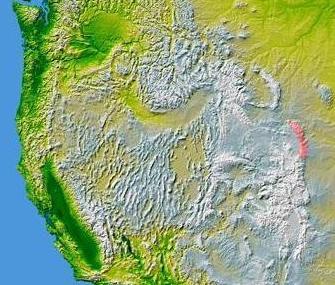
2 Mountain Hydrology Laramie Range Laramie Range


3 Blair Wallis N wetland Granite outcrop Wyoming Blair Creek Blair Creek Well field Granite outcrop Medicine Bow National Forest Mapped lineaments Granite outcrop km


 Petrophysics research: extend from field to mountain scale; http://www.")
4 Blair Wallis Fractured Rock Well Field Geology: fractured granite & metamorphic rock overlain by weathered granite; 2 miles South of Blair Wallis Well Field, WYDOT Hydrology: surface & subsurface hydrology dominated by snowmelt. Hydrological Research: SW & GW monitoring & GW well tests; Geophysical Research: borehole & surface (seismic, resistivity, GPR, NMR, gravity, etc.) Petrophysics research: extend from field to mountain scale;


5 Blair Wallis Fractured Rock Hydrology Research Well Field N wetland Blair Creek m Cross-hole hydraulic communication exists among BW 6, 7, 8, 9, and BW1.


6 Drilling at Blair Setting surface casing made of PVC at BW6


7 Cores from BW5 Natural Clay from BW6 killed our pump Sulfide-Rich Cores from BW4
8 BW-1 BW-2 BW-3 BW-4 BW-5 BW-6 BW-7 BW-8 BW-9 Coord N, W N, W N, W N, W N, W N, W N, W N, W N, W TD (m) Casing depth (m) Casing diameter (inch) Borehole diameter *1 (inch) 7 steel casing 7 pvc casing 7 pvc casing 4 pvc casing 4 pvc casing 6 pvc casing 6 pvc casing 6 pvc casing 6 pvc casing 4 7/ ~3.8 ~ Rock type Sulfide-rich DTW (m) * (8/15/2015) (11/18/2015) Drilling method air/water rotary +coring; air/water rotary +coring; not developed 5.7 (9/11/2015) wireline+coring (drilled with water); not developed 11.7 (11/18/2015) wireline+coring (drilled with water); 10.9 (9/11/2015) wireline+coring (drilled with water); from toc (9/8/2016) bgs (8/31/2016) air/water rotary + downhole hammer * from toc? (9/8/2016) bgs (9/1/2016) air/water rotary + downhole hammer; (12/8/2016) air/water rotary + downhole hammer; (12/8/2016) air/water rotary + downhole hammer; *1 This is diameter of the open borehole beneath the casing (see the diagram on previous page; also see caliper logs); *2 From top of casing (TOC) unless it is labeled as bgs (below ground surface); continuous WL monitoring is available since May, *3 No corings for BW 6, 7, 8, and 9. Note most shallow saprolite wells (Brady s; Austin s) in Blair Wallis were drilled using the backpack shaw drill.
9 Well Field Summary 9 bedrock wells completed in the saturated fractured granite; A subset of 5 wells (BW1, 6, 7, 8, 9) are hydraulically connected; 4 or 5 shallow wells completed in saturated weathered granite; 7 NMR boreholes completed in unsaturated weathered granite; All wells & boreholes: monitoring water pressure & temperature; Hydraulic tests: single well & cross-hole interference tests (hydraulic tomography);
; Fresh water (TDS<100 mg/l); a few tests produced suspended sediments (granite minerals & clay); 28 hr pumping test @ 20 gpm; Drawdown in BW4 is ~12 m; BW1, 40")
10 Well Field Observations Numerous bedrock fractures observed in cores and wireline logs; Short-term pumping tests (up to 44 hr) show from very-low to moderate productivity; BW4 Bedrock equivalent K H : 10-7 ~10-4 m/s (fine to medium sand); Fresh water (TDS<100 mg/l); a few tests produced suspended sediments (granite minerals & clay); 28 hr pumping 20 gpm; Drawdown in BW4 is ~12 m; BW1, 40 m away, had no response;
11 BW 7 Test Variable fracture connectivity: differential drawdowns in monitoring wells; Sediment production causes pumping rate to reduce; Drawdown stabilization at 3.5 gpm: water-supply BC (stream loss); DTW(m) 8/22/2017 0:00 8/22/ :00 8/23/2017 0:00 8/23/ :00 8/24/2017 0:00 8/24/ :00 8/25/2017 0: manual measurement transducer Sediment production
12 Recharge & Discharge Recharge: GW level is dominated by annual spring snowmelt indicating connectivity to surface. Discharge: GW flow to basin is estimated at 6~19% of the total precipitation over the Laramie Range, assuming local-scale K data at Blair extends to mountain scale.
13 Denver Basin Casper Aquifer

14 Laramie Basin: Casper Aquifer Monitoring Recharge to Casper Aquifer from above during annual snowmelt. Taboga (2006)
15 Laramie Basin: Casper Recharge Study Head (~20 bgs) Artesian (~13 ags) Sept-Oct, 2017: Hydraulic gradient exists for upward flow, supplying a sub-charge to Casper Aquifer Granite flow at ~2 gpm
16 Broader Connectivity Exists between snow, streams, lakes/reservoirs, soil, & groundwater regimes; Degrees of connectivity varies; Complex interaction.
17 Scientific: Implications Advance understanding of mountain hydrology & snowmelt partitioning into SW and GW; Management: Opportunities (mountain block v. mountain front recharge); Vulnerability; Conjunctive SW/GW management; Future Work: Petrophysics linking aquifer properties to geophysics for mountain scale surveys;
18 Extra
 Denver")
19 Casper Aquifer Monitoring Program & UW Golf Course Laramie Range Red Buttes Gov Gulch Site Laramie Basin Blair Wallis Fractured Rock research well field 6 stream sites with 12 riparian wells Monitored reservoirs Belvoir Ranch High plains aquifer monitoring well network (ALTAS site) Denver Basin
20
21 Acknowledgement Students: Shuangpo Ren, Sam Grag, Sam Coker; Consultants: Chris Moody, Bern Hinkeley, Mark Stacy; Funding: NSF, Wyoming Water Research Program, USGS; Cooperating Agencies: USFS, State of Wyoming DEQ, Cheyenne BOPU;
22 BW-1 BW-2 BW-3 BW-4 BW-5 BW-6 BW-7 BW-8 BW-9 Coord N, W N, W N, W N, W N, W N, W N, W N, W N, W TD (m) Casing depth (m) Casing diameter (inch) Borehole diameter *1 (inch) 7 steel casing 7 pvc casing 7 pvc casing 4 pvc casing 4 pvc casing 6 pvc casing 6 pvc casing 6 pvc casing 6 pvc casing 4 7/ ~3.8 ~ Rock type Sulfide-rich DTW (m) * (8/15/2015) (11/18/2015) Drilling method air/water rotary +coring; air/water rotary +coring; not developed 5.7 (9/11/2015) wireline+coring (drilled with water); not developed 11.7 (11/18/2015) wireline+coring (drilled with water); 10.9 (9/11/2015) wireline+coring (drilled with water); from toc (9/8/2016) bgs (8/31/2016) air/water rotary + downhole hammer * from toc? (9/8/2016) bgs (9/1/2016) air/water rotary + downhole hammer; (12/8/2016) air/water rotary + downhole hammer; (12/8/2016) air/water rotary + downhole hammer; *1 This is diameter of the open borehole beneath the casing (see the diagram on previous page; also see caliper logs); *2 From top of casing (TOC) unless it is labeled as bgs (below ground surface); continuous WL monitoring is available since May, *3 No corings for BW 6, 7, 8, and 9. Note most shallow saprolite wells (Brady s; Austin s) in Blair Wallis were drilled using the backpack shaw drill.
23 BW4

24 Denver Basins: Belvoir Ranch Stream, Riparian, and Casper Aquifer Study Upper Lone Tree Creek watershed Upper Goose Creek watershed A C B BELVOIR RANCH Upper Duck Creek watershed Upstream flow stations Downstream flow stations Existing monitoring wells Casper formation outcrop
 Precipitation (mm) 5/16 5/19 5/21 5/24 5/27 5/29 6/1 6/4 6/6 6/9 6/12 6/14 6/17 6/20 6/22 6/26 6/29 7/1 7/4 7/7 7/9 7/12 7/15 7/17 7/20 7/23 7/25 7/28 7/31 8/2 Stream WL, upstream site")
25 Belvoir Ranch: SW/GW Connectivity Precipitation and Snow Water Equivalence (mm) Water depth in stream (m) SWE (mm) Precipitation (mm) 5/16 5/19 5/21 5/24 5/27 5/29 6/1 6/4 6/6 6/9 6/12 6/14 6/17 6/20 6/22 6/26 6/29 7/1 7/4 7/7 7/9 7/12 7/15 7/17 7/20 7/23 7/25 7/28 7/31 8/2 Stream WL, upstream site Stream WL, downstream site Ground water depth at LTC Mon #1 5/16 5/19 5/21 5/24 5/27 5/29 6/1 6/4 6/6 6/9 6/12 6/14 6/17 6/20 6/22 6/26 6/29 7/1 7/4 7/7 7/9 7/12 7/15 7/17 7/20 7/23 7/25 7/28 7/31 8/ Ground water depth (m)


 Artesian (~13 ags) Granite flow at")
26 Laramie Basin: Casper Recharge Study Sept-Oct, 2017: Hydraulic gradient exists for upward flow, thus a sub-charge to Casper Granite interval: image & flowmeter logs outflow Head (~20 bgs) Artesian (~13 ags) Granite flow at ~2 gpm bgs (m) inflow

27 Geology of southern Wyoming UW GG
Soils, Hydrogeology, and Aquifer Properties. Philip B. Bedient 2006 Rice University
 Soils, Hydrogeology, and Aquifer Properties Philip B. Bedient 2006 Rice University Charbeneau, 2000. Basin Hydrologic Cycle Global Water Supply Distribution 3% of earth s water is fresh - 97% oceans 1%
Napa County Comprehensive Groundwater Monitoring Program 2015 Annual Report and CASGEM Update
 Napa County Comprehensive Groundwater Monitoring Program 2015 Annual Report and CASGEM Update April 21, 2016 Watershed Information & Conservation Council By Vicki Kretsinger Grabert Overview Evolving groundwater
Finding Large Capacity Groundwater Supplies for Irrigation
 Finding Large Capacity Groundwater Supplies for Irrigation December 14, 2012 Presented by: Michael L. Chapman, Jr., PG Irrigation Well Site Evaluation Background Investigation Identify Hydrogeologic Conditions
Prof. Stephen A. Nelson EENS 111. Groundwater
 Page 1 of 8 Prof. Stephen A. Nelson EENS 111 Tulane University Physical Geology This page last updated on 20-Oct-2003 is water that exists in the pore spaces and fractures in rock and sediment beneath
Groundwater Hydrology
 EXERCISE 12 Groundwater Hydrology INTRODUCTION Groundwater is an important component of the hydrologic cycle. It feeds lakes, rivers, wetlands, and reservoirs; it supplies water for domestic, municipal,
Squaw Creek. General Information
 General Information is a tributary to the Salmon River. It enters the north side of the river about 0 miles downstream of North Fork, Idaho. The study reach is about a 30 ft length of stream about 2 miles
11/22/2010. Groundwater in Unconsolidated Deposits. Alluvial (fluvial) deposits. - consist of gravel, sand, silt and clay
 deposits. - consist of gravel, sand, silt and clay") Groundwater in Unconsolidated Deposits Alluvial (fluvial) deposits - consist of gravel, sand, silt and clay - laid down by physical processes in rivers and flood plains - major sources for water supplies
Groundwater in Unconsolidated Deposits Alluvial (fluvial) deposits - consist of gravel, sand, silt and clay - laid down by physical processes in rivers and flood plains - major sources for water supplies
Imaging Critical Zone Processes
 Imaging Critical Zone Processes Kamini Singha Hydrologic Science and Engineering Colorado School of Mines With contributions from: Xavier Comas, Jorden Hayes, and Andy Parsekian Key critical zone processes
Groundwater. (x 1000 km 3 /y) Oceans Cover >70% of Surface. Groundwater and the. Hydrologic Cycle
 Oceans Cover >70% of Surface. Groundwater and the. Hydrologic Cycle") Chapter 17 Oceans Cover >70% of Surface Groundwater and the Hydrologic Cycle Vasey s Paradise, GCNP Oceans are only 0.025% of Mass Groundwater Groundwater is liquid water that lies in the subsurface in
Chapter 17 Oceans Cover >70% of Surface Groundwater and the Hydrologic Cycle Vasey s Paradise, GCNP Oceans are only 0.025% of Mass Groundwater Groundwater is liquid water that lies in the subsurface in
Groundwater. (x 1000 km 3 /y) Reservoirs. Oceans Cover >70% of Surface. Groundwater and the. Hydrologic Cycle
 Reservoirs. Oceans Cover >70% of Surface. Groundwater and the. Hydrologic Cycle") Chapter 13 Oceans Cover >70% of Surface Groundwater and the Hydrologic Cycle Oceans are only 0.025% of Mass Groundwater Groundwater is liquid water that lies in the subsurface in fractures in rocks and
Chapter 13 Oceans Cover >70% of Surface Groundwater and the Hydrologic Cycle Oceans are only 0.025% of Mass Groundwater Groundwater is liquid water that lies in the subsurface in fractures in rocks and
WWDC Green River Basin Plan II, Groundwater Study (Level I) WSGS USGS WRDS October 23, 2008 Green River Basin (GRB) Basin Advisory Group
 WSGS USGS WRDS October 23, 2008 Green River Basin (GRB) Basin Advisory Group") WWDC Green River Basin Plan II, Groundwater Study (Level I) WSGS USGS WRDS 2007-20092009 October 23, 2008 Green River Basin (GRB) Basin Advisory Group (BAG) Western Wyoming Community College, Rock Springs,
WWDC Green River Basin Plan II, Groundwater Study (Level I) WSGS USGS WRDS 2007-20092009 October 23, 2008 Green River Basin (GRB) Basin Advisory Group (BAG) Western Wyoming Community College, Rock Springs,
University of Wyoming Near-Surface Geophysical Instrument Center & Wyoming Center for Environmental Hydrology and Geophysics
 University of Wyoming Near-Surface Geophysical Instrument Center & Wyoming Center for Environmental Hydrology and Geophysics UWNSG & WyCEHG Groundwater Studies on the Brule Formation near Pine Bluffs,
Wisconsin s Hydrogeology: an overview
 2012 Soil and Water Conservation Society Conference Stevens Point, WI Feb 9, 2012 Wisconsin s Hydrogeology: an overview Ken Bradbury Wisconsin Geological and Natural History Survey University of Wisconsin-Extension
Lecture Outlines PowerPoint. Chapter 5 Earth Science 11e Tarbuck/Lutgens
 Lecture Outlines PowerPoint Chapter 5 Earth Science 11e Tarbuck/Lutgens 2006 Pearson Prentice Hall This work is protected by United States copyright laws and is provided solely for the use of instructors
1.72, Groundwater Hydrology Prof. Charles Harvey Lecture Packet #5: Groundwater Flow Patterns. Local Flow System. Intermediate Flow System
 1.72, Groundwater Hydrology Prof. Charles Harvey Lecture Packet #5: Groundwater Flow Patterns c Local Flow System 10,000 feet Intermediate Flow System Regional Flow System 20,000 feet Hydrologic section
FORENSIC GEOLOGY A CIVIL ACTION
 NAME 89.215 - FORENSIC GEOLOGY A CIVIL ACTION I. Introduction In 1982 a lawsuit was filed on behalf of eight Woburn families by Jan Schlictmann. The suit alleged that serious health effects (childhood
Surface Processes Focus on Mass Wasting (Chapter 10)
") Surface Processes Focus on Mass Wasting (Chapter 10) 1. What is the distinction between weathering, mass wasting, and erosion? 2. What is the controlling force in mass wasting? What force provides resistance?
Surface Processes Focus on Mass Wasting (Chapter 10) 1. What is the distinction between weathering, mass wasting, and erosion? 2. What is the controlling force in mass wasting? What force provides resistance?
Hillslope Hydrology Q 1 Q Understand hillslope runoff processes. 2. Understand the contribution of groundwater to storm runoff.
 Objectives Hillslope Hydrology Streams are the conduits of the surface and subsurface runoff generated in watersheds. SW-GW interaction needs to be understood from the watershed perspective. During a storm
Hydrogeology of Karst NE Wisconsin. Dr. Maureen A. Muldoon UW-Oshkosh Geology Department
 Hydrogeology of Karst NE Wisconsin Dr. Maureen A. Muldoon UW-Oshkosh Geology Department WI Bedrock Outline Karst Landscapes Existing WQ Data Flow in Karst Aquifers Overview of Silurian Aquifer Water Level
Water Framework Directive. Groundwater Monitoring Programme. Site Information. Kiltrough PWS
 Water Framework Directive Groundwater Monitoring Programme Site Information Kiltrough PWS ImagePath1: Kiltrough PWS\17_009_Kiltough_P1_SiteLo cation.jpg This monitoring point is a well that is part of
Groundwater Sustainability at Wadi Al Bih Dam, Ras El Khaimah, United Arab Emirates (UAE) using Geophysical methods
 using Geophysical methods") Groundwater Sustainability at Wadi Al Bih Dam, Ras El Khaimah, United Arab Emirates (UAE) using Geophysical methods Ahmed Murad, Amir Gabr, Saber Mahmoud, Hasan Arman & Abdulla Al Dhuhoori Geology Department
Groundwater Sustainability at Wadi Al Bih Dam, Ras El Khaimah, United Arab Emirates (UAE) using Geophysical methods Ahmed Murad, Amir Gabr, Saber Mahmoud, Hasan Arman & Abdulla Al Dhuhoori Geology Department
Chapter 12 Subsurface Exploration
 Page 12 1 Chapter 12 Subsurface Exploration 1. The process of identifying the layers of deposits that underlie a proposed structure and their physical characteristics is generally referred to as (a) subsurface
Chapter 14. Groundwater
 Chapter 14 Groundwater Importance of groundwater! Groundwater is water found in the pores of soil and sediment, plus narrow fractures in bedrock! Groundwater is the largest reservoir of fresh water that
Antelope Hills Directionally Drilled Water Well. Theresa Jehn-Dellaport Jehn Water Consultants, Inc.
 Antelope Hills Directionally Drilled Water Well Theresa Jehn-Dellaport Directional Well Applications Deep Bedrock Aquifers Proven Oil field technology Initial Analysis indicates up to 4 times the production
Hydrogeology of the San Agustin Plains
 Hydrogeology of the San Agustin Plains Alex Rinehart, Daniel Koning and Stacy Timmons New Mexico Bureau of Geology New Mexico Tech 16 August 2017 62nd New Mexico Water Conference Acknowledgments Community
 12 10 8 6 4 2 0 40-50 50-60 60-70 70-80 80-90 90-100 Fresh Water What we will cover The Hydrologic Cycle River systems Floods Groundwater Caves and Karst Topography Hot springs Distribution of water in
AWRA PMAS Engineers Club of Philadelphia. A Geologic Perspective on Stormwater
 AWRA PMAS Engineers Club of Philadelphia A Geologic Perspective on Stormwater Toby J. Kessler, P.G. Hydrogeologist Trevor G. Woodward, P.G. Engineering Geologist September 10, 2014 Gilmore & Associates,
TEMPERATURE GEOTHERMAL SYSTEM *.BY. Roger F. Harrison Salt Lake City, Utah. C; K. Blair
 - * f c * -6 9 -.I. lcal '. DEVELOPMENT AND TESTSNG OF A SMALL MODERATE TEMPERATURE GEOTHERMAL SYSTEM *.BY Roger F. Harrison Terra Tek, Inc. Salt Lake City, Utah C; K. Blair Terra Tek, Inc. - Salt Lake
Evaluation of the hydraulic gradient at an island for low-level nuclear waste disposal
 A New Focus on Groundwater Seawater Interactions (Proceedings of Symposium HS1001 at IUGG2007, Perugia, July 2007). IAHS Publ. 312, 2007. 237 Evaluation of the hydraulic gradient at an island for low-level
Understanding Water Level Transducers. Texas Groundwater Summit San Antonio, TX 2018
 Understanding Water Level Transducers Texas Groundwater Summit San Antonio, TX 2018 Presented by Raymond L Straub Jr., P.G. Raymond L Straub Jr., P.G. Licensed Professional Geoscientist President of Straub
6.1 Water. The Water Cycle
 6.1 Water The Water Cycle Water constantly moves among the oceans, the atmosphere, the solid Earth, and the biosphere. This unending circulation of Earth s water supply is the water cycle. The Water Cycle
Oak Ridge IFRC. Quantification of Plume-Scale Flow Architecture and Recharge Processes
 Oak Ridge IFRC Quantification of Plume-Scale Flow Architecture and Recharge Processes S. Hubbard *1, G.S. Baker *2, D. Watson *3, D. Gaines *3, J. Chen *1, M. Kowalsky *1, E. Gasperikova *1, B. Spalding
Essentials of Geology, 11e
 Essentials of Geology, 11e Groundwater Chapter 10 Instructor Jennifer Barson Spokane Falls Community College Geology 101 Stanley Hatfield Southwestern Illinois Co Jennifer Cole Northeastern University
Chapter 13. Groundwater
 Chapter 13 Groundwater Introduction Groundwater is all subsurface water that completely fills the pores and other open spaces in rocks, sediments, and soil. Groundwater is responsible for forming beautiful
Seismic Reflection Imaging across the Johnson Ranch, Valley County, Idaho
 Seismic Reflection Imaging across the Johnson Ranch, Valley County, Idaho Report Prepared for the Skyline Corporation Lee M. Liberty Center for Geophysical Investigation of the Shallow Subsurface (CGISS)
GPR AS A COST EFFECTIVE BEDROCK MAPPING TOOL FOR LARGE AREAS. Abstract
 GPR AS A COST EFFECTIVE BEDROCK MAPPING TOOL FOR LARGE AREAS Dr. Jutta L. Hager, Hager GeoScience, Inc., Waltham, MA Mario Carnevale, Hager GeoScience, Inc., Waltham, MA Abstract Hager GeoScience, Inc.
Hydrologic and Borehole Geophysical Investigation of Bedrock Observation Wells at the University of Maine
 Hydrologic and Borehole Geophysical Investigation of Bedrock Observation Wells at the University of Maine Abstract Eric Rickert, Andrew Reeve, Frederick L. Paillet, University of Maine The University of
Water Framework Directive. Groundwater Monitoring Programme. Site Information. Drum Bingahamstown
 Water Framework Directive Groundwater Monitoring Programme Site Information Drum Bingahamstown ImagePath1: Drum Bingahamstown\IE_WE_G_16_ 1_a_Spring.jpg Drum Binghamstown is a spring that is used for a
Chapter 14: Groundwater. Fig 14.5b
 Chapter 14: Groundwater Fig 14.5b OBJECTIVES Recognize that groundwater is a vital source of accessible freshwater. Describe how groundwater forms below the water table. Explain the origin of aquifers,
Sacramento Valley Groundwater Basin, Sutter Subbasin
 Sacramento Valley Groundwater Basin, Sutter Subbasin Groundwater Basin Number: 5-21.62 County: Sutter Surface Area: 234,400 acres (366 square miles) Boundaries and Hydrology The Sutter Subbasin lies in
What we will cover. The Hydrologic Cycle. River systems. Floods. Groundwater. Caves and Karst Topography. Hot springs
 Fresh Water What we will cover The Hydrologic Cycle River systems Floods Groundwater Caves and Karst Topography Hot springs On a piece of paper, put these reservoirs of water in to order from largest to
PHASE II LARAMIE MONITOR WELL PROJECT REPORT
 PHASE II LARAMIE MONITOR WELL PROJECT REPORT June 18, 2015 Submitted to: City of Laramie P.O. Box C Laramie, Wyoming 82073 Prepared by: Bern Hinckley, P.G. Chris Moody, P.G. Hinckley Consulting Wyoming
Appendix J. Geological Investigation
 Appendix J Geological Investigation Appendix J Geological Environment Table of Contents Page 1 INTRODUCTION...J-1 1.1 Purpose of the Investigation...J-1 1.2 Scope of the Investigation...J-1 2 METHODO OF
SHAWN NAYLOR. Research Hydrogeologist Center for Geospatial Data Analysis, Indiana Geological Survey
 SHAWN NAYLOR Research Hydrogeologist Center for Geospatial Data Analysis, Indiana Geological Survey Project overview Funded by American Recovery and Reinvestment Act Develop distributed network of databases
Chapter 2. Regional Landscapes and the Hydrologic Cycle
 Chapter 2. Regional Landscapes and the Hydrologic Cycle W. Lee Daniels Department of Crop and Soil Environmental Sciences, Virginia Tech Table of Contents Introduction... 23 Soils and landscapes of the
Prentice Hall EARTH SCIENCE
 Prentice Hall EARTH SCIENCE Tarbuck Lutgens Running Water and Groundwater Running Water The Water Cycle Water constantly moves among the oceans, the atmosphere, the solid Earth, and the biosphere. This
DATA ACQUISITION METHODS FOR GROUNDWATER INVESTIGATION AND THE SITING OF WATER SUPPLY WELLS
 DATA ACQUISITION METHODS FOR GROUNDWATER INVESTIGATION AND THE SITING OF WATER SUPPLY WELLS M.B.J. Foster Tetra Tech EM Inc., San Francisco, CA, USA Keywords: Groundwater, water wells, drilled wells, geophysical
Case Study: University of Connecticut (UConn) Landfill
 Landfill") Case Study: University of Connecticut (UConn) Landfill Problem Statement:» Locate disposal trenches» Identify geologic features and distinguish them from leachate and locate preferential pathways in fractured
Case Study: University of Connecticut (UConn) Landfill Problem Statement:» Locate disposal trenches» Identify geologic features and distinguish them from leachate and locate preferential pathways in fractured
Earth: The Water Planet
 Earth: The Water Planet Water is essential for living things to grow, reproduce, and carry out important processes. About 97% of Earth s water is salt water found in the ocean, while the other 3% is fresh
Lab 9: Petroleum and groundwater
 Geology 101 Name(s): Lab 9: Petroleum and groundwater Petroleum (oil) is a multi-component liquid refined to generate different hydrocarbons, such as heptane (a component of gasoline) and waxes. For the
David de Courcy-Bower and Samuel Mohr
 Applicability and Limitations of LNAPL Transmissivity as a Metric within Bedrock Formations Insert then choose Picture select your picture. Right click your picture and Send to back. David de Courcy-Bower
Surface Water and Stream Development
 Surface Water and Stream Development Surface Water The moment a raindrop falls to earth it begins its return to the sea. Once water reaches Earth s surface it may evaporate back into the atmosphere, soak
Why Study Groundwater?
 Groundwater Water filling open spaces in rock, sediment, and soil beneath the surface is called groundwater. This natural resource is as important to human endeavors as surface water. Groundwater is an
THE ROLE OF 3-D GEOLOGIC MODELING AND DATABASE SOLUTIONS IN THE VIRTTAANKANGAS ARTIFICIAL RECHARGE PROJECT, SOUTHWESTERN FINLAND
 THE ROLE OF 3-D GEOLOGIC MODELING AND DATABASE SOLUTIONS IN THE VIRTTAANKANGAS ARTIFICIAL RECHARGE PROJECT, SOUTHWESTERN FINLAND Artimo, A. 1, S. Saraperä 2, and I. Ylander 1 1 Turku Region Water Ltd.,
Dr. N.W. B. Balasooriya
 ESM 31031 HYDROGEOLOGY Dr. N.W. B. Balasooriya 1 1 Hydrogeology Hydrogeology is defined as the science which treats the occurrence, distribution and movement of water below the Earth surface. 2 Groundwater
Big Wood River. General Information
 General Information The flows out of the southern portion of the Sawtooth National Recreation Area in central Idaho. The study reach is about a,200 ft length of river about.5 miles upstream from the discontinued
Simulating the groundwater discharge to wetlands. Mukwonago Basin Example and Potential Application in Dane County
 Simulating the groundwater discharge to wetlands Mukwonago Basin Example and Potential Application in Dane County Conceptual Model Topography is major control on flow to wetlands Land Surface Water Table
URBAN HYDROLOGY: WATER IN THE CITY OF TSHWANE Plant Sciences Auditorium, University of Pretoria January 2014 URBAN HYDROGEOLOGY
 URBAN HYDROLOGY: WATER IN THE CITY OF TSHWANE Plant Sciences Auditorium, University of Pretoria 23 24 January 2014 URBAN HYDROGEOLOGY MATTHYS A. DIPPENAAR DEPARTMENT GEOLOGY, UNIVERSITY OF PRETORIA HYDROGEOLOGY
APPENDIX 3B OCCURRENCE OF SIGNIFICANT RIVER ALLUVIUM AQUIFERS IN THE PLATEAU REGION
 Plateau Region Water Plan January 2011 APPENDIX 3B OCCURRENCE OF SIGNIFICANT RIVER ALLUVIUM AQUIFERS IN THE PLATEAU REGION Occurrence of Significant River Alluvium Aquifers in the Plateau Region Prepared
Ground Water in the Piedmont and Blue Ridge
 engineering earth's development preserving earth's integrity Engineering Earth s Development Preserving Earth s Integrity Ground Water in the Piedmont and Blue Ridge Jim Renner Acknowledgements Contributors:
Deep Weathering at the LCZO
 Deep Weathering at the LCZO Heather L. Buss USGS Water Energy and Biogeochemical Budgets Program (WEBB), Puerto Rico Qtz Chlorite Hornblende Plag Plag Projects Observation wells: The Drilling Project :
1 Water Beneath the Surface
 CHAPTER 16 1 Water Beneath the Surface SECTION Groundwater KEY IDEAS As you read this section, keep these questions in mind: What are two properties of aquifers? How is the water table related to the land
BASIC PRINCIPLES OF GROUND-WATER OCCURANCE AND FLOW
 BASIC PRINCIPLES OF GROUND-WATER OCCURANCE AND FLOW GWPC Annual Forum Sept. 27-30, 2015 Oklahoma City, OK Mike Wireman Water well Rural Romania Water well Castle in Austria 1 ??? 2 BASIC PRINCIPLES OF
Hydrogeology of East-Central Union County, Northeastern New Mexico
 Hydrogeology of East-Central Union County, Northeastern New Mexico Geoffrey Rawling April 2013 New Mexico Bureau of Geology & Mineral Resources 1 What are the important hydrogeologic issues in Union County?
WATER ON AND UNDER GROUND. Objectives. The Hydrologic Cycle
 WATER ON AND UNDER GROUND Objectives Define and describe the hydrologic cycle. Identify the basic characteristics of streams. Define drainage basin. Describe how floods occur and what factors may make
Introduction to Formation Evaluation Abiodun Matthew Amao
 Introduction to Formation Evaluation By Abiodun Matthew Amao Monday, September 09, 2013 Well Logging PGE 492 1 Lecture Outline What is formation evaluation? Why do we evaluate formation? What do we evaluate?
Michigan s Geology and Groundwater
 Michigan s Geology and Groundwater Ralph J. Haefner Deputy Director U.S. Geological Survey Michigan-Ohio Water Science Center Lansing, Michigan Outline About the USGS Geology 101 Michigan s geology Bedrock
Hydraulic Characteristics of the Basel 1 Enhanced Geothermal System
 GRC Transactions, Vol. 33, 9 Hydraulic Characteristics of the Basel 1 Enhanced Geothermal System Florentin Ladner and Markus O. Häring Geothermal Explorers International Ltd, Switzerland Keywords Geothermal,
Effects of depositional and diagenetic heterogeneitites on fluid flow in Plio -- Pleistocene reefal carbonates of the Southern Dominican Republic
 Viviana Díaz was born in Puerto Rico and received her undergraduate degree from the University of Puerto Rico and her Master's at the University of North Carolina. She is currently working on her PhD at
GEOL.3250 Geology for Engineers Glacial Geology
 GEOL.3250 Geology for Engineers Glacial Geology NAME Part I: Continental Glaciation Continental glaciers are large ice sheets that cover substantial portions of the land area. In the region of accumulation
Southern Sierra Critical Zone Observatory (CZO): hydrochemical characteristics, science & measurement strategy
: hydrochemical characteristics, science & measurement strategy") Southern Sierra Critical Zone Observatory (CZO): hydrochemical characteristics, science & measurement strategy R. Bales, C. Hunsaker, M. Conklin, J. Kirchner, B. Boyer, P. Kirchner underlying hypothesis:
Southern Sierra Critical Zone Observatory (CZO): hydrochemical characteristics, science & measurement strategy R. Bales, C. Hunsaker, M. Conklin, J. Kirchner, B. Boyer, P. Kirchner underlying hypothesis:
MIDDLE NORTH PLATTE GLENDO WATERSHED LEVEL 1 STUDY JUNE 2016
 MIDDLE NORTH PLATTE GLENDO WATERSHED LEVEL 1 STUDY JUNE 2016 WHAT IS A WATERSHED STUDY? o A COMPREHENSIVE EVALUATION, analysis and description of the land and water resources within a watershed o GATHERS
PRELIMINARY. Select Geophysical Methods and Groundwater Modeling: Examples from USGS studies. Claudia Faunt and a cast of others
 Select Geophysical Methods and Groundwater Modeling: Examples from USGS studies Claudia Faunt and a cast of others Current Preliminary Studies Stanford Water in the West Groundwater Data Workshop Series:
Scholars Research Library. Predicting the aquifer characteristic within the major towns in Ndokwa land
 Available online at www.scholarsresearchlibrary.com Archives of Physics Research, 2011, 2 (4):1-5 (http://scholarsresearchlibrary.com/archive.html) ISSN : 0976-0970 CODEN (USA): APRRC7 Predicting the aquifer
the Quarrying Industry Dewatering and the Quarrying Industry the Quarrying Industry
 Dewatering and the Quarrying Industry Dewatering and Dewatering and the Quarrying Industry the Quarrying Industry Les Brown Eugene P. Daly John Kelly Objectives 1) To present a summary of water management
Airborne Geophysics to Map Groundwater. Bill Brown
 Airborne Geophysics to Map Groundwater Bill Brown bb@skytem.com A 6 borehole represents 1 millionth of an acre Aquifer Materials An aquifer is an underground layer of water bearing permeable rock, rock
ambiguity in earth sciences IESO Geophysics Section Eddy hartantyo, Lab Geofisika FMIPA UGM
 ambiguity in earth sciences IESO Geophysics Section Eddy hartantyo, Lab Geofisika FMIPA UGM Pelatihan Tahap II IESO Teknik Geologi UGM Februari 2009 1 Introduction Photos from http://www.eegs.org/whatis/
Ground-Water Exploration in the Worthington Area of Nobles County: Summary of Seismic Data and Recent Test Drilling Results
 Ground-Water Exploration in the Worthington Area of Nobles County: Summary of Seismic Data and Recent Test Drilling Results Jim Berg and Todd Petersen Geophysicists, DNR Waters January 2000 Table of Contents
GeothermEx, Inc. GEOTHERMAL RESERVOIR ASSESSMENT METHODOLOGY FOR THE SCIENTIFIC OBSERVATION HOLE PROGRAM, KILAUEA EAST RIFT ZONE, HAWAII TASK 1 REPORT
 (415) 527 9876 CABLE ADDRESS- GEOTHERMEX TELEX 709152 STEAM UD FAX (415) 527-8164 Geotherm Ex, Inc. RICHMOND. CALIFORNIA 94804-5829 GEOTHERMAL RESERVOIR ASSESSMENT METHODOLOGY FOR THE SCIENTIFIC OBSERVATION
FRACTURE TRACES AND PRODUCTIVITY OF MUNICIPAL WELLS IN THE MADISON LIMESTONE, RAPID CITY, SOUTH DAKOTA
 Proceedings of the South Dakota Academy of Science, Vol. 87 (2008) 261 FRACTURE TRACES AND PRODUCTIVITY OF MUNICIPAL WELLS IN THE MADISON LIMESTONE, RAPID CITY, SOUTH DAKOTA Perry H. Rahn Department of
Each basin is surrounded & defined by a drainage divide (high point from which water flows away) Channel initiation
 Channel initiation") DRAINAGE BASINS A drainage basin or watershed is defined from a downstream point, working upstream, to include all of the hillslope & channel areas which drain to that point Each basin is surrounded &
DRAINAGE BASINS A drainage basin or watershed is defined from a downstream point, working upstream, to include all of the hillslope & channel areas which drain to that point Each basin is surrounded &
Groundwater-Surface Water Interactions along the Hangman, California, and Rock Creeks, September 30, 2009
 Groundwater-Surface Water Interactions along the Hangman, California, and Rock Creeks, September 30, 2009 Abstract This data collection effort was required to complete recommendations in the Hangman Creek
Mark S. Nordberg Geology and Groundwater Investigations Section North Central Region Office California Department of Water Resources
 Mark S. Nordberg Geology and Groundwater Investigations Section North Central Region Office California Department of Water Resources Ukiah Drought Workshop July 29, 2009 Groundwater 101 Groundwater is
Challenges in Calibrating a Large Watershed Model with Varying Hydrogeologic Conditions
 Challenges in Calibrating a Large Watershed Model with Varying Hydrogeologic Conditions Presented by Johnathan R. Bumgarner, P.G., Celine A.L. Louwers, & Monica P. Suarez, P.E. In cooperation with the
REPORT ON ESTIMATES OF GROUNDWATER INFLOW INTO AND DRAWDOWN AROUND THE PROPOSED OPEN PIT SOUTHDOWN IRON ORE PROJECT. Submitted to:
 Pty Ltd A.B.N. 64 6 17 87 1 Havelock Street, West Perth, WA 6 Australia (PO Box 19, West Perth, WA 6872 Australia) Telephone (8) 92 76 Fax (8) 92 7611 http://www.golder.com REPORT ON ESTIMATES OF GROUNDWATER
Status of geothermal energy exploration at Buranga geothermal prospect, Western Uganda
 Status of geothermal energy exploration at Buranga geothermal prospect, Western Uganda ARGeo-C6, Addis Ababa 2016 James Francis Natukunda and Godfrey Bahati Ministry of Energy and Mineral Development Directorate
HYDROGEOLOGICAL PROPERTIES OF THE UG2 PYROXENITE AQUIFERS OF THE BUSHVELD COMPLEX
 R. Gebrekristos, P.Cheshire HYDROGEOLOGICAL PROPERTIES OF THE UG2 PYROXENITE AQUIFERS OF THE BUSHVELD COMPLEX R. Gebrekristos Digby Wells Environmental P. Cheshire Groundwater Monitoring Services Abstract
IPMO2-1. Groundwater Modelling of Chiang Rai Basin, Northern Thailand. Sattaya Intanum* Dr.Schradh Saenton**
 IPMO2-1 Groundwater Modelling of Chiang Rai Basin, Northern Thailand Sattaya Intanum* Dr.Schradh Saenton** ABSTRACT Chiang Rai basin, situated in Chiang Rai and Phayao provinces covering an area of 11,000
Surface Flow on Medano, Mosca, and Sand Creeks in Relation to Fault Zones and Water Tables
 University of Wyoming National Park Service Research Center Annual Report Volume 16 16th Annual Report, 1992 Article 25 1-1-1992 Surface Flow on Medano, Mosca, and Sand Creeks in Relation to Fault Zones
Hydrogeology and Simulated Effects of Future Water Use and Drought in the North Fork Red River Alluvial Aquifer: Progress Report
 Hydrogeology and Simulated Effects of Future Water Use and Drought in the North Fork Red River Alluvial Aquifer: Progress Report Developed in partnership with the Oklahoma Water Resources Board S. Jerrod
Lithium Brines: What can we learn from established brine production regions?
 Lithium Brines: What can we learn from established brine production regions? An Overview Of Lithium Brine Exploration for Resource Estimation Camilo de los Hoyos Ph.D, Senior Consultant (Geochemistry &
Water Framework Directive. Groundwater Monitoring Programme. Site Information. Tir na League
 Water Framework Directive Groundwater Monitoring Programme Site Information Tir na League ImagePath1: Tir na League\IE_NW_G_078_05_005_ A_PumpHouse.jpg Tir na League is an infiltration gallery situated
Which map shows the stream drainage pattern that most likely formed on the surface of this volcano? A) B)
 B)") 1. When snow cover on the land melts, the water will most likely become surface runoff if the land surface is A) frozen B) porous C) grass covered D) unconsolidated gravel Base your answers to questions
1. When snow cover on the land melts, the water will most likely become surface runoff if the land surface is A) frozen B) porous C) grass covered D) unconsolidated gravel Base your answers to questions
HOW. HOW vehicle mounted units portable units also available. HOW, WHEN & WHY to Geophysically Log in S.I.?
 HOW, WHEN & WHY to Geophysically Log in S.I.? by Kim Beesley HOW HOW vehicle mounted units portable units also available Access to borehole Depth of borehole sump / rat -hole? 1 HOW? - subject to borehole
Chapter 8 Fetter, Applied Hydrology 4 th Edition, Geology of Groundwater Occurrence
 Chapter 8 Fetter, Applied Hydrology 4 th Edition, 2001 Geology of Groundwater Occurrence Figure 8.42. Alluvial Valleys ground-water region. Fetter, Applied Hydrology 4 th Edition, 2001 Fetter, Applied
Susquehanna River Basin A Research Community Hydrologic Observatory. NSF-Funded Infrastructure Proposal in Support of River Basin Hydrologic Sciences
 Susquehanna River Basin A Research Community Hydrologic Observatory NSF-Funded Infrastructure Proposal in Support of River Basin Hydrologic Sciences Fundamental Problem: How Do Humans and Climate Impact
Patterns in Geophysical Data and Models
 Patterns in Geophysical Data and Models Jens Tronicke Angewandte Geophysik Institut für Geowissenschaften Universität Potsdam jens@geo.uni-potsdam.de Near-surface geophysics Using geophysical tools to
Water Framework Directive. Groundwater Monitoring Programme. Site Information. Galbally
 Water Framework Directive Groundwater Monitoring Programme Site Information Galbally ImagePath1: Galbally\Galbally1.jpg Galbally source is comprised of 2 boreholes situated in Devonian Old Red Sandstones
Geophysical Site Investigation (Seismic methods) Amit Prashant Indian Institute of Technology Gandhinagar
 Amit Prashant Indian Institute of Technology Gandhinagar") Geophysical Site Investigation (Seismic methods) Amit Prashant Indian Institute of Technology Gandhinagar Short Course on Geotechnical Aspects of Earthquake Engineering 04 08 March, 2013 Seismic Waves
Geophysical Site Investigation (Seismic methods) Amit Prashant Indian Institute of Technology Gandhinagar Short Course on Geotechnical Aspects of Earthquake Engineering 04 08 March, 2013 Seismic Waves
SEASONAL WATER STORAGE AND REPLENISHMENT OF A FRACTURED GRANITE AQUIFER USING ASR WELLS
 SEASONAL WATER STORAGE AND REPLENISHMENT OF A FRACTURED GRANITE AQUIFER USING ASR WELLS Mario R. Lluria; Phillip M. Paski; Gary G. Small HydroSystems, Incorporated Phoenix, Arizona USA Presentation Contents