Oak Ridge IFRC. Quantification of Plume-Scale Flow Architecture and Recharge Processes
|
|
|
- Antony Porter
- 5 years ago
- Views:
Transcription


1 Oak Ridge IFRC Quantification of Plume-Scale Flow Architecture and Recharge Processes S. Hubbard *1, G.S. Baker *2, D. Watson *3, D. Gaines *3, J. Chen *1, M. Kowalsky *1, E. Gasperikova *1, B. Spalding *3, S. Brooks *3, A. Modi *2 and P. Jardine *3 *1 Lawrence Berkeley National Laboratory *2 University of Tennessee *3 Oak Ridge National Laboratory ERSP Annual PI Meeting, Lansdowne, Virginia, April 20, 2009


2 OUTLINE Quantification of Flow Architecture at the Plume Scale using hydrogeophysical approaches Challenges, Observations, Developed Approach and Results Recharge Process Monitoring using Hydrogeochemical and Geophysical Methods Motivation, New Methods, Datasets, Approaches, Early results S-3


3 Part 1: Delineating Heterogeneity and Pathways CHALLENGES: Multiple Scales of Heterogeneity at ORNL IFRC Typical trade-offs between spatial coverage and resolution
.")

 Seismic Velocity (km/s) Hydraulic Conductivity (0-Low, 1-High) Probability of")


4 Previous Geophysical Characterization at ORNL provides motivation for Current Efforts Local scale (Area 3). Low seismic tomographic velocity indicative of high hydraulic conductivity fracture zones. Method developed to jointly invert wellbore flowmeter and seismic tomographic travel times in the estimate of fracture zonation (Chen et al., WRR, 2006) Seismic Velocity (km/s) Hydraulic Conductivity (0-Low, 1-High) Probability of being in a high K fracture Zone (red=0, blue=1) Watershed Scale Surface seismic refraction datasets collected perpendicular to and along the plume axis have revealed the presence of a laterally continuous low velocity zone. Multi-Scale Comparison of wellbore, crosshole, and surface geophyscial datasets suggest that multi-scale datasets provide information about heterogeneity. NT-2 Seismic P-Wave Velocity Seismic P-Wave Velocity S-3 Can we jointly honor multiscale relevant data in the quantification of major flowpaths?


5 Joint Inversion Approach A one-step process : Jointly honors relevant datasets and prior knowledge in inversion procedure. Provides architecture estimates and associated uncertainties. Elastic 2D (rather than raypath) works in traditionally difficult environments (LVZ)
 0 Bayesian Joint Inversion")


6 Joint Inversion Example at S-3 Comparison of Joint and Traditional Inversion Results near Source 25 Depth (m) 0 Bayesian Joint Inversion (only mean interface values shown) 0 Distance (m) 160 Traditional inversion Low velocity zone P-Wave Velocity Synthetic studies (not shown) suggest Bayesian approach provides: Improved delineation of interfaces and Low Velocity Zone; Good quantification of interface depth uncertainties.
 160 NT-2 S-3 NT-2 Differential weathering of competent")

 multi-scale measurements for quantitative architecture")
7 Quantifying Architecture of Low Velocity Zone from S-3 to NT-2 25 Depth (m) 0 S-3 0 Distance (m) 160 NT-2 S-3 NT-2 Differential weathering of competent dipping bedrock beneath saprolite? Laterally Continuous? Major flow pathway? Drilling campaign planned for Developed method permits synchronous consideration of geophysical and other (i.e., wellbore) multi-scale measurements for quantitative architecture characterization Chen et al., WRR, in development
 Significant Al and Fe oxides Variable mineralogy along different pathways (shale, gravel, carbonate) Contaminants")

8 Key Components: Precipitation low ionic strength high DO ph~5.5 Reactive system High ionic strength and low ph groundwater (especially near source) Significant Al and Fe oxides Variable mineralogy along different pathways (shale, gravel, carbonate) Contaminants such as nitrate & U. Heterogeneous Hydrogeology Drainage ditch Perched water Matrix vs. fracture pathways Role of antecedent conditions Recharge creates large hydraulic and geochemical gradients that disrupt equilibrium Part 2: Monitoring Recharge Processes KEY QUESTIONS Which recharge-related processes dominate at which locations in the watershed? How do these processes impact contaminant concentration and mobility? What is the time lag between recharge events and re-establishment of geochemical equilibrium? Can non-traditional methods be used to explore recharge processes across the plume?


9 Monitoring Recharge Processes: Extensive wellbore dataset Cumulative (~Annual) precipitation & Nitrate in a single well near S-3 source: ~1 year Investigate all key variables at all wells as function of: Precipitation: Seasonal and episodic storm events Depth Heterogeneity Distance from Source ppm Sampler Depth December Storms
 Deeper Groundwater (~11m BGS) U desorbs with decreasing ph")

10 Precipitation, ph, Nitrate and U Concentrations in FW120 (Near Source) Shallow Groundwater (~7m BGS) Deeper Groundwater (~11m BGS) U desorbs with decreasing ph Solid phase buffering decreases ph upon rainfall? Eventual nitrate dilution in shallow groundwater due to rainfall? ~1 month Different Recharge-related Processes!
.")
11 Permeable Environmental Leaching Capsules (PELCAPs) Quantifying In situ Reactive Contaminant Behavior Across the Watershed PROPERTIES Hydrogel-encapsulated soil samples are useful to follow in situ uptake and release of uranium by soil when immersed in groundwater. Polyacrylamide hydrogels are stable in situ for up to two years (and counting). No detectable interaction of uranium with hydrogel itself Brian Spalding
 Kinetic modeling performed to estimate leaching half lives and other parameters.")
12 Use of Pelcaps to explore U immobilization of different subsurface materials under Natural Attenuation conditions (i.e. ph rebound/solubility of U) Uranium loading: limestone and soil pelcaps were placed in FW106 Spring water used to study in-situ leaching (days>0 in above plot) Kinetic modeling performed to estimate leaching half lives and other parameters. Using technology to compare long term performance of various remedial strategies (bioreduction w/ different amendments, natural attenuation, ph manipulation, phosphate addition, etc.)
13 Geophysical Monitoring of Recharge Processes Geophysical responses to recharge processes. Development of novel monitoring methods. Joint incorporation of hydro-geochemical and geophysical datasets to test geophysical sensitivities and explore dynamic processes. Scaling of electrical response from log to crosshole to surface mode.


14 Petrophysical Relationships Effective Electrical Conductivity increases as a function of increasing: Seismic P-Wave Velocity TDS Saturation Porosity Surface Conduction Temperature 0.99 Biot-Gassman prediction for Vp changes as a function of water saturation (modified from Bachrach et al., 1988)


15 Time Lapse Seismic Refraction Tomography (TLSRT) 35 Campaigns: seismic refraction profile and 4 wellbores Seismic velocity changes as a function of perched water saturation Inverted Seismic Refraction Profile Detail, showing perched water locations Changes in seismic beyond sitespecific established error. New method for tracking perched water table responses to recharge Gaines et al., in submission, 2009

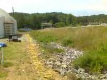
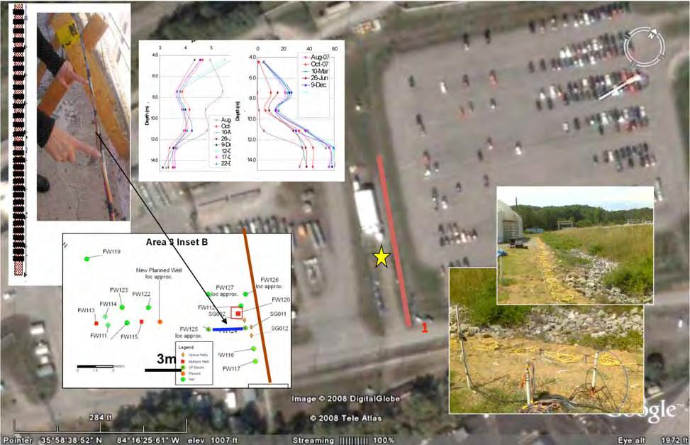
16 S-3 Ponds Recharge Hydrogeochemical-Geophysical Monitoring Study Area 3m 100m


17 Electrical Imaging near S-3 During Dec. Storms: MOVIES S N *joint inversion of dipole-dipole and Wenner-Schlumberger array datasets Cumulative Rainfall post 10/28/08 ~2 Months

18 Electrical Observations and Approach for Quantitative Watershed Monitoring Well bore Scale: Electrical measurements collected using wellbore and crosshole show consistent changes over scales and time. Scale matching between crosshole and surface is confounded by anisotropy and is under investigation. Petrophysics: Good relationship between saturated zone EC, Nitrate Concentration, and other geochemical parameters. Use Coupled Modeling to explore relative sensitivity of electrical methods to different recharge-related processes as a function of heterogeneity, distance from source, and scale. Surface ERT Scaling comparison between resistivity estimation from surface profiling and wellbore measurements.

19 Development and testing of Coupled Hydrogeophysical Flow Model for quantitatively interpreting the geophysical data in terms of hydrogeochemical properties and dynamics Calibration of 1-D and 2-D models using 2008 data sets Rainfall rates and ditch water levels Water levels in perched/saturated zone Dec. Nitrate Concentrations Coupled hydrogeochemical-ert model allows Joint interpretation of time-lapse ERT and hydrochemical datasets Understanding ERT sensitivity to time-varying hydrogeochemical parameters (e.g., saturation, and nitrate profiles) Development of petrophysical relationships and uncertainties. Examination of scaling from local to regional
 in progress.")
20 Model Input Model Output Ditch Water Level (m) Rainfall (cm) Day of year (2008) Water levels in perched and saturated zones and fluxes to deeper depths reproduced well in model calibration Incorporation of increasingly complex processes (2-D, fracture-matrix interactions, etc.) in progress.
21 Multilevel Nitrate Concentrations Saturation (Simulated) Nitrate EC Borehole ERT Data Predicted Nitrate concentrations reproduced reasonably well; complex phenomena near transition zone not yet captured. Resistivity calculated from simulated properties with petrophysical function compares well with borehole ERT data; peak near 9 m not yet reproduced. Currently calibrating coupled hydrogeophysical model to directly simulate the ERT data together with the hydrogeochemical data; will improve understanding of ERT response to hydrogeochemical processes
22 Summary Extensive Data Collection across Plume Geochemical Hydrological Geophysical Development of new monitoring methods TLSRT Pelcap Developed new approaches for integrating disparate, multi-scale datasets Joint inversion for watershed architecture delineation Coupled modeling for recharge process investigation Developing insights about properties and processes important for ORNL IFRC plume stewardship Laterally extensive low velocity zone Various recharge-related geochemical processes linked to heterogeneity Sensitivity of electrical data for quantifying recharge-related processes. Understanding the impact of natural recharge on contaminant concentrations over time and watershed scales is expected to be important for guiding decisions associated with long term plume stewardship
23 Computational Requirements Joint Inversion NT-2: 55 CPUs, each 3.6GHz. Ran for three days (12000 iterations) on the LBNL LRC cluster. Data: topography, water table. 55 sources, 2 meter source spacing, 0.5m receiver spacing 0.5m. S-3: 112 GHz Ran one day only (5000) iterations.
Joint inversion of geophysical and hydrological data for improved subsurface characterization
 Joint inversion of geophysical and hydrological data for improved subsurface characterization Michael B. Kowalsky, Jinsong Chen and Susan S. Hubbard, Lawrence Berkeley National Lab., Berkeley, California,
US Department of Energy, Office of Science Environmental Remediation Science Division (ERSD, now CESD) FY09 First Quarter Performance Measure
 FY09 First Quarter Performance Measure") US Department of Energy, Office of Science Environmental Remediation Science Division (ERSD, now CESD) FY09 First Quarter Performance Measure The FY09 ERSD Overall PART charge to Lawrence Berkeley National
US Department of Energy, Office of Science Environmental Remediation Science Division (ERSD, now CESD) FY09 First Quarter Performance Measure The FY09 ERSD Overall PART charge to Lawrence Berkeley National
Patterns in Geophysical Data and Models
 Patterns in Geophysical Data and Models Jens Tronicke Angewandte Geophysik Institut für Geowissenschaften Universität Potsdam jens@geo.uni-potsdam.de Near-surface geophysics Using geophysical tools to
Imaging Critical Zone Processes
 Imaging Critical Zone Processes Kamini Singha Hydrologic Science and Engineering Colorado School of Mines With contributions from: Xavier Comas, Jorden Hayes, and Andy Parsekian Key critical zone processes
Applied Geophysics for Environmental Site Characterization and Remediation
 Applied Geophysics for Environmental Site Characterization and Remediation MSECA Webinar September 24, 2015 John Mundell, P.E., L.P.G. Ryan Brumbaugh, L.P.G. MUNDELL & ASSOCIATES, INC. Webinar Objective
Case Study: University of Connecticut (UConn) Landfill
 Landfill") Case Study: University of Connecticut (UConn) Landfill Problem Statement:» Locate disposal trenches» Identify geologic features and distinguish them from leachate and locate preferential pathways in fractured
Case Study: University of Connecticut (UConn) Landfill Problem Statement:» Locate disposal trenches» Identify geologic features and distinguish them from leachate and locate preferential pathways in fractured
Development of a joint hydrogeophysical inversion approach and application to a contaminated fractured aquifer
 WATER RESOURCES RESEARCH, VOL. 42,, doi:10.1029/2005wr004694, 2006 Development of a joint hydrogeophysical inversion approach and application to a contaminated fractured aquifer J. Chen, 1 S. Hubbard,
Underground nuclear waste storage
 Underground nuclear waste storage Groundwater flow and radionuclide transport Jan-Olof Selroos Cargese Summer School, July 5, 2018 Contents: Concept for geological disposal of nuclear waste A few words
Pressure Grouting of Fractured Bedrock to Control Acid Mine Drainage
 WATER RESOURCES AT RISK May 14-18, 1995 Denver American Institute of Hydrology Pressure Grouting of Fractured Bedrock to Control Acid Mine Drainage S. A. Effner, G. D. Vandersluis, and V. Straskraba Hydro-Geo
LECTURE 10. Module 3 : Field Tests in Rock 3.6 GEOPHYSICAL INVESTIGATION
 LECTURE 10 3.6 GEOPHYSICAL INVESTIGATION In geophysical methods of site investigation, the application of the principles of physics are used to the study of the ground. The soil/rock have different characteristics
Azimuthal Resistivity to Characterize Fractures in a Glacial Till. Mark Boris, University of Saskatchewan Jim Merriam, University of Saskatchewan
 Azimuthal Resistivity to Characterize Fractures in a Glacial Till Mark Boris, University of Saskatchewan Jim Merriam, University of Saskatchewan Abstract Azimuthal resistivity was used to characterize
11280 Electrical Resistivity Tomography Time-lapse Monitoring of Three-dimensional Synthetic Tracer Test Experiments
 11280 Electrical Resistivity Tomography Time-lapse Monitoring of Three-dimensional Synthetic Tracer Test Experiments M. Camporese (University of Padova), G. Cassiani* (University of Padova), R. Deiana
Electrical Resistivity Survey for Delineating Seawater Intrusion in a Coastal Aquifer
 Electrical Resistivity Survey for Delineating Seawater Intrusion in a Coastal Aquifer Sung-Ho Song*, Gyu-Sang Lee*, Jin-Sung Kim*, Baekuk Seong*, Young-gyu Kim*, Myung-Ha Woo* and Namsik Park** Abstract
Site Characterization & Hydrogeophysics
 Site Characterization & Hydrogeophysics (Source: Matthew Becker, California State University) Site Characterization Definition: quantitative description of the hydraulic, geologic, and chemical properties
Groundwater Sustainability at Wadi Al Bih Dam, Ras El Khaimah, United Arab Emirates (UAE) using Geophysical methods
 using Geophysical methods") Groundwater Sustainability at Wadi Al Bih Dam, Ras El Khaimah, United Arab Emirates (UAE) using Geophysical methods Ahmed Murad, Amir Gabr, Saber Mahmoud, Hasan Arman & Abdulla Al Dhuhoori Geology Department
Groundwater Sustainability at Wadi Al Bih Dam, Ras El Khaimah, United Arab Emirates (UAE) using Geophysical methods Ahmed Murad, Amir Gabr, Saber Mahmoud, Hasan Arman & Abdulla Al Dhuhoori Geology Department
The mountain is permeable and fractured: Hydrological Connectivity in the Laramie Range
 WyCHEG Interest Group Meeting, Oct 30, 2017, Laramie, WY The mountain is permeable and fractured: Hydrological Connectivity in the Laramie Range Ye Zhang 1, Brad Carr 1, Shuangpo Ren 2, Andy Parsekian
Resistivity & IP methods
 International PhD Course in HYDROGEOPHYSICS Resistivity & IP methods Andrew Binley Lancaster University Overview We have demonstrated links between hydrological and geophysical properties and show the
Groundwater Level Monitoring of the Quaternary Aquifer at Al Ain City, United Arab Emirates (UAE) using Geophysical Methods
 using Geophysical Methods") Groundwater Level Monitoring of the Quaternary Aquifer at Al Ain City, United Arab Emirates (UAE) using Geophysical Methods Ahmed Murad & Amir Gabr Geology Department UAE University Outlines Introduction
Groundwater Level Monitoring of the Quaternary Aquifer at Al Ain City, United Arab Emirates (UAE) using Geophysical Methods Ahmed Murad & Amir Gabr Geology Department UAE University Outlines Introduction
Integration of seismic and fluid-flow data: a two-way road linked by rock physics
 Integration of seismic and fluid-flow data: a two-way road linked by rock physics Abstract Yunyue (Elita) Li, Yi Shen, and Peter K. Kang Geologic model building of the subsurface is a complicated and lengthy
Monitoring and Characterization of the Meadowview Lane Landslide: Boyd County, KY
 Monitoring and Characterization of the Meadowview Lane Landslide: Boyd County, KY Matt Crawford Appalachian Coalition for Geologic Hazards in Transportation 13 th Annual Technical Forum Harrisonburg, VA
Measurement, Monitoring and Verification (MMV)
") Measurement, Monitoring and Verification (MMV) Larry Myer USCSC CCS Capacity Building Workshop Charleston, West Virginia October 25, 2011 Outline Why monitor? Information needs Monitoring methods Baselines
Measurement, Monitoring and Verification (MMV) Larry Myer USCSC CCS Capacity Building Workshop Charleston, West Virginia October 25, 2011 Outline Why monitor? Information needs Monitoring methods Baselines
Th D Interpolation and Extrapolation of Sparse Well Data Using Rock Physics Principles - Applications to Anisotropic VMB
 Th-04-07 3D Interpolation and Extrapolation of Sparse Well Data Using Rock Physics Principles - Applications to Anisotropic VMB R. Bachrach* (Schlumberger WesternGeco) & K. Osypov (Schlumberger WesternGeco)
Chapter 12 Subsurface Exploration
 Page 12 1 Chapter 12 Subsurface Exploration 1. The process of identifying the layers of deposits that underlie a proposed structure and their physical characteristics is generally referred to as (a) subsurface
Modeling unsaturated flow and transport in the saprolite of fractured sedimentary rocks: Effects of periodic wetting and drying
 WATER RESOURCES RESEARCH, VOL. 39, NO. 7, 1186, doi:10.1029/2002wr001926, 2003 Modeling unsaturated flow and transport in the saprolite of fractured sedimentary rocks: Effects of periodic wetting and drying
ESTCP Cost and Performance Report
 ESTCP Cost and Performance Report (ER-200834) Geophysical Imaging for Investigating the Delivery and Distribution of Amendments in the Heterogeneous Subsurface of the F.E. Warren AFB November 2012 Environmental
DOWN-HOLE SEISMIC SURVEY AND VERTICAL ELECTRIC SOUNDINGS RABASKA PROJECT, LÉVIS, QUÉBEC. Presented to :
 DOWN-HOLE SEISMIC SURVEY AND VERTICAL ELECTRIC SOUNDINGS RABASKA PROJECT, LÉVIS, QUÉBEC Presented to : TERRATECH 455, René-Lévesque Blvd. West Montreal, Québec HZ 1Z3 Presented by : GEOPHYSICS GPR INTERNATIONAL
February 22, 2011 Picatinny Team Meeting Edison, New Jersey
 February 22, 2011 Picatinny Team Meeting Edison, New Jersey Updated Groundwater Model and Remedies Mid-Valley Groundwater (PICA 204) February 22, 2011 Imagine the result Review of 2009 2010 Field Program
Groundwater Resource Evaluation in Support of Dewatering a South Carolina Limestone Quarry
 Groundwater Resource Evaluation in Support of Dewatering a South Carolina Limestone Quarry Daniel T. Brantley 1, John M. Shafer 2, and Michael G. Waddell 3 AUTHORS: 1 Research Associate, Earth Sciences
Susquehanna River Basin A Research Community Hydrologic Observatory. NSF-Funded Infrastructure Proposal in Support of River Basin Hydrologic Sciences
 Susquehanna River Basin A Research Community Hydrologic Observatory NSF-Funded Infrastructure Proposal in Support of River Basin Hydrologic Sciences Fundamental Problem: How Do Humans and Climate Impact
Effects of depositional and diagenetic heterogeneitites on fluid flow in Plio -- Pleistocene reefal carbonates of the Southern Dominican Republic
 Viviana Díaz was born in Puerto Rico and received her undergraduate degree from the University of Puerto Rico and her Master's at the University of North Carolina. She is currently working on her PhD at
Statistical Rock Physics
 Statistical - Introduction Book review 3.1-3.3 Min Sun March. 13, 2009 Outline. What is Statistical. Why we need Statistical. How Statistical works Statistical Rock physics Information theory Statistics
University of Pretoria. Matthys Dippenaar and Louis van Rooy Engineering Geology and Hydrogeology, Geology Department July 2017, Livingstone, Zambia
 University of Pretoria Contributions to the Characterisation of the Vadose Zone f or Hydrogeological and Geotechnical Applications Matthys Dippenaar and Louis van Rooy Engineering Geology and Hydrogeology,
HYDROGEOPHYSICS. Susan Hubbard. Lawrence Berkeley National Laboratory. 1 Cyclotron Road, MS Berkeley, CA USA.
 HYDROGEOPHYSICS Susan Hubbard Lawrence Berkeley National Laboratory 1 Cyclotron Road, MS 90-1116 Berkeley, CA 94720 USA sshubbard@lbl.gov 1-510-486-5266 Niklas Linde Institute of Geophysics University
URTeC: Summary
 URTeC: 2665754 Using Seismic Inversion to Predict Geomechanical Well Behavior: a Case Study From the Permian Basin Simon S. Payne*, Ikon Science; Jeremy Meyer*, Ikon Science Copyright 2017, Unconventional
Hydrogeology of Karst NE Wisconsin. Dr. Maureen A. Muldoon UW-Oshkosh Geology Department
 Hydrogeology of Karst NE Wisconsin Dr. Maureen A. Muldoon UW-Oshkosh Geology Department WI Bedrock Outline Karst Landscapes Existing WQ Data Flow in Karst Aquifers Overview of Silurian Aquifer Water Level
Study of heterogeneous vertical hyporheic flux via streambed temperature at different depths
 168 Remote Sensing and GIS for Hydrology and Water Resources (IAHS Publ. 368, 2015) (Proceedings RSHS14 and ICGRHWE14, Guangzhou, China, August 2014). Study of heterogeneous vertical hyporheic flux via
Instructional Objectives
 GE 6477 DISCONTINUOUS ROCK 8. Fracture Detection Dr. Norbert H. Maerz Missouri University of Science and Technology (573) 341-6714 norbert@mst.edu Instructional Objectives 1. List the advantages and disadvantages
CHARACTERIZATION OF SOIL PROFILE OF DHAKA CITY USING ELECTRICAL RESISTIVITY TOMOGRAPHY (ERT)
") CHARACTERIZATION OF SOIL PROFILE OF DHAKA CITY USING ELECTRICAL RESISTIVITY TOMOGRAPHY (ERT) Mehedi Ahmed ANSARY 1, B.S. Pushpendue BISWAS 2 and Abul KHAIR 3 1 Professor, Department of Civil Engineering
CHARACTERIZATION OF SOIL PROFILE OF DHAKA CITY USING ELECTRICAL RESISTIVITY TOMOGRAPHY (ERT) Mehedi Ahmed ANSARY 1, B.S. Pushpendue BISWAS 2 and Abul KHAIR 3 1 Professor, Department of Civil Engineering
QUANTITATIVE INTERPRETATION
 QUANTITATIVE INTERPRETATION THE AIM OF QUANTITATIVE INTERPRETATION (QI) IS, THROUGH THE USE OF AMPLITUDE ANALYSIS, TO PREDICT LITHOLOGY AND FLUID CONTENT AWAY FROM THE WELL BORE This process should make
AFI (AVO Fluid Inversion)
") AFI (AVO Fluid Inversion) Uncertainty in AVO: How can we measure it? Dan Hampson, Brian Russell Hampson-Russell Software, Calgary Last Updated: April 2005 Authors: Dan Hampson, Brian Russell 1 Overview
AFI (AVO Fluid Inversion) Uncertainty in AVO: How can we measure it? Dan Hampson, Brian Russell Hampson-Russell Software, Calgary Last Updated: April 2005 Authors: Dan Hampson, Brian Russell 1 Overview
C18 Hydrogeophysical Monitoring of Landslide Processes Using Automated Time-Lapse Electrical Resistivity Tomography (ALERT)
") C18 Hydrogeophysical Monitoring of Landslide Processes Using Automated Time-Lapse Electrical Resistivity Tomography (ALERT) J.E. Chambers* (British Geological Survey), P.I. Meldrum (British Geological
C18 Hydrogeophysical Monitoring of Landslide Processes Using Automated Time-Lapse Electrical Resistivity Tomography (ALERT) J.E. Chambers* (British Geological Survey), P.I. Meldrum (British Geological
Training Venue and Dates Ref # Reservoir Geophysics October, 2019 $ 6,500 London
 Training Title RESERVOIR GEOPHYSICS Training Duration 5 days Training Venue and Dates Ref # Reservoir Geophysics DE035 5 07 11 October, 2019 $ 6,500 London In any of the 5 star hotels. The exact venue
Geophysical Characterization and Monitoring of Groundwater/Surface-Water Interaction in the Hyporheic Corridor at the Hanford 300 Area
 Geophysical Characterization and Monitoring of Groundwater/Surface-Water Interaction in the Hyporheic Corridor at the Hanford 300 Area L. Slater 1, F. Day-Lewis 2, R. Versteeg 3, A. Ward 4, J. Lane 2,
Appendix D Fractured Rock Appendix
 Appendix D Fractured Rock Appendix 1.0 Introduction The behavior of LNAPL in fractured bedrock is not necessarily intuitive and is not as easily described using the principles and techniques adopted for
Groundwater. (x 1000 km 3 /y) Reservoirs. Oceans Cover >70% of Surface. Groundwater and the. Hydrologic Cycle
 Reservoirs. Oceans Cover >70% of Surface. Groundwater and the. Hydrologic Cycle") Chapter 13 Oceans Cover >70% of Surface Groundwater and the Hydrologic Cycle Oceans are only 0.025% of Mass Groundwater Groundwater is liquid water that lies in the subsurface in fractures in rocks and
Chapter 13 Oceans Cover >70% of Surface Groundwater and the Hydrologic Cycle Oceans are only 0.025% of Mass Groundwater Groundwater is liquid water that lies in the subsurface in fractures in rocks and
Assessing the Tier 2 Trigger for Fractured Sedimentary Bedrock Sites
 Assessing the Tier 2 Trigger for Fractured Sedimentary Bedrock Sites Ken Lyon, Jennifer Arnold, Louise Burden Advisian WorleyParsons Group RemTech 2015, October 16, Banff, AB INTRODUCTION High level look
Groundwater. (x 1000 km 3 /y) Oceans Cover >70% of Surface. Groundwater and the. Hydrologic Cycle
 Oceans Cover >70% of Surface. Groundwater and the. Hydrologic Cycle") Chapter 17 Oceans Cover >70% of Surface Groundwater and the Hydrologic Cycle Vasey s Paradise, GCNP Oceans are only 0.025% of Mass Groundwater Groundwater is liquid water that lies in the subsurface in
Chapter 17 Oceans Cover >70% of Surface Groundwater and the Hydrologic Cycle Vasey s Paradise, GCNP Oceans are only 0.025% of Mass Groundwater Groundwater is liquid water that lies in the subsurface in
CROSSHOLE RADAR TOMOGRAPHY IN AN ALLUVIAL AQUIFER NEAR BOISE, IDAHO. Abstract. Introduction
 CROSSHOLE RADAR TOMOGRAPHY IN AN ALLUVIAL AQUIFER NEAR BOISE, IDAHO William P. Clement, Center for Geophysical Investigation of the Shallow Subsurface, Boise State University, Boise, ID, 83725 Warren Barrash,
Geophysical model response in a shale gas
 Geophysical model response in a shale gas Dhananjay Kumar and G. Michael Hoversten Chevron USA Inc. Abstract Shale gas is an important asset now. The production from unconventional reservoir like shale
Soils, Hydrogeology, and Aquifer Properties. Philip B. Bedient 2006 Rice University
 Soils, Hydrogeology, and Aquifer Properties Philip B. Bedient 2006 Rice University Charbeneau, 2000. Basin Hydrologic Cycle Global Water Supply Distribution 3% of earth s water is fresh - 97% oceans 1%
Inverting hydraulic heads in an alluvial aquifer constrained with ERT data through MPS and PPM: a case study
 Inverting hydraulic heads in an alluvial aquifer constrained with ERT data through MPS and PPM: a case study Hermans T. 1, Scheidt C. 2, Caers J. 2, Nguyen F. 1 1 University of Liege, Applied Geophysics
Geo-imaging: An Introduction to Engineering Geophysics
 Geo-imaging: An Introduction to Engineering Geophysics Chih-Ping Lin Distinguished Professor, Department of Civil Engineering & Natural Hazard Mitigation Research Center National Chiao Tung University,
Geophysical Exploration in Water Resources Assessment. John Mundell, P.E., L.P.G., P.G. Ryan Brumbaugh, L.P.G. Mundell & Associates, Inc.
 Geophysical Exploration in Water Resources Assessment John Mundell, P.E., L.P.G., P.G. Ryan Brumbaugh, L.P.G. Mundell & Associates, Inc. Presentation Objective Introduce the use of geophysical survey methods
Geophysical Surveys for Groundwater Modelling of Coastal Golf Courses
 1 Geophysical Surveys for Groundwater Modelling of Coastal Golf Courses C. RICHARD BATES and RUTH ROBINSON Sedimentary Systems Research Group, University of St. Andrews, St. Andrews, Scotland Abstract
ambiguity in earth sciences IESO Geophysics Section Eddy hartantyo, Lab Geofisika FMIPA UGM
 ambiguity in earth sciences IESO Geophysics Section Eddy hartantyo, Lab Geofisika FMIPA UGM Pelatihan Tahap II IESO Teknik Geologi UGM Februari 2009 1 Introduction Photos from http://www.eegs.org/whatis/
Borehole Seismic Monitoring of Injected CO 2 at the Frio Site
 Borehole Seismic Monitoring of Injected CO 2 at the Frio Site * Daley, T M (tmdaley@lbl.gov), Lawrence Berkeley National Lab., 1 Cyclotron Rd, Berkeley, CA 94720 Myer, L (lrmyer@lbl.gov), Lawrence Berkeley
Storage: Deep Monitoring and Verification
 Storage: Deep Monitoring and Verification IEA GHG Summer School, Austin, TX David White 7 th to 11 th July, 2014 www.slb.com/carbonservices CS1406-063-DW Why Monitor? Manage Risk Risk = (Impact of Undesirable
University of Wyoming Near-Surface Geophysical Instrument Center & Wyoming Center for Environmental Hydrology and Geophysics
 University of Wyoming Near-Surface Geophysical Instrument Center & Wyoming Center for Environmental Hydrology and Geophysics UWNSG & WyCEHG Groundwater Studies on the Brule Formation near Pine Bluffs,
Monitoring and Verification of CO 2 Storage in Geological Formations Sally M. Benson Lawrence Berkeley National Laboratory Berkeley, CA 94720
 Monitoring and Verification of CO 2 Storage in Geological Formations Sally M. Benson Lawrence Berkeley National Laboratory Berkeley, CA 94720 Global Climate & Energy Project (GCEP) International Workshop
DATA ACQUISITION METHODS FOR GROUNDWATER INVESTIGATION AND THE SITING OF WATER SUPPLY WELLS
 DATA ACQUISITION METHODS FOR GROUNDWATER INVESTIGATION AND THE SITING OF WATER SUPPLY WELLS M.B.J. Foster Tetra Tech EM Inc., San Francisco, CA, USA Keywords: Groundwater, water wells, drilled wells, geophysical
Geophysical Methods for Screening and Investigating Utility Waste Landfill Sites in Karst Terrain
 Geophysical Methods for Screening and Investigating Utility Waste Landfill Sites in Karst Terrain Gary Pendergrass, PE, RG, F.NSPE Principal Geological Engineer Kansas City Geotechnical Conference 2017
Electrical imaging techniques for hydrological and risk assessment studies
 Séminaire IPG le 9 mars 2006 Strasbourg Institute of Geophysics ETH Hoenggerberg CH-8093 Zurich Electrical imaging techniques for hydrological and risk assessment studies Laurent Marescot laurent@aug.ig.erdw.ethz.ch
Prof. Stephen A. Nelson EENS 111. Groundwater
 Page 1 of 8 Prof. Stephen A. Nelson EENS 111 Tulane University Physical Geology This page last updated on 20-Oct-2003 is water that exists in the pore spaces and fractures in rock and sediment beneath
Recommendations for Injection and Storage Monitoring
 Energy and Environmental Systems Group Institute for Sustainable Energy, Environment and Economy (ISEEE) Recommendations for Injection and Storage Monitoring WABAMUN AREA CO 2 SEQUESTRATION PROJECT (WASP)
Asymptotics, streamlines, and reservoir modeling: A pathway to production tomography
 Asymptotics, streamlines, and reservoir modeling: A pathway to production tomography D. W. VASCO, University of California Berkeley, U.S. AKHIL DATTA-GUPTA, Texas A&M University, College Station, U.S.
A Short Course in Contaminated Fractured Rock Hydrogeology and Geophysics
 A Short Course in Contaminated Fractured Rock Hydrogeology and Geophysics An Eight Hour Geophysics Course Offered Through the Environmental Professionals' Organization of Connecticut Date: Nov 19, Nov
2-D RESISTIVITY IMAGING SURVEY FOR WATER-SUPPLY TUBE WELLS IN A BASEMENT COMPLEX: A CASE STUDY OF OOU CAMPUS, AGO-IWOYE SW NIGERIA
 2-D RESISTIVITY IMAGING SURVEY FOR WATER-SUPPLY TUBE WELLS IN A BASEMENT COMPLEX: A CASE STUDY OF OOU CAMPUS, AGO-IWOYE SW NIGERIA 1 AYOLABI, Elijah Adebowale. 2 FOLORUNSO, Adetayo Femi. and 3 ARIYO, Stephen
Geoelectricity. ieso 2010
 Geoelectricity ieso 2010 1 RESISTIVITY SURVEY AT VENETO VILLA GRITTI AT THE TOWN OF TREVISO (VENETO REGION) The survey was carried out to verify the underground presence of the fondations of a rustic building.
URTeC: Abstract
 URTeC: 2902950 Can Seismic Inversion Be Used for Geomechanics? A Casing Deformation Example Jeremy J. Meyer 1*, Jeremy Gallop 1, Alvin Chen 1, Scott Reynolds 1, Scott Mildren 1 ; 1. Ikon Science Copyright
First Field Test of NAPL Detection with High Resolution Borehole Seismic Imaging
 1 First Field Test of NAPL Detection with High Resolution Borehole Seismic Imaging Jil T. Geller, John E. Peterson, Kenneth H. Williams, Jonathan B. Ajo!Franklin*, and Ernest L. Majer Earth Sciences Division,
Basin Analysis Applied to Modelling Buried Valleys in the Great Lakes Basin
 EARTH SCIENCES SECTOR GENERAL INFORMATION PRODUCT 35 Basin Analysis Applied to Modelling Buried Valleys in the Great Lakes Basin Sharpe, D R; Russell, H A J 2004 Originally released as: Basin Analysis
4.11 Groundwater model
 4.11 Groundwater model 4.11 Groundwater model 4.11.1 Introduction and objectives Groundwater models have the potential to make important contributions in the mapping and characterisation of buried valleys.
11/22/2010. Groundwater in Unconsolidated Deposits. Alluvial (fluvial) deposits. - consist of gravel, sand, silt and clay
 deposits. - consist of gravel, sand, silt and clay") Groundwater in Unconsolidated Deposits Alluvial (fluvial) deposits - consist of gravel, sand, silt and clay - laid down by physical processes in rivers and flood plains - major sources for water supplies
Groundwater in Unconsolidated Deposits Alluvial (fluvial) deposits - consist of gravel, sand, silt and clay - laid down by physical processes in rivers and flood plains - major sources for water supplies
Savannah River Site Mixed Waste Management Facility Southwest Plume Tritium Phytoremediation
 Savannah River Site Mixed Waste Management Facility Southwest Plume Tritium Phytoremediation Evaluating Irrigation Management Strategies Over 25 Years Prepared November 2003 Printed February 27, 2004 Prepared
Imaging complex structure with crosswell seismic in Jianghan oil field
 INTERPRETER S CORNER Coordinated by Rebecca B. Latimer Imaging complex structure with crosswell seismic in Jianghan oil field QICHENG DONG and BRUCE MARION, Z-Seis, Houston, Texas, U.S. JEFF MEYER, Fusion
ANGLE-DEPENDENT TOMOSTATICS. Abstract
 ANGLE-DEPENDENT TOMOSTATICS Lindsay M. Mayer, Kansas Geological Survey, University of Kansas, Lawrence, KS Richard D. Miller, Kansas Geological Survey, University of Kansas, Lawrence, KS Julian Ivanov,
Workflows for Sweet Spots Identification in Shale Plays Using Seismic Inversion and Well Logs
 Workflows for Sweet Spots Identification in Shale Plays Using Seismic Inversion and Well Logs Yexin Liu*, SoftMirrors Ltd., Calgary, Alberta, Canada yexinliu@softmirrors.com Summary Worldwide interest
Case study 2: Using seismic reflection to design a mine
 Case study 2: Using seismic reflection to design a mine Rob Knipe, Graham Stuart * and Stephen Freeman Rock Deformation Research & School of Earth and Environment * University of Leeds Seismic Reflection
Hydraulic and Water-Quality Characterization of Fractured-Rock Aquifers Using Borehole Geophysics
 Hydraulic and Water-Quality Characterization of Fractured-Rock Aquifers Using Borehole Geophysics John H. Williams Office of Ground Water Troy, New York Flow in Open Borehole Runkel and others (2003) Ambient
Surface and borehole electrical resistivity tomography
 Surface and borehole electrical resistivity tomography Laurent Marescot laurent@tomoquest.com Introduction Surface electrical resistivity surveying is based on the principle that the distribution of electrical
The Geology and Hydrogeology of the Spyhill Area
 The Geology and Hydrogeology of the Spyhill Area Clare North (WorleyParsons Komex) and Martin Ortiz (The City of Calgary) 2-Jul-08 Outline Background Site Location Existing Information New Work Geology
Technology of Production from Shale
 Technology of Production from Shale Doug Bentley, European Unconventional, Schlumberger May 29 th, 2012 Johannesburg, South Africa What are Unconventional Reservoirs Shale both Gas & Oil Coal Bed Methane
Use of Tracer Dyes to Understand Fractured Bedrock Flow during a Pumping Test
 Use of Tracer Dyes to Understand Fractured Bedrock Flow during a Pumping Test 2015 NGWA Conference on Groundwater in Fractured Rock Presenter: Bette Nowack, PE, Stone Environmental Co-Authors: Andrew Fuller,
Optimization of In-Situ Chemical Oxidation Design Parameters
 Optimization of In-Situ Chemical Oxidation Design Parameters by Amine Dahmani, PhD Director, Site Assessment & Remediation Laboratories Ken Huang, PhD Remediation Laboratory Manager Environmental Research
FRIO BRINE SEQUESTRATION PILOT IN THE TEXAS GULF COAST
 I1-2 FRIO BRINE SEQUESTRATION PILOT IN THE TEXAS GULF COAST Susan D. Hovorka and Paul R. Knox Bureau of Economic Geology, John A. and Katherine G. Jackson School of Geosciences, The University of Texas
Deep Borehole Disposal Performance Assessment and Criteria for Site Selection
 Deep Borehole Disposal Performance Assessment and Criteria for Site Selection Sandia is a multiprogram laboratory operated by Sandia Corporation, a Lockheed Martin Company, for the United States Department
Uranium in an ISR Wellfield using Kinetic-based
 Geochemical Fate and Transport of Dissolved Uranium in an ISR Wellfield using Kinetic-based Modeling Approach and PHREEQC and PHAST Aaron Payne, P.G., M.S. Senior Hydrogeologist PETROTEK ENGINEERING CORPORATION
Developments in Storage and Monitoring for CCUS
 Developments in Storage and Monitoring for CCUS Steve Whittaker Director Energy Research & Development Illinois State Geological Survey 4 th Beijing International Forum on Carbon Capture, Utilization and
Post-Injection Monitoring to Ensure Safety of CO 2 Storage
 Post-Injection Monitoring to Ensure Safety of CO 2 Storage - A case study at Nagaoka pilot site - (1/25) Saeko Mito 1, * & Ziqiu Xue 1,2 1 Research institute of Innovative Technology for the Earth (RITE)
Geophysics for Environmental and Geotechnical Applications
 Geophysics for Environmental and Geotechnical Applications Dr. Katherine Grote University of Wisconsin Eau Claire Why Use Geophysics? Improve the quality of site characterization (higher resolution and
Integration of Hydrogeologic and Geophysical Techniques for Identification of AMD Seepage and Remedial Design
 INTRODUCTION Integration of Hydrogeologic and Geophysical Techniques for Identification of AMD Seepage and Remedial Design Prepared by: Ronald H. Mullennex, C.P.G., C.G.W.P. Marshall Miller & Associates
Quantifying shallow subsurface flow and salt transport in the Canadian Prairies
 Quantifying shallow subsurface flow and salt transport in the Canadian Prairies Andrew Ireson GIWS, University of Saskatchewan www.usask.ca/water Uri Nachshon Garth van der Kamp GIWS, University of Saskatchewan
Integrated Approach to Delineate Fresh Groundwater Resources around Koganti Powers Ltd., Raichur, Karnataka, India
 5th Conference & Exposition on Petroleum Geophysics, Hyderabad-2004, India PP 937-942 around Koganti Powers Ltd., Raichur, Karnataka, India N.C. Mondal, V.S. Singh & B.A. Prakash National Geophysical Research
David de Courcy-Bower and Samuel Mohr
 Applicability and Limitations of LNAPL Transmissivity as a Metric within Bedrock Formations Insert then choose Picture select your picture. Right click your picture and Send to back. David de Courcy-Bower
SHALE GAS AND HYDRAULIC FRACTURING
 SHALE GAS AND HYDRAULIC FRACTURING JAMES VERDON FRONTIERS IN EARTH SCIENCES (EASC M0016) WEDNESDAY 29.11.2011 Tight gas reservoirs have permeability of 0.1mD or less difficult to produce at economic rates.
Anomaly effects of arrays for 3d geoelectrical resistivity imaging using orthogonal or parallel 2d profiles
 African Journal of Environmental Science and Technology Vol. 4(7), pp. 446-454, July 2010 Available online at http://www.academicjournals.org/ajest ISSN 1991-637X 2010 Academic Journals Full Length Research
GROUNDWATER PATHWAY MAPPING USING AIRBORNE GEOPHYSICS: TWO CASE STUDIES
 GROUNDWATER PATHWAY MAPPING USING AIRBORNE GEOPHYSICS: TWO CASE STUDIES Wayne Mandell 1, T. Jeffrey Gamey 2, William Doll 2 1 U.S. Army Environmental Center, Aberdeen Proving Ground, Maryland, 21010 (wayne.mandell@aec.apgea.army.mil)
First Technical Report Geophysical experiments near Kajiado town
 First Technical Report Geophysical experiments near Kajiado town Synthesis Report of First case study within the ISGEAG VIA Water project By: Michel Groen *), Harry Rolf **), and Ammon Muiti ***) *) Acacia
Self-potential and induced polarization: Geophysical tools to map flowpaths and monitor
 Self-potential and induced polarization: Geophysical tools to map flowpaths and monitor contaminant plumes André Revil (1) and Susan S. Hubbard (2) (1) Colorado School of Mines (2) L. Berkeley National
the Quarrying Industry Dewatering and the Quarrying Industry the Quarrying Industry
 Dewatering and the Quarrying Industry Dewatering and Dewatering and the Quarrying Industry the Quarrying Industry Les Brown Eugene P. Daly John Kelly Objectives 1) To present a summary of water management