A Short Story About Earthquakes Ein kurzer Vortrag über Erdbeben
|
|
|
- Helen Little
- 5 years ago
- Views:
Transcription


1 A Short Story About Earthquakes Ein kurzer Vortrag über Erdbeben Wolfgang Rattay Reuters BBC Kurt Decker Universität Wien Department für Geodynamik und Sedimentologie
2 The short sumary of a short story What causes an earthquake? Are earthquakes more frequent today than they were in the past? Are earthquakes predictable? Magnitude or intensity - what is useful for planning rescue missions? Where to get real-time data for the planning and preparation of rescue missions?
3 SHARE (Basili et al., 2013)
4 What causes an earthquake? How does it work? A very short introduction to earthquake physics
, 6.")
,")
,")

5 M = 6.4 Hualien (Taiwan), 6. Februar 2018 M = 6.2 Norcia-Amatrice (IT), 15. November 2016 M = 7.1 Christchurch (NZ), 4. September 2010 M = 7.2 Baja California (USA), 4. April 2010
 Rate and state variable friction / Reibungsstabilitätsregime: the Dietrich-Ruina or")
![Slowness Law t = [m 0 + a ln (V/V 0 ) + b ln (V 0 q/l)] s t Sheastress s Effective normal stress V Slip velocity V](/docs-images/92/110487484/images/6-3.jpg "0 Reference velocity m 0 Static friction L Slip distance q State variable: dq / dt = 1 qv/l a, b")
6 Earthquake physics Frictional plasticity / Elastisch-Reibungsplastisch Elastic Rebound Model (Benioff, 1964) (Baice & Byerlee, 1966) Rate and state variable friction / Reibungsstabilitätsregime: the Dietrich-Ruina or Slowness Law t = [m 0 + a ln (V/V 0 ) + b ln (V 0 q/l)] s t Sheastress s Effective normal stress V Slip velocity V 0 Reference velocity m 0 Static friction L Slip distance q State variable: dq / dt = 1 qv/l a, b Material-dependent constants
7 The active Vienna Basin Fault between the city of Vienna and Bratislava Interseismic deformation 10² - 10³ years 1-2 mm / year
8 The active Vienna Basin Fault between the city of Vienna and Bratislava Interseismic deformation 10² - 10³ years 1-2 mm / year
9 The active Vienna Basin Fault between the city of Vienna and Bratislava Interseismic deformation 10² - 10³ years
10 The active Vienna Basin Fault between the city of Vienna and Bratislava Interseismic deformation 10² - 10³ years 1-2 mm / year
11 The active Vienna Basin Fault between the city of Vienna and Bratislava Interseismic deformation 10² - 10³ years 1-2 mm / year
12 The active Vienna Basin Fault between the city of Vienna and Bratislava Coseismic deformation Seconds - minutes 1-2 mm / year
13 The active Vienna Basin Fault between the city of Vienna and Bratislava Postseismic deformation Weeks - months 1-2 mm / year
14 The active Vienna Basin Fault between the city of Vienna and Bratislava Interseismic deformation 10² - 10³ years 1-2 mm / year
15 The active Vienna Basin Fault between the city of Vienna and Bratislava Interseismic deformation 10² - 10³ years 1-2 mm / year
16 The active Vienna Basin Fault between the city of Vienna and Bratislava Interseismic deformation 10² - 10³ years 1-2 mm / year
17 The active Vienna Basin Fault between the city of Vienna and Bratislava Interseismic deformation 10² - 10³ years 1-2 mm / year
18 The active Vienna Basin Fault between the city of Vienna and Bratislava Interseismic deformation 10² - 10³ years 1-2 mm / year
19 The active Vienna Basin Fault between the city of Vienna and Bratislava Coseismic deformation Seconds - minutes 1-2 mm / year
 + b ln (V 0 q/l)] s Postseismic deformation Weeks - months 1-2 mm / year")
20 The active Vienna Basin Fault between the city of Vienna and Bratislava t = [m 0 + a ln (V/V 0 ) + b ln (V 0 q/l)] s Postseismic deformation Weeks - months 1-2 mm / year
21 Are earthquakes predictable? t = [m 0 + a ln (V/V 0 ) + b ln (V 0 q/l)] s No physics are too complicated and not (yet) properly understood
22 Are earthquake probabilities predictable? Earthquake hazard maps and their limitations

23 GSHAP (Giardini, 1999)

24 Probing the predictions of hazard maps GSHAP (Giardini, 1999) Wyss & Rosset, Nat. Hazards, 2013: Intensities reported for the last 60 earthquakes with M 7.5 were all significantly larger than expected, based on the hazard map (by 2.3 intensity units for the 12 deadliest earthquakes).


25 Probing the predictions of hazard maps Stein et al., Wenchuan, M = victims, > injured USGS seismic hazard map prior to the earthquake


26 Probing the predictions of hazard maps Hazard map before GSHAP, 1999 Stein et al., Port-Au-Prince (Haiti) M = victims, > buildings destroyed and after.

27 Probing the predictions of hazard maps 2003 Boumardés M = 6.8, victims Stein et al., Marocco M = 6.4, 600 victims, displaced


28 2001 Gujarat, India, M = Bam, Iran, M = Boumerdés, Algeria, M = Wenchuan, China, M = 7.9 ASAMPSA_E Technical Workshop, September 2014 / Page 28

29 Are earthquake probabilities predictable? Yes, but many earthquake hazard maps do a bad job; and


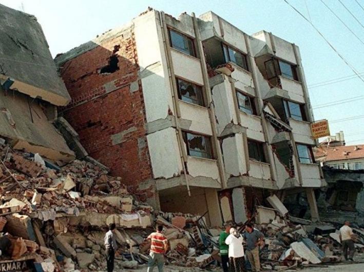
30 Earthquakes on the North Anatolian Fault Izmit, 6. August 1999, M = victims, injured

31 The conditional probability of an earthquake on the North Anatolian Fault next to Instanbul
32 M = 7.4 Izmit (Turky), 6. August 1999 M = 7.4 Izmit (Turky), 6. August 1999 M = 7.4 Izmit (Turky), 6. August 1999 M = 7.4 Izmit (Turky), 6. August 1999

33 The conditional probability of an earthquake on the North Anatolian Fault next to Instanbul


34 The conditional probability of an earthquake on the North Anatolian Fault next to Instanbul
35 Magnitude or intensity what is useful for planning rescue missions? Earthquake Magnitude M = log 10 A/T + F(D,h) + C
 damage Damaging Heavily damaging")

36 Earthquake Intensity EMS-98 European Macroseismic Scale Grünthal et al., 1998 I - VI VII VIII IX X XI XII No (serious) damage Damaging Heavily damaging Destructive Very destructive Devastating Completely devastating


37 Vulnerabilty classes Damage grade A Adobe, earth bricks 1 B Unreinforced, no RC floors 2 C D Unreinforced, RC floors Reinforced 3 4 5
38 Intensity VIII many few many few few Grünthal, 1998


39 Intensity IX many few many few many few Grünthal, 1998
,")


40 Izmit (Turkey), 6. August 1999 M = victims
,")


41 Kobe (Japan), 17. January 1995, M = victims
42 What type of measure of the strength of an eartquake ( magnitude, intensity ) is useful for planning rescue? X Earthquake intensity provides straightforward information on damage
43 Are earthquakes more frequent today than they were in the past? Introducing the Gutenberg-Richter frequency relation

44 Are earthquakes getting more frequent? Total losses and insured losses caused by natural desasters Münchner Rück Topics Geo 2016

45 Are earthquakes getting more frequent? Number of damaging natural desasters events Münchner Rück Topics Geo 2016

46 Are earthquakes getting more frequent? How frequent are earthquakes? Global CMT Catalogue Gutenberg-Richter magnitude-frequency relationship describing self-organized criticality

47 Are earthquakes getting more frequent? How frequent are earthquakes? Global CMT Catalogue Gutenberg-Richter magnitude-frequency relationship describing self-organized criticality

48 How frequent are earthquakes?
49 Are earthquakes more frequent today than they were in the past? No - losses and numbers of victims increase because more and more people and values are exposed to risk

50 Where to get real-time data for the planning and preparation of rescue missions? Some on-line sources

 U.")


51 Sources for real-time information European-Mediterranean Seismological Centre (EMSC) U.S. Geological Survey Last 24 hours before yesterday Last 24 hours before yesterday
52 (yesterday) ShakeMaps provide near-real-time maps of shaking intensity. The maps are used by federal, state, and local organizations, for postearthquake response and recovery, as well as for preparedness exercises and disaster planning.

53 (yesterday)

54 ShakeMap for 1999 Izmit M = 7.4


55 Izmit region on Google Earth
56


57 The short sumary of a short story Earthquakes are caused by tectonic faults Earthquake physics are too complex for predictions but they prove that earthquakes do not get more frequent Hazard maps provide information on earthquake probability However, hazard maps frequently fail Earthquake intensity is most meaningful for desaster mitigation Real-time information found in ShakeMaps
Earthquakes. Earthquake Magnitudes 10/1/2013. Environmental Geology Chapter 8 Earthquakes and Related Phenomena
 Environmental Geology Chapter 8 Earthquakes and Related Phenomena Fall 2013 Northridge 1994 Kobe 1995 Mexico City 1985 China 2008 Earthquakes Earthquake Magnitudes Earthquake Magnitudes Richter Magnitude
EARTHQUAKE MODELLING. Algiers, Belhassen Tonat
 EARTHQUAKE MODELLING Algiers, 10.11.2011 Belhassen Tonat Basic terms Plate tectonics Basic terms Average Number of Earthquakes/Year (Global) Magnitude Average Annually 8 and higher 1 ¹ 7-7.9 17 ² 6-6.9
I. What are Earthquakes?
 I. What are Earthquakes? A. There is more to earthquakes than just the shaking of the ground. An entire branch of Earth science, called seismology, is devoted to the study of earthquakes. B. Earthquakes
Earthquake early warning: Adding societal value to regional networks and station clusters
 Earthquake early warning: Adding societal value to regional networks and station clusters Richard Allen, UC Berkeley Seismological Laboratory rallen@berkeley.edu Sustaining funding for regional seismic
M-6.2 EARTHQUAKE NORCIA, ITALY AUGUST 24, 01:36:33 UTC
 M-6.2 EARTHQUAKE NORCIA, ITALY AUGUST 24, 2016 @ 01:36:33 UTC EARTHQUAKE REPORT - NORCIA, ITALY M-6.2, 24 August 2016 The M-6.2 earthquake had a shallow depth (10 km) and struck approximately 10 km SE
Earthquakes.
 Earthquakes http://thismodernworld.com/comic-archive Elastic rebound http://projects.crustal.ucsb.edu/understanding/elastic/rebound.html Elastic rebound Rocks store energy elastically When stored stress
The Earthquake Cycle Chapter :: n/a
 The Earthquake Cycle Chapter :: n/a A German seismogram of the 1906 SF EQ Image courtesy of San Francisco Public Library Stages of the Earthquake Cycle The Earthquake cycle is split into several distinct
GEO-VIII November Geohazard Supersites and Natural Laboratories Progress Report. Document 9
 GEO-VIII 16-17 November 2011 Geohazard Supersites and Natural Laboratories Progress Report Document 9 This document is submitted to GEO-VIII for information. Geohazard Supersites and Natural Laboratories
EARTHQUAKES. Bruce A. Bolt. Fifth Edition. W. H. Freeman and Company New York. University of California, Berkeley
 EARTHQUAKES Fifth Edition Bruce A. Bolt University of California, Berkeley DS W. H. Freeman and Company New York Preface xi What We Feel in an Earthquake 1 The 1906 Eye-Opening San Francisco Earthquake
Three Fs of earthquakes: forces, faults, and friction. Slow accumulation and rapid release of elastic energy.
 Earthquake Machine Stick-slip: Elastic Rebound Theory Jerky motions on faults produce EQs Three Fs of earthquakes: forces, faults, and friction. Slow accumulation and rapid release of elastic energy. Three
Earthquakes and Earth s Interior
 - What are Earthquakes? Earthquakes and Earth s Interior - The shaking or trembling caused by the sudden release of energy - Usually associated with faulting or breaking of rocks - Continuing adjustment
Low-Latency Earthquake Displacement Fields for Tsunami Early Warning and Rapid Response Support
 Low-Latency Earthquake Displacement Fields for Tsunami Early Warning and Rapid Response Support Hans-Peter Plag, Geoffrey Blewitt Nevada Bureau of Mines and Geology and Seismological Laboratory University
Earthquakes and Faulting
 Earthquakes and Faulting Crustal Strength Profile Quakes happen in the strong, brittle layers Great San Francisco Earthquake April 18, 1906, 5:12 AM Quake lasted about 60 seconds San Francisco was devastated
Basics of the modelling of the ground deformations produced by an earthquake. EO Summer School 2014 Frascati August 13 Pierre Briole
 Basics of the modelling of the ground deformations produced by an earthquake EO Summer School 2014 Frascati August 13 Pierre Briole Content Earthquakes and faults Examples of SAR interferograms of earthquakes
An entire branch of Earth science, called, is devoted to the study of earthquakes.
 Lesson One Essential Question Where do earthquakes take place? What causes earthquakes? What are three different types of faults that occur at plate boundaries? How does energy from earthquakes travels
FOURTH GRADE HAZARDS 1 WEEK LESSON PLANS AND ACTIVITIES
 FOURTH GRADE HAZARDS 1 WEEK LESSON PLANS AND ACTIVITIES PLATE TECTONIC CYCLE OVERVIEW OF FOURTH GRADE VOLCANOES WEEK 1. PRE: Comparing different structures of volcanoes. LAB: Modeling three types of volcanoes.
Earthquakes. Dr. Mark van der Meijde INTERNATIONAL INSTITUTE FOR GEO-INFORMATION SCIENCE AND EARTH OBSERVATION
 Earthquakes Dr. Mark van der Meijde vandermeijde@itc.nl INTERNATIONAL INSTITUTE FOR GEO-INFORMATION SCIENCE AND EARTH OBSERVATION Topics to handle Theory of earthquakes Mechanism Strength Measurements
Geohazards and disaster risk reduction
 Geohazards and disaster risk reduction Susanne Sargeant 8 November 2017 Overview University and my PhD Seismology at BGS Learning other skills Working at the interface between science and resilience building
PLATE DEFORMATION - 2
 H4.SMR/1775-24 "8th Workshop on Three-Dimensional Modelling of Seismic Waves Generation, Propagation and their Inversion" 25 September - 7 October 2006 PLATE DEFORMATION - 2 Roberto Sabadini Dipartimento
Characteristics and introduction of Earthquake in Asia-Pacific region
 Characteristics and introduction of Earthquake in Asia-Pacific region 1906 San Francisco 2011 Tohoku 1999 Chi-Chi 1985 Mexico City 2004 Sumatra Chung-Han Chan 詹忠翰 2011 Christchurch To understand the characteristics
I. Locations of Earthquakes. Announcements. Earthquakes Ch. 5. video Northridge, California earthquake, lecture on Chapter 5 Earthquakes!
 51-100-21 Environmental Geology Summer 2006 Tuesday & Thursday 6-9:20 p.m. Dr. Beyer Earthquakes Ch. 5 I. Locations of Earthquakes II. Earthquake Processes III. Effects of Earthquakes IV. Earthquake Risk
How to Use This Presentation
 How to Use This Presentation To View the presentation as a slideshow with effects select View on the menu bar and click on Slide Show. To advance through the presentation, click the right-arrow key or
Seismic vulnerability in Latinamerica Speaker: Rafael Osiris de León Sciences Academy of Dominican Republic.
 Seismic vulnerability in Latinamerica Speaker: Rafael Osiris de León Sciences Academy of Dominican Republic. IANAS GENERAL ASSEMBLY Punta Cana, 16-20 July, 2013 TECTONIC PLATES AND EARTHQUAKES Pacific
Interdisciplinary Framework to Reveal Earthquake Precursory Phenomena in Seismically Active Areas
 Interdisciplinary Framework to Reveal Earthquake Precursory Phenomena in Seismically Active Areas D.Ouzounov 1,2, S.Pulinets 3, M.Kafatos 1, P.Taylor 2 1 Chapman University, Orange, CA 92866, USA 2 NASA
Use this checklist for revision. Combine with textbook, revision websites and revision guide.
 Paper 1: Tectonics Use this checklist for revision. Combine with textbook, revision websites and revision guide. Lesson Title Spec Point Keywords Case Studies/Key skills Practiced Exam Questions Revised?
Source:
 Source: http://www.pastforward.ca/perspectives/columns/10_02_05.htm At 16:53, on Wednesday, January 12th, 2010, a devastating 7.0 earthquake struck Haiti's capital, Port-au-Prince. The earthquake left
Determining the Earthquake Epicenter: Japan
 Practice Name: Hour: Determining the Earthquake Epicenter: Japan Measuring the S-P interval There are hundreds of seismic data recording stations throughout the United States and the rest of the world.
NPTEL Online - IIT Kanpur. Course Name Geotechnical Earthquake Engineering. Department IIT Kanpur
 NPTEL Online - IIT Kanpur Course Name Geotechnical Earthquake Engineering Department Instructor Civil Engineering Department IIT Kanpur Prof. N.R. Patra Module 1 INTRODUCTION TO GEOTECHNICAL ENGINEERING
Earthquake. earthquake, epicenters in the U.S. Kobe, Japan deaths
 Kobe, Japan 1995 5000 deaths Earthquakes It is estimated that there are 500,000 detectable earthquakes in the world each year. 100,000 of those can be felt, and 100 of them cause damage. The world's deadliest
Module 2, Investigation 1: Earthquake Hazards
 Module 2, Investigation 1: Earthquake Hazards Introduction Welcome! In the last module, you assumed the role of a volcanologist and learned how volcanoes are described and monitored. You will now assume
COULOMB STRESS CHANGES DUE TO RECENT ACEH EARTHQUAKES
 COULOMB STRESS CHANGES DUE TO RECENT ACEH EARTHQUAKES Madlazim Physics Department, Faculty Mathematics and Sciences of Surabaya State University (UNESA) Jl. Ketintang, Surabaya 60231, Indonesia. e-mail:
(First Edition: prepared on 29/12/2003)
") (First Edition: prepared on 29/12/2003) Dr Sassan Eshghi 1 and Dr Mehdi Zaré 2 International Institute of Earthquake Engineering and Seismology, Tehran, P.O.Box: 19395/3913, IRAN e-mails: 1)s.eshghi@iiees.ac.ir,
(First Edition: prepared on 29/12/2003) Dr Sassan Eshghi 1 and Dr Mehdi Zaré 2 International Institute of Earthquake Engineering and Seismology, Tehran, P.O.Box: 19395/3913, IRAN e-mails: 1)s.eshghi@iiees.ac.ir,
Cyber Enabled Earth Exploration (CE )
") Cyber Enabled Earth Exploration 3 (CE ) Field Notebook Module 2: Introduction to Earthquakes Investigation 1: Earthquake Hazards Table of Contents Folder 1: Describing Earthquakes... 3 Folder 2: Shaanxi,
Cyber Enabled Earth Exploration 3 (CE ) Field Notebook Module 2: Introduction to Earthquakes Investigation 1: Earthquake Hazards Table of Contents Folder 1: Describing Earthquakes... 3 Folder 2: Shaanxi,
Earthquakes down under: a rare but real hazard
 University of Wollongong Research Online Faculty of Science, Medicine and Health - Papers Faculty of Science, Medicine and Health 2015 Earthquakes down under: a rare but real hazard Solomon Buckman University
1 of 27. Boardworks Ltd Earthquakes
 1 of 27 Earthquakes Teacher s notes and Flash files Most slides contain notes to accompany the presentation. This icon indicates that the notes contain particularly detailed instructions or extension activities.
20.1 Earthquakes. Chapter 20 EARTHQUAKES AND VOLCANOES. Earthquakes and plate boundaries 500 UNIT 6 EARTH S STRUCTURE
 Chapter 20 EARTHQUAKES AND VOLCANOES 20.1 Earthquakes In Chapter 19, you read about the San Andreas Fault, which lies along the California coast (Figure 20.1). This fault passes right through San Francisco
Forecasting Earthquakes
 Forecasting Earthquakes Lecture 9 Earthquake Recurrence ) Long-term prediction - Elastic Rebound Theory Stress Stress & strain accumulation 0 0 4 F slow accumulation of stress & strain that deforms rock
Mw 7.8, Southwest of Sumatra, Indonesia Wed, 2 March 2016 at 12:49:48 UTC M /03/03
 Earthquake overview AFGHANISTA N PAKISTA N INDIA A moment magnitude (Mw) 7.8 earthquake struck in South West, Indonesia. The epicentre was centered about 800 km West South West of Padang, Sumatra province,
Tectonic Seismogenic Index of Geothermal Reservoirs
 Tectonic Seismogenic Index of Geothermal Reservoirs C. Dinske 1, F. Wenzel 2 and S.A. Shapiro 1 1 Freie Universität Berlin 2 KIT Karlsruhe November 27, 2012 Introduction M max reservoir location -2.0 Barnett
Magnitude 6.9 GULF OF CALIFORNIA
 A pair of strong earthquakes struck off the coast of Mexico early Thursday only minutes apart. The magnitude 6.9 and 6.2 were centered about 85 miles northeast of Guerrero Negro in the Mexican state of
Magnitude 7.3 IRAQ. Early reports indicate that 140 have been killed with over 800 injuries reported. Sunday, November 12, 2017 at 18:18:17 UTC
 A magnitude 7.3 earthquake has occurred in the northern border region of Iran and Iraq centered about 350 kilometers (217 miles) north of Baghdad at a depth of 33.9 km (21 miles). The earthquake was felt
UNIT - 7 EARTHQUAKES
 UNIT - 7 EARTHQUAKES WHAT IS AN EARTHQUAKE An earthquake is a sudden motion or trembling of the Earth caused by the abrupt release of energy that is stored in rocks. Modern geologists know that most earthquakes
ENGINEERING-SEISMOLOGICAL ASPECTS OF EARTHQUAKE SCENARIO DEVELOPMENT ON THE EXAMPLE OF TASHKENT, UZBEKISTAN
 International Journal of Geology, Earth & Environmental Sciences ISSN: 2277-281 (Online) 218 Vol. 8 (2) May-August, pp. 3-35/Alixanovich ENGINEERING-SEISMOLOGICAL ASPECTS OF EARTHQUAKE SCENARIO DEVELOPMENT
Earthquakes. Photo credit: USGS
 Earthquakes Earthquakes Photo credit: USGS Pancaked Building - 1985 Mexico City Earthquakes don t kill people - buildings do! An earthquake is the motion or trembling of the ground produced by sudden displacement
Southern California Earthquake Center Collaboratory for the Study of Earthquake Predictability (CSEP) Thomas H. Jordan
 Thomas H. Jordan") Southern California Earthquake Center Collaboratory for the Study of Earthquake Predictability (CSEP) Thomas H. Jordan SCEC Director & Professor, University of Southern California 5th Joint Meeting of
Southern California Earthquake Center Collaboratory for the Study of Earthquake Predictability (CSEP) Thomas H. Jordan SCEC Director & Professor, University of Southern California 5th Joint Meeting of
GEOL/GEOE 344: EARTHQUAKES AND SEISMIC HAZARDS (FALL 2001) FINAL EXAM NAME: TIME AVAILABLE: 120 MINUTES TOTAL POINTS: 110
 FINAL EXAM NAME: TIME AVAILABLE: 120 MINUTES TOTAL POINTS: 110") GEOL/GEOE 344: EARTHQUAKES AND SEISMIC HAZARDS (FALL 2001) FINAL EXAM NAME: TIME AVAILABLE: 120 MINUTES TOTAL POINTS: 110 (yep, that s 10 bonus points, just for showing up!) Instructions: There are several
GEOL/GEOE 344: EARTHQUAKES AND SEISMIC HAZARDS (FALL 2001) FINAL EXAM NAME: TIME AVAILABLE: 120 MINUTES TOTAL POINTS: 110 (yep, that s 10 bonus points, just for showing up!) Instructions: There are several
Usually, only a couple of centuries of earthquake data is available, much shorter than the complete seismic cycle for most plate motions.
 Earthquake Hazard Analysis estimate the hazard presented by earthquakes in a given region Hazard analysis is related to long term prediction and provides a basis to expressed hazard in probabilistic terms.
Two Contrasting InSAR Studies of Recent Earthquakes in Tibet
 Two Contrasting InSAR Studies of Recent Earthquakes in Tibet Barry Parsons Department of Earth Sciences University of Oxford John Elliott, Wanpeng Feng,, James Jackson, Zhenhong Li, Xinjian Shan, Alastair
C2.2 The physics of Earthquakes
 C2.2 The physics of Earthquakes C2.2.1 Stress axes and faults Most earthquakes occur because of the mechanical failure on brittle faults. The type of faulting is a consequence of the stress pattern causing
Megathrust earthquakes: How large? How destructive? How often? Jean-Philippe Avouac California Institute of Technology
 Megathrust earthquakes: How large? How destructive? How often? Jean-Philippe Avouac California Institute of Technology World seismicity (data source: USGS) and velocities relative to ITRF1997 (Sella et
Gutenberg-Richter Relationship: Magnitude vs. frequency of occurrence
 Quakes per year. Major = 7-7.9; Great = 8 or larger. Year Major quakes Great quakes 1969 15 1 1970 20 0 1971 19 1 1972 15 0 1973 13 0 1974 14 0 1975 14 1 1976 15 2 1977 11 2 1978 16 1 1979 13 0 1980 13
Earthquakes An introduction to earthquake monitoring techniques
 Earthquakes An introduction to earthquake monitoring techniques TEACHER S COPY Aims To understand what an earthquake is and where they occur To gain an insight into how earthquakes are recorded and how
Earthquakes. Pt Reyes Station 1906
 Earthquakes Pt Reyes Station 1906 Earthquakes Ground shaking caused by the sudden release of accumulated strain by an abrupt shift of rock along a fracture in the earth. You Live in Earthquake Country
2018 REVIEW OF DISASTER EVENTS
 2018 REVIEW OF DISASTER EVENTS Supplementary Information* BRUSSELS, 24 January, 2019 In 2018, there were 281 climate-related and geophysical events recorded in the EM-DAT (International Disaster Database)
ES Ch 19 Earthquakes 1
 Chapter 19 - Earthquakes Objectives 1. Define stress vs. strain as they apply to rocks. 2. Define faults. 3. Contrast types of seismic waves-3 types according to their type of movement, speed, location
The Magnitude 7.2 Earthquake from the West Valley Fault: Implications for Metro Manila and Nearby Provinces
 The Magnitude 7.2 Earthquake from the West Valley Fault: Implications for Metro Manila and Nearby Provinces First DRI Collegiate Conference in the Philippines 16 March 2017 Renato U. Solidum, Jr. Department
Earthquakes Science & Safety. Dr. Richard Robertson Geologist & Head Seismic Research Unit
 Earthquakes Science & Safety Dr. Richard Robertson Geologist & Head Seismic Research Unit Summary The Eastern Caribbean islands are in a seismically active part of the world. Earthquake safety tips should
LAB 9: Earthquakes & Seismic Activity
 LAB 9: Earthquakes & Seismic Activity Objectives Identify P, S, and surface waves on a simple seismogram Locate the epicenter of an earthquake using seismograms and travel times curves Describe how the
Earthquake Disaster Management in India
 Earthquake Disaster Management in India Akshay B. Ahlawat JRF in Geography Abstract: The fact is that natural disasters are always unexpected events which affect human life as well as nature itself. Earthquakes
IGOS Geohazards: toward an improved use of Earth Observations for Geohazards mitigation
 IGOS Geohazards: toward an improved use of Earth Observations for Geohazards mitigation Scientific and Technical Subcommittee session Vienna, 15th February 2007 Gonéri Le Cozannet IGOS Geohazards Bureau
Lecture Outline Wednesday-Monday April 18 23, 2018
 Lecture Outline Wednesday-Monday April 18 23, 2018 Questions? Lecture Final Exam Lecture Section 1 Friday May 4, 8:00-10:00am Lecture Section 2 Friday May 4, 3:10-5:10 pm Final Exam is 70% new material
Magnitude 7.5 NEW BRITAIN REGION, PAPUA NEW GUINEA
 A magnitude 7.5 earthquake struck off the eastern coast of Papua New Guinea on Tuesday, approximately 130 km (81 mi) southsouthwest of Kokopo at a depth of 42 km (26.1 mi). There are reports of some structural
Earthquakes Science & Safety. Ms Joan L. Latchman Seismologist Seismic Research Unit
 Earthquakes Science & Safety Ms Joan L. Latchman Seismologist Seismic Research Unit Summary Trinidad lies in an area of high earthquake activity for the Caribbean. Earthquake safety tips should be practiced
New USGS Maps Identify Potential Ground- Shaking Hazards in 2017
 New USGS Maps Identify Potential Ground- Shaking Hazards in 2017 New USGS Maps Identify Potential Ground-Shaking Hazards in 2017 The central U.S. faces continued hazards from human-induced earthquakes
Earthquakes Web Quest
 NAME: Earthquakes Web Quest DATE: TASK #1: http://projects.crustal.ucsb.edu/understanding/history/historyhtml Read through the slides and answer the following questions: What did our ancient ancestors
Widespread Ground Motion Distribution Caused by Rupture Directivity during the 2015 Gorkha, Nepal Earthquake
 Widespread Ground Motion Distribution Caused by Rupture Directivity during the 2015 Gorkha, Nepal Earthquake Kazuki Koketsu 1, Hiroe Miyake 2, Srinagesh Davuluri 3 and Soma Nath Sapkota 4 1. Corresponding
3D Seismic Hazard and Risk Maps for Earthquake Awareness of Citizens with Aids of GIS and Remote Sensing Technologies
 3D Seismic Hazard and Risk Maps for Earthquake Awareness of Citizens with Aids of GIS and Remote Sensing Technologies Saburoh Midorikawa Tokyo Institute of Technology In Japan, seismic hazard and risk
Tectonic Processes and Hazards Enquiry Question 1: Why are some locations more at risk from tectonic hazards?
 Tectonic Processes and Hazards Enquiry Question 1: Why are some locations more at risk from tectonic hazards? Key words Basalt Andesite Rhyolite Benioff Zone Subduction zone Crustal fracturing Definition
Released Science Inquiry Task Location Grade 11
 Date: Your Name: Released Science Inquiry Task Location 2009 Grade 11 Science Directions: You will be completing an extended-response inquiry task called Location. Explain the reasons for all of your answers.
DAMAGE SCENARIOS FOR CENTRAL EUROPE HISTORICAL EARTHQUAKES AS BASIS FOR CALIBRATING PROGNOSIS TOOLS
 DAMAGE SCENARIOS FOR CENTRAL EUROPE HISTORICAL EARTHQUAKES AS BASIS FOR CALIBRATING PROGNOSIS TOOLS Jochen SCHWARZ 1, Silke BEINERSDORF 1, Christian KAUFMANN 1, and Tobias LANGHAMMER 1 Intensity-based
Magnitude 7.3 NEPAL. Tuesday, May 12, 2015 at 07:05:19 UTC
 A magnitude 7.3 earthquake has occurred near Mount Everest. Early reports suggest 32 people have been killed and at least 1,000 were injured in the earthquake. The region is still in recovery from a 7.8
Earthquake hazards. Aims 1. To know how hazards are classified 2. To be able to explain how the hazards occur 3. To be able to rank order hazards
 Earthquake hazards Aims 1. To know how hazards are classified 2. To be able to explain how the hazards occur 3. To be able to rank order hazards Types of hazard Primary A direct result of the earthquake
Application of a GIS for Earthquake Hazard Assessment and Risk Mitigation in Vietnam
 Application of a GIS for Earthquake Hazard Assessment and Risk Mitigation in Vietnam Nguyen Hong Phuong Earthquake Information and Tsunami Warning Centre, VAST OUTLINE Introduction Fault Source Model and
Earthquakes. Chapter Test A. Multiple Choice. Write the letter of the correct answer on the line at the left.
 Earthquakes Chapter Test A Multiple Choice Write the letter of the correct answer on the line at the left. 1. Stress that pushes a mass of rock in two opposite directions is called a. shearing. b. tension.
Ground-motion and Intensity: were the Basel 2006 and St. Gallen 2013 Events Fundamentally Different?
 Ground-motion and Intensity: were the Basel 2006 and St. Gallen 2013 Events Fundamentally Different? Benjamin Edwards 1,2, Toni Kraft 1, Carlo Cauzzi 1, Philipp Kästli 1 and Stefan Wiemer 1 1 Swiss Seismological
CASUALTY IN EARTHQUAKE AND TSUNAMI DISASTERS: INTERNET-BASED MONITORING AND EARLY ESTIMATION OF THE FINAL DEATH TOLL
 CASUALTY IN EARTHQUAKE AND TSUNAMI DISASTERS: INTERNET-BASED MONITORING AND EARLY ESTIMATION OF THE FINAL DEATH TOLL ABSTRACT : Y.Z. Zhao 1, Z.L. Wu 2 and Y.T. Li 2, 3 1 College of Earth Science, Graduate
Opera'onal Earthquake Forecas'ng At the USGS
 Opera'onal Earthquake Forecas'ng At the USGS Coordina(ng Commi,ee: Michael Blanpied, Associate Earthquake Program Coordinator Lucy Jones, Science Advisor for Risk Reduc'on Andy Michael, Task leader for
Two ways to think about the dynamics of earthquake ruptures
 Two ways to think about the dynamics of earthquake ruptures (1) In terms of friction (2) In terms of fracture mechanics Scholz describes conditions for rupture propagation (i.e. instability) via energy
M 7.1 EARTHQUAKE 5KM ENE OF RABOSO, MEXICO EXACT LOCATION: N W DEPTH: 51.0KM SEPTEMBER 19, 1:14 LOCAL TIME
 M 7.1 EARTHQUAKE 5KM ENE OF RABOSO, MEXICO EXACT LOCATION: 18.584 N 98.399 W DEPTH: 51.0KM SEPTEMBER 19, 2017 @ 1:14 LOCAL TIME Photo: Eduardo Verdugo / AP Photo: Alfredo Estrella/ Agence France-Presse/
Science of Natural Disasters: Earthquakes! 6 April Rebecca Clotts Department of Geology, University of St Thomas
 Science of Natural Disasters: Earthquakes! 6 April 2016 Rebecca Clotts Department of Geology, University of St Thomas 1 What is an earthquake? An episode of ground shaking Any earthquakes today? http://earthquake.usgs.gov/
Yesterday scaling laws. An important one for seismic hazard analysis
 Yesterday scaling laws An important one for seismic hazard analysis Estimating the expected size of an earthquake expected on a fault for which the mapped length is known. Wells & Coppersmith, 1994 And
Coulomb stress changes due to Queensland earthquakes and the implications for seismic risk assessment
 Coulomb stress changes due to Queensland earthquakes and the implications for seismic risk assessment Abstract D. Weatherley University of Queensland Coulomb stress change analysis has been applied in
Chapter 15. Earthquakes and Plate Tectonics. what s the connection? At the boundaries friction causes plates to stick together.
 Chapter 15 Earthquakes and Plate Tectonics what s the connection? As with volcanoes, earthquakes are not randomly distributed over the globe At the boundaries friction causes plates to stick together.
Magnitude 7.1 NEAR THE EAST COAST OF HONSHU, JAPAN
 Japan was rattled by a strong aftershock and tsunami warning Thursday night nearly a month after a devastating earthquake and tsunami flattened the northeastern coast. This earthquake can be considered
THERMAL REMOTE SENSING TECHNIQUES FOR STUDYING EARTHQUAKE ANOMALIES IN 2013 BALOCHISTAN EARTHQUAKES. G. Kaplan 1 and U. Avdan 2
 THERMAL REMOTE SENSING TECHNIQUES FOR STUDYING EARTHQUAKE ANOMALIES IN 2013 BALOCHISTAN EARTHQUAKES ABSTRACT: G. Kaplan 1 and U. Avdan 2 1 PhD Candidate, GIS and Remote Sensing program, Anadolu University,
EARTHQUAKE PROFILE. Figure 1-Seismic hazard map, I.R.Iran
 EARTHQUAKE PROFILE The Iranian plateau has long been known as one of the seismically active areas of the world and it frequently suffers destructive and catastrophic earthquakes that cause heavy loss of
Pacific Catastrophe Risk Assessment And Financing Initiative
 Pacific Catastrophe Risk Assessment And Financing Initiative VANUATU September 211 Country Risk Profile: VANUATU is expected to incur, on average, 48 million USD per year in losses due to earthquakes and
M-8.1 EARTHQUAKE 87KM SW OF PIJIJIAPAN, MEXICO EXACT LOCATION: N W DEPTH: 69.7KM SEPTEMBER 7, 11:49 PST
 M-8.1 EARTHQUAKE 87KM SW OF PIJIJIAPAN, MEXICO EXACT LOCATION: 15.068 N 93.715 W DEPTH: 69.7KM SEPTEMBER 7, 2017 @ 11:49 PST Photo: Luis Alberto Cruz / AP Photo: Carlos Jasso 1 THE 2017 CHIAPAS MEXICO
Year 9 Revision. The exam will be based on two topics: Natural hazards and Population. The Exam
 Year 9 Revision The exam will be based on two topics: Natural hazards and Population This document is designed to help you revise. You should use it alongside your class notes. In places there are some
Earthquakes and Earthquake Hazards Earth - Chapter 11 Stan Hatfield Southwestern Illinois College
 Earthquakes and Earthquake Hazards Earth - Chapter 11 Stan Hatfield Southwestern Illinois College What Is an Earthquake? An earthquake is the vibration of Earth, produced by the rapid release of energy.
Earthquakes Chapter 19
 Earthquakes Chapter 19 Does not contain complete lecture notes. What is an earthquake An earthquake is the vibration of Earth produced by the rapid release of energy Energy released radiates in all directions
Overview. Tools of the Trade. USGS Decision-Making Tools for Pre-Earthquake Mitigation and Post-Earthquake Response
 USGS Decision-Making Tools for Pre-Earthquake Mitigation and Post-Earthquake Response Tools of the Trade DAVID WALD United States Geological Survey NEHRP Workshop: Developing Earthquake Scenarios Sept
Scientific Programme. 1. Opening Day
 Scientific Programme International Training Course on Seismology, Seismic Data Analysis, Hazard Assessment and Risk Mitigation Potsdam, Germany, 12 August to 6 September, 2013 1. Opening Day Monday, Aug.
4/22/2011. Skill sharing session AVC what makes the ground tremble? What to do before. What to do during. What to do after
 Skill sharing session AVC 2011 Session Objectives what makes the ground tremble? What to do before What to do during What to do after Definition of earthquake Earthquake causes Characteristic of earthquake
Earthquake Hazards in Henderson
 Earthquake Hazards in Henderson Craig M. depolo Nevada Bureau of Mines and Geology Nevada Hazard Mitigation Planning Committee November 15, 2012 Earthquake Truths The consequences of bad earthquakes to
Tuesday 4 June 2013 Afternoon
 Tuesday 4 June 2013 Afternoon GCSE GEOGRAPHY B B561/01/02/RB Sustainable Decision Making (SDM) (Foundation and Higher Tier) RESOURCE BOOKLET *B521990613* This Resource Booklet should be available to candidates
EARTHQUAKE HAZARD ASSESSMENT IN KAZAKHSTAN
 EARTHQUAKE HAZARD ASSESSMENT IN KAZAKHSTAN Dr Ilaria Mosca 1 and Dr Natalya Silacheva 2 1 British Geological Survey, Edinburgh (UK) imosca@nerc.ac.uk 2 Institute of Seismology, Almaty (Kazakhstan) silacheva_nat@mail.ru
Once you have opened the website with the link provided choose a force: Earthquakes
 Name: Once you have opened the website with the link provided choose a force: Earthquakes When do earthquakes happen? On the upper left menu, choose number 1. Read What is an Earthquake? Earthquakes happen
Magnitude 6.3 SOUTH ISLAND OF NEW ZEALAND
 A magnitude 6.3 earthquake shook the southern New Zealand city of Christchurch. At least 100 people are reported dead, and there are reports of collapsed buildings, cracked streets and flooding due to
Important Concepts. Earthquake hazards can be categorized as:
 Lecture 1 Page 1 Important Concepts Monday, August 17, 2009 1:05 PM Earthquake Engineering is a branch of Civil Engineering that requires expertise in geology, seismology, civil engineering and risk assessment.