Environmental Criminology
|
|
|
- Corey Joseph
- 5 years ago
- Views:
Transcription
1 ENVIRONMENTAL CRIMINOLOGY AND THE IMPACT OF PROBLEM BUSINESSES ON CRIME IN PORTLAND NEIGHBORHOODS Presented by Ryan Arnold Hector Osuna Allen Byrd Environmental Criminology Annually crime plays a large part in effecting livability and infrastructure in major cities. Research in environmental criminology has shown that the presence of some phenomena can have a secondary impact on crime rates. The geodatabase designed in this project creates a framework for research and study of spatial aspects of environmental criminology. Common variables were selected based upon recent articles in the criminal justice field and known phenomena that has been linked to crime.
2 Environmental Criminology Examples from recent studies: Alcohol Sales Concentrations of both on-premise and off-premise outlets are associated with high levels of disorderly conduct (Roman, 2008). Land Use Variations in land use, like variations in housing type, are part of the fundamental fabric of neighborhoods. They shape the quality of life for residents and contribute to local reputations, house market values, and, of course, local crime rates (McCord et al, 2007). Adult Stores and Strip Clubs we present the results of two case studies. In both instances, ambient crime rises when off-site adult stores open for business (McCleary et al, 2008). When an adult entertainment business opens on an interstate highway off-ramp to a small rural village, total crime rises by 60% (McCleary, 2008). Design Objectives To build a geodatabase to test and compare research on environmental factors that contribute to crime and the location of those crimes by Portland neighborhood

3 Intended Applications To answer specific questions related to the spatial aspects of crime by investigating possible relationships with non-criminal data This database design facilitates this by showing relationships between relatable tables and feature classes Geographic Extent Portland Police Bureau Patrol Areas Emphasis on Portland Neighborhoods Unincorporated areas were not included


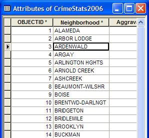
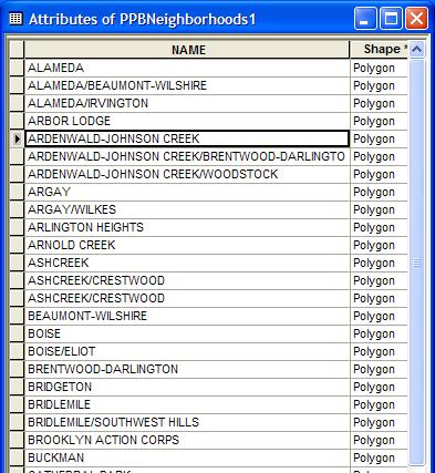
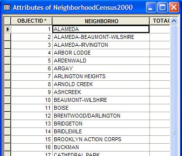
4 Data Layer Specifications Metro RLIS 2008 City Streets City Parks City Schools City Zoning Portland Police Bureau Portland Neighborhood Crime Count Neighborhood Boundaries Office of Neighborhood Involvement Neighborhood Boundaries Neighborhood Census Data Oregon Liquor Control Commission Liquor Store Locations Google Earth & Google Maps Adult Entertainment Locations Convenience Stores Locations Grocery Stores Locations Bars Locations Check Cashing Locations Pawn Shops Locations Political Area Discrepancy
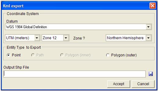
5 Dataset Discrepancy KML 2 SHP
6 Methods and Techniques Geocoding and Projecting: Liquor stores, bars, adult entertainment locations, etc. Clipping data to study area Joining data to study area? Formatting and relating tabular data tables Overlay analysis Statistical analysis More Methods and Techniques ArcToolbox Analysis Tools Extract Proximity Data Management Tools Geocoding Tools Create Address Locator Geocode Adresses Conversion Tools To Raster Field Calculator Dasymetric Mapping Raster Calculator SQL

7 Personal Geodatabase Demonstration Application In 2008 Roman et al completed a study on the District of Columbia for the National Institute of Justice Alcohol Outlets as Attractors of Violence and Disorder: A Closer Look at the Neighborhood Environment This demonstration attempts to repeat aspects of Roman s s research and compare general findings to the Portland area
8 Key Differences In Study Areas Roman et al Location Washington D.C. Area of analysis Block Group 2000 Population density 9316 per sq mile Demonstration Location Portland Area of analysis Neighborhood 2000 Population density 9939 per sq mile * Levels of economic disparity and violent crime rates are much higher in Washington D.C. than Portland. Roman s s Findings On-premise outlets, but not off premise outlets are a significant predictor of aggravated assault Concentrations of both on-premise and offpremise outlets are associated with high levels of disorderly conduct Off-premise outlets were associated with a significant increase in domestic violence, but onpremise outlets (specifically restaurants and nightclubs) were associated with a decrease in domestic violence *We did not have information on domestic violence and were unable to perform a comparison for this variable
 Off-premise alcohol outlets Grocery, convenience and liquor stores (310) Violent and alcohol")

9 Methodology Location counts were collected by neighborhood for On-premise alcohol outlets Bars and pubs (473) Off-premise alcohol outlets Grocery, convenience and liquor stores (310) Violent and alcohol related crimes Homicide, aggravated assault, rape, robbery, and simple assault DUII, drug crimes, liquor law violations, disorderly conduct, and weapon violations Demonstration Application Identity tool Summarize table

10 Methodology Data was normalized using 2000 Census population data for each neighborhood Crime and store counts were divided by the population of the neighborhood and multiplied by 1000 Ex. (Crime / Population) * 1000 = number of crime incidents or alcohol outlet locations per 1000 residents, for each neighborhood
11 Methodology Spearman s s Rho was then used to generate bivariate correlation coefficients for each crime type (SPSS) Pearon s R was not used because the level of skewness was high for the data Spearman s Rho Results Table 1. Spearman s Correlations On-Premises Outlets Off-Premises Outlets **. Correlation is significant at the 0.01 level (2-tailed). Homicide Aggravated Assault Rape Robbery Drugs Simple Assault Weapon Disorderly Conduct DUII Liquor Laws **.381 **.423 **.527 **.445 **.403 **.398 **.407 **.471 ** ** **.272 **.303 ** **.362 **.433 ** *. Correlation is significant at the 0.05 level (2-tailed). A coefficient value of +.1 is considered a small correlation, is a medium correlation, and +.5 and above is a large correlation (Green( and Salkind,, 2004) Comparison of findings Roman found that on-premises, but not off-premises outlets were significant predictor of aggravated assault We found that both were significant Roman determined that concentrations of both on-premise and offpremise outlets are associated with high levels of disorderly conduct Our results were in agreement We found additional significance On-premises outlets had a significant correlation between all crimes tested, with the exception of homicide Off-premises outlets had a significant correlation between most crimes tested, with the exception of homicide, rape, and weapons offenses
12 Limitations and Quality Statements Complete crime data was only available through 2006 Census data is limited to the year 2000 Crime incident point location data is not available to the general public Annual crime counts by neighborhood was used Unincorporated areas are not included in this study Patrolled by Multnomah County Sherriff s s Dept., crime data is unavailable Some neighborhood acreage from ONI data did not match with PPB. This may have been due to different methods of measurement or the inclusion of river area by ONI Crime data entry error for Crestwood and Creston-Kenilworth, data was reversed and needs to be revised Works Cited Arc GIS Desktop Help RLIS Office of Neighborhood Involvement Portland Police Bureau Green, S, & Salkind,, N (2004). Using SPSS for Windows and Macintosh: Analyzing and Understanding Data.New York: Prentice Hall. McCleary,, Richard (2008).The Case of Adult Businesses. Criminal Justice Policy Review. 19-2,, McCleary,, R. and Weinstein, A. "Do Off-Site Adult Businesses Have Secondary Effects? Legal Doctrine, Social Theory, and Empirical Results." Paper presented at the annual meeting of the AMERICAN SOCIETY OF CRIMINOLOGY, Atlanta Marriott Marquis, Atlanta, Georgia <Not Available> from McCord, Eric S., Ratcliffe,, Jerry H., Garcia, R. Marie, & Taylor, Ralph B. (2007). Nonresidential Crime Attractors and Generators Elevate Perceived Neighborhood Crime and Incivilities. Journal of Research in Crime and Delinquency, 44-3,, Staff, (2005) Census: US Municipalities Over 50,000: Ranked d by 2000 Population. Retrieved December 8, 2008, from Demographia Web site:
Belton Police Department
 Belton Police Department Uniform Crime Report for June 2013 RETURN-A - MONTHLY RETURN OF OFFENSES KNOWN TO THE POLICE 1 Classification of offenses 1 Criminal Homicide A Murder/nonnegligent homicide 2 Offenses
A Micro-Spatial Analysis of Violent Crime
 A Micro-Spatial Analysis of Violent Crime The Experience of a Small Southern City Isaac T. Van Patten Radford University Levels of Measurement Macro-spatial analysis Crime at the state, regional, or national
UC POLICE DEPARTMENT REPORTS DASHBOARD
 UC POLICE DEPARTMENT REPORTS DASHBOARD UC MERCED Annual 1. UC Merced FBI Part I Crime Offenses 2 2. UC Merced FBI Part II Crime Offenses 3 3. UC Merced Arrests - FBI Crime Offenses 4 4. UC Merced Value
EICCARS WORKBOOK FOR INITIATING COMMUNITY PROFILES WITH STATISTICAL AND OTHER SECONDARY DATA
 The Cultural Ecology of Health and Change (CEHC) Working Papers Ethnographically Informed Community and Cultural Assessment Research Systems (EICCARS) Workbooks EICCARS WORKBOOK FOR INITIATING COMMUNITY
Developing Built Environment Indicators for Urban Oregon. Dan Rubado, MPH EPHT Epidemiologist Oregon Public Health Division
 Developing Built Environment Indicators for Urban Oregon Dan Rubado, MPH EPHT Epidemiologist Oregon Public Health Division What is the built environment? The built environment encompasses spaces and places
U.C. Davis FBI Part I & Part II Crime Offenses 2008 to 2010
 U.C. Davis FBI Part I & Part II Crime Offenses 2008 to 2010 2010 PART I OFFENSES 2008 Number of Actual Offenses 2009 Number of Actual Offenses 2010 Number of Actual Offenses 2009 to 2010 Percent Change
Introduction: Name Redacted November 17, 2017 GSP 370 Research Proposal and Literature Review
 Name Redacted November 17, 2017 GSP 370 Research Proposal and Literature Review Introduction: The study of spatial patterns and distributions has been conducted for many years. Over the last few decades,
FBI Part I & Part II Crime Offenses Arrests Miscellaneous Activity Value of Stolen Property Crime Pie Charts Crime Line Charts Crime Rate Charts
 U.C. Davis Medical Center Crime Statistics (Medical Center) PDF Version FBI Part I & Part II Crime Offenses Arrests Miscellaneous Activity Value of Stolen Property Crime Pie Charts Crime Line Charts Crime
Exploring the Impact of Ambient Population Measures on Crime Hotspots
 Exploring the Impact of Ambient Population Measures on Crime Hotspots Nick Malleson School of Geography, University of Leeds http://nickmalleson.co.uk/ N.S.Malleson@leeds.ac.uk Martin Andresen Institute
ROBBERY VULNERABILITY
 Spatial Risk Assessment: ROBBERY VULNERABILITY A Spatial Risk Assessment was conducted to identify environmental features which make locations conducive to robberies in the City of Burlington, NC. Findings
A GIS TOUR OF DES MOINES PRESENTED BY ANNA WHIPPLE, GIS MANAGER APRIL 20, 2015
 A GIS TOUR OF DES MOINES PRESENTED BY ANNA WHIPPLE, GIS MANAGER APRIL 20, 2015 Welcome to Des Moines! Capital of Iowa Among 100 largest metropolitan areas Insurance, biotech, healthcare, and entertainment
GIS = Geographic Information Systems;
 What is GIS GIS = Geographic Information Systems; What Information are we talking about? Information about anything that has a place (e.g. locations of features, address of people) on Earth s surface,
Crime Analysis. GIS Solutions for Intelligence-Led Policing
 Crime Analysis GIS Solutions for Intelligence-Led Policing Applying GIS Technology to Crime Analysis Know Your Community Analyze Your Crime Use Your Advantage GIS aids crime analysis by Identifying and
Mapping Crime in Sacramento: A GIS Approach to analyzing the spatial distribution of crime in Sacramento, California
 Mapping Crime in Sacramento: A GIS Approach to analyzing the spatial distribution of crime in Sacramento, California Name Redacted Humboldt State University GSP 370: Intermediate GIS December 8, 2017 MAPPING
Neighborhood Locations and Amenities
 University of Maryland School of Architecture, Planning and Preservation Fall, 2014 Neighborhood Locations and Amenities Authors: Cole Greene Jacob Johnson Maha Tariq Under the Supervision of: Dr. Chao
City of Newcastle Police Services Report. Third Quarter 2017
 City of Newcastle Police Services Report Third Quarter 2017 Prepared by: The Research, Planning and Information Services Unit of the King County Sheriff s Office CITY OF NEWCASTLE CHIEF OF POLICE SERVICES
Policy and Procedures For Issuing Timely Warnings
 The Pennsylvania State University Policy and Procedures For Issuing Timely Warnings I. Purpose The purpose of this Policy is to establish a process by which The Pennsylvania State University (hereinafter
Background of Project
 RELOCATION OF GRESHAM FIRE STATION #76 Mike Shelby Annie Scriven Andrea Consalus Background of Project Wanted to do a project that was meaningful Contacted Molly Vogt, GIS Manager at City of Gresham Informed
University of Huddersfield Repository
 University of Huddersfield Repository Newton, Andrew D. Activity nodes and licensed premises: Risky mixes and risky facilities Original Citation Newton, Andrew D. (2014) Activity nodes and licensed premises:
A Socioeconomic Analysis of the Spatial Distribution of Fire Hydrants. History of Portland Fire Hydrants
 A Socioeconomic Analysis of the Spatial Distribution of Fire Hydrants By Dylan Carmody Robert Chappell Jana Tracy Allan McMillian 2003 History of Portland Fire Hydrants The first fire hydrant was installed
Introduction to GIS. Dr. M.S. Ganesh Prasad
 Introduction to GIS Dr. M.S. Ganesh Prasad Department of Civil Engineering The National Institute of Engineering, MYSORE ganeshprasad.nie@gmail.com 9449153758 Geographic Information System (GIS) Information
High Speed / Commuter Rail Suitability Analysis For Central And Southern Arizona
 High Speed / Commuter Rail Suitability Analysis For Central And Southern Arizona Item Type Reports (Electronic) Authors Deveney, Matthew R. Publisher The University of Arizona. Rights Copyright is held
Percent Change. Last YTD
 Part I L Month Month HOMICIDE 1 0 5 3 66.7% 1 4 3 100.0% 80.0% 100.0% 0 0 0 2 6 8 MURDER 0 0 4 1 300.0% 0 3 1-75.0% 100.0% 0 0 0 2 6 8 MANSLAUGHTER 0 0 0 2-100.0% 0 0 2 - - 100.0% 0 0 0 0 0 0 NEG. HOMICIDE
Medford Police Department April 2018 Consolidated Incident Report(includes all nature of call codes)
") Part I L Month Month HOMICIDE 0 0 2 1 100.0% 0 3 1-150.0% 100.0% 0 0 0 0 5 5 MURDER 0 0 2 1 100.0% 0 2 1-100.0% 100.0% 0 0 0 0 2 2 MANSLAUGHTER 0 0 0 0 0% 0 0 0 - - - 0 0 0 0 0 0 NEG. HOMICIDE - TRAFFIC
Part I L Month Month HOMICIDE 0 0 2 1 100.0% 0 3 1-150.0% 100.0% 0 0 0 0 5 5 MURDER 0 0 2 1 100.0% 0 2 1-100.0% 100.0% 0 0 0 0 2 2 MANSLAUGHTER 0 0 0 0 0% 0 0 0 - - - 0 0 0 0 0 0 NEG. HOMICIDE - TRAFFIC
Percent Change. Last YTD MANSLAUGHTER % % 100.0% JUST. HOMICIDE %
 Part I L Month Month HOMICIDE 1 0 3 1 200.0% 2 4 1 200.0% 133.3% 100.0% 0 2 2 0 4 4 MURDER 0 0 1 1-1 2 1-200.0% 100.0% 0 0 0 0 1 1 MANSLAUGHTER 1 0 2 0 200% 1 2 0 100.0% 100.0% - 0 2 2 0 3 3 JUST. HOMICIDE
Crime and Fire Statistics
 Crime and Fire Statistics Monmouth University Police Department Crime Statistics Murder Negligent Manslaughter Forcible Sex Offenses Rape Criminal Sexual Contact Non-Forced Sex Offenses Incest Statutory
Major Crime Map Help Documentation
 Major Crime Map Help Documentation This web application is designed to make it easier to visualize and understand crime trends in Overland Park. The data for this application are generally limited to relatively
Geodatabase for Sustainable Urban Development. Presented By Rhonda Maronn Maurice Johns Daniel Ashney Jack Anliker
 Geodatabase for Sustainable Urban Development Presented By Rhonda Maronn Maurice Johns Daniel Ashney Jack Anliker Objective Build a Geodatabase that will enable urban planners to create and assess the
Using GIS to Explore the Relationship between Socioeconomic Status and Demographic Variables and Crime in Pittsburgh, Pennsylvania
 Using GIS to Explore the Relationship between Socioeconomic Status and Demographic Variables and Crime in Pittsburgh, Pennsylvania Stephen E. Mitchell Department of Resource Analysis, Saint Mary s University
GIS for ChEs Introduction to Geographic Information Systems
 GIS for ChEs Introduction to Geographic Information Systems AIChE Webinar John Cirucci 1 GIS for ChEs Introduction to Geographic Information Systems What is GIS? Tools and Methods Applications Examples
GEOG 3340: Introduction to Human Geography Research
 GEOG 3340: Introduction to Human Geography Research Lecture 1: Course Overview Guofeng Cao www.myweb.ttu.edu/gucao Department of Geosciences Texas Tech University guofeng.cao@ttu.edu Fall 2015 Course Description
Manual of Crime Analysis Map Production
 Manual of Crime Analysis Map Production Manual of Crime Analysis Map Production Written by: Mary Velasco Research Associate, Crime Mapping Laboratory and Rachel Boba, Ph.D. Director, Crime Mapping Laboratory
Acknowledgments xiii Preface xv. GIS Tutorial 1 Introducing GIS and health applications 1. What is GIS? 2
 Acknowledgments xiii Preface xv GIS Tutorial 1 Introducing GIS and health applications 1 What is GIS? 2 Spatial data 2 Digital map infrastructure 4 Unique capabilities of GIS 5 Installing ArcView and the
Exploring the Relationship Between Vacant and Distressed Properties and Community Health and Safety
 Exploring the Relationship Between Vacant and Distressed Properties and Community Health and Safety Prepared for: Western Reserve Land Conservancy Prepared by: Center on Urban Poverty and Community Development
ITT Technical Institute, Salem, Oregon Safety and Security Policies with Crime Statistics Report CRIME STATISTICS
 ITT Technical Institute, Salem, Oregon Safety and Security Policies with Crime Statistics Report CRIME STATISTICS In each of the specified calendar years, the following number of crimes were reported to
Juvenile Justice Information System
 Juvenile Justice Information System Data & Evaluation Reports Dispositions () JJIS Steering Committee JJIS Data & Evaluation Sub-Committee JJIS A Shared Information System Oregon Youth Authority Oregon
Shannon E. Reid Curriculum Vitae June 2013
 Shannon E. Reid Curriculum Vitae June 2013 Assistant Professor University of North Carolina, Charlotte Phone: 704-687-7862 Criminal Justice and Criminology Email: s.reid@uncc.edu Charlotte, NC 28223 Education
Introducing GIS analysis
 1 Introducing GIS analysis GIS analysis lets you see patterns and relationships in your geographic data. The results of your analysis will give you insight into a place, help you focus your actions, or
The Effects of Place Centric Crime Reduction Efforts In Three Neighborhoods Appendix
 The Effects of Place Centric Crime Reduction Efforts In Three Neighborhoods Appendix Francisca Winston January 31, 2017 This Appendix accompanies The Effects of Place Centric Crime Reduction Efforts in
Lecture 9: Geocoding & Network Analysis
 Massachusetts Institute of Technology - Department of Urban Studies and Planning 11.520: A Workshop on Geographic Information Systems 11.188: Urban Planning and Social Science Laboratory Lecture 9: Geocoding
Exploring the Conditional Effects of Bus Stops on Crime. Thomas D. Stucky* Sarah L. Smith. School of Public and Environmental Affairs
 Exploring the Conditional Effects of Bus Stops on Crime Thomas D. Stucky* Sarah L. Smith School of Public and Environmental Affairs Indiana University Purdue University Indianapolis This paper could not
All data is subject to further review and change.
 All data is subject to further review and change. 5500 5000 4500 32% Increase Number or Incidents 4000 3500 3000 2500 2000 1500 21% Decrease 3742 4936 2008 2009 1000 500 0 1052 Part I 827 Part II 800 700
Density and Walkable Communities
 Density and Walkable Communities Reid Ewing Professor & Chair City and Metropolitan Planning University of Utah ewing@arch.utah.edu Department of City & Metropolitan Planning, University of Utah MRC Research
Understanding China Census Data with GIS By Shuming Bao and Susan Haynie China Data Center, University of Michigan
 Understanding China Census Data with GIS By Shuming Bao and Susan Haynie China Data Center, University of Michigan The Census data for China provides comprehensive demographic and business information
Running head: GEOGRAPHICALLY WEIGHTED REGRESSION 1. Geographically Weighted Regression. Chelsey-Ann Cu GEOB 479 L2A. University of British Columbia
 Running head: GEOGRAPHICALLY WEIGHTED REGRESSION 1 Geographically Weighted Regression Chelsey-Ann Cu 32482135 GEOB 479 L2A University of British Columbia Dr. Brian Klinkenberg 9 February 2018 GEOGRAPHICALLY
LAND USE AND VIOLENT CRIME. Thomas D. Stucky. John R. Ottensmann. School of Public and Environmental Affairs
 Contact Information: Thomas D. Stucky, Ph.D. Associate Professor of Criminal Justice School of Public and Environmental Affairs BS/SPEA Building 4069 801 W. Michigan St. Indianapolis, IN 46202 tstucky@iupui.edu.
Exercise 3: GIS data on the World Wide Web
 Exercise 3: GIS data on the World Wide Web These web sites are a few examples of sites that are serving free GIS data. Many other sites exist. Search in Google or other search engine to find GIS data for
Geographic Systems and Analysis
 Geographic Systems and Analysis New York University Robert F. Wagner Graduate School of Public Service Instructor Stephanie Rosoff Contact: stephanie.rosoff@nyu.edu Office hours: Mondays by appointment
Inclusion of Non-Street Addresses in Cancer Cluster Analysis
 Inclusion of Non-Street Addresses in Cancer Cluster Analysis Sue-Min Lai, Zhimin Shen, Darin Banks Kansas Cancer Registry University of Kansas Medical Center KCR (Kansas Cancer Registry) KCR: population-based
Lecture 1 Introduction to GIS. Dr. Zhang Spring, 2017
 Lecture 1 Introduction to GIS Dr. Zhang Spring, 2017 Topics of the course Using and making maps Navigating GIS Map design Working with spatial data Geoprocessing Spatial data infrastructure Digitizing
Mapping and Health Equity Advocacy
 Mapping and Health Equity Advocacy Sarah Treuhaft PolicyLink November 7, 2008 About us PolicyLink National research and action institute that advances policies to achieve economic and social equity Center
Crime and Fire Statistics
 Monmouth University Police Department Crime Statistics Murder Negligent Manslaughter Forcible Sex Offenses Rape Criminal Sexual Contact Non-Forced Sex Offenses Incest Statutory Rape Robbery Aggravated
Trip Generation Model Development for Albany
 Trip Generation Model Development for Albany Hui (Clare) Yu Department for Planning and Infrastructure Email: hui.yu@dpi.wa.gov.au and Peter Lawrence Department for Planning and Infrastructure Email: lawrence.peter@dpi.wa.gov.au
Chapter 1 Introducing GIS for police work
 Chapter 1 Introducing GIS for police work Introduction This chapter introduces crime mapping and analysis using Esri s ArcGIS Desktop for meeting the day-to-day information needs of police organizations.
WlLPEN L. GORR KRISTEN S. KURLAND. Universitats- und Landesbibliothek. Bibliothek Architektur und Stadtebau ESRI
 hj WlLPEN L. GORR KRISTEN S. KURLAND Universitats- und Landesbibliothek Darmstadt Bibliothek Architektur und Stadtebau ESRI Contents Acknowledgments Preface xvii XV GIS Tutorial 1 Introduction Launch ArcMap
Population Profiles
 U N D E R S T A N D I N G A N D E X P L O R I N G D E M O G R A P H I C C H A N G E MAPPING AMERICA S FUTURES, BRIEF 6 2000 2010 Population Profiles Atlanta, Las Vegas, Washington, DC, and Youngstown Allison
Environmental Analysis, Chapter 4 Consequences, and Mitigation
 Environmental Analysis, Chapter 4 4.17 Environmental Justice This section summarizes the potential impacts described in Chapter 3, Transportation Impacts and Mitigation, and other sections of Chapter 4,
GEOG 510 DEATON Assignment 2: Homicides in Chicago INTRODUCTION
 GEOG 510 DEATON Assignment 2: Homicides in Chicago INTRODUCTION Of America s three largest cities (by population), Chicago has the highest violent crime and murder rate. i However, Chicago didn t make
Utilizing Data from American FactFinder with TIGER/Line Shapefiles in ArcGIS
 Utilizing Data from American FactFinder with TIGER/Line Shapefiles in ArcGIS Web Adams, GISP Data Dissemination Specialist U.S. Census Bureau New York Regional Office 1 What We Do Decennial Census Every
What Explains the Effectiveness of Hot Spots Policing And What New Strategies Should we Employ?
 What Explains the Effectiveness of Hot Spots Policing And What New Strategies Should we Employ? David Weisburd Executive Director Center for Evidence-Based Crime Policy George Mason 1 The Effectiveness
Portland s regional economy is integrated
 Periodic Atlas of the Regional Connections 2: Economy by Jeremy Young, Sheila Martin, and Meg Merrick; Cartography by Robert Smith, Jeremy Young, and Meg Merrick s regional economy is integrated across
Hierarchical Additive Modeling of Nonlinear Association with Spatial Correlations
 1 ENAR09 LSUHSC p. 1/18 Hierarchical Additive Modeling of Nonlinear Association with Spatial Correlations Qingzhao Yu, Bin Li, Richard Scribner Louisiana State University, School of Public Health Supported
Implications for the Sharing Economy
 Locational Big Data and Analytics: Implications for the Sharing Economy AMCIS 2017 SIGGIS Workshop Brian N. Hilton, Ph.D. Associate Professor Director, Advanced GIS Lab Center for Information Systems and
TEXAS WESLEYAN UNIVERSITY CAMPUS SECURITY AND FIRE SAFETY ANNUAL REPORT January 1, 2010 through December 31, 2010
 TEXAS WESLEYAN UNIVERSITY CAMPUS SECURITY AND FIRE SAFETY ANNUAL REPORT January 1, 2010 through December 31, 2010 The following information is provided to better inform University students and others.
Techniques for Science Teachers: Using GIS in Science Classrooms.
 Techniques for Science Teachers: Using GIS in Science Classrooms. After ESRI, 2008 GIS A Geographic Information System A collection of computer hardware, software, and geographic data used together for
GIS Lecture 4: Data. GIS Tutorial, Third Edition GIS 1
 GIS Lecture 4: Data GIS 1 Outline Data Types, Tables, and Formats Geodatabase Tabular Joins Spatial Joins Field Calculator ArcCatalog Functions GIS 2 Data Types, Tables, Formats GIS 3 Directly Loadable
CERTIFIED RESOLUTION. introduction: and dated May 29, 2017, as attached, as appropriate
 15322 Buena Vista Avenue, White Rock BC, Canada V4B 1Y6 www.whiterockcity.ca City of White Rock P: 604.541.22121 F: 604.541.9348 /2tC% City Clerk s Office IT E ROC K June 13,2017 Stephanie Lam, Deputy
LEWISVILLE POLICE DEPARTMENT
 STATISTICAL REPORT FOR THE MONTH OF RUSSELL KERBOW CHIEF OF POLICE PREPARED BY: ROBIN BRIZENDINE PUBLIC SAFETY DATA TECHNICIAN DATE PREPARED: September 20, 2017 ORI: TX0610600 AGENCY: LEWISVILLE STATE:
Spatial Organization of Data and Data Extraction from Maptitude
 Spatial Organization of Data and Data Extraction from Maptitude N. P. Taliceo Geospatial Information Sciences The University of Texas at Dallas UT Dallas GIS Workshop Richardson, TX March 30 31, 2018 1/
Appendix: Development Patterns and Design
 Appendix: Development Patterns and Design Development Patterns Figure 1 lists the amount of land converted from undeveloped to some other form of land for the 13 county and 20 county Atlanta Region. In
Nuisance and Call for Service Data Analysis
 Augustana College Augustana Digital Commons 2015-2016: Clinton, Iowa Sustainable Workshops Landscapes Initiative 2016 Nuisance and Call for Service Data Analysis Dr. Jennifer Burnham Augustana College,
Development of Crime Forecasting and Mapping Systems for Use by Police
 i Final Report Development of Crime Forecasting and Mapping Systems for Use by Police 2001-IJ-CX-0018 By Jacqueline Cohen Wilpen L. Gorr August 10, 2005 H. John Heinz III School of Public Policy and Management
Census Geography, Geographic Standards, and Geographic Information
 Census Geography, Geographic Standards, and Geographic Information Michael Ratcliffe Geography Division US Census Bureau New Mexico State Data Center Data Users Conference November 19, 2015 Today s Presentation
Hot spot Analysis with Clustering on NIJ Data Set The Data Set:
 Hot spot Analysis with Clustering on NIJ Data Set The Data Set: The data set consists of Category, Call groups, final case type, case desc, Date, X-coordinates, Y- coordinates and census-tract. X-coordinates
MICHIGAN JUSTICE STATISTICS CENTER SCHOOL OF CRIMINAL JUSTICE MICHIGAN STATE UNIVERSITY JULY 2014 FLINT DDACTS PILOT EVALUATION
 MICHIGAN JUSTICE STATISTICS CENTER SCHOOL OF CRIMINAL JUSTICE MICHIGAN STATE UNIVERSITY JULY 2014 FLINT DDACTS PILOT EVALUATION MICHIGAN JUSTICE STATISTICS CENTER SCHOOL OF CRIMINAL JUSTICE MICHIGAN STATE
presents challenges related to utility infrastructure planning. Many of these challenges
 1 Introduction: - a. Purpose According to U.S. Census Bureau the population of stark county was 367,585 in 1990, and in 2000 it was increase to 378,098. Thus County is experiencing a growth that presents
Tools for Analyzing NIBRS Data and Tips for Merging NIBRS Data with Publicly Available Datasets
 Tools for Analyzing NIBRS Data and Tips for Merging NIBRS Data with Publicly Available Datasets Scott Came Executive Director Becki Goggins Director, Law and Policy Program 2016 Association of State Uniform
Utilizing GIS Technology for Rockland County. Rockland County Planning Department Douglas Schuetz & Scott Lounsbury
 Utilizing GIS Technology for Rockland County Rockland County Planning Department Douglas Schuetz & Scott Lounsbury Presentation Agenda Introduction What is GIS What can GIS do GIS Efforts for BOE Resources
Land Use and Opportunities for Crime: Using GIS as an Analysis Tool
 Land Use and Opportunities for Crime: Using GIS as an Analysis Tool Vinay M. Suryavanshi Major Paper submitted to the Faculty of the Virginia Polytechnic Institute and State University in partial fulfillment
John Laznik 273 Delaplane Ave Newark, DE (302)
") Office Address: John Laznik 273 Delaplane Ave Newark, DE 19711 (302) 831-0479 Center for Applied Demography and Survey Research College of Human Services, Education and Public Policy University of Delaware
Office Address: John Laznik 273 Delaplane Ave Newark, DE 19711 (302) 831-0479 Center for Applied Demography and Survey Research College of Human Services, Education and Public Policy University of Delaware
compass.durhamnc.gov Building Community by Illustrating Community Durham s Neighborhood Compass
 Building Community by Illustrating Community Durham s Neighborhood Compass A presentation by John Killeen Rob Cushman Tyler Waring Neighborhood Improvement Services & Technology Solutions City of Durham,
Are You Maximizing The Value Of All Your Data?
 Are You Maximizing The Value Of All Your Data? Using The SAS Bridge for ESRI With ArcGIS Business Analyst In A Retail Market Analysis SAS and ESRI: Bringing GIS Mapping and SAS Data Together Presented
2013 NASCIO Award Submission Category: Cross-Boundary Collaboration and Partnerships. Project Title: Public Safety and Enterprise GIS in Tennessee
 2013 NASCIO Award Submission Category: Cross-Boundary Collaboration and Partnerships Project Title: Public Safety and Enterprise GIS in Tennessee State of Tennessee, Board of Parole State of Tennessee,
Date: Wed 12 July 2017 Reference Number: FOI Category: Stats - Crime
 Date: Wed 12 July 2017 Reference Number: 20171145 FOI Category: Stats - Crime Title: Hate Crimes Request Date: Friday, 23 June, 2017 Response Date: Wednesday, 12 July, 2017 Request Details: Q1: The total
- Geography is important when studying crime because when a crime happens it always has a location, a time and a reason.
 - Geography is important when studying crime because when a crime happens it always has a location, a time and a reason. - Crime figures are collected from the number of crime incidents reported to the
OREGON POPULATION FORECAST PROGRAM
 OREGON POPULATION FORECAST PROGRAM PROGRAM OVERVIEW BACKGROUND Beginning in 1973 with the passage of Senate Bill (SB) 100, Oregon s growth management system has relied on population forecasts as the primary
UN-GGIM: User case studies ISRAEL
 UNGGIM: User case studies ISRAEL ISRAEL GIS for 2008 Integrated Population Census GIS was used as a main infrastructure for the 2008 Israeli integrated census of population The Integrated Census is based
Introduction To Raster Based GIS Dr. Zhang GISC 1421 Fall 2016, 10/19
 Introduction To Raster Based GIS Dr. Zhang GISC 1421 Fall 2016, 10/19 Model of the course Using and making maps Navigating GIS maps Map design Working with spatial data Geoprocessing Spatial data infrastructure
MEMPHIS POLICE DEPARTMENT
 MEMPHIS POLICE DEPARTMENT Sentinel Camera Project City Council Districts (Data Dates Jan. 1 Dec. 31, 2016) District 1 - Councilman Bill Morrison District 2 - Councilman Frank Colvett District 3 Councilwoman
Creating a Pavement Management System Using GIS
 Christopher Castruita PPD 631 Prof. Barry Waite & Prof. Bonnie Shrewsbury Creating a Pavement Management System Using GIS Problem Definition As is the case with many cities, the city of La Cañada Flintridge
Modeling Urban Sprawl: from Raw TIGER Data with GIS
 Modeling Urban Sprawl: from Raw TIGER Data with GIS Brady Foust University of Wisconsin-Eau Claire Lisa Theo University of Wisconsin-Stevens Point Modeling Urban Sprawl 1 Problem How to model & predict
Seasonality in recorded crime: preliminary findings
 Seasonality in recorded crime: preliminary findings Celia Hird Chandni Ruparel Home Office Online Report /7 The views expressed in this report are those of the authors, not necessarily those of the Home
Space and the City: Modern Chicago (and Beyond)
") Space and the City: Modern Chicago (and Beyond) Robert J. Sampson Department of Sociology Harvard University Concentration of Collective Action Events in Chicago Spatial Interdependence of Concentrated
Space and the City: Modern Chicago (and Beyond) Robert J. Sampson Department of Sociology Harvard University Concentration of Collective Action Events in Chicago Spatial Interdependence of Concentrated
BROOKINGS May
 Appendix 1. Technical Methodology This study combines detailed data on transit systems, demographics, and employment to determine the accessibility of jobs via transit within and across the country s 100
FHWA GIS Outreach Activities. Loveland, Colorado April 17, 2012
 FHWA GIS Outreach Activities Loveland, Colorado April 17, 2012 GIS for Improved Decision Making FHWA believes that geographic information systems and other geospatial technologies (remote sensing and GPS)
violent offenses, social interaction theory, ambient temperature, geographic
 Global Journal of Science Frontier Research: H Environment & Earth Science Volume 14 Issue 6 Version 1.0 Year 2014 Type : Double Blind Peer Reviewed International Research Journal Publisher: Global Journals
METHODOLOGICAL ISSUES IN CREATING A REGIONAL NEIGHBORHOOD TYPOLOGY
 METHODOLOGICAL ISSUES IN CREATING A REGIONAL NEIGHBORHOOD TYPOLOGY Z. Asligul Gocmen Urban and Regional Planning Program, University of Michigan Ann Arbor, MI 48109 Tel: +1 734-904-2762 (c) Fax: +1 734-763-2322
GIS Spatial Statistics for Public Opinion Survey Response Rates
 GIS Spatial Statistics for Public Opinion Survey Response Rates July 22, 2015 Timothy Michalowski Senior Statistical GIS Analyst Abt SRBI - New York, NY t.michalowski@srbi.com www.srbi.com Introduction
ArcGIS Online Analytics. Mike Flanagan
 ArcGIS Online Analytics Mike Flanagan MFlanagan@esri.com Agenda Introduction to ArcGIS Online Spatial Analysis ArcGIS Online Spatial Analysis Workflow Demos and Examples Wrap-up Q&A ArcGIS A complete web
AN INTRODUCTION TO GEOSPATIAL TECHNOLOGY AS IT RELATES TO CREATING BASELINE INFORMATION FOR CLIMATE, HEALTH, DISASTER, AND DISEASE MAPPING AND CHANGE
 AN INTRODUCTION TO GEOSPATIAL TECHNOLOGY AS IT RELATES TO CREATING BASELINE INFORMATION FOR CLIMATE, HEALTH, DISASTER, AND DISEASE MAPPING AND CHANGE Carl L. Zimmerman, PhD Tufts University, UEPP and Geospatial