Socioeconomic data for climate change impacts, vulnerability and adaptation assessment
|
|
|
- Owen Carson
- 6 years ago
- Views:
Transcription
1 Socioeconomic data for climate change impacts, vulnerability and adaptation assessment Alex de Sherbinin Center for International Earth Science Information Network (CIESIN), The Earth Institute at Columbia University 3 rd NCAR Community Workshop on GIS in Weather, Climate and Impacts October 2008 Overview 1. Vulnerability definitions 2. Sample applications Population and poverty and current hazards Population and poverty and CC scenarios 3. Data needs for describing population vulnerability 4. Data needs for describing adaptive capacity 5. A proposed Climate Change IVA collection 6. Conclusions 1


 S = sensitivity the intrinsic (age, sex, SES, ethnicity, livelihood strategies, etc.) and extrinsic (institutions, entitlements, etc.")
2 IPCC Working Group 2 Definition of Vulnerability Vulnerability is the degree to which a system is susceptible to, or unable to cope with, adverse effects of climate change, including climate variability and extremes. Vulnerability is a function of the character, magnitude and rate of climate change and variation to which a system is exposed, its sensitivity, and its adaptive capacity. Population s Vulnerability = f (E, S, A) Where E = exposure size of the area and/or population affected (does the event occur there?) S = sensitivity the intrinsic (age, sex, SES, ethnicity, livelihood strategies, etc.) and extrinsic (institutions, entitlements, etc.) characteristics of a population A = adaptive capacity capacities of the population, place or system to resist impacts, cope with losses, and/or regain functions Extended Framework for Vulnerability Source: Turner et al. PNAS (2003) 2


3 The Main Point Climate change impacts are spatially differentiated Vulnerabilities are spatially differentiated Adaptive/coping capacities are spatially differentiated Drought Frequency Georeferenced data on population, poverty, land use types, hazards, and climate change scenario outputs, together with ancillary biogeophysical data, can help us in our understanding of climate change impacts and vulnerability, and in turn inform where adaptation may be required Poverty Levels Cropping System Societal Impacts Exposure to Current Hazards as a Way of Understanding Potential Future Vulnerabilities to Climate Change 3

, Natural Disaster Hotspots: A")


4 Exposure to Current Climate Hazards Source: Dilley, M., R.S Chen, U. Deichmann, A. Lerner-Lam and M. Arnold (2005), Natural Disaster Hotspots: A Global Risk Analysis, World Bank, Washington DC. Exposure to Current Climate Hazards Source: Dilley, M., R.S Chen, U. Deichmann, A. Lerner-Lam and M. Arnold (2005), Natural Disaster Hotspots: A Global Risk Analysis, World Bank, Washington DC. 4


5 5

 and sensitivity")
")


6 Integrating data to assess vulnerability: An example ntal Hazard Environmen Exposure (location) and sensitivity (individual, household and community characteristics) Exposure to hazards Hazard risk represents a cumulative score based on risk of cyclones, flooding, landslides and drought. Source: de Sherbinin et al. (2007). The vulnerability of global cities to climate hazards. Environment & Urbanization. 19(1):


7 Vulnerability to Drought: Exposure + Sensitivity Frequency Mortality Claudio Szlafsztein & Horst Sterr A GISbased vulnerability assessment of coastal natural hazards, state of Pará, Brazil. J. Coastal Conservation. 11:
8 Poverty as a proxy for vulnerability Poverty refers to lack of physical requirements, assets and income; while vulnerability focuses on the exposure to shocks, stress and risks, and on the lack of means to face the damage or loss. Poverty is a relatively static, unidimensional concept, while vulnerability is more dynamic, multidimensional, and a better concept for measuring change. Poverty contributes to vulnerability bl through hthree mechanisms: (a) the narrowing of coping and resistance strategies, (b) the loss of diversification and the restriction of entitlements, and (c) the lack of empowerment. Difficult to measure vulnerability at global/regional level Very place specific and multi dimensional Internal or intrinsic vulnerability a function of: Socioconomic status Household characteristics Gender and age Social networks Historic inequalities Institutional inequalities Building codes National or local preparedness (e.g. early warning systems) 8


9 National Poverty Rate percentage of the population having per capita consumption of less than $1.08 a day 9
10 Compared with the non poor, poor people are more likely to be found in drought prone areas with shorter growing seasons Non-poor Poor For the Millennium Ecosystem Assessment CIESIN calculated average IMR within each MA ecosystem. We also calculated another measure of well being, the ratio of the share of world population to share of world GDP. The drylands are the most disadvantaged. We further calculated rates of population growth within each ecosystem unit, and noted that the drylands had the highest rate of growth. To have fragile ecosystems with low levels of well being experience the highest population growth is bound to make challenges more difficult in these regions. Millennium Ecosystem Assessment,


11 Exposure to Drought & Sensitivity Not Poor Somewhat Poor Moderately Poor Poor Extremely Poor The poor are at much greaterrisk risk of experiencing a drought 11

12 Not Poor Somewhat Poor Moderately Poor Poor Extremely Poor The poor are also much more vulnerable to drought Potential Future Vulnerabilities to Climate Change and Data Needs 12
.")


13 Change in Runoff by 2080 Source: Nohara et al.(2006). Impact of climate change on river runoff. Journal of Hydrometeorology. 7: , cited in the IPCC AR4 WG-2 report. Knowing where people are 6 billion persons (2000, UN) 13


.")


14 in relation to prolonged drying, drought, and floods By 2015, there will be >405 million people in regions where runoff is projected to decline by more than 20% by 2080 Source: Adamo and de Sherbinin (forthcoming). The impact of climate change on the spatial distribution of populations and migration. Proceedings of the Expert Group Meeting on Migration, UN Population Division, January Knowing where people and cities are in relation to sea level rise of 10 meters Source: Balk, D., G. McGranahan, and B. Anderson Population and Land Area in Distribution in Urban Coastal Zones A Systematic Assessment. Earth System Science Partnership Open Science Meeting, Nov 2006, Beijing. 14
15 Differences in population in the low elevation coastal zone (LECZ) by Region Region Total Population Urban population p (10 6 ) (%) (10 6 ) (%) Africa 56 7% 31 12% Asia % % Europe 50 7% 40 8% Latin America 29 6% 23 7% Australia & N. Z. 3 13% 3 13% North America 24 8% 21 8% SIS 6 13% 4 13% World % % Differences in land area in the LECZ by Region Region Total Land Urban Land (10 3 km 2 ) (%) (10 3 km 2 ) (%) Africa 191 1% 15 7% Asia 881 3% % Europe 490 2% 56 7% Latin America 397 2% 33 7% Australia & N. Z % 6 13% North America 553 3% 52 6% SIS 58 16% 5 13% World 2,700 2% 279 8% 15

.")
16 Which country has the greatest share of its population living in the LECZ? Countries ranked by share of their population in the LECZ Country Rank 1 Population in LECZ % of Pop in LECZ 1 Bahamas ,580 88% 2 Suriname ,683 76% 3 Netherlands 58 11,716,861 74% 4 Vietnam 13 43,050,593 55% 5 Guyana , % 6 Bangladesh 8 62,524,048 46% 7 Belize ,268 40% 8 Djibouti ,394 39% 9 Gambia ,159 39% 10 Egypt 16 25,655,481 38% Varying levels of sea level eerise can be assessed Source: Dasgupta et al. (2007). The Impact of Sea Level Rise on Developing Countries: A Comparative Analysis World Bank Working Paper No


17 Climate Change Health Impacts Source: de Sherbinin. (2005) Covariates of Malnutrition in Africa, 2005 Open Meeting Relative risk of a vector borne emerging infectious disease outbreak Source: Jones et al Global Trends in EIDs. Nature, 451(21 Feb) 17


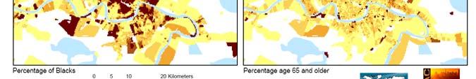
18 Other Data Needs for Vulnerability Analysis Age/sex breakdown of population High spatial resolution poverty data Sector specific employment data Better health statistics/epidemiological data Data on race/ethnicity Social vulnerability Cutter S. L., Finch C. PNAS 2008;105: by The National Academy of Sciences of the USA 18


19 This paper demonstrates the importance of disaggregating population data aggregated by census tracts or other units, for more realistic population distribution/location. A newly developed mapping method, the Cadastral-based Expert Dasymetric System (CEDS), calculates population in hyperheterogeneous urban areas better than traditional mapping techniques. A case study estimating population potentially impacted by flood hazard in New York City compares the impacted population determined by CEDS with that derived by centroid-containment method and filtered areal-weighting interpolation. Source: Maantay, J., Maroko, A Mapping urban risk: Flood hazards, race, & environmental justice in New York, Applied Geography, doi: /j.apgeog Demographic Data Challenges National census units are often not well delineated in geographic space, making it difficult to locate human populations with respect to climate risks, particularly l in relation to coastlines and sea level rise risks. Intra-annual variation in population distribution is not systematically tracked, making it difficult to characterize exposure to highly variable climate risks. Inter-annual change in the spatial distribution of population is difficult to characterize with precision because of incommensurate administrative i ti boundaries across censuses. Changes in census spatial units are more common at higher resolution (census tract level and higher), which are the ones needed for vulnerability assessment. 19


20 Adaptive Capacity Determinants of coping capacity are awareness, ability, and action Lucas and Hilderink 2004 A function of national income A function of human and social capital A function of past infrastructure development A function of good governance A function of political stability And many other issues 20

21 Water storage capacity an important indicator of drought resilience: Global Map of Irrigated Areas Source: Siebert et al Road networks 21


22 Spatial data on adaptive/coping capacities exist for the following Gridded income data (Nordhaus, Sutton) Radio/TV ownership, Internet access (UNESCO) Water holding capacity of dams (UNH WSAG) Governance indicators at the national level (World Bank, Transparency Int l, POLITY proj.) Conflict areas (PRIO, CRED CE DAT, CIESIN) Refugee camps (UNHCR) Health infrastructure (WHO) Age structure (CIESIN forthcoming) This study sought to measure vulnerability as a function of adaptive capacity Source: Yohe, G., E. Malone, A. Brenkert, M. Schlesinger, H. Meij, X. Xing, and D. Lee A Synthetic Assessment of the Global Distribution of Vulnerability to Climate Change from the IPCC Perspective that Reflects Exposure and Adaptive Capacity. Palisades, New York: CIESIN, Columbia University. 22
23 A Climate Change IVA Data Kit The proposed data collection would include pre packaged data layers for a number of biophysical and socioeconomic parameters at a 1 kilometer grid cell resolution (30 arc seconds). This is equivalent of a map at a scale of 1:1,000,000 that would serve as an adequate base for national level planning, even for relatively small countries Critical data integration headaches would be solved, by ensuring each layer has standard coastlines and admin boundaries (where possible) Would be a resource for developing countries with limited GIS data creation capacities, and could be distributed under the UNFCCC s Nairobi Work Programme Potential Layers Thirty year climate normal ( ) annual and monthly Mean temperature Mean precipitation Mean runoff Population distribution (2000, 2015, and 2050) Poverty GDP Roads Hazards Land cover types Cropping areas Percentage land cropped per grid cell By type By value Pasture lands Soil types Elevation Coastlines First and second level administrative boundaries Climate scenarios Ensemble model outputs for changes in temperature (2050, 2100) Ensemble model outputs for changes in precipitation (2050, 2100) Ensemble model outputs for changes in runoff (2050, 2100) Sea level rise (3m, 5m, 7m, 10m) Modeled storm surges based on SLR of different levels Modeled drought frequency Remote sensing image mosaics Real time data integration: MODIS fire data Climate anomalies in the past three months Flood data Aerosols 23


24 Some Starting Points FAO s Food Insecurity, Poverty and Environment Global GIS Database at Overall Conclusions Climate change of greater than 2 o C is likely to happen: forewarned is fore armed Since impacts, vulnerability, and adaptive capacity are spatially differentiated, spatial data are vital There is an increasing amount of spatially disaggregated data on hazard exposure, aspects of vulnerability, and adaptive capacity Dynamism of social systems and multiple stressors on those systems is inadequately captured by most spatial data sets, and some global/regional GIS assessments can risk being perceived as mechanistic by lacking adequate grounding in local realities Yet, such analyses can identify hotspots of vulnerability where adaptation interventions may be required 24
25 Thank you! 25
Spatial Data Integration and Data Gaps for Climate Impacts, Vulnerability, and Adaptation
 Spatial Data Integration and Data Gaps for Climate Impacts, Vulnerability, and Adaptation Alex de Sherbinin Center for International Earth Science Information Network (CIESIN), The Earth Institute at Columbia
Deborah Balk 1,2 Gordon McGranahan 3 Bridget Anderson 2
 Preference and Risks of Coastal Population Distribution: A systematic assessment of population and land area in urban and rural areas of coastal zones. Deborah Balk 1,2 Gordon McGranahan 3 Bridget Anderson
Poverty and Hazard Linkages
 Poverty and Hazard Linkages Global Risk Identification Programme Proposal Development Coordination Meeting Friday, 19 May 2006 CIESIN Earth Institute Columbia University www.ciesin.columbia.edu Data Improvements
Identifying Global Natural Disaster Hotspots
 Identifying Global Natural Disaster Hotspots Gregory Yetman and Robert S. Chen Center for International Earth Science Information Network (CIESIN), Columbia University Abstract The World Bank and Columbia
Disaster Management & Recovery Framework: The Surveyors Response
 Disaster Management & Recovery Framework: The Surveyors Response Greg Scott Inter-Regional Advisor Global Geospatial Information Management United Nations Statistics Division Department of Economic and
What s new (or not so new) in Population and Poverty Data Initiatives
 in Population and Poverty Data Initiatives") What s new (or not so new) in Population and Poverty Data Initiatives Deborah Balk Global Spatial Data and Information User Workshop 21 September 2004 Evolution in global collection of population and poverty
What s new (or not so new) in Population and Poverty Data Initiatives Deborah Balk Global Spatial Data and Information User Workshop 21 September 2004 Evolution in global collection of population and poverty
Social Vulnerability Index. Susan L. Cutter Department of Geography, University of South Carolina
 Social Vulnerability Index Susan L. Cutter Department of Geography, University of South Carolina scutter@sc.edu Great Lakes and St. Lawrence Cities Initiative Webinar December 3, 2014 Vulnerability The
Assessing Social Vulnerability to Biophysical Hazards. Dr. Jasmine Waddell
 Assessing Social Vulnerability to Biophysical Hazards Dr. Jasmine Waddell About the Project Built on a need to understand: The pre-disposition of the populations in the SE to adverse impacts from disaster
Vulnerability of Bangladesh to Cyclones in a Changing Climate
 Vulnerability of Bangladesh to Cyclones in a Changing Climate Susmita Dasgupta Kiran Pandey Mainul Huq Zahirul Huq Khan M.M. Zahid Ahmed Nandan Mukherjee Malik Fida Khan 2010 Bangladesh: Tropical Cyclone
Geospatial Technologies for Resources Planning & Management
 Geospatial Technologies for Resources Planning & Management Lal Samarakoon, PhD Director, Geoinformatics Center Asian Institute of Technology, Thailand Content Geoinformatics for SDG Information Integration
Measuring Disaster Risk for Urban areas in Asia-Pacific
 Measuring Disaster Risk for Urban areas in Asia-Pacific Acknowledgement: Trevor Clifford, Intl Consultant 1 SDG 11 Make cities and human settlements inclusive, safe, resilient and sustainable 11.1: By
Disaster Risk Assessment: Opportunities for GIS and data management with Open DRI
 Disaster Risk Assessment: Opportunities for GIS and data management with Open DRI Jacob Opadeyi Department of Geomatics Engineering and Land Management, The University of the West Indies, St. Augustine,
Lessons Learned from the production of Gridded Population of the World Version 4 (GPW4) Columbia University, CIESIN, USA EFGS October 2014
 Columbia University, CIESIN, USA EFGS October 2014") Lessons Learned from the production of Gridded Population of the World Version 4 (GPW4) Columbia University, CIESIN, USA EFGS October 2014 Gridded Population of the World Gridded (raster) data product
Lessons Learned from the production of Gridded Population of the World Version 4 (GPW4) Columbia University, CIESIN, USA EFGS October 2014 Gridded Population of the World Gridded (raster) data product
Liana Talaue McManus. Division of Marine Affairs and Policy Rosenstiel School of Marine & Atmospheric Science University of Miami
 Liana Talaue McManus Division of Marine Affairs and Policy Rosenstiel School of Marine & Atmospheric Science University of Miami Outline 1. Coasts as vulnerable & resilient social ecological systems 2.
Overview of proposed approach to the Desktop Study to inform discussion
 LTAS Phase 2: Climate Change Implications for the Human Settlements sector in South Africa Overview of proposed approach to the Desktop Study to inform discussion Project Team Project Lead: Crispian Olver
PROF. DR HAB. PIOTR TRYJANOWSKI
 IMPACT OF EXTREME WEATHER EVENTS ON LOCAL COMMUNITIES AND POSSIBLE RESPONSE FROM THE LOCAL LEVEL PROF. DR HAB. PIOTR TRYJANOWSKI FACULTY OF VETERINARY MEDICINE AND ANIMAL SCIENCES Changes in natural
Global Challenges - Partnering with Service Providers. World Meteorological Organization. J. Lengoasa WMO Deputy Secretary-General
 WMO World Meteorological Organization Working together in weather, climate and water Global Challenges - Partnering with Service Providers J. Lengoasa WMO Deputy Secretary-General jlengoasa@wmo.int http://www.wmo.int/pages/gfcs/gfcs_en.html
Emergent Geospatial Data & Measurement Issues
 CUNY Institute for Demographic Research Emergent Geospatial Data & Measurement Issues Deborah Balk CUNY Institute for Demographic Research (CIDR) & School of Public Affairs, Baruch College City University
KENTUCKY HAZARD MITIGATION PLAN RISK ASSESSMENT
 KENTUCKY HAZARD MITIGATION PLAN RISK ASSESSMENT Presentation Outline Development of the 2013 State Hazard Mitigation Plan Risk Assessment Determining risk assessment scale Census Data Aggregation Levels
Use of Geospatial data for disaster managements
 Use of Geospatial data for disaster managements Source: http://alertsystemsgroup.com Instructor : Professor Dr. Yuji Murayama Teaching Assistant : Manjula Ranagalage What is GIS? A powerful set of tools
BASE FOR. New York CIES. in this paper Nations or
 UNITED NATIONS N EXPERT GROUP MEETING ON STRENGTHENING THE DEMOGRAPHIC EVIDENCE BASE FOR THE POST-2015 DEVELOPMENT AGENDA Population Division Department of Economic and Social Affairs United Nations Secretariat
Foundation Geospatial Information to serve National and Global Priorities
 Foundation Geospatial Information to serve National and Global Priorities Greg Scott Inter-Regional Advisor Global Geospatial Information Management United Nations Statistics Division UN-GGIM: A global
Global Climate Change, Weather, and Disasters
 Global Climate Change, Weather, and Disasters The Hype and the Available Data! K.E. Kelly Is Climate Change Causing Extreme Weather? New Republic www.greenpeace.org Zogby Analytics poll shortly after hurricane
9768 GEOGRAPHY. Mark schemes should be read in conjunction with the question paper and the Principal Examiner Report for Teachers.
 CAMBRIDGE INTERNATIONAL EXAMINATIONS Cambridge Pre-U Certificate MARK SCHEME for the May/June 2015 series 9768 GEOGRAPHY 9768/01 Paper 1 (Geographical Issues), maximum raw mark 105 This mark scheme is
World Geography. WG.1.1 Explain Earth s grid system and be able to locate places using degrees of latitude and longitude.
 Standard 1: The World in Spatial Terms Students will use maps, globes, atlases, and grid-referenced technologies, such as remote sensing, Geographic Information Systems (GIS), and Global Positioning Systems
Georeferencing and Satellite Image Support: Lessons learned, Challenges and Opportunities
 Georeferencing and Satellite Image Support: Lessons learned, Challenges and Opportunities Shirish Ravan shirish.ravan@unoosa.org UN-SPIDER United Nations Office for Outer Space Affairs (UNOOSA) UN-SPIDER
Temperature ( C) Map 1. Annual Average Temperatures Are Projected to Increase Dramatically by 2050
 Map 1. Annual Average Temperatures Are Projected to Increase Dramatically by 2050") CO UNT RY S NA P SHO T India s Hotspots The Impact of Temperature and Precipitation Changes on Living Standards Climate change is already a pressing issue for India. Temperatures have risen considerably
CO UNT RY S NA P SHO T India s Hotspots The Impact of Temperature and Precipitation Changes on Living Standards Climate change is already a pressing issue for India. Temperatures have risen considerably
INDIANA ACADEMIC STANDARDS FOR SOCIAL STUDIES, WORLD GEOGRAPHY. PAGE(S) WHERE TAUGHT (If submission is not a book, cite appropriate location(s))
 WHERE TAUGHT (If submission is not a book, cite appropriate location(s))") Prentice Hall: The Cultural Landscape, An Introduction to Human Geography 2002 Indiana Academic Standards for Social Studies, World Geography (Grades 9-12) STANDARD 1: THE WORLD IN SPATIAL TERMS Students
Prentice Hall: The Cultural Landscape, An Introduction to Human Geography 2002 Indiana Academic Standards for Social Studies, World Geography (Grades 9-12) STANDARD 1: THE WORLD IN SPATIAL TERMS Students
Use of Climate information in Disaster Risk Management in Zimbabwe
 Use of Climate information in Disaster Risk Management in Zimbabwe WMO Regional Technical Meeting & User/CONOPS Workshop, 28 th October 2015 Lameck Betera Department of Civil Protection Institutional Arrangements
COASTAL FLOOD RISK MODELING TOOL (Preliminary assessment of impact of climate change in north Jakarta coastal area)
") COASTAL FLOOD RISK MODELING TOOL (Preliminary assessment of impact of climate change in north Jakarta coastal area) Prof. Dr. rer.nat. Muh Aris Marfai, M.Sc Dr. Philip Ward Workshop-Seminar Jakarta Climate
COASTAL FLOOD RISK MODELING TOOL (Preliminary assessment of impact of climate change in north Jakarta coastal area) Prof. Dr. rer.nat. Muh Aris Marfai, M.Sc Dr. Philip Ward Workshop-Seminar Jakarta Climate
Indicators of sustainable development: framework and methodologies CSD Indicators of sustainable development 1996
 Indicators of sustainable development: framework and methodologies CSD Indicators of sustainable development 1996 Keywords: mountain areas, mountain development, natural resources management, sustainable
Sea Level Rise and Storm surges: High Stakes for a Small Number of Developing Countries
 Sea Level Rise and Storm surges: High Stakes for a Small Number of Developing Countries Susmita Dasgupta Benoit Laplante Siobhan Murray David Wheeler DECEE The World Bank March, 2009 Objective of our Study
GIS in Weather and Society
 GIS in Weather and Society Olga Wilhelmi Institute for the Study of Society and Environment National Center for Atmospheric Research WAS*IS November 8, 2005 Boulder, Colorado Presentation Outline GIS basic
Session III: Geohazards - Minimizing Risk, Maximizing Awareness. Grand Challenges on Natural and Human-induced Hazards and Disasters
 Session III: Geohazards - Minimizing Risk, Maximizing Awareness Grand Challenges on Natural and Human-induced Hazards and Disasters Sospeter Muhongo s.muhongo@icsu-africa.org www.icsu-africa.org IYPE-Global
RiskCity Training package on the Application of GIS for multi- hazard risk assessment in an urban environment.
 RiskCity Training package on the Application of GIS for multi- hazard risk assessment in an urban environment. Cees van Westen (Westen@itc.nl) & Nanette C. Kingma (Kingma@itc.nl) ITC: Training & Research
DROUGHT ASSESSMENT USING SATELLITE DERIVED METEOROLOGICAL PARAMETERS AND NDVI IN POTOHAR REGION
 DROUGHT ASSESSMENT USING SATELLITE DERIVED METEOROLOGICAL PARAMETERS AND NDVI IN POTOHAR REGION Researcher: Saad-ul-Haque Supervisor: Dr. Badar Ghauri Department of RS & GISc Institute of Space Technology
EARLY WARNING IN SOUTHERN AFRICA:
 EARLY WARNING IN SOUTHERN AFRICA: Enhancing the Meteorological Early Warning System Eugene Poolman South African Weather Service OUTLINE OF PRESENTATION Impact of Climate Change Meteorological Early Warning
The Council Study: Social assessment approach and methodology
 Preliminary draft for internal discussion The Council Study: Social assessment approach and methodology Vientiane, September 24 2015 Social /economic assessment team Basin Development Plan (BDP) Programme
The UN-GGIM: Europe core data initiative to encourage Geographic information supporting Sustainable Development Goals Dominique Laurent, France
 INSPIRE conference Strasbourg 6 September 2017 The UN-GGIM: Europe core data initiative to encourage Geographic information supporting Sustainable Development Goals Dominique Laurent, France Introduction
Climate Resilience Decision Making Framework in the Caribbean. A case of Spatial Data Management
 Climate Resilience Decision Making Framework in the Caribbean A case of Spatial Data Management Bishwa Pandey Sr. Data Management Specialist The World Bank Background The mission of The World Bank s Latin
Space Application in Support of Land Management for SDG Implementation
 Space Application in Support of Land Management for SDG Implementation Regional Expert Workshop on Land Accounting for SDG Monitoring and Reporting 26 September 2017 Space Application Section Information
Improving global coastal inundation forecasting WMO Panel, UR2014, London, 2 July 2014
 Improving global coastal inundation forecasting WMO Panel, UR2014, London, 2 July 2014 Cyclone Sidr, November 2007 Hurricane Katrina, 2005 Prof. Kevin Horsburgh Head of marine physics, UK National Oceanography
Coping With Disaster: The Impact of Hurricanes on International Financial Flows,
 Coping With Disaster: The Impact of Hurricanes on International Financial Flows, 1970-2001 Dean Yang Gerald R. Ford School of Public Policy University of Michigan 1 Motivation Disasters cause huge human
Word Cards. 2 map. 1 geographic representation. a description or portrayal of the Earth or parts of the Earth. a visual representation of an area
 Name: Date: Hour: Word Cards 1 geographic representation a description or portrayal of the Earth or parts of the Earth Example: A map is a representation of an actual location or place. 2 map a visual
WORLD COUNCIL ON CITY DATA
 WORLD COUNCIL ON CITY DATA WCCD ISO 37120 STANDARDIZED CITY DATA TO MEET UN SDG TARGETS UN WORLD DATA FORUM Presented by: James Patava www.dataforcities.org @wccitydata PUBLICATION OF THE FIRST ISO STANDARD
Summary Article: Poverty from Encyclopedia of Geography
 Topic Page: Poverty Definition: poverty from Dictionary of Energy Social Issues. the fact of being poor; the absence of wealth. A term with a wide range of interpretations depending on which markers of
Understanding Weather and Climate Risk. Matthew Perry Sharing an Uncertain World Conference The Geological Society, 13 July 2017
 Understanding Weather and Climate Risk Matthew Perry Sharing an Uncertain World Conference The Geological Society, 13 July 2017 What is risk in a weather and climate context? Hazard: something with the
Assessment Objectives Grid for Geography - G1. Summer Application Skills Total. (a) (b) (c) (a)
 (b) (c) (a)") Assessment Objectives Grid for Geography - G1 Summer 2014 Question 1 Knowledge and Understanding Application Skills Total Key Question (a) 0 2 3 5 1.5 (b) 8 2 10 1.3 (c) 7 3 10 1.4 15 7 3 25 Question 2
Assessment Objectives Grid for Geography - G1 Summer 2014 Question 1 Knowledge and Understanding Application Skills Total Key Question (a) 0 2 3 5 1.5 (b) 8 2 10 1.3 (c) 7 3 10 1.4 15 7 3 25 Question 2
WMO Statement on the State of the Global Climate Preliminary conclusions for 2018 and WMO Greenhouse Bulletin
 WMO Statement on the State of the Global Climate Preliminary conclusions for 2018 and WMO Greenhouse Bulletin Dr Elena Manaenkova Deputy Secretary General World Meteorological Organisation Statement on
A Framework for the Study of Urban Health. Abdullah Baqui, DrPH, MPH, MBBS Johns Hopkins University
 This work is licensed under a Creative Commons Attribution-NonCommercial-ShareAlike License. Your use of this material constitutes acceptance of that license and the conditions of use of materials on this
12/05/2016. The First step in Adaptation to future climate change Reduce Vulnerability and Exposure to present Climate Variability (IPCC 2014)
") Integrating CCA, DRR and L+D to Address Emerging Challenges due to Slow Onset Processes Joy Jacqueline Pereira (Project Leader), SEADPRI-Universiti Kebangsaan Malaysia, Nguyen Van Thang (Collaborator),
Integrating CCA, DRR and L+D to Address Emerging Challenges due to Slow Onset Processes Joy Jacqueline Pereira (Project Leader), SEADPRI-Universiti Kebangsaan Malaysia, Nguyen Van Thang (Collaborator),
NOAA s Regional Climate Science & Information: Opportunities and Challenges
 NOAA s Regional Climate Science & Information: Opportunities and Challenges Dr. Wayne Higgins Climate Program Office, Director Office of Oceanic and Atmospheric Research National Oceanic and Atmospheric
Pacific Catastrophe Risk Assessment And Financing Initiative
 Pacific Catastrophe Risk Assessment And Financing Initiative VANUATU September 211 Country Risk Profile: VANUATU is expected to incur, on average, 48 million USD per year in losses due to earthquakes and
INTEGRATING CLIMATE VULNERABILITY & RISK ASSESSMENT INTO URBAN SPATIAL PLANNING PROCESS
 INTEGRATING CLIMATE VULNERABILITY & RISK ASSESSMENT INTO URBAN SPATIAL PLANNING PROCESS (CASE STUDY: BLITAR CITY, EAST JAVA, INDONESIA) SHINTA MICHIKO PUTERI, ST, MT. DR. IR. DENNY ZULKAIDI, MUP. WRITER
From Vulnerability to Resilience And the Tools to Get There. Out of Harm s Way Partnership for the Delaware Estuary August 1, 2012
 From Vulnerability to Resilience And the Tools to Get There Out of Harm s Way Partnership for the Delaware Estuary August 1, 2012 Today s Presentation Tour of New Jersey Challenges Definitions so we re
Social Science Data for High Latitudes
 LCLUC Science Team Meeting High Latitudes in the Context of the International Polar Year Social Science Data for High Latitudes 2 May 2008 Dr. Robert S. Chen Director and Senior Research Scientist, CIESIN
Extreme Weather Events: Infrastructure Damage and Impact on Vulnerable Populations
 Extreme Weather Events: Infrastructure Damage and Impact on Vulnerable Populations Cindy L. Parker MD, MPH Physicians for Social Responsibility Johns Hopkins Bloomberg School of Public Health 1 Climate
Quantifying Climate Impacts on Sustainable Livelihoods in Coastal Caribbean Communities: The Development of a Vulnerability Index
 Quantifying Climate Impacts on Sustainable Livelihoods in Coastal Caribbean Communities: The Development of a Vulnerability Index Sherry Ann Ganase, Sandra Sookram, Sonja Teelucksingh and Patrick Watson
1990 Intergovernmental Panel on Climate Change Impacts Assessment
 1990 Intergovernmental Panel on Climate Change Impacts Assessment Although the variability of weather and associated shifts in the frequency and magnitude of climate events were not available from the
Copernicus Overview and Emergency Management Service
 Copernicus Overview and Emergency Management Service Frédéric BASTIDE European Commission Open informal session of the United Nations Inter-Agency Meeting on Outer Space Activities 12 March 2013, Geneva
Topic 4: Changing cities
 Topic 4: Changing cities Overview of urban patterns and processes 4.1 Urbanisation is a global process a. Contrasting trends in urbanisation over the last 50 years in different parts of the world (developed,
Discussion paper Climate change and human vulnerability:
 Discussion paper Climate change and human vulnerability: Mapping emerging trends and risk hotspots for humanitarian actors Summary for decision makers Dr Andrew Thow and Mark de Blois March 2008 Edition
By Lillian Ntshwarisang Department of Meteorological Services Phone:
 By Lillian Ntshwarisang Department of Meteorological Services Phone: +267 3612200 Email: lntshwarisang@gov.bw/ lntshwarisang@gmail.com Introduction Mandate of DMS Function of the Department Services to
Department of Geography: Vivekananda College for Women. Barisha, Kolkata-8. Syllabus of Post graduate Course in Geography
 India: Regional Problems and Resource management Module 11 (Full Marks 50) Unit I: Region and Regionalisation 1.1 Various bases of regionalisation of India; problems of identification and delineation.
Uses of The Climate and Climate-related Hazard Information in The Adaptation Strategies for Development and Spatial Planning Assessments
 Uses of The Climate and Climate-related Hazard Information in The Adaptation Strategies for Development and Spatial Planning Assessments Wilmar Salim, ST., M. Reg. Dev., Ph.D. Yogyakarta Monday, March
Global Atmospheric Circulation. Past climate change and natural causes. Global climate change and human activity
 GCSE Geography Edexcel B Revision Checklist Paper 1. Global Geographical Issues Topic 1. Hazardous Earth Key Idea I know/ understand The world s climate system Global Atmospheric Circulation Past climate
The AIR Bushfire Model for Australia
 The AIR Bushfire Model for Australia In February 2009, amid tripledigit temperatures and drought conditions, fires broke out just north of Melbourne, Australia. Propelled by high winds, as many as 400
The contents of the full book can be found here: This pdf was downloaded from
 This pdf contains: Balk, D., M.R. Montgomery, G. McGranahan and M. Todd 2009. Understanding the Impacts of Climate Change: Linking Satellite and Other Spatial Data with Population Data. Pp 206 217 in:
Temperature ( C) Map 1. Annual Average Temperatures Are Projected to Increase Dramatically by 2050
 Map 1. Annual Average Temperatures Are Projected to Increase Dramatically by 2050") CO UNT RY S NA P SHO T Sri Lanka s Hotspots The Impact of Temperature and Precipitation Changes on Living Standards Climate change is already a pressing issue for Sri Lanka. Temperatures have risen considerably
CO UNT RY S NA P SHO T Sri Lanka s Hotspots The Impact of Temperature and Precipitation Changes on Living Standards Climate change is already a pressing issue for Sri Lanka. Temperatures have risen considerably
ENVIRONMENTAL VULNERABILITY INDICATORS OF THE COASTAL SLOPES OF SÃO PAULO, BRAZIL *
 ENVIRONMENTAL VULNERABILITY INDICATORS OF THE COASTAL SLOPES OF SÃO PAULO, BRAZIL * D ANTONA, Álvaro de O. (FCA, NEPO-Unicamp, Brazil) BUENO, Maria do Carmo D. (IBGE; IFCH-Unicamp, Brazil) IWAMA, Allan
M14/3/GEOGR/SP2/ENG/TZ0/XX/Q GEOGRAPHY STANDARD LEVEL PAPER 2. Monday 19 May 2014 (morning) 1 hour 20 minutes INSTRUCTIONS TO CANDIDATES
 1 hour 20 minutes INSTRUCTIONS TO CANDIDATES") M14/3/GEOGR/SP2/ENG/TZ0/XX/Q 22145203 GEOGRAPHY STANDARD LEVEL PAPER 2 Monday 19 May 2014 (morning) 1 hour 20 minutes INSTRUCTIONS TO CANDIDATES Do not open this examination paper until instructed to do
M14/3/GEOGR/SP2/ENG/TZ0/XX/Q 22145203 GEOGRAPHY STANDARD LEVEL PAPER 2 Monday 19 May 2014 (morning) 1 hour 20 minutes INSTRUCTIONS TO CANDIDATES Do not open this examination paper until instructed to do
Impact of Cyclone Nargis
 Lessons Learnt from Nargis Recovery for the Next Disaster International Recovery Forum (2011) 12, JAN 2011, Kobe, Japan Home for over 100 national races. Profile of Myanmar The 2 nd largest country in
DEPARTMENT OF GEOGRAPHY B.A. PROGRAMME COURSE DESCRIPTION
 DEPARTMENT OF GEOGRAPHY B.A. PROGRAMME COURSE DESCRIPTION (3 Cr. Hrs) (2340100) Geography of Jordan (University Requirement) This Course pursues the following objectives: - The study the physical geographical
CIESIN Overview: Human-Environment Research and Data Mark Becker Associate Director, Geospatial Applications Division
 CIESIN Overview: Human-Environment Research and Data Mark Becker Associate Director, Geospatial Applications Division Center for International Earth Science Information Network The Earth Institute, Columbia
9768 GEOGRAPHY. Mark schemes should be read in conjunction with the question paper and the Principal Examiner Report for Teachers.
 CAMBRIDGE INTERNATIONAL EXAMINATIONS Pre-U Certificate www.xtremepapers.com MARK SCHEME for the May/June 2014 series 9768 GEOGRAPHY 9768/01 Paper 1 (Geographical Issues), maximum raw mark 105 This mark
Semester: Two. Study Hours: 28 contact/80 independent BSU Credits: 10 ECTS: 5
 BATH SPA UNIVERSITY Erasmus, exchange & study abroad module catalogue Geography: semester 2 Modules at Bath Spa University are usually worth either 10, 20 or 40 credits. If you are using the European Credit
Curriculum Unit. Instructional Unit #1
 Curriculum Unit Name of Course: AP Human Geography Grade Level(s): 9-12 Brief Description (Course Catalog): The purpose of the AP Human Geography course is to introduce students to the systematic study
Climate Security Vulnerability in Africa. Joshua W. Busby Assistant Professor, LBJ School of Public Affairs University of Texas - Austin
 Climate Security Vulnerability in Africa Joshua W. Busby Assistant Professor, LBJ School of Public Affairs University of Texas - Austin 1 AGENDA Brief overview of our project Discussion of our vulnerability
Environmentally-induced Population Displacements: Conclusions from PERN s Online Seminar
 Environment, Forced Migration & Social Vulnerability International Conference 9-11 October 2008 Bonn, Germany www.efmsv2008.org Environmentally-induced Population Displacements: Conclusions from PERN s
World Meteorological Organization
 Appendix VI Presentation on disaster risk reduction brainstorming session (1) World Meteorological Organization WMO DRR Programme Dieter C. Schiessl Director, Weather and Disaster Risk Reduction Services
Geography General Course Year 12. Selected Unit 3 syllabus content for the. Externally set task 2019
 Geography General Course Year 12 Selected Unit 3 syllabus content for the Externally set task 2019 This document is an extract from the Geography General Course Year 12 syllabus, featuring all of the content
Climate Change in Newfoundland & Labrador
 Climate Change in Newfoundland & Labrador Impacts and Adaptation Newleef Conference 08 October 2015 Met-Ocean Services The Team 55 personnel; 24/7 operational weather forecast desk; Equipment technician
DROUGHT INDICES BEING USED FOR THE GREATER HORN OF AFRICA (GHA)
") DROUGHT INDICES BEING USED FOR THE GREATER HORN OF AFRICA (GHA) Christopher Oludhe IGAD Climate Prediction and Applications Centre (ICPAC) Inter-Regional Workshop on Indices and Early Warning Systems for
DROUGHT INDICES BEING USED FOR THE GREATER HORN OF AFRICA (GHA) Christopher Oludhe IGAD Climate Prediction and Applications Centre (ICPAC) Inter-Regional Workshop on Indices and Early Warning Systems for
Alleghany County Schools Curriculum Guide GRADE/COURSE: World Geography
 GRADE/COURSE: World 2013-14 GRADING PERIOD: 1 st Six Weeks Time Frame Unit/SOLs SOL # Strand Resource Assessment 8 days* The student will use maps, globes, satellite images, photographs, or diagrams to
Pacific Catastrophe Risk Assessment And Financing Initiative
 Pacific Catastrophe Risk Assessment And Financing Initiative PALAU September is expected to incur, on average,.7 million USD per year in losses due to earthquakes and tropical cyclones. In the next 5 years,
Examples of Vulnerability Assessment Aggregation Results from other Regions. Spatial Vulnerability Assessments
 Examples of Vulnerability Assessment Aggregation Results from other Regions Potential Vulnerability to Climate change in the European Union Kathrin Renner EURAC.Research,, Risk, Vulnerability and Climate
ReCAP Status Review of the Updated Rural Access Index (RAI) Stephen Vincent, Principal Investigator
 Stephen Vincent, Principal Investigator") ReCAP Status Review of the Updated Rural Access Index (RAI) Stephen Vincent, Principal Investigator Establishment of RAI in 2005/2006 2006 Definition of the RAI Note by Peter Roberts Dated September 2005
ReCAP Status Review of the Updated Rural Access Index (RAI) Stephen Vincent, Principal Investigator Establishment of RAI in 2005/2006 2006 Definition of the RAI Note by Peter Roberts Dated September 2005
World Meteorological Organization
 World Meteorological Organization Opportunities and Challenges for Development of Weather-based Insurance and Derivatives Markets in Developing Countries By Maryam Golnaraghi, Ph.D. Head of WMO Disaster
EXECUTIVE BRIEF: El Niño and Food Security in Southern Africa October 2009
 El Niño is a phenomenon which occurs in the Pacific Ocean, but affects climate globally. This document summarizes the known historic impacts of El Niño in southern Africa. The impact of El Niño in the
Enquiry question: How does the world s climate system function, why does it change and how can this be hazardous for people?
 Content Topic 1: Hazardous Earth Enquiry question: How does the world s climate system function, why does it change and how can this be hazardous for people? 1.1 The atmosphere operates as a global system
hurricane harvey and equitable recovery
 hurricane harvey and equitable recovery Mapping social vulnerability and intensity of wind and flooding from Hurricane Harvey in Texas hurricane harvey s impact on texas In August 2017, Hurricane Harvey
Seamless weather and climate for security planning
 Seamless weather and climate for security planning Kirsty Lewis, Principal Climate Change Consultant, Met Office Hadley Centre 28 June 2010 Global Climate Models Mitigation timescale changes could be avoided
Together towards a Sustainable Urban Agenda
 Together towards a Sustainable Urban Agenda The City We (Youth) Want Preliminary findings from youth consultations Areas Issue Papers Policy Units 1.Social Cohesion and Equity - Livable Cities 2.Urban
Pacific Catastrophe Risk Assessment And Financing Initiative
 Pacific Catastrophe Risk Assessment And Financing Initiative TIMOR-LESTE September Timor-Leste is expected to incur, on average, 5.9 million USD per year in losses due to earthquakes and tropical cyclones.
5.2 IDENTIFICATION OF HAZARDS OF CONCERN
 5.2 IDENTIFICATION OF HAZARDS OF CONCERN 2016 HMP Update Changes The 2011 HMP hazard identification was presented in Section 3. For the 2016 HMP update, the hazard identification is presented in subsection
Implications of Climate Change on Long Lead Forecasting and Global Agriculture. Ray Motha
 Implications of Climate Change on Long Lead Forecasting and Global Agriculture Ray Motha Source: http://www.coaps.fsu.edu/lib/climatoons/toon38.shtml ENSO Teleconnections 30 Observed Monthly Sea Surface
TOOLS FOR RISK MANAGEMENT Related to climate change
 TOOLS FOR RISK MANAGEMENT Related to climate change copyright CONTENT 1 CLIMATE CHANGE AND ENVIRONMENTAL STUDIES 2 METHODS AND TOOLS DEVELOPED BY EGIS For infrastructures For urban areas For crisis management
GIS (GEOGRAPHICAL INFORMATION SYSTEMS) AS A FACILITATION TOOL FOR SUSTAINABLE DEVELOPMENT IN AFRICA
 AS A FACILITATION TOOL FOR SUSTAINABLE DEVELOPMENT IN AFRICA") GIS (GEOGRAPHICAL INFORMATION SYSTEMS) AS A FACILITATION TOOL FOR SUSTAINABLE DEVELOPMENT IN AFRICA a presentation by Elizabeth Hicken GDEST Conference on Geospatial Sciences for Sustainable Development
GIS (GEOGRAPHICAL INFORMATION SYSTEMS) AS A FACILITATION TOOL FOR SUSTAINABLE DEVELOPMENT IN AFRICA a presentation by Elizabeth Hicken GDEST Conference on Geospatial Sciences for Sustainable Development
Vulnerability and Adaptation to Climate Change
 Vulnerability and Adaptation to Climate Change Prof. Dr. Christoph Görg Department of Social Sciences, University of Kasssel Head of Department Environmental Politics, UFZ Leipzig 1 Introduction: Climate
Migration Modelling using Global Population Projections
 Migration Modelling using Global Population Projections Bryan Jones CUNY Institute for Demographic Research Workshop on Data and Methods for Modelling Migration Associated with Climate Change 5 December