Uses of The Climate and Climate-related Hazard Information in The Adaptation Strategies for Development and Spatial Planning Assessments
|
|
|
- Egbert Knight
- 5 years ago
- Views:
Transcription
1 Uses of The Climate and Climate-related Hazard Information in The Adaptation Strategies for Development and Spatial Planning Assessments Wilmar Salim, ST., M. Reg. Dev., Ph.D. Yogyakarta Monday, March 28 th 2016
2 Climate Change Risk Based on IPCC AR-5, assessment of climate change risk is used as an approach to the adaptation of climate change Risk is defined as the potential for consequences when something of values is at stake and the outcome is uncertain, recognizing the diversity of values (IPCC AR-5, 2014) In the disaster management community, the disaster risk is defined as the probability of adverse consequences or potential losses as a result of interaction between natural and man-made hazard with vulnerability condition (ISDR, 2004) R (Risk) = H (Hazard) x V (Vulnerability) Climate Change Stimuli Temperature Increase Climate Extreme Events Precipitation Change Sea Level Rise Environment Economy Social Physical
3 Climate Change Risk (ii) Vulnerability can be identified as a function of character, magnitude, and level of climate variation to which a system is exposed, having sensitivity and adaptive capacity. Where : V : vulnerability E : exposure S : sensitivity AC : adaptive capasity V = E S AC
4 Framework of The Climate Change Risk and Adaptation Assessment Climate Change Science Based Assessment (Atmosphere & Sea Climate) Spatial & Non Spatial Data & Information Acquisition Climate Change Hazard Assessment Drought Landslide Flood Coastal Inudation Climate Change Vulnerability Assessment Climate Change Risk Assessment Recommendation on Adaptation Options to Climate Change
5 Framework for Policy Study Indonesian Development Planning Non Spatial Development Planning Spatial Planning Law 25 / 2004 on National Development Planning System Law 26/ 2007 on Spatial Planning National Development Planning System is whole set of development planning activities that produce multiple development plans in long term, medium term, and yearly terms that will be implemented by central and local governments (Law 25/ 2004)
6 INTEGRATION OF CLIMATE CHANGE ADAPTATION IN DEVELOPMENT PLANNING


7 Climate Risk Assessment Process

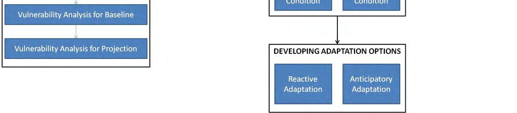
8 Guidelines for Climate Change Risk and Adaptation Assessment and for Mainstreaming into Policy Science Basis Analysis Baseline climate analysis Rainfall and temperature projection Sea level rise analysis and projection Hazard Analysis due to Climate Change Vulnerability Assessment Risks Analysis Developing Adaptation Options Policy Mainstreaming Prioritization of Adaptation Options Compatibility Analysis

9 Hazard Analysis Model and VA Indicators Source: Ministry of Environment (2012)

10 Case Study: Greater Malang Water Sector Agriculture Sector Health Sector


11 Risk and Hazard Assessment in Greater Malang - Flood HAZARD ASSESSMENT: GREATER MALANG RISK ASSESSMENT: MALANG CITY Baseline Condition Projection Condition Source: Ministry of Environment (2012)


12 HAZARD ASSSESSMENT Risk and Hazard Assessment in Malang Water Shortage BASELINE PROJECTION RISK ASSSESSMENT BASELINE PROJECTION Source: Ministry of Environment (2012)

 Source: Ministry of Environment")
13 Risk and Hazard Assessment in Greater Malang - Agriculture Wetland Paddy HAZARD ASSESSMENT Dryland Paddy Wetland Paddy RISK ASSESSMENT Dryland Paddy Projection (2030) Source: Ministry of Environment (2012)
 Source: Ministry of Environment")
14 Samples of Adaptation Measures (UNFCCC, 2008) Source: Ministry of Environment (2012)
15 Objectives of Climate Change Integration to Development Planning Awareness To enhance awareness on climate change impact and its adaptation management for regional/ local government and stakeholders Assessment To assess compatibility of adaptation options recommended by sectoral expert with annual program of local government Priority Levels To judge the priority levels of adaptation options Recommendation To recommend on which ways or how to mainstream the prioritized adaptation options into local and national development planning Source: Ministry of Environment (2012)
16 Climate Change Integration Process into Development Planning Program 1. Initiation Workshop 2. Public Consultation 3. Policy Study of Planning Documents 4. Focus Group Discussion 5. Compatibility Study Key Points and Strategies : Assuring local development planning agencies are being informed by the relevant outputs of impact and vulnerability assessments Strengthening environmental and sectoral institutions in order to be able to address the complexities in addressing and coordinating the implementation of adaptation action Effective tools and frameworks for developing, disseminating and building capacity for adaptation and integrating it into policy at all levels Source: Ministry of Environment (2012)
17 Prioritization of Adaptation Options Option Prioritization Hedonic-Qualitative Cost Benefit Analysis (HQCBA) Prioritization Importance Level Rating (ILR) matrix Area Prioritization Principles: 1. Whether risk exists on single or multiple sectors 2. Whether risk occurs on strategic area or not 3 Whether risk affects large area or not Source: Ministry of Environment (2012)
18 Compatibility Analysis Compatibility analysis compares adaptation options with government program side by side along with its location, risk level, and importance level. The compatibility assessment will recommend on what adaptation strategies need to be mainstreamed into future government planning and programs and how. Source: Ministry of Environment (2012)

19 Compatibility Matrix between Climate Change Adaptations and Programs in Annual Plan Source: Ministry of Environment (2012)
20 INTEGRATION OF CLIMATE CHANGE ADAPTATION IN SPATIAL PLANNING


21 CCRAA: CCA Policy Recommendations for East Java CCRAA: Guideline for Integration into Spatial Planning Source: Ministry of Agrarian and Spatial Planning (2015)


22 Legal Aspect for Integrating Climate Change Adaptation into Spatial Planning UU 26/2007 SPATIAL PLANNING UU 32/ 2009 PPLH UU 24/ 2007 DISASTER MANAGEMENT PP 26/ 2008 NATIONAL SPATIAL PLAN PP 15/ 2010 SPATIAL PLAN IMPLEMENTATION RPP RPPLH & KLHS SPATIAL PLAN GUIDELINES PermenPU 15/ 2009 PermenPU 16/ 2009 PermenPU 17/ 2009 PermenPU 20/ 2011 PermenPU 15/ 2012 Permen PU 11/2009 TECHNICAL GUIDELINE OF SPATIAL PLAN ANALYSIS PermenPU 20/ 2007 PermenPU 21/ 2007 PermenPU 22/ 2007 Completing/ refining GUIDELINE OF INTEGRATION OF CLIMATE CHANGE RISK & ADAPTATION Completing/ refining Source: Ministry of Agrarian and Spatial Planning (2015)
23 Law 26/ 2007 on Spatial Planning System-Based Main Fucntion- Based Administrative- Based Regional Activity- Based Regional Strategic Value- Based Regional System Protected Area Cultivation Area National Urban Area National Strategic Area Internal Urban System Area which provides protection to its below area Province Rural Area Provincial Strategic Area Local Preservation Area Regency/City Regency/City Strategic Area Conservation Area for Nature and Wildlife Natural Disaster Prone Area Other Protected Area Source: Ministry of Agrarian and Spatial Planning (2015)
24 Concept of Integration of Climate Change Adaptation Into Spatial Planning SPATIAL PLANNING PROCESS PREPARATION DATA COLLECTION DATA PROCESSING & ANALYISIS CONCEPT OF FORMULATION OF SPATIAL PLAN DRAFT OF SPATIAL PLAN LAW PRODUCT YES CLIMATE CHANGE ADAPTATION ASSESSMENT SPATIAL PLAN NOT CHANGED NO REVISION REVIEW OF SPATIAL PLAN: REVIEW EVALUATION ASSESS DETERMINATION OF SPATIAL PLAN APPROVAL OF SUBTANCE SPATIAL PLAN RATIFICATION BY LAW IMPLEMENTATION THE UTILIZATION OF SPATIAL Source: Ministry of Agrarian and Spatial Planning (2015)
25 Integration into Spatial Planning Process Spatial Planning Process Preparation Data collection Data processing & analysis Formulation the concept of spatial plan (RTR) Drafting of RTR to be enacted Integration of Climate Change Adaptation into Spatial Planning The Collection of Data and Information Outputs of Climate Science Basis : condition of climate and climate change Outputs of Climate Change Hazard assessment (in the form of climate change hazard map Data Processing and Analysis Outputs of Climate Change Vulnerability Assessment (in the form of Spatial Climate Change Vulnerability Map) Outputs of Climate Change Risk Assessment (in the form of Climate Change Risk Map) Source: Ministry of Agrarian and Spatial Planning (2015)
26 Integration Concept of Climate Change Adaptation in The Spatial Planning Process CLIMATE CHANGE ADAPTATION CLIMATE CHANGE SCIENCE BASED ASSESSMENT CLIMATE CHANGE HAZARD ASSESSMENT CLIMATE CHANGE RISK ASSESSMENT CLIMATE CHANGE VULNERABILITY ASSESSMENT PREPARATION DATA COLLECTION DATA PROCESSING & ANALYISIS CONCEPT OF FORMULATION OF SPATIAL PLAN DRAFT OF SPATIAL PLAN LAW PRODUCT APPROVAL OF SUBTANCE SPATIAL PLAN RATIFICATION BY LAW SPATIAL PLANNING PROCESS DETERMINATION OF SPATIAL PLAN Source: Ministry of Agrarian and Spatial Planning (2015)
27 Spatial Plan Evaluation Process The RTR Evaluation is an attempt to review the suitability between the RTR and development needs considering to the development of strategic environment and internal dynamics, as well as the implementation of spatial utilization The RTR Evaluation Assessment Spatial Planning Related Laws and Regulations Evaluation Quality of RTR Validity of RTR Problems on spatial utilization Assessment Level of the RTR Quality Level of RTR Validity Level of spatial utilization problems Source: Ministry of Agrarian and Spatial Planning (2015)
28 Integration into Spatial Plan Evaluation Process Climate Change Adaptation Assessment in the RTR review is performed to provide inputs to the evaluation process of RTR. In the review of RTR, the Climate Change Adaptation Assessment can be performed in the whole to produce the final outputs in the form of Formulation of Climate Change Adaptation Efforts. Source: Ministry of Agrarian and Spatial Planning (2015)
29 Concept of Integration of Climate Change Adaptation into The Evaluation of Spatial Planning CLIMATE CHANGE ADAPTATION CLIMATE CHANGE SCIENCE BASED ASSESSMENT SPATIAL PLAN NOT CHANGED NO REVISION SPATIAL PLAN REVISED CLIMATE CHANGE HAZARD ASSESSMENT CLIMATE CHANGE RISK ASSESSMENT REVIEW OF SPATIAL PLAN: REVIEW EVALUATION ASSESS CLIMATE CHANGE VULNERABILITY ASSESSMENT RECOMMENDATION OF CLIMATE CHANGE ADAPTATION IMPLEMENTATION THE UTILIZATION OF SPATIAL LAW PRODUCT OF SPATIAL PLAN Source: Ministry of Agrarian and Spatial Planning (2015)

30 INTEGRATION OF CLIMATE CHANGE ADAPTATION ASSESSMENT INTO OF SPATIAL PLANNING Source: Ministry of Agrarian and Spatial Planning (2015)
31 Climate Change Science Basis Assessment Result as Input for Data and Information Collection of Spatial Planning Development Baseline and Projected Climate Change Science Based Assessment: Surface Temperatur and Rainfall (Atmosphere Climate) CLIMATOLOGY DATA Data & Information Administrative Area Physiography Land Use Spatial Alocation Disaster Prone Area Social & Demographic Facilities Infrastructure Economic Growth Fiscal Capacity COLLECTING DATA AND INFORMATION ON THE SPATIAL PLANNING PROCESS Institutional Spatial Planning Policies Sectoral Development Policies Aspirations of the people Source: Ministry of Agrarian and Spatial Planning (2015)

32 Specification and Utilization of Science Basis Assessment Data in The Data and Information Collection for Spatial Planning Source: Ministry of Agrarian and Spatial Planning (2015)

33 Source: Ministry of Agrarian and Spatial Planning (2015)
34 Climate Change Hazard Assessment Result as Input for Data and Information Collection of Spatial Planning Process Data & Information Administrative Area Physiography Baseline & Projected Climate Change Hazard Map: Drought Landslide Flood Coastal Inudation Land Use Spatial Alocation Disaster Prone Area Social & Demographic Facilities Infrastructure Economic Growth Fiscal Capacity COLLECTING DATA AND INFORMATION ON THE SPATIAL PLANNING PROCESS Institutional Spatial Planning Policies Sectoral Development Policies Aspirations of the people Source: Ministry of Agrarian and Spatial Planning (2015)

35 Specification and Utilization of Hazard Assessment Data in The Data and Information Collection for Spatial Planning Source: Ministry of Agrarian and Spatial Planning (2015)

36 Source: Ministry of Agrarian and Spatial Planning (2015)


37 azard Baseline Risk Projection Risk ZONE 1 : Kab. Gresik: Kec. Ujungpangkah, Sidayu, Bungah Manyar, Dukun Kab. Lamongan: Kec. Kalitengah, Karangbinangun, Glagar An Example of Risk based Adaptation on Spatial Planning (Bengawan Solo Watershed) Land Use Spatial Plan Adaptation Options on Spatial Structure Structure Adaptation Option Primary Arteri Road Flood Proofing on the road part Primary Collector Road Flood Proofing on the road part Highway Flood Proofingon the road part Adaptation Options on Spatial Pattern Pattern Agricul-ture land Settle-ment Adaptation Option Development of Early Warning System Development of water inundation proof rice seed Development of river dike Development of ponds and dams Controlling settlements in inundation areas Flood-proofing on housing Combination of structural and vegetation protection Development of settlements out of inundation areas Source: Ministry of Agrarian and Spatial Planning (2015)
38 THANK YOU
Center for Spatial Data Infrastructures and Land Administration Department of Geomatics, University of Melbourne. Content
 Heri SUTANTA, Abbas RAJABIFARD, Ian BISHOP Center for Spatial Data Infrastructures and Land Administration Department of Geomatics, University of Melbourne Content Introduction Coastal Urban Environment
Risk-based land use and spatial planning
 Risk-based land use and spatial planning Miho OHARA International Centre for Water Hazards and Risk Management (ICHARM) Public Works Research Institute PWRI), Japan Under the auspices of UNESCO Introduction
Randall W. Parkinson, Ph.D., P.G. Institute of Water and Environment Florida International University
 An Update on Adaptation Action Activities Undertaken Since Completion of the City of Satellite Beach (FL) Vulnerability Assessment to Rising Seas (2010) Randall W. Parkinson, Ph.D., P.G. Institute of Water
Disaster Risk Assessment: Opportunities for GIS and data management with Open DRI
 Disaster Risk Assessment: Opportunities for GIS and data management with Open DRI Jacob Opadeyi Department of Geomatics Engineering and Land Management, The University of the West Indies, St. Augustine,
Georeferencing and Satellite Image Support: Lessons learned, Challenges and Opportunities
 Georeferencing and Satellite Image Support: Lessons learned, Challenges and Opportunities Shirish Ravan shirish.ravan@unoosa.org UN-SPIDER United Nations Office for Outer Space Affairs (UNOOSA) UN-SPIDER
INTEGRATING CLIMATE VULNERABILITY & RISK ASSESSMENT INTO URBAN SPATIAL PLANNING PROCESS
 INTEGRATING CLIMATE VULNERABILITY & RISK ASSESSMENT INTO URBAN SPATIAL PLANNING PROCESS (CASE STUDY: BLITAR CITY, EAST JAVA, INDONESIA) SHINTA MICHIKO PUTERI, ST, MT. DR. IR. DENNY ZULKAIDI, MUP. WRITER
SEISMIC RISK ASSESSMENT IN ARMENIA
 SEISMIC RISK ASSESSMENT IN ARMENIA Hovhannes Khangeldyan Head of National Crisis Management Center Rescue Service Ministry of Emergency Situations of the Republic of Armenia Tokyo, 2016 ARMENIA: GEOGRAPHICAL
TOWARDS STRATEGIC SPATIAL PLANNING IN JAMAICA: THE NATIONAL SPATIAL PLAN
 TOWARDS STRATEGIC SPATIAL PLANNING IN JAMAICA: THE NATIONAL SPATIAL PLAN JIEP 5th Biennial Conference on the Environment: Balancing National Development and Environmental Protection June 6, 2011 Jamaica
Climate Change Vulnerability Assessment in Thailand. Kampanart PiyathamrongchaI Naresuan University
 Climate Change Vulnerability Assessment in Thailand Kampanart PiyathamrongchaI Naresuan University Outline Background Objectives Concept and technique to assess climate change vulnerability Discussion
International Guidelines on Access to Basic Services for All
 International Guidelines on Access to Basic Services for All Presentation and initials lessons from implementation Accessibility to services in regions and cities : measures and policies, OECD 18 June
TOWARDS CLIMATE-RESILIENT COASTAL MANAGEMENT: OPPORTUNITIES FOR IMPROVED ICZM IN BELIZE
 TOWARDS CLIMATE-RESILIENT COASTAL MANAGEMENT: OPPORTUNITIES FOR IMPROVED ICZM IN BELIZE CHANTALLE SAMUELS Coastal Zone Management Authority and Institute The Caribbean Community Climate Change Centre VULNERABILITY
Cities and Climate Change (P123201)
") Public Disclosure Authorized AFRICA Mozambique Social, Urban, Rural and Resilience Global Practice Global Practice IBRD/IDA Investment Project Financing FY 2012 Seq No: 14 ARCHIVED on 04-Nov-2018 ISR33750
Public Disclosure Authorized AFRICA Mozambique Social, Urban, Rural and Resilience Global Practice Global Practice IBRD/IDA Investment Project Financing FY 2012 Seq No: 14 ARCHIVED on 04-Nov-2018 ISR33750
The World Bank BiH Floods Emergency Recovery Project (P151157)
") EUROPE AND CENTRAL ASIA Bosnia and Herzegovina Social, Urban, Rural and Resilience Global Practice Global Practice IBRD/IDA Investment Project Financing FY 2014 Seq No: 4 ARCHIVED on 22-Jun-2016 ISR22737
EUROPE AND CENTRAL ASIA Bosnia and Herzegovina Social, Urban, Rural and Resilience Global Practice Global Practice IBRD/IDA Investment Project Financing FY 2014 Seq No: 4 ARCHIVED on 22-Jun-2016 ISR22737
By Lillian Ntshwarisang Department of Meteorological Services Phone:
 By Lillian Ntshwarisang Department of Meteorological Services Phone: +267 3612200 Email: lntshwarisang@gov.bw/ lntshwarisang@gmail.com Introduction Mandate of DMS Function of the Department Services to
The World Bank Cities and Climate Change (P123201)
") Public Disclosure Authorized AFRICA Mozambique Social, Urban, Rural and Resilience Global Practice Global Practice IBRD/IDA Investment Project Financing FY 2012 Seq No: 13 ARCHIVED on 17-May-2018 ISR31517
Public Disclosure Authorized AFRICA Mozambique Social, Urban, Rural and Resilience Global Practice Global Practice IBRD/IDA Investment Project Financing FY 2012 Seq No: 13 ARCHIVED on 17-May-2018 ISR31517
International Symposium on Natural Disaster Mitigation. Local vulnerability assessment of landslides and debris flows
 International Symposium on Natural Disaster Mitigation of landslides and debris flows Lessons learnt from Cam Pha town and Van Don district, Quang Ninh province, Vietnam Nguyen Quoc Phi Faculty of Environment
Measuring Disaster Risk for Urban areas in Asia-Pacific
 Measuring Disaster Risk for Urban areas in Asia-Pacific Acknowledgement: Trevor Clifford, Intl Consultant 1 SDG 11 Make cities and human settlements inclusive, safe, resilient and sustainable 11.1: By
Progress Report. Flood Hazard Mapping in Thailand
 Progress Report Flood Hazard Mapping in Thailand Prepared By: Mr. PAITOON NAKTAE Chief of Safety Standard sub-beuro Disaster Prevention beuro Department of Disaster Prevention and Mitigation THAILAND E-mail:
Delta Flood Protection Strategy Update. May 16, 2016
 Delta Flood Protection Strategy Update May 16, 2016 Presentation Overview 1. Background 2. Understanding the Dike Reaches/Issues 3. Future Dike Improvements 4. Next Steps Boundary Bay Village March 10,
Dar es Salaam - Reality Check Workshop
 Dar es Salaam - Reality Check Workshop hosted by GIZ and Dar es Salaam City Council Introduction: Key Urban Characteristics of Dar es Salaam Challenges and Opportunities for Resilient Development in the
Oregon APA Legal Issues Workshop December 7, Tricia Sears, DLCD With information from Bill Burns, DOGAMI
 Oregon APA Legal Issues Workshop December 7, 2018 Tricia Sears, DLCD With information from Bill Burns, DOGAMI How this Topic Arrived WE FREQUENTLY HEAR CONCERNS ABOUT LIABILITY AND TAKINGS. Current federal
Use of Geospatial data for disaster managements
 Use of Geospatial data for disaster managements Source: http://alertsystemsgroup.com Instructor : Professor Dr. Yuji Murayama Teaching Assistant : Manjula Ranagalage What is GIS? A powerful set of tools
One map policy (OMP) implementation strategy to accelerate mapping of regional spatial planing (RTRW) in Indonesia
 implementation strategy to accelerate mapping of regional spatial planing (RTRW) in Indonesia") IOP Conference Series: Earth and Environmental Science PAPER OPEN ACCESS One map policy (OMP) implementation strategy to accelerate mapping of regional spatial planing (RTRW) in Indonesia To cite this
IOP Conference Series: Earth and Environmental Science PAPER OPEN ACCESS One map policy (OMP) implementation strategy to accelerate mapping of regional spatial planing (RTRW) in Indonesia To cite this
Spatial Analysis of Natural Hazard and Climate Change Risks in Peri-Urban Expansion Areas of Dakar, Senegal
 1 Spatial Analysis of Natural Hazard and Climate Change Risks in Peri-Urban Expansion Areas of Dakar, Senegal URBAN WEEK 2009 BBL Preston Lounge Thursday, March 12, 2009 Christian Hoffmann GeoVille group
Geospatial Technologies for Resources Planning & Management
 Geospatial Technologies for Resources Planning & Management Lal Samarakoon, PhD Director, Geoinformatics Center Asian Institute of Technology, Thailand Content Geoinformatics for SDG Information Integration
Public Disclosure Copy
 Public Disclosure Authorized EAST ASIA AND PACIFIC Vanuatu Social, Urban, Rural and Resilience Global Practice Global Practice Recipient Executed Activities Technical Assistance Loan FY 2013 Seq No: 7
Disaster Management in Republic of Korea
 The Third UN-GGIM-AP Plenary Meeting Disaster Management in Republic of Korea ~Coordination among NGIA & Other Related Organizations and Recommendations~ Bali Indonesia 10 November 2014 Sanghoon Lee, Ph.D.
Sediment Disasters and Mass Movement (SD&M 2 ) NATIONAL DISASTER MANAGEMENT RESEARCH INSTITUTE
 NATIONAL DISASTER MANAGEMENT RESEARCH INSTITUTE") Sediment Disasters and Mass Movement (SD&M 2 ) Contents Outline of SD&M 2 Major outcomes Issues and conclusions Prologue Mass movement in Ulsan, Korea by Typhoon CHABA on Oct. 5. Outline of SD&M 2 Activities
Sediment Disasters and Mass Movement (SD&M 2 ) Contents Outline of SD&M 2 Major outcomes Issues and conclusions Prologue Mass movement in Ulsan, Korea by Typhoon CHABA on Oct. 5. Outline of SD&M 2 Activities
INDONESIA IMPACT BASED FORECAST PROGRAM
 INDONESIA IMPACT BASED FORECAST PROGRAM Seoul, 19-21 November 2018 The 2nd Regional Workshop on Impact-based Forecasts in Asia Indonesia Agency for Meteorology Climatology and Geophysics (BMKG) A. Fachri
THE IMPACT OF EL NIÑO AND LA NIÑA ON SOUTHEAST ASIA
 THE IMPACT OF EL NIÑO AND LA NIÑA ON SOUTHEAST ASIA 21st-23rd February 2000 WORKSHOP SUMMARY Organized by the Indochina Global Change Network Funded by the Asia-Pacific Network for Global Change Research
TERMS OF REFERENCE CONSULTANCY TO DEVELOP CLIMATE PRODUCTS AND SERVICES FOR THE CARIBBEAN TOURISM INDUSTRY (FEASIBILITY STUDY)
") Appendix 2 TERMS OF REFERENCE CONSULTANCY TO DEVELOP CLIMATE PRODUCTS AND SERVICES FOR THE CARIBBEAN TOURISM INDUSTRY (FEASIBILITY STUDY) 1. BACKGROUND 1.01 The Caribbean tourism product depends largely
Appendix 2 TERMS OF REFERENCE CONSULTANCY TO DEVELOP CLIMATE PRODUCTS AND SERVICES FOR THE CARIBBEAN TOURISM INDUSTRY (FEASIBILITY STUDY) 1. BACKGROUND 1.01 The Caribbean tourism product depends largely
CAN THO URBAN DEVELOPMENT AND RESILIENCE PROJECT
 CAN THO URBAN DEVELOPMENT AND RESILIENCE PROJECT 1 Phnom Penh Can Tho City HCM City EAST SEA 2 1 3 Highest Water Level WATER LEVEL RAISE IN CAN THO DURING LAST 40 YEARS 4 2 Land subsidence a threat that
Use of geo-referenced data for DRM in Central Asia, problems and prospective
 Use of geo-referenced data for DRM in Central Asia, problems and prospective Dr. Akylbek Chymyrov Director, Kyrgyz Center of Geoinformation Systems Member of the Public Supervisory Board MES KR KSUCTA,
RETA 6422: Mainstreaming Environment for Poverty Reduction Category 2 Subproject
 RETA 6422: Mainstreaming Environment for Poverty Reduction Category 2 Subproject A. Basic Data 1. Subproject Title: Poverty-Environment Mapping to Support Decision Making 2. Country Director: Adrian Ruthenberg
Climate Resilience Decision Making Framework in the Caribbean. A case of Spatial Data Management
 Climate Resilience Decision Making Framework in the Caribbean A case of Spatial Data Management Bishwa Pandey Sr. Data Management Specialist The World Bank Background The mission of The World Bank s Latin
Roles of NGII in successful disaster management
 The Second UN-GGIM-AP Plenary Meeting Roles of NGII in successful disaster management Republic of Korea Teheran Iran 28 October 2013 Sanghoon Lee, Ph.D. NGII Outline Type of Disasters Occur in Korea Practical
Disaster Risk Reduction and
 6 th ICRM Symposium 2015 Disaster Risk Reduction and 2015/04/23 Resilience in Taipei Outline Natural Disaster and Loss in Taiwan Climate Change and Geohazard Hazard Alert & App Monitoring & Modeling Land
City of Manitou Springs
 March 2018 City of Manitou Springs Implementing Land Use tools to reduce and mitigate natural hazard risk Context & History Past Present Historic homes Older infrastructure Hillside development Creekside
The Governance of Land Use
 The Governance of Land Use Country fact sheet Czech Republic The planning system Levels of government and their responsibilities The Czech Republic is a unitary state with 3 levels of government: the national
The UN-GGIM: Europe core data initiative to encourage Geographic information supporting Sustainable Development Goals Dominique Laurent, France
 INSPIRE conference Strasbourg 6 September 2017 The UN-GGIM: Europe core data initiative to encourage Geographic information supporting Sustainable Development Goals Dominique Laurent, France Introduction
The World Bank Emergency 2007 Cyclone Recovery and Restoration Project (P111272)
") Public Disclosure Authorized SOUTH ASIA Bangladesh Social, Urban, Rural and Resilience Global Practice Global Practice IBRD/IDA Emergency Recovery Loan FY 2009 Seq No: 17 ARCHIVED on 19-Jun-2017 ISR27863
Public Disclosure Authorized SOUTH ASIA Bangladesh Social, Urban, Rural and Resilience Global Practice Global Practice IBRD/IDA Emergency Recovery Loan FY 2009 Seq No: 17 ARCHIVED on 19-Jun-2017 ISR27863
MOZAMBIQUE: Institutional Arrangements and Achievements
 UN-International Strategy for Disaster Reduction Global Platform for Disaster Risk Reduction- First Session MOZAMBIQUE: Institutional Arrangements and Achievements on Implementation of Hyogo Framework
Vulnerability of Bangladesh to Cyclones in a Changing Climate
 Vulnerability of Bangladesh to Cyclones in a Changing Climate Susmita Dasgupta Kiran Pandey Mainul Huq Zahirul Huq Khan M.M. Zahid Ahmed Nandan Mukherjee Malik Fida Khan 2010 Bangladesh: Tropical Cyclone
Overview of proposed approach to the Desktop Study to inform discussion
 LTAS Phase 2: Climate Change Implications for the Human Settlements sector in South Africa Overview of proposed approach to the Desktop Study to inform discussion Project Team Project Lead: Crispian Olver
The Global Fundamental Geospatial Data Themes Journey. April Clare Hadley WG Chair
 The Global Fundamental Geospatial Data Themes Journey April 2018 Clare Hadley WG Chair The Road to here Why Global? Why Geospatial? Why Fundamental? Why Themes? The route we took Where does the road go
Coastal Impacts of Climate Change in the Northwest: A Summary of the Findings of the upcoming National Climate Assessment
 Western Washington University Western CEDAR Salish Sea Ecosystem Conference 2014 Salish Sea Ecosystem Conference (Seattle, Wash.) May 1st, 3:30 PM - 5:00 PM Coastal Impacts of Climate Change in the Northwest:
UN-GGIM: Strengthening Geospatial Capability
 Fifth Plenary Meeting of UN-GGIM: Europe Brussels, 6-7 June 2018 UN-GGIM: Strengthening Geospatial Capability Walking the talk to leave no one behind Greg Scott, UN-GGIM Secretariat Environmental Statistics
CHAPTER 4 HIGH LEVEL SPATIAL DEVELOPMENT FRAMEWORK (SDF) Page 95
 Page 95") CHAPTER 4 HIGH LEVEL SPATIAL DEVELOPMENT FRAMEWORK (SDF) Page 95 CHAPTER 4 HIGH LEVEL SPATIAL DEVELOPMENT FRAMEWORK 4.1 INTRODUCTION This chapter provides a high level overview of George Municipality s
CHAPTER 4 HIGH LEVEL SPATIAL DEVELOPMENT FRAMEWORK (SDF) Page 95 CHAPTER 4 HIGH LEVEL SPATIAL DEVELOPMENT FRAMEWORK 4.1 INTRODUCTION This chapter provides a high level overview of George Municipality s
KUNMING FORUM ON UNITED NATIONS GLOBAL GEOSPATIAL INFORMATION MANAGEMENT CITIES OF THE FUTURE: SMART, RESILIENT
 KUNMING FORUM ON UNITED NATIONS GLOBAL GEOSPATIAL INFORMATION MANAGEMENT CITIES OF THE FUTURE: SMART, RESILIENT and SUSTAINABLE Yunnan Zhenzhuang Guest House, Kunming, China 10 12 May 2017 BACKGROUND CONCEPT
Key Indicators for Territorial Cohesion & Spatial Planning Stakeholder Workshop - Project Update. 13 th December 2012 San Sebastián, Basque Country
 Key Indicators for Territorial Cohesion & Spatial Planning Stakeholder Workshop - Project Update 13 th December 2012 San Sebastián, Basque Country Key Aims Explore the use of territorial data in developing
Populations effected by flood top ten districts
 2050 - Populations effected by flood top ten districts 14 Extreme A2 Extreme A2 with dyke District Area (Ha) Population 2050 People affected Percent area affected People affected Percent area affected
Emerging Needs, Challenges and Response Strategy
 Emerging Needs, Challenges and Response Strategy Development of Integrated Observing Systems in China JIAO Meiyan Deputy Administrator China Meteorological Administration September 2011 Geneva Outline
The Governance of Land Use
 The planning system Levels of government and their responsibilities The Governance of Land Use COUNTRY FACT SHEET NORWAY Norway is a unitary state with three levels of government; the national level, 19
SUPPORTS SUSTAINABLE GROWTH
 DDSS BBUUN NDDLLEE G E O S P AT I A L G O V E R N A N C E P A C K A G E SUPPORTS SUSTAINABLE GROWTH www.digitalglobe.com BRISBANE, AUSTRALIA WORLDVIEW-3 30 CM International Civil Government Programs US
Impacts of Climate Change and Water-Related Disaster Reduction Management in the Asia-Pacific Region
 Impacts of Climate Change and Water-Related Disaster Reduction Management in the Asia-Pacific Region Katumi MUSIAKE Professor, Fukushima University Secretary General, Asia Pacific Association of Hydrology
Local Development Pilot Project: Island of Cres. Ranka Saračević Würth, Ministry of Culture, Republic of Croatia
 Local Development Pilot Project: Island of Cres Ranka Saračević Würth, Ministry of Culture, Republic of Croatia BACKGROUND, RATIFICATION OF THE FARO CONVENTION BY REPUBLIC OF CROATIA The Framework Convention
What is the deal with climate change?
 Contents Climate change, vulnerability and adapta5on Hazards and challenges for SIDS Why work at the city level? Exis5ng assessment tools Aim and objec5ves Methodology Case studies Construc5ng the CCUVI
Vincent Goodstadt. Head of European Affairs METREX European Network
 Vincent Goodstadt Head of European Affairs METREX European Network METREX (Network of 50 European Metropolitan Regions and Areas ) Exchanging Knowledge (e.g. Benchmarking) Climate Change CO2/80/50 Expertise
Sri Lanka has a coastline of km excluding the shoreline of bays and inlets.
 Defining and Demarcating Coastal zones in Sri Lanka Procedure, Challenges and What needs to be done? Dr. Anil Premaratne Director General Coast Conservation Coast Conservation Department Sri Lanka 1 Sri
Global Atmospheric Circulation. Past climate change and natural causes. Global climate change and human activity
 GCSE Geography Edexcel B Revision Checklist Paper 1. Global Geographical Issues Topic 1. Hazardous Earth Key Idea I know/ understand The world s climate system Global Atmospheric Circulation Past climate
IDB s Emerging and Sustainable Cities Initiative. Challenges and lessons learnt
 IDB s Emerging and Sustainable Cities Initiative Challenges and lessons learnt 1. Introduction 2. Quick example: Joao Pessoa 3. Challenges and Lessons learnt 1. Introduction 2. Quick example: Joao Pessoa
EARLY WARNING SYSTEM AND THE ROLE OF METEOROLOGICAL AND HYDROLOGICAL SERVICE CROATIA
 EARLY WARNING SYSTEM AND THE ROLE OF METEOROLOGICAL AND HYDROLOGICAL SERVICE CROATIA Meteorological and Hydrological Service National Protection and Rescue Directorate B. Ivančan an-picek V. Stajčić Establishment
New Zealand s Next Top Model: integrating tsunami modelling into land use planning
 New Zealand s Next Top Model: integrating tsunami modelling into land use planning Wendy Saunders (MZNZPI), Gegar Prasetya, Graham Leonard GNS Science, Lower Hutt, w.saunders@gns.cri.nz In April 2011 a
Sustainable Development Goal 11 and the New Urban Agenda: can planning deliver? Vanessa Watson University of Cape Town 2016
 Sustainable Development Goal 11 and the New Urban Agenda: can planning deliver? Vanessa Watson University of Cape Town 2016 .to reinvigorate the global political commitment to the sustainable development
Reducing Vulnerability to Extreme Heat: Science-Policy Interface
 Reducing Vulnerability to Extreme Heat: Science-Policy Interface Olga Wilhelmi, Mary Hayden, Jennifer Boehnert, Ursula Lauper and SIMMER research team October 23, 2013 Toronto SIMMER workshop Science-Policy
Bhutan Country Report for JPTM 2010 (July, 2010) Department of Disaster Management Ministry of Home & Cultural Affairs Royal Government of Bhutan
 Department of Disaster Management Ministry of Home & Cultural Affairs Royal Government of Bhutan") Bhutan Country Report for JPTM 2010 (July, 2010) Department of Disaster Management Ministry of Home & Cultural Affairs Royal Government of Bhutan 1 Contents of Presentation 1. Disaster Hazards and Underlying
Bhutan Country Report for JPTM 2010 (July, 2010) Department of Disaster Management Ministry of Home & Cultural Affairs Royal Government of Bhutan 1 Contents of Presentation 1. Disaster Hazards and Underlying
DISASTER INFORMATION MANAGEMENT SYSTEM Sri Lanka
 DISASTER INFORMATION MANAGEMENT SYSTEM Sri Lanka 15 March 2016 - Partnership Meeting Global Centre for Disaster Statistics SRIMAL SAMANSIRI ASSISTANT DIRECTOR R&D DISASTER MANAGEMENT CENTRE Overview Country
Progress on the Development of the Strategic Framework on Geospatial Information and Services for Disasters
 Progress on the Development of the Strategic Framework on Geospatial Information and Services for Disasters Dr. Peter N. Tiangco Administrator, NAMRIA, Philippines Co-chair, Working Group on Geospatial
Foundation Geospatial Information to serve National and Global Priorities
 Foundation Geospatial Information to serve National and Global Priorities Greg Scott Inter-Regional Advisor Global Geospatial Information Management United Nations Statistics Division UN-GGIM: A global
National Disaster Management Centre (NDMC) Republic of Maldives. Location
 Republic of Maldives. Location") National Disaster Management Centre (NDMC) Republic of Maldives Location Country Profile 1,190 islands. 198 Inhabited Islands. Total land area 300 sq km Islands range b/w 0.2 5 sq km Population approx.
National Disaster Management Centre (NDMC) Republic of Maldives Location Country Profile 1,190 islands. 198 Inhabited Islands. Total land area 300 sq km Islands range b/w 0.2 5 sq km Population approx.
12/05/2016. The First step in Adaptation to future climate change Reduce Vulnerability and Exposure to present Climate Variability (IPCC 2014)
") Integrating CCA, DRR and L+D to Address Emerging Challenges due to Slow Onset Processes Joy Jacqueline Pereira (Project Leader), SEADPRI-Universiti Kebangsaan Malaysia, Nguyen Van Thang (Collaborator),
Integrating CCA, DRR and L+D to Address Emerging Challenges due to Slow Onset Processes Joy Jacqueline Pereira (Project Leader), SEADPRI-Universiti Kebangsaan Malaysia, Nguyen Van Thang (Collaborator),
The Governance of Land Use
 The planning system The Governance of Land Use United Kingdom Levels of government and their responsibilities The United Kingdom is a unitary state with three devolved governments in Northern Ireland,
Local Area Key Issues Paper No. 13: Southern Hinterland townships growth opportunities
 Draft Sunshine Coast Planning Scheme Review of Submissions Local Area Key Issues Paper No. 13: Southern Hinterland townships growth opportunities Key Issue: Growth opportunities for Southern Hinterland
Disaster Management and Spatial Data An Experience of Sri Lanka for Joint project team meeting 2012
 Disaster Management and Spatial Data An Experience of Sri Lanka for Joint project team meeting 2012 1 by Padma Kumara Withana Provincial Surveyor General Uva Province 2 Out line ü Introduction ü Natural
The Governance of Land Use
 The planning system Levels of government and their responsibilities The Governance of Land Use Country fact sheet Germany Germany is a federal country with four levels of government. Below the national
Cataloguing high impact Weather and Climate Events
 Cataloguing high impact Weather and Climate Events Omar Baddour Chief Data Management Applications Divison World Meteorological Organisation Geneva, Switzerland 2 3 Estimating and cataloguing loss & damage
Applying Hazard Maps to Urban Planning
 Applying Hazard Maps to Urban Planning September 10th, 2014 SAKAI Yuko Disaster Management Expert JICA Study Team for the Metro Cebu Roadmap Study on the Sustainable Urban Development 1 Contents 1. Outline
The World Bank Mali Reconstruction and Economic Recovery (P144442)
") Public Disclosure Authorized AFRICA Mali Social, Urban, Rural and Resilience Global Practice Global Practice IBRD/IDA Emergency Recovery Loan FY 2014 Seq No: 7 ARCHIVED on 30-Jun-2017 ISR28723 Implementing
Public Disclosure Authorized AFRICA Mali Social, Urban, Rural and Resilience Global Practice Global Practice IBRD/IDA Emergency Recovery Loan FY 2014 Seq No: 7 ARCHIVED on 30-Jun-2017 ISR28723 Implementing
West Carroll Parish Hazard Mitigation Plan Update Public Meeting. August 25, 2015 Oak Grove, LA
 West Carroll Parish Hazard Mitigation Plan Update Public Meeting August 25, 2015 Oak Grove, LA Agenda Hazard Mitigation Planning Process SDMI Staff Risk Assessment SDMI Staff Update on Previous/Current
Wetland Programmes. Biodiversity assessments in determining wetland conservation priorities: a catchment approach. Dr. Piet-Louis Grundling
 CHIEF DIRECTORATE NATURAL RESOURCE MANAGEMENT PROGRAMMES: Wetland Programmes Biodiversity assessments in determining wetland conservation priorities: a catchment approach Dr. Piet-Louis Grundling Environmental
Chapter 2 Land Use Management and Risk Communication
 Chapter 2 Land Use Management and Risk Communication Michiko Banba Abstract Land use represents a relationship between natural and urban environment. Land use management is the way of managing land use
Understanding Weather and Climate Risk. Matthew Perry Sharing an Uncertain World Conference The Geological Society, 13 July 2017
 Understanding Weather and Climate Risk Matthew Perry Sharing an Uncertain World Conference The Geological Society, 13 July 2017 What is risk in a weather and climate context? Hazard: something with the
HCMC CLIMATE CHANGE IMPACT AND ADAPTATION ADB/HCMC PPC. Director ICEM International Centre for Environmental Management
 HCMC CLIMATE CHANGE IMPACT AND ADAPTATION STUDY ADB/HCMC PPC Jeremy Carew-Reid Jeremy Carew-Reid Director ICEM International Centre for Environmental Management Adaptation planning capacity 2 Increasing
Space Application in Support of Land Management for SDG Implementation
 Space Application in Support of Land Management for SDG Implementation Regional Expert Workshop on Land Accounting for SDG Monitoring and Reporting 26 September 2017 Space Application Section Information
M14/3/GEOGR/SP2/ENG/TZ0/XX/Q GEOGRAPHY STANDARD LEVEL PAPER 2. Monday 19 May 2014 (morning) 1 hour 20 minutes INSTRUCTIONS TO CANDIDATES
 1 hour 20 minutes INSTRUCTIONS TO CANDIDATES") M14/3/GEOGR/SP2/ENG/TZ0/XX/Q 22145203 GEOGRAPHY STANDARD LEVEL PAPER 2 Monday 19 May 2014 (morning) 1 hour 20 minutes INSTRUCTIONS TO CANDIDATES Do not open this examination paper until instructed to do
M14/3/GEOGR/SP2/ENG/TZ0/XX/Q 22145203 GEOGRAPHY STANDARD LEVEL PAPER 2 Monday 19 May 2014 (morning) 1 hour 20 minutes INSTRUCTIONS TO CANDIDATES Do not open this examination paper until instructed to do
Development of Geospatial Information in Indonesia: Progress & Challenge
 Development of Geospatial Information in Indonesia: Progress & Challenge Dr. Nurwadjedi Sarbini Deputy of Thematic Geospatial Information Geospatial Information Agency (BIG) Geosmart Asia, September 29
Coastal Inundation Forecasting Demonstration Project CIFDP. Flood Forecasting Initiative-Advisory Group (FFI-AG 3), Geneva, 5-7 Dec, 2017
, Geneva, 5-7 Dec, 2017") Coastal Inundation Forecasting Demonstration Project CIFDP Flood Forecasting Initiative-Advisory Group (FFI-AG 3), Geneva, 5-7 Dec, 2017 Coastal Flooding & Vulnerable Populations Coastal populations are
Coastal Inundation Forecasting Demonstration Project CIFDP Flood Forecasting Initiative-Advisory Group (FFI-AG 3), Geneva, 5-7 Dec, 2017 Coastal Flooding & Vulnerable Populations Coastal populations are
Regional Growth Strategy Work Session Growth Management Policy Board
 Regional Growth Strategy Work Session Growth Management Policy Board September 6, 2018 1 Overview Recap June GMPB work session Objectives and outcomes Regional geographies Growth scenarios Breakout Discussion:
Project Name: Implementation of Drought Early-Warning System over IRAN (DESIR)
") Project Name: Implementation of Drought Early-Warning System over IRAN (DESIR) IRIMO's Committee of GFCS, National Climate Center, Mashad November 2013 1 Contents Summary 3 List of abbreviations 5 Introduction
Project Name: Implementation of Drought Early-Warning System over IRAN (DESIR) IRIMO's Committee of GFCS, National Climate Center, Mashad November 2013 1 Contents Summary 3 List of abbreviations 5 Introduction
Country Report Vanuatu
 Country Report Vanuatu Ministry Infrastructure and Public Utilities. Application of Space Technology and the Geographic information system for DRR and Sustainable Development 18 th 22 nd December 2012
Public Disclosure Copy
 Public Disclosure Authorized EAST ASIA AND PACIFIC Vietnam Environment & Natural Resources Global Practice IBRD/IDA Investment Project Financing FY 2016 Seq No: 1 ARCHIVED on 03-Nov-2016 ISR25240 Implementing
Resilience Concept in Indonesian Small Town Development and Planning: a Case of Lasem, Central Java
 1 st SRICOENV 2018 Resilience Concept in Indonesian Small Town Development and Planning: a Case of Lasem, Central Java Jawoto Sih Setyono 1,*,Wiwandari Handayani 1,Iwan Rudiarto 1,and Landung Esariti 1
Summary of Available Datasets that are Relevant to Flood Risk Characterization
 Inter-Agency Characterization Workshop February 25-27, 2014 USACE Institute for Water Resources, Alexandria, VA, IWR Classroom Summary of Available Datasets that are Relevant to Characterization National
FIG Congress 2014 Engaging the Challenges, Enhancing the Relevance Kuala Lumpur, Malaysia, June 2014
 FIG Congress 2014 Engaging the Challenges, Enhancing the Relevance Kuala Lumpur, Malaysia, 16 21 June 2014 Disaster Risk Maps for Gender Empowerment in Disaster Management Lalitya Narieswari, Sri Lestari
Mainstream Space Technology in Implementing SFDRR - GPSTAR. Srimal Samansiri Disaster Management Centre Government of Sri Lanka
 Mainstream Space Technology in Implementing SFDRR - GPSTAR Srimal Samansiri Disaster Management Centre Government of Sri Lanka SFDRR Priority Actions Effective use of Space technology in SFDRR Priority
ENVIRONMENTAL CONSIDERATIONS IN CLUP
 ENVIRONMENTAL CONSIDERATIONS IN CLUP Ricardo M. Sandalo Assistant Professor DCERP, College of Human Ecology University of the Philippines Los Baños April 9-10, 2016 CHE Multi Purpose Hall 1 Twin Objectives
Jim Fox. copyright UNC Asheville's NEMAC
 Decisions and System Thinking Jim Fox November, 2012 1 UNC Asheville s s NEMAC National Environmental Modeling and Analysis Center Applied Research and technology development on integration of environmental
SDI Development in Georgia. Mari Khardziani Head of International Relations Unit National Agency of Public Registry
 SDI Development in Georgia Mari Khardziani Head of International Relations Unit National Agency of Public Registry Kehl, Germany September 5, 2017 2 National Agency of Public Registry Legal Entity of Public
GIS as a tool in flood management
 GIS for the United Nations and the International Community Conference Panel: GIS and Capacity - How Territorial Planning Benefits from Geospatial Information 3-5 April 2012 Geneva, Switzerland GIS as a
Doug Kluck NOAA Kansas City, MO National Center for Environmental Information (NCEI) National Integrated Drought Information System (NIDIS)
 National Integrated Drought Information System (NIDIS)") National Integrated Drought Information System (NIDIS) for the Missouri River Basin Drought Early Warning Information System (DEWS) & Runoff Trends in the Missouri Basin & Latest Flood Outlook Doug Kluck
National Integrated Drought Information System (NIDIS) for the Missouri River Basin Drought Early Warning Information System (DEWS) & Runoff Trends in the Missouri Basin & Latest Flood Outlook Doug Kluck