G. I. Science Education: A Computing Perspective
|
|
|
- Helen Lynch
- 6 years ago
- Views:
Transcription
1 A Position Statement on G. I. Science Education: A Computing Perspective (A Panel Discussion in UCGIS Summer Assembly 2008) By Shashi Shekhar McKnight Distinguished University Professor Faculty of Computer Science and Engineering University of Minnesota
2 Outline What is G. I. Science? Core Edges (e.g. Application Domain Driven) What is exciting about Computing? How I teach Computational aspects of G. I. Science?
3 Core G. I. Science: 3 Views 3 Views of G. I. S. are important Science of information Conceptual and theoretical foundations new & adapted Systems: engineering of information systems Structure, algorithms, behavior, and interactions of systems to store, process, access and communicate information. Services: practice of information processing Computational, cognitive and social aspects E.g. study of the social impact of information technologies. Sources: Wikipedia, Dictionary.com, M. Goodchild, Personal Interpretation
4 Core G. I. Science : Example Questions How do we conceptualize Physical and Cyber (P&C) worlds? How do we measure P&C concepts, recognize them in (remotely) sensed information or in the field, and identify their accuracy and quality? How do we represent P&C concepts with incomplete/ uncertain information, with alternative data models, and possibly with multiple representations for the same data, in digital environments? How do we store, access, and transform P&C concepts, facilitating data sharing, data transfer, and data archiving, while ensuring minimum information loss? How do we explain P&C phenomena through the application of appropriate methods of forward or inverse models of physical and human processes? How do we visualize P&C concepts on a variety of media such as maps on electronic displays or animated displays? How do we use P&C concepts to think about spatio-temporal phenomena, and to seek explanations for spatio-temporal patterns and phenomena? Source: Adaptation from NCGIA proposal to NSF by Goodchild et al.


5 Edges of G. I. Science Still expanding!

6 Source:
7 Outline What is G. I. Science? What is exciting about Computing? Trends Implications for G. I. Science 2020 How I teach Computational aspects of G. I. Science?
8 What is Exciting about Computing for G.I.Sc.?.? Continued improvement in computing technology Ex Projections [M. Gough, CEO (NCC)] PC Terflop CPU, Terabyte memory, Peta-byte disks, internet 2.0, cyberinfrastructure Ubiquitous computing and sensing Spatial Sensors: location + orientation + posture Web 2.0, social networking, virtual life Q? What implication on G.I.Sc. in 2020? Point and ask in real world (w/ laser pointer?) Increase computing capacity Scale up spatial models (e.g. spatial autoregression, agent based) Wider use of LIDAR, Global-Hawk UAVs Will web 2.0 change importance of location? Impact on clustering of brainpower and wealth
9 Trends in Broader Technology beyond Computing Future Shock [Livewire, Summer 2007], AI Magazine, Robotics Mind-controlled interfaces Personal networking Smart Building Smart Fabric Nano Bio-technology Semantic Web Q? What is the impact on G.I.Sc. 2020? Bio-technology Neurosurgery how to locate safe pathways to target in brain? Autonomous robots (.g. DARPA grand challenge) Navigation on dessert terrain => real-time GIS
10 Outline What is G. I. Science? What is exciting about Computing? How I teach Computational aspects of G. I. Science? Graduate students Undergraduate students

11 How I teach GIS and Computing? Csci 8715: Spatial Database Course Two dozen students across many disciplines Offered at graduate level every other year Focus on reading research papers and projects Challenge: Diversity
12 How I teach GIS and Computing to Graduate Students? Emphasize 6 elements Problem Why is it important? Why is it challenging? Solution / Approach, In what sense is novel? How is it better than state of the art? These 6 elements are used in Critical reading of technical papers, books, etc. Structuring student project proposals, reports, presentations Peer reviews


13 Six Elements Example1: Problem, Importance, Challenge Nest locations Distance to open water Vegetation durability Water depth
14 6 Elements Example 1: Challenge,, Approach Name Model Classification Accuracy Classical Linear Regression Spatial Auto-Regression y = x β + ε y = ρwy + xβ + ε Low High ρ : the spatial auto - regression (auto - correlatio n) parameter W : n - by - n neighborho od matrix over spatial framework Computational Challenge: Computing determinant of a very large matrix in the Maximum Likelihood Function: ln( L) = ln I ρw n ln(2π ) 2 n ln( σ 2 2 ) SSE
15 6 Elements Example 1: Approach - Novelty, Better Linear Regression Spatial Regression Spatial model is better y = Xβ + ε y = ρ Wy + Xβ + ε ROC Curve for learning ROC Curve for testing
16 Future Work: Unresolved Challenges Location Prediction and Spatial interest measure: e.g., avg, dist(actual, predicted) Actual Sites Pixels with actual sites Prediction 1 Prediction 2. Spatially more accurate than Prediction 1
 pairs with correlated")

 Global Influence of El Nino during the Northern")
17 6 Elements: Another Example Teleconnection Find (land location, ocean location) pairs with correlated climate changes Ex. El Nino affects climate at many land locations Average Monthly Temperature (Courtsey: NASA, Prof. V. Kumar) Global Influence of El Nino during the Northern Hemisphere Winter (D: Dry, W: Warm, R: Rainfall)
18 6 Elements Example 2: Teleconnection (Cont ) Challenge high dimensional (e.g., 600) feature space 67k land locations and 100k ocean locations (degree by degree grid) 50-year monthly data Computational Efficiency Spatial autocorrelation Reduce Computational Complexity Spatial indexing to organize locations Top-down tree traversal is a strong filter Spatial join query: filter-and-refine save 40% to 98% computational cost at θ = 0.3 to 0.9
19 Outline What is G. I. Science? What is exciting about Computing? How I teach Computational aspects of G. I. Science? Graduate students Undergraduate students
20 Undergraduates in Csci 8715 Few Undergraduate Students They are interested in current issues Location Based Web Services (LBS) In-vehicle, on cell-phone, Navigation devices, GPS Open operating systems in Cell Phones, e.g. Google Android Mash-ups Google Earth or Microsoft Virtual Earth

21 Q? Have we used the following? E.g.: MapQuest, Google Maps, LBS - Examples Q? Are these location-based services? Courtesy: Microsoft Live Search (


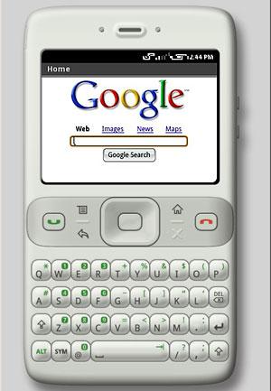
22 Cell-phone, watch, custom Navigation Devices Open platforms, e.g. Android For in-vehicle or portable use
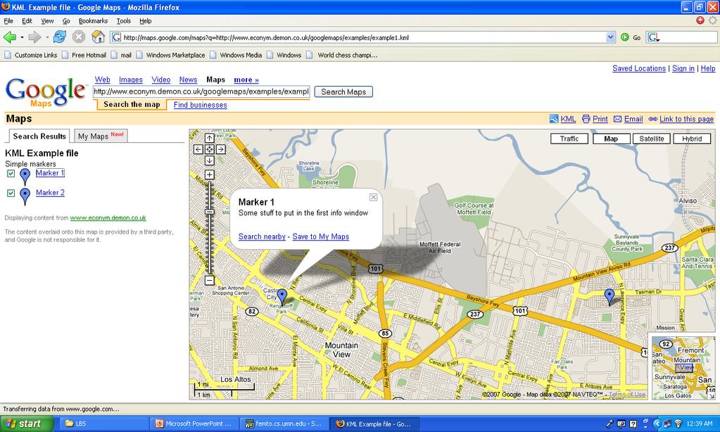
23 Mashups
24 <?xml version="1.0" encoding="utf-8"?> <kml xmlns=" <Document> <name>kml Example file</name> <description>simple markers</description> <Placemark> <name>marker 1</name> <description>some stuff to put in the first info window</description> <Point> <coordinates>-122.1,37.4,0</coordinates> </Point> </Placemark> </Document> </kml> Mashups:Under the Hood Simple APIs Google Earth KML Microsoft Virtual Earth SDK Example Code: KML (Source:
25 Outline What is G. I. Science? Core Edges (e.g. Application Domain Driven) What is exciting about Computing? Trends Implications for G. I. Science 2020 How I teach Computational aspects of G. I. Science? Graduate students Undergraduate students
Mining Spatial Data in Human Health?
 What is Special about Mining Spatial Data in Human Health? Shashi Shekhar McKnight Distinguished University Professor Department of Computer Science and Engineering, University of Minnesota www.cs.umn.edu/~shekhar
Lecture 11. Data Standards and Quality & New Developments in GIS
 Lecture 11 Data Standards and Quality & New Developments in GIS Lecture 11: Outline I. Data Standards and Quality 1. Types of Spatial Data Standards 2. Data Accuracy II. New Developments/The Future of
Transportation Data Mining: Vision & Challenges
 Transportation Data Mining: Vision & Challenges Shashi Shekhar McKnight Distinguished University Professor University of Minnesota www.cs.umn.edu/~shekhar Pervasive Data for Transportation: Innovations
Dynamic Maps and Historical Context
 Dynamic Maps and Historical Context Jeanette Zerneke International Joint GIS-IDEAS and PNC/ECAI Conference December 2008 Dynamic Maps Roles and Functions of Dynamic Maps in Cultural Collections and Atlases
Advanced Algorithms for Geographic Information Systems CPSC 695
 Advanced Algorithms for Geographic Information Systems CPSC 695 Think about Geography What is Geography The 3 W s of Geography What is where Why is it there Why do I care Data - Data - Data We all got
Lecture 12. Data Standards and Quality & New Developments in GIS
 Lecture 12 Data Standards and Quality & New Developments in GIS Lecture 12: Outline I. Data Standards and Quality 1. Types of Spatial Data Standards 2. Data Accuracy 3. III. Documenting Spatial Data Accuracy
Application of WebGIS and VGI for Community Based Resources Inventory. Jihn-Fa Jan Department of Land Economics National Chengchi University
 Application of WebGIS and VGI for Community Based Resources Inventory Jihn-Fa Jan Department of Land Economics National Chengchi University OUTLINE Introduction Methodology Results Conclusions 2 MOTIVATION
2013 AND 2025 THE FUTURE OF GIS
 THE FUTURE OF GIS 2013 AND 2025 What is the state of geospatial computing today? What are the issues today? Unresolved problems What will geospatial computing be like in 2025? What issues will be of concern
Photogrammetry and Remote Sensing Beyond the Centenary
 Photogrammetry and Remote Sensing Beyond the Centenary Norbert Pfeifer Vienna University of Technology Institute of Photogrammetry and Remote Sensing I.P.F. Statements Photogrammetry is completed Professor
Cutting Edge Engineering for Modern Geospatial Systems Rear Admiral Dr. S Kulshrestha, retd
 Cutting Edge Engineering for Modern Geospatial Systems Rear Admiral Dr. S Kulshrestha, retd 11 Jun 2015 GeoIntelligence Asia 2015 The technology would become so pervasive that it becomes a part of you
GIS Workshop Data Collection Techniques
 GIS Workshop Data Collection Techniques NOFNEC Conference 2016 Presented by: Matawa First Nations Management Jennifer Duncan and Charlene Wagenaar, Geomatics Technicians, Four Rivers Department QA #: FRG
Display and analysis of weather data from NCDC using ArcGIS
 Display and analysis of weather data from NCDC using ArcGIS Helen M. Cox Associate Professor Geography Department California State University, Northridge and Stephen Krug Graduate Student Geography Department
Spatial Data Science. Soumya K Ghosh
 Workshop on Data Science and Machine Learning (DSML 17) ISI Kolkata, March 28-31, 2017 Spatial Data Science Soumya K Ghosh Professor Department of Computer Science and Engineering Indian Institute of Technology,
XXIII CONGRESS OF ISPRS RESOLUTIONS
 XXIII CONGRESS OF ISPRS RESOLUTIONS General Resolutions Resolution 0: Thanks to the Czech Society commends: To congratulate The Czech Society, its president and the Congress Director Lena Halounová, the
Big Data and Geospatial Cyberinfrastructure for Advancing Applications
 Big Data and Geospatial Cyberinfrastructure for Advancing Applications Presented at GIScience 2012 Big Data and CyberGIS Panel Budhendra Bhaduri September 20, 2012 Columbus, OH Geospatial Cyberinfrastructure
You are Building Your Organization s Geographic Knowledge
 You are Building Your Organization s Geographic Knowledge And Increasingly Making it Available Sharing Data Publishing Maps and Geo-Apps Developing Collaborative Approaches Citizens Knowledge Workers Analysts
GIS Applications on Environmental Education in Taiwan
 GIS Applications on Environmental Education in Taiwan Track: Education Authors: Yu-Chen Lai, Mei-Ling Yeh, Tien-Yin Chou Abstract GIS is a perfect vehicle to deliver environmental knowledge and spatial
Spatial Analysis and Modeling (GIST 4302/5302) Guofeng Cao Department of Geosciences Texas Tech University
 Guofeng Cao Department of Geosciences Texas Tech University") Spatial Analysis and Modeling (GIST 4302/5302) Guofeng Cao Department of Geosciences Texas Tech University TTU Graduate Certificate Geographic Information Science and Technology (GIST) 3 Core Courses and
Spatial Analysis and Modeling (GIST 4302/5302) Guofeng Cao Department of Geosciences Texas Tech University TTU Graduate Certificate Geographic Information Science and Technology (GIST) 3 Core Courses and
The 7th Annual SARGIS Workshop and Meeting. Welcome to SARGIS7!
 The 7th Annual SARGIS Workshop and Meeting Welcome to SARGIS7! The National Alliance for Public Safety GIS Foundation is a 501 (C) (3) not-forprofit organization» OUR VISION A Nation of emergency responders
Research Group Cartography
 Research Group Cartography Research Group Cartography Towards supporting wayfinding LBS components 1. Mobile devices 2. Communication Network 3. Positioning Component 4. Service and Application Provider
Cartographic and Geospatial Futures
 Cartographic and Geospatial Futures 1. Web Cartography, WebGIS, & Virtual Globes--New Roles for Maps, GIS, and GIS professionals 2. Map Mashups, the Neo Neo-geography Movement, & Crowd-sourcing Geospatial
Models to carry out inference vs. Models to mimic (spatio-temporal) systems 5/5/15
 systems 5/5/15") Models to carry out inference vs. Models to mimic (spatio-temporal) systems 5/5/15 Ring-Shaped Hotspot Detection: A Summary of Results, IEEE ICDM 2014 (w/ E. Eftelioglu et al.) Where is a crime source?
Models to carry out inference vs. Models to mimic (spatio-temporal) systems 5/5/15 Ring-Shaped Hotspot Detection: A Summary of Results, IEEE ICDM 2014 (w/ E. Eftelioglu et al.) Where is a crime source?
Spatial Decision Tree: A Novel Approach to Land-Cover Classification
 Spatial Decision Tree: A Novel Approach to Land-Cover Classification Zhe Jiang 1, Shashi Shekhar 1, Xun Zhou 1, Joseph Knight 2, Jennifer Corcoran 2 1 Department of Computer Science & Engineering 2 Department
From Research Objects to Research Networks: Combining Spatial and Semantic Search
 From Research Objects to Research Networks: Combining Spatial and Semantic Search Sara Lafia 1 and Lisa Staehli 2 1 Department of Geography, UCSB, Santa Barbara, CA, USA 2 Institute of Cartography and
Michael Harrigan Office hours: Fridays 2:00-4:00pm Holden Hall
 Announcement New Teaching Assistant Michael Harrigan Office hours: Fridays 2:00-4:00pm Holden Hall 209 Email: michael.harrigan@ttu.edu Guofeng Cao, Texas Tech GIST4302/5302, Lecture 2: Review of Map Projection
What is GIS? G: Geographic, Geospatial, Geo
 GEOG 488/588: GIS I Introduction Instructor: Geoffrey Duh TA: David Graves What is GIS? G: Geographic, Geospatial, Geo Alternatives: Spatial Information Systems, Land Information Systems Geography diverse
Introduction to Field Data Collection
 Introduction to Field Data Collection Dr. Yuji Murayama (Professor) Dr. Ko Ko Lwin (JSPS Postdoctoral Researcher) Division of Spatial Information Science Graduate School of Life and Environmental Sciences
Introduction to Geographic Information Science. Updates/News. Last Lecture 1/23/2017. Geography 4103 / Spatial Data Representations
 Geography 4103 / 5103 Introduction to Geographic Information Science Spatial Data Representations Updates/News Waitlisted students First graded lab this week: skills learning Instructional labs vs. independence
What is special about geospatial? or A discipline in constant transition
 What is special about geospatial? or A discipline in constant transition Marinos Kavouras NTUA Ensuring the Rapid Response to Change, Ensuring the Surveyor of Tomorrow FIG 2015 Several paradigm shifts
Web-based Interactive Landform Simulation Model (WILSIM)
") Web-based Interactive Landform Simulation Model (WILSIM) Wei Luo Dept. of Geography Northern Illinois University, DeKalb, IL 60115 Project Funded by NSF CCLI (2002-2004) Collaborators: Kirk Duffin, Jay
Web-based Interactive Landform Simulation Model (WILSIM) Wei Luo Dept. of Geography Northern Illinois University, DeKalb, IL 60115 Project Funded by NSF CCLI (2002-2004) Collaborators: Kirk Duffin, Jay
Canadian Board of Examiners for Professional Surveyors Core Syllabus Item C 5: GEOSPATIAL INFORMATION SYSTEMS
 Study Guide: Canadian Board of Examiners for Professional Surveyors Core Syllabus Item C 5: GEOSPATIAL INFORMATION SYSTEMS This guide presents some study questions with specific referral to the essential
Building a Vibrant and Enduring Spatial Science John P. Wilson IWGIS2014 Beijing, China
 Building a Vibrant and Enduring Spatial Science John P. Wilson IWGIS2014 Beijing, China Outline Spatial roots o Geography o Landscape architecture o Computer science The (current) opportunity Guiding principles
If you are looking for the ebook by Tobias H. Ppner;Tobias Hoppner Google Earth - NASA World Wind - MS Virtual Earth: Ein Wissenschaftlicher
 Google Earth - NASA World Wind - MS Virtual Earth: Ein Wissenschaftlicher Vergleich Aus Sicht Der Geodasie Und Geoinformatik (German Edition) By Tobias H. Ppner;Tobias Hoppner READ ONLINE If you are looking
Spatial Big Data (SBD) Challenges Intersecting Mobile and Cloud Computing
 Challenges Intersecting Mobile and Cloud Computing") Spatial Big Data (SBD) Challenges Intersecting Mobile and Cloud Computing Shashi Shekhar McKnight Distinguished University Professor Department of Computer Science and Engineering University of Minnesota
Spatial Big Data (SBD) Challenges Intersecting Mobile and Cloud Computing Shashi Shekhar McKnight Distinguished University Professor Department of Computer Science and Engineering University of Minnesota
Department of Computer Science Federal University of São Carlos São Carlos SP, Brazil
 Department of Computer Science Federal University of São Carlos São Carlos SP, Brazil 12th International Conference on Enterprise 50 Information Systems ICEIS 2010 / Outline Motivations and Goals Multidimensional
Geo Business Gis In The Digital Organization
 We have made it easy for you to find a PDF Ebooks without any digging. And by having access to our ebooks online or by storing it on your computer, you have convenient answers with geo business gis in
Key Issue #1. How do geographers describe where things are? 2014 Pearson Education, Inc.
 Key Issue #1 How do geographers describe where things are? Learning Outcomes 1.1.1: Explain differences between early maps and contemporary maps. 1.1.2: Describe the role of map scale and projections and
Re-imagining Religion: The Spatial Humanities as a Framework for New Scholarship
 2010 Re-imagining Religion: The Spatial Humanities as a Framework for New Scholarship David J. Bodenhamer The Polis Center at IUPUI Virtual Center for Spatial Humanities New Technologies and Interdisciplinary
CARTOGRAPHY in a Web World
 CARTOGRAPHY in a Web World Nationale GI Minor BAREND KÖBBEN b.j.kobben@utwente.nl Agenda Short introduction to ITC and me Cartography: communicating spatial data Changing GIS & Cartography technology:
Development and operation of GIS exercise materials for undergraduate students
 Development and operation of GIS exercise materials for undergraduate students Since around 2000, GIS researchers in Japan have collaborated to provide materials for GIS lecture classes for university
INTRODUCTION TO GEOGRAPHIC INFORMATION SYSTEM By Reshma H. Patil
 INTRODUCTION TO GEOGRAPHIC INFORMATION SYSTEM By Reshma H. Patil ABSTRACT:- The geographical information system (GIS) is Computer system for capturing, storing, querying analyzing, and displaying geospatial
1. Omit Human and Physical Geography electives (6 credits) 2. Add GEOG 677:Internet GIS (3 credits) 3. Add 3 credits to GEOG 797: Final Project
 2. Add GEOG 677:Internet GIS (3 credits) 3. Add 3 credits to GEOG 797: Final Project") The Department of Geography and the Office of Professional Studies propose to modify the Master of Professional Studies in Geospatial Information Sciences (GIS) as follows: 1. Omit Human and Physical Geography
The Department of Geography and the Office of Professional Studies propose to modify the Master of Professional Studies in Geospatial Information Sciences (GIS) as follows: 1. Omit Human and Physical Geography
GEOGRAPHY (GE) Courses of Instruction
 Courses of Instruction") GEOGRAPHY (GE) GE 102. (3) World Regional Geography. The geographic method of inquiry is used to examine, describe, explain, and analyze the human and physical environments of the major regions of the
GEOGRAPHY (GE) GE 102. (3) World Regional Geography. The geographic method of inquiry is used to examine, describe, explain, and analyze the human and physical environments of the major regions of the
Real Astronomy from Virtual Observatories
 THE US NATIONAL VIRTUAL OBSERVATORY Real Astronomy from Virtual Observatories Robert Hanisch Space Telescope Science Institute US National Virtual Observatory About this presentation What is a Virtual
An Introduction to Geographic Information System
 An Introduction to Geographic Information System PROF. Dr. Yuji MURAYAMA Khun Kyaw Aung Hein 1 July 21,2010 GIS: A Formal Definition A system for capturing, storing, checking, Integrating, manipulating,
FUTURE DATA. Future data Future hardware Future software Future issues. Getting Started With GIS. Chapter 10
 THE FUTURE OF GIS Getting Started With GIS Chapter 10 GIS Futures Future data Future hardware Future software Future issues Dursun Z. ªeker Theme of the book GIS's place in understanding geographic distributions
NSF Expeditions in Computing. Understanding Climate Change: A Data Driven Approach. Vipin Kumar University of Minnesota
 NSF Expeditions in Computing Understanding Climate Change: A Data Driven Approach Vipin Kumar University of Minnesota kumar@cs.umn.edu www.cs.umn.edu/~kumar Vipin Kumar UCC Aug 15, 2011 Climate Change:
Crowdsourcing approach for large scale mapping of built-up land
 Crowdsourcing approach for large scale mapping of built-up land Kavinda Gunasekara Kavinda@ait.asia Geoinformatics Center Asian Institute of Technology, Thailand. Regional expert workshop on land accounting
A Model of GIS Interoperability Based on JavaRMI
 A Model of GIS Interoperability Based on Java Gao Gang-yi 1 Chen Hai-bo 2 1 Zhejiang University of Finance & Economics, Hangzhou 310018, China 2 College of Computer Science and Technology, Zhejiang UniversityHangzhou
From GPS and Virtual Globes to Spatial Computing
 From GPS and Virtual Globes to Spatial Computing Shashi Shekhar McKnight Distinguished University Professor Department of Computer Science and Engineering University of Minnesota www.cs.umn.edu/~shekhar
CAS GE 365 Introduction to Geographical Information Systems. The Applications of GIS are endless
 Spring 2007 CAS GE 365 Introduction to Geographical Information Systems Boston University Department of Geography and Environment The Applications of GIS are endless images from www.esri.com CAS GE 365
by Dr. Ming-Hsiang (Ming) Tsou Associate Professor Internet-based Mapping is a new form (medium) of maps in cartography and for geographic research.
 Tsou Associate Professor Internet-based Mapping is a new form (medium) of maps in cartography and for geographic research.") San Diego State University GEOG 104 Class New Research Directions of Internet GIS and Disaster Management and Lessons Learned from the San Diego 2007 Wildfires. Technology Advancement by Dr. Ming-Hsiang
San Diego State University GEOG 104 Class New Research Directions of Internet GIS and Disaster Management and Lessons Learned from the San Diego 2007 Wildfires. Technology Advancement by Dr. Ming-Hsiang
CPSC 695. Future of GIS. Marina L. Gavrilova
 CPSC 695 Future of GIS Marina L. Gavrilova The future of GIS Overview What is GIS now How GIS was viewed before Current trends and developments Future directions of research What is GIS? Internet's definition
Leveraging the GIS Capability within FlexiCadastre
 Managing Local Land Concerns, Maintaining Corporate Governance Leveraging the GIS Capability within FlexiCadastre Regional User Conference, North America May 6 th May 9 th, 2013 Cameron McKellar, Technical
Lesson 16: Technology Trends and Research
 http://www.esri.com/library/whitepapers/pdfs/integrated-geoenabled-soa.pdf GEOG DL582 : GIS Data Management Lesson 16: Technology Trends and Research Overview Learning Objective Questions: 1. Why is integration
A spatial literacy initiative for undergraduate education at UCSB
 A spatial literacy initiative for undergraduate education at UCSB Mike Goodchild & Don Janelle Department of Geography / spatial@ucsb University of California, Santa Barbara ThinkSpatial Brown bag forum
Themes for Geomatics Conference. Geodesy Themes
 Themes for Geomatics Conference Geodesy Themes Geodynamics o Modeling the Deformation of the Earth s Crust o Recent Advances in Geometric Approaches to Deformation Analysis o Monitoring Systems (Sensors
The Importance of Spatial Literacy
 The Importance of Spatial Literacy Dr. Michael Phoenix GIS Education Consultant Taiwan, 2009 What is Spatial Literacy? Spatial Literacy is the ability to be able to include the spatial dimension in our
LAB 19. Lab 19. Differences in Regional Climate: Why Do Two Cities Located at the Same Latitude and Near a Body of Water Have Such Different Climates?
 Lab Handout Lab 19. Differences in Regional Climate: Why Do Two Cities Located at the Same Latitude and Near a Body of Water Have Such Different Climates? Introduction Weather describes the current atmospheric
Chapter 10: The Future of GIS Why Speculate? 10.2 Future Data 10.3 Future Hardware 10.4 Future Software 10.5 Some Future Issues and Problems
 Chapter 10: The Future of GIS 10.1 Why Speculate? 10.2 Future Data 10.3 Future Hardware 10.4 Future Software 10.5 Some Future Issues and Problems Theme of the Course GIS's place in understanding geographic
GIS and Community Health. GIS and Community Health. Institutional Context and Interests in GIS Development. GIS and Community Health
 GIS and Community Health GIS and Community Health Some critiques of GIS emphasize the potentially harmful social consequences of the diffusion of GIS technology, including reinforcing the power of state
Esri and GIS Education
 Esri and GIS Education Organizations Esri Users 1,200 National Government Agencies 11,500 States & Regional Agencies 30,800 Cities & Local Governments 32,000 Businesses 8,500 Utilities 12,600 NGOs 11,000
3/29/11. Why bother with tools? Incorporating Decision Support Tools into Climate Adaptation Planning. A Simplified Planning Process
 Incorporating Decision Support Tools into Climate Adaptation Planning Why bother with tools? Tools don t eliminate complexity but they can help deal with it" Tools can:"! Help incorporate science into
2015 Copyright Board of Studies, Teaching and Educational Standards NSW for and on behalf of the Crown in right of the State of New South Wales.
 2015 Copyright Board of Studies, Teaching and Educational Standards NSW for and on behalf of the Crown in right of the State of New South Wales. This document contains Material prepared by the Board of
The Road to Data in Baltimore
 Creating a parcel level database from high resolution imagery By Austin Troy and Weiqi Zhou University of Vermont, Rubenstein School of Natural Resources State and local planning agencies are increasingly
AJJAR Astronomical Javascript/Java Applet Resource
 AJJAR Astronomical Javascript/Java Applet Resource Siobahn Morgan Department of Earth Science University of Northern Iowa Siobahn.Morgan@uni.edu Abstract The AJJAR (Astronomical Javascript/Java Applet
The INES Archive in the era of Virtual Observatories. E. Solano Spanish Virtual Observatory LAEX CAB / INTA-CSIC
 The INES Archive in the era of Virtual Observatories E. Solano Spanish Virtual Observatory LAEX CAB / INTA-CSIC PV2009, ESAC, Dec 2009 Outline Introduction: Archives in in Astronomy The IUE Archive Curation
Mining Climate Data. Michael Steinbach Vipin Kumar University of Minnesota /AHPCRC
 Mining Climate Data Michael Steinbach Vipin Kumar University of Minnesota /AHPCRC Collaborators: G. Karypis, S. Shekhar (University of Minnesota/AHPCRC) V. Chadola, S. Iyer, G. Simon, P. Zhang (UM/AHPCRC)
Transportation Data Mining Challenges
 Transportation Data Mining Challenges Shashi Shekhar McKnight Distinguished University Professor University of Minnesota www.cs.umn.edu/~shekhar Next Generation Data Mining Session of Transportation October
ArcGIS is Advancing. Both Contributing and Integrating many new Innovations. IoT. Smart Mapping. Smart Devices Advanced Analytics
 ArcGIS is Advancing IoT Smart Devices Advanced Analytics Smart Mapping Real-Time Faster Computing Web Services Crowdsourcing Sensor Networks Both Contributing and Integrating many new Innovations ArcGIS
National Climatic Data Center Data Management Issues Tom Karl Director, NOAA s National Climatic Data Center
 National Climatic Data Center Data Management Issues Tom Karl Director, NOAA s National Climatic Data Center Opening Meeting NOAA Science Advisory Board s Data Archiving and Access Requirements Working
Course Syllabus. Geospatial Data & Spatial Digital Technologies: Assessing Land Use/Land Cover Change in the Ecuadorian Amazon.
 Course Syllabus Geospatial Data & Spatial Digital Technologies: Assessing Land Use/Land Cover Change in the Ecuadorian Amazon Co- Instructors Dr. Carlos F. Mena, Universidad San Francisco de Quito, Ecuador
An Ontology-based Framework for Modeling Movement on a Smart Campus
 An Ontology-based Framework for Modeling Movement on a Smart Campus Junchuan Fan 1, Kathleen Stewart 1 1 Department of Geographical and Sustainability Sciences, University of Iowa, Iowa City, IA, 52242,
GIS = Geographic Information Systems;
 What is GIS GIS = Geographic Information Systems; What Information are we talking about? Information about anything that has a place (e.g. locations of features, address of people) on Earth s surface,
Techniques for Science Teachers: Using GIS in Science Classrooms.
 Techniques for Science Teachers: Using GIS in Science Classrooms. After ESRI, 2008 GIS A Geographic Information System A collection of computer hardware, software, and geographic data used together for
Construction and Analysis of Climate Networks
 Construction and Analysis of Climate Networks Karsten Steinhaeuser University of Minnesota Workshop on Understanding Climate Change from Data Minneapolis, MN August 15, 2011 Working Definitions Knowledge
Earth Science (Tarbuck, et al) 2009 Correlated to: Colorado Academic Standards Science (High School)
 2009 Correlated to: Colorado Academic Standards Science (High School)") Content Area: Science Standard: Earth Systems Science Prepared Graduates: Describe and interpret how Earth's geologic history and place in space are relevant to our understanding of the processes that
Content Area: Science Standard: Earth Systems Science Prepared Graduates: Describe and interpret how Earth's geologic history and place in space are relevant to our understanding of the processes that
Data Visualization (CSE 578) About this Course. Learning Outcomes. Projects
 About this Course. Learning Outcomes. Projects") (CSE 578) Note: Below outline is subject to modifications and updates. About this Course Visual representations generated by statistical models help us to make sense of large, complex datasets through
(CSE 578) Note: Below outline is subject to modifications and updates. About this Course Visual representations generated by statistical models help us to make sense of large, complex datasets through
AP Human Geography Chapter 1: Thinking Geographically Key Issue 1: How do Geographers describe where things are?
 AP Human Geography Chapter 1: Thinking Geographically Key Issue 1: How do Geographers describe where things are? Studying Human Geography Physical Geography Physical geography deals with Earth s natural
SPACE Workshop NSF NCGIA CSISS UCGIS SDSU. Aldstadt, Getis, Jankowski, Rey, Weeks SDSU F. Goodchild, M. Goodchild, Janelle, Rebich UCSB
 SPACE Workshop NSF NCGIA CSISS UCGIS SDSU Aldstadt, Getis, Jankowski, Rey, Weeks SDSU F. Goodchild, M. Goodchild, Janelle, Rebich UCSB August 2-8, 2004 San Diego State University Some Examples of Spatial
Scalable and Power-Efficient Data Mining Kernels
 Scalable and Power-Efficient Data Mining Kernels Alok Choudhary, John G. Searle Professor Dept. of Electrical Engineering and Computer Science and Professor, Kellogg School of Management Director of the
Introduction to Google Mapping Tools
 Introduction to Google Mapping Tools Google s Mapping Tools Explore geographic data. Organize your own geographic data. Visualize complex data. Share your data with the world. Tell your story and educate
Colorado Academic Standards for High School Science Earth Systems Science
 A Correlation of Pearson 12 th Edition 2015 Colorado Academic Standards Introduction This document demonstrates the alignment between, 12 th Edition, 2015, and the, Earth Systems Science. Correlation page
The Case for Space in the Social Sciences
 The Case for Space in the Social Sciences Don Janelle Center for Spatially Integrated Social Science University of California, Santa Barbara Roundtable on Geographical Voices and Geographical Analysis
Twenty Years of Progress: GIScience in Michael F. Goodchild University of California Santa Barbara
 Twenty Years of Progress: GIScience in 2010 Michael F. Goodchild University of California Santa Barbara Outline The beginnings: GIScience in 1990 Major accomplishments research institutional The future
Introduction to Contour Maps
 Your web browser (Safari 7) is out of date. For more security, comfort and Activityengage the best experience on this site: Update your browser Ignore Introduction to Contour Maps What information does
Critical Thinking Review
 Critical Thinking Review (wk3) Cognitive Skill of the Week: Analysis Analysis is the examination of a system (or complex), its components (or ingredients), and the linkages among these components. One
GIST 4302/5302: Spatial Analysis and Modeling
 GIST 4302/5302: Spatial Analysis and Modeling Lecture 2: Review of Map Projections and Intro to Spatial Analysis Guofeng Cao http://thestarlab.github.io Department of Geosciences Texas Tech University
Introduction to ArcGIS Server Development
 Introduction to ArcGIS Server Development Kevin Deege,, Rob Burke, Kelly Hutchins, and Sathya Prasad ESRI Developer Summit 2008 1 Schedule Introduction to ArcGIS Server Rob and Kevin Questions Break 2:15
The Changing Landscape of Land Administration
 The Changing Landscape of Land Administration B r e n t J o n e s P E, PLS E s r i World s Largest Media Company No Journalists No Content Producers No Photographers World s Largest Hospitality Company
What you learned. Lecture 27: Class Summary. Maps and geodesy. How you learned it
 What you learned Geography 12: Maps and Spatial Reasoning Lecture 27: Class Summary Professor Keith Clarke Map geometry, construction and content Practical map use, reading and navigation Map representation
These modules are covered with a brief information and practical in ArcGIS Software and open source software also like QGIS, ILWIS.
 Online GIS Training and training modules covered are: 1. ArcGIS, Analysis, Fundamentals and Implementation 2. ArcGIS Web Data Sharing 3. ArcGIS for Desktop 4. ArcGIS for Server These modules are covered
94-802Z: Geographic Information Systems Summer 2018
 94-802Z: Geographic Information Systems Summer 2018 Instructor: Professor Kristen Kurland Teaching Assistant(s): (Office hours to be posted on Canvas) TBA Class Web Site: http:/www.cmu.edu/canvas
GIS Visualization: A Library s Pursuit Towards Creative and Innovative Research
 GIS Visualization: A Library s Pursuit Towards Creative and Innovative Research Justin B. Sorensen J. Willard Marriott Library University of Utah justin.sorensen@utah.edu Abstract As emerging technologies
United States Forest Service Makes Use of Avenza PDF Maps App to Reduce Critical Time Delays and Increase Response Time During Natural Disasters
 CASE STUDY For more information, please contact: Christine Simmons LFPR Public Relations www.lfpr.com (for Avenza) 949.502-7750 ext. 270 Christines@lf-pr.com United States Forest Service Makes Use of Avenza
Your web browser (Safari 7) is out of date. For more security, comfort and. the best experience on this site: Update your browser Ignore
 is out of date. For more security, comfort and. the best experience on this site: Update your browser Ignore") Your web browser (Safari 7) is out of date. For more security, comfort and Activityengage the best experience on this site: Update your browser Ignore Introduction to GIS What is a geographic information
Your web browser (Safari 7) is out of date. For more security, comfort and Activityengage the best experience on this site: Update your browser Ignore Introduction to GIS What is a geographic information
Measurement and Instrumentation, Data Analysis. Christen and McKendry / Geography 309 Introduction to data analysis
 1 Measurement and Instrumentation, Data Analysis 2 Error in Scientific Measurement means the Inevitable Uncertainty that attends all measurements -Fritschen and Gay Uncertainties are ubiquitous and therefore
GIS Boot Camp for Education June th, 2011 Day 1. Instructor: Sabah Jabbouri Phone: (253) x 4854 Office: TC 136
 x 4854 Office: TC 136") GIS Boot Camp for Education June 27-30 th, 2011 Day 1 Instructor: Sabah Jabbouri Phone: (253) 833-9111 x 4854 Office: TC 136 Email: sjabbouri@greenriver.edu http://www.instruction.greenriver.edu/gis/ Summer
GIS Boot Camp for Education June 27-30 th, 2011 Day 1 Instructor: Sabah Jabbouri Phone: (253) 833-9111 x 4854 Office: TC 136 Email: sjabbouri@greenriver.edu http://www.instruction.greenriver.edu/gis/ Summer
W-BASED VS LATENT VARIABLES SPATIAL AUTOREGRESSIVE MODELS: EVIDENCE FROM MONTE CARLO SIMULATIONS
 1 W-BASED VS LATENT VARIABLES SPATIAL AUTOREGRESSIVE MODELS: EVIDENCE FROM MONTE CARLO SIMULATIONS An Liu University of Groningen Henk Folmer University of Groningen Wageningen University Han Oud Radboud
Reducing Computation Time for the Analysis of Large Social Science Datasets
 Reducing Computation Time for the Analysis of Large Social Science Datasets Douglas G. Bonett Center for Statistical Analysis in the Social Sciences University of California, Santa Cruz Jan 28, 2014 Overview