2013 AND 2025 THE FUTURE OF GIS
|
|
|
- Cameron Fletcher
- 6 years ago
- Views:
Transcription
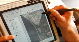
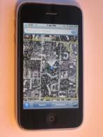
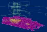
1 THE FUTURE OF GIS 2013 AND 2025 What is the state of geospatial computing today? What are the issues today? Unresolved problems What will geospatial computing be like in 2025? What issues will be of concern then? COMPUTING ISSUES IN 2013 Building the cyberinfrastructure The digital divide The where of computing User interfaces and Web 2.0/3.0 Who owns software? Too much data GEOGRAPHIC INFORMATION TECHNOLOGY IN 2013 Countering industry trends, LBS Positioning systems commonplace Geobrowser era, and VGI Mobile GIS New generation of earth imaging (e.g. webcams) Interoperability and standards 1

.")


2 WHAT WILL THE ISSUES BE IN 2025? CYBERINFRASTRUCTURE aka Grid computing NSF Vision for next era of computing integrated suite of computational engines, mass storage, networks, digital libraries and databases, sensors, software and services (NSF, 2003). Can include human users and the user interface NSF (2003) Revolutionizing Science and Engineering Through Cyberinfrastructure: Report of the National Science Foundation Blue-Ribbon Advisory Panel on Cyberinfrastructure: Atkins report. COMPUTING ON THE GRID GEOSPATIAL ELEMENTS OF THE GRID: SENSOR WEBS Services available on demand Independence of source The computer is the network Cloud computing Virtual organizations 2

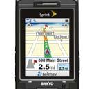


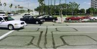

3 LOCATION-BASED SYSTEMS CITIZENS AS SENSORS MORE SENSORS FOR EXAMPLE: Bookstore entrance: e.aspx East Gate: 3

 Who")


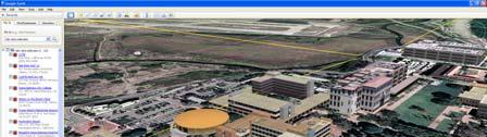
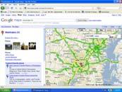
4 THE GEOSPATIAL WEB GOOGLE STREETVIEW Content on server side What content? (Map, image, video, text) Who supplies and moderates the content? How can the geospatial web build a market? Dick Cheney s House STREETVIEW NAVIGATION BING MAPS 4


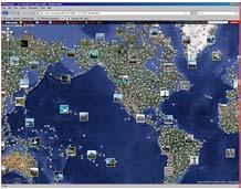
5 BINGMAPS 3D SELECTED CITIES (LA) EVERYSCAPE WHAT IF? All geospatial content becomes available over distributed systems Geobrowsers link content and facilitate search Most other web (and data) content become linked by geography? Vision of a Digital Earth DIGITAL EARTH Visionary concept: Holistic perspective Popularized by former US VP Al Gore Virtual and 3-D representation of the Earth Spatially referenced Connected with digital knowledge archives Vast amounts of scientific, natural, and cultural information to describe and understand the Earth, its systems, and human activities. 5
 A multi-resolution, three dimensional representation of the planet, into which we")


6 MARY BAKER EDDY LIBRARY FOR THE BETTERMENT OF HUMANITY 1935 GORE S EARTH IN THE BALANCE (1992) A multi-resolution, three dimensional representation of the planet, into which we can embed vast quantities of georeferenced data. CONSENSUS DEFINITION 1999 WORLD WIDE PARTICIPATION Digital Earth will be a virtual representation of our planet that enables a person to explore and interact with the vast amounts of natural and cultural information gathered about the Earth. (Consensus definition adopted at 2nd interagency workshop, 1999 Sept 23) 6


7 THE NASA WEB SITE NASA WORLDWIND SO WHAT ABOUT CONTENT? GLOBAL MAPS LOD and drill-down Maps and imagery plus search Crosses boundaries between MAPS IMAGERY TOPONYMY GENERALIZATION IN COMPUTER GRAPHICS: LEVEL OF DETAIL James H. Clark (1976) Hierarchical Geometric Models for Visible Surface Algorithms. Communications of the ACM, October 1976,19, 10. pp
")


8 WE VE BEEN THERE BEFORE: AUSTRALIA SERIES (PART) GLOBAL MAPS International Millionth Map of the World VMAP0 (DCW) GlobalMap GLOBAL MAP: VMAP0 PLUS MASSIVE AMOUNTS OF DATA: LU 8


9 INTERFACES GUI and WIMP Perceptual and multimodal interfaces User centered design, cognitive engineering GESTURE RECOGNITION AND AR Images/Movies courtesy of Mathias Kolsh, UCSB AUGMENTED REALITY WEARABLE GIS 9


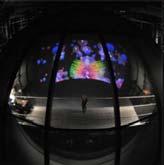

10 GEOVISUALIZATION Visual analytics: the science of analytic reasoning, facilitated by interactive visual interfaces. New technologies and methods New hardware Visual analytics VISUALIZATION OF UNCERTAINTY VIRTUAL REALITY: THE ALLOSPHERE Prof. Dr. Bernd Fröhlich Visualization of Uncertainty: Visualizing Errors and Uncertainties in Geo-Scientific Data 10
 3D")


11 SIMPLEST 3D TOOL: SKETCH-UP (KML) 3D BUILDINGS/FLAT TREES POLYGON EXTRUSION (ARCSCENE) BUNDLER Structure-from-motion system for unordered image collections (for instance, images from the Internet) written in C and C++. Opensource, UWash+Cornell Outdoor game: Our ultimate goal is to reconstruct the entire world, one photo at a time. 11


 Change")


12 NEW IMAGERY SOURCES VGI: GeoTagged photographs Kite photography Microsoft Kinect Quadcopters UAVs Webcams Virtual geography SOME UNSOLVED PROBLEMS Fusion Conflation Spatio-Temporal GIS (4D GIS) Change detection Multiple moving objects Forecasting, modeling and simulation Fusion: aggregation, integration and conflation of geospatial data across time and space with the goal of removing the effects of data measurement systems and facilitating spatial analysis and synthesis across information sources CONFLATION 12


13 TEMPORAL CONFLATION SOURCE/SCALE CONFLATION AUTOMATED CHANGE DETECTION MULTIPLE MOVING OBJECTS 13


 LOSS")
 THE THREATS")

14 Forecasting: an operational research technique used to anticipate outcomes, trends, or expected future behavior of a system using statistics and modeling. GEOSPATIAL ISSUES IN 2025 GEOPRIVACY Who owns your lifeline? (Huisman and Forer, 1998; students in Auckland) LOSS OF ANONYMITY (MINORITY REPORT 2002) THE THREATS FOIA vs. Mapping the Risks Geoslavery "You have no privacy - get over it." (Scott McNealy, Sun Microsystems) 14

15 COMING NEXT The Final Exam! 15
Chapter 10: The Future of GIS Why Speculate? 10.2 Future Data 10.3 Future Hardware 10.4 Future Software 10.5 Some Future Issues and Problems
 Chapter 10: The Future of GIS 10.1 Why Speculate? 10.2 Future Data 10.3 Future Hardware 10.4 Future Software 10.5 Some Future Issues and Problems Theme of the Course GIS's place in understanding geographic
Geog183: Cartographic Design and Geovisualization Spring Quarter 2018 Lecture 3: Thematic cartography, geovisualization and visual analytics
 Geog183: Cartographic Design and Geovisualization Spring Quarter 2018 Lecture 3: Thematic cartography, geovisualization and visual analytics General Purpose or Reference Cartography Maps showing generic
FUTURE DATA. Future data Future hardware Future software Future issues. Getting Started With GIS. Chapter 10
 THE FUTURE OF GIS Getting Started With GIS Chapter 10 GIS Futures Future data Future hardware Future software Future issues Dursun Z. ªeker Theme of the book GIS's place in understanding geographic distributions
Introduction To A New Geo-Referenced Street Level Content: 3D GEOPANO
 Free and Open Source Software for Geospatial (FOSS4G) Conference Proceedings Volume 15 Seoul, South Korea Article 10 2015 Introduction To A New Geo-Referenced Street Level Content: 3D GEOPANO Boram Yoon
CyberGIS: What Still Needs to Be Done? Michael F. Goodchild University of California Santa Barbara
 CyberGIS: What Still Needs to Be Done? Michael F. Goodchild University of California Santa Barbara Progress to date Interoperable location referencing coordinate transformations geocoding addresses point-of-interest
July 5-6, 2010 Mytilene, Greece
 Web GIS platform for forest fire management Prof. Kostas Kalabokidis Principal Investigator Univ. of the Aegean, Dept. of Geography, Greece Prof. George Kallos Univ. of Athens, Dept. of Physics, Greece
GIS and Community Health. GIS and Community Health. Institutional Context and Interests in GIS Development. GIS and Community Health
 GIS and Community Health GIS and Community Health Some critiques of GIS emphasize the potentially harmful social consequences of the diffusion of GIS technology, including reinforcing the power of state
TRAITS to put you on the map
 TRAITS to put you on the map Know what s where See the big picture Connect the dots Get it right Use where to say WOW Look around Spread the word Make it yours Finding your way Location is associated with
Geometric Algorithms in GIS
 Geometric Algorithms in GIS GIS Visualization Software Dr. M. Gavrilova GIS Software for Visualization ArcView GEO/SQL Digital Atmosphere AutoDesk Visual_Data GeoMedia GeoExpress CAVE? Visualization in
Lecture 11. Data Standards and Quality & New Developments in GIS
 Lecture 11 Data Standards and Quality & New Developments in GIS Lecture 11: Outline I. Data Standards and Quality 1. Types of Spatial Data Standards 2. Data Accuracy II. New Developments/The Future of
Canadian Board of Examiners for Professional Surveyors Core Syllabus Item C 5: GEOSPATIAL INFORMATION SYSTEMS
 Study Guide: Canadian Board of Examiners for Professional Surveyors Core Syllabus Item C 5: GEOSPATIAL INFORMATION SYSTEMS This guide presents some study questions with specific referral to the essential
G. I. Science Education: A Computing Perspective
 A Position Statement on G. I. Science Education: A Computing Perspective (A Panel Discussion in UCGIS Summer Assembly 2008) By Shashi Shekhar McKnight Distinguished University Professor Faculty of Computer
Geo Business Gis In The Digital Organization
 We have made it easy for you to find a PDF Ebooks without any digging. And by having access to our ebooks online or by storing it on your computer, you have convenient answers with geo business gis in
Planning in a Geospatially Enabled Society. Michael F. Goodchild University of California Santa Barbara
 Planning in a Geospatially Enabled Society Michael F. Goodchild University of California Santa Barbara What is a geospatially enabled society? Knowing the locations of all points of interest and their
Features and Benefits
 Autodesk LandXplorer Features and Benefits Use the Autodesk LandXplorer software family to help improve decision making, lower costs, view and share changes, and avoid the expense of creating physical
Cutting Edge Engineering for Modern Geospatial Systems Rear Admiral Dr. S Kulshrestha, retd
 Cutting Edge Engineering for Modern Geospatial Systems Rear Admiral Dr. S Kulshrestha, retd 11 Jun 2015 GeoIntelligence Asia 2015 The technology would become so pervasive that it becomes a part of you
A Digital Atlas for the Byzantine and Post Byzantine Churches of Troodos Region (central Cyprus)
") CAA'2010 Fusion of Cultures Francisco Contreras & Fco. Javier Melero (Editors) A Digital Atlas for the Byzantine and Post Byzantine Churches of Troodos Region (central Cyprus) Agapiou A. 1, Georgopoulos
CAA'2010 Fusion of Cultures Francisco Contreras & Fco. Javier Melero (Editors) A Digital Atlas for the Byzantine and Post Byzantine Churches of Troodos Region (central Cyprus) Agapiou A. 1, Georgopoulos
A Geographer s role in a Google Maps World. Jeremy Bartley ESRI
 A Geographer s role in a Google Maps World Jeremy Bartley ESRI 1 It is a good time to be a Geographer. 2 Microsoft, Google, Yahoo, and others are pushing geographic awareness to the general public Providing
Techniques for Science Teachers: Using GIS in Science Classrooms.
 Techniques for Science Teachers: Using GIS in Science Classrooms. After ESRI, 2008 GIS A Geographic Information System A collection of computer hardware, software, and geographic data used together for
Cognitive Engineering for Geographic Information Science
 Cognitive Engineering for Geographic Information Science Martin Raubal Department of Geography, UCSB raubal@geog.ucsb.edu 21 Jan 2009 ThinkSpatial, UCSB 1 GIScience Motivation systematic study of all aspects
GEOGRAPHIC INFORMATION SYSTEMS
 GEOGRAPHIC INFORMATION SYSTEMS 4-H Round-Up Community Transitions Workshop Daniel Hanselka June 14, 2011 Goals of the Workshop Answer the question: What is GIS? Uses of GIS. Some of the Common Terminology
Manual of Digital Earth
 V8.0 March 27, 2018 International Society for Digital Earth Manual of Digital Earth (Tentative Title) OUTLINE Foreword Chapter 1 Understanding Digital Earth 1.1 Origins and Precursors of Digital Earth
ESRI Survey Summit August Clint Brown Director of ESRI Software Products
 ESRI Survey Summit August 2006 Clint Brown Director of ESRI Software Products Cadastral Fabric How does Cadastral fit with Survey? Surveyors process raw field observations Survey measurements define high-order
Three-Dimensional Visualization of Activity-Travel Patterns
 C. Rinner 231 Three-Dimensional Visualization of Activity-Travel Patterns Claus Rinner Department of Geography University of Toronto, Canada rinner@geog.utoronto.ca ABSTRACT Geographers have long been
Lecture 12. Data Standards and Quality & New Developments in GIS
 Lecture 12 Data Standards and Quality & New Developments in GIS Lecture 12: Outline I. Data Standards and Quality 1. Types of Spatial Data Standards 2. Data Accuracy 3. III. Documenting Spatial Data Accuracy
CPSC 695. Future of GIS. Marina L. Gavrilova
 CPSC 695 Future of GIS Marina L. Gavrilova The future of GIS Overview What is GIS now How GIS was viewed before Current trends and developments Future directions of research What is GIS? Internet's definition
STATE GEOGRAPHIC INFORMATION DATABASE
 STATE GEOGRAPHIC INFORMATION DATABASE Data Information and Knowledge Management STATE GEOGRAPHIC INFORMATION DATABASE EXECUTIVE SUMMARY Utah has developed one of the most comprehensive statewide GIS resources
Basics of GIS reviewed
 Basics of GIS reviewed Martin Breunig Karlsruhe Institute of Technology martin.breunig@kit.edu GEODETIC INSTITUTE, DEPARTMENT OF CIVIL ENGINEERING, GEO AND ENVIRONMENTAL SCIENCES, CHAIR IN GEOINFORMATICS
CARTOGRAPHY in a Web World
 CARTOGRAPHY in a Web World Nationale GI Minor BAREND KÖBBEN b.j.kobben@utwente.nl Agenda Short introduction to ITC and me Cartography: communicating spatial data Changing GIS & Cartography technology:
June 19 Huntsville, Alabama 1
 June 19 Huntsville, Alabama 1 Real-Time Geospatial Data: The Fusion of PI and ArcGIS Enabling Smarter Facilities Management OSIsoft and Esri Mapping and Location Analytics Platform Supporting Your Use
Massachusetts Institute of Technology Department of Urban Studies and Planning
 Massachusetts Institute of Technology Department of Urban Studies and Planning 11.520: A Workshop on Geographic Information Systems 11.188: Urban Planning and Social Science Laboratory GIS Principles &
How a Media Organization Tackles the. Challenge Opportunity. Digital Gazetteer Workshop December 8, 2006
 A Case-Study-In-Process: How a Media Organization Tackles the Georeferencing Challenge Opportunity Digital Gazetteer Workshop December 8, 2006 to increase and diffuse geographic knowledge 1888 to 2006:
Introduction to GIS Suchith Anand
 Introduction to GIS Suchith Anand Introduction What is GIS? Spatial Data Models Fundamental GIS Map generalization Applied GIS Future Study links What is a Map? A map is a visual representation of an area
XXIII CONGRESS OF ISPRS RESOLUTIONS
 XXIII CONGRESS OF ISPRS RESOLUTIONS General Resolutions Resolution 0: Thanks to the Czech Society commends: To congratulate The Czech Society, its president and the Congress Director Lena Halounová, the
The Relevance of Cartography. Dubai 2015, Georg Gartner
 The Relevance of Cartography Dubai 2015, Georg Gartner Where are we? Data! Data? We are not short of data Technologies! Technologies? We are not short of technologies Data-driven and technology-driven
Web Visualization of Geo-Spatial Data using SVG and VRML/X3D
 Web Visualization of Geo-Spatial Data using SVG and VRML/X3D Jianghui Ying Falls Church, VA 22043, USA jying@vt.edu Denis Gračanin Blacksburg, VA 24061, USA gracanin@vt.edu Chang-Tien Lu Falls Church,
Lesson 16: Technology Trends and Research
 http://www.esri.com/library/whitepapers/pdfs/integrated-geoenabled-soa.pdf GEOG DL582 : GIS Data Management Lesson 16: Technology Trends and Research Overview Learning Objective Questions: 1. Why is integration
ArcGIS is Advancing. Both Contributing and Integrating many new Innovations. IoT. Smart Mapping. Smart Devices Advanced Analytics
 ArcGIS is Advancing IoT Smart Devices Advanced Analytics Smart Mapping Real-Time Faster Computing Web Services Crowdsourcing Sensor Networks Both Contributing and Integrating many new Innovations ArcGIS
Space-adjusting Technologies and the Social Ecologies of Place
 Space-adjusting Technologies and the Social Ecologies of Place Donald G. Janelle University of California, Santa Barbara Reflections on Geographic Information Science Session in Honor of Michael Goodchild
Data Aggregation with InfraWorks and ArcGIS for Visualization, Analysis, and Planning
 Data Aggregation with InfraWorks and ArcGIS for Visualization, Analysis, and Planning Stephen Brockwell President, Brockwell IT Consulting, Inc. Join the conversation #AU2017 KEYWORD Class Summary Silos
Spatial Data Science. Soumya K Ghosh
 Workshop on Data Science and Machine Learning (DSML 17) ISI Kolkata, March 28-31, 2017 Spatial Data Science Soumya K Ghosh Professor Department of Computer Science and Engineering Indian Institute of Technology,
<Insert Picture Here> Oracle Spatial 11g. Dr. Siva Ravada
 Oracle Spatial 11g Dr. Siva Ravada New in Oracle Spatial 11g 3D Support Spatial Web Services Network Data Model GeoRaster Performance Improvements 3D Applications Location-based services
A Technique for Importing Shapefile to Mobile Device in a Distributed System Environment.
 A Technique for Importing Shapefile to Mobile Device in a Distributed System Environment. 1 Manish Srivastava, 2 Atul Verma, 3 Kanika Gupta 1 Academy of Business Engineering and Sciences,Ghaziabad, 201001,India
What is GIS? G: Geographic, Geospatial, Geo
 GEOG 488/588: GIS I Introduction Instructor: Geoffrey Duh TA: David Graves What is GIS? G: Geographic, Geospatial, Geo Alternatives: Spatial Information Systems, Land Information Systems Geography diverse
3D CARTOGRAPHY IN URBAN ENVIRONMENTS FOR MUNICIPAL ADMINISTRATIONS
 3D CARTOGRAPHY IN URBAN ENVIRONMENTS FOR MUNICIPAL ADMINISTRATIONS Andreea Calugaru Andreea Calugaru, Paula Florina Anca, Alexandru Vasile a.esri Romania 8 Roma, Bucharest, Romania 011774 0212339086, 0212339088,
CARTOGRAPHY in a Web World
 CARTOGRAPHY in a Web World SENSE Research Cluster XIII meeting: Concepts and tools for spatial data visualization BAREND KÖBBEN kobben@itc.nl b.j.kobben@utwente.nl Agenda Short introduction to ITC and
Assessing pervasive user-generated content to describe tourist dynamics
 Assessing pervasive user-generated content to describe tourist dynamics Fabien Girardin, Josep Blat Universitat Pompeu Fabra, Barcelona, Spain {Fabien.Girardin, Josep.Blat}@upf.edu Abstract. In recent
UTAH S STATEWIDE GEOGRAPHIC INFORMATION DATABASE
 UTAH S STATEWIDE GEOGRAPHIC INFORMATION DATABASE Data Information and Knowledge Management NASCIO Awards 2009 STATE GEOGRAPHIC INFORMATION DATABASE B. EXECUTIVE SUMMARY Utah has developed one of the most
The Challenge of Geospatial Big Data Analysis
 288 POSTERS The Challenge of Geospatial Big Data Analysis Authors - Teerayut Horanont, University of Tokyo, Japan - Apichon Witayangkurn, University of Tokyo, Japan - Shibasaki Ryosuke, University of Tokyo,
Themes for Geomatics Conference. Geodesy Themes
 Themes for Geomatics Conference Geodesy Themes Geodynamics o Modeling the Deformation of the Earth s Crust o Recent Advances in Geometric Approaches to Deformation Analysis o Monitoring Systems (Sensors
Generating and Caching 3D-Tiles for Large-Scale 3D-Visualization GeoSharing , Bern, Switzerland
 Generating and Caching 3D-Tiles for Large-Scale 3D-Visualization GeoSharing 02.11.2013, Bern, Switzerland Martin Christen, Robert Wüest, Benjamin Loesch, Stephan Nebiker FHNW University of Applied Sciences
GIS at UCAR. The evolution of NCAR s GIS Initiative. Olga Wilhelmi ESIG-NCAR Unidata Workshop 24 June, 2003
 GIS at UCAR The evolution of NCAR s GIS Initiative Olga Wilhelmi ESIG-NCAR Unidata Workshop 24 June, 2003 Why GIS? z z z z More questions about various climatological, meteorological, hydrological and
Abstract. Interoperable Framework for Mobile Dynamic Surveying based on open source components
 Interoperable Framework for Mobile Dynamic Surveying based on open source components Sergiusz Pawlowicz, Didier Leibovici, Richard Saull±, Mike Jackson, Chaoyu Ye, Wenchao Jiang, Natalie Adams 1, Suchith
Enriching the GIScience Research Agenda: Fusing Augmented Reality (AR) and Location Based Social Networks (LBSN)
 and Location Based Social Networks (LBSN)") Enriching the GIScience Research Agenda: Fusing Augmented Reality (AR) and Location Based Social Networks (LBSN) Chengbi Liu and Sven Fuhrmann Department of Geography and Geoinformation Science George
Enriching the GIScience Research Agenda: Fusing Augmented Reality (AR) and Location Based Social Networks (LBSN) Chengbi Liu and Sven Fuhrmann Department of Geography and Geoinformation Science George
RGI: geo-visualization RGI. The road to. Ron van Lammeren. Centre for Geo-Information 1RL01
 : geo-visualization The road to. Ron van Lammeren 300505 1RL01 Contents Geo-visualisation Types of geo-visualisation Interacting by interfaces Role of geo-visualisation Usability and perception Constructing
Research of analog and digital data sources for landscape development analysis. Sebastian Kahlert, May 3 rd 2007 FIT 2005 UASE
 Research of analog and digital data sources for landscape development analysis Sebastian Kahlert, May 3 rd 2007 FIT 2005 UASE Agenda Objective of Research Project Material and Methodology Historic Maps
Cities in Space and Time: A Spatial-Temporal Visualization Model of Urban Environments
 Cities in Space and Time: A Spatial-Temporal Visualization Model of Urban Environments Li Yin Assistant Professor Department of Urban and Regional Planning University at Buffalo, The State University of
USGIF Essential Body of Knowledge Competency Areas
 GEOINT Job/Practice Analysis USGIF, in consultation with psychometric consultants and the GEOINT community, executed a job/practice analysis to identify common competencies within the GEOINT profession.
From User Requirements Analysis to Conceptual Design of a Mobile Augmented Reality Tool to be used in an Urban Geography Fieldwork Setting
 From User Requirements Analysis to Conceptual Design of a Mobile Augmented Reality Tool to be used in an Urban Geography Fieldwork Setting Xiaoling Wang, Corné P.J.M. van Elzakker, Menno-Jan Kraak 2016
Course Syllabus. Geospatial Data & Spatial Digital Technologies: Assessing Land Use/Land Cover Change in the Ecuadorian Amazon.
 Course Syllabus Geospatial Data & Spatial Digital Technologies: Assessing Land Use/Land Cover Change in the Ecuadorian Amazon Co- Instructors Dr. Carlos F. Mena, Universidad San Francisco de Quito, Ecuador
Navigating to Success: Finding Your Way Through the Challenges of Map Digitization
 Library Faculty Presentations Library Faculty/Staff Scholarship & Research 10-15-2011 Navigating to Success: Finding Your Way Through the Challenges of Map Digitization Cory K. Lampert University of Nevada,
Re-imagining Religion: The Spatial Humanities as a Framework for New Scholarship
 2010 Re-imagining Religion: The Spatial Humanities as a Framework for New Scholarship David J. Bodenhamer The Polis Center at IUPUI Virtual Center for Spatial Humanities New Technologies and Interdisciplinary
GIS (GEOGRAPHIC INFORMATION SYSTEMS)
") GIS (GEOGRAPHIC INFORMATION SYSTEMS) 1 1. DEFINITION SYSTEM Any organised assembly of resources and procedures united and regulated by interaction or interdependence to complete a set of specific functions.
GIS (GEOGRAPHIC INFORMATION SYSTEMS) 1 1. DEFINITION SYSTEM Any organised assembly of resources and procedures united and regulated by interaction or interdependence to complete a set of specific functions.
An Introduction to Geographic Information System
 An Introduction to Geographic Information System PROF. Dr. Yuji MURAYAMA Khun Kyaw Aung Hein 1 July 21,2010 GIS: A Formal Definition A system for capturing, storing, checking, Integrating, manipulating,
ENV208/ENV508 Applied GIS. Week 1: What is GIS?
 ENV208/ENV508 Applied GIS Week 1: What is GIS? 1 WHAT IS GIS? A GIS integrates hardware, software, and data for capturing, managing, analyzing, and displaying all forms of geographically referenced information.
Display data in a map-like format so that geographic patterns and interrelationships are visible
 Vilmaliz Rodríguez Guzmán M.S. Student, Department of Geology University of Puerto Rico at Mayagüez Remote Sensing and Geographic Information Systems (GIS) Reference: James B. Campbell. Introduction to
Research Group Cartography
 Research Group Cartography Research Group Cartography Towards supporting wayfinding LBS components 1. Mobile devices 2. Communication Network 3. Positioning Component 4. Service and Application Provider
Vision 2020: Focus on the Future. Michael F. Goodchild University of California Santa Barbara
 Vision 2020: Focus on the Future Michael F. Goodchild University of California Santa Barbara A little context Gore, Earth in the Balance, 1992 a single portal to Earth information Fall 1997 Tom Kalil,
Introduction to Field Data Collection
 Introduction to Field Data Collection Dr. Yuji Murayama (Professor) Dr. Ko Ko Lwin (JSPS Postdoctoral Researcher) Division of Spatial Information Science Graduate School of Life and Environmental Sciences
UBGI and Address Standards
 Workshop on address standards UBGI and Address Standards 2008. 5.25 Copenhagen, Denmark Sang-Ki Hong Convenor, WG 10 1 Evolution of Geographic Information Visualization Feature (Contents) Context Accessibility
GIS in Weather and Society
 GIS in Weather and Society Olga Wilhelmi Institute for the Study of Society and Environment National Center for Atmospheric Research WAS*IS November 8, 2005 Boulder, Colorado Presentation Outline GIS basic
Arboretum Explorer: Using GIS to map the Arnold Arboretum
 Arboretum Explorer: Using GIS to map the Arnold Arboretum Donna Tremonte, Arnold Arboretum of Harvard University 2015 Esri User Conference (UC), July 22, 2015 http://arboretum.harvard.edu/explorer Mission
Global 3D Models with Local Content
 Gunnar Misund Associate Professor Head of Environmental Computing gunnar.misund@hiof.no - Morten Granlund, Scientfic Assistant Herman Kolås, Master Student Mats Lindh, Master Student - Østfold University
Geographic Data Science - Lecture II
 Geographic Data Science - Lecture II (New) Spatial Data Dani Arribas-Bel "Yesterday" Introduced the (geo-)data revolution What is it? Why now? The need of (geo-)data science to make sense of it all Today
NR402 GIS Applications in Natural Resources
 NR402 GIS Applications in Natural Resources Lesson 1 Introduction to GIS Eva Strand, University of Idaho Map of the Pacific Northwest from http://www.or.blm.gov/gis/ Welcome to NR402 GIS Applications in
PUBLIC OUTREACH THROUGH GIS
 PUBLIC OUTREACH THROUGH GIS Tim Witt, Department of Earth Sciences, University of South Alabama, Mobile, AL 36688. E-mail: tw501@jaguar1.usouthal.edu. In this paper, I propose a few ways, by using GIS
- Towards new concepts for handling geoinformation
 - Towards new concepts for handling geoinformation Centre for 3D Geoinformation Aalborg University Denmark Outline 1. Introduction 2. Digital Northern Jutland in DK 3. Cente for 3D geoinformation 4. Drivers
An Ontology-based Framework for Modeling Movement on a Smart Campus
 An Ontology-based Framework for Modeling Movement on a Smart Campus Junchuan Fan 1, Kathleen Stewart 1 1 Department of Geographical and Sustainability Sciences, University of Iowa, Iowa City, IA, 52242,
Corporate. Information. Railway Infrastructure Administrator. Year indracompany.com
 geospatial and mobility Corporate Geographic Information System of ADIF Railway Infrastructure Administrator. Year 2009-2010 Corporate Geographic Information System of ADIF ADIF. Spanish Administrator
A BASE SYSTEM FOR MICRO TRAFFIC SIMULATION USING THE GEOGRAPHICAL INFORMATION DATABASE
 A BASE SYSTEM FOR MICRO TRAFFIC SIMULATION USING THE GEOGRAPHICAL INFORMATION DATABASE Yan LI Ritsumeikan Asia Pacific University E-mail: yanli@apu.ac.jp 1 INTRODUCTION In the recent years, with the rapid
DANIEL WILSON AND BEN CONKLIN. Integrating AI with Foundation Intelligence for Actionable Intelligence
 DANIEL WILSON AND BEN CONKLIN Integrating AI with Foundation Intelligence for Actionable Intelligence INTEGRATING AI WITH FOUNDATION INTELLIGENCE FOR ACTIONABLE INTELLIGENCE in an arms race for artificial
Spatial Information Retrieval
 Spatial Information Retrieval Wenwen LI 1, 2, Phil Yang 1, Bin Zhou 1, 3 [1] Joint Center for Intelligent Spatial Computing, and Earth System & GeoInformation Sciences College of Science, George Mason
David Lanter PhD GISP. Information Security Risks and Controls of Public Geospatial Datasets July 17, 2014
 David Lanter PhD GISP Information Security Risks and Controls of Public Geospatial Datasets July 17, 2014 This Presentation CDM Smith applies GIS and develops custom applications producing, deploying and
GIS = Geographic Information Systems;
 What is GIS GIS = Geographic Information Systems; What Information are we talking about? Information about anything that has a place (e.g. locations of features, address of people) on Earth s surface,
Digital Map of Mexico Platform and MxSIG. March 2017
 Digital Map of Mexico Platform and MxSIG March 2017 1 I. Digital Map of Mexico Platform Concept Evolution II. Digital Map of Mexico online Concept Capabilities Information available Other state units information
GIScience: Current Technology. Michael F. Goodchild University of California Santa Barbara
 GIScience: Current Technology Michael F. Goodchild University of California Santa Barbara What is a GIS? A class of software designed to handle geographic information and perform virtually any conceivable
Cyberinfrastructure and CyberGIS: Recent Advances and Key Themes
 Cyberinfrastructure and CyberGIS: Recent Advances and Key Themes Shaowen Wang CyberInfrastructure and Geospatial Information Laboratory (CIGI) Department of Geography Department of Computer Science National
GOVERNMENT GIS BUILDING BASED ON THE THEORY OF INFORMATION ARCHITECTURE
 GOVERNMENT GIS BUILDING BASED ON THE THEORY OF INFORMATION ARCHITECTURE Abstract SHI Lihong 1 LI Haiyong 1,2 LIU Jiping 1 LI Bin 1 1 Chinese Academy Surveying and Mapping, Beijing, China, 100039 2 Liaoning
GIS-based Smart Campus System using 3D Modeling
 GIS-based Smart Campus System using 3D Modeling Hardik Panchal & Rizwan Khan, Smita Sengupta, GISE Advance Lab, Indian Institute of Technology, Bombay, India N.L. Sarda, Dept. Of Computer Science, Indian
Cartographic and Geospatial Futures
 Cartographic and Geospatial Futures 1. Web Cartography, WebGIS, & Virtual Globes--New Roles for Maps, GIS, and GIS professionals 2. Map Mashups, the Neo Neo-geography Movement, & Crowd-sourcing Geospatial
Map Services Are We Getting It?
 Map Services Are We Getting It? Rich Herrmann VP Global Platforms & Technology, IHS James Sanders Senior Product Manager, IHS April 19, 2011 Houston, TX USA Overview The Challenge Keith Fraley s 2010 PUG
Geography involves the study of places: their locations, their characteristics, and how humans use and move around them.
 Physical Geography Looking at the Earth Geography involves the study of places: their locations, their characteristics, and how humans use and move around them. NEXT Physical Geography Looking at the Earth
DATA SOURCES AND INPUT IN GIS. By Prof. A. Balasubramanian Centre for Advanced Studies in Earth Science, University of Mysore, Mysore
 DATA SOURCES AND INPUT IN GIS By Prof. A. Balasubramanian Centre for Advanced Studies in Earth Science, University of Mysore, Mysore 1 1. GIS stands for 'Geographic Information System'. It is a computer-based
New Perspectives in GIS Databases. «80% of the data throughout the world have some geographic basis» New Perspectives in GIS Databases
 New Perspectives in GIS Databases Pr. Robert LAURINI University of Lyon (INSA), France University of Venice (IUAV), Italy «80% of the data throughout the world have some geographic basis» New Perspectives
The Global Statistical Geospatial Framework and the Global Fundamental Geospatial Themes
 The Global Statistical Geospatial Framework and the Global Fundamental Geospatial Themes Sub-regional workshop on integration of administrative data, big data and geospatial information for the compilation
Application of WebGIS and VGI for Community Based Resources Inventory. Jihn-Fa Jan Department of Land Economics National Chengchi University
 Application of WebGIS and VGI for Community Based Resources Inventory Jihn-Fa Jan Department of Land Economics National Chengchi University OUTLINE Introduction Methodology Results Conclusions 2 MOTIVATION
INSTITUTE OF AERONAUTICAL ENGINEERING (Autonomous) Dundigal, Hyderabad
 Dundigal, Hyderabad") INSTITUTE OF AERONAUTICAL ENGINEERING (Autonomous) Dundigal, Hyderabad -00 0 CIVIL ENGINEERING TUTORIAL QUESTION BANK Course Name : Remote Sensing and GIS Course Code : A00 Class : IV B. Tech I Semester
INSTITUTE OF AERONAUTICAL ENGINEERING (Autonomous) Dundigal, Hyderabad -00 0 CIVIL ENGINEERING TUTORIAL QUESTION BANK Course Name : Remote Sensing and GIS Course Code : A00 Class : IV B. Tech I Semester
OGC Standards Update 29 November 2018 Orlando
 OGC Standards Update 29 November 2018 Orlando Mark Reichardt mreichardt@opengeospatial.org +1 301 840-1361 OGC S INTEREST It s simple You have this or this and you need to make this... or this Courtesy
Lecture 1: Geospatial Data Models
 Lecture 1: GEOG413/613 Dr. Anthony Jjumba Introduction Course Outline Journal Article Review Projects (and short presentations) Final Exam (April 3) Participation in class discussions Geog413/Geog613 A
Building a National Data Repository
 Building a National Data Repository Mladen Stojic, Vice President - Geospatial 1/30/2013 2012 Intergraph Corporation 1 Information has meaning and gives power only when shared and distributed. Information,