OGC Standards Update 29 November 2018 Orlando
|
|
|
- Alicia Perkins
- 5 years ago
- Views:
Transcription


1 OGC Standards Update 29 November 2018 Orlando Mark Reichardt
2 OGC S INTEREST
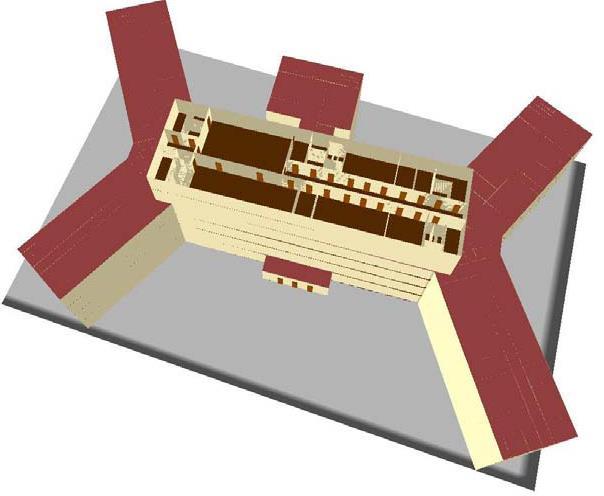
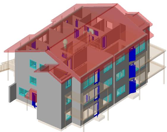
3 It s simple You have this or this and you need to make this... or this Courtesy CAE

4 You have this It s not so simple or this and then push changes and you need to make this... or this Courtesy CAE


5 It s valuable Geospatial data should be discoverable, accessible, and reusable for many purposes without multiple format changes


6 Facilitate compilation Validated watertight geometry Complete web services Reach-back to data sources OGC standards Consistent support for Coordinate Reference Systems Web processing services and automation Correlated database
7 RELEVANT STANDARDS

8 OGC Services Architecture Visualization / Decision Tools and Applications GeoAPI OpenLS GML IndoorGML NetCDF GMLJP2 GeoSparql SLD KML WMC Data Models and Encodings Moving Features CityGML WaterML GeoXACML FE SE OpenGeoSMS GeoPackage Other Services Workflow, Alerts TJS Processing Services WPS WCPS OpenMI Discovery Services CSW OpenSearch Geo ebrim Simple Features Access Access Services WFS WMTS WCS WMS Sensor Web Enablement SPS SensorML O&M SOS Discover Task Access Geospatially Enabled Metadata Geospatial Feature Data Geospatial Browse/Maps Puck Geospatial Coverage Data Other Data Sensors

9 CDB The CDB standard relies on three important means to organize the data: Tiles organization of data by location Layers organization of data by type Levels of Detail (LOD) organization of data by detail Tile size and location are specified by CDB The amount of data per LOD is specified by CDB The data layers are specified by CDB (can be extended)


10 CityGML - 3D Urban Models Urban Planning / Operations Emergency Mgt / Response Public Safety Transportation / Routing / Logistics Indoor navigation Retail Site analysis Sustainable / Green Communities City Services Management Noise abatement Telecommunications placement Many other uses Source; Thomas Kolbe, Berlin TU Source: GTA Geoinformatik GmbH,


11 Integrated Outdoor / Indoor location/navigation IndoorGML Approved Sept 2014 OGC IndoorGML


12 ARML 2.0: 1 st open, multi-vendor Augmented Reality implementation + = >50 Million users AR content encoded in OGC ARML 2.0 standard Organized by AR Standards Community Demonstrated at Mobile World Congress


13 3DPS: delivery of data or representation Thick client, delivery of 3D content Scenegraph Images Thin client, delivery of queryable images


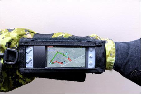
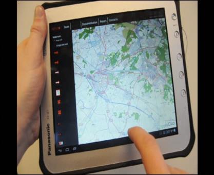
14 GeoPackage universal geodata file format GeoPackage is a universal file format for geodata. open, standards-based, application and platform independent, and self-describing. Works on any desktop or mobile OS Connected / limited / disconnected environment use GeoPackage - the modern alternative to formats like GeoTIFF, SDTS and vendor specific Experience it here:

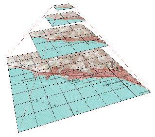

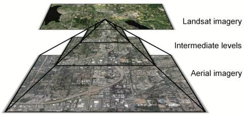
15 GeoPackage: Raster Maps, Images and Feature Data in One File Imagery Low High Resolution Feature Data Raster Maps: Small Large Scale Tile Pyramids 24 zoom levels Single File Sqlite Database containing all data for direct-use on mobile platforms & handheld devices


16 OGC Moving Features Encoding Standard "Moving features" data describes such things as vehicles, pedestrians, airplanes and ships. This is Big Data high volume, high velocity. CSV and XML encodings of ISO 19141

17 RECENT STANDARDS ACTIVITIES

18 Indexed 3D Scene Layer (i3s) OGC Community Standard Developed by Esri Implemented by Esri, Vricon, Bentley, Cyclomedia by 2016 Adopted as an OGC Community standard Source: Vricon
 or >Orthometric")
19 i3s streaming Geospatial Data Types Layer Type (example) Features with Identity 3D Object Yes Yes Attributes Integrated Mesh No Triangle Attributes (planned) Point Yes Yes Pointcloud No Vertex Attributes Line Yes Yes Polygon Yes Yes Render in Planar and Geocentric modes Vertical frame of reference >Ellipsoidal (elevation/height with respect to a reference ellipsoid) or >Orthometric (elevation/height with respect to a reference geoid/gravity surface)


20 Cesium 3DTiles In approval process as OGC Community standard Stream 100K+ buildings Mouse over highlight Per-building attributes Display Style Combine with terrain, imagery, and vector data.csv /.dae

21 New OGC Community Standard Submission Presagis is introducing OpenFlight as a new Community standard Work Item for consideration by OGC Community standard Endorsement by OGC membership of a widely-implemented specification developed outside of OGC Part of the OGC standards baseline Carries the full weight of an OGC standard At time of approval, the specification is frozen and published by OGC; the originating body can continue development of their own version, if desired Examples: GeoRSS, Indexed 3D Scene Layers (I3S), LAS 1.4
22 Joint AR Standards Advancement W3C and OGC together are looking to run a Pilot to address a range of AR interoperability challenges Pilot is intended to: Advance or propose W3C and OGC standards related to Augmented Reality. Provide models, interfaces, and an architecture that will enable seamless integration of real world, geospatial, and web data. Be run as an Initiative of the OGC Innovation Program, co-branded with W3C
23 Distributed Simulation and Gaming Functioning as an ad hoc OGC Working Group In consideration by members as a new Domain Working Group Led by Modeling and Simulation industry experts Refs: OGC Domain Working Groups: OGC Standards Working Groups: OGC Standards:
Geospatial Standards Support - An Overview. Marten Hogeweg & Satish Sankaran
 Geospatial Standards Support - An Overview Marten Hogeweg & Satish Sankaran Agenda Interoperability and Standards ArcGIS Open, Interoperable and Standards Compliant Esri Open initiatives Understanding
Mark E Reichardt. President & CEO Open Geospatial Consortium
 Mark E Reichardt President & CEO Open Geospatial Consortium mreichardt@myogc.org Agenda 0900-0915 Welcome and Introduction - Topic setting (Chair) 0915-0935 Ron Bloksma, The next step is interoperability
OGC and GSDI: A Partnership in Advancing SDI Best Practices
 OGC and GSDI: A Partnership in Advancing SDI Best Practices GSDI 11 Workshop 1.4 SDI Challenges 15 June 2009 Mark Reichardt President and CEO mreichardt@opengeospatial.org +1 301 840-1361 Copyright 2009,
Geo-Enabling Digital India. 15 th Esri India User Conference GIS and Smart Cities
 15 th Esri India User Conference 2014 GIS and Smart Cities 15 th Esri India User Conference 2014 GIS and Smart Cities Agendra Kumar President, Esri India Our World Is Facing Serious Challenges Our World
Discovery and Access of Geospatial Resources using the Geoportal Extension. Marten Hogeweg Geoportal Extension Product Manager
 Discovery and Access of Geospatial Resources using the Geoportal Extension Marten Hogeweg Geoportal Extension Product Manager DISCOVERY AND ACCESS USING THE GEOPORTAL EXTENSION Geospatial Data Is Very
Complexity, Convergence, Divergence and the Geospatial Knowledge Economy: The Role of Standards
 Complexity, Convergence, Divergence and the Geospatial Knowledge Economy: The Role of Standards Mark Reichardt President & CEO mreichardt@opengeospatial.org +1 301 840-1361 Copyright 2014 Open Geospatial
Pushing the Standards Edge: Collaborative Testbeds to Accelerate Standards Development and Implementation
 Pushing the Standards Edge: Collaborative Testbeds to Accelerate Standards Development and Implementation Mark E. Reichardt President mreichardt@opengeospatial.org 31 October 2006 2006 Open Geospatial
Leveraging the OGC Capabilities of ArcGIS Server
 Leveraging the OGC Capabilities of ArcGIS Server Satish Sankaran Interoperability and Standards Team Yingqi Tang Server Team Jessica Parteno Geodatabase Team ArcGIS Server is Open & Interoperable Using
OGC GEOPACKAGE AND HOW OPEN SOURCE IS CHANGING THE WAY GOVERNMENTS THINK ABOUT STANDARDS. Nathan Frantz Geospatial Research Lab
 OGC GEOPACKAGE AND HOW OPEN SOURCE IS CHANGING THE WAY GOVERNMENTS THINK ABOUT STANDARDS Nathan Frantz Geospatial Research Lab Dr. Ben Tuttle National Geospatial-Intelligence Agency FOSS4G 2015 Geospatial
A Vision for ArcGIS Applying Geography Everywhere
 A Vision for ArcGIS Applying Geography Everywhere WELCOME PURPOSE A Network of GIS Professionals Are Awakening the World to the Power of Web GIS You Your WORK Making a Difference Your Work Open Maps and
Using OGC standards to improve the common
 Using OGC standards to improve the common operational picture Abstract A "Common Operational Picture", or a, is a single identical display of relevant operational information shared by many users. The
OGC 3D Portrayal Interoperability Experiment (3DPIE) Insights and Results
 Insights and Results") OGC 3D Portrayal Interoperability Experiment (3DPIE) Insights and Results Jan Klimke, Benjamin Hagedorn (Hasso-Plattner-Institut at the University Potsdam) Web 3D 2012 Los Angeles, August 4, 2012 Agenda
OGC 3D Portrayal Interoperability Experiment (3DPIE) Insights and Results Jan Klimke, Benjamin Hagedorn (Hasso-Plattner-Institut at the University Potsdam) Web 3D 2012 Los Angeles, August 4, 2012 Agenda
Hosted by Esri Official Distributor
 Hosted by Esri Official Distributor Esri European User Conference October 15-17, 2012 Oslo, Norway Hosted by Esri Official Distributor Interoperability and Standards Support in ArcGIS 10.1 Roberto Lucchi
GIS-based Smart Campus System using 3D Modeling
 GIS-based Smart Campus System using 3D Modeling Smita Sengupta GISE Advance Research Lab. IIT Bombay, Powai Mumbai 400 076, India smitas@cse.iitb.ac.in Concept of Smart Campus System Overview of IITB Campus
March 10 OGC Technical Committee
 March 10 OGC Technical Committee Frascati 99 3 7 99 3 15 99 3 17 1 2010 OGC (Open Geospatial Consortium, Inc.) Technical Committee Frascati 2007 OGC OGC Sensor Web Enablement (SWE) 2.0 Attributes Usage
<Insert Picture Here> Oracle Spatial 11g. Dr. Siva Ravada
 Oracle Spatial 11g Dr. Siva Ravada New in Oracle Spatial 11g 3D Support Spatial Web Services Network Data Model GeoRaster Performance Improvements 3D Applications Location-based services
Data Aggregation with InfraWorks and ArcGIS for Visualization, Analysis, and Planning
 Data Aggregation with InfraWorks and ArcGIS for Visualization, Analysis, and Planning Stephen Brockwell President, Brockwell IT Consulting, Inc. Join the conversation #AU2017 KEYWORD Class Summary Silos
7 11 August 2011, Vancouver. Don Brutzman, Benjamin Hagedorn. The OGC: Making Location Count
 OGC 3D Portrayal Interoperability Experiment, OGC 3D Summit 2011 SIGGRAPH 2011 7 11 August 2011, Vancouver Don Brutzman, Benjamin Hagedorn The OGC: Making Location Count What is the Open Geospatial Consortium?
ArcGIS is Advancing. Both Contributing and Integrating many new Innovations. IoT. Smart Mapping. Smart Devices Advanced Analytics
 ArcGIS is Advancing IoT Smart Devices Advanced Analytics Smart Mapping Real-Time Faster Computing Web Services Crowdsourcing Sensor Networks Both Contributing and Integrating many new Innovations ArcGIS
Portals: Standards in Action
 Portals: Standards in Action David Danko ISO TC 211 Metadata Project Leader GIS Standards Consultant-ESRI. Metadata Portals Portal gateway, place of entry Producers Advertise, expose products Share information
Generating and Caching 3D-Tiles for Large-Scale 3D-Visualization GeoSharing , Bern, Switzerland
 Generating and Caching 3D-Tiles for Large-Scale 3D-Visualization GeoSharing 02.11.2013, Bern, Switzerland Martin Christen, Robert Wüest, Benjamin Loesch, Stephan Nebiker FHNW University of Applied Sciences
Data Conversion to I3S for 3D Modeling from CityGML. Christian Dahmen (con terra GmbH) Satish Sankaran (Esri)
 Satish Sankaran (Esri)") Data Conversion to I3S for 3D Modeling from CityGML Christian Dahmen (con terra GmbH) Satish Sankaran (Esri) 3D Across the ArcGIS Platform Manage Multiscale 3D Models 3D Geodesign ArcGIS for 3D Cities
Data Conversion to I3S for 3D Modeling from CityGML Christian Dahmen (con terra GmbH) Satish Sankaran (Esri) 3D Across the ArcGIS Platform Manage Multiscale 3D Models 3D Geodesign ArcGIS for 3D Cities
Geospatial Products V8i (SELECTseries 1)
") Geospatial Products V8i (SELECTseries 1) Keith Raymond Product Manager Geospatial Desktop Products Presentation Overview What are the various products? Why would you need them? Demonstrations 2 WWW.BENTLEY.COM
Geospatial Products V8i (SELECTseries 1) Keith Raymond Product Manager Geospatial Desktop Products Presentation Overview What are the various products? Why would you need them? Demonstrations 2 WWW.BENTLEY.COM
OGC Smart Cities Spatial Information Framework
 Open Geospatial Consortium Submission Date: 2014-11-26 Approval Date: 2014-12-05 Publication Date: 2015-01-21 External identifier of this OGC document: http://www.opengis.net/doc/wp/smart-cities-sif Internal
Health DWG ad-hoc. May 31 st, 2013 OGC-TC
 Health DWG ad-hoc May 31 st, 2013 OGC-TC AGENDA 1. Welcome / Roundtable Introductions 2. Background of OGC and proposal of Health DWG 3. Toward an OGC Health DWG 4. Draft Health DWG Charter 5. Potential
These modules are covered with a brief information and practical in ArcGIS Software and open source software also like QGIS, ILWIS.
 Online GIS Training and training modules covered are: 1. ArcGIS, Analysis, Fundamentals and Implementation 2. ArcGIS Web Data Sharing 3. ArcGIS for Desktop 4. ArcGIS for Server These modules are covered
Spatial data interoperability and INSPIRE compliance the platform approach BAGIS
 Spatial data interoperability and INSPIRE compliance the platform approach BAGIS BAGIS Voluntary, independent, public, non-profit organization; Organization with main mission to promote the growth of the
Bentley Map Advancing GIS for the World s Infrastructure
 Bentley Map Advancing GIS for the World s Infrastructure Presentation Overview Why would you need Bentley Map? What is Bentley Map? Where is Bentley Map Used? Why would you need Bentley Map? Because your
Key Points Sharing fosters participation and collaboration Metadata has a big role in sharing Sharing is not always easy
 Sharing Resources Geoff Mortson esri, Inc. SDI Solutions Team Key Points Sharing fosters participation and collaboration Metadata has a big role in sharing Sharing is not always easy Data Sharing is Good
Open Geospatial Consortium Meteorology & Oceanography Domain Working Group Progress
 Open Geospatial Consortium Meteorology & Oceanography Domain Working Group Progress Chris Little, Co-Chair Met Ocean DWG (Marie-Françoise Voidrot, Météo-France, Co-Chair) ECWMF, Reading UK 2013-03-04/06
Federal GIS Conference February 10 11, 2014 Washington DC. Standards in action. David Danko, Esri Marten Hogeweg, Esri
 Federal GIS Conference 2014 February 10 11, 2014 Washington DC Standards in action David Danko, Esri Marten Hogeweg, Esri ESRI learns about and supports standards through active participation: Organizations
The PREVIEW Global Risk Data Platform: a geoportal to serve and share global data on risk to natural hazards
 The PREVIEW Global Risk Data Platform: a geoportal to serve and share global data on risk to natural hazards Gregory Giuliani (UNEP/GRID-Geneva & University of Geneva/enviroSPACE ) http://www.grid.unep.ch
Imagery and the Location-enabled Platform in State and Local Government
 Imagery and the Location-enabled Platform in State and Local Government Fred Limp, Director, CAST Jim Farley, Vice President, Leica Geosystems Oracle Spatial Users Group Denver, March 10, 2005 TM TM Discussion
Communicating Geospatial Information across Communities and Technologies. Presentation to IHO Marine Spatial Data Infrastructure Forum
 Communicating Geospatial Information across Communities and Technologies Presentation to IHO Marine Spatial Data Infrastructure Forum George Percivall OGC Chief Engineer 4 February 2014 OGC Copyright 2014
OpenGeospatial Consortium Working Group Reports 3DIM, Urban planning, Land & Infrastructure
 OpenGeospatial Consortium Working Group Reports 3DIM, Urban planning, Land & Infrastructure Leif Granholm BIM Ambassador, Trimble October 30, 2014 Toronto 3DIM Charter The 3D Information Management (3DIM)
SDI Standards at work
 SDI Standards at work Jan Juul Jensen Senior Technology Strategist Informi GIS Denmark Informi GIS Private held Limited Company Specialized in GIS 100+ employees HQ in Charlottenlund, Copenhagen Regional
Web 3D Service & CityGML Update
 Technische Universität Berlin Web 3D Service & CityGML Update Thomas H. Kolbe Institute for Geodesy and Geoinformation Science Berlin University of Technology kolbe@igg.tu-berlin.de 2nd of November, 2007
Overview of Geospatial Open Source Software which is Robust, Feature Rich and Standards Compliant
 Overview of Geospatial Open Source Software which is Robust, Feature Rich and Standards Compliant Cameron SHORTER, Australia Key words: Open Source Geospatial Foundation, OSGeo, Open Standards, Open Geospatial
Open Geospatial Consortium activities in the Maritime domain
 Open Geospatial Consortium activities in the Maritime domain Scott Simmons Executive Director, Standards Program General Maritime efforts participants Alliance partners IHO ISO / TC 211 Members Danish
Exelis and Esri Technologies for Defense and National Security. Cherie Muleh
 Exelis and Esri Technologies for Defense and National Security Cherie Muleh Cherie.Muleh@exelisinc.com ENVI IMAGERY AND DATA BECOME KNOWLEDGE > Add information from imagery to your GIS > Automated workflows
Overview. Everywhere. Over everything.
 Cadenza Desktop Cadenza Web Cadenza Mobile Cadenza Overview. Everywhere. Over everything. The ultimate GIS and reporting suite. Provide, analyze and report data efficiently. For desktop, web and mobile.
One platform for desktop, web and mobile
 One platform for desktop, web and mobile Search and filter Get access to all data thematically filter data in context factually and spatially as well as display it dynamically. Export a selection or send
ArcGIS Runtime: Migrating Your Apps from ArcGIS Engine. Eric Bader Lucas Danzinger Mike Branscomb
 ArcGIS Runtime: Migrating Your Apps from ArcGIS Engine Eric Bader Lucas Danzinger Mike Branscomb Migrating to ArcGIS Runtime ArcGIS Engine ArcGIS Runtime AppStudio for ArcGIS Apps: Collector, Workforce,
Strategies for Integrating CAD and BIM in ArcGIS. Don Kuehne Esri 3D Product Manager: CAD/BIM/AEC
 Strategies for Integrating CAD and BIM in ArcGIS Don Kuehne Esri 3D Product Manager: CAD/BIM/AEC CAD Digital Drawing CAD in ArcGIS Desktop CAD in Desktop CAD as Data CAD as a Map EXPORT TO CAD Create and
Cadastral Standards & Interoperability
 Cadastral Standards & Interoperability Some Considerations Black Hills Digital Mapping Association September 18, 2007 Jeanne Foust ESRI Spatial Data Infrastructure Global Manager jfoust@esri.com Why is
Connecting Communities. Jeff Peters - Esri
 Connecting Communities Jeff Peters - Esri Public Safety and Security Infrastructure Protection Officer Involved Shootings and Violent Crimes DHS Police Foundation Operation Centers Mail Theft Live Incident
Developing 3D Geoportal for Wilayah Persekutuan Iskandar
 Developing 3D Geoportal for Wilayah Persekutuan Iskandar Dionnald Beh BoonHeng and Alias Abdul Rahman Department of Geoinformatics, Faculty of Geoinformation Engineering and Sciences, Universiti Teknologi
3D City GIS. Agenda. Why 3D City GIS? What does 3D City GIS mean?
 3D City GIS 1 of 60 WWW.BENTLEY.COM Ben Fredericque, Product Manager, Geospatial Agenda Why 3D City GIS? What does 3D City GIS mean? 2 of 60 WWW.BENTLEY.COM Sydney, Australia, 11 16 April 2010 1 Why 3D
ArcGIS for INSPIRE. Marten Hogeweg Satish Sankaran
 ArcGIS for INSPIRE Marten Hogeweg Satish Sankaran Outline What is ArcGIS ArcGIS for INSPIRE Web GIS Case Studies Roadmap Q&A What is INSPIRE? INSPIRE is the legal framework for a European Spatial Data
A Geographer s role in a Google Maps World. Jeremy Bartley ESRI
 A Geographer s role in a Google Maps World Jeremy Bartley ESRI 1 It is a good time to be a Geographer. 2 Microsoft, Google, Yahoo, and others are pushing geographic awareness to the general public Providing
Bentley Map V8i (SELECTseries 3)
") Bentley Map V8i (SELECTseries 3) A quick overview Why Bentley Map Viewing and editing of geospatial data from file based GIS formats, spatial databases and raster Assembling geospatial/non-geospatial data
Bentley Map V8i (SELECTseries 3) A quick overview Why Bentley Map Viewing and editing of geospatial data from file based GIS formats, spatial databases and raster Assembling geospatial/non-geospatial data
SDI and Beyond The Importance of Standards and Interoperability For Good Governance; Selected Examples
 SDI and Beyond The Importance of Standards and Interoperability For Good Governance; Selected Examples Trevor Taylor, Director, Member Services, Asia and the Americas Sao Paulo May 7 th, 2014 Why is Geospatial
Web-based Exploration of and Interaction with Large and Deeply Structured Semantic 3D City Models using HTML5 and WebGL
 Web-based Exploration of and Interaction with Large and Deeply Structured Semantic 3D City Models using HTML5 and WebGL KANISHK CHATURVEDI 1, ZHIHANG YAO 2 & THOMAS H. KOLBE 1 Abstract: The aim of the
Implementing INSPIRE Geoportal in Turkey
 Implementing INSPIRE Geoportal in Turkey Gencay SERTER City and Regional Planner 1 Presentation Plan Introduction INSPIRE and Turkey Importance of al Spatial Planning Portal Logical&Legal Hierarchy GeoPortal
Global 3D Models with Local Content
 Gunnar Misund Associate Professor Head of Environmental Computing gunnar.misund@hiof.no - Morten Granlund, Scientfic Assistant Herman Kolås, Master Student Mats Lindh, Master Student - Østfold University
Enabling ENVI. ArcGIS for Server
 Enabling ENVI throughh ArcGIS for Server 1 Imagery: A Unique and Valuable Source of Data Imagery is not just a base map, but a layer of rich information that can address problems faced by GIS users. >
Innovation. The Push and Pull at ESRI. September Kevin Daugherty Cadastral/Land Records Industry Solutions Manager
 Innovation The Push and Pull at ESRI September 2004 Kevin Daugherty Cadastral/Land Records Industry Solutions Manager The Push and The Pull The Push is the information technology that drives research and
What you always wanted to know about the OGC Programs, Process, Participation
 What you always wanted to know about the OGC Programs, Process, Participation UNIGIS International u_lecture, 25. March 2014 https://www3.gotomeeting.com/register/909498390 Dipl.-Geogr. Athina Trakas Open
ArcGIS Earth for Enterprises DARRON PUSTAM ARCGIS EARTH CHRIS ANDREWS 3D
 ArcGIS Earth for Enterprises DARRON PUSTAM ARCGIS EARTH CHRIS ANDREWS 3D ArcGIS Earth is ArcGIS Earth is a lightweight globe desktop application that helps you explore any part of the world and investigate
G EOSPAT I A L ERDAS IMAGINE. The world s most widely-used software package for creating information from geospatial data
 G EOSPAT I A L ERDAS IMAGINE The world s most widely-used software package for creating information from geospatial data ERDAS IMAGINE Geographic imaging professionals need to process vast amounts of
Features and Benefits
 Autodesk LandXplorer Features and Benefits Use the Autodesk LandXplorer software family to help improve decision making, lower costs, view and share changes, and avoid the expense of creating physical
A Web Service based U.S. Cropland Visualization, Dissemination and Querying System
 A Web Service based U.S. Cropland Visualization, Dissemination and Querying System Rick Mueller and Zhengwei Yang USDA/National Agricultural Statistics Service Weiguo Han and Liping Di GMU/Center for Spatial
INSPIRE Shared Service
 INSPIRE Shared Service Creation and operation out of the box Petra Fritz (HZD), Michael Voigtländer (Esri Deutschland GmbH) INSPIRE Shared Service Agenda HZD backbone for a geodata infrastructure Implementing
Paper UC1351. Conference: User Conference Date: 08/10/2006 Time: 8:30am-9:45am Room: Room 23-B (SDCC)
") Conference: User Conference Date: 08/10/2006 Time: 8:30am-9:45am Room: Room 23-B (SDCC) Title of Paper: Increasing the Use of GIS in the Federal Government Author Name: Miss Abstract This presentation
Conference: User Conference Date: 08/10/2006 Time: 8:30am-9:45am Room: Room 23-B (SDCC) Title of Paper: Increasing the Use of GIS in the Federal Government Author Name: Miss Abstract This presentation
ArcGIS Data Reviewer: Assessing Positional Accuracy. Roslyn Dunn
 ArcGIS Data Reviewer: Assessing Positional Accuracy Roslyn Dunn What is ArcGIS Data Reviewer? Data Quality Management for ArcGIS Provides - Rule-based validation - Interactive tools - Track errors Validate
GIS-based Smart Campus System using 3D Modeling
 GIS-based Smart Campus System using 3D Modeling Hardik Panchal & Rizwan Khan, Smita Sengupta, GISE Advance Lab, Indian Institute of Technology, Bombay, India N.L. Sarda, Dept. Of Computer Science, Indian
ArcGIS. for Server. Understanding our World
 ArcGIS for Server Understanding our World ArcGIS for Server Create, Distribute, and Manage GIS Services You can use ArcGIS for Server to create services from your mapping and geographic information system
Atmospheric Science and GIS Interoperability issues: some Data Model and Computational Interface aspects
 UNIDATA Boulder, Sep. 2003 Atmospheric Science and GIS Interoperability issues: some Data and Computational Interface aspects Stefano Nativi University of Florence and IMAA-CNR Outline Service-Oriented
UBGI and Address Standards
 Workshop on address standards UBGI and Address Standards 2008. 5.25 Copenhagen, Denmark Sang-Ki Hong Convenor, WG 10 1 Evolution of Geographic Information Visualization Feature (Contents) Context Accessibility
3D Portrayal Interoperability Experiment
 3D Portrayal Interoperability Experiment Benjamin Hagedorn Computergraphische Systeme Hasso-Plattner-Institut an der Universität Potsdam Workshop 3D-Stadtmodelle 2011 Bonn, 9. November 2011 OGC & 3DIM
The (Rough) road to BIM- Geospatial standards. Leif Granholm BIM ambassador
 road to BIM- Geospatial standards. Leif Granholm BIM ambassador") The (Rough) road to BIM- Geospatial standards Leif Granholm BIM ambassador What is Structured Semantic data BIM Graphics to objects Drawings geometry are graphics (appearance important) A Model consists
The (Rough) road to BIM- Geospatial standards Leif Granholm BIM ambassador What is Structured Semantic data BIM Graphics to objects Drawings geometry are graphics (appearance important) A Model consists
Methodological Chain for Hydrological Management with Web-GIS Applications
 Advances in Geosciences Konstantinos Perakis & Athanasios Moysiadis, Editors EARSeL, 2012 Methodological Chain for Hydrological Management with Web-GIS Applications Alexandros Konstantinidis 1, Eleni Tzanou
Solving the European Data Puzzle Simplifying INSPIRE Challenges and Usage. con terra GmbH Dipl.-Ing. Mark Döring
 Solving the European Data Puzzle Simplifying INSPIRE Challenges and Usage con terra GmbH Dipl.-Ing. Mark Döring INSPIRE Reference Projects GeoBAK 2.0 Project // INSPIRE Data & Services The Project Evolution
ArcGIS for INSPIRE. Marten Hogeweg
 ArcGIS for INSPIRE Marten Hogeweg Please Take Our Survey on the App Download the Esri Events app and find your event Select the session you attended Scroll down to find the feedback section Complete answers
Climate Data for Non-experts: Standards-based Interoperability
 Climate Data for Non-experts: Standards-based Interoperability Ben Domenico Unidata Program Center University Corporation for Atmospheric Research April 2010 Working Together on A Mosaic for Atmospheric
New Methods for GeoDesign with ArcGIS and CityEngine. Dr. Özgür Ertac, Prof. Dr. Jörg Schaller, Cristina Mattos Tech. Uni. Munich, Esri Germany
 New Methods for GeoDesign with ArcGIS and CityEngine Dr. Özgür Ertac, Prof. Dr. Jörg Schaller, Cristina Mattos Tech. Uni. Munich, Esri Germany Agenda Evolution in 3D Introduction 3D Across the ArcGIS Platform
3D Urban Information Models in making a smart city the i-scope project case study
 UDC: 007:528.9]:004; 007:912]:004; 004.92 DOI: 10.14438/gn.2014.17 Typology: 1.04 Professional Article 3D Urban Information Models in making a smart city the i-scope project case study Dragutin PROTIĆ
ArcGIS Runtime: Migrating from ArcGIS Engine. Rex Hansen
 ArcGIS Runtime: Migrating from ArcGIS Engine Rex Hansen Thank You to Our Sponsors Migrating from ArcGIS Engine to ArcGIS Runtime ArcGIS Runtime API: new and evolved workflows on all platforms Windows Linux
Digital Map of Mexico Platform and MxSIG. March 2017
 Digital Map of Mexico Platform and MxSIG March 2017 1 I. Digital Map of Mexico Platform Concept Evolution II. Digital Map of Mexico online Concept Capabilities Information available Other state units information
Bentley Map Advancing GIS for the World s Infrastructure
 Bentley Map Advancing GIS for the World s Infrastructure Presentation Overview Why would you need Bentley Map? What is Bentley Map? Where is Bentley Map Used? Red text signifies new things in Bentley Map
INSPIRE General Introduction & Service Architecture
 INSPIRATION Spatial Data Infrastructure in the Western Balkans INSPIRE General Introduction & Service Architecture 1st National INSPIRATION Workshop Croatia November 21-22, 2012 A multi-countryprojectfunded
Esri WebGIS Highlights of What s New, and the Road Ahead
 West Virginia GIS Conference WVU, Morgantown, WV Esri WebGIS Highlights of What s New, and the Road Ahead Mark Scott, Solutions Engineer, Esri Local Government Team May 5 th, 2016 West Virginia GIS Conference
ISO Series Standards in a Model Driven Architecture for Landmanagement. Jürgen Ebbinghaus, AED-SICAD
 ISO 19100 Series Standards in a Model Driven Architecture for Landmanagement Jürgen Ebbinghaus, AED-SICAD 29.10.2003 The Company 100% SIEMENS PTD SIEMENS Business Services Shareholder & Strategic Business
Arne SCHILLING, Steffen NEUBAUER, Alexander ZIPF Germany. Key words: 3D city models, OpenGIS, SDI, interoperability, service oriented architecture
 Putting GDI-3D into practice: Experiences from developing an 3D spatial data infrastructure based on OpenGIS standards for the sustainable management of urban areas Arne SCHILLING, Steffen NEUBAUER, Alexander
Innovation in Land Management: Integrated Solutions For National Cadastre Projects
 Success With GIS Innovation in Land Management: Integrated Solutions For National Cadastre Projects XXIII International FIG Congress Munich These documents are only complete, when used in connection with
UN-GGIM Arab States Meeting Welcome Address. Denise McKenzie Open Geospatial Consortium 21 February 2017 Doha, Qatar
 UN-GGIM Arab States Meeting Welcome Address Denise McKenzie Open Geospatial Consortium 21 February 2017 Doha, Qatar The Open Geospatial Consortium Not-for-profit, international voluntary consensus standards
ArcGIS 10.1 An Overview of the System
 ArcGIS 10.1 An Overview of the System ArcGIS 10.1 An Overview of the System Damian Spangrud Director of Solutions, Esri Redlands, CA USA ArcGIS 10.1 Web Cloud Online Mobile Enterprise Desktop ArcGIS 10.1
Charter for the. Information Transfer and Services Architecture Focus Group
 for the Information Transfer and Services Architecture Focus Group 1. PURPOSE 1.1. The purpose of this charter is to establish the Information Transfer and Services Architecture Focus Group (ITSAFG) as
INTEROPERABLE VISUALIZATION OF 3D CITY MODELS USING OGC S STANDARD 3D PORTRAYAL SERVICE
 INTEROPERABLE VISUALIZATION OF 3D CITY MODELS USING OGC S STANDARD 3D PORTRAYAL SERVICE A. Koukofikis 1, V. Coors 1, R. Gutbell 2 1 Hochschule für Technik Stuttgart, Faculty Geomatics, Computer Science
OGC and the Relevance of Standards for Environmental Matters
 and the Relevance of Standards for Environmental Matters Scott Simmons Executive Director, Standards Program, 1 December 2017 Copyright 2017 Open Geospatial Consortium So what brings so many standards
Exploit your geodata to enable smart cities and countries
 Exploit your geodata to enable smart cities and countries Carsten Rönsdorf, Head of Advisory Services Middle East Practice Manager Future Cities, standards and 3D 24 November 2014 Importance of Standards
SYNERGY OF SATELLITE REMOTE SENSING AND SENSOR NETWORKS ON GEO GRID
 SYNERGY OF SATELLITE REMOTE SENSING AND SENSOR NETWORKS ON GEO GRID National Institute of Advanced Industrial Science and Technology, Japan Yoshio Tanaka (on behalf of AIST GEO Grid team) Contents Brief
Smart Land Administration. Brent A. Jones, PE, PLS
 Smart Land Administration Brent A. Jones, PE, PLS bjones@esri.com What is Smart? Required Important Modern Open Secure Authoritative Sustainable Cost Effective Reliable Scalable Contributory Usable Timely
SITR-IDT The Spatial Data Infrastructure of Sardinia Region
 ITALY LOCAL AUTHORITY FOR MUNICIPALITIES, FINANCES AND URBAN PLANNING REGIONAL DEPARTMENT FOR CARTOGRAPHY AND INFORMATION SYSTEMS SITR-IDT The Spatial Data Infrastructure of Sardinia Region Content of
UNIPD RESEARCH UNIT Progress Report Francesca FISSORE, Marco PIRAGNOLO, Francesco PIROTTI
 UNIPD RESEARCH UNIT Progress Report Francesca FISSORE, Marco PIRAGNOLO, Francesco PIROTTI PRIN PROJECT: URBAN GEOmatics for Bulk Information Generation, Data Assessment and Technology Awareness UR UniPD
ArcGIS Earth an Intro
 ArcGIS Earth an Intro Chris Andrews Product Manager, 3D and ArcGIS Earth Brian Sims 3D Content Lead 3D across the Esri product family ArcGIS Pro 3D Analyst CityEngine ArcGIS for Server ArcGIS Online ArcGIS
RHOAPS. Real-time Hydrology Ocean Atmosphere Prediction System. Pronunciation: Ropes Motto: More than just THREDDS
 RHOAPS Real-time Hydrology Ocean Atmosphere Prediction System Pronunciation: Ropes Motto: More than just THREDDS Key Aspects Integrated real-time data systems Atmospheric Hydrologic Coastal oceans Societal
GIS Community Standards. Satish Sankaran, Esri Mark Reichardt, OGC Dave Danko, Esri Kevin Sigwart, Esri
 GIS Community Standards Satish Sankaran, Esri Mark Reichardt, OGC Dave Danko, Esri Kevin Sigwart, Esri GIS Creating and Managing Geo Information Products - Proprietary - Open Specifications - Standards
GEOSPATIAL WEB SERVICE INTEGRATION AND MASHUPS FOR WATER RESOURCE APPLICATIONS
 GEOSPATIAL WEB SERVICE INTEGRATION AND MASHUPS FOR WATER RESOURCE APPLICATIONS C. Granell a, *, L. Díaz a, M. Gould a a Center for Interactive Visualization, Department of Information Systems, Universitat
BIM Week October 2013 Munich, GERMANY
 BIM Week October 2013 Munich, GERMANY Paul Scarponcini, PE, PhD Bentley Systems, Inc. COBie (for Buildings) Based on MVD of Building IFCs no geometry extended constraints, attributes, relationships Uses