What are we like? Population characteristics from UK censuses. Justin Hayes & Richard Wiseman UK Data Service Census Support
|
|
|
- Horace Simpson
- 6 years ago
- Views:
Transcription
1 What are we like? Population characteristics from UK censuses Justin Hayes & Richard Wiseman UK Data Service Census Support


2 Who are we? Richard Wiseman UK Data Service / Jisc Justin Hayes UK Data Service / Jisc

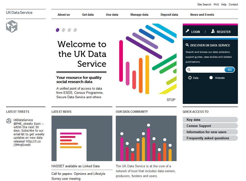
3 The UK Data Service Funded by the ESRC, integrating several previous resources A single, comprehensive and integrated point of access to a wide range of social science data Support, training and guidance ukdataservice.ac.uk
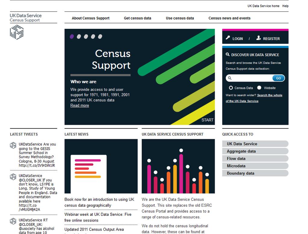
4 UK Data Service Census Support A specialist unit of the UK Data Service Access to, and support for use of data from the last five UK censuses ( ) Bespoke interfaces to make data easy to find, understand and use census.ukdataservice.ac.uk
5
6
7 Who are you? Where are you from? What do you do with data? Why are you here?
8 Workshop structure
9 Workshop structure
10 UK Censuses Decennial questionnaire surveys Entire UK population every ten years* since 1801 Questions mainly about people and households 2011 Census cost ~ 500m Primary evidence for government policy and spending Wide range of high quality demographic and socio-economic characteristics Detailed combinations of characteristics - What? Small areas - Where? Long history When? Rich secondary source of information Open Government License!
11 UK 2011 Census 27 March 2011 Three UK census agencies (ONS, NRS, NISRA) New questions and variables Online and postal completion Targeted enumeration Sophisticated quality assurance
 Intention to stay Second homes")
12 New variables National identity Passports held Ability in spoken English Languages other than English used at home Long term health conditions Month/year of arrival into the UK (for people not born in the UK) Intention to stay Second homes


13 Main language other than English by number of speakers in England and Wales
14 Main language other than English by number of speakers in England and Wales
15 Census output data types Aggregate data Population characteristics and locations Flow data Migration and travel to work Anonymised microdata Personal and household level Digital boundary data Mapping and spatial analysis
16 Census output data types Aggregate data Population characteristics and locations Flow data Migration and travel to work Anonymised microdata Personal and household level Digital boundary data Mapping and spatial analysis
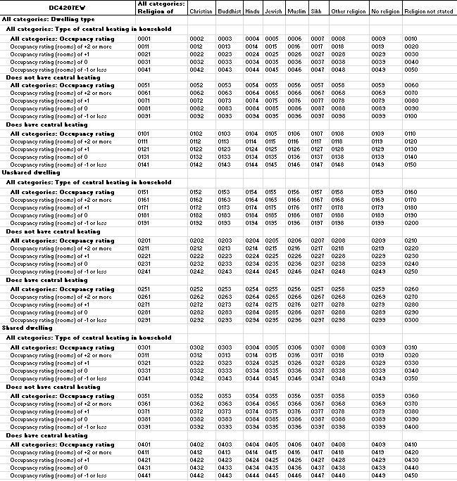
17 Aggregate data Counts of people and households in specific locations with particular combinations of characteristics Derived from questionnaire responses Characteristics What? Complex combinations of variables and categories Location Where? Very large to very small areas (UK to postcodes) For example Counts of female usual residents aged in employment in associate professional and technical occupations for all wards in the County of Devon
18
19


20
21
22
23 Workshop structure

24 Aggregate data Age : Age 16 to 74 - Economic activity : in employment the week before the census - Occupation : 3. Associate professional and technical occupations - Sex : Female - Unit : Persons Age : Age 16 to 74 - Economic activity : in employment the week before the census - Occupation : All categories\ Occupation - Sex : Female - Unit : Persons
25 Aggregate data
26 Workshop structure
27 2011 Census geographies Subdivisions of the UK into smaller areas Sets of similar areas called geographies Functional and statistical geographies Local government districts Wards and electoral divisions Expecting around 100 different geographies Hierarchies of geographies with nesting areas Administrative Statistical Health, Electoral, Postcode, etc

28 UK administrative geographies
29 UK statistical geographies
30 Workshop structure
31 Data scale and complexity Second instalment of 2011 data from InFuse Local and Detailed Characteristics for England and Wales Harmonised UK outputs to local authority level 422 supply characteristics table specifications 11, 000+ supply data files 97 variables 2501 categories 281 variable combinations 139,554 category combinations 4,595,560,475 values Inconsistent descriptions inhibit global operations Inconsistent releases from three UK agencies

32 Characteristics tables
33 Geographies scale and complexity Second instalment of 2011 data from InFuse Local and Detailed Characteristics for England and Wales Harmonised UK outputs to local authority level 31 geography types 241,334 areas Expecting 100 geography types 2 million areas
34 Raw geography entities and relationships
35 Incomplete geographical availability Not all characteristics for all areas Principle of confidentiality Information detail vs geographical detail Random noise added to data in outputs Lower threshold data Produced for all areas Key Statistics, Quick Statistics, Local Characteristics Upper threshold data Produced for areas down to wards* and MSOAs Detailed Characteristics Other outputs UK data to district level
36 Workshop structure
37 Working with census aggregate information All values are all estimates! Imputation and record swapping Making comparisons Use denominators to compare rates Use identifiers Areas Cells and intersections Variations within and between censuses Match to non-census data Expect gaps in data from InFuse
38 Traditional table selection

39 Traditional table cell selection
40 InFuse Open Interface to UK census data Currently 2011 and 2001 censuses New approach to dissemination for the 2011 Census Simple and comprehensive global search across UK data Selection of multiple areas at different levels across UK Based on integrated data and geography models API with lightweight dynamic application
41 InFuse data model Single multidimensional dataset Deconstruction, rationalisation and re-integration of variables and categories All UK table specifications processed Integration of table universes as variables Enforce consistency across dataset Library of variables and categories to describe all counts Re-insertion of counts into model Retain original cell identifiers Attachment of metadata
42 InFuse variable combination selection
43 InFuse geography model(s) Raw geography model All original geographies and their areas Direct and indirect hierarchical relationships Simplified geography model Combinations of equivalent geographies into geography sets with UK coverage where possible Condensed standard/merged geographies in England Selections of areas across the UK Multiple geographies in one operation Geography jumps in interface Currently administrative and statistical geographies More to follow
44 Raw geography entities and relationships

45 Admin and statistical geography layers
46 United Kingdom Data under Open Government License (OGL) version 1.0
")
47 Nations Data under Open Government License (OGL) version 1.0
48 Regions Data under Open Government License (OGL) version 1.0
49 Counties Data under Open Government License (OGL) version 1.0
50 District Layer Data under Open Government License (OGL) version 1.0
51 Ward Layer Data under Open Government License (OGL) version 1.0
52 Output Area Layer Data under Open Government License (OGL) version 1.0
53 InFuse geographic area selection
54 Key features Open access! Fast and easy global search Variable and category combinations No tables! Simplified geographies Guide users to find data Populated variable combinations Available geographies No data fast! More data for more geographies 2.5% of values unique to InFuse Improved contextual information
55 Workshop structure
56 InFuse demonstration
57 Workshop structure
58 Workshop structure

59 Mapping aggregate data

60 Digital boundary data
61 Geographical Information Systems (GIS) Sophisticated database applications Store spatial entities and relationships Perform common spatial operations Visualisations Spatial analysis Join aggregate values to spatial entities (What to Where) Use area identifiers
62 Aggregate data
63 Ward Layer Data under Open Government License (OGL) version 1.0

64 Aggregate data
65 Workshop structure


66 Workshop structure
67 What s next? Big data release imminent! Remaining UK 2011 outputs Scotland and Northern Ireland Previous censuses (currently in Casweb) Integrated boundary data in GIS formats Interface design and features More contextual information Access to API for application development Continue engagement with census agencies Better data from producers Less processing!
68 And after that? Integration of multiple censuses Resampling to common geographies Output Area Classification Non-census data External APIs Development of data and geography models Postcodes? Flow (origin/destination) data
69 Support Web forms ukdataservice.ac.uk/help/ Follow us twitter.com/ukdataservice
70 Questions?
Understanding and accessing 2011 census aggregate data
 Understanding and accessing 2011 census aggregate data 4 July 11:00 to 16:00 BST Justin Hayes and Richard Wiseman UK Data Service Census Support UK censuses provide an unparalleled resource of high quality
2011 census geography and beyond: what can we expect? David Martin SLA Conference, 27 October 2008
 2011 census geography and beyond: what can we expect? David Martin SLA Conference, 27 October 2008 Overview A quick history lesson: census 2001-2001 output area design Where have we got to since then?
Understanding China Census Data with GIS By Shuming Bao and Susan Haynie China Data Center, University of Michigan
 Understanding China Census Data with GIS By Shuming Bao and Susan Haynie China Data Center, University of Michigan The Census data for China provides comprehensive demographic and business information
Population health across space & time: geographical harmonisation of the ONS Longitudinal Study for England & Wales
 British Society for Population Studies Annual Conference, York, September 2011 Population health across space & time: geographical harmonisation of the ONS Longitudinal Study for England & Wales Paul Norman
Exploring Digital Welfare data using GeoTools and Grids
 Exploring Digital Welfare data using GeoTools and Grids Hodkinson, S.N., Turner, A.G.D. School of Geography, University of Leeds June 20, 2014 Summary As part of the Digital Welfare project [1] a Java
Globally Estimating the Population Characteristics of Small Geographic Areas. Tom Fitzwater
 Globally Estimating the Population Characteristics of Small Geographic Areas Tom Fitzwater U.S. Census Bureau Population Division What we know 2 Where do people live? Difficult to measure and quantify.
Millennium Cohort Study:
 Millennium Cohort Study: Geographic Identifiers in MCS June 2009 Jon Johnson Centre for Longitudinal Studies Faculty of Policy and Society Institute of Education, University of London Page 1 Introduction
A Guide to Census Geography
 Research Briefing 2013-05 July 2013 A Guide to Census Geography Contents 1 About this Briefing... 3 2 Sub Ward Geography... 3 3 The Geographical Hierarchies... 3 4 The Statistical Hierarchy... 4 5 Nesting...
Demographic Data in ArcGIS. Harry J. Moore IV
 Demographic Data in ArcGIS Harry J. Moore IV Outline What is demographic data? Esri Demographic data - Real world examples with GIS - Redistricting - Emergency Preparedness - Economic Development Next
Brazil Paper for the. Second Preparatory Meeting of the Proposed United Nations Committee of Experts on Global Geographic Information Management
 Brazil Paper for the Second Preparatory Meeting of the Proposed United Nations Committee of Experts on Global Geographic Information Management on Data Integration Introduction The quick development of
Integrating Official Statistics and Geospatial Information NBS Experience
 Integrating Official Statistics and Geospatial Information NBS Experience Presented by Eng. Reda AL Sabbagh Director of IT Dept. Prepared by Eng. Adham Makky GIS Specialist Topics to be covered: Background
Geographical Inequalities and Population Change in Britain,
 Geographical Inequalities and Population Change in Britain, 1971-2011 Chris Lloyd, Nick Bearman, Gemma Catney Centre for Spatial Demographics Research, University of Liverpool, UK Email: c.d.lloyd@liverpool.ac.uk
Methodological issues in the development of accessibility measures to services: challenges and possible solutions in the Canadian context
 Methodological issues in the development of accessibility measures to services: challenges and possible solutions in the Canadian context Alessandro Alasia 1, Frédéric Bédard 2, and Julie Bélanger 1 (1)
Gridded population data for the UK redistribution models and applications
 Gridded population data for the UK redistribution models and applications David Martin 1 1 School of Geography, University of Southampton, Southampton, SO17 1BJ, UK e- mail: D.J.Martin@soton.ac.uk Abstract
Census Transportation Planning Products (CTPP)
") Census Transportation Planning Products (CTPP) Penelope Weinberger CTPP Program Manager - AASHTO September 15, 2010 1 What is the CTPP Program Today? The CTPP is an umbrella program of data products, custom
Census Transportation Planning Products (CTPP) Penelope Weinberger CTPP Program Manager - AASHTO September 15, 2010 1 What is the CTPP Program Today? The CTPP is an umbrella program of data products, custom
An Introduction to China and US Map Library. Shuming Bao Spatial Data Center & China Data Center University of Michigan
 An Introduction to China and US Map Library Shuming Bao Spatial Data Center & China Data Center University of Michigan Current Spatial Data Services http://chinadataonline.org China Geo-Explorer http://chinageoexplorer.org
Typical information required from the data collection can be grouped into four categories, enumerated as below.
 Chapter 6 Data Collection 6.1 Overview The four-stage modeling, an important tool for forecasting future demand and performance of a transportation system, was developed for evaluating large-scale infrastructure
2016 New Ward Boundaries Guidance on calculating statistics for the new 2016 wards
 2016 New Ward Boundaries Page 1 Performance, Information and Intelligence 2016 New Ward Boundaries Guidance on calculating statistics for the new 2016 wards Briefing Note Version 2 - March 2016 2016 New
Digitization in a Census
 Topics Connectivity of Geographic Data Sketch Maps Data Organization and Geodatabases Managing a Digitization Project Quality and Control Topology Metadata 1 Topics (continued) Interactive Selection Snapping
Data Collection. Lecture Notes in Transportation Systems Engineering. Prof. Tom V. Mathew. 1 Overview 1
 Data Collection Lecture Notes in Transportation Systems Engineering Prof. Tom V. Mathew Contents 1 Overview 1 2 Survey design 2 2.1 Information needed................................. 2 2.2 Study area.....................................
GEOGRAPHIC INFORMATION SYSTEMS Session 8
 GEOGRAPHIC INFORMATION SYSTEMS Session 8 Introduction Geography underpins all activities associated with a census Census geography is essential to plan and manage fieldwork as well as to report results
Technical Documentation Demostats april 2018
 Technical Documentation Demostats 2018 april 2018 what it is DemoStats is a database of estimates and projections for a comprehensive set of demographic and socioeconomic attributes about the Canadian
British Household Panel Survey, waves 1-17 ( )
") UK Data Archive Study Number 6032 - British Household Panel Survey, Waves 1-17, 1991-2008: Conditional Access, Rural-Urban s British Household Panel Survey, waves 1-17 (1991-2008) User Documentation: Rural-Urban
UK Data Archive Study Number 6032 - British Household Panel Survey, Waves 1-17, 1991-2008: Conditional Access, Rural-Urban s British Household Panel Survey, waves 1-17 (1991-2008) User Documentation: Rural-Urban
Dorling fbetw.tex V1-04/12/2012 6:10 P.M. Page xi
 Dorling fbetw.tex V1-04/12/2012 6:10 P.M. Page xi List of figures P.1 Born in England, Scotland or Wales Britain 1981 (four levels each), ward map (wards are used to define most other administrative areas
Geographic Products and Data. Improvements in Spatial Accuracy and Accessing Data
 Geographic Products and Data Improvements in Spatial Accuracy and Accessing Data How it Began TIGER was internally developed to support the 1990 Decennial Census operations Used data sources such as USGS
Spotlight on Population Resources for Geography Teachers. Pat Beeson, Education Services, Australian Bureau of Statistics
 Spotlight on Population Resources for Geography Teachers Pat Beeson, Education Services, Australian Bureau of Statistics Population Population size Distribution Age Structure Ethnic composition Gender
Spatial Organization of Data and Data Extraction from Maptitude
 Spatial Organization of Data and Data Extraction from Maptitude N. P. Taliceo Geospatial Information Sciences The University of Texas at Dallas UT Dallas GIS Workshop Richardson, TX March 30 31, 2018 1/
The Global Statistical Geospatial Framework and the Global Fundamental Geospatial Themes
 The Global Statistical Geospatial Framework and the Global Fundamental Geospatial Themes Sub-regional workshop on integration of administrative data, big data and geospatial information for the compilation
2016 New Ward Boundaries Guidance on calculating statistics for the new 2016 wards
 2016 New Ward Boundaries Page 1 Performance, Information and Intelligence 2016 New Ward Boundaries Guidance on calculating statistics for the new 2016 wards Briefing Note February 2016 2016 New Ward Boundaries
The History Behind Census Geography
 The History Behind Census Geography Michael Ratcliffe Geography Division US Census Bureau Kentucky State Data Center Affiliate Meeting August 5, 2016 Today s Presentation A brief look at the history behind
INTRODUCTION. In March 1998, the tender for project CT.98.EP.04 was awarded to the Department of Medicines Management, Keele University, UK.
 INTRODUCTION In many areas of Europe patterns of drug use are changing. The mechanisms of diffusion are diverse: introduction of new practices by new users, tourism and migration, cross-border contact,
Merging statistics and geospatial information
 Merging statistics and geospatial information Demography / Commuting / Spatial planning / Registers Mirosław Migacz Chief GIS Specialist Janusz Dygaszewicz Director Central Statistical Office of Poland
LEO Catchment Profile (LCP) Key Data for Enterprise Strategy
 Key Data for Enterprise Strategy") Laois...Portarlington LEO Catchment Profile (LCP) Key Data for Enterprise Strategy Laois Local Enterprise Office Address: Business Support Unit, County Hall, Portlaoise, County Laois Web: https://www.localenterprise.ie/laois/
Laois...Portarlington LEO Catchment Profile (LCP) Key Data for Enterprise Strategy Laois Local Enterprise Office Address: Business Support Unit, County Hall, Portlaoise, County Laois Web: https://www.localenterprise.ie/laois/
Mastering ArcGIS Platforms to Build a National Census Web Mapping Tool. Eoghan McCarthy (AIRO)
") Mastering ArcGIS Platforms to Build a National Census Web Mapping Tool Eoghan McCarthy (AIRO) Outline What is AIRO The Census in Ireland Building National Mapping Infrastructure Demographic Profiling through
Mastering ArcGIS Platforms to Build a National Census Web Mapping Tool Eoghan McCarthy (AIRO) Outline What is AIRO The Census in Ireland Building National Mapping Infrastructure Demographic Profiling through
GIS Lecture 5: Spatial Data
 GIS Lecture 5: Spatial Data GIS 1 Outline Vector Data Formats Raster Data Formats Map Projections Coordinate Systems US Census geographic files US Census data files GIS Data Sources GIS 2 Vector Data Formats
USING CENSUS OUTPUT AREAS FOR MARKET RESEARCH SAMPLING
 USING CENSUS OUTPUT AREAS FOR MARKET RESEARCH SAMPLING Martin van Staveren Small Area Geography Planning for the Future MRS CGG Seminar, 5 th February 2007 INITIAL USE OF GEODEMOGRAPHICS BMRB was first
Visualization of Commuter Flow Using CTPP Data and GIS
 Visualization of Commuter Flow Using CTPP Data and GIS Research & Analysis Department Southern California Association of Governments 2015 ESRI User Conference l July 23, 2015 l San Diego, CA Jung Seo,
DATA DISAGGREGATION BY GEOGRAPHIC
 PROGRAM CYCLE ADS 201 Additional Help DATA DISAGGREGATION BY GEOGRAPHIC LOCATION Introduction This document provides supplemental guidance to ADS 201.3.5.7.G Indicator Disaggregation, and discusses concepts
Developing Database and GIS (First Phase)
") 13.3 Developing Database and GIS (First Phase) 13.3.1 Unifying GIS Coordinate System There are several data sources which have X, Y coordinate. In one study, UTM is used, in the other study, geographic
13.3 Developing Database and GIS (First Phase) 13.3.1 Unifying GIS Coordinate System There are several data sources which have X, Y coordinate. In one study, UTM is used, in the other study, geographic
Gridded population. redistribution models and applications. David Martin 20 February 2009
 Gridded population data for the UK redistribution models and applications David Martin 20 February 2009 Overview UK gridded data history (brief!) Small area data availability Grid-based modelling responses
John Laznik 273 Delaplane Ave Newark, DE (302)
") Office Address: John Laznik 273 Delaplane Ave Newark, DE 19711 (302) 831-0479 Center for Applied Demography and Survey Research College of Human Services, Education and Public Policy University of Delaware
Office Address: John Laznik 273 Delaplane Ave Newark, DE 19711 (302) 831-0479 Center for Applied Demography and Survey Research College of Human Services, Education and Public Policy University of Delaware
Using American Factfinder
 Using American Factfinder What is American Factfinder? American Factfinder is a search engine that provides access to the population, housing and economic data collected by the U.S. Census Bureau. It can
Principle 3: Common geographies for dissemination of statistics Poland & Canada. Janusz Dygaszewicz Statistics Poland
 Principle 3: Common geographies for dissemination of statistics Poland & Canada Janusz Dygaszewicz Statistics Poland Reference materials Primary: Ortophotomap, Cadastral Data, Administrative division borders,
Lessons Learned from the production of Gridded Population of the World Version 4 (GPW4) Columbia University, CIESIN, USA EFGS October 2014
 Columbia University, CIESIN, USA EFGS October 2014") Lessons Learned from the production of Gridded Population of the World Version 4 (GPW4) Columbia University, CIESIN, USA EFGS October 2014 Gridded Population of the World Gridded (raster) data product
Lessons Learned from the production of Gridded Population of the World Version 4 (GPW4) Columbia University, CIESIN, USA EFGS October 2014 Gridded Population of the World Gridded (raster) data product
Application Issues in GIS: the UCL Centre for Advanced Spatial Analysis. Paul Longley UCL
 Application Issues in GIS: the UCL Centre for Advanced Spatial Analysis Paul Longley UCL GIS: inclusive, shared understanding Geodemographics as a focus of interest Profiling public goods and services
National Statistics 2001 Area Classifications
 National Statistics 2001 Area Classifications John Charlton, ONS see http://neighbourhood.statistics.gov.uk areaclassifications@ons.gov.uk Copyright ONS What are the Area Classifications Summarise 2001
Population 24/7 Download: User Guide. Purpose
 Population 24/7 Download: User Guide Purpose The Population 24/7 Download application is designed to enable a user to navigate around a map of England and Wales; select an area of interest represented
An Internet-Based Integrated Resource Management System (IRMS)
") An Internet-Based Integrated Resource Management System (IRMS) Third Quarter Report, Year II 4/1/2000 6/30/2000 Prepared for Missouri Department of Natural Resources Missouri Department of Conservation
An Internet-Based Integrated Resource Management System (IRMS) Third Quarter Report, Year II 4/1/2000 6/30/2000 Prepared for Missouri Department of Natural Resources Missouri Department of Conservation
Understanding Your Community A Guide to Data
 Understanding Your Community A Guide to Data Alex Lea September 2013 Research and Insight Team LeicestershireCounty Council Understanding Geographies Important to understand the various geographies that
Speakers: Jeff Price, Federal Transit Administration Linda Young, Center for Neighborhood Technology Sofia Becker, Center for Neighborhood Technology
 Speakers: Jeff Price, Federal Transit Administration Linda Young, Center for Neighborhood Technology Sofia Becker, Center for Neighborhood Technology Peter Haas, Center for Neighborhood Technology Craig
The History Behind Census Geography
 The History Behind Census Geography Michael Ratcliffe Geography Division US Census Bureau Tennessee State Data Center August 8, 2017 Today s Presentation A brief look at the history behind some of the
UNCERTAINTY IN THE POPULATION GEOGRAPHIC INFORMATION SYSTEM
 UNCERTAINTY IN THE POPULATION GEOGRAPHIC INFORMATION SYSTEM 1. 2. LIU De-qin 1, LIU Yu 1,2, MA Wei-jun 1 Chinese Academy of Surveying and Mapping, Beijing 100039, China Shandong University of Science and
Welcome. C o n n e c t i n g
 Welcome C o n n e c t i n g YOU D i s c i p l i n e s Why is This Meeting......So Important Now? OUR WORLD Is Increasingly Challenged The Evidence Is Clear We Need Better Understanding and More Collaboration
Gridded Population of the World Version 4 (GPWv4)
") Gridded Population of the World Version 4 (GPWv4) Greg Yetman Chris Small Erin Doxsey-Whitfield Kytt MacManus May 28, 2015 Global Urbanization Workshop http://sedac.ciesin.columbia.edu 1 Focus on applying
Gridded Population of the World Version 4 (GPWv4) Greg Yetman Chris Small Erin Doxsey-Whitfield Kytt MacManus May 28, 2015 Global Urbanization Workshop http://sedac.ciesin.columbia.edu 1 Focus on applying
ACS Multiyear PUMS Estimates and Usage: User-Created PUMS Files. Nate Ramsey U.S. Department of Education
 ACS Multiyear PUMS Estimates and Usage: User-Created PUMS Files Nate Ramsey U.S. Department of Education Research Questions 1. How accurate are concatenated single-year PUMS file estimates? 2. How often
CHAPTER 22 GEOGRAPHIC INFORMATION SYSTEMS
 CHAPTER 22 GEOGRAPHIC INFORMATION SYSTEMS PURPOSE: This chapter establishes the administration and use of to improve the quality and accessibility of Department s spatial information and support graphical
compass.durhamnc.gov Building Community by Illustrating Community Durham s Neighborhood Compass
 Building Community by Illustrating Community Durham s Neighborhood Compass A presentation by John Killeen Rob Cushman Tyler Waring Neighborhood Improvement Services & Technology Solutions City of Durham,
Census GIS and beyond: a journey in space and time
 Census GIS and beyond: a journey in space and time David Martin, University of Southampton AGI Education Lecture 2011 University College London 2 Overview Two timelines Census GIS: the historical view
A User s Guide to the Federal Statistical Research Data Centers
 A User s Guide to the Federal Statistical Research Data Centers Mark Roberts Professor of Economics and Director PSU FSRDC September 2016 M. Roberts () RDC User s Guide September 2016 1 / 14 Outline Introduction
Land-Line Technical information leaflet
 Land-Line Technical information leaflet The product Land-Line is comprehensive and accurate large-scale digital mapping available for Great Britain. It comprises nearly 229 000 separate map tiles of data
Population 24/7. David Martin, University of Southampton
 Population 24/7 David Martin, University of Southampton Demographics User Group 18 March 2011 Presentation overview Acknowledgement: Samantha Cockings and Samuel Leung; ESRC award RES-062-23-181 Small
Spatial Data Management of Bio Regional Assessments Phase 1 for Coal Seam Gas Challenges and Opportunities
 Spatial Data Management of Bio Regional Assessments Phase 1 for Coal Seam Gas Challenges and Opportunities By Dr Zaffar Sadiq Mohamed-Ghouse Principal Consultant, Spatial & IT, GHD zaffar.sadiq@ghd.com
OnTheMap for Emergency Management
 OnTheMap for Emergency Management Robert Pitts Geographer/Project Manager Longitudinal Employer Household Dynamics (LEHD) Center for Economic Studies U.S. Census Bureau Jody Hoon-Star Geographer/Application
GIS ADMINISTRATOR / WEB DEVELOPER EVANSVILLE-VANDERBURGH COUNTY AREA PLAN COMMISSION
 GIS ADMINISTRATOR / WEB DEVELOPER EVANSVILLE-VANDERBURGH COUNTY AREA PLAN COMMISSION SALARY RANGE INITIATION $43,277 SIX MONTHS $45,367 POSITION GRADE PAT VI The Evansville-Vanderburgh County Area Plan
The Church Demographic Specialists
 The Church Demographic Specialists Easy-to-Use Features Map-driven, Web-based Software An Integrated Suite of Information and Query Tools Providing An Insightful Window into the Communities You Serve Key
CentropeSTATISTICS Working Interactively with Cross-Border Statistic Data Clemens Beyer, Walter Pozarek, Manfred Schrenk
 Clemens Beyer, Walter Pozarek, Manfred Schrenk (Dipl.-Ing. Clemens Beyer, CEIT ALANOVA, Concorde Business Park 2/F, 2320 Schwechat, Austria, c.beyer@ceit.at) (Dipl.-Ing. Walter Pozarek, PGO Planungsgemeinschaft
Visualization of Origin- Destination Commuter Flow Using CTPP Data and ArcGIS
 Visualization of Origin- Destination Commuter Flow Using CTPP Data and ArcGIS Research & Analysis Department Southern California Association of Governments 2015 ESRI User Conference l July 23, 2015 l San
Assessment and management of at risk populations using a novel GIS based UK population database tool
 Safety and Security Engineering 203 Assessment and management of at risk populations using a novel GIS based UK population database tool H. Balmforth 1, H. McManus 1 & A. Fowler 2 1 Health and Safety Laboratory,
GRID map of Household and Population data in Kosovo. European Forum for Geostatistics, 5 7 October 2009, in The Hague, Netherlands
 GRID map of Household and Population data in Kosovo European Forum for Geostatistics, 5 7 October 2009, in The Hague, Netherlands SUMMARY Introduction Data sources Methods Results, & Maps WebGIS Description
Introducing the WISERD Geoportal. WISERD DATA TEAM Dr Robert Berry & Dr Richard Fry, University of Glamorgan Dr Scott Orford, Cardiff University
 Introducing the WISERD Geoportal WISERD DATA TEAM Dr Robert Berry & Dr Richard Fry, University of Glamorgan Dr Scott Orford, Cardiff University WISERD What is WISERD? Wales Institute of Social and Economic
A Case Study of Regional Dynamics of China 中国区域动态案例研究
 A Case Study of Regional Dynamics of China 中国区域动态案例研究 Shuming Bao Spatial Data Center & China Data Center University of Michigan 1:00 PM - 2:00 PM, Tue, Feb 6, 2018 EST USA A Case Study of Regional Dynamics
BROOKINGS May
 Appendix 1. Technical Methodology This study combines detailed data on transit systems, demographics, and employment to determine the accessibility of jobs via transit within and across the country s 100
Working with Census 2000 Data from MassGIS
 Tufts University GIS Tutorial Working with Census 2000 Data from MassGIS Revised September 26, 2007 Overview In this tutorial, you will use pre-processed census data from Massachusetts to create maps of
Gistat: moving towards a location information management system
 Gistat: moving towards a location information management system (merging geographical, statistical and historical information) Pina Grazia Ticca Marco Ballin Istat - Italy Aguascalientes, Mexico 2-4 December
Accessibility analysis of multimodal transport systems using advanced GIS techniques
 Urban Transport XIII: Urban Transport and the Environment in the 21st Century 655 Accessibility analysis of multimodal transport systems using advanced GIS techniques T. Vorraa Citilabs Regional Director,
Identifying Gaps in Health Service Provision: GIS Approaches
 Identifying Gaps in Health Service Provision: GIS Approaches Errol Bamford, Graeme Hugo Errol Bamford 6th National Rural Health Conference Canberra, Australian Capital Territory, 4-7 March 2001 Identifying
Administrative Data Research Facility Linked HMDA and ACS Database
 University of Pennsylvania ScholarlyCommons 2017 ADRF Network Research Conference Presentations ADRF Network Research Conference Presentations 11-2017 Administrative Data Research Facility Linked HMDA
Egypt Public DSS. the right of access to information. Mohamed Ramadan, Ph.D. [R&D Advisor to the president of CAPMAS]
![Egypt Public DSS. the right of access to information. Mohamed Ramadan, Ph.D. [R&D Advisor to the president of CAPMAS]](/thumbs/89/98483713.jpg "Egypt Public DSS. the right of access to information. Mohamed Ramadan, Ph.D. [R&D Advisor to the president of CAPMAS]") Egypt Public DSS ì the right of access to information Central Agency for Public Mobilization and Statistics Arab Republic of Egypt Mohamed Ramadan, Ph.D. [R&D Advisor to the president of CAPMAS] Egypt
Egypt Public DSS ì the right of access to information Central Agency for Public Mobilization and Statistics Arab Republic of Egypt Mohamed Ramadan, Ph.D. [R&D Advisor to the president of CAPMAS] Egypt
Atlas of Living Scotland New data infrastructure for research and citizen science
 Atlas of Living Scotland New data infrastructure for research and citizen science John Sawyer and Rachel Stroud CEO NBN Trust, j.sawyer@nbn.org.uk Who is the National Biodiversty Network? The National
SPACE-TIME ACCESSIBILITY MEASURES FOR EVALUATING MOBILITY-RELATED SOCIAL EXCLUSION OF THE ELDERLY
 SPACE-TIME ACCESSIBILITY MEASURES FOR EVALUATING MOBILITY-RELATED SOCIAL EXCLUSION OF THE ELDERLY Izumiyama, Hiroshi Institute of Environmental Studies, The University of Tokyo, Tokyo, Japan Email: izumiyama@ut.t.u-tokyo.ac.jp
Creating a Geodemographic Classification
 Creating a Geodemographic Classification Dr Daniel Vickers Department of Geography, University of Sheffield D.Vickers@sheffield.ac.uk www.shef.ac.uk/sasi www.areaclassification.org.uk Why classify areas?
Population, Housing and Employment Forecasts. Technical Report
 Population, Housing and Employment Forecasts Technical Report Population, Housing and Employment Forecasts Technical Report Research and Performance April 2013 A report by the Cambridgeshire County Council
HORIZON 2030: Land Use & Transportation November 2005
 PROJECTS Land Use An important component of the Horizon transportation planning process involved reviewing the area s comprehensive land use plans to ensure consistency between them and the longrange transportation
INSPIRE in the context of EC Directive 2002/49/EC on Environmental Noise
 INSPIRE in the context of EC Directive 2002/49/EC on Environmental Noise Simon Shilton Acustica Ltd, United Kingdom Nigel Jones Extrium Ltd, United Kingdom About the Authors www.acustica.co.uk Acoustics
Qatar Statistical Geospatial Integration
 Qatar Statistical Geospatial Integration A Presentation by the Ministry of Development Planning & Statistics (MDPS), State of Qatar http://www.mdps.gov.qa (Fourth UN-GGIM Arab States Committee Meeting,
IRTS 2008 Compilation Guide: an overview
 IRTS 2008 Compilation Guide: an overview Content: The process The provisional organization of the content of the compilation guide Major highlights The process It was initiated as soon as the IRTS 2008
TOWARDS THE DEVELOPMENT OF A MONITORING SYSTEM FOR PLANNING POLICY Residential Land Uses Case study of Brisbane, Melbourne, Chicago and London
 TOWARDS THE DEVELOPMENT OF A MONITORING SYSTEM FOR PLANNING POLICY Residential Land Uses Case study of Brisbane, Melbourne, Chicago and London Presented to CUPUM 12 July 2017 by Claire Daniel Urban Planning/Data
TRAFFIC ANALYSIS ZONES - HOW DO WE MOVE FORWARD?
 TRAFFIC ANALYSIS ZONES - HOW DO WE MOVE FORWARD? Huimin Zhao (Corresponding author) Independent Consultant hzhao88@gmail.com Yong Zhao Senior Transportation Planner Jacobs Engineering Group 2705 Bee Cave
School of Geography and Geosciences. Head of School Degree Programmes. Programme Requirements. Modules. Geography and Geosciences 5000 Level Modules
 School of Geography and Geosciences Head of School Degree Programmes Graduate Diploma: Dr W E Stephens Health Geography Research Environmental History and Policy (see School of History) M.Res.: M.Litt.:
Indicator 5.4.1: Proportion of time spent on unpaid domestic and care work, by sex, age and location
 Goal 5: Achieve gender equality and empower all women and girls Target 5.4: Recognize and value unpaid care and domestic work through the provision of public services, infrastructure and social protection
Labour Market Areas in Italy. Sandro Cruciani Istat, Italian National Statistical Institute Directorate for territorial and environmental statistics
 Labour Market Areas in Italy Sandro Cruciani Istat, Italian National Statistical Institute Directorate for territorial and environmental statistics Workshop on Developing European Labour Market Areas Nuremberg,
European Regional and Urban Statistics
 European Regional and Urban Statistics Dr. Berthold Feldmann berthold.feldmann@ec.europa.eu Eurostat Structure of the talk Regional statistics in the EU The tasks of Eurostat Regional statistics Urban
Tuesday 6:30 9:30 (First/Last classes) Home Phone: SYLLABUS. I. Focus of Course
 Home Phone: SYLLABUS. I. Focus of Course") PSC 560-G Stephen Sherman GIS in Public Administration Political Science Dept. Summer, First Session, 2014 Work Phone: 373-4503 (Tue & Thur) Tuesday 6:30 9:30 (First/Last classes) Home Phone: 375-5328
PSC 560-G Stephen Sherman GIS in Public Administration Political Science Dept. Summer, First Session, 2014 Work Phone: 373-4503 (Tue & Thur) Tuesday 6:30 9:30 (First/Last classes) Home Phone: 375-5328
FHWA Planning Data Resources: Census Data Planning Products (CTPP) HEPGIS Interactive Mapping Portal
 HEPGIS Interactive Mapping Portal") FHWA Planning Data Resources: Census Data Planning Products (CTPP) HEPGIS Interactive Mapping Portal Jeremy Raw, P.E. FHWA, Office of Planning, Systems Planning and Analysis August 2017 Outline Census
FHWA Planning Data Resources: Census Data Planning Products (CTPP) HEPGIS Interactive Mapping Portal Jeremy Raw, P.E. FHWA, Office of Planning, Systems Planning and Analysis August 2017 Outline Census
2010 Census Data Release and Current Geographic Programs. Michaellyn Garcia Geographer Seattle Regional Census Center
 2010 Census Data Release and Current Geographic Programs Michaellyn Garcia Geographer Seattle Regional Census Center 2010 Center of Population Located approximately 2.7 miles northeast of Plato, Missouri
UK Academic Geospatial Metadata Application Profile (Version 1.0)
") UK Academic Geospatial Metadata Application Profile (Version 1.0) The Go-Geo! UK Academic Geospatial Metadata Application Profile (UK AGMAP), (Appendix A) is a template designed to support the documentation
UK Academic Geospatial Metadata Application Profile (Version 1.0) The Go-Geo! UK Academic Geospatial Metadata Application Profile (UK AGMAP), (Appendix A) is a template designed to support the documentation
GIS Monroe Geographic Information System March 14, 2018
 GIS Monroe Geographic Information System March 14, 2018 Goals Maintain Enterprise/County-wide geo-database Increase spatial accuracy of data Build and acquire more data layers Increase use of GIS; as another
HertfordshireCC GIS Standards (draft) Contents
 Contents") Standards for Geographic Information Systems Contents Requirements for the procurement of systems with mapping/gis functionality...2 Background...2 System Requirements...2 HCC Corporate Standard for Spatial
Standards for Geographic Information Systems Contents Requirements for the procurement of systems with mapping/gis functionality...2 Background...2 System Requirements...2 HCC Corporate Standard for Spatial
Applying Health Outcome Data to Improve Health Equity
 Applying Health Outcome Data to Improve Health Equity Devon Williford, MPH, Health GIS Specialist Lorraine Dixon-Jones, Policy Analyst CDPHE Health Equity and Environmental Justice Collaborative Mile High
Presented at ESRI Education User Conference, July 6-8, 2001, San Diego, CA
 Presented at ESRI Education User Conference, July 6-8, 2001, San Diego, CA Irina V. Sharkova, Ph.D., Research Assistant Professor Richard Lycan, Ph.D., Senior Research Associate Population Research Center