Understanding and accessing 2011 census aggregate data
|
|
|
- Jonathan Charles
- 6 years ago
- Views:
Transcription
1 Understanding and accessing 2011 census aggregate data 4 July 11:00 to 16:00 BST Justin Hayes and Richard Wiseman UK Data Service Census Support UK censuses provide an unparalleled resource of high quality information about a wide range of current and historical demographic and socio-economic characteristics of the population across the UK. This free, one-day workshop will provide an introduction to the aggregate data outputs from the 2011 UK Census and an opportunity to explore the InFuse interface designed to simplify access to and understanding of these data in hands on sessions. The workshop will be of interest to existing and potential academic users of census outputs.


2 Welcome Justin Hayes UK Data Service The University of Manchester Richard Wiseman UK Data Service The University of Manchester
3 Workshop structure

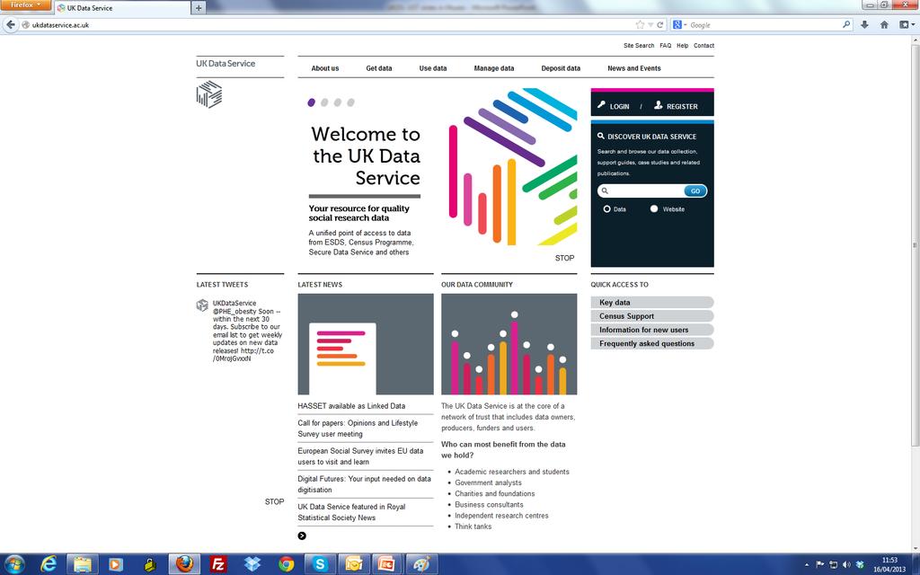
4 The UK Data Service A new service funded by the ESRC, integrating several previous resources A single, comprehensive and integrated point of access to a wide range of social science data Support, training and guidance ukdataservice.ac.uk
5
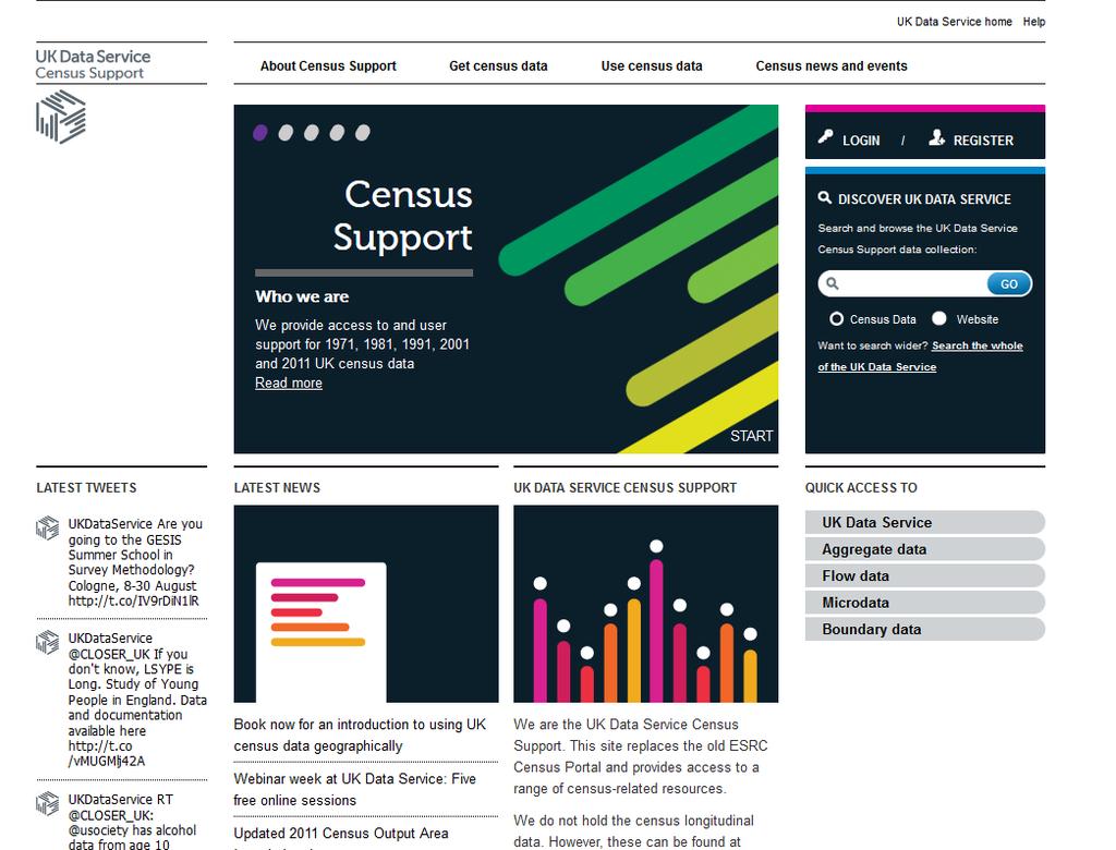
6 UK Data Service Census Support A specialist unit of the UK Data Service Access to, and support for use of data from the last five UK censuses ( ) Bespoke interfaces to make data easy to find, understand and use census.ukdataservice.ac.uk
7
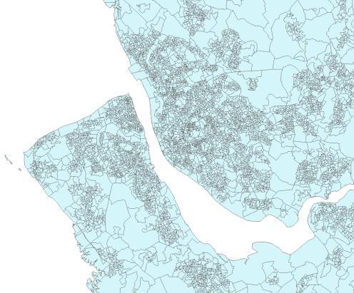
8 UK Censuses Huge questionnaire surveys of the entire UK population Primary evidence for government policy and spending Rich source of secondary socio-economic information Wide range of variables Small geographical scales High quality and consistency Long history Individual-level, aggregate, flow and boundary data outputs
9 UK 2011 Census 27 March 2011 UK census agencies (ONS, NRS, NISRA) New questions and variables Online and postal completion Targeted enumeration Sophisticated quality assurance
 Month/year of arrival into the UK (for people not born in the UK) Intention to stay")
10 New questions National identity Passports held Ability in spoken English Languages other than English used at home Long term health conditions (detailed for Scotland/Northern Ireland) Month/year of arrival into the UK (for people not born in the UK) Intention to stay Second homes
11 Aggregate data Counts of people or households, etc. with particular combinations of characteristics within sets of geographical zones varying from large to small Number of female full-time students resident in the County of Devon? = 20,434
12
13
 : Muslim - Unit :")
14 Example aggregate data Age : 16 to 24 years old - Religion (England and Wales) : Muslim - Unit : People
15 2011 Census geographies Subdivisions of the area of the UK into zones Layers of similar zones called geographies (eg Counties) Nesting geography hierarchies Administrative Statistical Small areas consistent with 2001 Different structures across UK

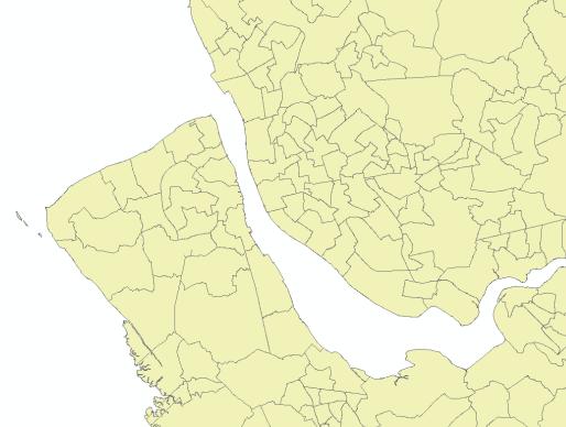
16 2011 Census geographies
17 UK administrative geography relationships

18 UK statistical geography relationships
19 Geography characteristics zone_count mean population stdev/mean United Kingdom 1 63,182,200 - Countries 4 15,795, Regions 9 5,890, Counties 35 1,168, Unitary Authorities , Districts , MSOA , Wards , LSOA , Output Area
20 Geography zone codes GSS codes (Government Statistical Service) Uniquely identify zones 9 characters E First character - country Second and third digits geography entity Final six digits geography zone instance
21 Top ward names
22 Other Geographies Parishes Electoral Health areas Postcodes and Postcode sectors Urban areas and settlements Workplace zones National parks
23 2011 Census aggregate outputs Lengthy consultation process Confidentiality 100 year rule Statistical disclosure control (SDC) measures Trade-off of information detail vs geographical detail Lower information detail for smallest zones Higher information detail for larger zones Examples Single years of age at MSOA Five year groups at OA Open data! Open Government Licence (OGL)
24 2011 Census Aggregate Outputs
25 Lower detail for all geographies zone_count mean population stdev/mean United Kingdom 1 63,182,200 - Countries 4 15,795, Regions 9 5,890, Counties 35 1,168, Unitary Authorities , Districts , MSOA , Wards , LSOA , Output Area
26 Higher detail down to wards zone_count mean population stdev/mean United Kingdom 1 63,182,200 - Countries 4 15,795, Regions 9 5,890, Counties 35 1,168, Unitary Authorities , Districts , MSOA , Wards , LSOA , Output Area


27 Release Timeline Jul-Aug 2012 Oct-Nov 2012 Dec 2012 Jan Feb Mar Apr May Jun Jul Aug Sep Oct From Winter /14
28 Release Timeline Jul-Aug 2012 Oct-Nov 2012 Dec 2012 Jan Feb Mar Apr May Jun Jul Aug Sep Oct From Winter /14
29 InFuse Make census data easier to: Find Understand Use Improvements in Search across entire census datasets Availability of meaning via metadata Consistency of categories and labels Built on comprehensive reprocessing and integration of data and metadata NO TABLES! - cross-search by topic No data fast!
30 Access to InFuse Census version of InFuse recently launched Public access with registration and login All data is open via Open Government Licence UK academics using their usual username and password Others using a UK Data Archive account
31 What s next? Progressive release of UK 2011 outputs Previous censuses (currently in Casweb) Search and comparability across censuses Improvements to interface design and features Access to underlying API for application development Engagement with NSIs Better data from producers Possible access without login
32 census.ukdataservice.ac.uk


33 InFuse Support infuse.mimas.ac.uk census.ukdataservice.ac.uk

34 Digital boundaries and mapping


35 Digital boundary data
36 Geographical Information Systems (GIS) Sophisticated database applications Store spatial entities and relationships Join attribute data to spatial entities (what to where) Perform spatial operations Visualisations Spatial analysis
What are we like? Population characteristics from UK censuses. Justin Hayes & Richard Wiseman UK Data Service Census Support
 What are we like? Population characteristics from UK censuses Justin Hayes & Richard Wiseman UK Data Service Census Support Who are we? Richard Wiseman UK Data Service / Jisc Justin Hayes UK Data Service
A Guide to Census Geography
 Research Briefing 2013-05 July 2013 A Guide to Census Geography Contents 1 About this Briefing... 3 2 Sub Ward Geography... 3 3 The Geographical Hierarchies... 3 4 The Statistical Hierarchy... 4 5 Nesting...
GAMINGRE 8/1/ of 7
 FYE 09/30/92 JULY 92 0.00 254,550.00 0.00 0 0 0 0 0 0 0 0 0 254,550.00 0.00 0.00 0.00 0.00 254,550.00 AUG 10,616,710.31 5,299.95 845,656.83 84,565.68 61,084.86 23,480.82 339,734.73 135,893.89 67,946.95
2011 census geography and beyond: what can we expect? David Martin SLA Conference, 27 October 2008
 2011 census geography and beyond: what can we expect? David Martin SLA Conference, 27 October 2008 Overview A quick history lesson: census 2001-2001 output area design Where have we got to since then?
Millennium Cohort Study:
 Millennium Cohort Study: Geographic Identifiers in MCS June 2009 Jon Johnson Centre for Longitudinal Studies Faculty of Policy and Society Institute of Education, University of London Page 1 Introduction
Understanding China Census Data with GIS By Shuming Bao and Susan Haynie China Data Center, University of Michigan
 Understanding China Census Data with GIS By Shuming Bao and Susan Haynie China Data Center, University of Michigan The Census data for China provides comprehensive demographic and business information
Population health across space & time: geographical harmonisation of the ONS Longitudinal Study for England & Wales
 British Society for Population Studies Annual Conference, York, September 2011 Population health across space & time: geographical harmonisation of the ONS Longitudinal Study for England & Wales Paul Norman
Gridded population. redistribution models and applications. David Martin 20 February 2009
 Gridded population data for the UK redistribution models and applications David Martin 20 February 2009 Overview UK gridded data history (brief!) Small area data availability Grid-based modelling responses
2016 New Ward Boundaries Guidance on calculating statistics for the new 2016 wards
 2016 New Ward Boundaries Page 1 Performance, Information and Intelligence 2016 New Ward Boundaries Guidance on calculating statistics for the new 2016 wards Briefing Note Version 2 - March 2016 2016 New
Exploring Digital Welfare data using GeoTools and Grids
 Exploring Digital Welfare data using GeoTools and Grids Hodkinson, S.N., Turner, A.G.D. School of Geography, University of Leeds June 20, 2014 Summary As part of the Digital Welfare project [1] a Java
Integrating Official Statistics and Geospatial Information NBS Experience
 Integrating Official Statistics and Geospatial Information NBS Experience Presented by Eng. Reda AL Sabbagh Director of IT Dept. Prepared by Eng. Adham Makky GIS Specialist Topics to be covered: Background
2016 New Ward Boundaries Guidance on calculating statistics for the new 2016 wards
 2016 New Ward Boundaries Page 1 Performance, Information and Intelligence 2016 New Ward Boundaries Guidance on calculating statistics for the new 2016 wards Briefing Note February 2016 2016 New Ward Boundaries
Gridded population data for the UK redistribution models and applications
 Gridded population data for the UK redistribution models and applications David Martin 1 1 School of Geography, University of Southampton, Southampton, SO17 1BJ, UK e- mail: D.J.Martin@soton.ac.uk Abstract
Corn Basis Information By Tennessee Crop Reporting District
 UT EXTENSION THE UNIVERSITY OF TENNESSEE INSTITUTE OF AGRICULTURE AE 05-13 Corn Basis Information By Tennessee Crop Reporting District 1994-2003 Delton C. Gerloff, Professor The University of Tennessee
Florida Courts E-Filing Authority Board. Service Desk Report March 2019
 Florida Courts E-Filing Authority Board Service Desk Report March 219 Customer Service Incidents March 219 Status January 219 February 219 March 219 Incidents Received 3,261 3,51 3,118 Incidents Worked
AS Population Change Question spotting
 AS Change Question spotting Changing rate of growth How the rate of growth has changed over the last 100 years Explain the reasons for these changes Describe global or national distribution. Study the
Average 175, , , , , , ,046 YTD Total 1,098,649 1,509,593 1,868,795 1,418, ,169 1,977,225 2,065,321
 AGRICULTURE 01-Agriculture JUL 2,944-4,465 1,783-146 102 AUG 2,753 6,497 5,321 1,233 1,678 744 1,469 SEP - 4,274 4,183 1,596 - - 238 OCT 2,694 - - 1,032 340-276 NOV 1,979-5,822 637 3,221 1,923 1,532 DEC
Average 175, , , , , , ,940 YTD Total 944,460 1,284,944 1,635,177 1,183, ,954 1,744,134 1,565,640
 AGRICULTURE 01-Agriculture JUL 2,944-4,465 1,783-146 102 AUG 2,753 6,497 5,321 1,233 1,678 744 1,469 SEP - 4,274 4,183 1,596 - - 238 OCT 2,694 - - 1,032 340-276 NOV 1,979-5,822 637 3,221 1,923 1,532 DEC
GALLUP NEWS SERVICE JUNE WAVE 1
 GALLUP NEWS SERVICE JUNE WAVE 1 -- FINAL TOPLINE -- Timberline: 937008 IS: 392 Princeton Job #: 15-06-006 Jeff Jones, Lydia Saad June 2-7, 2015 Results are based on telephone interviews conducted June
Spotlight on Population Resources for Geography Teachers. Pat Beeson, Education Services, Australian Bureau of Statistics
 Spotlight on Population Resources for Geography Teachers Pat Beeson, Education Services, Australian Bureau of Statistics Population Population size Distribution Age Structure Ethnic composition Gender
British Household Panel Survey, waves 1-17 ( )
") UK Data Archive Study Number 6032 - British Household Panel Survey, Waves 1-17, 1991-2008: Conditional Access, Rural-Urban s British Household Panel Survey, waves 1-17 (1991-2008) User Documentation: Rural-Urban
UK Data Archive Study Number 6032 - British Household Panel Survey, Waves 1-17, 1991-2008: Conditional Access, Rural-Urban s British Household Panel Survey, waves 1-17 (1991-2008) User Documentation: Rural-Urban
Public Disclosure Copy
 Public Disclosure Authorized EAST ASIA AND PACIFIC Myanmar Energy & Extractives Global Practice IBRD/IDA Investment Project Financing FY 2016 Seq No: 5 ARCHIVED on 18-Jan-2018 ISR29499 Implementing Agencies:
Dates and Prices ICAEW - Manchester In Centre Programme Prices
 Dates and Prices ICAEW - Manchester - 2019 In Centre Programme Prices Certificate Level GBP ( ) Intensive Accounting 690 Assurance 615 Law 615 Business, Technology and Finance 615 Mangement Information
geographic patterns and processes are captured and represented using computer technologies
 Proposed Certificate in Geographic Information Science Department of Geographical and Sustainability Sciences Submitted: November 9, 2016 Geographic information systems (GIS) capture the complex spatial
Hennig, B.D. and Dorling, D. (2014) Mapping Inequalities in London, Bulletin of the Society of Cartographers, 47, 1&2,
 Mapping Inequalities in London, Bulletin of the Society of Cartographers, 47, 1&2,") Hennig, B.D. and Dorling, D. (2014) Mapping Inequalities in London, Bulletin of the Society of Cartographers, 47, 1&2, 21-28. Pre- publication draft without figures Mapping London using cartograms The
Hennig, B.D. and Dorling, D. (2014) Mapping Inequalities in London, Bulletin of the Society of Cartographers, 47, 1&2, 21-28. Pre- publication draft without figures Mapping London using cartograms The
Development of Global Map for GEOSS SBAs US-09-03a
 Development of Global Map for GEOSS SBAs US-09-03a UIC User Engagement Session 2 November, 2010 Yoshikazu FUKUSHIMA Secretariat General of International Steering Committee for Global Mapping Geospatial
The World Bank Third National Urban Water Sector Reform Project (P123513)
") Public Disclosure Authorized AFRICA Nigeria Water Global Practice IBRD/IDA Investment Project Financing FY 2014 Seq No: 6 ARCHIVED on 27-Jun-2017 ISR28879 Implementing Agencies: Federal Republic of Nigeria,
Public Disclosure Authorized AFRICA Nigeria Water Global Practice IBRD/IDA Investment Project Financing FY 2014 Seq No: 6 ARCHIVED on 27-Jun-2017 ISR28879 Implementing Agencies: Federal Republic of Nigeria,
NHS Postcode Directory User Guide
 NHS Postcode Directory User Guide Edition: November 2017 Editor: ONS Geography Office for National Statistics November 2017 A National Statistics Publication National Statistics are produced to high professional
Welcome. C o n n e c t i n g
 Welcome C o n n e c t i n g YOU D i s c i p l i n e s Why is This Meeting......So Important Now? OUR WORLD Is Increasingly Challenged The Evidence Is Clear We Need Better Understanding and More Collaboration
USING CENSUS OUTPUT AREAS FOR MARKET RESEARCH SAMPLING
 USING CENSUS OUTPUT AREAS FOR MARKET RESEARCH SAMPLING Martin van Staveren Small Area Geography Planning for the Future MRS CGG Seminar, 5 th February 2007 INITIAL USE OF GEODEMOGRAPHICS BMRB was first
Population 24/7 Download: User Guide. Purpose
 Population 24/7 Download: User Guide Purpose The Population 24/7 Download application is designed to enable a user to navigate around a map of England and Wales; select an area of interest represented
Understanding the 2011 Census Geographies December 2012
 Introduction Understanding the 2011 Census Geographies December 2012 10 21 Other useful documents: The release of the 2011 Census results has brought with it some changes to the geographies at which we
Public Disclosure Copy. Implementation Status & Results Report REVITALIZING EDUCATION DEVELOPMENT IN SIERRA LEONE (P133070)
") Public Disclosure Authorized AFRICA Sierra Leone Education Global Practice Recipient Executed Activities Investment Project Financing FY 2015 Seq No: 4 ARCHIVED on 27-Jun-2016 ISR24052 Implementing Agencies:
Public Disclosure Authorized AFRICA Sierra Leone Education Global Practice Recipient Executed Activities Investment Project Financing FY 2015 Seq No: 4 ARCHIVED on 27-Jun-2016 ISR24052 Implementing Agencies:
Brazil Paper for the. Second Preparatory Meeting of the Proposed United Nations Committee of Experts on Global Geographic Information Management
 Brazil Paper for the Second Preparatory Meeting of the Proposed United Nations Committee of Experts on Global Geographic Information Management on Data Integration Introduction The quick development of
Digitization in a Census
 Topics Connectivity of Geographic Data Sketch Maps Data Organization and Geodatabases Managing a Digitization Project Quality and Control Topology Metadata 1 Topics (continued) Interactive Selection Snapping
Understanding Your Community A Guide to Data
 Understanding Your Community A Guide to Data Alex Lea September 2013 Research and Insight Team LeicestershireCounty Council Understanding Geographies Important to understand the various geographies that
The World Bank Georgia National Innovation Ecosystem (GENIE) Project (P152441)
 Project (P152441)") Public Disclosure Authorized EUROPE AND CENTRAL ASIA Georgia Trade & Competitiveness Global Practice IBRD/IDA Investment Project Financing FY 2016 Seq No: 1 ARCHIVED on 28-Jun-2016 ISR24271 Implementing
Public Disclosure Authorized EUROPE AND CENTRAL ASIA Georgia Trade & Competitiveness Global Practice IBRD/IDA Investment Project Financing FY 2016 Seq No: 1 ARCHIVED on 28-Jun-2016 ISR24271 Implementing
The World Bank Indonesia National Slum Upgrading Project (P154782)
") Public Disclosure Authorized EAST ASIA AND PACIFIC Indonesia Social, Urban, Rural and Resilience Global Practice Global Practice IBRD/IDA Investment Project Financing FY 2017 Seq No: 4 ARCHIVED on 04-Apr-2018
Public Disclosure Authorized EAST ASIA AND PACIFIC Indonesia Social, Urban, Rural and Resilience Global Practice Global Practice IBRD/IDA Investment Project Financing FY 2017 Seq No: 4 ARCHIVED on 04-Apr-2018
Please see the attached document in relation to your Freedom of Information request.
 Our ref: 375/16 Please send me: all statistics for the last 3 years and the information to be broken down into years and months. I require national and regional statistics (UK, West Yorkshire, Leeds).
Introducing the WISERD Geoportal. WISERD DATA TEAM Dr Robert Berry & Dr Richard Fry, University of Glamorgan Dr Scott Orford, Cardiff University
 Introducing the WISERD Geoportal WISERD DATA TEAM Dr Robert Berry & Dr Richard Fry, University of Glamorgan Dr Scott Orford, Cardiff University WISERD What is WISERD? Wales Institute of Social and Economic
OnTheMap for Emergency Management
 OnTheMap for Emergency Management Robert Pitts Geographer/Project Manager Longitudinal Employer Household Dynamics (LEHD) Center for Economic Studies U.S. Census Bureau Jody Hoon-Star Geographer/Application
Merging statistics and geospatial information
 Merging statistics and geospatial information Demography / Commuting / Spatial planning / Registers Mirosław Migacz Chief GIS Specialist Janusz Dygaszewicz Director Central Statistical Office of Poland
Public Disclosure Copy
 Public Disclosure Authorized AFRICA Ghana Transport & Digital Development Global Practice IBRD/IDA Investment Project Financing FY 2014 Seq No: 8 ARCHIVED on 24-Feb-2018 ISR31557 Implementing Agencies:
Mapping the Route Identifying and Consulting with HS2 s Impacted Populations
 Tuesday 6 December 2016 Mapping the Route Identifying and Consulting with HS2 s Impacted Populations Carry Stephenson, Evelyn Robertson SYSTRA Michael Flynn HS2 Summary Study Context and Objectives Methodology
Public Disclosure Copy
 Public Disclosure Authorized AFRICA Mali Global Practice IBRD/IDA Specific Investment Loan FY 2009 Seq No: 10 ARCHIVED on 29-Jun-2015 ISR20110 Implementing Agencies: Eenrgie du Mali (EDM-SA) Public Disclosure
Challenges in Geocoding Socially-Generated Data
 Challenges in Geocoding Socially-Generated Data Jonny Huck (2 nd year part-time PhD student) Duncan Whyatt Paul Coulton Lancaster Environment Centre School of Computing and Communications Royal Wedding
International Court of Justice World Trade Organization Migration and its affects How & why people change the environment
 Social Issues Unit 2 Population Grade 9 Time for Completion: 12 class period State Standard: The student uses a working knowledge and understanding of the spatial organization of Earth s surface and relationships
An Internet-Based Integrated Resource Management System (IRMS)
") An Internet-Based Integrated Resource Management System (IRMS) Third Quarter Report, Year II 4/1/2000 6/30/2000 Prepared for Missouri Department of Natural Resources Missouri Department of Conservation
An Internet-Based Integrated Resource Management System (IRMS) Third Quarter Report, Year II 4/1/2000 6/30/2000 Prepared for Missouri Department of Natural Resources Missouri Department of Conservation
REPORT ON LABOUR FORECASTING FOR CONSTRUCTION
 REPORT ON LABOUR FORECASTING FOR CONSTRUCTION For: Project: XYZ Local Authority New Sample Project Contact us: Construction Skills & Whole Life Consultants Limited Dundee University Incubator James Lindsay
The World Bank Community Development Program Support Project-Phase III (P144637)
") Public Disclosure Authorized AFRICA Cameroon Social, Urban, Rural and Resilience Global Practice Global Practice IBRD/IDA Investment Project Financing FY 2016 Seq No: 5 ARCHIVED on 21-Dec-2017 ISR30226
Public Disclosure Authorized AFRICA Cameroon Social, Urban, Rural and Resilience Global Practice Global Practice IBRD/IDA Investment Project Financing FY 2016 Seq No: 5 ARCHIVED on 21-Dec-2017 ISR30226
Technical Documentation Demostats april 2018
 Technical Documentation Demostats 2018 april 2018 what it is DemoStats is a database of estimates and projections for a comprehensive set of demographic and socioeconomic attributes about the Canadian
Census GIS and beyond: a journey in space and time
 Census GIS and beyond: a journey in space and time David Martin, University of Southampton AGI Education Lecture 2011 University College London 2 Overview Two timelines Census GIS: the historical view
putting communities in control of their neighbourhood plan using new technologies
 putting communities in control of their neighbourhood plan using new technologies Richard Kingston Senior Lecturer in Urban Planning & Smart Cities Head of Planning & Environmental Management University
GIS Visualization: A Library s Pursuit Towards Creative and Innovative Research
 GIS Visualization: A Library s Pursuit Towards Creative and Innovative Research Justin B. Sorensen J. Willard Marriott Library University of Utah justin.sorensen@utah.edu Abstract As emerging technologies
Geographical Inequalities and Population Change in Britain,
 Geographical Inequalities and Population Change in Britain, 1971-2011 Chris Lloyd, Nick Bearman, Gemma Catney Centre for Spatial Demographics Research, University of Liverpool, UK Email: c.d.lloyd@liverpool.ac.uk
The World Bank OECS Regional Tourism Competitiveness (P152117)
") Public Disclosure Authorized LATIN AMERICA AND CARIBBEAN OECS Countries Finance, Competitiveness and Innovation Global Practice IBRD/IDA Investment Project Financing FY 2017 Seq No: 2 ARCHIVED on 28-Jan-2018
Public Disclosure Authorized LATIN AMERICA AND CARIBBEAN OECS Countries Finance, Competitiveness and Innovation Global Practice IBRD/IDA Investment Project Financing FY 2017 Seq No: 2 ARCHIVED on 28-Jan-2018
LEO Catchment Profile (LCP) Key Data for Enterprise Strategy
 Key Data for Enterprise Strategy") Laois...Portarlington LEO Catchment Profile (LCP) Key Data for Enterprise Strategy Laois Local Enterprise Office Address: Business Support Unit, County Hall, Portlaoise, County Laois Web: https://www.localenterprise.ie/laois/
Laois...Portarlington LEO Catchment Profile (LCP) Key Data for Enterprise Strategy Laois Local Enterprise Office Address: Business Support Unit, County Hall, Portlaoise, County Laois Web: https://www.localenterprise.ie/laois/
Welcome Survey getting to know you Collect & log Supplies received Classroom Rules Curriculum overview. 1 : Aug 810. (3 days) 2nd: Aug (5 days)
 2nd: Aug (5 days)") 1st Quarter (41Days) st 1 : Aug 810 (3 days) 2nd: Aug 13-17 Reporting Categories (TEKS SEs) Skill Create and write a postcard about your favorite community activity Review 2nd Grade Vocabulary Chapter
1st Quarter (41Days) st 1 : Aug 810 (3 days) 2nd: Aug 13-17 Reporting Categories (TEKS SEs) Skill Create and write a postcard about your favorite community activity Review 2nd Grade Vocabulary Chapter
The Added Value of Geospatial Data in a Statistical Office. Pedro Diaz Munoz Director Sectoral and Regional Statistics EUROSTAT European Commission
 The Added Value of Geospatial Data in a Statistical Office Pedro Diaz Munoz Director Sectoral and Regional Statistics EUROSTAT European Commission Why integrate Responsibility of all the information we
Geographic Products and Data. Improvements in Spatial Accuracy and Accessing Data
 Geographic Products and Data Improvements in Spatial Accuracy and Accessing Data How it Began TIGER was internally developed to support the 1990 Decennial Census operations Used data sources such as USGS
Second High Level Forum on GGIM Seminar on Regional Cooperation in Geospatial Information Management Doha, Qatar, 7 February 2013
 Second High Level Forum on GGIM Seminar on Regional Cooperation in Geospatial Information Management Doha, Qatar, 7 February 2013 Overview on Geospatial Activities in Egypt BY : Eng.Nahla Seddik Mohamed
GEOGRAPHIC INFORMATION SYSTEMS Session 8
 GEOGRAPHIC INFORMATION SYSTEMS Session 8 Introduction Geography underpins all activities associated with a census Census geography is essential to plan and manage fieldwork as well as to report results
Assessing the impact of seasonal population fluctuation on regional flood risk management
 Assessing the impact of seasonal population fluctuation on regional flood risk management Alan Smith *1, Andy Newing 2, Niall Quinn 3, David Martin 1 and Samantha Cockings 1 1 Geography and Environment,
BRADSHAW'S RAILWAY GUIDE : accessible copies
 BRADSHAW'S RAILWAY GUIDE : accessible copies Y = copy held; YS = copy held with supplement; R = reprint held; I = incomplete copy held; F = fragile copy (not available for general public - access limited);
SOUTH COAST COASTAL RECREATION METHODS
 SOUTH COAST COASTAL RECREATION METHODS A customized, web-based survey instrument, which utilizes Point 97 s Viewpoint survey and mapping technology, was used to collect spatially explicit data on coastal
The World Bank. Key Dates. Project Development Objectives. Components. Implementation Status & Results Report. Key Project Dates
 Public Disclosure Copy AFRICA Africa Environment & Natural Resources Global Practice IBRD/IDA Adaptable Program Loan FY 2009 Seq No: 11 ARCHIVED on 18-Dec-2015 ISR21679 Implementing Agencies: Ministry
Geographic Boundaries of Population Census of Japan 1
 UNITED NATIONS SECRETARIAT ESA/STAT/AC.279/P20 Department of Economic and Social Affairs October 2013 Statistics Division English only United Nations Expert Group on the Integration of Statistical and
Open Geospatial Data Science for Modelling Commuter Movements and Demographics
 Open Geospatial Data Science for Modelling Commuter Movements and Demographics Lorraine Barry Centre for GIS and Geomatics, School of Natural and Built Environment, Queen s University Belfast l.barry@qub.ac.uk
CES Seminar 2016: Geospatial information services based on official statistics Key issues from the session II papers
 Norbert Rainer 64 th plenary session of the Conference of European Statisticians 28 April 2016, Paris CES Seminar 2016: Geospatial information services based on official statistics Key issues from the
HertfordshireCC GIS Standards (draft) Contents
 Contents") Standards for Geographic Information Systems Contents Requirements for the procurement of systems with mapping/gis functionality...2 Background...2 System Requirements...2 HCC Corporate Standard for Spatial
Standards for Geographic Information Systems Contents Requirements for the procurement of systems with mapping/gis functionality...2 Background...2 System Requirements...2 HCC Corporate Standard for Spatial
Implementation Status & Results Congo, Democratic Republic of Democratic Republic of Congo Emergency Social Action Project (P086874)
") Public Disclosure Authorized Public Disclosure Authorized The World Bank Implementation Status & Results Congo, Democratic Republic of Democratic Republic of Congo Emergency Social Action Project (P086874)
Public Disclosure Authorized Public Disclosure Authorized The World Bank Implementation Status & Results Congo, Democratic Republic of Democratic Republic of Congo Emergency Social Action Project (P086874)
WHEN IS IT EVER GOING TO RAIN? Table of Average Annual Rainfall and Rainfall For Selected Arizona Cities
 WHEN IS IT EVER GOING TO RAIN? Table of Average Annual Rainfall and 2001-2002 Rainfall For Selected Arizona Cities Phoenix Tucson Flagstaff Avg. 2001-2002 Avg. 2001-2002 Avg. 2001-2002 October 0.7 0.0
Public Disclosure Copy. Implementation Status & Results Report Cambodia Global Partnership for Education Second Education Support Project (P144715)
") Public Disclosure Authorized EAST ASIA AND PACIFIC Cambodia Education Global Practice Recipient Executed Activities Investment Project Financing FY 2014 Seq No: 3 ARCHIVED on 30-May-2015 ISR18803 Implementing
Public Disclosure Authorized EAST ASIA AND PACIFIC Cambodia Education Global Practice Recipient Executed Activities Investment Project Financing FY 2014 Seq No: 3 ARCHIVED on 30-May-2015 ISR18803 Implementing
ENGINE SERIAL NUMBERS
 ENGINE SERIAL NUMBERS The engine number was also the serial number of the car. Engines were numbered when they were completed, and for the most part went into a chassis within a day or so. However, some
GRADE 8 LEAP SOCIAL STUDIES ASSESSMENT STRUCTURE. Grade 8 Social Studies Assessment Structure
 Grade 8 Social Studies Assessment Structure 1 In 2013-2014, the grade 8 LEAP test continues to assess Louisiana s social studies benchmarks. The design of the multiple-choice sessions of the test remains
Tuesday 6:30 9:30 (First/Last classes) Home Phone: SYLLABUS. I. Focus of Course
 Home Phone: SYLLABUS. I. Focus of Course") PSC 560-G Stephen Sherman GIS in Public Administration Political Science Dept. Summer, First Session, 2014 Work Phone: 373-4503 (Tue & Thur) Tuesday 6:30 9:30 (First/Last classes) Home Phone: 375-5328
PSC 560-G Stephen Sherman GIS in Public Administration Political Science Dept. Summer, First Session, 2014 Work Phone: 373-4503 (Tue & Thur) Tuesday 6:30 9:30 (First/Last classes) Home Phone: 375-5328
Implementation Status & Results Central African Republic CAR - Emergency Urban Infrastructure Rehabilitation & Maintenance (P104595)
") Public Disclosure Authorized Public Disclosure Authorized The World Bank Implementation Status & Results Central African Republic CAR - Emergency Urban Infrastructure Rehabilitation & Maintenance (P104595)
Public Disclosure Authorized Public Disclosure Authorized The World Bank Implementation Status & Results Central African Republic CAR - Emergency Urban Infrastructure Rehabilitation & Maintenance (P104595)
The World Bank Local and Regional Competitiveness Project (P154263)
") Public Disclosure Authorized EUROPE AND CENTRAL ASIA Macedonia, former Yugoslav Republic of Finance, Competitiveness and Innovation Global Practice Recipient Executed Activities Investment Project Financing
Public Disclosure Authorized EUROPE AND CENTRAL ASIA Macedonia, former Yugoslav Republic of Finance, Competitiveness and Innovation Global Practice Recipient Executed Activities Investment Project Financing
Egypt Public DSS. the right of access to information. Mohamed Ramadan, Ph.D. [R&D Advisor to the president of CAPMAS]
![Egypt Public DSS. the right of access to information. Mohamed Ramadan, Ph.D. [R&D Advisor to the president of CAPMAS]](/thumbs/89/98483713.jpg "Egypt Public DSS. the right of access to information. Mohamed Ramadan, Ph.D. [R&D Advisor to the president of CAPMAS]") Egypt Public DSS ì the right of access to information Central Agency for Public Mobilization and Statistics Arab Republic of Egypt Mohamed Ramadan, Ph.D. [R&D Advisor to the president of CAPMAS] Egypt
Egypt Public DSS ì the right of access to information Central Agency for Public Mobilization and Statistics Arab Republic of Egypt Mohamed Ramadan, Ph.D. [R&D Advisor to the president of CAPMAS] Egypt
DATA DISAGGREGATION BY GEOGRAPHIC
 PROGRAM CYCLE ADS 201 Additional Help DATA DISAGGREGATION BY GEOGRAPHIC LOCATION Introduction This document provides supplemental guidance to ADS 201.3.5.7.G Indicator Disaggregation, and discusses concepts
Applying Health Outcome Data to Improve Health Equity
 Applying Health Outcome Data to Improve Health Equity Devon Williford, MPH, Health GIS Specialist Lorraine Dixon-Jones, Policy Analyst CDPHE Health Equity and Environmental Justice Collaborative Mile High
Economic and Social Council
 United Nations Economic and Social Council 28 December 2000 Original: English E/CN.3/2001/2 Statistical Commission Thirty-second session 6-9 March 2001 Item 3 (a) of the provisional agenda * Demographic
The World Bank. Key Dates. Project Development Objectives. Components. Public Disclosure Authorized. Implementation Status & Results Report
 Public Disclosure Authorized AFRICA Uganda Energy & Extractives Global Practice IBRD/IDA Adaptable Program Loan FY 2009 Seq No: 11 ARCHIVED on 26-Oct-2015 ISR21123 Implementing Agencies: Public Disclosure
Globally Estimating the Population Characteristics of Small Geographic Areas. Tom Fitzwater
 Globally Estimating the Population Characteristics of Small Geographic Areas Tom Fitzwater U.S. Census Bureau Population Division What we know 2 Where do people live? Difficult to measure and quantify.
Mapping UK. David Martin, University of Southampton. Open Data Workshop, Nottingham, 21 June 2011
 Mapping UK population over time David Martin, University of Southampton Open Data Workshop, Nottingham, 21 June 2011 Presentation overview Small area spatial population distributions The time dimension
Regionalizing and Understanding Commuter Flows: An Open Source Geospatial Approach
 Regionalizing and Understanding Commuter Flows: An Open Source Geospatial Approach Lorraine Barry School of Natural and Built Environment, Queen's University Belfast l.barry@qub.ac.uk January 2017 Summary
2011 Built-up Areas - Methodology and Guidance
 2011 Built-up Areas - Methodology and Guidance June 2013 Version: 2013 v1 Office for National Statistics 2013 Contents 1. Introduction... 3 2. Methodology... 3 2.1 Identifying built-up areas for the 2011
Lessons Learned from the production of Gridded Population of the World Version 4 (GPW4) Columbia University, CIESIN, USA EFGS October 2014
 Columbia University, CIESIN, USA EFGS October 2014") Lessons Learned from the production of Gridded Population of the World Version 4 (GPW4) Columbia University, CIESIN, USA EFGS October 2014 Gridded Population of the World Gridded (raster) data product
Lessons Learned from the production of Gridded Population of the World Version 4 (GPW4) Columbia University, CIESIN, USA EFGS October 2014 Gridded Population of the World Gridded (raster) data product
Application Issues in GIS: the UCL Centre for Advanced Spatial Analysis. Paul Longley UCL
 Application Issues in GIS: the UCL Centre for Advanced Spatial Analysis Paul Longley UCL GIS: inclusive, shared understanding Geodemographics as a focus of interest Profiling public goods and services
Population 24/7. David Martin, University of Southampton
 Population 24/7 David Martin, University of Southampton Demographics User Group 18 March 2011 Presentation overview Acknowledgement: Samantha Cockings and Samuel Leung; ESRC award RES-062-23-181 Small
INTRODUCTION. In March 1998, the tender for project CT.98.EP.04 was awarded to the Department of Medicines Management, Keele University, UK.
 INTRODUCTION In many areas of Europe patterns of drug use are changing. The mechanisms of diffusion are diverse: introduction of new practices by new users, tourism and migration, cross-border contact,
ACCA Interactive Timetable
 ACCA Interactive Timetable 2018 Professional Version 4.1 Information last updated 1st May 2018 Please note: Information and dates in this timetable are subject to change. A better way of learning that
The World Bank. Key Dates. Project Development Objectives. Components. Public Disclosure Authorized. Implementation Status & Results Report
 Public Disclosure Authorized AFRICA Uganda Energy and Mining Global Practice IBRD/IDA Adaptable Program Loan FY 2009 Seq No: 10 ARCHIVED on 10-Mar-2015 ISR16830 Implementing Agencies: Public Disclosure
Public Disclosure Copy
 Public Disclosure Authorized SOUTH ASIA Nepal Agriculture Global Practice IBRD/IDA Investment Project Financing FY 2008 Seq No: 22 ARCHIVED on 27-Apr-2018 ISR32244 Implementing Agencies: Poverty Alleviation
Public Disclosure Copy
 Public Disclosure Authorized AFRICA Mali Energy & Extractives Global Practice IBRD/IDA Specific Investment Loan FY 2009 Seq No: 11 ARCHIVED on 10-Feb-2016 ISR22432 Implementing Agencies: Eenrgie du Mali
Cook Islands Household Expenditure Survey
 National Data Archive Cook Islands - 2005-06 Household Expenditure Survey Cook Islands Statistics Office - Ministry of Finance and Economic Management Report generated on: August 19, 2013 Visit our data
The World Bank Decentralized Community Driven Services Project (P117764)
") Public Disclosure Authorized AFRICA Benin Social Protection Global Practice IBRD/IDA Adaptable Program Loan FY 2012 Seq No: 6 ARCHIVED on 12-Jun-2015 ISR19748 Implementing Agencies: Public Disclosure Authorized
Public Disclosure Authorized AFRICA Benin Social Protection Global Practice IBRD/IDA Adaptable Program Loan FY 2012 Seq No: 6 ARCHIVED on 12-Jun-2015 ISR19748 Implementing Agencies: Public Disclosure Authorized
CIRCULATION STATISTICS BY JANUARY 2017
 CIRCULATION STATISTICS BY COLLECTION JANUARY 2017 28% 3% 26% 3% ADULT AV CHILDREN'S AV ADULT CHILDREN'S 40% YA Circulation Statistics Digital Collections OVERDRIVE New Patrons 2015-2016 73 69 51 37 43
Public Disclosure Copy
 Public Disclosure Authorized SOUTH ASIA Nepal Agriculture Global Practice IBRD/IDA Investment Project Financing FY 2008 Seq No: 23 ARCHIVED on 26-Jul-2018 ISR33099 Implementing Agencies: Poverty Alleviation
The World Bank Local and Regional Competitiveness Project (P154263)
") Public Disclosure Authorized EUROPE AND CENTRAL ASIA Macedonia, former Yugoslav Republic of Trade & Competitiveness Global Practice Recipient Executed Activities Investment Project Financing FY 2016 Seq
Public Disclosure Authorized EUROPE AND CENTRAL ASIA Macedonia, former Yugoslav Republic of Trade & Competitiveness Global Practice Recipient Executed Activities Investment Project Financing FY 2016 Seq