CE 59700: Digital Photogrammetric Systems
|
|
|
- Dulcie Carroll
- 6 years ago
- Views:
Transcription
1 CE 59700: Digital Photogrammetric Systems Fall
2 Instructor: Contact Information Office: HAMP 4108 Tel: (765) Lectures (HAMP 2102): Monday, Wednesday & Friday (12:30 p.m. 1:20 p.m.) Office Hours: Monday & Wednesday(1:30 p.m. 2:30 p.m.) Course webpage: 2
3 Course Objectives Gain familiarity with the basic principles of photogrammetric operations Emphasis: Definition and possible applications, Electromagnetic radiation, Optical principles, film development, and digital cameras, Vertical photography, Image coordinate measurement and reduction, Mathematical and geometric principles, Theory and procedures of photogrammetric orientation, Photogrammetric geo-referencing, Digital image matching, and Digital orthophoto generation. 3
4 Course Notes and Textbooks Material presented in class, as well as supplemental notes, will be available through the course webpage. Contains all the required material for the assignments and exams. Supplementary References (optional): Mikhail, E., Bethel, J., McGlone, J., Introduction to Modern Photogrammetry. John Wiley & Sons, Inc. McGlone, C, Mikhail, E., Bethel, J., 2012, Manual of Photogrammetry, Sixth Edition, American Society for Photogrammetry and Remote Sensing. Wolf, P., Dewitt, B., Elements of Photogrammetry with Applications in GIS. McGraw-Hill. Krauss, K., Photogrammetry, Volume 1: Fundamentals and Standard Processes. Dummler/Bonn. Krauss, K., Photogrammetry, Volume 2: Advanced Methods and Applications. Dummler/Bonn. 4
5 Assignments: Grading Scheme (25% of Total Grade) Assignments will be due within roughly two weeks after they are handed out. Grades for late assignments will be reduced by 10% per day for each day overdue. Some assignments will require computer programming (Mat lab, C, or C++) and submissions must include a softcopy of the source code (well documented) and the program output. (25% of Total Grade) (50% of Total Grade) Mid-Term Exam: Final Exam: Exams are closed book/notes Bonus points for class participation 5
6 Syllabus (Course Content) Chapter 1: Introduction Definition, concepts, and applications Chapter 2: Electro-Magnetic Radiation Energy sources and radiation principles Chapter 3: Basic Optics Principles of geometric optics and important optical conditions for photogrammetric applications Chapter 4: Film Development & Digital Cameras Development of B/W and color films Digital cameras (frame and line cameras) Chapter 5: Vertical Photography Basic definitions, image scale, image to ground coordinate transformation, relief displacement 6
7 Syllabus (Course Content) Chapter 6: Image Coordinate Measurements Measurements and necessary reductions of image coordinates Chapter 7: The Mathematical Model Rotation matrices, the collinearity equations (concept and derivation) Projective transformation, DLT, and RFM Chapter 8: Theory of Orientation Interior, relative, and absolute orientation Chapter 9: Photogrammetric Bundle Adjustment Sequential reconstruction of the normal equation matrix and derivation of the unknown parameters Chapter 10: Photogrammetric Geo-Referencing Integrated sensor orientation and direct geo-referencing 7
8 Syllabus (Course Content) Chapter 11: Digital Image Matching Identification of conjugate points in overlapping images (cross correlation and least-squares matching) Chapter 12: Digital Orthophoto Generation Polynomial rectification, differential rectification, and true orthophotos 8
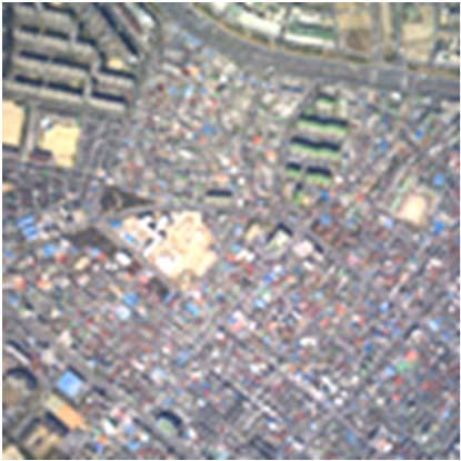
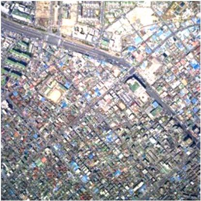
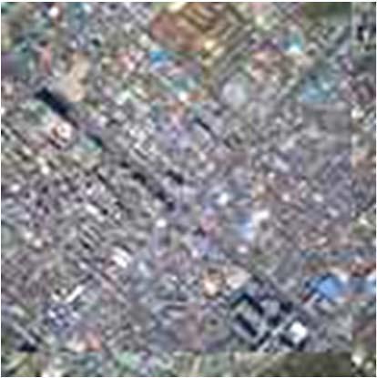
9 Definition & Objectives Applications: Ch 1: Introduction Reconnaissance Production of Topographic Maps DEM Generation Close Range Photogrammetry: Precision survey of buildings and engineering objects Documentation of historical buildings Medical applications Mapping of roads and nearby objects (mobile mapping systems) 9


10 Ch 1: Introduction Art and science of tool development for automatic generation of spatial and descriptive information from multi-sensory data and/or systems 10
11 Ch 2: Electro-Magnetic Radiation Bands of the electro-magnetic radiation: Radio waves Microwaves Infrared radiation Visible light Ultraviolet rays X-rays Gamma rays Properties of the electro-magnetic radiation Passive versus active remote sensing systems 11

12 Ch 2: Electro-Magnetic Radiation 12
13 Active Versus Passive Sensors 13
14 Ch 3: Basic Optics Basic camera components Reflection and refraction Lenses: Definitions Lens equation, aberrations, and distortions Diffraction Resolving power of optical systems Depth of focus and depth of field Motion blur 14
15 Ch 3: Basic Optics 15
16 Ch 4: Film Development & Digital Cameras Photographic film components Processing of Black and White (B/W) film Negative film & inverse film Nature of color Processing of color film Negative film & inverse film Digital cameras Frame cameras Line cameras (push-broom, three-line, and panoramic scanners) 16

17 Ch 4: Film Development & Digital Cameras 17


18 Ch 4: Analog Cameras Negative Film Positive Film 18

19 Frame Camera: Scene Acquisition 19
20 Line Camera: Scene Acquisition 1D Images Different PC Image # Scene 20
21 Ch 5: Vertical Photography Image versus map characteristics Vertical photography: definitions and characteristics Image scale Mathematical relationship between corresponding image and ground coordinates Relief displacements 21

22 Ch 5: Vertical Photography 22
23 Ground Coordinates from Image Coordinates a b c Negative plane f f y c b Perspective center x a Positive diapositive contact print Flying height (H) Y X p A C Ground level B 23
24 Ch 6: Image Coordinate Measurements Image coordinate measurements in analog, analytical, and digital environments Comparators: mono and stereo-comparators Comparator to image coordinate transformations Reduction/refinement of image coordinate measurements: Radial and de-centering lens distortions Atmospheric refraction Earth curvature 24

25 Ch 6: Image Coordinate Measurements y x y x 25
26 Ch7: Mathematical Model Objectives: Derive the general mathematical relationship between corresponding image and object space coordinates Projection alternatives Rotation matrices (2-D and 3-D) Derivations and characteristics Collinearity equations Concept and derivation Projective transformation, DLT, and RFM Least-squares adjustment in photogrammetry 26

27 Ch7: Mathematical Model

28 Ch7: Mathematical Model 28
29 Ch 8: Theory of Orientation Objective: Transform centrally projected images into a three-dimensional model which we can use to plot an orthogonal map Interior orientation Exterior orientation: Relative orientation X versus y-parallax Absolute orientation Aerial Triangulation: Strip and block triangulation 29
30 Ch 8: Theory of Orientation 30
31 Ch 9: Bundle Block Adjustment Objective: Mathematical manipulation of the observation equations to speed up the Formation of the normal equation matrix, and Derivation of the unknown parameters Special cases: Single photo resection, Spatial intersection, Relative orientation, and Stereo-pair orientation 31


32 Ch 9: Bundle Block Adjustment 2 cameras 4 images 16 points All the points appear in all the images. Two images were captured by each camera. 32
33 Ch 9: Bundle Block Adjustment N C 33
34 Ch 10: Photogrammetric Geo-Referencing Objective: Define the position and orientation of the different images at the moment of exposure Exterior Orientation Parameters (EOP) Geo-referencing alternatives: Indirect geo-referencing, Integrated Sensor Orientation (ISO), and Direct geo-referencing 34
35 Ch 10: Photogrammetric Geo-Referencing R m c (t) c-frame r m (t) c m-frame 35

36 Indirect Geo-Referencing Ground Control Points Tie Points 36

37 Indirect Geo-Referencing Signalized Targets 37

38 Indirect Geo-Referencing Natural Targets 38
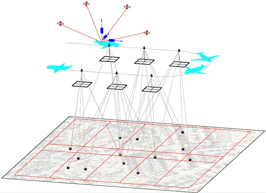
39 Direct Geo-Referencing 39
40 Direct Geo-Referencing IMU b-frame GPS antenna R m b (t) b r c b R c r m (t) b R m c c-frame (t) r m c (t ) m-frame 40


41 Direct Geo-Referencing: Airborne System GPS Antenna INS PC Two Base Stations Camera GPS Receiver 41

42 Direct Geo-Referencing: Land-Based System Digital camera GPS antenna INS 42

43 Direct Geo-Referencing: Land-Based System 43
44 Ch 11: Digital Image Matching Objective: Automated identification of conjugate points in overlapping images Terminology Issues affecting the complexity of the matching problem Area-based matching: Cross correlation, and Least-squares matching Image resampling according to epipolar geometry 44

45 Image Matching 45
46 Image Matching 46
47 Image Matching Template Matching Window Search Window 47
48 Original Images Conjugate points do not have the same y-coordinates. 48


49 Normalized Images Conjugate points have the same y-coordinates. 49
 Object Point (A)")


50 3D Reconstruction Conjugate Points a a Camera Calibration (IOP) Object Point (A) Camera Geo-referencing (EOP) The interior orientation parameters of the involved cameras have to be known. The position and the orientation of the camera stations have to be known. 50
51 Ch 12: Digital Orthophoto Generation Objective: Manipulate a perspective image to remove the sensor tilt and terrain relief effects Image resampling: Interpolation of intensity values Image transformation: Direct and indirect transformation Image Rectification: Polynomial rectification, Differential rectification, and True orthophoto generation 51
52 Perspective Image 52
53 True Orthophoto 53
54 CE 59700: Roadmap Chapter 1: Introduction Chapters 2 4: Data acquisition Chapters 5 12: Data manipulation Chapter 5: Vertical imagery Chapter 6: Image coordinate measurements and refinements Chapters 7-10: Mathematical model, bundle block adjustment, integrated sensor orientation, and direct georeferencing Chapter 11: Digital image matching Chapter 12: Production of map-like images (orthophotos) 54
Department of Civil and Environmental Engineering. CE Surveying
 Department of Civil and Environmental Engineering CE 200 - Surveying Instructor: Dr. Laramie Potts Contact: email lpotts@njit.edu Office Hours in 2510 GITC: Wednesday 10:00 12:00 pm Classroom: CULM LEC
INSTITUTE OF AERONAUTICAL ENGINEERING (Autonomous) Dundigal, Hyderabad
 Dundigal, Hyderabad") INSTITUTE OF AERONAUTICAL ENGINEERING (Autonomous) Dundigal, Hyderabad -00 0 CIVIL ENGINEERING TUTORIAL QUESTION BANK Course Name : Remote Sensing and GIS Course Code : A00 Class : IV B. Tech I Semester
INSTITUTE OF AERONAUTICAL ENGINEERING (Autonomous) Dundigal, Hyderabad -00 0 CIVIL ENGINEERING TUTORIAL QUESTION BANK Course Name : Remote Sensing and GIS Course Code : A00 Class : IV B. Tech I Semester
Chapter 1: Introduction
 Chapter 1: Introduction Photogrammetry: Definition & applications What are we trying to do? Data acquisition systems 3-D viewing of 2-D imagery Automation (matching problem) Necessary tools: Image formation
CE 200 Surveying Fall 2017
 Department of Civil and Environmental Engineering CE 200 Surveying Fall 2017 Instructor: Dr. Laramie Potts Contact: email lpotts@njit.edu Office Hours in 2510 GITC: Monday 4:00 5:30 pm Classroom: CULM
ENVIRONMENT AND NATURAL RESOURCES 3700 Introduction to Spatial Information for Environment and Natural Resources. (2 Credit Hours) Semester Syllabus
 Semester Syllabus") ENVIRONMENT AND NATURAL RESOURCES 3700 Introduction to Spatial Information for Environment and Natural Resources COURSE INSTRUCTOR: Dr. Kris Jaeger Assistant Professor 359 Kottman Hall (Mondays and Tuesdays)
ENVIRONMENT AND NATURAL RESOURCES 3700 Introduction to Spatial Information for Environment and Natural Resources COURSE INSTRUCTOR: Dr. Kris Jaeger Assistant Professor 359 Kottman Hall (Mondays and Tuesdays)
Reminder: All answers MUST GO ON ANSWER SHEET! Answers recorded in the exam booklet will not count.
 Reminder: All answers MUST GO ON ANSWER SHEET! Answers recorded in the exam booklet will not count. 1. Identify the following acronyms; compare these platform types; provide situations where one platform
Generation of Ortho Photo and Contours by Using High Resolution Satellite Data
 International Journal of Engineering and Technical Research (IJETR) Generation of Ortho Photo and Contours by Using High Resolution Satellite Data Dr. S.S.Manugula, Mr. Aavula Siva Sai Kumar, Mr. B. Harish
9/24/2014. Georeferencing: conclusions
 Georeferencing: conclusions 1 GEOG 300: UTM REVIEW QUIZ (0%) 1. The UTM system is composed of zones, each degrees longitude wide 2. The 0 value for northings is located at 3. The 0 value for eastings is
Geologic Remote Imaging - Geology 212 Syllabus Spring 2010
 Geologic Remote Imaging - Geology 212 Syllabus Spring 2010 Dr. Brian Hausback Course Schedule (approximate): Geology Room 1001 Lecture: M-Tu 5:30 6:30 PM Email via SacCT web site Lab: M-Tu 6:50 8:20 PM
Hazard Mapping Along the Dead Sea Shoreline
 FIG Working Week in Marrakech, Morocco 18-22 May 2011 Hazard Mapping Along the Dead Sea Shoreline Rami Al-Ruzouq, Abdullah Al-Zuobi, AbdEl-Rahman Abueladas, Emad Akkawi Department of Surveying and Geomatics
Only for Reference Page 1 of 11
 Only for Reference www.civilpddc2013.weebly.com Page 1 of 11 Seat No.: Enrolment No. PDDC - SEMESTER II EXAMINATION WINTER 2013 Subject Code: X20601 Date: 20-12-2013 Subject Name: Advance Surveying Time:
Nineteen engineering disciplines are included in the Examination Syllabus issued by the Canadian Engineering Qualifications Board of Engineers Canada.
 INTRODUCTION Nineteen engineering disciplines are included in the Examination Syllabus issued by the Canadian Engineering Qualifications Board of Engineers Canada. Each discipline examination syllabus
DMS-UAV Accuracy Assessment: AP20 with Nikon D800E
 DMS-UAV Accuracy Assessment: AP20 with Nikon D800E Joe Hutton, Greg Lipa, James Lutes, Omer Mian Applanix, William Chan - GeoPixel Air Introduction The Direct Mapping Solution for Unmanned Aerial Vehicles
Yrd. Doç. Dr. Saygın ABDİKAN Öğretim Yılı Güz Dönemi
 Yabancı Dil III (YDL285) Introduction to Geomatics Yrd. Doç. Dr. Saygın ABDİKAN 2017-2018 Öğretim Yılı Güz Dönemi 1 géomatique Geo (Earth) + informatics Geodesy + Geoinformatics Geomatics: The mathematics
Course Syllabus. Geospatial Data & Spatial Digital Technologies: Assessing Land Use/Land Cover Change in the Ecuadorian Amazon.
 Course Syllabus Geospatial Data & Spatial Digital Technologies: Assessing Land Use/Land Cover Change in the Ecuadorian Amazon Co- Instructors Dr. Carlos F. Mena, Universidad San Francisco de Quito, Ecuador
History & Scope of Remote Sensing FOUNDATIONS
 History & Scope of Remote Sensing FOUNDATIONS Lecture Overview Introduction Overview of visual information Power of imagery Definition What is remote sensing? Definition standard for class History of Remote
Lecture 9: Reference Maps & Aerial Photography
 Lecture 9: Reference Maps & Aerial Photography I. Overview of Reference and Topographic Maps There are two basic types of maps? Reference Maps - General purpose maps & Thematic Maps - maps made for a specific
Lecture Outlines. Chapter 5. Astronomy Today 8th Edition Chaisson/McMillan Pearson Education, Inc.
 Lecture Outlines Chapter 5 Astronomy Today 8th Edition Chaisson/McMillan Chapter 5 Telescopes Units of Chapter 5 5.1 Optical Telescopes 5.2 Telescope Size 5.3 Images and Detectors 5.4 High-Resolution Astronomy
GEOG 508 GEOGRAPHIC INFORMATION SYSTEMS I KANSAS STATE UNIVERSITY DEPARTMENT OF GEOGRAPHY FALL SEMESTER, 2002
 GEOG 508 GEOGRAPHIC INFORMATION SYSTEMS I KANSAS STATE UNIVERSITY DEPARTMENT OF GEOGRAPHY FALL SEMESTER, 2002 Course Reference #: 13210 Meeting Time: TU 2:05pm - 3:20 pm Meeting Place: Ackert 221 Remote
Applications of GIS in assessing Coastal Change Rachel Hehre November 30, 2004 NRS 509 OVERVIEW
 Applications of GIS in assessing Coastal Change Rachel Hehre November 30, 2004 NRS 509 OVERVIEW ITRODUCTION Due to the dynamic nature of coastal systems, representing coastal change with precision and
Innovative image geo-referencing tool for decision support in wildfire fighting
 Modelling, Monitoring and Management of Forest Fires II 173 Innovative image geo-referencing tool for decision support in wildfire fighting A. Losso, L. Corgnati & G. Perona Turin Polytechnic, Italy Abstract
CORRELATION OF PADDY FIELD FOR LAND BOUNDARY RECORD
 CORRELATION OF PADDY FIELD FOR LAND BOUNDARY RECORD, Hong Kong Key words: District Sheet, correlation, land boundary record, paddy field SUMMARY Land boundary rights are legally documented in land leases
IMPROVEMENT OF THE AUTOMATIC MOMS02-P DTM RECONSTRUCTION
 170 IAPRS, Vol. 32, Part 4 "GIS-Between Visions and Applications", Stuttgart, 1998 IMPROVEMENT OF THE AUTOMATIC MOMS02-P DTM RECONSTRUCTION Dieter Fritsch 1), Michael Kiefner 1), Dirk Stallmann 1), Michael
REMOTE SENSING OF THE ATMOSPHERE AND OCEANS
 EAS 6145 SPRING 2007 REMOTE SENSING OF THE ATMOSPHERE AND OCEANS Instructor: Prof. Irina N. Sokolik office 2258, phone 404-894-6180 isokolik@eas.gatech.edu Meeting Time: Mondays: 3:05-4:25 PM Wednesdays:
GIS and Forest Engineering Applications FE 257 Lecture and laboratory, 3 credits
 GIS and Forest Engineering Applications FE 257 Lecture and laboratory, 3 credits Instructor: Michael Wing Associate Professor Forest Engineering, Resources, and Management Oregon State University Crop
David Tenenbaum GEOG 070 UNC-CH Spring 2005
 GEOG 070 Introduction to Geographic Information GEOG 070 Introduction to Geographic Information Course Description: There is a spatial component to all that occurs on our planet. Everything happens somewhere
COMPARISON OF THE RESULTS OBTAINED FROM THE AERIAL PHOTOGRAPHS AND SPOT STEREO IMAGES IN THE PRODUCTION OF 1: SCALED TOPOGRAPHICAL MAPS
 COMPARISON OF THE RESULTS OBTAINED FROM THE AERIAL PHOTOGRAPHS AND SPOT STEREO IMAGES IN THE PRODUCTION OF 1:50.000 SCALED TOPOGRAPHICAL MAPS Mahmut ÖZBALMUMCU Dr. Lt.Col. Photogrammetry Department The
AGRY 545/ASM 591R. Remote Sensing of Land Resources. Fall Semester Course Syllabus
 AGRY 545/ASM 591R Remote Sensing of Land Resources Fall Semester 2005 Course Syllabus Agronomy 545/ASM 591R is a graduate level course designed to teach students how to analyze and interpret remotely sensed
INSTRUCTOR DR. HOWARD TURNER P.L.S.
 ORTHOPHOTO PRODUCTION WORKSHOP CALIFORNIA STATE POLYTECHNIC UNIVERSITY, POMONA INSTRUCTOR DR. HOWARD TURNER P.L.S. In this workshop, you will learn how to produce an orthophoto. This will include the base
Airborne Corridor-Mapping. Planning and documentation of company infrastructure: precise, rapid, and cost effective
 Airborne Corridor-Mapping Planning and documentation of company infrastructure: precise, rapid, and cost effective Technology Airborne Laser-Scanning, digital orthophotos and thermal imaging: one flight
Physics Summer 1996
 http://physics.syr.edu/courses/phy212.96summer/ Syracuse University - Department of Physics Physics 212 - Summer 1996 Textbook: Halliday/Resnick/Walker. Fundamentals of Physics. Chapters 23-42. Scheduling
COURSE SCHEDULE, GRADING, and READINGS
 COURSE SCHEDULE, GRADING, and READINGS Note: All academic classes will be held in the GIS lab at Royal Thimphu College. These dates are listed here. Other days will involve travel or days off, and the
PROJECT FOR THE PRODUCTION OF 1/1000 SCALE BASE MAPS FROM COLOUR IMAGES USING DIGITAL CAMERAS IN BURSA METROPOLITAN AREA (BMA) IN TURKEY
 IN TURKEY") PROJECT FOR THE PRODUCTION OF 1/1000 SCALE BASE MAPS FROM COLOUR IMAGES USING DIGITAL CAMERAS IN BURSA METROPOLITAN AREA (BMA) IN TURKEY Şenol KUŞCU, M.Sait AYIK, Eray CAN, Hasan Yasar ARKAYIN, Turkey
PROJECT FOR THE PRODUCTION OF 1/1000 SCALE BASE MAPS FROM COLOUR IMAGES USING DIGITAL CAMERAS IN BURSA METROPOLITAN AREA (BMA) IN TURKEY Şenol KUŞCU, M.Sait AYIK, Eray CAN, Hasan Yasar ARKAYIN, Turkey
Lesson 4b Remote Sensing and geospatial analysis to integrate observations over larger scales
 Lesson 4b Remote Sensing and geospatial analysis to integrate observations over larger scales We have discussed static sensors, human-based (participatory) sensing, and mobile sensing Remote sensing: Satellite
SATELLITE REMOTE SENSING
 SATELLITE REMOTE SENSING of NATURAL RESOURCES David L. Verbyla LEWIS PUBLISHERS Boca Raton New York London Tokyo Contents CHAPTER 1. SATELLITE IMAGES 1 Raster Image Data 2 Remote Sensing Detectors 2 Analog
Photogeology In Terrain Evaluation (Part 1) Prof. Javed N Malik. Department of Earth Sciences Indian Institute of Technology, Kanpur
 Prof. Javed N Malik. Department of Earth Sciences Indian Institute of Technology, Kanpur") Photogeology In Terrain Evaluation (Part 1) Prof. Javed N Malik. Department of Earth Sciences Indian Institute of Technology, Kanpur Lecture 01 Introduction to Remote Sensing Photogeology Hello everybody.
Photogeology In Terrain Evaluation (Part 1) Prof. Javed N Malik. Department of Earth Sciences Indian Institute of Technology, Kanpur Lecture 01 Introduction to Remote Sensing Photogeology Hello everybody.
Optics and Telescopes
 Optics and Telescopes Guiding Questions 1. Why is it important that telescopes be large? 2. Why do most modern telescopes use a large mirror rather than a large lens? 3. Why are observatories in such remote
Chapter 5 Telescopes
 Chapter 5 Telescopes Units of Chapter 5 Telescope Design Images and Detectors The Hubble Space Telescope Telescope Size High-Resolution Astronomy Radio Astronomy Interferometry Space-Based Astronomy Full-Spectrum
GIS Data Conversion: Strategies, Techniques, and Management
 GIS Data Conversion: Strategies, Techniques, and Management Pat Hohl, Editor SUB G6ttlngen 208 494219 98 A11838 ONWORD P R E S S V Contents SECTION 1: Introduction 1 Introduction and Overview 3 Ensuring
USING GIS CARTOGRAPHIC MODELING TO ANALYSIS SPATIAL DISTRIBUTION OF LANDSLIDE SENSITIVE AREAS IN YANGMINGSHAN NATIONAL PARK, TAIWAN
 CO-145 USING GIS CARTOGRAPHIC MODELING TO ANALYSIS SPATIAL DISTRIBUTION OF LANDSLIDE SENSITIVE AREAS IN YANGMINGSHAN NATIONAL PARK, TAIWAN DING Y.C. Chinese Culture University., TAIPEI, TAIWAN, PROVINCE
Welcome to PHYS 201 Modern Physics Fall 2018
 Welcome to PHYS 201 Modern Physics Fall 2018 Lectures: MWF 10:00-10:50 am Fridays 2:00-2:50 pm Co-requisite PHYS 251 Experimental Atomic Physics Textbook Required text: Modern Physics by R. A. Serway,
PHYSICS 100. Introduction to Physics. Bridges the gap between school science and Physics 101, Physics 120, Physics 125 or Physics 140
 PHYSICS 100 Introduction to Physics Bridges the gap between school science and Physics 101, Physics 120, Physics 125 or Physics 140 Only for those WITHOUT Physics 12 or equiv. (C+ or better). If you have
Multiple View Geometry in Computer Vision
 Multiple View Geometry in Computer Vision Prasanna Sahoo Department of Mathematics University of Louisville 1 Scene Planes & Homographies Lecture 19 March 24, 2005 2 In our last lecture, we examined various
Physics 402: Electricity & Magnetism II
 Physics 402: Electricity & Magnetism II (i.e. time-dependent electromagnetism) [image from weapons.technology.youngester.com] Prof. Seth Aubin Office: room 255, Small Hall, tel: 1-3545 Lab: room 069, Small
Frank Hegyi President, Ferihill Technologies Ltd Victoria, B.C.
 REMOTE SENSING TECHNIQUES IN ENVIRONMENTAL MONITORING By Frank Hegyi President, Ferihill Technologies Ltd Victoria, B.C. ABSTRACT Increasing public awareness about environmental concerns is creating pressures
Telescopes. Lecture 7 2/7/2018
 Telescopes Lecture 7 2/7/2018 Tools to measure electromagnetic radiation Three essentials for making a measurement: A device to collect the radiation A method of sorting the radiation A device to detect
Answer Key for Exam C
 Answer Key for Exam C 1 point each Choose the answer that best completes the question. Read each problem carefully and read through all the answers. Take your time. If a question is unclear, ask for clarification
Answer Key for Exam B
 Answer Key for Exam B 1 point each Choose the answer that best completes the question. Read each problem carefully and read through all the answers. Take your time. If a question is unclear, ask for clarification
Syllabus Reminders. Geographic Information Systems. Components of GIS. Lecture 1 Outline. Lecture 1 Introduction to Geographic Information Systems
 Syllabus Reminders Geographic Information s Lecture Introduction to Geographic Information s. Class Info: www.saigis.com/class/ 2. Office T / TH (8:00-9:30 a.m.) and (2:30 3:30pm) or Appt 3. Email: burgerpr@unk.edu
Astronomy A BEGINNER S GUIDE TO THE UNIVERSE EIGHTH EDITION
 Astronomy A BEGINNER S GUIDE TO THE UNIVERSE EIGHTH EDITION CHAPTER 3 Telescopes Lecture Presentation 3.0 Imaging the universe Our original observations of the universe depended on our eyes! What other
Accuracy Input: Improving Spatial Data Accuracy?
 This file was created by scanning the printed publication. Errors identified by the software have been corrected; however, some errors may remain. GPS vs Traditional Methods of Data Accuracy Input: Improving
Astronomy 114. Lecture 26: Telescopes. Martin D. Weinberg. UMass/Astronomy Department
 Astronomy 114 Lecture 26: Telescopes Martin D. Weinberg weinberg@astro.umass.edu UMass/Astronomy Department A114: Lecture 26 17 Apr 2007 Read: Ch. 6,26 Astronomy 114 1/17 Announcements Quiz #2: we re aiming
Foundations of Astronomy 13e Seeds. Chapter 6. Light and Telescopes
 Foundations of Astronomy 13e Seeds Chapter 6 Light and Telescopes Guidepost In this chapter, you will consider the techniques astronomers use to study the Universe What is light? How do telescopes work?
Grade 8 Science: Unit 3-Optics Chapter 4: Properties of Light
 Grade 8 Science: Unit 3-Optics Chapter 4: Properties of Light Key Terms: Microscope, telescope, amplitude, crest, energy, force, frequency, hertz, medium, transverse wave, trough, wave, wavelength, reflection,
Watershed Delineation in GIS Environment Rasheed Saleem Abed Lecturer, Remote Sensing Centre, University of Mosul, Iraq
 Watershed Delineation in GIS Environment Rasheed Saleem Abed Lecturer, Remote Sensing Centre, University of Mosul, Iraq Abstract: The management and protection of watershed areas is a major issue for human
Spatial Data Analysis with ArcGIS Desktop: From Basic to Advance
 Spatial Data Analysis with ArcGIS Desktop: From Basic to Advance 1. Course overview Modern environmental, energy as well as resource modeling and planning require huge amount of geographically located
AFFILIATED INSTITUTIONS M.TECH. REMOTE SENSING
 AFFILIATED INSTITUTIONS ANNA UNIVERSITY, CHENNAI REGULATIONS - 2009 CURRICULUM I TO IV SEMESTERS (FULL TIME) M.TECH. REMOTE SENSING SEMESTER I SL. COURSE No CODE COURSE TITLE L T P C THEORY 1 MA9316 Probability
How Light Beams Behave. Light and Telescopes Guiding Questions. Telescopes A refracting telescope uses a lens to concentrate incoming light at a focus
 Light and Telescopes Guiding Questions 1. Why is it important that telescopes be large? 2. Why do most modern telescopes use a large mirror rather than a large lens? 3. Why are observatories in such remote
PRINCIPLES OF PHYSICAL OPTICS
 PRINCIPLES OF PHYSICAL OPTICS C. A. Bennett University of North Carolina At Asheville WILEY- INTERSCIENCE A JOHN WILEY & SONS, INC., PUBLICATION CONTENTS Preface 1 The Physics of Waves 1 1.1 Introduction
Why Use a Telescope?
 1 Why Use a Telescope? All astronomical objects are distant so a telescope is needed to Gather light -- telescopes sometimes referred to as light buckets Resolve detail Magnify an image (least important
1994: JV formed for civil engineering consultancy COWI/KX A/s, Denmark(51%) IFU, Denmark (24% ) IL&FS Infrastructure Dev Corp, India(25%)
 IFU, Denmark (24% ) IL&FS Infrastructure Dev Corp, India(25%)") Company Profile 1994: JV formed for civil engineering consultancy COWI/KX A/s, Denmark(51%) IFU, Denmark (24% ) IL&FS Infrastructure Dev Corp, India(25%) 1998: Start of mapping as a new segment of Business.
Company Profile 1994: JV formed for civil engineering consultancy COWI/KX A/s, Denmark(51%) IFU, Denmark (24% ) IL&FS Infrastructure Dev Corp, India(25%) 1998: Start of mapping as a new segment of Business.
West Virginia University Department of Civil and Environmental Engineering Course Syllabus
 West Virginia University Department of Civil and Environmental Engineering Course Syllabus Course: CE 305 - Introduction to Geomatics Semester: Summer 2012 (6 weeks) May 21 June 29 Course Format And Credit
Name Date Class _. Please turn to the section titled The Nature of Light.
 Please turn to the section titled The Nature of Light. In this section, you will learn that light has both wave and particle characteristics. You will also see that visible light is just part of a wide
A Production Method for Conversion of Scanned Historic Aerial Imagery into Orthophotos Using the Rational Function Model
 University of Redlands InSPIRe @ Redlands MS GIS Program Major Individual Projects Geographic Information Systems 7-2011 A Production Method for Conversion of Scanned Historic Aerial Imagery into Orthophotos
GIS = Geographic Information Systems;
 What is GIS GIS = Geographic Information Systems; What Information are we talking about? Information about anything that has a place (e.g. locations of features, address of people) on Earth s surface,
Refraction is the bending of light when it passes from one substance into another. Your eye uses refraction to focus light.
 Telescopes Portals of Discovery Chapter 6 Lecture The Cosmic Perspective 6.1 Eyes and Cameras: Everyday Light Sensors How do eyes and cameras work? Seventh Edition Telescopes Portals of Discovery The Eye
AS 101: The Solar System (Spring 2017) Course Syllabus
 Course Syllabus") AS 101: The Solar System (Spring 2017) Course Syllabus Instructor: Professor Wen Li Office: CAS 501 Phone: 617-353-7439 Email: wenli77@bu.edu Office hours: Mondays 3:30 5:00 pm, Wednesdays 3:30 5:00 pm,
AS 101: The Solar System (Spring 2017) Course Syllabus Instructor: Professor Wen Li Office: CAS 501 Phone: 617-353-7439 Email: wenli77@bu.edu Office hours: Mondays 3:30 5:00 pm, Wednesdays 3:30 5:00 pm,
Use of Corona, Landsat TM, Spot 5 images to assess 40 years of land use/cover changes in Cavusbasi
 New Strategies for European Remote Sensing, Olui (ed.) 2005 Millpress, Rotterdam, ISBN 90 5966 003 X Use of Corona, Landsat TM, Spot 5 images to assess 40 years of land use/cover changes in Cavusbasi N.
Academic Model in South Africa Some Background
 Academic Model in South Africa Some Background 6 Professional models. (Land, Hydro, Engineering, Photo, GISc) 4 Technologist Models. (Engineering, Mining, Photo, GISc) 4 Technician Models. (Engineering,
Summary. Week 7: 10/5 & 10/ Learning from Light. What are the three basic types of spectra? Three Types of Spectra
 Week 7: 10/5 & 10/7 Capturing that radiation Chapter 6 (Telescopes & Sensors) Optical to Radio Summary What are we sensing? Matter! Matter is made of atoms (nucleus w/ protons, neutrons & cloud of electrons
REVIEW MAPWORK EXAM QUESTIONS 31 JULY 2014
 REVIEW MAPWORK EXAM QUESTIONS 31 JULY 2014 Lesson Description In this lesson we: Focus on key concepts and exam questions relating to GIS. Question 1 Test Yourself The most important component of a GIS
Phys 100 Astronomy (Dr. Ilias Fernini) Review Questions for Chapter 5
 Review Questions for Chapter 5") Phys 100 Astronomy (Dr. Ilias Fernini) Review Questions for Chapter 5 MULTIPLE CHOICE 1. What is the wavelength of the longest wavelength light visible to the human eye? a. 400 nm b. 4000 nm c. 7000 nm
Phys 100 Astronomy (Dr. Ilias Fernini) Review Questions for Chapter 5 MULTIPLE CHOICE 1. What is the wavelength of the longest wavelength light visible to the human eye? a. 400 nm b. 4000 nm c. 7000 nm
Projections & GIS Data Collection: An Overview
 Projections & GIS Data Collection: An Overview Projections Primary data capture Secondary data capture Data transfer Capturing attribute data Managing a data capture project Geodesy Basics for Geospatial
GIS and Forest Engineering Applications FE 357 Lecture: 2 hours Lab: 2 hours 3 credits
 GIS and Forest Engineering Applications FE 357 Lecture: 2 hours Lab: 2 hours 3 credits Instructor: Michael Wing Assistant Professor Forest Engineering Department Oregon State University Peavy Hall 275
PHYSICS 370 OPTICS. Instructor: Dr. Fred Otto Phone:
 PHYSICS 370 OPTICS Instructor: Dr. Fred Otto Phone: 457-5854 Office: Pasteur 144 E-mail: fotto@winona.edu Text: F.L. Pedrotti, L.S. Pedrotti, and L.M. Pedrotti, Introduction to Optics, 3 rd Ed., 2000,
DEPARTMENT OF GEOMATICS
 DEPARTMENT OF GEOMATICS UNDERGRADUATE COURSES F611800 Introduction to Geomatics (2) Definition of Surveying and its history; Coordinate system and map projection; Fundamental conception of surveying engineering;
Name Class Date. What two models do scientists use to describe light? What is the electromagnetic spectrum? How can electromagnetic waves be used?
 CHAPTER 16 12 SECTION Sound and Light The Nature of Light KEY IDEAS As you read this section, keep these questions in mind: What two models do scientists use to describe light? What is the electromagnetic
SPOT DEM Product Description
 SPOT DEM Product Description Version 1.1 - May 1 st, 2004 This edition supersedes previous versions Acronyms DIMAP DTED DXF HRS JPEG, JPG DEM SRTM SVG Tiff - GeoTiff XML Digital Image MAP encapsulation
Geog418: Introduction to GIS Fall 2011 Course Syllabus. Textbook: Introduction to Geographic Information Systems edited by Chang (6th ed.
 Geog418: Introduction to GIS Fall 2011 Course Syllabus AH 1320 3:30 4:45 p.m.tr Instructor: Dr. Shunfu Hu Office: AH1413 Telephone 650-2281 Office hours: 10:00 11:00 a.m. TR or by appointment (shu@siue.edu)
The well-composed image was recorded over a period of nearly 2 hours as a series of 30 second long, consecutive exposures on the night of October 5.
 Happy Thursday! The well-composed image was recorded over a period of nearly 2 hours as a series of 30 second long, consecutive exposures on the night of October 5. The exposures were made with a digital
Chapter 3 Telescopes 2/19/2014. Lecture Outline. 3.1 Optical Telescopes. 3.1 Optical Telescopes. Units of Chapter Optical Telescopes
 Lecture Outline Chapter 3 Telescopes Images can be formed through reflection or refraction. Reflecting mirror Chapter 3 Telescopes Refracting lens Units of Chapter 3 Optical Telescopes Telescope Size High-Resolution
Physics 402: Electricity & Magnetism II
 Physics 402: Electricity & Magnetism II (i.e. time-dependent electromagnetism) [image from www.apdconsumo.pt] [image from weapons.technology.youngester.com] Instructors Prof. Seth Aubin Office: room 255,
CE 316 GEOMATICS COURSE NOTES DR. MOIR D HAUG, C.L.S., P. ENG. JANUARY 2012
 CE 316 GEOMATICS COURSE NOTES DR. MOIR D HAUG, C.L.S., P. ENG. JANUARY 2012 0 COURSE INFORMATION Dr Moir D Haug, P. Eng University Office 2B25 Engineering 966 5355 moir.haug@usask.ca MDH Engineered Solutions
PHYS 1112: Introductory Physics-Electricity and Magnetism, Optics, Modern Physics
 FALL 2012 Department of Physics & Astronomy, University of Georgia PHYS 1112: Introductory Physics-Electricity and Magnetism, Optics, Modern Physics The course syllabus is a general plan for the course;
Electromagnetic Waves. Electromagnetic Spectrum. Electromagnetic Spectrum. Electromagnetic Waves. CH 27-Physics (B) Fall, 2010
 Fall, 2010") Electromagnetic Waves Electromagnetic Spectrum CH 27-Physics (B) Fall, 2010 Electric and magnetic fields always exist When ever one is. the other is The fields can exist in a... They are at. o to each
Electromagnetic Waves Electromagnetic Spectrum CH 27-Physics (B) Fall, 2010 Electric and magnetic fields always exist When ever one is. the other is The fields can exist in a... They are at. o to each
1. Using, scientists can use a few smaller telescopes to take images with the. 2. To double the resolving power of a telescope, you must.
 Chapter 5 Telescopes Multiple Choice Questions 1. Using, scientists can use a few smaller telescopes to take images with the same resolution as a much larger telescope. A. Satellite telescopes B. Charge-coupled
What you learned. Lecture 27: Class Summary. Maps and geodesy. How you learned it
 What you learned Geography 12: Maps and Spatial Reasoning Lecture 27: Class Summary Professor Keith Clarke Map geometry, construction and content Practical map use, reading and navigation Map representation
Technical note: Creating geometrically-correct photo-interpretations, photomosaics, and base maps for a project GIS
 Technical note: Creating geometrically-correct photo-interpretations, photomosaics, and base maps for a project GIS D.G. Rossiter & T. Hengl 26 January 2004 Version adjusted for a GIS course in Zagreb
Astronomical Tools. Optics Telescope Design Optical Telescopes Radio Telescopes Infrared Telescopes X Ray Telescopes Gamma Ray Telescopes
 Astronomical Tools Optics Telescope Design Optical Telescopes Radio Telescopes Infrared Telescopes X Ray Telescopes Gamma Ray Telescopes Laws of Refraction and Reflection Law of Refraction n 1 sin θ 1
Introduction to Geographic Information Systems
 Geog 58 Introduction to Geographic Information Systems, Fall, 2003 Page 1/8 Geography 58 Introduction to Geographic Information Systems Instructor: Lecture Hours: Lab Hours: X-period: Office Hours: Classroom:
Physics 402: Electricity & Magnetism II
 Physics 402: Electricity & Magnetism II (i.e. time-dependent electromagnetism) [image from www.apdconsumo.pt] [image from weapons.technology.youngester.com] Instructors Prof. Seth Aubin Office: room 255,
Aerial Photography and Parcel Mapping for Immovable Property Registration in Albania
 No. 10 A L B A N I A S E R I E S September 1997 Aerial Photography and Parcel Mapping for Immovable Property Registration in Albania Maksimiljan Gjika and Edmond Leka AERIAL PHOTOGRAPHY AND PARCEL MAPPING
IB Physics Year II Instructor: J. O Brien website: j/ classroom: Physics Lab #2
 IB Physics Year II Instructor: J. O Brien email: jobrien.cec@gmail.com website: http://cec.ccrsb.ca/staff/obrien j/ classroom: Physics Lab #2 In science there is only physics, all the rest is stamp collecting.
Introduction To A New Geo-Referenced Street Level Content: 3D GEOPANO
 Free and Open Source Software for Geospatial (FOSS4G) Conference Proceedings Volume 15 Seoul, South Korea Article 10 2015 Introduction To A New Geo-Referenced Street Level Content: 3D GEOPANO Boram Yoon
Introduction to GIS (GEOG 401) Spring 2014, 3 credit hours
 Spring 2014, 3 credit hours") Introduction to GIS (GEOG 401) Spring 2014, 3 credit hours Instructors: Guangxing Wang, Ph.D. Email: gxwang@siu.edu Phone: (618) 453-6017 Office: 4442 Faner Hall Office hours: M& W&F 9:00am-11:00am or
Introduction to GIS (GEOG 401) Spring 2014, 3 credit hours Instructors: Guangxing Wang, Ph.D. Email: gxwang@siu.edu Phone: (618) 453-6017 Office: 4442 Faner Hall Office hours: M& W&F 9:00am-11:00am or
Optical/IR Observational Astronomy Telescopes I: Optical Principles. David Buckley, SAAO. 24 Feb 2012 NASSP OT1: Telescopes I-1
 David Buckley, SAAO 24 Feb 2012 NASSP OT1: Telescopes I-1 1 What Do Telescopes Do? They collect light They form images of distant objects The images are analyzed by instruments The human eye Photographic
DATA SOURCES AND INPUT IN GIS. By Prof. A. Balasubramanian Centre for Advanced Studies in Earth Science, University of Mysore, Mysore
 DATA SOURCES AND INPUT IN GIS By Prof. A. Balasubramanian Centre for Advanced Studies in Earth Science, University of Mysore, Mysore 1 1. GIS stands for 'Geographic Information System'. It is a computer-based
A DIGITAL NATIONAL FRAMEWORK FOR TOPOGRAPHIC DATA IN GREAT BRITAIN
 A DIGITAL NATIONAL FRAMEWORK FOR TOPOGRAPHIC DATA IN GREAT BRITAIN David Holland, Keith Murray Ordnance Survey dholland@ordsvy.gov.uk kmurray@ordsvy.gov.uk IC WG IV/III.2 KEY WORDS: National Mapping Agencies,
(Refer Slide Time: 3:48)
") Introduction to Remote Sensing Dr. Arun K Saraf Department of Earth Sciences Indian Institute of Technology Roorkee Lecture 01 What is Satellite based Remote Sensing Hello, hello everyone this is Arun
Introduction to Remote Sensing Dr. Arun K Saraf Department of Earth Sciences Indian Institute of Technology Roorkee Lecture 01 What is Satellite based Remote Sensing Hello, hello everyone this is Arun
GIS (GEOGRAPHIC INFORMATION SYSTEMS)
") GIS (GEOGRAPHIC INFORMATION SYSTEMS) 1 1. DEFINITION SYSTEM Any organised assembly of resources and procedures united and regulated by interaction or interdependence to complete a set of specific functions.
GIS (GEOGRAPHIC INFORMATION SYSTEMS) 1 1. DEFINITION SYSTEM Any organised assembly of resources and procedures united and regulated by interaction or interdependence to complete a set of specific functions.