9/24/2014. Georeferencing: conclusions
|
|
|
- Maude Fisher
- 5 years ago
- Views:
Transcription
1 Georeferencing: conclusions 1
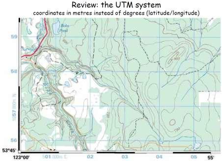
 4. What unit are eastings and northings coordinates measured in? 5. The maximum possible northings value in BC is approx? 6.")
2 GEOG 300: UTM REVIEW QUIZ (0%) 1. The UTM system is composed of zones, each degrees longitude wide 2. The 0 value for northings is located at 3. The 0 value for eastings is located at ( a trick question) 4. What unit are eastings and northings coordinates measured in? 5. The maximum possible northings value in BC is approx? 6. In Canada, eastings have digits and northings have digits 2

 projection")
3 Projection / Coordinate System has been defined: BC Albers Albers is an equal-area projection Projection / Coordinate System has been defined: UTM Transverse Mercator is a conformal (shape preserving) projection 3

4 Projection / Coordinate System has NOT been defined (but we can see its UTM) Projection / coordinate system undefined Review slides: georeferencing and projections Appendix A: Comparison of BC Albers and UTM The following identifies the maximum distortion for both BC Albers and UTM that was found when 1000-meter squares were constructed, and projected into each projection. UTM Distortions (within each UTM zone within BC) The maximum linear distortion is 0.040% The maximum area distortion is 0.08% BC Albers Distortions (within all of BC) The maximum linear distortion is 0.36% The maximum area distortion is 0.00% UTM preserves shape (distance) Albers preserves area Lab last week: one neighbourhood polygon measured in area: (?) UTM: sq km ( sq m) Albers: sq km ( sq m) Difference:.0218 sq km 21,800 sq m (= 0.08%) 4


5 Note: only UTM has zones -> Georeferencing: Rectification - imagery Georeferencing How do we make sure all our data layers line up? Georeferencing: = linking a layer or dataset with spatial coordinates Registration: = lining up layers with each other Rectification: The process by which the geometry of an image is made planimetric 5

, using Ground Control")
6 Air photo: not georeferenced, registered or rectified Air photo rectified to match vector layer (roads), using Ground Control Points (GCPs) 6
7 Photos are not planimetric : there are distortions Tip, tilt and swing Relief distortion Radial distortion Photos (film now digital) are rectified and mosaiced to create Orthophotos [Ortho = upright or straight / overhead] 7


8 GIS Data creation Photogrammetry is the science of making measurements from photographs, especially for recovering the exact positions of surface points. Rectifying and registering air photos -> orthophotos 8

 Most of our base map GIS")
9 ORTHOPHOTOS Once corrected, and georeferenced, photos can be used for topographic mapping and as a mapping layer, with map data overlain on top. Aerial photograph Interpretation (API) Most of our base map GIS layers have come from air photos (BC- TRIM program) 9


10 Image interpretation GIS layer features are manually identified using: Shape Pattern Size Tone Colour Shadow Texture Site Time Provincial photography is redone only every years City photography more frequently: 3-5 years Smaller regions/countries would be flown more frequently PG
 2012 London Olympic stadium")

11 Digital photography 2000-> : rectification fast and automated GeoEye high resolution satellite image (50cm pixels) 2012 London Olympic stadium (satellite altitude: 700 km) Image layer included in GIS raster data for updating and checking Since 2000, the use of high resolution satellite imagery has increased 11
imagery Google Earth since 2005, using Landsat mosaic and global elevation model Myths about satellite")


12 Google Earth- overlain georeferenced aerial photography and higher resolution satellite (ortho-) imagery; also including historical (ortho-)imagery Google Earth since 2005, using Landsat mosaic and global elevation model Myths about satellite imagery: The giant dog you can see from space Monday, June 9, 2008 BORIS the bull mastiff is so big that he can be seen lounging in his favourite position in the garden - from space. The 89kg dog has been captured on Google Earth's satellite images. His owners noticed an enormous brown blob on the image of their front garden and were stunned to discover it was their pet. 'He was in his favourite place,' said Fran Milner, from Bournemouth. We knew he was big but didn't think he was big enough to be seen from space. 12
Lecture 9: Reference Maps & Aerial Photography
 Lecture 9: Reference Maps & Aerial Photography I. Overview of Reference and Topographic Maps There are two basic types of maps? Reference Maps - General purpose maps & Thematic Maps - maps made for a specific
12/26/2012. Geographic Information Systems * * * * GIS (... yrezaei
 ( - Geographic Information Systems ( ( 1 2 3 Information System Data base DB IS IS DB (Knowledge ( ( (System (Information System - (Georefrence Analysis Data + Knowledge ======== Information 4 5 ( < 10%
Display data in a map-like format so that geographic patterns and interrelationships are visible
 Vilmaliz Rodríguez Guzmán M.S. Student, Department of Geology University of Puerto Rico at Mayagüez Remote Sensing and Geographic Information Systems (GIS) Reference: James B. Campbell. Introduction to
QuestUAV British UAV Manufacturer
 QuestUAV British UAV Manufacturer Aircraft designed to carry sensors such as high resolution cameras infra red cameras thermal and video cameras multiple payloads QuestUAV have been operating for five
Illustrator: Vector base Each line/point store some sort of information Mapping Representation of the world
 Illustrator: Vector base Each line/point store some sort of information Mapping Representation of the world Photoshop Raster base Images can be overlaid Pixel vector data model: [data models] A representation
CE 59700: Digital Photogrammetric Systems
 CE 59700: Digital Photogrammetric Systems Fall 2016 1 Instructor: Contact Information Office: HAMP 4108 Tel: (765) 496-0173 E-mail: ahabib@purdue.edu Lectures (HAMP 2102): Monday, Wednesday & Friday (12:30
Digital Elevation Models (DEM)
") Digital Elevation Models (DEM) Digital representation of the terrain surface enable 2.5 / 3D views Rule #1: they are models, not reality Rule #2: they always include some errors (subject to scale and data
Digital Elevation Models (DEM) Digital representation of the terrain surface enable 2.5 / 3D views Rule #1: they are models, not reality Rule #2: they always include some errors (subject to scale and data
Watershed Sciences 4930 & 6920 GEOGRAPHIC INFORMATION SYSTEMS
 PROJECTS Watershed Sciences 4930 & 6920 GEOGRAPHIC INFORMATION SYSTEMS WEEK THREE Lecture 5 PROJECT DATA/IDEAS, PROJECTIONS (Cont.) & LAB REVIEW Joe Wheaton GUEST LECTURE HOUSEKEEPING: LAB 01 GRADES This
FlexiCadastre User Conference 2013 GIS Data Verification & Challenges
 FlexiCadastre User Conference 2013 GIS Data Verification & Challenges May 7, 2013 Amanda Blackmore GIS Specialist OVERVIEW GIS Definitions & Terminology Spatial Data Common Issues or Concerns Data Verification
DATA SOURCES AND INPUT IN GIS. By Prof. A. Balasubramanian Centre for Advanced Studies in Earth Science, University of Mysore, Mysore
 DATA SOURCES AND INPUT IN GIS By Prof. A. Balasubramanian Centre for Advanced Studies in Earth Science, University of Mysore, Mysore 1 1. GIS stands for 'Geographic Information System'. It is a computer-based
Generation of Ortho Photo and Contours by Using High Resolution Satellite Data
 International Journal of Engineering and Technical Research (IJETR) Generation of Ortho Photo and Contours by Using High Resolution Satellite Data Dr. S.S.Manugula, Mr. Aavula Siva Sai Kumar, Mr. B. Harish
Map Name(s) and Date(s) Historical Map - Slice B. Order Details. Site Details Site at, Bicester, Oxfordshire
 and Date(s) Historical Map - Slice B. Order Details. Site Details Site at, Bicester, Oxfordshire") Published 1996 Source map scale - used to update the maps. The published date given therefore is were based on the assini Projection, with independent surveys of a single the mapping from a number of sources.
Published 1996 Source map scale - used to update the maps. The published date given therefore is were based on the assini Projection, with independent surveys of a single the mapping from a number of sources.
Projections & GIS Data Collection: An Overview
 Projections & GIS Data Collection: An Overview Projections Primary data capture Secondary data capture Data transfer Capturing attribute data Managing a data capture project Geodesy Basics for Geospatial
Data Quality and Uncertainty
 Data Quality and Uncertainty The power of GIS analysis is based on the assembly of layers of data, but as data layers increase, errors multiply - quality decreases. Garbage in, garbage out. High quality
Georeferencing. Where on earth are we? Critical for importing and combining layers for mapping
 Georeferencing Where on earth are we? Critical for importing and combining layers for mapping 1. The Geoid Earth is not a perfect sphere, it is ellipsoidal.. earth is the 'Geoid'. The difference between
Aerial Photography and Imagery Resources Guide
 Aerial Photography and Imagery Resources Guide Cheyenne and Laramie County Cooperative GIS Created and Maintained by the GIS Coordinator for the Cooperative GIS Program March 2011 CHEYENNE / LARAMIE COUNTY
INSTITUTE OF AERONAUTICAL ENGINEERING (Autonomous) Dundigal, Hyderabad
 Dundigal, Hyderabad") INSTITUTE OF AERONAUTICAL ENGINEERING (Autonomous) Dundigal, Hyderabad -00 0 CIVIL ENGINEERING TUTORIAL QUESTION BANK Course Name : Remote Sensing and GIS Course Code : A00 Class : IV B. Tech I Semester
INSTITUTE OF AERONAUTICAL ENGINEERING (Autonomous) Dundigal, Hyderabad -00 0 CIVIL ENGINEERING TUTORIAL QUESTION BANK Course Name : Remote Sensing and GIS Course Code : A00 Class : IV B. Tech I Semester
Aerial Photography and Imagery Resources Guide
 Aerial Photography and Imagery Resources Guide Cheyenne and Laramie County Cooperative GIS Created and Maintained by the GIS Coordinator for the Cooperative GIS Program May 2016 CHEYENNE / LARAMIE COUNTY
The Wildlife Society Meet and Greet. Come learn about what the UNBC Student Chapter of TWS is all about!
 Georeferencing I GEOG 300, Lecture 4 Dr. Anthony Jjumba 1 The Wildlife Society Meet and Greet Quiz Come learn about what the UNBC Student Chapter of TWS is all about! 5:30 7:30 PM, Wednesday September
Overview key concepts and terms (based on the textbook Chang 2006 and the practical manual)
") Introduction Geo-information Science (GRS-10306) Overview key concepts and terms (based on the textbook 2006 and the practical manual) Introduction Chapter 1 Geographic information system (GIS) Geographically
Introduction Geo-information Science (GRS-10306) Overview key concepts and terms (based on the textbook 2006 and the practical manual) Introduction Chapter 1 Geographic information system (GIS) Geographically
What Do You See? FOR 274: Forest Measurements and Inventory. Area Determination: Frequency and Cover
 What Do You See? Message of the Day: Many options exist to determine the size, area, or extent of a feature on a landscape FOR 274: Forest Measurements and Inventory Lecture 7: Measures of Land Area Frequency
Intro to GIS Fall 2010 Georeferencing & Map Projections
 Intro to GIS Fall 2010 Georeferencing & Map Projections SHAPE OF THE EARTH Earth's Shape Geoid: shape of earth minus topographic features (irregular due to local variations in gravity) Ellipsoid: elongated
2. GETTING STARTED WITH GIS
 2. GETTING STARTED WITH GIS What are geographic information systems and what are they used for? ArcGIS: ArcMap, ArcCatalog and ArcToolbox Vector data vs. raster data vs. attribute tables Polygons, polylines,
Terms GIS GPS Vector Data Model Raster Data Model Feature Attribute Table Point Line Polygon Pixel RGB Overlay Function
 FINAL REVIEW FOR GIS (2016) PRACTICAL COMPONENT The first 40 mins of the exam will be open book and will require you to make a map using all the techniques learned over the semester. This map will be e-mailed
Technical note: Creating geometrically-correct photo-interpretations, photomosaics, and base maps for a project GIS
 Technical note: Creating geometrically-correct photo-interpretations, photomosaics, and base maps for a project GIS D.G. Rossiter & T. Hengl 26 January 2004 Version adjusted for a GIS course in Zagreb
A Basic Introduction to Geographic Information Systems (GIS) ~~~~~~~~~~
 ~~~~~~~~~~") A Basic Introduction to Geographic Information Systems (GIS) ~~~~~~~~~~ Rev. Ronald J. Wasowski, C.S.C. Associate Professor of Environmental Science University of Portland Portland, Oregon 3 September
A Basic Introduction to Geographic Information Systems (GIS) ~~~~~~~~~~ Rev. Ronald J. Wasowski, C.S.C. Associate Professor of Environmental Science University of Portland Portland, Oregon 3 September
A Production Method for Conversion of Scanned Historic Aerial Imagery into Orthophotos Using the Rational Function Model
 University of Redlands InSPIRe @ Redlands MS GIS Program Major Individual Projects Geographic Information Systems 7-2011 A Production Method for Conversion of Scanned Historic Aerial Imagery into Orthophotos
Fundamentals of Photographic Interpretation
 Principals and Elements of Image Interpretation Fundamentals of Photographic Interpretation Observation and inference depend on interpreter s training, experience, bias, natural visual and analytical abilities.
Lab 1: Importing Data, Rectification, Datums, Projections, and Coordinate Systems
 Lab 1: Importing Data, Rectification, Datums, Projections, and Coordinate Systems Topics covered in this lab: i. Importing spatial data to TAS ii. Rectification iii. Conversion from latitude/longitude
Introduction to GIS - 2
 Introduction to GIS - 2 Outline Using GIS Representation of spatial objects in GIS Prof. D. Nagesh Kumar Department of Civil Engineering Indian Institute of Science Bangalore 560 012, India http://www.civil.iisc.ernet.in/~nagesh
Pierce Cedar Creek Institute GIS Development Final Report. Grand Valley State University
 Pierce Cedar Creek Institute GIS Development Final Report Grand Valley State University Major Goals of Project The two primary goals of the project were to provide Matt VanPortfliet, GVSU student, the
Fundamentals of Remote Sensing REMS5001 CAPSTONE PROJECT
 Fundamentals of Remote Sensing REMS5001 CAPSTONE PROJECT Due Date December 10, 2014 W0279429 TABLE OF CONTENTS 1.0 Introduction.. 1 2.0 Study Area.. 1 3.0 Procedures...... 2 Vector National Road and Hydro
THE CADASTRAL INFORMATION SYSTEM IN THE REPUBLIC OP SOUTH AFRICA
 I $:? Distr.: LIMITED ECA/NRD/CART.9/ORG.27 November 1996 Original: ENGLISH Ninth United Nations Regional Cartographic Conference for Africa Addis Ababa, Ethiopia 11-15 November 1996 THE CADASTRAL INFORMATION
Metadata for 2005 Orthophotography Products
 Metadata for 2005 Orthophotography Products What does this data set describe? 1. How should this data set be cited? 2. What geographic area does the data set cover? 3. What does it look like? 4. Does the
Welcome to NR502 GIS Applications in Natural Resources. You can take this course for 1 or 2 credits. There is also an option for 3 credits.
 Welcome to NR502 GIS Applications in Natural Resources. You can take this course for 1 or 2 credits. There is also an option for 3 credits. The 1st credit consists of a series of readings, demonstration,
Working with georeferenced data. What is georeferencing? Coordinate Systems. Geographic and Projected Coordinate System
 GIS501 Fundamentals of Geographical Information Systems (GIS) Coordinate Systems Working with georeferenced data What is georeferencing? Geographically referenced data which is, in some way, referenced
Use of ArcGIS Applications for Analysis and Representation of the Terrains: The Case Study of Alakır River Sub-basin
 Use of ArcGIS Applications for Analysis and Representation of the Terrains: The Case Study of Alakır River Sub-basin Ahmet BENLİAY, Tahsin YILMAZ and H. Ekin OKTAY 1 Introduction 3D visualizations have
DMS-UAV Accuracy Assessment: AP20 with Nikon D800E
 DMS-UAV Accuracy Assessment: AP20 with Nikon D800E Joe Hutton, Greg Lipa, James Lutes, Omer Mian Applanix, William Chan - GeoPixel Air Introduction The Direct Mapping Solution for Unmanned Aerial Vehicles
McHenry County Property Search Sources of Information
 Disclaimer: The information in this system may contain inaccuracies or typographical errors. The information in this system is a digital representation of information derived from original documents; as
Hydric Rating by Map Unit Ocean County, New Jersey (Larsen & N New Prospect Jackson Twp., NJ)
") 74 16' 14'' W Hydric Rating by Map Unit Ocean County, New Jersey ( ) 74 15' 50'' W 40 9' 17'' N 40 8' 53'' N 4444460 4444550 4444640 4444730 4444820 4444910 4445000 4445090 4445180 562120 562210 562300
74 16' 14'' W Hydric Rating by Map Unit Ocean County, New Jersey ( ) 74 15' 50'' W 40 9' 17'' N 40 8' 53'' N 4444460 4444550 4444640 4444730 4444820 4444910 4445000 4445090 4445180 562120 562210 562300
USING GIS CARTOGRAPHIC MODELING TO ANALYSIS SPATIAL DISTRIBUTION OF LANDSLIDE SENSITIVE AREAS IN YANGMINGSHAN NATIONAL PARK, TAIWAN
 CO-145 USING GIS CARTOGRAPHIC MODELING TO ANALYSIS SPATIAL DISTRIBUTION OF LANDSLIDE SENSITIVE AREAS IN YANGMINGSHAN NATIONAL PARK, TAIWAN DING Y.C. Chinese Culture University., TAIPEI, TAIWAN, PROVINCE
Lab 1: Importing Data, Rectification, Datums, Projections, and Output (Mapping)
") Lab 1: Importing Data, Rectification, Datums, Projections, and Output (Mapping) Topics covered in this lab: i. Importing spatial data to TAS ii. Rectification iii. Conversion from latitude/longitude to
Lab 1: Importing Data, Rectification, Datums, Projections, and Output (Mapping) Topics covered in this lab: i. Importing spatial data to TAS ii. Rectification iii. Conversion from latitude/longitude to
Data Quality and Uncertainty. Accuracy, Precision, Data quality and Errors
 Data Quality and Uncertainty The power of GIS analysis is based on the assembly of layers of data, but as data layers increase, errors multiply (and quality decreases). Garbage in, garbage out. High quality
Use of Corona, Landsat TM, Spot 5 images to assess 40 years of land use/cover changes in Cavusbasi
 New Strategies for European Remote Sensing, Olui (ed.) 2005 Millpress, Rotterdam, ISBN 90 5966 003 X Use of Corona, Landsat TM, Spot 5 images to assess 40 years of land use/cover changes in Cavusbasi N.
NR402 GIS Applications in Natural Resources. Lesson 9: Scale and Accuracy
 NR402 GIS Applications in Natural Resources Lesson 9: Scale and Accuracy 1 Map scale Map scale specifies the amount of reduction between the real world and the map The map scale specifies how much the
Hydric Rating by Map Unit Harrison County, Mississippi
 89 6' 12'' W 89 5' 54'' W 30 28' 47'' N 30 28' 26'' N 3373210 3373290 3373370 3373450 3373530 3373610 3373690 3373770 3373850 298080 298160 298240 298320 298400 298480 298560 30 28' 47'' N Soil Map may
Shape e o f f the e Earth
 1 Coordinate Systems & Projections Coordinate Systems Two map layers are not going to register spatially unless they are based on the same coordinate system. 2 Contents Shape of the earth Datum Projections
Hydric Rating by Map Unit Harrison County, Mississippi. Web Soil Survey National Cooperative Soil Survey
 89 9' 7'' W 89 8' 38'' W 30 34' 13'' N 30 33' 57'' N 3383480 3383560 3383640 3383720 3383800 3383880 3383960 293640 293720 293800 293880 293960 294040 294120 294200 294280 294360 3383480 3383560 3383640
Applied Cartography and Introduction to GIS GEOG 2017 EL. Lecture-1 Chapters 1 and 2
 Applied Cartography and Introduction to GIS GEOG 2017 EL Lecture-1 Chapters 1 and 2 What is GIS? A Geographic Information System (GIS) is a computer system for capturing, storing, querying, analyzing and
Airborne Corridor-Mapping. Planning and documentation of company infrastructure: precise, rapid, and cost effective
 Airborne Corridor-Mapping Planning and documentation of company infrastructure: precise, rapid, and cost effective Technology Airborne Laser-Scanning, digital orthophotos and thermal imaging: one flight
NR402 GIS Applications in Natural Resources
 NR402 GIS Applications in Natural Resources Lesson 1 Introduction to GIS Eva Strand, University of Idaho Map of the Pacific Northwest from http://www.or.blm.gov/gis/ Welcome to NR402 GIS Applications in
Hazard Mapping Along the Dead Sea Shoreline
 FIG Working Week in Marrakech, Morocco 18-22 May 2011 Hazard Mapping Along the Dead Sea Shoreline Rami Al-Ruzouq, Abdullah Al-Zuobi, AbdEl-Rahman Abueladas, Emad Akkawi Department of Surveying and Geomatics
Report on the UNGEGN liaison with the Scientific Committee on Antarctic Research *
 UNITED NATIONS Working Paper GROUP OF EXPERTS ON No. 63 GEOGRAPHICAL NAMES Twenty-fifth session Nairobi, 5 12 May 2009 Item 6 of the provisional agenda Reports of the liaison officers and international
EnvSci 360 Computer and Analytical Cartography
 EnvSci 360 Computer and Analytical Cartography Lecture 7 Mapping Images, Surfaces, and 3-D Data Brief Overview of Imagery What is Imagery? A spatial data model that defines space as an array of equally
Identifying Landslides Using Google Earth
 Identifying Landslides (This draft updated on 1 Dec 2014) Page 1 of 15 1. Introduction Identifying Landslides Using Google Earth 1.1. Workshop Aims 1. Identify landslides from Google Earth images 2. Approximate
Digital Elevation Models (DEM) / DTM
 / DTM") Digital Elevation Models (DEM) / DTM Uses in remote sensing: queries and analysis, 3D visualisation, classification input Fogo Island, Cape Verde Republic ASTER DEM / image Banks Peninsula, Christchurch,
Digital Elevation Models (DEM) / DTM Uses in remote sensing: queries and analysis, 3D visualisation, classification input Fogo Island, Cape Verde Republic ASTER DEM / image Banks Peninsula, Christchurch,
Digital Elevation Models (DEM) / DTM
 / DTM") Digital Elevation Models (DEM) / DTM Uses in remote sensing: queries and analysis, 3D visualisation, layers in classification Fogo Island, Cape Verde Republic ASTER DEM / image Banks Peninsula, Christchurch,
Digital Elevation Models (DEM) / DTM Uses in remote sensing: queries and analysis, 3D visualisation, layers in classification Fogo Island, Cape Verde Republic ASTER DEM / image Banks Peninsula, Christchurch,
Projections and Coordinate Systems
 Projections and Coordinate Systems Overview Projections Examples of different projections Coordinate systems Datums Projections Overview Projections and Coordinate Systems GIS must accurately represent
Introduction-Overview. Why use a GIS? What can a GIS do? Spatial (coordinate) data model Relational (tabular) data model
 data model Relational (tabular) data model") Introduction-Overview Why use a GIS? What can a GIS do? How does a GIS work? GIS definitions Spatial (coordinate) data model Relational (tabular) data model intro_gis.ppt 1 Why use a GIS? An extension
Introduction-Overview Why use a GIS? What can a GIS do? How does a GIS work? GIS definitions Spatial (coordinate) data model Relational (tabular) data model intro_gis.ppt 1 Why use a GIS? An extension
Lab#3: GIS Projections and Coordinate Systems. Start Arcmap and create a data frame for each of the above coordinate systems.
 NRM338 Fall 2017 Lab#3 Page#1 of 18 In this lab, you will Lab#3: GIS Projections and Coordinate Systems 1) Define the geographic coordinate system of two GIS themes. 2) Determine the geographic coordinates
A Case Study of Using Remote Sensing Data and GIS for Land Management; Catalca Region
 A Case Study of Using Remote Sensing Data and GIS for Land Management; Catalca Region Dr. Nebiye MUSAOGLU, Dr. Sinasi KAYA, Dr. Dursun Z. SEKER and Dr. Cigdem GOKSEL, Turkey Key words: Satellite data,
Mapping coordinate systems
 Mapping coordinate systems 1. The Earth's Graticule Latitude and Longitude The graticule is the imaginary grid of lines running east-west (lines of latitude = parallels) and north-south lines of longitude
UAV APPLICATIONS IN ENGINEERING. Presented By Wohnrade Civil Engineers, Inc.
 UAV APPLICATIONS IN ENGINEERING Presented By Wohnrade Civil Engineers, Inc. UAV BUSINESS STARTUP March 31, 2015 - Obtained DJI Inspire 1 Unmanned Aerial Vehicle (UAV) FAA requires Certificate of Authorization
Conservative bias in classification accuracy assessment due to pixelby-pixel comparison of classified images with reference grids
 INT. J. REMOTE SENSING, 1995, VOL. 16, No.3, 581-587 Conservative bias in classification accuracy assessment due to pixelby-pixel comparison of classified images with reference grids D. L. VERBYLA and
Suitability Analysis on Second Home Areas Selection in Smithers British Columbia
 GEOG 613 Term Project Suitability Analysis on Second Home Areas Selection in Smithers British Columbia Zhengzhe He November 2005 Abstract Introduction / background Data Source Data Manipulation Spatial
Custom Soil Resource Report. Soil Map. Map projection: Web Mercator Corner coordinates: WGS84 Edge tics: UTM Zone 14N WGS84. Feet.
 Custom Soil Resource Report Soil Map 3188500 3188700 3188900 3189100 3189300 3189500 3189700 96 43' 30'' W 3188500 3188700 3188900 3189100 3189300 3189500 3189700 96 42' 11'' W 28 48' 59'' N 28 48' 59''
Lauren Jacob May 6, Tectonics of the Northern Menderes Massif: The Simav Detachment and its relationship to three granite plutons
 Lauren Jacob May 6, 2010 Tectonics of the Northern Menderes Massif: The Simav Detachment and its relationship to three granite plutons I. Introduction: Purpose: While reading through the literature regarding
Georeferencing. datum. projection. scale. The next few lectures will introduce you to these elements. on the Earth, you ll need to understand how
 Georeferencing GOAL: To assign a location to all the features represented in our geographic information data In order to do so, we need to make use of the following elements: ellipsoid/geoid To determine
Learning ArcGIS: Introduction to ArcCatalog 10.1
 Learning ArcGIS: Introduction to ArcCatalog 10.1 Estimated Time: 1 Hour Information systems help us to manage what we know by making it easier to organize, access, manipulate, and apply knowledge to the
Test Bank Chapter 2: Representations of Earth
 Multiple Choice Test Bank Chapter 2: Representations of Earth 1. A rhumb line on a Mercator projection is a line of. a. true size b. true shape c. true compass bearing d. true location 2. Maximum longitude
Welcome to Lesson 4. It is important for a GIS analyst to have a thorough understanding of map projections and coordinate systems.
 Welcome to Lesson 4. It is important for a GIS analyst to have a thorough understanding of map projections and coordinate systems. A GIS without coordinates would simply be a database like Microsoft Excel
Donald K. Stauble and Bill Birkemeier Coastal and Hydraulics Laboratory US Army Corps of Engineers
 Donald K. Stauble and Bill Birkemeier Coastal and Hydraulics Laboratory US Army Corps of Engineers Define the Problem Navigation Shore Protection Environmental Political So what is the problem? Management
Chapter 02 Maps. Multiple Choice Questions
 Chapter 02 Maps Multiple Choice Questions 1. Every projection has some degree of distortion because A. a curved surface cannot be represented on a flat surface without distortion. B. parallels and meridians
Coupling GIS and Photogrammetry for the Development of Large-Scale Land Information System (LIS)
") Journal of Geosciences and Geomatics, 2014, Vol. 2, No. 1, 1-10 Available online at http://pubs.sciepub.com/jgg/2/1/1 Science and Education Publishing DOI:10.12691/jgg-2-1-1 Coupling GIS and Photogrammetry
Journal of Geosciences and Geomatics, 2014, Vol. 2, No. 1, 1-10 Available online at http://pubs.sciepub.com/jgg/2/1/1 Science and Education Publishing DOI:10.12691/jgg-2-1-1 Coupling GIS and Photogrammetry
Manitoba s Elevation (LiDAR) & Imagery Datasets. Acquisition Plans & Opportunities for Collaboration
 & Imagery Datasets. Acquisition Plans & Opportunities for Collaboration") Manitoba s Elevation (LiDAR) & Imagery Datasets Acquisition Plans & Opportunities for Collaboration Manitoba Planning Conference May 2017 Presentation Outline Manitoba s Elevation (LiDAR) and Imagery Datasets
Manitoba s Elevation (LiDAR) & Imagery Datasets Acquisition Plans & Opportunities for Collaboration Manitoba Planning Conference May 2017 Presentation Outline Manitoba s Elevation (LiDAR) and Imagery Datasets
Outline. Shape of the Earth. Geographic Coordinates (φ, λ, z) Ellipsoid or Spheroid Rotate an ellipse around an axis. Ellipse.
 Ellipsoid or Spheroid Rotate an ellipse around an axis. Ellipse.") Map Projections Outline Geodesy and map projections Prof. D. Nagesh Kumar Department of Civil Engineering Indian Institute of Science Bangalore 560 012, India http://www.civil.iisc.ernet.in/~nagesh Shape
Map Projections Outline Geodesy and map projections Prof. D. Nagesh Kumar Department of Civil Engineering Indian Institute of Science Bangalore 560 012, India http://www.civil.iisc.ernet.in/~nagesh Shape
Louisiana Transportation Engineering Conference. Monday, February 12, 2007
 Louisiana Transportation Engineering Conference Monday, February 12, 2007 Agenda Project Background Goal of EIS Why Use GIS? What is GIS? How used on this Project Other site selection tools I-69 Corridor
Custom Soil Resource Report for Victoria County, Texas
 United States Department of Agriculture Natural Resources Conservation Service A product of the National Cooperative Soil Survey, a joint effort of the United States Department of Agriculture and other
The Nature of Spatial Data. Keith C. Clarke Geography UCSB
 The Nature of Spatial Data Keith C. Clarke Geography UCSB Geographic primitives G = g (x, y, z, s, A, t) [x, y, z] = f(λ, φ, d) Geography also highly dependent upon model First, the datum (d) Models of
Web Soil Survey National Cooperative Soil Survey
 121 52' 18'' W Irrigated Capability Class Sutter County, California () 121 51' 49'' W 597600 597700 597800 597900 598000 598100 598200 39 6' 27'' N 39 6' 27'' N 39 5' 57'' N 4328400 4328500 4328600 4328700
Name NRS 409 Exam I. 1. (24 Points) Consider the following questions concerning standard data for GIS systems.
 Consider the following questions concerning standard data for GIS systems.") Read every question carefully. You may use a calculator if you wish. Conversion tables are provided at the end of the exam. If you have any questions, raise your hand. Be sure to show your work on computational
Read every question carefully. You may use a calculator if you wish. Conversion tables are provided at the end of the exam. If you have any questions, raise your hand. Be sure to show your work on computational
Data Creation and Editing
 11.520:A Workshop on Geographical Information Systems 1.188: Urban Planning and Social Science Laboratory Data Creation and Editing Based in part on notes by Prof. Joseph Ferreira and Michael Flaxman Lulu
CRUM RANCH AREA MAP YOLO COUNTY, California, AC +/-
 CRUM RANCH AREA MAP YOLO COUNTY, California, 235.59 AC +/- Map data 2016 Google Imagery 2016, CAPCOG, DigitalGlobe, Texas Orthoimagery Program, U.S. Geological Survey, USDA Farm Service Agency Boundary
8.9 Geographical Information Systems Advantages of GIS
 8.9 Geographical Information Systems A Geographic Information System (GIS) is a computer-based system that is used in input, storage, analysis manipulation, retrieval, and output, of spatial data. These
The Retreat of the Grinnell Glacier: 1990-Present
 Falk, Hepler, Lopez 1 Megan Falk, Alex Hepler, Michelle Lopez GSP 270/ Graham Group Project/ Final Draft December 8, 2014 Word count: 1,148 Introduction The Retreat of the Grinnell Glacier: 1990-Present
This week s topics. Week 6. FE 257. GIS and Forest Engineering Applications. Week 6
 FE 257. GIS and Forest Engineering Applications Week 6 Week 6 Last week Chapter 8 Combining and splitting landscape features and merging GIS databases Chapter 11 Overlay processes Questions? Next week
Catchment Delineation Workflow
 Catchment Delineation Workflow Slide 1 Given is a GPS point (Lat./Long.) for an outlet location. The outlet could be a proposed Dam site, a storm water drainage culvert on a rural highway, or any other
Map projections. Rüdiger Gens
 Rüdiger Gens 2 Outline! Relevant terms! Why map projections?! Map projection categories " Projection surfaces " Features preserved from distortions! Map projection examples! Right choice Relevant terms!
An Internet-based Agricultural Land Use Trends Visualization System (AgLuT)
") An Internet-based Agricultural Land Use Trends Visualization System (AgLuT) Prepared for Missouri Department of Natural Resources Missouri Department of Conservation 07-01-2000-12-31-2001 Submitted by
An Internet-based Agricultural Land Use Trends Visualization System (AgLuT) Prepared for Missouri Department of Natural Resources Missouri Department of Conservation 07-01-2000-12-31-2001 Submitted by
Hydrology and Floodplain Analysis, Chapter 10
 Hydrology and Floodplain Analysis, Chapter 10 Hydrology and Floodplain Analysis, Chapter 10.1 Introduction to GIS GIS Geographical Information System Spatial Data Data linked with geographical location
UNIVERSITY OF CALIFORNIA SANTA CRUZ
 UNIVERSITY OF CALIFORNIA SANTA CRUZ GIS GPS INTEGRATION: CHALLENGES OF UNCERTAIN REALITY A thesis submitted in partial satisfaction of the requirements for the degree of MASTER OF SCIENCE in COMPUTER SCIENCE
COURSE SCHEDULE, GRADING, and READINGS
 COURSE SCHEDULE, GRADING, and READINGS Note: All academic classes will be held in the GIS lab at Royal Thimphu College. These dates are listed here. Other days will involve travel or days off, and the
Mapping Earth. How are Earth s surface features measured and modeled?
 Name Mapping Earth How are Earth s surface features measured and modeled? Before You Read Before you read the chapter, think about what you know about maps Record your thoughts in the first column Pair
INSTRUCTOR DR. HOWARD TURNER P.L.S.
 ORTHOPHOTO PRODUCTION WORKSHOP CALIFORNIA STATE POLYTECHNIC UNIVERSITY, POMONA INSTRUCTOR DR. HOWARD TURNER P.L.S. In this workshop, you will learn how to produce an orthophoto. This will include the base
Frank Hegyi President, Ferihill Technologies Ltd Victoria, B.C.
 REMOTE SENSING TECHNIQUES IN ENVIRONMENTAL MONITORING By Frank Hegyi President, Ferihill Technologies Ltd Victoria, B.C. ABSTRACT Increasing public awareness about environmental concerns is creating pressures
Features and Benefits
 Autodesk LandXplorer Features and Benefits Use the Autodesk LandXplorer software family to help improve decision making, lower costs, view and share changes, and avoid the expense of creating physical
DATA BASE NEWSLETTER. A Newsletter about Natural Resource Digital Data Bases Relating to National Park ServiceAreas
 DATA BASE NEWSLETTER Number! Winter 1983 A Newsletter about Natural Resource Digital s Relating to National Park ServiceAreas Issued by: Science and Remote Sensing Sections Denver Service Center National
Utilization and Provision of Geographical Name Information on the Basic Map of Japan*
 UNITED NATIONS WORKING PAPER GROUP OF EXPERTS NO. 1/9 ON GEOGRAPHICAL NAMES Twenty-eight session 28 April 2 May 2014 Item 9 of the Provisional Agenda Activities relating to the Working Group on Toponymic
REQUEST FOR PROPOSALS FOR DIGITAL ORTHOPHOTOGRAPHY PROJECT
 REQUEST FOR PROPOSALS FOR DIGITAL ORTHOPHOTOGRAPHY PROJECT The purpose of this Request for Proposals (RFP) is to solicit responses from qualified professionals for the production and supply of ortho rectified
ch02.pdf chap2.pdf chap02.pdf
 Introduction to Geographic Information Systems 8th Edition Karl Solutions Manual Full Download: http://testbanklive.com/download/introduction-to-geographic-information-systems-8th-edition-karl-solutions-manu