Modelling Annual Suspended Sediment Yields in Irish River Catchments
|
|
|
- Muriel McCoy
- 5 years ago
- Views:
Transcription


1 Modelling Annual Suspended Sediment Yields in Irish River Catchments Rymszewicz, A., Bruen, M., O Sullivan, J.J., Turner, J.N., Lawler, D.M., Harrington, J., Conroy, E., Kelly-Quinn, M. SILTFLUX Project Soil Erosion Modelling Workshop, March 2017, JRC, Ispra, Italy


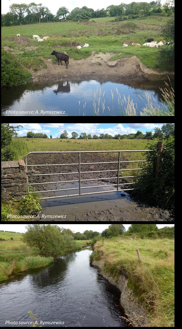
2 Objective and Study Sites Objective: Model for annual sediment yields for Irish ungauged catchments developing sediment database for Irish catchments exploring controlling factors considering spatial and temporal variations model simplicity and inclusion of GIS datasets minimum number of meaningful predictor variables Study Sites 21 catchments 51 catchment years Catchment size: km 2 Sediment yields: 2.11 to tonnes km -2 year -1
 (km 2 ) Land Cover Arable (%) Conifer (%) Pasture (%) Natural (%) Peat_LC (%) Soil")
 ALTBAR (m) TAYSLO (m km -1 ) Drainage Network MSL (Mainstream Length) (km) DRAIND (Drainage")
 (km) STMFRQ (Stream Frequency) (dimensionless) BFISOIL (Baseflow Index) (dimensionless) Climate")
 (mm year -1 ) FLATWET (Index of Wetness) (dimensionless) Hydrological descriptors P Total")
 (mm) Pwinter (December February Rainfall) (mm) R Rainfall Erosivity Factor (MJ mm ha -1 h")
3 Predictor Variables Explored GIS based spatial predictor variables Hydrological and weather variables Spatial Scale A (Catchment Area) (km 2 ) Land Cover Arable (%) Conifer (%) Pasture (%) Natural (%) Peat_LC (%) Soil Properties WD (Well-Drained) (%) PD (Poorly-Drained) (%) Alluv (Mineral Alluvium) (%) Peat_S (%) Topography S1085 (m km -1 ) ALTBAR (m) TAYSLO (m km -1 ) Drainage Network MSL (Mainstream Length) (km) DRAIND (Drainage Density) (km -1) NETLEN (Length of U/S Hydrol. Network) (km) STMFRQ (Stream Frequency) (dimensionless) BFISOIL (Baseflow Index) (dimensionless) Climate SAAPE (Standard Average Annual Potential Evapotranspiration) (mm year -1 ) SAAR (Standard Period Average Annual Rainfall) (mm year -1 ) FLATWET (Index of Wetness) (dimensionless) Hydrological descriptors P Total Annual Rainfall (mm) Pspring (March May Rainfall) (mm) Psummer (June August Rainfall) (mm) Pautumn (September November Rainfall) (mm) Pwinter (December February Rainfall) (mm) R Rainfall Erosivity Factor (MJ mm ha -1 h -1 year -1 ) Q Mean Annual Discharge (m 3 s -1 ) Annual Runoff amount (mm)
4 SSY SY A P Pspring Psummer Pautumn Pwinter R Q Runoff WD PD Alluv Peat_S Arable Pasture Conifer Natural Peat_LC S1085 MSL DRAIND ALTBAR NETLEN STMFRQ BFISOIL SAAR FLATWET Correlations Between Predictor Variables Relationship between catchment area and SSY SSY SY A P Pspring Psummer Pautumn Pwinter R Q Runoff WD PD Alluv Peat_S Arable Pasture Conifer Natural Peat_LC S1085 MSL DRAIND ALTBAR NETLEN STMFRQ BFISOIL SAAR FLATWET Scatter plots between sediment yields and some predictor variables Spearman correlation matrix between potential predictor variables

5 Model Building Multiple linear regression models for predicting SSY and SY were fitted to log transformed data A stepwise regression analysis combining backward and forward inclusion/ exclusion of individual predictors was used to select good combinations of predictor variables Informed decisions were made to exclude variables that were correlated strongly with others in the regression (e.g. MSL and NETLEN was one such combination) The coefficients of this model (developed with the log transformed data) became the exponents in the final nonlinear multiple regression model based on the original (not log transformed) data
6 Models for SY (tonnes year -1 ) Three variable SY model Four variable SY model Five variable SY model Six variable SY model Measure of fit Six parameter SY model (Pspring) Six parameter SY model (Pwinter) Six parameter SY model (Pwinter+Pspring) Five parameter SY model Four parameter SY model Three parameter SY model R adj. R BIAS MAE
7 SY Model Validation Split-Sample Tests Variable Calibration Dataset A Validation Dataset B Calibration Dataset B Validation Dataset A N R adjusted R Mean Bias Mean Absolute Error
8 Model Limitations Scale: Catchment size were limited to km 2 Land use: Particular focus on Pasture and Tillage
9 Conclusions (i) (ii) (iii) A database of annual values of suspended sediment yield was constructed for Irish catchments: SSY varied between 2.11 and tonnes km -2 year -1 Regression based models for area specific (SSY) and absolute (SY) sediment yield indicate better fits for SY models as indicated by adjusted R 2 values of up to 0.58 for SSY models and adjusted R 2 value of up to 0.67 for the best SY model. Validation of SY model based on the split-sample datasets indicate that the model is relatively robust, however limitations exist (possibly due to the bias of the calibration dataset towards catchments of a smaller size and particular focus on the pasture and arable land use)
10
11 Thank You
Physical Catchment Descriptors
 Flood Studies Update Technical Research Report Paul Mills, Oliver Nicholson and Duncan Reed Based on research reports by Compass Informatics, DWRconsult and OPW Volume I Volume II Volume III Volume V Volume
Assessing the applicability of the Revised Universal Soil Loss Equation (RUSLE) to Irish Catchments
 to Irish Catchments") doi:10.5194/piahs-367-99-2015 Sediment Dynamics from the Summit to the Sea 99 (Proceedings of a symposium held in New Orleans, Louisiana, USA, 11 14 December 2014) (IAHS Publ. 367, 2014). Assessing the
doi:10.5194/piahs-367-99-2015 Sediment Dynamics from the Summit to the Sea 99 (Proceedings of a symposium held in New Orleans, Louisiana, USA, 11 14 December 2014) (IAHS Publ. 367, 2014). Assessing the
Drought Monitoring with Hydrological Modelling
 st Joint EARS/JRC International Drought Workshop, Ljubljana,.-5. September 009 Drought Monitoring with Hydrological Modelling Stefan Niemeyer IES - Institute for Environment and Sustainability Ispra -
Design Flood Estimation in Ungauged Catchments: Quantile Regression Technique And Probabilistic Rational Method Compared
 Design Flood Estimation in Ungauged Catchments: Quantile Regression Technique And Probabilistic Rational Method Compared N Rijal and A Rahman School of Engineering and Industrial Design, University of
Fleming County Schools Long Range Plan Teacher(s):
:") School Calendar Days Unit Title Standards August 2015 10 11 12 13 14 1-3 Get To Know You (2) Newton s Third Law of Motion (10) 17 18 19 20 21 4-8 Newton s Third Law of Motion 24 25 26 27 28 9-13 September
School Calendar Days Unit Title Standards August 2015 10 11 12 13 14 1-3 Get To Know You (2) Newton s Third Law of Motion (10) 17 18 19 20 21 4-8 Newton s Third Law of Motion 24 25 26 27 28 9-13 September
DESCRIPTION OF A HYDROLOGIC DATASET. Department of Environmental Sciences, Wageningen University and. Research Center. Wageningen, The Netherlands
 DESCRIPTION OF A HYDROLOGIC DATASET FOR THE BRISY SUBCATCHMENT R. T. Oosterho? and C. Paniconi y? Department of Environmental Sciences, Wageningen University and Research Center Wageningen, The Netherlands
Influence of the timing of flood events on sediment yield in the north-western Algeria
 Calabria, 5-7 Septembre 2 4th International Workshop on Hydrological Extremes Session A : Modelling and forecast of hydrological extreme event Influence of the timing of flood events on sediment yield
A Comparison of Rainfall Estimation Techniques
 A Comparison of Rainfall Estimation Techniques Barry F. W. Croke 1,2, Juliet K. Gilmour 2 and Lachlan T. H. Newham 2 SUMMARY: This study compares two techniques that have been developed for rainfall and
CARPE DIEM CENTRE FOR WATER RESOURCES RESEARCH DELIVERABLE 9.5(NUID-CWRR) PRECIPITATION DATA ANALYSIS AND ERRORS DRAFT
 PRECIPITATION DATA ANALYSIS AND ERRORS DRAFT") CARPE DIEM CENTRE FOR WATER RESOURCES RESEARCH DELIVERABLE 9.5(NUID-CWRR) PRECIPITATION DATA ANALYSIS AND ERRORS DRAFT by Micheal Bruen & Benoit Parmentier December 2004 Department of Civil Engineering
CARPE DIEM CENTRE FOR WATER RESOURCES RESEARCH DELIVERABLE 9.5(NUID-CWRR) PRECIPITATION DATA ANALYSIS AND ERRORS DRAFT by Micheal Bruen & Benoit Parmentier December 2004 Department of Civil Engineering
Figure 0-18: Dendrogeomorphic analysis of streambank erosion and floodplain deposition (from Noe and others, 2015a)
") Appendix 9A: Stream to River During the development of the Phase 6 Watershed Model, multiple methods for determining coefficients were often attempted. In some cases, the methods are averaged or otherwise
Appendix 9A: Stream to River During the development of the Phase 6 Watershed Model, multiple methods for determining coefficients were often attempted. In some cases, the methods are averaged or otherwise
Optimal Artificial Neural Network Modeling of Sedimentation yield and Runoff in high flow season of Indus River at Besham Qila for Terbela Dam
 Optimal Artificial Neural Network Modeling of Sedimentation yield and Runoff in high flow season of Indus River at Besham Qila for Terbela Dam Akif Rahim 1, Amina Akif 2 1 Ph.D Scholar in Center of integrated
Soil Formation. Lesson Plan: NRES B2-4
 Soil Formation Lesson Plan: NRES B2-4 1 Anticipated Problems 1. What are five different factors that affect soil formation? 2. What are some different types of parent material that affect soils? 3. What
Drought forecasting methods Blaz Kurnik DESERT Action JRC
 Ljubljana on 24 September 2009 1 st DMCSEE JRC Workshop on Drought Monitoring 1 Drought forecasting methods Blaz Kurnik DESERT Action JRC Motivations for drought forecasting Ljubljana on 24 September 2009
Near Real-Time Runoff Estimation Using Spatially Distributed Radar Rainfall Data. Jennifer Hadley 22 April 2003
 Near Real-Time Runoff Estimation Using Spatially Distributed Radar Rainfall Data Jennifer Hadley 22 April 2003 Introduction Water availability has become a major issue in Texas in the last several years,
The relationship between catchment characteristics and the parameters of a conceptual runoff model: a study in the south of Sweden
 FRIEND: Flow Regimes from International Experimental and Network Data (Proceedings of the Braunschweie _ Conference, October 1993). IAHS Publ. no. 221, 1994. 475 The relationship between catchment characteristics
Basin characteristics
 Basin characteristics From hydrological processes at the point scale to hydrological processes throughout the space continuum: point scale à river basin The watershed characteristics (shape, length, topography,
PRELIMINARY ASSESSMENT OF SURFACE WATER RESOURCES - A STUDY FROM DEDURU OYA BASIN OF SRI LANKA
 PRELIMINARY ASSESSMENT OF SURFACE WATER RESOURCES - A STUDY FROM DEDURU OYA BASIN OF SRI LANKA THUSHARA NAVODANI WICKRAMAARACHCHI Hydrologist, Water Resources Secretariat of Sri Lanka, Room 2-125, BMICH,
FLORA: FLood estimation and forecast in complex Orographic areas for Risk mitigation in the Alpine space
 Natural Risk Management in a changing climate: Experiences in Adaptation Strategies from some European Projekts Milano - December 14 th, 2011 FLORA: FLood estimation and forecast in complex Orographic
Global Flash Flood Guidance System Status and Outlook
 Global Flash Flood Guidance System Status and Outlook HYDROLOGIC RESEARCH CENTER San Diego, CA 92130 http://www.hrcwater.org Initial Planning Meeting on the WMO HydroSOS, Entebbe, Uganda 26-28 September
Changing Hydrology under a Changing Climate for a Coastal Plain Watershed
 Changing Hydrology under a Changing Climate for a Coastal Plain Watershed David Bosch USDA-ARS, Tifton, GA Jeff Arnold ARS Temple, TX and Peter Allen Baylor University, TX SEWRU Objectives 1. Project changes
NATIONAL HYDROPOWER ASSOCIATION MEETING. December 3, 2008 Birmingham Alabama. Roger McNeil Service Hydrologist NWS Birmingham Alabama
 NATIONAL HYDROPOWER ASSOCIATION MEETING December 3, 2008 Birmingham Alabama Roger McNeil Service Hydrologist NWS Birmingham Alabama There are three commonly described types of Drought: Meteorological drought
Liliana Pagliero June, 15 th 2011
 Liliana Pagliero liliana.pagliero@jrc.ec.europa.eu June, 15 th 2011 2/18 SWAT MODELLING AT PAN EUROPEAN SCALE: THE DANUBE BASIN PILOT STUDY Introduction The Danube Model Available databases Model set up
Chiang Rai Province CC Threat overview AAS1109 Mekong ARCC
 Chiang Rai Province CC Threat overview AAS1109 Mekong ARCC This threat overview relies on projections of future climate change in the Mekong Basin for the period 2045-2069 compared to a baseline of 1980-2005.
Floodplain modeling. Ovidius University of Constanta (P4) Romania & Technological Educational Institute of Serres, Greece
 Romania & Technological Educational Institute of Serres, Greece") Floodplain modeling Ovidius University of Constanta (P4) Romania & Technological Educational Institute of Serres, Greece Scientific Staff: Dr Carmen Maftei, Professor, Civil Engineering Dept. Dr Konstantinos
Floodplain modeling Ovidius University of Constanta (P4) Romania & Technological Educational Institute of Serres, Greece Scientific Staff: Dr Carmen Maftei, Professor, Civil Engineering Dept. Dr Konstantinos
Abebe Sine Gebregiorgis, PhD Postdoc researcher. University of Oklahoma School of Civil Engineering and Environmental Science
 Abebe Sine Gebregiorgis, PhD Postdoc researcher University of Oklahoma School of Civil Engineering and Environmental Science November, 2014 MAKING SATELLITE PRECIPITATION PRODUCTS WORK FOR HYDROLOGIC APPLICATION
Calculating the suspended sediment load of the Dez River
 Erosion and Sediment Transport Monitoring Programmes in River Basins (Proceedings of the Osio Symposium, August 1992). IAHS Publ. no. 210, 1992. 219 Calculating the suspended sediment load of the Dez River
Gökhan Cüceloğlu, İzzet Öztürk. Istanbul Technical University Department of Environmental Engineering Maslak/IstanbulTurkey
 Assessing the Influence of Climate Datasets for Quantification of Water Balance Components in Black Sea Catchment: Case Study for Melen Watershed, Turkey Gökhan Cüceloğlu, İzzet Öztürk Istanbul Technical
Gully erosion in winter crops: a case study from Bragança area, NE Portugal
 Gully erosion in winter crops: a case study from Bragança area, NE Portugal T. de Figueiredo Instituto Politécnico de Bragança (IPB/ESAB), CIMO Mountain Research Centre, Bragança, Portugal Foreword This
Regionalising the hydrologic response of ungauged catchments using the SIMHYD, IHACRES, and Sacramento rainfall-runoff models
 Regionalising the hydrologic response of ungauged catchments using the SIMHYD, IHACRES, and Sacramento rainfall-runoff models Post, D. A. 1, Vaze, J. 2, Viney, N. 1 and Chiew, F. H. S. 1 david.post@csiro.au
How to integrate wetland processes in river basin modeling? A West African case study
 How to integrate wetland processes in river basin modeling? A West African case study stefan.liersch@pik-potsdam.de fred.hattermann@pik-potsdam.de June 2011 Outline Why is an inundation module required?
IMPACT OF CLIMATE CHANGE OVER THE ARABIAN PENINSULA
 IMPACT OF CLIMATE CHANGE OVER THE ARABIAN PENINSULA By: Talal Alharbi June, 29 2017 1 Motivation: In arid and semi-arid regions of the world the demand for fresh water resources is increasing due to: increasing
Prediction of Climate Change Impacts in Tanzania using Mathematical Models: The Case of Dar es Salaam City
 Prediction of Climate Change Impacts in Tanzania using Mathematical Models: The Case of Dar es Salaam City By Guido Uhinga PhD Student (Climate Change) Ardhi University Local Climate Solutions for Africa
Hands On Applications of the Latin American and Caribbean Flood and Drought Monitor (LACFDM)
") Hands On Applications of the Latin American and Caribbean Flood and Drought Monitor (LACFDM) Colby Fisher, Eric F Wood, Justin Sheffield, Nate Chaney Princeton University International Training: Application
Hands On Applications of the Latin American and Caribbean Flood and Drought Monitor (LACFDM) Colby Fisher, Eric F Wood, Justin Sheffield, Nate Chaney Princeton University International Training: Application
WINFAP 4 QMED Linking equation
 WINFAP 4 QMED Linking equation WINFAP 4 QMED Linking equation Wallingford HydroSolutions Ltd 2016. All rights reserved. This report has been produced in accordance with the WHS Quality & Environmental
Conservation Planning evaluate land management alternatives to reduce soil erosion to acceptable levels. Resource Inventories estimate current and
 Conservation Planning evaluate land management alternatives to reduce soil erosion to acceptable levels. Resource Inventories estimate current and projected erosion levels and their impact on natural resource
Introduction Fluvial Processes in Small Southeastern Watersheds
 Introduction Fluvial Processes in Small Southeastern Watersheds L. Allan James Scott A. Lecce Lisa Davis Southeastern Geographer, Volume 50, Number 4, Winter 2010, pp. 393-396 (Article) Published by The
Appendix D. Model Setup, Calibration, and Validation
 . Model Setup, Calibration, and Validation Lower Grand River Watershed TMDL January 1 1. Model Selection and Setup The Loading Simulation Program in C++ (LSPC) was selected to address the modeling needs
Data Repository. Spatiotemporal trends in erosion rates across a pronounced rainfall gradient: examples from the south central Andes
 Data Repository Spatiotemporal trends in erosion rates across a pronounced rainfall gradient: examples from the south central Andes Bodo Bookhagen 1 and Manfred R. Strecker 2 1 Geography Department, Ellison
Statistical modelling of suspended sediment transport in the Cherf drainage basin, Algeria
 13 Statistical modelling of suspended sediment transport in the Cherf drainage basin, Algeria K. KHANCHOUL 1, Z-E BOUKHRISSA 1 & H. MAJOUR 2 (Reçu le 09/01/2012 ; Accepté le 15/03/2012) Abstract This work
A combination of neural networks and hydrodynamic models for river flow prediction
 A combination of neural networks and hydrodynamic models for river flow prediction Nigel G. Wright 1, Mohammad T. Dastorani 1, Peter Goodwin 2 & Charles W. Slaughter 2 1 School of Civil Engineering, University
Impact of different types of meteorological data inputs on predicted hydrological and erosive responses to projected land use change
 Impact of different types of meteorological data inputs on predicted hydrological and erosive responses to projected land use change Suman Bhattacharyya 1 & Joy Sanyal * 1 2 1 Department of Geography,
A Report on a Statistical Model to Forecast Seasonal Inflows to Cowichan Lake
 A Report on a Statistical Model to Forecast Seasonal Inflows to Cowichan Lake Prepared by: Allan Chapman, MSc, PGeo Hydrologist, Chapman Geoscience Ltd., and Former Head, BC River Forecast Centre Victoria
Journal of Urban and Environmental Engineering, v.3, n.1 (2009) 1 6 ISSN doi: /juee.2009.v3n
 1 6 ISSN doi: /juee.2009.v3n") J U E E Journal of Urban and Environmental Engineering, v.3, n.1 (2009) 1 6 ISSN 1982-3932 doi: 10.4090/juee.2009.v3n1.001006 Journal of Urban and Environmental Engineering www.journal-uee.org USING ARTIFICIAL
J U E E Journal of Urban and Environmental Engineering, v.3, n.1 (2009) 1 6 ISSN 1982-3932 doi: 10.4090/juee.2009.v3n1.001006 Journal of Urban and Environmental Engineering www.journal-uee.org USING ARTIFICIAL
Flood Forecasting Tools for Ungauged Streams in Alberta: Status and Lessons from the Flood of 2013
 Flood Forecasting Tools for Ungauged Streams in Alberta: Status and Lessons from the Flood of 2013 John Pomeroy, Xing Fang, Kevin Shook, Tom Brown Centre for Hydrology, University of Saskatchewan, Saskatoon
Regional Flash Flood Guidance and Early Warning System
 WMO Training for Trainers Workshop on Integrated approach to flash flood and flood risk management 24-28 October 2010 Kathmandu, Nepal Regional Flash Flood Guidance and Early Warning System Dr. W. E. Grabs
Appendix O. Sediment Transport Modelling Technical Memorandum
 Appendix O Sediment Transport Modelling Technical Memorandum w w w. b a i r d. c o m Baird o c e a n s engineering l a k e s design r i v e r s science w a t e r s h e d s construction Final Report Don
GIS BASED HYDROLOGICAL MODELLING FOR CLIMATE CHANGE IMPACT ASSESSMENT. Dr. Amardeep Singh, MoWR Prof. A. K. Gosain, IIT Delhi
 GIS BASED HYDROLOGICAL MODELLING FOR CLIMATE CHANGE IMPACT ASSESSMENT Dr. Amardeep Singh, MoWR Prof. A. K. Gosain, IIT Delhi Model Description SWAT (Soil and Water Assessment Tool) Conceptual, distributed,
Land-use impacts on catchment erosion for the Waitetuna catchment, New Zealand
 Sediment Dynamics in Changing Environments (Proceedings of a symposium held in Christchurch, New Zealand, December 2008). IAHS Publ. 325, 2008. 453 Land-use impacts on catchment erosion for the Waitetuna
The impact of hill land clearance and urbanization on runoff and sediment yield of small catchments in Pulau Pinang, Malaysia
 Human Impact on Erosion and Sedimentation (Proceedings of Rabat Symposium S6, April 1997). IAHS Publ. no. 245, 1997 91 The impact of hill land clearance and urbanization on runoff and sediment yield of
The Hydrologic Cycle STREAM SYSTEMS. Earth s Water and the Hydrologic Cycle. The Hydrologic Cycle. Hydrologic Cycle
 STREAM SYSTEMS Earth Science: Chapter 5 Reading pages 114-124 The Hydrologic Cycle Oceans not filling up Evaporation = precipitation System is balanced Earth s Water and the Hydrologic Cycle Earth s Water
HYDROLOGIC AND WATER RESOURCES EVALUATIONS FOR SG. LUI WATERSHED
 HYDROLOGIC AND WATER RESOURCES EVALUATIONS FOR SG. LUI WATERSHED 1.0 Introduction The Sg. Lui watershed is the upper part of Langat River Basin, in the state of Selangor which located approximately 20
FRACTAL RIVER BASINS
 FRACTAL RIVER BASINS CHANCE AND SELF-ORGANIZATION Ignacio Rodriguez-Iturbe Texas A & M University Andrea Rinaldo University of Padua, Italy CAMBRIDGE UNIVERSITY PRESS Contents Foreword Preface page xiii
Draft Water Resources Management Plan 2019 Annex 3: Supply forecast Appendix B: calibration of the synthetic weather generator
 Draft Water Resources Management Plan 2019 Annex 3: Supply forecast Appendix B: calibration of the synthetic weather generator November 30, 2017 Version 1 Introduction This appendix contains calibration
RR#5 - Free Response
 Base your answers to questions 1 through 3 on the data table below and on your knowledge of Earth Science. The table shows the area, in million square kilometers, of the Arctic Ocean covered by ice from
CE 394K.3 GIS in Water Resources Midterm Quiz Fall There are 5 questions on this exam. Please do all 5. They are of equal credit.
 Name: CE 394K.3 GIS in Water Resources Midterm Quiz Fall 2000 There are 5 questions on this exam. Please do all 5. They are of equal credit. 1. The ArcView Geographic Information System can display different
A Comparative Study of the National Water Model Forecast to Observed Streamflow Data
 A Comparative Study of the National Water Model Forecast to Observed Streamflow Data CE394K GIS in Water Resources Term Project Report Fall 2018 Leah Huling Introduction As global temperatures increase,
Flood and runoff estimation on small catchments. Duncan Faulkner
 Flood and runoff estimation on small catchments Duncan Faulkner Flood and runoff estimation on small catchments Duncan Faulkner and Oliver Francis, Rob Lamb (JBA) Thomas Kjeldsen, Lisa Stewart, John Packman
Promoting Rainwater Harvesting in Caribbean Small Island Developing States Water Availability Mapping for Grenada Preliminary findings
 Promoting Rainwater Harvesting in Caribbean Small Island Developing States Water Availability Mapping for Grenada Preliminary findings National Workshop Pilot Project funded by The United Nations Environment
Sources of uncertainty in estimating suspended sediment load
 136 Sediment Budgets 2 (Proceedings of symposium S1 held during the Seventh IAHS Scientific Assembly at Foz do Iguaçu, Brazil, April 2005). IAHS Publ. 292, 2005. Sources of uncertainty in estimating suspended
Impacts of climate change on flooding in the river Meuse
 Impacts of climate change on flooding in the river Meuse Martijn Booij University of Twente,, The Netherlands m.j.booij booij@utwente.nlnl 2003 in the Meuse basin Model appropriateness Appropriate model
NATIONAL WATER RESOURCES OUTLOOK
 NATIONAL WATER RESOURCES OUTLOOK American Meteorological Society Annual Meeting 24 th Hydrology Conference 9.2 James Noel Service Coordination Hydrologist National Weather Service-Ohio River Forecast Center
Integrating Geographical Information Systems (GIS) with Hydrological Modelling Applicability and Limitations
 with Hydrological Modelling Applicability and Limitations") Integrating Geographical Information Systems (GIS) with Hydrological Modelling Applicability and Limitations Rajesh VijayKumar Kherde *1, Dr. Priyadarshi. H. Sawant #2 * Department of Civil Engineering,
Integrating Geographical Information Systems (GIS) with Hydrological Modelling Applicability and Limitations Rajesh VijayKumar Kherde *1, Dr. Priyadarshi. H. Sawant #2 * Department of Civil Engineering,
Hydrological modelling of the Lena River using SWIM
 Hydrological modelling of the Lena River using SWIM Michel Wortmann 1 1 Potsdam Institute for Climate Impact Research (PIK), Germany July 8, 214 Contents 1 The Lena catchment and data used 1 1.1 Discharge
A distributed runoff model for flood prediction in ungauged basins
 Predictions in Ungauged Basins: PUB Kick-off (Proceedings of the PUB Kick-off meeting held in Brasilia, 2 22 November 22). IAHS Publ. 39, 27. 267 A distributed runoff model for flood prediction in ungauged
WATER ON AND UNDER GROUND. Objectives. The Hydrologic Cycle
 WATER ON AND UNDER GROUND Objectives Define and describe the hydrologic cycle. Identify the basic characteristics of streams. Define drainage basin. Describe how floods occur and what factors may make
ESTIMATION OF DISCHARGE FOR UNGAUGED CATCHMENTS USING RAINFALL-RUNOFF MODEL IN DIDESSA SUB-BASIN: THE CASE OF BLUE NILE RIVER BASIN, ETHIOPIA.
 ESTIMATION OF DISCHARGE FOR UNGAUGED CATCHMENTS USING RAINFALL-RUNOFF MODEL IN DIDESSA SUB-BASIN: THE CASE OF BLUE NILE RIVER BASIN, ETHIOPIA. CHEKOLE TAMALEW Department of water resources and irrigation
Modeling Upland and Channel Sources of Sediment in the Le Sueur River Watershed, Minnesota
 Modeling Upland and Channel Sources of Sediment in the Le Sueur River Watershed, Minnesota Solomon Folle and David Mulla Department of Soil, Water and Climate University of Minnesota August 6, 2009 5 th
Regionalisation of Rainfall-Runoff Models
 Regionalisation of Rainfall-Runoff Models B.F.W. Croke a,b and J.P. Norton a,c a Integrated Catchment Assessment and Management Centre,School of Resources, Environment and Society, The Australian National
Sediment Deposition LET THE RIVER RUN T E A C H E R. Activity Overview. Activity at a Glance. Time Required. Level of Complexity.
 Activity at a Glance Grade: 6 9 Subject: Science Category: Physical Science, Earth Science Topic: Deposition, River Systems Time Required Two 45-minute periods Level of Complexity Medium Materials* TI-73
Unit E: Basic Principles of Soil Science. Lesson 2: Understanding Soil Formation
 Unit E: Basic Principles of Soil Science Lesson 2: Understanding Soil Formation Important Terms Alluvium Bedrock Chemical weathering Climate Glacial till Loess Native vegetation Organic matter Outwash
CLIMATOLOGICAL REPORT 2002
 Range Cattle Research and Education Center Research Report RC-2003-1 February 2003 CLIMATOLOGICAL REPORT 2002 Range Cattle Research and Education Center R. S. Kalmbacher Professor, IFAS, Range Cattle Research
Range Cattle Research and Education Center January CLIMATOLOGICAL REPORT 2016 Range Cattle Research and Education Center.
 1 Range Cattle Research and Education Center January 2017 Research Report RC-2017-1 CLIMATOLOGICAL REPORT 2016 Range Cattle Research and Education Center Brent Sellers Weather conditions strongly influence
Sediment yield estimation from a hydrographic survey: A case study for the Kremasta reservoir, Western Greece
 Sediment yield estimation from a hydrographic survey: A case study for the Kremasta reservoir, Western Greece 5 th International Conference Water Resources Management in the Era of Transition,, Athens,
David R. Vallee Hydrologist-in-Charge NOAA/NWS Northeast River Forecast Center
 David R. Vallee Hydrologist-in-Charge NOAA/NWS Northeast River Forecast Center Record flooding along the Shawsheen River during the 2006 Mother s Day Floods Calibrate and implement a variety of hydrologic
SPATIAL AND TEMPORAL ANALYSIS OF THE DEGRADATION OF NATURAL RESOURCES IN RIVER LIKODRA WATERSHED
 Soil Erosion Modelling JRC Ispra 20-21-22 March 2017 University of Belgrade, Faculty of Forestry Department for Ecological Engineering in Protection of Soil and Water Resources SPATIAL AND TEMPORAL ANALYSIS
Regional Flood Estimation for NSW: Comparison of Quantile Regression and Parameter Regression Techniques
 21st International Congress on Modelling and Simulation, Gold Coast, Australia, 29 Nov to 4 Dec 2015 www.mssanz.org.au/modsim2015 Regional Flood Estimation for NSW: Comparison of Quantile Regression and
FLOODPLAIN ATTENUATION STUDIES
 OPW Flood Studies Update Project Work-Package 3.3 REPORT for FLOODPLAIN ATTENUATION STUDIES September 2010 Centre for Water Resources Research, School of Engineering, Architecture and Environmental Design,
EFFICIENCY OF THE INTEGRATED RESERVOIR OPERATION FOR FLOOD CONTROL IN THE UPPER TONE RIVER OF JAPAN CONSIDERING SPATIAL DISTRIBUTION OF RAINFALL
 EFFICIENCY OF THE INTEGRATED RESERVOIR OPERATION FOR FLOOD CONTROL IN THE UPPER TONE RIVER OF JAPAN CONSIDERING SPATIAL DISTRIBUTION OF RAINFALL Dawen YANG, Eik Chay LOW and Toshio KOIKE Department of
Analysis of real-time prairie drought monitoring and forecasting system. Lei Wen and Charles A. Lin
 Analysis of real-time prairie drought monitoring and forecasting system Lei Wen and Charles A. Lin Back ground information A real-time drought monitoring and seasonal prediction system has been developed
Geostatistical Analysis of Rainfall Temperature and Evaporation Data of Owerri for Ten Years
 Atmospheric and Climate Sciences, 2012, 2, 196-205 http://dx.doi.org/10.4236/acs.2012.22020 Published Online April 2012 (http://www.scirp.org/journal/acs) Geostatistical Analysis of Rainfall Temperature
Effect of Variations in Reflectivity-Rainfall Relationships on Runoff Predictions
 Effect of Variations in Reflectivity-Rainfall Relationships on Runoff Predictions Chakradhar G. Malakpet, Emad Habib (*), Ehab A. Meselhe Department of Civil Engineering, University of Louisiana at Lafayette,
July, International SWAT Conference & Workshops
 July, 212 212 International SWAT Conference & Workshops Hydrological Modelling of Kosi and Gandak Basins using SWAT Model S. Dutta, Pritam Biswas, Sangita Devi, Suresh A Karth and Bimlesh kumar, Ganga
GIS Application in Landslide Hazard Analysis An Example from the Shihmen Reservoir Catchment Area in Northern Taiwan
 GIS Application in Landslide Hazard Analysis An Example from the Shihmen Reservoir Catchment Area in Northern Taiwan Chyi-Tyi Lee Institute of Applied Geology, National Central University, No.300, Jungda
Date of Report: EPA agreement number: Center Name and Institution of Ctr. Director: Identifier used by Center for Project: Title of Project:
 Date of Report: March 31, 2003 EPA agreement number: R829515C003 Center Name and Institution of Ctr. Director: Rocky Mountain Regional Hazardous Substance Research Center, Colorado State University, Fort
Rainfall variability and uncertainty in water resource assessments in South Africa
 New Approaches to Hydrological Prediction in Data-sparse Regions (Proc. of Symposium HS.2 at the Joint IAHS & IAH Convention, Hyderabad, India, September 2009). IAHS Publ. 333, 2009. 287 Rainfall variability
INTRODUCTION TO HEC-HMS
 INTRODUCTION TO HEC-HMS Hydrologic Engineering Center- Hydrologic Modeling System US Army Corps of Engineers Hydrologic Engineering Center HEC-HMS Uses Schematics Enter properties: watershed, rivers (reaches),
Influence of rainfall space-time variability over the Ouémé basin in Benin
 102 Remote Sensing and GIS for Hydrology and Water Resources (IAHS Publ. 368, 2015) (Proceedings RSHS14 and ICGRHWE14, Guangzhou, China, August 2014). Influence of rainfall space-time variability over
Potential Restorable Wetlands (PRWs):
:") ASWM Webinar Sept. 17, 2014 Potential Restorable Wetlands (PRWs): Working definition: wetland hydrology and soils minus presently mapped wetlands for the re-establishment of wetlands Hydric Soil Query
ASWM Webinar Sept. 17, 2014 Potential Restorable Wetlands (PRWs): Working definition: wetland hydrology and soils minus presently mapped wetlands for the re-establishment of wetlands Hydric Soil Query
Lecture 10: River Channels
 GEOG415 Lecture 10: River Channels 10-1 Importance of channel characteristics Prediction of flow was the sole purpose of hydrology, and still is a very important aspect of hydrology. - Water balance gives
Use of SWAT to Scale Sediment Delivery from Field to Watershed in an Agricultural Landscape with Depressions
 Use of SWAT to Scale Sediment Delivery from Field to Watershed in an Agricultural Landscape with Depressions James E. Almendinger St. Croix Watershed Research Station, Science Museum of Minnesota Marylee
Development of single rain storm erosivity models in central plateau and hill zones for Chitrakoot district
 218; 7(2): 2961-2965 E-ISSN: 2278-4136 P-ISSN: 2349-8234 JPP 218; 7(2): 2961-2965 Received: 5-1-218 Accepted: 6-2-218 KN Singh A Dalai RR Mohanty Instructor (Agril. Engg.) of Agro Polytechnic Centre, Rourkela,
Haiti and Dominican Republic Flash Flood Initial Planning Meeting
 Dr Rochelle Graham Climate Scientist Haiti and Dominican Republic Flash Flood Initial Planning Meeting September 7 th to 9 th, 2016 Hydrologic Research Center http://www.hrcwater.org Haiti and Dominican
Regional analysis of hydrological variables in Greece
 Reponalhation in Hydrology (Proceedings of the Ljubljana Symposium, April 1990). IAHS Publ. no. 191, 1990. Regional analysis of hydrological variables in Greece INTRODUCTION MARIA MMKOU Division of Water
Drought News August 2014
 European Drought Observatory (EDO) Drought News August 2014 (Based on data until the end of July) http://edo.jrc.ec.europa.eu August 2014 EDO (http://edo.jrc.ec.europa.eu) Page 2 of 8 EDO Drought News
Tarbela Dam in Pakistan. Case study of reservoir sedimentation
 Tarbela Dam in Pakistan. HR Wallingford, Wallingford, UK Published in the proceedings of River Flow 2012, 5-7 September 2012 Abstract Reservoir sedimentation is a main concern in the Tarbela reservoir
Article Comparison of Flood Frequency Analysis Methods for Ungauged Catchments in France
 Article Comparison of Flood Frequency Analysis Methods for Ungauged Catchments in France Jean Odry * and Patrick Arnaud Irstea Centre d Aix-en-Provence, 3275 Route Cézanne, 13100 Aix-en-Provence, France;
Flash Flood Guidance System On-going Enhancements
 Flash Flood Guidance System On-going Enhancements Hydrologic Research Center, USA Technical Developer SAOFFG Steering Committee Meeting 1 10-12 July 2017 Jakarta, INDONESIA Theresa M. Modrick Hansen, PhD
SOIL EROSION MEASUREMENTS AND CONSERVATION PRACTICES AT PLOT SCALE IN MEDITERRANEAN RANGELAND ENVIROMENTS (SOUTH OF SPAIN)
") SOIL EROSION MEASUREMENTS AND CONSERVATION PRACTICES AT PLOT SCALE IN MEDITERRANEAN RANGELAND ENVIROMENTS (SOUTH OF SPAIN) J.F. Martínez-Murillo, P. Hueso-González and J.D. Ruiz-Sinoga. Physical Geography
SOIL EROSION MEASUREMENTS AND CONSERVATION PRACTICES AT PLOT SCALE IN MEDITERRANEAN RANGELAND ENVIROMENTS (SOUTH OF SPAIN) J.F. Martínez-Murillo, P. Hueso-González and J.D. Ruiz-Sinoga. Physical Geography
Surface Water and Stream Development
 Surface Water and Stream Development Surface Water The moment a raindrop falls to earth it begins its return to the sea. Once water reaches Earth s surface it may evaporate back into the atmosphere, soak
Absolute gravity monitoring in the Taiwan Orogen
 Absolute gravity monitoring in the Taiwan Orogen 1 M. Mouyen 1, F. Masson 1, C. Hwang 2, C.C. Cheng 2, N. Le Moigne 3, C.W. Lee 4, R. Kao 2,4, W.C. Hsieh 2,4 1 : Institut de Physique du Globe de Strasbourg,